arch
now browsing by tag
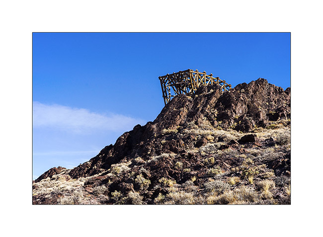
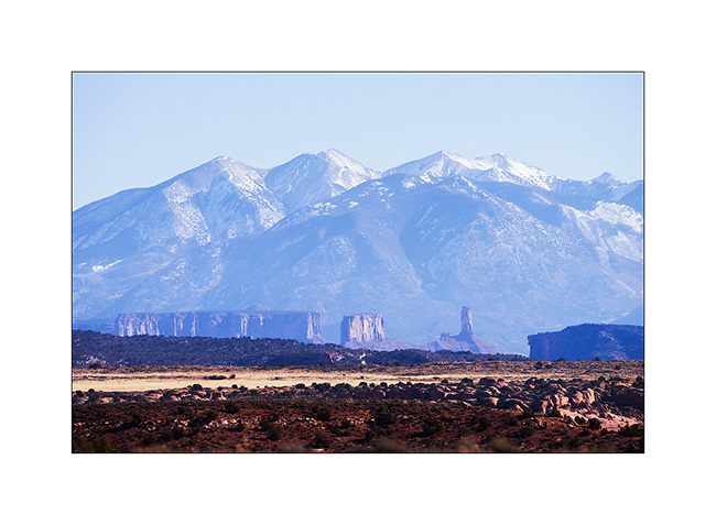
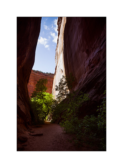
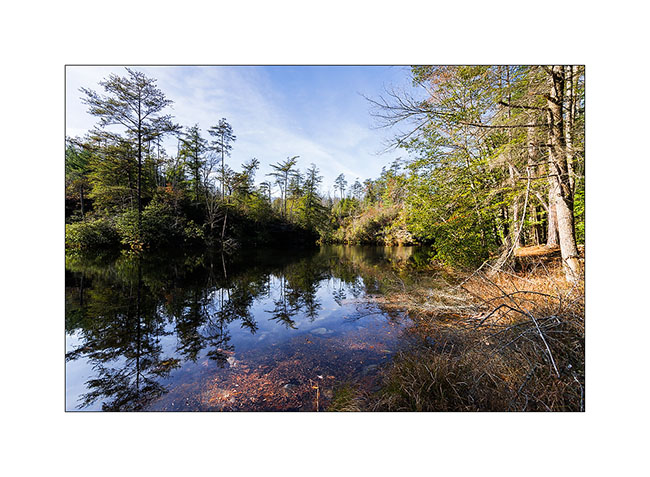
Salt Tram…
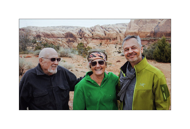
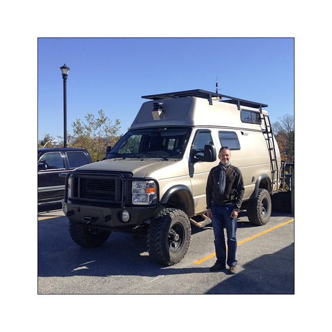
I met Andrew with whom I went to Baja last year. He’s gonna make a little way with VivaLaVida before I hit the road toward East…
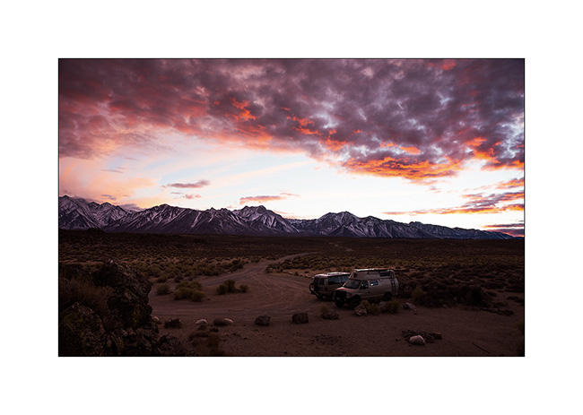
1. Beautiful colors to the first camp together near hot springs.
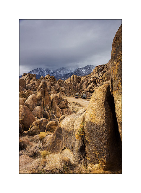
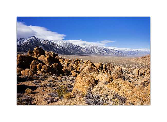
2. Stop at Alabama Hills that I discovered last spring with Jean-Luc.
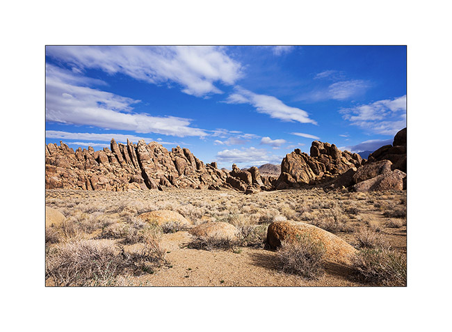
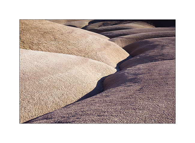
3. This place is really fun with these conglomerate concretions.
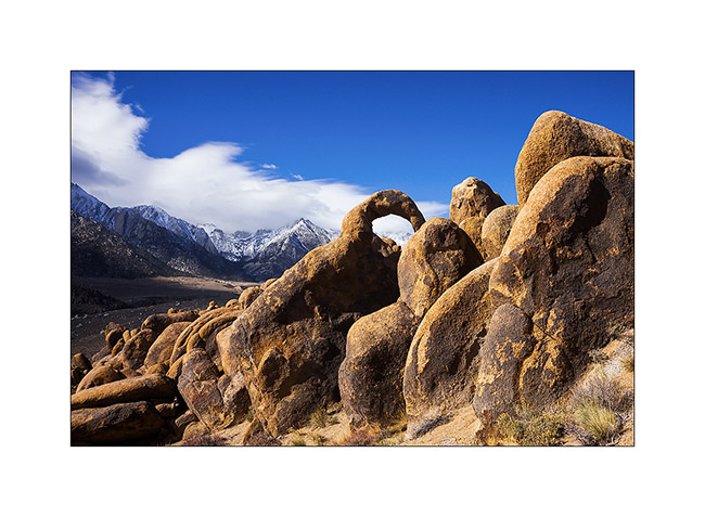
4. Withney Portal Arch.
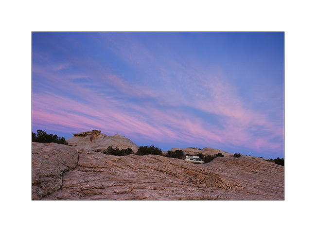
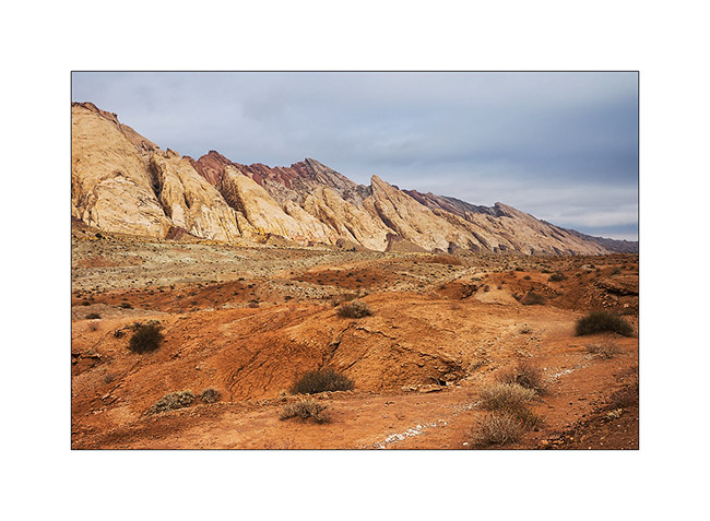
5. These hills are located at the foot of the Sierra Nevada.
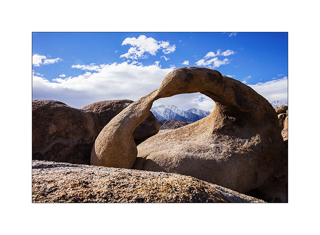
6. Visit of Mobius Arch I had already presented here.
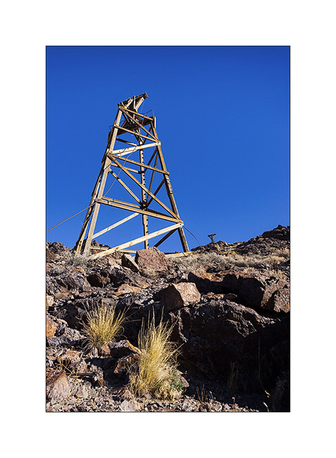
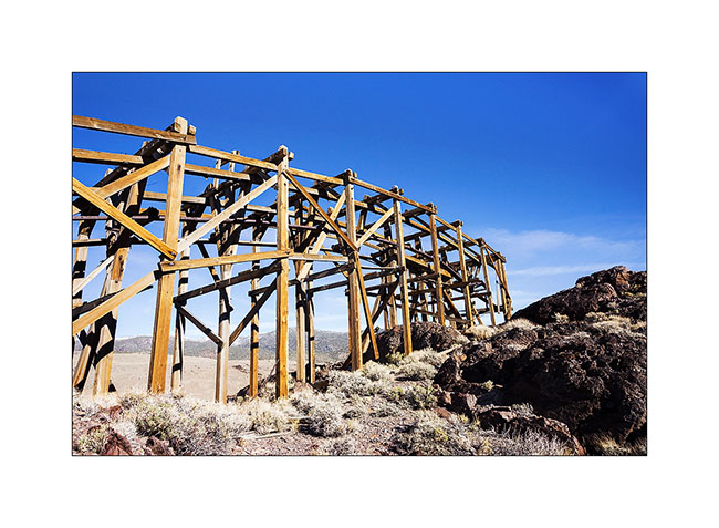
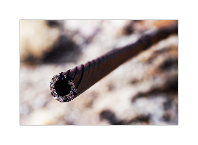
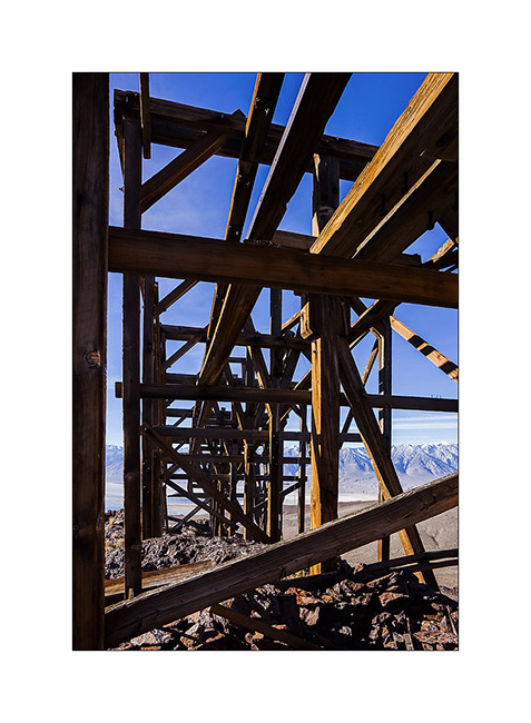
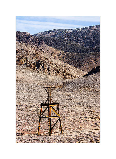
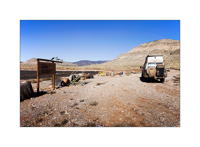
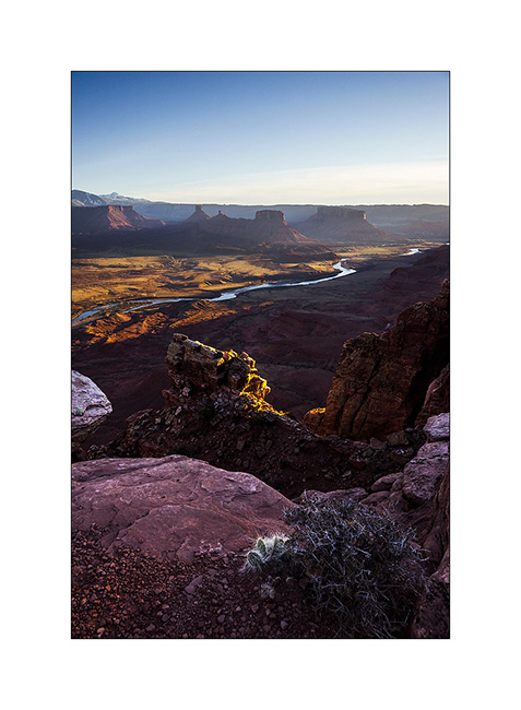
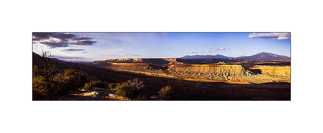
We then went to discover the Salt Tram, a construction that I wanted to explore. We had seen some pylons with Jean-Luc in the Saline Valley, thinking it was an elevator built for mining. In fact, it was a tram designed to exploit the salt deposit of the Saline Valley. Built between 1911 and 1913, the numbers are just amazing! It starts from 3,300 feet above sea level in Swansea, in the Owens Valley, rises more than 8,000 feet and goes down the other side of the mountain in the Saline Valley. The hauling cable was 27 miles long!
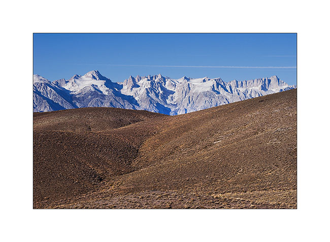
7. Up the Swansea Grade, above Owens Valley.
8. The Sierras received some snow three days ago.
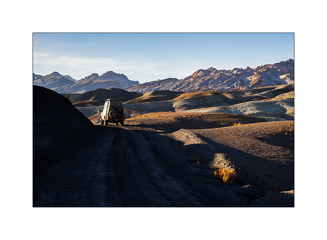
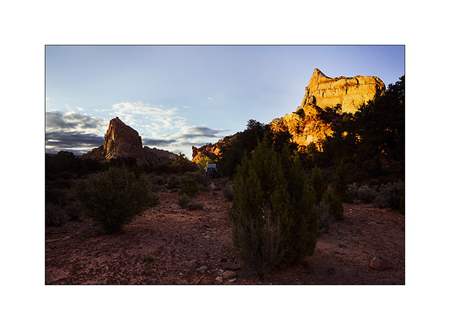
9. Owens Valley with VLV and Baja Shaker camping at 5,500 feet elevation.

10. I approach a first pylon.
11. Assembly.
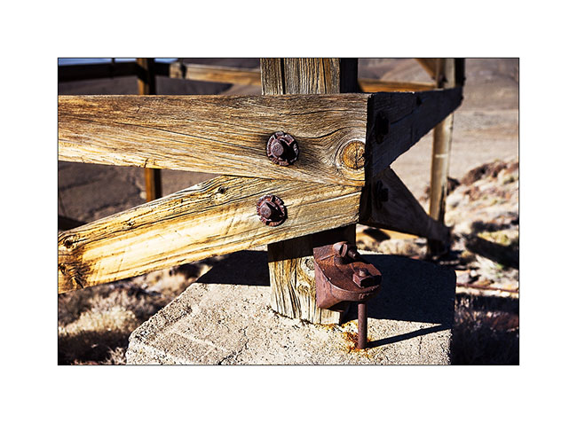
12. The dry climate has preserved the wood for over a hundred years.
13. Second pylon.
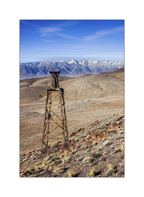
14. One of the intermediate stations to cross a ridge.
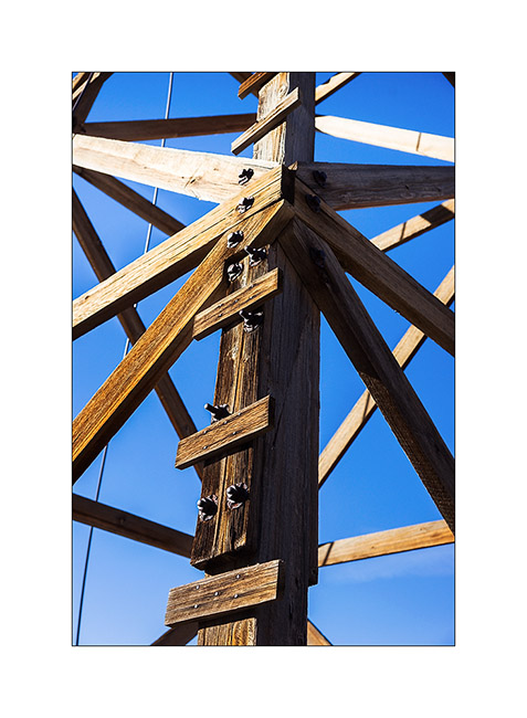
15. The construction is very similar to modern lifts excepted it’s made of wood.
16. Hauling cable detail.
17. Framework.
18. Pylons alignment with the top station at the bottom.
19. View of a lower intermediate station in front of the saline still in use today.
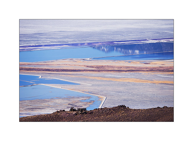
20. Graphics of saline.
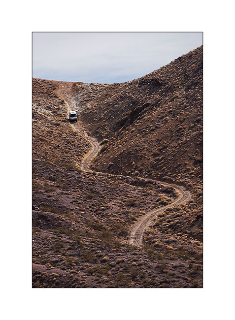
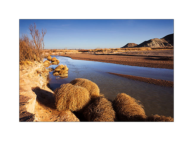
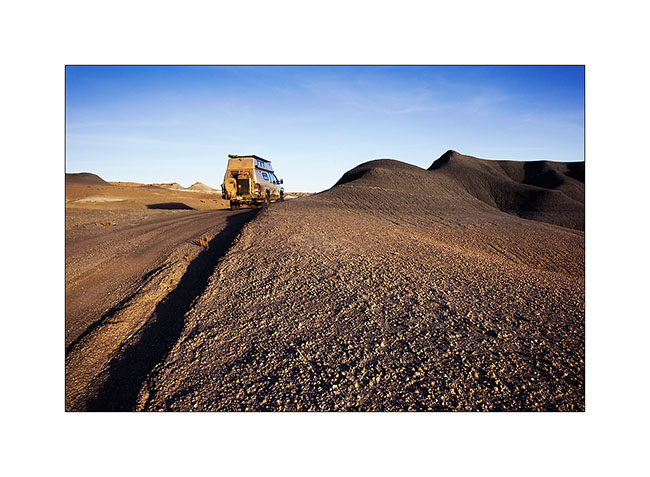
21. Baja Shacker going down the Swansea Grade quite steep and dissected in places.
To be followed in some days… 😀
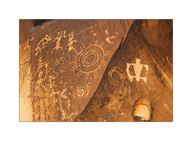
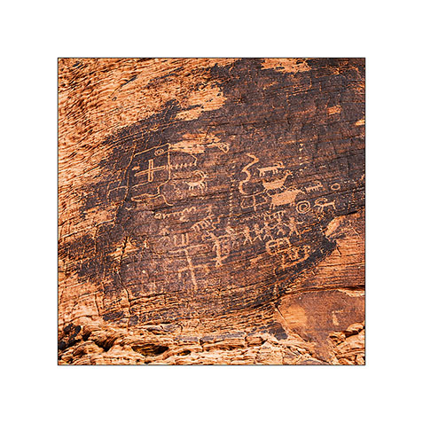
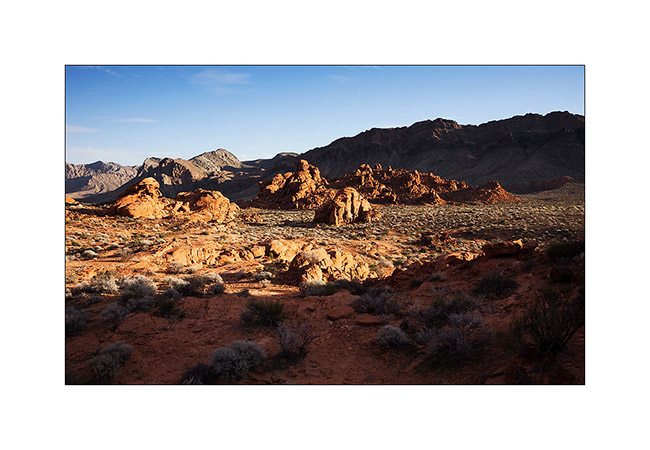
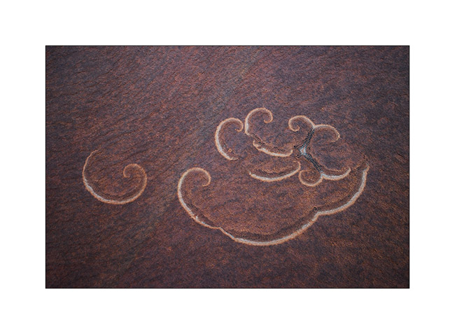
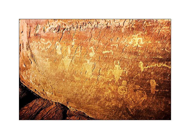
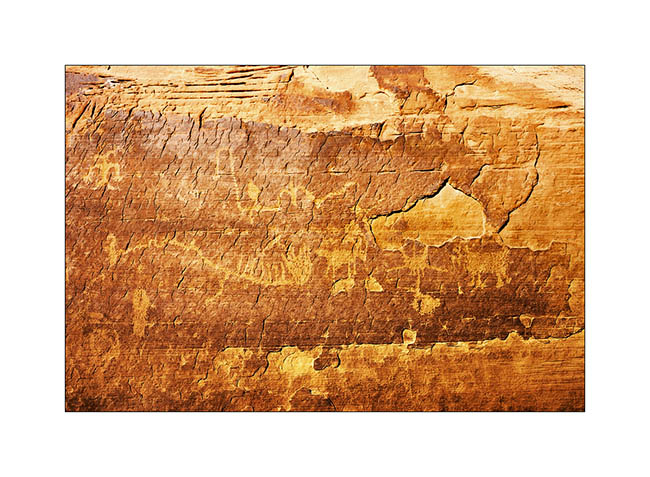
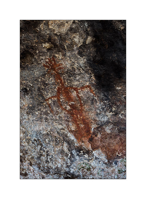
Petrogryphs of Arizona and Nevada
Vivalavida went discover another access to the Grand Canyon, also on the North Rim but further west.
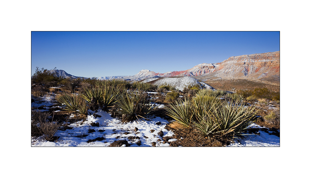
1. Cactus in snow…
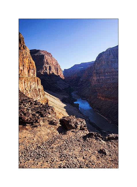
2. After going down Whitmore Canyon, I reached the end of the trail, approx. 700 feet above the Colorado River.

3. Grand Canyon is also gorgious here.
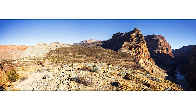
4. The site is interesting because it presents a large lava flow clearly visible on this panoramic (3 images stiched). There have been several successive lava flows, the first about 170,000 years ago that created a temporary 250 feet deep lake obstructing the Grand Canyon. This lake has remained approx. 20,000 years before the lava broke, creating a gigantic tidal wave downstream. Since then, there have been seven succesive lava flowa, the last one approx. 20,000 years ago. Do you find VivaLaVida that gives the scale in the image? 😀
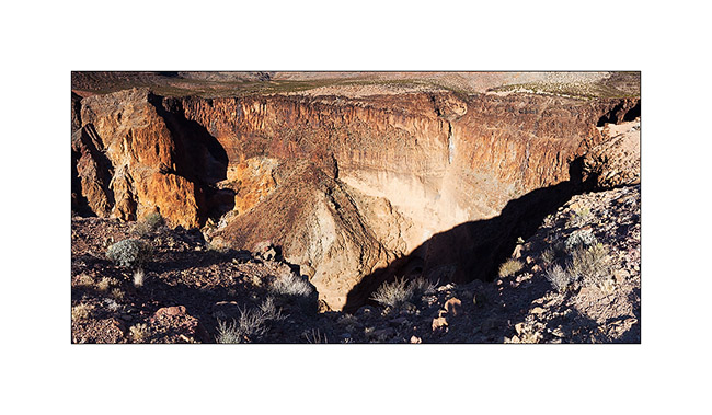
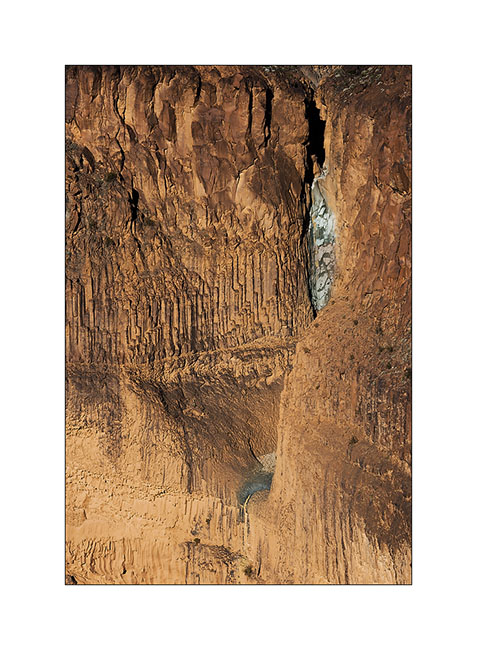
5. To the left of the promontory from which I took the previous image, there is a wide collapse that reveals beautiful basalt organ walls. It’s approx. half a mile in diameter and almost 600 feet deep.
6. Details of the cliff with a waterfall that has carved its way.
7. Just to the testimony, picture is not great, a “beep beep” surprised in the warmer micro-climate of the canyon.

8. Going back up the trail, I pass a small country air strip. Some guys don’t lack humor with this “Whitmore International Airport” sign and the two small escalators… 😉
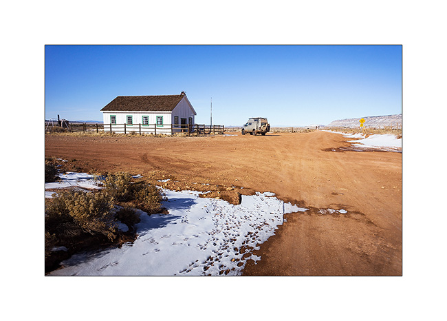
9. VLV near the Mount Trumbull old school. Built in 1922, it was burned by vandals in 2000 and rebuilt in an identical in 2001. It was the only school in the area where the first collons arrived in 1916, growing grains and beans until 1934 where the climate became much drier. Therefore, some og them turned to breeding cattle and sheep while many others left the premises. The school was in operation until 1968 when it was closed for lack of students. the last man living year round in this region died in 1984. Since few ranch remain scattered and inhabited during sommer only.
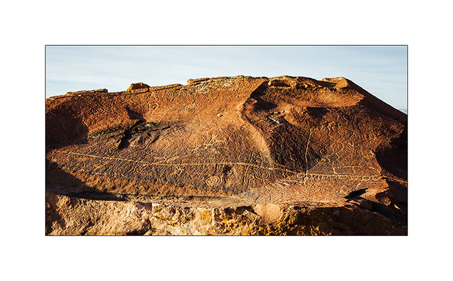
10. Short detour to Little Black Mountain, an interesting petroglyphs site.

11. the almost horizontal line is oriented exactly in the axis of the winter solstice; December 21st, the sun rises just above its eastern end.
12. One of the big boulders of the site.

13. Details…
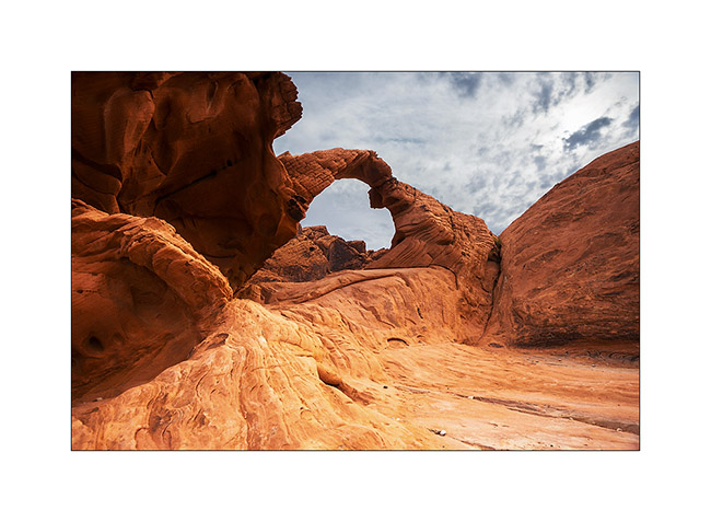
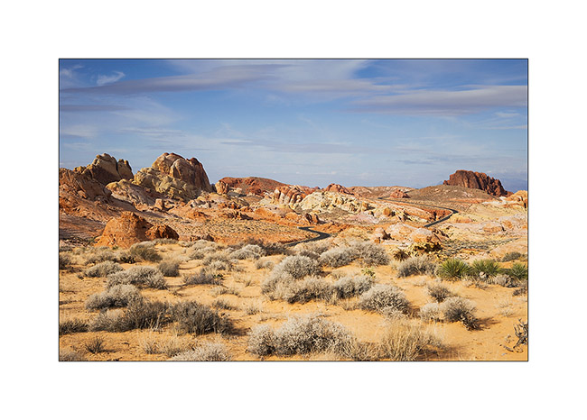
After this escapade in Arizona, I made another into Nevada to spend the evening with my friend Christian who was a few days in Las Vegas for the CES. Heading back to Utah where I should pick up a new compressor for VLV (the actual one being at its 4th beakdown…), I stopped at the Valley of Fire, a small Nevada State Park not far from Lake Mead.
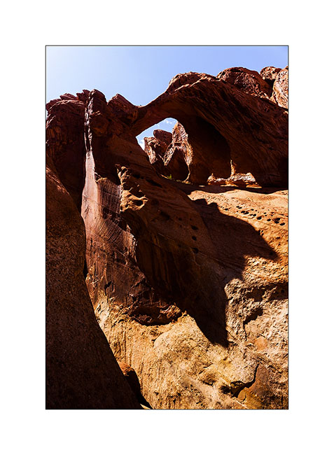
14. Arch Rock.
15. They are also many petroglyphs, those ar at Altalt Rock.
16. Still Altalt Rock.
17. Those are in Mouse’s Tank Canyon.
18. The road heading to White Domes.
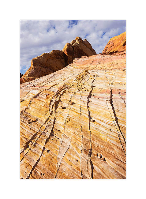
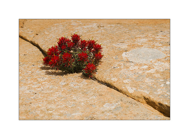
19. Sandstone is veined with various mineral colors.

20. Like a petrified wave…
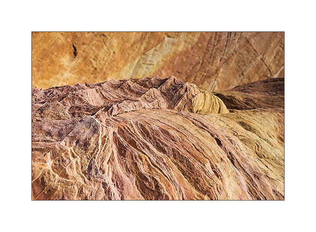
21. Veining…
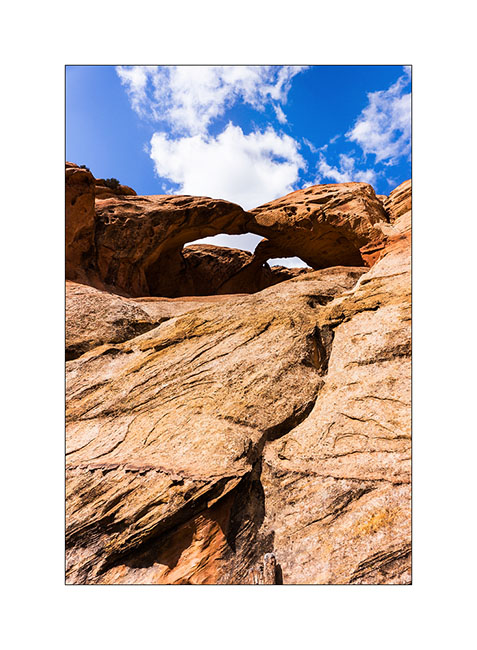
22. Windstone Arch, rather unusual in an alcove of the rock.

23. Late afternoon in Valley of Fire.
That’s it for today. Next step of VivaLaVida’s journey in the coming days… 😀
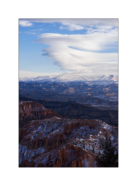
Bryce Canyon in winter…
Finally, not far from Bryce Canyon, snowfall inspired me to go discover it in his winter coat…
1. Start on Christmas Day. Warmer than the night before but snow and blizzard formed small snowdrifts while rocking me all night long… 😉
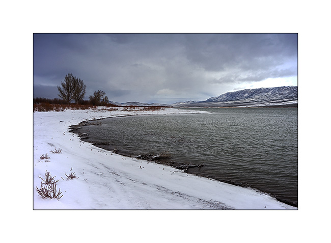
2. Small lake along a country road, between two flurries…
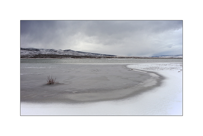
3. It is large enough to not be completely frozen yet. I saw two great eagles, probably on the lookout for some fish to eat.
4. Arriving near Bryce, I first discovered a secondary cayon, less known but beautiful too.
5. It was partly dug by the water of an irrigation canal built upstream by Mormons a hundred years ago.
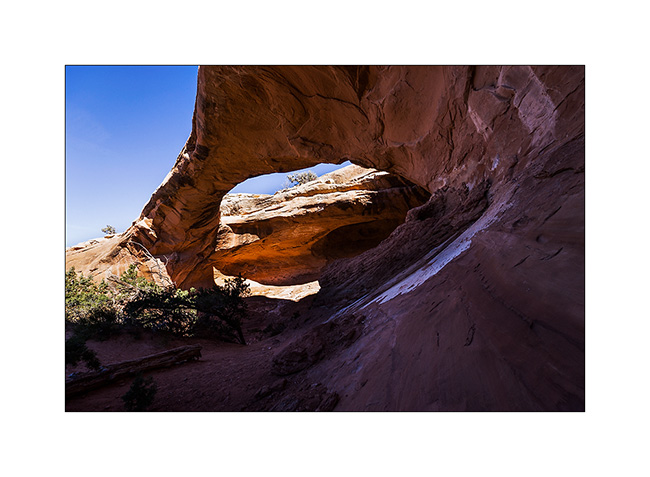
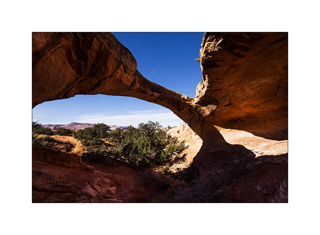
6. Triple arch on an edge.
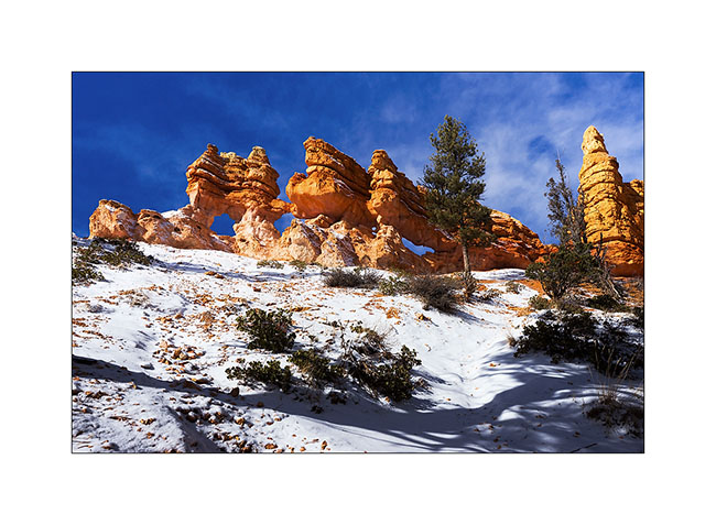
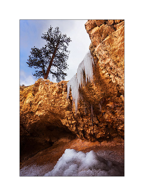
7. A small waterfall almost completely frozen…
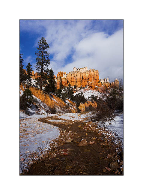
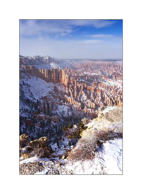
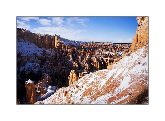
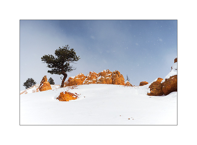
8. I arrived on the heights of Bryce Canyon between scathing snow showers and blue sky. It was 15F and for once, there wasn’t many people there, only some Japaneses and Hindous.
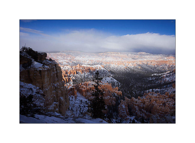
9. While I go down into it, snow showers give a wintry atmosphere…
10. Then shower fades…
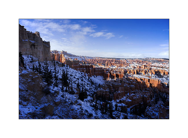
11. The white-red contrasts give a very different face of this exceptional place…
12. The next night was one of the colder than VivaLaVida has had to endure: -10F to her thermometer. Olive oil even froze in the closet… 😉

13. Wind creates clouds that cause snowing on the mountains while the rest of the sky his quite blue.
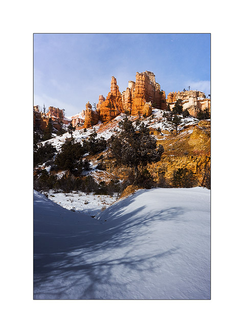
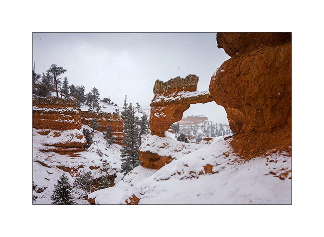
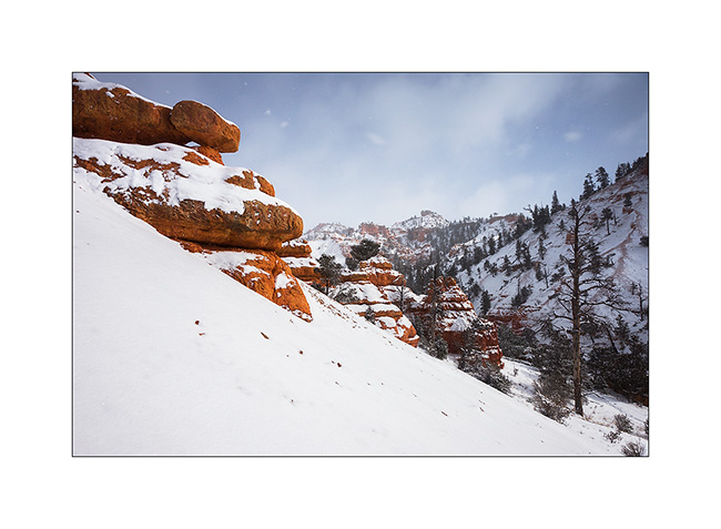
14. I went hiking in an annex canyon of Red Canyon, not far from Bryce and less known but also interesting to me.
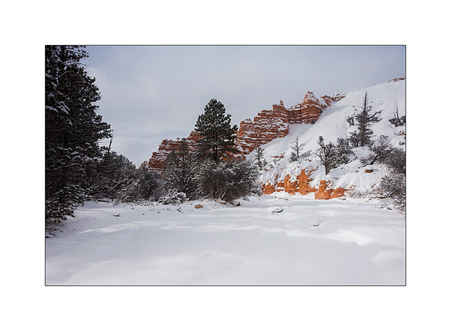
15. Hoodoos are everywhere.

16. I even find that unnamed arch.
17. Almost ten inches powder snow fell in this wilderness.
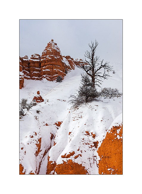
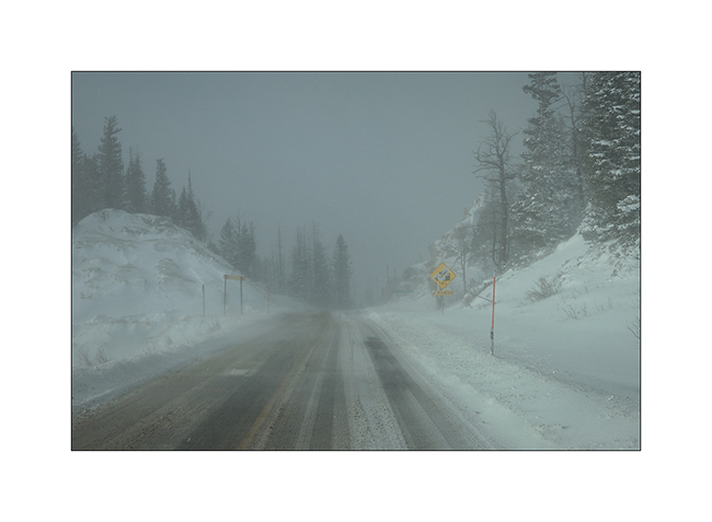
18. And he still snosw under showers while the wind blows almost as a storm.
19. Going down to VLV in late afternoon.
20. That road conditions we had at almost 10,000 feet above sea level, near Cedar Break inaccessible due to snow.
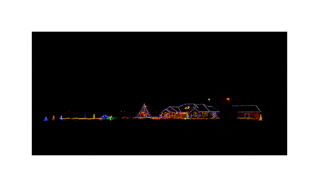
21. Down to warmer altitudes, an example of bright Christmas decoration that you Americans love. 😉
Change of scenery to come in the next update… 😉
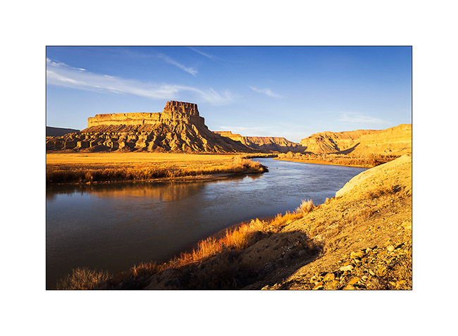
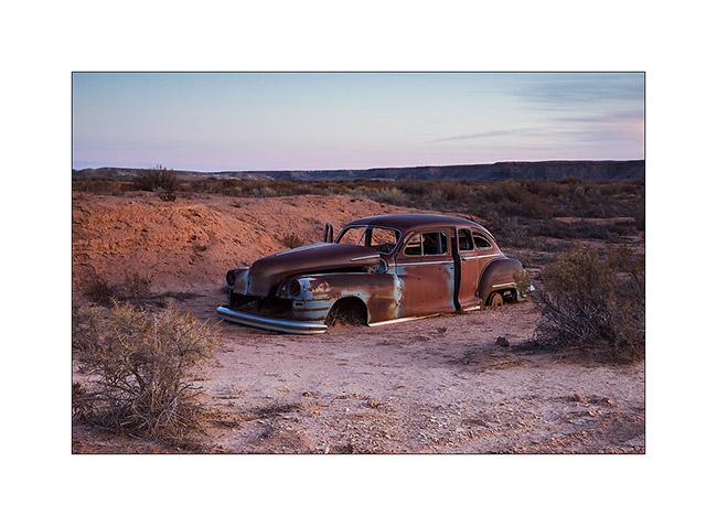
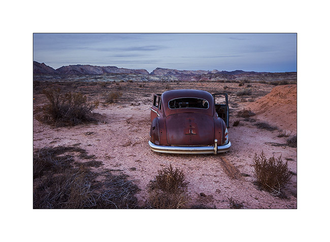
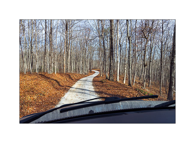
Around Moab, and then leaving Moab…
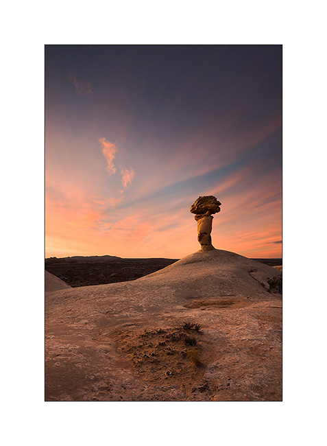
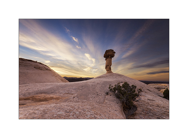
1. Three days later, I spent the night near a giant mushroom. Believe me, the dawn will reveal it. 😉
2. Here he appears…
3. Fifteen minutes later, the diverging sky makes me think about the brilliance of a lighthouse…
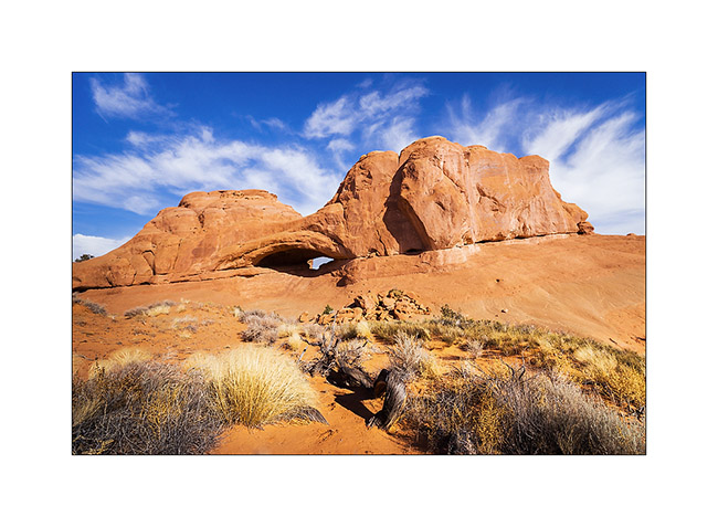
4. Still waiting for VivaLaVida’s door handle to replace the broken one, I did another little journey around Moab… I went to find an arch named Eye of the Wale. And it looks really like one. 😀
5. In the eye…
6. Farther on the trail, the Marching Men, in the Klondike Bluf.
7. I drove that trail in 2011 and it is much more ruff than three years ago, much more than it appears in this image!
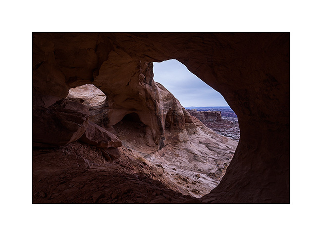
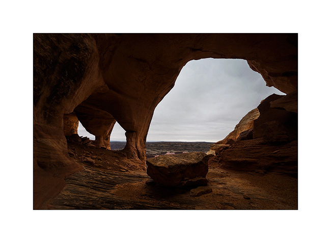
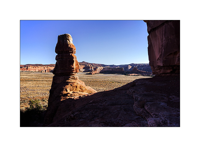
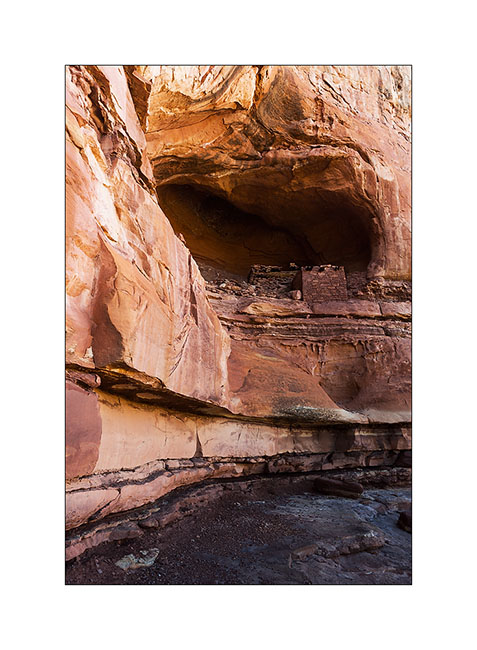
8. Another quick getaway the next day in Canyonlands National Park to discover a ruin located under the overhang of a huge cliff … Not shown on maps of the park, this spot is still unspoiled by mass tourism. A fantastic place with a wonderful view of Candelstick Butte.
9. Souvenir picture with Madeleine and Hans who welcomed me at their home like a king. I left Moab the Friday before Christmas, VLV’s handle finally being fixed. (Picture of another picture, sorry for the quality)
10. I then drove upstream the Green River hoping to see Desert Big Horn Sheep which live in cliffs of mesas. Late afternoon light in the entrance of Gray Canyon.
11. The next day it’s really gray over the Gray Canyon. I didn’t see any Big Horn… :-/
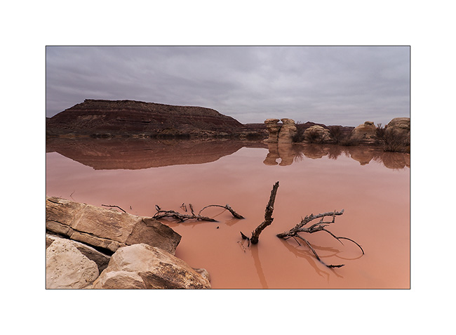
12. Returning to the San Rafael Swell, I made a detour to discover a rather unique triple arch. Along the track, when the water meets the bentonite…
13. Natural arabesques of some lichen on sandstone.
14. Here is Colonnade Arch, above the canyon of the Green River.
15. Almost a cathedral, unfortunately without light that evening…
16. While going back to VivaLaVida, I spoted by chance these sandstone stalagmites at nightfall.
The next day, the weather was still very gray, so I took over the direction of the San Rafael Swell to discover petrographs in Dark Dragon Canyon.
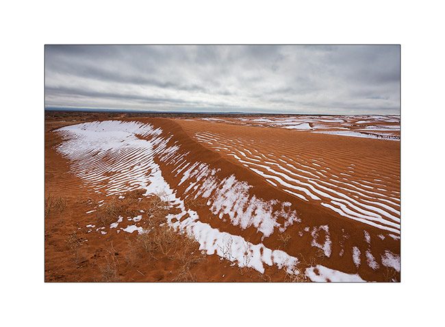
17. Small dune area where snow remains in place.
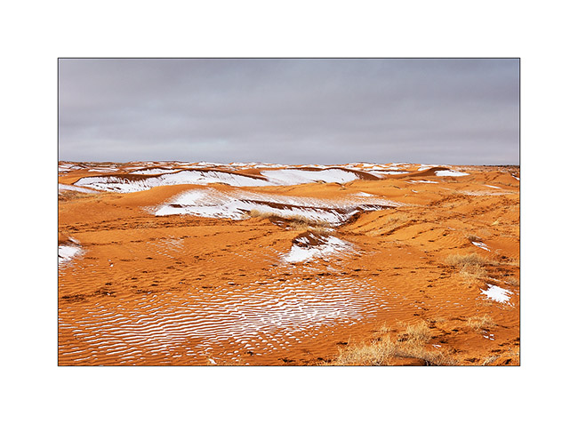
18. The contrast between orange dunes and white snow is beautiful.
19. I pass close to Goblin Valley and discovered almost similar concretions.
20. Ray of light on the reef of San Rafael Swell.
21. VivaLaVida runs along the spectacular reef.
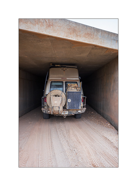
22. Path Under I-70 ; there is one inch margin with suspensions maximum lowered and tires deflated for trail! 😀
Discovery of petrographs in the next update.
South San Rafael Swell
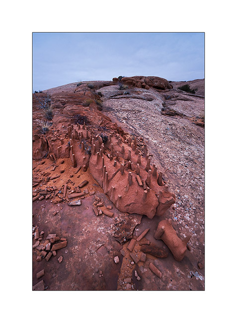
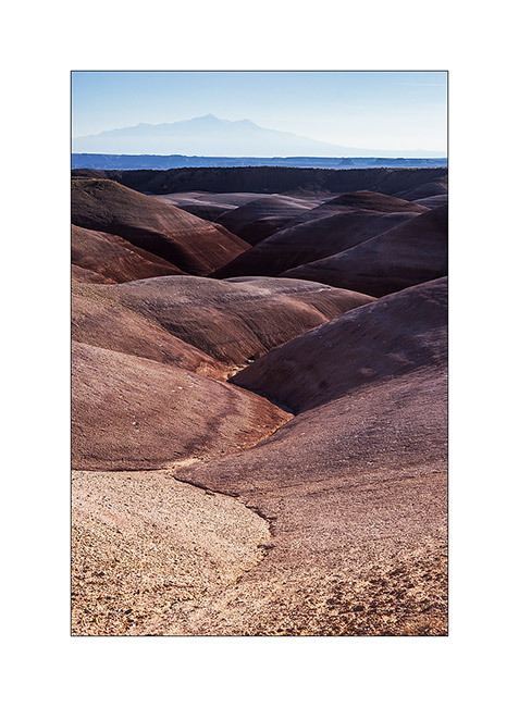
Out of my hike in the slot canyons, I saw a sign “Muddy Creek”. I thus followed the trail south and had the good surprise to find a quite large area of “bentonite”, this kind of clay that I also found at the Painted Hill in Oregon.
1. Bentonite Hills and Henry Mountains in the distance.
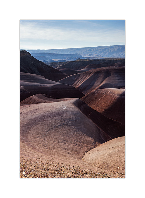
2. Nice colors in front of San Rafael Reef.

3. Valley…
4. Sweetness…
5. I vary the compositions in this sensual landscape…

6. VivaLaVida having fun on that beautiful trail!
7. Muddy Creek, at the end of the trail.
8. Ride over the Bentonite. 😉
9. I slept near an abandoned ranch and discovered this carcass at nightfall.
10. She too has beautiful sensual forms, isn’t it? 😀
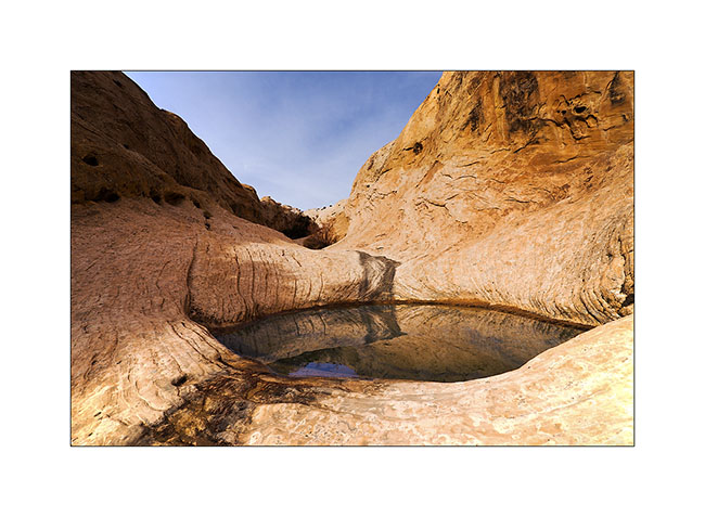
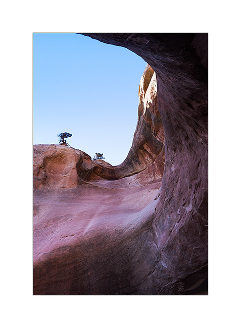
11. The next morning I went up towards a small arch and saw this pothole on my sundstone path.
12. Here is Wild Horse Window.

13. The window is nice! 😀
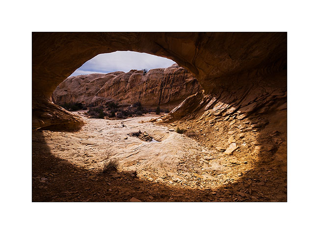
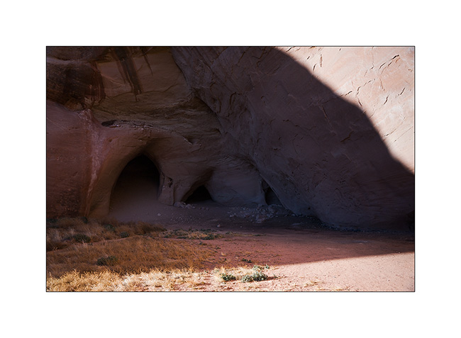
14. Guess who created this double cave? Yes, that’s it, that little spring that seeps from the bottom of the two caves, giving life to some ferns…
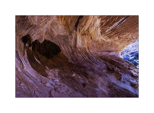
15. Almost a makeup eye…
16. By late afternoon, towards a high plateau at almost 7,000 feet elevationl to a camp near another slot canyon.
17. Upper Reds Canyon cliffs in Sunset light.
Another dive in a slot canyon to come soon! 😀
Sandstone around Moab
Leaving the Beef Basin, I had the good surprise to find a message from Hans, a Swiss who lives here with his wife Madeleine for 35 years. I was greeted like a king by this adorable couple, not forgeting to specify that Madeleine is fine cooker. 😉
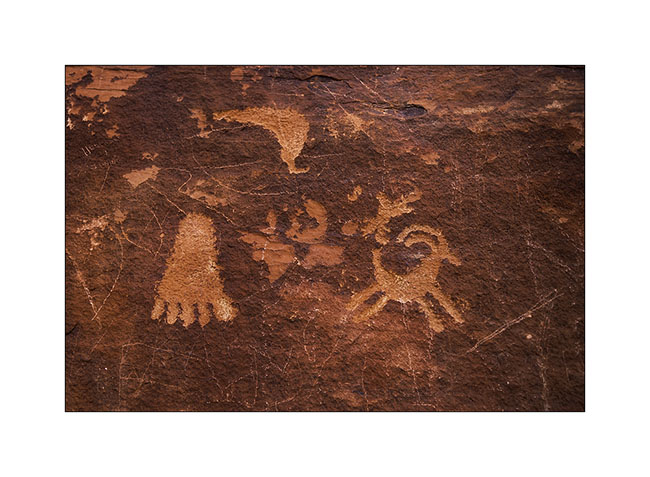
They explained me how to access a petroglyph site within walking distance of their beautiful home nestled on a sandstone hill.
1. What a privilege to discover this private site where access is usually closed!
2. I have found some symbols already observed elsewhere.
3. The next day and despite his 80 years, Hans brought me drive the Sevenmile Ridge Trail, a 4WD trail listed red (the most difficult) which passes near Uranium Arch.
4. It’s a nice medium sized arch.
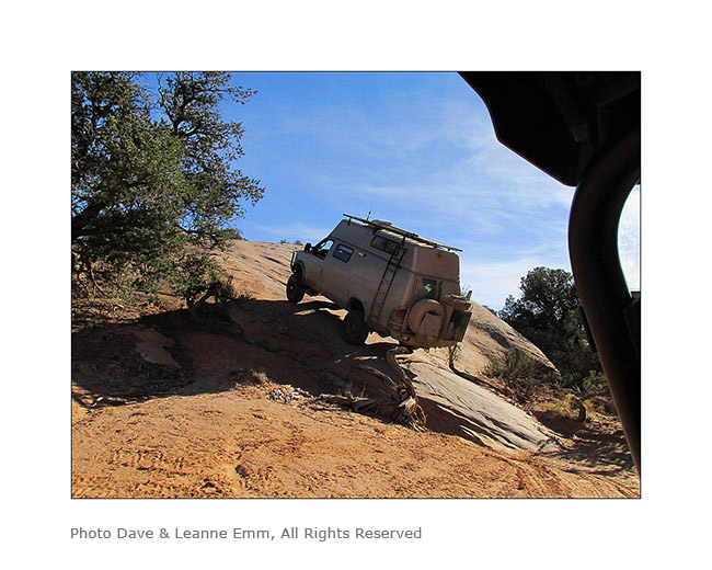
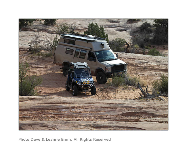
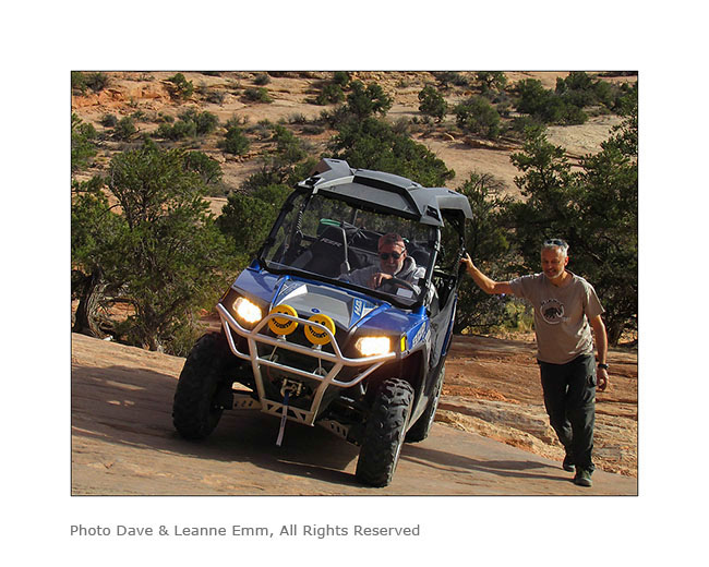
Near this arch, we met a couple from Colorado, Dave and Leanne, a little lost because their trail description was out of date. They followed us throughout the rest of the trail and took images of VLV in downright cool passages, especially a leaning spot that I really wasn’t sure how to deal with VLV high-pitched on her wheels. They sent me some pictures to discover here…
5. Steep hill leaving the arch.
6. It’s like David and Goliath, isn’t it? 😉
7. Here is Hans spotting me on the step to access to the leaning spot..
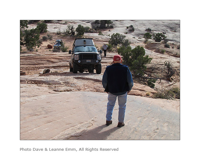
8. It doesn’t seem so but this entry is rather steep, with a good step!
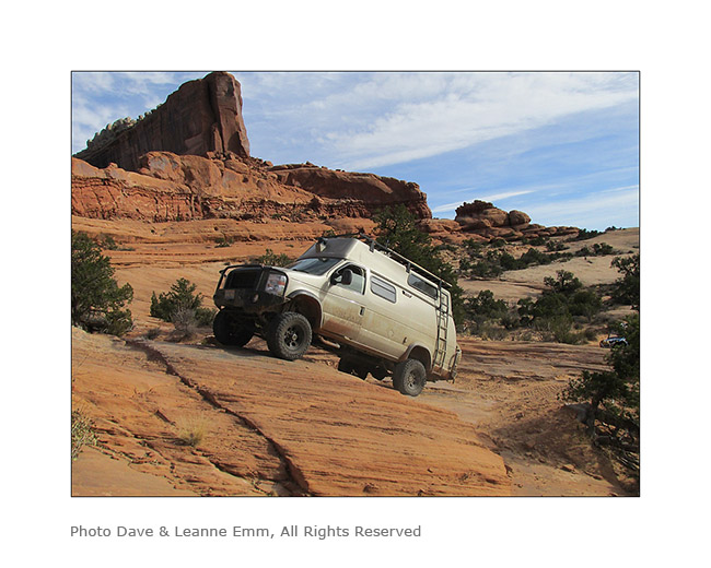
9. and here is the off camber spot. It leans quite a bit despite the left suspension fully inflated and the right one completely down..!
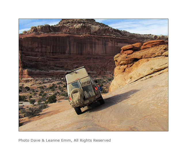
10. After VivaLaVida it’s Dave who goes through in his 50 inches wide only vehicle. I indicated him the line to follow. Well done Dave ! 😀
I want to say a huge thank you to Hans and Madeleine for their so warm welcome. I had such a great time with them. 😉
Hans recommended me a spot on the Dome Plateau where I had already spotted a natural arch. Leaving them, VivaLaVida took the path of this view that I discovered the next morning.
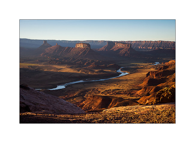
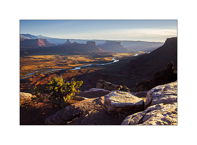
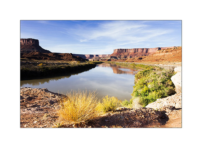
11. Colorado River and Castle Valley in early light…
12. Not far away, I went to discover La Boca Arch, a small pretty massive arch.

13. A bush managed to grow under the arch…
14. Castle Valley towers in front of La Sal Mountains.
15. On my way to natural shelters, the famous herbs that are seen in Westerns rolled by the wind have almost eliminated the trail… 😉
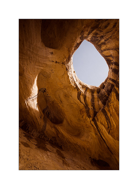
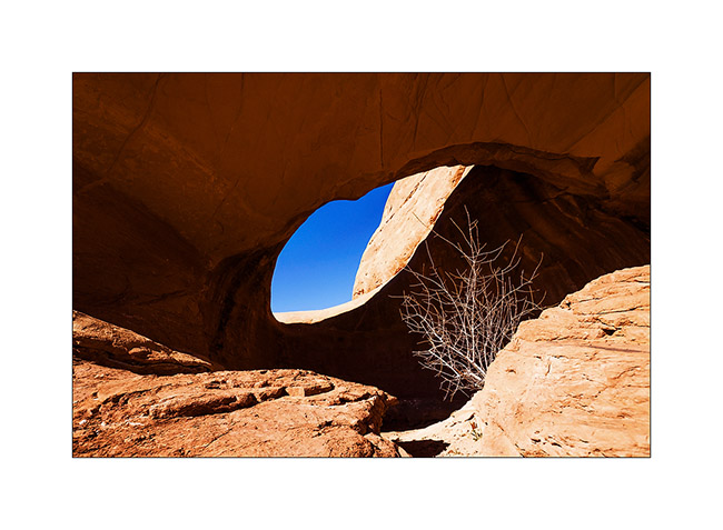
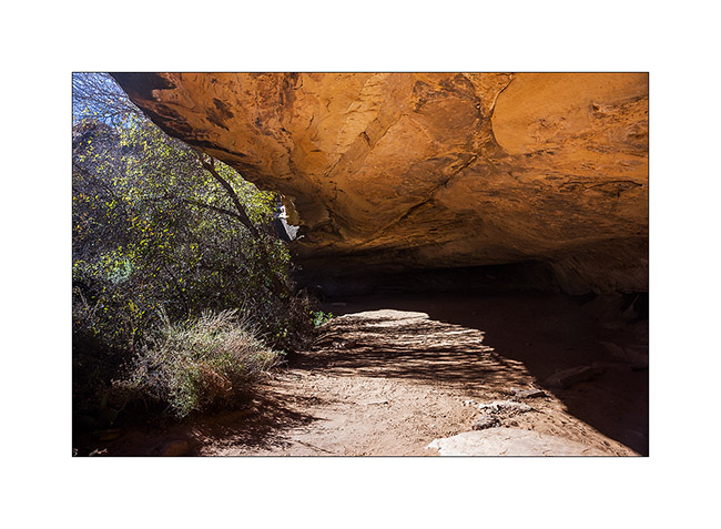
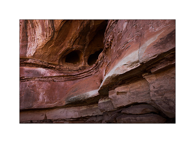
16. Here are sandstone cavities inhabited by Indians several hundreds years ago. One of them houses a source.
17. The bluff above is polished by the elements.
18. The lower cave is quite deep and some water oozes from the walls in places. The soot of inhabitant’s fires is still present (left of the entrance on this image).
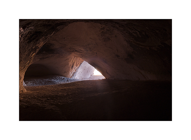
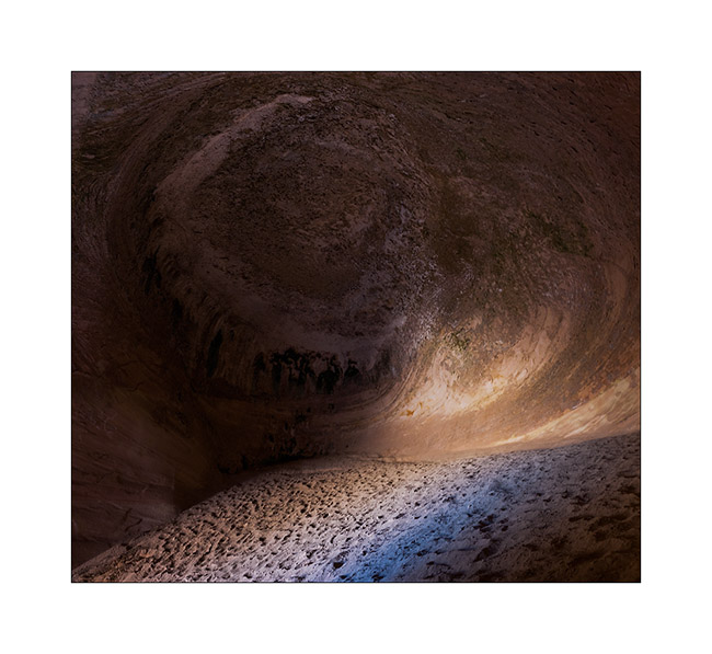
19. The top one’s ceiling is shaped in a quite photogenic circular vault.
20. Back to the overview in late afternoon.
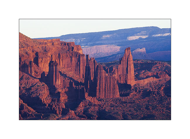
21. Very red material of Fisher Towers is colored by the sunset light.
22. Last sunrays over Castle Valley.
More to come soon. Once again, thanks for your loyalty! 😀
Back in Utah
I met Nick and Kim in Moab. I met Nick in North Carolina. He also owns a Ford van, two-wheel drive and shorter than VivaLaVida but well equipped for two. He’s traveling for two and a half weeks with his friend Kim who discovers the West for the first time.
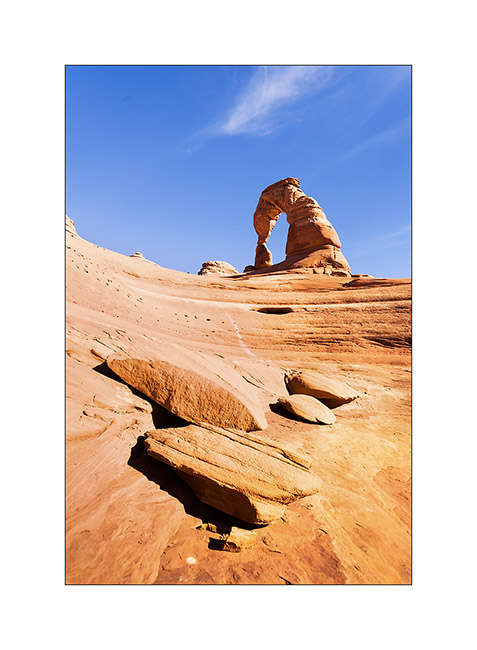
1. We spent the first day in Arches National Park, the opportunity to make an image a little different from Delicate Arch while every picture has been done on the site, one of the most photographed of Utah.
2. The next day, Nick rented a jeep to travel the White Rim Trail, a 100 miles trail that runs north of the Colorado first, then the Green River.
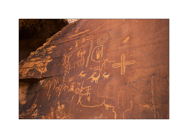
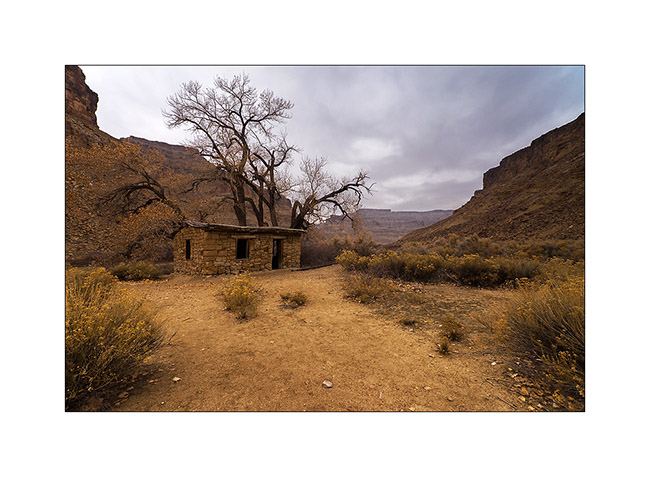
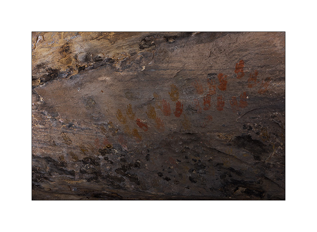
3. Having to wait four days to service VLV, I got back to the Needles, probably my favorite place in Canyonsland NP. I went to see Cave Spring inhabited by the Anasazi Indians from 7,600 years BC.
4. Petrograph in Cave Spring
5. The famous hands of Cave Spring.
6. On the way to Tour Ruins, another spot I discovered.
7. I first discovered granaries on the cliffs.
8. Here is the tower which gave its name to the ruins…
9. Here is the ruin, surprisingly well preserved. It was a dwelling place for the summer season.
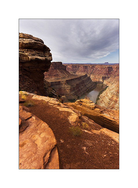
10. I went to sleep above the Colorado and enjoyed the viewpoint the next morning.
11. The track to get back is quite interesting by place.
12. Axle crossing.
13. In the afternoon, I returned to Chesler Park, a beautiful place.
14. One of the canyons we cross to get there.
15. I approach the famous Needles.
16. And here I am in Chesler Park.
17. The south side is a beautiful meadow that makes me want to camp there.
18. In a side canyon to Elephant Canyon, I discovered this fault created by erosion.
19. It’s late but I go up the Elephant Canyon to find a nice arch.
20. Small tree in the cliffs…
21. After almost running at full speed, here is Druid Arch, a rather unusual double arch.
22. I’m still at the top of Elephant Canyon and I must go down without delay to reach the Trailhead before nightfall, 6.5 miles away.
I reached VivaLaVida at nightfall, a little tired after more than 14 miles on quite uneven terrain.
Some other spots discovered in Utah to come soon…
Cottonwood Road UT
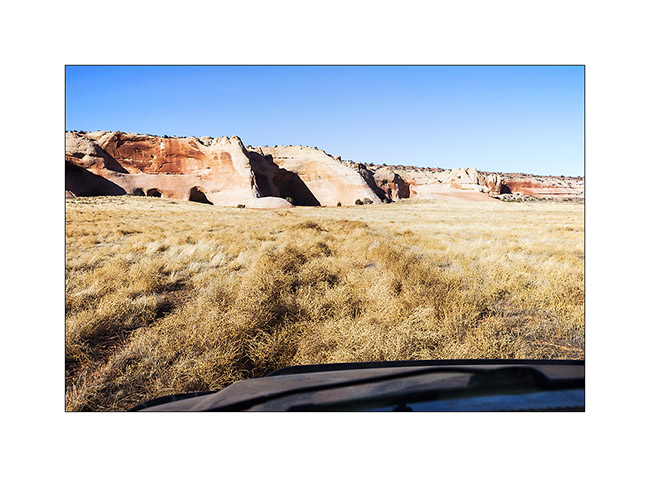
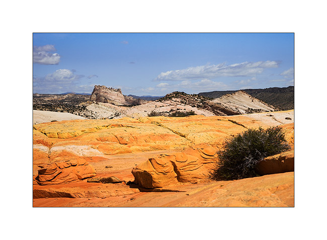
Still dazzled by the beautiful Coyote Butes, we continued our route using the Cottonwood Road northbound. I noticed several spots of interest on this route. The first at which we stopped is entitled Yellow Rock, an orange to yellow sandstome dome….
1. The side canyon to the Cottonwood River I walked to Yellow Rock. Nice to walk barefoot in the cool water… 😉
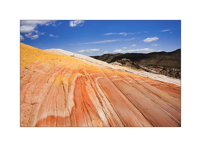
2. Yellow Rock is well named.
3. The sandstone is veined of colors…
4. Some more color touch…
5. A little further on, we stopped at Lower Cottonwood Narrow.
6. The walls are impressive, probably more than 1000 feet high.
7. We ended the day with a stop at Kodachrome Basin.
8. Jean-Luc on sandstone. 😀
9. Cliffs in late afternoon.
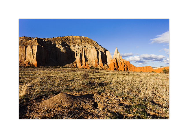
10. Opposition of forms: soft to the anthill, acute to the cliffs.
The next day, I brought Jean-Luc discover Bryce Canyon, the must see. Since I already take quite a lot of pictures of it, I went walking light, leaving my camera in Vivalavida. You so won’t see picture of our hike here…
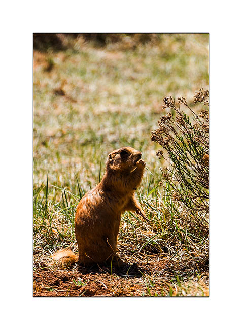
11. An attentive prairie dog.
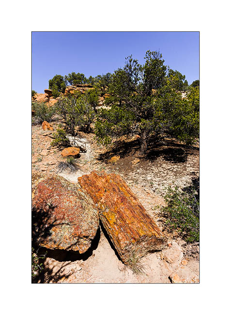
12. Not far from there, a short stop at the Escalante Petrified Forest. Some petrified trunks are impressive!
13. Late afternoon hiking to the Calf Creek Falls.
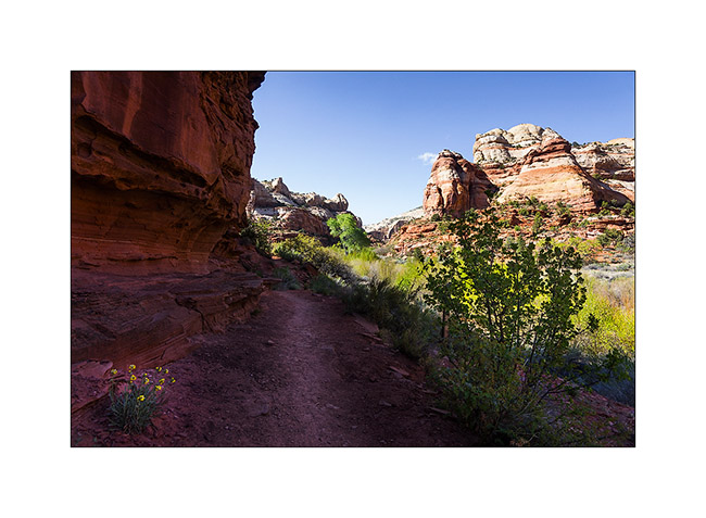
14. Side canyon to Long Canyon, on the Burr Trail Road.
Arrived in the area of Capitol Reef, we visited the Muley Canyon to discover some natural arches.
15. Cheerios Double Arch.
16. Bells…
17. Saddle Arch.
18. Another natural arch.
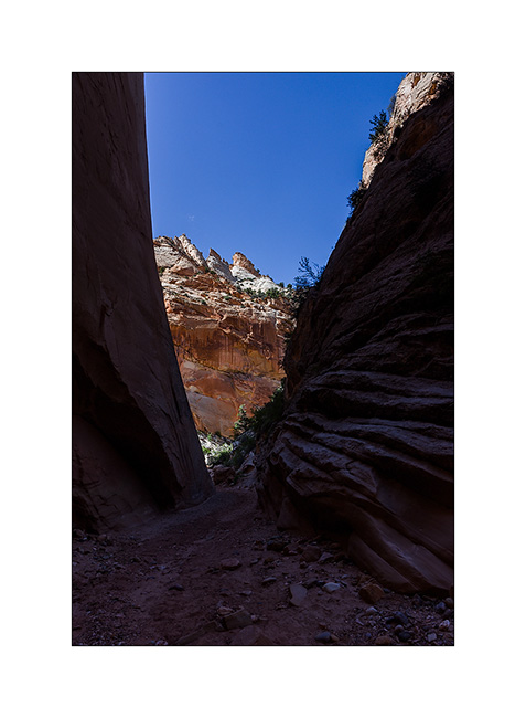
19. We ended in the Muley Twist Canyon, a Slot Canyon where there was still water in places.
20. Fun on passages in opposition.
21. Back down at the end of the road where we slept, I went back to the view of the valley of Capitol Reef, grandiose!
22. Mineral colors are everywhere…

23. … while the sun is going down…
24. Camp in Muley Canyon.
The next update will take you all soon in the Henry Mountains and the Maze of Canyonsland Distric National Park… 😉
Tennessee (4 and end)
Here it is, the new Title of Vivalavida arrived! So I’m back to Fletcher to pass technical inspection by the seller – Chris in this case – necessary for subsequent registration. I will then be able to go to Georgia where the following steps are still to be done: get proof of residence, a certificate stating that I am not “eligible” for social security, obtain my Georgian driving lisence (it will be easier since I already have a US driver license) and finally register VLV Under my name. Still many steps, hoping they will not be as long as the previous…
I take this opportunity to update the blog with some of the last images brought from Tennessee. I left you at the Big South Fork …
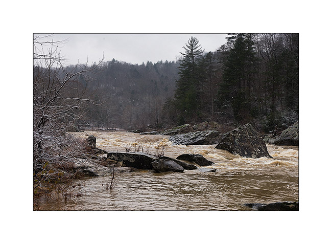
The next morning, the snow had whited the country and the clouds were very low. I went to see the Angel Falls on the Big South Fork River, flooded after two days of almost uninterrupted heavy rains. A beautiful wild atmosphere …
I saw two pileated woodpecker, too fearful that I could photograph without a tent.
1) Flooded Big South Fork River

3) driftwood…
4) Angel Falls transformed in powerful rapids…
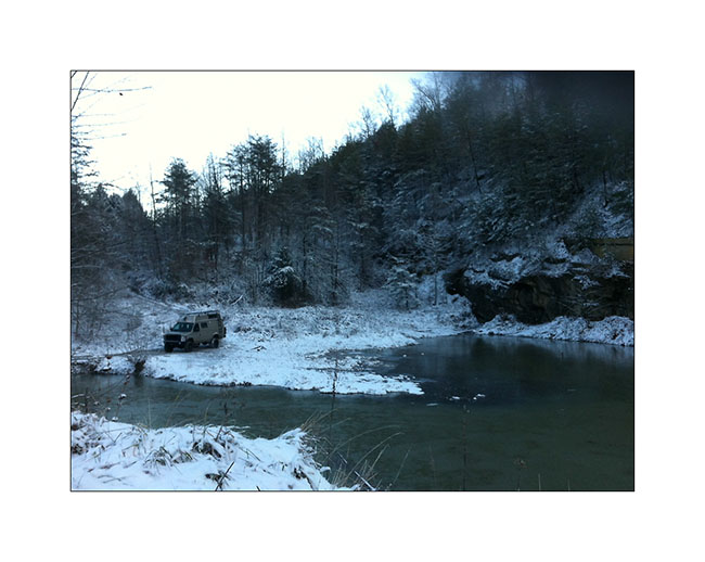
I then did a bit of road eastward to explore two beautiful natural arches the next day. Arrived when the night was well fallen, I declined to pursue the trail marked on the map which was washed out and completely frozen by the ambient 16°. I stopped near a small lake to spend a night.
The next day, I was somehow baptized by that winter! 😉
First by a really frosty morning: 7° to the outside thermometer, 27° to Vivalavida’s dash thermometer, behind the front curtain. First night that the heater, set to 40° to protect the bowels from freezing, has started at 3.30 am.
5) Morning at my campsite with 7°: cold! (taken with my iPhone…)
In the daylight, I was able to continue the snowy trail and I stopped at the hiking trailhead. After having equipped myself for “cold” weather, with my waterproof pants, my jacket on three polar layers, I started the trail. After a little more than a mile, I discovered a river to cross! Not very big, probably 20-25 feets wide, but deep enough for the water to enter in my shoes, which was excluded given the temperature. So, no other choice than taking my shoes off and cross barefoot! believe me, it was an exhilarating experience! 😀 A beautiful baptism, isn’t it?
After walking a few feets in the snow to dry my feet, I puted socks and shoes again and had good warm feet for the whole hike! A little more than one hour later, I discovered Primroy Arch, beautiful in that snowy day. I don’t know if it’s because of its name but it is unfortunately widely tagged with lovers names … A shame for such a great natural monument even if the symbol is pretty…
6) Primeroy Arch
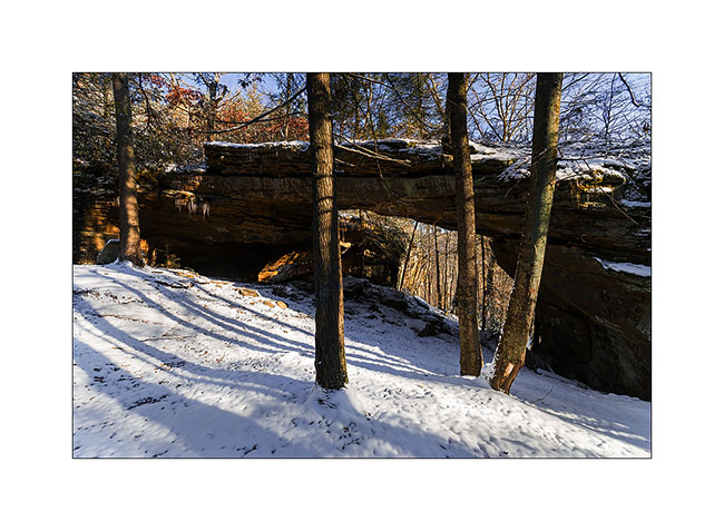
7) Primeroy Arch (2)
8) Thanksgiving decoration..! 😉
9) Pretty colors under the arch, portion that taggers didn’t reach…
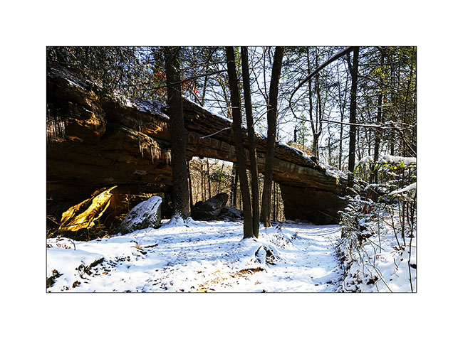
I continued the hike to the beautiful “Drive’in Triple Arch”, rather sought my way through the forest, which was a little difficult to find with the recently fallen snow…
10) do you see the trail..?
11) end there..? 🙂
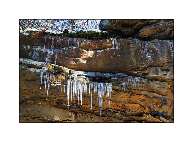
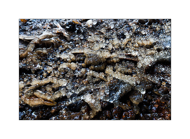
In fact, it was more a GPS navigation than anything else .. I also had some trouble finding the arch nestled at the bottom of a long cliff, or more exactly to access it. I made several attempts to down the cliff of about hundred feet, finding me every time over a impassable sheer. In the end, I made a detour of nearly an hour to reach the end of this long cliff, then walk down of it the other way. I discovered this beautiful arch which is actually a double arch. It is a good example of how these arches appear: water seeps into cracks of the cliff and the frost breaks the rock above, the keystone of the arch preventing it from breaking below. Ice present that day highlight water infiltration.
12) Dirve’in triple Arch
13) ice stalagmites under the arch…
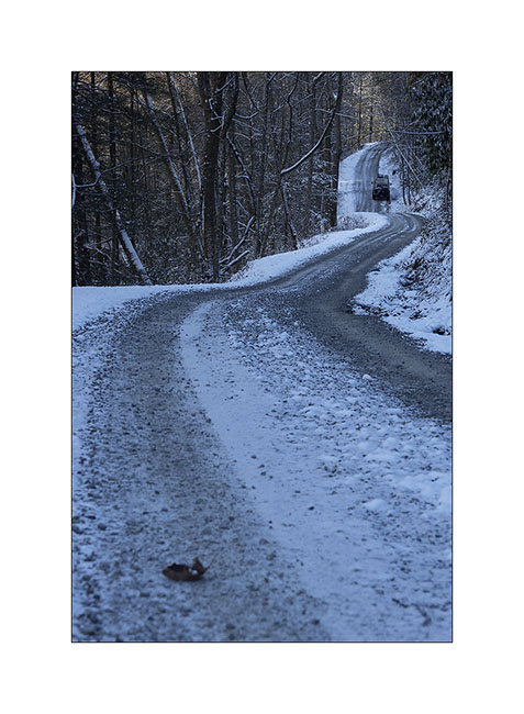
The return went without particular problem – in recrossing the river of course – and when I found Vivalavida at about 3PM back, the roads were still frozen by 26° ambiance…
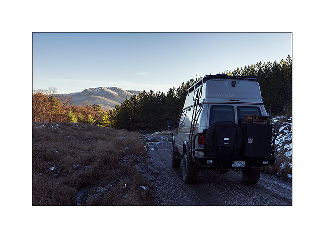
14) winter on the raos…
15) narrow passage…
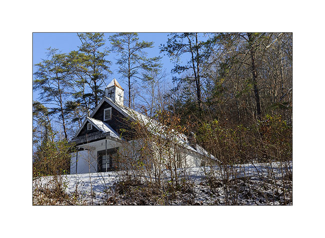
16) small Church on the road
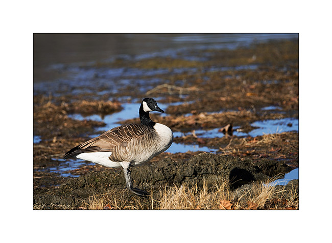
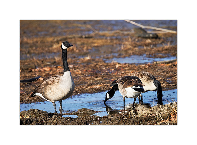
I then spent two days next to an artificial lake, enjoying watching the birds. First, a large group of Canadian Geese, about 80 individuals. What a noise they make! 😀
17) Canadian Goose
18) this was a little worried about my presence…
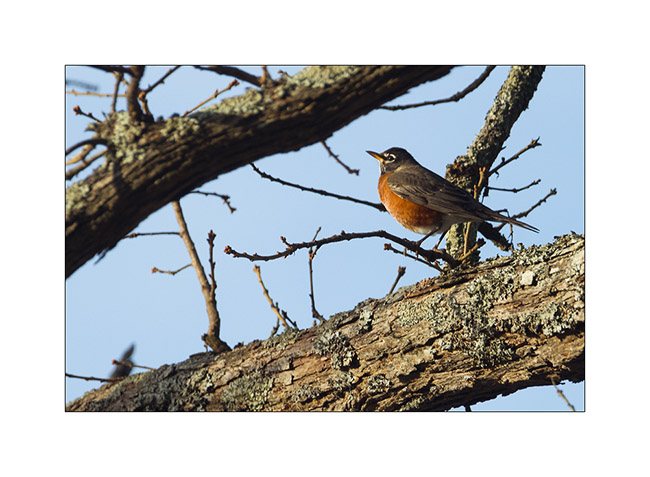
19) an American robin
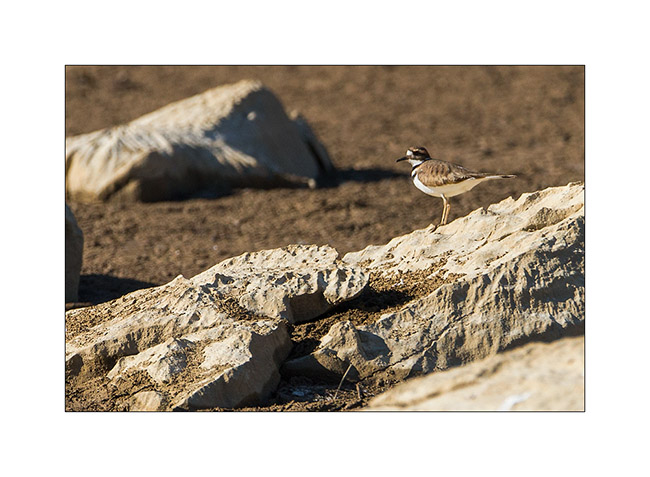
20) a plower killdeer, quite difficult to approach…
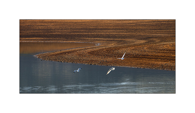
21) seagulls..
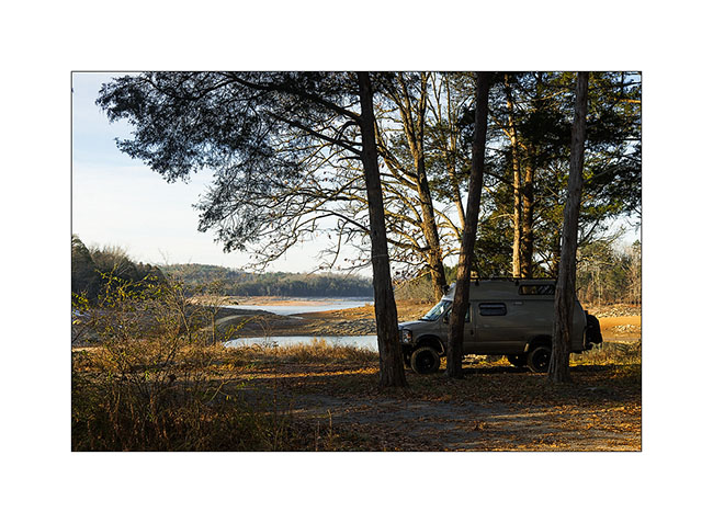
22) my campsite thèses two days. Nice, isn’t it?
At the announcement of the arrival of the Title, I took the road back to North Carolina, stopping to visit some relics of the past…
23) muddy road…
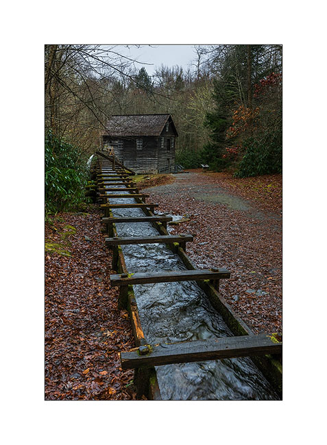
24) One of the first l’un des premiers weight-mill, a column of water driving a turbine. This one was built in late 19th century.
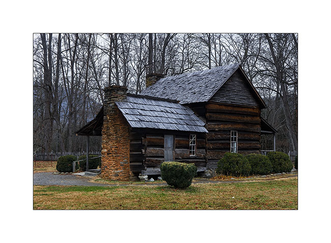
25) old preserved house, a relic of the 19th century (1860 for it)
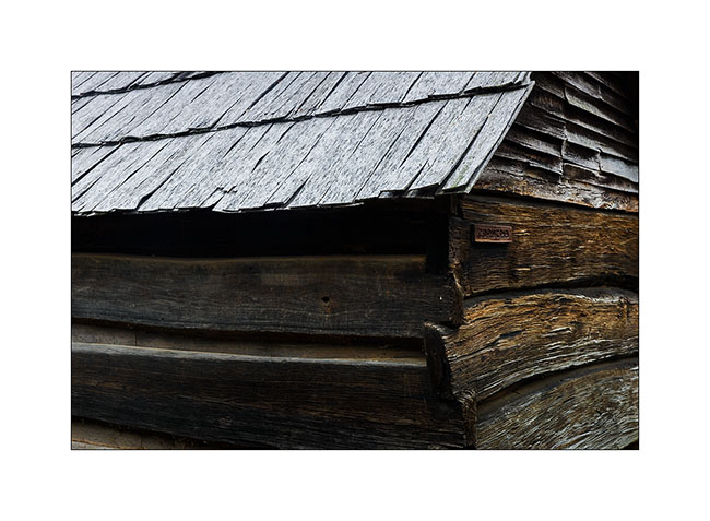
26) construction details…
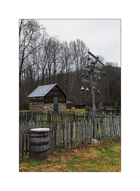
27) traditional barriers; durable and which don’t need nails to build..!

28) traditional birdhouses made in calabashes and an apples house in the background.
29) And finally, a photo taken by Eric during our meeting in Maryville. It was he who advised me to visit the Big South Fork, many thanks to him!
Tennesse again (2)
Still waiting for VivaLaVida’s new title, I get to Tennesse again since last Saturday. I found there the winter with low temps and some snow, the first one for VivaLaVida! 🙂
this time, I’m visiting the Big South Fork, North-East of the state. they are several natural arches and bridges I wanted to discover…
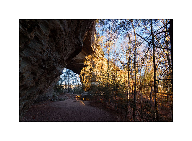
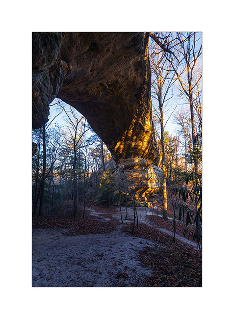
the first I visited were Twin Arches, two arches only about hundred yards one from the other on the same ridge, easy to access by a nice forest road. the morining I was there and even it doesn’t seem on the pictures, temp was 16°..!
1) The South arch, the largest one : about 95 feets high and 135 wide.
2) The North arch is smaller but thiner.
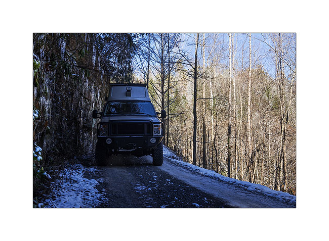
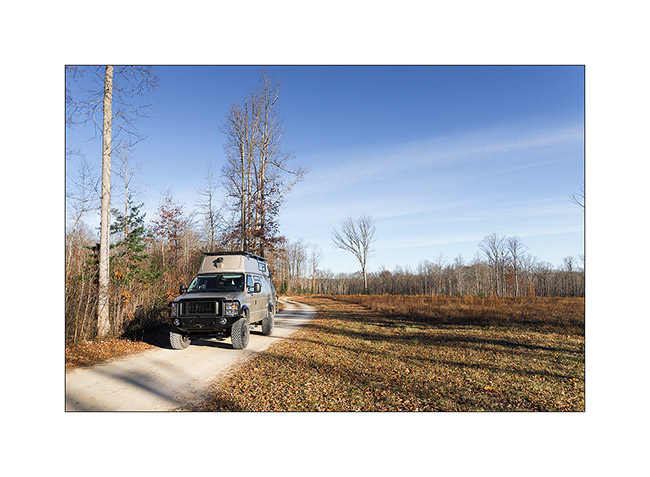
3) VivaLaVida on nice forest roads…
then I followed the trail to the Slave Falls, thin waterfall jumbing from a overhanging cliff.
4) Slave Falls
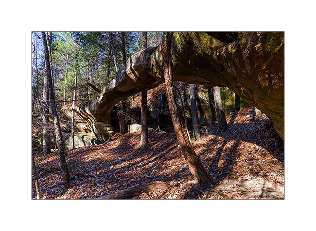
5) Further on the same trail, the very elegant Needle Arch.
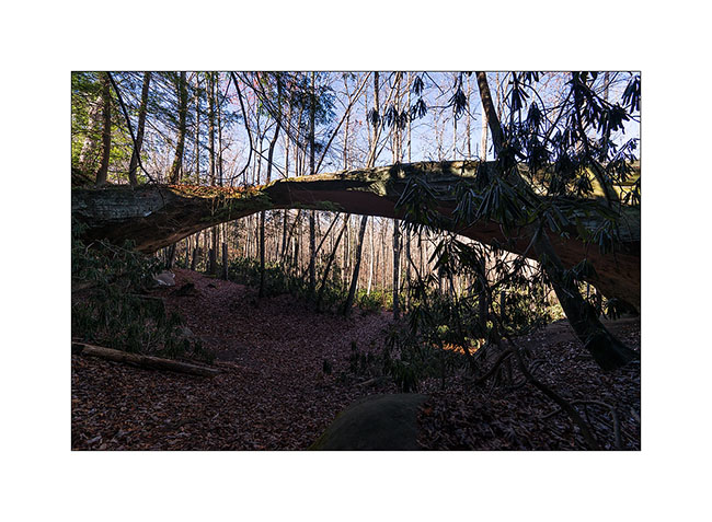
On the way back, I discussed with a ranger – the only person I saw during three days- and he adviced me two other arches in the area, one over. The first one is just called Natural Bridge and is very thin in the middle. I had to climb a little to go down to it.
6) Natural Bridge
The seconde one is over the Picket Lake. Not easy to find a nice spot to shoot it without walking in the watter, what I refused to do since the cold temp, 26° at that time. 😉
6) Picket Arch
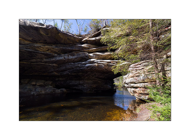
7) Nice Picket Lake…
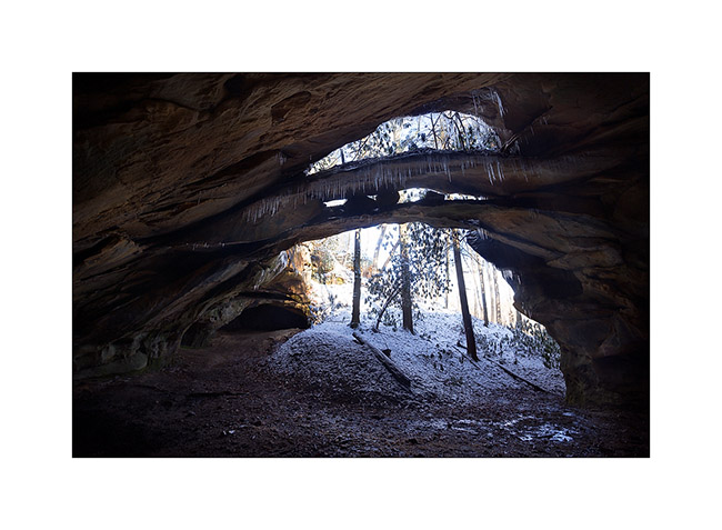
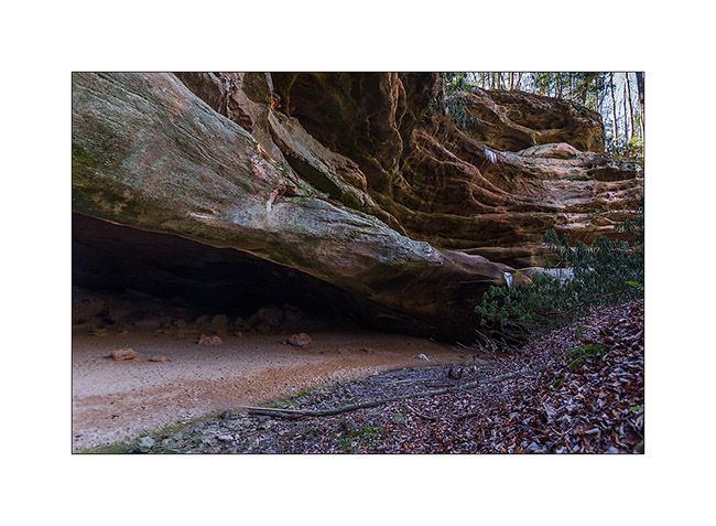
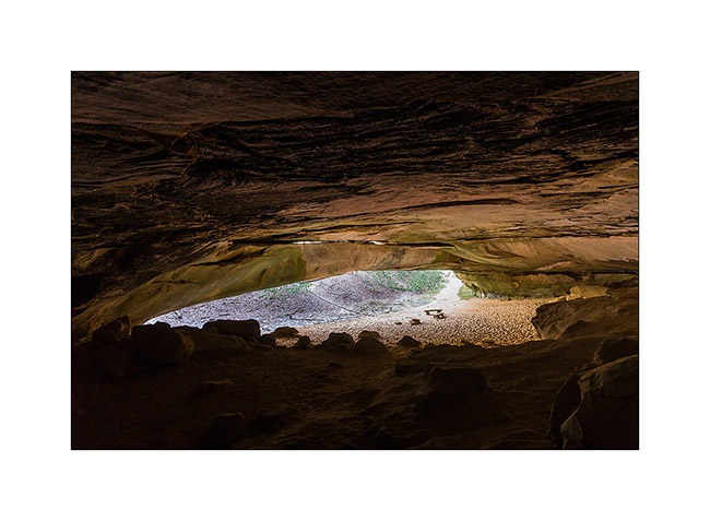
8) The next morning, I drove another nice forest road, about 28 miles long, to visit a cave used long time ago par Indians Cherokee.
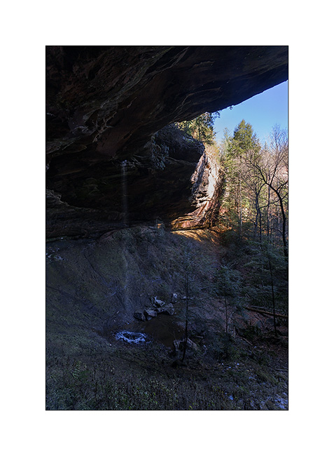
9) Entry of the cave
10) New arch in formation over the entry
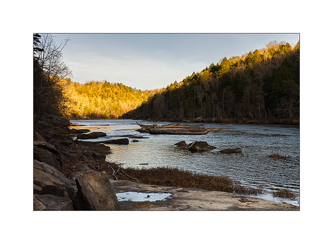
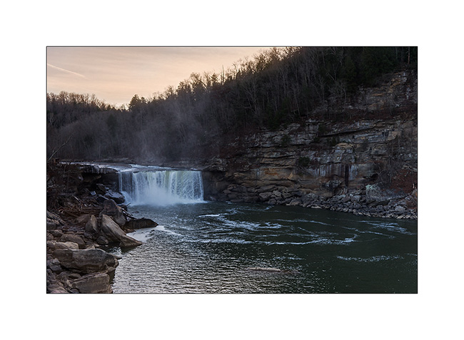
Some road again to the Knetucky to visite the Cumberland Falls, known as the most powerful waterfalls of North-East America excepted Niagara .
11) Arrival at Sunset, a little too late for the right light…
12) The Cumberland River jumps 120 feets , making a permanent water cloud…
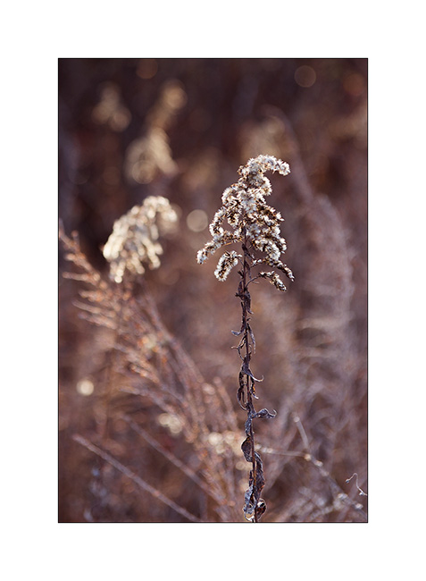
13) Grass…
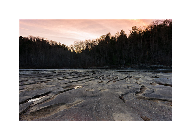
14) Sunset on the Cumberland River
Following of these Tennessee discovery soon… 😉
Happy Thanks Giving to all ! 😀