petroglyph
now browsing by tag
Minerality…
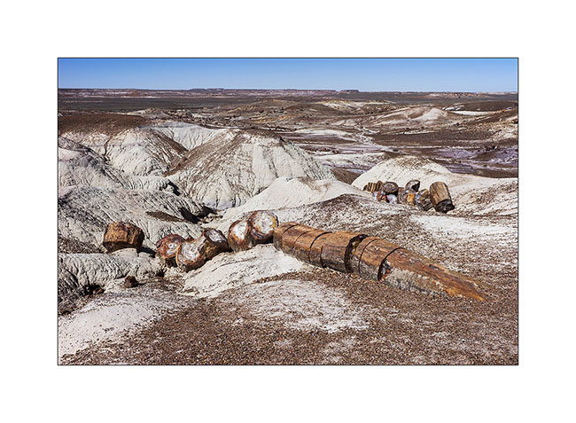
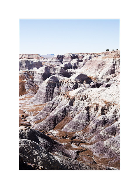
Still in Arizona, I made a short stop at Petrified Forest National Park. 225 million years ago, the current Arizona was nearly 3,500 miles South of his actual location, in a tropical climate and thus covered with tropical forests. During large floods on clay areas, trees fell and were buried in the clay that protected them from putrefaction. Over hundreds of thousands years that followed, the clay was covered with new sediment layers totaling till 1.5 miles thickness. The pressure thus exerted generated petrification of wood. Then the continental drift has gradually dried up the soil of Arizona allowing wind and rain to erode the upper sediments and leaving the petrified trunk now appear in the bentonite layers.
In places, the amount of petrified wood is staggering.
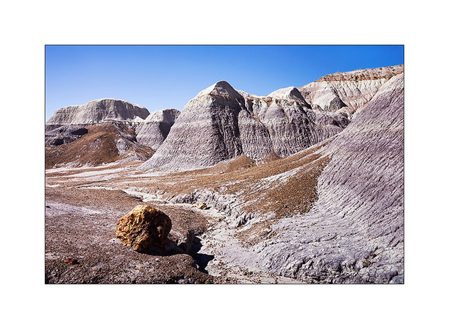
1. Bentonite which erosion reveals petrified trunks.
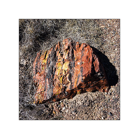
2. The colors are amazing! The density of this stone is such that it takes 4 times longer to a silica carbide saw to cut the same thickness as in granite.
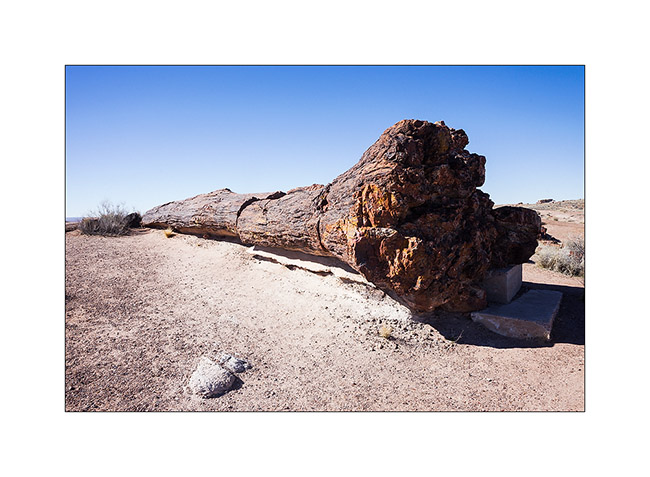
3. Most of the time, erosion causes trunks to break. On some, the petrified bark is still present.
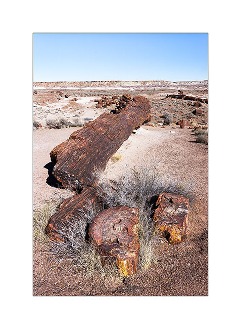
4. A giant! His strain is over 8 feet high.
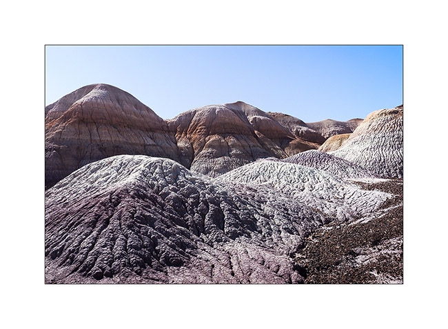
5. The desert surrounding area is varied.
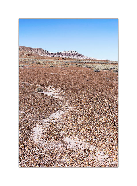
6. Undulation…
7. Mixes…
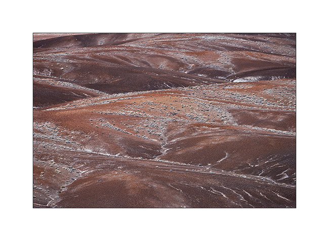
8. Amazing colors and shapes.
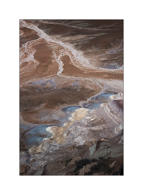
9. Edge of a bentonite mesa taht erosion carves.
10. This bentonite is less colorful than in other places but the presence of petrified trunks contrasts with the soft shapes of clay.
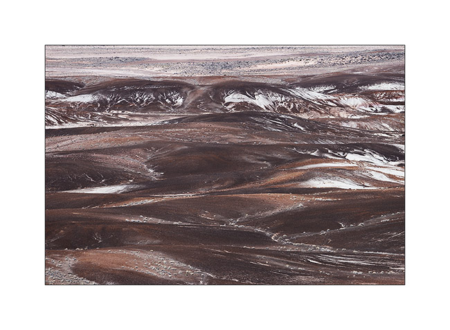
11. The eroded texture reminds me of some corals…
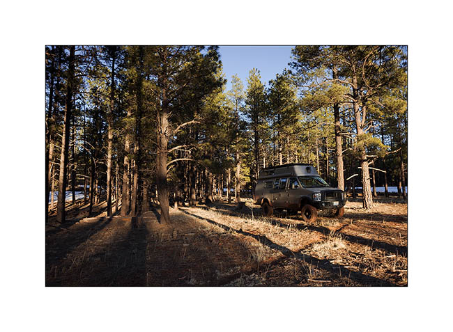
12. Vivalavida then moved to New Mexico, spending a first night at over 7,000 feet above sea level in the forests of the Zuni Mountains.
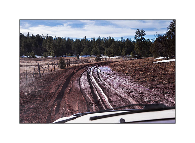
13. The next morning we crossed the Zuni Mountains with sometimes quite rutted and muddy roads…
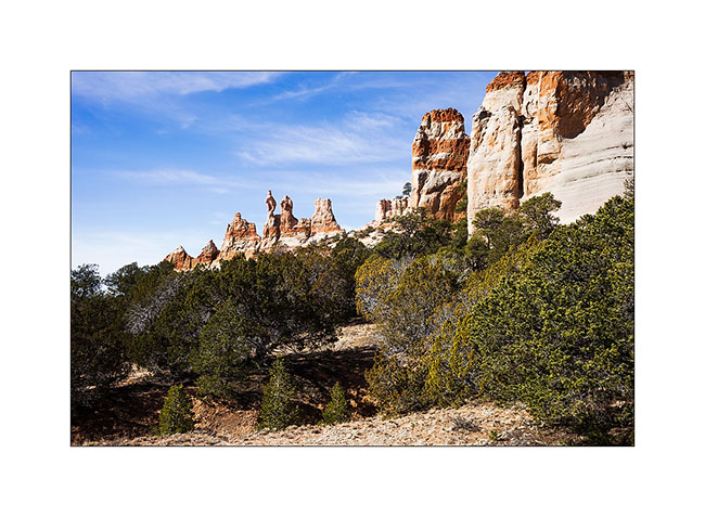
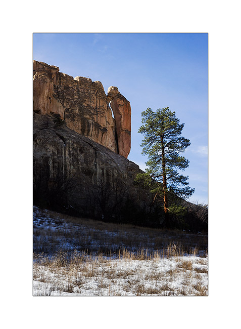
14. Discovery of the pinnacles of Los Gigantes by chance…
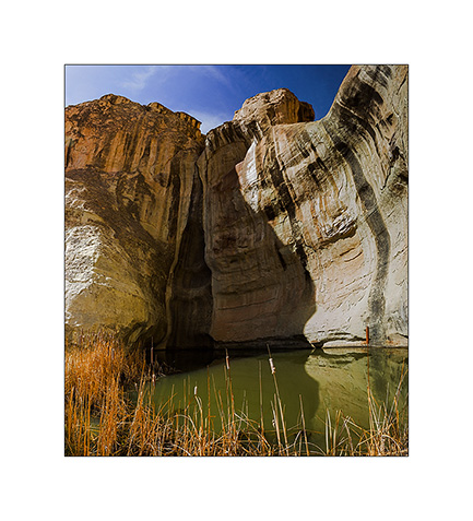
15. A guelta sheltered against a cliff of El Morro.
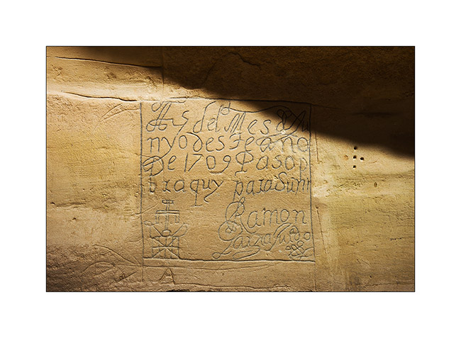
16. Etching in sandstone describing the passage of some Spanish in 1706.
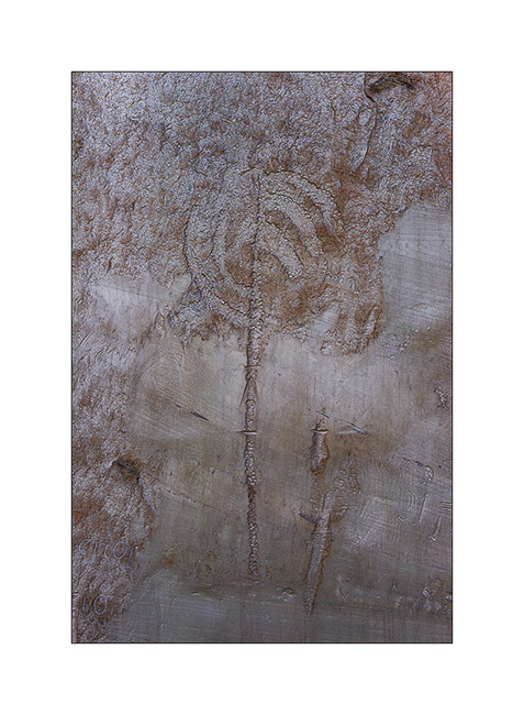
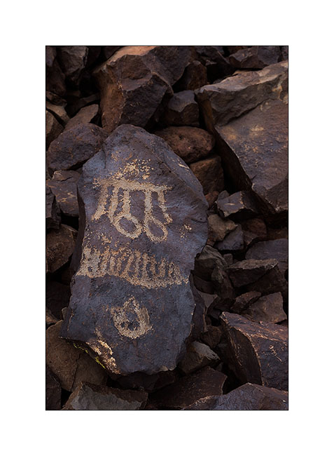
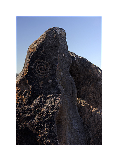
17. Petroglyph much older, probably around the year 1200.
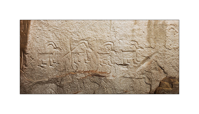
18. Another petroglyph estimated at 1,400 years BC.
19. “Woodpecker” natural arch.
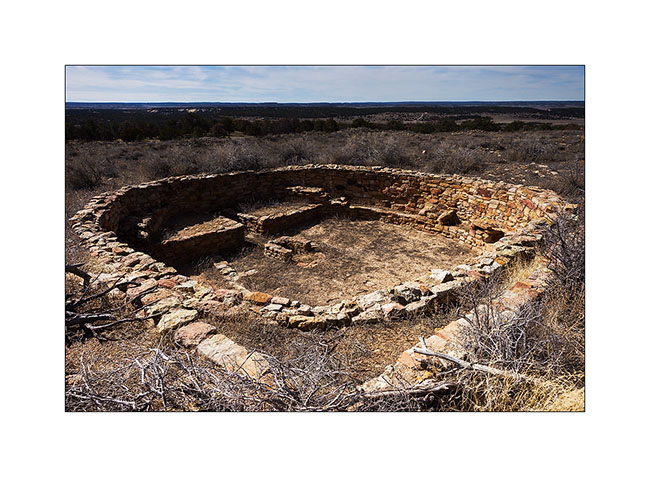
20. Pueblo ruins in El Morro National Monument.
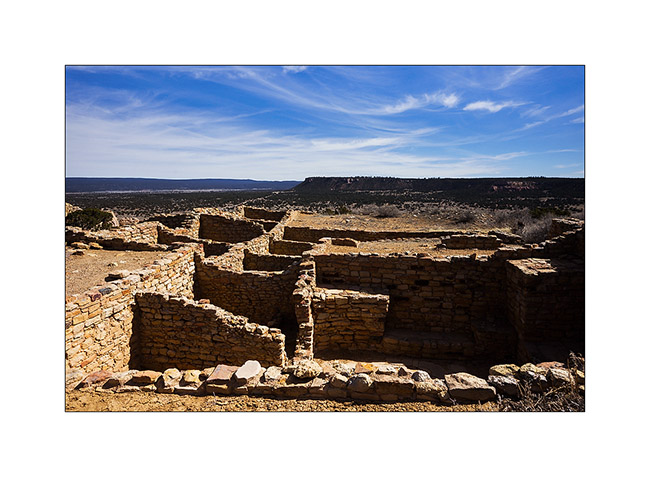
21. Another ruin of the same area.
Further discoveries along the East crossing of VivaLaVida to come soon… 😉
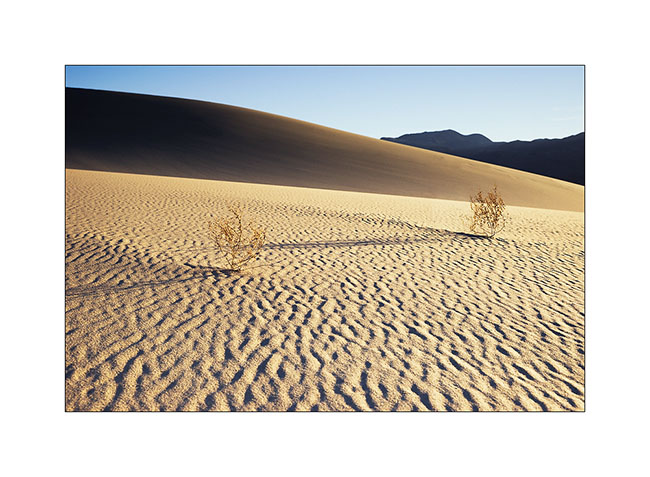
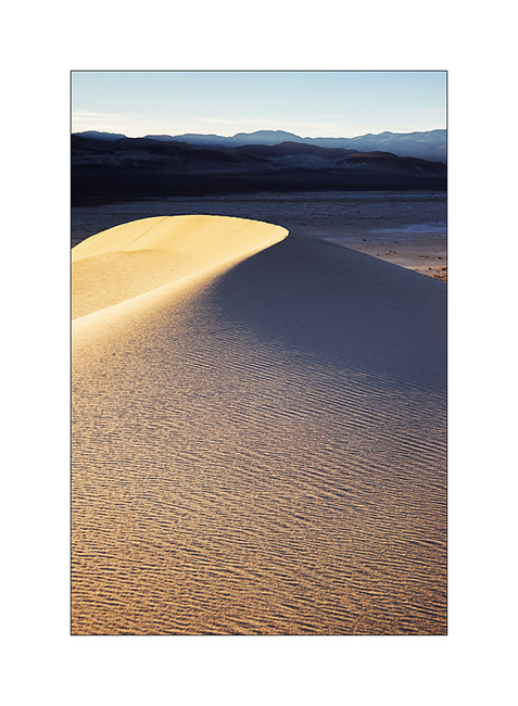
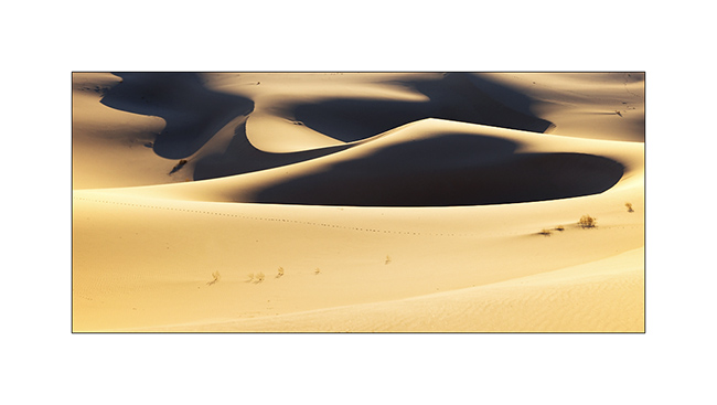
Petroglyphs and sand of Death Valley…
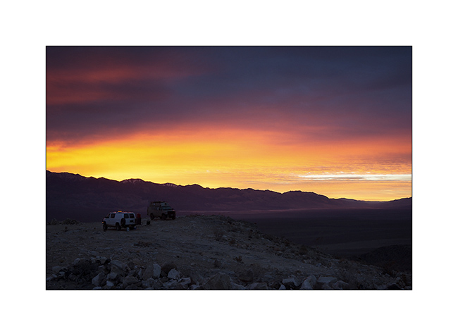
1. Intense sunrise at Lookout City.
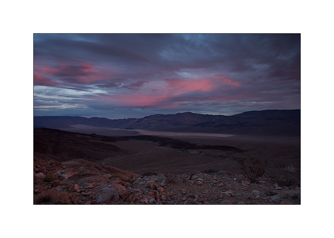
2. Softer colors over Panamint Valley.
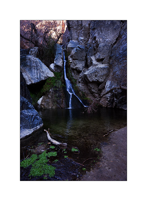
3. Treasure of Death Valley, a waterfall going down Darwin Canyon.
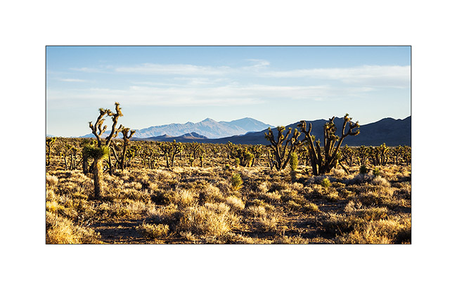
4. End of the day near Hunter Mountain, in a beautiful forest of Joshua trees.
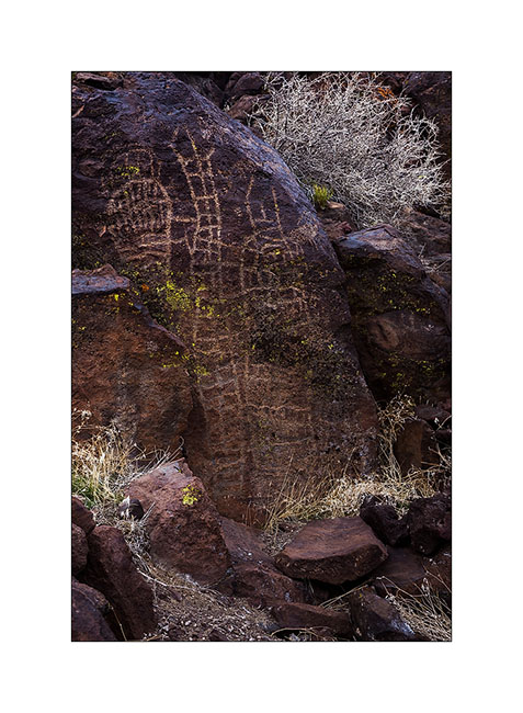
5. We discovered the Blackrock Canyon Well, a little-known petroglyph site.

6. This representation of wild sheep with her calf mouflon backs almost 3,000 years BC.
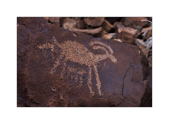
7. Shoshone Indians were admiring wild sheeps.
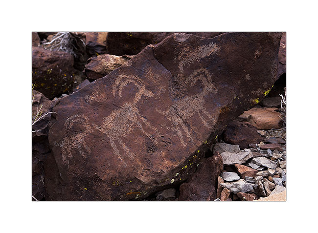
8. There are other representations which we don’t know the meaning on this site.
9. The change of patterns is amazing in some fifty petroglyphs we spoted.
10. Here is the largest of the canyon, near 10 feet high!
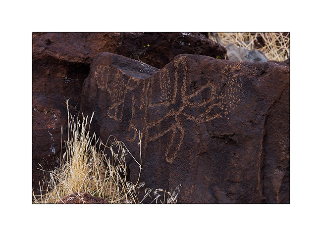
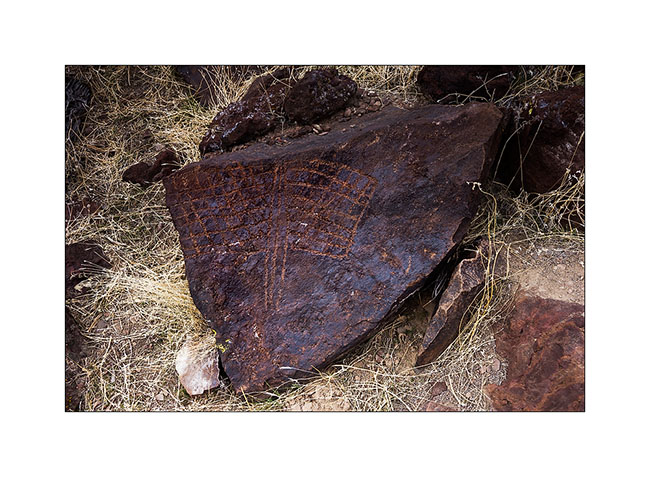
11. Likely a butterfly…
12. There are even some representations on detached blocks.
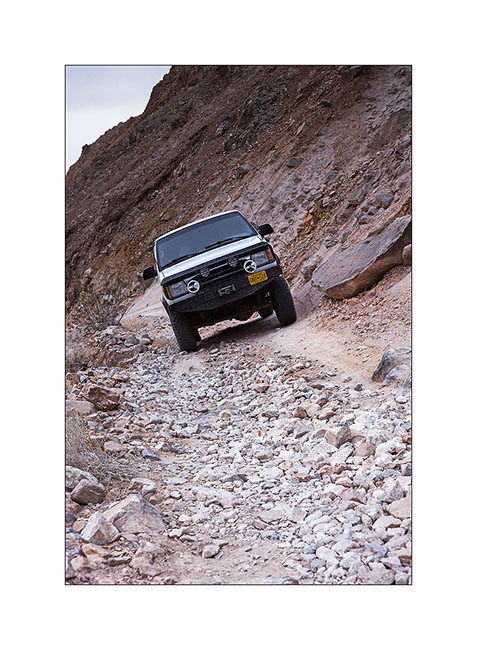
13. Jeff a little tense on the Road Linpincott…
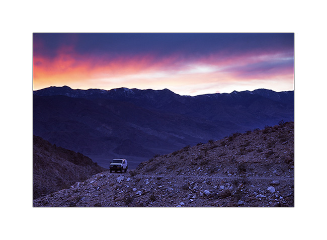
14. We arrive at the top at sunset.
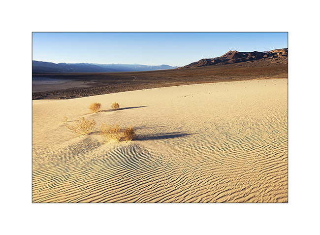
15. Stop near Eureka Dunes I had discovered with Jean-Luc last spring.
16. Wind pattern…
17. … and shadows…
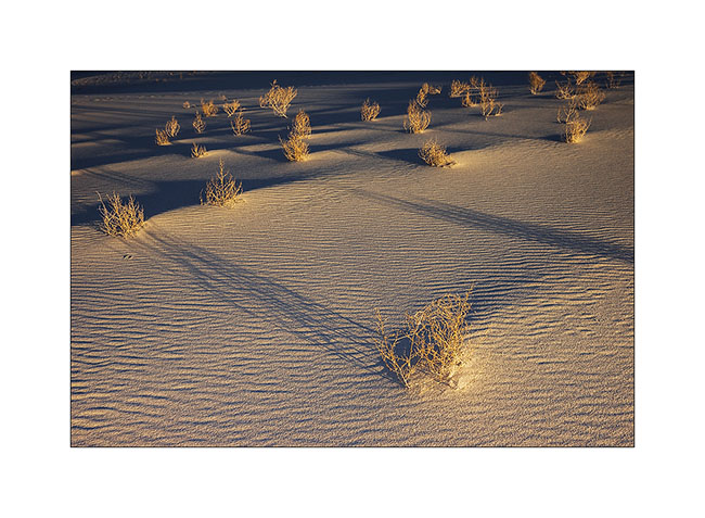
18. Ripples…
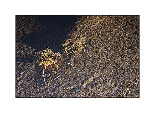
19. Vegetal graphism on mineral.
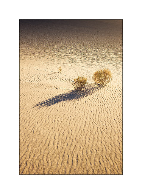
20. Last sunrays lengthen the shadows…
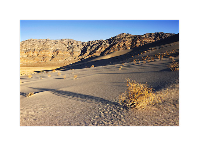
21. Dune…
22. Sand waves…
This concludes the eight days spent with Jeff & Janet who continued their journey toward North. It was nice to share these few campfires and make them discover some hidden corners of this splendid Death valley.
Next of the journey coming soon… 😉
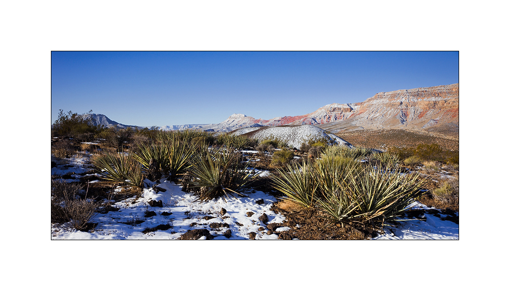
Petrogryphs of Arizona and Nevada
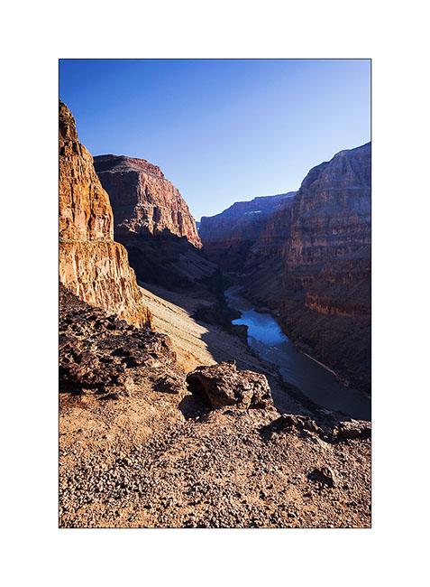
Vivalavida went discover another access to the Grand Canyon, also on the North Rim but further west.
1. Cactus in snow…
2. After going down Whitmore Canyon, I reached the end of the trail, approx. 700 feet above the Colorado River.

3. Grand Canyon is also gorgious here.
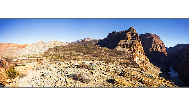
4. The site is interesting because it presents a large lava flow clearly visible on this panoramic (3 images stiched). There have been several successive lava flows, the first about 170,000 years ago that created a temporary 250 feet deep lake obstructing the Grand Canyon. This lake has remained approx. 20,000 years before the lava broke, creating a gigantic tidal wave downstream. Since then, there have been seven succesive lava flowa, the last one approx. 20,000 years ago. Do you find VivaLaVida that gives the scale in the image? 😀
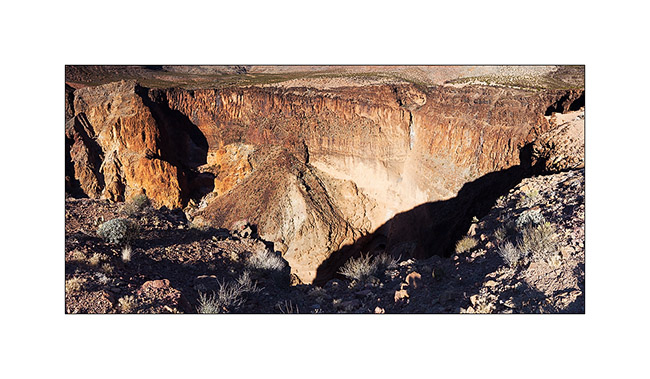
5. To the left of the promontory from which I took the previous image, there is a wide collapse that reveals beautiful basalt organ walls. It’s approx. half a mile in diameter and almost 600 feet deep.
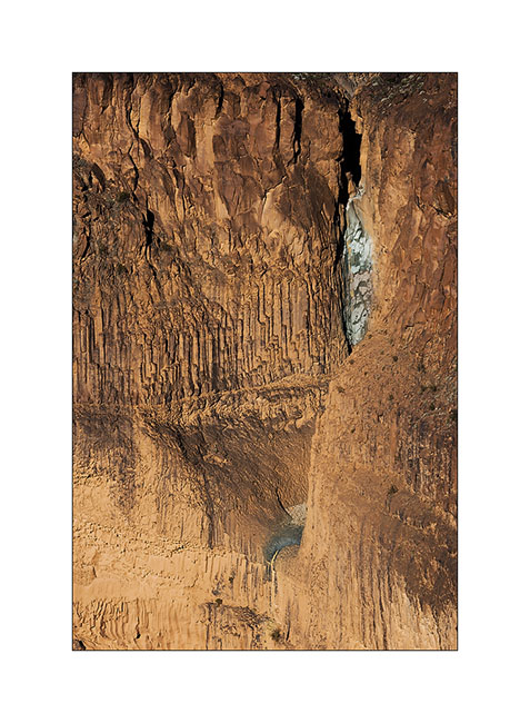
6. Details of the cliff with a waterfall that has carved its way.
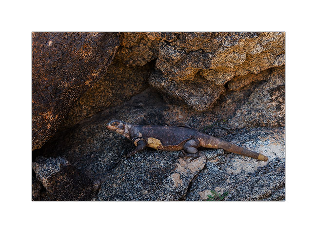
7. Just to the testimony, picture is not great, a “beep beep” surprised in the warmer micro-climate of the canyon.

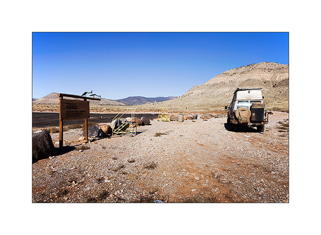
8. Going back up the trail, I pass a small country air strip. Some guys don’t lack humor with this “Whitmore International Airport” sign and the two small escalators… 😉
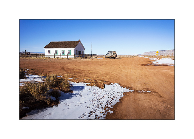
9. VLV near the Mount Trumbull old school. Built in 1922, it was burned by vandals in 2000 and rebuilt in an identical in 2001. It was the only school in the area where the first collons arrived in 1916, growing grains and beans until 1934 where the climate became much drier. Therefore, some og them turned to breeding cattle and sheep while many others left the premises. The school was in operation until 1968 when it was closed for lack of students. the last man living year round in this region died in 1984. Since few ranch remain scattered and inhabited during sommer only.
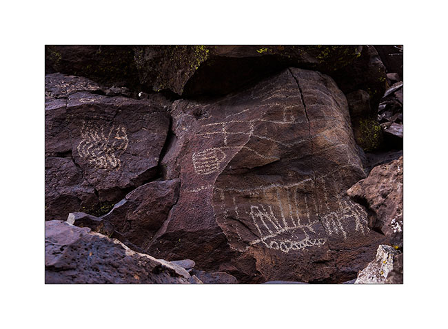
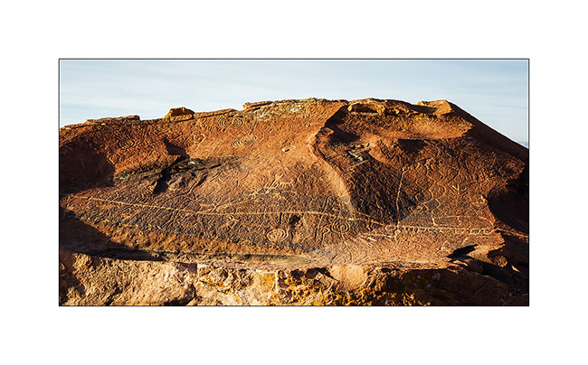
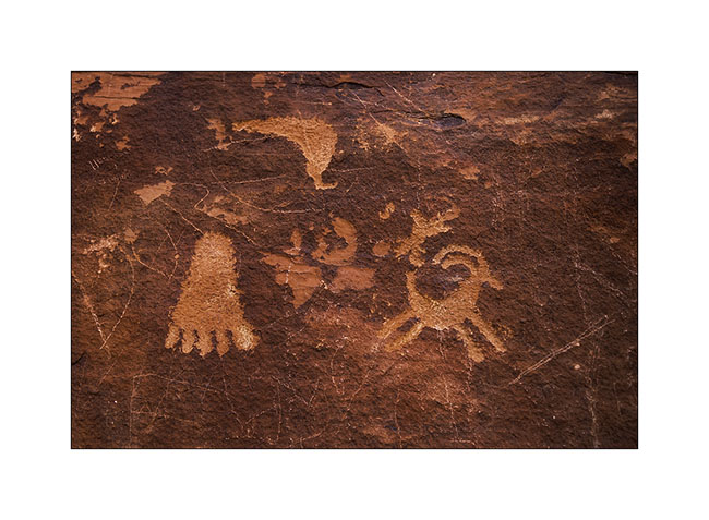
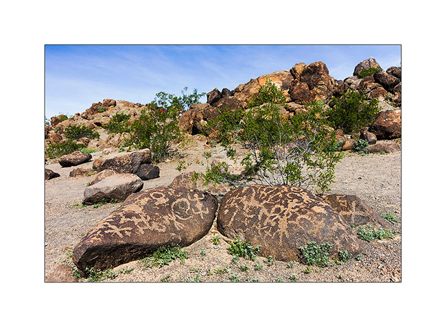
10. Short detour to Little Black Mountain, an interesting petroglyphs site.

11. the almost horizontal line is oriented exactly in the axis of the winter solstice; December 21st, the sun rises just above its eastern end.
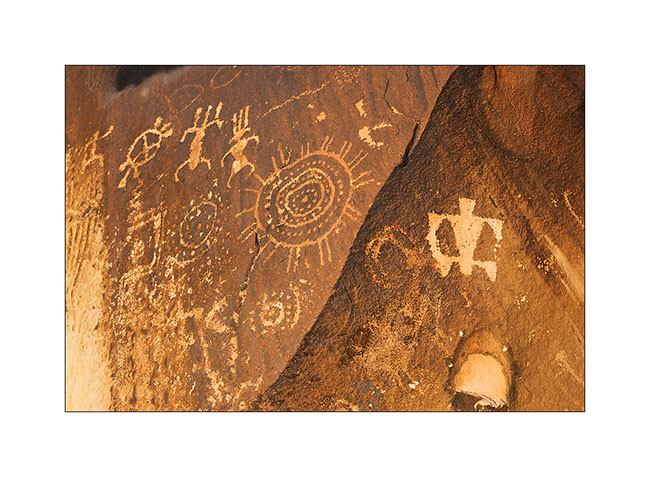
12. One of the big boulders of the site.

13. Details…
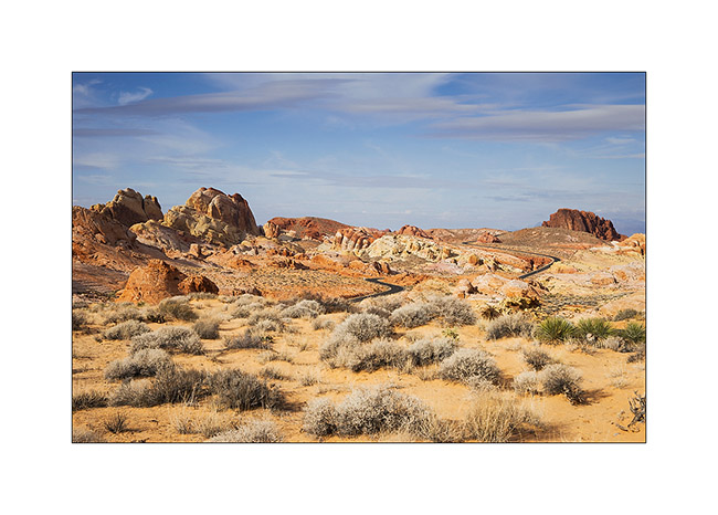
After this escapade in Arizona, I made another into Nevada to spend the evening with my friend Christian who was a few days in Las Vegas for the CES. Heading back to Utah where I should pick up a new compressor for VLV (the actual one being at its 4th beakdown…), I stopped at the Valley of Fire, a small Nevada State Park not far from Lake Mead.
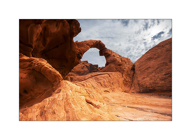
14. Arch Rock.
15. They are also many petroglyphs, those ar at Altalt Rock.
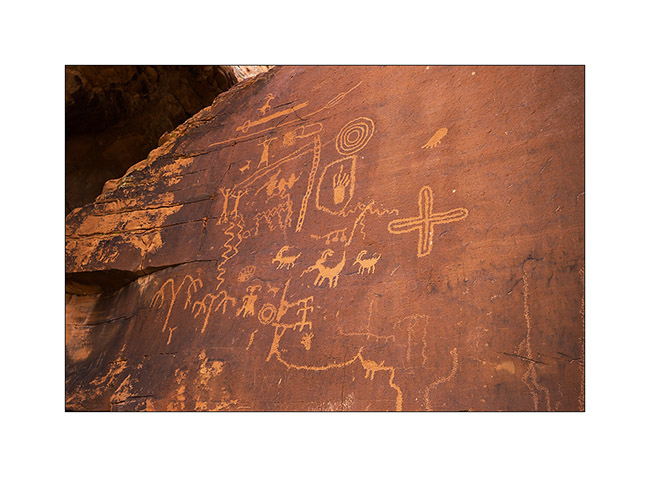
16. Still Altalt Rock.
17. Those are in Mouse’s Tank Canyon.
18. The road heading to White Domes.
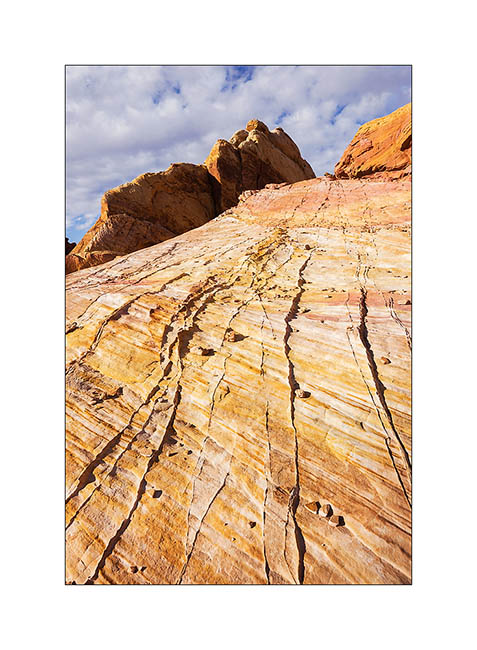
19. Sandstone is veined with various mineral colors.

20. Like a petrified wave…
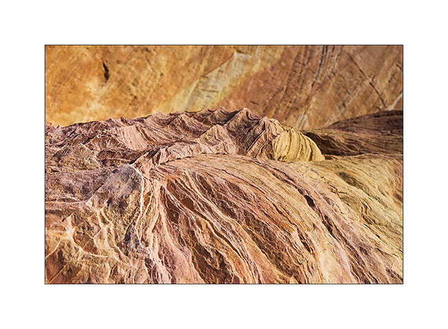
21. Veining…
22. Windstone Arch, rather unusual in an alcove of the rock.

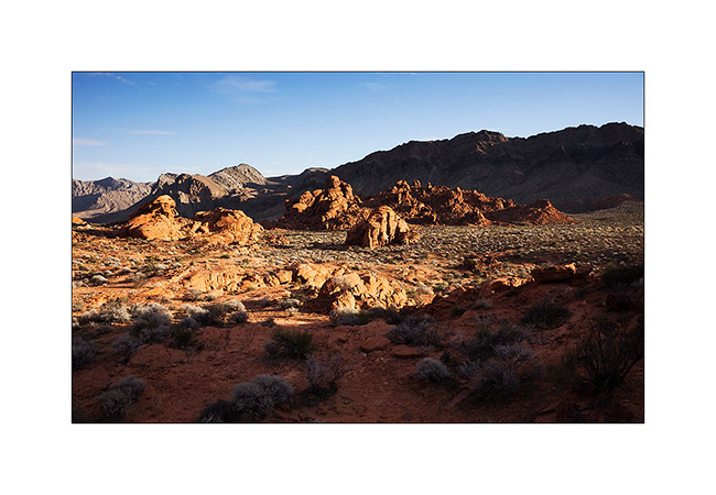
23. Late afternoon in Valley of Fire.
That’s it for today. Next step of VivaLaVida’s journey in the coming days… 😀
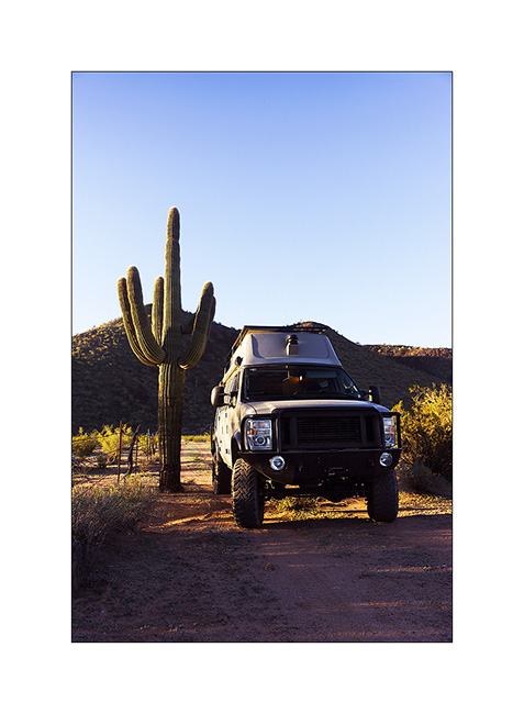
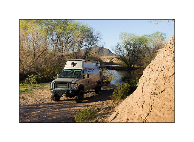
Arizona
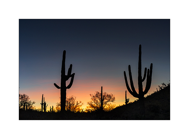
Last update on the road to Baja, I crossed Arizona in one day, in some desert places where are saguaro, the giant cactus.
1. Symbol of Arizona!
2. VivaLaVida gives the scale.
3. A deep coat of fech-fech dust in this wash…
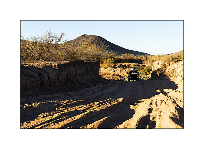
4. … then a river crossing quite deep too!
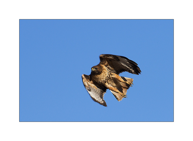
5. A Swainson’s hawk.
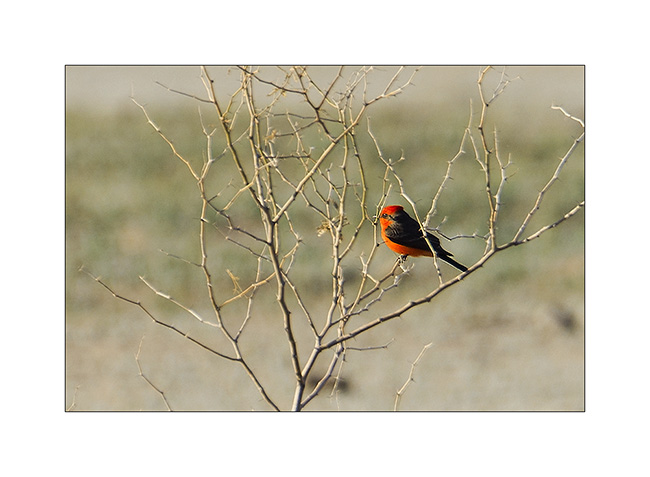
6. Nice small red bird.
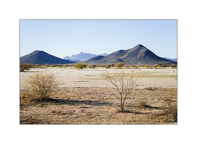
7. Nice desert landscape.
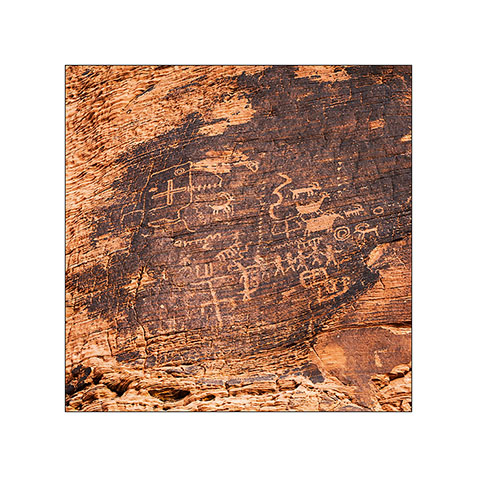
8. A petroglyph site.
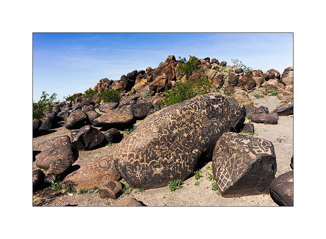
9. Representation…

10. … and model!
11. This represents the sun.
12. More petroglyphs.
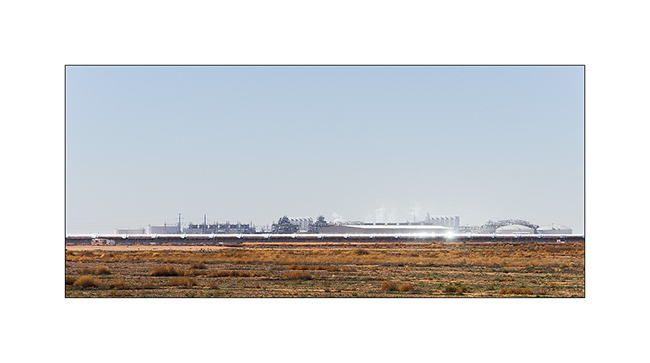
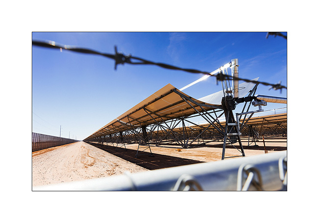
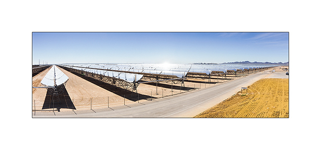
13. On the road, I stoped to see that solar plant.
14. Each parabolic mirror is more than 3/4 mile long and moves to follow the path of the sun, focusing the rays onto the pipe located in his focus. Thus, water is converted into steam under pressure which makes a turbine turn, similar to those used incoal plants.
15. Surface is huge. I estimated it at about one square mile.
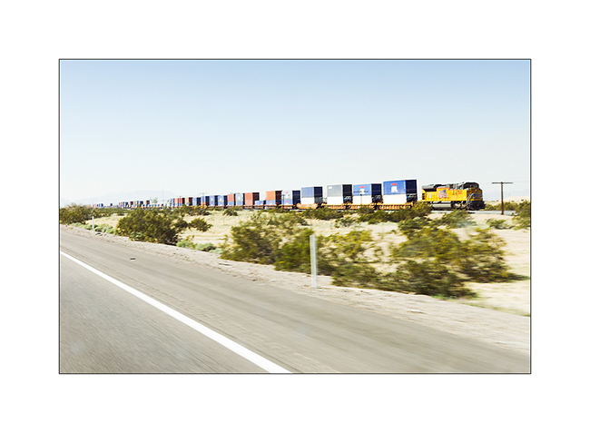
16. And especially for Patrick and Claudia who drive trains, a picture of the huge convoys crossing the U.S. by the southern route, driven by large Union Pacific diesel locomotive. The photo, taken while driving is not terrible,, sorry…
That is it for my crossing of the southern United States. The following will take you to Baja Mexico where I spent four weeks with Andrew that I will present to you soon.