trail
now browsing by tag
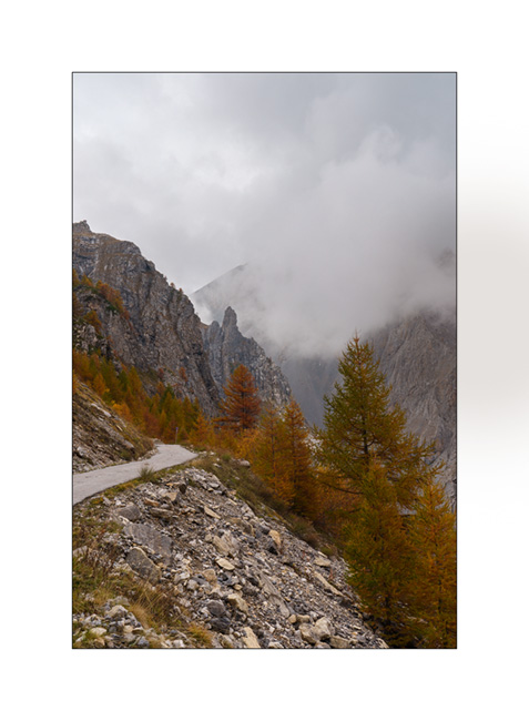
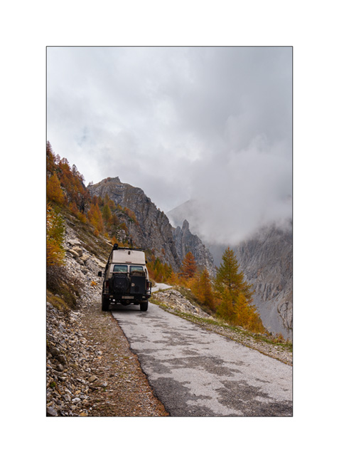
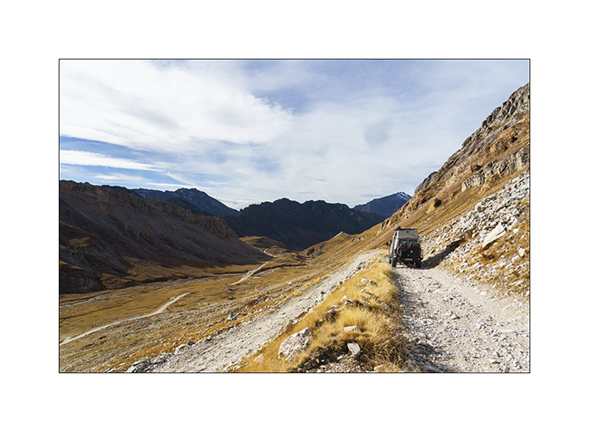
Alta Via del Sale
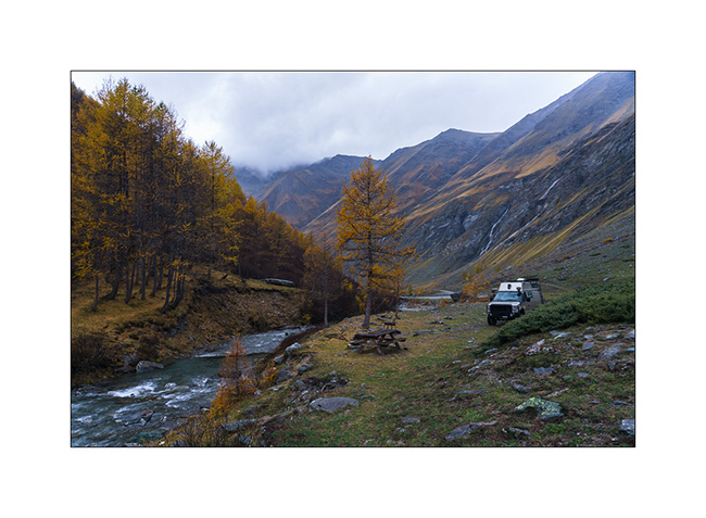
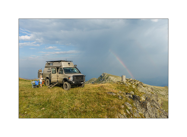
It’s Wednesday. We arrive at the entrance to the High Salt Road, unsure if we’ll be allowed to enter. Officially, the road is restricted to vehicles less than 18 feet long, 5 feet high and weighing less than 3.5 tons..
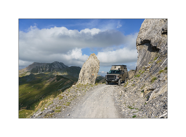
At the ticket booth where you pay your way, I don’t hide the fact that VivaLaVida is breaking the three previous criteria and I’m glad I did. The attendant tells me that my honesty does me credit and that he’s happy to let me through. He tells me that in an overhanging section, I’ll have to drive close the edge to avoid hitting the rock but that he thinks it should be fine.
We are very happy to be able to discover this legendary trail!
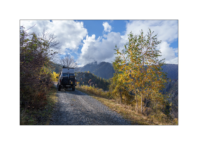
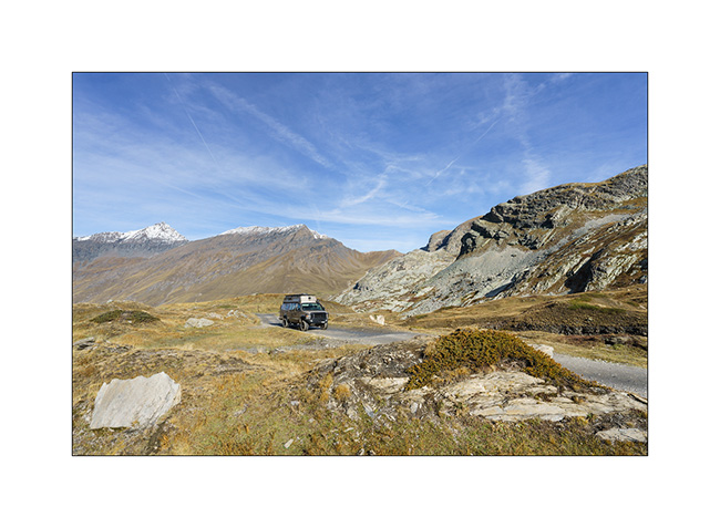
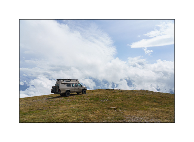
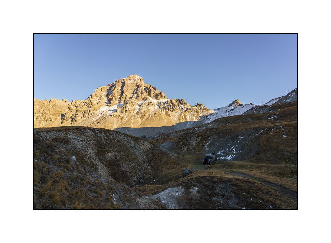
1. In the wellknown hairpin just before the Pass of Boaria, where we turned back on our bikes the day before.
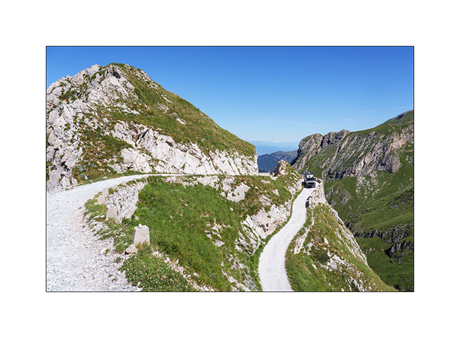
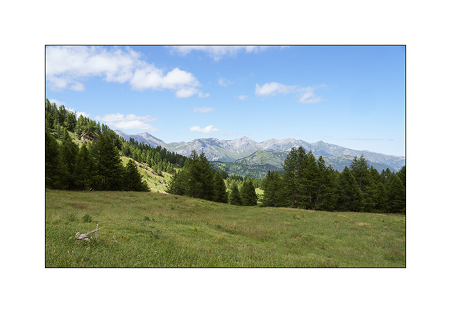
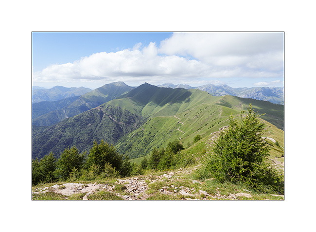
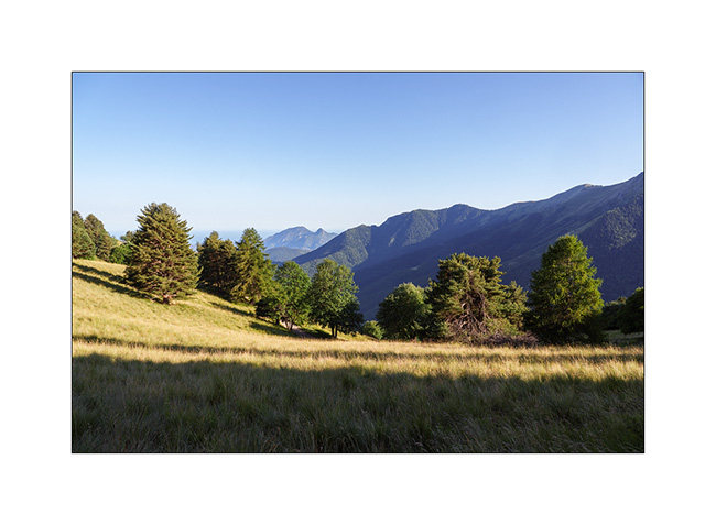
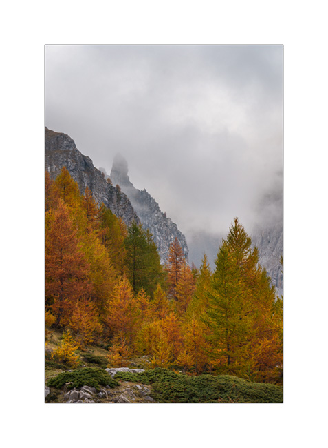
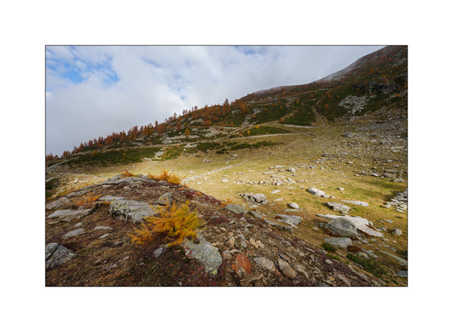
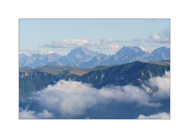
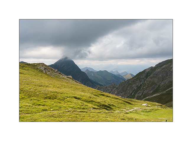
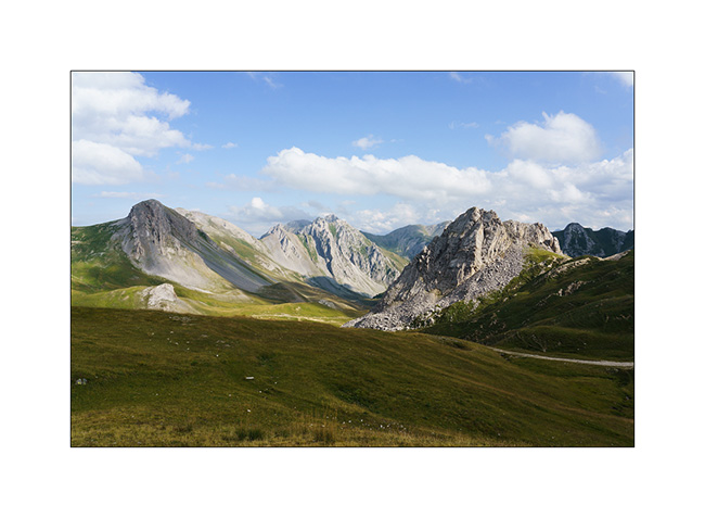
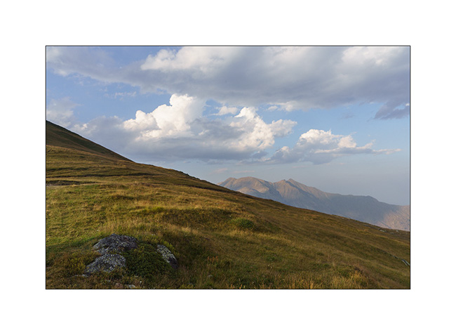
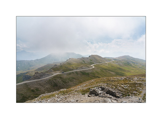
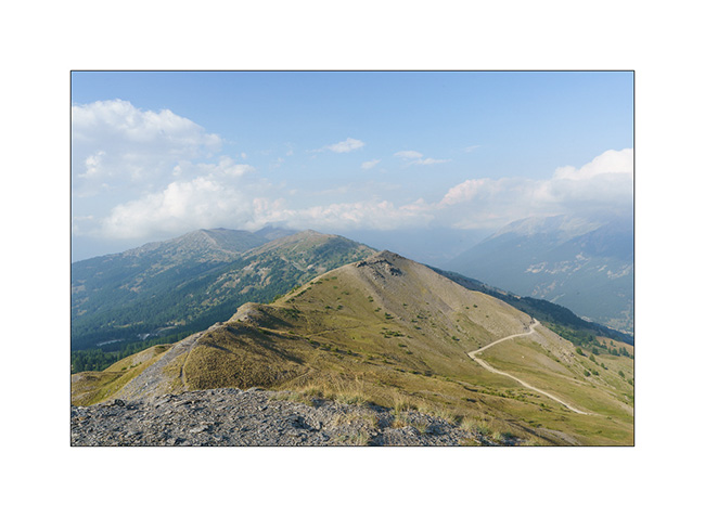
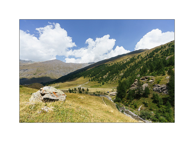
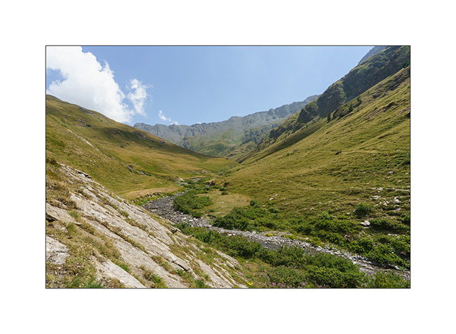
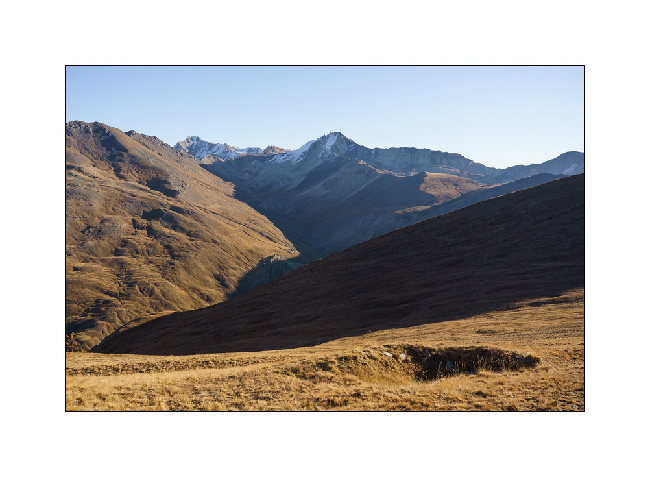
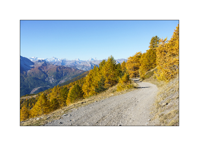
2. The trail winds between 6,000 and 7,200 feet above sea level for around thirty-five miles.
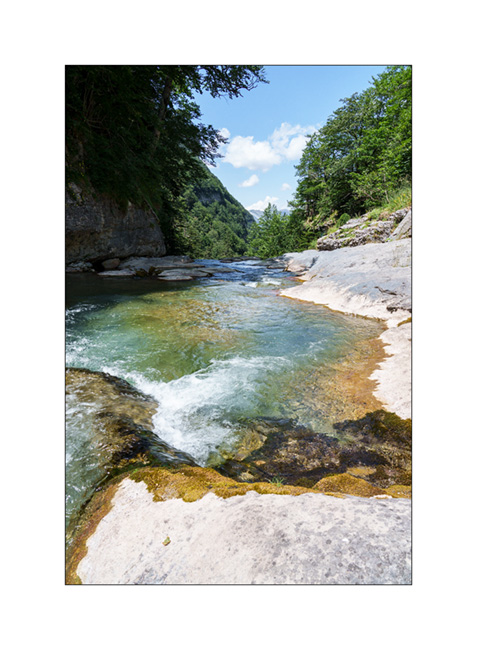
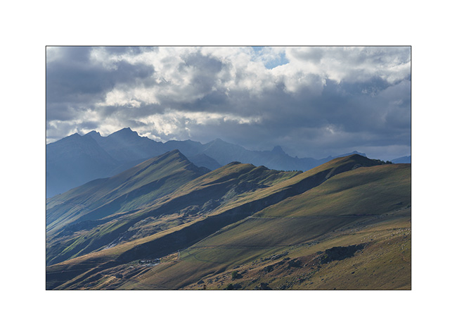
3. Landscape is superb.
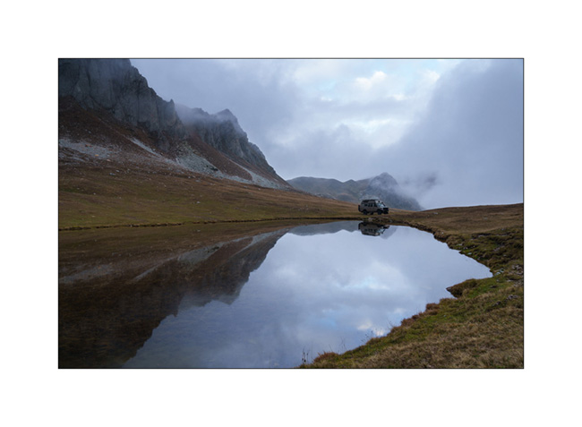
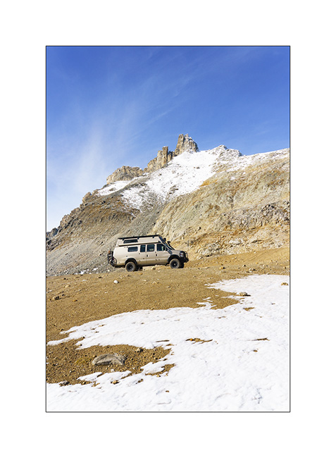
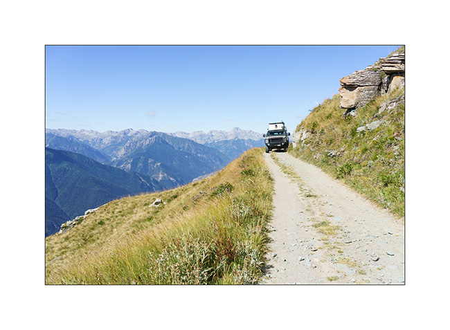
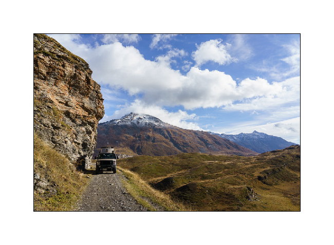
4. After the Don Barbera refuge and the overhanging passage passed without any problem.
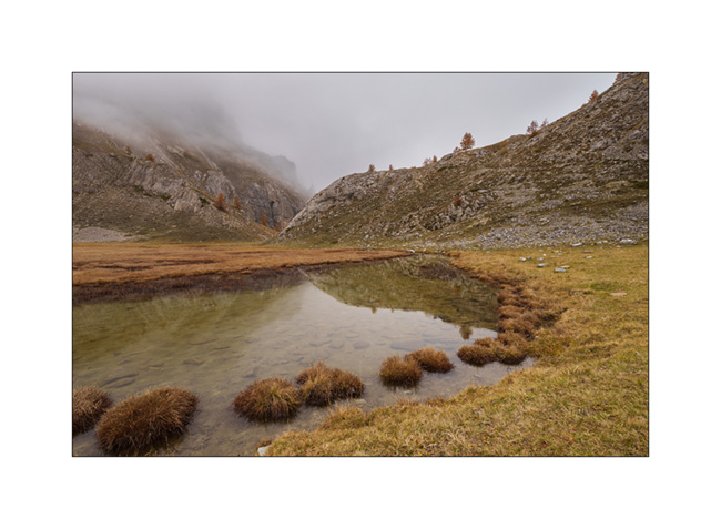
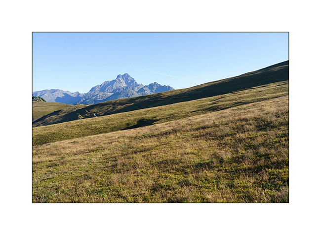
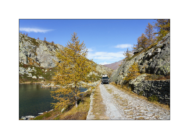
5. Part closer to the tree line.
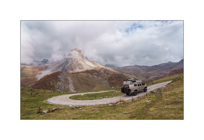
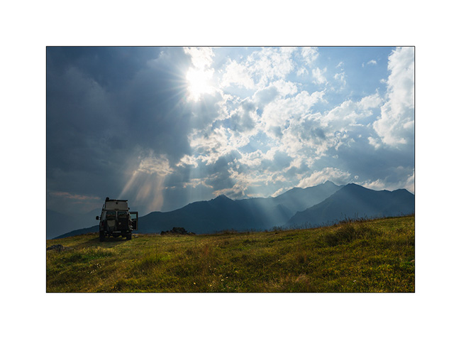
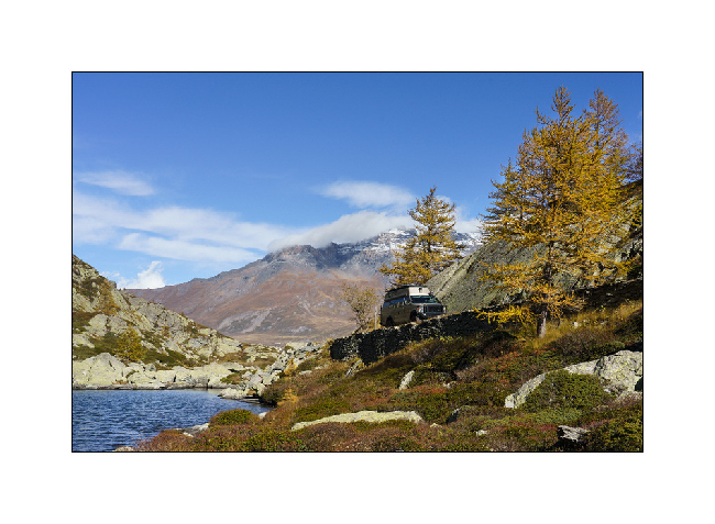
6. Mount Saccarel, at 6,600 feet elevation.
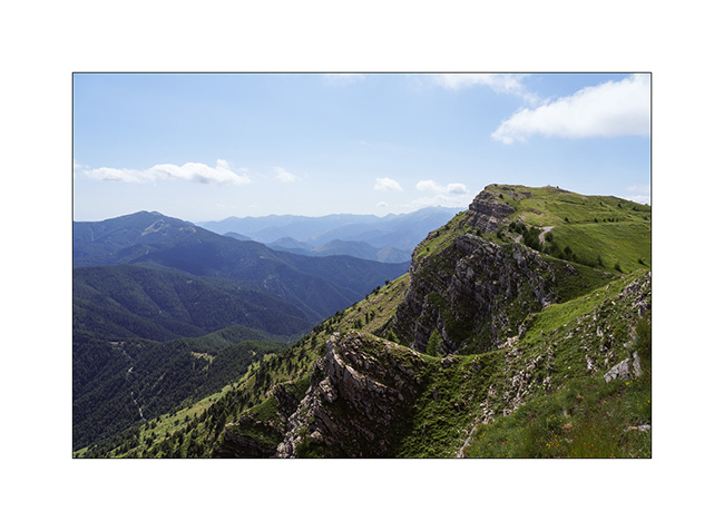
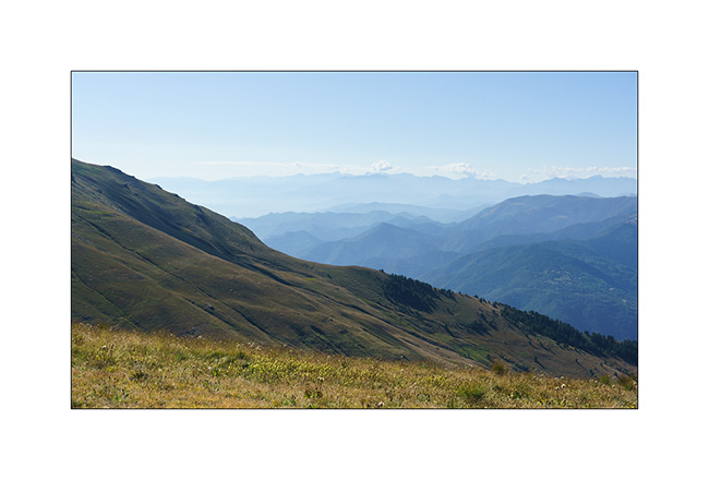
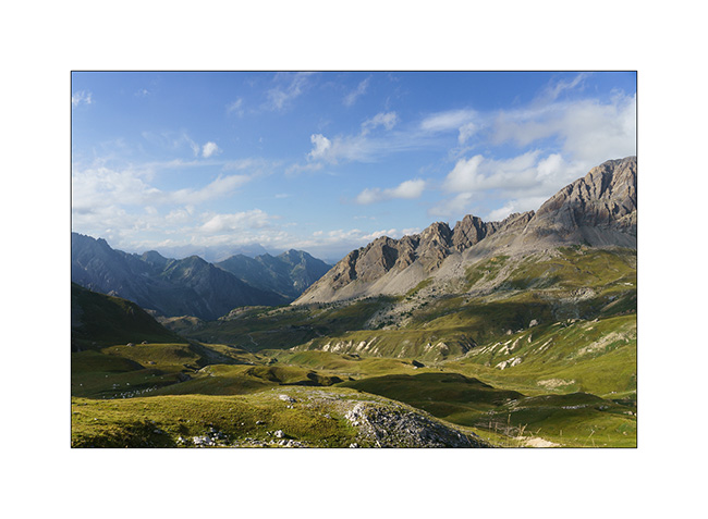
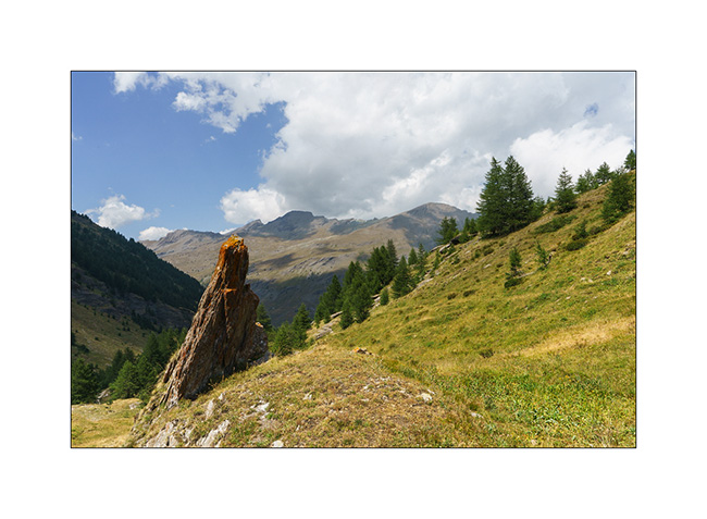
7. High altitude landscape.
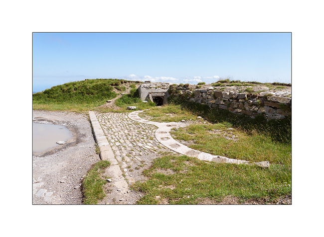
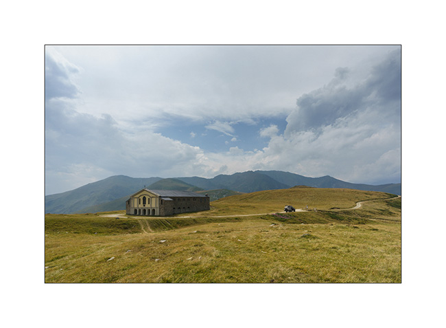
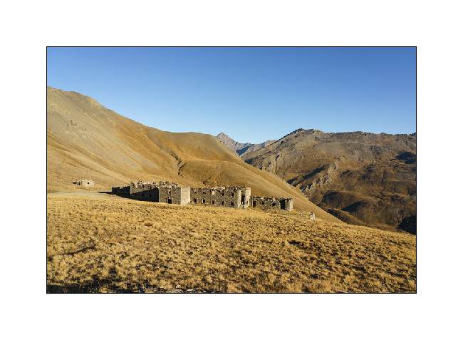
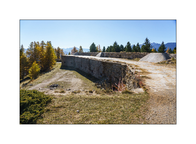
8. Former cannon battery of Mount Saccarel.
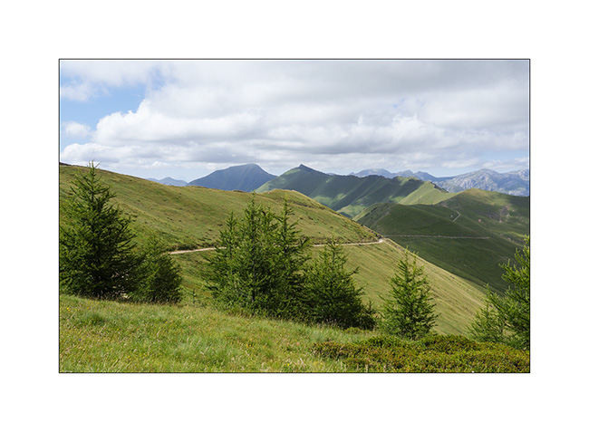
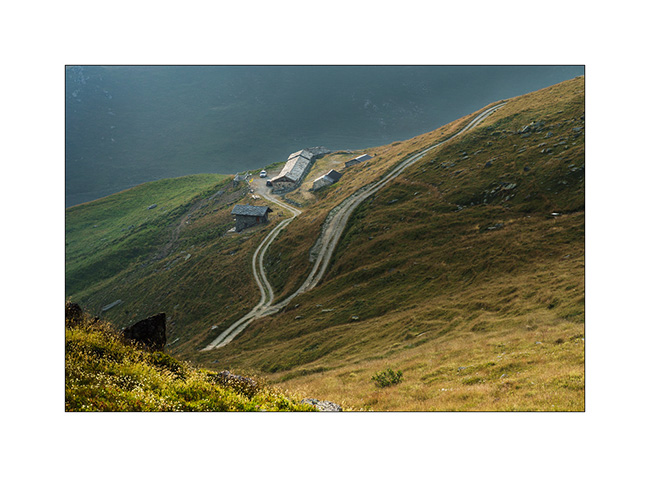
9. From Mount Saccarel, the trail we will take to descend. It is in poor condition and it will take us more than two hours to reach La Brigue where we will spend the night in a small campground.
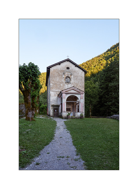
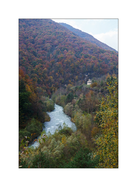
10. Chapel of Our Lady of the Fountains, just before La Brigue.
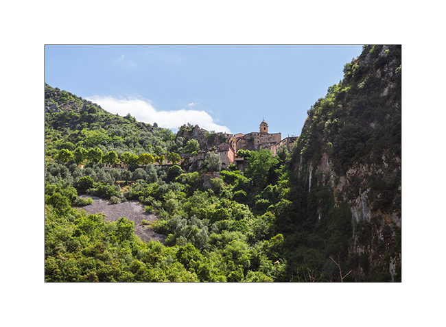
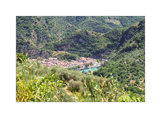
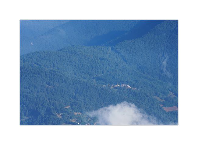
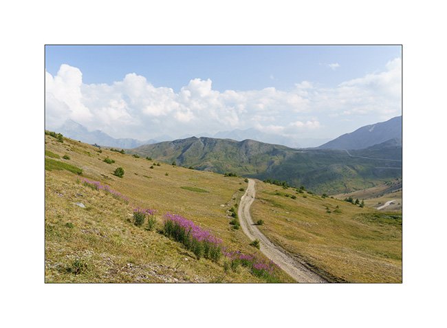
11. After a good night’s sleep preceded by a dinner in a small restaurant, we go shopping food in Breil-sur-Roya and then take a trail leading to the Mercantour Park. Here, the pretty hilltop village of Soargue.
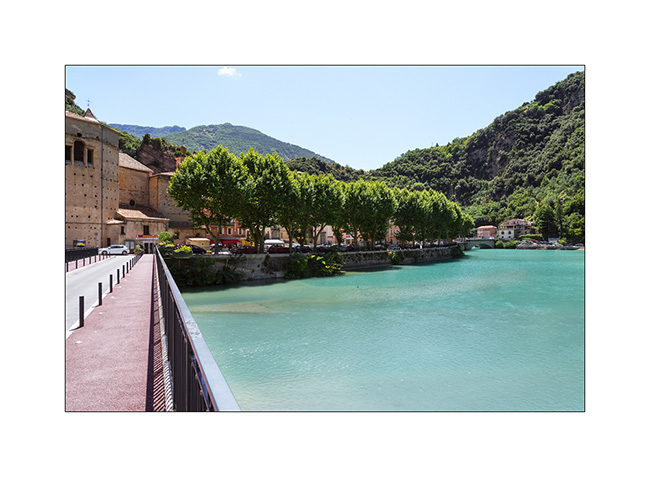
12. Breil-sur-Roya.
13. From a little higher up, where we stopped for lunch.
We meet a Mercantour park ranger who informs us that the heart of the park has been extended and that the planned trail now crosses it and it’s thus closed to all traffic.
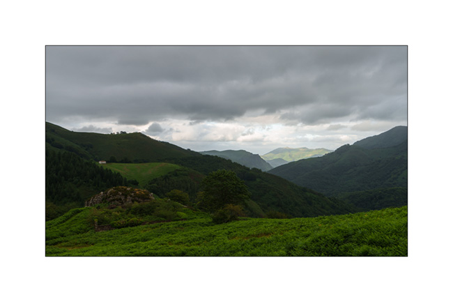
He points us to an alternative route that’s a bit of a detour but allows us to avoid the heart of the park. So we retrace our steps to a junction and take the indicated trail. The loop is significantly longer but allows us to discover the hills of the hinterland with the Mediterranean sea in the background.
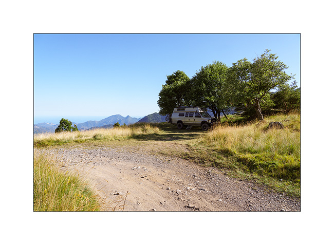
14. We find a gorgeous bivouac spot a few miles before the Turini barracks which we will discover the next day.
15. Walk at the end of the day.
To be followed soon… 😉
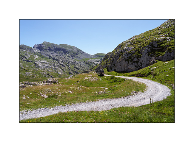
Maira Stura
As announced, we continued South hoping to be able to access the Maira Stura trail which was closed during our last visit in summer.
1. Chapel of San Salvatore, driving up the Val Maira.
2. Village of Macra, in the same valley.

3. Indeed, the gate located after Pian Preit is open at this time of year. We can take the small road towards the Meja Pass.

4. Cloudy weather as the road climbs steep.
5. …
6. The limestone is steep on this side of the valley.
7. Near Meja Pass.

8. We continue on the trail towards refuge Gardetta.
9. Meja Mountain in the clouds.

10. Altitude marshes.

11. The atmosphere is magical with the fog coming in.

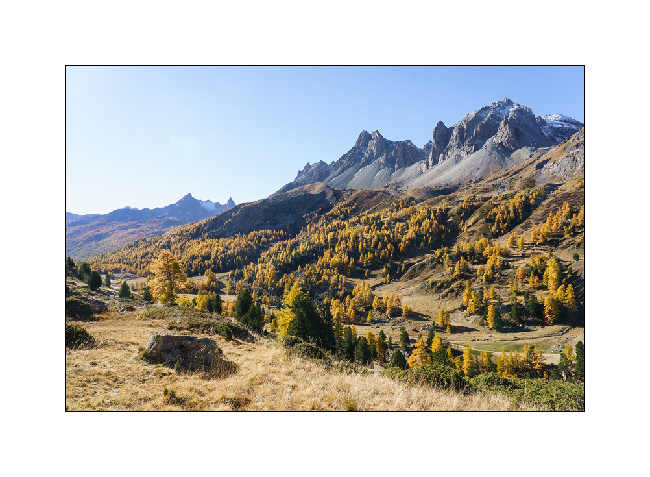
12. Fall colors…
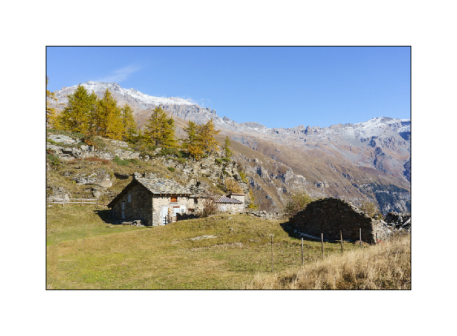
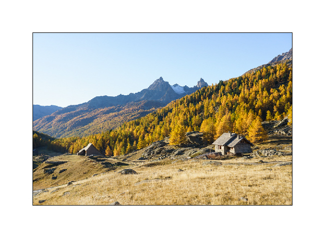
13. Under refuge Gardetta, at almost 7,000 feet elevation.

14. We do the entire crossing of the Maira Stura trail via Margherina Pass in the rain. Here, the old Barracks Della Bandia.

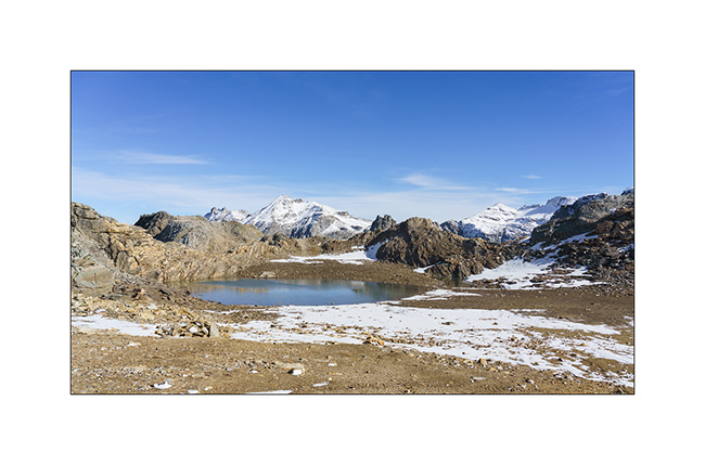
15. We find a nice boondocking spot on the edge of a small lake.
16. Rainy and windy twilight.

To be followed soon… 😉
Fall holiday : Lake Lauson
For the second week of Emile’s vacation, we went to discover new alpine spots.
1. Sunset et our first boondocking spot, near Sansicario.
2. Herd going up towards Sestriere.
3. Going down the valley of Cluson river.

4. On the trail going up to Lake Lauson.
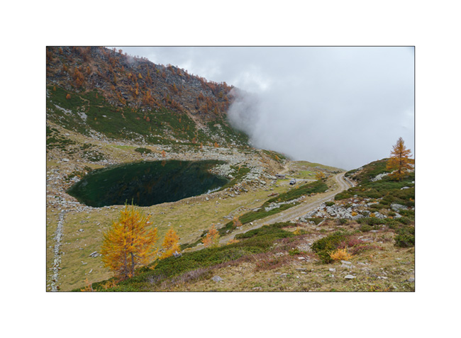
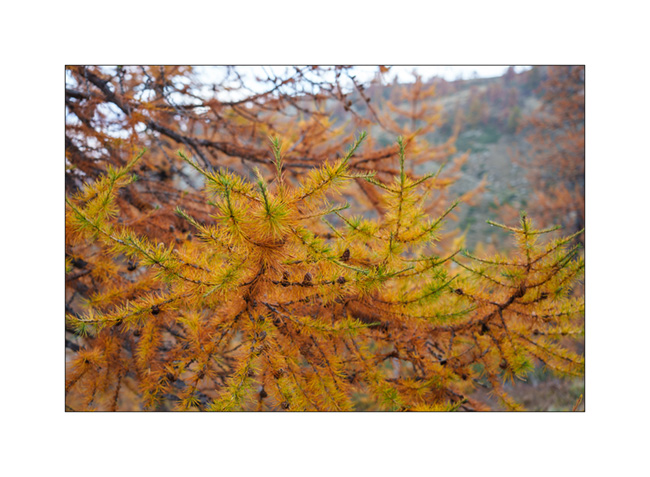
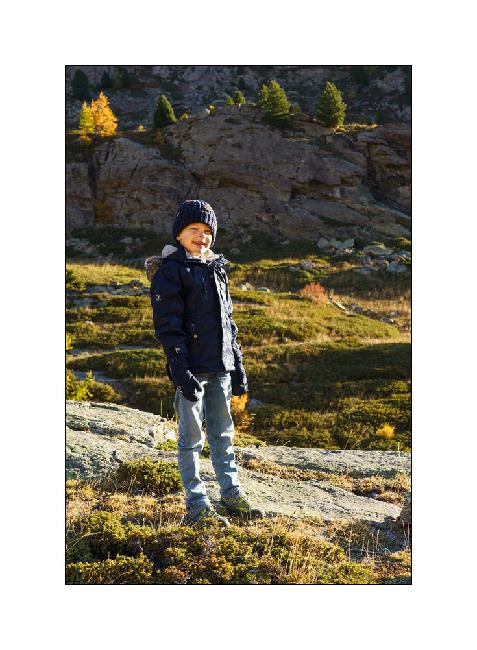
5. At almost 6,000 feet elevation, the larches are gorgeous in their autumn dress.

6. The best of co-pilots!! 😀

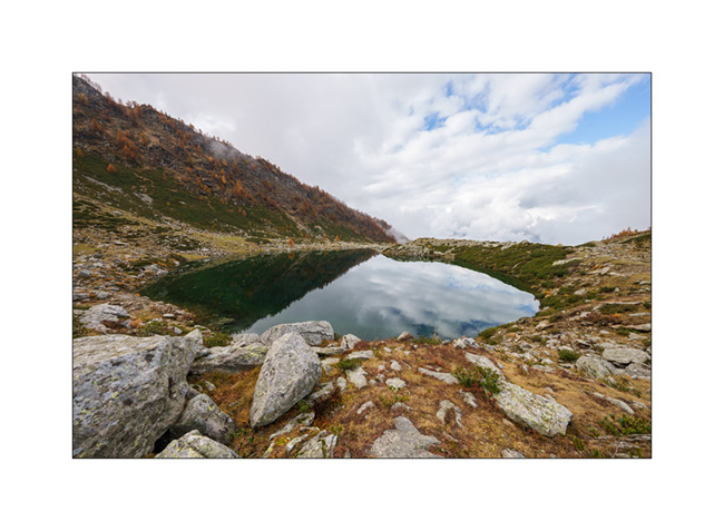
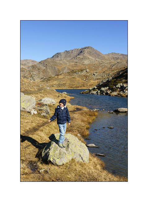
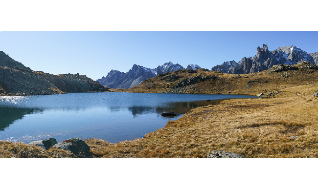
7. Lake Lauson.
8. Still a few holes of sunshine as the clouds gather.
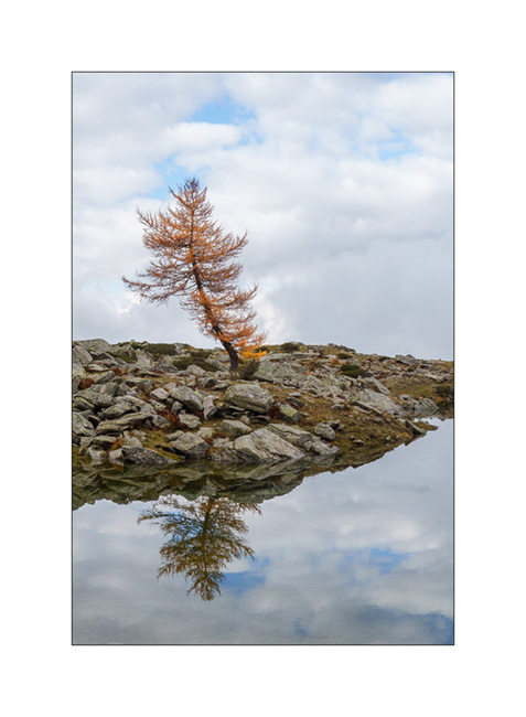
9. Lonely tree.
10. Sheepfold under the lake.

11. Shepherd house.

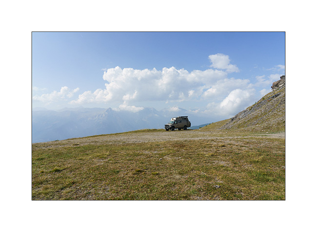
12. Before dinner, we walk up the old military road above the lake, now closed by a gate. We overlook VLV at his camp near the lake.
13. Golden larches…
14. After rain and fog.

15. The view from our camp at sunset…
16. Last colors…
After a wet night, we will continue South…
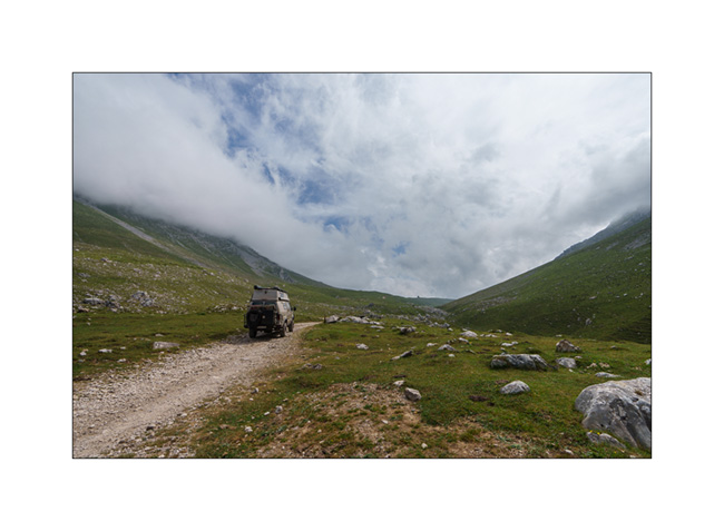
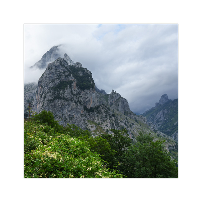
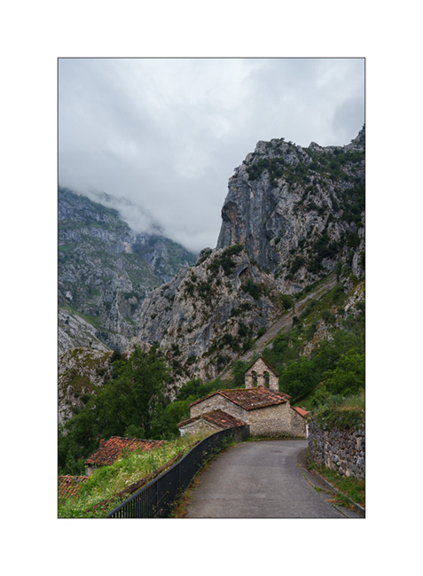
Picos de Europa (continued) and back towards East.
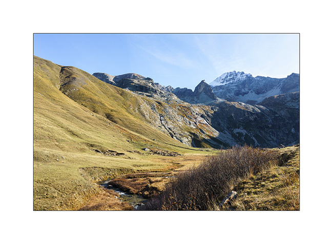
We go up the valley towards Sotres and leave the road on the right to discover a trail which climbs to almost 6,000 feet above sea level.
1. Alpine pasture at the bottom of the valley, before the climb.

2. As VivaLaVida gains altitude, the landscape becomes more arid.

3. Snack break!
4. At the end of the afternoon, the convection of the day brings us a beautiful thunderstorm, forcing us to turn back.

5. Going down in the rain…

6. After the storm, we go up to discover a viewpoint on the opposite slope.
7. Small mountain church.
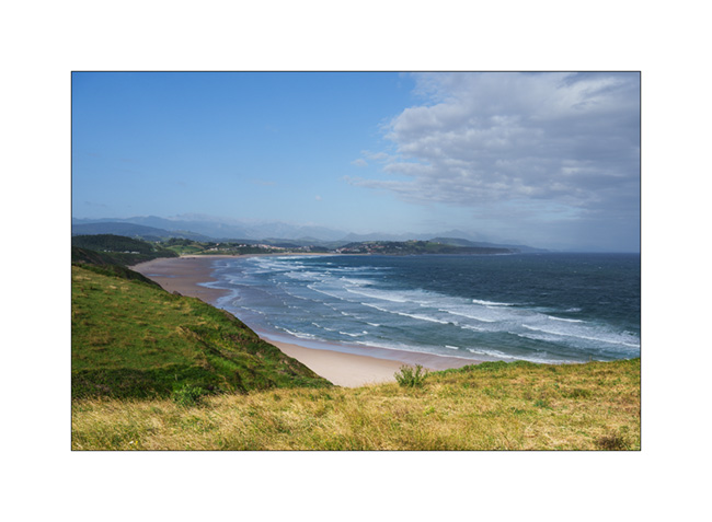
8. Then we head back east. Emile wants to go back to sleep at the surfing spot where we already spent a night.
Along the road the next day, we make a quick stop to discover Santillana del Mar which also turns out to be a real tourist trap….
9. Village house.
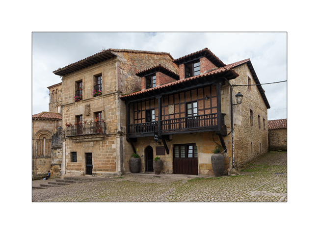
10. Church porch.

11. Entrance to the inner courtyard.
12. Large traditional house.

We continue on the road and reach the Spanish Basque country.
13. Nice bivouac on a ridge…

14. The sky is heavy at the end of this day.
15. A visitor who comes to observe us closely at our camp.

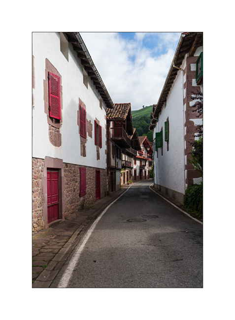
16. Last image of Spain in a pretty Basque village, the next morning, just before crossing the French border.
To be continued shortly with the rest of the trip: a stop in Navarrenx and a lovely bivouac with friends, in the foothills of the Pyrenees. 😉
Southern foot of the Pyrenees
To protect ourselves from the heat wave that has been raging for a few days, we decide to discover the Ordesa valley, hoping to find some freshness there. In the summer time, access roads are closed to individual vehicles and after a night in the small campground of the San Nicolás de Bujaruelo refuge, we take the shuttle to the valley.
1. After an hour of hiking, we are in front of the “Cascada del Estrecho”.

2. Continuing up the river…
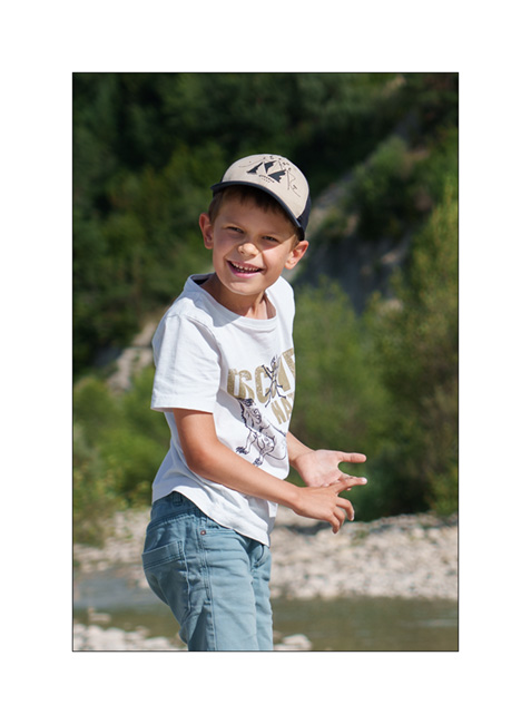
3. Emile playing at our picnic spot. I won’t bring back other images, a heavy rain shower forcing us to shorten our walk.
4. Boondocking near a small river…

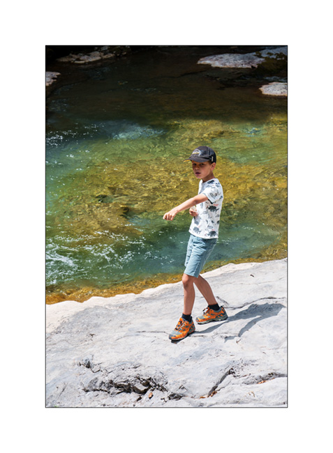
5. My son happy to play with his feet in the water. 😉
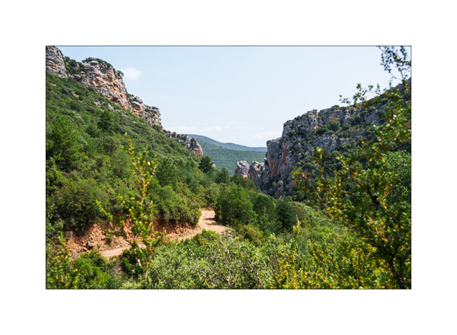
6. The next day, the track rises in a limestone range.

7. Landscape and geology change rapidly.
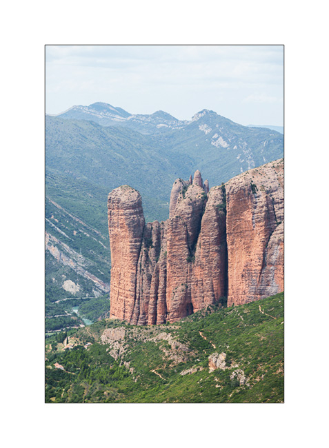
8. We reach the “Mirador de Los Buitres” shortly after noon and enjoy a magnificent view on the “Mallos de Riglos”.
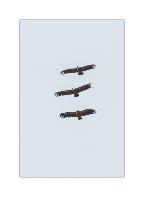
9. As we eat, many vultures fly over us.

10. Squadron…
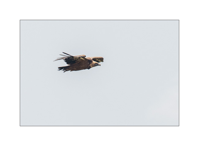
11. Glider…
12. Ruin along the trail…
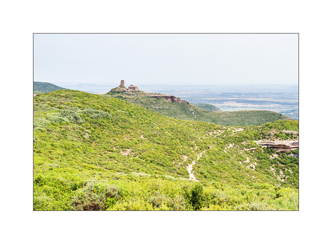
13. Late in the afternoon, we arrive in sight of the “Castillo de Loarre”.

Images of our visit are coming in the next article… 😉
Fall holidays
Our short week of vacation with Emile begins with a rainy day. We make the road to the region of Bardonecchia where I hope to drive the Sommeiller trail that we had not been able to discover the past summer.
1. Rainy boondocking above Rochemolle.
2. The next morning, the clouds have disappeared and the sky is blue when we wake up.
3. Uphill to the Scarfiotti refuge.
4. Higher on the trail…
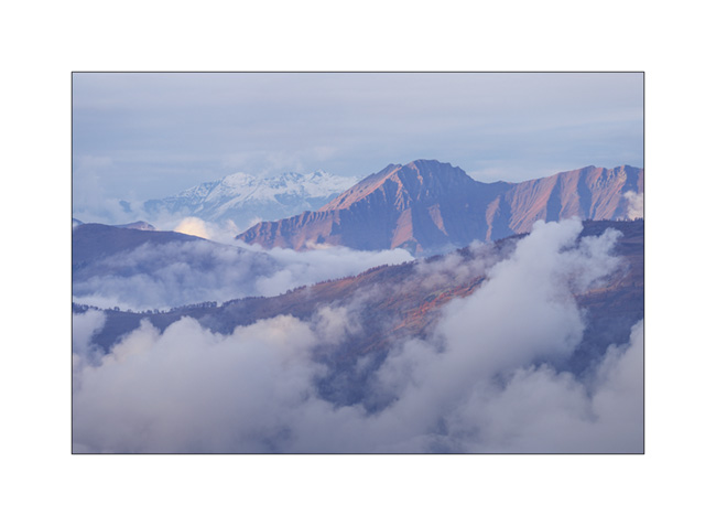
5. The surrounding mountains are gorgeous!

6. High altitude fall colors.

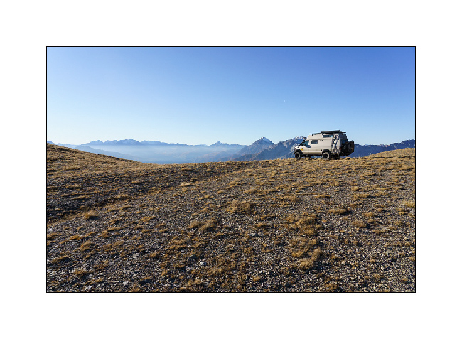
7. VivaLaVida on the trail, at already more than 8,200 feet above sea level.
8. Arrival at the end of the trail whose descent on the other side has never been built.
9. Round altitude (3,000 meters = 9,842 feet), the highest reached by VLV in Europe. As a reminder, she went over 13,000 feet in 2016, in Colorado…

10. The small lake which is just after the pass.
11. And the other side remained empty of trail. Only a footpath leads down to the Ambin Valley.

12. We are close to the first snow that fell a few days before…

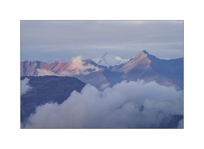
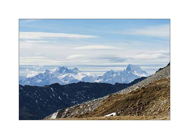
13. View of the peaks of the Parc des Ecrins in the distance…
14. Descending back. We only passed two local motorbikes all day.
To be continued in a few days… 😉
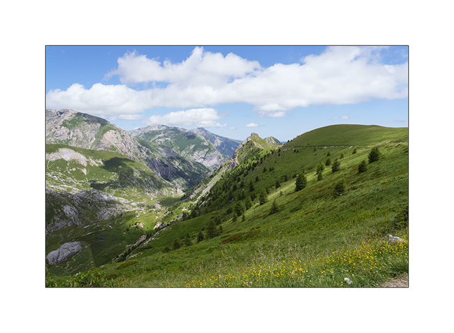
Strada del Canoni…
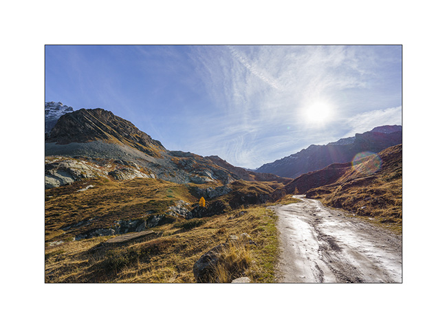
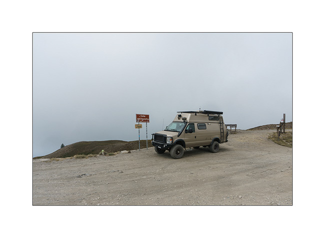
After Colle Agnello, we continue to discover high altitude trail.
1. Ascent in the rain…
2. Fortunately, after lunch, the sky starts to open.
3. We are again at more than 6,500 feet elevation.
4. And the sun returns in late afternoon.
5. The clouds still cling to the north.
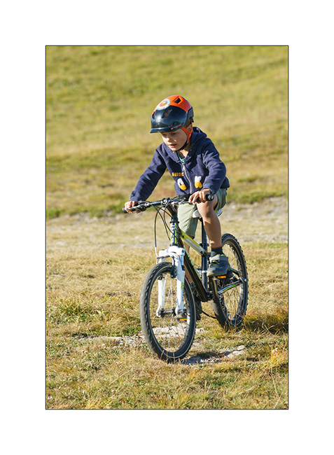
6. Emile trains on his bike.
7. View from above…
8. In the distance, the Maira mountains that we will discover later.
9. In the morning, blue sky is back.
10. On the Strada del Canoni trail.
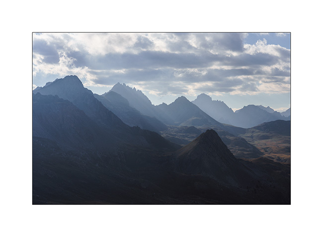
11. Distant view…
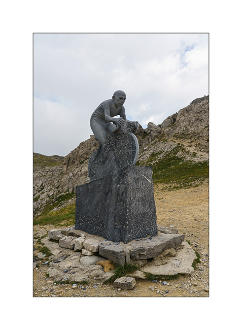
12. After having tried to reach the Maira by the Meja valley which we discover closed by a gate, we climb there by the Colle Fauniera.
13. It is a pass visited by the Giro and a sculpture recalls it.
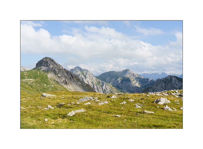
14. We discover the trail of the Maira Stura from the East side, looking for a boondocking place.
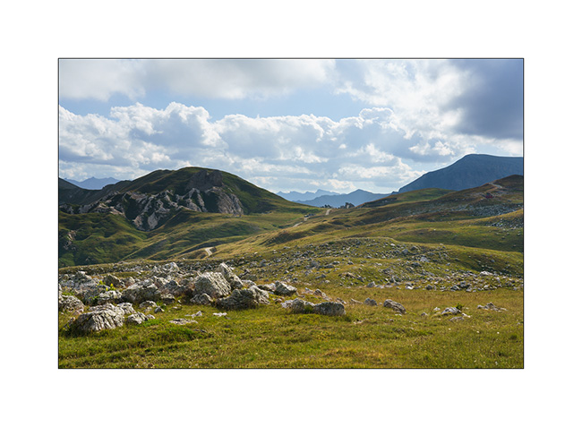
15. The massif is spectacular, alternating limestone walls and high meadows.
16. …
17. VivaLaVida on the trail.
18. Val Meja from above.
19. Sunset from our camp.
The trail being closed to motorized vehicles on Sunday, we spend a full there day enjoying this beautiful panorama. We’ll tell you that soon. 🙂
Slowly going South…
After these two days around the Colle del Nivolet, we move a few miles South along the first alpine foothills which border the Piedmontese plain..
1. Short stop at Pont-Canavese to refurnish us with various groceries.
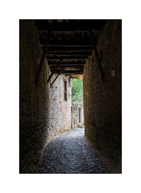
2. This village offers the typical architecture of the region with narrow streets and houses build over the sidewalks and stalls thus shaded.
3. Then, a nice climb on the trail that leads to Colle del Colombardo and its imposing sanctuary overlooking Turin.
4. A few storms are brewing, which will however avoid our camp.
5. We sleep on a hill, along the descent on the south side.
6. Sheepfold…
7. Quiet end of the day…
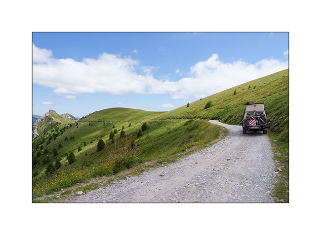
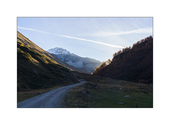
8. The next day, we go back to the Colle del Finestre that we discovered last year in order to access the Strada del Assietta which was closed during our previous visit. Souvenir at Colle del Assietta.
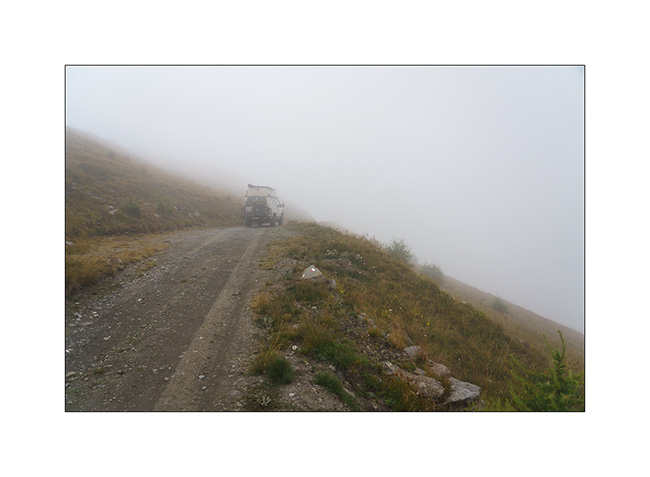
9. This old military road winds for about twenty miles between 6,000 and 7,500 feet above sea level, connecting Colle del Finestre to Sestriere. However, German tour operators specialized in 4×4 trips have almost transformed it into a motorway, rushing there every day in dozens of convoys of 10 to 15 vehicles each, to such a point that it is now closed on certain days of the week to preserve some peace for pedestrians and cyclists.
10. We take a secondary track to find us a nice boondocking place…
11. … on the ridge, above the Sauze d’Oulx.
12. Assietta trail from our camp.
After filling the fridge in Sestriere, we go up the superb Valley Argentera which we had already enjoyed last year. We stay there for two days to enjoy its tranquility and its beautiful river, alone in its upper part which is difficult to access without 4WD.
13. VivaLaVida’s camp along the river.
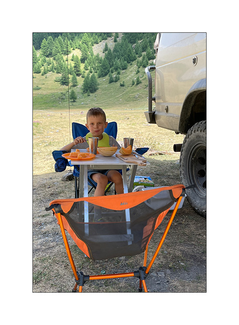
14. Emile enjoys a few lazy mornings… 😉
15. Lichens on a rock in the upper Argentera valley.
16. Emile is over the moon!
17. Upper Argentera valley.
Other of our discoveries in a few days… 😀
Fall holidays (4)
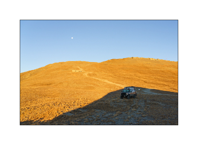
1. Wake up at 8,500 feet elevation under Fort Jafferau and the full moon.
2. Mineral universe in the warm light of the rising sun…
3. Another fort, Föens fortress, much lower in the mountain.
4. I love these high altitude tundra.
5. Another abandoned fort, just beside our bivouac.
6. It’s time to break camp.
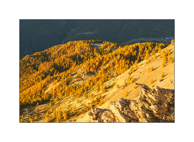
7. Going down, we find other golden larches…
8. … and a much smoother trail on this side.
9. Föens fortress…
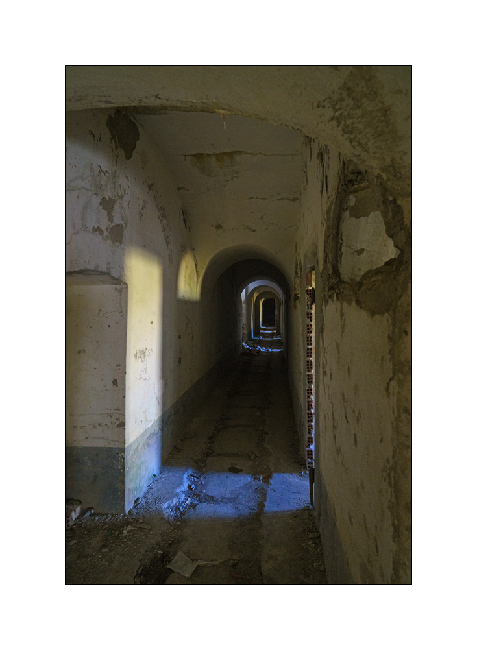
10. … of which we discover part of interior.
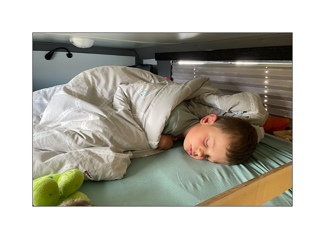
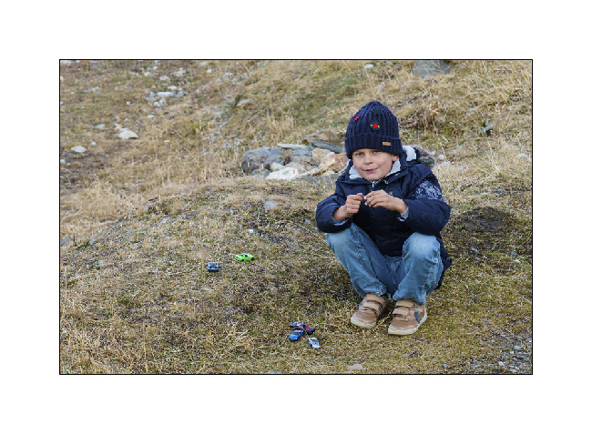
11. It’s already time to go home as it’s the end of holidays. Last boondocking under the Galibier Pass. Despite the negative temps, Emile plays with his small cars. 🙂
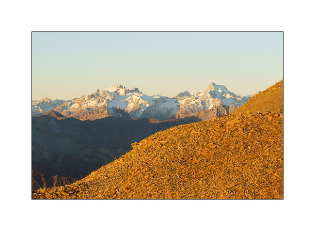
12. Last sunrays on the surrounding peaks and last image of the season for VivaLaVida.
Thank you for following our few 2021 peregrinations.
It is time for Emile and I to wish you a Happy Christmas! See you next year for new adventures!! 🙂
Fall holidays (2)
Continuation of these few days of relaxation and discovery…
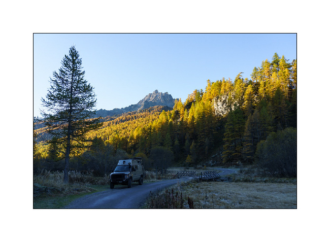
1. To descend from Mont-Cenis to Italy, VivaLaVida discovers a trail, an old border road, some passages of which are spectacular.
2. Passage near the pretty little lake of Roterel…
3. … as the sky clears.
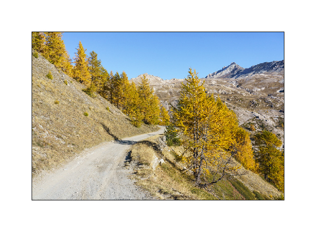
4. The larches are already gorgeous with their yellow-orange hue…
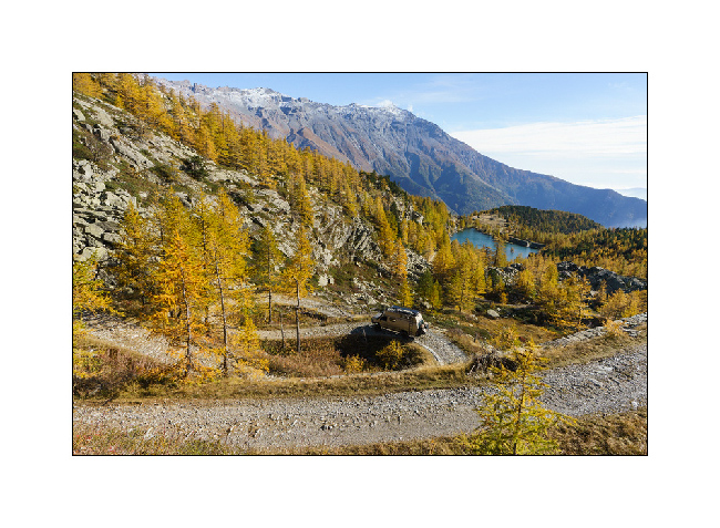
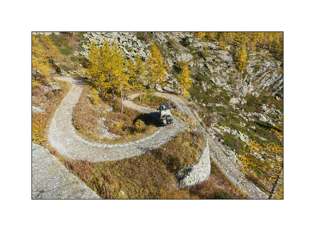
5. Turns…
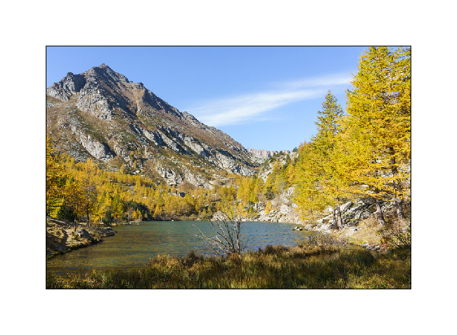
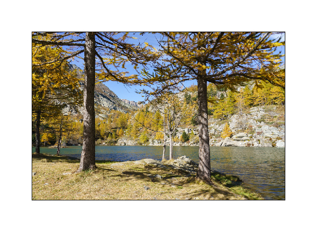
6. Another small lake, Arpon Lake, just after the Italian border.
7. We make a little stop for the lunch…
8. … near a pretty mountain pasture already closed this season.
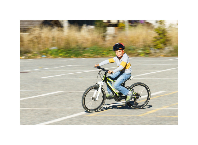
9. While waiting for the grocery store to open – it is closed at nap time – Emile improves his cycling technique! 🙂
10. We take the direction of the upper valley of the Claree via the Col de l’Echelle (Ladder Pass).
11. Wake up at the end of the road on a beautiful fall day ideal for a mountain walk.
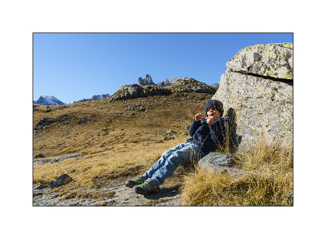
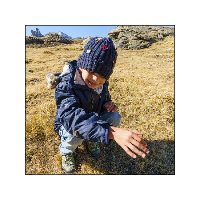
12. At 5 years old, Emile is a good walker, 5 or 10 miles uphill doesn’t frighten him!
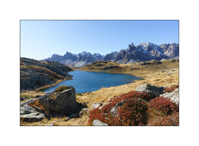
13. Climb to Long Lake in the midst of the fall colors.
14. Arrival at the lake where the temperature hardly exceeds 32°F.
15. Immaculate tranquility…
16. Break sheltered from the strong North wind.
17. Lac Long in a setting of blueberries reddened by autumn.
18. Meeting with a beautiful cricket a little numb by the cold.
19. Going back down to VivaLaVida
More soon… 🙂