Grand Canyon @en
now browsing by tag
Petrogryphs of Arizona and Nevada
Vivalavida went discover another access to the Grand Canyon, also on the North Rim but further west.
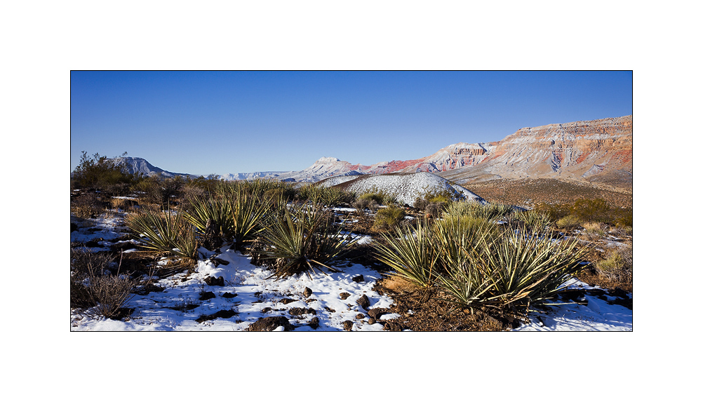
1. Cactus in snow…
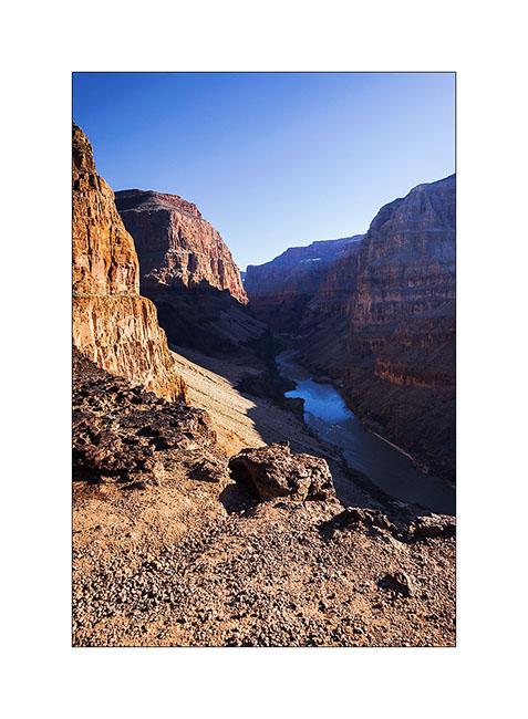
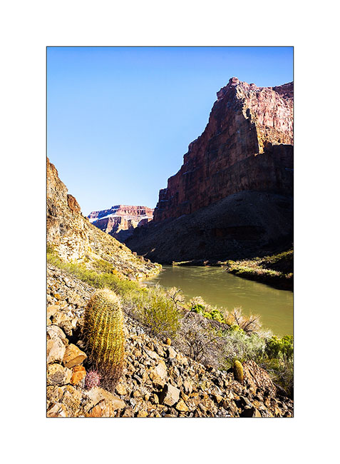
2. After going down Whitmore Canyon, I reached the end of the trail, approx. 700 feet above the Colorado River.

3. Grand Canyon is also gorgious here.
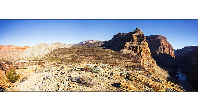
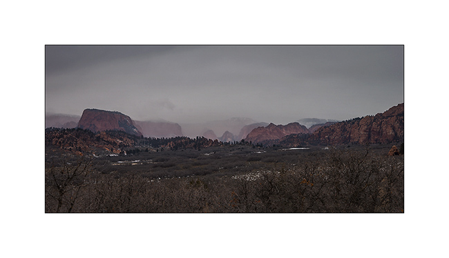
4. The site is interesting because it presents a large lava flow clearly visible on this panoramic (3 images stiched). There have been several successive lava flows, the first about 170,000 years ago that created a temporary 250 feet deep lake obstructing the Grand Canyon. This lake has remained approx. 20,000 years before the lava broke, creating a gigantic tidal wave downstream. Since then, there have been seven succesive lava flowa, the last one approx. 20,000 years ago. Do you find VivaLaVida that gives the scale in the image? 😀
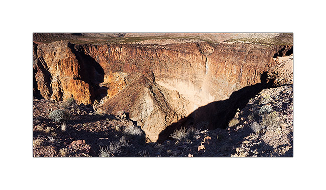
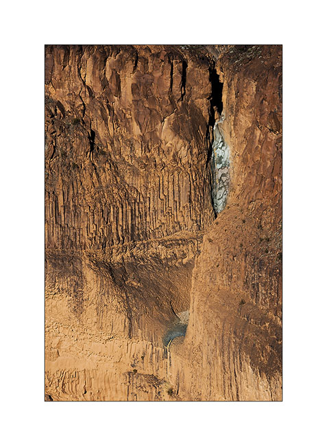
5. To the left of the promontory from which I took the previous image, there is a wide collapse that reveals beautiful basalt organ walls. It’s approx. half a mile in diameter and almost 600 feet deep.
6. Details of the cliff with a waterfall that has carved its way.
7. Just to the testimony, picture is not great, a “beep beep” surprised in the warmer micro-climate of the canyon.

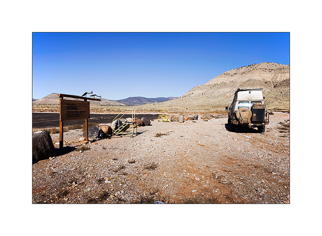
8. Going back up the trail, I pass a small country air strip. Some guys don’t lack humor with this “Whitmore International Airport” sign and the two small escalators… 😉
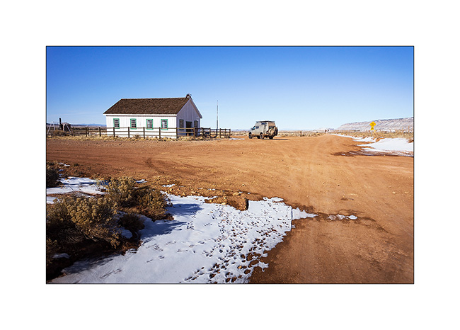
9. VLV near the Mount Trumbull old school. Built in 1922, it was burned by vandals in 2000 and rebuilt in an identical in 2001. It was the only school in the area where the first collons arrived in 1916, growing grains and beans until 1934 where the climate became much drier. Therefore, some og them turned to breeding cattle and sheep while many others left the premises. The school was in operation until 1968 when it was closed for lack of students. the last man living year round in this region died in 1984. Since few ranch remain scattered and inhabited during sommer only.
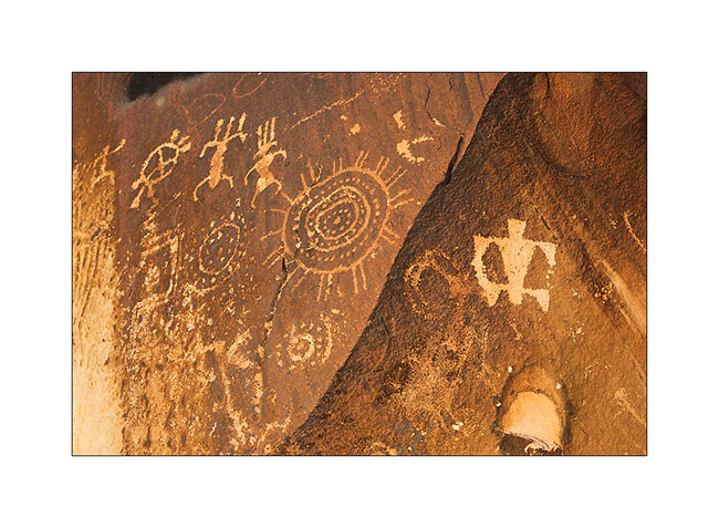
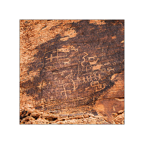
10. Short detour to Little Black Mountain, an interesting petroglyphs site.

11. the almost horizontal line is oriented exactly in the axis of the winter solstice; December 21st, the sun rises just above its eastern end.
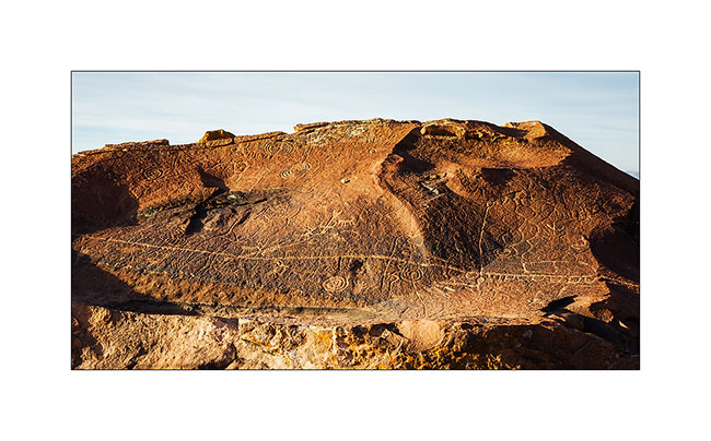
12. One of the big boulders of the site.

13. Details…
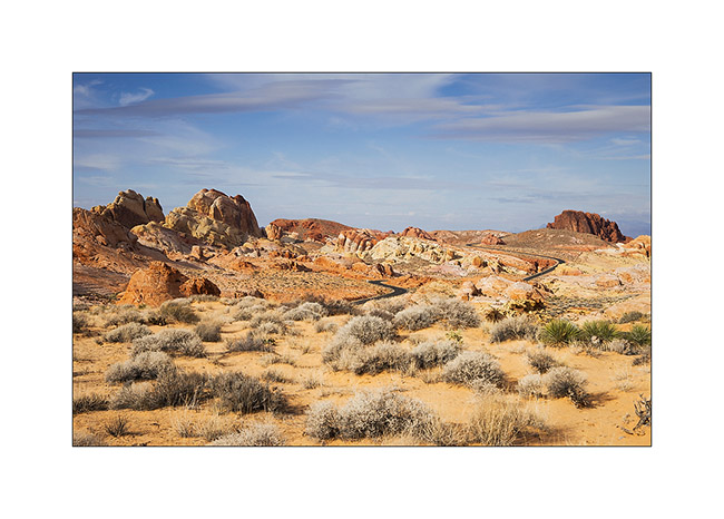
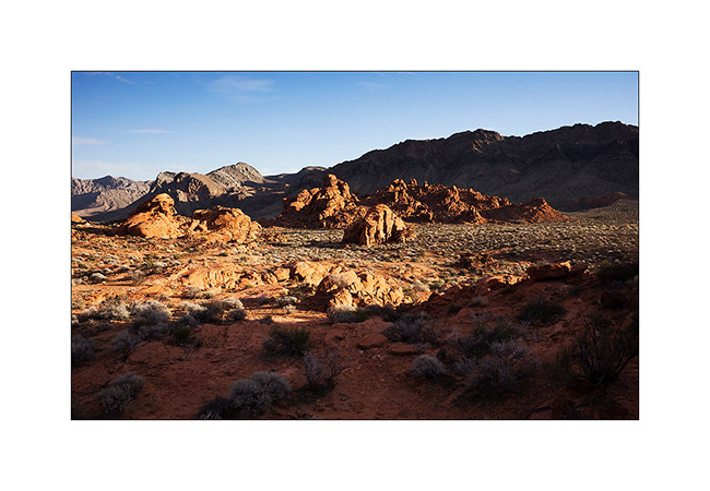
After this escapade in Arizona, I made another into Nevada to spend the evening with my friend Christian who was a few days in Las Vegas for the CES. Heading back to Utah where I should pick up a new compressor for VLV (the actual one being at its 4th beakdown…), I stopped at the Valley of Fire, a small Nevada State Park not far from Lake Mead.
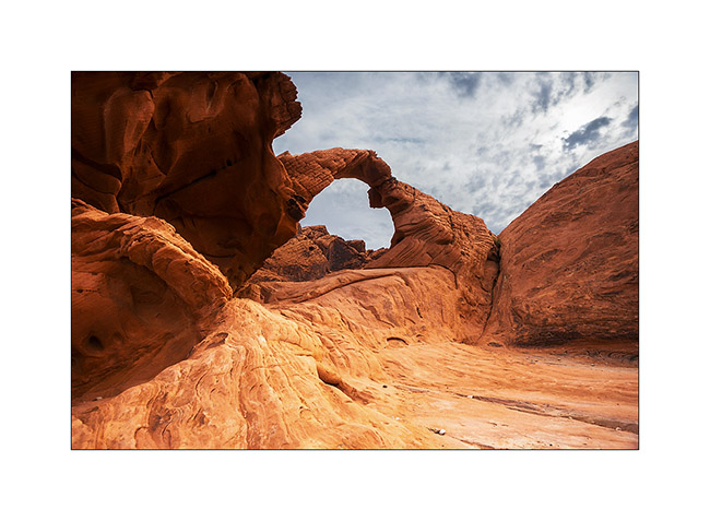
14. Arch Rock.
15. They are also many petroglyphs, those ar at Altalt Rock.
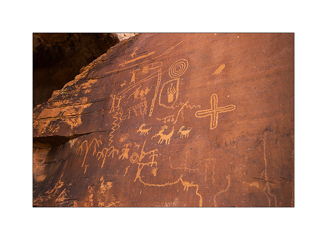
16. Still Altalt Rock.
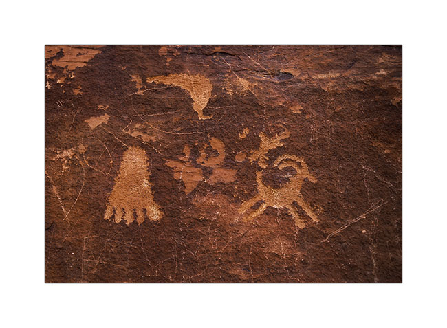
17. Those are in Mouse’s Tank Canyon.
18. The road heading to White Domes.
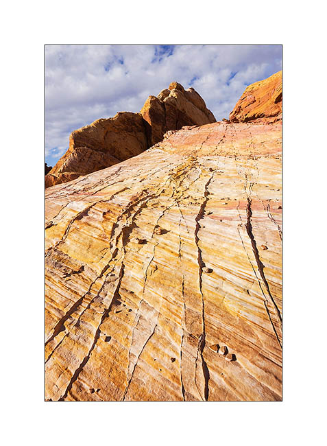
19. Sandstone is veined with various mineral colors.

20. Like a petrified wave…
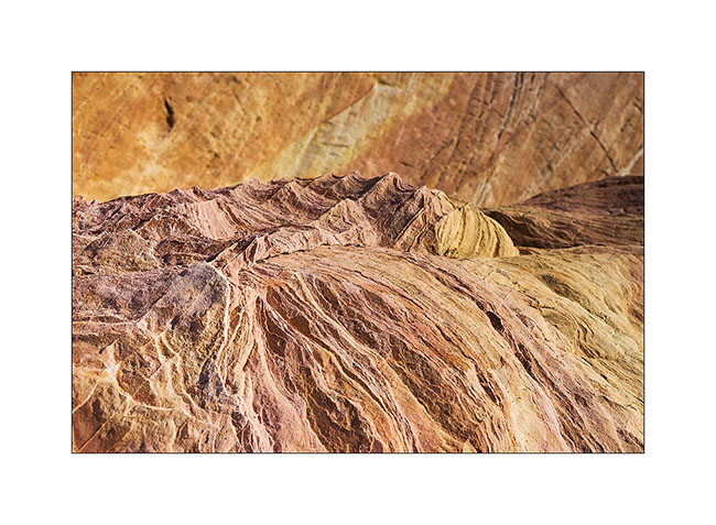
21. Veining…
22. Windstone Arch, rather unusual in an alcove of the rock.

23. Late afternoon in Valley of Fire.
That’s it for today. Next step of VivaLaVida’s journey in the coming days… 😀
From Utah to Arizona…
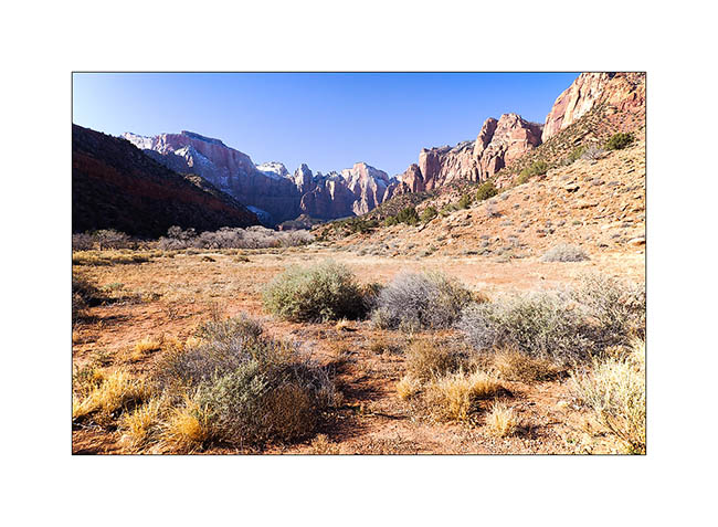
I spent the last days of 2014 between Zion and Gooseberry Mesa, not far away.
1. The bottom of the Zion Canyon is quite open, with magnificent cliffs.
2. Gradually, when going upstream in it, he gently tightens.
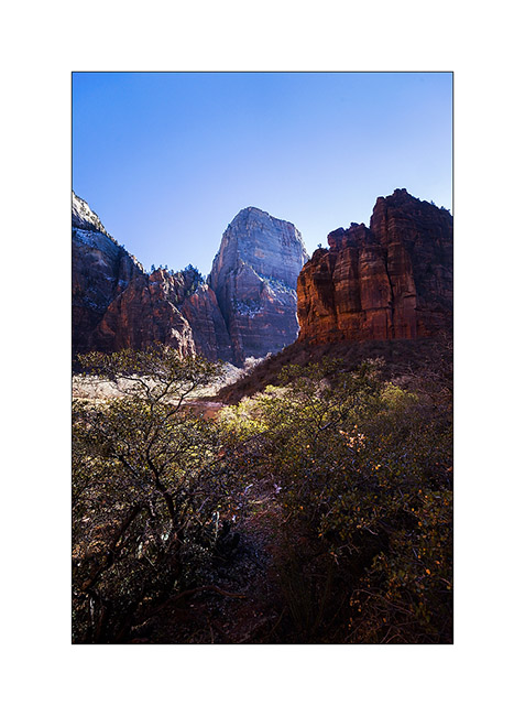
3. Then suddenly, because of a change of rock, it turns into a narrow, a deep trench not wider than the river bed.
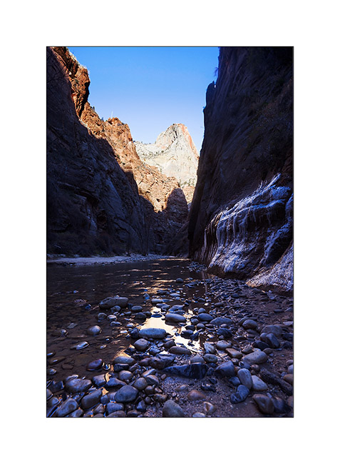
4. Some cliffs are almost vertical walls over 2,000 feet high, really impressive!
5. Along Kolob Terrace Road while it starts snowing… A few miles further, I will tow the Subaru of two French and two Belgian guys stucked in deep snow. Without VivaLaVida, they would have spent the night there, no one else was up there in this season. A little reckless in my opinion, without even a tow strap…
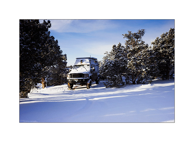
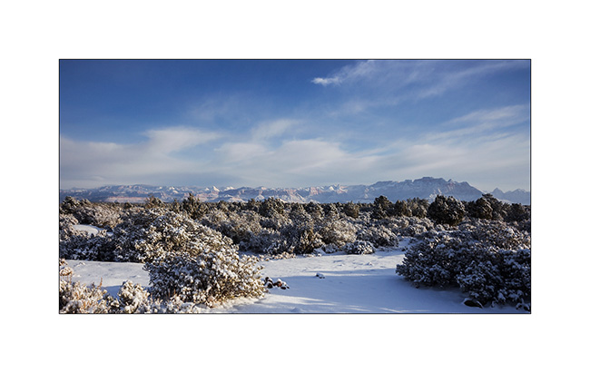
6. I spent my New Year Eve on Gooseberry Mesa, while it was snowing… 😀
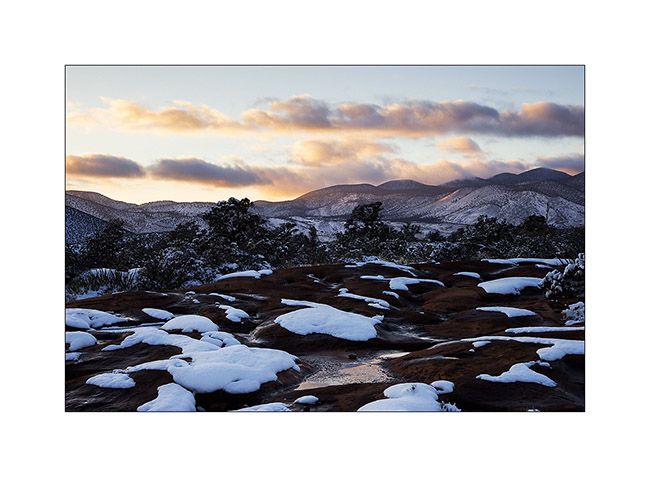
7. In the morning, there was about 4 inches fresh snow.
8. The view over the Zion Mountains clears in early morning…
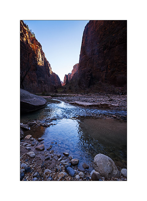
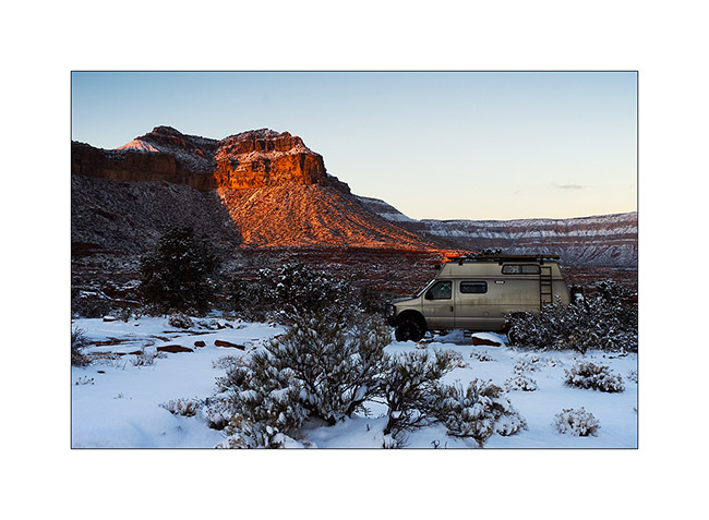
9. Despite the snow that fell the previous night, I tried to reach a viewpoint on the North Rim of the Grand Canyon. It’s a really unfrequented corner because of difficult access via a hundred miles trail, really muddy for the first part, then rocky and quite rough for the last 20 miles and closed in winter. However with VLV capabilities, I reached it in late afternoon when the moon rose.
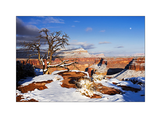
10. Enough air there! I’m on a 20 inches ledge overhanging a truly vertical wall… But it was the only way to show you the Colorado River, exactly 2,890 feet down! 😀
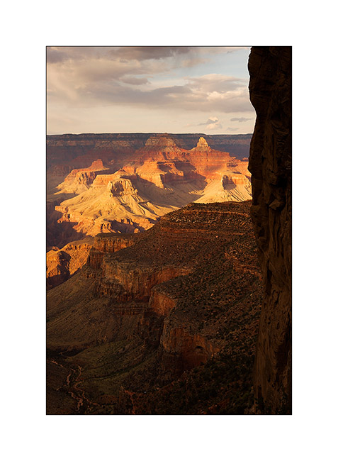
11. Warm last light rays in this winter atmosphere.
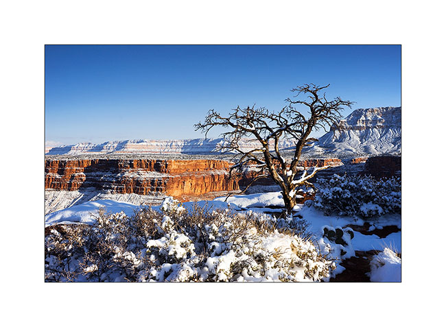
12. The snow fallen a few hours earlier makes patchwork design on the sandstone.
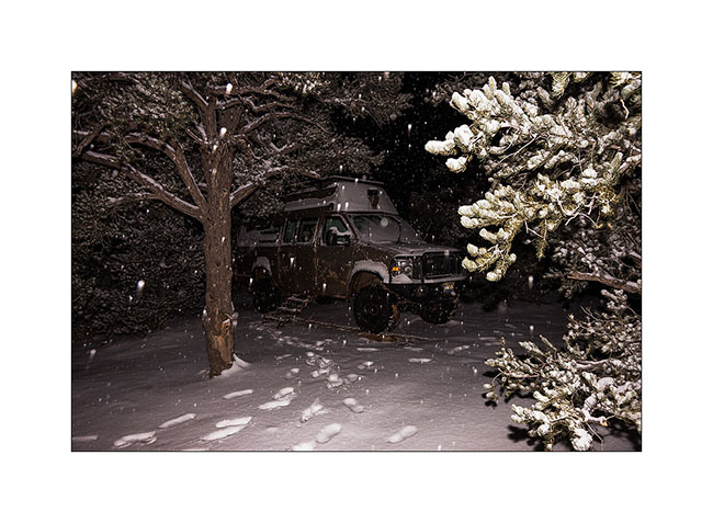
13. The camp will be really cold in the clear night…
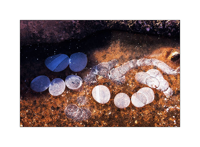
14. The potholes freeze on the sandstone, with beautiful textures. Here, ice pebbles…
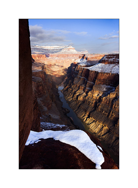
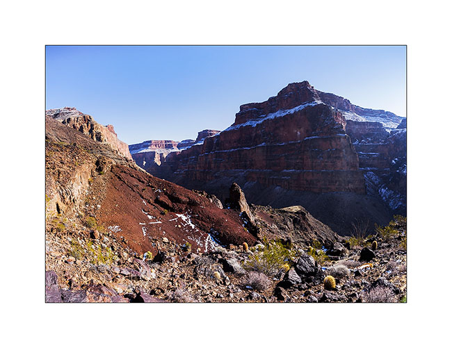
15. Down the next day in the canyon to see Lava Bed Rapids, the most difficult rapids of the entire Colorado River. The trail, sometimes non-existent, is very steep in a lava flow that makes walking dangerous, lava stones rolling like bearings under the feet. there is even some climbing in places, hopefully not too difficult because only I wouldn’t have be able to reach the bottom otherwise. A trek to not recommend to everyone anyway!
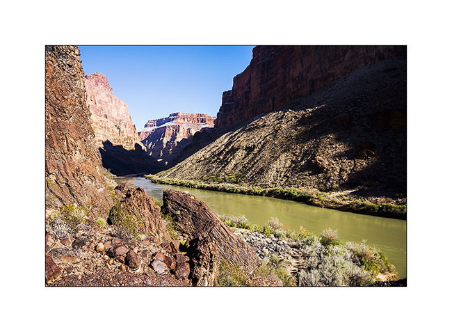
16. Here the rapids, without sun this season. Hard to show the scale as the canyon is so huge but it’s pretty impressive. What a power! I understand that there is a portage trail for canoes…
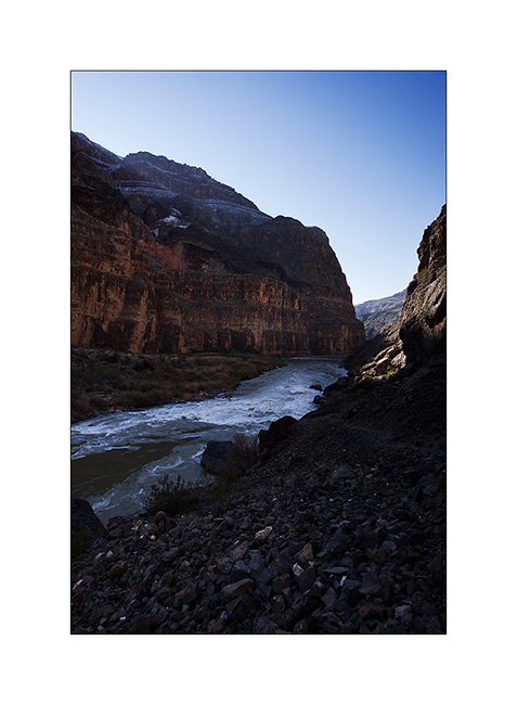
17. The depth of this canyon is just amazing, I fell really small down there!
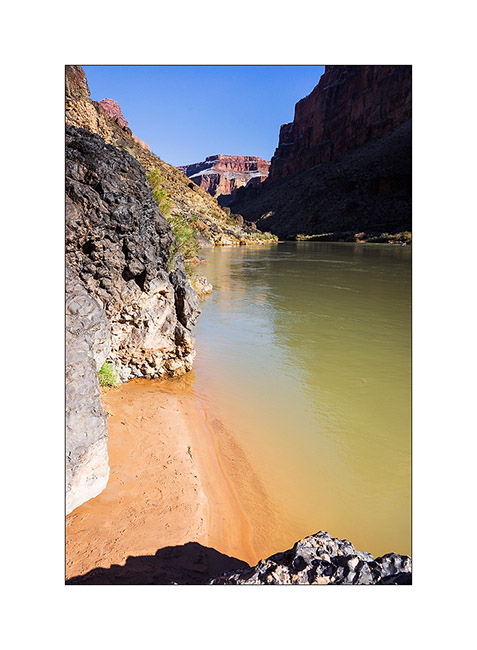
18. Small beach upstream the rapids.
19. I begin the long climb back. Top left is Toroweap Point where I go, 2,890 feet higher! 😀
Following of the discovery of this part of the Grand Canyon to come soon!
Grand Canyon
It was a wish of Jean-Luc to discover the Grand Canyon, one of the seven wonders of the world…
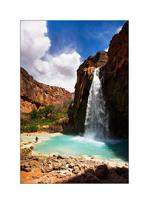
We made a stop to go down to Havasu Canyon, the Havasupai Indian Reservation, tosee the turquoise falls of Havasu Creek. Without tent, we decided to make the round trip in the day, it was a little crazy as we walk over 22 miles that day … But the falls worth the detour !
1. Our camp near a dry reservoir on the plateau above Havasupai.

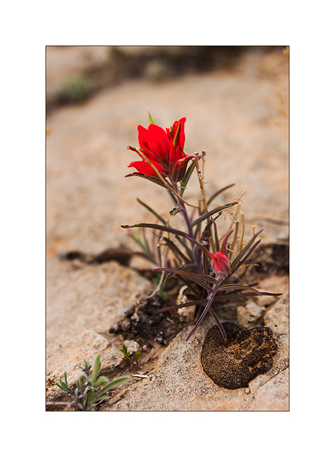
2. Touch of color in a gray afternoon…
3. The Havasu Falls which run of about 140 feet in a large natural pool.
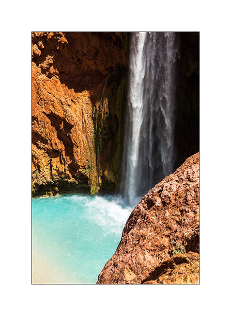
4. Some miles further down, the Mooney Falls, still higher…
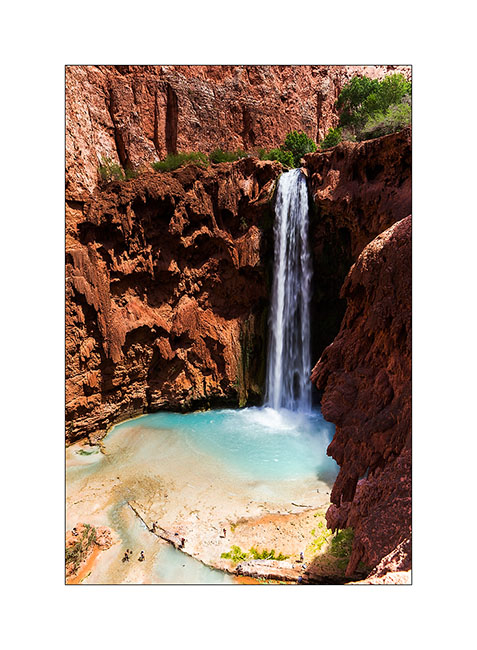
5. Details…
6. back on the plateau, we were rewarded with beautiful lights at sunset…
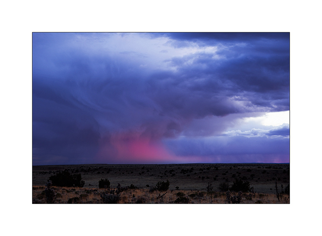
7. … while clouds burst around us.
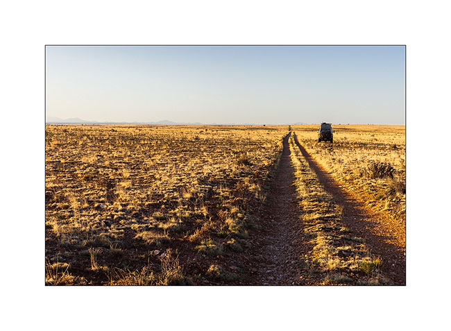
8. Borrowing a track to join the South Rim of the Grand Canyon, we slept on the immense plateau…
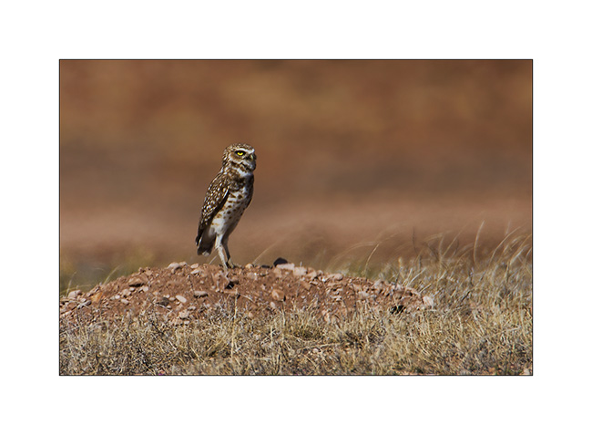
9. Along the trail, meeting with two burrowing owls. Difficult to get close on this terrain…
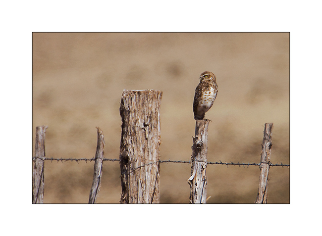
10. Typical straight posture.
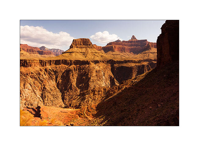
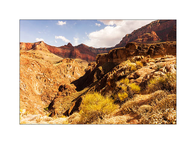
The next day we decided to go down to the bottom of the Grand Canyon. It’s still a long walk ahead of us, with about 5,000 feet of elevation gain. But it is only down there we can perceive the full extent of the giant…
11. Start of the hike down in early morning.

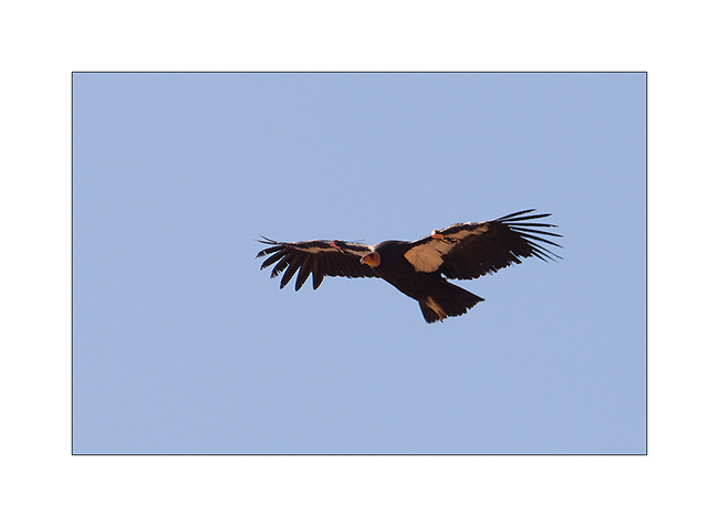
12. We were lucky to see condors reintroduced here too.
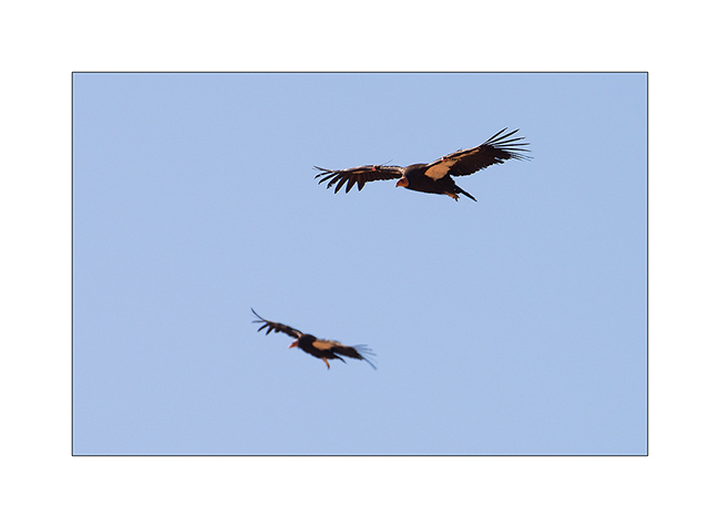
13. What a bird!
14. After 3,000 feet of descent, we’re not at the bottom, far from it, and crossed the caravan of mules which comes from the ranch at the bottom on the other side.
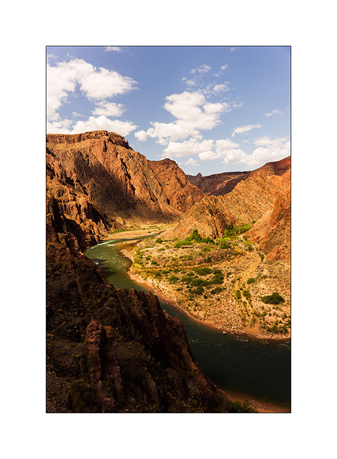
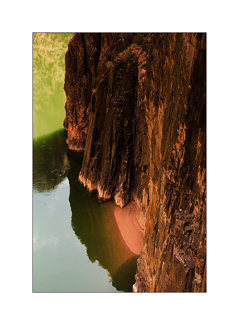
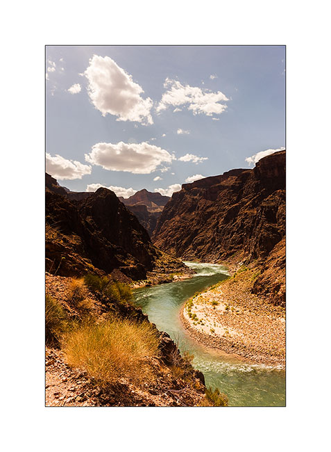
15. The Colorado River is still 1,500 feet below.
16. It grows as we decend!
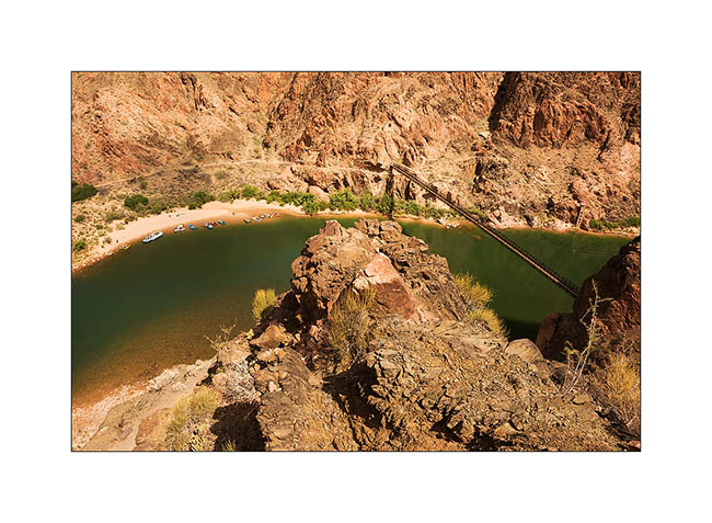
17. From the suspension bridge which allows to cross it…
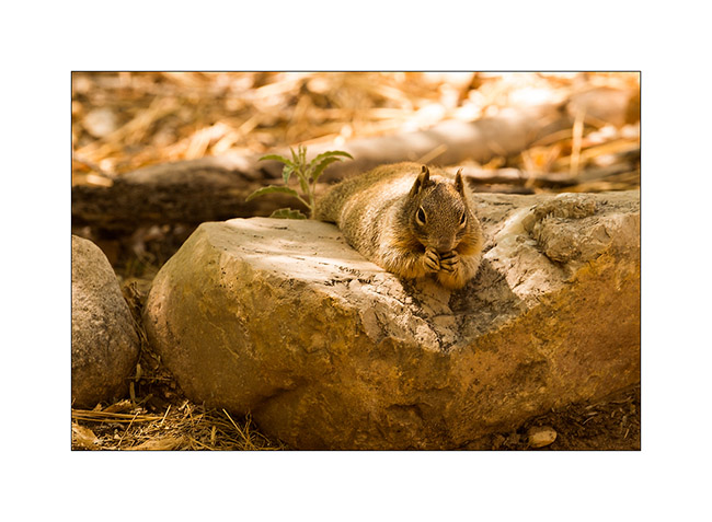
18. A neighbor of our snack break, especially photographed for Isa Belle who will recognize herself. 😉
19. He is 4PM and we still have to go up all the canyon, after Jean-Luc has sent a postcard “by mule” from the bottom of the canyon…
20. The light falls, saturating colors…
21. … and playing hide and seek with the clouds.
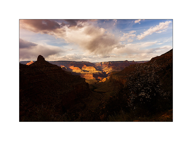
22. Last view of the canyon reaching the top just at sunset.
We then took the road again to join the Page area and I’ll tell you that soon… 😉