boondocking
now browsing by tag
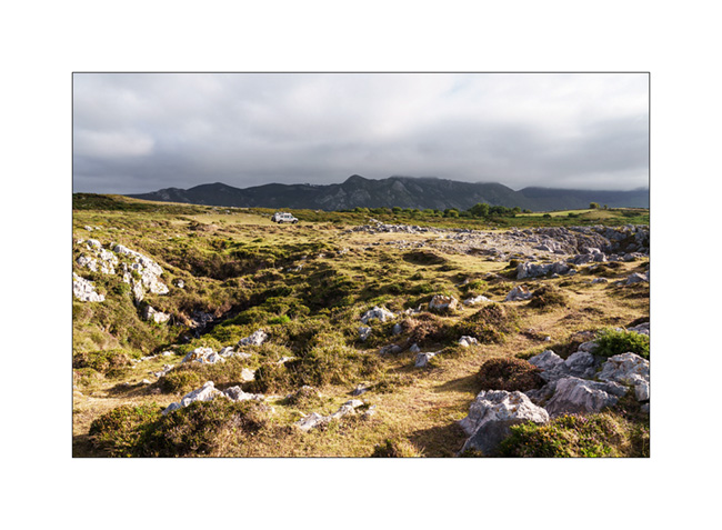
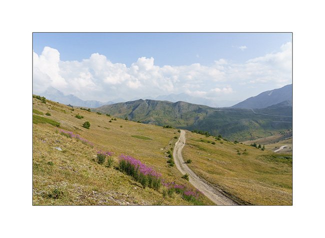
Devoluy (2)
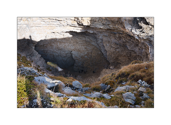
While preparing our exploration of the Dévoluy massif, I spotted several “chourum” – the local name for sinkholes, these limestone cavities sometimes forming caves – and we decided to go and discover one.
1. Going up from our camp…
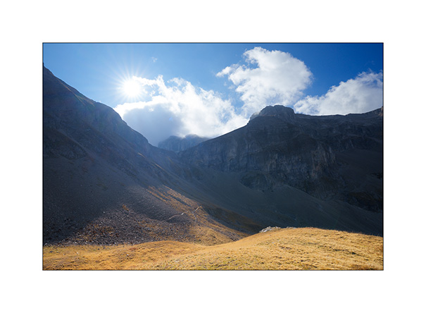
2. Arrival at the Chourum of the Heroic Crossing from above. A group of mountain troops in training is climbing it, little black dots which give a sense of the scale of this vast chimney.
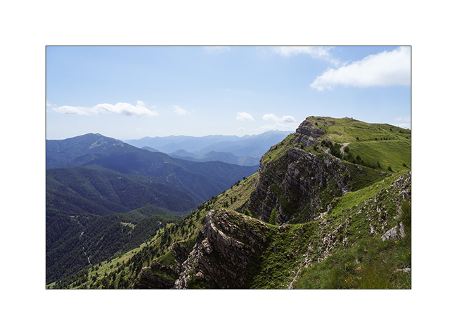
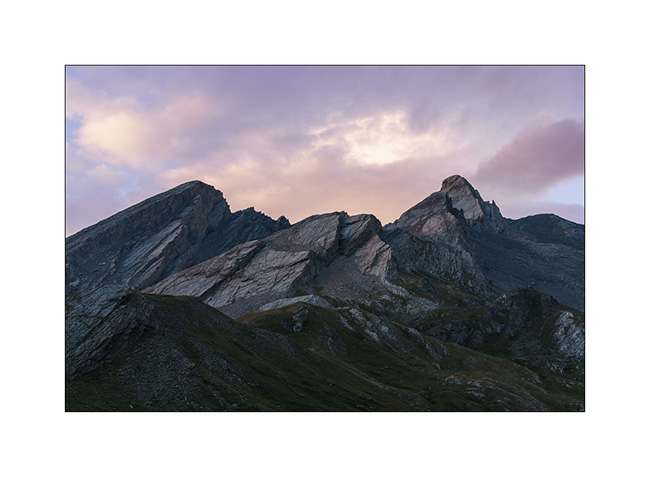
3. On the descent back towards VivaLaVida, looking up towards the Bure Plateau.
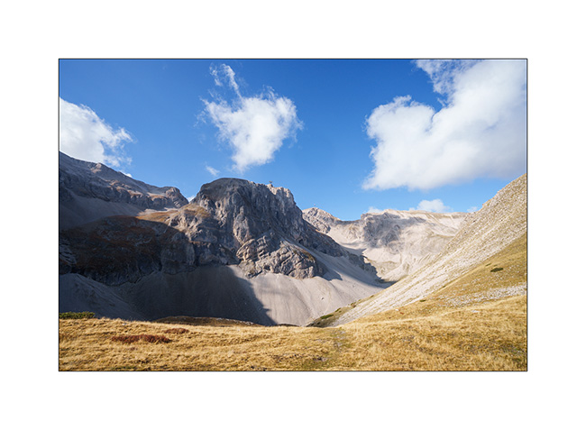
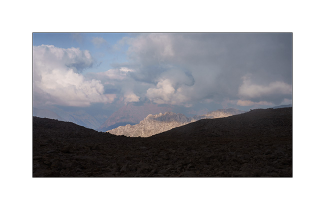
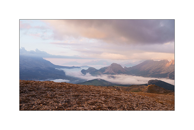
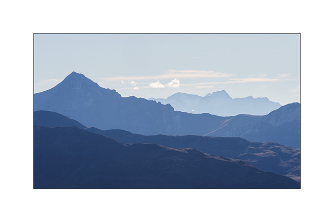
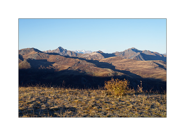
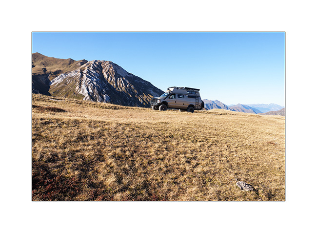
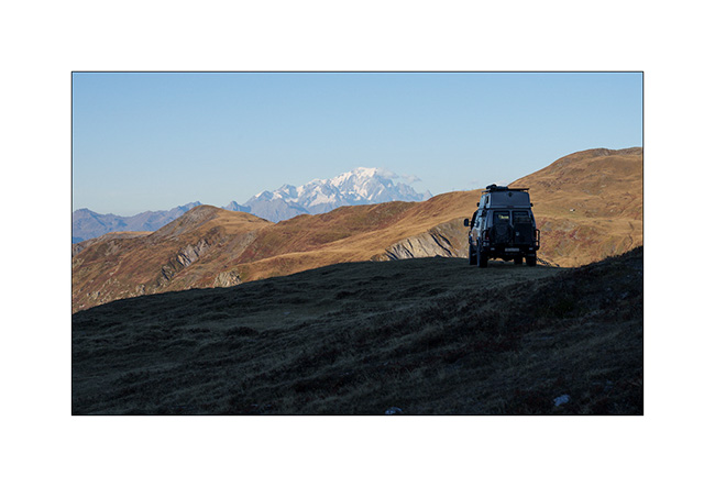
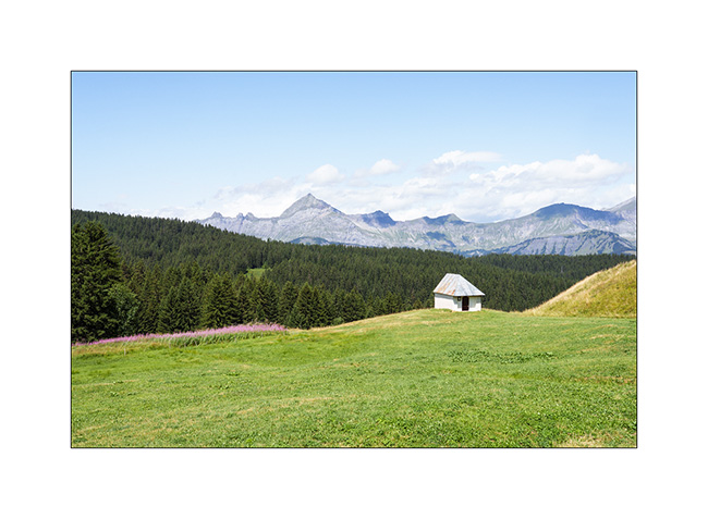
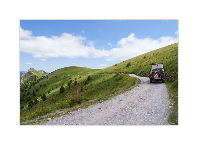
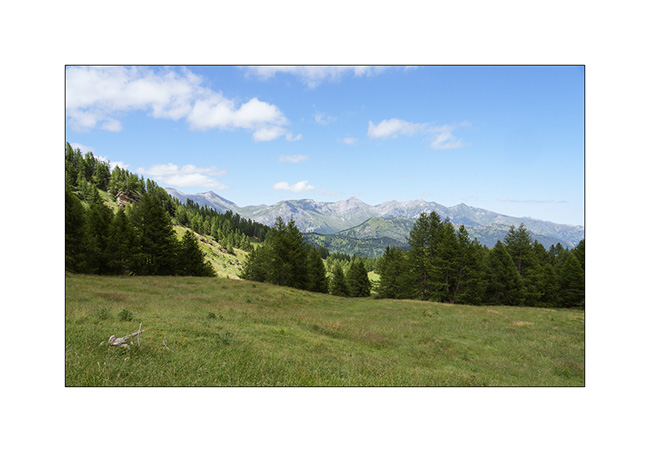
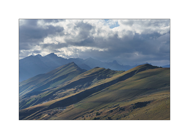
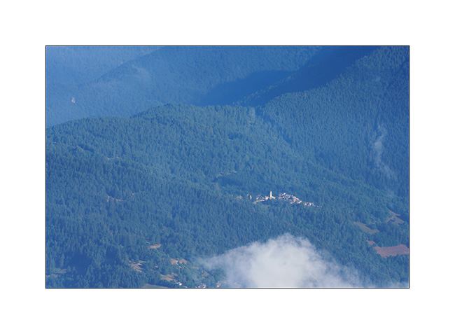
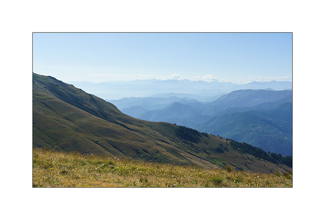
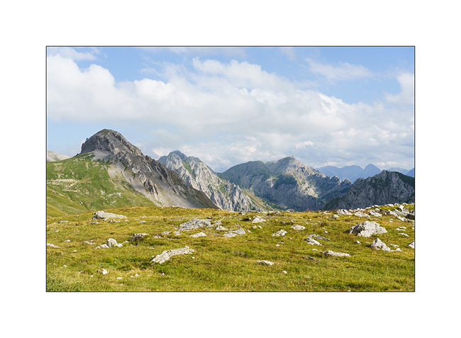
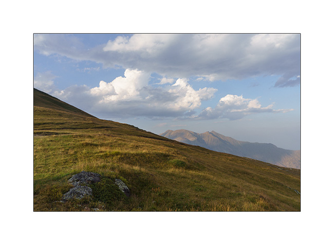
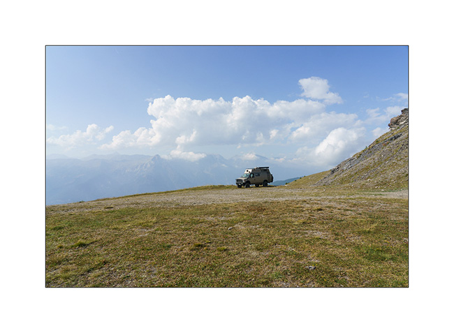
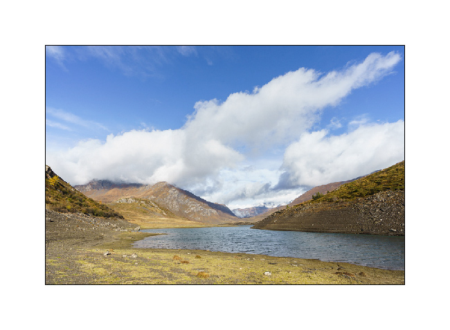
4. In the afternoon, we drive in VLV above the Super-Devoluy resort to get closer to Bure Plateau. The view opens up to the surrounding mountains.
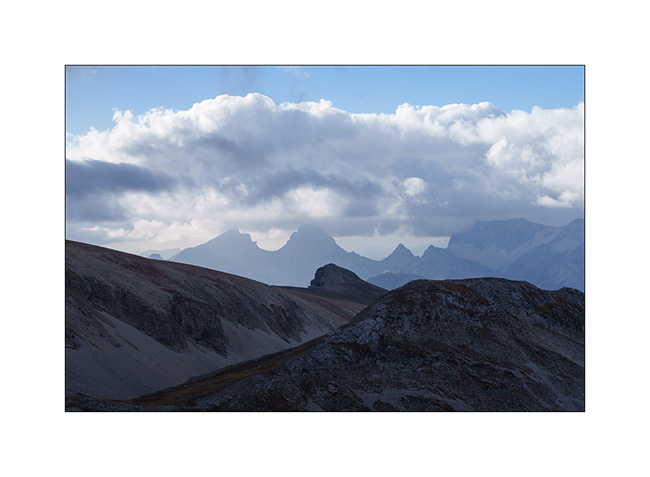
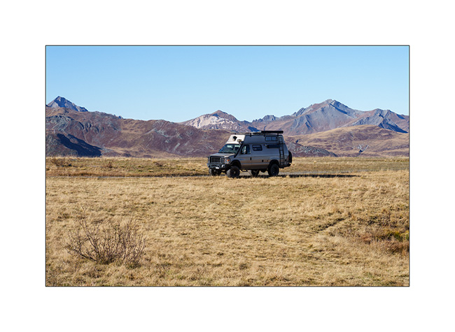
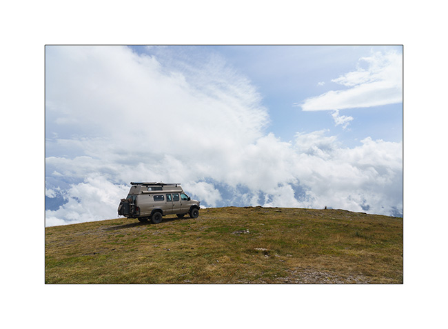
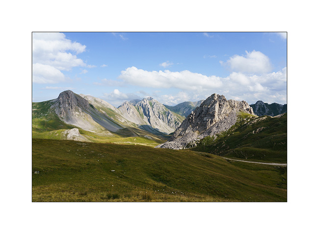
5. VivaLaVida at the end of the road, at about 8,200 feet elevation.
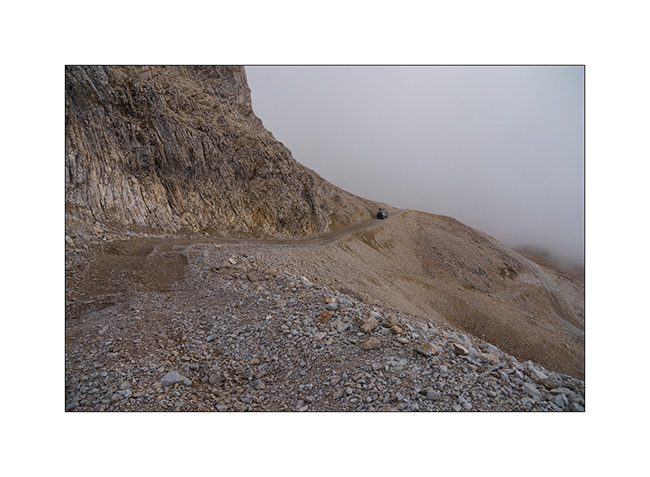
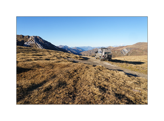
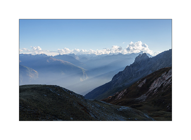
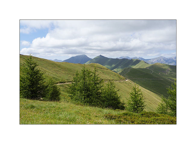
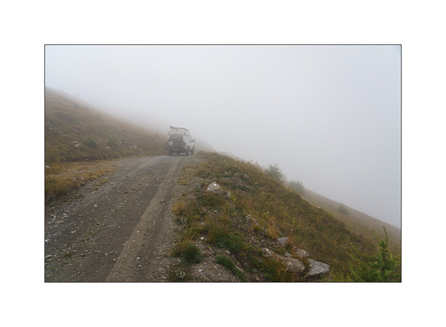
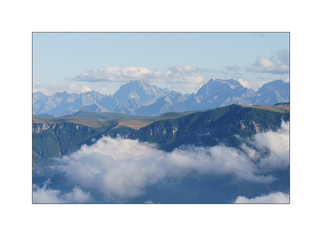
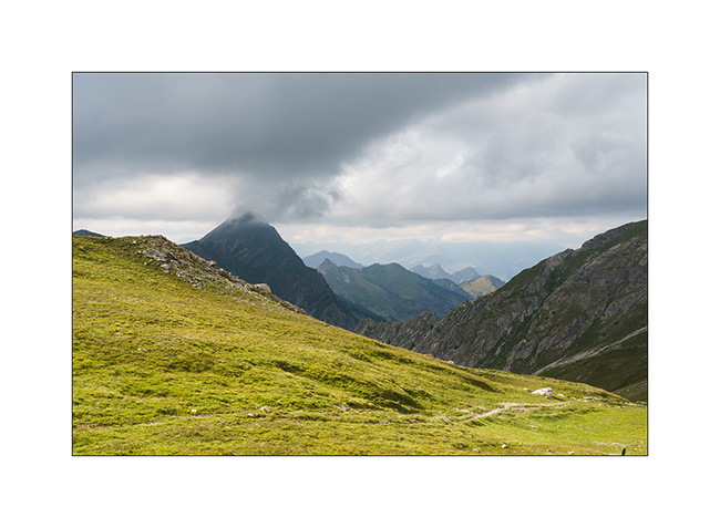
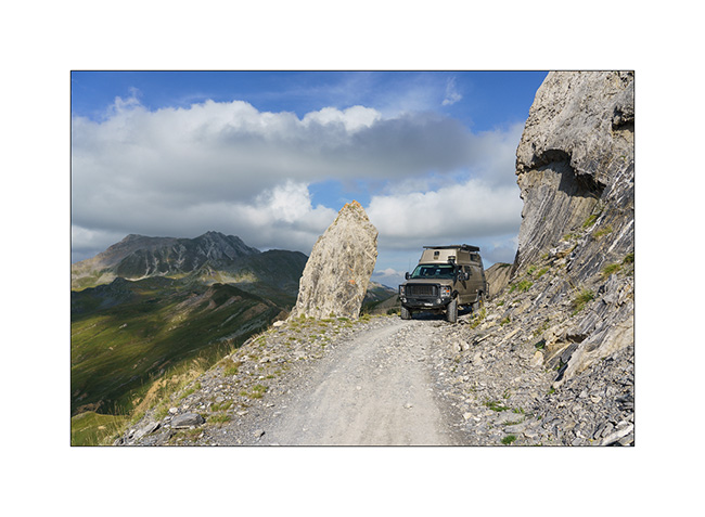
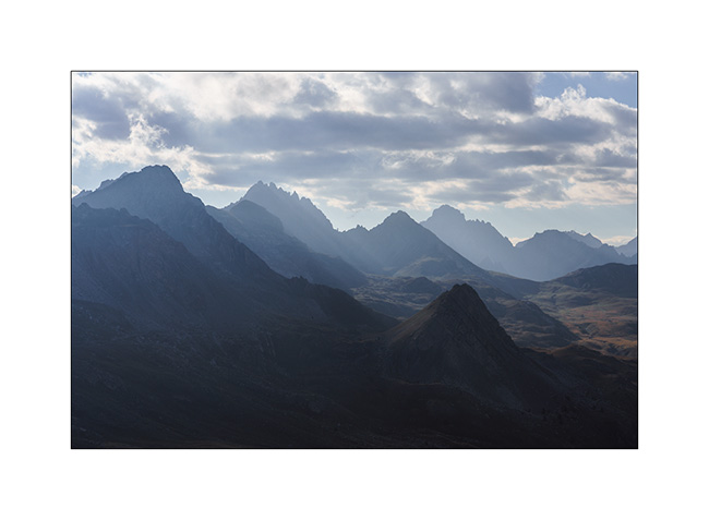
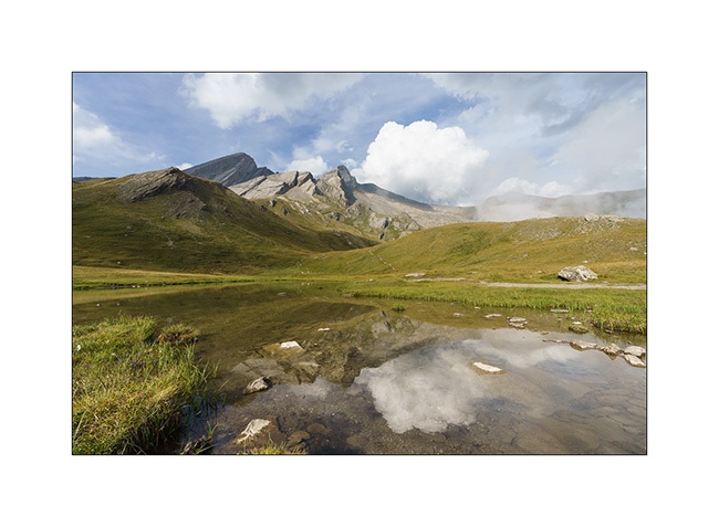
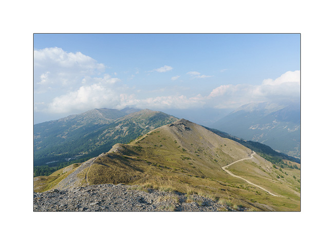
6. The clouds are starting to gather but we still attempt to pass through “the Window” to discover the interferometer on the Bure Plateau.
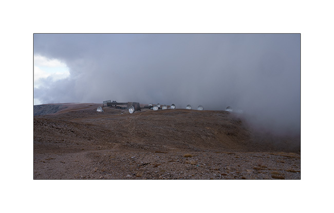
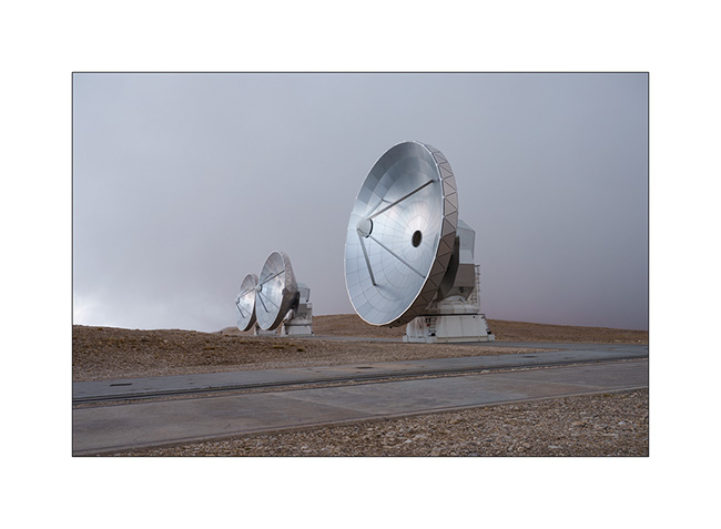
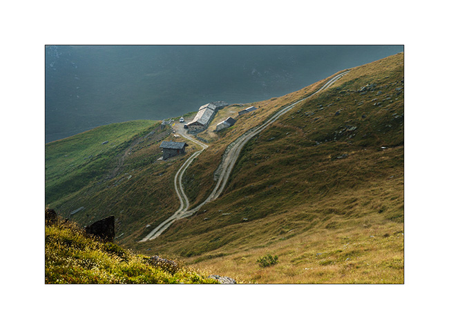
7. After a short hour’s walk, a few breaks in the fog give us a glimpse of the site. Located at an altitude of 8,350 feet, the interferometer consists of 11 large-diameter parabolic antennas working together; it is the largest installation of its kind in Europe.
8. The scientists who work here in four-month shifts are particularly isolated during the winter, sometimes drawing comparisons to the missions of scientists in Antarctica. Only a private cable car serves the plateau, which suffered a serious accident in 1999 when the haul rope broke, killing 20 people.
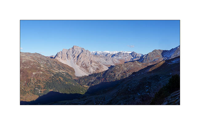
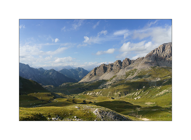
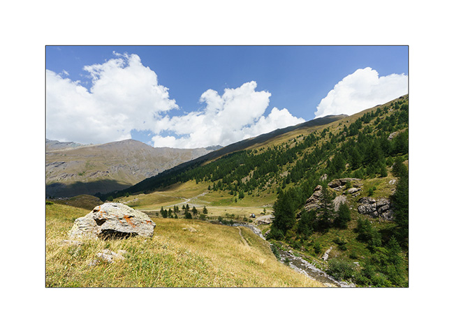
9. We descend to about 6,500 feet to spend our last night of the holiday in VLV. The view is gorgeous.
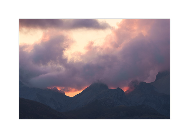
10. Last dream campsite.

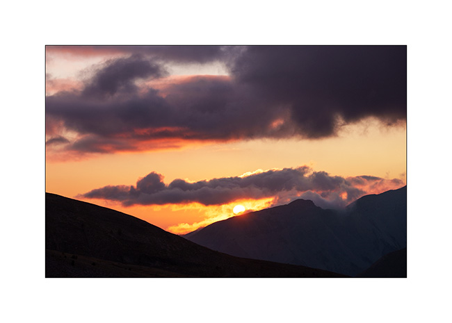
11. Sun is setting…
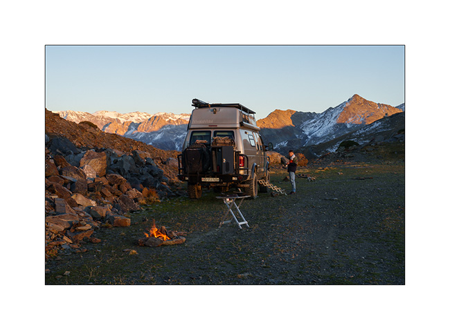
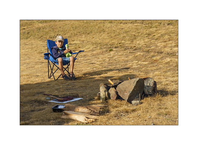
12. … and we make a final campfire to cook our supper.
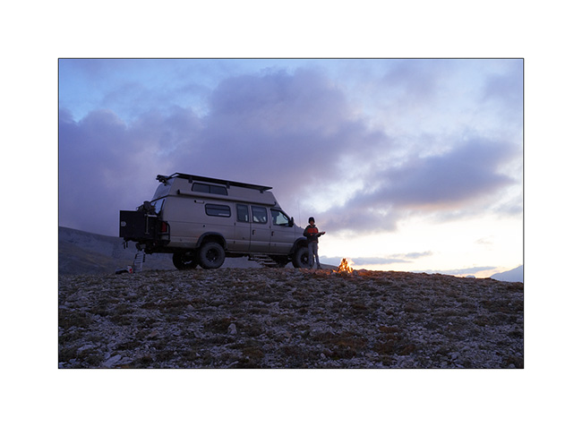
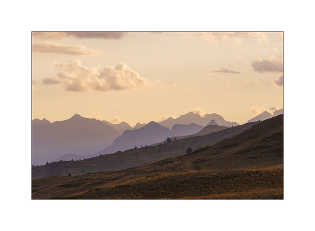
13. This twilight concludes the story of VLV’s wanderings in the year 2025.
Thank you all for continuing to follow this little blog in such large numbers. It ends here for 2025 but will resume next summer with new discoveries… 🙂
Autumnal Savoie…
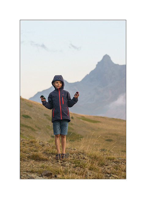
While Emile spends the first week of his fall holidays with me, we go to Savoie for a few days in VivaLaVida to enjoy the fall colours already present at altitude.
1. Mountains of Tarentaise, above Meribel.
2. From the Pass of Tougnète where we spend the first night, view of the Aiguille du Fruit.
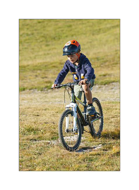
3. Emile drives offroad! 🙂
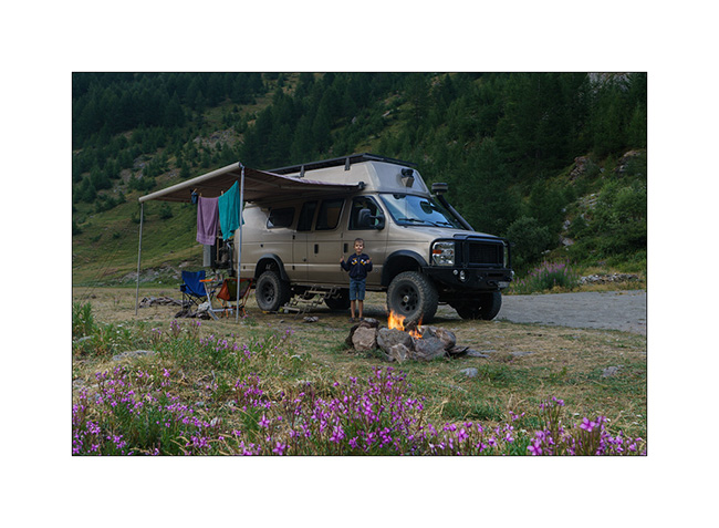
4. Our first bivouac at almost 8,000 feet with a lovely campfire.
5. The sun bows out in a cloudless sky.

6. Waking up to a sky as clear as the day before.
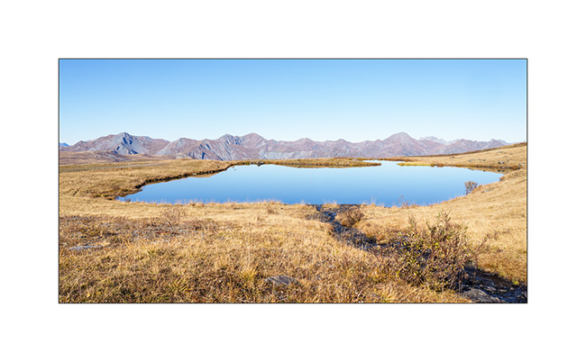
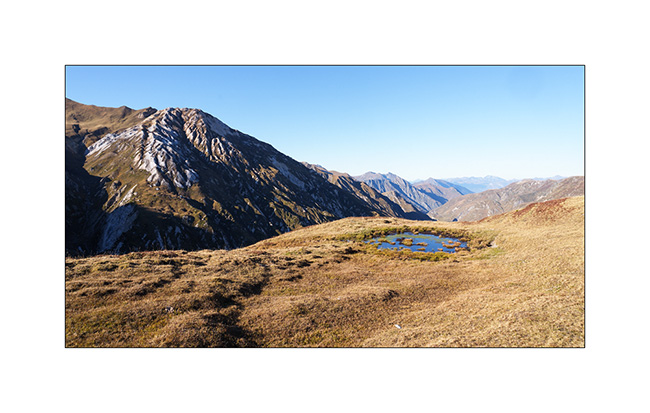
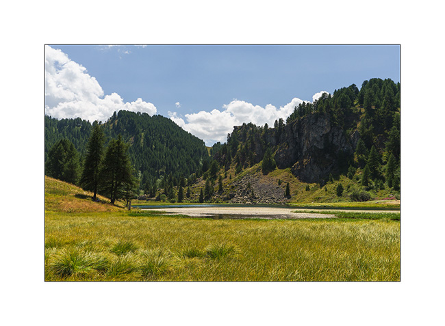
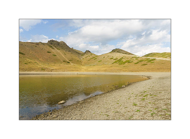
7. Small lake called “Large Lake” above Levassaix.
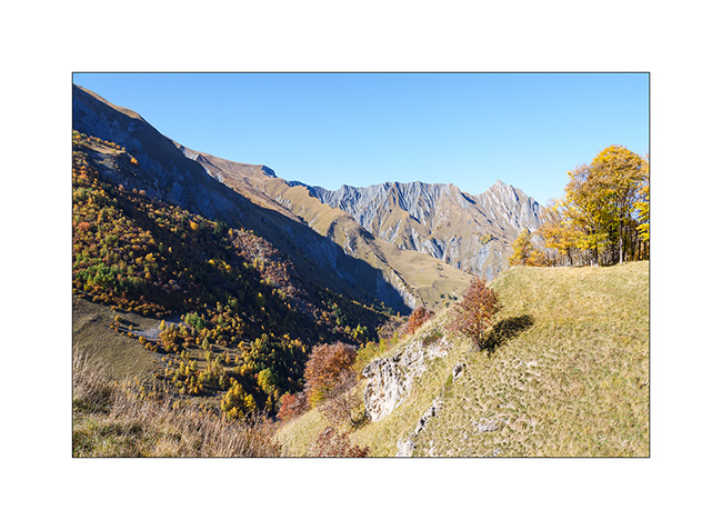
8. The mountain has already donned its fall hues.
9. We go discovering the Val des Encombres, with the hope of reaching the Maurienne Valley via the pass of the same name.
10. It is a gorgeous rather wild valley where only the hamlet of Bourtacombe, a few mountain pastures or herds embody human presence. It is unfortunately disfigured by a high-voltage line which crosses it from top to bottom and which I try to hide in my frames.
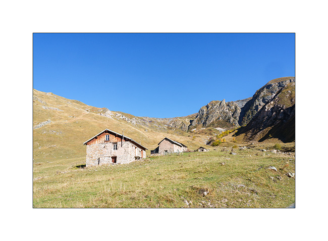
11. Alpine pasture of the Cariots,
12. The trail rises in the upper valley.
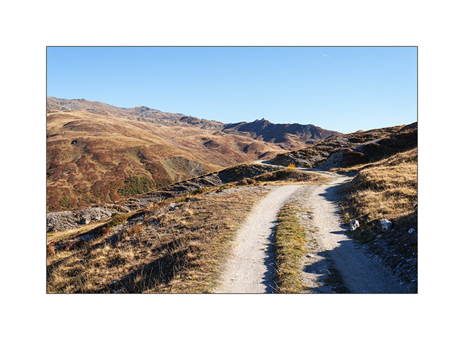
13. View of the valley already driven.
14. VivaLaVida on the trail.
15. Altitude marsh.
16. Arriving at the pass, at an altitude of 7,800 feet, we notice that the descent to the Maurienne Valley is impassable. While the beginning of the trail would be passable, this is not the case further down, where it has partially collapsed on an unstable slope, leaving only a quad path, far too narrow for VLV. Moreover, a recently posted sign prohibits access from the pass to any motorized vehicle.
We therefore turn back to a boondocking spot we spotted on the way up.
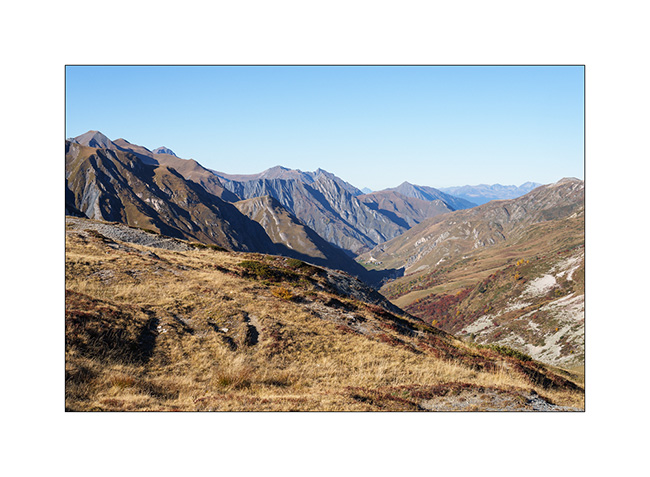
17. View of the Maurienne from the Petit Col des Encombres.
18. Our bivouac, with the Mont Blanc – the highest mountain in Europe – in the background.
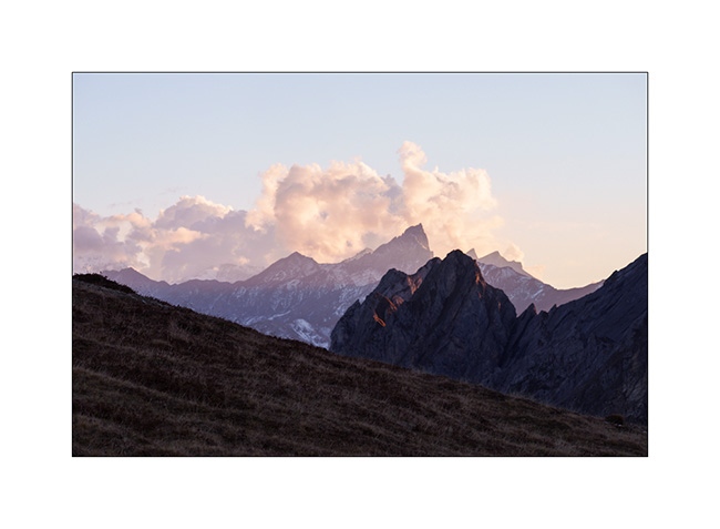
19. Soft light at sunset…
I take this opportunity to wish you all a wonderful Christmas and a very happy 2026! See you here next year. 😉
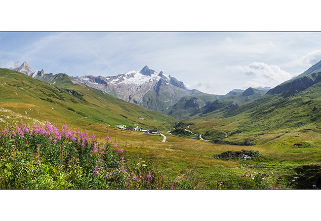
Valley of Glaciers
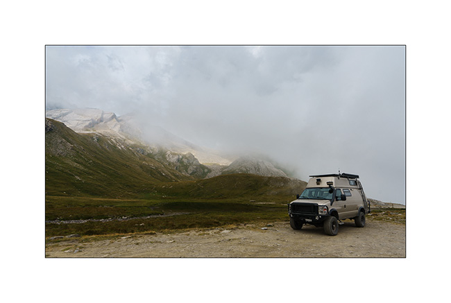
As Emile will soon be joining his mother for the rest of his holidays, we stop at the foot of the Val des Glaciers, near Les Chapieux. We spend a day there without moving VivaLaVida as Cormet of Roselend road is closed one day for the “Etape du Tour”. It’s the largest amateur cycling event with no fewer than 19,000 entrants who set off on one of the stages of the Tour de France: 85 miles and 12,500 feet of elevation gain!
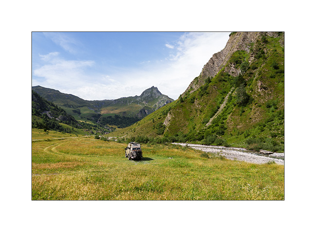
1. We find a nice bivouac spot near the river.
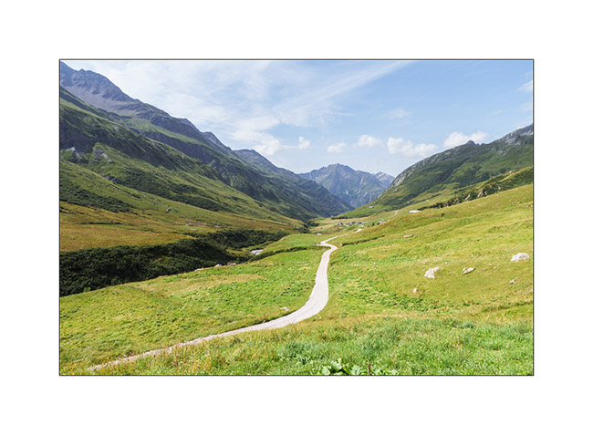
2. The next morning, we take the bikes to explore the Valley of Glaciers.
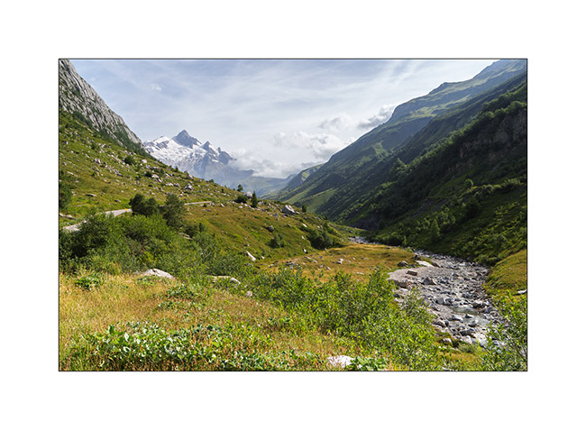
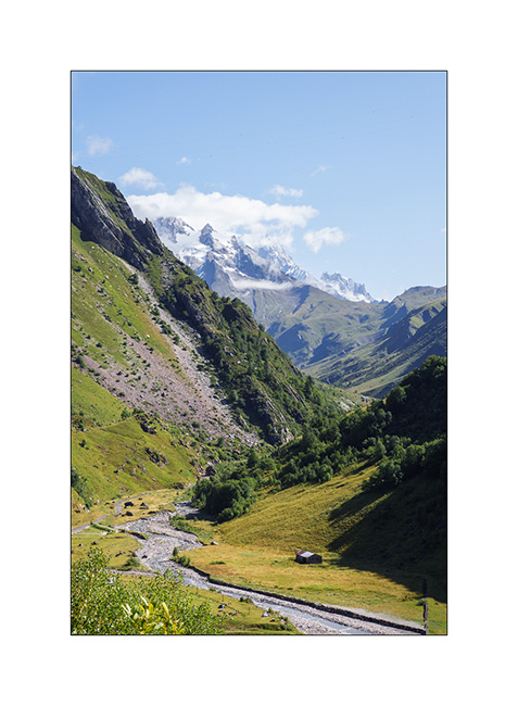
3. Panoramic view of the valley with the Aiguille des Glaciers towering above. The Tour du Mont-Blanc trail passes through this valley and the Pass of la Seigne, to the right of the needle.
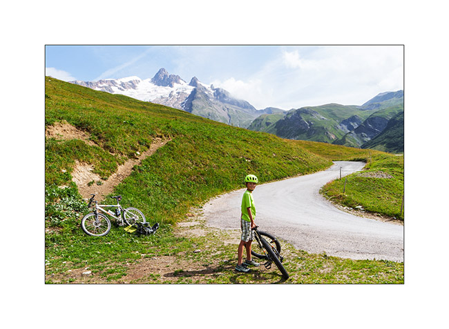
4. As we look back, the small road that leads us to the Refuge des Mottets.
5. Despite the long climb, Emile once again makes it on his mountain bike !
6. Last look at the valley as we leave the next day.
7. And the last image of this holiday: a small chapel in Les Saisies, with the Aravis Mountains in the background.
The year of VivaLaVida continues with a mountain bike getaway in Valais, a few weekend outings followed by the fall break.
Find out more here soon! 🙂
Alta Via del Sale
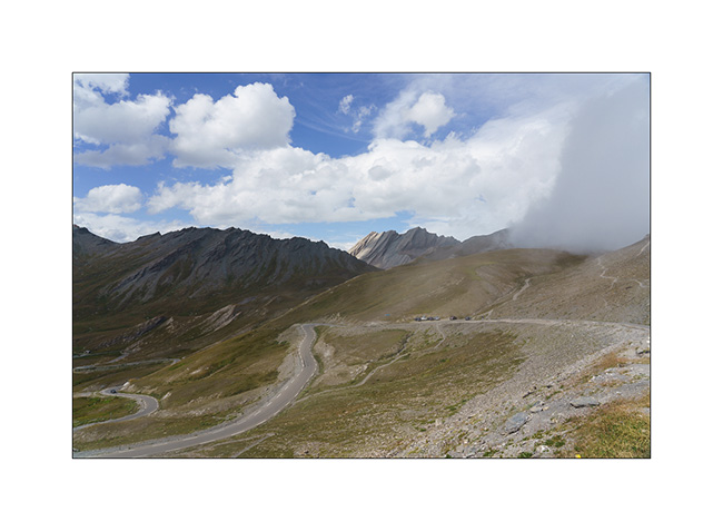
It’s Wednesday. We arrive at the entrance to the High Salt Road, unsure if we’ll be allowed to enter. Officially, the road is restricted to vehicles less than 18 feet long, 5 feet high and weighing less than 3.5 tons..
At the ticket booth where you pay your way, I don’t hide the fact that VivaLaVida is breaking the three previous criteria and I’m glad I did. The attendant tells me that my honesty does me credit and that he’s happy to let me through. He tells me that in an overhanging section, I’ll have to drive close the edge to avoid hitting the rock but that he thinks it should be fine.
We are very happy to be able to discover this legendary trail!
1. In the wellknown hairpin just before the Pass of Boaria, where we turned back on our bikes the day before.
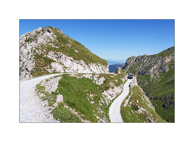
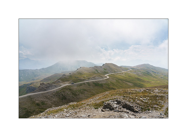
2. The trail winds between 6,000 and 7,200 feet above sea level for around thirty-five miles.
3. Landscape is superb.
4. After the Don Barbera refuge and the overhanging passage passed without any problem.
5. Part closer to the tree line.
6. Mount Saccarel, at 6,600 feet elevation.
7. High altitude landscape.
8. Former cannon battery of Mount Saccarel.
9. From Mount Saccarel, the trail we will take to descend. It is in poor condition and it will take us more than two hours to reach La Brigue where we will spend the night in a small campground.
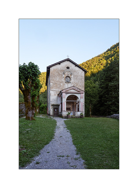
10. Chapel of Our Lady of the Fountains, just before La Brigue.
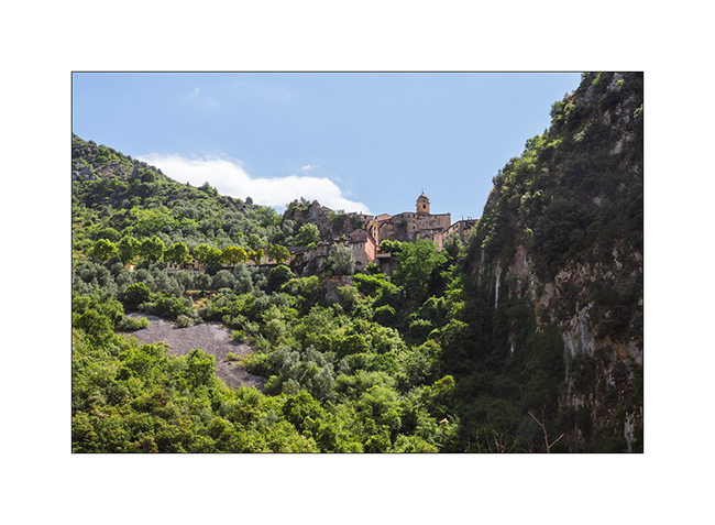
11. After a good night’s sleep preceded by a dinner in a small restaurant, we go shopping food in Breil-sur-Roya and then take a trail leading to the Mercantour Park. Here, the pretty hilltop village of Soargue.
12. Breil-sur-Roya.
13. From a little higher up, where we stopped for lunch.
We meet a Mercantour park ranger who informs us that the heart of the park has been extended and that the planned trail now crosses it and it’s thus closed to all traffic.
He points us to an alternative route that’s a bit of a detour but allows us to avoid the heart of the park. So we retrace our steps to a junction and take the indicated trail. The loop is significantly longer but allows us to discover the hills of the hinterland with the Mediterranean sea in the background.
14. We find a gorgeous bivouac spot a few miles before the Turini barracks which we will discover the next day.
15. Walk at the end of the day.
To be followed soon… 😉
Spanish Basque country
Wanting to discover the Guggenheim Museum building in Bilbao, we drive along the Basque coast.
1. Stop in Ondarroa to discover this pretty little coastal town.
2. Its marina at the mouth of the river.

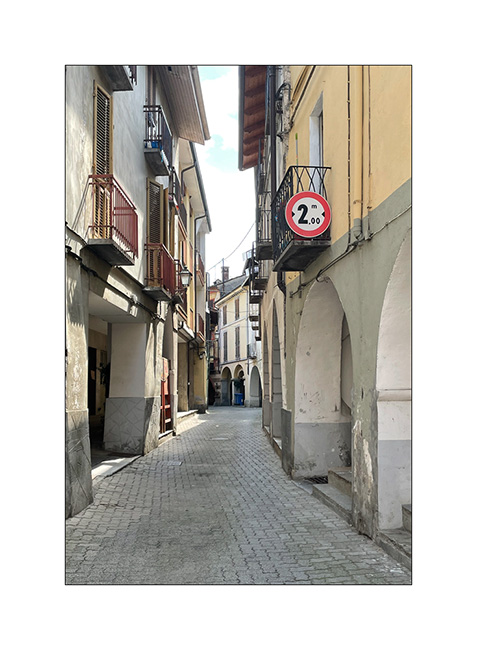
3. Back street…

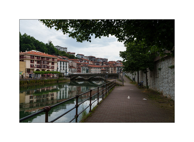
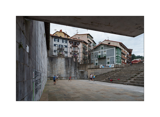
4. Intrigued by the noise, we discover a group playing Basque pelota on a concha (field) .
5. Return to VLV via the fish auction, empty this morning…

6. The same auction from the outside. It is built on a quay, right in the city.

After a one-hour stop to repair the VLV headlights that no longer work – one contact of a plug, corroded, broke – we arrive in Bilbao shortly after noon. After parking not without difficulty – it’s not easy to find a space large enough – we eat in VivaLaVida and then go discover the famous building of the Guggenheim Museum.
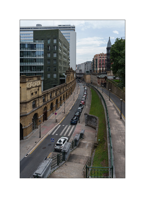
7. The city of Bilbao combines the old and the new.
8. We discover the Guggenheim from the opposite bank.
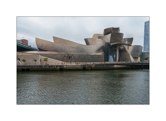
9. What an architecture!
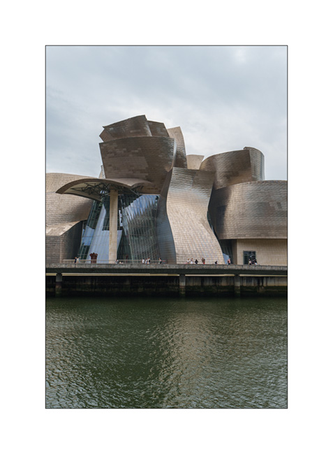
10. Spectacular!

11. Contrast of the sculpture all in curves…
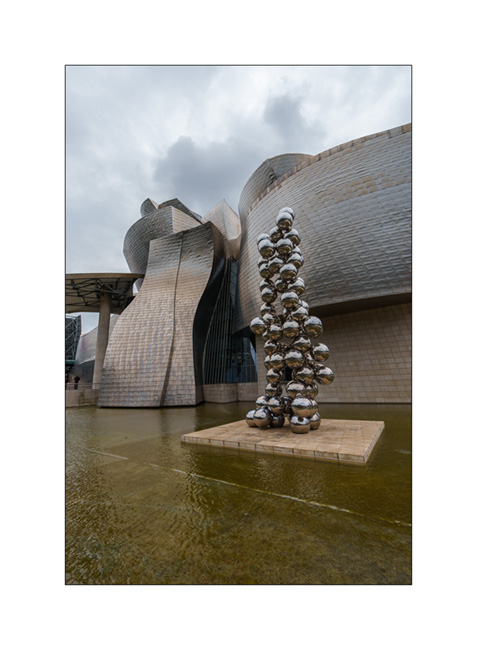
12. Water…

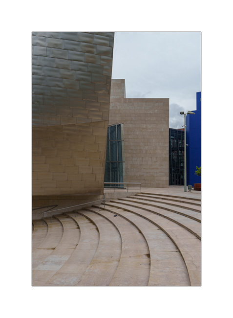
13. Nothing is strait!

14. Curves…

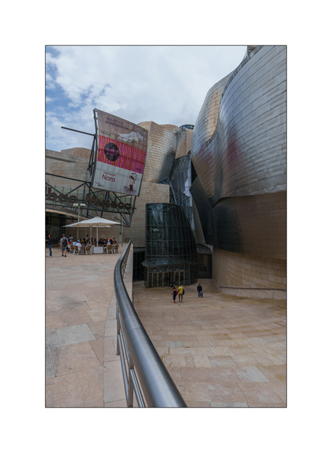
15. Entrance to the museum which we’re not going to, the current exhibition not being suitable for children.
16. Still curves…
17. The part of the building that houses the administration.

18. Plaza.

19. After searching in vain for a place to sleep by the ocean, we finally find it in the hills back from the coast, right next to a real menhir.
20. It’s Euro soccer final night and Emile doesn’t want to miss it! On my side, I’m enjoying the sunset…
More to come very soon as we continue our progress towards the west.
Cantabria…
Here is the continuation of our discovery of northern Spain, now in Cantabria.
1. Here we are on the coast of the Atlantic Ocean, in the Golfe de Gascogne where it is blowing strong that day.

2. Walk in the eucalyptus trees.

3. Emile wants to see a lighthouse up close, so we take the coastal path.

4. Ajo lighthouse.

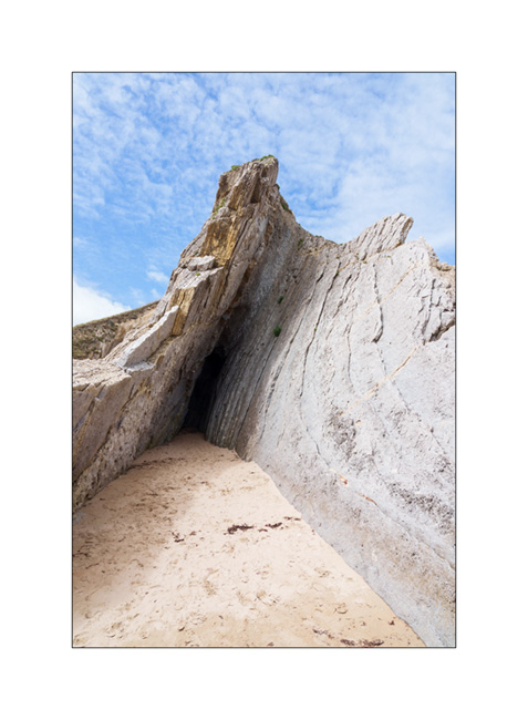
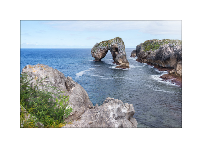
5. We also discover a nearby natural arch.

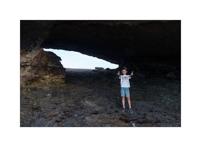
6. Emile giving the scale.
7. Window on the ocean…

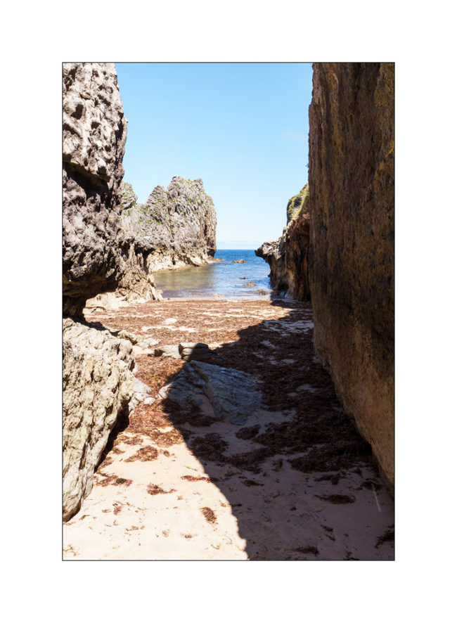
8. After sleeping practically over this arch, we discover a very famous spot the next day: Urros de Liencres.

9. Low tide uncovers rock strata…

10. Little alcove…
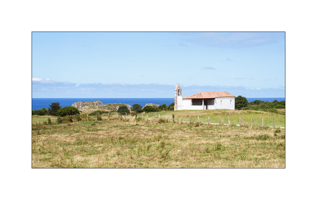
11. Another quick hop to discover another natural arch: El Castro de las Gaviotas. We park towards a pretty chapel.
12. Small cove in the cliff…
13. The arch still partially hidden.
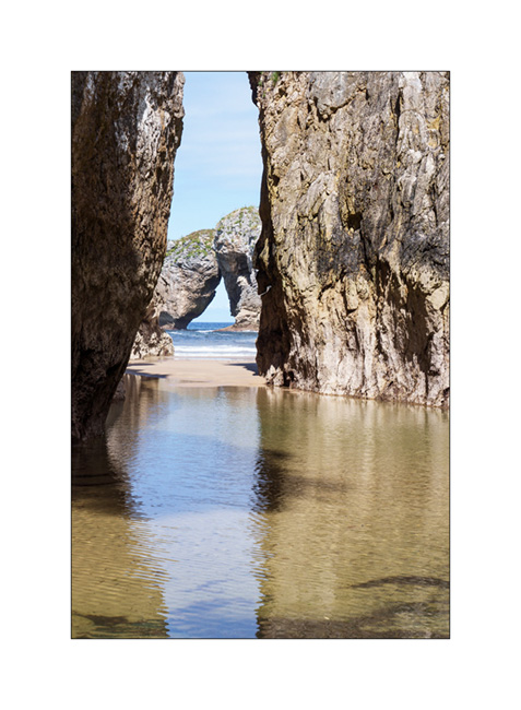
14. And here it is complete.
15. After looking for almost two hours for a place to boondock because of the crowds at this time of the year, we finally found a nice place to sleep, at the bottom of the Picos de Europa, near the ocean and accessible only thanks to VivaLaVida’s 4-wheel drive.
16. The ocean is close.

17. The view behind our camp.
18. Pastel twilight…

To be followed soon!
Strada del Canoni…
After Colle Agnello, we continue to discover high altitude trail.
1. Ascent in the rain…
2. Fortunately, after lunch, the sky starts to open.
3. We are again at more than 6,500 feet elevation.
4. And the sun returns in late afternoon.
5. The clouds still cling to the north.
6. Emile trains on his bike.
7. View from above…
8. In the distance, the Maira mountains that we will discover later.
9. In the morning, blue sky is back.
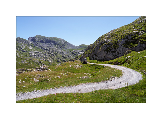
10. On the Strada del Canoni trail.
11. Distant view…
12. After having tried to reach the Maira by the Meja valley which we discover closed by a gate, we climb there by the Colle Fauniera.
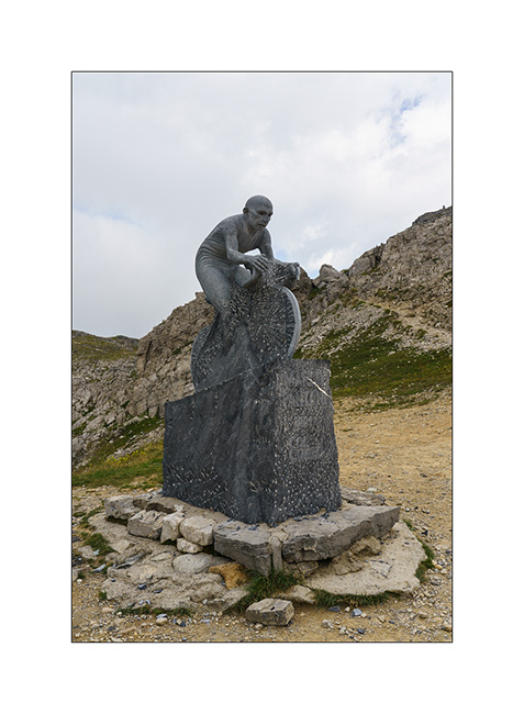
13. It is a pass visited by the Giro and a sculpture recalls it.
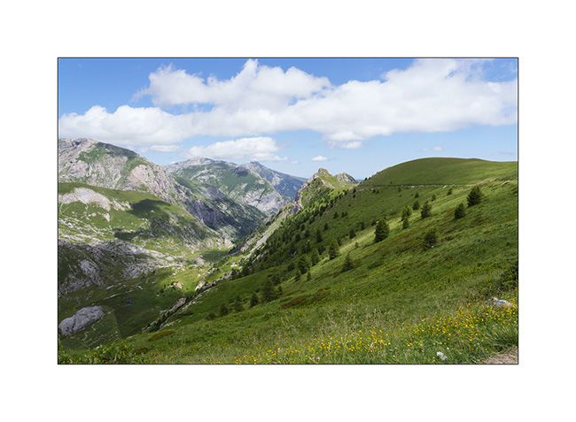
14. We discover the trail of the Maira Stura from the East side, looking for a boondocking place.
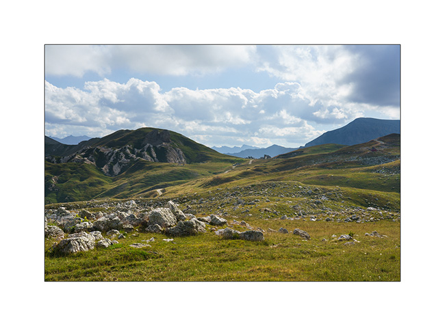
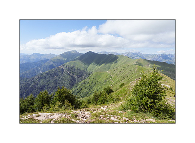
15. The massif is spectacular, alternating limestone walls and high meadows.
16. …
17. VivaLaVida on the trail.
18. Val Meja from above.
19. Sunset from our camp.
The trail being closed to motorized vehicles on Sunday, we spend a full there day enjoying this beautiful panorama. We’ll tell you that soon. 🙂
Lacs et Queyras…
1. Dernière soirée dans le Val Argentera.
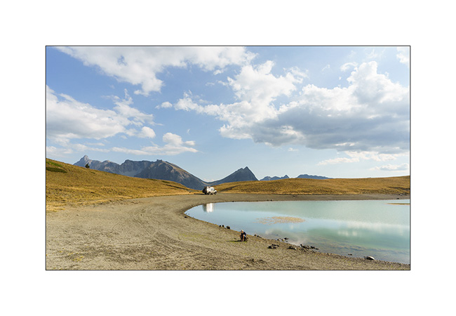
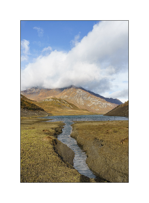
2. Le Lago Nero (Lac Noir), proche de la frontière franco-italienne, bondé ce jour-là alors que plusieurs colonies s’y sont données rendez-vous pour la journée. Nous décidons ainsi de poursuivre la piste vers un autre lac d’altitude.
3. Campement à 2’400 m. d’altitude.
4. Emile s’entraîne à faire des ricochets.
5. Quiétude…
6. Préparation du souper.
7. Couchant
8. On se couvre un peu alors que la brise du soir rafraîchit l’atmosphère.
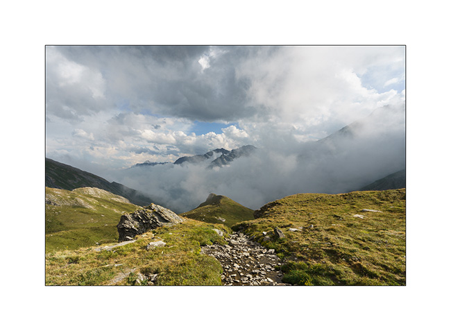
Ensuite, nous partons découvrir le Colle Agnello qui relie la haute vallée du Queyras à l’Italie. La vallée qui y mêne est magnifique, nous y reviendront à l’occasion.
9. Dernier lacets avant le col alors que la brume bouche le versant italien.
10. Nous trouvons un bivouac sur le versant italien, près d’un petit lac.
11. Et surprise, la brume se retire en début de soirée…
12. J’en profite pour tirer le portrait à ce joli petit lac.
13. Dernières lueurs sur les sommets.
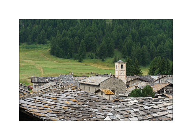
14. Village aux traditionnels toits de pierre sur la descente côté italien.
La suite dans le prochain post.
Slowly going South…
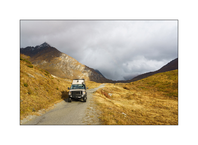
After these two days around the Colle del Nivolet, we move a few miles South along the first alpine foothills which border the Piedmontese plain..
1. Short stop at Pont-Canavese to refurnish us with various groceries.
2. This village offers the typical architecture of the region with narrow streets and houses build over the sidewalks and stalls thus shaded.
3. Then, a nice climb on the trail that leads to Colle del Colombardo and its imposing sanctuary overlooking Turin.
4. A few storms are brewing, which will however avoid our camp.
5. We sleep on a hill, along the descent on the south side.
6. Sheepfold…
7. Quiet end of the day…
8. The next day, we go back to the Colle del Finestre that we discovered last year in order to access the Strada del Assietta which was closed during our previous visit. Souvenir at Colle del Assietta.
9. This old military road winds for about twenty miles between 6,000 and 7,500 feet above sea level, connecting Colle del Finestre to Sestriere. However, German tour operators specialized in 4×4 trips have almost transformed it into a motorway, rushing there every day in dozens of convoys of 10 to 15 vehicles each, to such a point that it is now closed on certain days of the week to preserve some peace for pedestrians and cyclists.
10. We take a secondary track to find us a nice boondocking place…
11. … on the ridge, above the Sauze d’Oulx.
12. Assietta trail from our camp.
After filling the fridge in Sestriere, we go up the superb Valley Argentera which we had already enjoyed last year. We stay there for two days to enjoy its tranquility and its beautiful river, alone in its upper part which is difficult to access without 4WD.
13. VivaLaVida’s camp along the river.
14. Emile enjoys a few lazy mornings… 😉
15. Lichens on a rock in the upper Argentera valley.
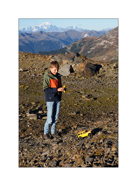
16. Emile is over the moon!
17. Upper Argentera valley.
Other of our discoveries in a few days… 😀
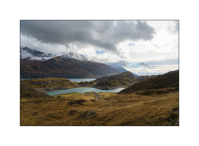
Fall holidays (1)
As Emile is on vacation with me for a week, we decide to go enjoying the fall colors without traveling too far since we only have 5 days to travel. The destination will be the Hautes-Alpes, between France and Italy.
1. After half a day on the road, we arrive in the Mont-Cenis region and its lake at the end of the day.
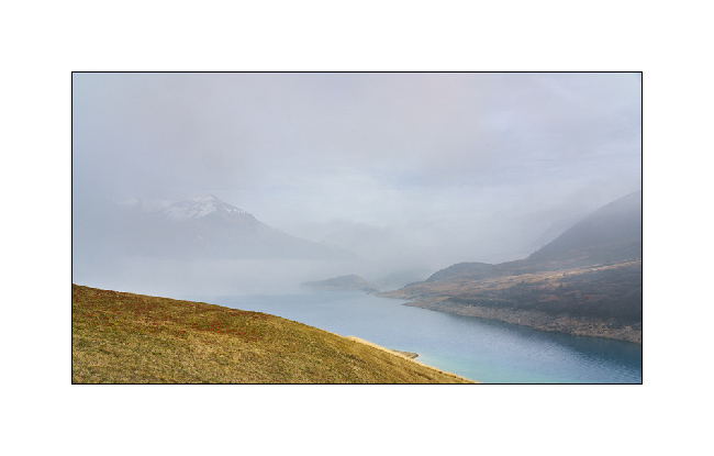
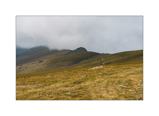
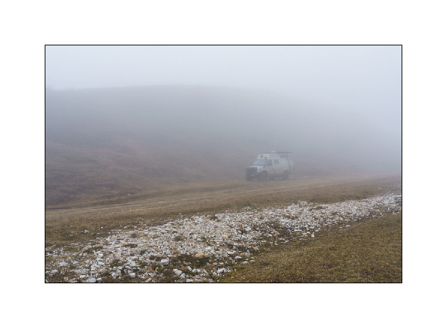
2. While the weather is fine all along the road, the east wind blows fog from Italy which gradually rises, enveloping VivaLaVida.
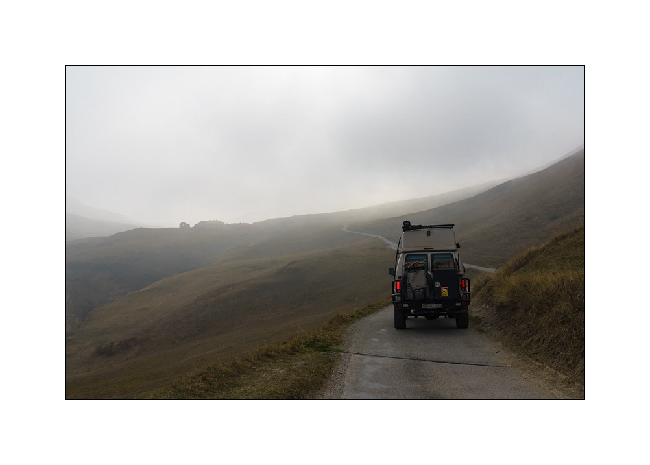
3. Climbing up to 2,200 m, we have time to make a shot hike outside the nimbuses.
4. But half an hour later, the fog catches up with us.
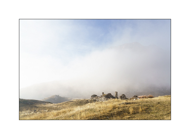
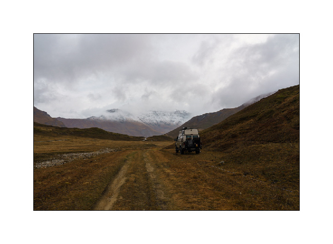
5. The time to find a boondocking site for the night and we are isolated by the clouds for a quiet but cool night.
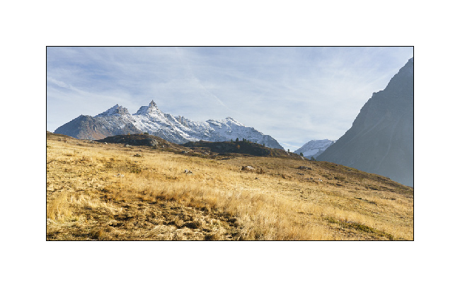
6. The disturbance of the night removed the fog and nicely sprinkled summits with fresh snow.
7. A few openings in the couds let in the light…
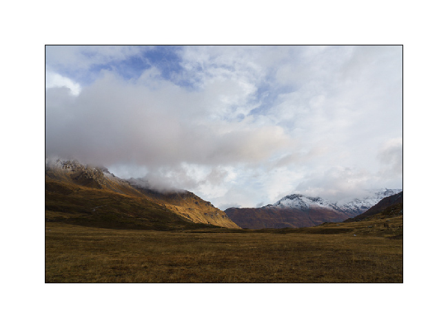
8. … and VLV takes the trail again to reach the lake.
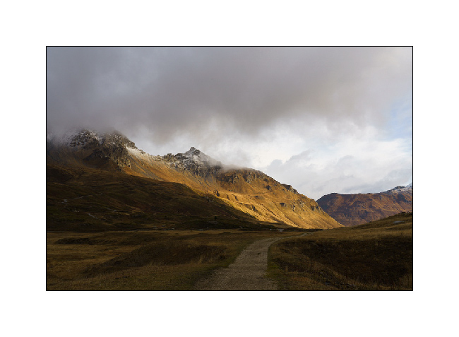
9. We take the trail that goes West of the lake…
10. … trail that we couldn’t drive in July, a barrier now blocking access from July 1st to September 15.
11. The showers follow one another and the wind is still blowing strong.
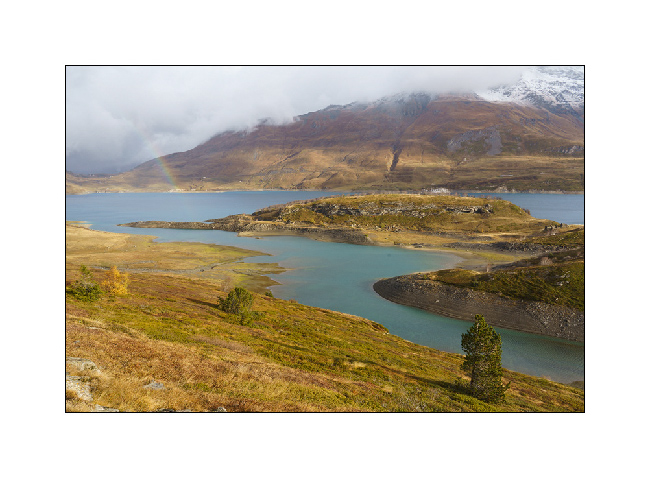
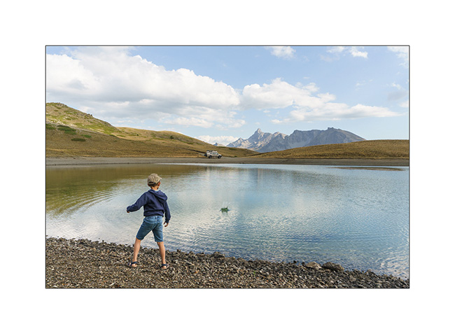
12. But we anyway go for a walk by the lake, just to play with Emile and, for me, to look for some picture composition.
13. …
The continuation of the story in a few days…