arch
now browsing by tag
Highlands of Lozère
Coming back from Spain, we cross France by small roads, discovering some spots identified during previous research. We arrive in Gorges du Tarn and go up to a first causse (kind of of high plateau) by a very small road. It leads us to a trailhead to discover several natural arches.
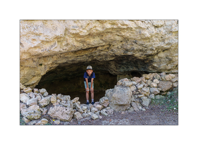
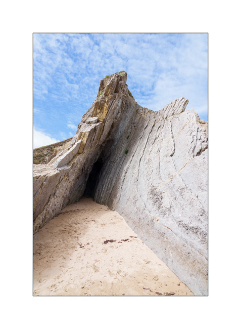
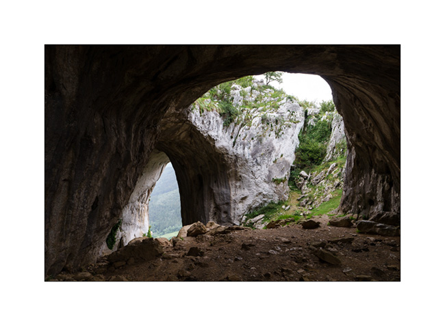
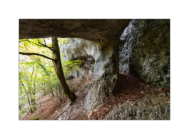
1. First spot, a cave in the limestone.

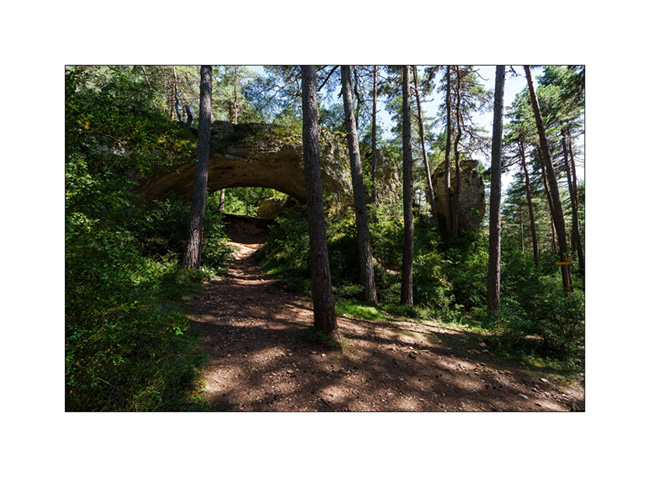
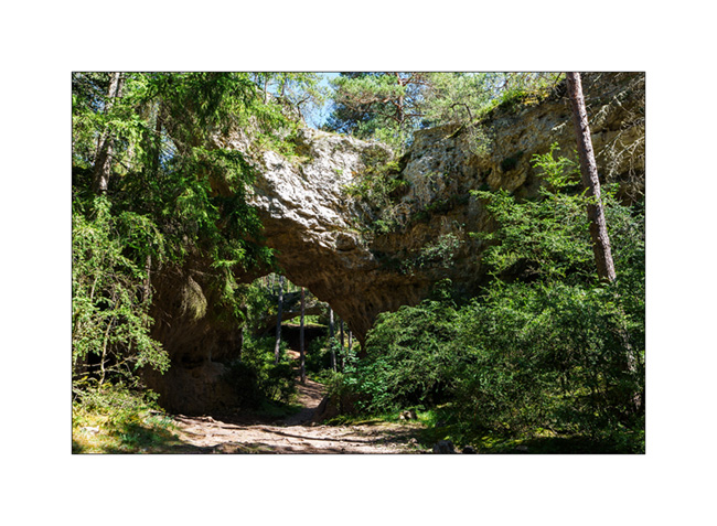
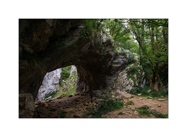
2. A few hundred yards further, a first arch.

3. A hoodoo in the middle of a clearing.

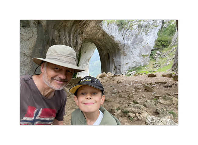
4. Emile poses for the photo.
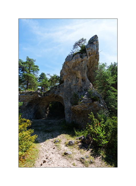
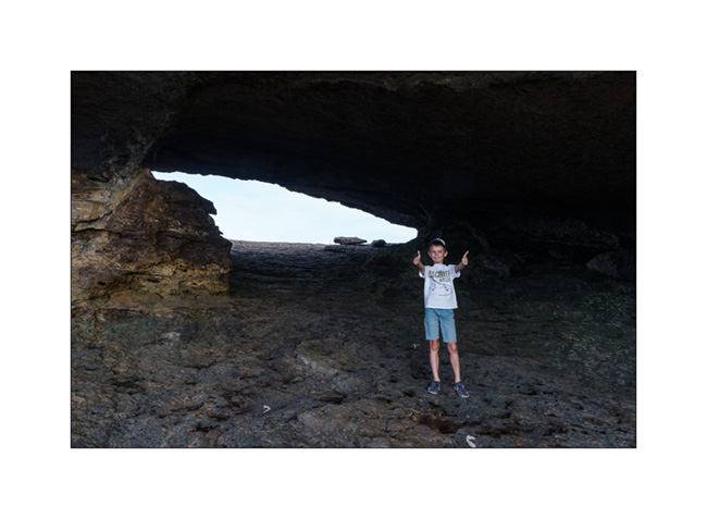
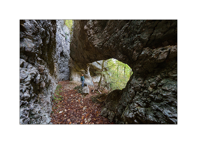
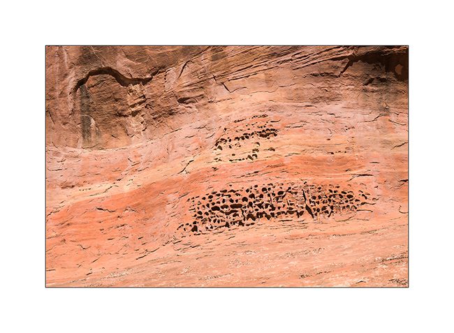
5. At the end of the loop trail, we arrive at the spot called Arcs St-Pierre with three natural arches within a radius of barely 150 yards. The first, which seems to have served as a shelter in ancient times.
6. The same from the opposite.

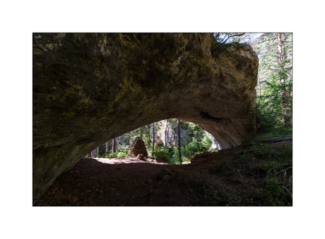
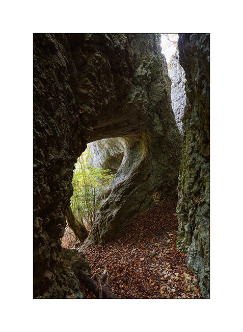
7. The second.
8. …
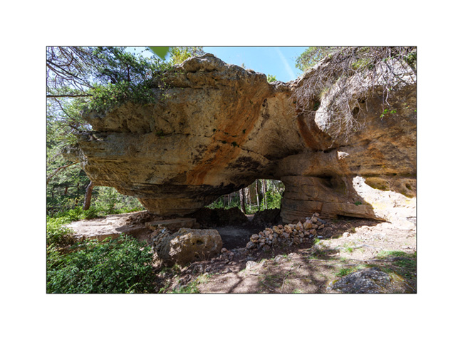
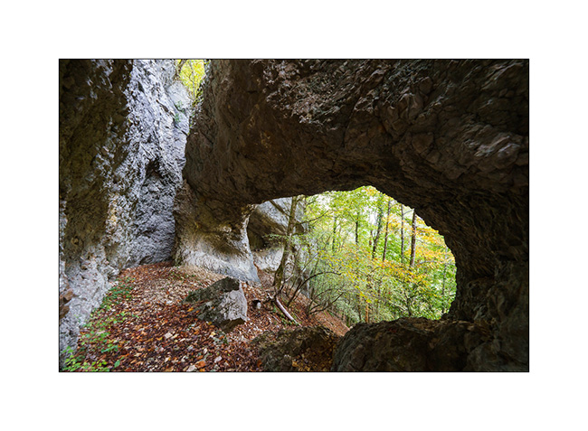
9. The third, the most imposing.

10. Both in a row…
11. Emile in a small cave along the path.
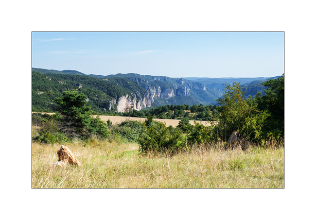
12. View from the plateau.
13. The meadows are quite dry but some flowers remain.

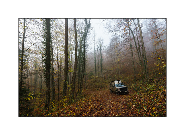
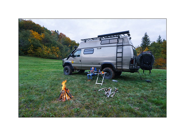
14. Our camp a few miles further; the shower feels good. 😉

Continuation and end of these summer holidays in the next update soon…
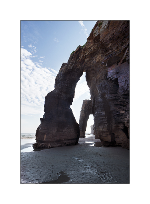
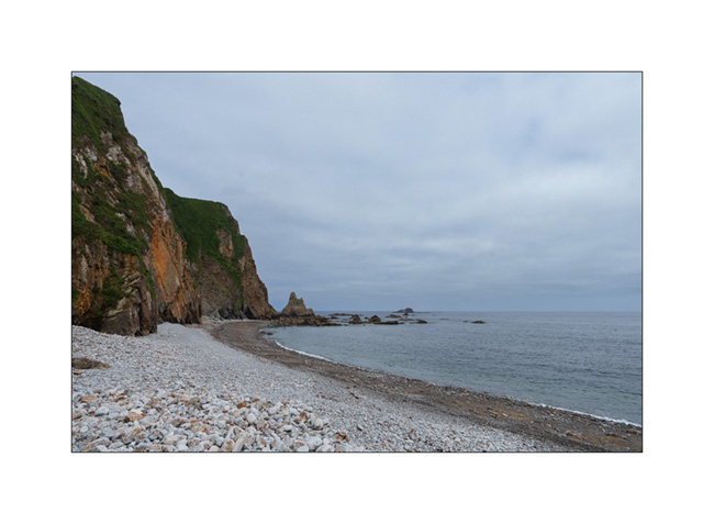
Incursion into Galicia and return to Asturias
It was one of the spots I wanted to discover for a long time: Praia de Catedrais or “Beach of the Cathedrals”, in Galicia, about ten kilometers from the border with Asturias. A spot that has become extremely touristy since it was published hundreds of times on Instagram, so much that you now have to register on Internet to be allowed to access it via a QR code. As some arches are only accessible at low tide, this further concentrates the crowd at certain times of the day.
First there around 3pm, I gave up as there were so many people. Thus, we discovered it the next day around 8am and if there were still a lot of people, it was probably 5 or 10 times less than the day before.
1. The site consists of a cliff whose bottom is at sea level and “sanded” on a beach.

2. The most famous arches, in a row with each other.
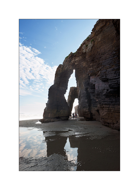
3. What a perspective!
4. Another arch on the way back to the access to the foot of the cliff.

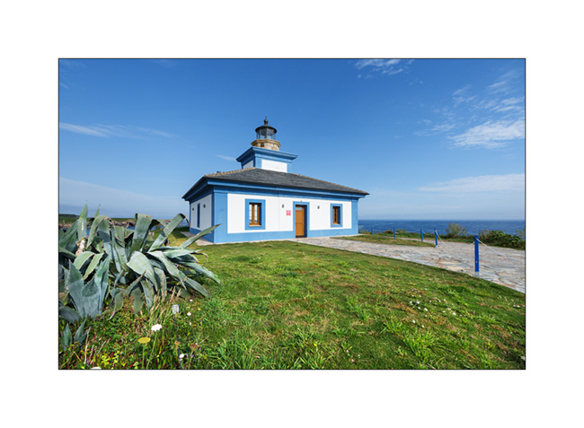
5. Heading back west, we follow the coast on small roads and come across a pretty lighthouse: Faro de Ribadeo.
6. A little further East, a pretty wild cove. We discover that it is currently reserved for nudists.

7. New stop a few miles further to discover another natural arch, at the Mirador de Atalaya.

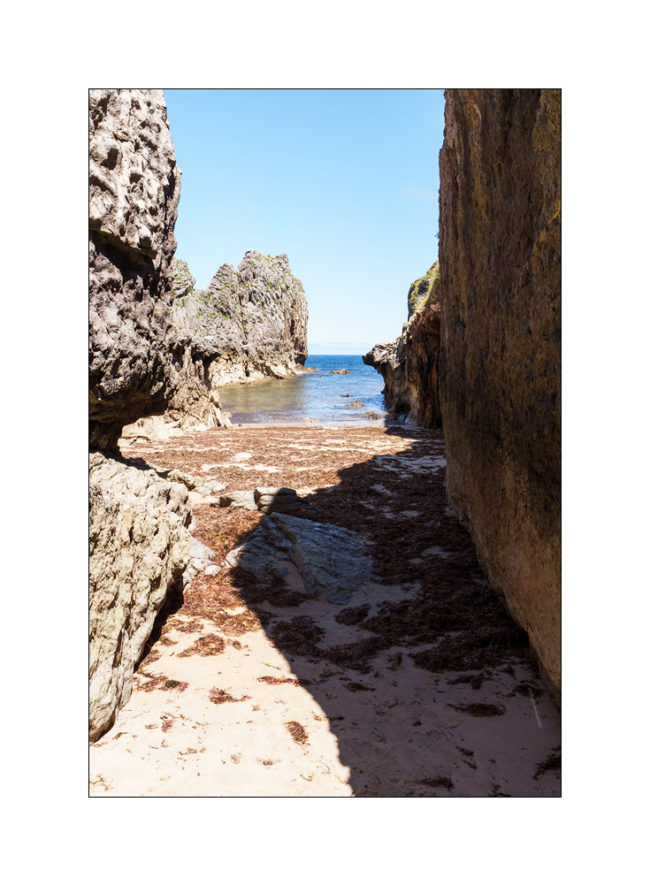
8. We continue to follow the coast, sometimes on trails, discovering pretty coves like this one.
9. Here a pretty little harbor, in Viavelèz.

10. It’s time to look for a place to camp and after three unsuccessful attempts, we find a spot above a beautiful cliff that turns orange at sunset.

11. The next morning, discovery of a pebble beach after a short offroad session on an abandoned path.
Then we leave the coast to reach the mountains of the Somedio National Park. To be discovered in the next update. 😉
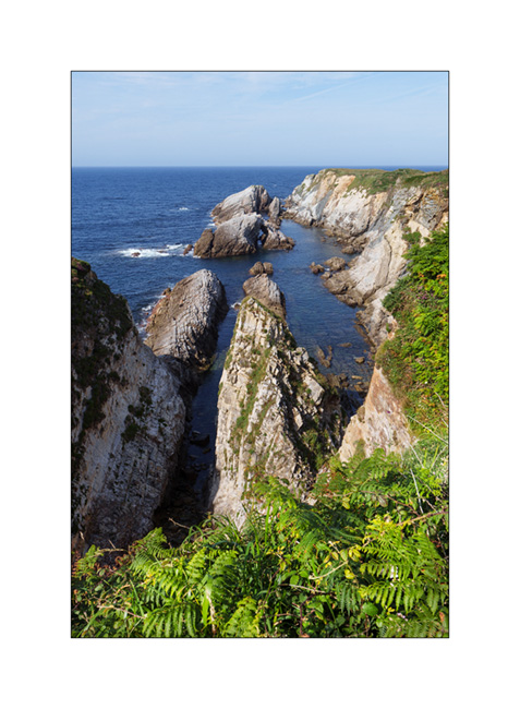
Cantabria and Basque Country (continued)
The next morning, we continue to discover this rocky coast.
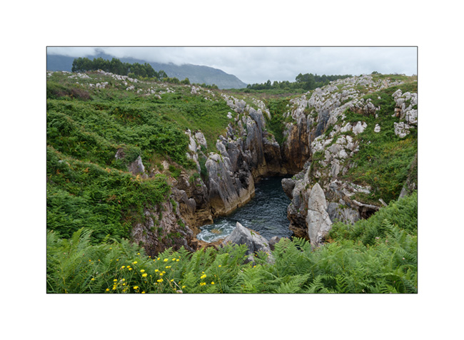
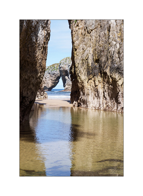
1. The ocean passes through the limestone crevices to create this small lake about three hundred feet from the coast. The swell makes the water move, a rather unusual effect!
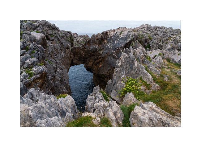
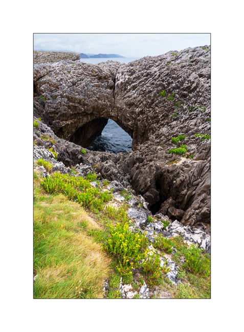
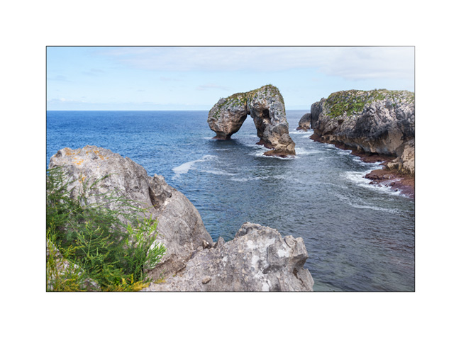
2. Another arch.
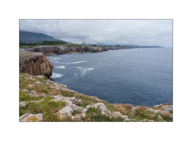
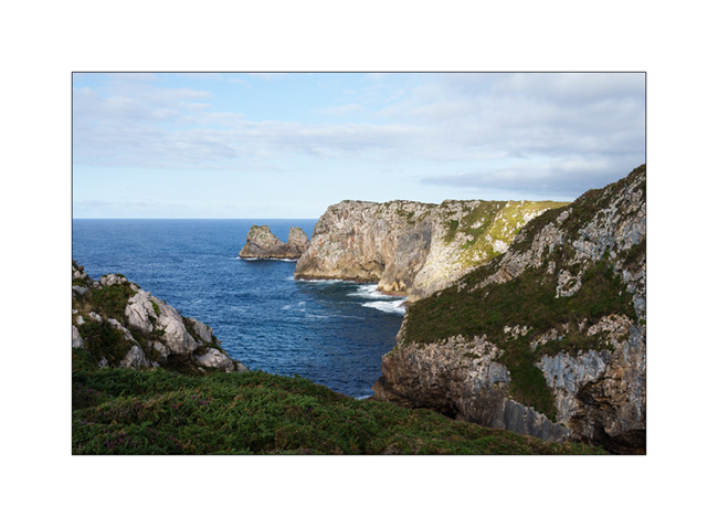
3. The coast towards West from a small peninsula.
4. And one more arch.
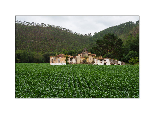
5. There are only a few days left before the end of the vacation, we are heading back east. Abandoned farm along the road…
6. Church near the village of Niembru.

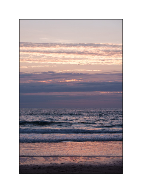
7. We sleep on a surf spot near San Vincente de la Barquera, with beautiful colors at sunset.
8. …

9. …
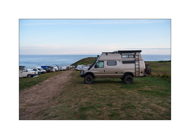
10. VivaLaVida among surfer campers.
11. First light at dawn…

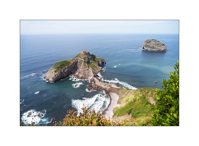
12. We continue our route in the Basque Country and make a short stop at the Hermitage of San Juan de Gaztelugatxe. It’s so crowded that it’s not possible for us to go down because all tickets for the day have been sold.
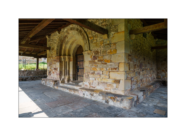
13. Church with covered passageways…

14. Main door.
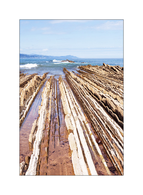
15. Another known spot where we find these layered rocks which have tilted to offer their slices to the ocean, in Zumaia. You don’t see it ont the picture but to my left, there is a beach with probably an average of 1 human per square feet! 😀
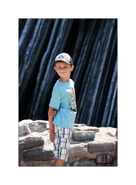
16. My son in discovery mode.
17. Layered cliff…

I will still have one last update to publish in a few days to close the story of this summer trip… See you soon! 😉
Cantabria…
Here is the continuation of our discovery of northern Spain, now in Cantabria.
1. Here we are on the coast of the Atlantic Ocean, in the Golfe de Gascogne where it is blowing strong that day.

2. Walk in the eucalyptus trees.

3. Emile wants to see a lighthouse up close, so we take the coastal path.

4. Ajo lighthouse.

5. We also discover a nearby natural arch.

6. Emile giving the scale.
7. Window on the ocean…

8. After sleeping practically over this arch, we discover a very famous spot the next day: Urros de Liencres.

9. Low tide uncovers rock strata…

10. Little alcove…
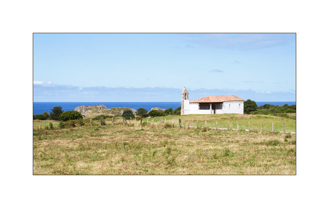
11. Another quick hop to discover another natural arch: El Castro de las Gaviotas. We park towards a pretty chapel.
12. Small cove in the cliff…
13. The arch still partially hidden.
14. And here it is complete.
15. After looking for almost two hours for a place to boondock because of the crowds at this time of the year, we finally found a nice place to sleep, at the bottom of the Picos de Europa, near the ocean and accessible only thanks to VivaLaVida’s 4-wheel drive.
16. The ocean is close.

17. The view behind our camp.
18. Pastel twilight…

To be followed soon!
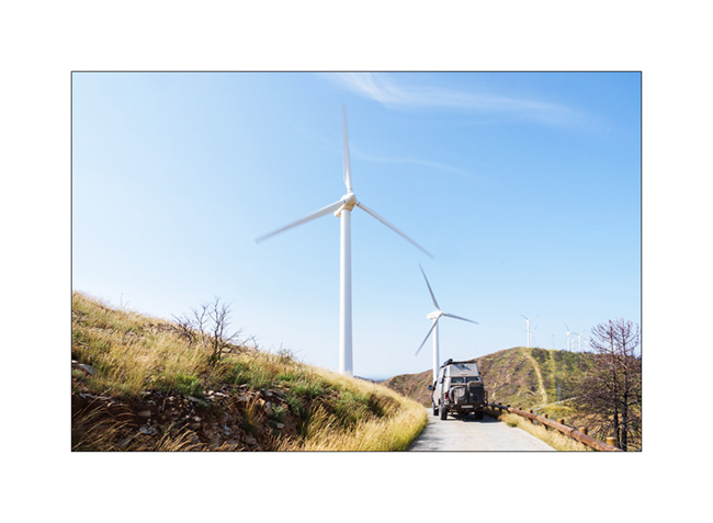
Navarre and Basque Country…
1. As we continue our progress towards the West…
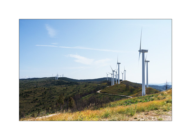
2. … we take a short break in a wind farm.
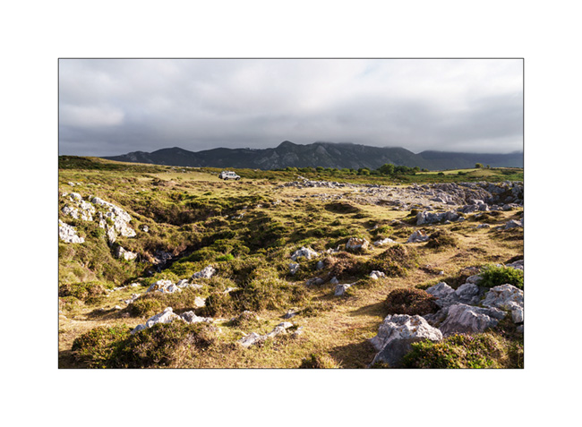
3. Around midday, we reach Urbasa Natural Park, a gorgeous karst plateau between 2,400 and 3,000 feet above sea level.
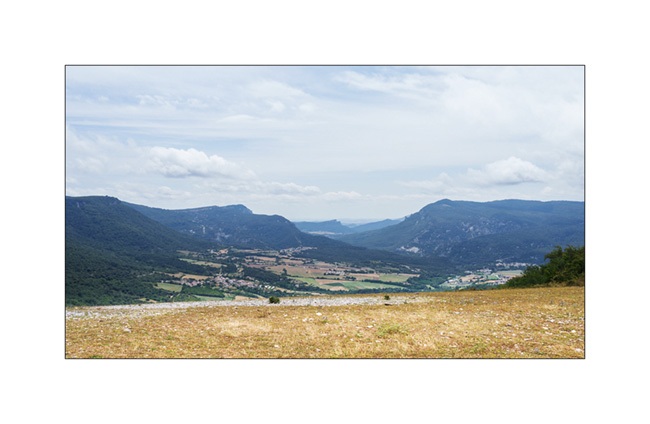
4. After lunch, we go for a walk there.

5. Cliffs…

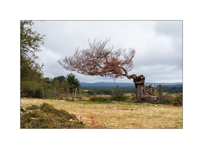
6. Distorted silhouette…
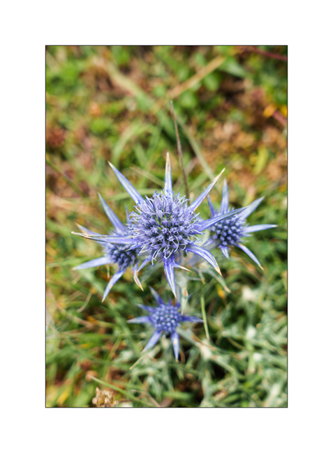
7. Beautiful blue thistles dot these high pastures.
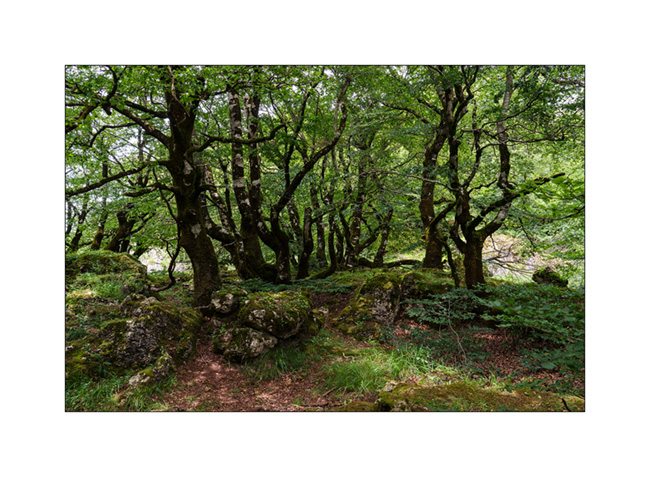
8. Dense forest at the Northwest end of the plateau…

9. …
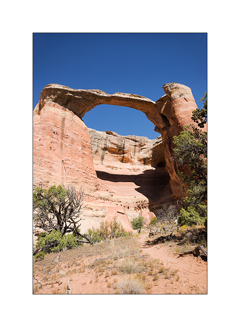
We then head Southeast of Bilbao in search of a natural arch, the Oyo de Aizulo, in the Basque Country.
10. After a walk in a light rain, we arrive at the entrance of this magnificent double arch.
11. Its dimensions are quite impressive! Here the lower arch, probably around ninety feet high.

12. And there the upper arch through which you access the site.

13. The same from above.
14. Selfie ! 😉
15. The next day, after the rain stopped, we go discover an impressive waterfall, the Salto del Nervion which, with its 666 feet, is the highest waterfall in the entire Iberian Peninsula.
As a gate now prohibits access to the trail, it’s after an approx. 2 hours hike that we reach the site to discover a completely dry waterfall! Too bad, it must be quite impressive when the Nervion flows there.

The next post will be more “oceanic” with the arrival of VivaLaVida in the Bay of Biscay… 😉
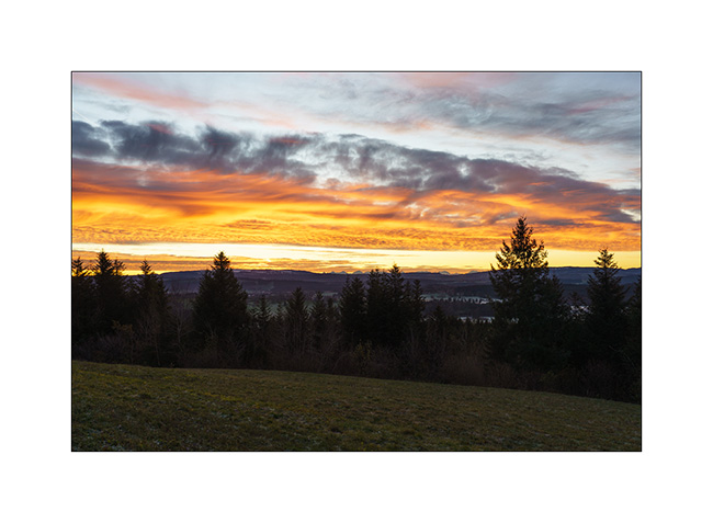
Last outing of the year in the Doubs
While I was hoping to do another 2-3 weekends in VivaLaVida before storing her for the winter, a family celebration and an episode of gastroenteritis for Emile only let us make one last bivouac of the year on the last November weekend.
We went discovering two natural arches located in the Doubs department, south of Montbelliard in France.
1. Here we are not far from the first arch.
2. After a short climb, we walk along the cliff towards the arch…
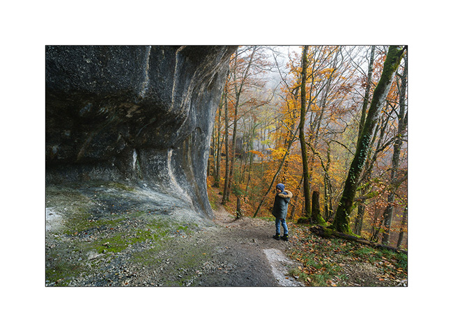
3. … which soon appears through the fog.

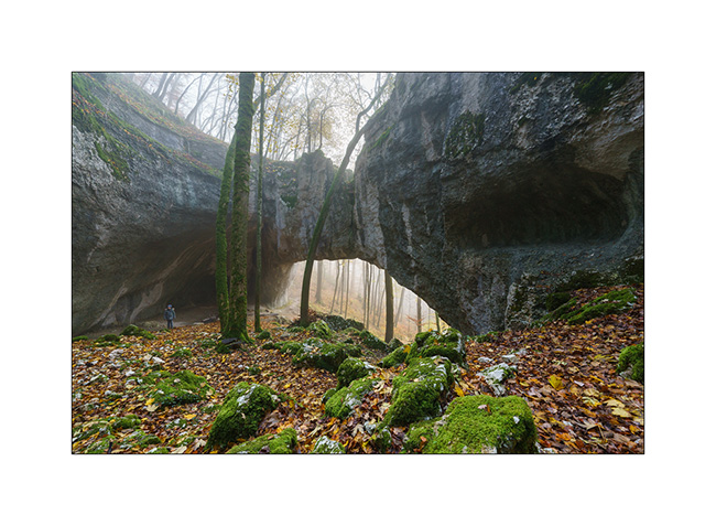
4. Called Cave of Bisontin, the arch was created by the collapse probably several thousand years ago of the roof of a large cave created by infiltrations in the limestone rock.
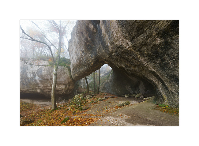
5. The arch is quite impressive with a span of about hundred feet. It is the largest I have seen in Europe so far.
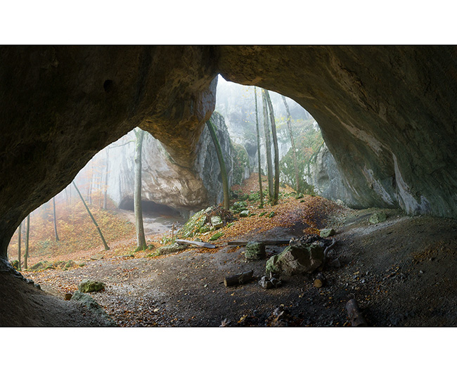
6. Emile gives the scale as the fog creates a particular atmosphere.
7. To reach the second arch, the path is steep as it follows a limestone ridge with cliffs on both sides. While the fog makes everything very slippery, I give up going there with Emile as a slip would certainly lead to a serious accident.
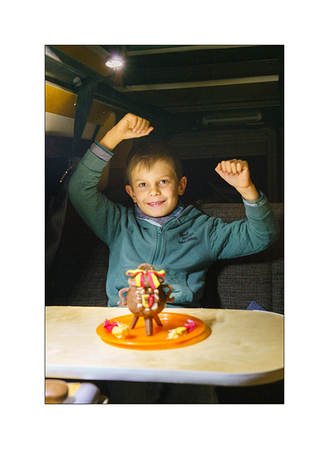
We go boondocking on a viewpoint above Maîche where we cook a good sauerkraut on our last campfire of 2022! It is also an opportunity to break a “Marmite de l’Escalade” (chocolate pot) a few days in advance, a Geneva tradition which commemorates the attempted invasion of 1602 by the Savoyards.
8. Chilly wake up…
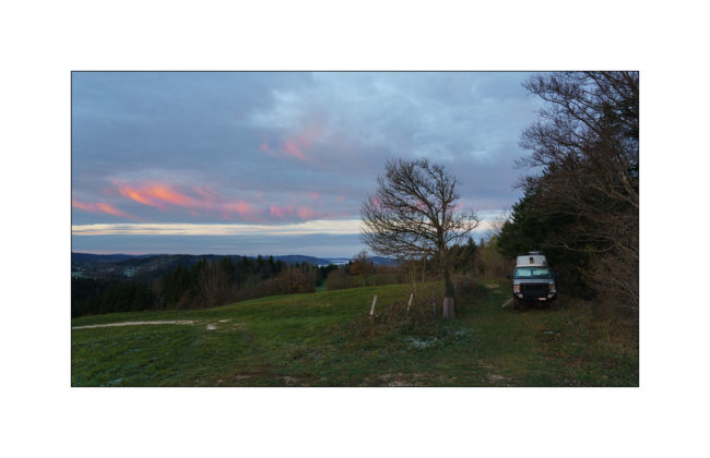
9. … above the mist…

10. … with beautiful colors.
11. On the return trip, VivaLaVida crosses the symbolic bar of 300,000 km (186,000 miles). It’s not huge for a vehicle that drives in America – those with between 300 and 500,000 miles are quite common – but given the miles driven on trails – probably approx. 35,000 since I converted VLV to 4×4 – and the twisty roads of Europe, that’s already a respectable mileage. 🙂

After this outing, VivaLaVida went back to its winter shelter. I am already looking forward to the next adventures she has in store for us!
Thank you again to all of you who follow our modest peregrination on board. I already wish you Happy Christmas time. 😉
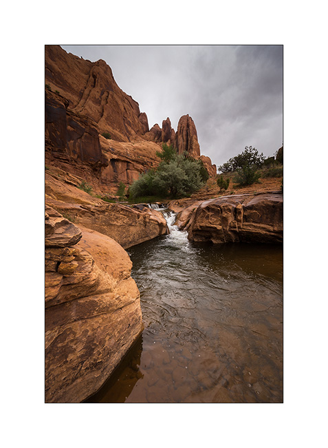
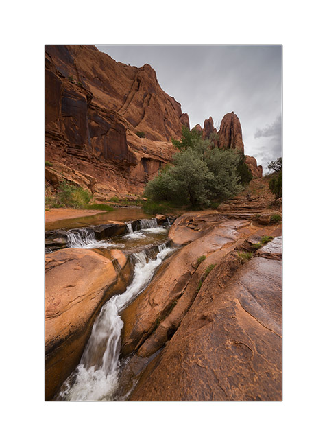
Getaway in France
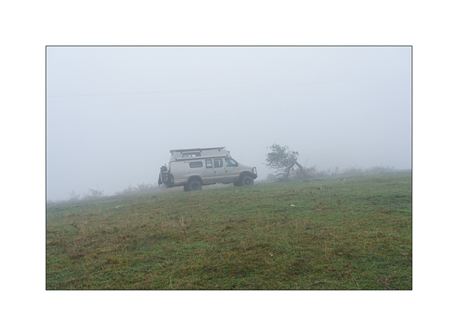
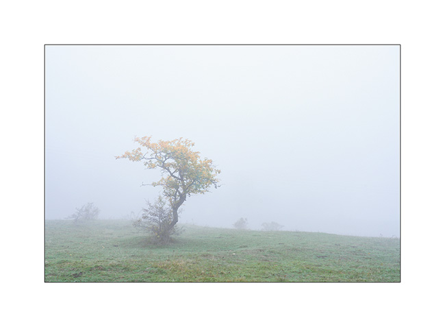
As fall holidays are approaching, we camped south of the Ain to discover a beautiful natural arch that had been on my bucket list for quite some time.
1. Through the fog…
2. Spooky silhouette…
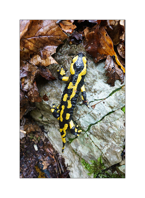
3. After finding our boondocking place, we follow the path that leads to the arch and we have a great encounter : a beautiful spotted salamander! Glad to be able to show it to Emile when it becomes more and more rare to meet them…
4. And here we are at this beautiful natural arch, created by a collapse following the digging of a trench in a limestone shoulder in order to pass a pipe through. Emile gives the scale ! 😉
5. In fact, it’s even a double arch; here the secondary arch of approx. 10 feet wide, smaller than the main one which should be around 25-28 feet wide.
6. The place reminds me of some of the arches discovered in America during VivaLaVida’s journey.
7. Last look before heading back to our camp.
8. On the way back, we somewhat searched for the path that fades into the vegetation, forcing us to cut through the woods to find our way back. We then enjoyed a lull that allows us to taste a succulent salmon & vegetables cooked on the campfire.
Return on Sunday by some logging roads under the showers. Now, I’ve to prepare VLV for the departure on vacation in a few days.
Thank you for your loyalty and see you soon here! 😀
Arch and highlands…
As written at the end of the previous article, I went to discover a natural arch, one of these natural formations that always attract me much. These, called Aspen Arch, is fairly isolated. To achieve it requires first finding your way through a maze of various tracks more or less maintained and then, about 20 miles further, to hike through virgin nature on a sometimes steep mountainside.
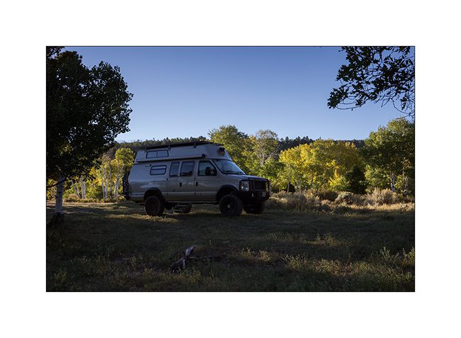
1. The place I left VivaLaVida for a few hours…
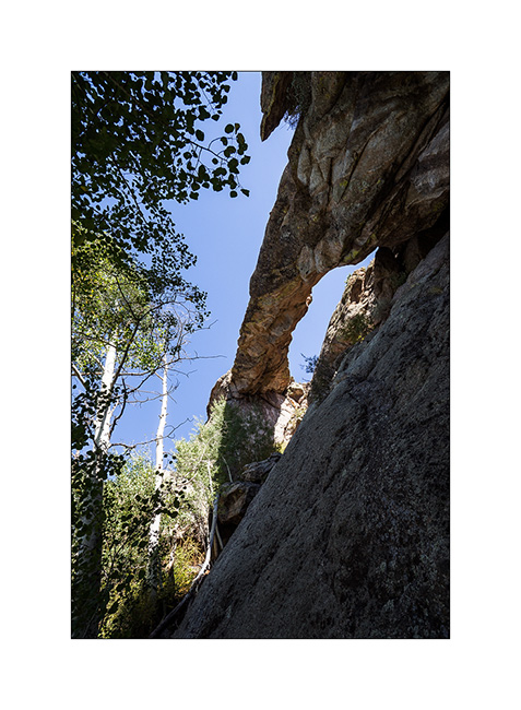
2. After 3 hours hijing and some pretty climbing, I discover Aspen Arch.
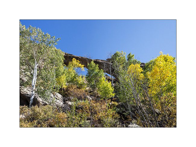
3. Its about 70 feet long impress!
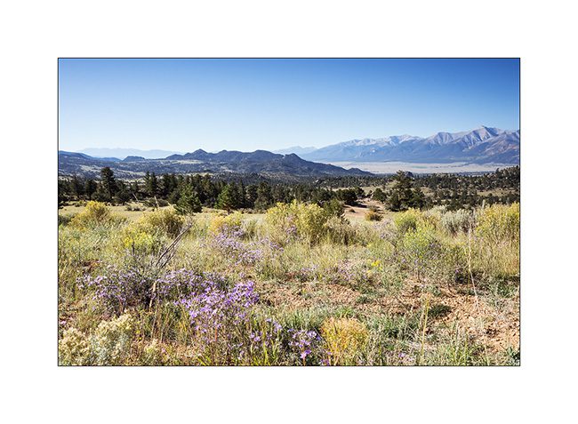
4. Continuing her way eastward, VLC crosses beautiful highlands.
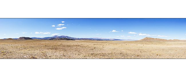
5. Lost ranch…
6. Looks like the Altiplano sometimes, here with a salty pond…

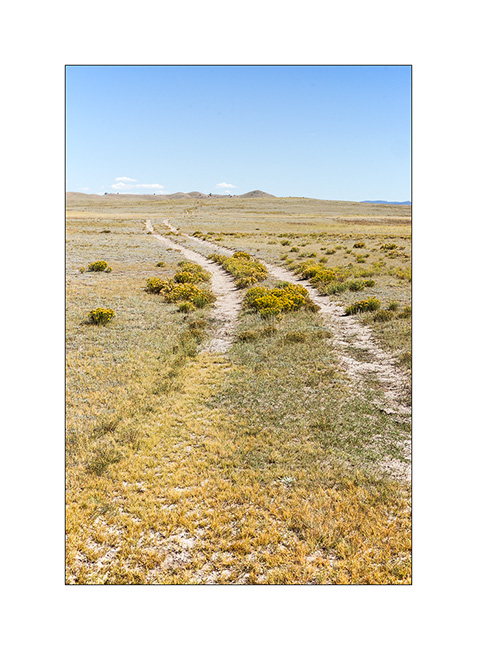
7. The track is not very marked in places…
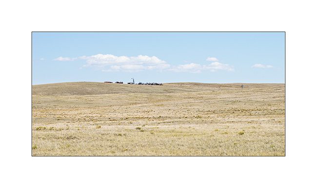
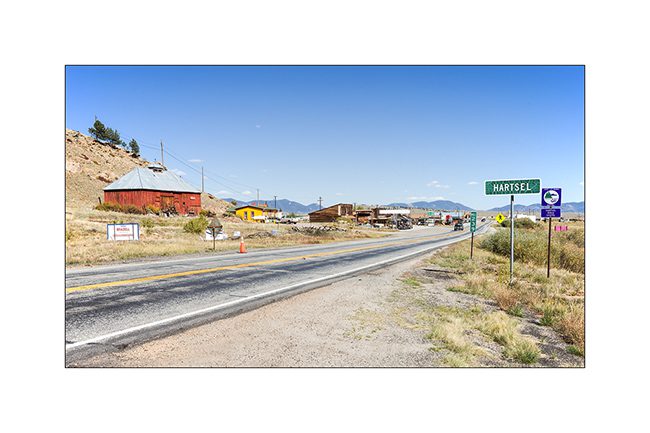
8. In Hartsel, small highland village…
9. Another ranch, a bit further, as VLC approach the last mountain range before the great plains, laste Rocky Mountains range eastward.
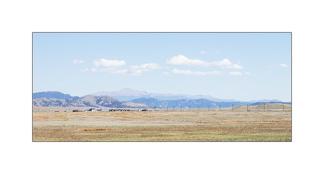
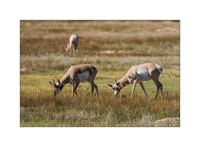
10. Not far from the road, a small group Pronghorn antelope, the last species of wild antelope in North America.
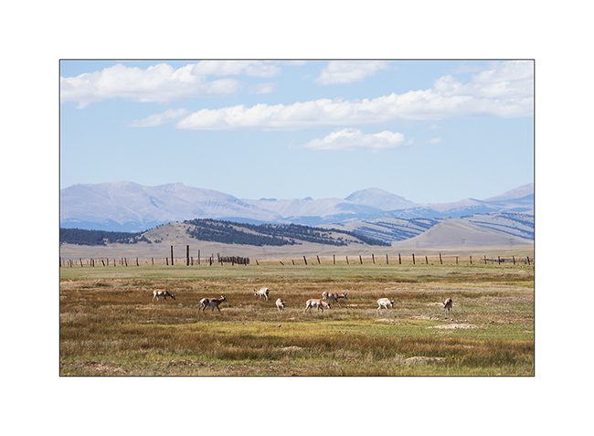
11. With some patience, I let them approach.
12. VLC sometimes serves me as a blind! 😉

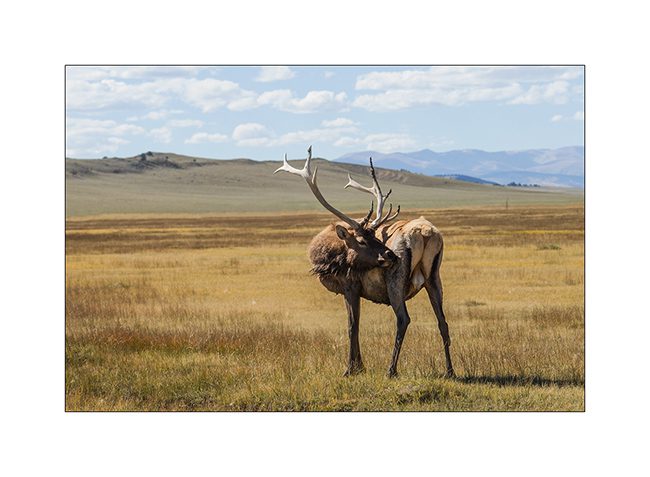
13. Only a few miles further, a new unexpected meet: a beautiful deer that VLV hardly scares.
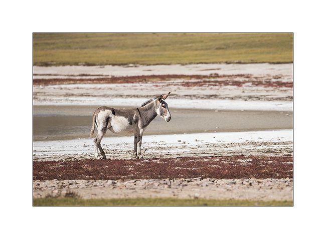
14. And a small band of burro, wild donkeys.
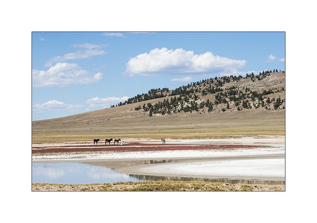
15. That day, they were more fearful than the deer, I couldn’t approach that much!
Continuation and end of my crossing of Colorado in a few days…
Sandstone du Colorado…
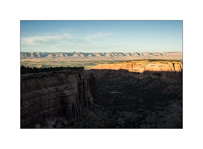
J’ai décidé de faire quelques détours sur la route de l’Est, en commençant par la découverte de quelques arches naturelles. J’ai traversé le “Colorado National Monument” qui n’a rien d’exceptionnel à mes yeux puis emprunter une piste assez rocailleuse sur une vingtaine de kilomètres.
1. Colorado National Monument, de hautes falaises de sandstone.
2. N’ayant pas trouvé la piste alors qu’il faisait nuit, j’ai dormi sur Grand Mesa, à 2’680 mètres d’altitude.
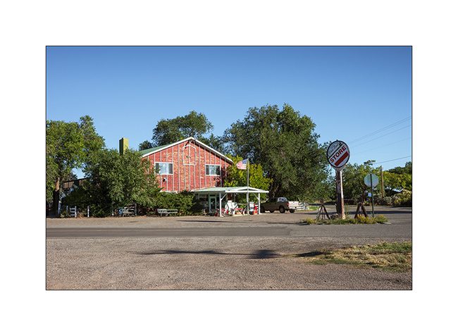
3. General Store perdu…
4. Ela Natural Bridge, non loin de là.
5. A défaut de puma que je n’ai toujours pas vu, j’ai aperçu une espèce extrêmement rare : un jeune éléphant d’Amérique ! 🙂
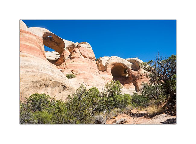
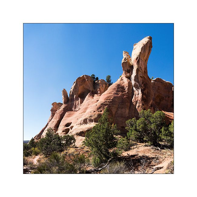
6. La rim que je découvre comporte cinq arches naturelles, ici celle de Hole in the Bridge Arch ainsi qu’une autre sans nom.
7. Sandstone…
8. Aérienne Centenial Arch.
9. Le vente et la pluie ont sculpté la sandstone.
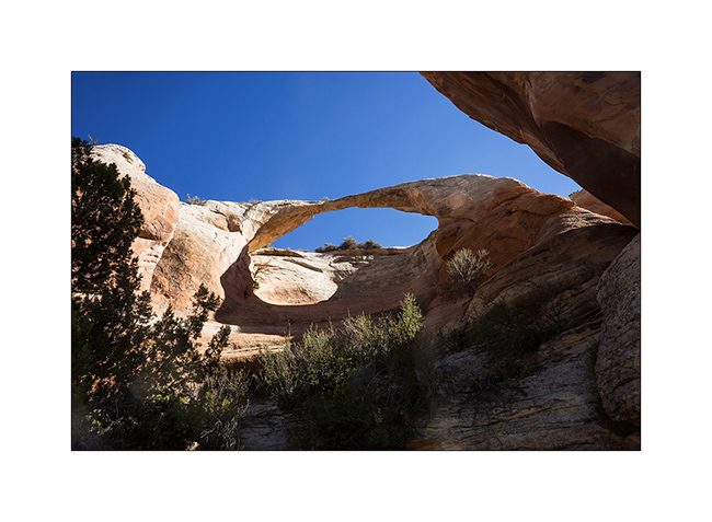
10. Et au bout du sentier, voici Rattlesnake Arch, l’arche du serpent à sonnette (que je n’ai pas vu là…).
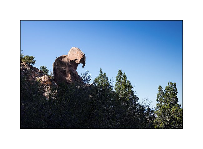
11. Un rocher en équilibre sur le flanc du canyon…
12. Ayant découvert une autre curiosité à découvrir (dont j’ignorait l’existence jusqu’à un panneau au trailhead), j’ai dormi sur place. La couchant m’a gratifié d’une lumière très inhabituelle, le grand feu de forêt sévissant actuellement au Wyoming envoyant sa fumée dans le ciel…
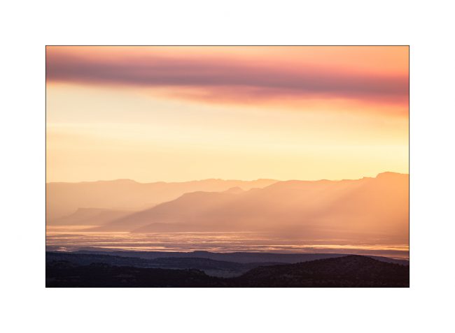
13. Couchant…

Voilà pour aujourd’hui. Découverte de l’une des plus grandes alcôves du continent nord américain dans la prochaine update… 😉
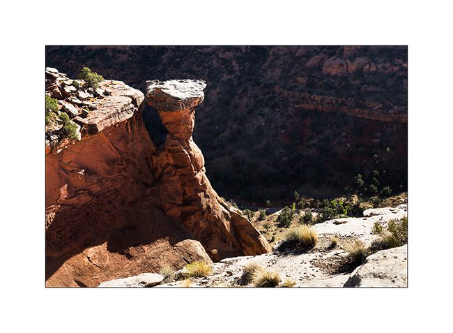
Hikes in Utah…
During Memorial Day Weekend, I held waiting for mechanical work on VivaLaVida discovering some surrounding canyons.
1. Going up Mill Creek canyon in a rainy day…
2. … I discover this pretty small waterfall.
3. Higher in the canyon, is a cave whose traces of soot on the vault attest that it served as a shelter for Indian people years ago.
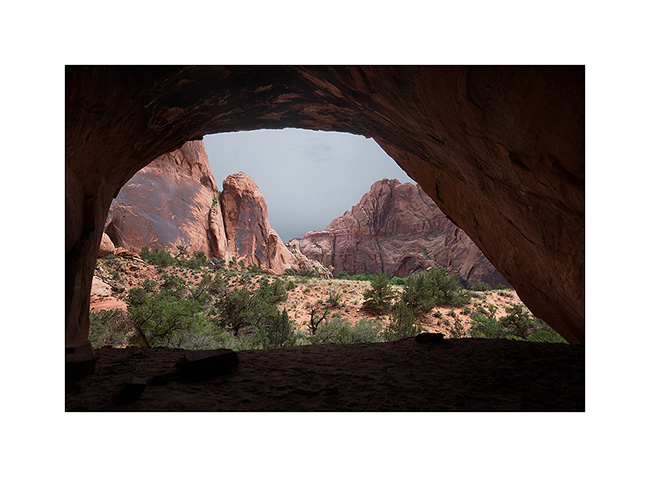
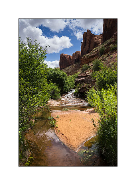
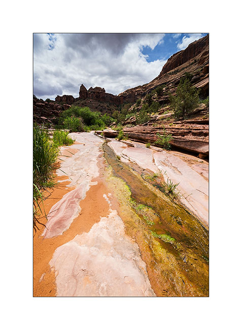
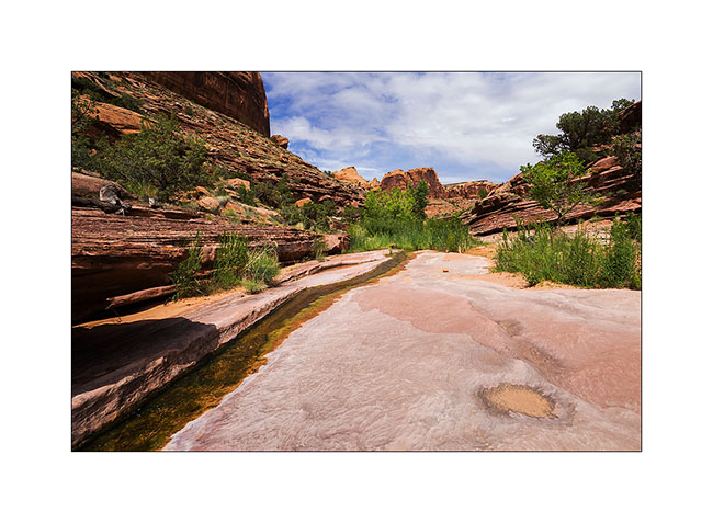
4. The next day I went discover the Negro Bill Canyon, renamed since with an unpronounceable name for “political correctness” reasons. The unusually wet spring in this region provides more water and greenery than it’s common here.
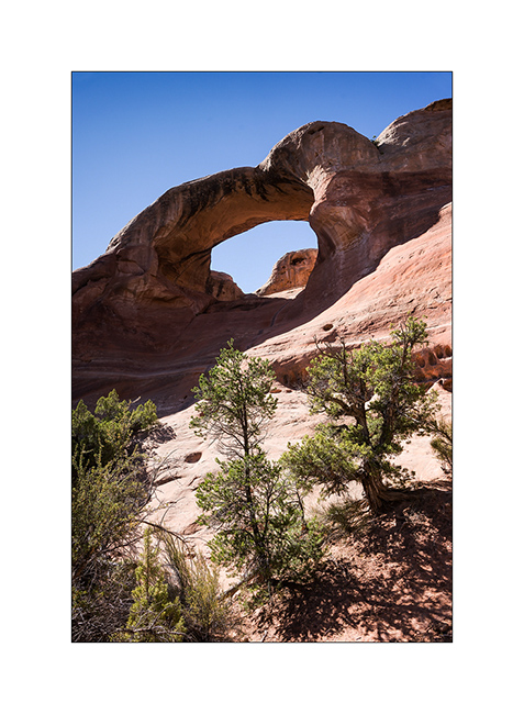
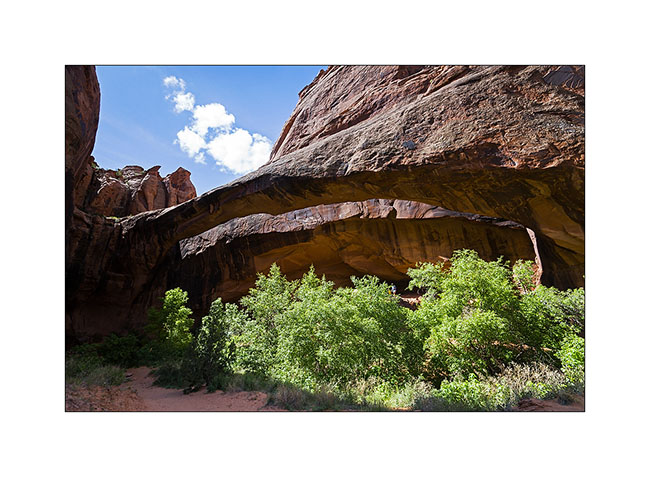
5. Arriving near Morning Glory Arch.
6. It’s a place where tourists offer some thrills rapelling from about 120 feet.
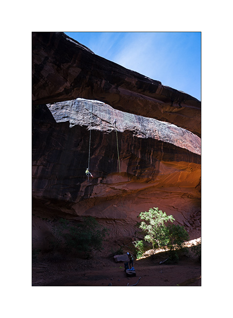
7. There is quite some air with a second portion away from the overhanging cliff.
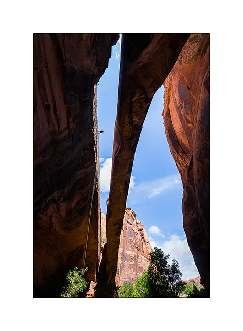
8. Giant arch.
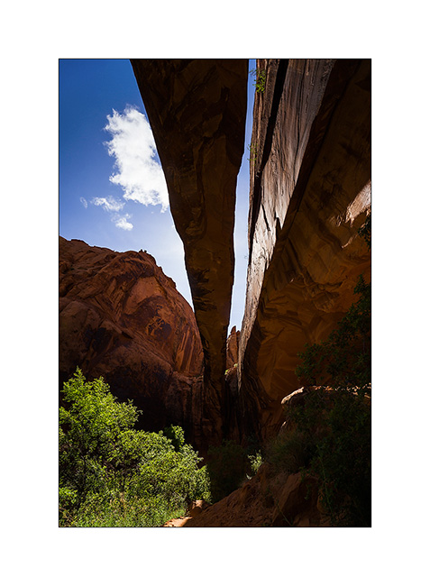
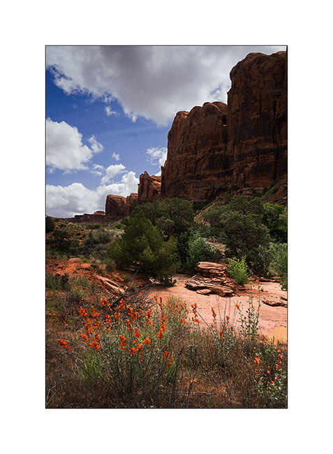
9. Hiking higher in Negro Bill Canyon, widely flowery.
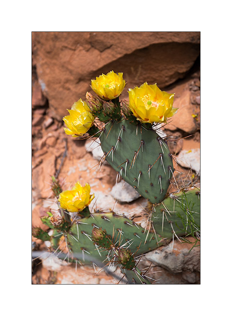
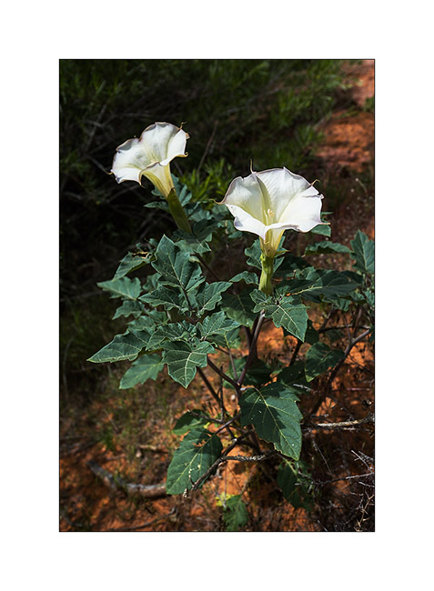
10. Cacti offer many yellow ar roses flowers.
11. Small waterfall down the cliffs.
12. This one looks like a lys…
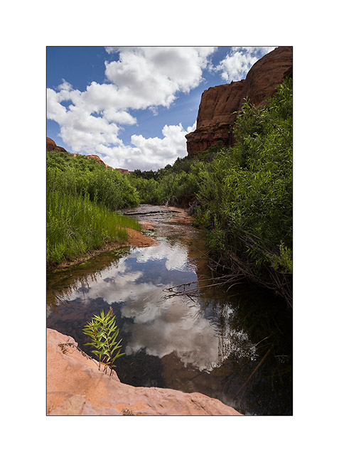
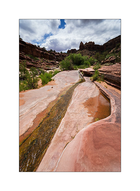
13. Not far from the mouth of the canyon, water runs on the sandstone.
14. The place is wild and desert despite the crowds of Memorial Day.
15. Last compo before going back to VLV and heading to Salt Lake City to do the work on VLV.
To be followed soon. 😀