Italy
now browsing by tag
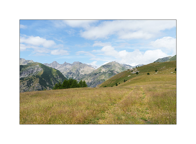
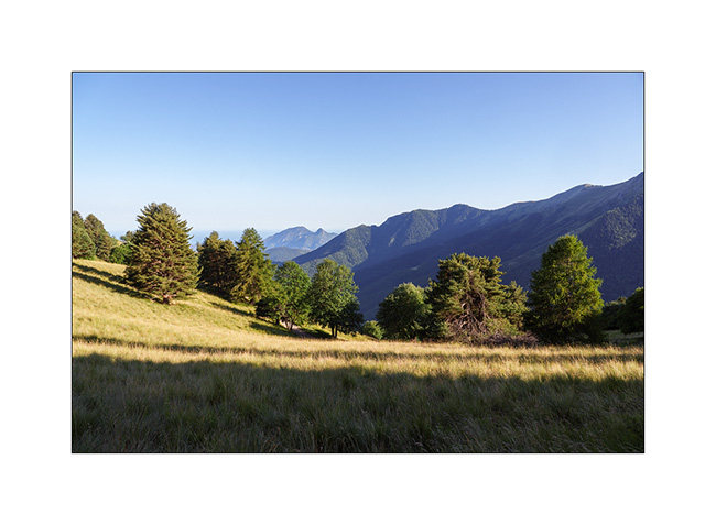
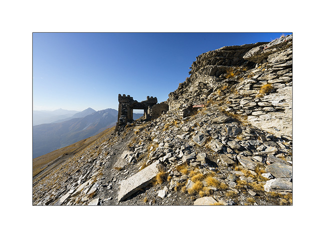
Jafferau fortress and Ecot Gorge
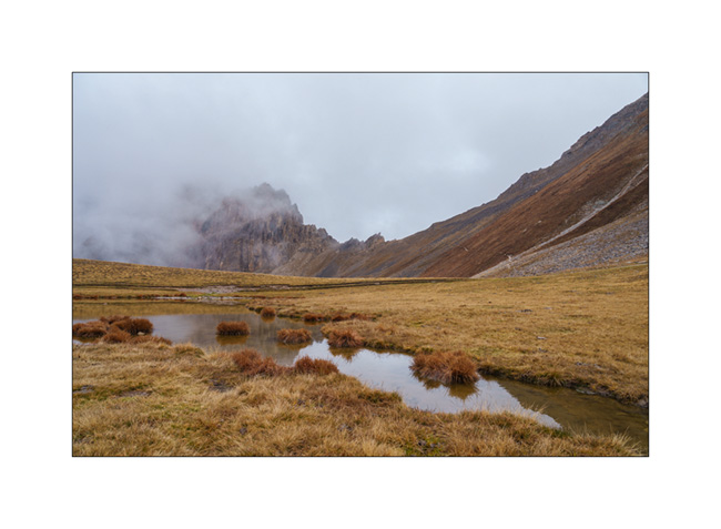
1. Fredda Valley in the morning.
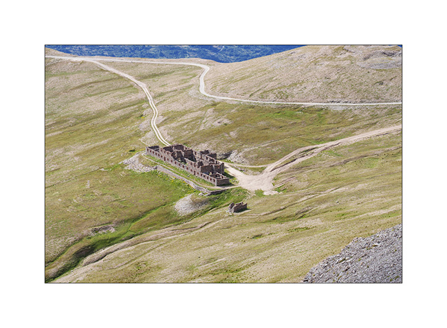
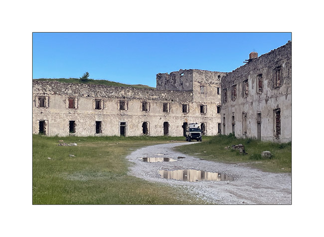
2. Barracks of Pass Jafferau.
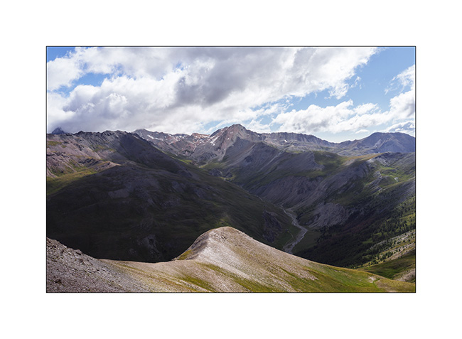
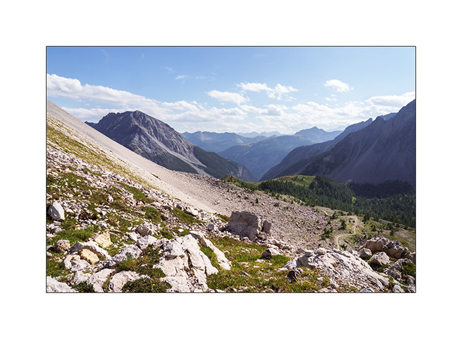
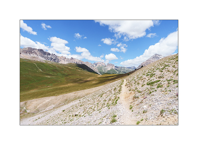
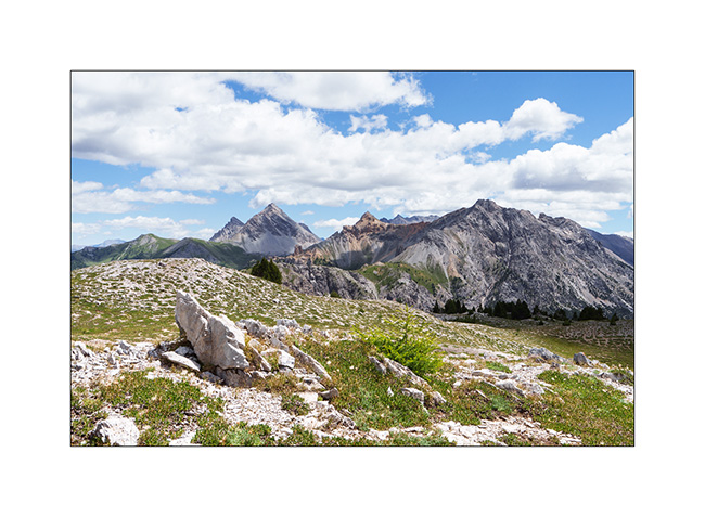
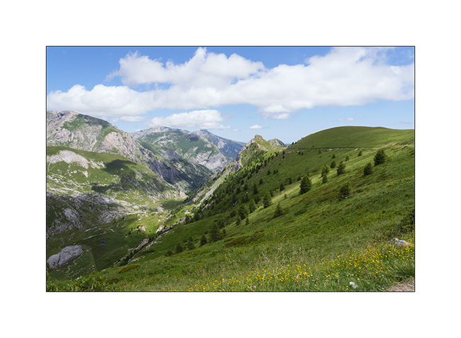
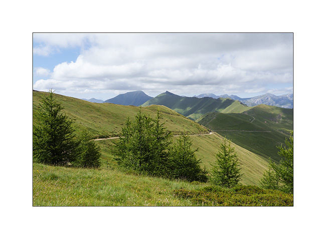
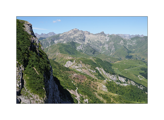
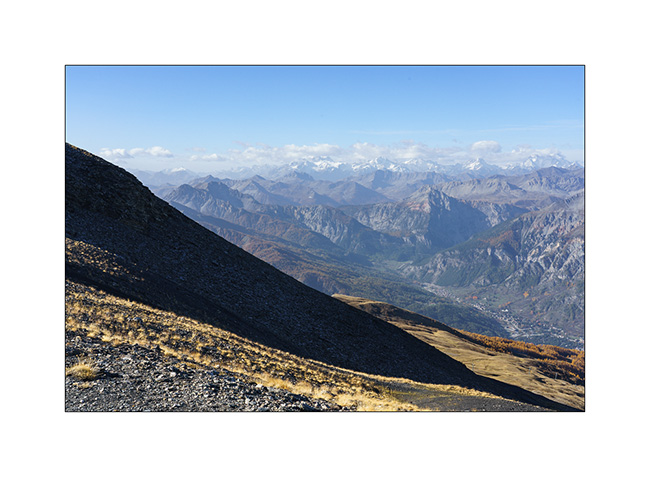
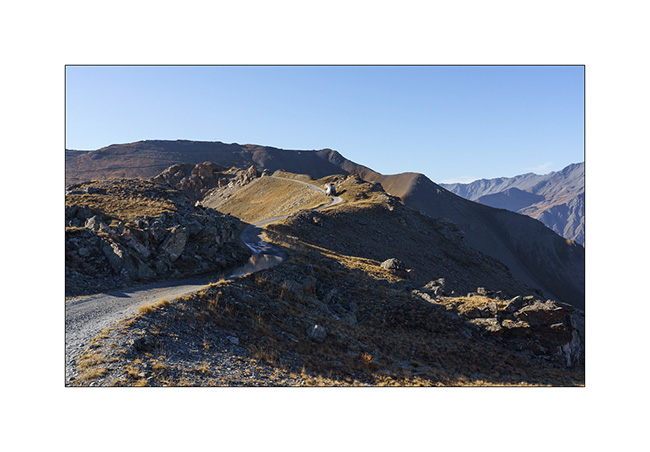
3. From the summit, the panorama towards South with the track that brought us here. It’s definitely steeper than it seems.
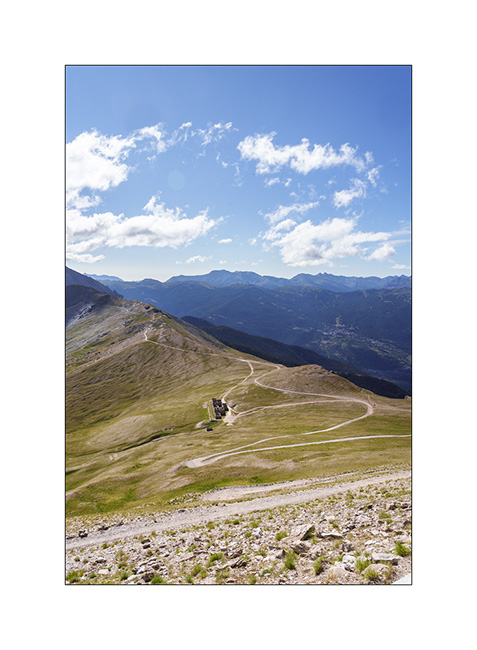
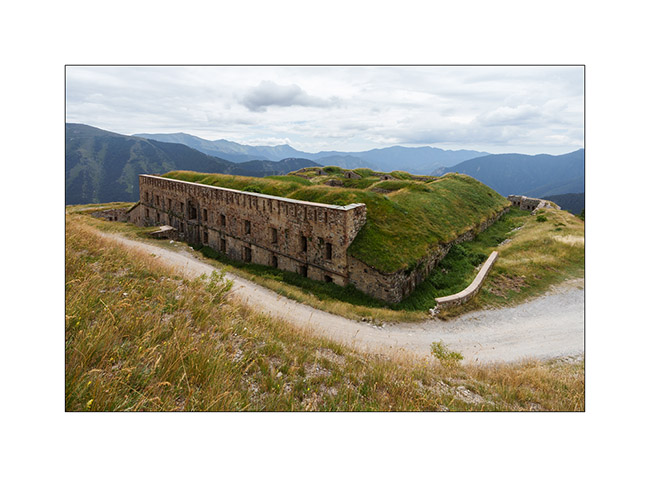
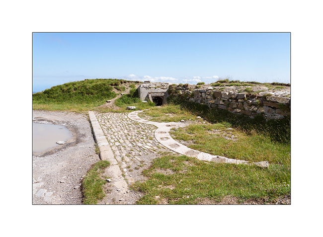
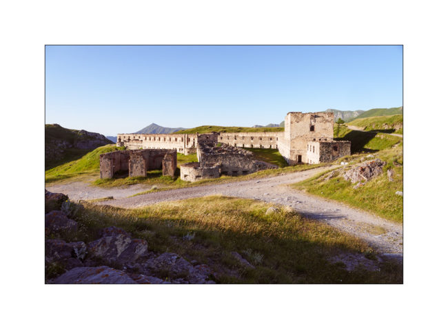
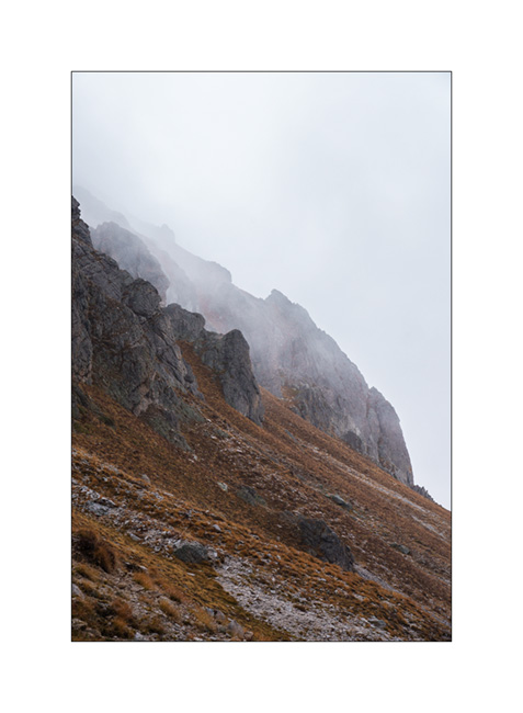
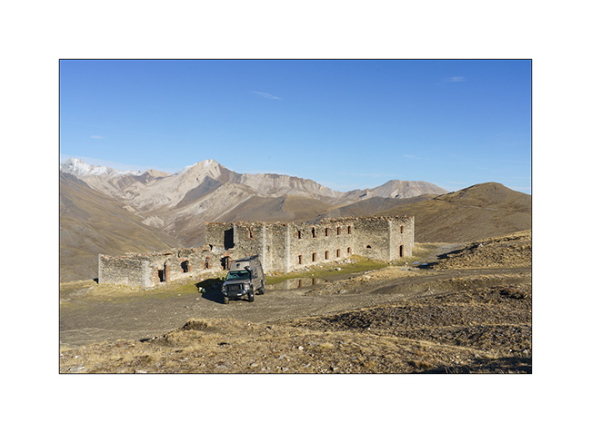
4. Jafferau fortress ruins.
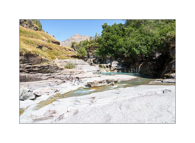
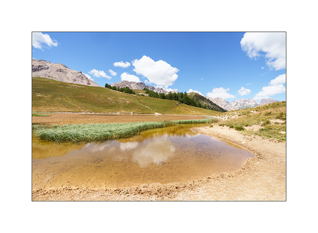
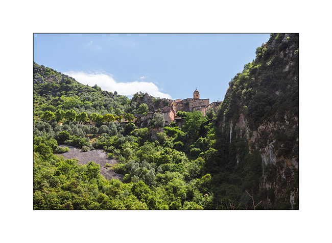
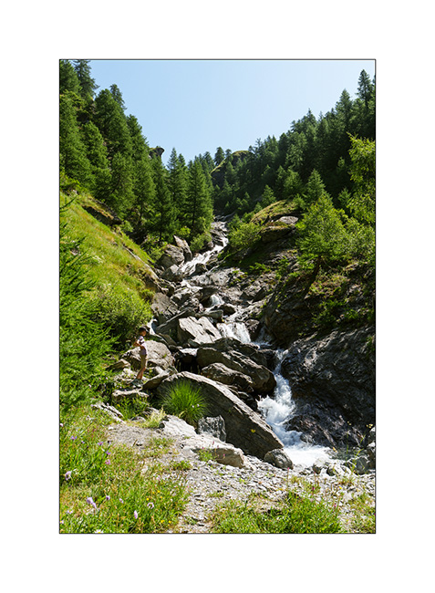
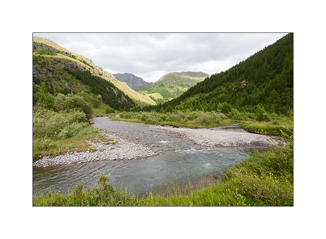
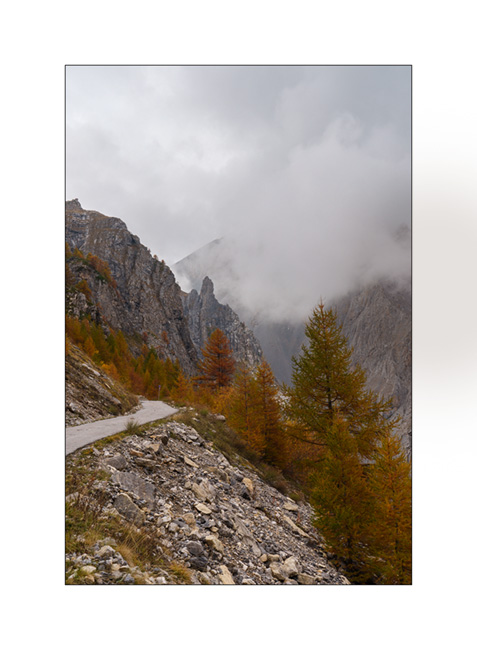
5. After a boondocking at Mont-Cenis, we go discover the Gorges of l’Ecot, above the village of Bonneval-sur-Arc.
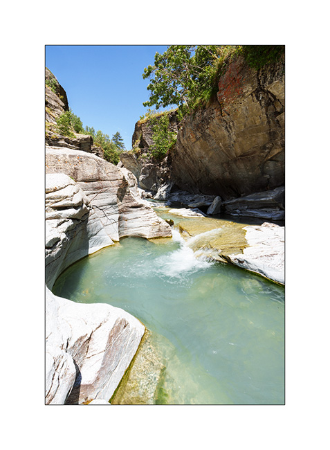
6. One part – just about an hour’s walk from Bonneval – is spectacular.
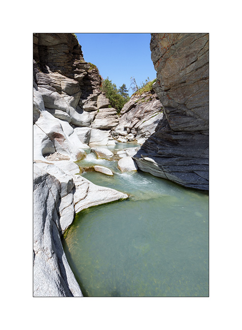
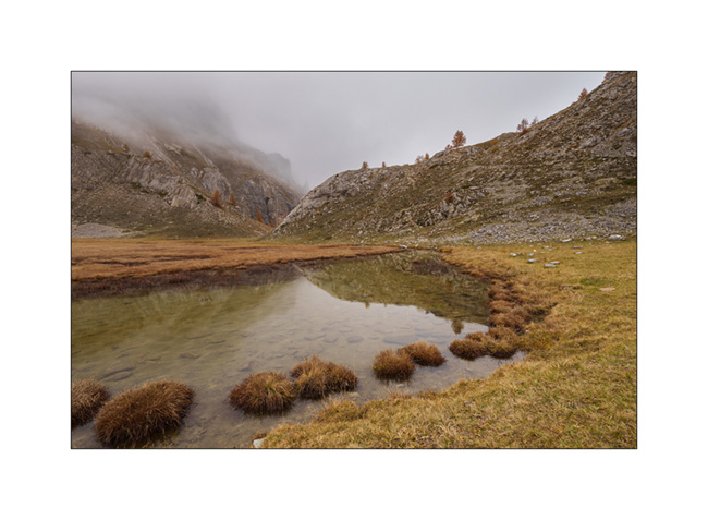
7. When water carves rock.
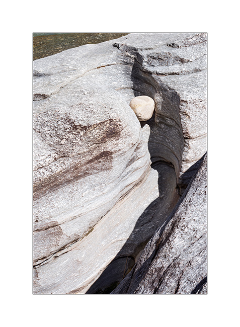
8. There are some beautiful pots.
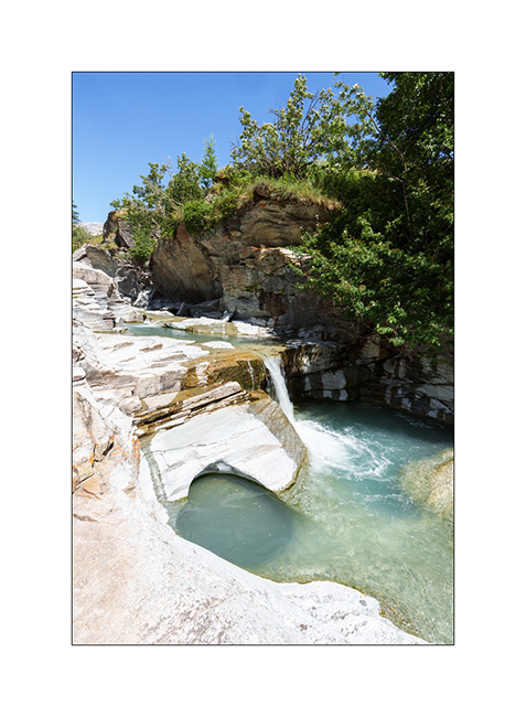
9. Wide shot of the lower entrance to the gorge.
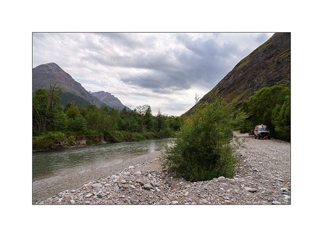
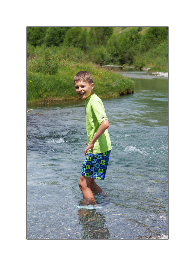
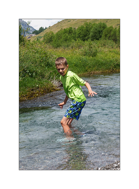
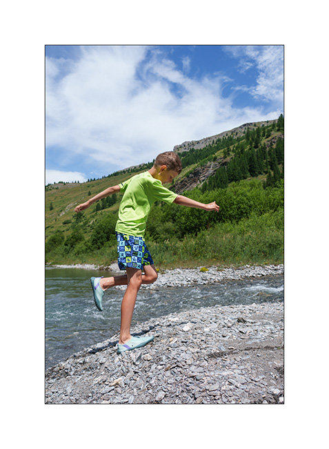
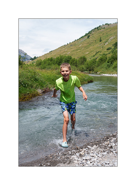
10. We go sleeping further down in the Arc Valley, after having crossed it by ford to reach a quiet spot.
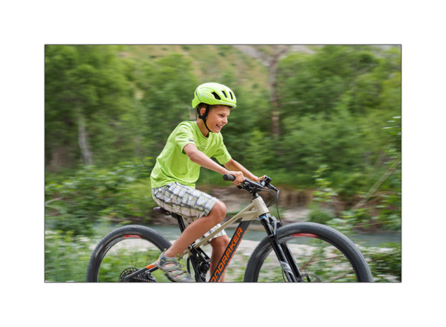
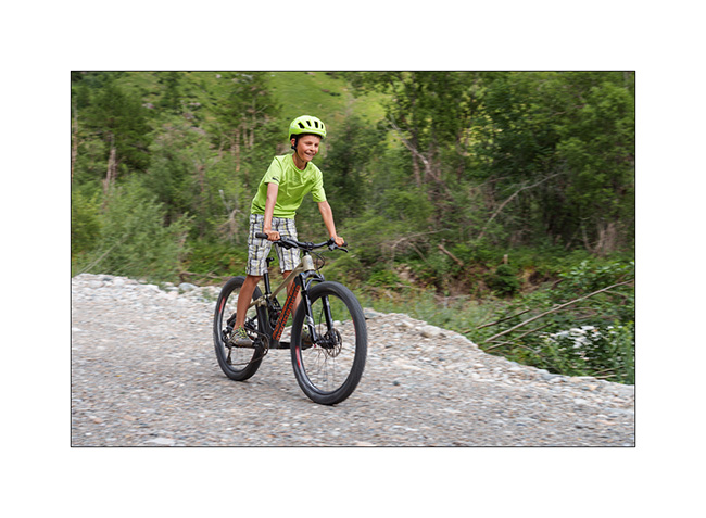
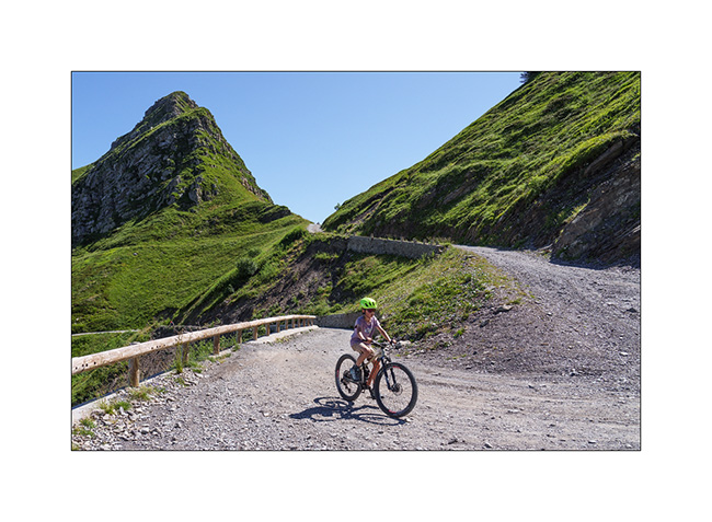
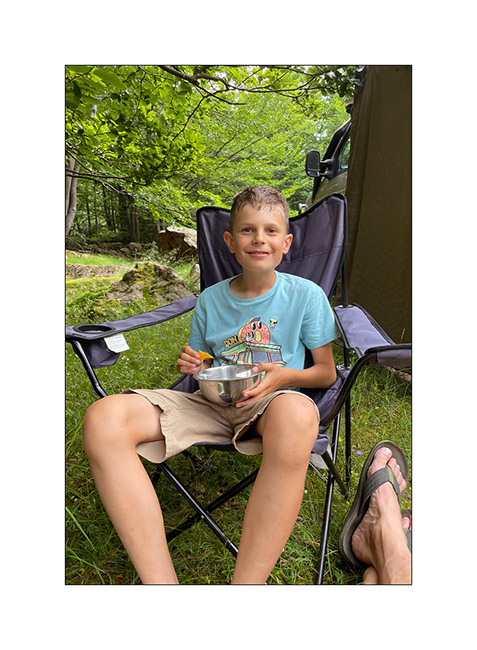
11. Emile takes the opportunity to practice his cycling! 🙂
12. …
There is one last post to publish soon which will conclude the story of these short summer holidays. 😉
Monviso – Bardonecchia area
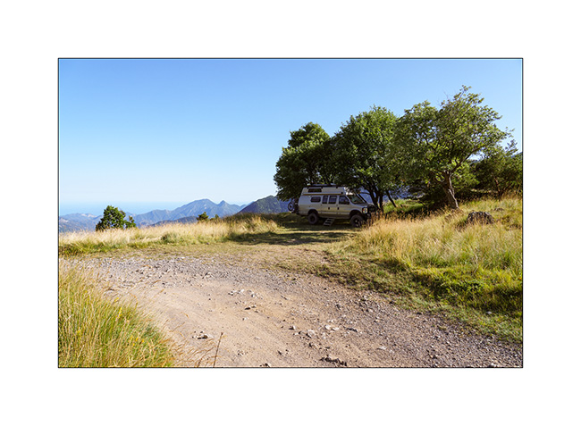
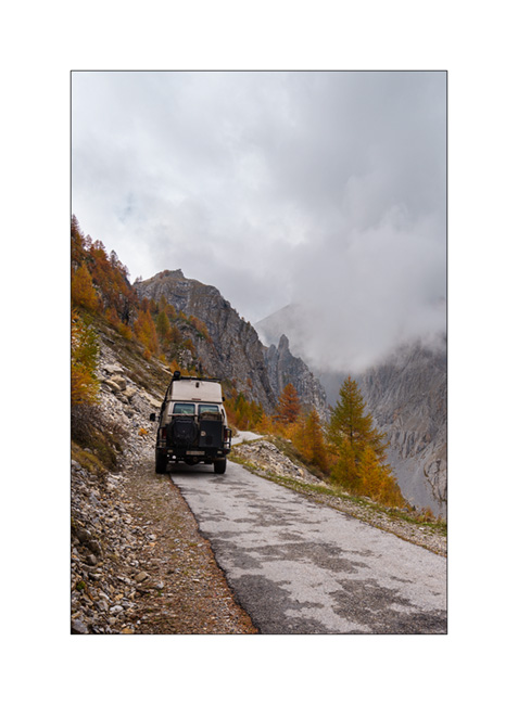
1. Here we are again on the Alta Via del Sale but on its western part.
2. …
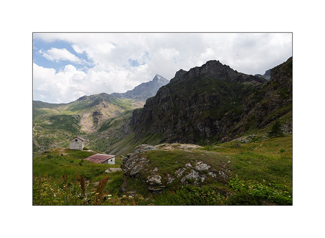
3. The Marguerie fortress where we spend the next night.
4. I go exploring part of it but don’t stay long because it’s really falling into ruin..
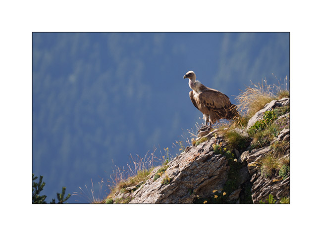
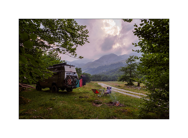
5. An early morning visitor to our camp.
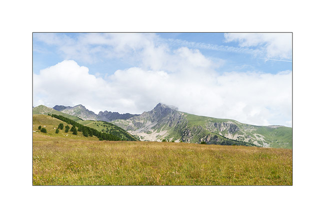
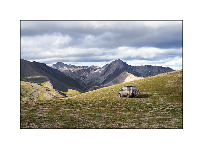
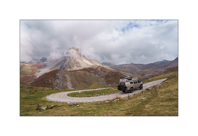
6. As we begin our journey toward North, we go discover Monviso, the main Italian peak in the Southern Alps. A view from Pian de Rey. The afternoon convection partially hides the summit.
7. Further down, a small waterfall not far from our camp.
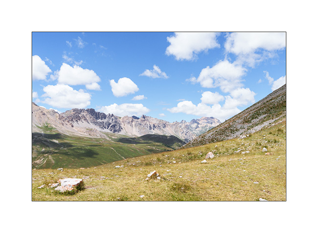
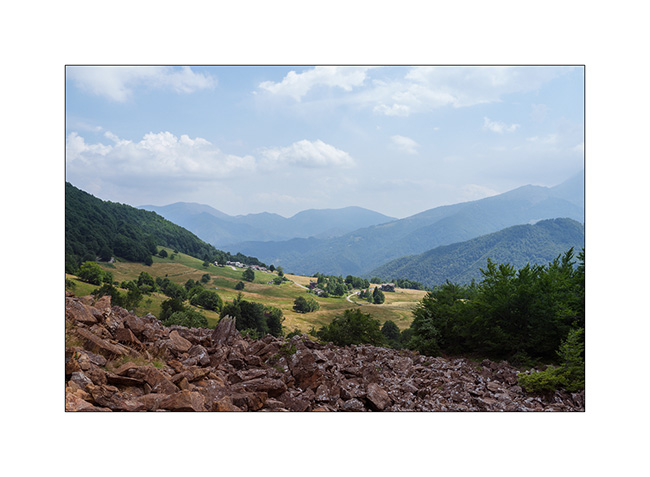
8. View on the valley.
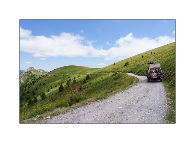
9. Then we head back up towards Bardonecchia to explore the Passo de la Mulatiera region. A narrow trail takes us to an altitude of 6,000 feet. Then we continue on foot to the pass.
10. The large scree slope that lies beneath the Mulatiera fortress ruins. We look at a fearless marmot less than 15 feet away.
11. The next day, we park at the Col de l’Echelle and set off on a hike towards the Col des Thures. After a quite steep climb, we discover the Vallon des Thures and the small mountain pasture of the same name.
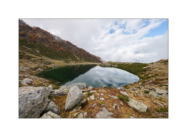
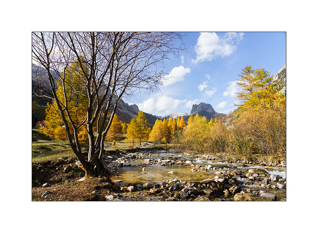
12. Arrival at the superb Chavillon lake with Mount Thabor in the background.
13. I vary the compositions.
14. …
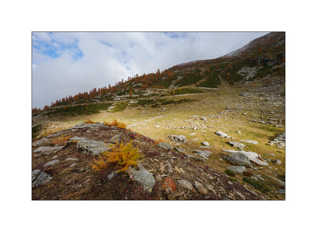
15. Return path through the screes.
16. Last look at the valley.
17. Above the Col de l’Echelle.
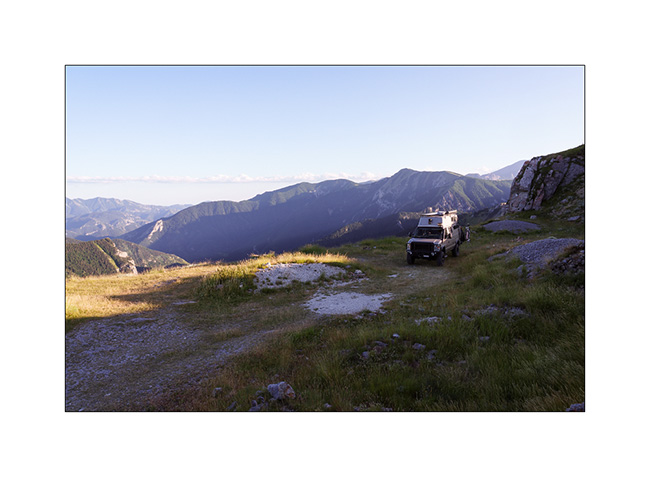
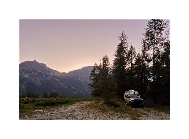
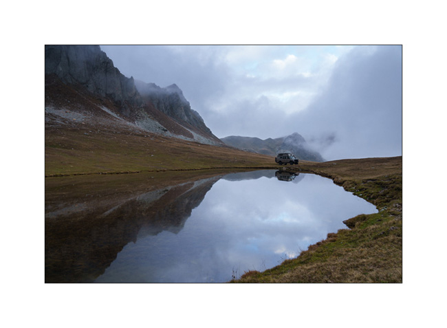
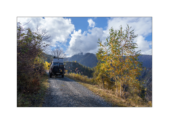
18. Our camp under Mount Jafferau, a spot where we already spent the night three years ago.
The rest of our journey will take us through Mont Cenis, Isère, and the Savoie region. We’ll show you that soon! 😉
Alta Via del Sale
It’s Wednesday. We arrive at the entrance to the High Salt Road, unsure if we’ll be allowed to enter. Officially, the road is restricted to vehicles less than 18 feet long, 5 feet high and weighing less than 3.5 tons..
At the ticket booth where you pay your way, I don’t hide the fact that VivaLaVida is breaking the three previous criteria and I’m glad I did. The attendant tells me that my honesty does me credit and that he’s happy to let me through. He tells me that in an overhanging section, I’ll have to drive close the edge to avoid hitting the rock but that he thinks it should be fine.
We are very happy to be able to discover this legendary trail!
1. In the wellknown hairpin just before the Pass of Boaria, where we turned back on our bikes the day before.
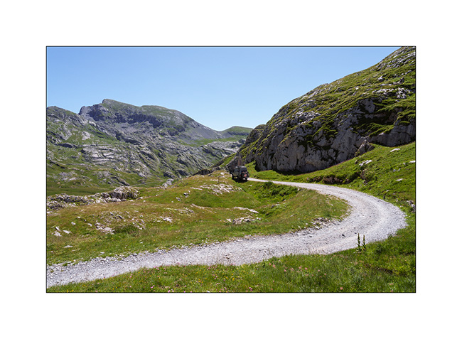
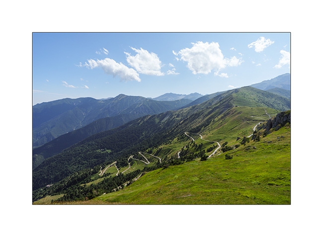
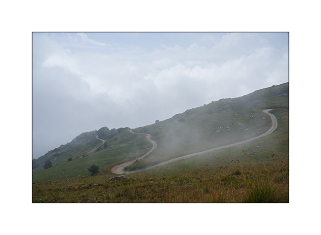
2. The trail winds between 6,000 and 7,200 feet above sea level for around thirty-five miles.
3. Landscape is superb.
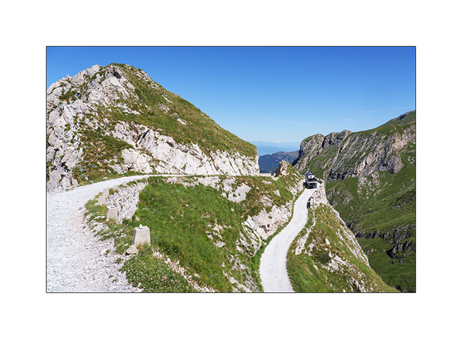
4. After the Don Barbera refuge and the overhanging passage passed without any problem.
5. Part closer to the tree line.
6. Mount Saccarel, at 6,600 feet elevation.
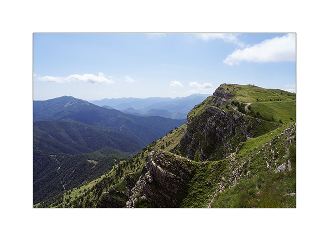
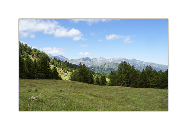
7. High altitude landscape.
8. Former cannon battery of Mount Saccarel.
9. From Mount Saccarel, the trail we will take to descend. It is in poor condition and it will take us more than two hours to reach La Brigue where we will spend the night in a small campground.
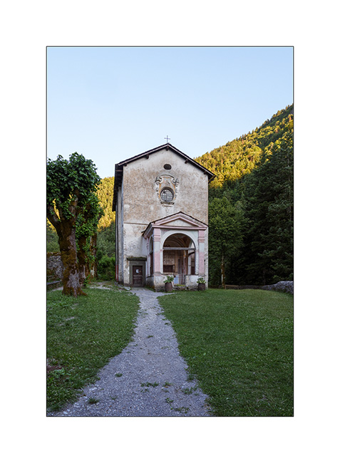
10. Chapel of Our Lady of the Fountains, just before La Brigue.
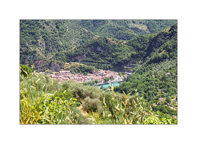
11. After a good night’s sleep preceded by a dinner in a small restaurant, we go shopping food in Breil-sur-Roya and then take a trail leading to the Mercantour Park. Here, the pretty hilltop village of Soargue.
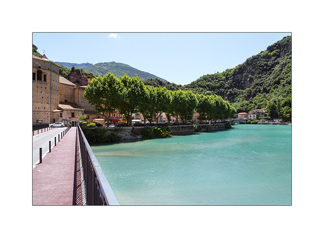
12. Breil-sur-Roya.
13. From a little higher up, where we stopped for lunch.
We meet a Mercantour park ranger who informs us that the heart of the park has been extended and that the planned trail now crosses it and it’s thus closed to all traffic.
He points us to an alternative route that’s a bit of a detour but allows us to avoid the heart of the park. So we retrace our steps to a junction and take the indicated trail. The loop is significantly longer but allows us to discover the hills of the hinterland with the Mediterranean sea in the background.
14. We find a gorgeous bivouac spot a few miles before the Turini barracks which we will discover the next day.
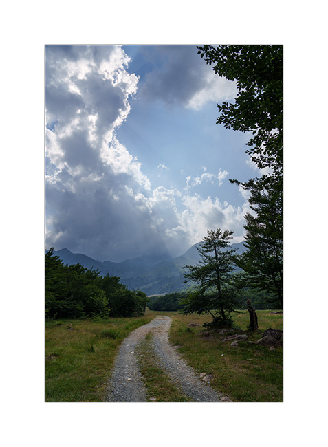
15. Walk at the end of the day.
To be followed soon… 😉
Argentera Valley & Pass of Tende
As previously mentioned, we’re delaying our descent to Tende as the weather isn’t favorable. Emile wanted to return, so we head up to the Argentera Valley. Access is now subject to a toll, with a toll booth on the bridge at the entrance to the valley.
We are a little disappointed to discover that major protection works have been undertaken, no doubt following recent heavy storms. Several areas of earthworks aimed at channeling lateral streams disfigure the lower part of the valley and greatly reduce its charm. Fortunately, higher up, nothing has yet been undertaken.
1. We find a nice spot down by the river.
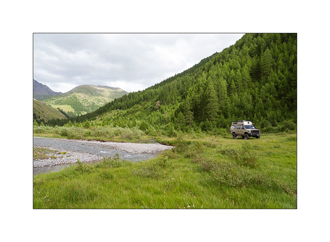
2. View from our camp.
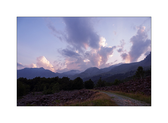
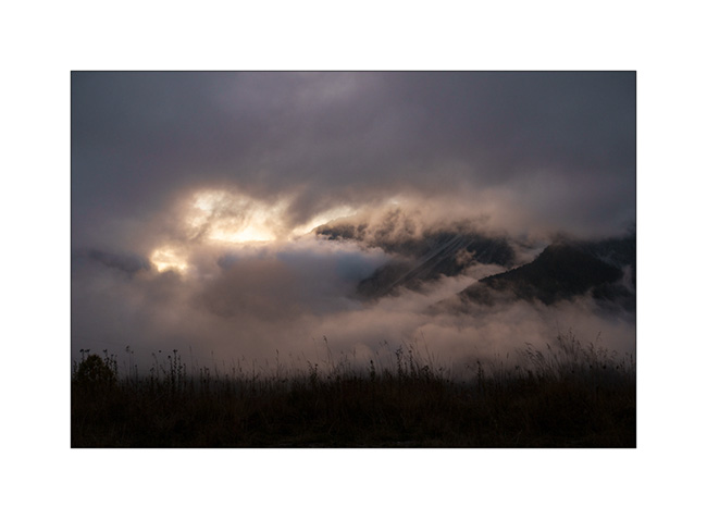
3. End of day tones.
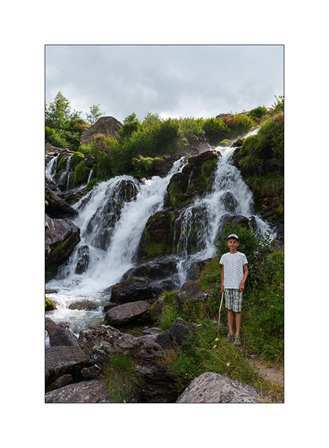
4. The next morning, we take a walk upstream to discover a beautiful torrent.
5. Back at our camp, Emile takes the opportunity to cool off in the river.
6. Brrrr… it’s cold!
7. …
8. But it feels good!
9. The upper part of the valley remains quite wild.
With the weather improving in the South, we head down to Tende where we hope to discover the Alta Via del Sale (High Salt Road), an approximately 55 miles long trail that follows the ridgeline border between Italy and France. We did the Western section in 2017 but not the Eastern loop.
10. The hairpins of the Col de Tende on the French side (South). This trail is closed to traffic for several years.
11. Meet upon arrival at Fortress Central.
12. First night in the barracks, alone that evening.
13. Since it’s Tuesday and the regulated section of the Ruta del Sale is reserved for pedestrians and bicycles on Tuesdays and Thursdays, we set off to discover the beginning by bike. Here, on the climb to Campanino Pass, with Fortress Central in the background.
14. Emile is comfortable on his new mountain bike, even on climbs.
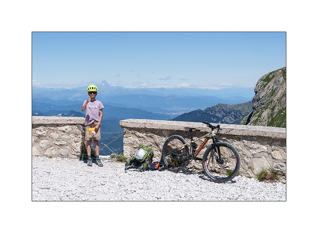
15. In the end, we rided 12 miles and 13,600 feet of elevation gain. Well done to him!
16. Second night in one of the old quarries used to build the barracks, for sheltering as a strong north wind is blowing.
17. Barracks at sunset.
To be followed in a few days…
Technical inspection and start of summer holidays…
This year began with VivaLaVida’s periodic technical inspection, which was once again refused. Almost every time I presented her, the experts found “something else”: this time, they asked for proof that some non-original equipment – there’s a lot on VLV – was already there when imported in 2016. Another point was the non-compliant rear lighting, even though I had modified it following the DTC guidelines when I imported it and haven’t touched anything since. VLV was also rejected for “insufficient parking brake efficiency,” a classic.
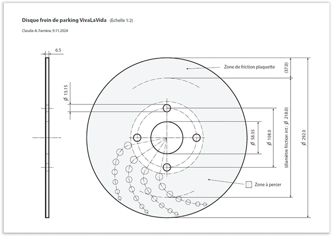
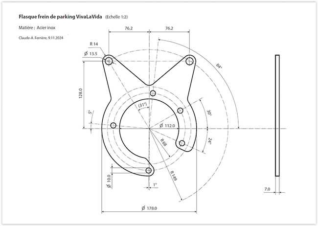
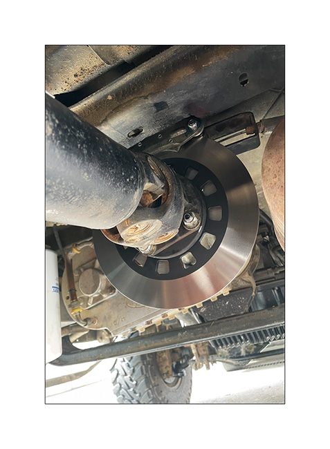
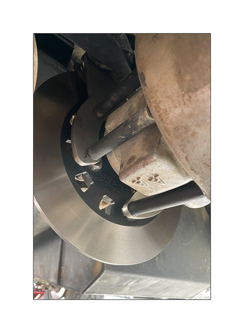
Offroad Accessoires in Geneva – where Andrew, with whom I had done part of the Baja California journey, works and who had carried out the first VLV inspection in Switzerland – kindly issued a certificate indicating that the relevant components were indeed present at the time of importation. On my side, I decided to enlarge the diameter of the parking brake disc to increase its efficiency. The parts were custom machined.
1. Technical drawing of the disc.
2. Caliper flange.
3. Mounted system.
4. …
VivaLaVida presented for a counter-expertise, it was still necessary to go through various administrative procedures before the technical service finally agreed to keep the rear lighting as it was. It was only at the end of June that I was finally able to re-register VLV. Just in time for holidays!
This spring, with Emile staying with me for 4 weeks this summer, I planned to go to Montenegro. But having lost my job at the end of May, unemployment insurance obligations require me to remain available within 48 hours. So I had to change plans and decided to go discover new places in the Italian and French Alps, at a distance that would allow me to return in 2 days if requested.
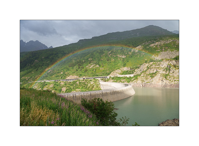
5. First bivouac in the downpour, above the Toules dam, on the climb to the Grand St-Bernard Pass.
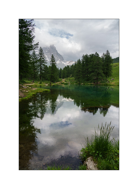
6. The next day, we go to Val Cervinia, which I only know from skiing. The Matterhorn is in the clouds…
7. Boondocking on the southern slope, below Alpe Champleve.
The next morning, we set off to explore a trail leading to the Pian Fum pass and the Sualera mountain pasture, which I had spotted several months ago through my map research. A barrier had recently been installed, which now blocks access to the pass. But we find a lovely spot to camp below, on Alpe Folere.
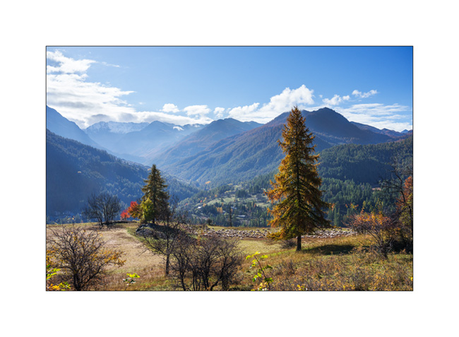
8. We are not far from Turin, in the Alpine foothills.
9. Trail…
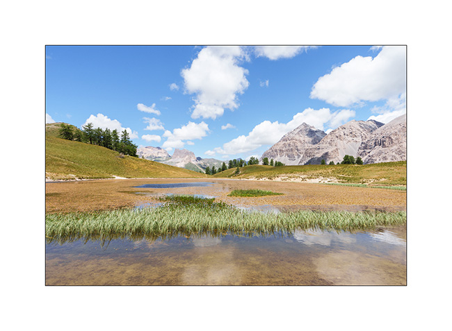
10. Pretty pond near our camp. Top right, the Pian Fum pass.
11. It’s aperitif time!
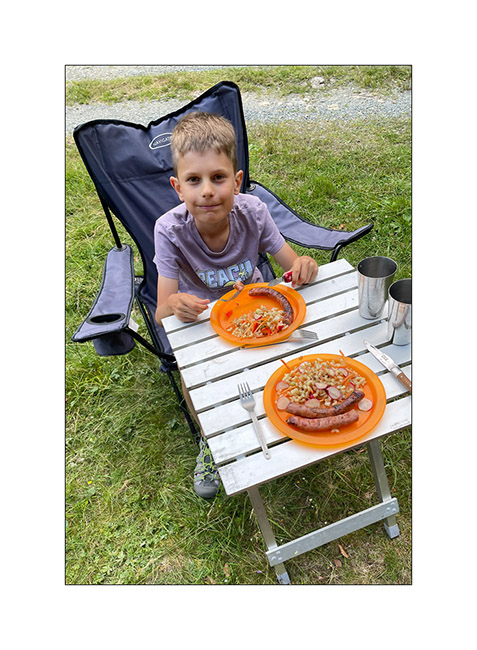
12. After the shower, first campfire of the holidays…
13. With a grill of course!
14. Time to go to bed…
15. The next day, we climb the Colle del Colombardo, which we had first discovered in 2017. But at altitude, the weather was not very favorable…
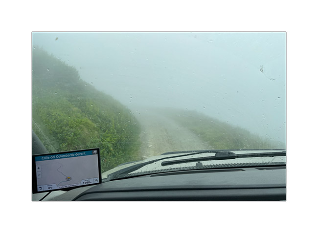
16. It is only when going down the other side that the fog dissipates a little.
With the weather forecast predicts rain in the South, we go spending two days in Valle Argentera, near Sestriere, where Emile wanted to return. We’ll tell you the rest very soon. 😉
Lake Meja
The next morning, we set off on a hike to explore Lake Meja despite the poor weather..
1. Our camp going up towards the small pass which overlooks us.

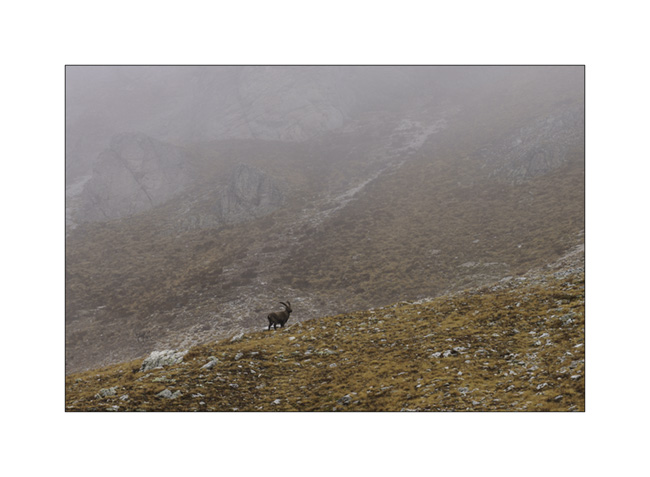
2. We see a few ibex near the pass.
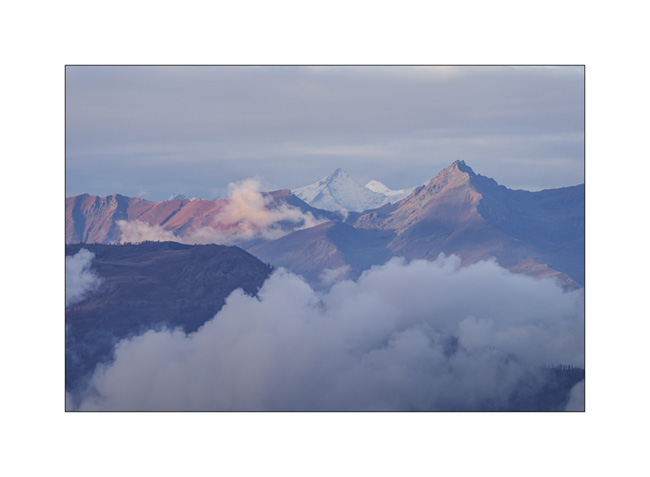
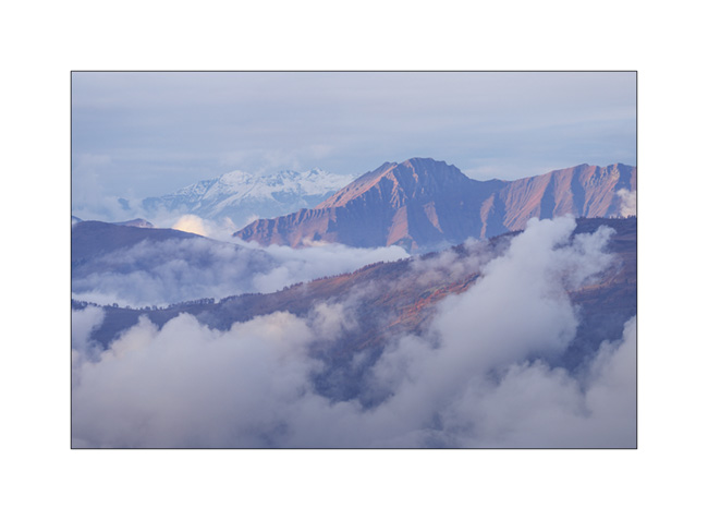
3. Mountains appear and disappear in the clouds.
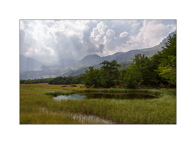
4. Some marshes along the path.
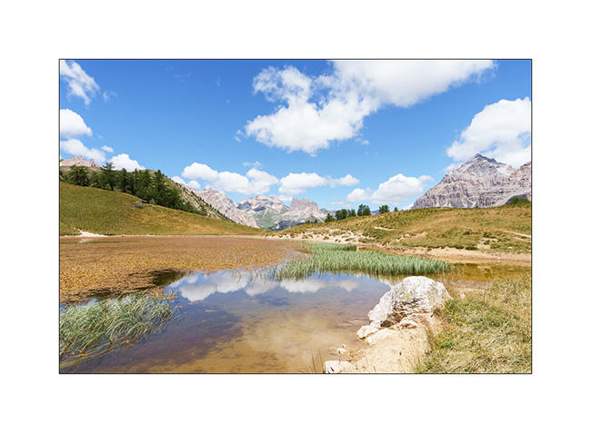
5. Lake Meja.

6. Small mushrooms on a dung.

7. The rain starts again as we go back to VivaLaVida.
8. It’s already time to head back. A short stop on the way up the Maddalena Pass.
In the next update, we will discover a beautiful valley in Haute Ubaye.
Maira Stura
As announced, we continued South hoping to be able to access the Maira Stura trail which was closed during our last visit in summer.
1. Chapel of San Salvatore, driving up the Val Maira.
2. Village of Macra, in the same valley.

3. Indeed, the gate located after Pian Preit is open at this time of year. We can take the small road towards the Meja Pass.

4. Cloudy weather as the road climbs steep.
5. …
6. The limestone is steep on this side of the valley.
7. Near Meja Pass.

8. We continue on the trail towards refuge Gardetta.
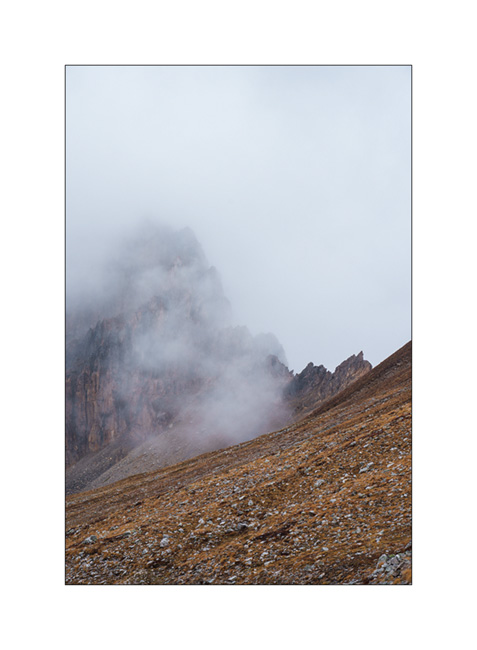
9. Meja Mountain in the clouds.

10. Altitude marshes.

11. The atmosphere is magical with the fog coming in.

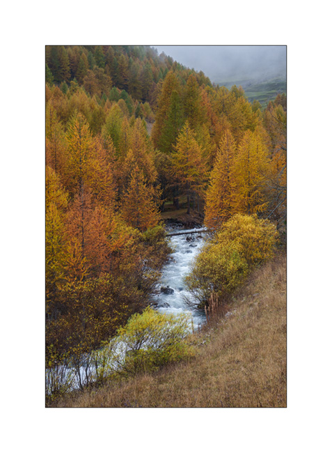
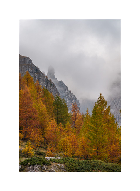
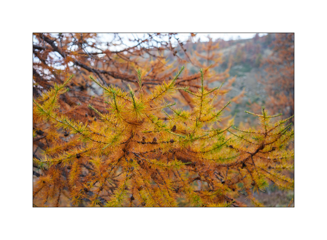
12. Fall colors…
13. Under refuge Gardetta, at almost 7,000 feet elevation.

14. We do the entire crossing of the Maira Stura trail via Margherina Pass in the rain. Here, the old Barracks Della Bandia.

15. We find a nice boondocking spot on the edge of a small lake.
16. Rainy and windy twilight.

To be followed soon… 😉
Fall holiday : Lake Lauson
For the second week of Emile’s vacation, we went to discover new alpine spots.
1. Sunset et our first boondocking spot, near Sansicario.
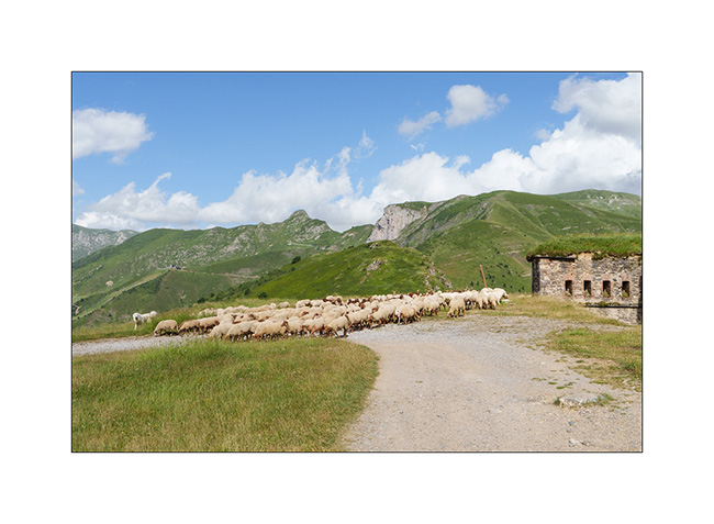
2. Herd going up towards Sestriere.
3. Going down the valley of Cluson river.

4. On the trail going up to Lake Lauson.
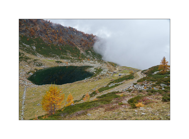
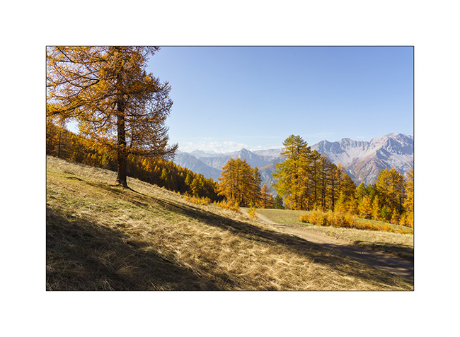
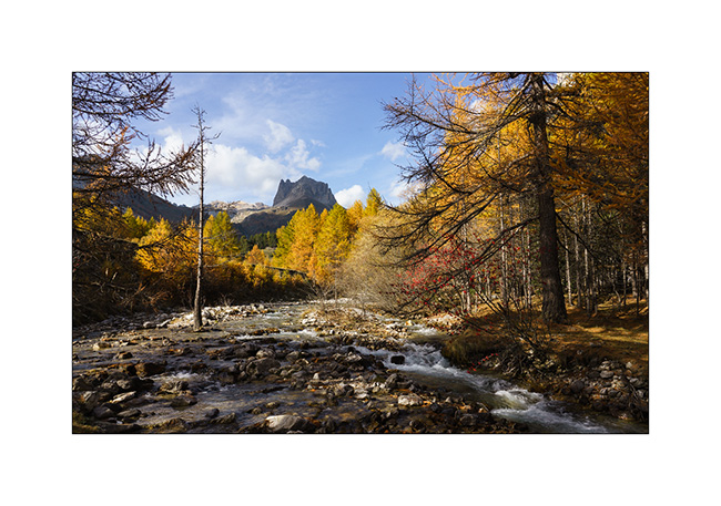
5. At almost 6,000 feet elevation, the larches are gorgeous in their autumn dress.

6. The best of co-pilots!! 😀

7. Lake Lauson.
8. Still a few holes of sunshine as the clouds gather.
9. Lonely tree.
10. Sheepfold under the lake.

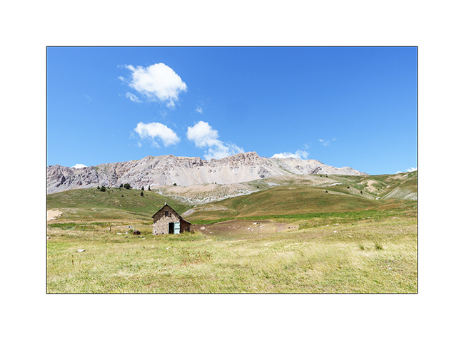
11. Shepherd house.

12. Before dinner, we walk up the old military road above the lake, now closed by a gate. We overlook VLV at his camp near the lake.
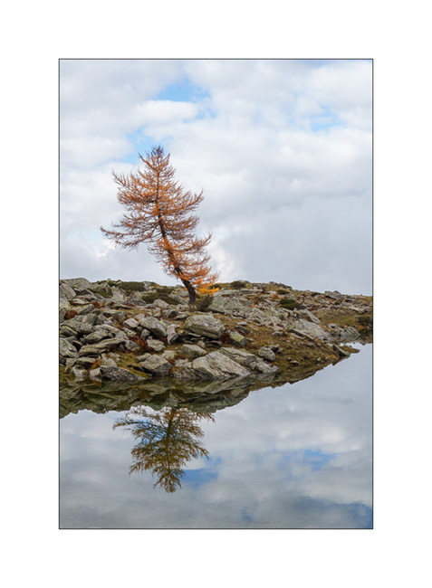
13. Golden larches…
14. After rain and fog.

15. The view from our camp at sunset…
16. Last colors…
After a wet night, we will continue South…
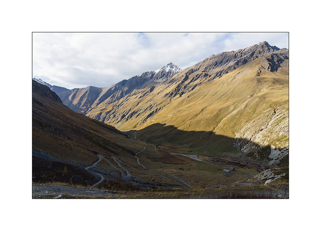
Jafferau fortress, then Vallée étroite (Narrow valley)…
While setting up camp, I badly sprained my ankle. Despite the ointment applied quickly and a bandage to try to succeed in putting the foot on the ground, I will have to revise the plans. Damn! Here I am forced to give up a hike planned in two days. So, after having slept just under Fort Jafferau, we decide to take a look at this fortress in ruins.
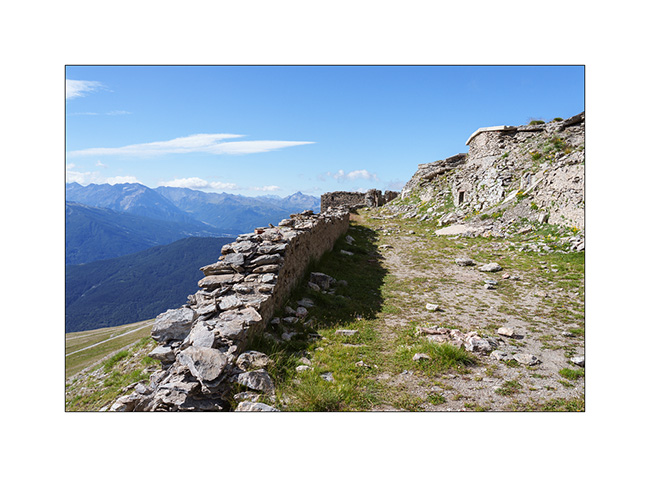
1. South portal or what’s left of it…
2. Here, canon battery bases with the arcs indicating the directions of fire.
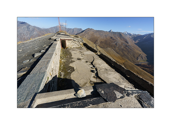
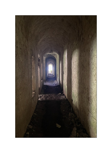
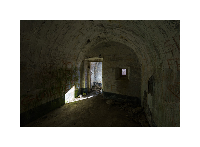
3. And one of the many vaulted chambers which likely served as cantonment.
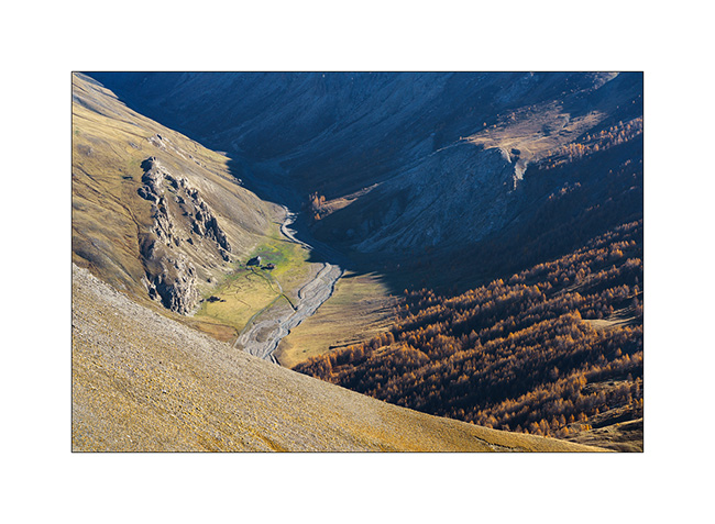
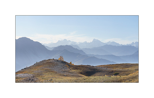
4. Bird’s eye view of an alpine pasture below.
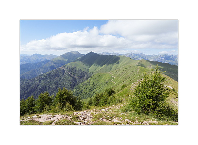
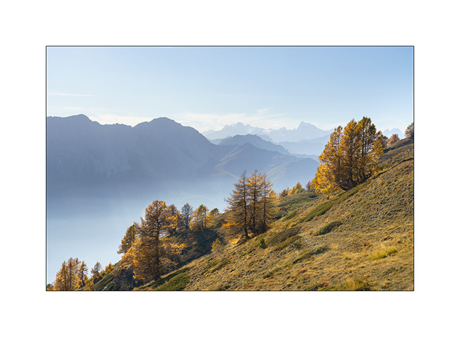
5. Panoramic view of Ecrins mountains to the West.
6. Descent to Bardonecchia via the northwest side.
7. We take advantage of the afternoon to discover the Vallée Etroite (Narrow Valley) straddling the Franco-Italian border. The enfilade towards Mount Thabor is magnificent with the fall colors.

8. Opposite, by where we arrived.

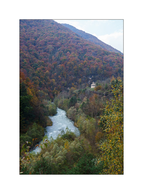
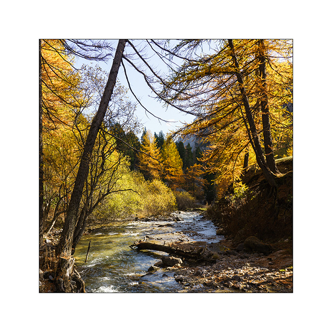
9. The river that carved out this valley, called Narrow Valley Stream.
10. I take advantage of varying the compositions since I can hardly walk. Variation 1.
11. Variation 2.
12. And one last before leaving to do some grocery shopping in Bardonecchia and refuel VivaLaVida since the strikes in France make the refill difficult.

The rest with a return into the Clarée Valley in a few days. Thanks! 😀
Discovery and re-discovery…
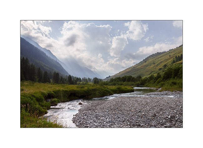
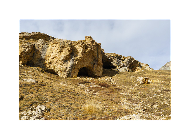
Still going down in the valley that leads to the Col du Sommeiller, we stop to discover a vast alcove created by the collapse of a friable cliff.
1. The cavity visible on the other side of the torrent, at the top of a steep slope.
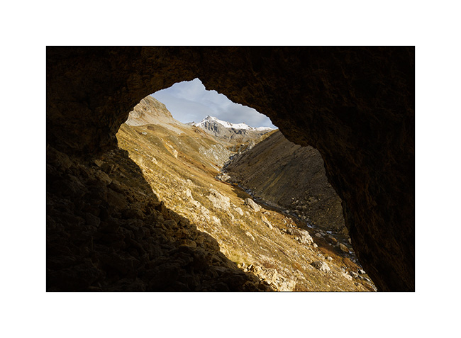
2. Here we are. Emile gives the scale.

3. I take this opportunity to “frame” the landscape…
4. Back to VivaLaVida.
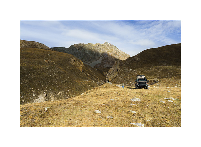
5. VLV in the switchbacks of the track above the Scarfiotti refuge.

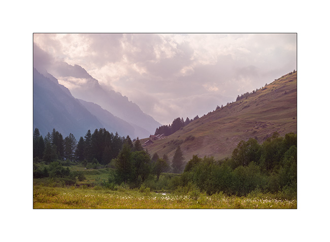
6. The surrounding mountains as the sun slowly turns West.

7. The valley below the refuge.
8. Wake up!
9. This is the period when the larches are all golden!

10. Rochemolle village.

11. Ascent to Colle Basset that we drove in the other direction this summer.
12. As we rise, the view opens up to the distance…
13. VLV on the trail above Colle Basset.
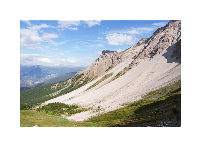
14. Valfredda valley.

15. Fort in ruins.
16. We sleep just above, with a superb panorama!
NExt to come soon… 😀