Moab @en
now browsing by tag
Hikes in Utah…
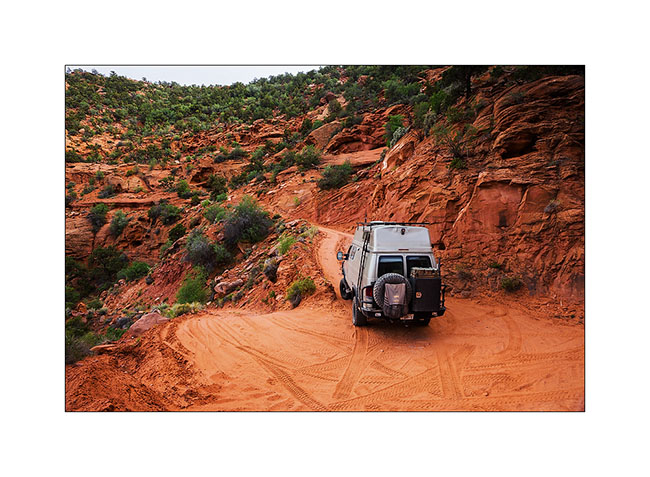
During Memorial Day Weekend, I held waiting for mechanical work on VivaLaVida discovering some surrounding canyons.
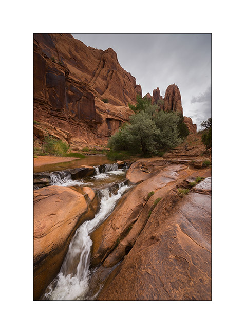
1. Going up Mill Creek canyon in a rainy day…
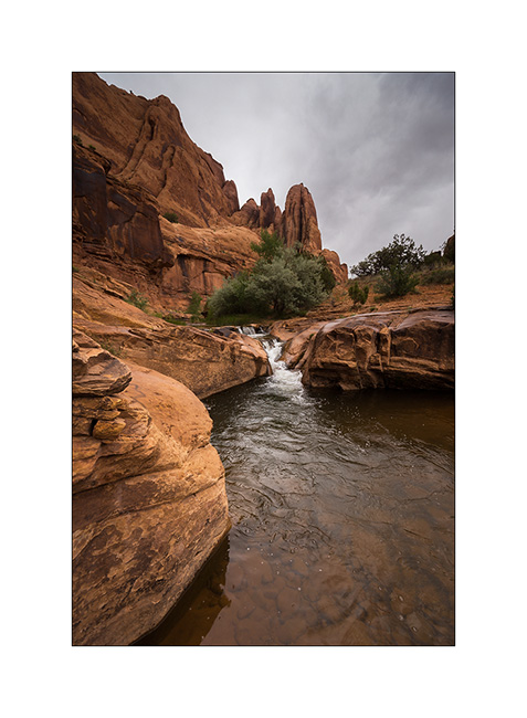
2. … I discover this pretty small waterfall.
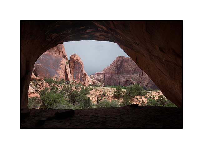
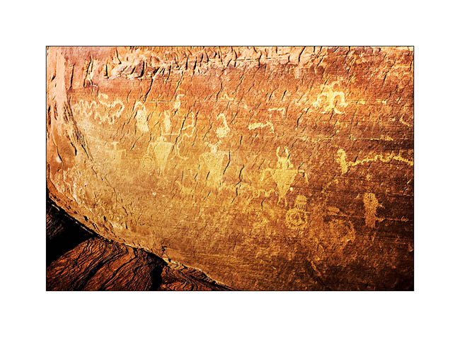
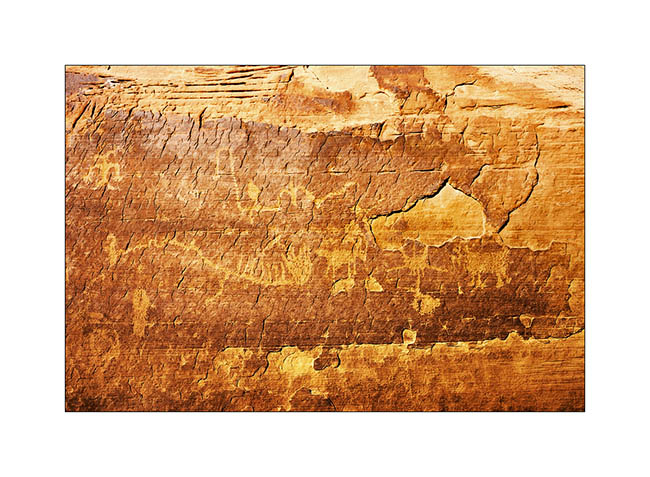
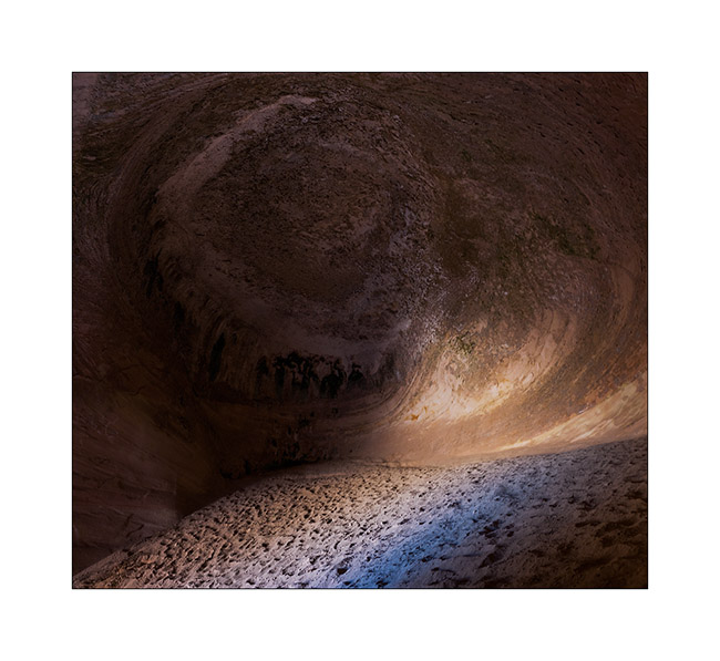
3. Higher in the canyon, is a cave whose traces of soot on the vault attest that it served as a shelter for Indian people years ago.
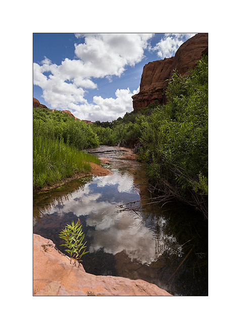
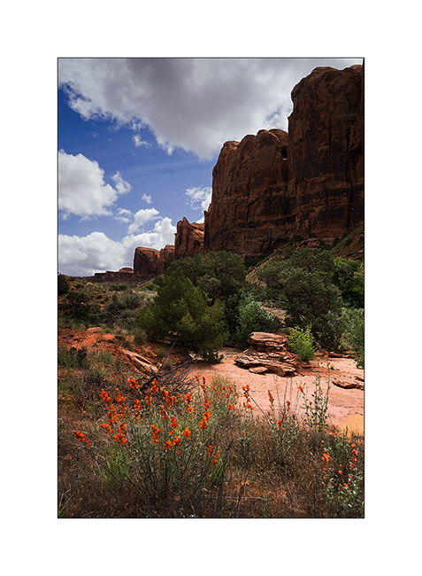
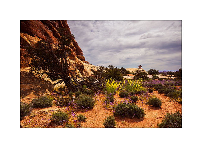
4. The next day I went discover the Negro Bill Canyon, renamed since with an unpronounceable name for “political correctness” reasons. The unusually wet spring in this region provides more water and greenery than it’s common here.
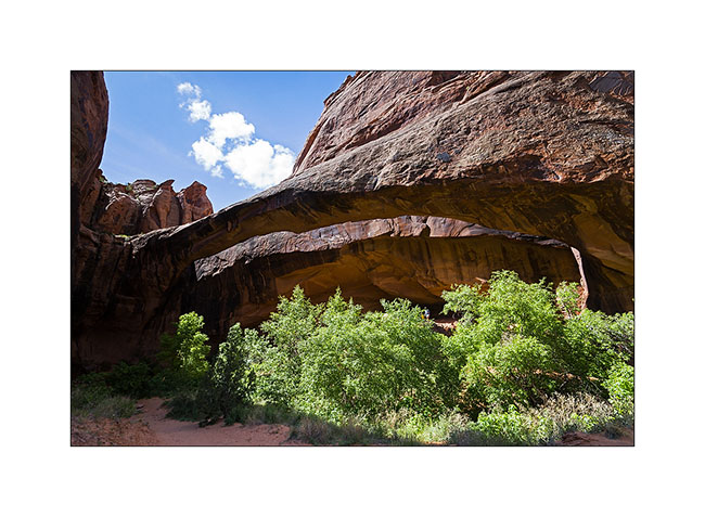
5. Arriving near Morning Glory Arch.
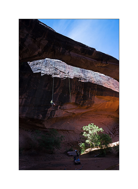
6. It’s a place where tourists offer some thrills rapelling from about 120 feet.
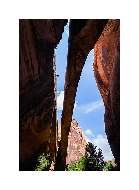
7. There is quite some air with a second portion away from the overhanging cliff.
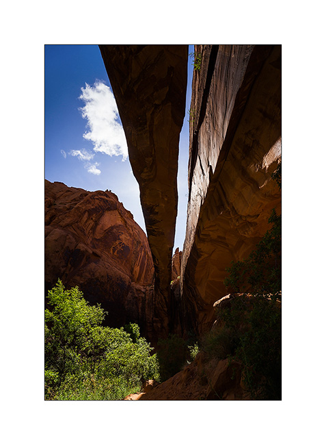
8. Giant arch.
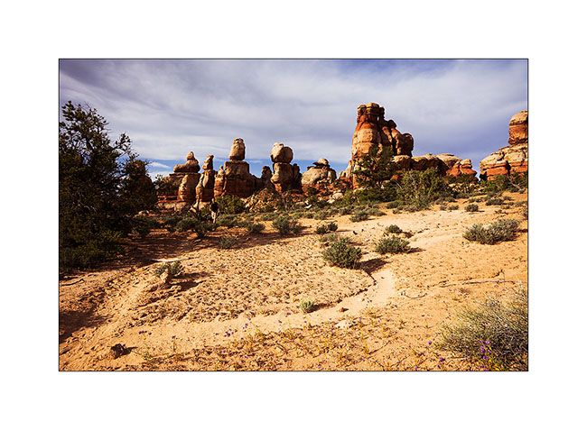
9. Hiking higher in Negro Bill Canyon, widely flowery.
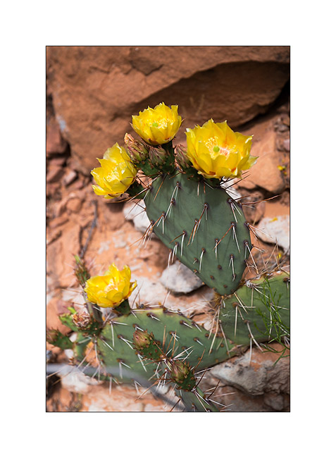
10. Cacti offer many yellow ar roses flowers.
11. Small waterfall down the cliffs.
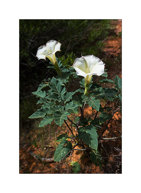
12. This one looks like a lys…
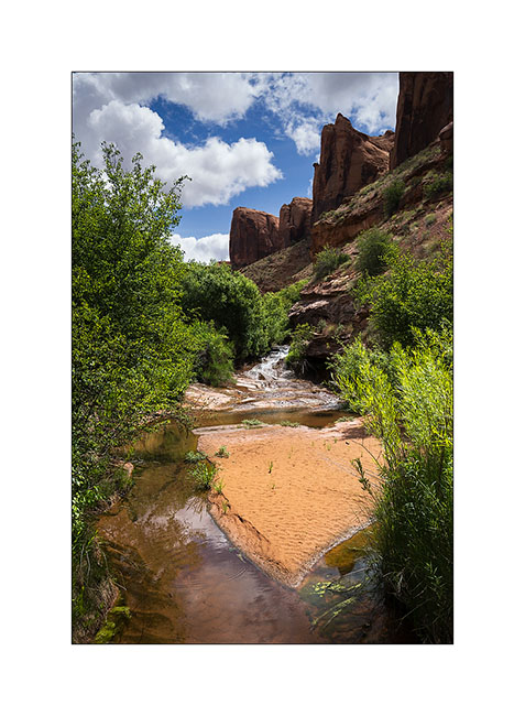
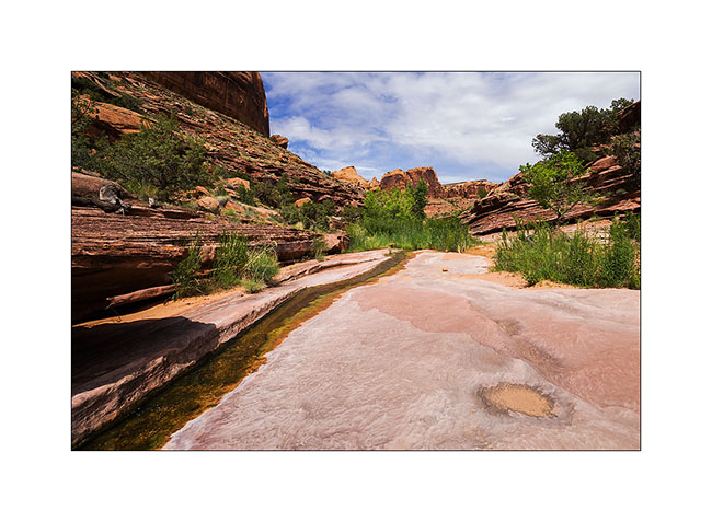
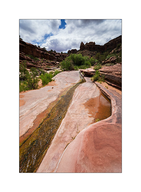
13. Not far from the mouth of the canyon, water runs on the sandstone.
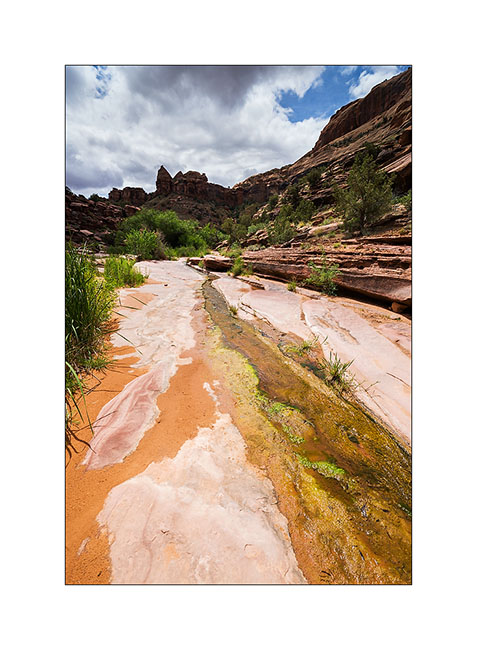
14. The place is wild and desert despite the crowds of Memorial Day.
15. Last compo before going back to VLV and heading to Salt Lake City to do the work on VLV.
To be followed soon. 😀
Sandstone around Moab
Leaving the Beef Basin, I had the good surprise to find a message from Hans, a Swiss who lives here with his wife Madeleine for 35 years. I was greeted like a king by this adorable couple, not forgeting to specify that Madeleine is fine cooker. 😉
They explained me how to access a petroglyph site within walking distance of their beautiful home nestled on a sandstone hill.
1. What a privilege to discover this private site where access is usually closed!
2. I have found some symbols already observed elsewhere.
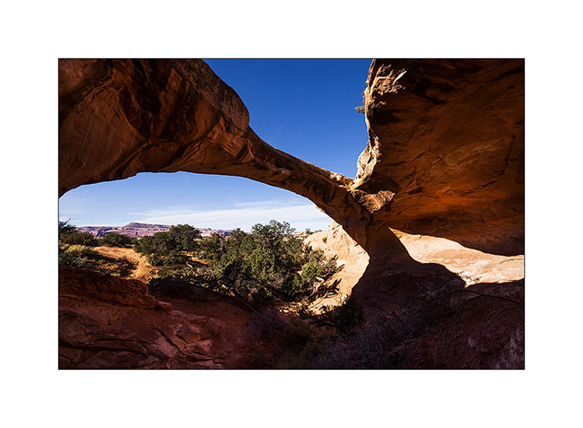
3. The next day and despite his 80 years, Hans brought me drive the Sevenmile Ridge Trail, a 4WD trail listed red (the most difficult) which passes near Uranium Arch.
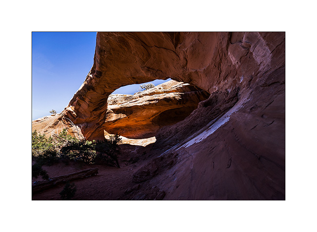
4. It’s a nice medium sized arch.
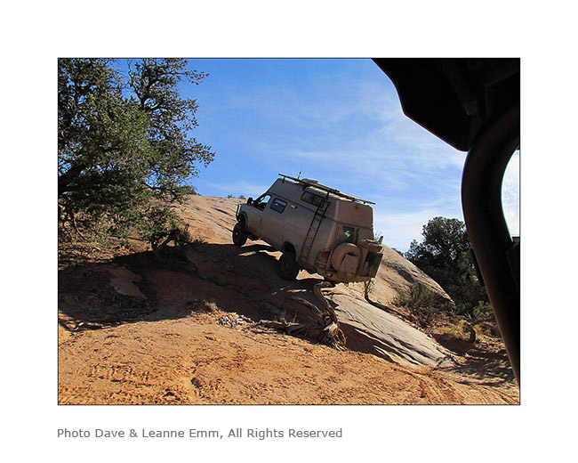
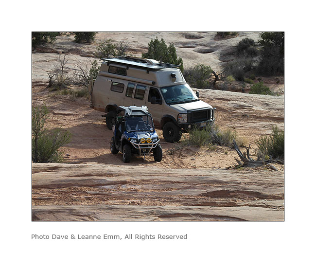
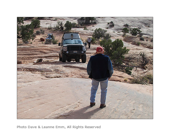
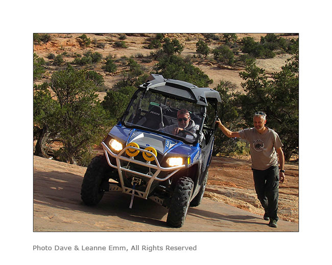
Near this arch, we met a couple from Colorado, Dave and Leanne, a little lost because their trail description was out of date. They followed us throughout the rest of the trail and took images of VLV in downright cool passages, especially a leaning spot that I really wasn’t sure how to deal with VLV high-pitched on her wheels. They sent me some pictures to discover here…
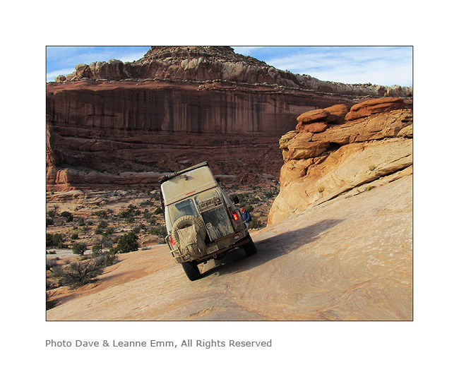
5. Steep hill leaving the arch.
6. It’s like David and Goliath, isn’t it? 😉
7. Here is Hans spotting me on the step to access to the leaning spot..
8. It doesn’t seem so but this entry is rather steep, with a good step!
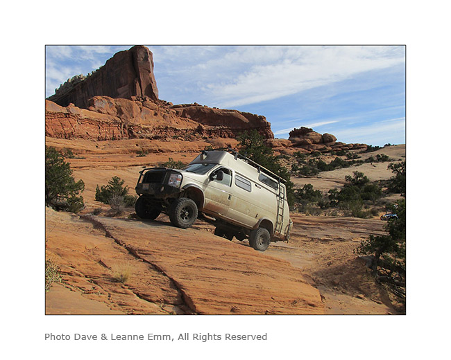
9. and here is the off camber spot. It leans quite a bit despite the left suspension fully inflated and the right one completely down..!
10. After VivaLaVida it’s Dave who goes through in his 50 inches wide only vehicle. I indicated him the line to follow. Well done Dave ! 😀
I want to say a huge thank you to Hans and Madeleine for their so warm welcome. I had such a great time with them. 😉
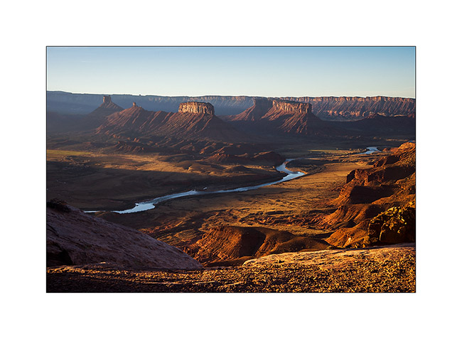
Hans recommended me a spot on the Dome Plateau where I had already spotted a natural arch. Leaving them, VivaLaVida took the path of this view that I discovered the next morning.
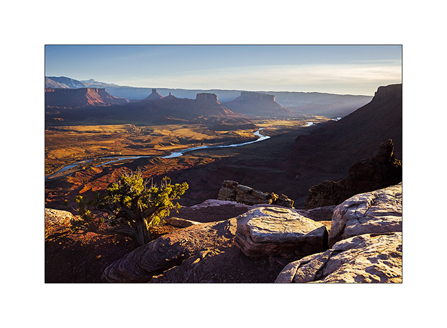
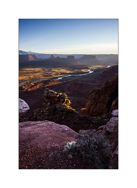
11. Colorado River and Castle Valley in early light…
12. Not far away, I went to discover La Boca Arch, a small pretty massive arch.

13. A bush managed to grow under the arch…
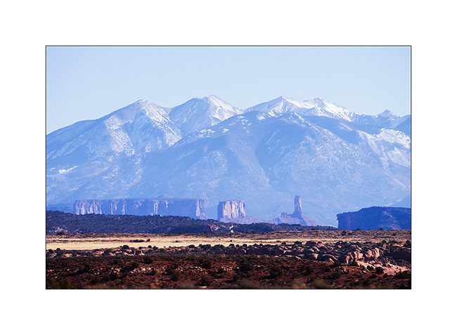
14. Castle Valley towers in front of La Sal Mountains.
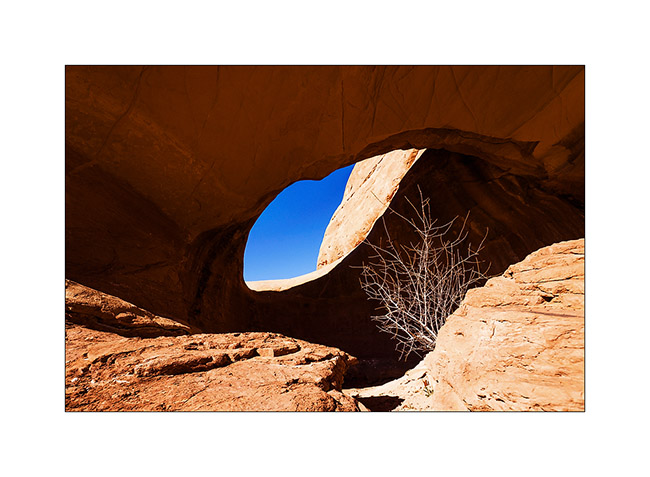
15. On my way to natural shelters, the famous herbs that are seen in Westerns rolled by the wind have almost eliminated the trail… 😉
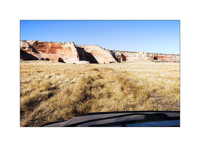
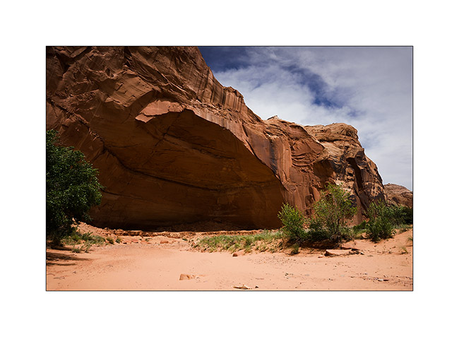
16. Here are sandstone cavities inhabited by Indians several hundreds years ago. One of them houses a source.
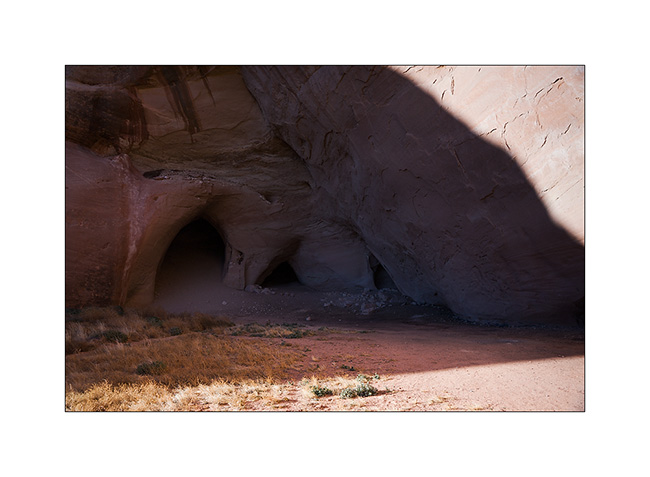
17. The bluff above is polished by the elements.
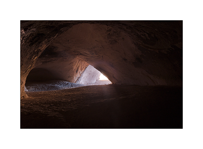
18. The lower cave is quite deep and some water oozes from the walls in places. The soot of inhabitant’s fires is still present (left of the entrance on this image).
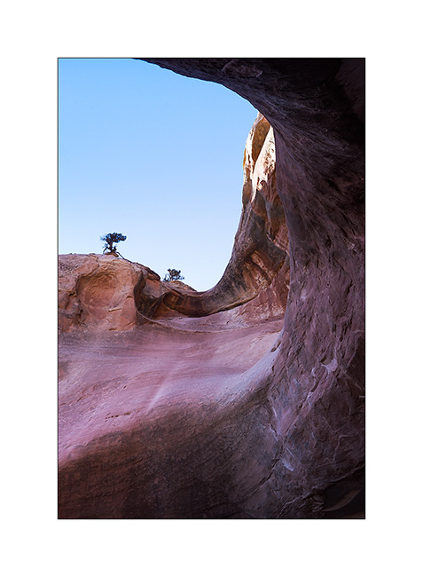
19. The top one’s ceiling is shaped in a quite photogenic circular vault.
20. Back to the overview in late afternoon.
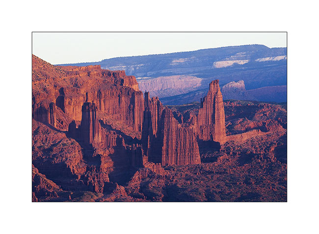
21. Very red material of Fisher Towers is colored by the sunset light.
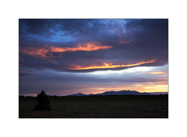
22. Last sunrays over Castle Valley.
More to come soon. Once again, thanks for your loyalty! 😀
Maze Disctrict of Canyonsland NP & Moab area
The next day we decided to walk to the confluence of the Green River and Colorado River, north of Doll House.
1. Along the trail.
2. Some areas are full of flowers.
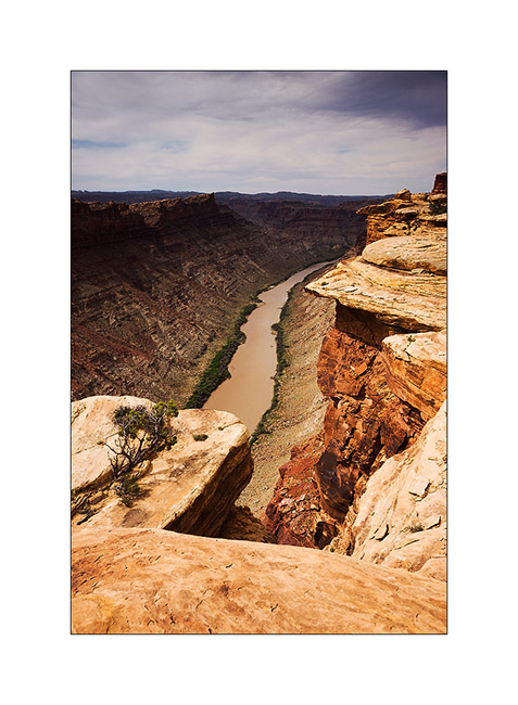
3. Colorado River 1000 feet below.
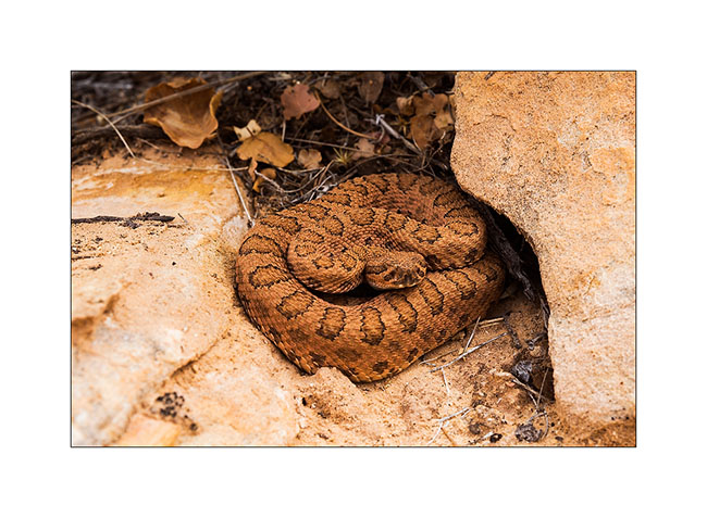
4. Jean-Luc saw him just before to walk on!
5. Using the Flint Trail to go up on the plateau, some switchbacks were really narrow, requiring maneuver. what an initiative to have drawn a road in such a steep slope!
6. We slept on the plateau…
7. … and saw a gorgious sunset.
8. We joined the Horseshoe Canyon to discover cave petrographs. Huge overhang! Can you see Jean-Luc ..? 😉
9. Panoramic picture from the bottom of it.
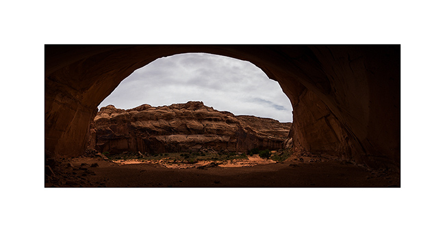
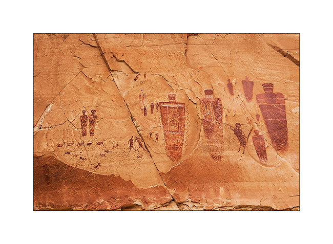
10. The “Great Gallery”.
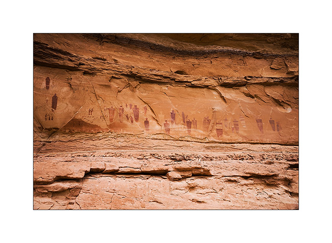
11. Surprising painting…
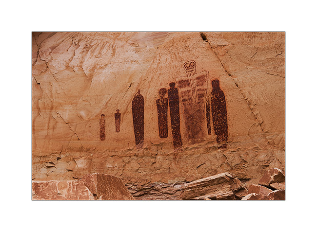
12. … so varied.
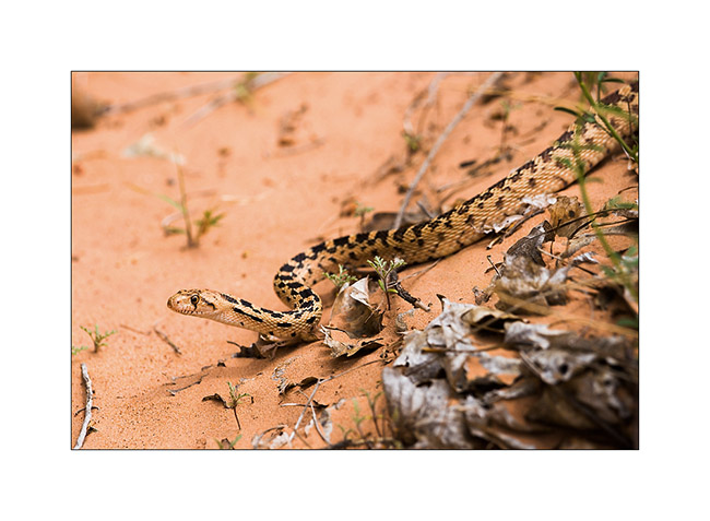
13. Going down the canyon, we saw this beautiful snake (about four feet long), an enemy of rattlesnakes he kills by constriction.
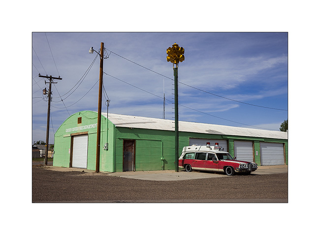
14. At Green River UT…
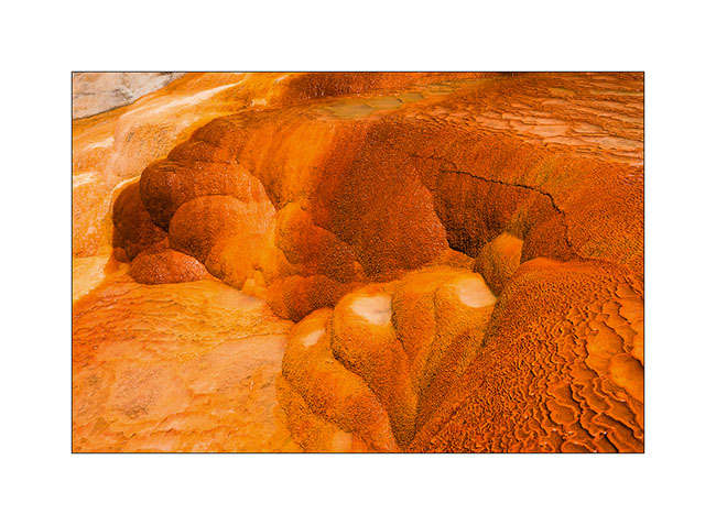
15. Further, a short stop to Crystal Geiser…
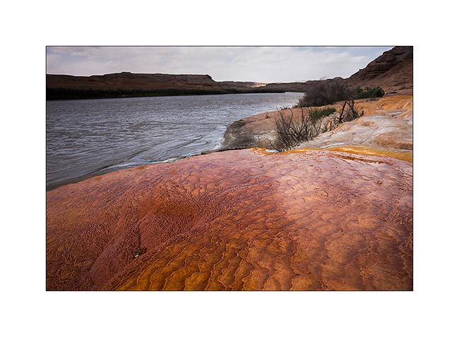
16. Saturated colors!
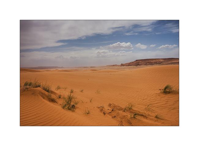
17. Detour through a smal erg of orange dunes.
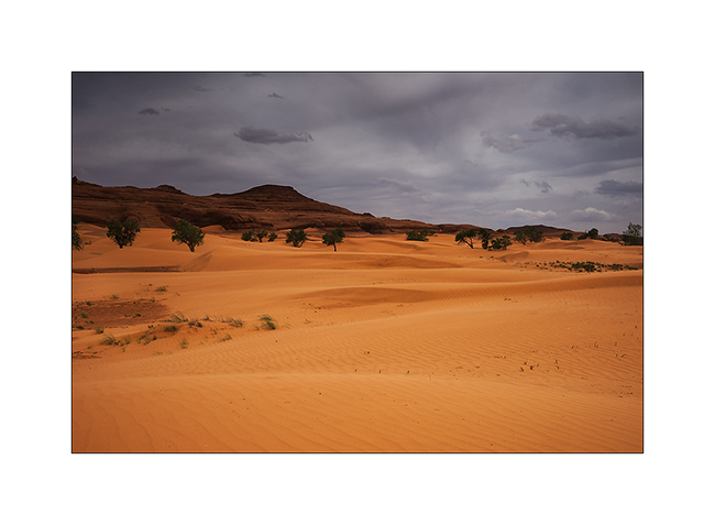
18. But the sand Wind will force us to go away.
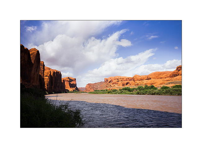
19. Colorado River near Moab.
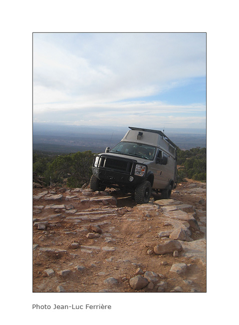
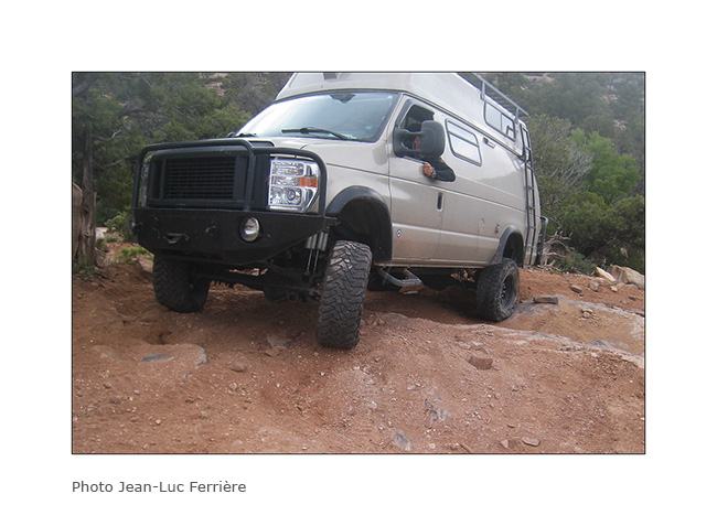
The next day we joined a place called “Top of the World” by another quite rockcrawling track! Here are some images of Vivalavida in action since I had a photographer there. 😉
20. Steep hill…
21. Here, both lockers were necessary! 😀
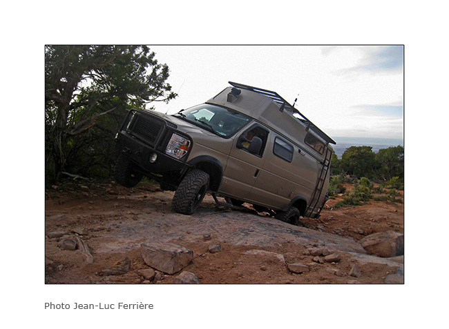
22. big step.
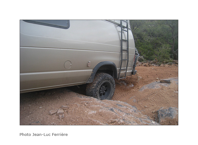
23. Axle crossing.

24. Where is the best way to go..?

25. There! 😀
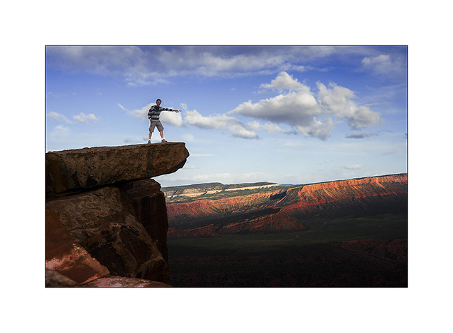
26. The Sunset was gorgious on this promontory!

27. Jean-Luc over tausend feet emptyness..!
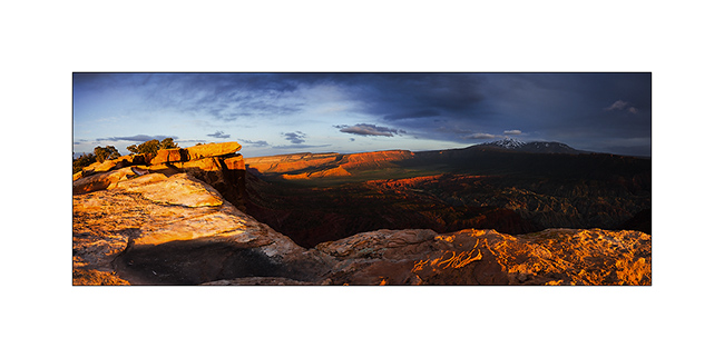
28. A panoramic picture to finish this update…
The next update will bring you to the Great Salt Lake, the last place we wisited with Jean-Luc who then flew back. To come soon.