San Rafael Swell @en
now browsing by tag
Still San Rafael Swell…
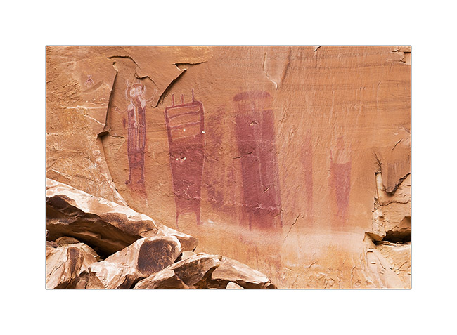
So here I am in Black Dragon Canyon where I first discovered conventional petrographs but with quite rare scenes.
1. Principal petrographs panel.
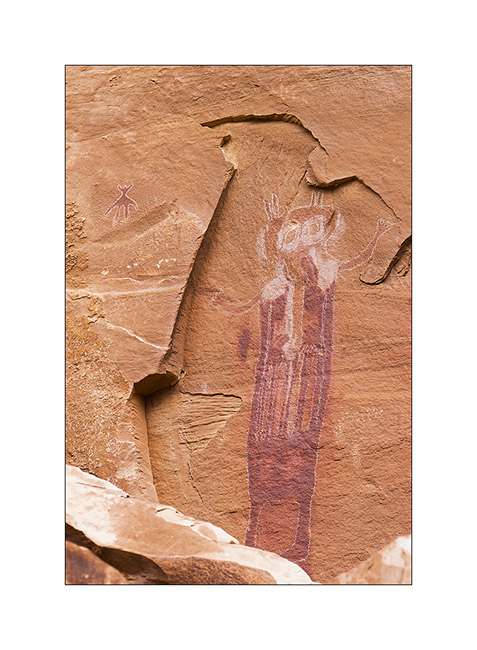
2. Detail of the figure on the left and a kind of small octopus.
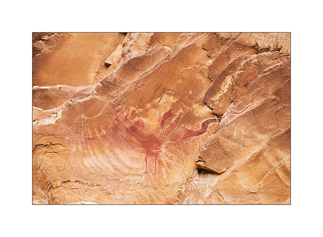
3. A chicken attacked by a snake!
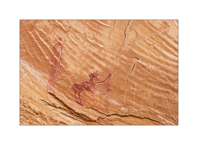
4. And here is another rare representation with that kind of dog.
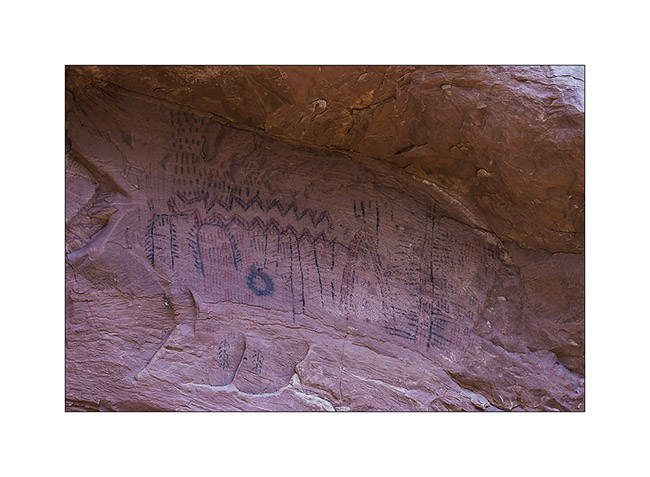
5. Beside, under an overhang, is another type of petroglyphs making the site’s reputation. It seems this is the only place where they are such petroglyphs.
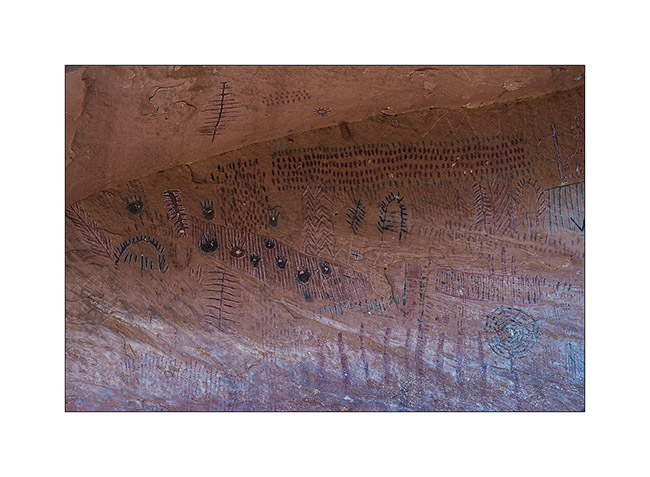
6. They extend over about thirty feet.
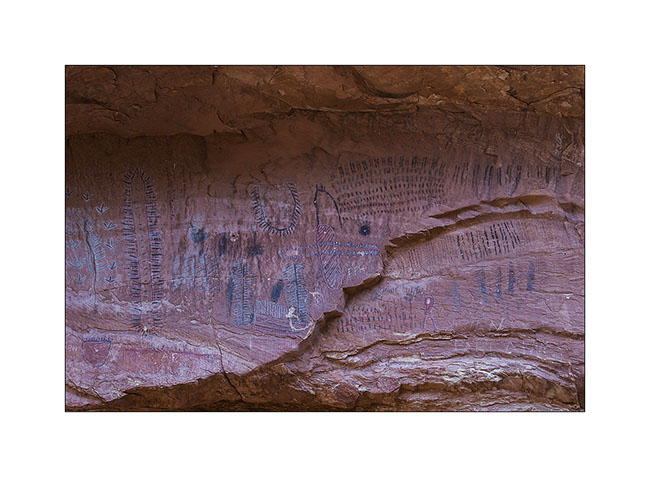
7. I didn’t find any information about what they might represent.
8. I then hiked in another nearby canyon where there are potholes, water points for many animals.
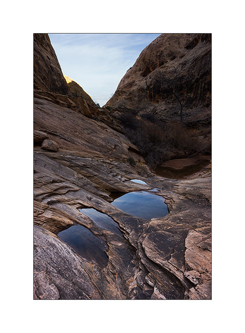
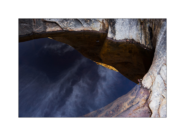
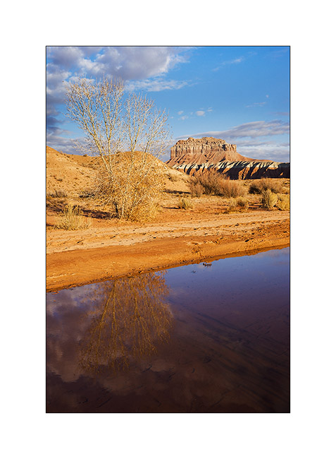
9. Reflection…
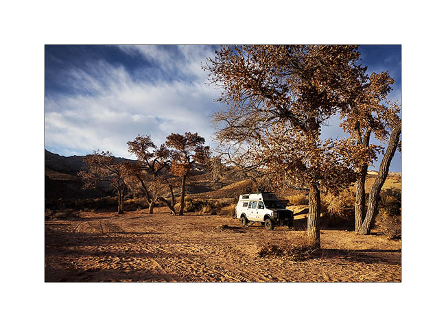
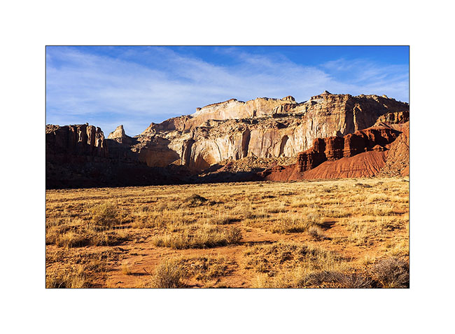
10. Nice place to spend the night while a ray of light finally shines…
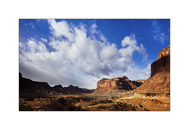
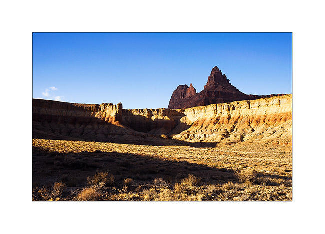
11. The next day, arriving at one of the highlands of the San Rafael Swell in a shower sky and a chill wind.
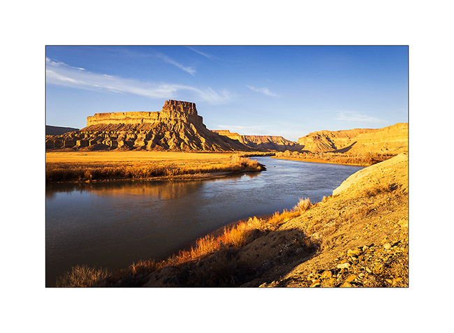
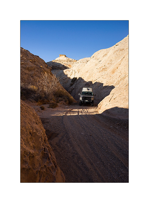
12. VLV advances towards the canyon of the San Rafael River.
13. The place is beautiful, with high cliffs.
14. Heavy sky…
15. After a good hike in the wind, I reached the slopes of Black Box, a deep chasm of the Sans Rafael River.
16. Black Box…
17. While going back to VLV in late afternoon…
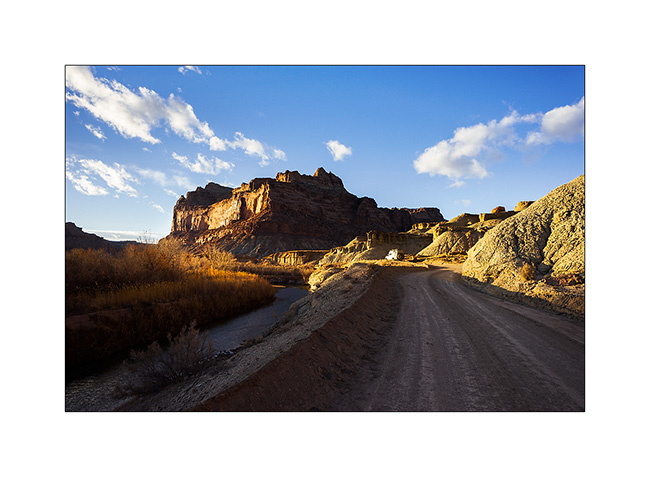
18. Downstream the Buckhorn Wash.
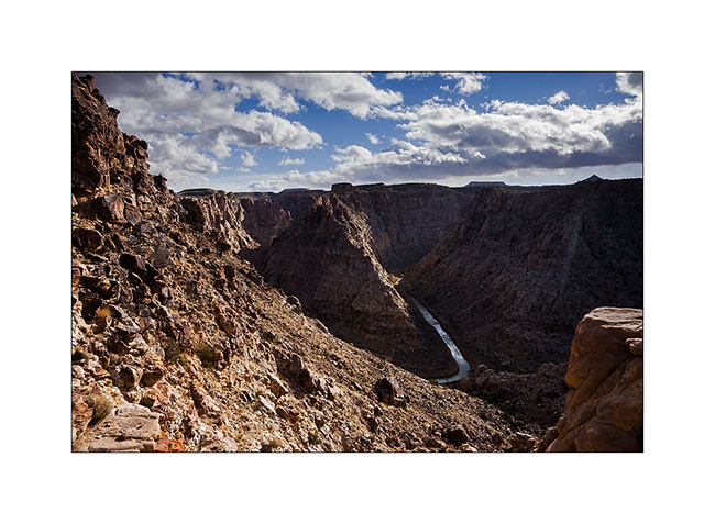
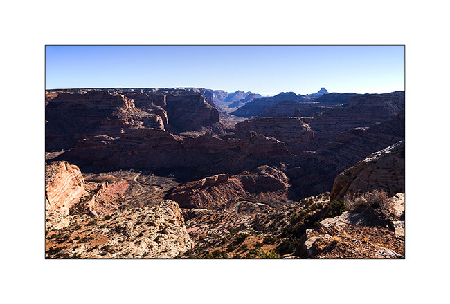
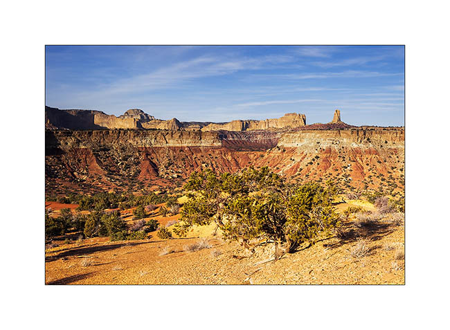
19. Little Grand Canyon, another canyon made by the San Rafael River upstream. The view is superb despite the 15F..!
VivaLaVida then turned South-West, in search of little milder temperatures for Christmas. To discover soon… 😉
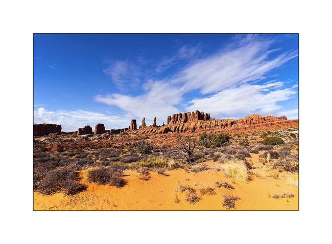
Around Moab, and then leaving Moab…
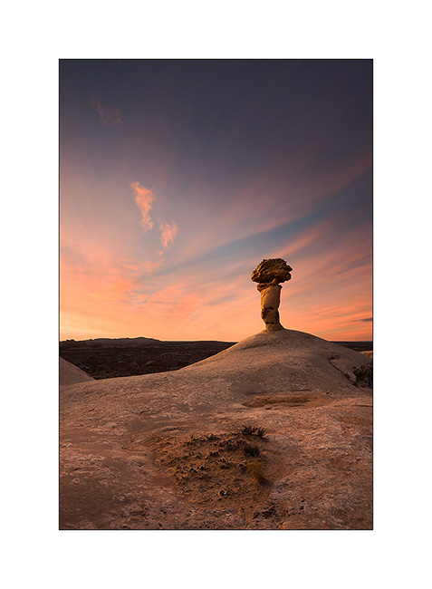
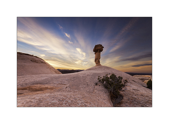
1. Three days later, I spent the night near a giant mushroom. Believe me, the dawn will reveal it. 😉
2. Here he appears…
3. Fifteen minutes later, the diverging sky makes me think about the brilliance of a lighthouse…
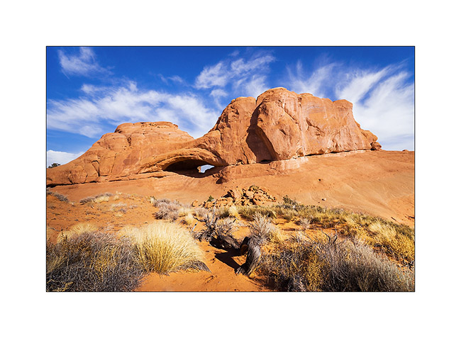
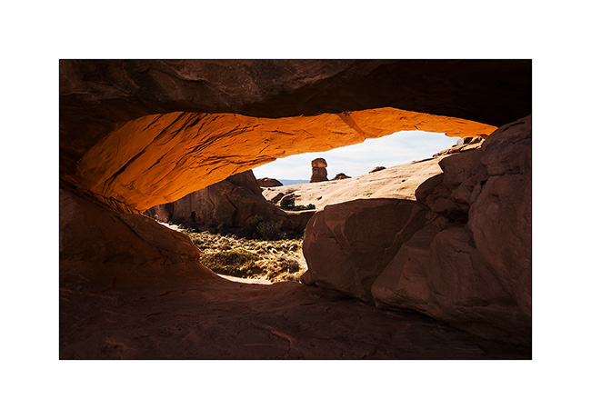
4. Still waiting for VivaLaVida’s door handle to replace the broken one, I did another little journey around Moab… I went to find an arch named Eye of the Wale. And it looks really like one. 😀
5. In the eye…
6. Farther on the trail, the Marching Men, in the Klondike Bluf.
7. I drove that trail in 2011 and it is much more ruff than three years ago, much more than it appears in this image!
8. Another quick getaway the next day in Canyonlands National Park to discover a ruin located under the overhang of a huge cliff … Not shown on maps of the park, this spot is still unspoiled by mass tourism. A fantastic place with a wonderful view of Candelstick Butte.
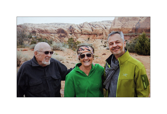
9. Souvenir picture with Madeleine and Hans who welcomed me at their home like a king. I left Moab the Friday before Christmas, VLV’s handle finally being fixed. (Picture of another picture, sorry for the quality)
10. I then drove upstream the Green River hoping to see Desert Big Horn Sheep which live in cliffs of mesas. Late afternoon light in the entrance of Gray Canyon.
11. The next day it’s really gray over the Gray Canyon. I didn’t see any Big Horn… :-/
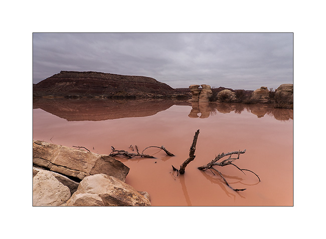
12. Returning to the San Rafael Swell, I made a detour to discover a rather unique triple arch. Along the track, when the water meets the bentonite…
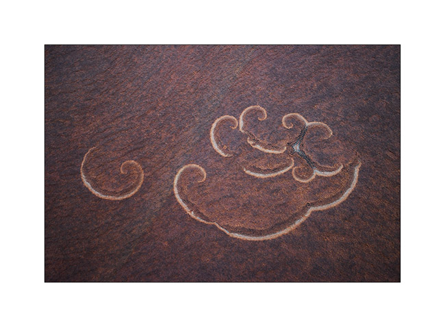
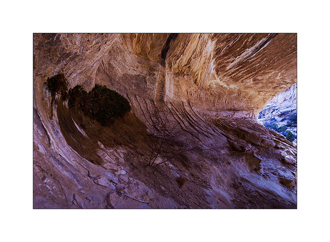
13. Natural arabesques of some lichen on sandstone.
14. Here is Colonnade Arch, above the canyon of the Green River.
15. Almost a cathedral, unfortunately without light that evening…
16. While going back to VivaLaVida, I spoted by chance these sandstone stalagmites at nightfall.
The next day, the weather was still very gray, so I took over the direction of the San Rafael Swell to discover petrographs in Dark Dragon Canyon.
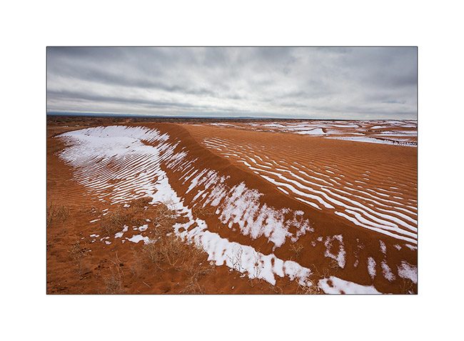
17. Small dune area where snow remains in place.
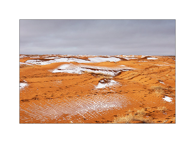
18. The contrast between orange dunes and white snow is beautiful.
19. I pass close to Goblin Valley and discovered almost similar concretions.
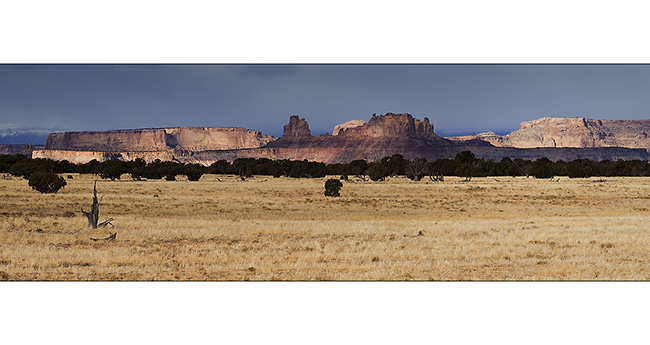
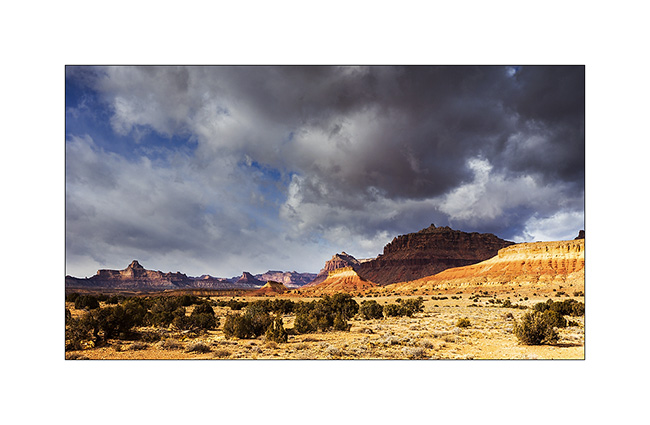
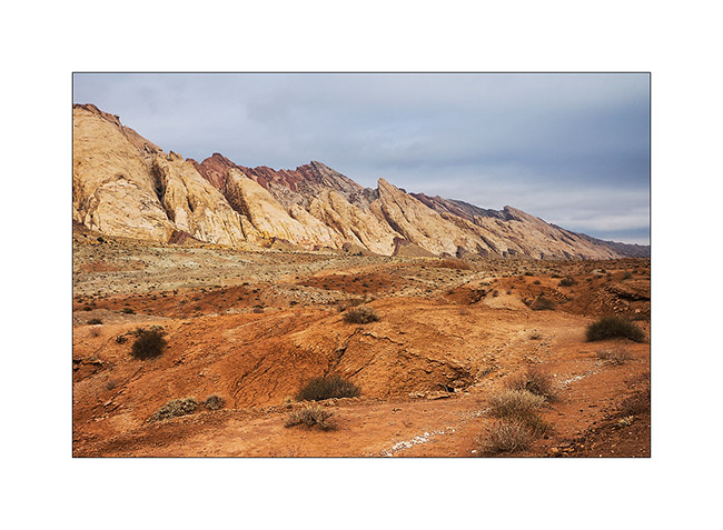
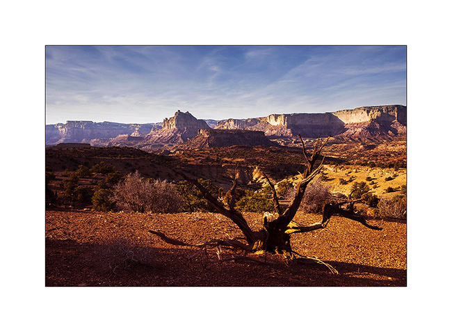
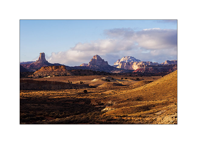
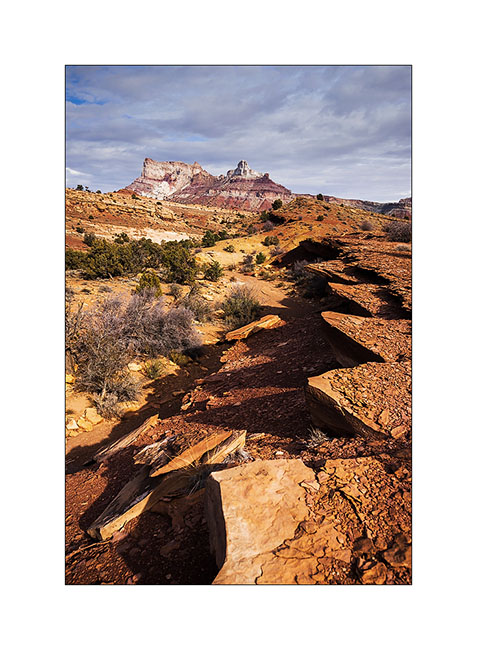
20. Ray of light on the reef of San Rafael Swell.
21. VivaLaVida runs along the spectacular reef.
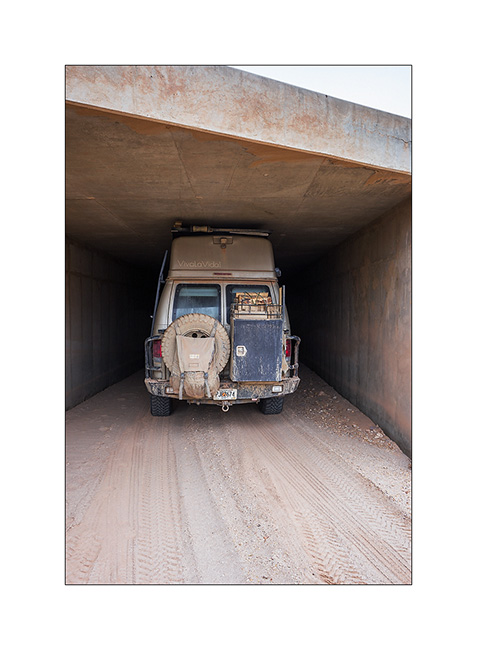
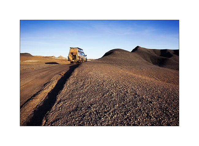
22. Path Under I-70 ; there is one inch margin with suspensions maximum lowered and tires deflated for trail! 😀
Discovery of petrographs in the next update.
McKay Flat & Reds Canyon
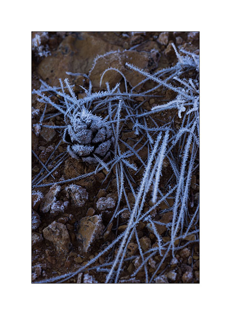
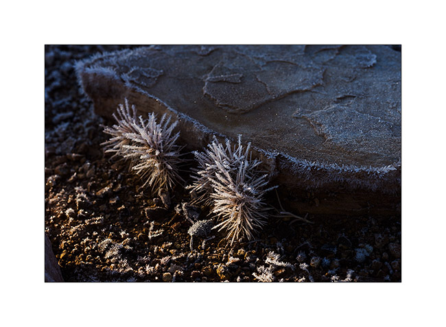
1. The night was clear and at this altitude, the frost covers everything including VivaLaVida.
2. In exposed areas, ice crystals are huge!
3. Even cactus appear to wear Christmas dress… 😉
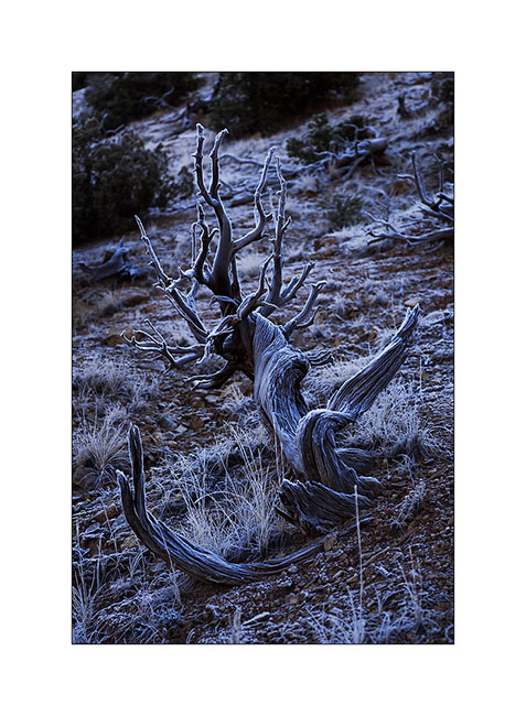
4. This old juniper trunk looks almost like antlers.
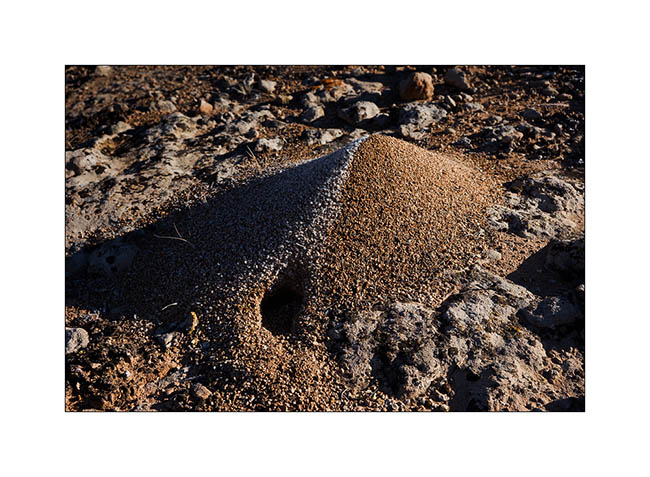
5. This anthill is an evident good insulation.
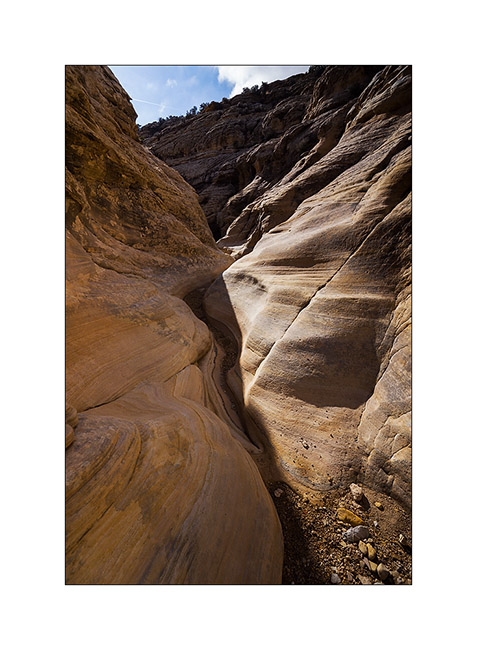
6. After two hours hiking, I arrived at the entrance of Baptist Draw, a little-known slot canyon. While above it is an open canyon, it suddenly changes in this thin crack…
7. … that sinks ever deeper…
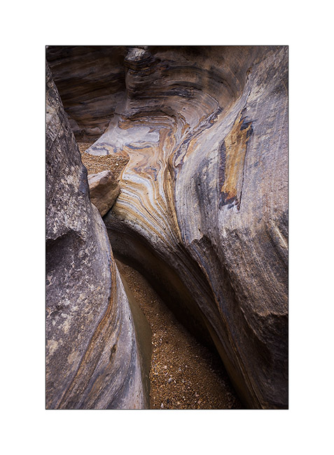
8. … sometimes with a larger pot…
9. … and again some jumps and small waterfalls.
10. It’s a special atmosphere to be alone, isolated in such a corridor, I recommend it! 😀
11. Intrigued by the heights of Reds Canyon I had spotted the previous day, I continued south for exploring this little known canyon too. Dug by the Muddy Creek, it is huge canyon, comparable to Canyonsland by the height of the cliffs.
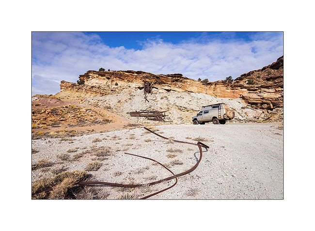
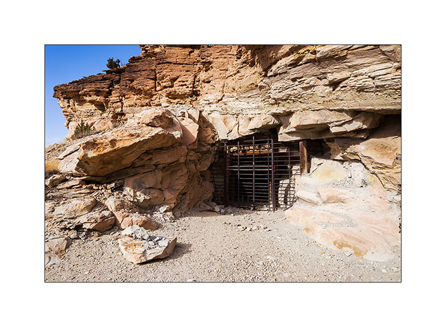
12. At Tomsich Butte, there are several uranium mines that have been oparated until the mid 50s.
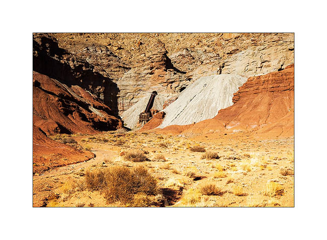
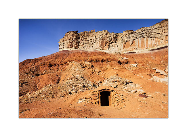
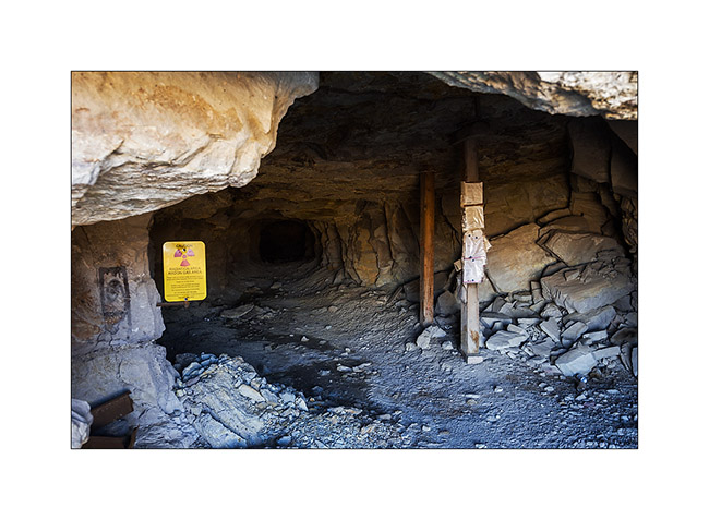
13. I even discovered that curious shelter. I learned afterwards that it was the dynamite deposit of the mine!
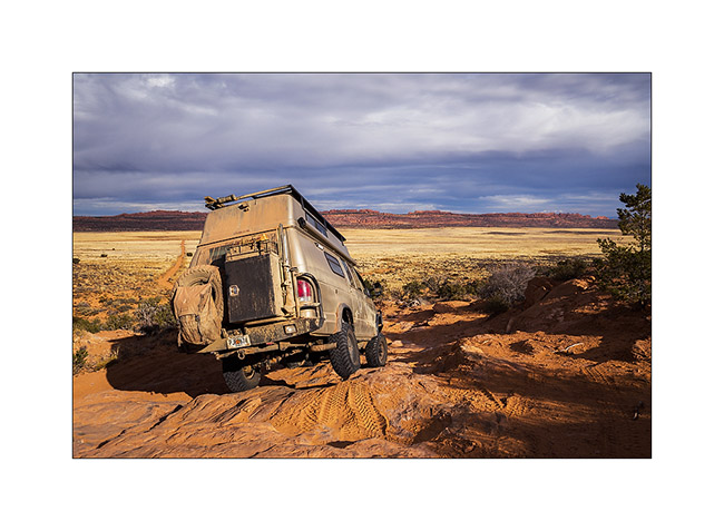
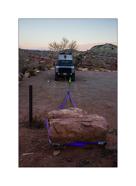
Taking a look at the front axle, I discovered that the right wheel was again quite backward. In fact, everything moved and the axle was misaligned. Blame it on the right suspension of which the centering pin broke.
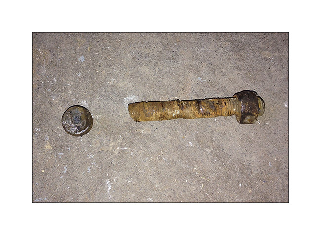
I couldn’t ride like that, so I had to mechanic for more than three hours under VLV, separating the axle of the spring with two jacks for inserting a bolt as temporary guide. Over one and a half hour to loosen four seized bolts, pulling on the handle of the hi-lift jack lever to achieve this; I so hurted my back …: – / But finaly, VLV was able to continue his way and hang gently until a more serious repair by replacing the broken pin. I then also removed the other side and I did well: the pin was also about to break.
It’s crazy what dirt raods hurts all running gear..!
14. Going up Reds Canyon, the scenery is gorgeous. Don’t they look like cathedrals porches carved in these huge cliffs?
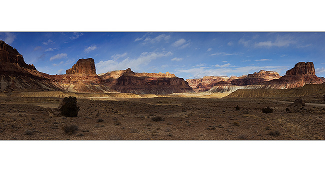
15. In the upper canyon, about twenty miles away, they are some spectacular buttes.
16. Last look before returning to Moab to fix my broken suspension…
So much for today, hoping you’re not getting too bored with all these canyons! Thanks again for your loyalty. 😉
South San Rafael Swell
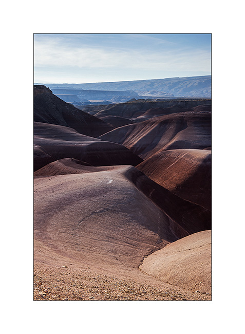
Out of my hike in the slot canyons, I saw a sign “Muddy Creek”. I thus followed the trail south and had the good surprise to find a quite large area of “bentonite”, this kind of clay that I also found at the Painted Hill in Oregon.
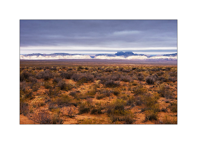
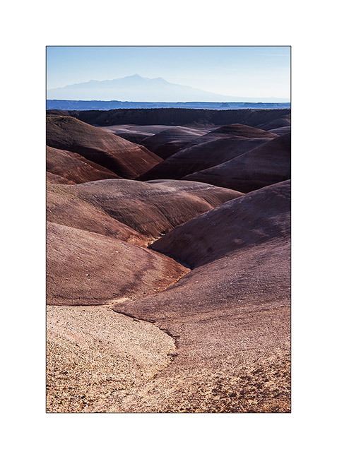
1. Bentonite Hills and Henry Mountains in the distance.
2. Nice colors in front of San Rafael Reef.

3. Valley…
4. Sweetness…
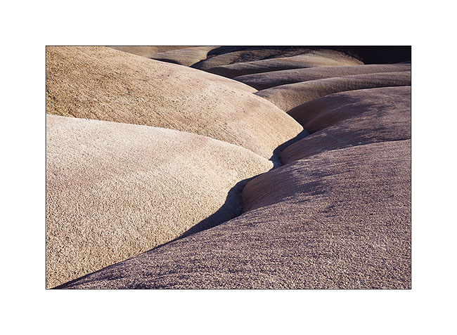
5. I vary the compositions in this sensual landscape…

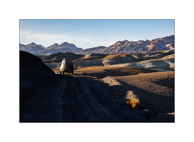
6. VivaLaVida having fun on that beautiful trail!
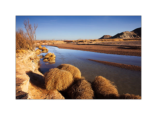
7. Muddy Creek, at the end of the trail.
8. Ride over the Bentonite. 😉
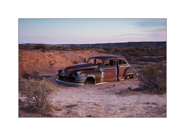
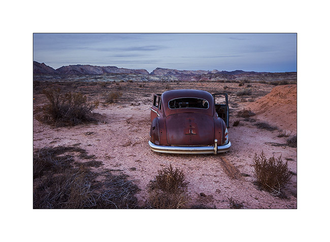
9. I slept near an abandoned ranch and discovered this carcass at nightfall.
10. She too has beautiful sensual forms, isn’t it? 😀
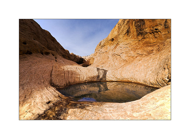
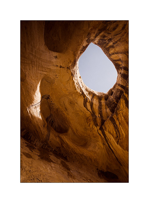
11. The next morning I went up towards a small arch and saw this pothole on my sundstone path.
12. Here is Wild Horse Window.

13. The window is nice! 😀
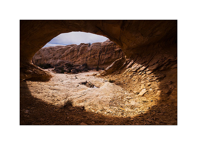
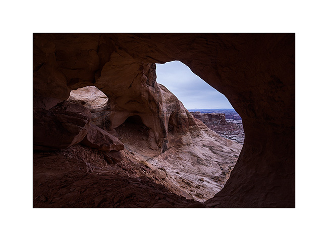
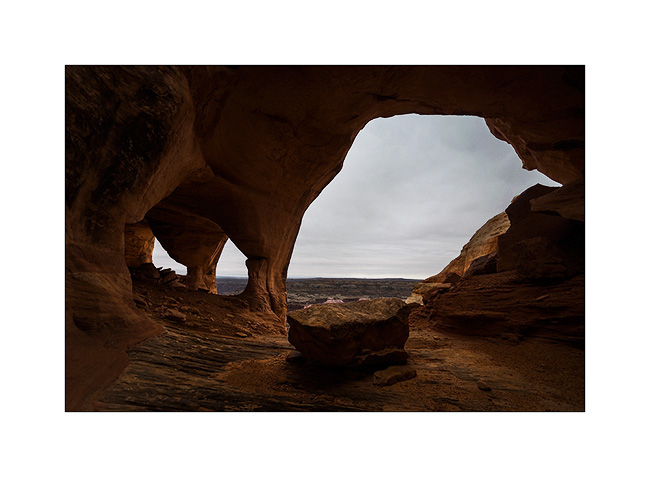
14. Guess who created this double cave? Yes, that’s it, that little spring that seeps from the bottom of the two caves, giving life to some ferns…
15. Almost a makeup eye…
16. By late afternoon, towards a high plateau at almost 7,000 feet elevationl to a camp near another slot canyon.
17. Upper Reds Canyon cliffs in Sunset light.
Another dive in a slot canyon to come soon! 😀
San Rafael Swell
Continuation of discovering this region less known and yet not far from Moab.
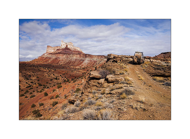
1. VivaLaVida on a little-used trail that circumvents Temple Mountain.
2. They are many old uranium mines in the area.
3. They are of course closed.
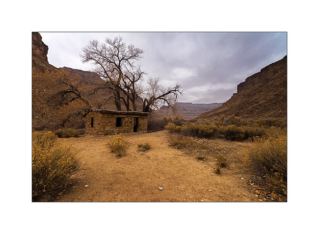
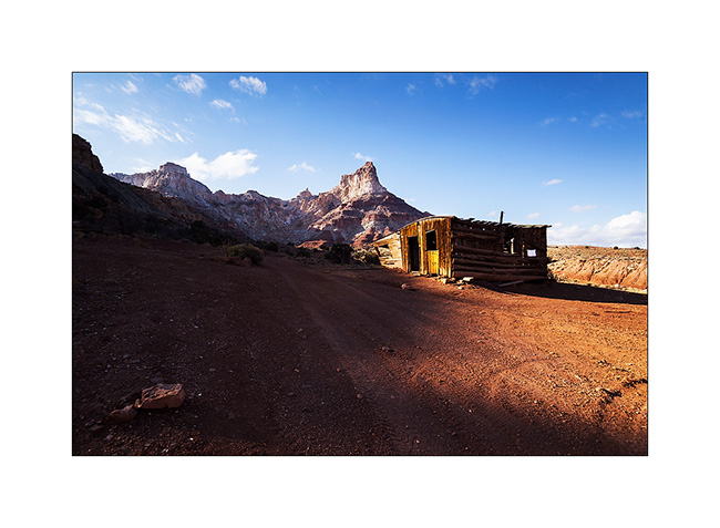
4. On the other side of Temple Mountain remains the “cabin” which housed miners.
5. Mining access corridor.
6. VivaLaVida going down the beautiful North Temple Wash…
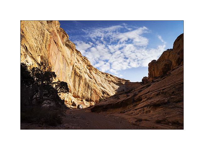
7. … driving in the course of the wash.
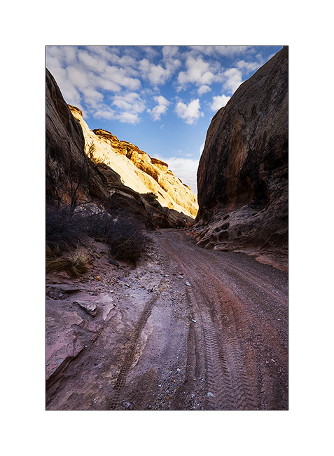
8. The output is a little narrow.
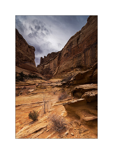
9. Splendid petrograph panel in the South Temple Wash.
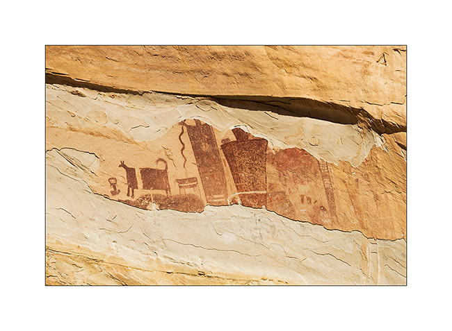
10. The white dots are not of the same time, just a idiot who shot this exceptional site… The weapons are all over the US, unfortunately.
11. Going to the mouth of another canyon that I will explore the next day, I discovered a source…
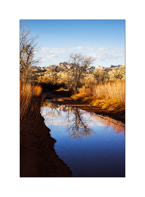
12. Late afternoon reflection…
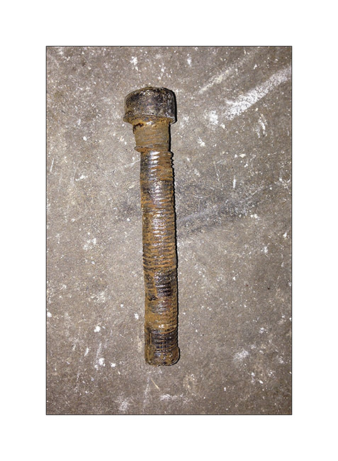
13. Having discovered that the bolts that connect the front axle with suspension springs were loose, I had to make some winching to realign the front axle before tightening… 😉
The next day I made a big hiking loop, up Little Wild Horse Canyon and back down through Bell Canyon.
14. Silhouette…
15. Entering Little Wild Horse slot canyon.
16. End and deep trench in which we sometimes have to go sideways as it’s so narrow.
17. Some water remains in places.
18. I imagine water flowing into these curves…
19. Labyrinth…
20. Some veining of sandstone are incredible.
21. Going down through Bell Canyon
22. Convergence…
23. Oui, it’s the right way! 😉

After this hike, I discovered by chance a nice area that I will present soon. 😀
Ruins and canyons
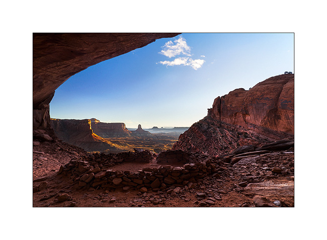
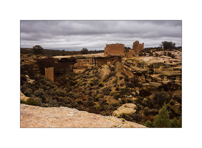
At a small meeting with Tom, aka Zeta on Sportsmobile forum, he advised me to visit the Hovenweep National Monument, a site where are grouped different Anasazi ruins. When I went there, it was raining but I still visited seven different sites.
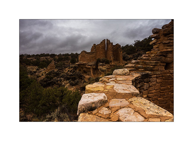
1. The Twin Towers, on the main site in Utah.
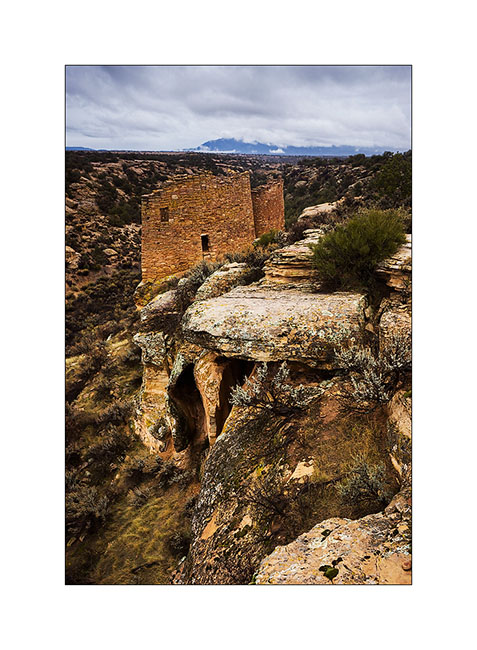
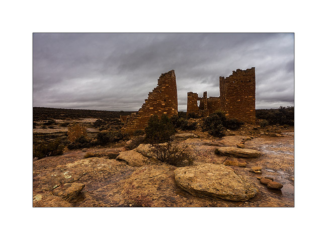
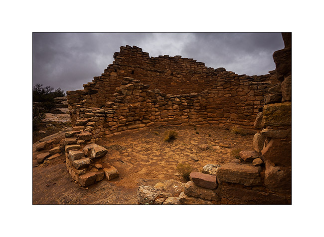
2. Hovenweep Castle and Square Tower. These sites were all built on springs and have likely been built to protect those They were all built between 1220 and 1280, were inhabited by three generations before being abandoned for unknown reason.
3. Hovenweep Castle, consists of two horseshoe towers and a large main house.
4. We go to Colorado, just ten miles away, at Holly site. Amazing how these builders were able to anchor foundations on vertical blocks of sandstone.
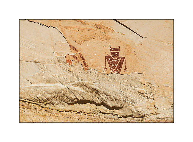
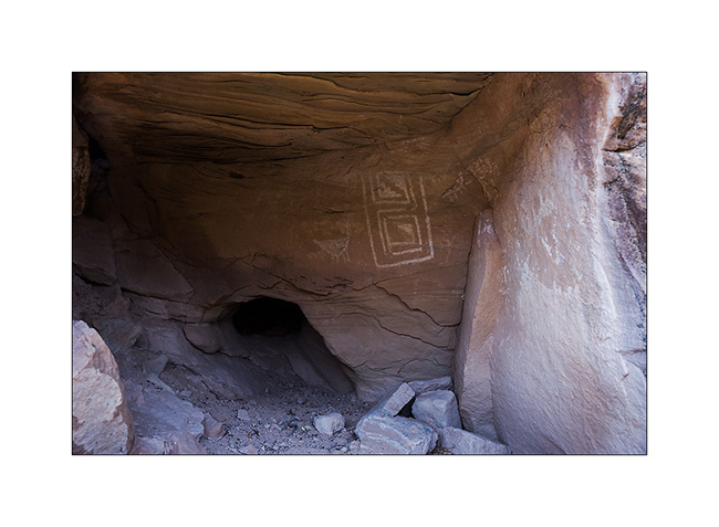
5. While walking through the canyon of Holly, I spotted this petrograph symbolizing the sun.
6. Here is the Horseshoe ruin, an house shaped like a horseshoe with double row walls.
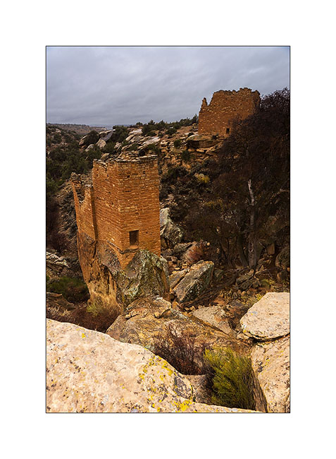
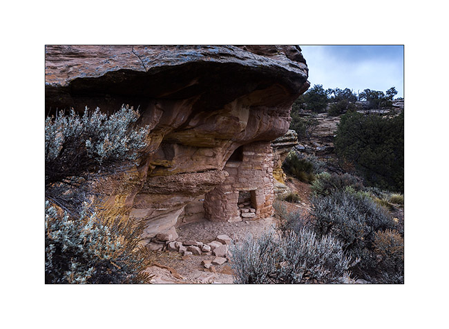
7. Farther, the Cutthroat Castle. Yet the Anasazi Indians were farmers, not warriors.
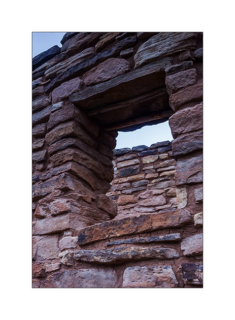
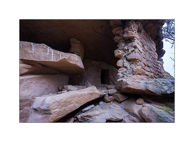
8. A well-preserved window. The covered – a large flat stone – is ensured with two poles of juniper.
9. At the foot of the sandstone block on which the castle sits, there are other structures, probably granaries.
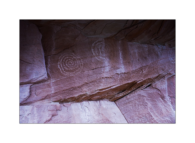
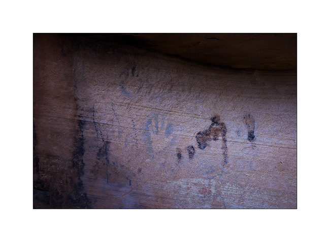
10. Not far away, a known petrograph: Painted Hands. It dates as the ruins of the 13th century.
11. On the site of Cajon, again in Utah, the spring still exists and was protected by two walls.
12. Some petroglyphs in Cajon Cayon.
A part ordered for VLV still not arrived, I went to spend a few days in South San Rafael Swell, beautiful region that contains many canyons.
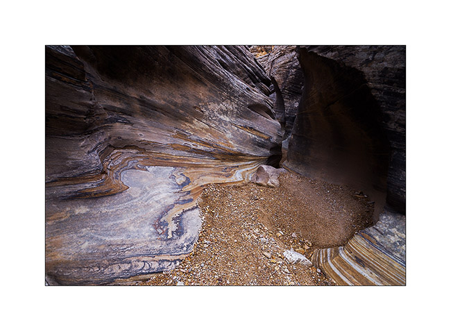
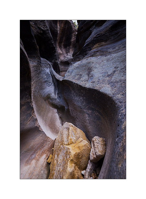
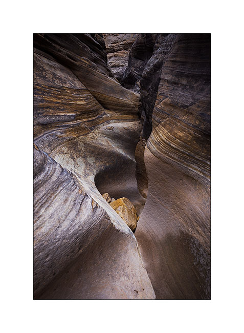
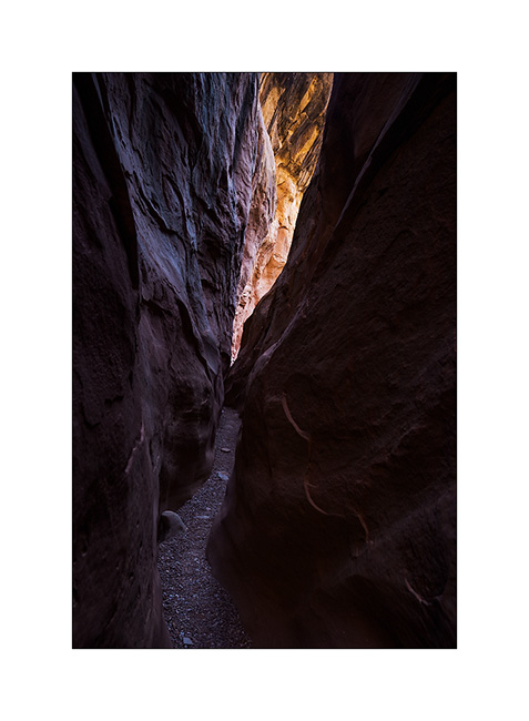
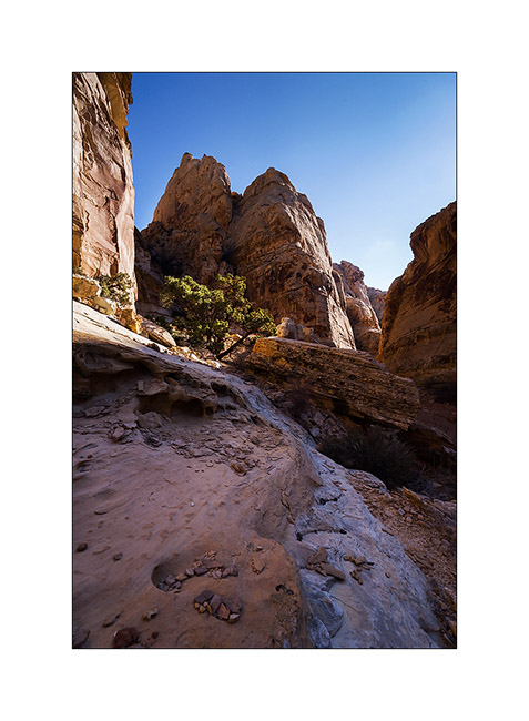
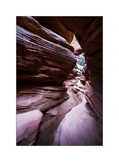
13. It is rather gray and very cold when I enter Crack Canyon.
14. This is not really a slot canyon but some portions have beautiful overhangs dug by flash floods.

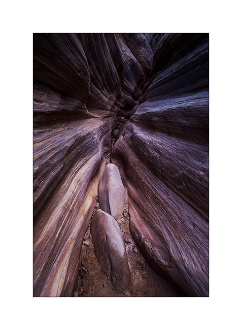
15. This is the narrowest part.
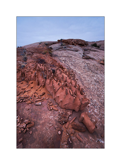
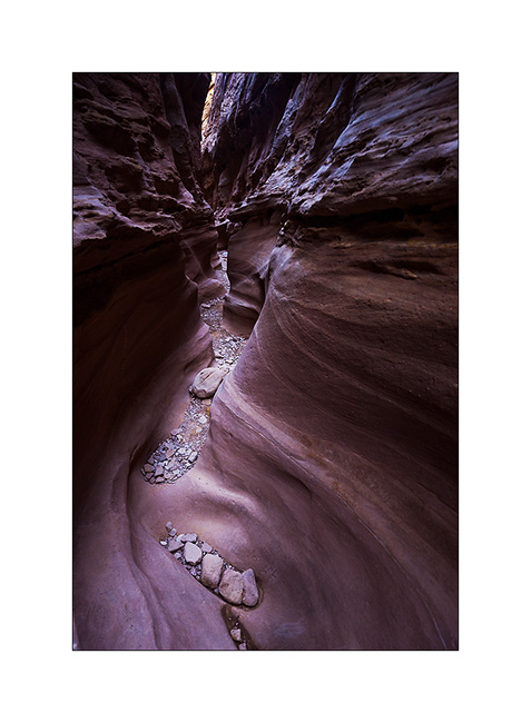
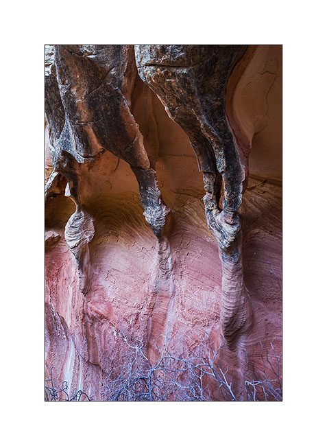
16. Columns carved by wind and water…
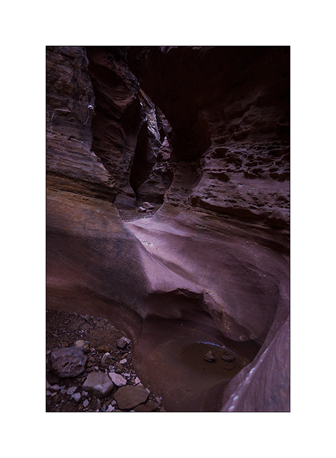
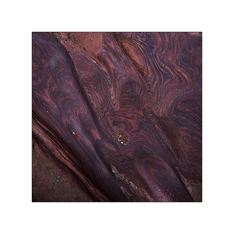
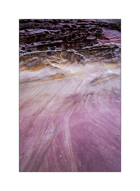
17. Sandstone colors…
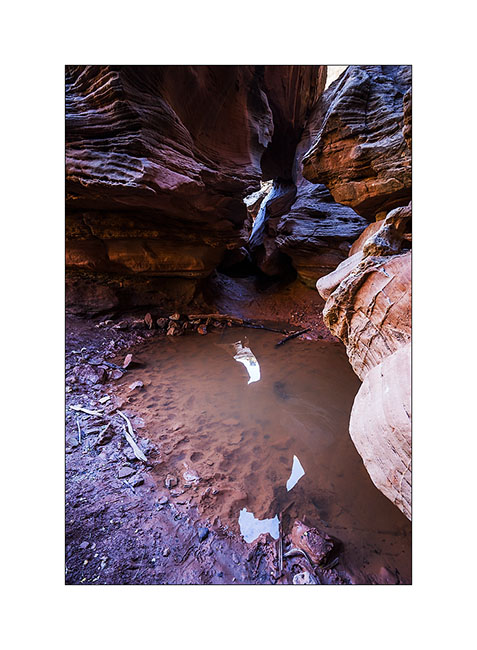
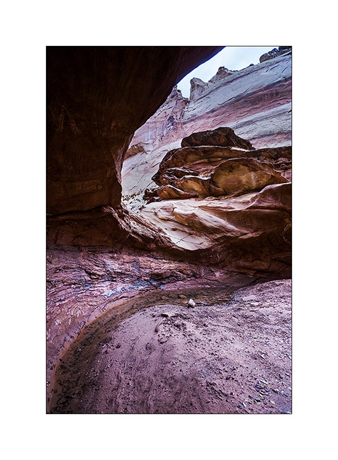
18. Pot…
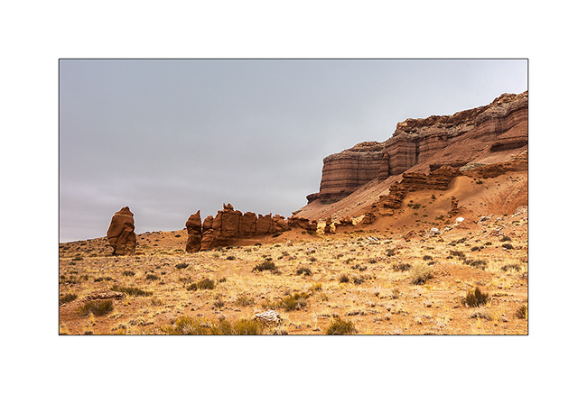
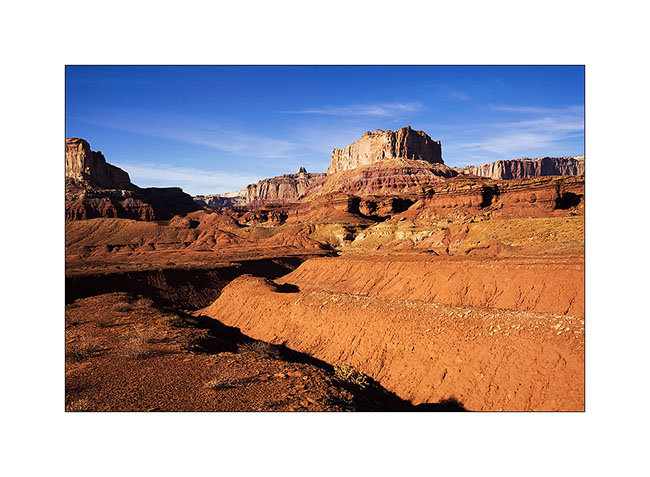
19. Late afternoon on Temple Mountain with finally some sunshine…
More to come in San Rafael Swell soon. 😀