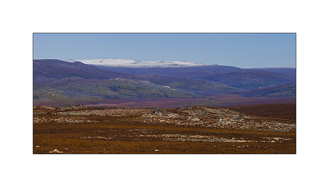
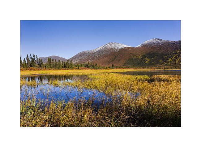
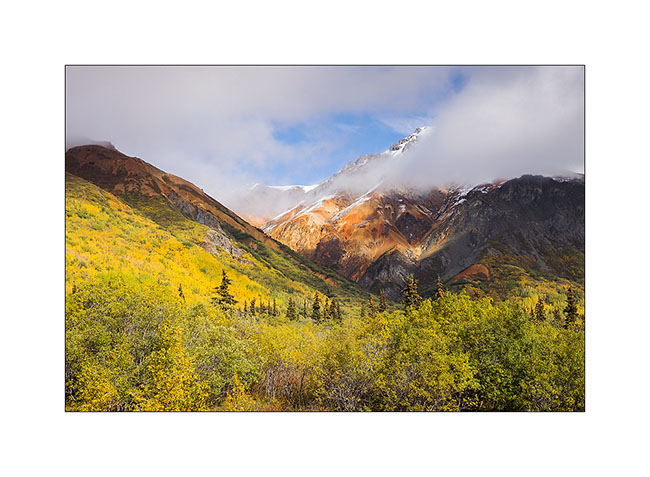
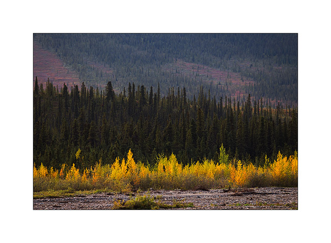
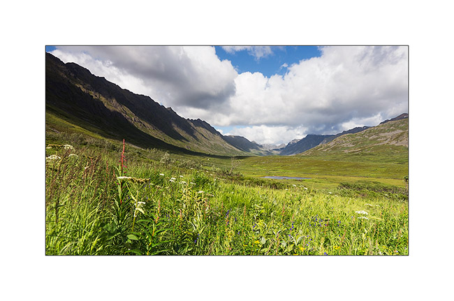
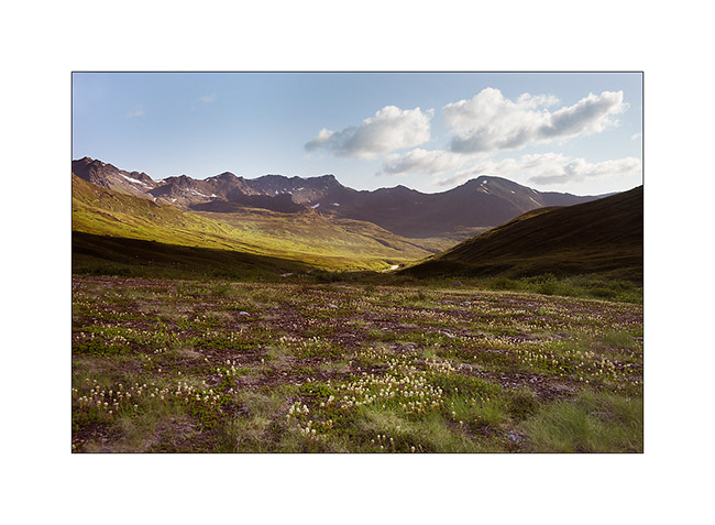
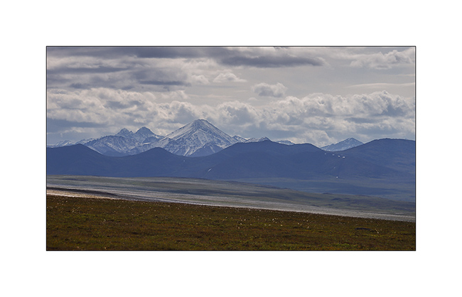
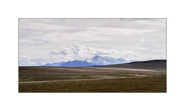
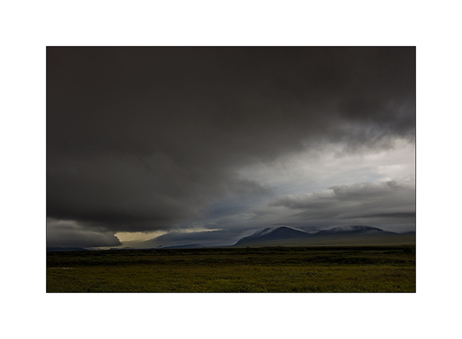
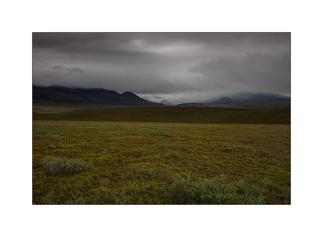
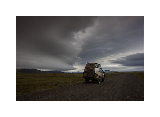
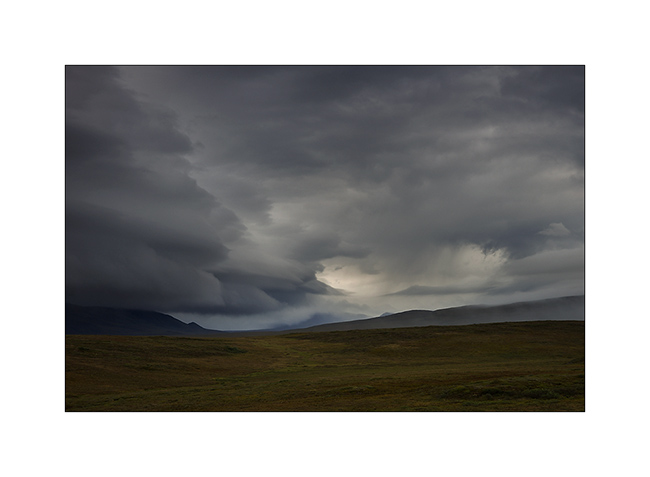
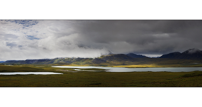
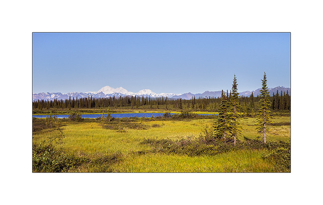
tundra
now browsing by tag
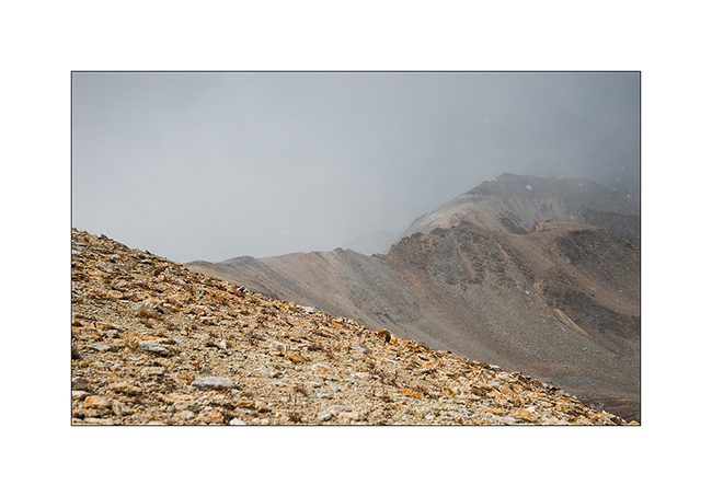
Alpine loop…
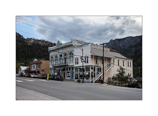
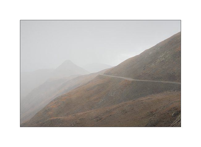
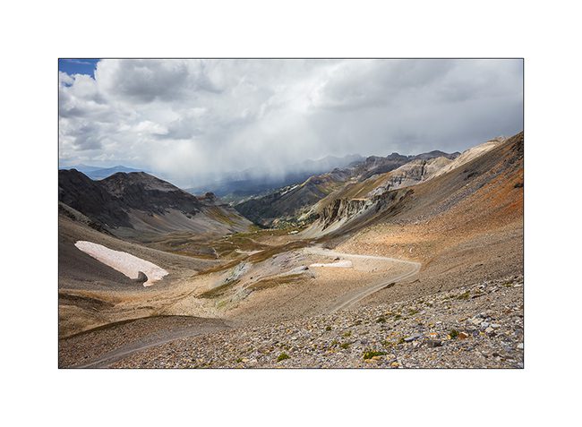
Imogene Pass is by far not the only track traced in these mountains. I went through Ouray buy some fresh food before traveling part of the Alpine Loop, a track that some Jeep enthusiasts love to discover.
1. In Ouray even more than in Telluride, we believe to be a century ago!
2. The opera building.
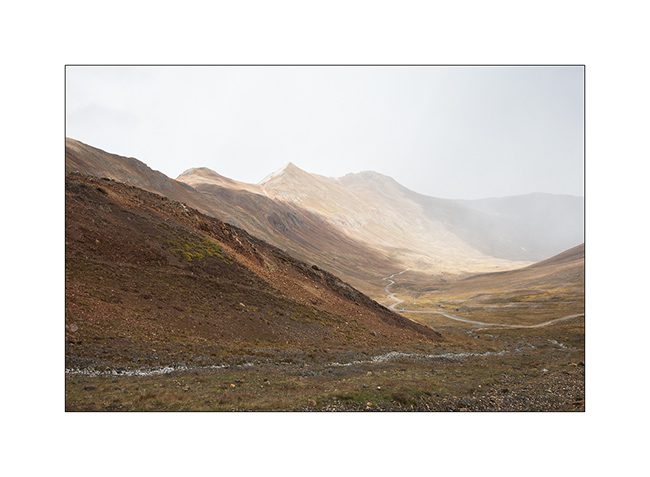
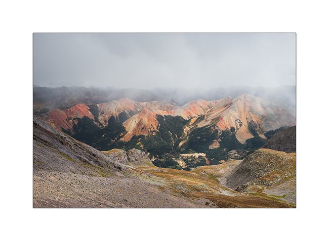
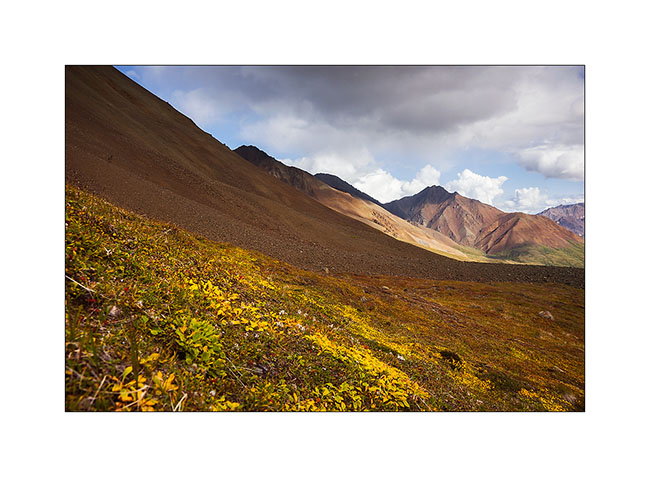
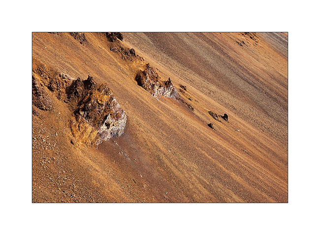
3. Red Mountains which are aptly named, since my camp.
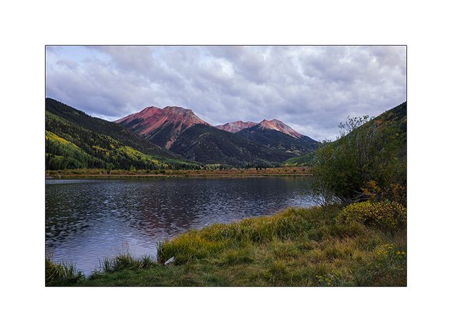
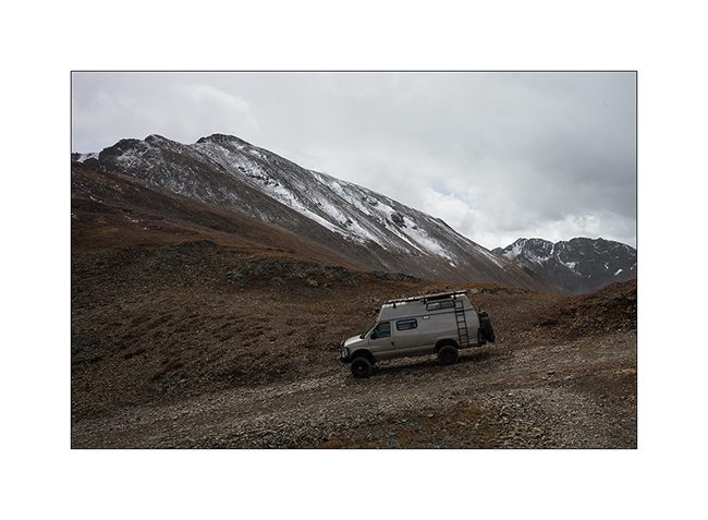
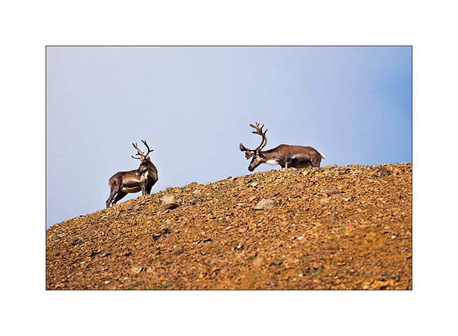
4. The next day, VivaLaVida begins by Gray Copper Gulch roa, amid the Red Mountains.
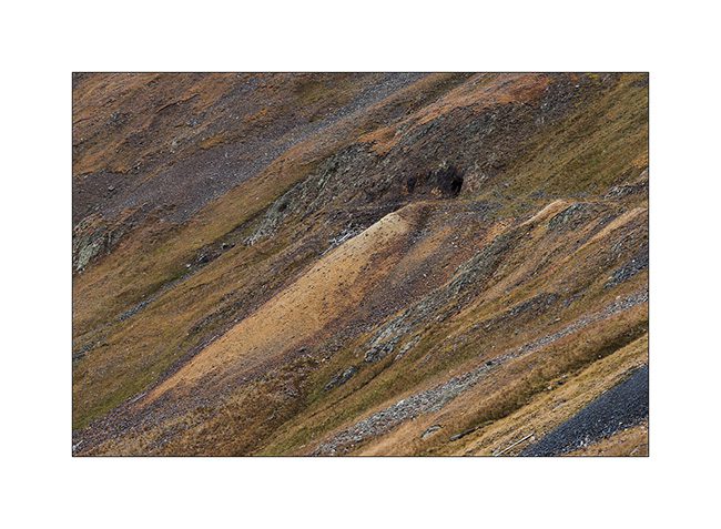
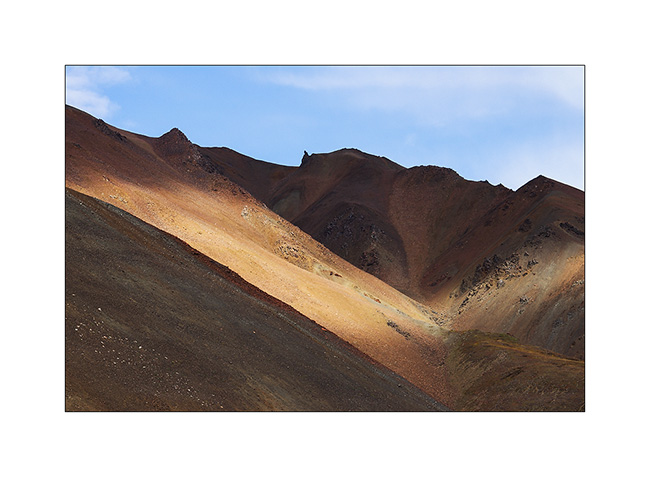
5. It’s color of the iron oxide which obviously gave their name to these mountains.
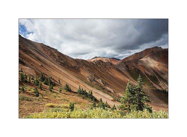
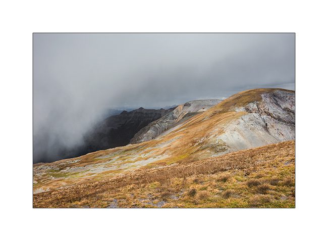
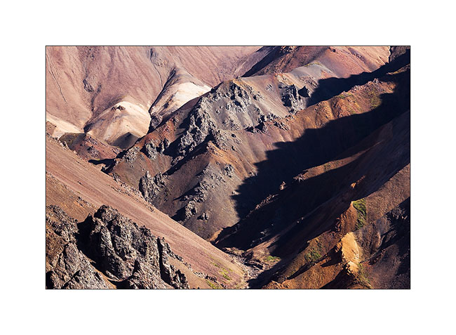
6. Colors are awesome!
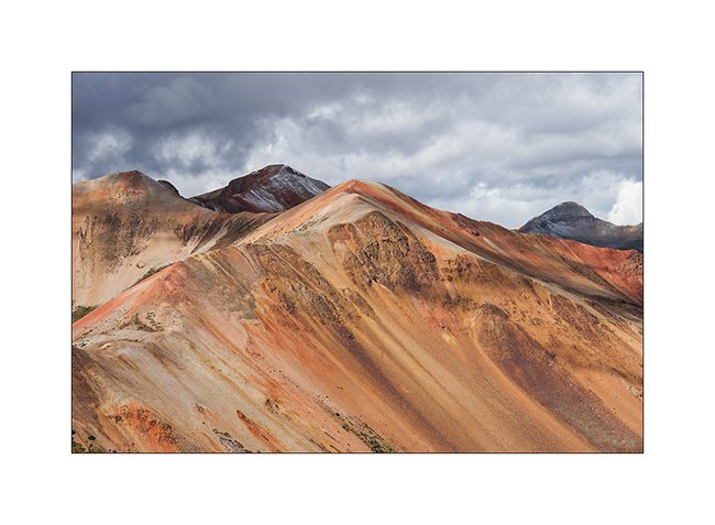
7. While on the nearby mountains, the iron ore concentration is not as important.
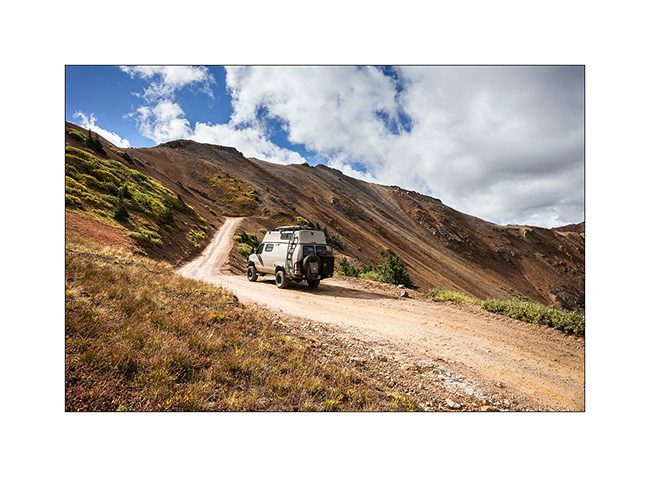
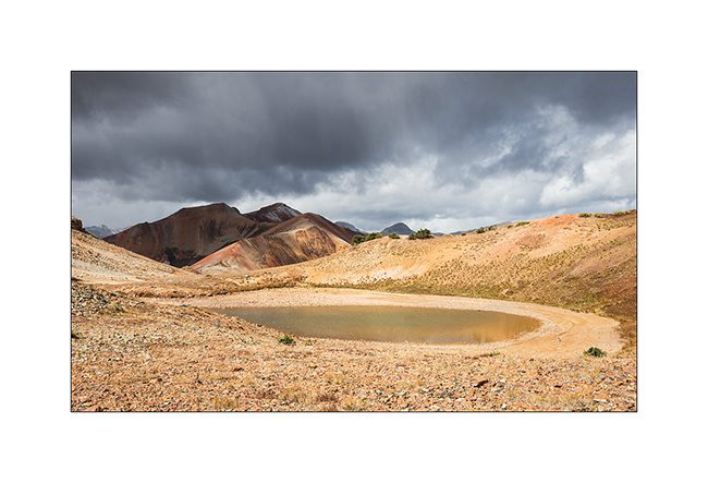
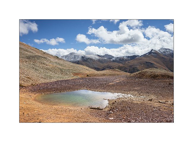
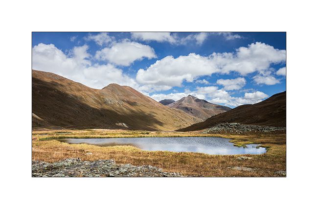
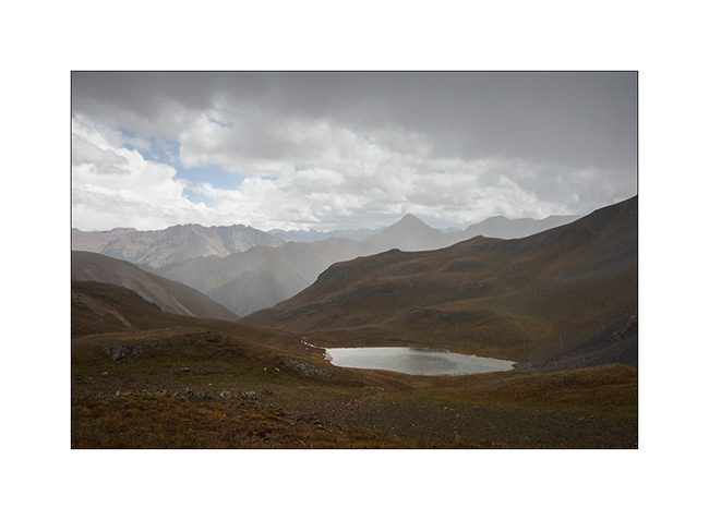
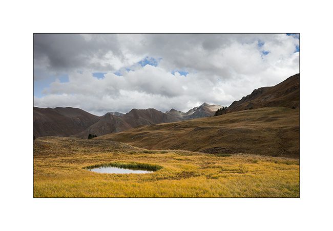
8. At the first pass (12,400 feet), a small lake…
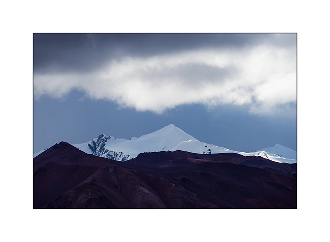
9. A little further, another cad and peaks powdered with snow of the night.
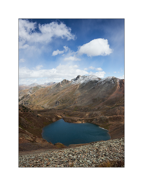
10. Lake Como, the larger of the area.
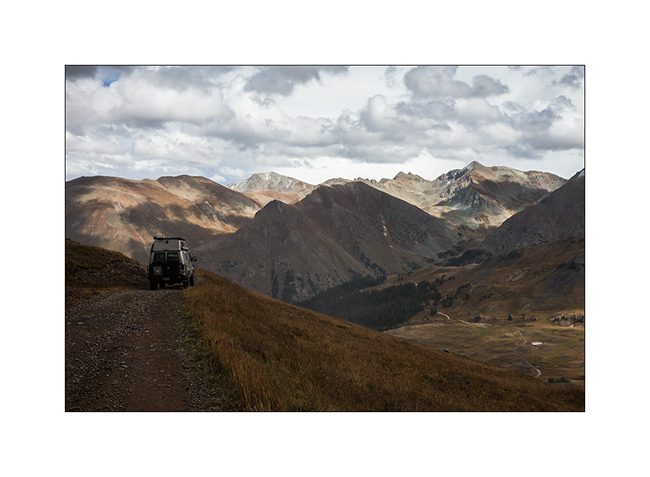
11. VLV cashes altitude unflinchingly.
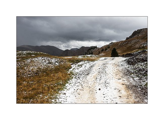
12. Snow shower at 12,700 feet, over California Pass.
13. Downhill on the other side while the shower goes away.
14. I left VLV a few hours to walk to a swampy area.
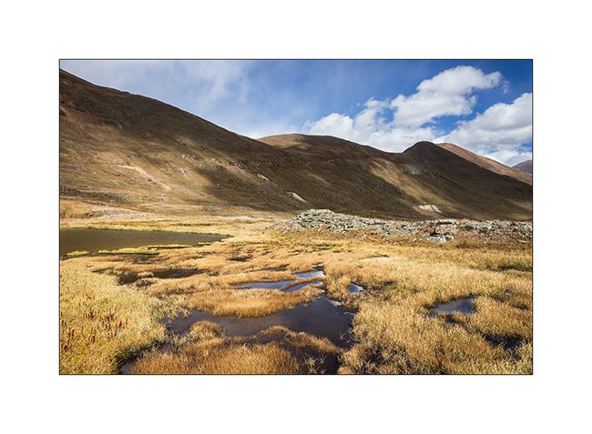
15. Altitude bogs…
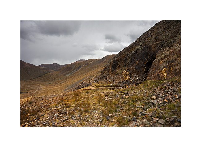
16. Everywhere, mining relics leave their trace. Here, a typical mine with tongue extracts waste.
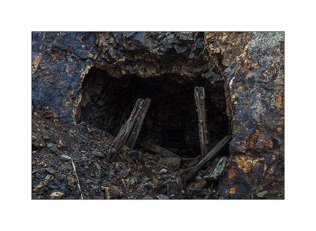
17. entrance of Silver Queen Mine…
18. All were closed to prevent accident.
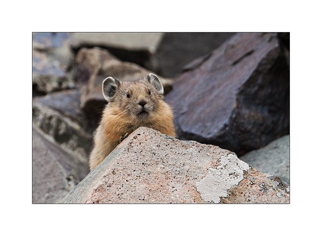
19. Nice surprise: I could finally capture the portrait of an adorable pika, so lively that it’s almost impossible to photograph.
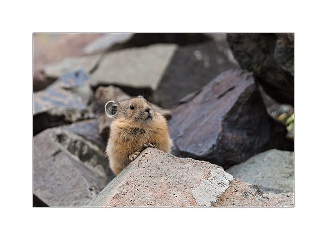
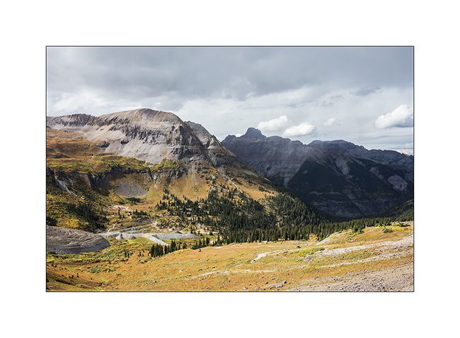
20. It lives in screes and it sneaks in full speed.
21. New snow shower.
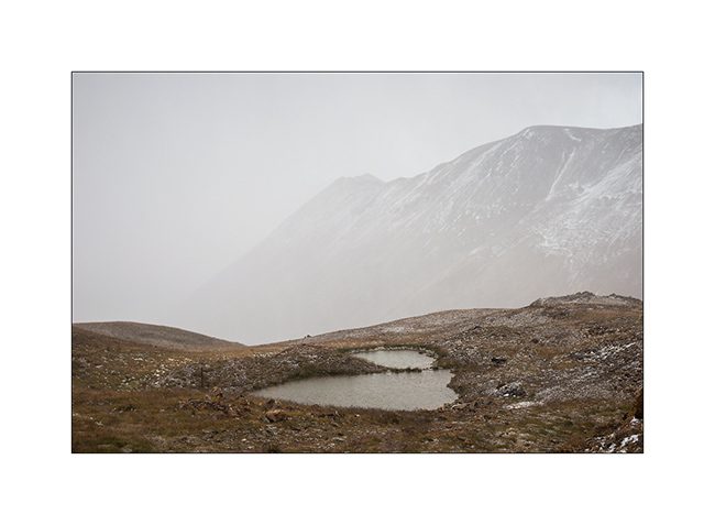
22. Small alpine lake.
23. Downhill into the next valley. I only saw two Jeeps that day…
nbsp;
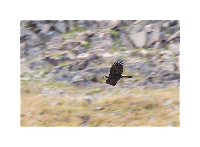
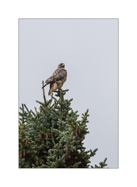
24. For my brother and just as testimony because the picture is very bad: a golden eagle.
25. Another raptor that I have not positively identified.
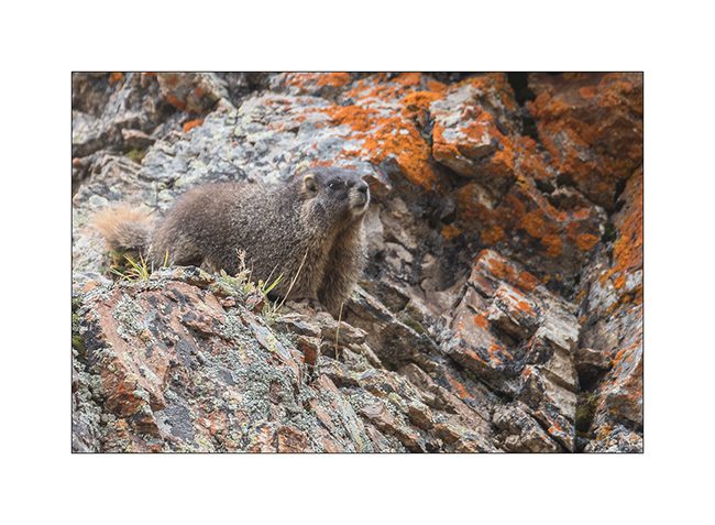
26. There is plenty of marmots..!
27. Alpine biotope.
28. Within minutes, the track is covered with hail…
Well, following the Alpine Loop in the next update, hoping not to bore you with all these alpine tundra images…
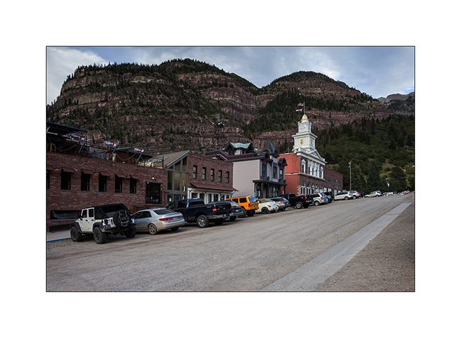
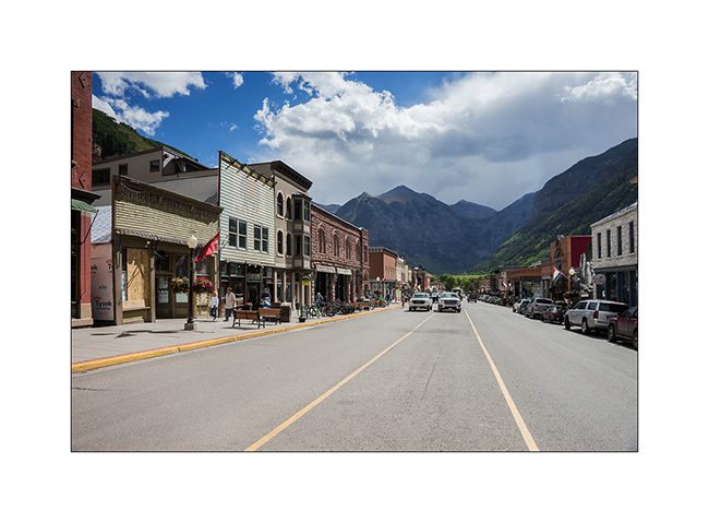
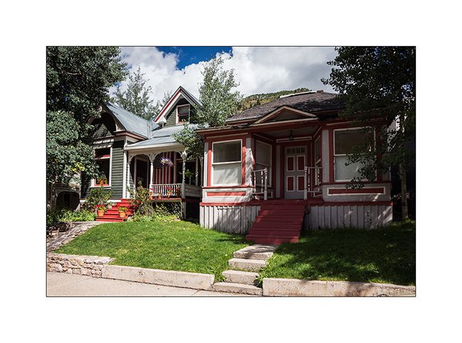
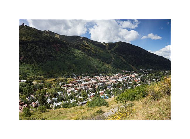
Telluride and its mountains
Less than 200 miles away from Moab, landscape is fully different.
1. Telluride, small mining town founded around 1870.
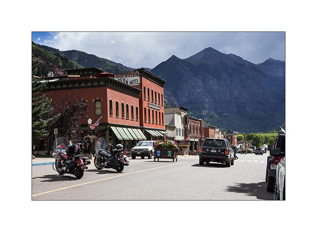
2. Most of the buildings are original and façades are maintained around what they looked like then.
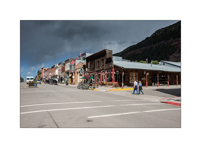
3. Main street.
4. In the side streets, small miners houses have become prized.
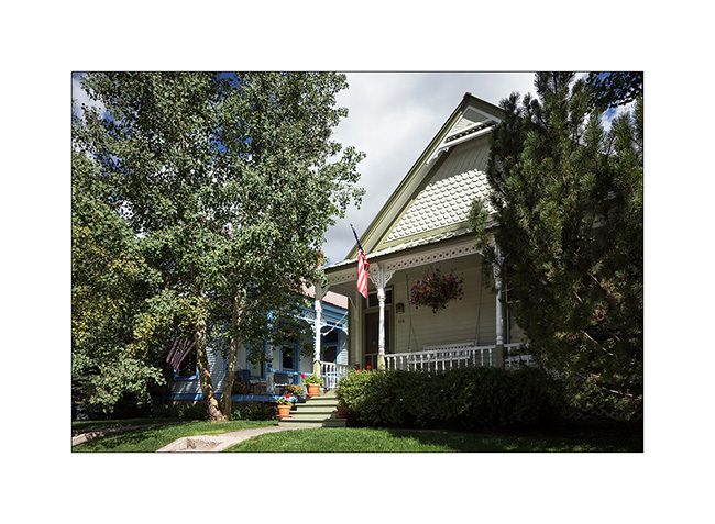
5. They are jealously kept in owning families.
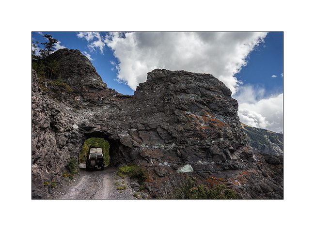
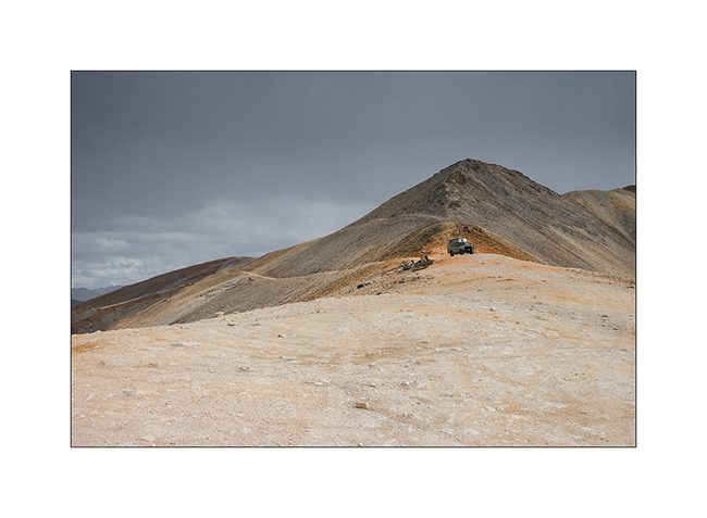
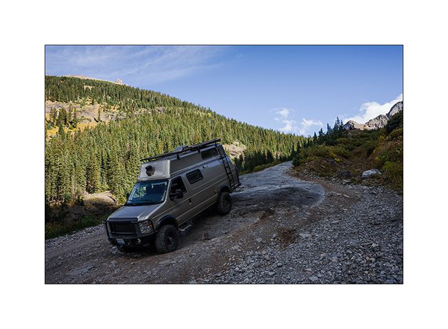
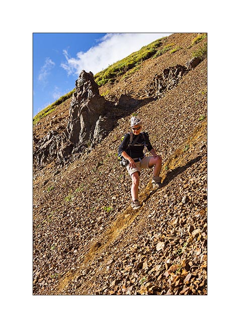
6. Overview of the city that became famous ski resort, while VLV starts the track that will lead her to Imogene Pass.
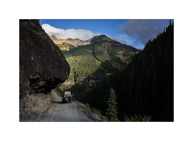
7. Another example ofwhat was created by the gold fever: a carved into the cliff road that crosses a pass at over 13’000 feet above sea level, not less!
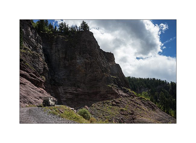
8. VivaLaVida sometimes seemed well wide on the narrow track. Would recommend as therapy for people suffering from vertigo..!
9. There is even a small tunnel to cross a rocky outcrop.
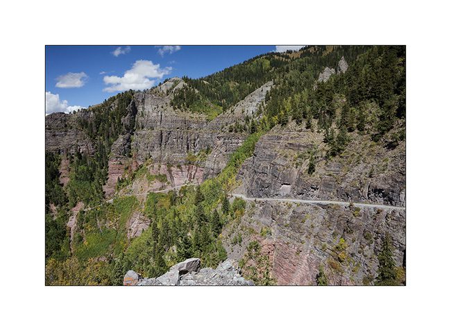
10. The road rises amid the still green aspens.
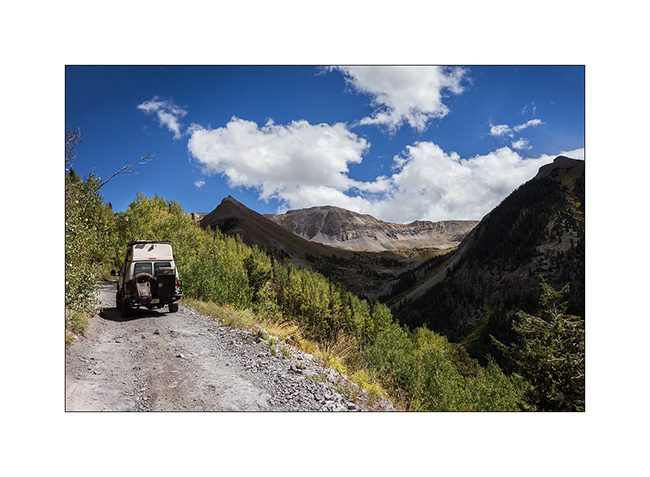
11. The tree limit stands between 9,500 and 10,800 feet elevation here.
12. The mountain is gorgeous with alpine tundra and large screes.
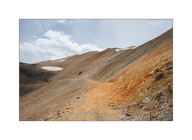
13. The rise is endless but VLV climb valiantly despite the altitude.
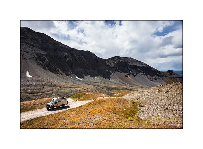
14. The last section is cutted in a 45° scree.
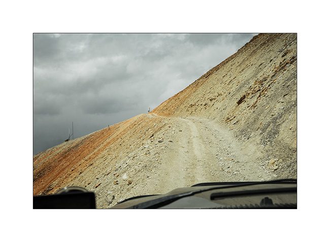
15. And here is the pass!
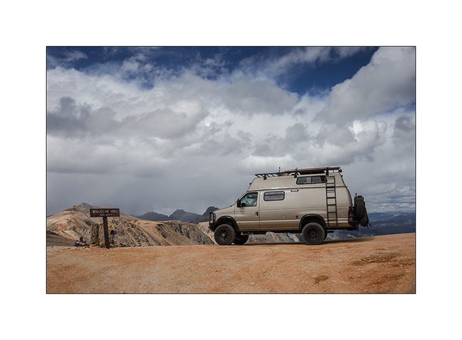
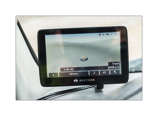
16. Altitude is on the GPS: 4029 meters or 13,218 feet! Impressive!
17. There are no more than loose stones up there.
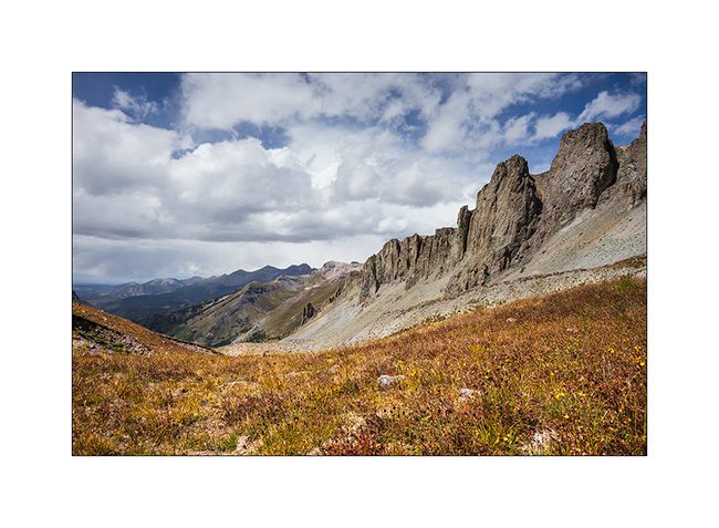
18. Clouds arrived…

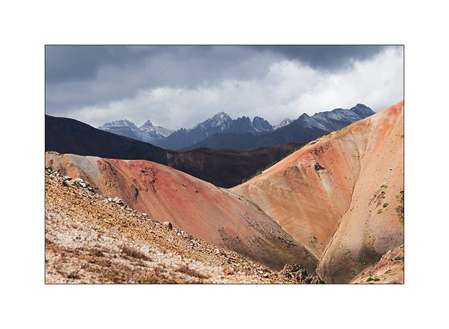
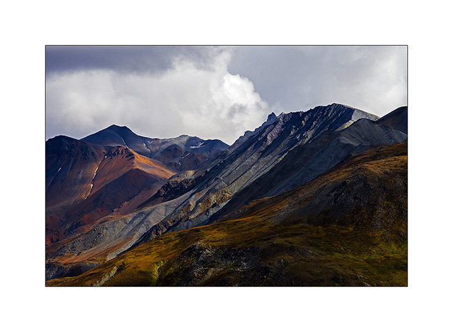
19. Mineral oxides are ubiquitous, coloring the mountains…
20. The trail near the pass.
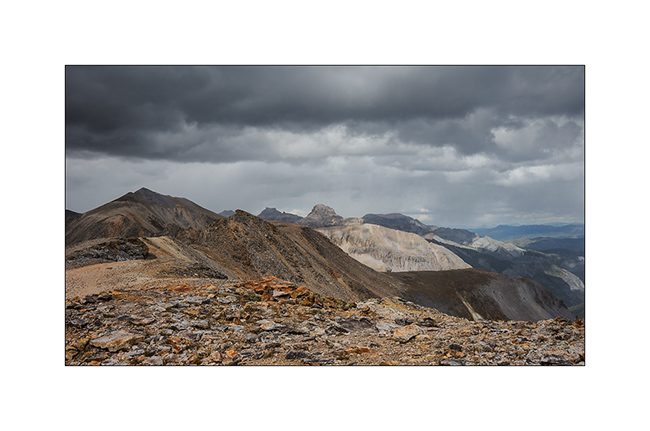
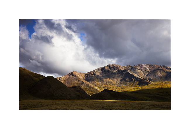
21. Red Mountains through which VLV will sneak tomorrow.
22. Snow showers changing landscape…
23. Constrasts…
24. Mineral desert…
25. Down the other side.
26. The track is not of every rest but nothing to stop VLV!
27. Last section before the arrival in Ouray, another small mining town to discover in the next update.
Sorry for the long update, follow of the journey in a few days. 😉
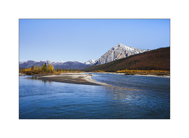
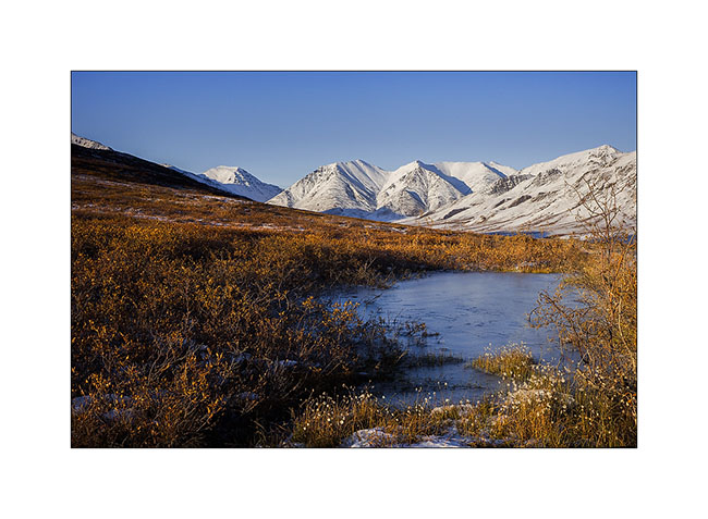
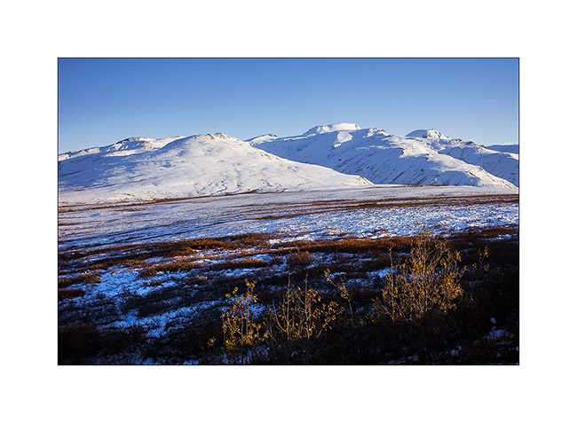
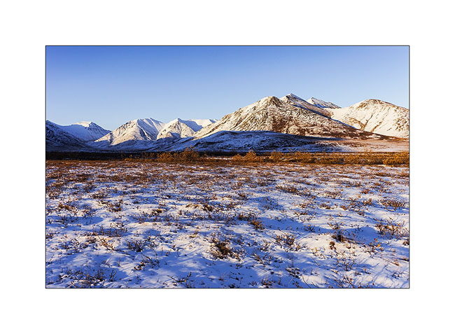
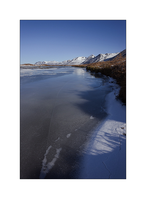
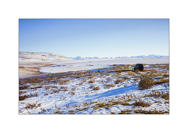
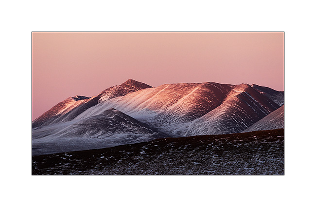
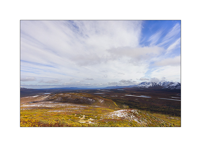
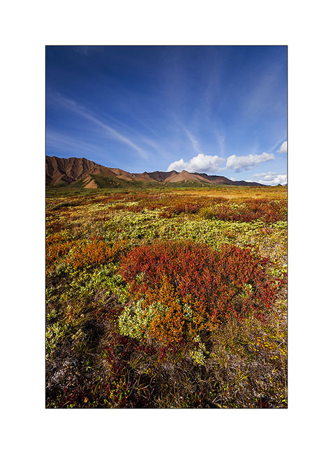
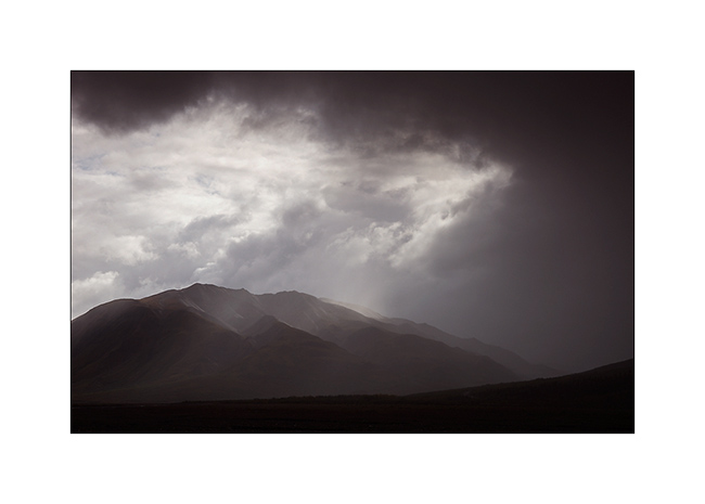
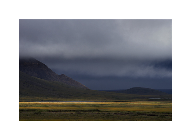
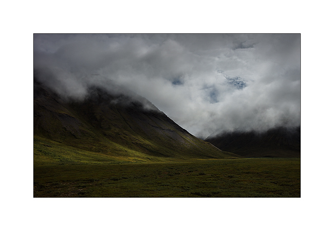
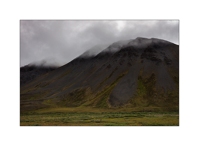
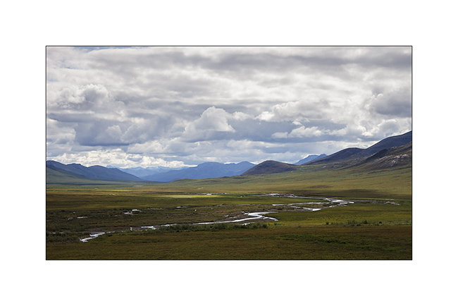
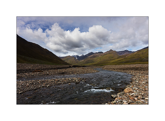
Brooke Range and arctic tundra
We continue farer northward…
1. Nolan valley, a side valley accessible by a really muddy small mining road .
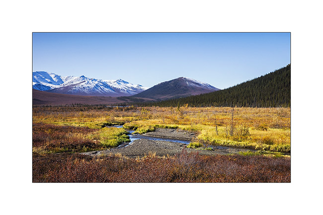
2. At this altitude, the marshes are still not frozen.
3. I found the Brooke Range that bars northern Alaska back.
4. We stop a few dozen miles after Coldfoot to go climbing one of the mountains beside the road.
5. While VivaLaVida begins to climb Antigun Pass, the atmosphere becomes wintry.
6. All is already frozen here…
7. … and it is already well below freezing in late afternoon.
8. As it’s already late, we find a nice boondocking site before Antigun Pass, approx. 4,000 feet elevation on the banks of a small river.
9. Despite the cold, I’m going to make some pictures while Mino is preparing the aperitif!
Temp will almost reach 10°F that night and VLV’s heater resume service after resting for a few months…
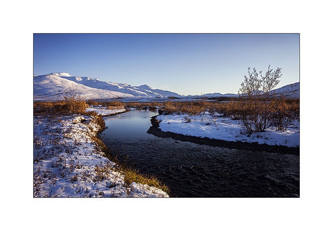
The next morning we cross the Antigun Pass and stop thirty miles down it to go hiking along a beautiful river.
10. The blizzard that blew here two days previously installed winter before autumn has arrived…
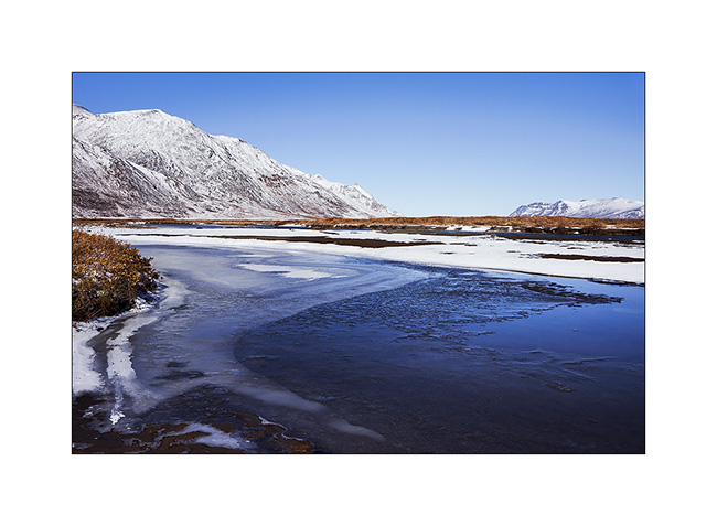
11. Despite a significant current, the banks of the river are well frozen. It was about -5F° in previous days…
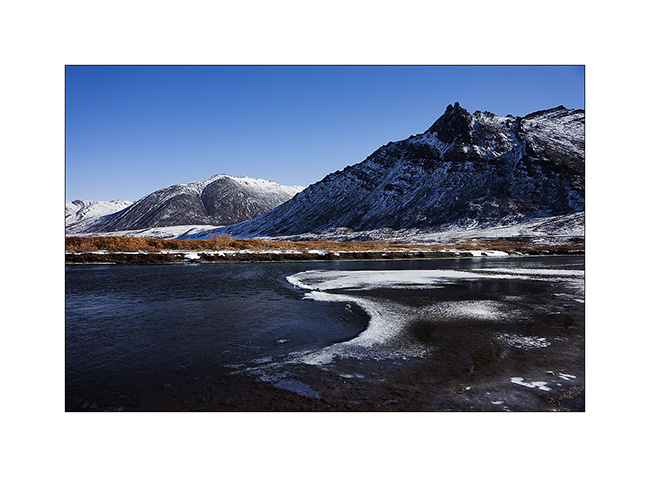
12. I enjoy the clear light to play with ice concretions…
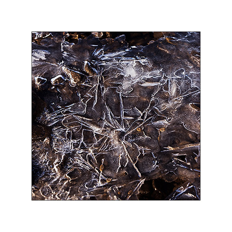
13. … sometimes contrasting and twisted…
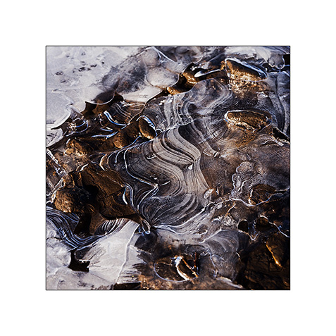
14. … sometimes carved by running water below.
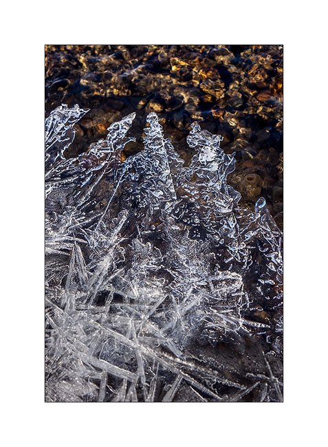
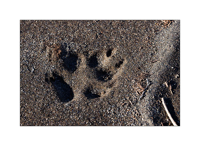
15. On a bank, we find wolf tracks. It happened here less than two days ago, the snow testifies it.
16. The show is sparkling as the river is freezing and carries plates of ice that break in crystal clear sound…
17. … and our eyes feast.
18. Continuing towards the far north, the landscape becomes truly arctic.

19. Blizzard designed the reliefs.
20. Not sure that the truck drivers who supply Deadhorse and Prudhoe Bay are all aware of this beauty…
21. We leave VivaLaVida to walk on a side track…
22. Perfect lines of the wintry tundra…
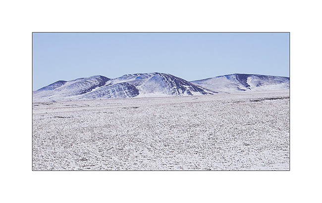
23. We will not go to Deadhorse, the last part of the track is less interesting. We stop at the last foothills of the Norths Brooke Range…
24. … and even find a camp on the tundra. What a fantastic place to camp, isn’t it? 😀
25. The Sunset is beautiful again…
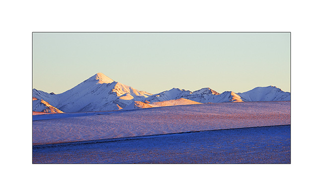
26. … the last rays coloring the hills…
27. … before a magic full moonrise.
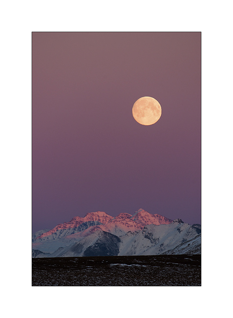
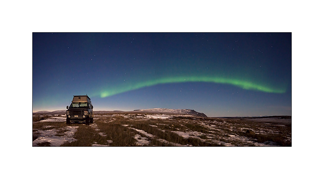
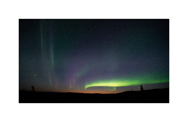
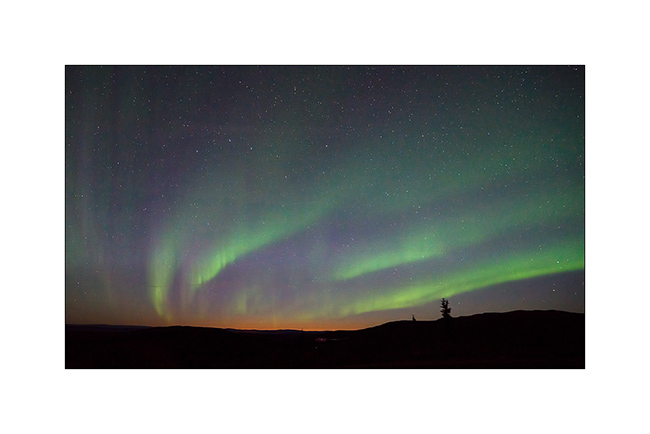
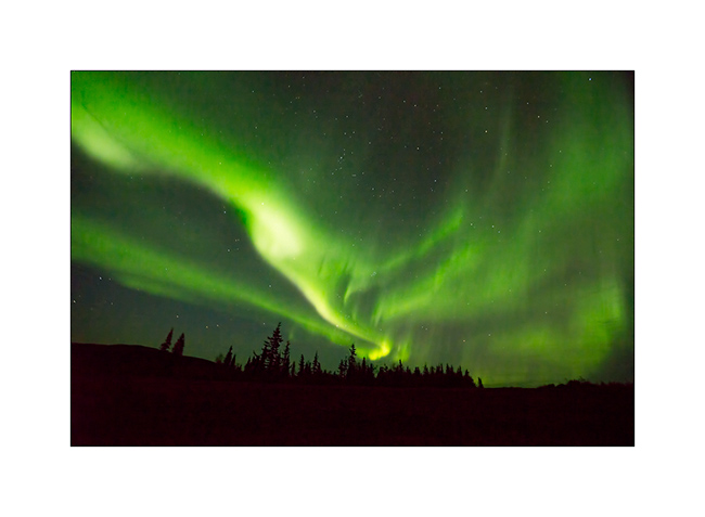
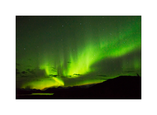
28. And to complete this grandiose day, a northern light came to wish good night to VivaLaVida while the full moon was lighting up the tundra!
We began our descent back to the South the next day. To discover in the next update… 😉
Thanks again for your loyalty!
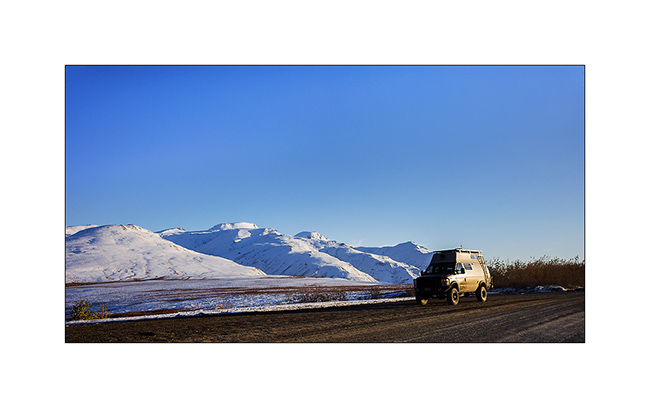
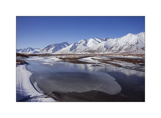
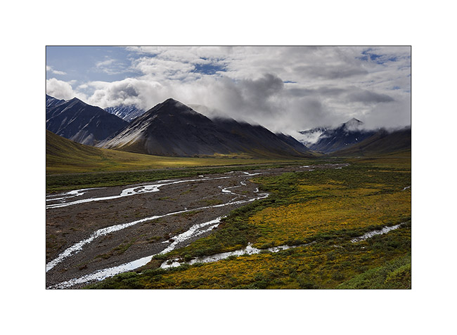
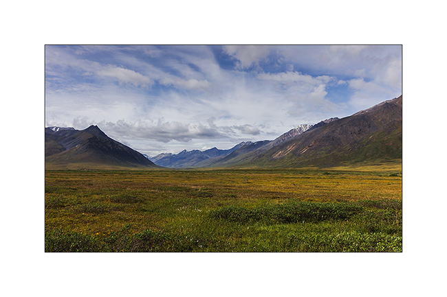
Richardson & Dalton Highways
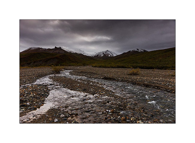
Continuing our journey northward, we cross the Alaska Range covered with fresh snow.
1. Exploring a side valley, not far from our camp.
2. The Richardson Highway passes through high mountains with difficult access.
3. Scree dusted with snow…
4. North slope of Alaska Range.
5. In the kitchen, we don’t let go: wild salmon with dill on a bed of spinach, all cooked over our campfire, hummm… 😉

6. After the show of the previous day, we watch the sky and a new northern light appears with the last light of the Sunset still pointing north…
7. We spend almost three hours outside despite a tempestuous wind and biting cold!
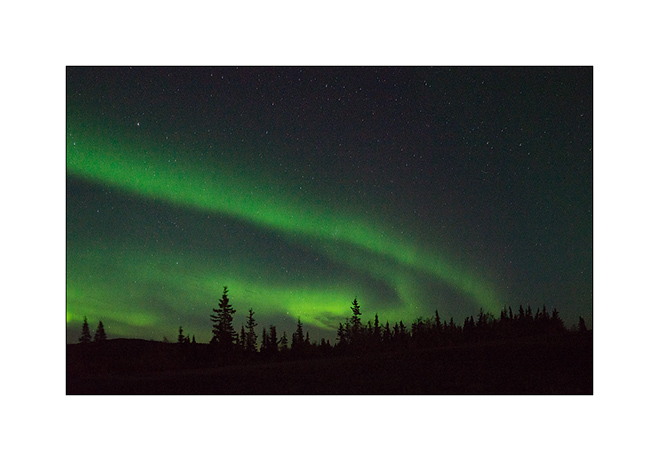
8. Paintings are constantly changing…
9. … sometimes very soft…
10. … sometimes very intense.
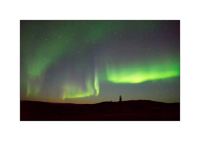
11. Sometimes the aurora crosses the sky with a truly amazing intensity, almost comparable to that of the moon.
12. We are almost hypnotized by the show…
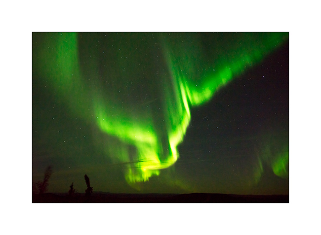
13. … and the grandiose beauty.
14. After going late to bed, we entered the Dalton Highway the next day. The atmosphere was completely different than during my first visit, I feel like discovering other landscapes…
15. Here too the recent snow still covers the hills.
16. Taiga has completely changed color with warm tones adorning.
17. A picture of Grayling Lake I made during my first visit. If you want, you can compare: it’s the image # 17 ! 😉
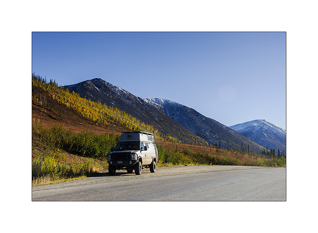
18. VivaLaVida on the Dalton Highway.
19. Between the orange-red willows and bright yellow aspen and birch, the colors are incredibly saturated…
20. … and snow further strengthens those.
To be followed soon…
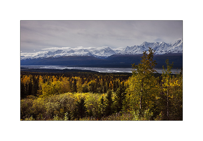
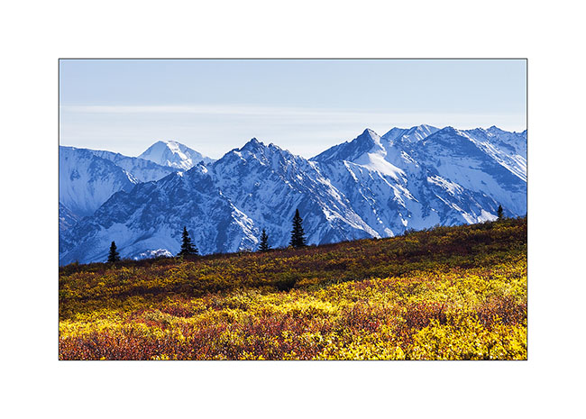
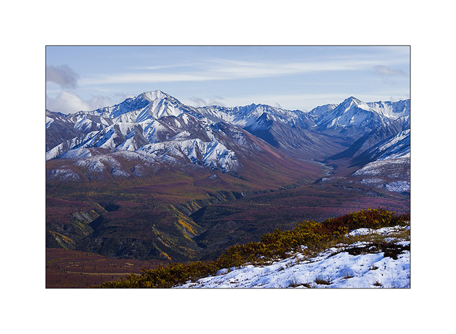
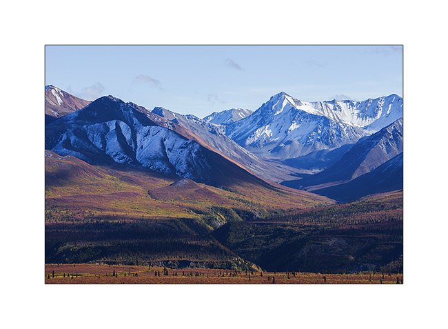
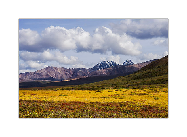
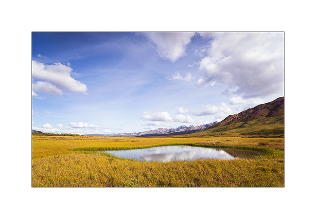
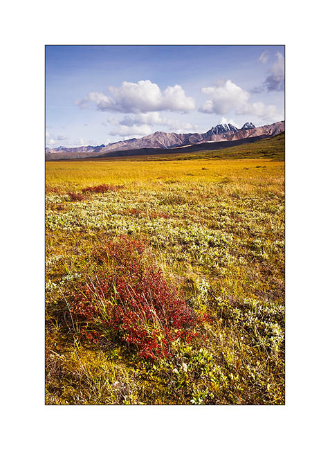
Central Alaska
I’m back after a few days of silence due to a lack of network.
Initially, Mino should leave from Seattle. However, to take advantage of the fall in Alaska, at our last update, we were waiting for a confirmation on the ability to change her return flight to leave from Anchorage. The response was positive and, at the time you’ll discover this update, Mino will be on the plane bringing her back the Switzerland…
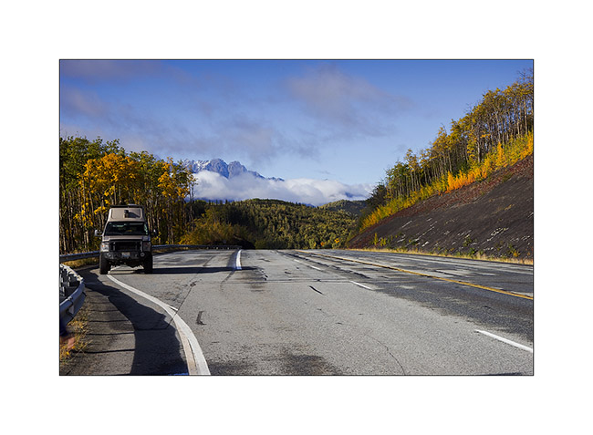
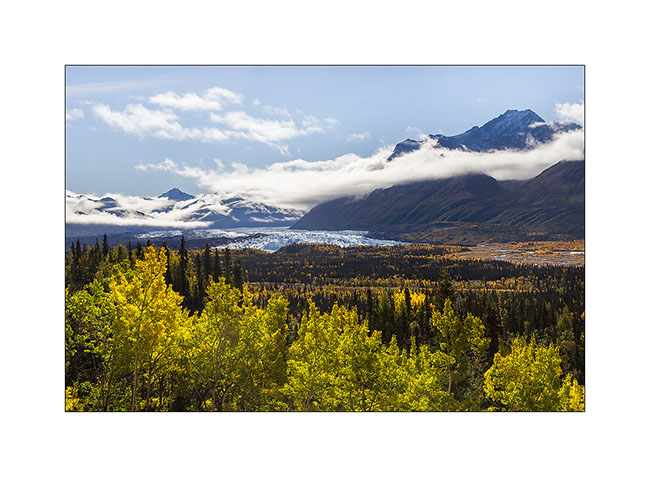
As soon as we got the answer, a favorable weather forecast decided us to move north along the Dalton Highway I had already traveled six weeks before. We hoped to discover the fall colors on the tundra and to hike in Brooke Range. We then headed to the Glenn Highway to Glennallen and after a first night at a hundred miles from Anchorage, we woke up enjoying the first snow fall on the surrounding mountains.
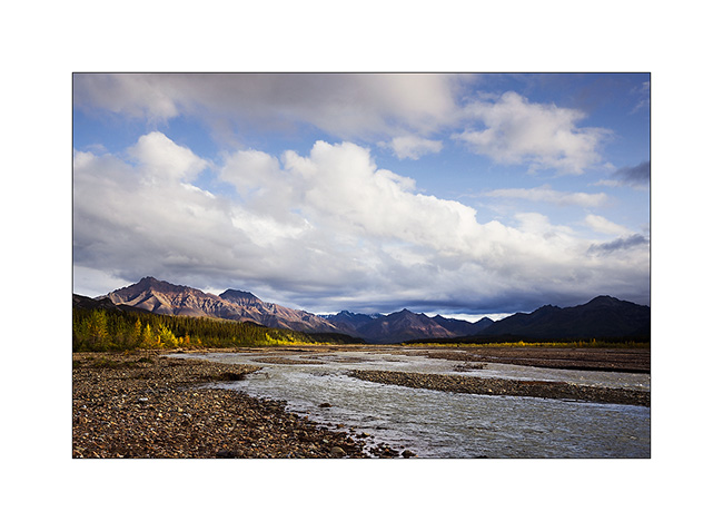
1. Matanuska River in ther morning.
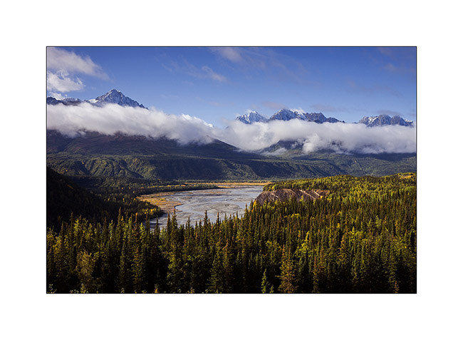
2. They are still many clouds on the mountains.

3. The first frosts begin to color the trees.
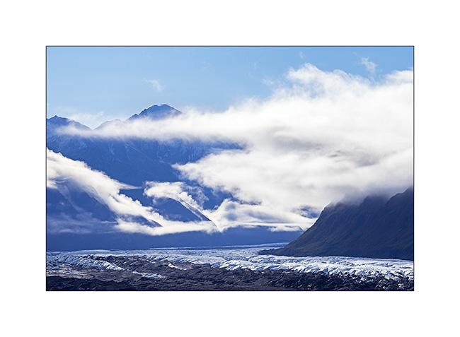
4. We pass near the huge Matanuska Glacier.
5. Clouds plays…
6. Some hills are really colorfull.
7. With such a nice weather, we decided to go hiking and discovered a small altitude lake.

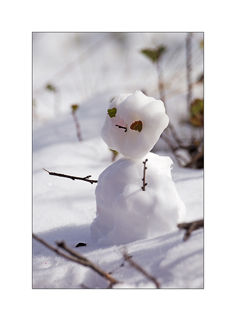
8. The first snow of the season inspires Mino…

9. … who signs its passage ephemerally… 😀
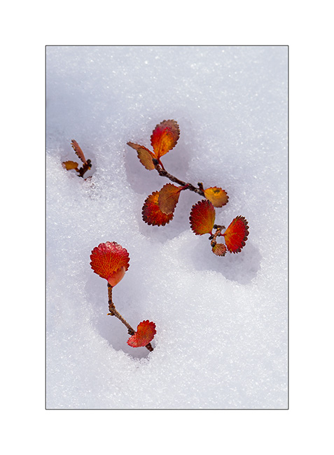
10. … while for my part, I play with the contrast between the snow and the “willows” colored with their characteristic orange-red fall color.
11. As and when we climb, the view extends over the surrounding valleys.
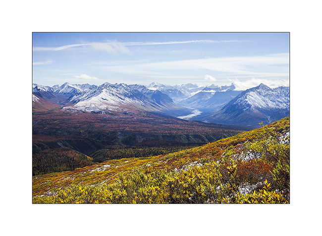
12. The horizon is so wide…
13. Souvenir picture…
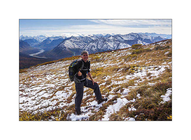
14. After nearly three hours to make our way uphill in the tundra, a break is welcome under a beautiful sky of cirrus.
15. A river that flows from one icefield, more than 40 miles away..!

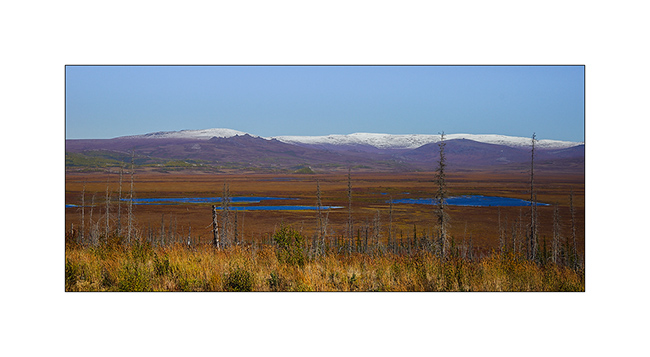
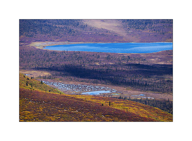
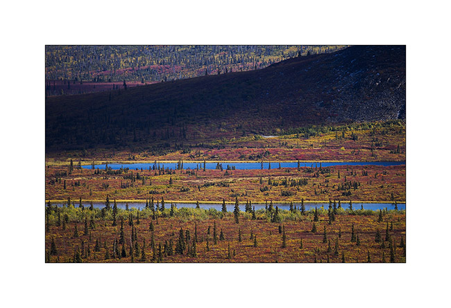
16. From above, tundra reveals so many small lakes and marshes…
17. The contrast between the warm tones of the autumn tundra and the white snow is beautiful.
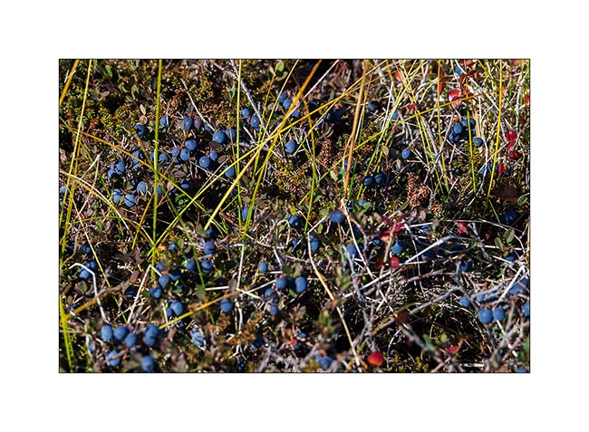
18. We enjoy some of the thousands of blueberries that are everywhere.
19. This mix of colors is so beautiful that I would stay there longer and longer…
20. Other lakes as we descend…
21. It’s getting late, shadows contrasted the opposite side of the valley…
22. Continuing the road, I took a foot bath to take this image in a flooded marsh in beautiful sunset light.
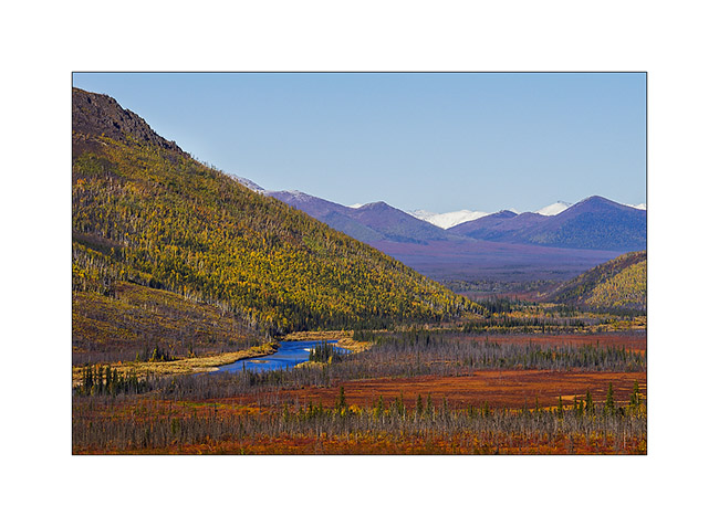
23. Vivalavida goes north. In the distance, Mount Drum, another volcano from the large fault extending from the Aleutian Islands to Mexico, and the huge dome of Mount Jarvis.
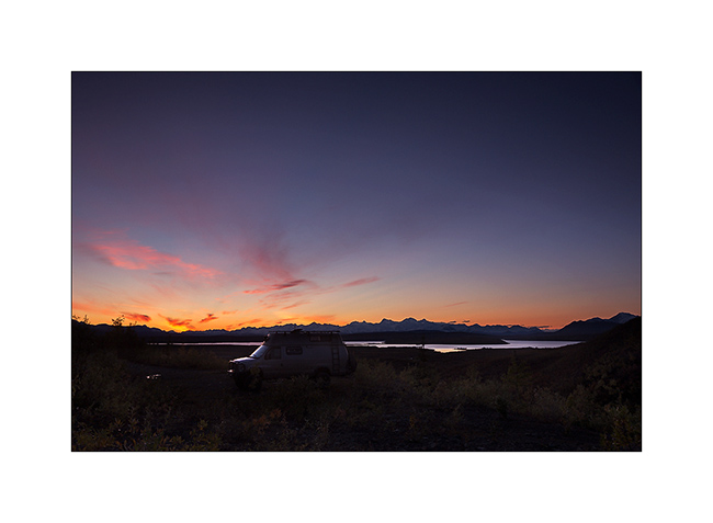
24. We find a nice camp site near Paxson.
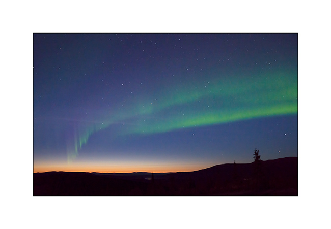
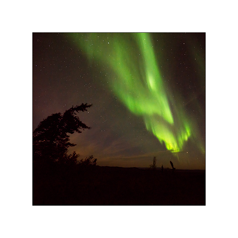
25. And while I’m about to go to bed, surprise: a powerful northern light lights the sky up!

26. This is the first that I have the opportunity to see, what a sublime spectacle… I will lie down only at 2am that night… 😉
The following will take in the far north where we had a small preview of the new winter to come … Coming soon here. 😀
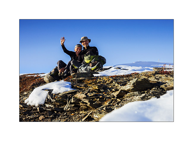
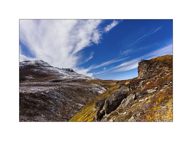
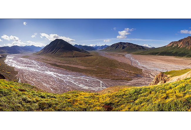
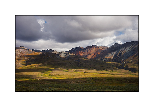
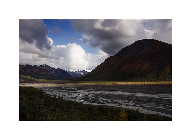
Denali National Park (3)
Third day of discovery still hiking. That time, we leaved the bus at Toklat River to climb Polychrom Mountain.
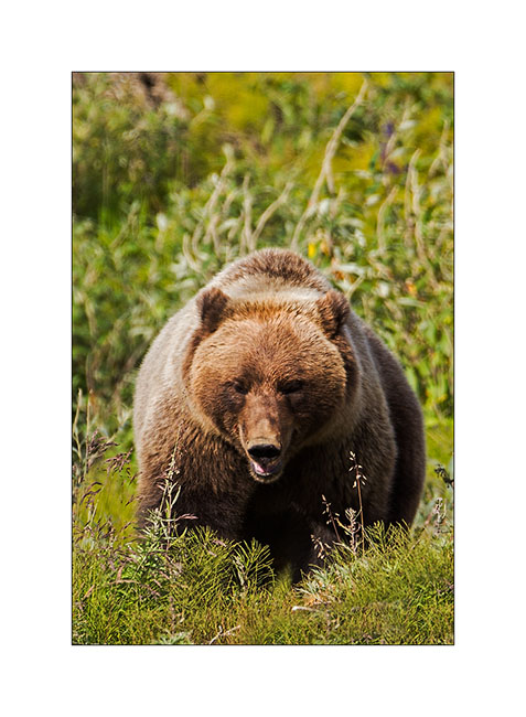
1. New encounter in the morning!
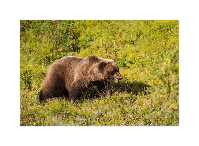
2. He is also ready for a hibernating winter!
3. Starting to climb above the Toklat River.
4. From above, the view is fantastic!
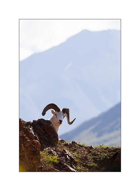
5. As we climb a cliff, we see the same dall sheep with a broken horn than two days earlier.
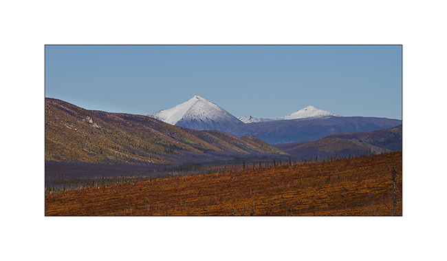
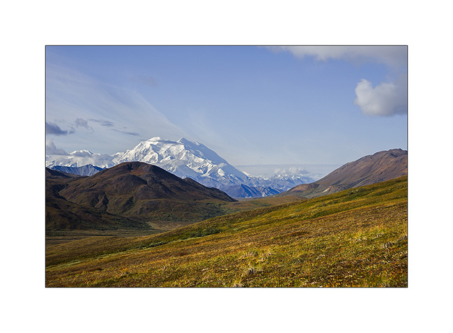
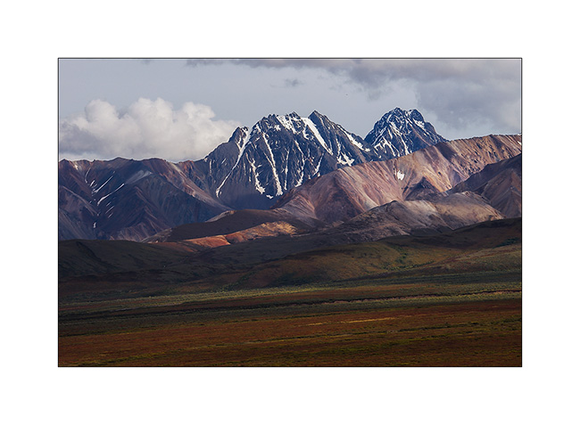
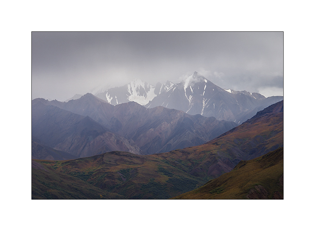
6. In the morning, we enjoy an unobstructed view of the Giant, “Denali” or “the High One”.
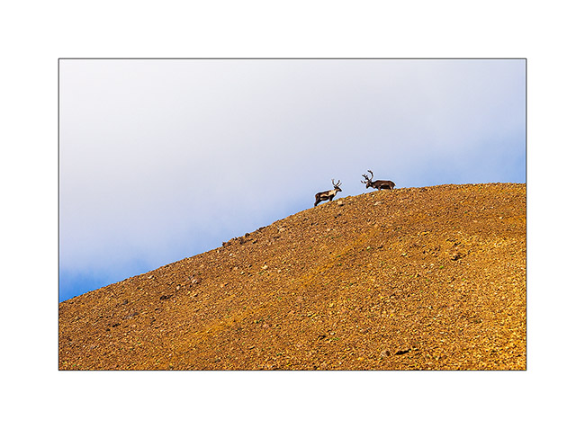
7. Higher in the scree, caribous appear on a ridge.
8. I approached slowly trying to be as quiet as possible…
9. I am now only a dozen yards and when I get up, I discover a two heads caribou! 😀
10. This is a male and a female.
11. Meanwhile, Mino contemplates the landscape…
12. I must say that everything is so beautiful here…
13. These screes bewitch me…
14. I could shoot dozens of times.

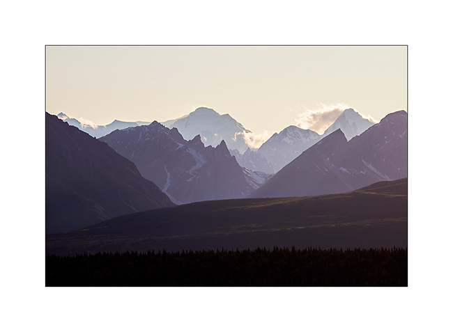
15. Clouds are back over the Alaska Range…
16. … but we still have sun here.
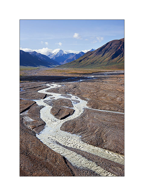
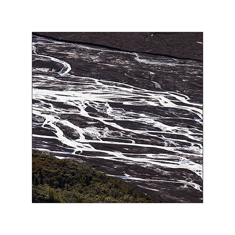
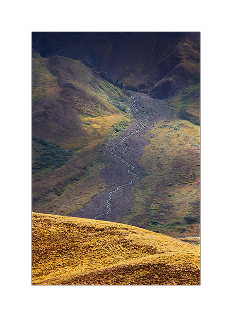
17. From there, the rivers form beautiful designs…

18. Scabrous descent into a steep scree!
19. We continue our journey across the alpine tundra…
20. … dotted with small puddles and swamps.
21. Colors are awesome.
22. It is almost 6 PM but we don’t want to leave.
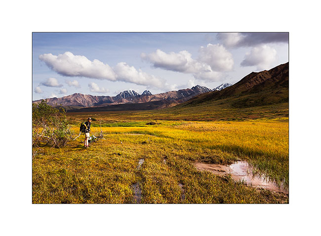
23. Tundra, I love you…
24. The day ends, we must resolve to take the bus back to Teklanika.
25. Last encounter of the day hiking down the Teklanika River to reach the campground…
26. Contrasts…
27. End of a great day for my birthday eve..! 😉
That’s it for our brief stay in this beautiful park. Following of the discovery of VivaLaVida to come in a few days…
Denali National Park (2)
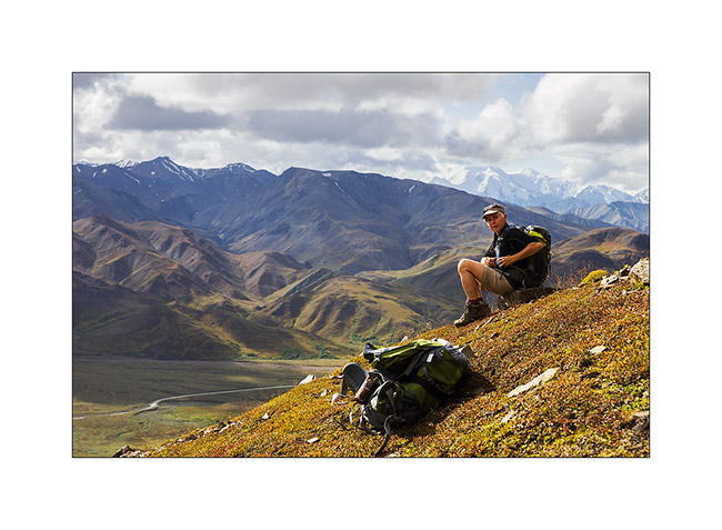
We took a bus the next morning that dropped us near Highpass, the highest point of the road. So we walked over seven hours in wildnature, first under the sun before rain in the afternoon. There are no trails, so we progress in the tundra and freely choose our way.
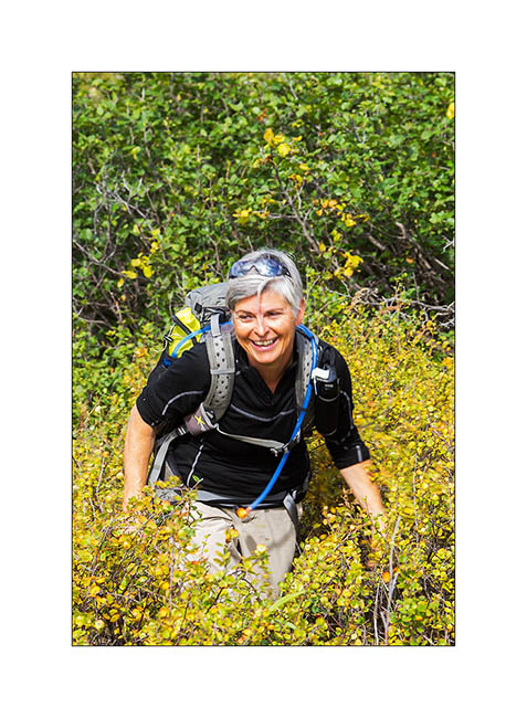
1. Sometimes, willows are several feet high. Progressing is not always easy but Mino keep smiling! 😀
2. clouds growing rapidely…
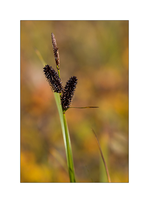
3. Berries are everywhere at that time of year, including blueberries that we gather throughout our journey.
4. Oh greedy!! 😉 (Well, I confess, me too! 😀 )
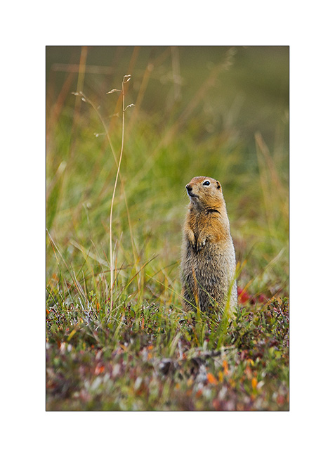
5. They are many ground squirrels that signal our arrival by their characteristic cry.
6. This powerful nature is just beautiful!
7. Atmospheres constantly change with the passing clouds…
8. Some flowers remain on the tundra in the late summer.
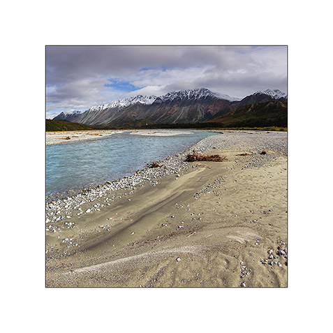
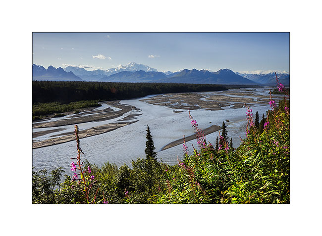
9. Rivers have formed large gravel bars by getting silt away from the glacier they flow from…
10. Meanders games…
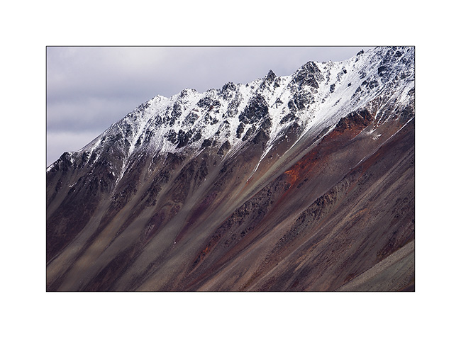
11. The top of the mountains is mostly made from large colorful screes.
12. Plunging perspective…
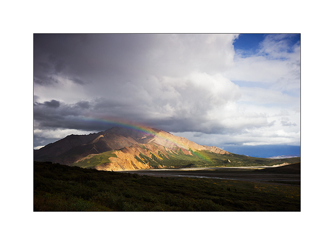
13. Afternoon showers start again…
14. … and a beautiful rainbow emerges a few moments.
15. Fortunately, our rain suits protect us well!
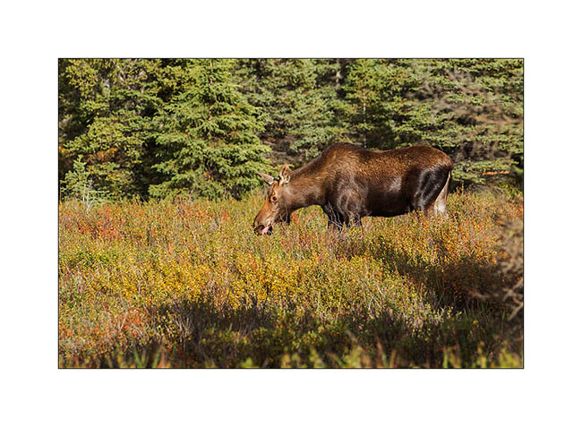
16. While we join Teklanika by bus, we see this female moose.
17. Off the bus a few miles before the campground, we enjoyed the last sun rays going down the bed of Teklanika River.
So much for the second day. To be followed soon.
Dalton Highway (3) & Hatcher Pass
I let you at the botom of the Brooke Range heading back South.
1. I’m half mesmerized by the scenes that follow one to the other…
2. … sometimes low “heavy” skies…
3. … sometimes cottony openings…

4. … or larger…
5. … but which close again almost immediately…
6. Where slopes are to steep, there are only screes…
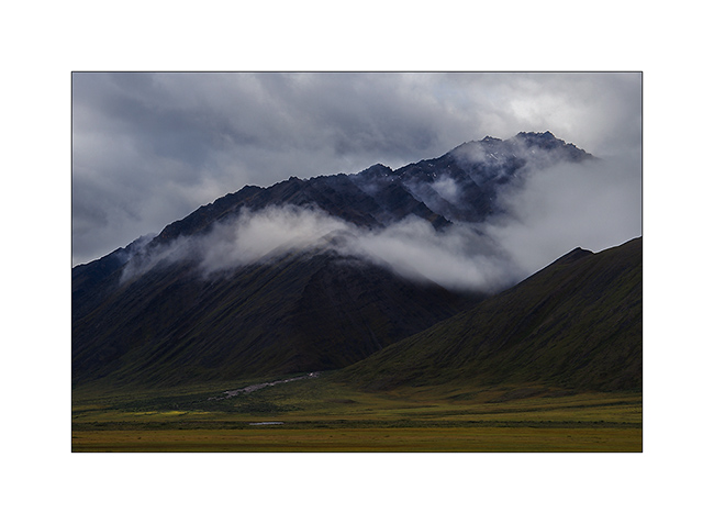
7. High plateau of the Brooke Range, just north of Antigun Pass.
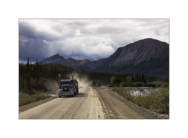
8. Going down the Brooke Range to the south, trucks roll again. They were stoped during the rain, too slippery for them. It must be said that here, hills have impressive percentages! Some also have evocative names: Beaver Slide for example, a 22% slope. VLV drove it down with 4WD 4×4 and not faster than 10 mph in the rain, in six inches of mud… Trucks then stop to wait for the road to dry.
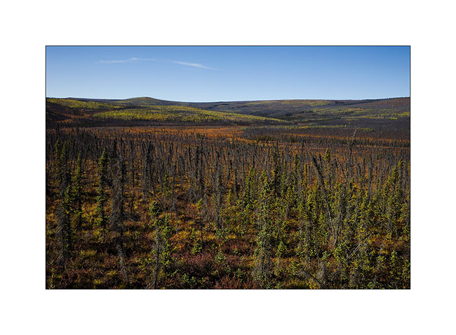
9. The trees gradually reappear on the south side of the Brooke Range…
10. … However, not many yet.
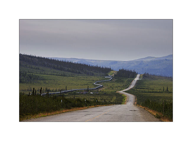
11. The pipeline sometimes accompanies me.
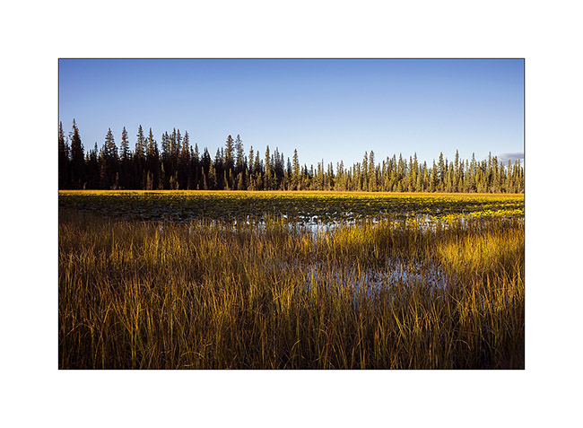
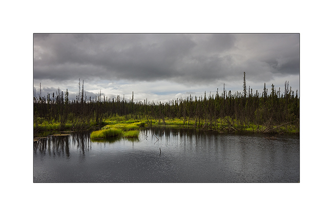
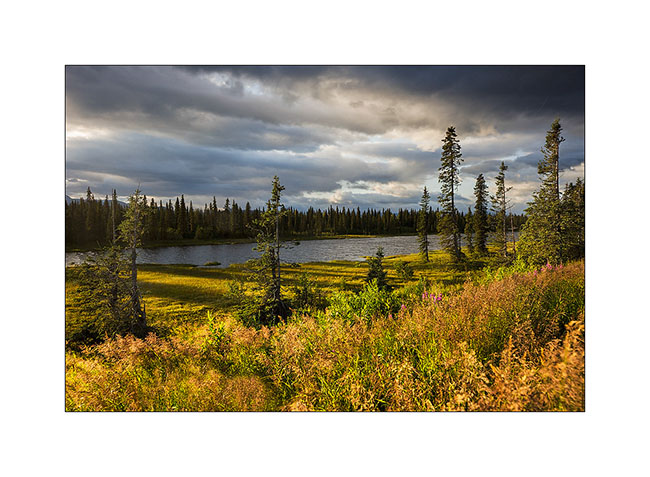
12. Marsh in the taiga.
13. A beautiful rainbow welcomes Vivalavida! 😀
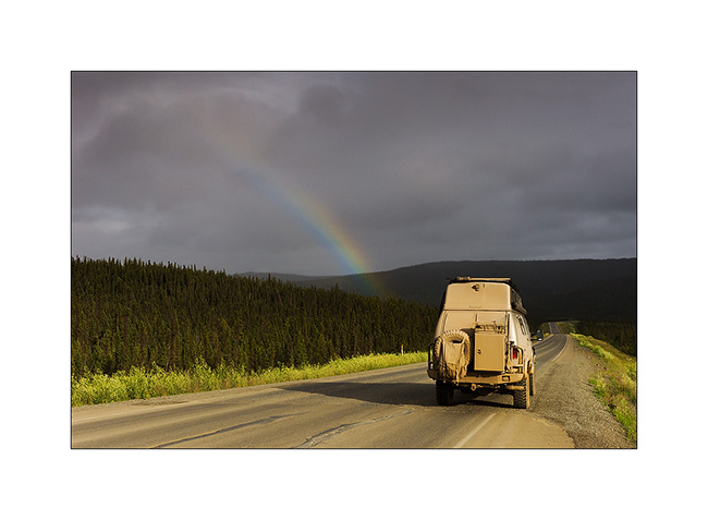
14. But the rain starts soon again.
that’s it for my fast south-north-south through Alaska via the Dalton. A barely arrived that I already want to go back..! 😉 I hope I managed to transcribe some scenes of these beautiful northern landscapes that fascinate me…
15. On the road to Anchorage, I made a detour to the beautiful Hatcher Pass.
16. Late afternoon from my bivouac.
Starting next update, Mino will keep me company… Updates will be more spaced again further apat, my delay is now caught! 😀
One more time, thank you for your loyalty to read this little blog. 😉
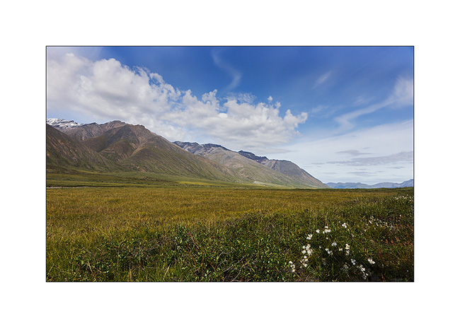
Dalton Highway (2)
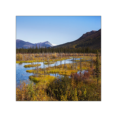
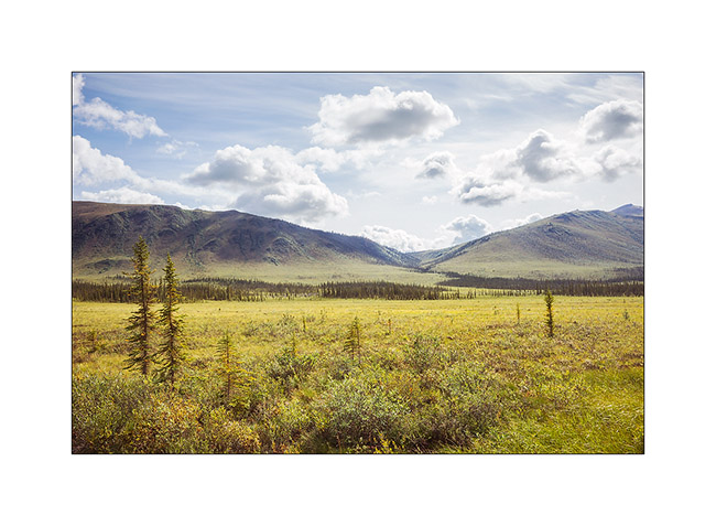
One continued ascent of Vivalavida to “far North” … The Brooke Range crossed, there is only a great plain that slopes gently toward the north to the Beaufort Sea. The more I go North and the more I can feel that winter isn’t gone since long ago…
1. Tundra flowers…
2. … out of sight…
3. Although it doesn’t look on the picture, the road is really rough. Despite its large Wheel traval, VLV didn’t drove a high speed average.
4. I meet from time to time a truck. The windshield ofVLV remembers it with a new large stone impact. It’s gonna be time to replace it once back from Alaska…
5. Colors of the tundra are constantly changing.
6. Water is everywhere, everything is marsh … I imagine how difficult it was for explorers of these regions to progress on such land.
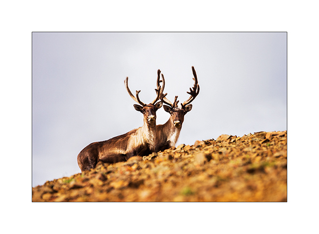
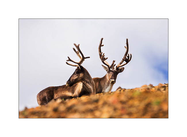
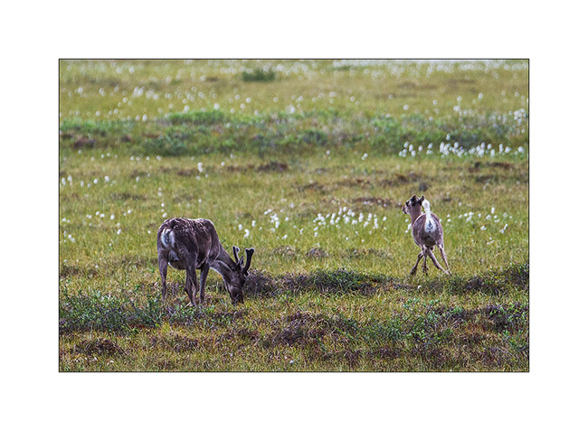
7. This tundra is summer areas for caribous that migrate South during the winter, looking for less snowed areas to find lichens which are their menu.
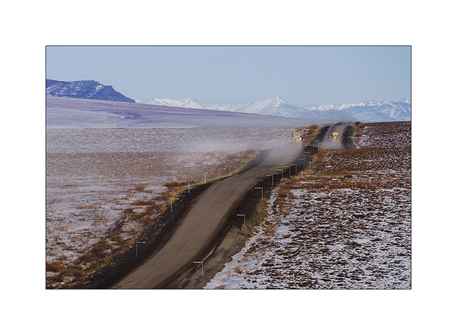
8. A long time before seeing it, the dust announces the arrival of a vehicle!

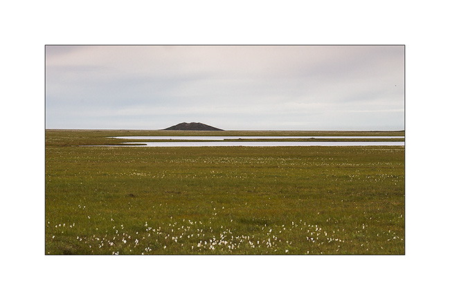
9. Far North, a pingo. This hill is created by a “ice bubble” that has developed in the tundra, pushing it upwards.
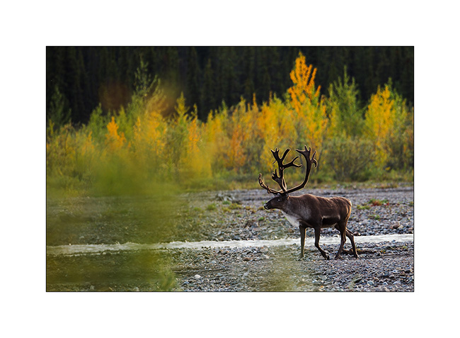
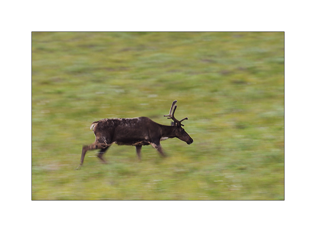
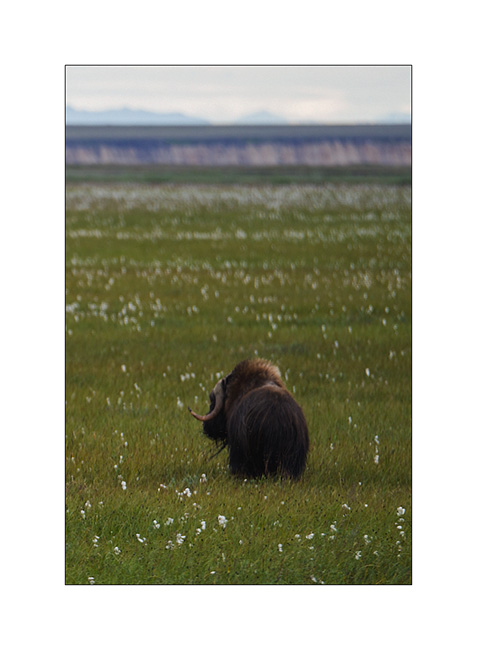
10. I have the chance to see the biggest herbivore of the tundra: a group of muskoxen.
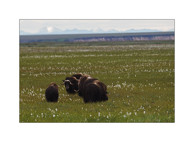
11. What a big animal! I’m not going to scratch his ear… 😉
12. A caribou mother and is calf of the year.
Quizz : que veut dire faire la cleupette ? Indice : ça vient du Jura neuchâtelois… Et Pum-Tac, t’as pas le droit de jouer !! 😀
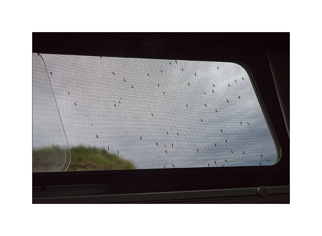
13. My bivouac announces the return of the rain. To try to show you the invasion of mosquitoes in this area: I opened this window for less than 15 seconds! Here, there are five species of these bloodsuckers, with the big tiger mosquito…
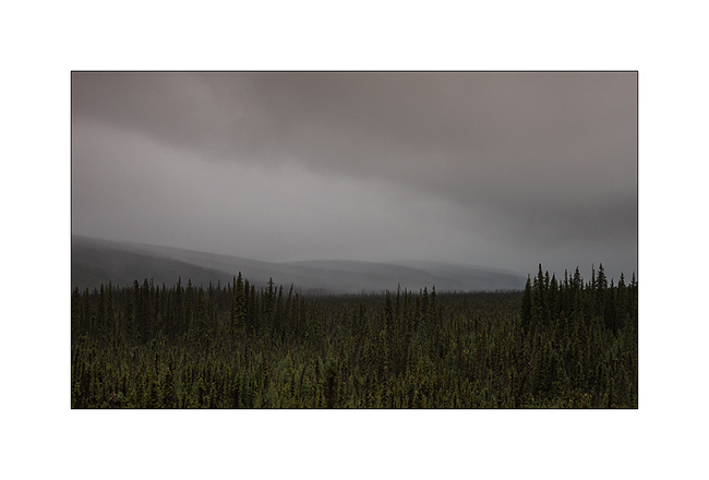
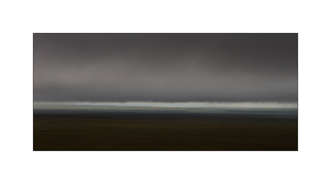
14. Low clouds in the morning, in the rain.
15. While VLV took the road heading South again, clouds are gorgious and impressive.
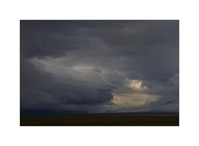
16. What an ambiance!
17. I think I’m in love with this tundra! 😀
18. VLV is already quite muddy!
19. Rain starts again…
20. Higher in the Brooke Range, the sun makes short appearances.
21. Difficult to show you how VLV was dirty!
To be continued soon… 😉
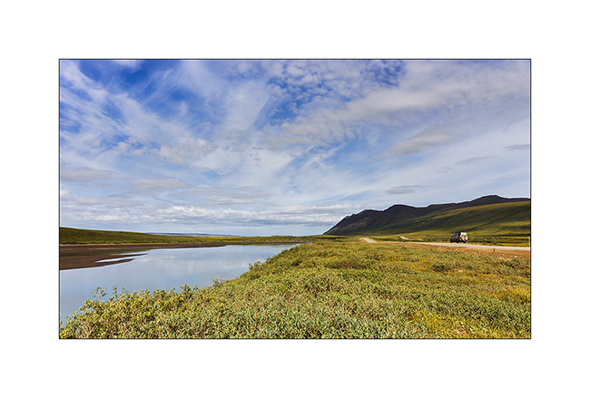
Fjords, McKinley & Dalton Highway 1…
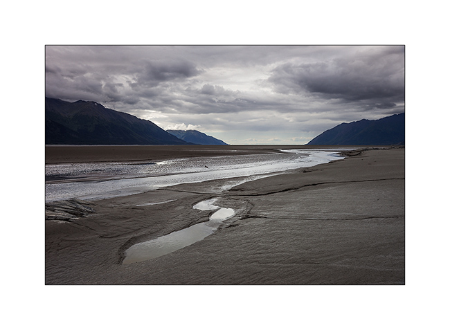
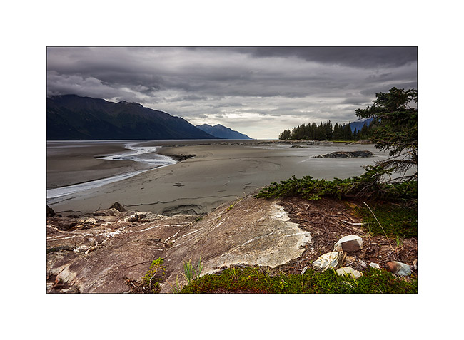
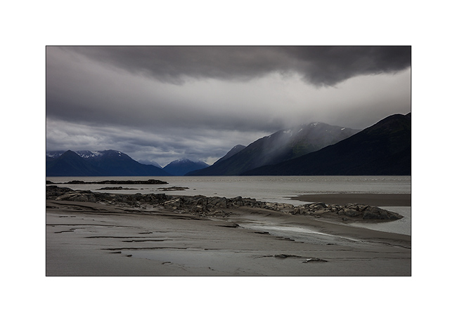
Pending favorable weather conditions to head to the far north, I took advantage of a brief lull to explore a fjord South of Anchorage. Large glacier valley, it was filled with sediment by the surrounding glaciers to the sea level or nearly. At low tide only remains a narrow channel of water in the middle. Each tide begins with a tidal wave. Not very spectacular the day I was there because the moon was in first quarter…
1. Turnagain fjord at almost low tide.
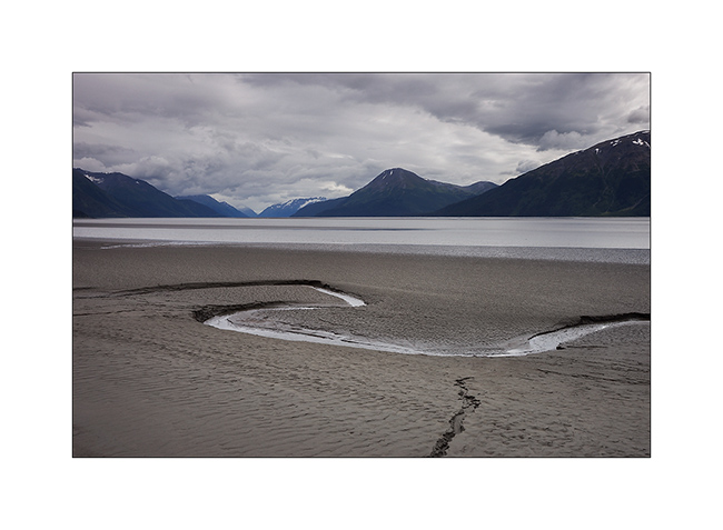
2. The channel that remains at low tide.
3. More than 150 miles away, the mountains of Kodiak.
4. After crossing swamps to seek a new composition… 😉
5. A non-edible touch of color in the undergrowth.
6. The lull was short-term…
And finally, after more than three weeks of waiting, thinnings were announced on the far north. Vivalavida hit the road for a 1,800 miles way before the arrival of my friend Mino.
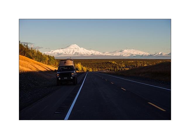
An unexpected opportunity: the beautiful weather allows me to see Mount McKinley, a rare opportunity as it is hidden in the clouds more than 80% of the year. It is the highest peak in North America, more than 20,000 feet elevation. A real giant!
7. I’m unable to transmit how big it is through my pictures but I was there still more than 120 miles away…
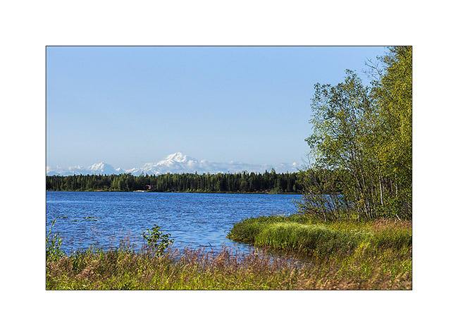
8. Here, still more than 50 miles away…
9. End of day on the surrounding mountains…
10. Camp next to a small lake.
11. The next morning, the giant is still visible while I’m more than 70 miles North!
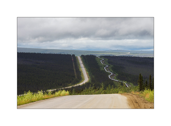
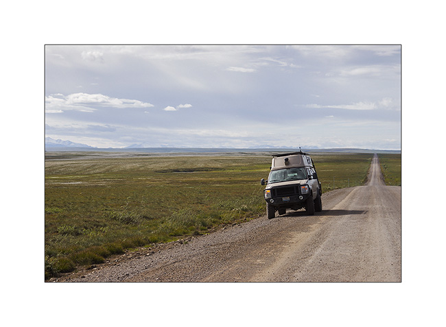
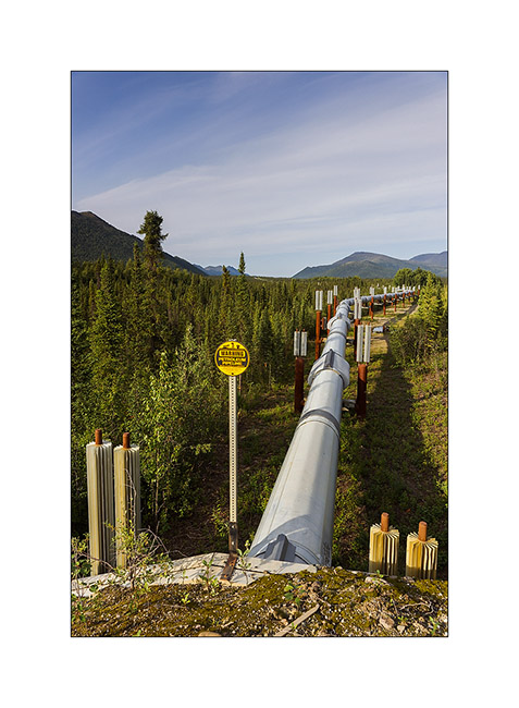
To go to the far north, there is only one path: the Dalton Highway, a 500 miles long road serving Prudhoe Bay and its oil fields. It was built along the Alaskan Pipeline and along almost its entire length. It took only five months and a half in 1976 to 15 teams working in parallel to build it, a performance driven by the short northern summer. It’s a road really committed, thin strip of dirt that goes up and down every hill in impressive percentages, then through the Brooke Range with a top at Antigun Pass, at about 3,400 feet. Only one service at mile 249, about midway. Traveled almost exclusively by large trucks that supply the oil workers, it turns into a quagmire when it rains; Vivalavida will find it out… It stays open all year round since the build of the bridge over the Yukon River.
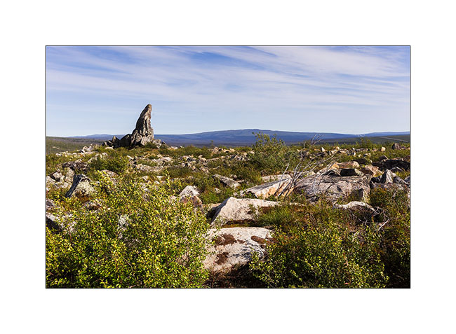
12. at mile 96, “Finger Mountain” points to the sky in the middle of the tundra.
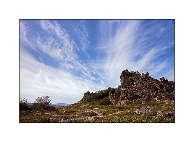
13. The sky is beautiful but cirrus clouds are already announcing the arrival of the next perturbation.
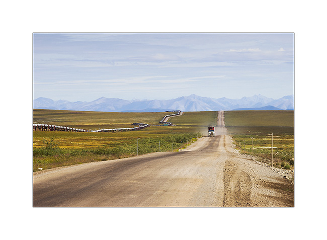
14. The Alaskan Pipeline, also completed in 1976. This is a strategic corridor for the exploitation of northern Alaska oil resources.
15. Its build shows great ingenuity. Each pillar is “free”, only laying on bidirectional Teflon pads. To overcome the expansion created by the magnitude of extreme temperature between winter (-60°F are common and every winter the temperature drops below that!) and summer, each tube is “sleeved free” to the next. Estimation of total theoretical expansion over the entire length would be more than 8 miles from Prudhoe Bay to Valdez terminal, 800 miles south..!
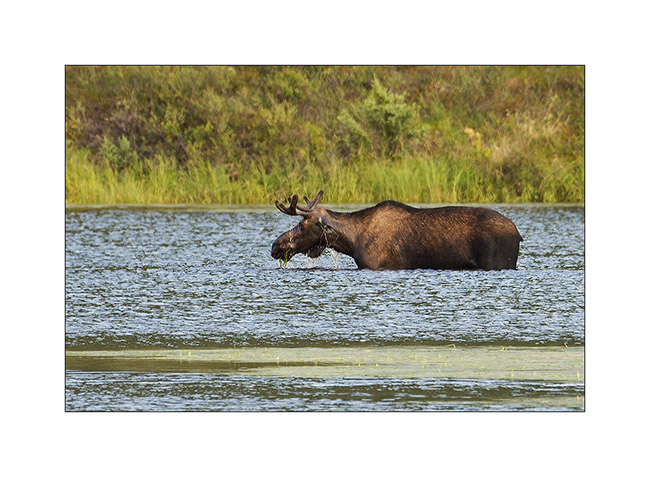
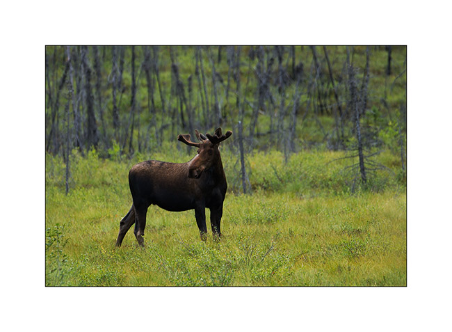
16. An moose grazing aquatic weeds that grow at the bottom of this small lake. They love it!
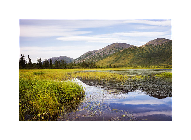
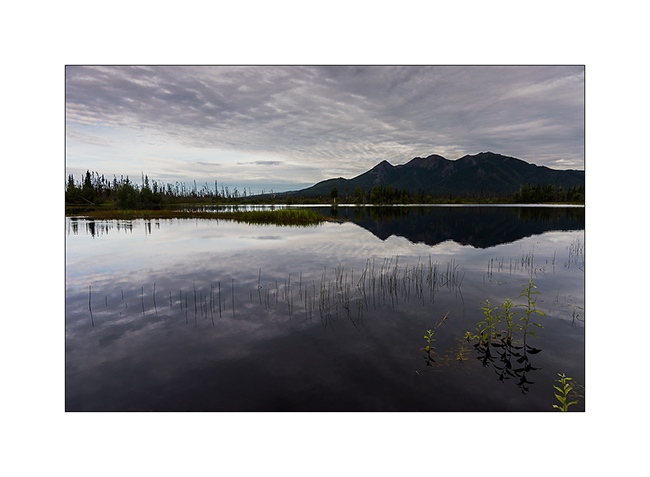
17. Small lake besides really aesthetic…
18. Everything passes through the Dalton; here, an about 25 feet wide house on this oversize convoy..!
19. Another moose seen from my camp in the morning.
20. Mirror…
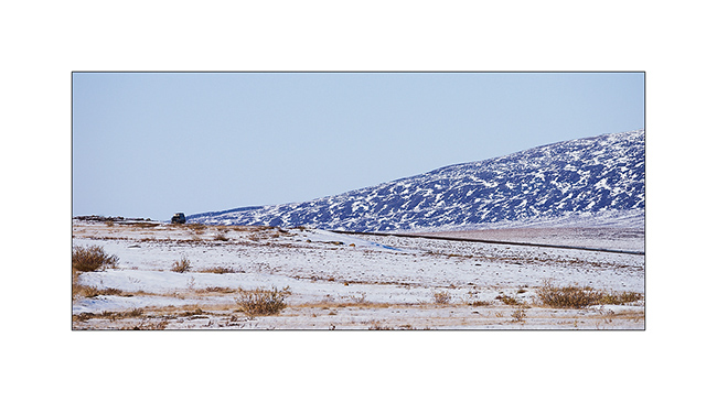
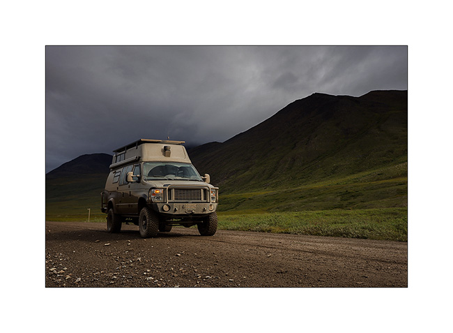
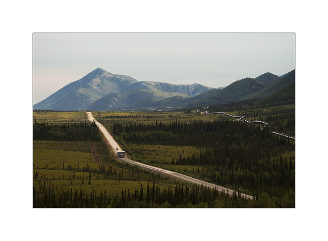
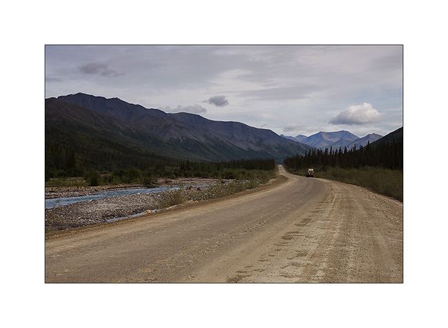
21. VivaLaVida on the northern foothills of the Brooke Range.
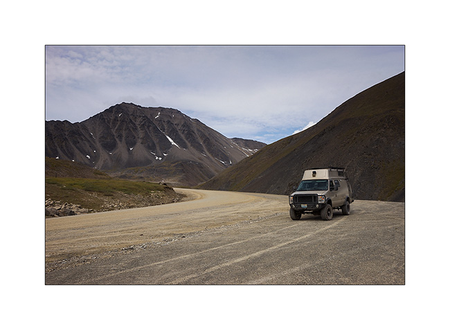
22. Antigun Pass.
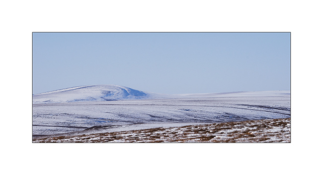
23. The Brooke Range is superb, with beautiful streams that dig valleys.
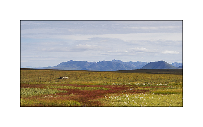
24. No more tree since mile 215. It’s to far North, the climate is too harsh. Only the tundra remains.
25. I take the opportunity of this thinning to “strafe” these moorland landscapes that are probably the ones that attract me the most…
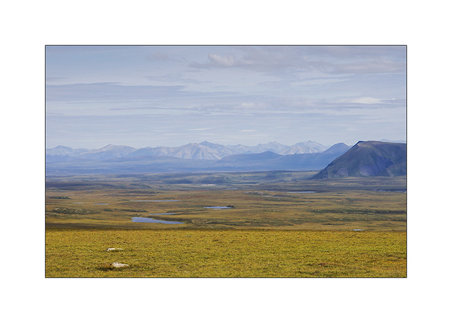
26. VLV looks really small in these landscapes…
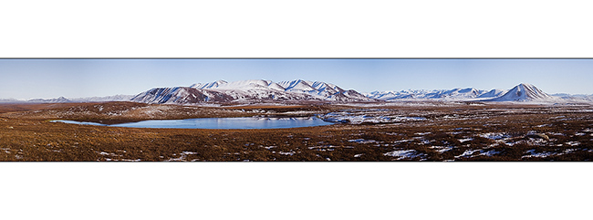
27. … dotted with small lakes.

Following of the thinning and return of bad weather in the next update… 😀