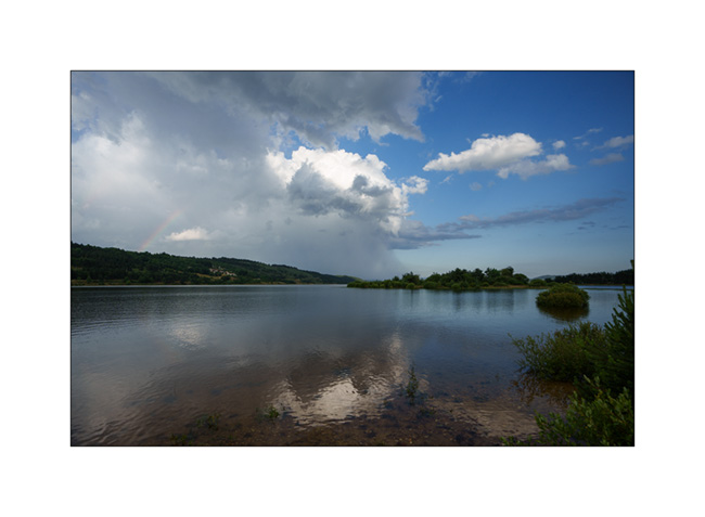
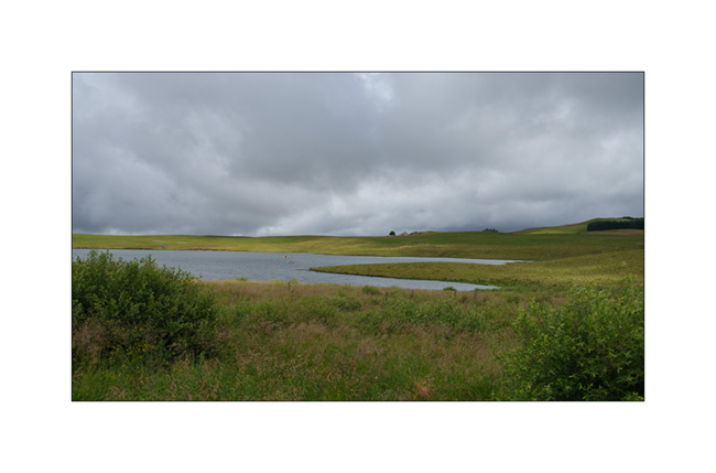
lake
now browsing by tag
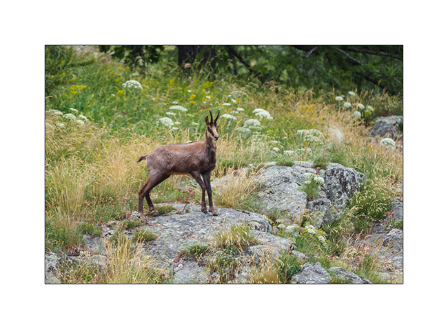
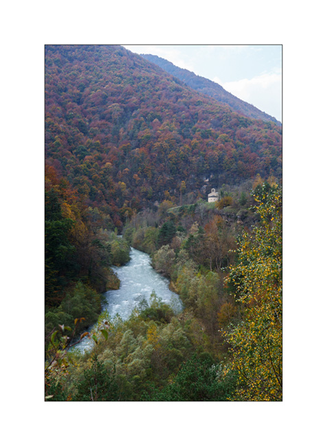
Valais : Anniviers Valley
While Emile continues his vacation with his mom, I go enjoying the summer in the Swiss Alps by doing a few days of mountain biking in Valais.
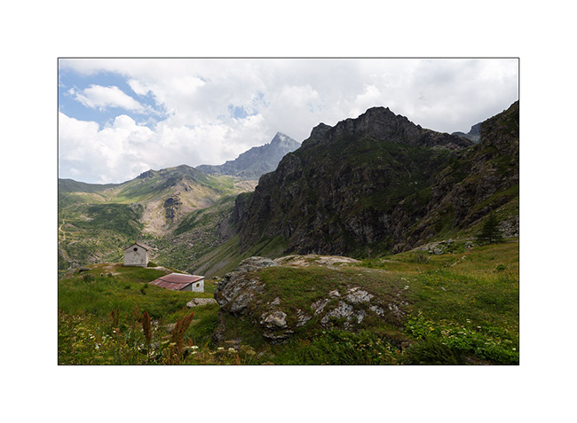
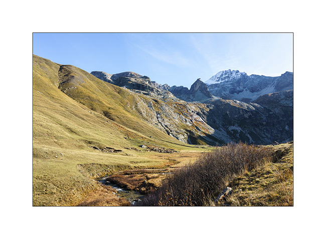
1. Arriving at the end of the day in the valley, I walk up the valley towards the Petit Mountet refuge.
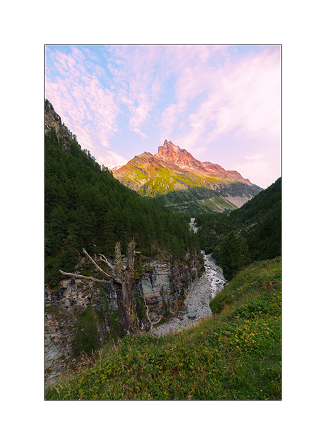
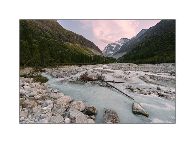
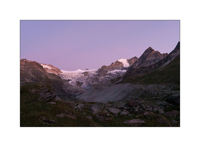
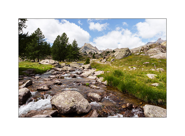
2. The Navizence River at sunset, downstream from the Zinal glacier.
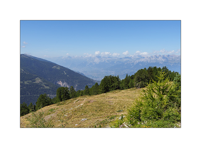
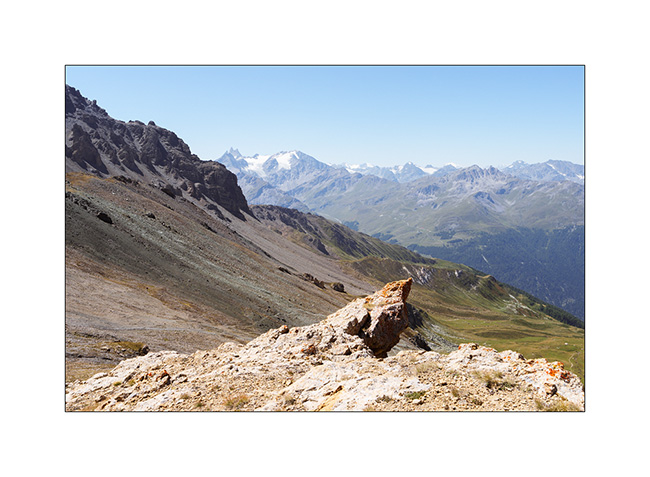
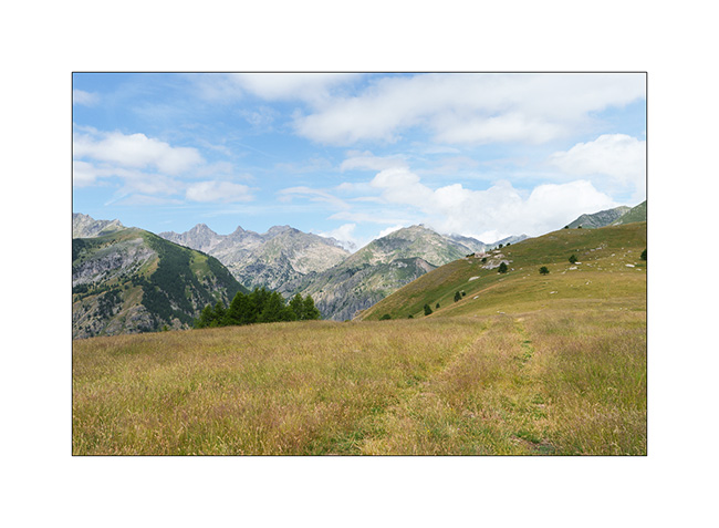
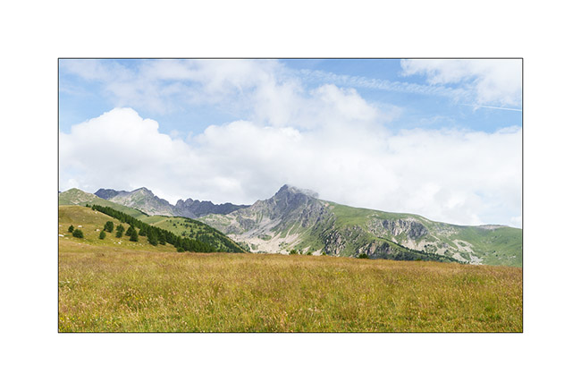
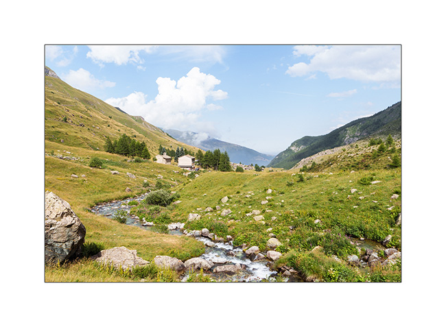
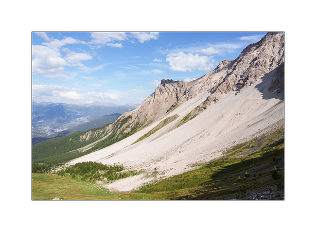
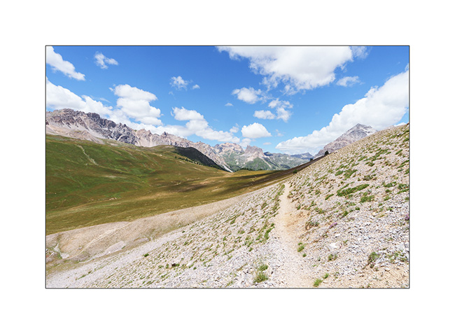
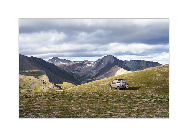
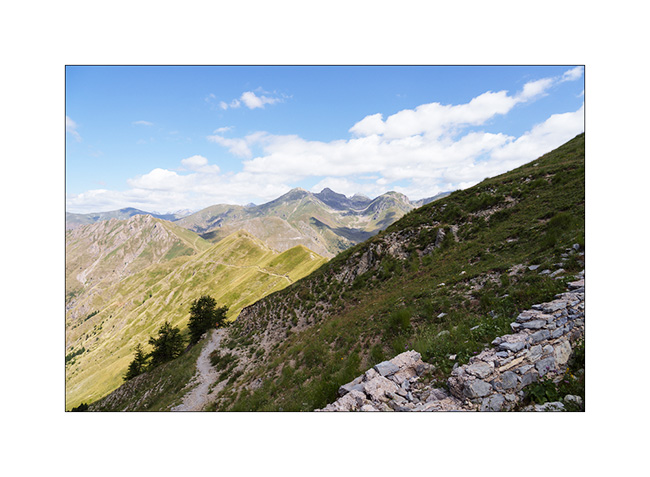
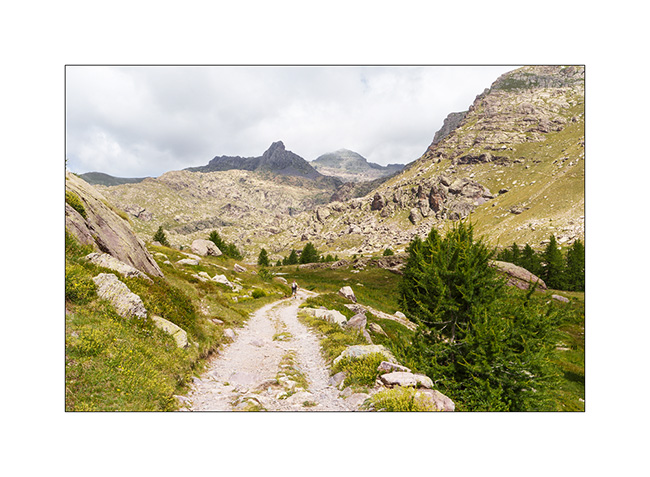
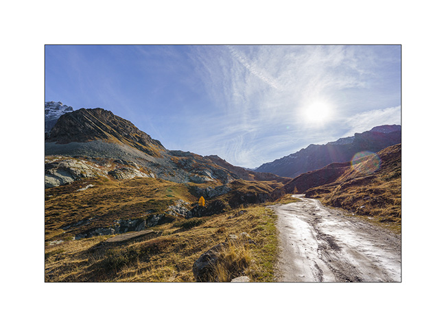
3. The next day, long 44 miles loop with a 5.5 hour ride. Views of central Valais from the heights of Chandolin..
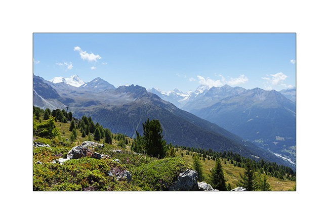
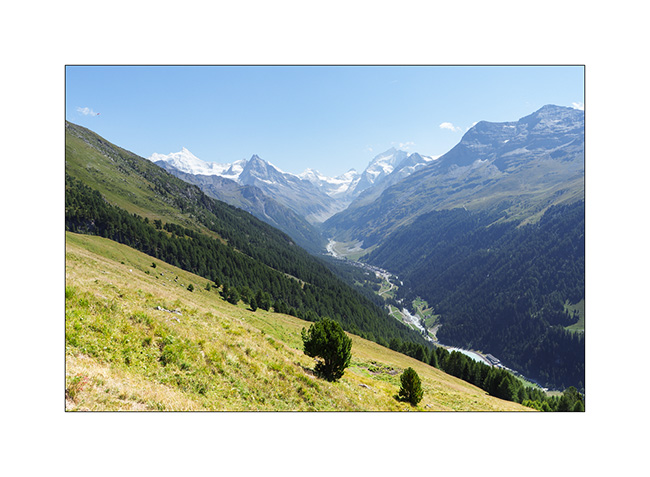
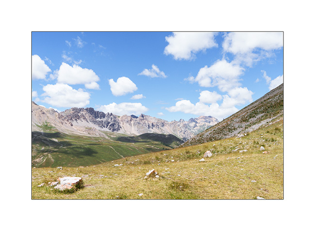
4. The upper Anniviers Valley from the heights of St-Luc.
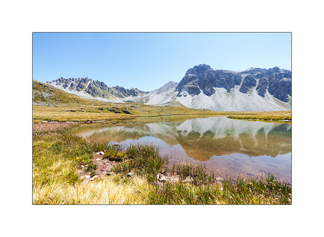
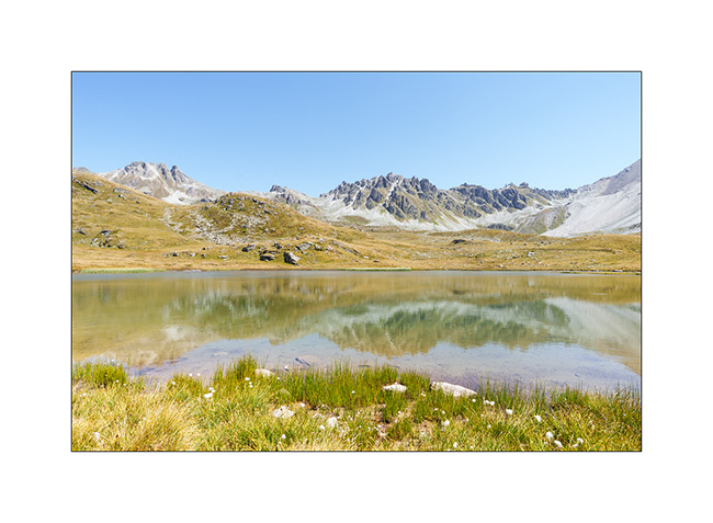
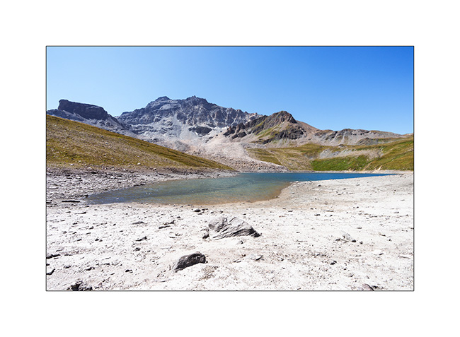
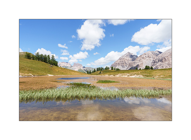
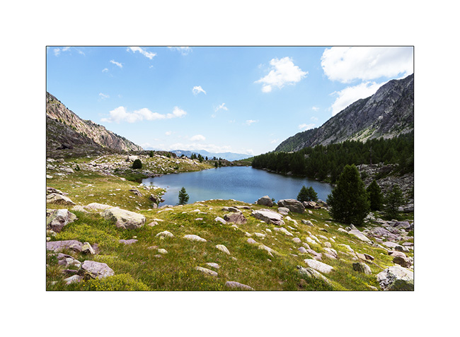
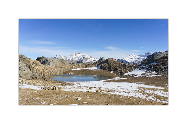
5. Mountain lake above Plan Torgnon.
6. …
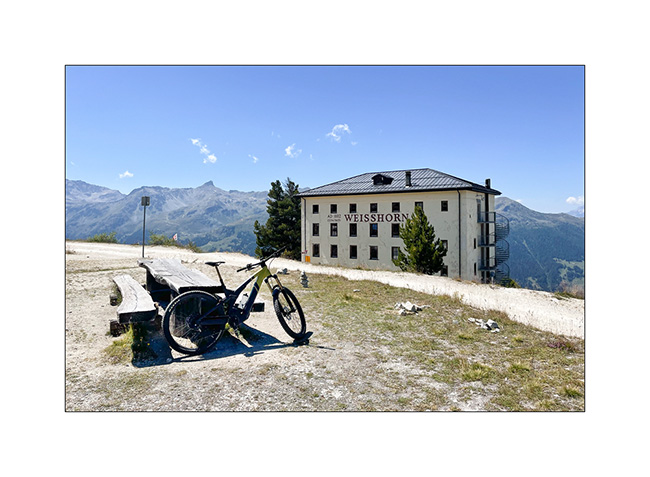
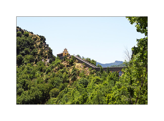
7. I make a detour to discover the famous Hotel Weisshorn.
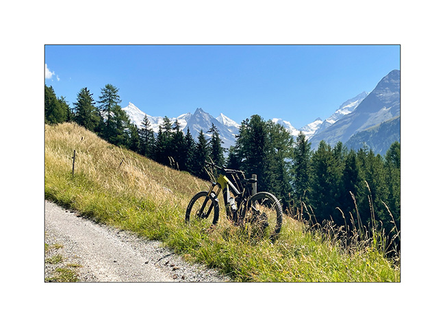
8. Going up towards Zinal, above Ayer.
9. View of Zinal and the final downhill.
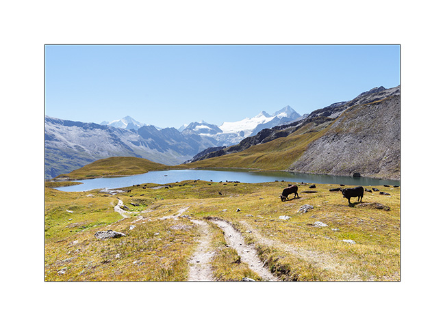
10. I go sleeping above the Moiry lake.
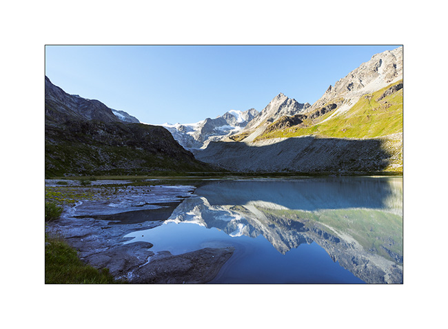
11. Châteaupré Lake in early morning.
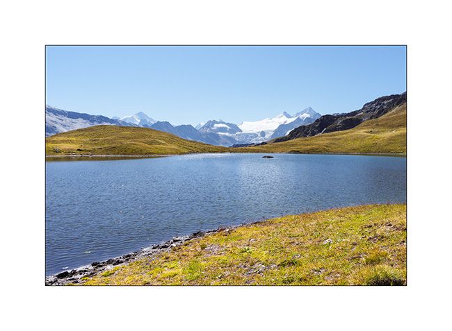
12. Second mountain bike outing to Lake Autanne.
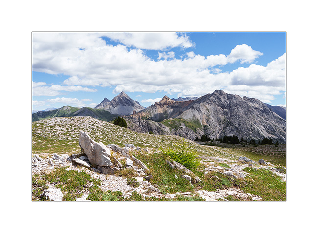
13. Alpine summer view…
14. Launa lake.
15. Pass of Launa, a mecca of the Grand Raid VTT event.
16. From the Pass of Launa looking East.

That’s it for my first two days of mountain biking. More to come soon!
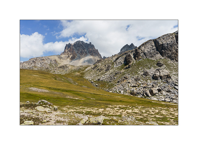
Monviso – Bardonecchia area
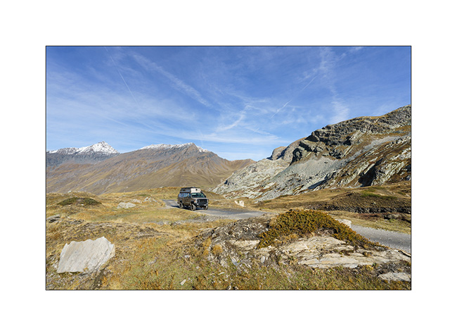
1. Here we are again on the Alta Via del Sale but on its western part.
2. …
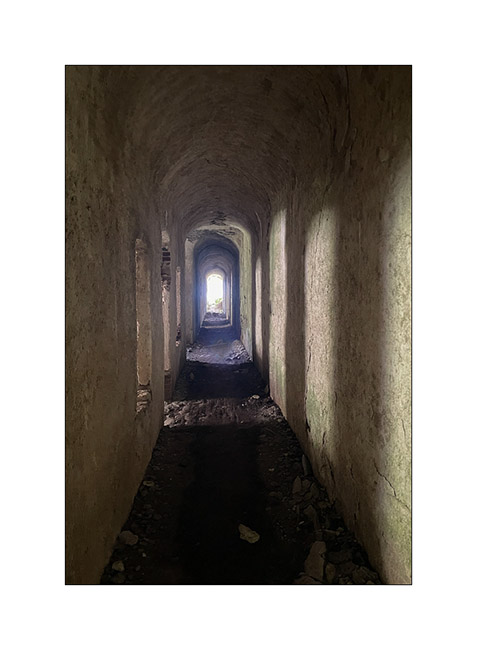
3. The Marguerie fortress where we spend the next night.
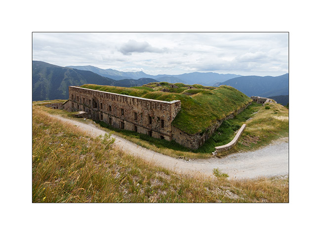
4. I go exploring part of it but don’t stay long because it’s really falling into ruin..
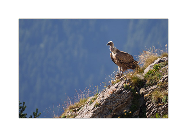
5. An early morning visitor to our camp.
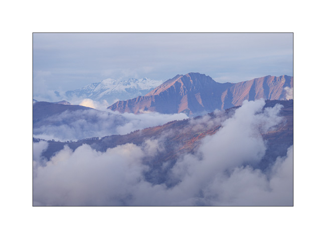
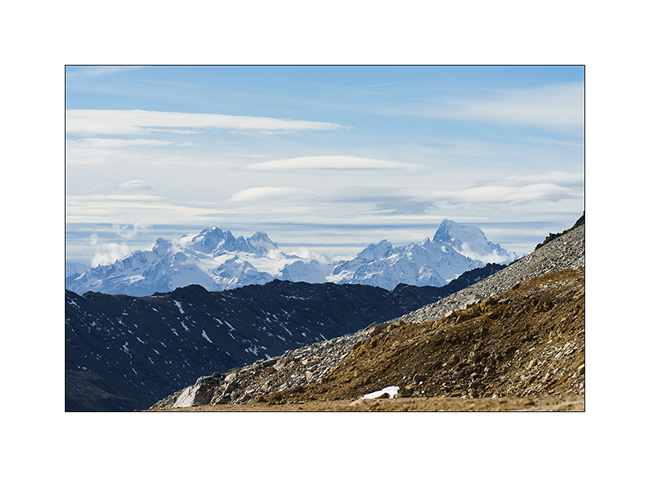
6. As we begin our journey toward North, we go discover Monviso, the main Italian peak in the Southern Alps. A view from Pian de Rey. The afternoon convection partially hides the summit.
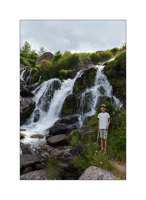
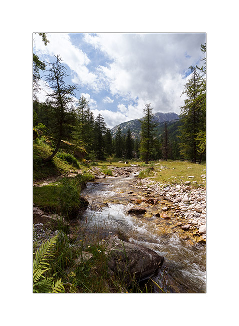
7. Further down, a small waterfall not far from our camp.
8. View on the valley.
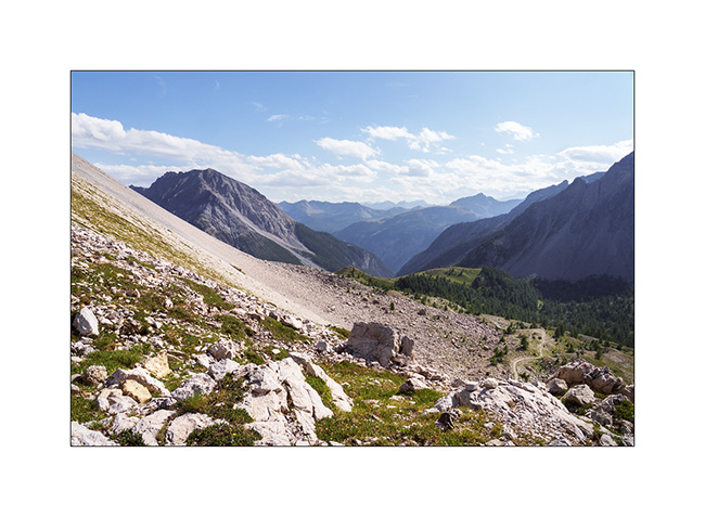
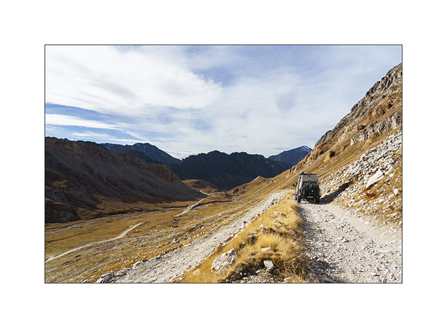
9. Then we head back up towards Bardonecchia to explore the Passo de la Mulatiera region. A narrow trail takes us to an altitude of 6,000 feet. Then we continue on foot to the pass.
10. The large scree slope that lies beneath the Mulatiera fortress ruins. We look at a fearless marmot less than 15 feet away.
11. The next day, we park at the Col de l’Echelle and set off on a hike towards the Col des Thures. After a quite steep climb, we discover the Vallon des Thures and the small mountain pasture of the same name.
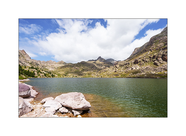
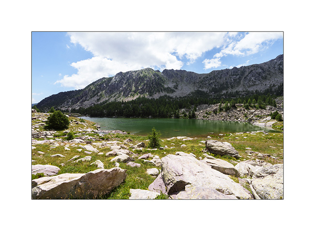
12. Arrival at the superb Chavillon lake with Mount Thabor in the background.
13. I vary the compositions.
14. …
15. Return path through the screes.
16. Last look at the valley.
17. Above the Col de l’Echelle.
18. Our camp under Mount Jafferau, a spot where we already spent the night three years ago.
The rest of our journey will take us through Mont Cenis, Isère, and the Savoie region. We’ll show you that soon! 😉
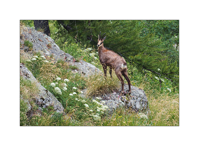
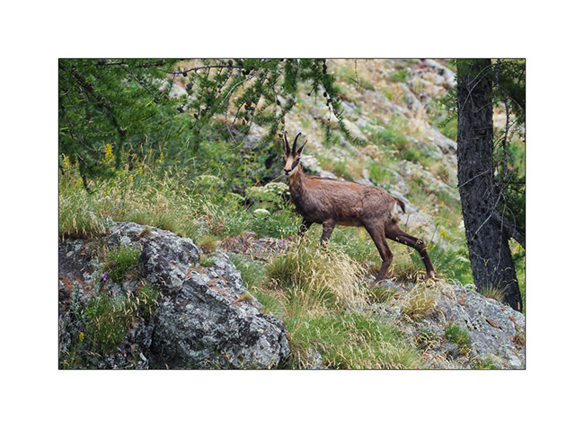
Turini and Miniere Valley
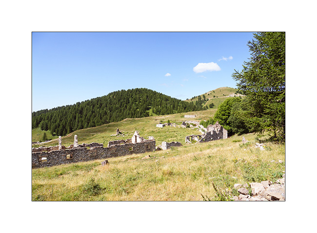
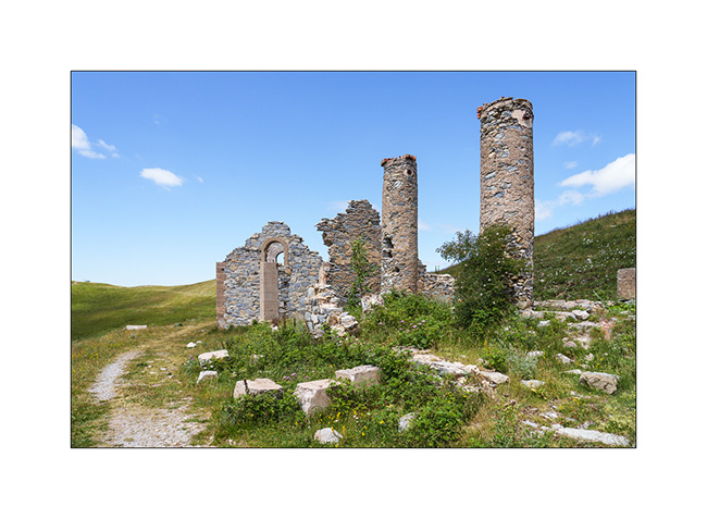
1. Just a few miles above our camp, we discover the old Turini barracks.
2. Views of the Mercantour Park are magnificent.
3. Another ruin, the Trois Communes barracks.
4. Going down to Sospel, the Chapel of Notre Dame de la Menour.
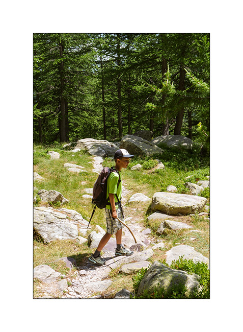
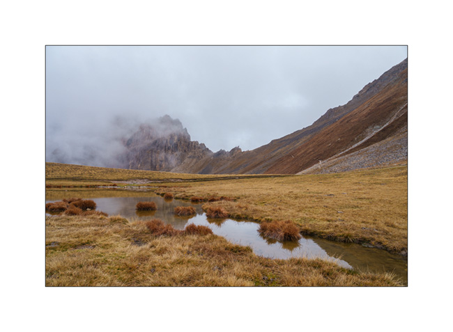
5. The next day, we take a long hike to discover the Valley of la Minière and its lakes.
6. After more than 5 miles, we approach the first lake, the Lac Long Supérieur.
7. It is the largest since the construction of a small dam at its end.
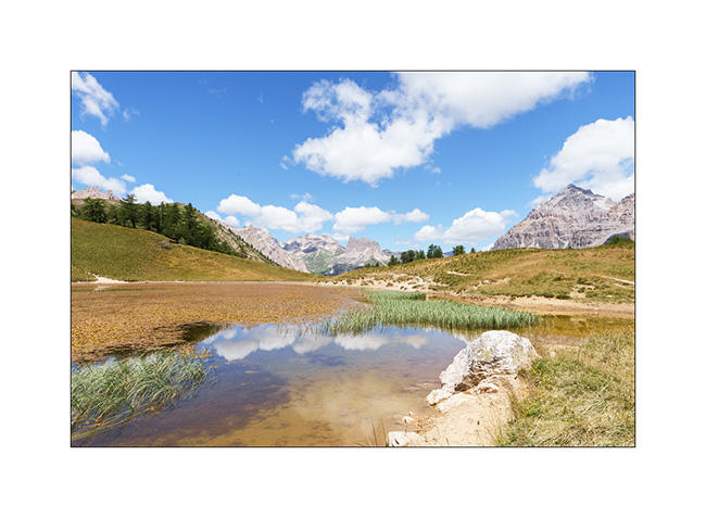
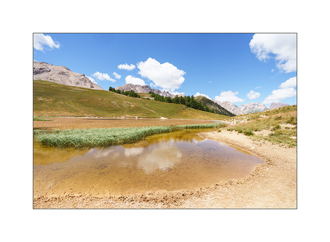
8. After discovering Lake Fourca, above the Merveilles refuge, here is Lake Soargine, at the start of our descent.
9. From another angle.
10. The marshes below the lake are gorgeous.
11. …
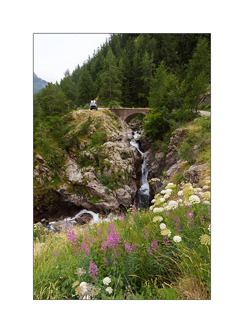
12. The river Miniere, carving the valley.
13. Almost back tout VivaLaVida after more than 15 miles of hiking.
14. Tired, we enjoy VLV’s shower and head straight to a boondocking spot I spotted in 2017, at the start of the western part of the Alta Via del Sale.
15. Nice surprise while preparing the aperitif: a local resident comes to eat nearby..
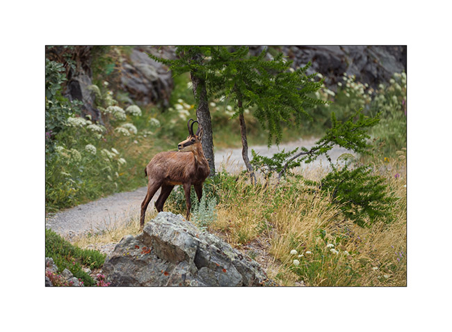
16. We watched him for a good 15 minutes when he was only about thirty feet away until a car coming onto the track made him go up the slope.
17. …
18. … before disappearing into the bushes.
More coming soon… Thanks again for your loyalty to this little blog! 😀
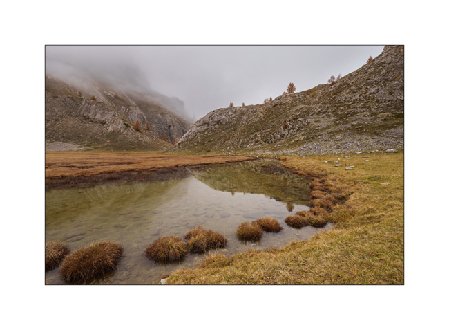
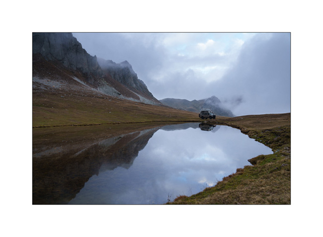
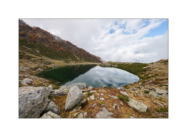
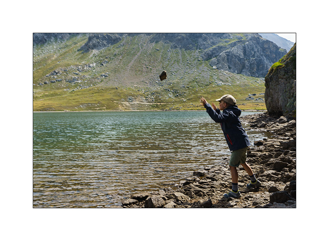
Lake Meja
The next morning, we set off on a hike to explore Lake Meja despite the poor weather..
1. Our camp going up towards the small pass which overlooks us.

2. We see a few ibex near the pass.
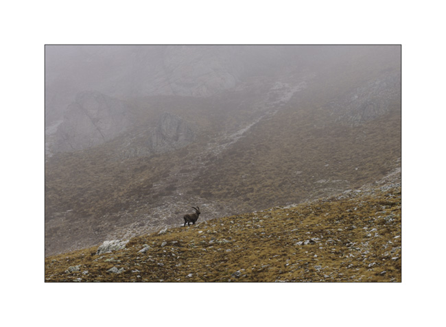
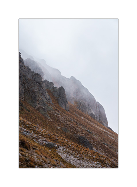
3. Mountains appear and disappear in the clouds.
4. Some marshes along the path.
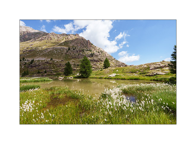
5. Lake Meja.

6. Small mushrooms on a dung.

7. The rain starts again as we go back to VivaLaVida.
8. It’s already time to head back. A short stop on the way up the Maddalena Pass.
In the next update, we will discover a beautiful valley in Haute Ubaye.
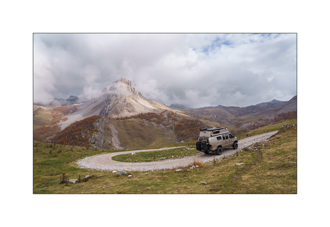
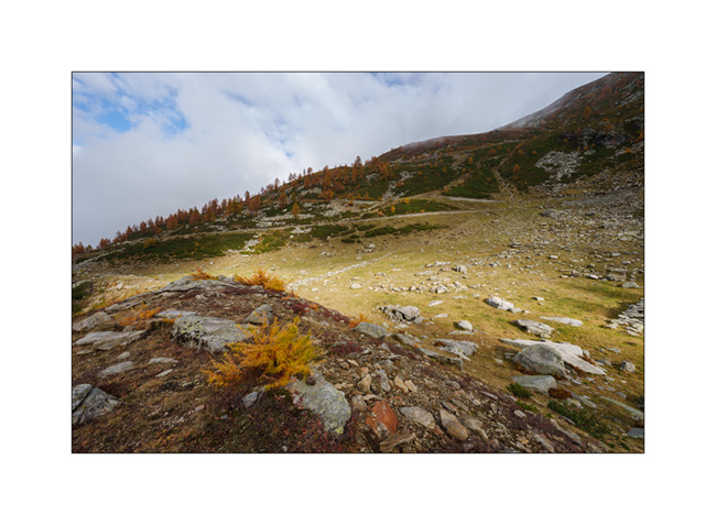
Maira Stura
As announced, we continued South hoping to be able to access the Maira Stura trail which was closed during our last visit in summer.
1. Chapel of San Salvatore, driving up the Val Maira.
2. Village of Macra, in the same valley.

3. Indeed, the gate located after Pian Preit is open at this time of year. We can take the small road towards the Meja Pass.

4. Cloudy weather as the road climbs steep.
5. …
6. The limestone is steep on this side of the valley.
7. Near Meja Pass.

8. We continue on the trail towards refuge Gardetta.
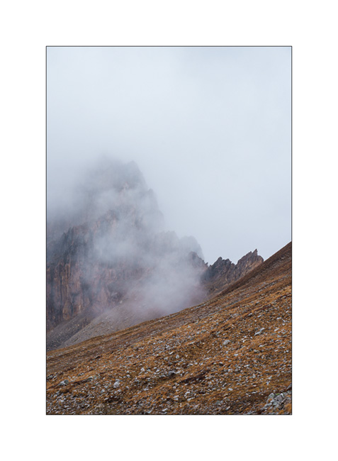
9. Meja Mountain in the clouds.

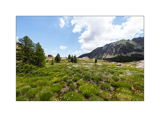
10. Altitude marshes.

11. The atmosphere is magical with the fog coming in.

12. Fall colors…
13. Under refuge Gardetta, at almost 7,000 feet elevation.

14. We do the entire crossing of the Maira Stura trail via Margherina Pass in the rain. Here, the old Barracks Della Bandia.

15. We find a nice boondocking spot on the edge of a small lake.
16. Rainy and windy twilight.

To be followed soon… 😉
Fall holiday : Lake Lauson
For the second week of Emile’s vacation, we went to discover new alpine spots.
1. Sunset et our first boondocking spot, near Sansicario.
2. Herd going up towards Sestriere.
3. Going down the valley of Cluson river.

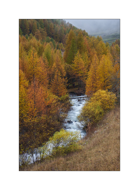
4. On the trail going up to Lake Lauson.
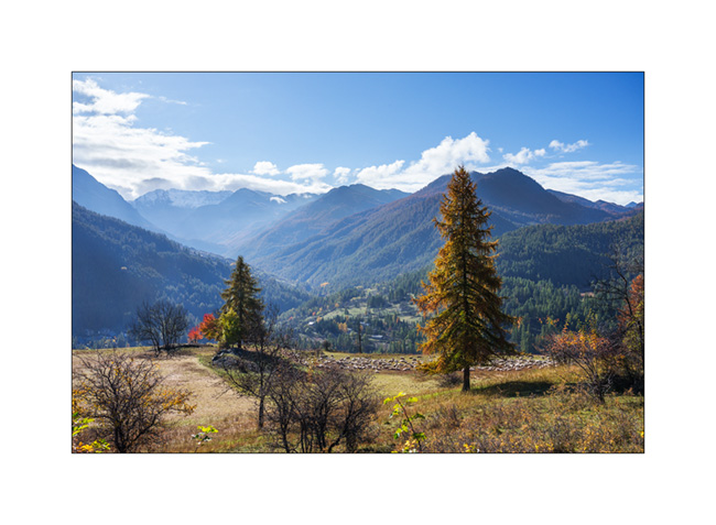
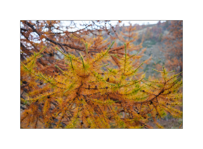
5. At almost 6,000 feet elevation, the larches are gorgeous in their autumn dress.

6. The best of co-pilots!! 😀

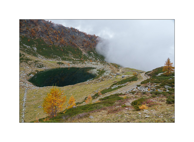
7. Lake Lauson.
8. Still a few holes of sunshine as the clouds gather.
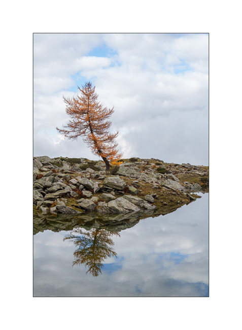
9. Lonely tree.
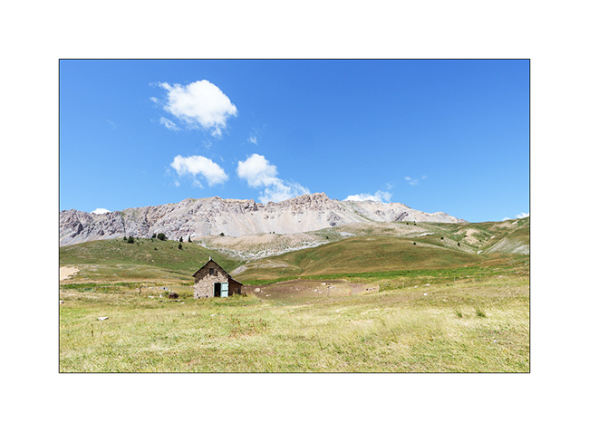
10. Sheepfold under the lake.

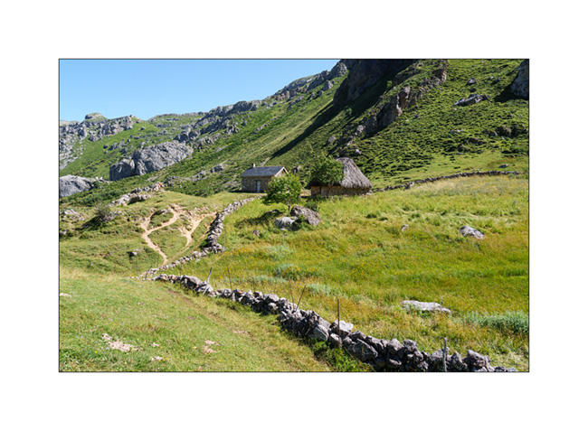
11. Shepherd house.

12. Before dinner, we walk up the old military road above the lake, now closed by a gate. We overlook VLV at his camp near the lake.
13. Golden larches…
14. After rain and fog.

15. The view from our camp at sunset…
16. Last colors…
After a wet night, we will continue South…
Somiedo National Park and Picos de Europa
After traveling along the coast of Asturias, we head South to discover the Somiedo National Park, in the “valley of lakes”.
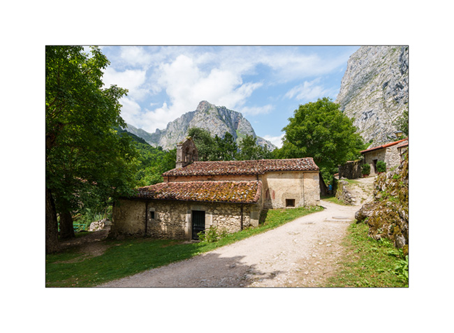
1. Houses and granaries typical of this region.

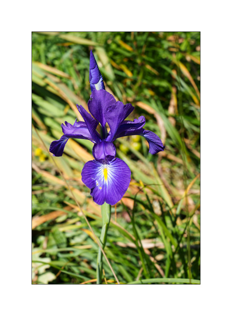
2. After spending a night in a small mountain campground in Valle de Lago, we set off on a lovely hike up the valley, towards the lakes. Along our walk, a beautiful wild iris.
3. Arrival at the lake.
4. Alpine pasture near the lake. We are only at 5,250 feet elevation but already at the tree line.
5. Picnic.

6. Lake plants.

7. Along the return hike.

The next day, we hit the road again to go to the lakes of Covadonga. We sleep in a parking lot under the sanctuary. The next morning, we discover that the road leading to the lakes is closed to private vehicles during summer. We park and go to buy tickets for the shuttle; arriving at 8:15 am at the gatehouse, the employee tells me with a large smile: “The next availability is at 4 pm”… It’s a bit of a cold shower! From then on, we give up and go to discover the Sanctuary of Our Lady of Covadonga.
8. Chapel on the cliff, next to the Virgin.

9. Kneeling pilgrims praying in front of the Holy Virgin.
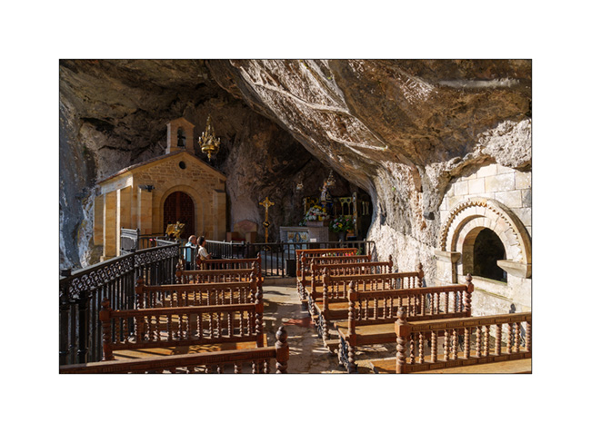
10. The Basilica of Santa Maria la Real de Covalonga.

11. Crypt under the basilica.

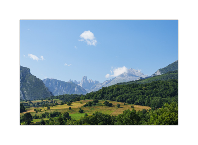
After this visit, we decide to go and discover the Picos de Europa, magnificent limestone mountain range set back from the coast a little further east, and more particularly the Gorge of Cáres.
12. Stop on the road at Mirador del Pozo which offers a magnificent view of the mountain range.
But arriving at the Viesgo crossroads, the road is also blocked because there are too many people. Traveling in the middle of summer is sometimes frustrating!
Emile spots a funicular that goes up to Bulnes, apparently a small mountain village. We go back down the road for 1.5 mile to find a place to park, take the picnic, walk the 45 mintues to the departure station. There is an hour and a half wait but as it’s noon, I buy the tickets and we go to picnic on the banks of the Rio Cáres.
13. Arriving at the top of the funicular, the place turns out to be a real tourist trap! After barely 10 minutes of walking, we arrive in a former summer mountain village which has been completely transformed into a series of crowded tourist restaurants. After only 15 minutes, we have gone around and realize that there is nothing to see there except a small mountain chapel. We can’t even go in as it’s locked.
Back at the upper station of the funicular, we have to wait one and a half hour to be allowed to go back down and we reach VivaLaVida after 4pm. I then decide to go up the East fork of the valley, towards Sotres where I have spotted a high-altitude track. You will discover it in the next article! 😉
A somewhat thwarted start to the summer holidays…
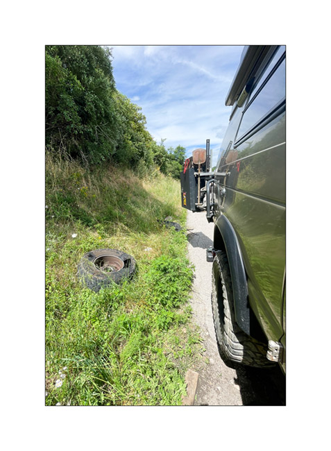
After taking VivaLaVida out of its winter quarters by carrying out a major service, replacing the steering ball joints and some other maintenance work, Emile and I set off again on board for a three-week holiday heading to Galicia, which we hadn’t discovered last year. But after barely a few hundred miles, a big BAM stop us dead in our way!
1. One of the rear tires decided to suddenly give out on us.

2. It takes me an hour under a blazing sun to change the wheel before getting back on the road.
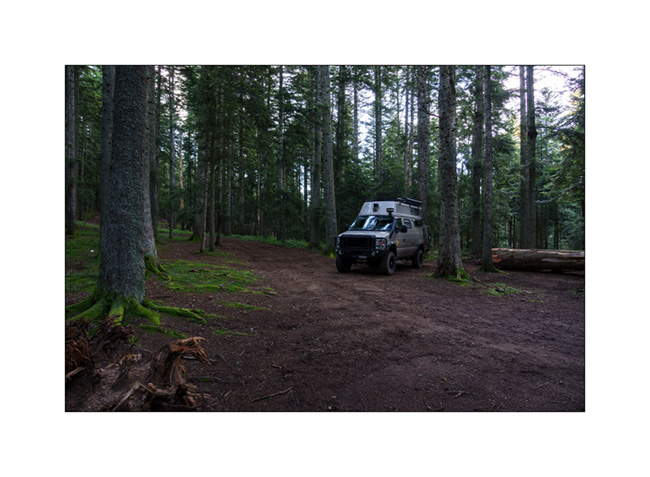
3. We find a cool spot to sleep, on the edge of a beautiful forest.
No question of continuing the journey without a spare wheel. I decide to change the 4 tires that have more than 70,000 miles and are soon worn out. Going toward Saint-Etienne, the nearest town, to find 4 new socks to VivaLaVida. But it’s not an easy task: we go to three tire specialists who cannot order the required size not common in Europe. Finally, one gives us the contact details of an American vehicle seller, Presticar Automobiles in Grand-Croix, which imports Dodge pick-ups we find him late Monday morning.
After two hours of searching and multiple phone calls, he finally finds 4 tires in the right size and I confirm the order. But the delivery won’t take place until Thursday at best. So we decide to pass the time by discovering the surroundings, starting with the Pilat, a local summit which overlooks the Loire to the Northwest, the Ardèche to the South and the Lyonnais to the Northeast.
4. View of the Lyonnais from the Pilat summit.

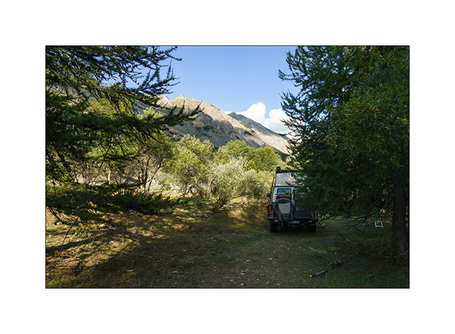
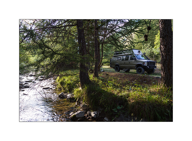
5. We find a nice boondocking spot at almost 4,300 feet elevation where we spend 3 nights.
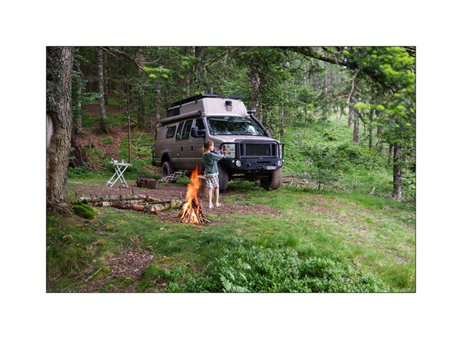
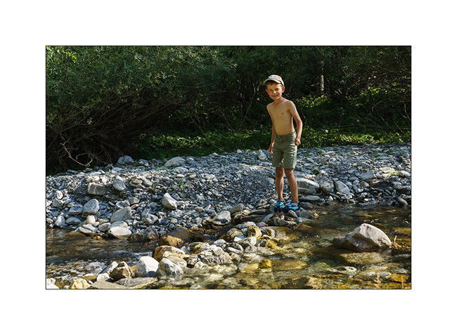
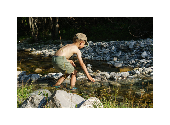
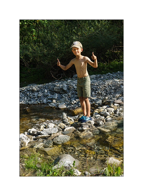
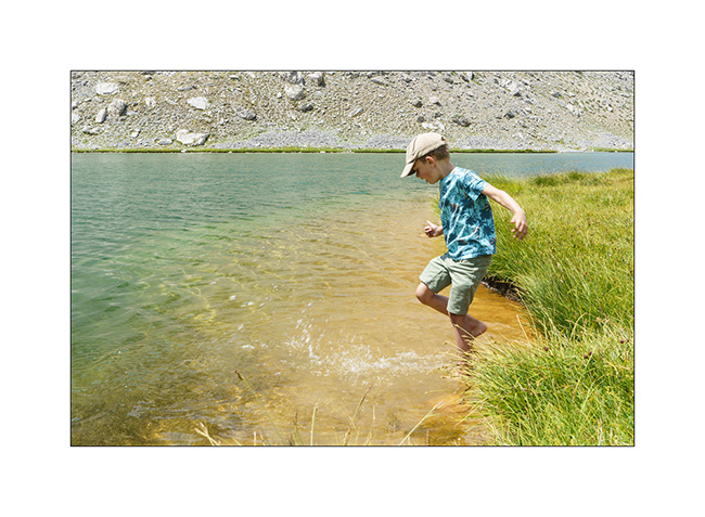
6. There is a stream that runs right next to our camp and Emile likes to play in it.
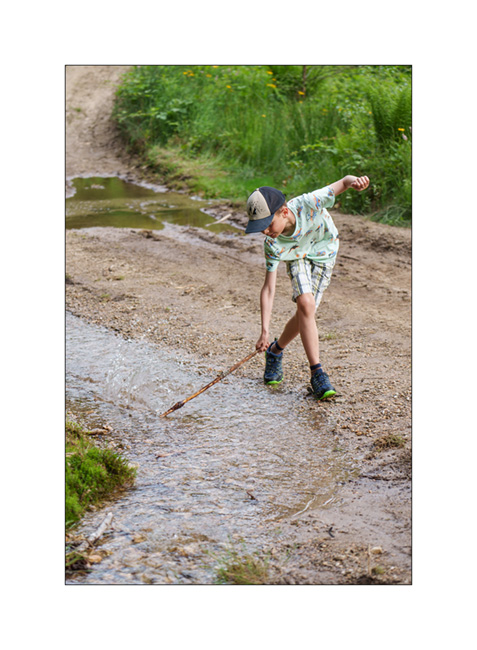
7. We buid a dam.

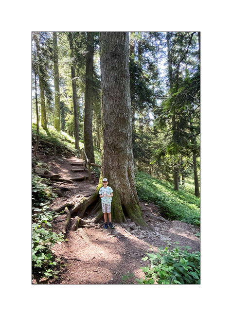
8. We also visit the surrounding area, in particular this “giant fir tree” which reaches 150 ft in height!
So it’s only on Thursday mid-afternoon that VivaLaVida, wearing her new shoes, resumed her route towards the West. Three hours later, we find a nice boondocking place on the banks of Lake Naussac while a storm threatened.
9. After the first thunderstorm. Three more will follow during the night which will still be restful.
10. The next day we cross the gorgeous Aubrac plateau. Our spot for lunch!
After a night in a camping between Montauban and Auch , we will reach the Spanish Basque Country the next day. To be continued soon.
Fall holidays
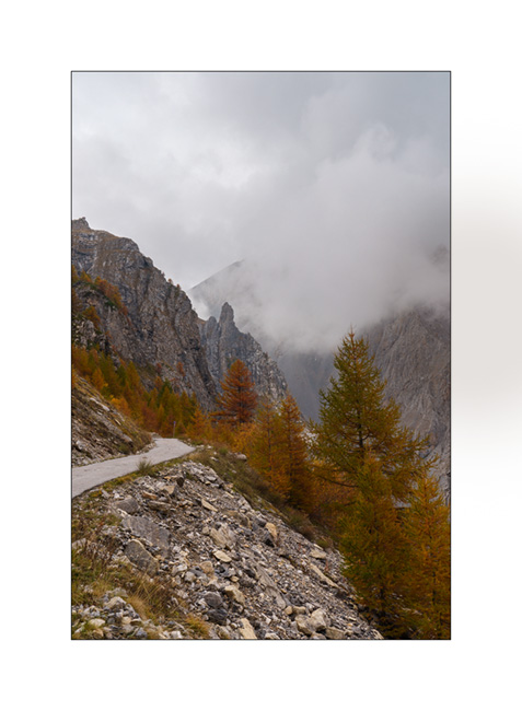
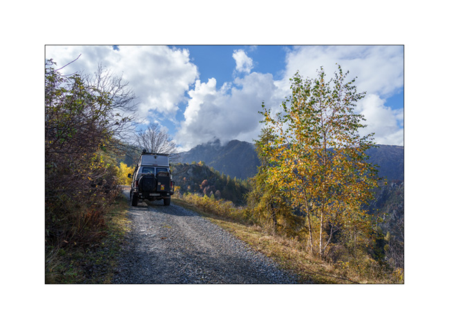
Our short week of vacation with Emile begins with a rainy day. We make the road to the region of Bardonecchia where I hope to drive the Sommeiller trail that we had not been able to discover the past summer.
1. Rainy boondocking above Rochemolle.
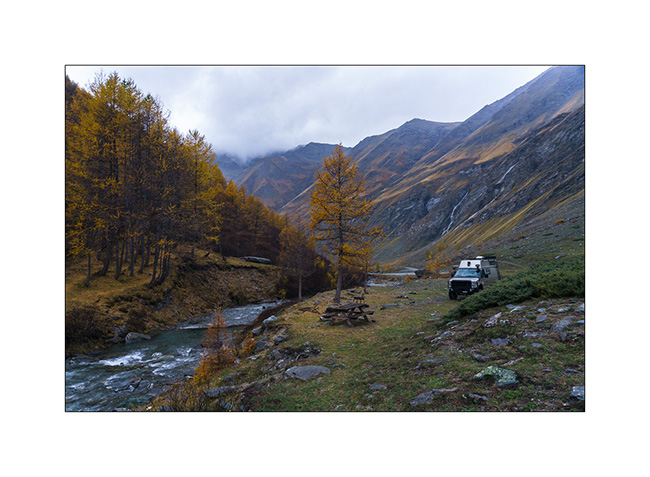
2. The next morning, the clouds have disappeared and the sky is blue when we wake up.
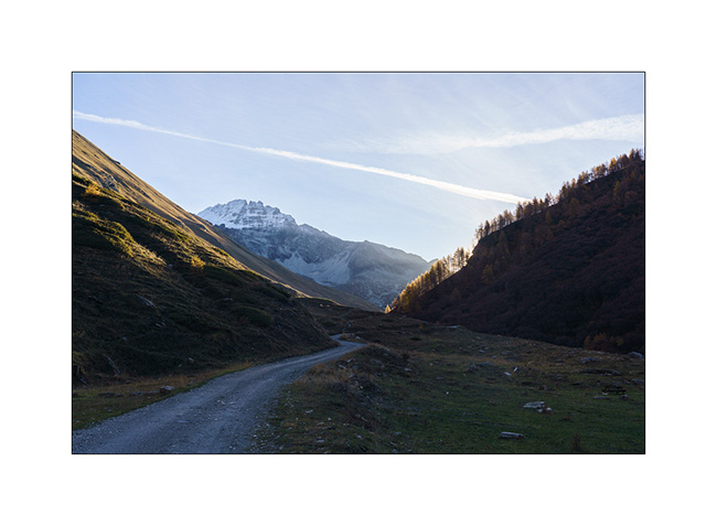
3. Uphill to the Scarfiotti refuge.
4. Higher on the trail…
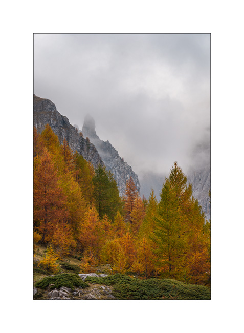
5. The surrounding mountains are gorgeous!

6. High altitude fall colors.

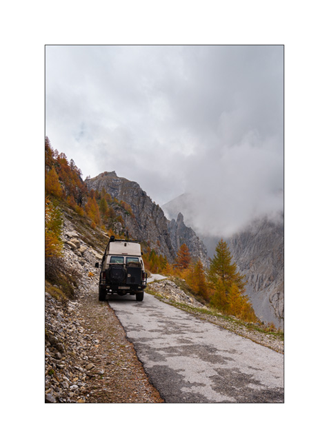
7. VivaLaVida on the trail, at already more than 8,200 feet above sea level.
8. Arrival at the end of the trail whose descent on the other side has never been built.
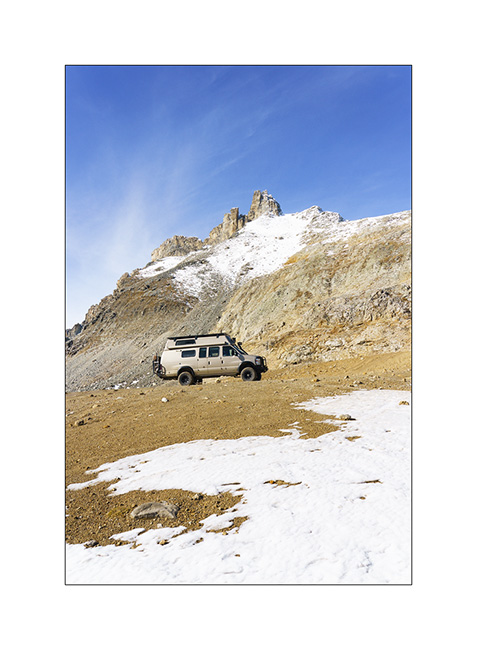
9. Round altitude (3,000 meters = 9,842 feet), the highest reached by VLV in Europe. As a reminder, she went over 13,000 feet in 2016, in Colorado…

10. The small lake which is just after the pass.
11. And the other side remained empty of trail. Only a footpath leads down to the Ambin Valley.

12. We are close to the first snow that fell a few days before…

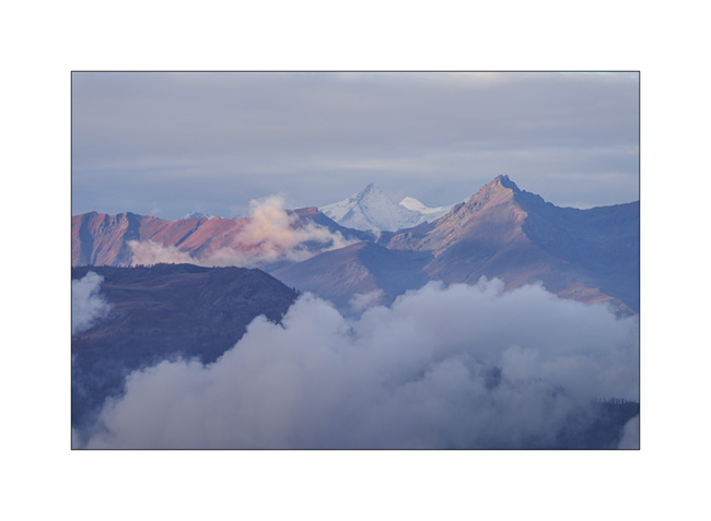
13. View of the peaks of the Parc des Ecrins in the distance…
14. Descending back. We only passed two local motorbikes all day.
To be continued in a few days… 😉
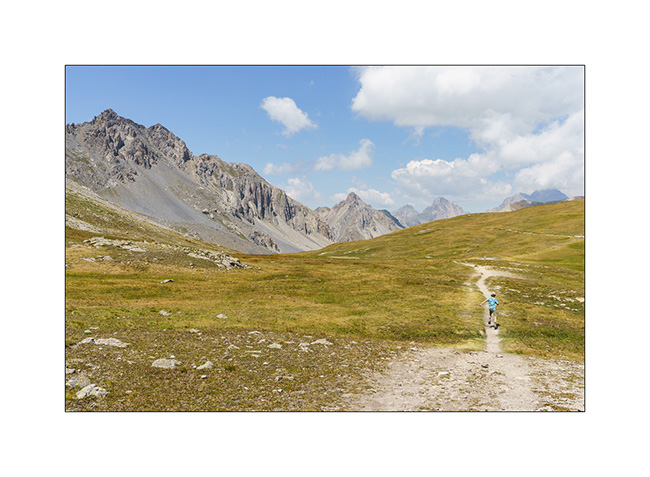
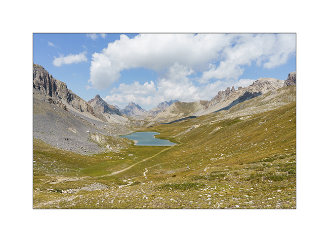
Lakes in Ubaye
We leave this beautiful place to discover others…
1. Going down from Colle Fauniera.
2. We find a boondocking place on the edge of a pretty river, very close to the French border from where we will hike tomorrow.
3. …
4. And we build a dam on the river!
5. …
6. …
7. Leaving VivaLaVida early the next day for a nice mountain hike to discover several lakes.
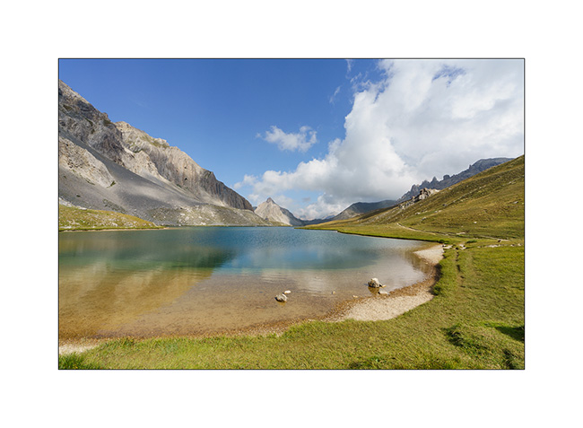
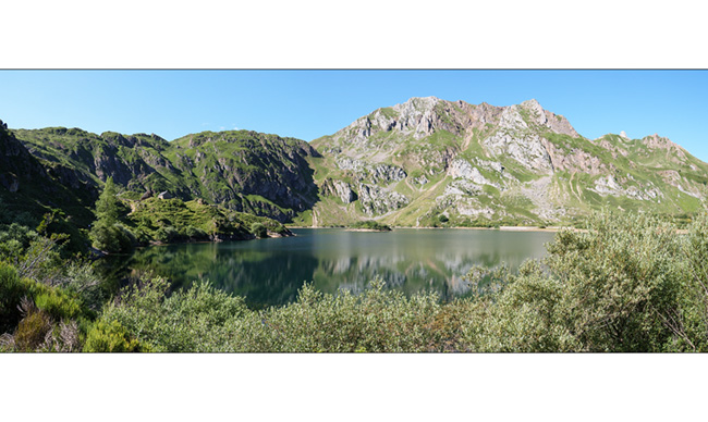
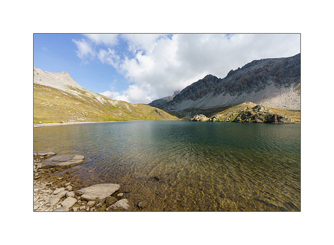
8. The goal of our day: the Lake of Roburent which I wanted to discover for a long time.
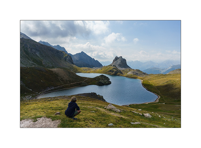
9. That’s where we picnic…
10. .. and Emile plays for a while.
11. We start the way back with a climb to the Col de Roburent.
12. Emile frolics like a goat!
13. The valley we descend with the Lake of Orrenaye.
14. We stop there to refresh ourselves before returning to camp at the same place as yesterday…
Continuation and end of our three week trip shortly. 😉