Arizona @en
now browsing by category
The journey resumes…
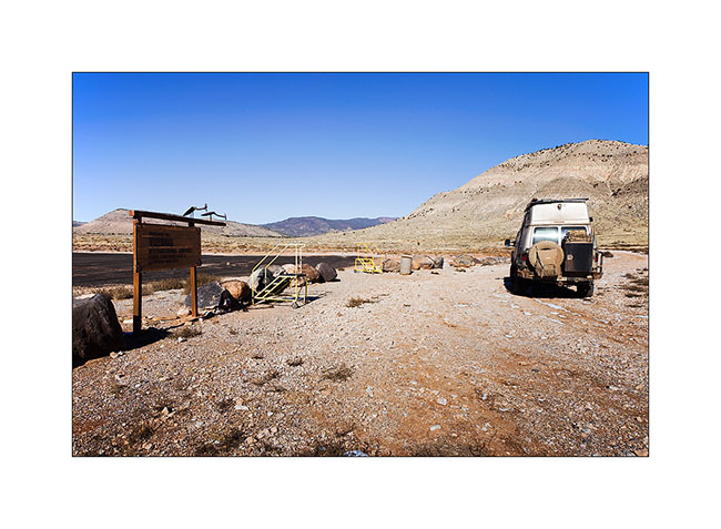
Thank you for your latest messages triggered by the long rest of the blog. Vivalavida received important works, including the modification of the entire oil system to try to improve cooling. The oïl to water exchanger has been removed and replaced by a large oil cooler controlled by a thermostat. I hope that recurring heat problems will be if not solved at least reduced.
After the long break period, VivaLaVida has hit the road again.
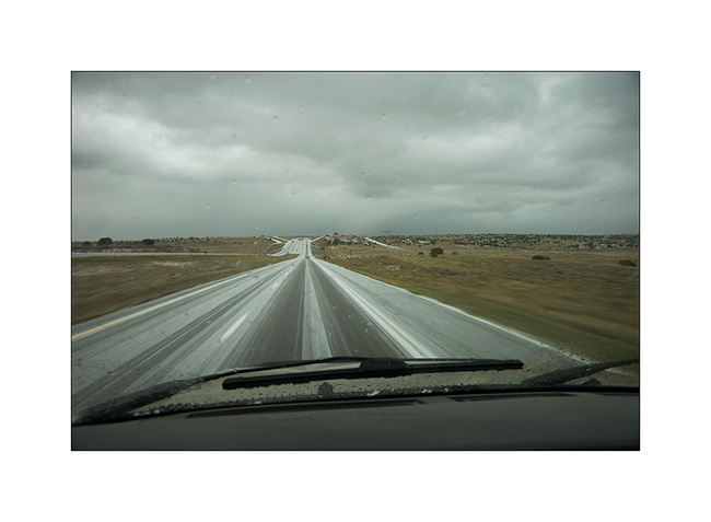
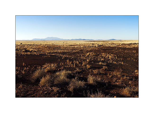
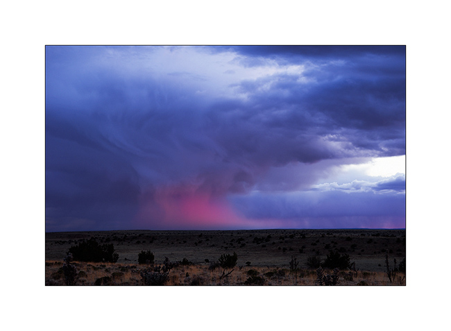
1. Heavy thunderstorms dot the plains of New Mexico.
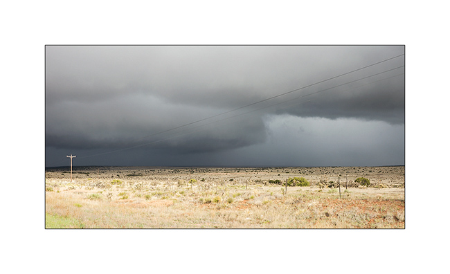
2. Some dump hail..!
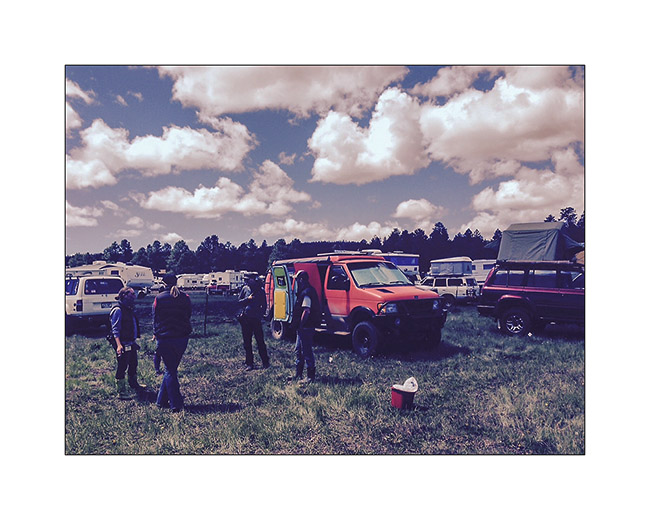
3. I make a stop at the Overland Expo West, South of Flagstaff, where I see John & Mandi again who started their journey since two weeks for their Pan American: from Alaska to Patagonia…
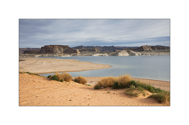
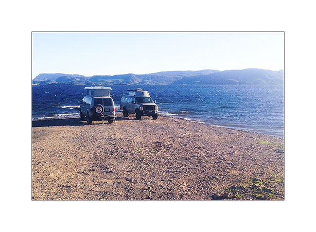
4. Camping stop with Chris and Jennifer on the shore of Lake Powel.
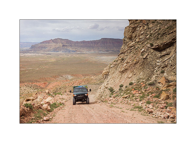
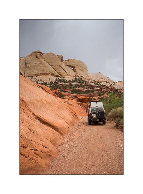
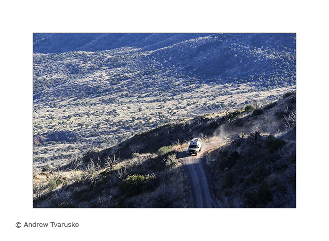
5. V4 with the “Sherpa” installed, the Chris’s very special van going up the Grade Kelly on the Smoky Mountain Road.
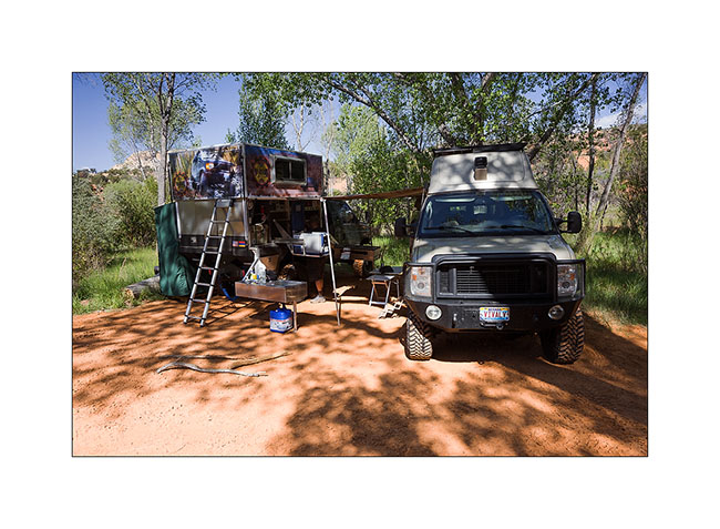
6. Camping at Deer Creek, along the Blurr Trail. The Sherpa is a base station for group camping. It offers a double bed in the upper part once lifted.
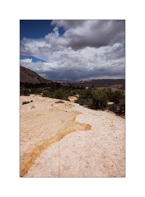
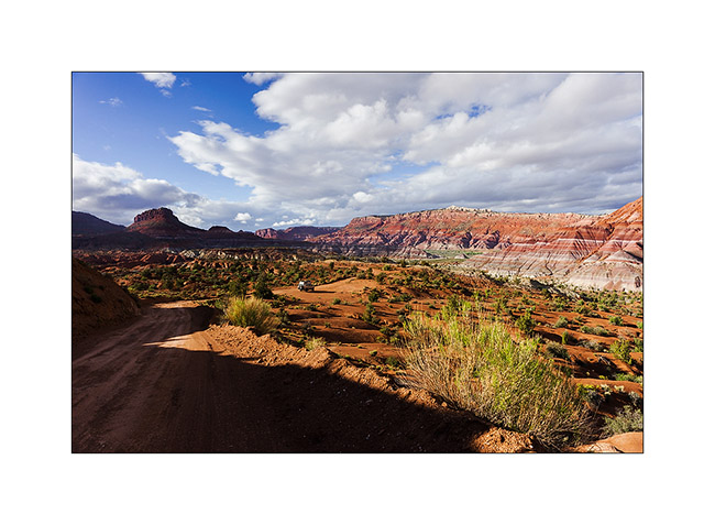
7. Fantastic view over the north of Capitol Reef and the Water Pocket Fault.
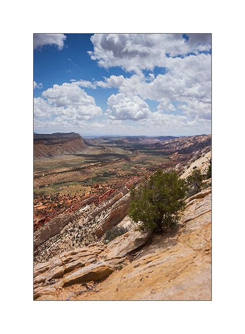
8. View toward South.
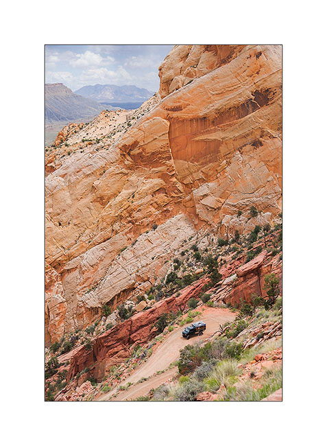
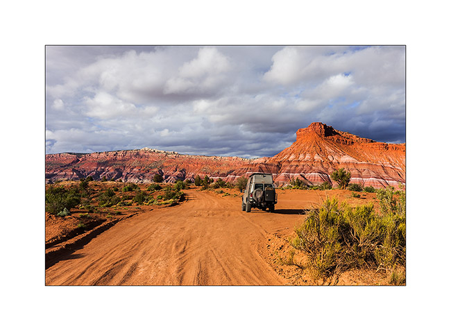
9. VLV in the Upper Muley Twist Canyon.
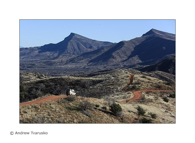
10. V4 going down the Blurr Trail.
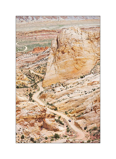
11. A few hundred feet below, it is only a small point…
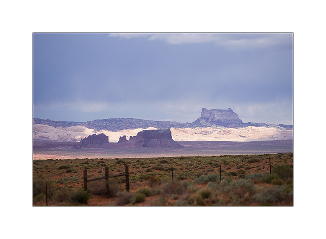
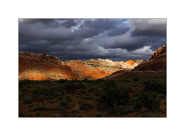
12. Temple Mountain Under thundersotrms.
Vivalavida is gonna stop again for some technical changes, the oil cooler mounted recently needs to be repositioned. If it significantly lowers the oil temperature, the hot air flow is building heat in the transmission. We must find another solution.
So expect a few delays before new updates… 😉
Minerality…
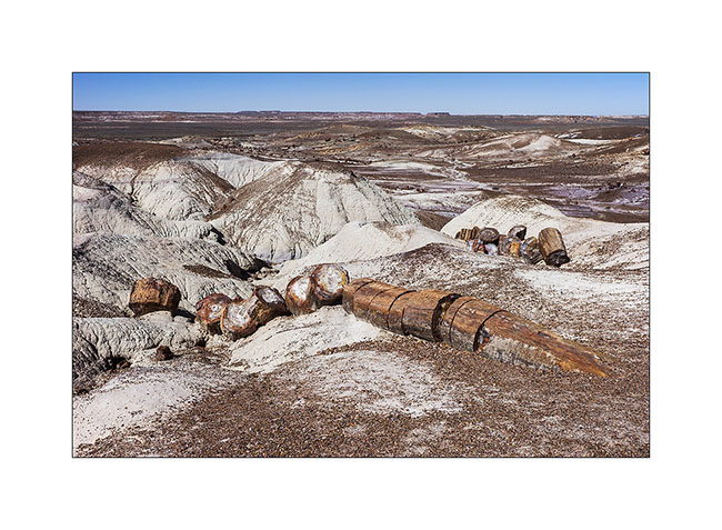
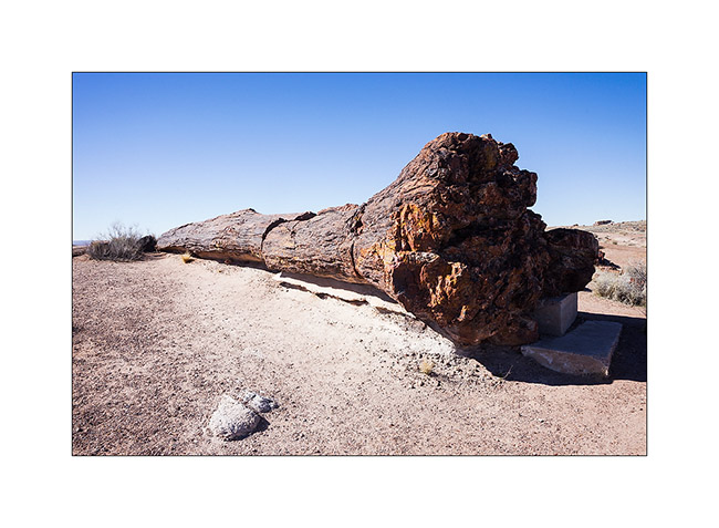
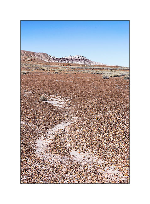
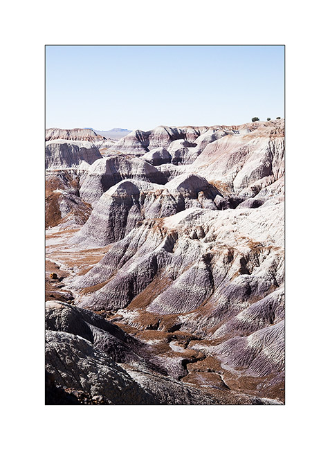
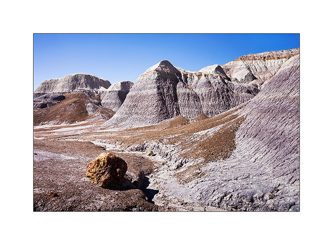
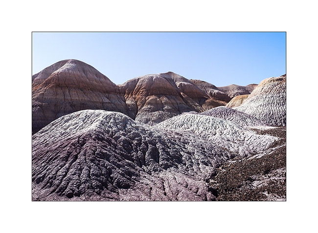
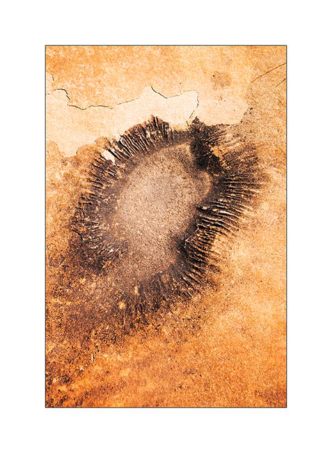
Still in Arizona, I made a short stop at Petrified Forest National Park. 225 million years ago, the current Arizona was nearly 3,500 miles South of his actual location, in a tropical climate and thus covered with tropical forests. During large floods on clay areas, trees fell and were buried in the clay that protected them from putrefaction. Over hundreds of thousands years that followed, the clay was covered with new sediment layers totaling till 1.5 miles thickness. The pressure thus exerted generated petrification of wood. Then the continental drift has gradually dried up the soil of Arizona allowing wind and rain to erode the upper sediments and leaving the petrified trunk now appear in the bentonite layers.
In places, the amount of petrified wood is staggering.
1. Bentonite which erosion reveals petrified trunks.
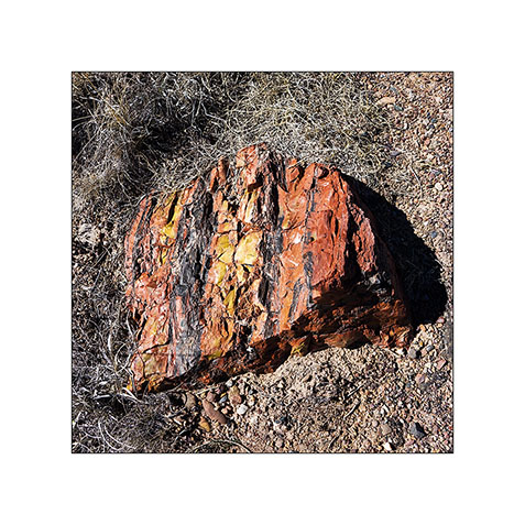
2. The colors are amazing! The density of this stone is such that it takes 4 times longer to a silica carbide saw to cut the same thickness as in granite.
3. Most of the time, erosion causes trunks to break. On some, the petrified bark is still present.
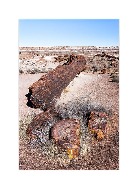
4. A giant! His strain is over 8 feet high.
5. The desert surrounding area is varied.
6. Undulation…
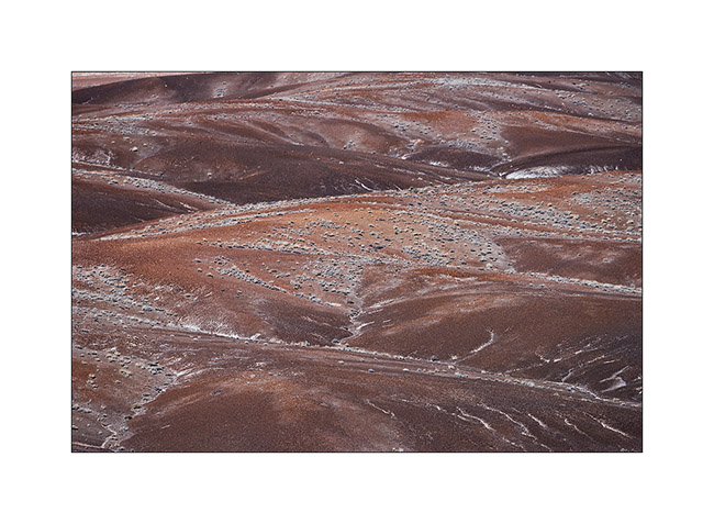
7. Mixes…
8. Amazing colors and shapes.
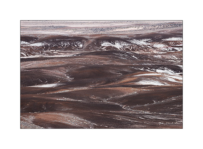
9. Edge of a bentonite mesa taht erosion carves.
10. This bentonite is less colorful than in other places but the presence of petrified trunks contrasts with the soft shapes of clay.
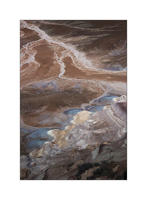
11. The eroded texture reminds me of some corals…
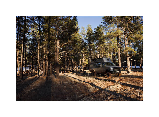
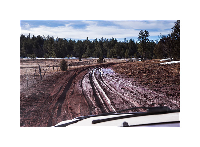
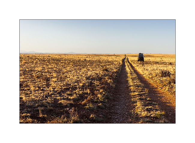
12. Vivalavida then moved to New Mexico, spending a first night at over 7,000 feet above sea level in the forests of the Zuni Mountains.
13. The next morning we crossed the Zuni Mountains with sometimes quite rutted and muddy roads…
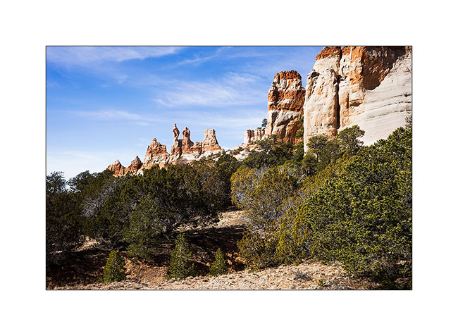
14. Discovery of the pinnacles of Los Gigantes by chance…
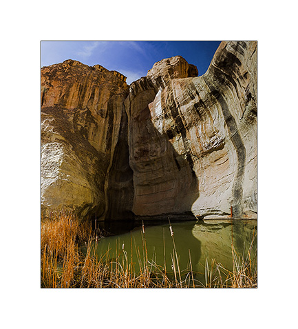
15. A guelta sheltered against a cliff of El Morro.
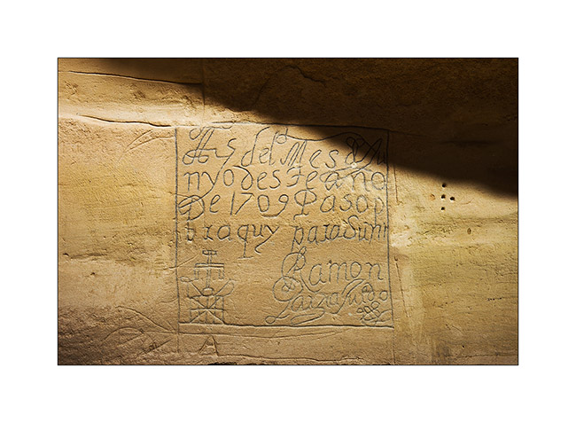
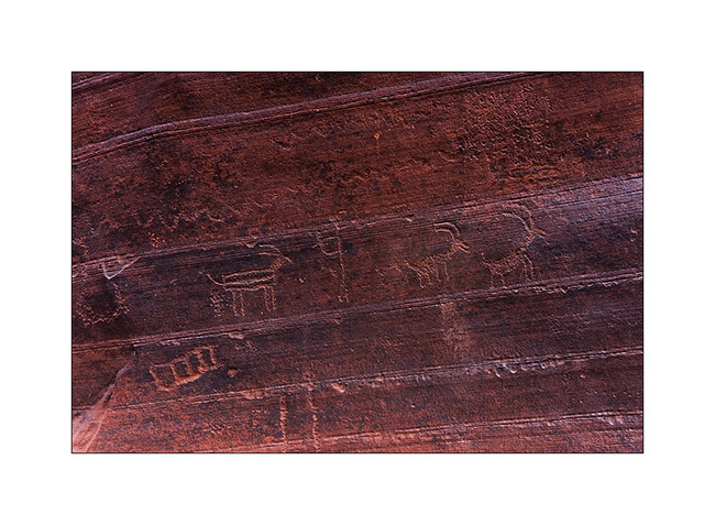
16. Etching in sandstone describing the passage of some Spanish in 1706.
17. Petroglyph much older, probably around the year 1200.
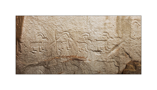
18. Another petroglyph estimated at 1,400 years BC.
19. “Woodpecker” natural arch.
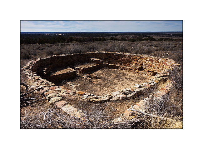
20. Pueblo ruins in El Morro National Monument.
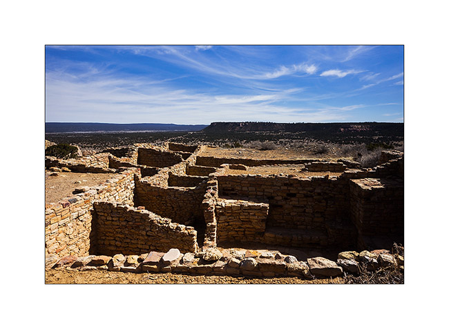
21. Another ruin of the same area.
Further discoveries along the East crossing of VivaLaVida to come soon… 😉
Craters and ruins…
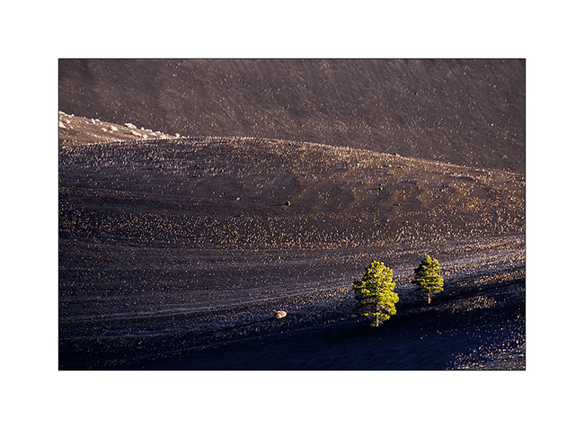
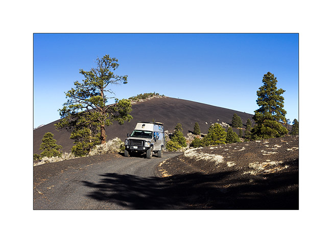
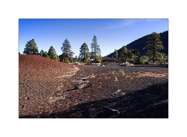
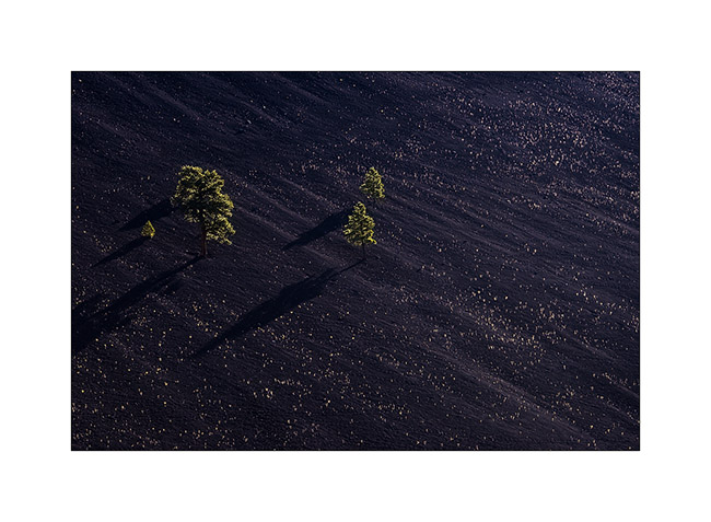
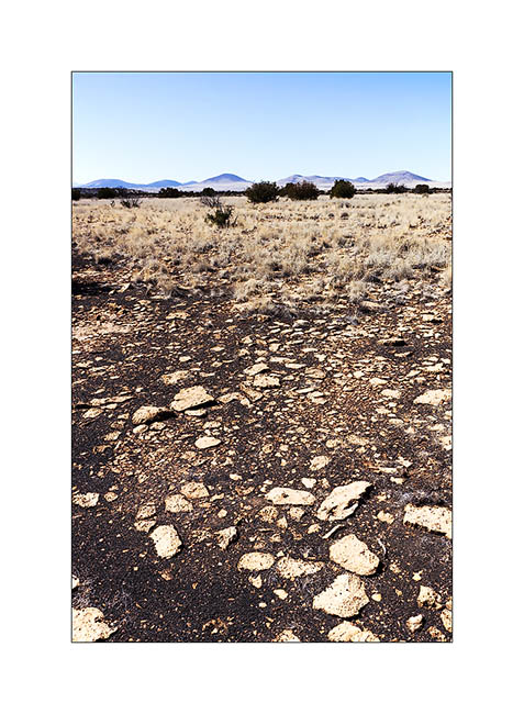
On the road to the east, VivaLaVida made some detours, the first close to Flagstaff to discover scoria cones. They appeared very recently, about in year 1080.
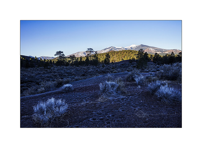
1. Mount San Fransisco in a freezing morning, a snowy volcano close to Flagstaff.
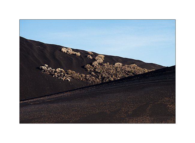
2. Cinder cones around Sunset Crater…
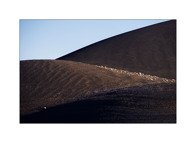
3. The vegetation is sparse and scattered.
4. First collons… 😉
5. Riding the volcano… 😉
6. Some areas are rich in ferrous minerals.
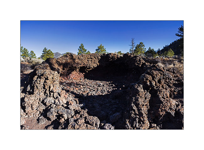
7. A lava bubble (hornito) whose roof collapsed.
8. Diagonals…
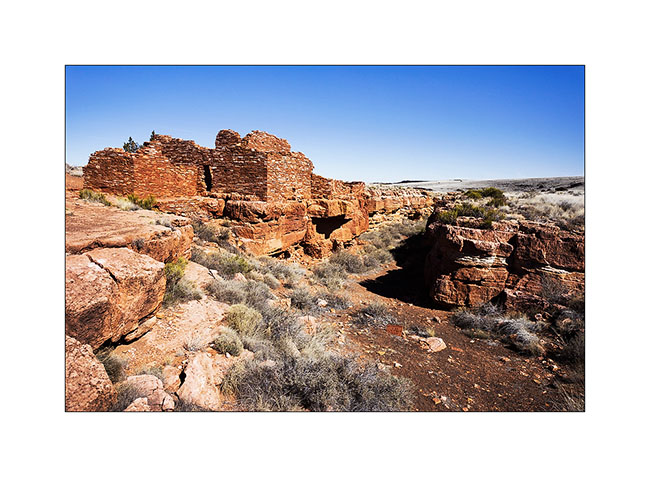
I then went to explore various ruins of Wupatki National Monument, at the limit of the Painted Desert. Several pueblos are grouped within a radius of ten miles.
9. Arrival in Pueblo Wukoki looking like a castle on a cliff.
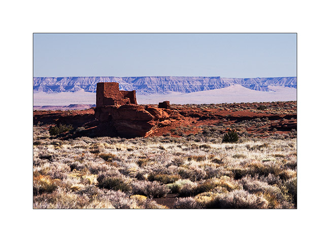
10. Yet this was the home of two or three families.
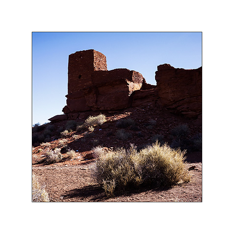
11. These ruins were built by the Indians who left the Sunset Crater region, about 25 miles away and were inhabited from approx. 1080 to 1200.
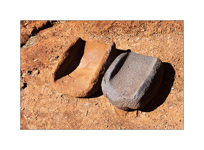
12. Stones to grind seeds.
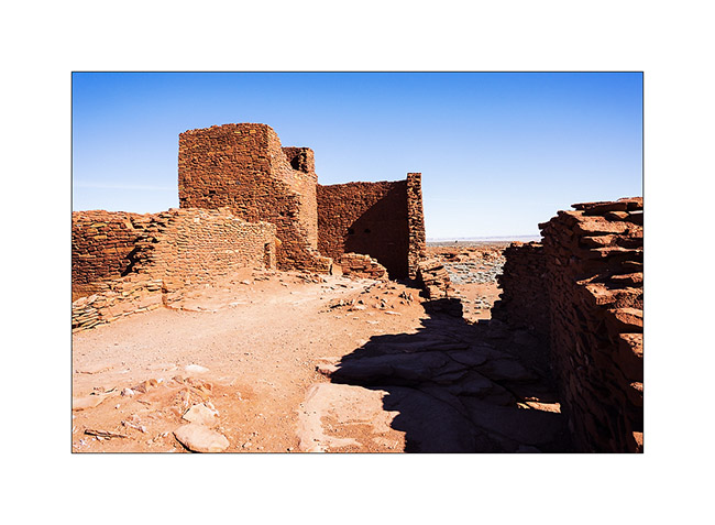
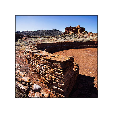
13. Another very impressive pueblo: Wupatki. The circular part of the foreground was a place of council and ceremonies.
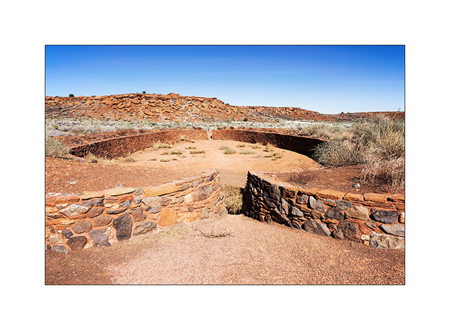
14. Here is a Ballcourt, a kind of arena in which games and trainings were organized. Ballcourts are frequent in southern Arizona and New Mexico but it is the only on known in Northern Arizona; thus assumes that Hoppi Indians who built these pueblos had contact with Southern tribes…
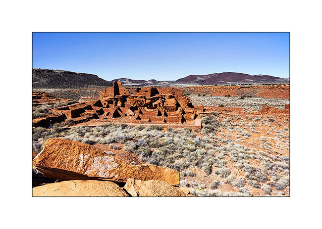
15. An overview of Wupatki Pueblo who had a hundred various rooms.
16. A pothole in the sandstone, a kinf of bowl eroded by water…
17. Other destruction the Lomaki Pueblo. The canyon on whose banks it was built is not due to erosion; it’s an earth crack created by the seismic activity.
18. Cinder cones dot the landscape; There are nearly 600 registered in the area.
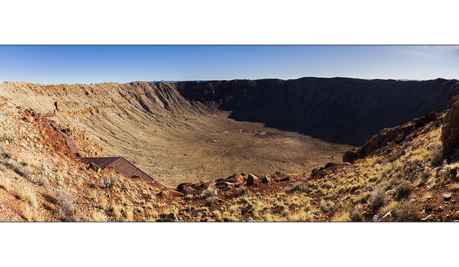
19. Here is a crater but it is a very different origin: it was created by the impact of a meteorite estimated at 140 feet in diameter 50,000 years ago! It hit the desert to the incredible speed of 11 miles/second, creating a shockwave of an equivalent power than a 20-megaton nuclear bomb. The crater is about one mile in diameter and 500 feet deep.
20. In the distance, Mount San Francisco rises above the plain…
21. I got to a nice oasis at dusk…
22. Restful tranquility…
Other discoveries to follow soon. 😉
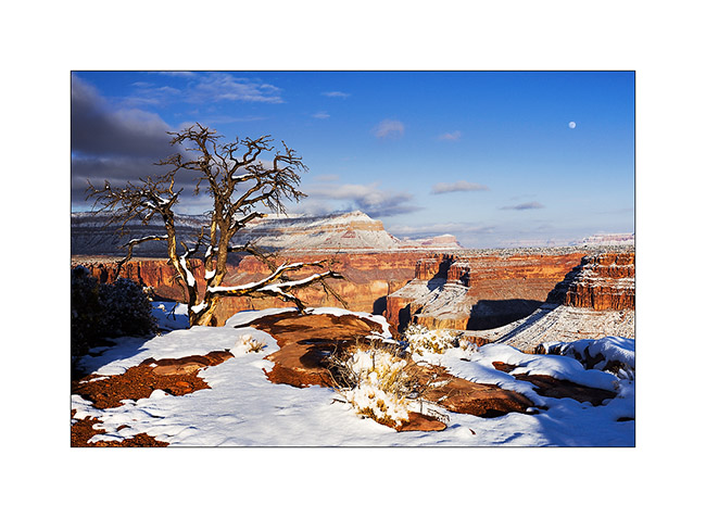
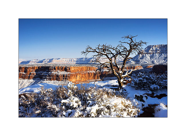
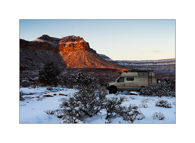
Winter in Arizona
I had a few days of Arizona winter with summer temperatures. Between 70 and 80 degrees, it changes with the -9 I had a few weeks ago in Utah!
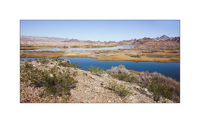
1. Wetland where the Colorado meander between the mountains.
2. Windy camp on the shore of Lake Pleasant (iPhone photo, sorry for the bad quality…)
3. VivaLaVida on the road to the Verde River.
4. Mountain desert.
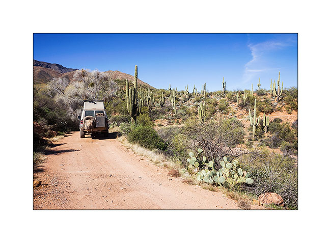
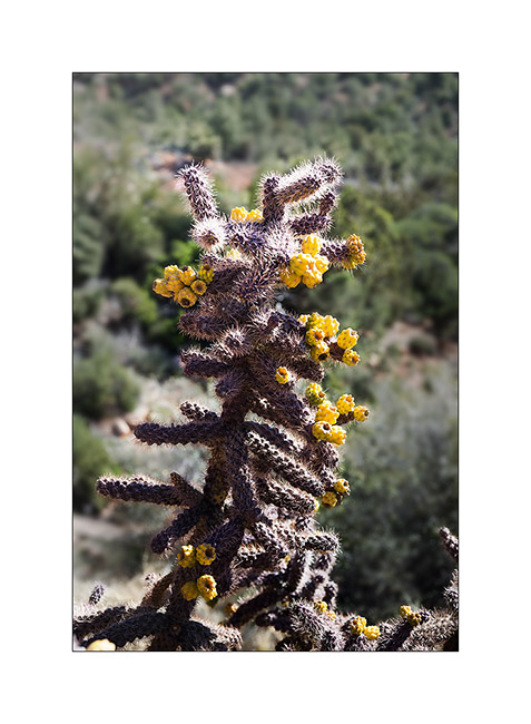
5. L’Arizona, it is also the saguaros, giant cactus which are the symbol of the State.
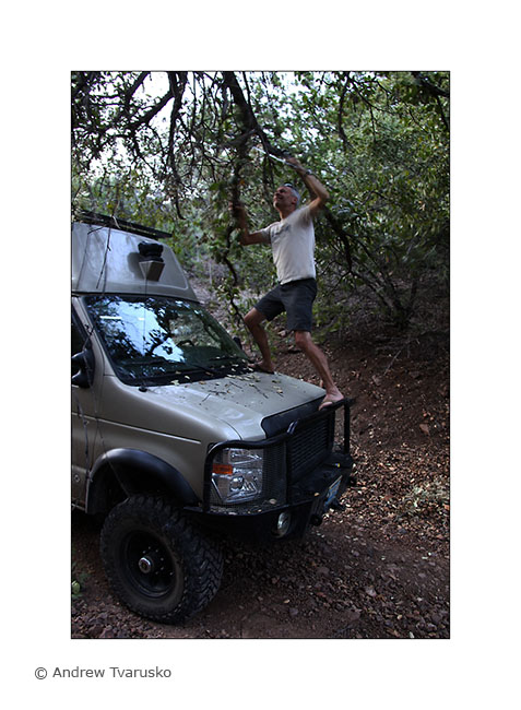
6. In some glens, trees sometimes hamper progress…
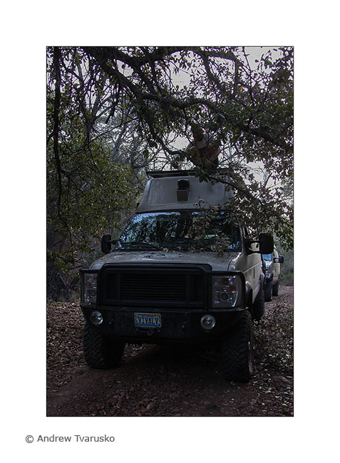
7. … forcing to play the saw or pruning shears…
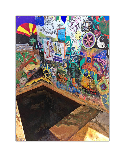
8. Rio Verde Hot Springs, a nice hot spring. There was a resort that burned in the 80ies. Remains the baths above the Verde River.
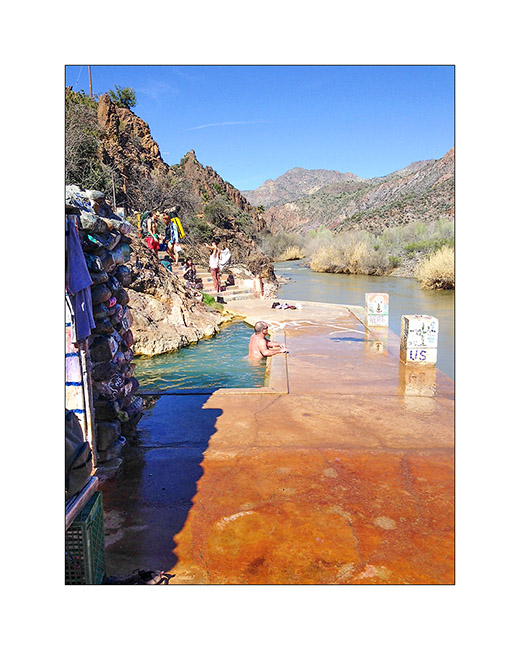
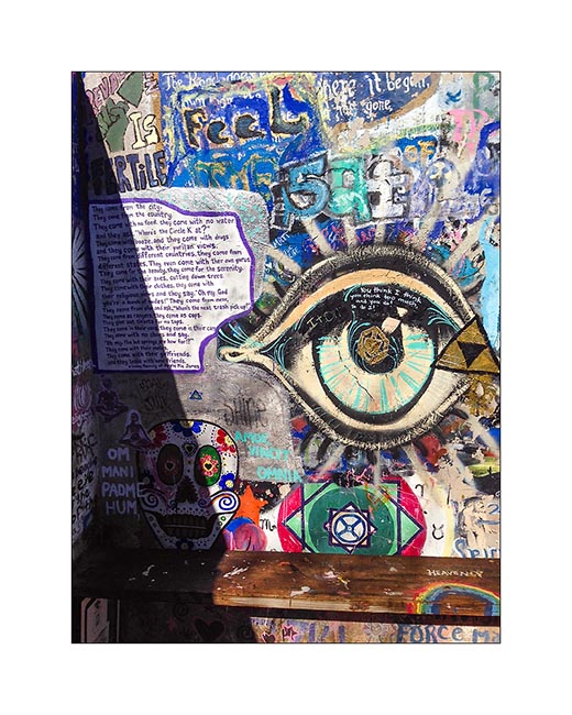
9. You will encounter a Hippies atmosphere, everything has been taged in a spirit of freedom and sharing. Swiming suits are “optional” and many are enjoy the hot water in their nude…
10. The “inner” basin whose water is warmer.
11. Last drink with Andrew who will continue his vacation in the South, well … if it doesn’t change his mind! 😀
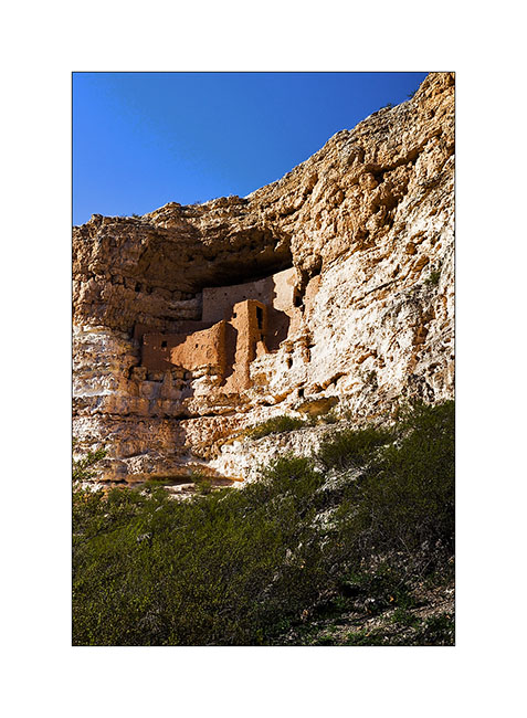
12. Short stop at the magnificent ruins of Montezuma Castle inhabited three centuries between 1,100 and 1,400.
13. Sunset over Red Rocks near Sedona.

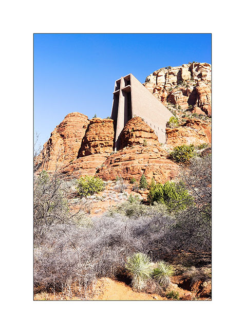
14. Chapel of the Holly Cross in Sedona. It was built in 1956, rather futuristic for its time..!
15. Cactus…
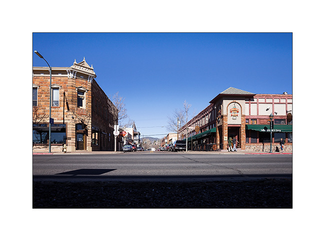
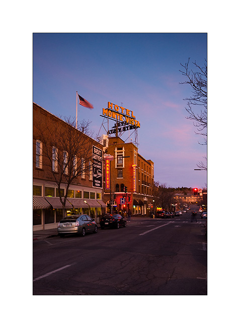
16. And here is a little serie of the small town of Flagstaff.
17. Hotel Monte Vista.
19. In Main Street.
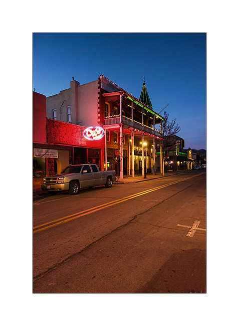
20. Back street.
So much for today. Vivalavida is currently heading East to reach North Carolina, where I’m gonna leave her in good hands during my stay in Switzerland. She will go through all the US toward East in ten days, nearly 2,200 miles.
Thus, updates will likely space themselves out before they stop in March, you will not hold it against me…
ay tuned for some pictures of this crossing coming soon… 😉
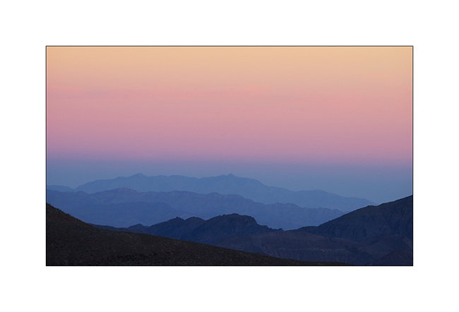
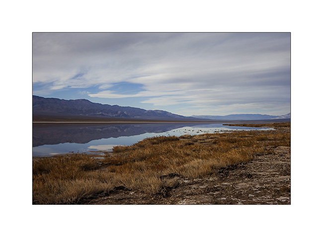
Death Valley
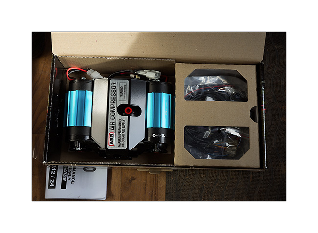
I went to join Jeff and Janet, an Alaskan couple who wanted discover some places of the Death Valley and preferred to do it in two vehicles. But before that, I installed the new compressor of VivaLaVida.
1. Beautiful sky over Arizona strip.
2. ARB was kind enough to replace the compressor with a new one, the previous being his fourth failure. Thanks to them.
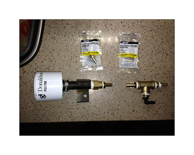
3. To try to prevent this from happening again, I installed a “house made” air filter which should limit the amount of dust that it swallows…
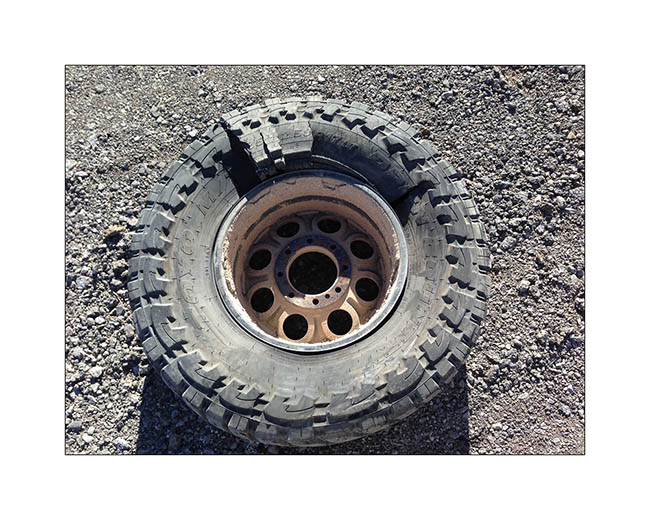
4. On the road to Las Vegas Where I met my friend Christian for dinner, I heard a big “bang” and the back of VLV sagged while I was driving at 70 mph.
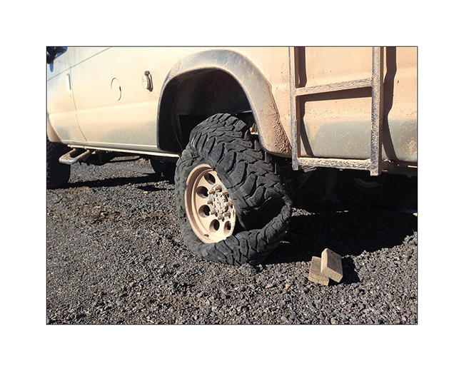
5. A tire suffered a carcass break, probably the result of fatigue of the carcass. Admittedly, these tires have rolled some 10,000 miles of trails at reduced pressure…
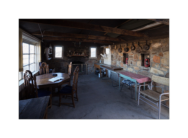
6. Met Jeff and Janet in Bed Springs Cabin, a pretty little miners cabin.
7. Saratoga Springs, south of Death Valley. There were a few ducks and a lot of frogs croaking! 😀
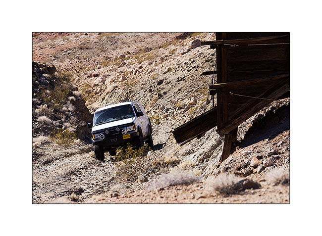
8. Arctictraveller going up to Black Magic Mine.
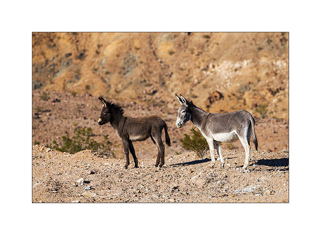
9. Wild donkeys or “burros”, presumably a mother and her young.
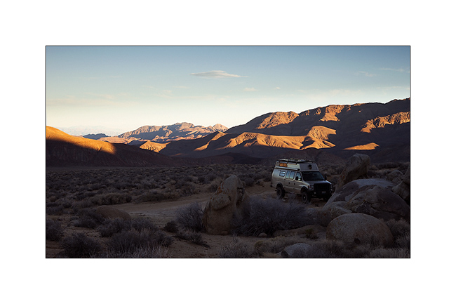
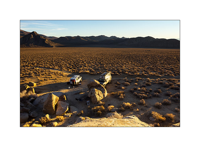
10. Late afternoon on the trail to Owlshead Mountains where we spent the night.
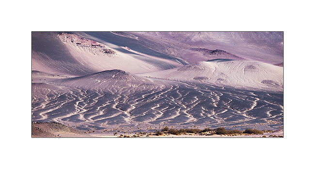
11. Diversity of mineral colors is pretty amazing in places.
12. One of the few stone cabinss, the Geologist Cabin.
13. Camp at about 4,000 feet above sea level, near the Striped Butte.
14. Raking light…
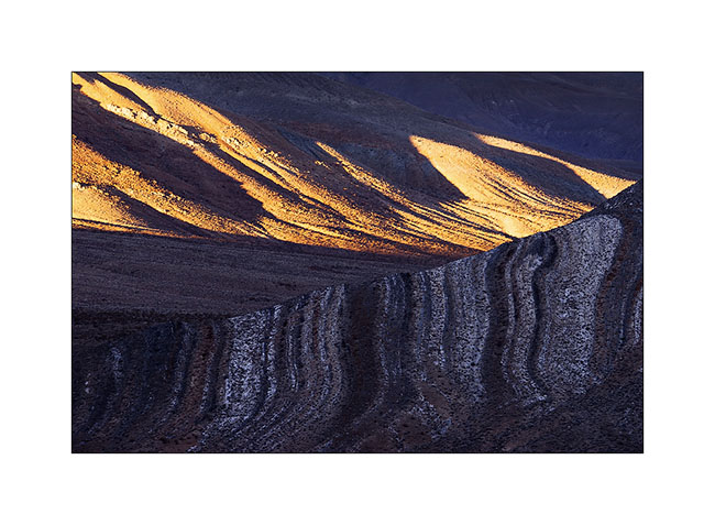
15. Striped Butte at sunset.
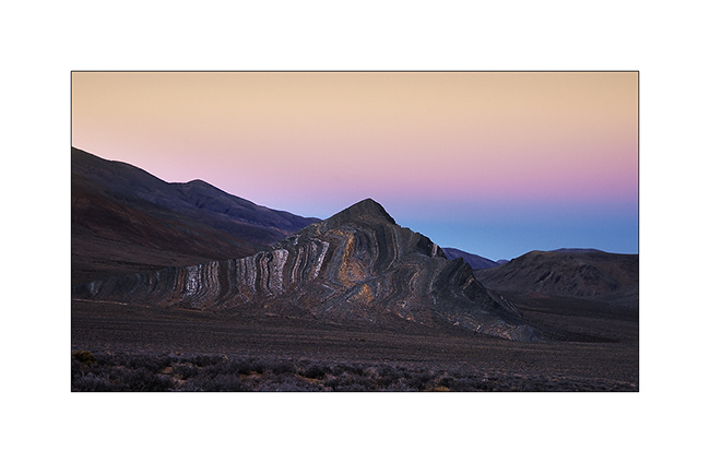
16. Twilight on this desert of rocks…
17. Jeff & Janet joined me in the night after going to fill Arctictraveller’s tank.
18. Jeff on Mengel Pass tral. It is not very experienced in offroading, I have therefore spoted him on tricky places…
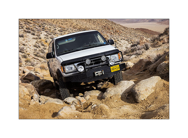
19. There was quite a few steps!
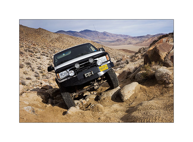
20. And some quite off camber path to…
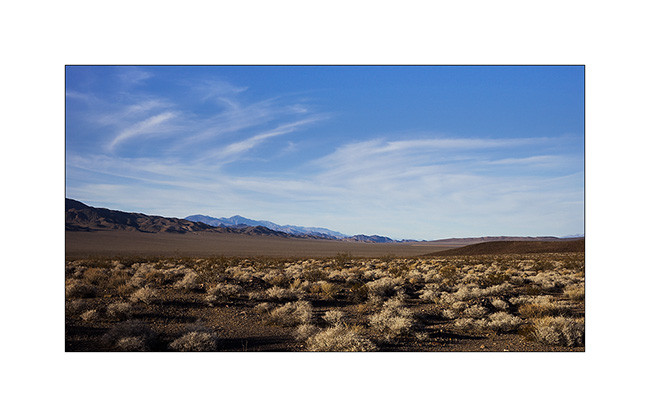
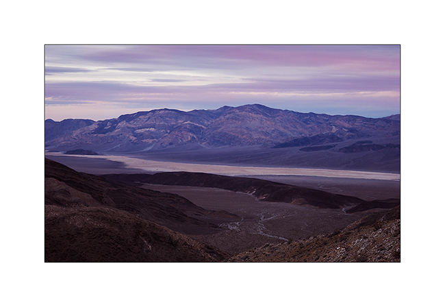
21. Panamint Valley.
22. Dusk from Lookout City, an old mining town over Panamint Valley.
And for a change, here are two videos of VLV in action. Thanksu to Jeff for having sent me. 😉
To be follwed in some days… 😉
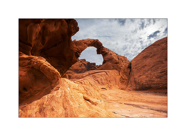
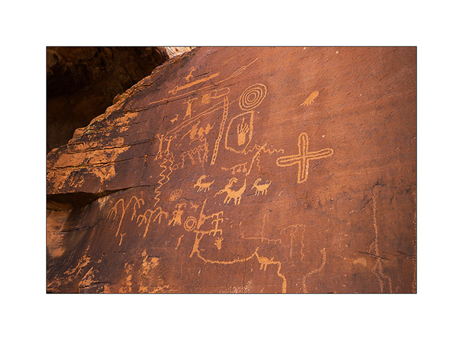
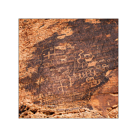
Petrogryphs of Arizona and Nevada
Vivalavida went discover another access to the Grand Canyon, also on the North Rim but further west.
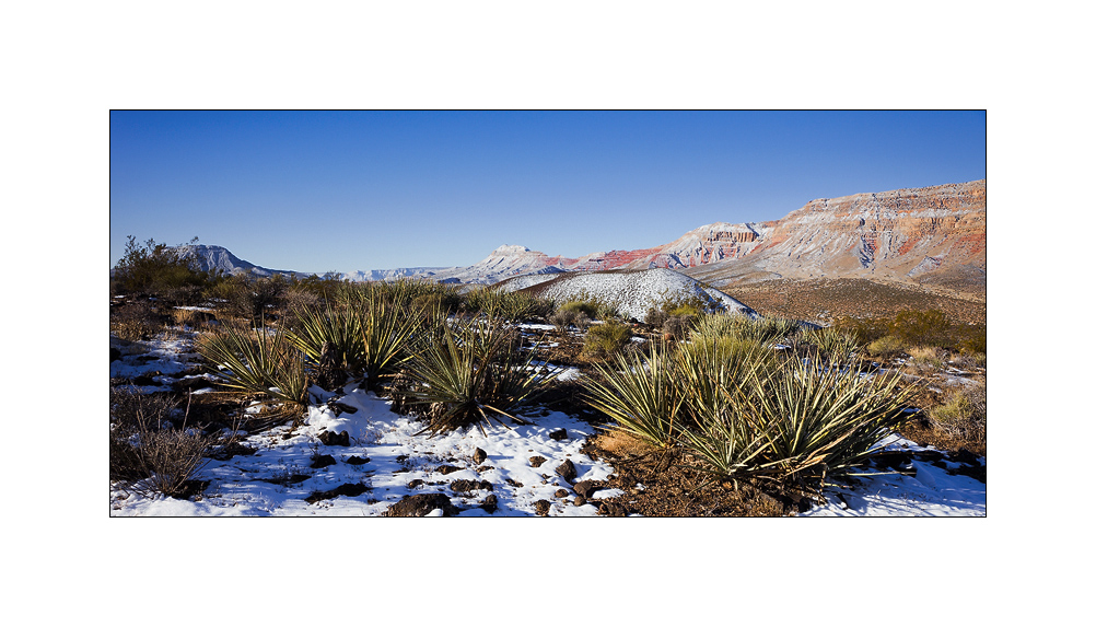
1. Cactus in snow…
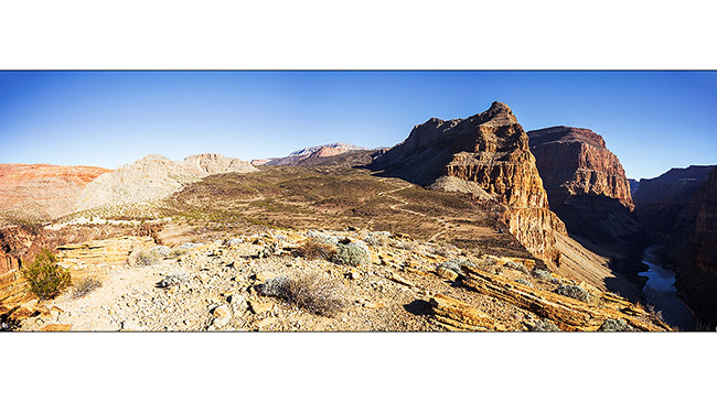
2. After going down Whitmore Canyon, I reached the end of the trail, approx. 700 feet above the Colorado River.

3. Grand Canyon is also gorgious here.
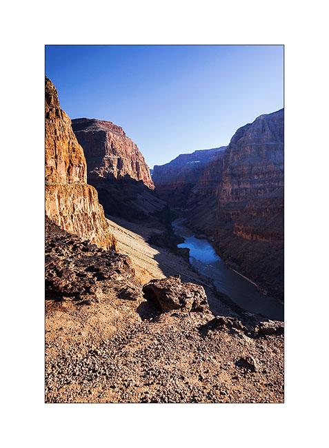
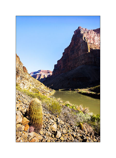
4. The site is interesting because it presents a large lava flow clearly visible on this panoramic (3 images stiched). There have been several successive lava flows, the first about 170,000 years ago that created a temporary 250 feet deep lake obstructing the Grand Canyon. This lake has remained approx. 20,000 years before the lava broke, creating a gigantic tidal wave downstream. Since then, there have been seven succesive lava flowa, the last one approx. 20,000 years ago. Do you find VivaLaVida that gives the scale in the image? 😀
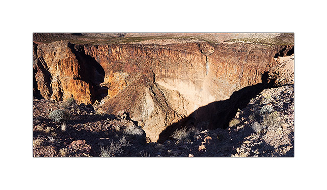
5. To the left of the promontory from which I took the previous image, there is a wide collapse that reveals beautiful basalt organ walls. It’s approx. half a mile in diameter and almost 600 feet deep.
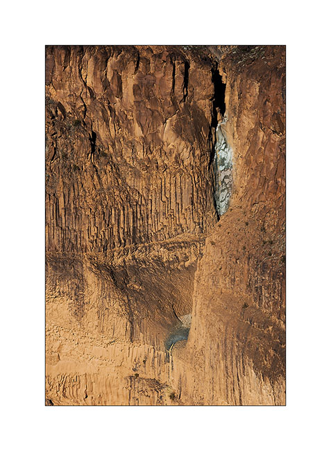
6. Details of the cliff with a waterfall that has carved its way.
7. Just to the testimony, picture is not great, a “beep beep” surprised in the warmer micro-climate of the canyon.

8. Going back up the trail, I pass a small country air strip. Some guys don’t lack humor with this “Whitmore International Airport” sign and the two small escalators… 😉
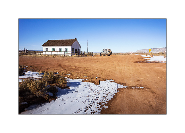
9. VLV near the Mount Trumbull old school. Built in 1922, it was burned by vandals in 2000 and rebuilt in an identical in 2001. It was the only school in the area where the first collons arrived in 1916, growing grains and beans until 1934 where the climate became much drier. Therefore, some og them turned to breeding cattle and sheep while many others left the premises. The school was in operation until 1968 when it was closed for lack of students. the last man living year round in this region died in 1984. Since few ranch remain scattered and inhabited during sommer only.
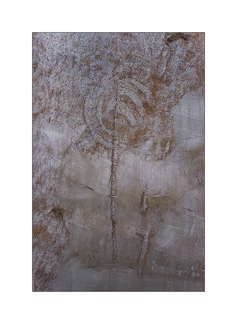
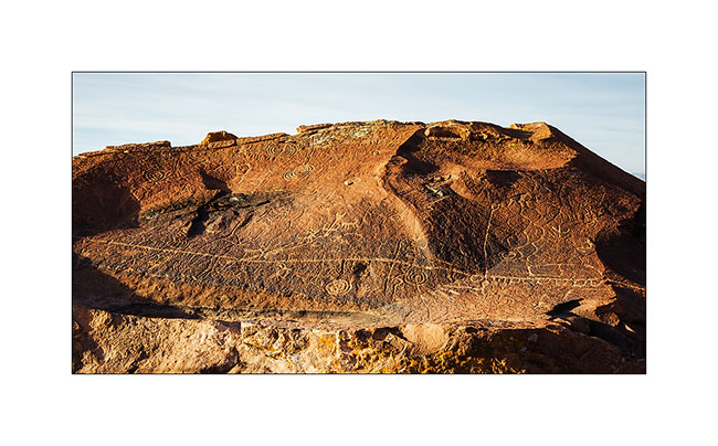
10. Short detour to Little Black Mountain, an interesting petroglyphs site.

11. the almost horizontal line is oriented exactly in the axis of the winter solstice; December 21st, the sun rises just above its eastern end.
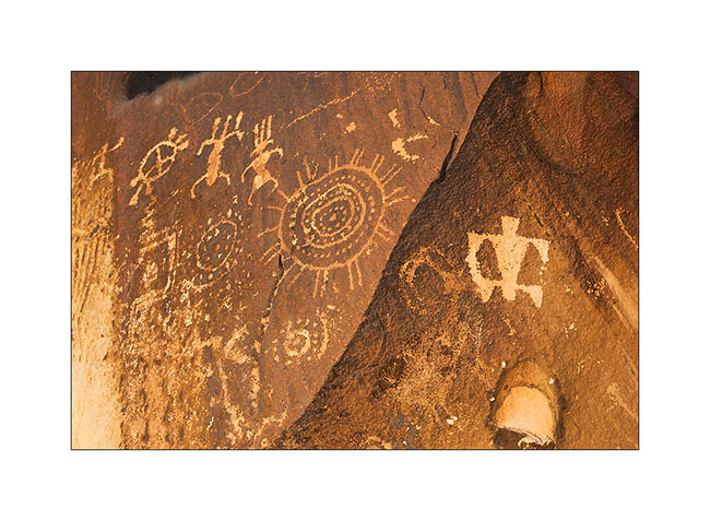
12. One of the big boulders of the site.

13. Details…
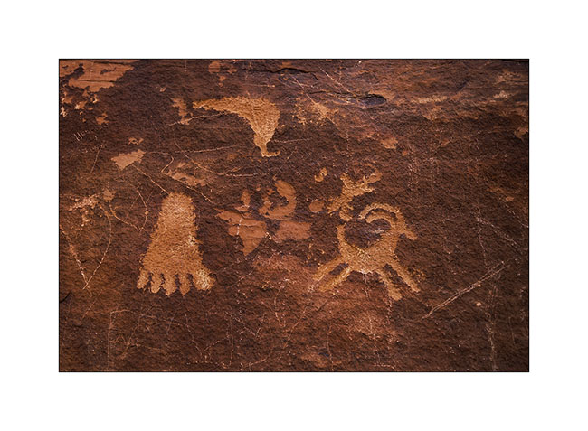
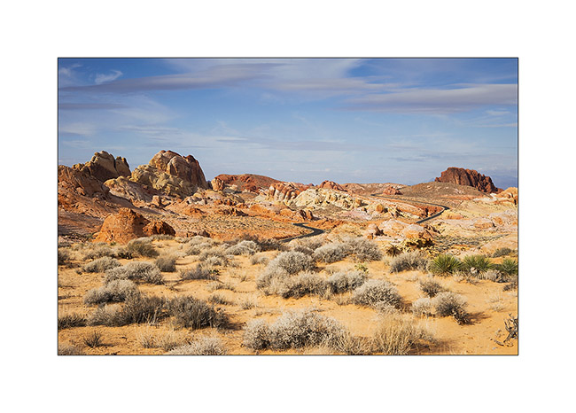
After this escapade in Arizona, I made another into Nevada to spend the evening with my friend Christian who was a few days in Las Vegas for the CES. Heading back to Utah where I should pick up a new compressor for VLV (the actual one being at its 4th beakdown…), I stopped at the Valley of Fire, a small Nevada State Park not far from Lake Mead.
14. Arch Rock.
15. They are also many petroglyphs, those ar at Altalt Rock.
16. Still Altalt Rock.
17. Those are in Mouse’s Tank Canyon.
18. The road heading to White Domes.
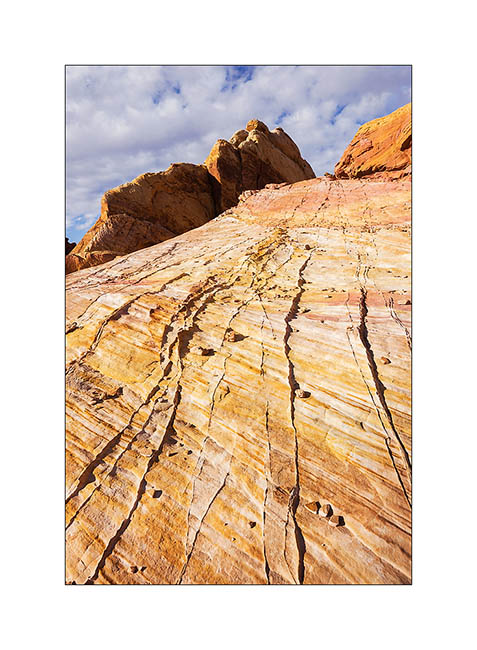
19. Sandstone is veined with various mineral colors.

20. Like a petrified wave…
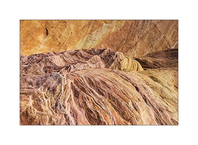
21. Veining…
22. Windstone Arch, rather unusual in an alcove of the rock.

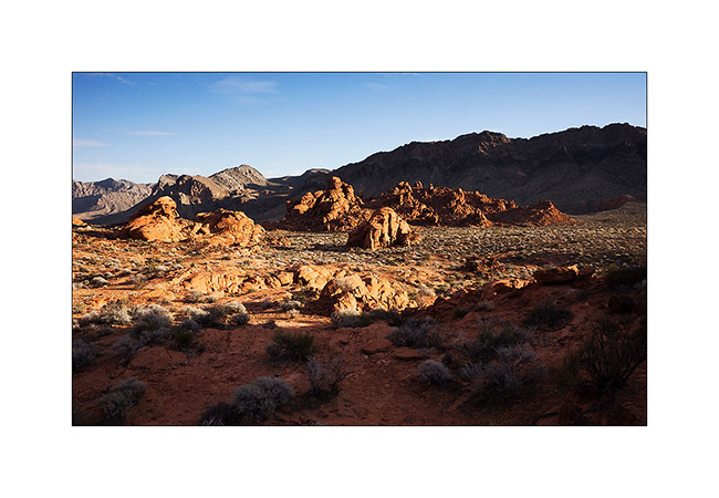
23. Late afternoon in Valley of Fire.
That’s it for today. Next step of VivaLaVida’s journey in the coming days… 😀
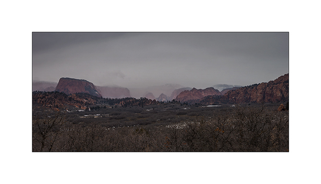
From Utah to Arizona…
I spent the last days of 2014 between Zion and Gooseberry Mesa, not far away.
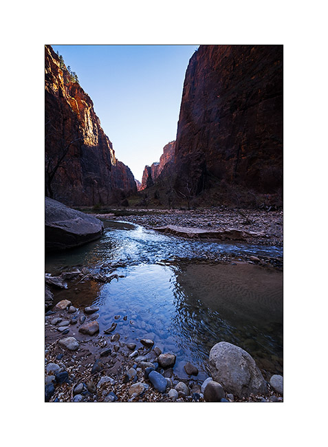
1. The bottom of the Zion Canyon is quite open, with magnificent cliffs.
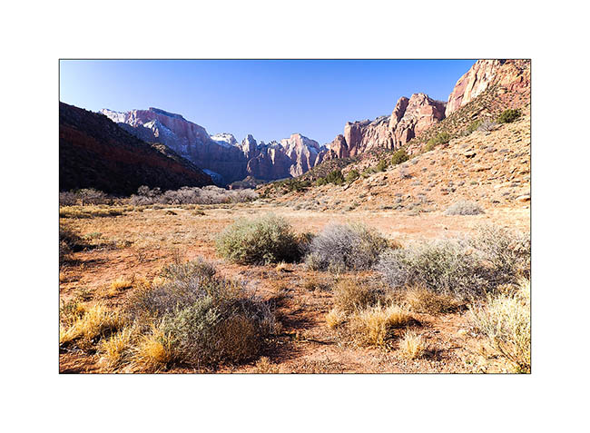
2. Gradually, when going upstream in it, he gently tightens.
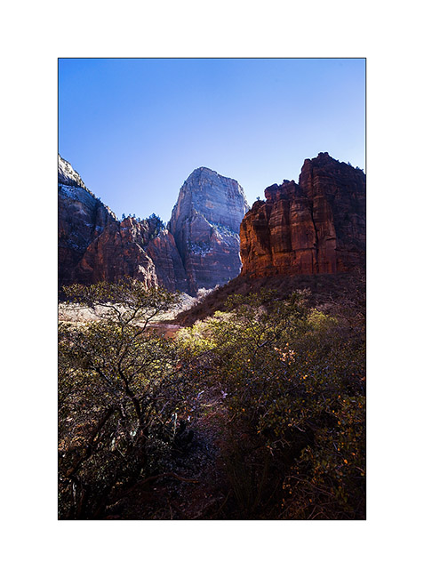
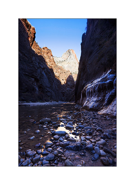
3. Then suddenly, because of a change of rock, it turns into a narrow, a deep trench not wider than the river bed.
4. Some cliffs are almost vertical walls over 2,000 feet high, really impressive!
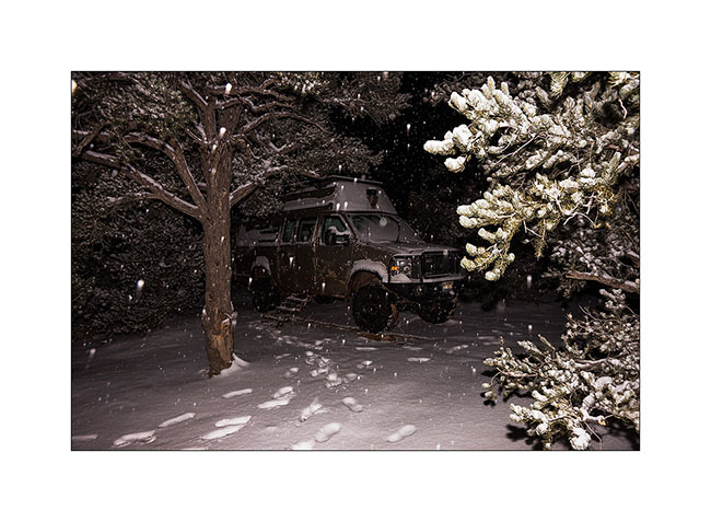
5. Along Kolob Terrace Road while it starts snowing… A few miles further, I will tow the Subaru of two French and two Belgian guys stucked in deep snow. Without VivaLaVida, they would have spent the night there, no one else was up there in this season. A little reckless in my opinion, without even a tow strap…
6. I spent my New Year Eve on Gooseberry Mesa, while it was snowing… 😀
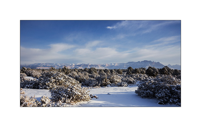
7. In the morning, there was about 4 inches fresh snow.
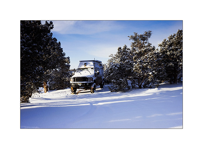
8. The view over the Zion Mountains clears in early morning…
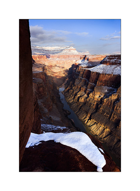
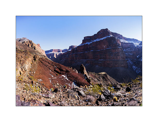
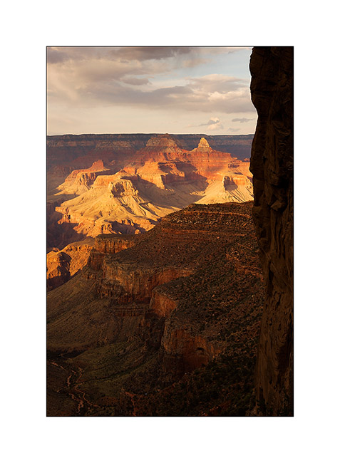
9. Despite the snow that fell the previous night, I tried to reach a viewpoint on the North Rim of the Grand Canyon. It’s a really unfrequented corner because of difficult access via a hundred miles trail, really muddy for the first part, then rocky and quite rough for the last 20 miles and closed in winter. However with VLV capabilities, I reached it in late afternoon when the moon rose.
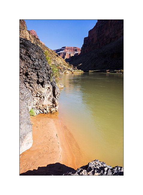
10. Enough air there! I’m on a 20 inches ledge overhanging a truly vertical wall… But it was the only way to show you the Colorado River, exactly 2,890 feet down! 😀
11. Warm last light rays in this winter atmosphere.
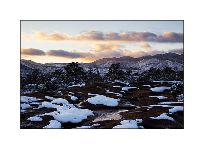
12. The snow fallen a few hours earlier makes patchwork design on the sandstone.
13. The camp will be really cold in the clear night…
14. The potholes freeze on the sandstone, with beautiful textures. Here, ice pebbles…
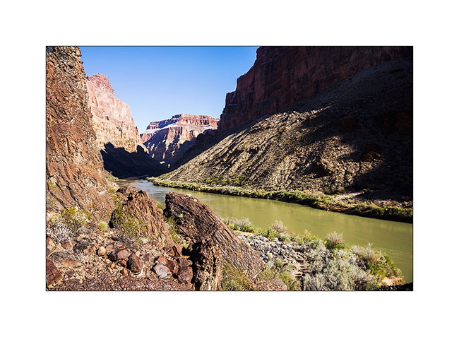
15. Down the next day in the canyon to see Lava Bed Rapids, the most difficult rapids of the entire Colorado River. The trail, sometimes non-existent, is very steep in a lava flow that makes walking dangerous, lava stones rolling like bearings under the feet. there is even some climbing in places, hopefully not too difficult because only I wouldn’t have be able to reach the bottom otherwise. A trek to not recommend to everyone anyway!
16. Here the rapids, without sun this season. Hard to show the scale as the canyon is so huge but it’s pretty impressive. What a power! I understand that there is a portage trail for canoes…
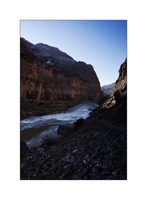
17. The depth of this canyon is just amazing, I fell really small down there!
18. Small beach upstream the rapids.
19. I begin the long climb back. Top left is Toroweap Point where I go, 2,890 feet higher! 😀
Following of the discovery of this part of the Grand Canyon to come soon!
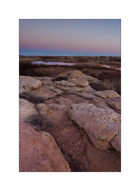
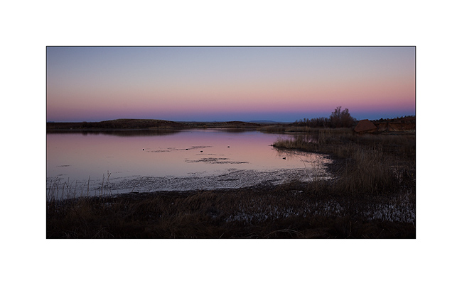
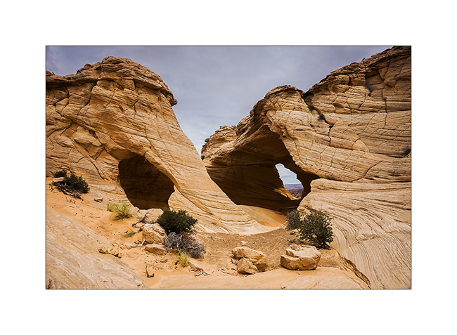
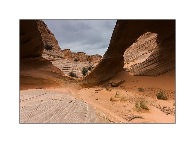
Vermillion Plateau (2)
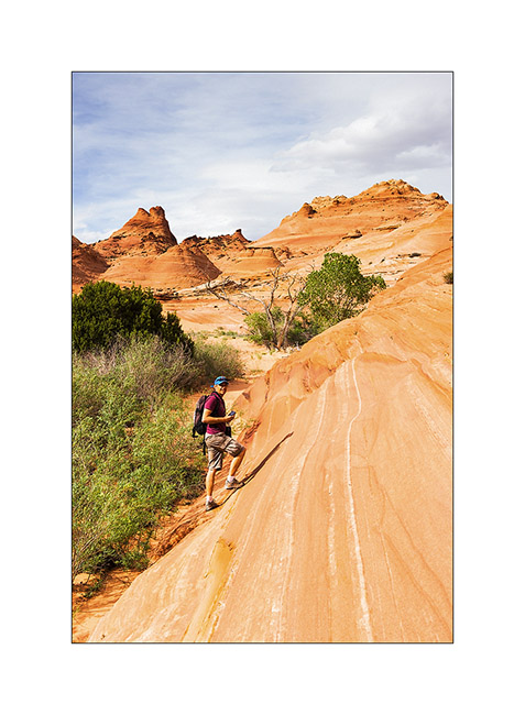
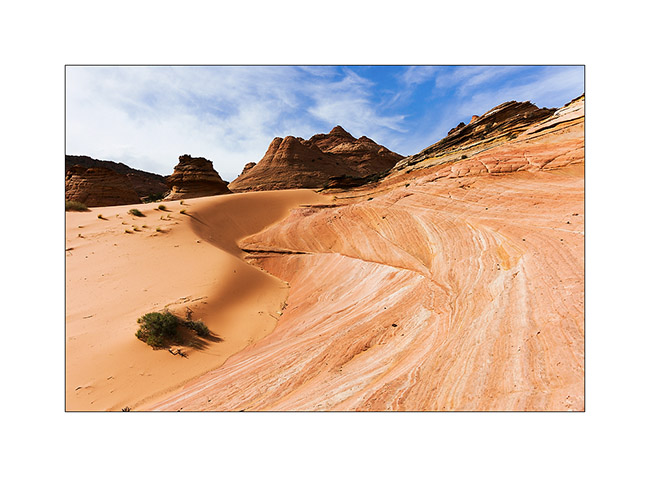
So we continue our journeys in North Coyote Butes.
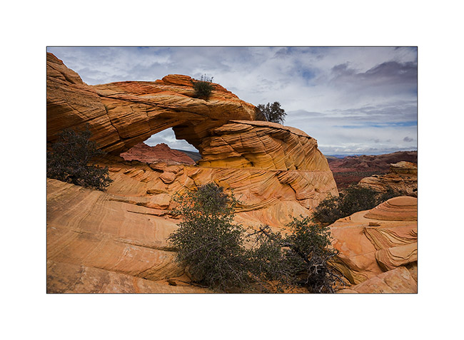
1. The climb takes us near Top Rock Arch…
2. Scenery towards the South Coyote Butes.
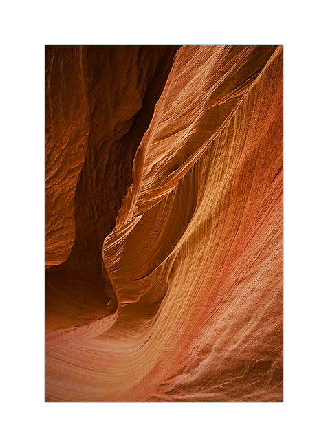
3. Later, we visit the Alcove, a large cavity excavated by the wind. I find several very graphics compounds…
4. Draperies of sandstone…
5. The top of the North Coyote Butes is a sort of plateau…
6. Reached Melody Arch and its “window” on the South Coyote Butes.
7. Perspective…
8. Descend of the opposite side.

9. Still beautiful…
10. … and even a sombrero ! 😀
11. Lower, the turtle rock seems sweet…
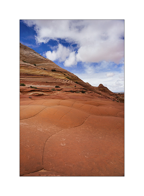
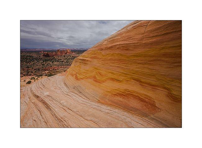
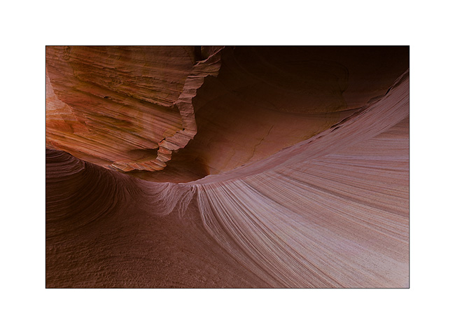
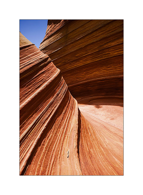
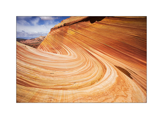
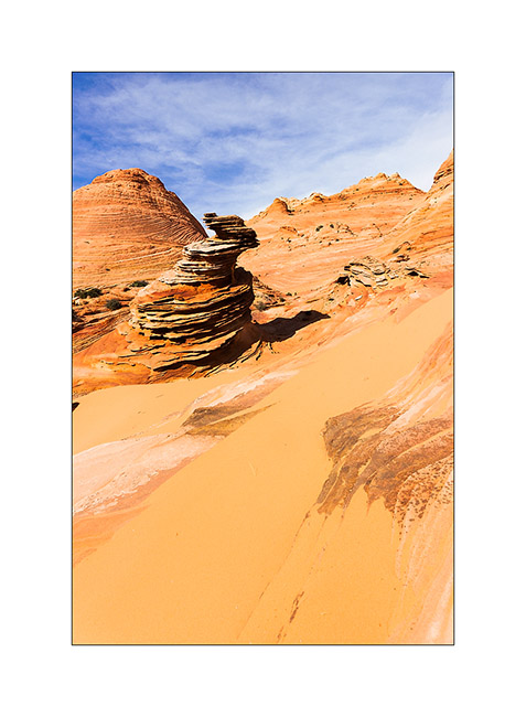
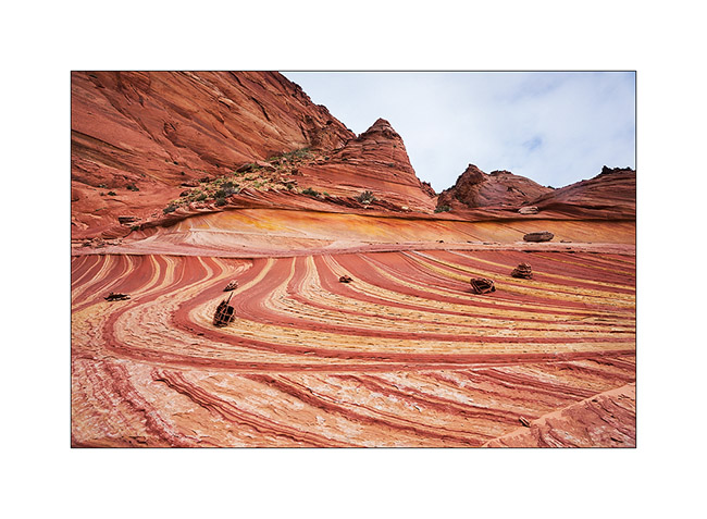
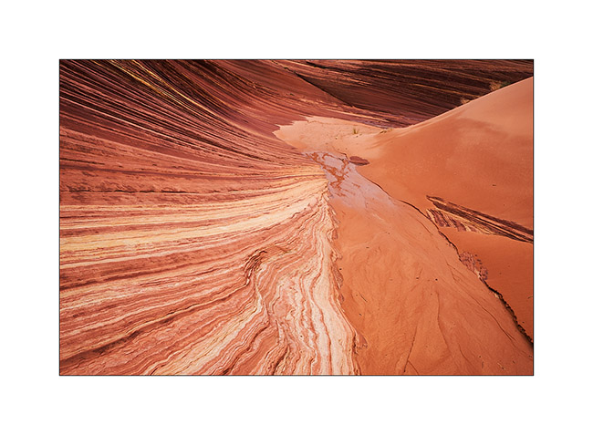
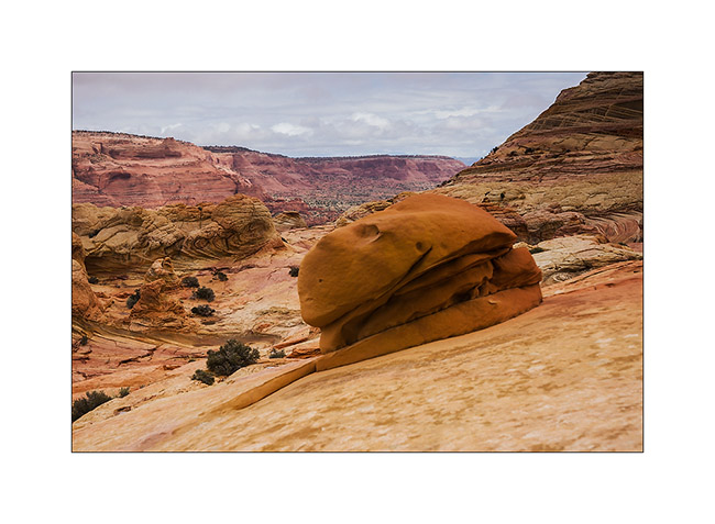
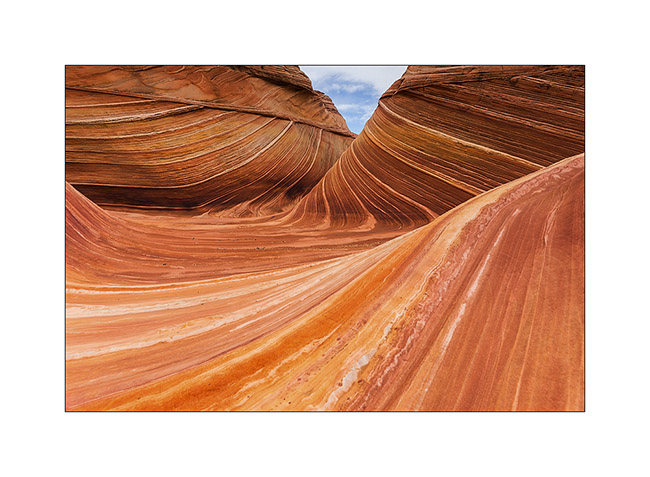
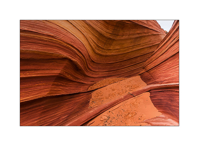
12. Back to the Wave as the light comes.
13. The contrasts are more pronounced but the softnees of lines remains…
14. …
15. …
16. On the way back, stop at a small little colorful quadruple teepee.
17. …
We slept in the Paria Town in Paria Canyon, only some miles away.
18. Heavy sky over the trail…
19. … and hard light on the mesas.
20. What a nice place.
21. Contrasts in late afternoon…
Well, I hope you’re not too drunk by the number of images of these beautiful Coyote Butes. The next update will resent the beginning of our journey to Utah. Coming in a few days…
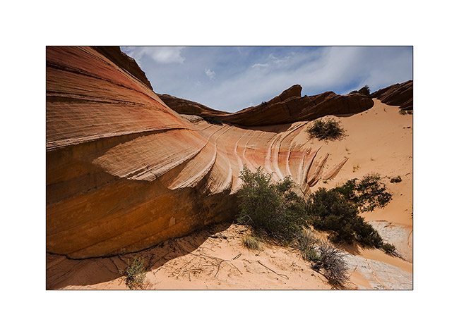
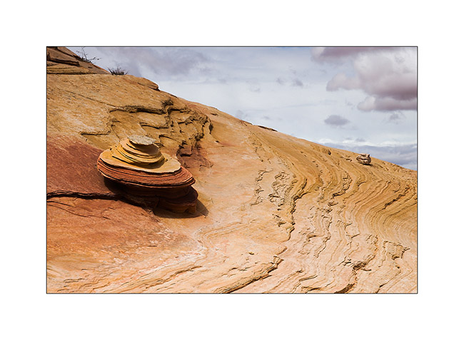
Vermillion Plateau (1)
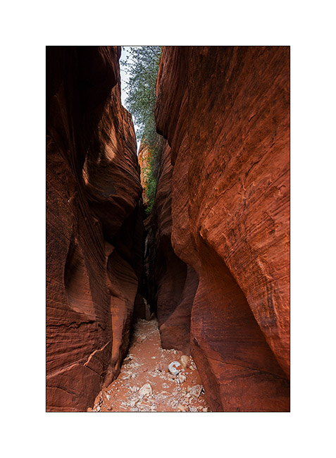
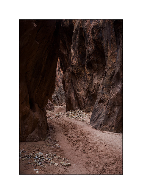
Having luckily won the draw which gives access to the Wave, we spent the afternoon exploring the Wire Pass and Buckskin Gulch. The first is a slot canyon at Buckskin Gulch side, one of the longest slot canyon with more than 45 miles long.
1. Entry of Wire Pass.
2. Petroglyphs at the intersection Wire Pass/Buckskin Gulch.

3. Some animals are really aesthetic.
4. Going up the upper part of Buckskin Gulch…
5. … it opens after a few miles in a kind of bowl where some trees manage to grow.
6. When sand and sandstone are one…
7. Sculpted by the wind.
The weather forecast was bad for the next day with a 90% chance of rain for our walk to the Wave. However, we were ready to brave the elements at 8:00 and it was pouring rain as we began our walk. Rather than go directly to the Wave, we made a detour to another site lesser known of North Coyote Butes: Fatali’s Boneyard.
8. Fatali’s Boneyard, all of yello and pink…
9. Kind of sand roses on striped sandstone.
10. Perspective…
11. … and mix of striped rock and plain sand.
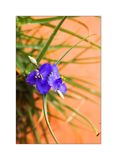
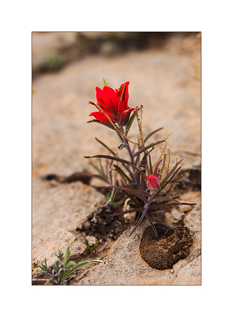
12. A flower, scarce greenery at this location.
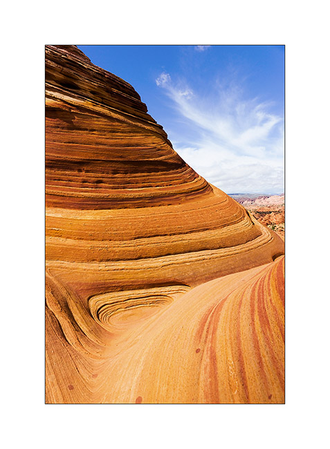
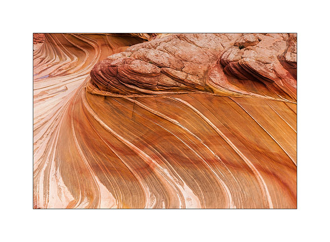
13. Along the walk to the Wave, run by the Second Wave, unfortunately without light despite the rain stopped.
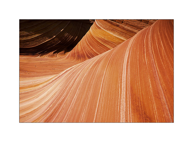
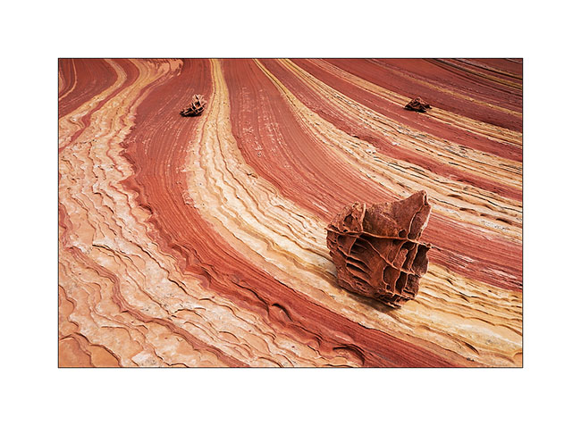
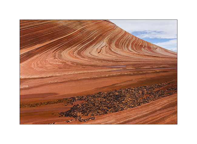
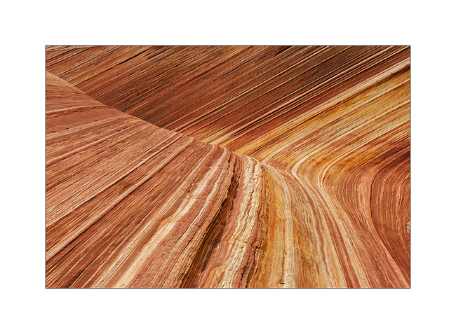
14. Stone waves…
15. Still journeying towards the goal of the day, we found this rock hamburger! 😉
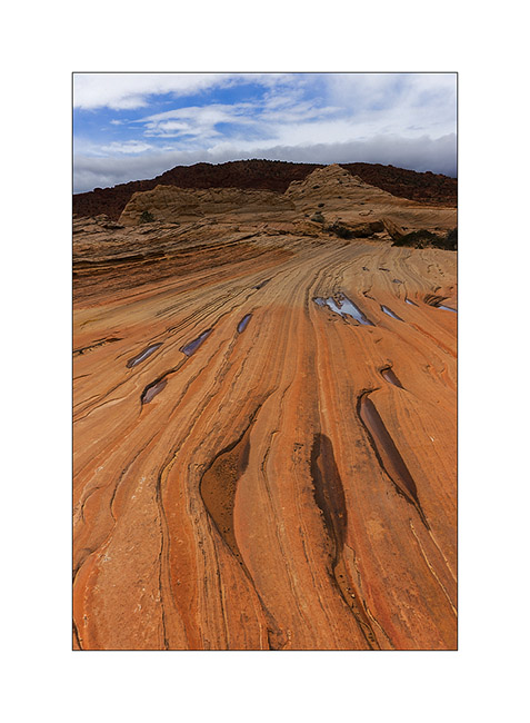
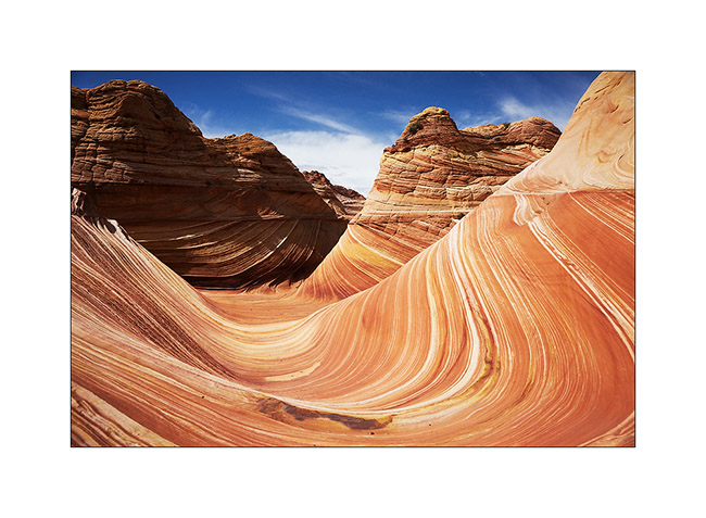
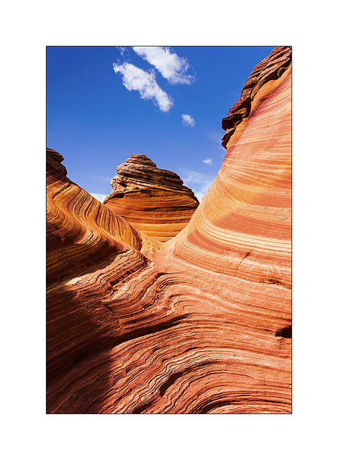
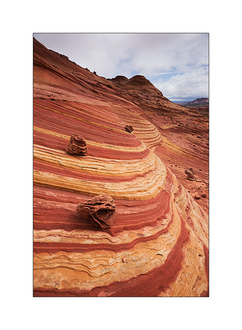
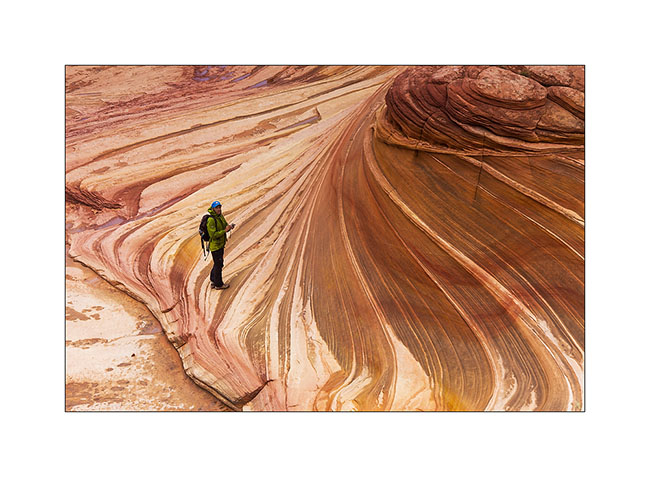
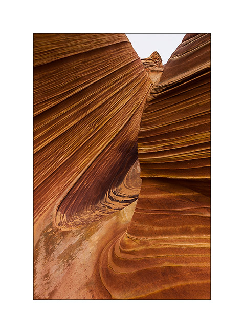
16. It was around noon when we finally reached the Wave.
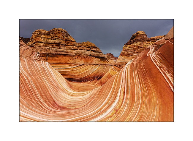
17. Magic place…
18. …

19. …
20. …
21. …
22. …
The light wass still not at the rendez vous, so we decided to climb higher on the North Coyote Butes looking for Melody Arch. To come very soon…
Grand Canyon
It was a wish of Jean-Luc to discover the Grand Canyon, one of the seven wonders of the world…
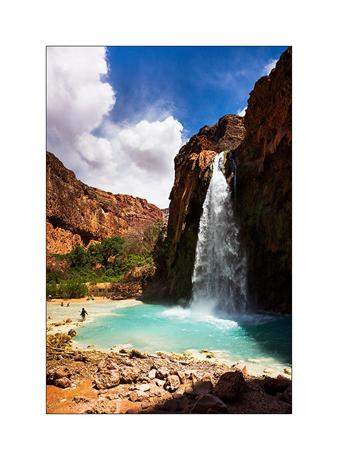
We made a stop to go down to Havasu Canyon, the Havasupai Indian Reservation, tosee the turquoise falls of Havasu Creek. Without tent, we decided to make the round trip in the day, it was a little crazy as we walk over 22 miles that day … But the falls worth the detour !
1. Our camp near a dry reservoir on the plateau above Havasupai.

2. Touch of color in a gray afternoon…
3. The Havasu Falls which run of about 140 feet in a large natural pool.
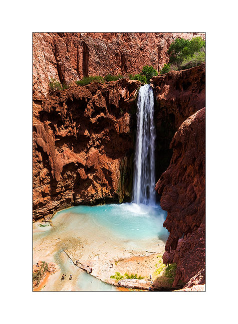
4. Some miles further down, the Mooney Falls, still higher…
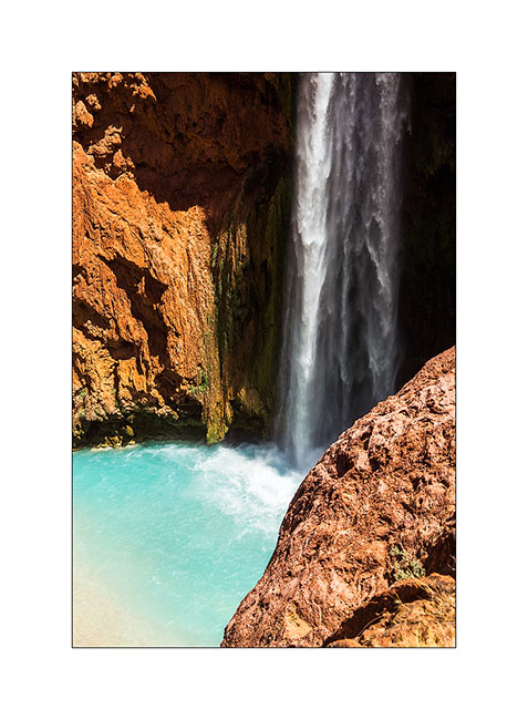
5. Details…
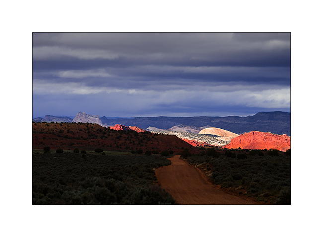
6. back on the plateau, we were rewarded with beautiful lights at sunset…
7. … while clouds burst around us.
8. Borrowing a track to join the South Rim of the Grand Canyon, we slept on the immense plateau…
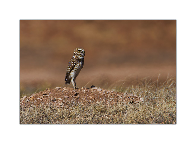
9. Along the trail, meeting with two burrowing owls. Difficult to get close on this terrain…
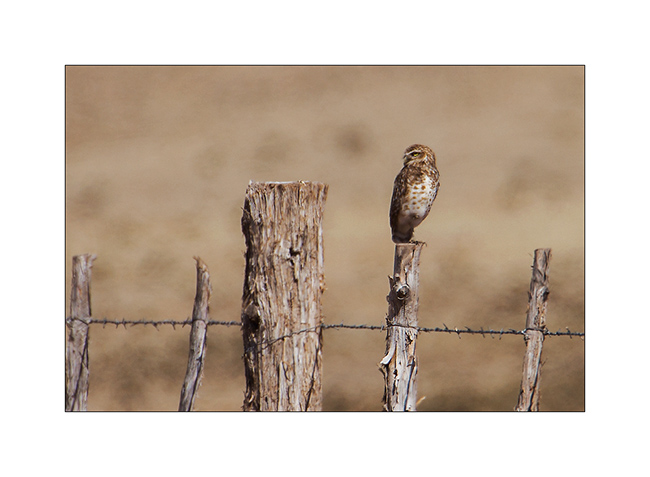
10. Typical straight posture.
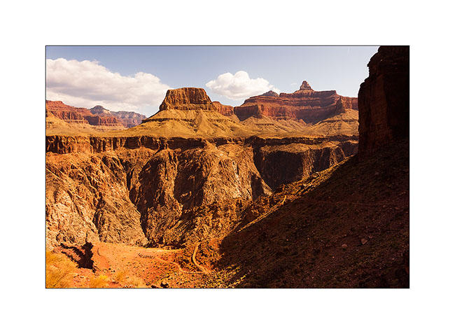
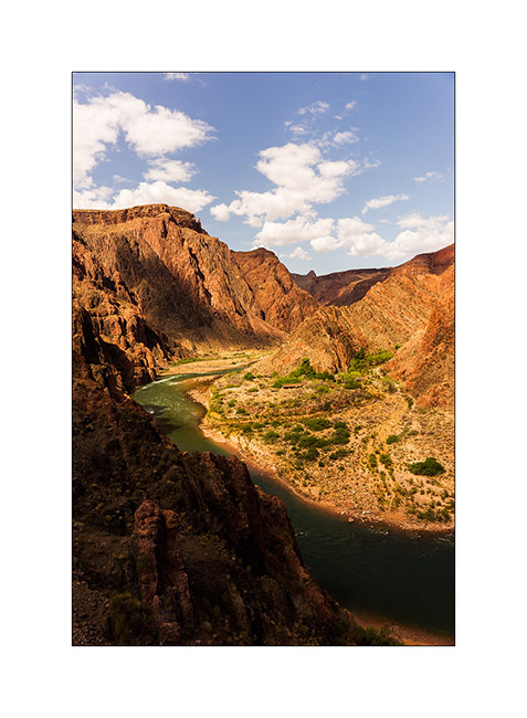
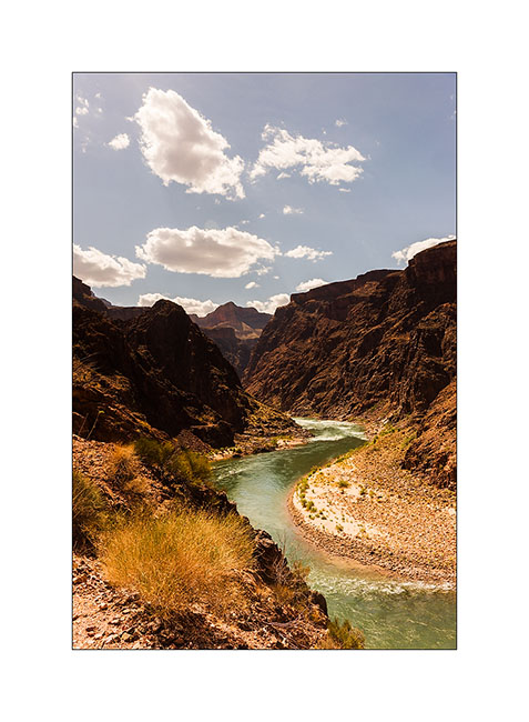
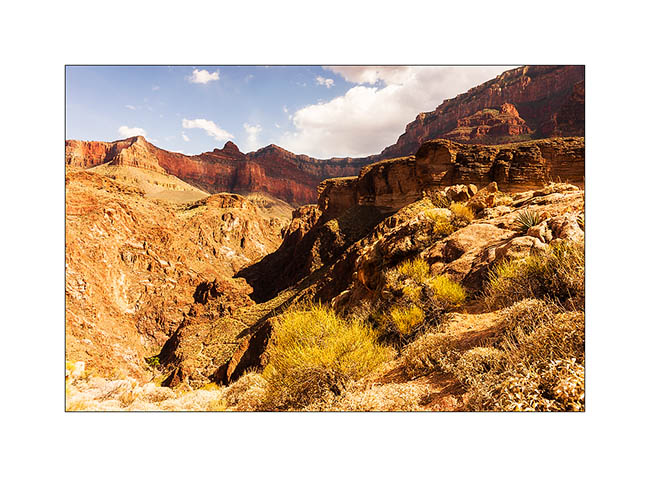
The next day we decided to go down to the bottom of the Grand Canyon. It’s still a long walk ahead of us, with about 5,000 feet of elevation gain. But it is only down there we can perceive the full extent of the giant…
11. Start of the hike down in early morning.

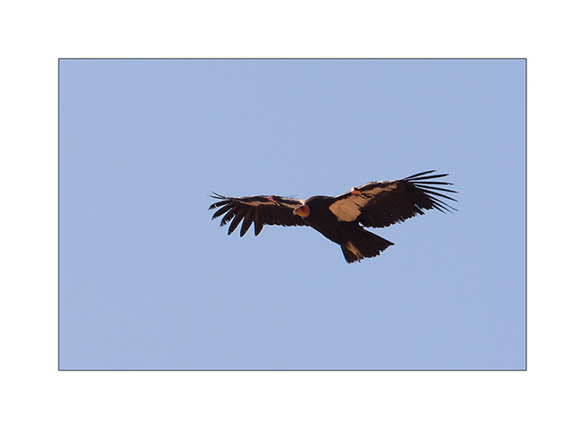
12. We were lucky to see condors reintroduced here too.
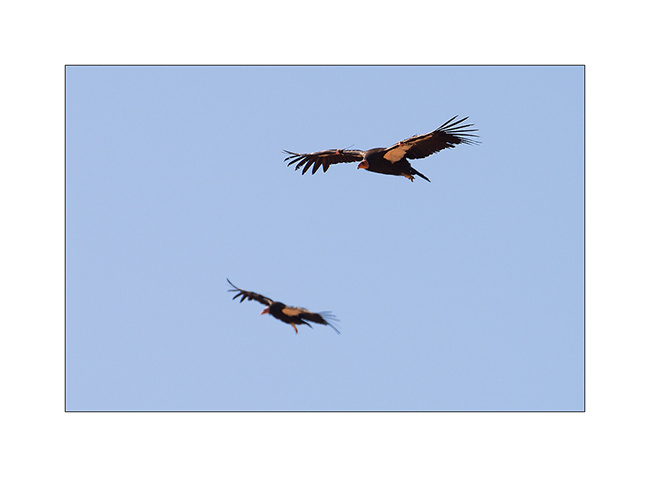
13. What a bird!
14. After 3,000 feet of descent, we’re not at the bottom, far from it, and crossed the caravan of mules which comes from the ranch at the bottom on the other side.
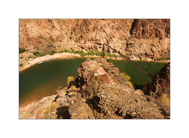
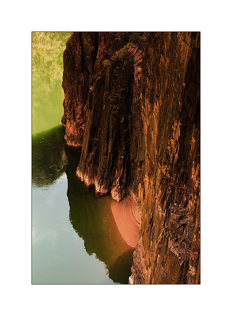
15. The Colorado River is still 1,500 feet below.
16. It grows as we decend!
17. From the suspension bridge which allows to cross it…
18. A neighbor of our snack break, especially photographed for Isa Belle who will recognize herself. 😉
19. He is 4PM and we still have to go up all the canyon, after Jean-Luc has sent a postcard “by mule” from the bottom of the canyon…
20. The light falls, saturating colors…
21. … and playing hide and seek with the clouds.
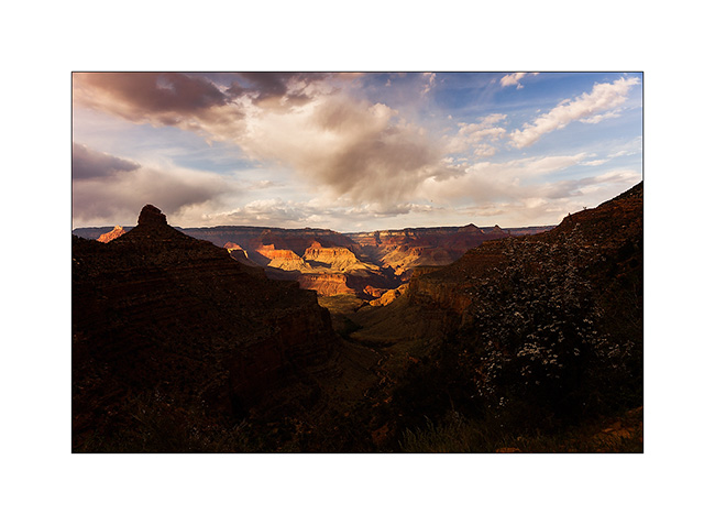
22. Last view of the canyon reaching the top just at sunset.
We then took the road again to join the Page area and I’ll tell you that soon… 😉