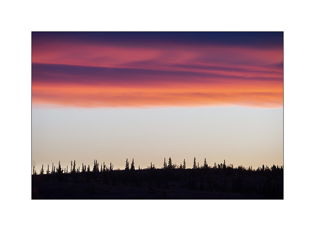
fall
now browsing by tag
Autumnal Savoy (2) and Devoluy (1)
First of all, Happy New Year 2026 to you all !! 😀 May it hold many adventures and wonderful discoveries!
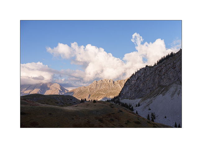
I continue the story. Still at the Col des Encombres the next morning..
1. Large sinkhole.
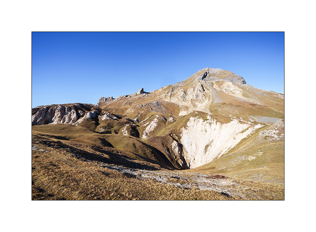
2. We’re going to discover it…
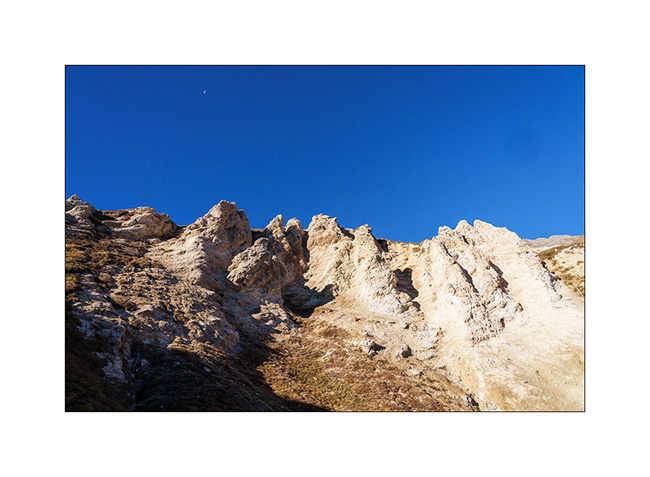
3. Erosion…
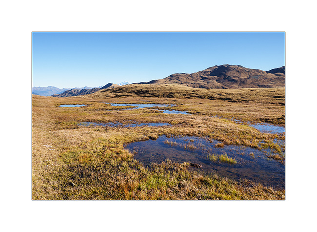
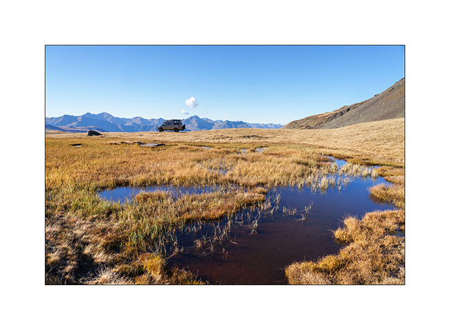
4. Below our bivouac, an alpine marsh.
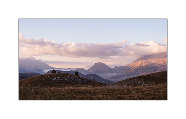
5. We go back towards VLV before breaking camp.
6. Going down the valley…
7. We go sleeping not far from where we were two nights ago, above Les Menuires..
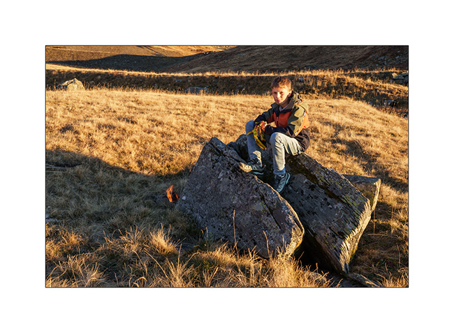
8. Campfire…
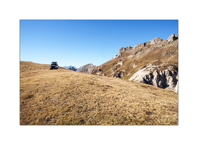
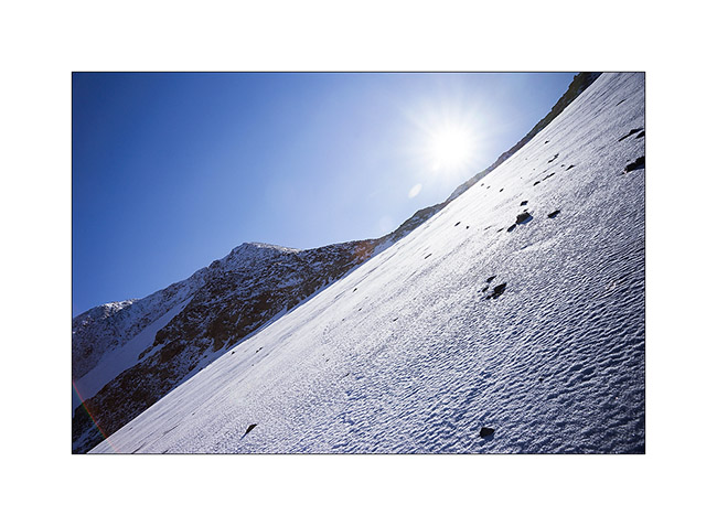
9. We try to cross to Orelle via the Brèche de Rosaël but at 9,850 feet, the snow forces us to turn back. Without the snow chains left at home, we would have taken too many risks.
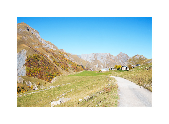
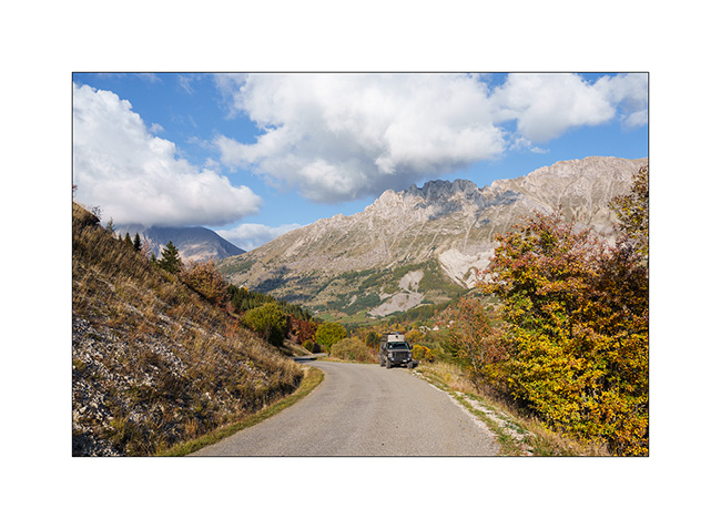
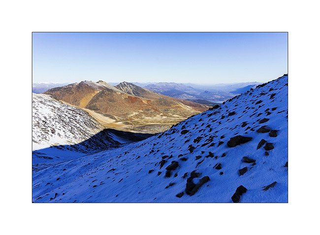
10. We then take the road to Devoluy, South of Grenoble.
11. Ascent to the Refuge of Vallon d’Anes.
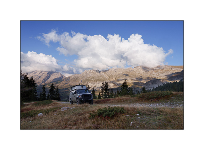
12. From our boondocking spot.
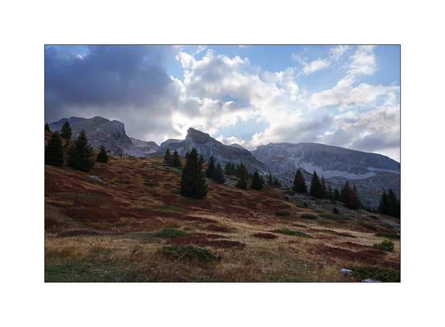
13. Sunset…
14. Dusk…
That’s it for today. There will be another article about these autumn holidays. 😉
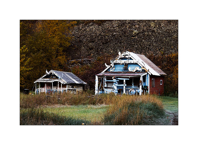
Cassiar Highway
VivaLaVida has left the Yukon and began his journey across British Columbia toward South.
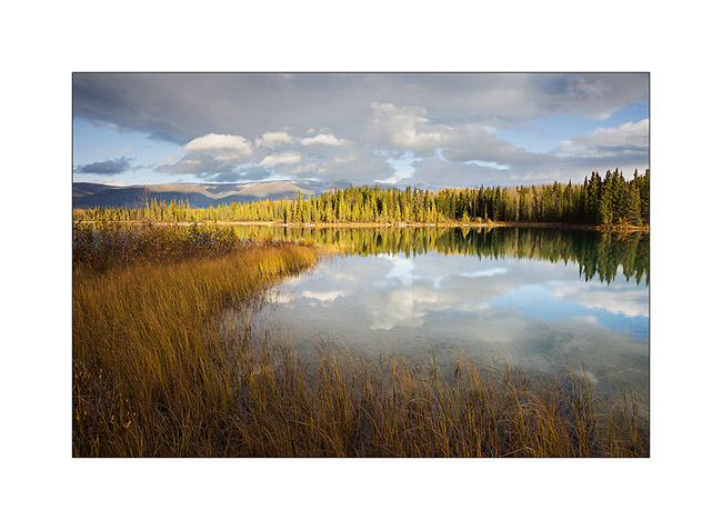
1. First night in BC on the lovely little Boya Lake.
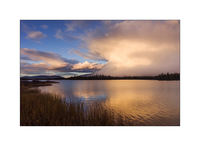
2. A few minutes ago, I was in this beautiful snow shower!
3. Best of all, as a goodbye from the Yukon on which she extends, this beautiful northern light was offered to my eyes as the full moon lit up the shores of the lake.
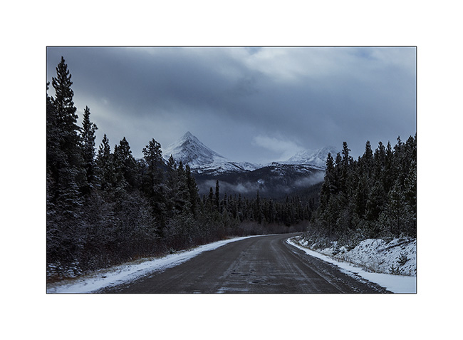
4. The Cassiar Highway isn’t in really good state and snowshowers continue the next day…
5. Graphism of the snow on this lake.
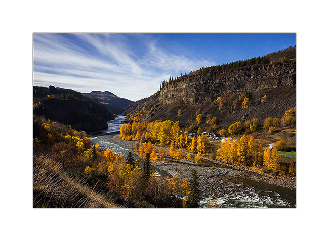
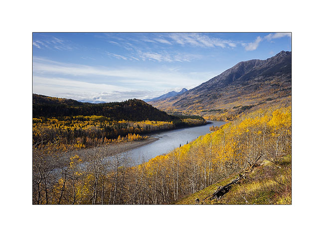
First detour to discover the valley that leads to Telegraph Creek, a samll village. This valley is the lower valley of the Stikine River, a mighty river that carves its canyon through layers of basalt before emptying into the Pacific Ocean.
6. Confluence of Tahltan and Stikine rivers, with the summer camp of Tahltan Indians. They spend three months there to catch salmons migrating upstream these rivers.
7. Tahltan cabins.
8. Almost at the end of the road, after Telegraph Creek, there is a nice small lake…
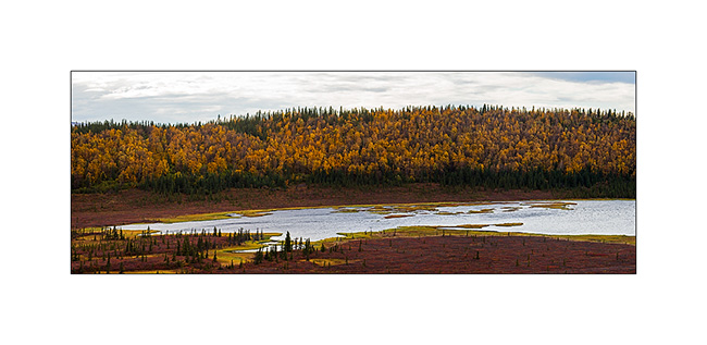
9. … dressed in the colors of autumn that I found back in these warmer latitudes.
10. The Stikine River, powerfull and gorgious…
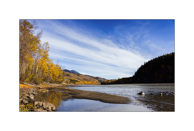
11. … which flows to the Pacific, just behind the distant mountains.
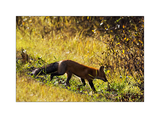
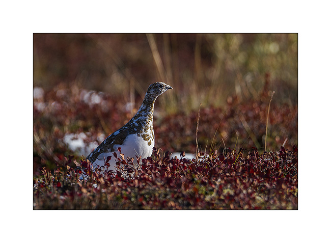
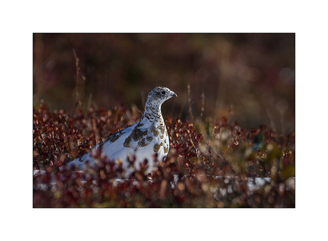
12. It’s the high season for parades of ruffed grouse!
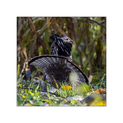
13. This guy don’t care my presence and runs to the female across the road.
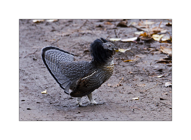
14.Here is one of the coveted female.
15. The road ends here. I hoped to continue on foot but the bad weather forecast for the coming week have made me give up to spend the night here and hike the next day.
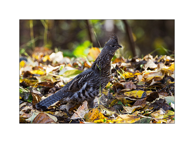
16. He was sitting in the middle of the road and went away quietly…
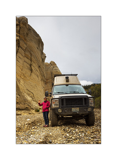
17. VivaLaVida in the Stikine River canyon.
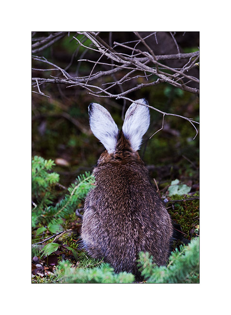
18. And to complete this update, a “snowshoe” hare whose lower legs and ears remain white all summer. This is the main food of the lynx and red fox and as its population has an unchanging cycle of ten years where it almost disappears, predators must rely on squirrels and other small rodents, seeing their population also drastically reducing. It seems that the cycle of snowshoe is from a genetic cause, in part at least…
So much for today! The next miles of VLV to South to come in a few days… 😉
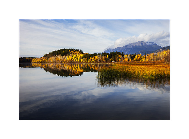
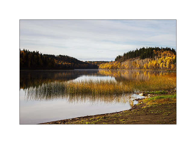
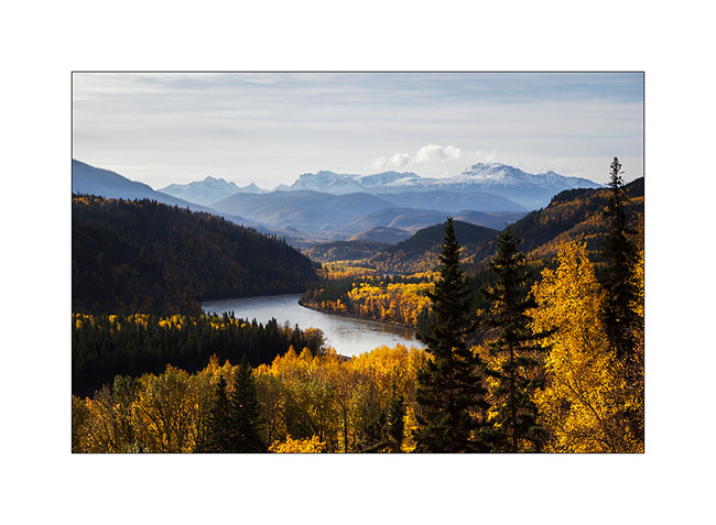
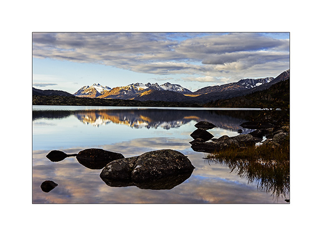
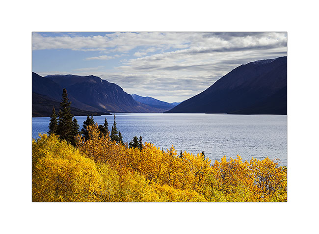
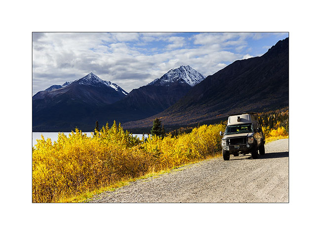
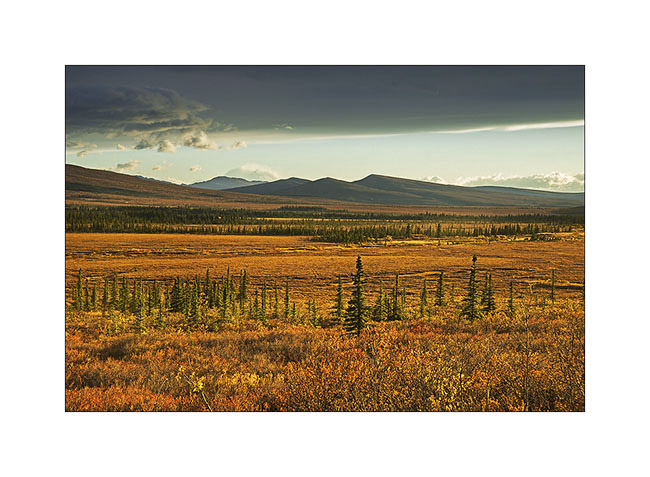
Sud Yukon
1. Up early to enjoy the first sunrays, quite rare however…
2. Some lakes empty into others in tumultuous torrents.
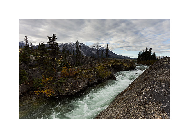
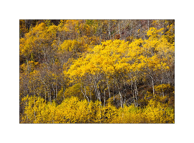
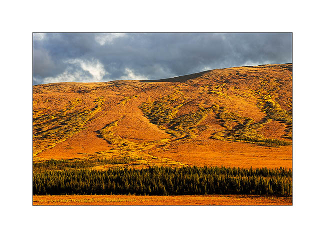
3. As I head to Carcross, fall colors are vibrant again.
4. I make several “photo stop”…
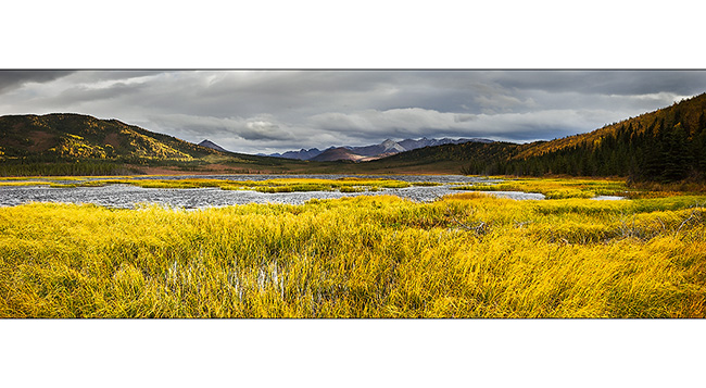
5. … throughout the many lakes of southern Yukon.
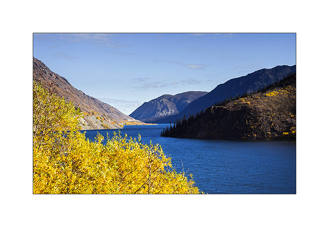
6. They really resemble to fjords.
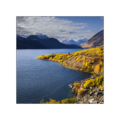
7. And always these incredibly saturated colors!
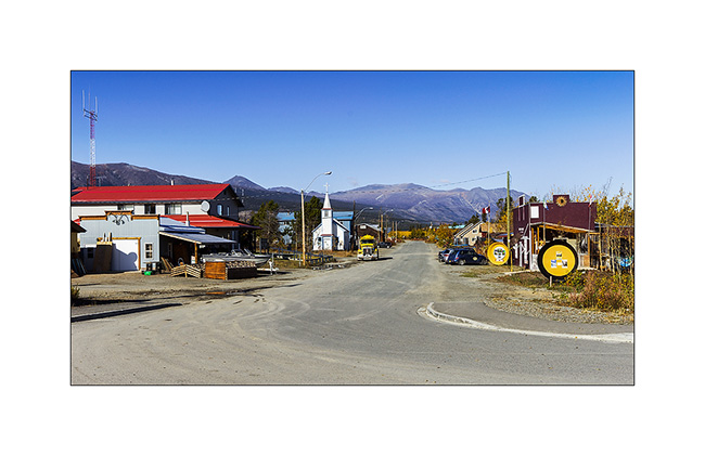
8. Carcross, a very welcoming small village.
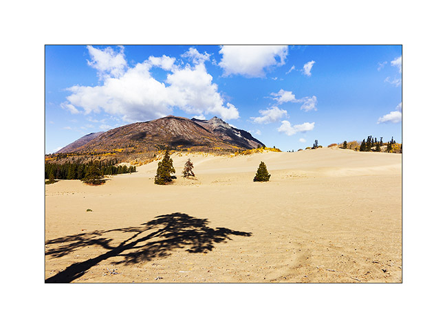
9. Here is the curiosity of the area that people call “the smallest desert in the world!” This is actually a great dune formed by the prevailing winds ammassing sand of Bennett Lake for thousands of years. Rather incongruous amid this mountainous landscape.
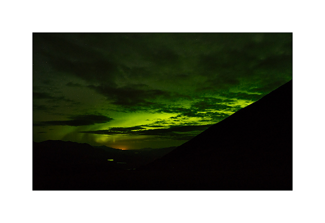
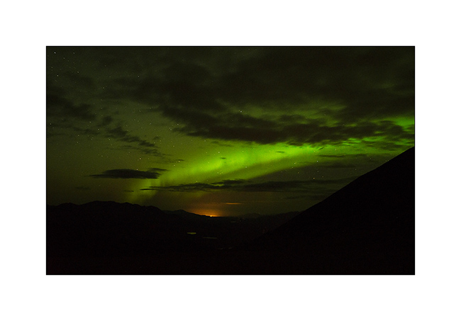
10. I decide to climb the highest surrounding mountain the next day, the Montana Mountain, and VivaLaVida takes me to sleep over 4,500 feet elevation. A nice place to enjoy a northern light over Whitehorse, about 80 miles away.
11. I will go to bed quite late again…
12. Still, I’m up before sunrise, ready to climb the peak that awaits me.
13. After two hours ascending, the conditions turn out almost like in winter. As I have to cross a quite icy snow slope chilled to 40 degrees, I regret that I left my ice ax in VivaLaVida as my only one walking stick don’t give me much assurance … Even hiting my shoes hard in the slope, my sole only grips less than one inch in the snow. I assure each of my steps carefully.
14. but progression continues…
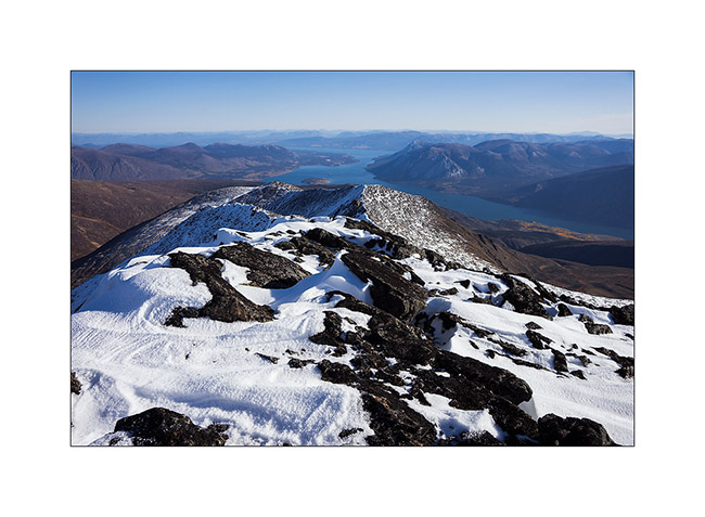
15. … and I soon reach the ridge where I get an incredible panorama.
16. After another hour, I finally reach the summit, in the second plane on this image. I continue the ridge til the funny rocket – probably a radio relay – erected on the secondary summit.
17. The view of the surrounding lakes is just grandiose!
18. Selfie picture despite the bitter cold: 10°F on the thermometer of my watch.

19. Three hours later, geting back to VivaLaVida, a picture of this beautiful mountain that doesn’t seem very impressive from here.
20. Descent by the Mountain Hero Trail partly washed away by rain. Somewhat to remind me bad memories in Baja..!

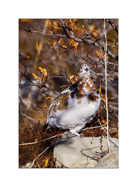
21. I see many molting willow ptarmigan during this descent.
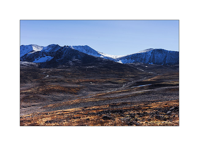
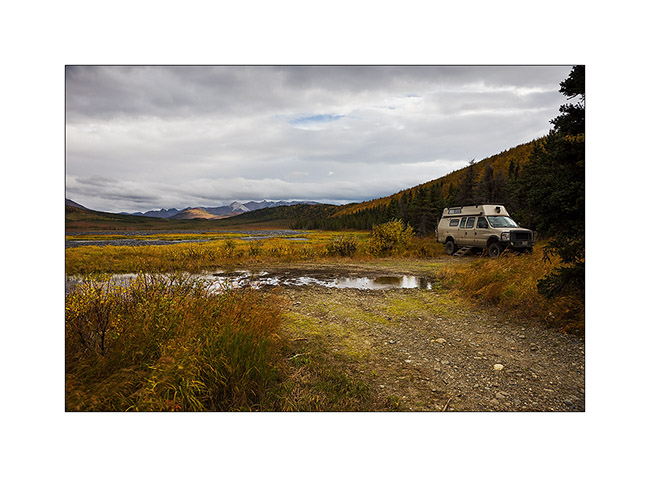
22. Having discussed with some locals who recommended it to me, I went discovering and sleeping in the Annie Lake Valley, another remote valley…

I then headed to Whitehorse where I spent a weekend of bad weather writing the last updates and does an oïl change to VivaLaVida. Stay tuned for later news of VivaLaVida’s journey… 😉
Last days in Alaska…
As I was writing the last update, I left you in Anchorage without still knowing where VivaLaVida would then head as I wrote the last article.
After some cleaning and laundry tasks, a small weather window seemed to open up to Eastern Alaska where I had spotted a few places to discover. So I took the road again but first stopped not far away from Anchorage, in the Knik Valley, hoping to reach the glacier of the same name. The end of the road has been privatized by a Lodge, so I couldn’t access the trail to the glacier. I thus opted to climb one of the mountains along the west side of the valley to get a view on the glacier…
1. It’s gray and cold when I leave VLV. I finally get some view on the long Knik Glacier ice tongue after two hours of steep ascent. Above, I’ll even get two snow showers and the stormy wind will ping my face. Hello winter! 😀
2. I continue the climb and from this plunging point of view, the Knik River reveals beautiful designs.
3. While I go back down in late afternoon, a few light holes below reveals fall colors.
4. The light becomes more generous…
5. Natural graphics…
6. The other side of the valley is only swamps…

7. Looking North, towards the Hatcher Pass.
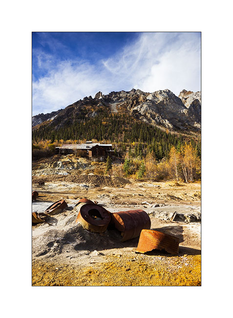
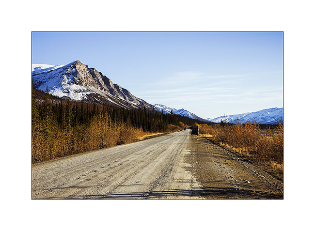
I followed the journey driving the Glenn Highway again to reach the Nabesna Valley on an old mining road which provides access to this remote place.
8. Fall colors are now everywhere.
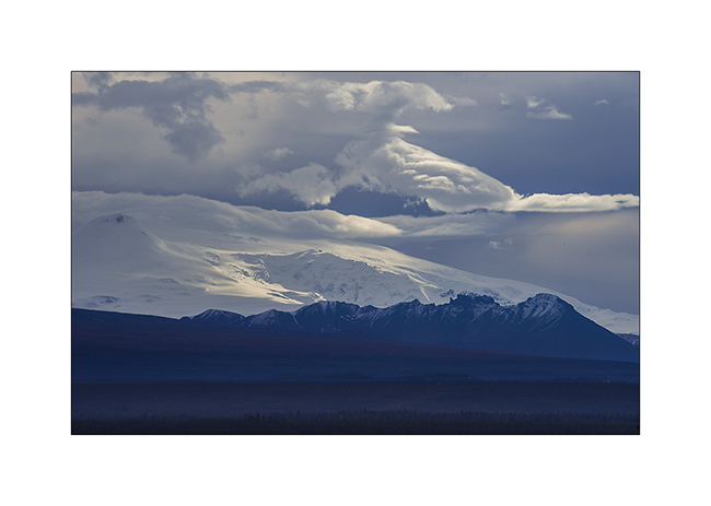
9. I’m on the edge of bad weather that creates a charged atmosphere over volcanoes of the area.
10. The snow is still present in altitude.
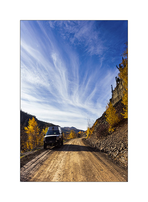
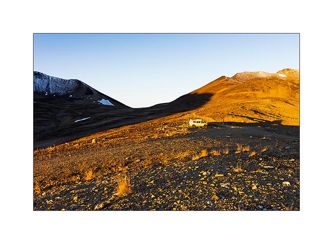
11. VLV sneaks up on the long and remote Nabesna Road…
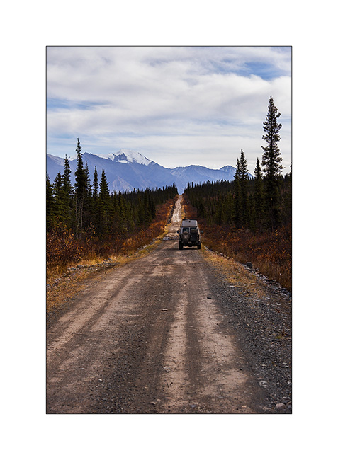
12. Since the road was washed away by some past flood, I will walk the last 6 miles to reach the site of the mine.
13. On a side trail, I discovered an authentic log cabin from early last century.

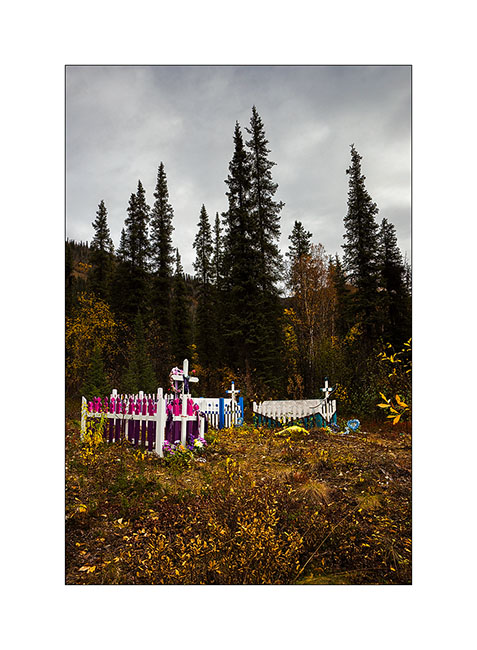
14. A well-colored indigenous cemetery along the road to Mentasta.
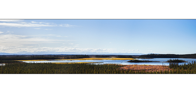
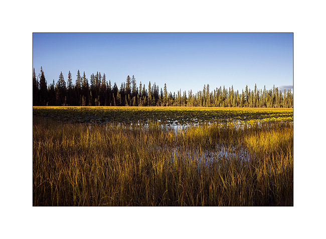
15. Vivalavida then follows the Alaska Highway heading to Canada. Quantities of small lakes and marshes bordering the main road.
16. I stoped at Deadman Lake and had a nice kayak trip on a completely smooth lake…

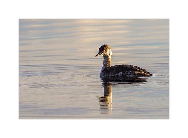
17. A female duck…

18. … and a little grebe in late afternoon light.
19. The light was awesome when I got the kayak out of the water…
20. … the sun sometimes playing with clouds.
21. Last sun rays on this idyllic lake.
The next day, VivaLaVida left Alaska after more than three months of enchanting discoveries … More from her journey coming soon. 😉
Going back South of Alaska
Before quietly thinking about joining back Anchorage where Mino will take his plane, we still made two beautiful hikes.
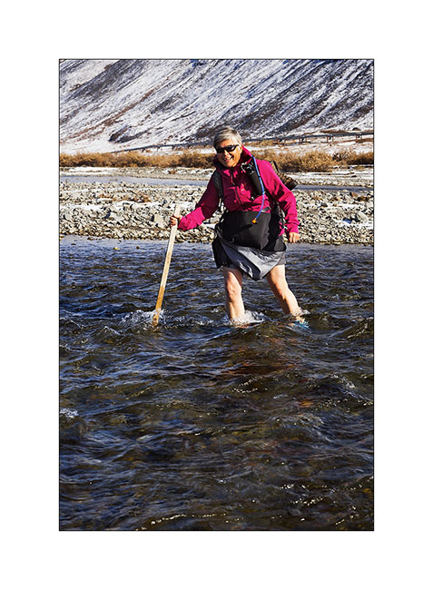
1. I initiate Mino to river crossings! This one was only about 32°F.
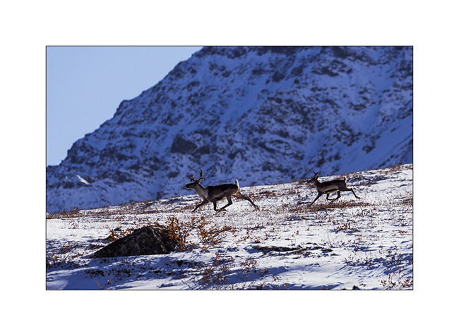
2. Caribou migration southward began, we see several made fearful by the hinting season opened since almost two months.
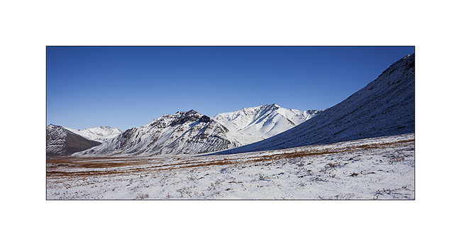
3. I never tire of these landscapes…
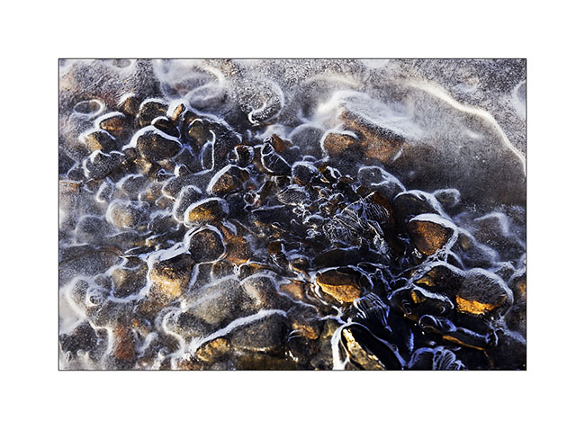
4. I find other paintings of ice…
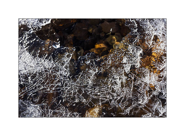
5. … that trap pebbles.
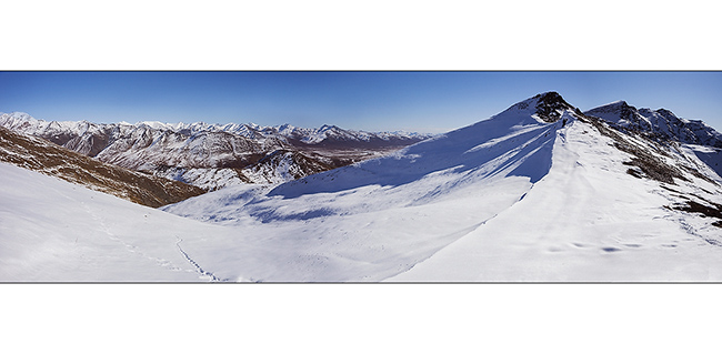
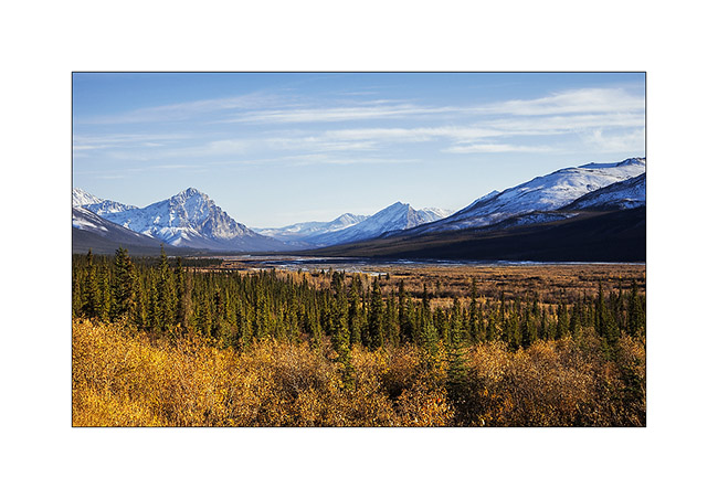
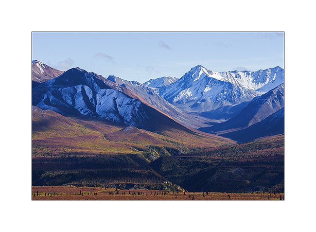
6. The next day, we explored a valley north of Antigun Pass to climb a nearby summit.
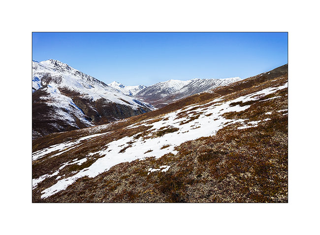
7. We stop at a pass after a hard climb. The view is gorgious.
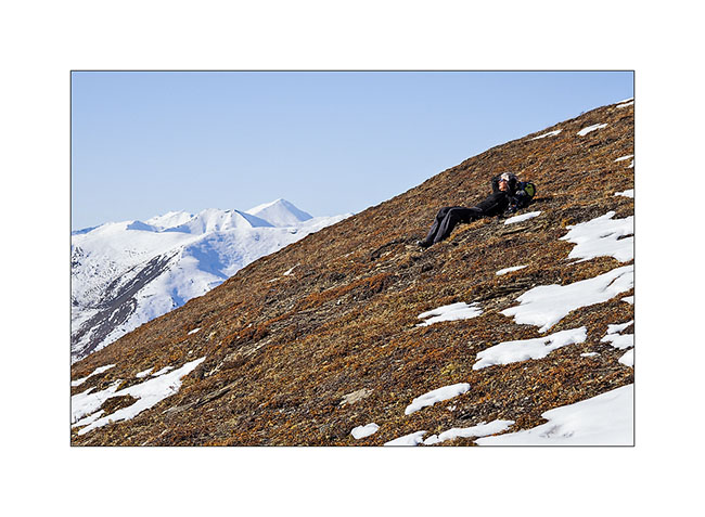
8. Mino rests admiring the scenery.
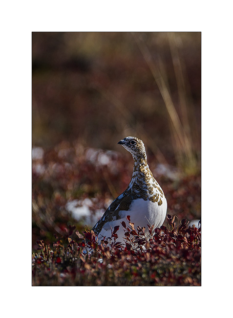
9. Going down, I manage to approach ptarmigans in moult.
10. This one is already quite white…
11. … while the neck of that one just starts to lose its summer color.
12. This end of day still reserve us a beautiful light.
13. VivaLaVida along beautiful granite peaks…
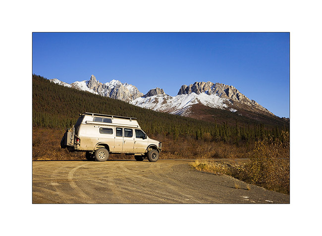
14. … and goes down a large valley.
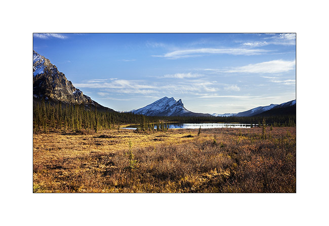
15. A pond that reflects Chugapak Mountain.
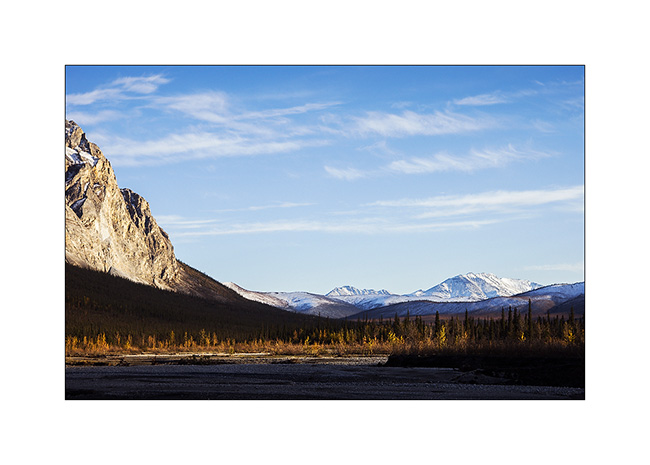
16. Crossing the Brooke Range is really beautiful.
This concludes the report of our visit to the Dalton Highway. We continued towards the Denali where we spent the two last days before Mino’s departure.
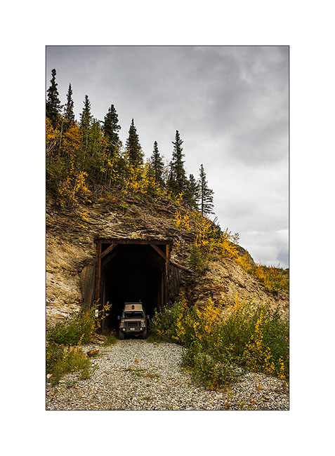
17. VLV strikes a pose in an old railway tunnel.
18. Quick “wild” visit (because unauthorized) of a still active coal mine.
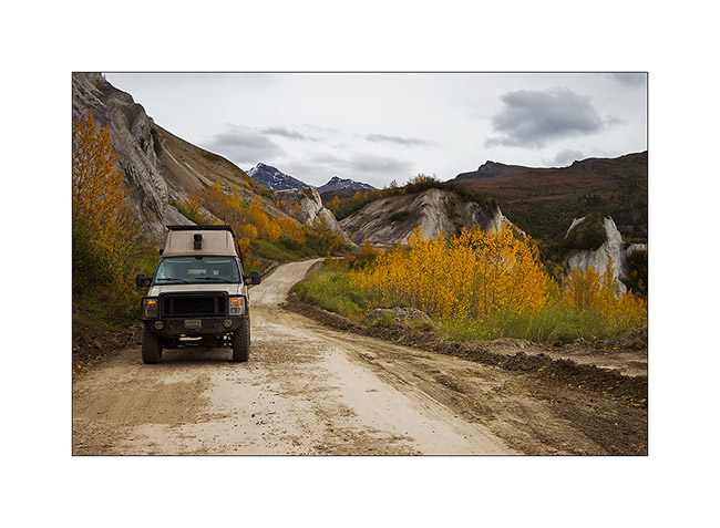
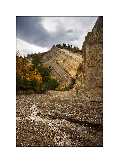
19. In a rather aesthetic side canyon.
20. VLV has managed to go up the riverbed to pose in front of the cliffs sculpted by wind and rain.
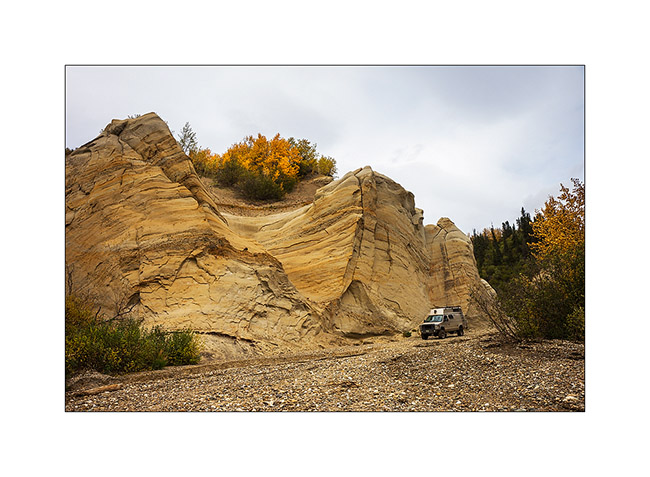
21. Since it is difficult to realize the size of VivaLaVida on pictures – when seeing for the first time, Mino exclaimed “Oh what a monster!” – I took advantage of her presence to give you the scale. She stands under the mirror..! 😀
22. We are approaching a small lake that will give us a nice camp for the night.
23. The south wind blows in gusts but offers me some sunrays.
24. We sleep on the windy shore…
25. The next day, we explore the mine from the top, after a track more than 35% steep !

26. The fall colors have invaded the forest…
27. … and the tundra.
28. The sky clears as the sun sets down…
29. … coloring the nearby mountains of the last boondocking for Mino.
30. Last colors on the taïga.
That ended the few weeks when Mino traveled in VivaLaVida. She walk the over 180 miles I hiked during these almost six weeks and has cooked me some really good dinners! Thanks to her. 😀
At the time of this writing, I do not know what will be the road ahead yet; so you will discover it in a future update. 😉
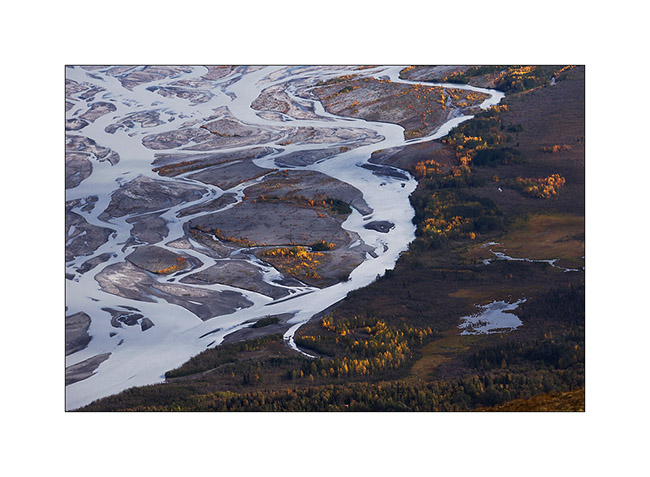
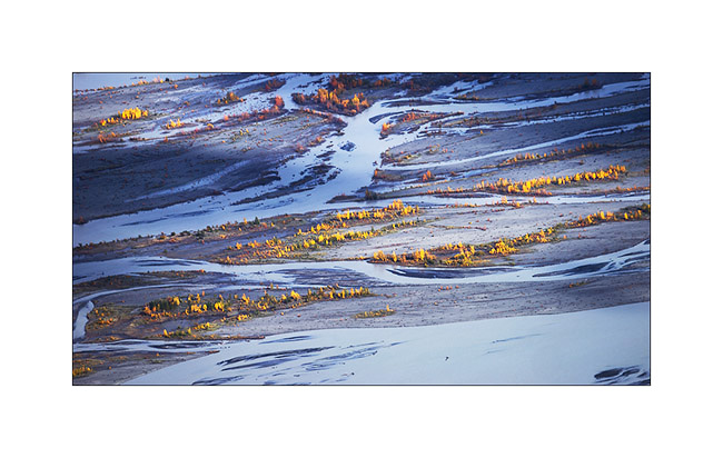
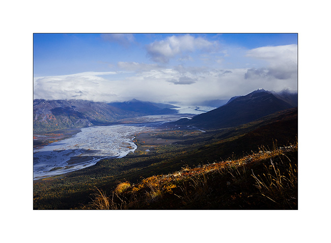
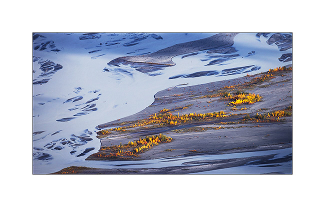
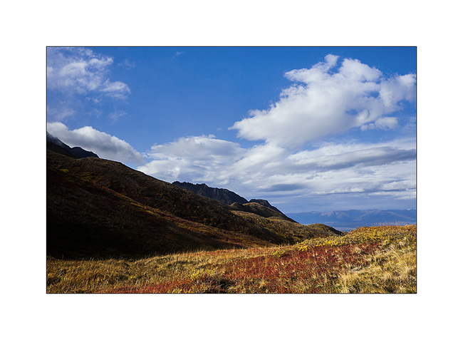
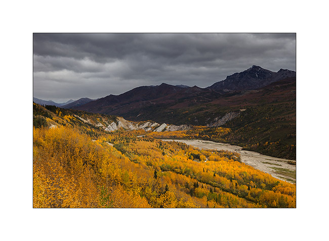
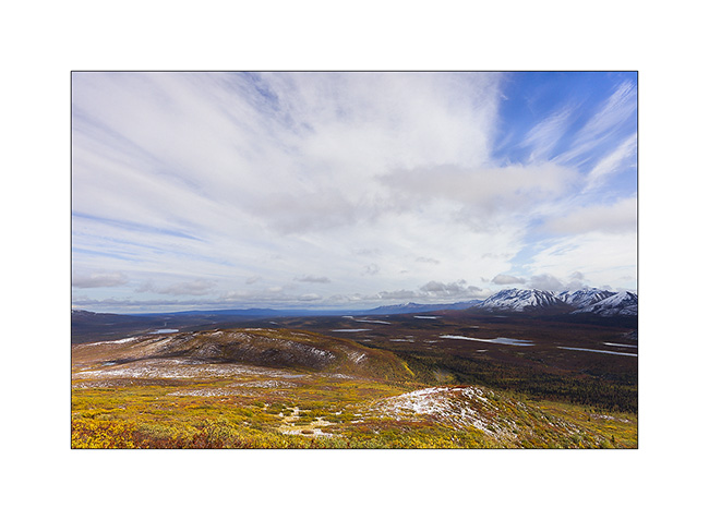
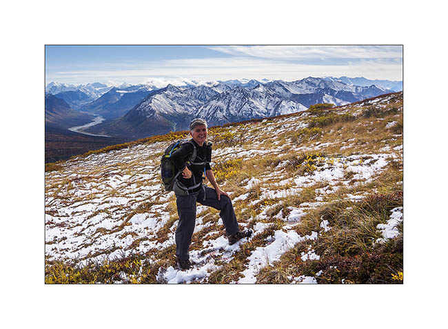
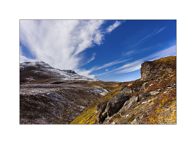
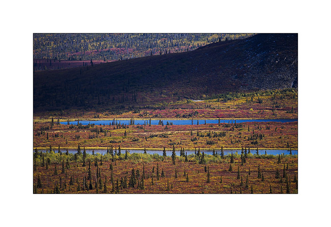
Central Alaska
I’m back after a few days of silence due to a lack of network.
Initially, Mino should leave from Seattle. However, to take advantage of the fall in Alaska, at our last update, we were waiting for a confirmation on the ability to change her return flight to leave from Anchorage. The response was positive and, at the time you’ll discover this update, Mino will be on the plane bringing her back the Switzerland…
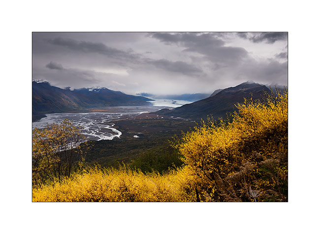
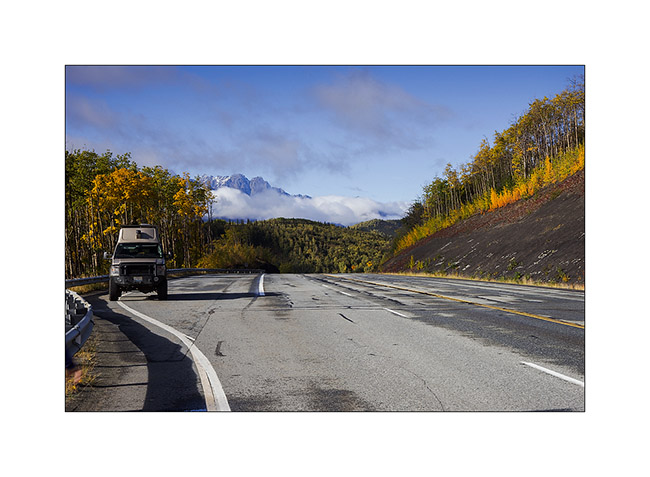
As soon as we got the answer, a favorable weather forecast decided us to move north along the Dalton Highway I had already traveled six weeks before. We hoped to discover the fall colors on the tundra and to hike in Brooke Range. We then headed to the Glenn Highway to Glennallen and after a first night at a hundred miles from Anchorage, we woke up enjoying the first snow fall on the surrounding mountains.
1. Matanuska River in ther morning.
2. They are still many clouds on the mountains.

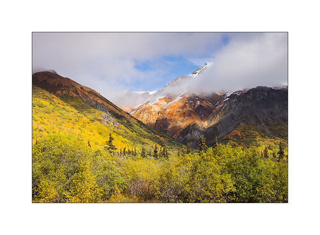
3. The first frosts begin to color the trees.
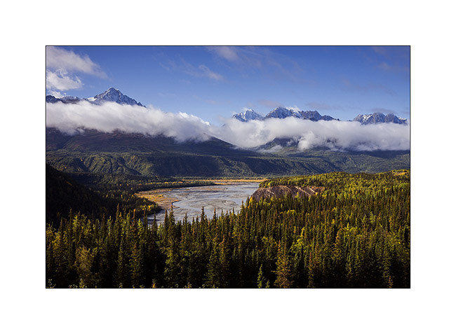
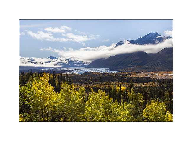
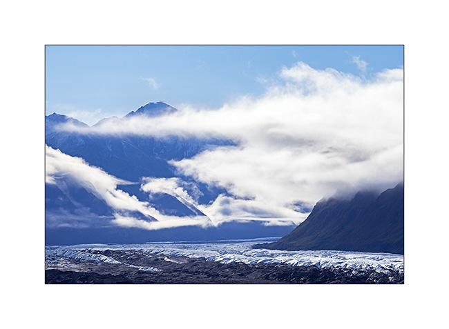
4. We pass near the huge Matanuska Glacier.
5. Clouds plays…
6. Some hills are really colorfull.
7. With such a nice weather, we decided to go hiking and discovered a small altitude lake.

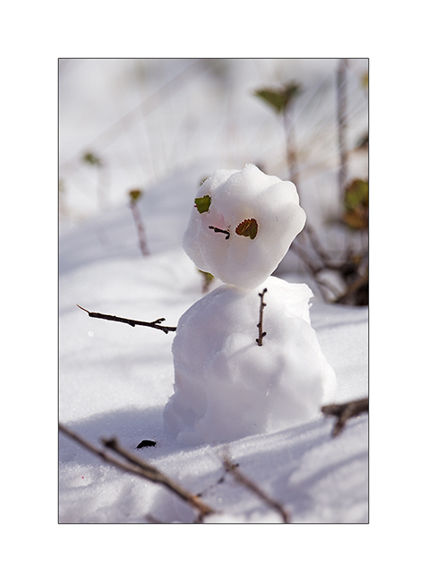
8. The first snow of the season inspires Mino…

9. … who signs its passage ephemerally… 😀
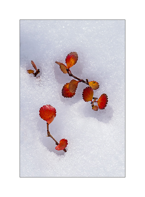
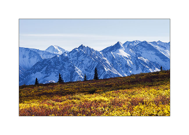
10. … while for my part, I play with the contrast between the snow and the “willows” colored with their characteristic orange-red fall color.
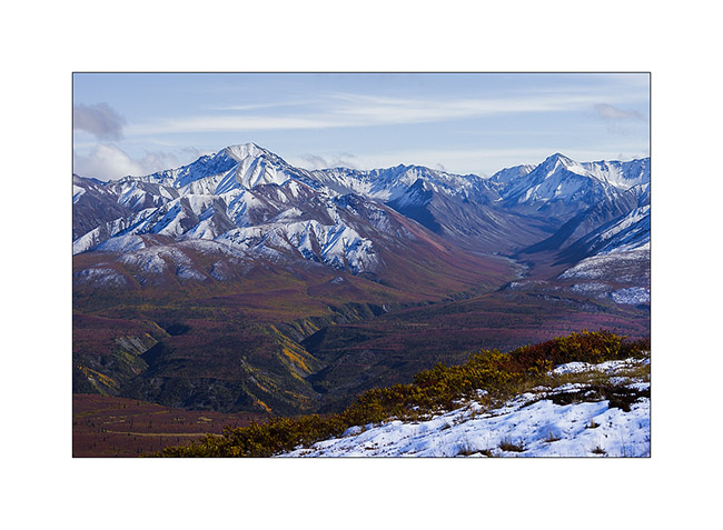
11. As and when we climb, the view extends over the surrounding valleys.
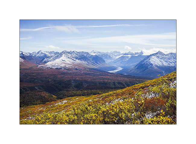
12. The horizon is so wide…
13. Souvenir picture…
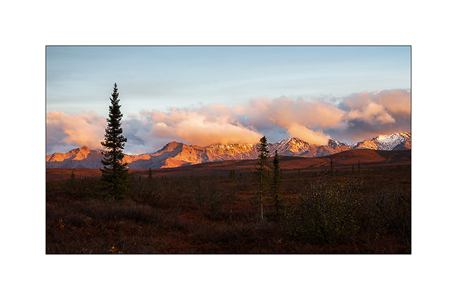
14. After nearly three hours to make our way uphill in the tundra, a break is welcome under a beautiful sky of cirrus.
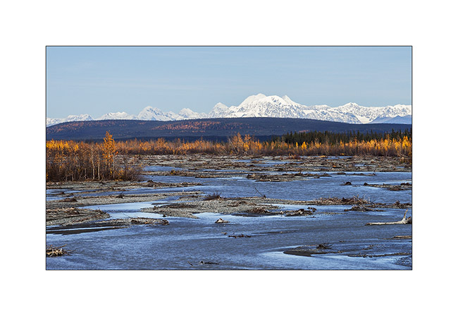
15. A river that flows from one icefield, more than 40 miles away..!

16. From above, tundra reveals so many small lakes and marshes…
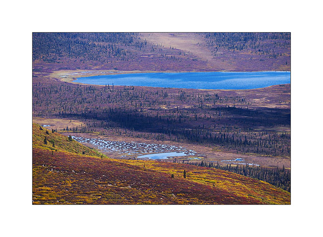
17. The contrast between the warm tones of the autumn tundra and the white snow is beautiful.
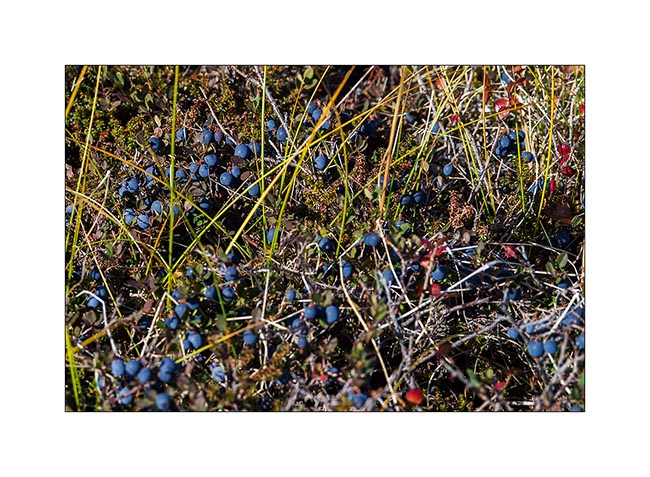
18. We enjoy some of the thousands of blueberries that are everywhere.
19. This mix of colors is so beautiful that I would stay there longer and longer…
20. Other lakes as we descend…
21. It’s getting late, shadows contrasted the opposite side of the valley…
22. Continuing the road, I took a foot bath to take this image in a flooded marsh in beautiful sunset light.
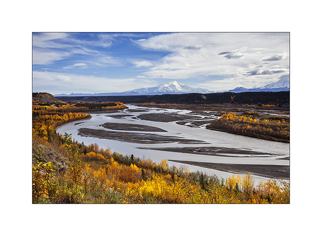
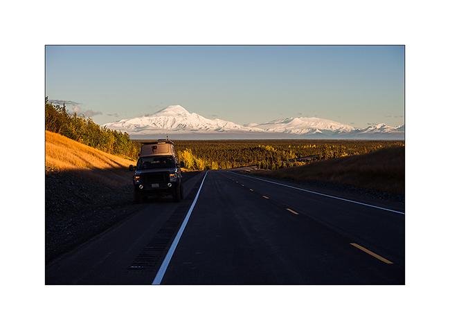
23. Vivalavida goes north. In the distance, Mount Drum, another volcano from the large fault extending from the Aleutian Islands to Mexico, and the huge dome of Mount Jarvis.
24. We find a nice camp site near Paxson.
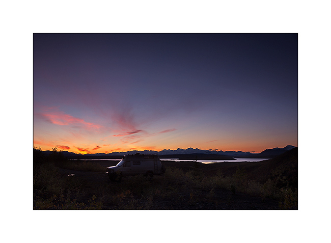
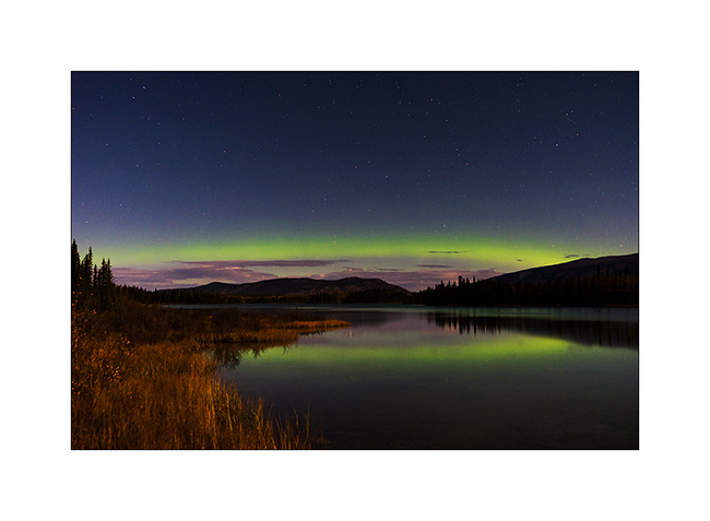
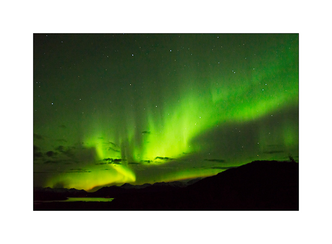
25. And while I’m about to go to bed, surprise: a powerful northern light lights the sky up!

26. This is the first that I have the opportunity to see, what a sublime spectacle… I will lie down only at 2am that night… 😉
The following will take in the far north where we had a small preview of the new winter to come … Coming soon here. 😀