mine @en
now browsing by tag
Alpine loop…
Imogene Pass is by far not the only track traced in these mountains. I went through Ouray buy some fresh food before traveling part of the Alpine Loop, a track that some Jeep enthusiasts love to discover.
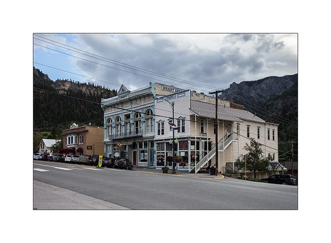
1. In Ouray even more than in Telluride, we believe to be a century ago!
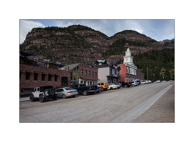
2. The opera building.
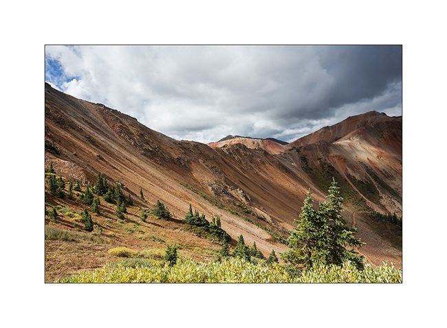
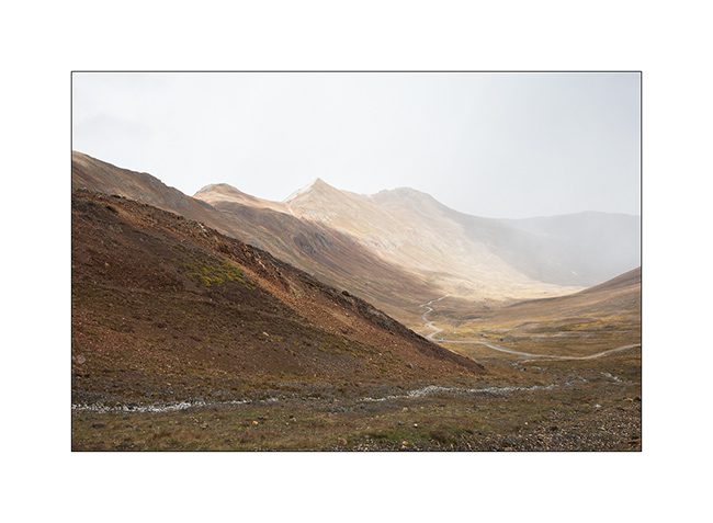
3. Red Mountains which are aptly named, since my camp.
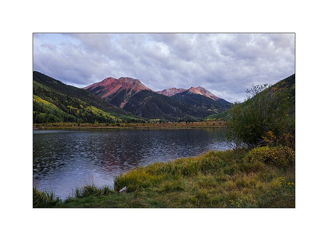
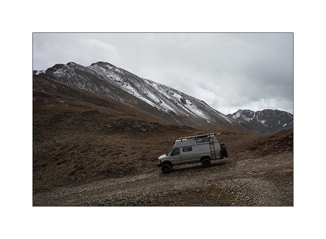
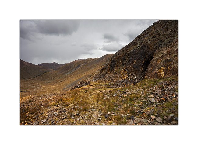
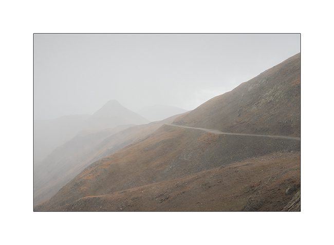
4. The next day, VivaLaVida begins by Gray Copper Gulch roa, amid the Red Mountains.
5. It’s color of the iron oxide which obviously gave their name to these mountains.
6. Colors are awesome!
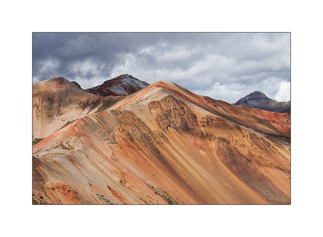
7. While on the nearby mountains, the iron ore concentration is not as important.
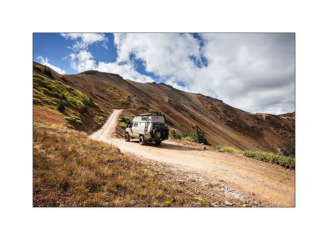
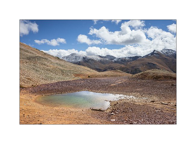
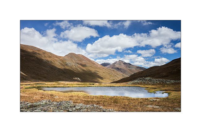
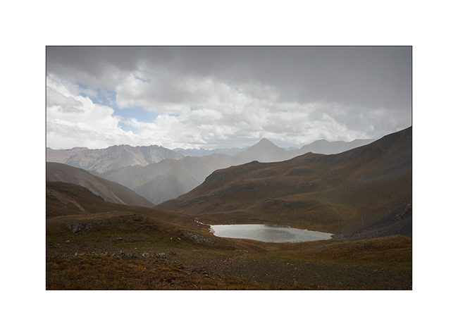
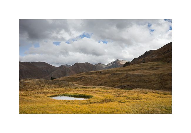
8. At the first pass (12,400 feet), a small lake…
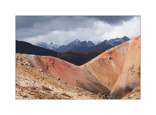
9. A little further, another cad and peaks powdered with snow of the night.
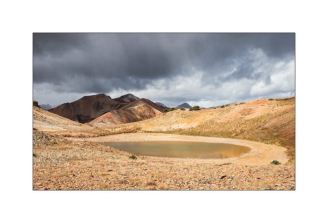
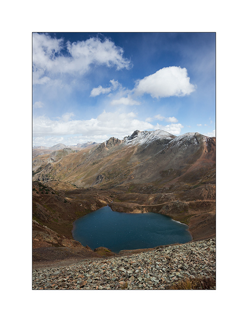
10. Lake Como, the larger of the area.
11. VLV cashes altitude unflinchingly.
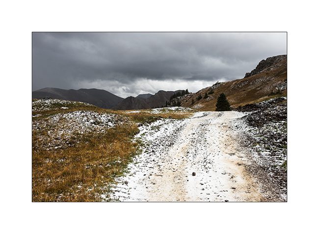
12. Snow shower at 12,700 feet, over California Pass.
13. Downhill on the other side while the shower goes away.
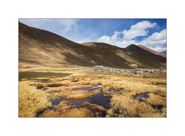
14. I left VLV a few hours to walk to a swampy area.
15. Altitude bogs…
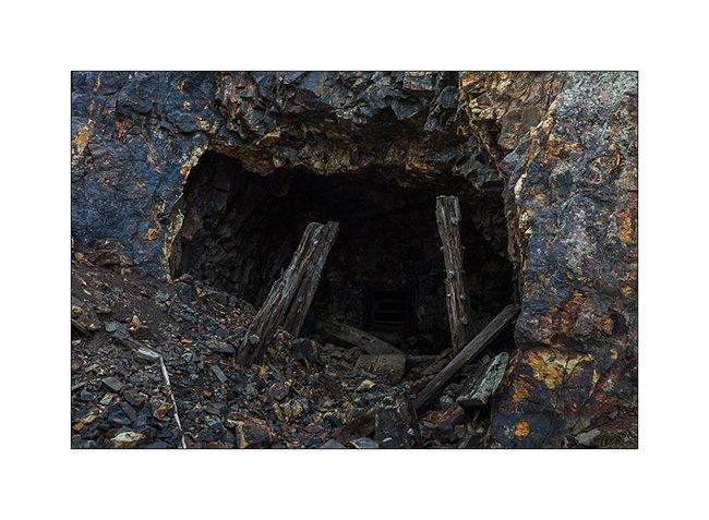
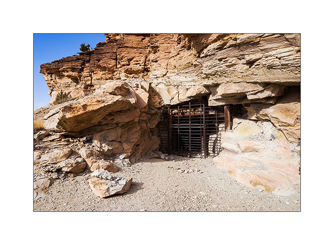
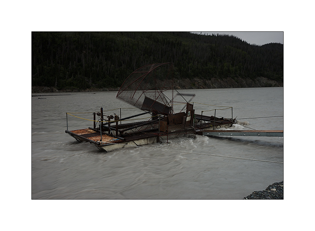
16. Everywhere, mining relics leave their trace. Here, a typical mine with tongue extracts waste.
17. entrance of Silver Queen Mine…
18. All were closed to prevent accident.
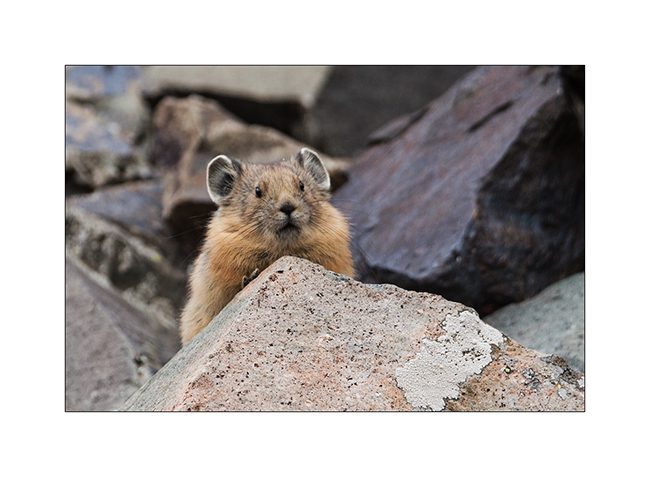
19. Nice surprise: I could finally capture the portrait of an adorable pika, so lively that it’s almost impossible to photograph.
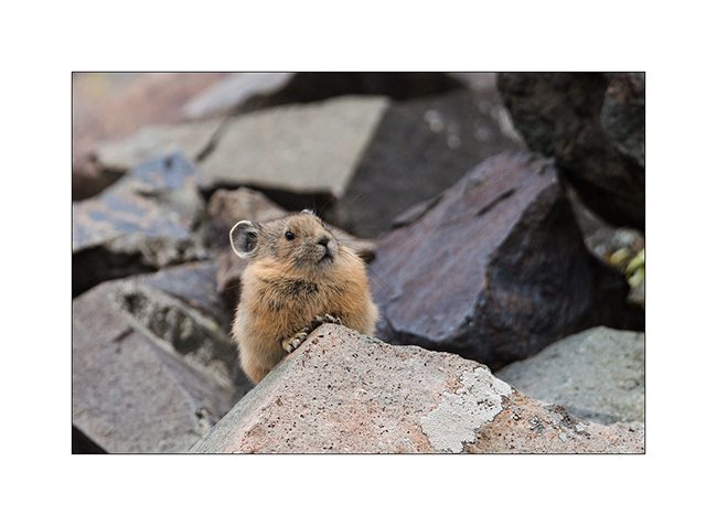
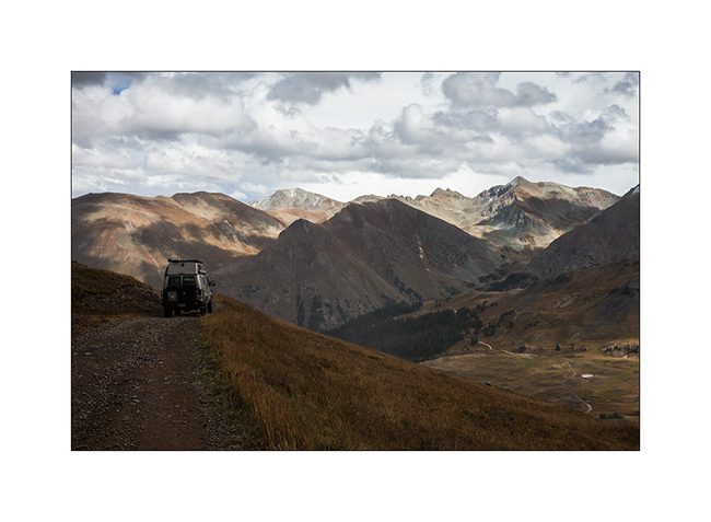
20. It lives in screes and it sneaks in full speed.
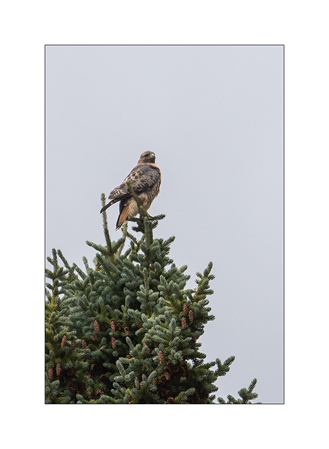
21. New snow shower.
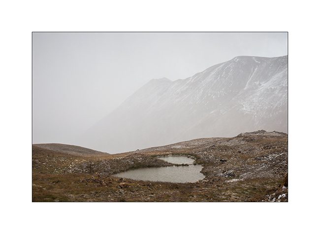
22. Small alpine lake.
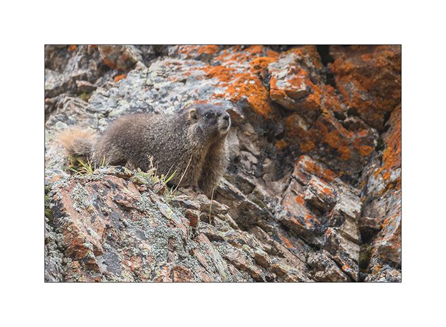
23. Downhill into the next valley. I only saw two Jeeps that day…
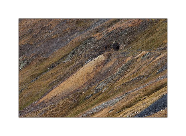
nbsp;
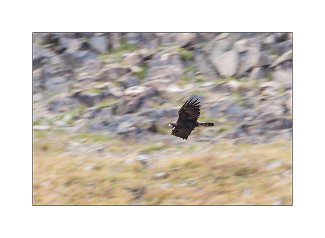
24. For my brother and just as testimony because the picture is very bad: a golden eagle.
25. Another raptor that I have not positively identified.
26. There is plenty of marmots..!
27. Alpine biotope.
28. Within minutes, the track is covered with hail…
Well, following the Alpine Loop in the next update, hoping not to bore you with all these alpine tundra images…
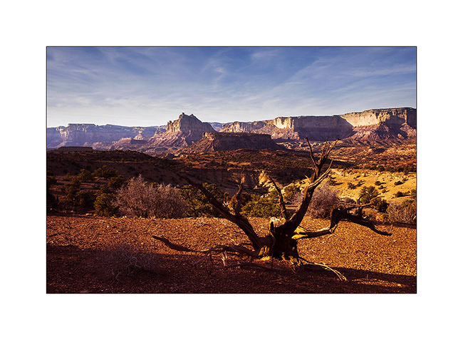
McKay Flat & Reds Canyon
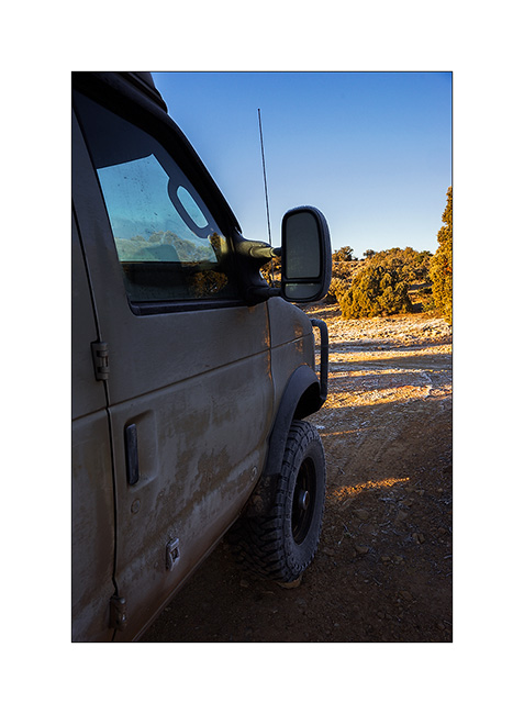
1. The night was clear and at this altitude, the frost covers everything including VivaLaVida.
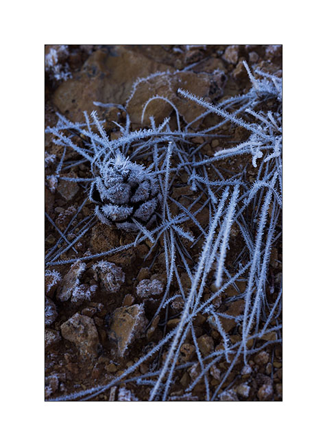
2. In exposed areas, ice crystals are huge!
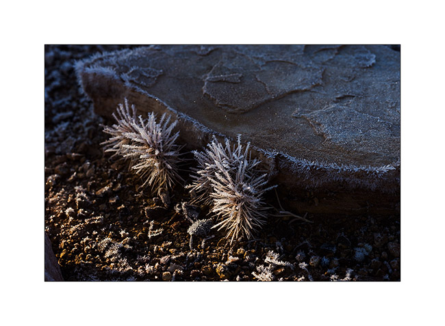
3. Even cactus appear to wear Christmas dress… 😉
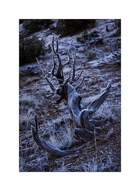
4. This old juniper trunk looks almost like antlers.
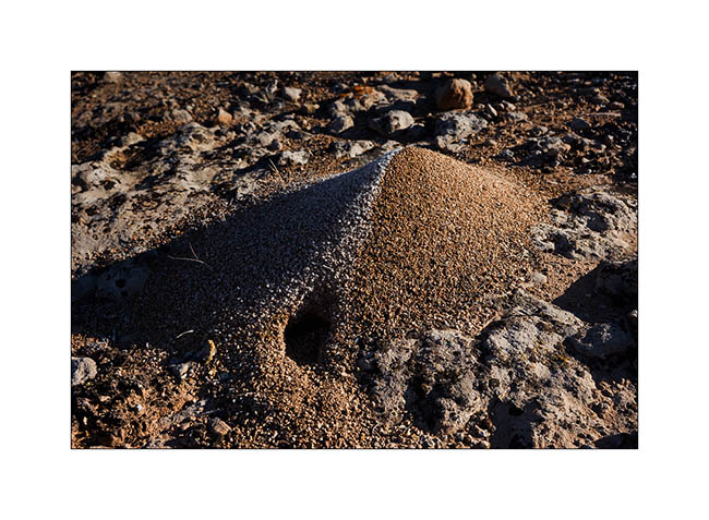
5. This anthill is an evident good insulation.
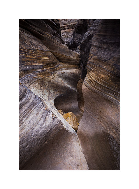
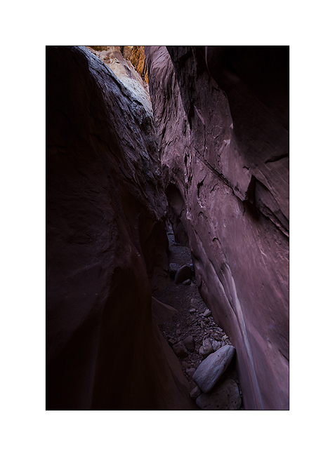
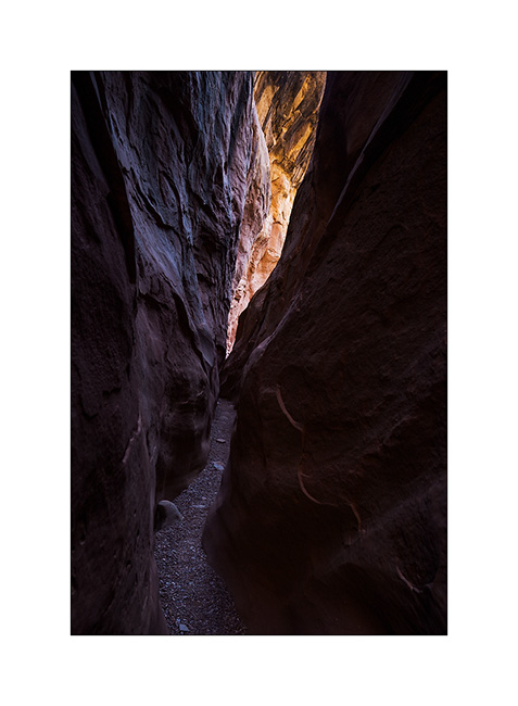
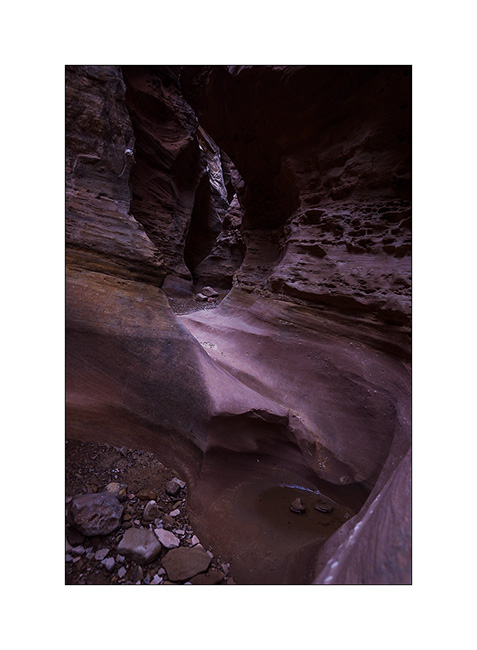
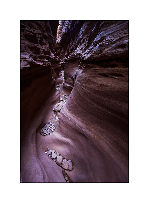
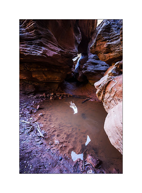
6. After two hours hiking, I arrived at the entrance of Baptist Draw, a little-known slot canyon. While above it is an open canyon, it suddenly changes in this thin crack…
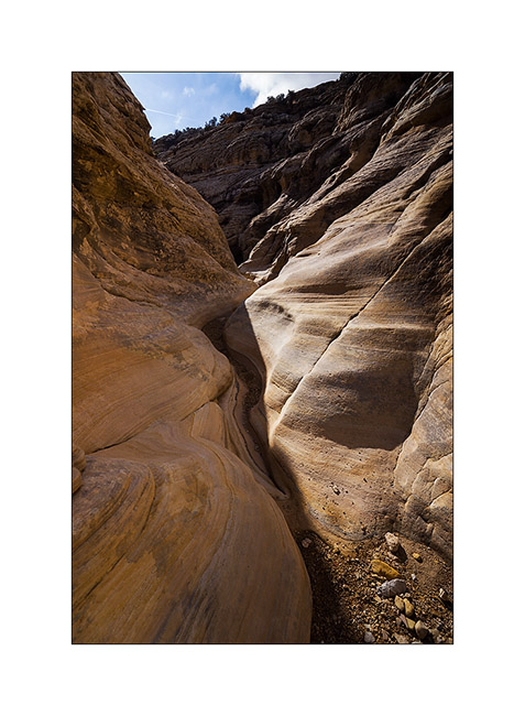
7. … that sinks ever deeper…
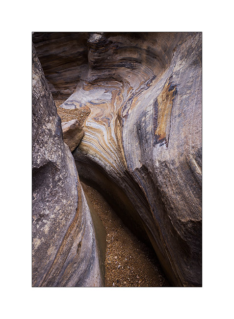
8. … sometimes with a larger pot…
9. … and again some jumps and small waterfalls.
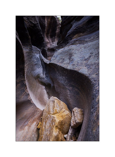
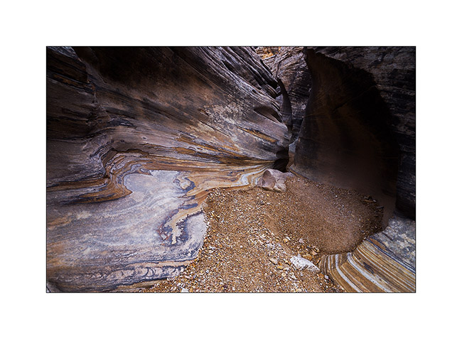
10. It’s a special atmosphere to be alone, isolated in such a corridor, I recommend it! 😀
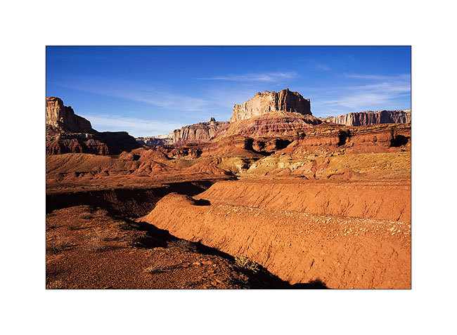
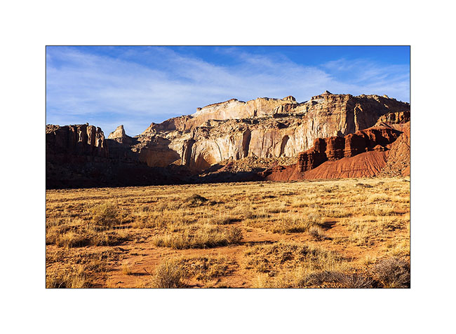
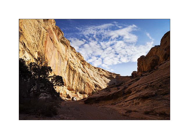
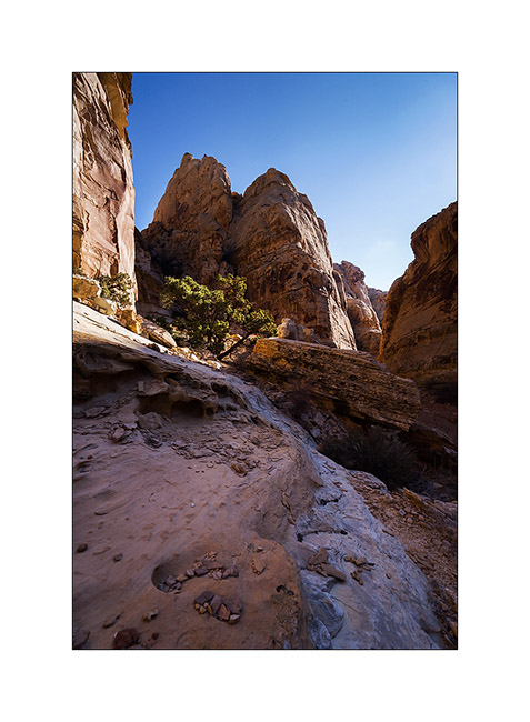
11. Intrigued by the heights of Reds Canyon I had spotted the previous day, I continued south for exploring this little known canyon too. Dug by the Muddy Creek, it is huge canyon, comparable to Canyonsland by the height of the cliffs.
12. At Tomsich Butte, there are several uranium mines that have been oparated until the mid 50s.
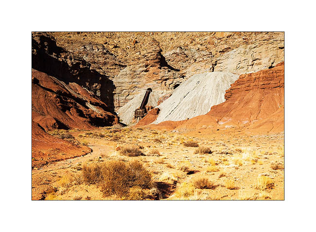
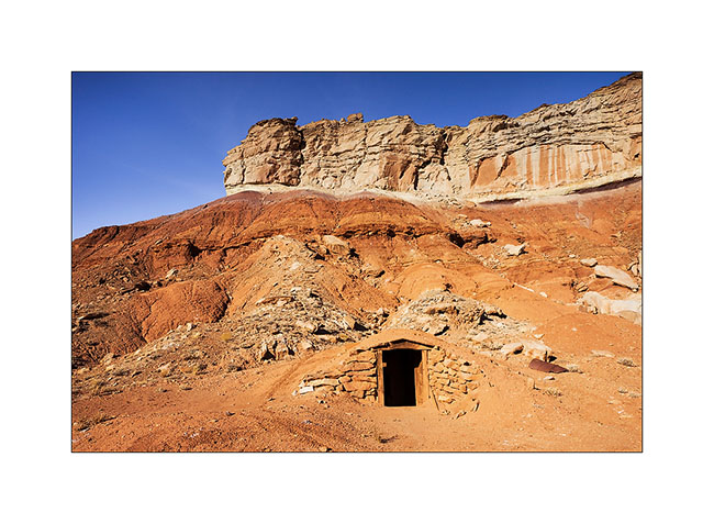
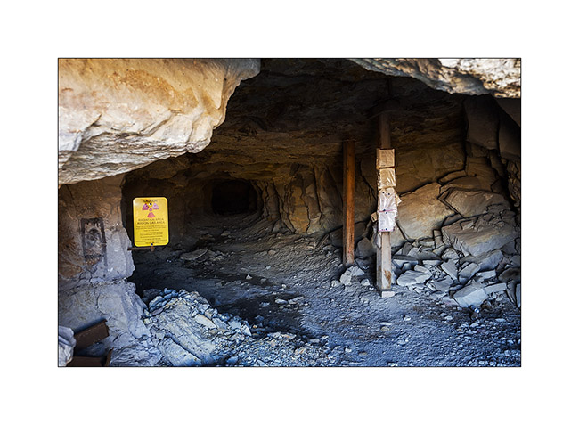
13. I even discovered that curious shelter. I learned afterwards that it was the dynamite deposit of the mine!
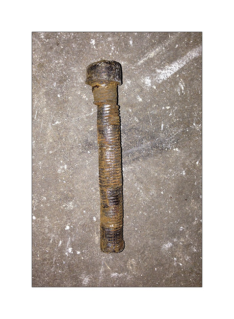
Taking a look at the front axle, I discovered that the right wheel was again quite backward. In fact, everything moved and the axle was misaligned. Blame it on the right suspension of which the centering pin broke.
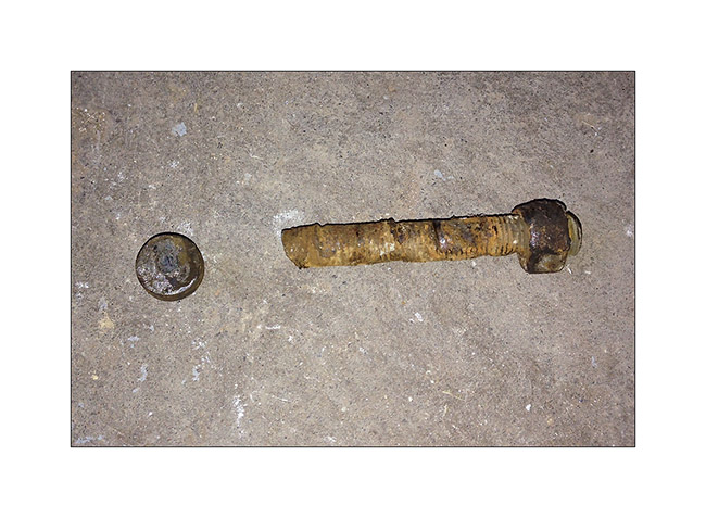
I couldn’t ride like that, so I had to mechanic for more than three hours under VLV, separating the axle of the spring with two jacks for inserting a bolt as temporary guide. Over one and a half hour to loosen four seized bolts, pulling on the handle of the hi-lift jack lever to achieve this; I so hurted my back …: – / But finaly, VLV was able to continue his way and hang gently until a more serious repair by replacing the broken pin. I then also removed the other side and I did well: the pin was also about to break.
It’s crazy what dirt raods hurts all running gear..!
14. Going up Reds Canyon, the scenery is gorgeous. Don’t they look like cathedrals porches carved in these huge cliffs?
15. In the upper canyon, about twenty miles away, they are some spectacular buttes.
16. Last look before returning to Moab to fix my broken suspension…
So much for today, hoping you’re not getting too bored with all these canyons! Thanks again for your loyalty. 😉
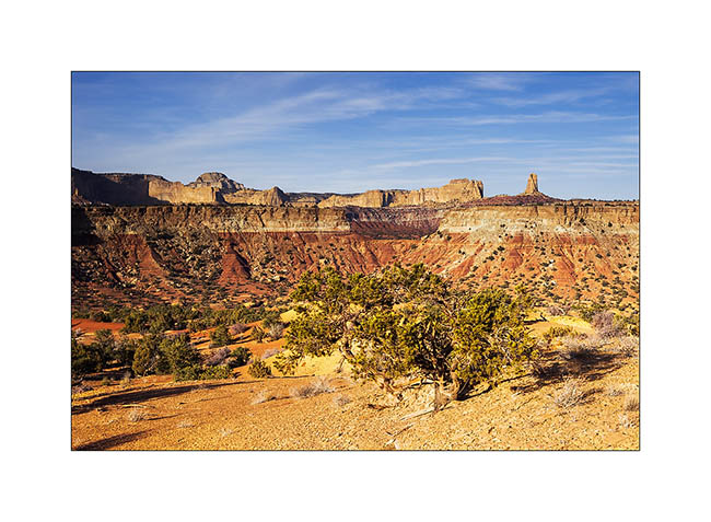
San Rafael Swell
Continuation of discovering this region less known and yet not far from Moab.
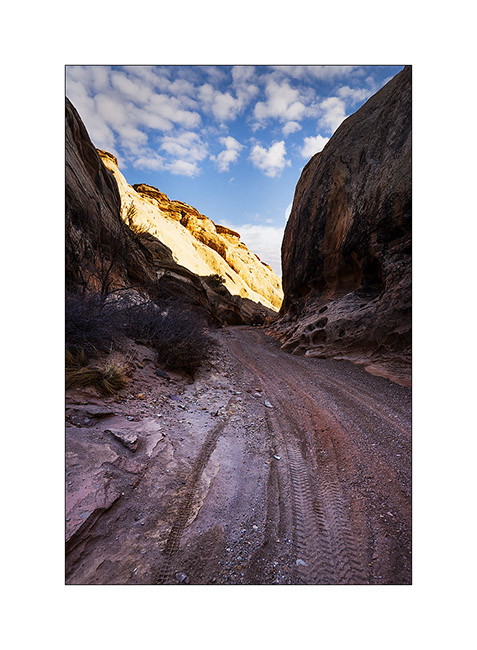
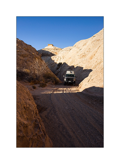
1. VivaLaVida on a little-used trail that circumvents Temple Mountain.
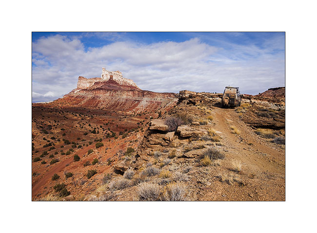
2. They are many old uranium mines in the area.
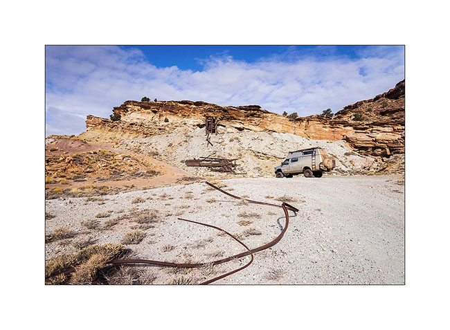
3. They are of course closed.
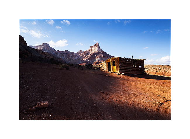
4. On the other side of Temple Mountain remains the “cabin” which housed miners.
5. Mining access corridor.
6. VivaLaVida going down the beautiful North Temple Wash…
7. … driving in the course of the wash.
8. The output is a little narrow.
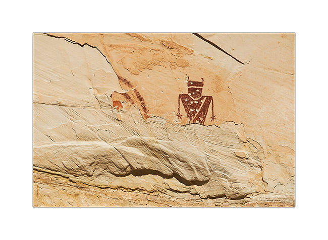
9. Splendid petrograph panel in the South Temple Wash.
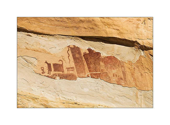
10. The white dots are not of the same time, just a idiot who shot this exceptional site… The weapons are all over the US, unfortunately.
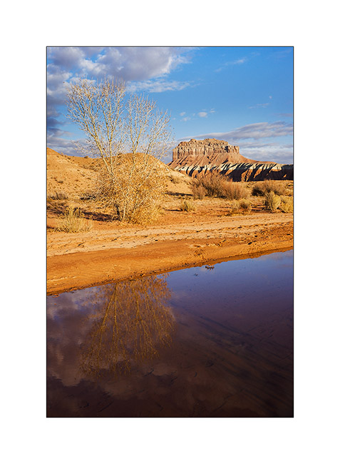
11. Going to the mouth of another canyon that I will explore the next day, I discovered a source…
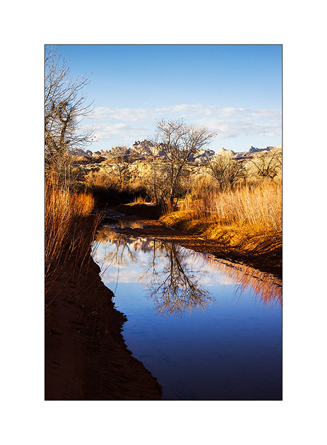
12. Late afternoon reflection…
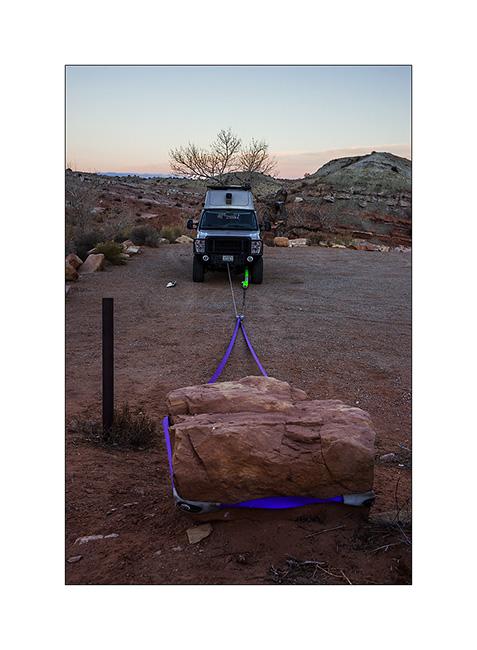
13. Having discovered that the bolts that connect the front axle with suspension springs were loose, I had to make some winching to realign the front axle before tightening… 😉
The next day I made a big hiking loop, up Little Wild Horse Canyon and back down through Bell Canyon.
14. Silhouette…
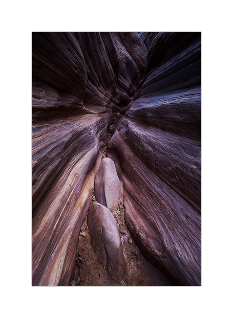
15. Entering Little Wild Horse slot canyon.
16. End and deep trench in which we sometimes have to go sideways as it’s so narrow.
17. Some water remains in places.
18. I imagine water flowing into these curves…
19. Labyrinth…
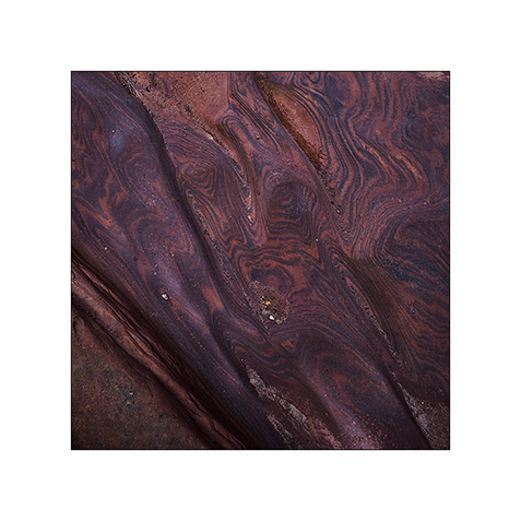
20. Some veining of sandstone are incredible.
21. Going down through Bell Canyon
22. Convergence…
23. Oui, it’s the right way! 😉

After this hike, I discovered by chance a nice area that I will present soon. 😀
Back from canada to the US !
Bad weather pursuing me, I chose the option of heading south in search of better weather…
1. It’s really larger than VLV !
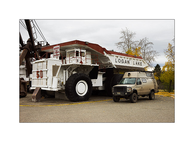
For the record, the gross weight of the monster reached 844’600 pounds!!! Two-stroke engine of 12 cylinders, each 645 cubic inches, and 2,500 horses to move the monster, the numbers are just unimaginable. Each tire weighs 6 tons alone – there are 10 of those! – with a diameter of 11 feet 4 inches, definitely higher than VLV!
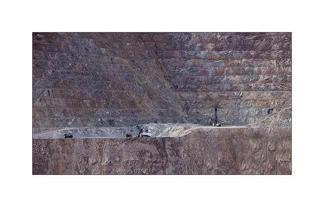
2. These trucks work in the huge open pit copper mine in Logan Lake.
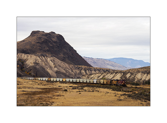
3. The processed ore is transported by train to Vancouver harbour.
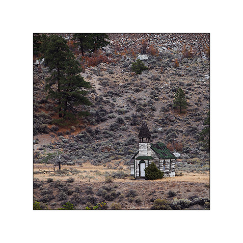
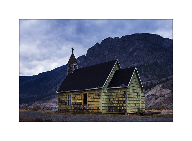
4. Olong the road, an abandoned church in Pokhaist.
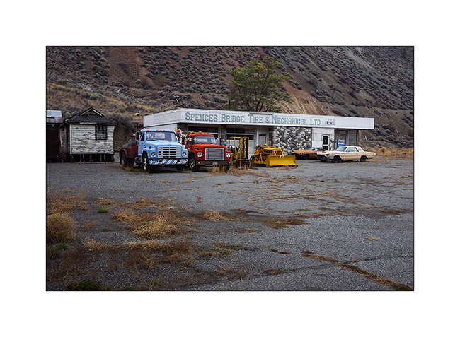
5. In Spences Bridge, there is also this workshop for sale, … 😉
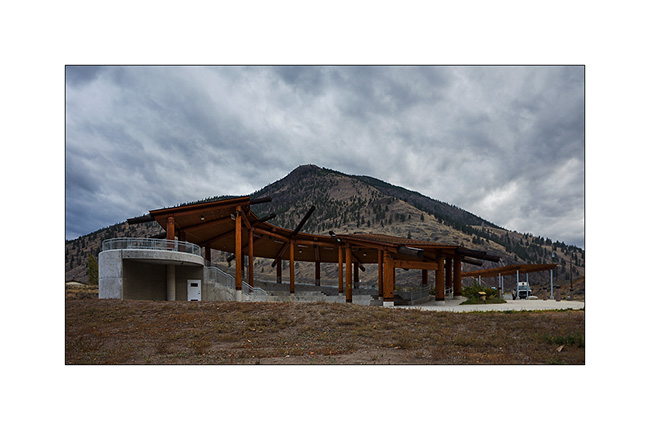
6. … and also, on the other side of the river, this outdoor theater of the Indian reservation that I found quite aesthetic.
7. Another church…
That’s it for Canada who reserved me a lot of moisture in this season. I then recrossed in the US with a little story. At the border, I got an agriculture service check and as I had forgotten three logs of firewood in the back box of VLV, the inspector sent me crossing the Canadian Customs again by foot with the three logs that I had to let on the Canadian Parking (import of untreated wood is prohibited). In short, it made me smile… 🙂
The weather was not better on the coast of Washington, so I went through Seattle without stopping and headed to the East to find better weather behind the mountains.
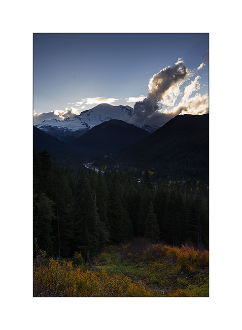
8. By late afternoon, unexpected clearing let me see the impressive Mount Rainier. It is a gray volcano that last erupted barely 300 years ago.
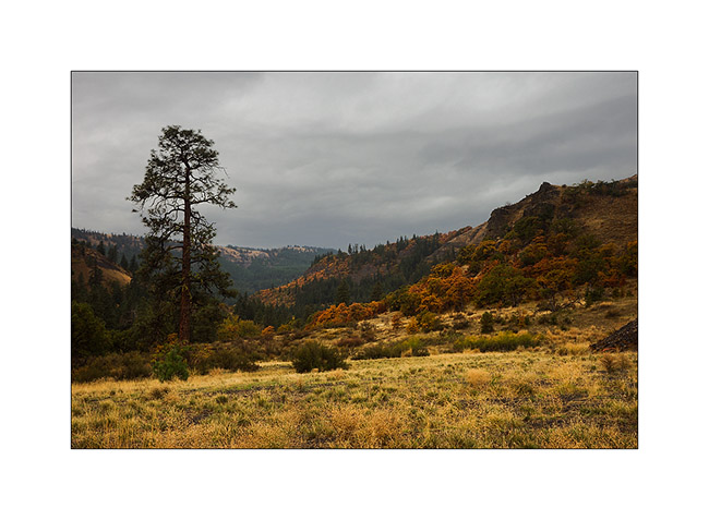
9. The next day, the rain is still with me when I go down the East side of the Cascade Range. Within a few tens of kilometers, landscapes change from a very wet climate to semi-desert lands, pretty amazing. Here halfway, it’s a typical Mediterranean climate with small oak trees that show a full range of autumn colors.
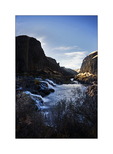
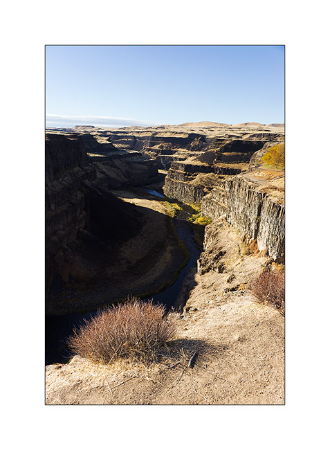
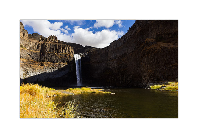
10. Arrived late at night, I woke up on the site of Palouse Falls.
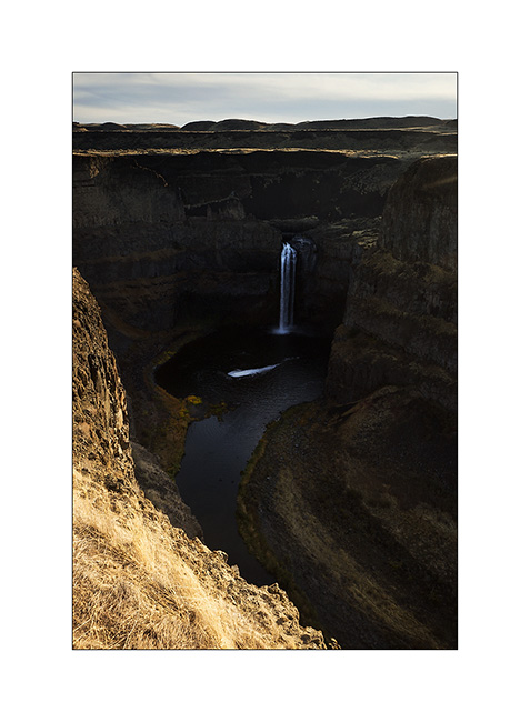
11. Light was difficult but I went anyway down the canyon…
12 … before to go up again for this view from above.
13. New descent on the other side this time to try to see the falls from below, which I managed after many unsuccessful attempts to find a way that allows me to reach the bottom of the canyon.
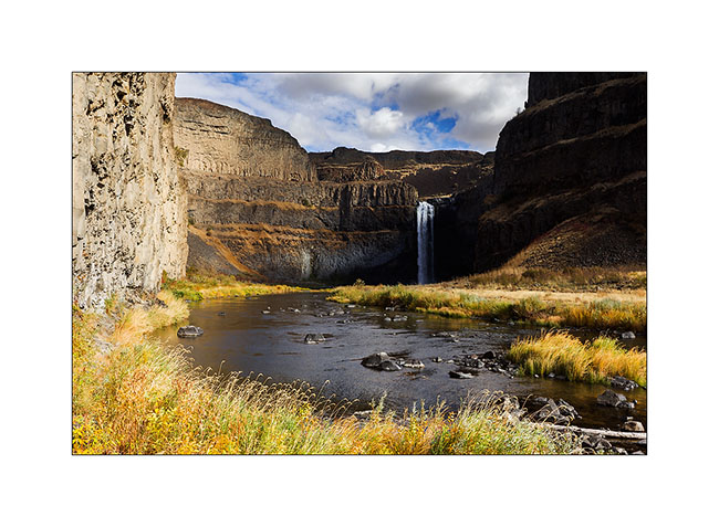
14. These waterfalls are gorgious, jumping barely 200 feet of basalt.
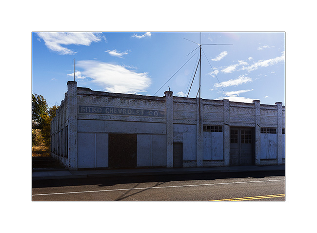
15. VLV take the road towards Oregon to the South. Here an old shed…
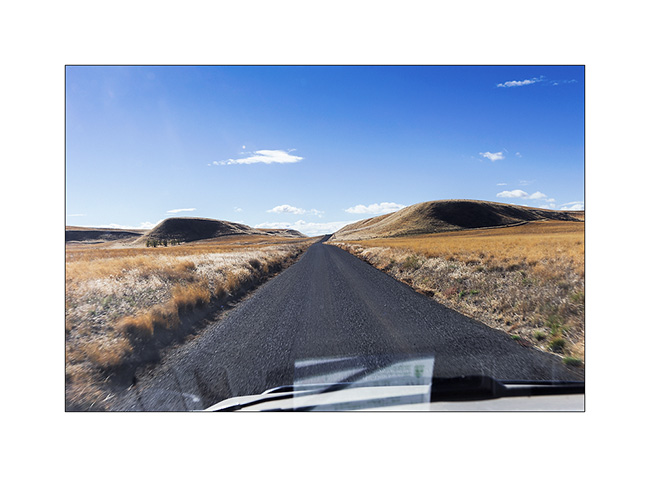
16. Here, some dirt road through the hills…
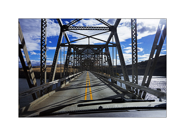
17. Here again, one of those metal bridges that cross some rivers.
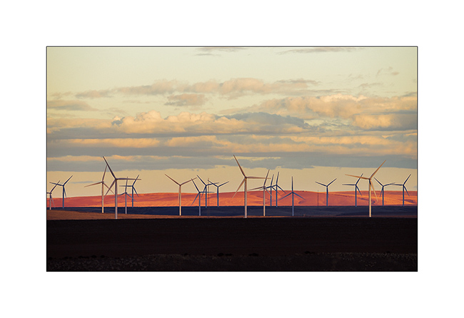
18. Arrived in Oregon, there is a lot of Wind mills on the plains where the wind often blows.
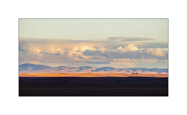
19. Il slept on a ridge with a beautiful late afternoon light on the plain.
I will present a few sites in Oregon in the next update! 😀
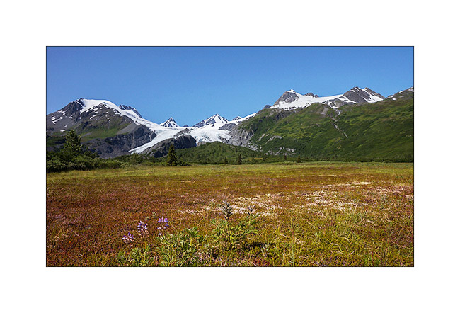
Glaciers & McCarthy Road
Better weather announced for two days, I drove the McCarthy Road, which sinks for about hundred miles between large ice areas. But on the road from Valdez to get there, I made a stop to walk to the bottom of the Worthington Glacier, easily accessible.
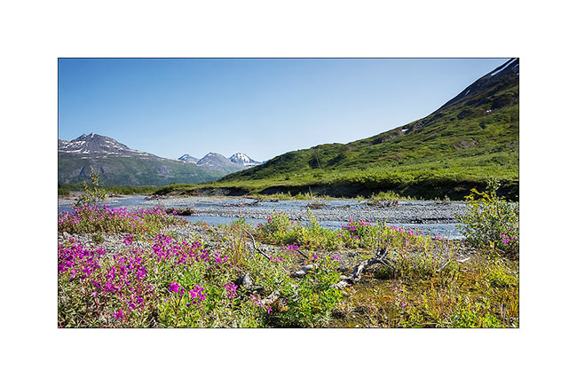
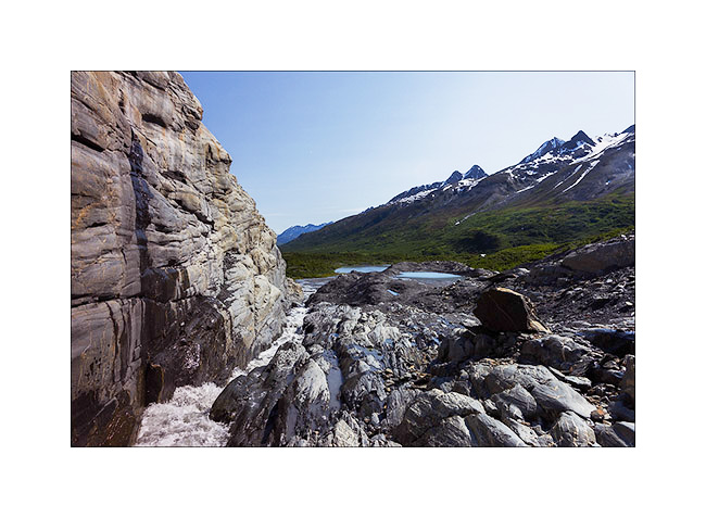
1. Glacial river near Thompson Pass.
2. The glacier tongue is divided in two by a lock of granite.
3. Hiking along the granite.
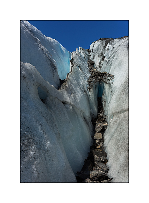
4. The ice also recedes every year here… In 1950, she was almost half a mile below.

5. Ice carved by melting…
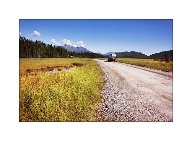
6. Going up the McCarthy road, near the confluence of two beautiful rivers…
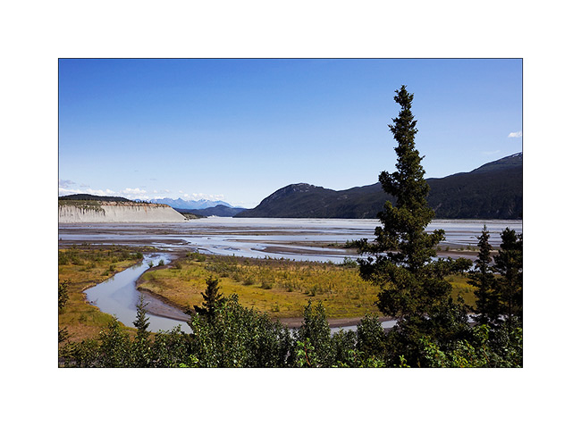
7. The road passes through beautiful landscapes of taiga alternating spruce forests and swamps…
8. … and numerous small lakes.

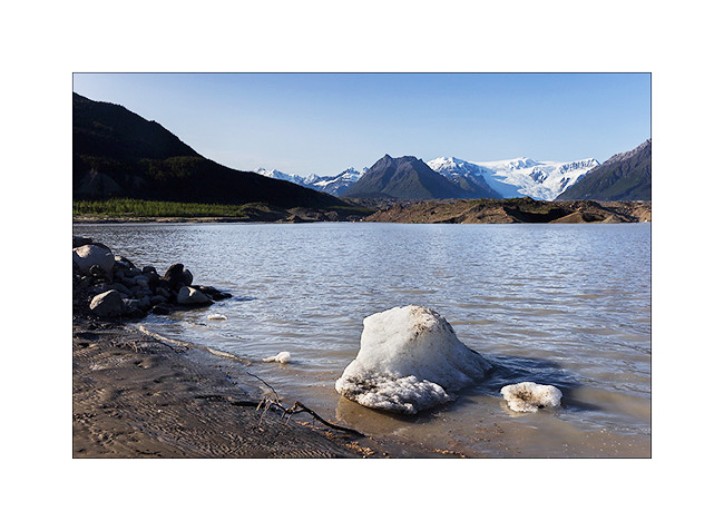
9. Arrived in McCarthy – on the other side of the river that crosses a footbridge to reach this little city – I slept at the foot of the gigantic Roos Glacier, near the small lake which ended his over 30 miles long tongue.
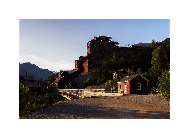
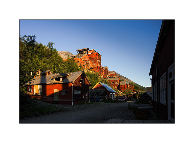
Enjoying the light of late afternoon, I took my Mountain Bike to for explore the Kennicott Mine, one of Alaska’s largest mines operated at the beginning of the last century.
10. This historical heritage is being renovated.
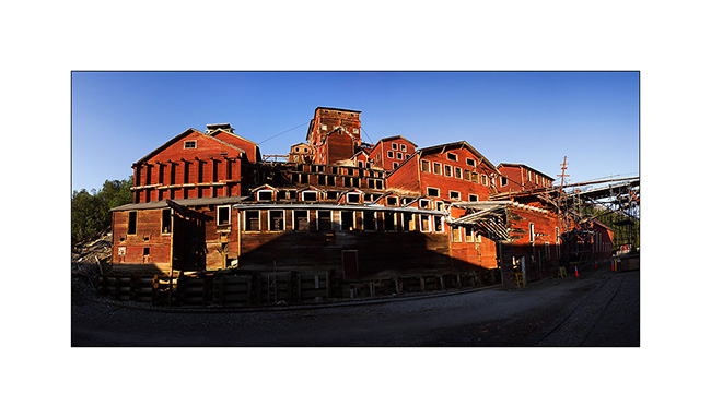
11. The construction of the mill itself is really huge. Even this panoramic of 6 stiiched images don’t manage to show you how large it is.
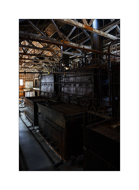
12. Several outbuildings surround it…
13. … whose thermal plant that produced the electricity needed in a real coal power plant.

14. The four huge boilers are impressive!
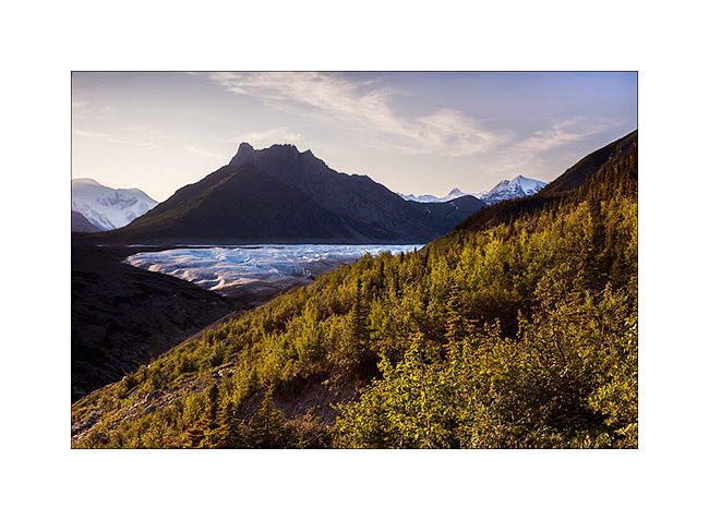
15. This mine is built on the lateral moraine of Roos Glacier which descends more than 5 miles downstream.
The next day will be a hard day: I decided to go up the glacier as far as I could. I made more than 30 miles, mountain biking first, then hiking. I arrive much only as half of the glacier…
16. A panoramic shot of 8 images in an attempt to show you that immensity. By itself, this glacier is larger than Rhode Island!

17. Back by the McCarthy Road and even there, I founnd a swiss cow!! 😀
18. VivaLaVida would almoast fly..! 😉
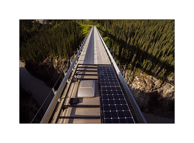
19. This is actually a high and narrow bridge over a deep gorge. It was built in 1905 for the railway route which allowed to bring coal to Kennicott Mine and transport gold mined.

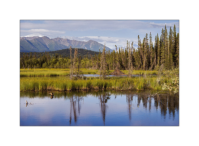
20. Beaver lodge in a pond near the road.
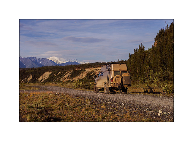
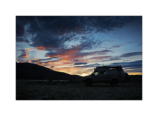
21. VivaLaVida approaches his camp of the day…
22. … along a beautiful river… The large icy dome in the background is Mount Wrangell, a dome volcano.
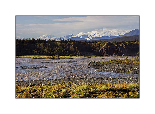
23. … where salmon fishing is going well. There were a dozen of these catch-machine driven by the current.
24. I still see the large dome that gives rise to Roos Glacier, more than 60 miles as the crow flies.

25. The Sunset was beautiful, the bad weather coming again and bringing some clouds…
The rain will follow me again during several days. So I headed to Anchorage for some maintenance work on VLV and to prepare the last updates before the arrival of Mino who’ll have landed when you’ll discover these lines. 😉