Alps
now browsing by tag
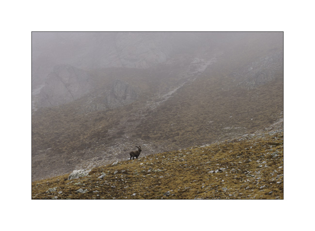
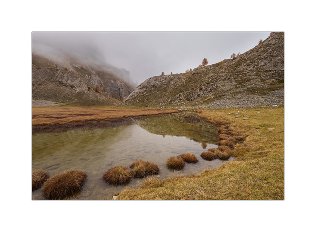
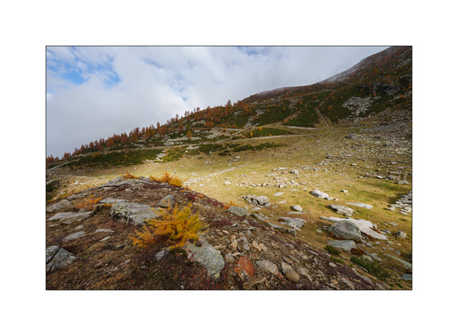
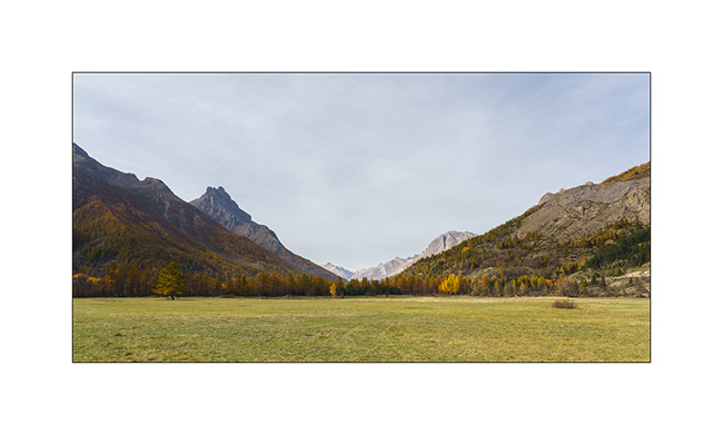
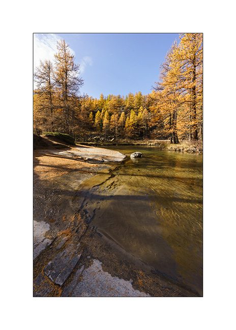
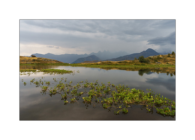
Lake Meja
The next morning, we set off on a hike to explore Lake Meja despite the poor weather..
1. Our camp going up towards the small pass which overlooks us.

2. We see a few ibex near the pass.
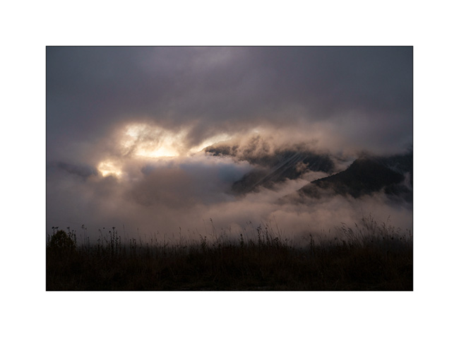
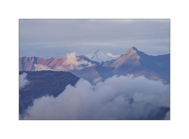
3. Mountains appear and disappear in the clouds.
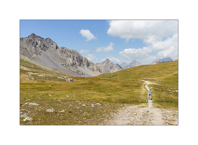
4. Some marshes along the path.
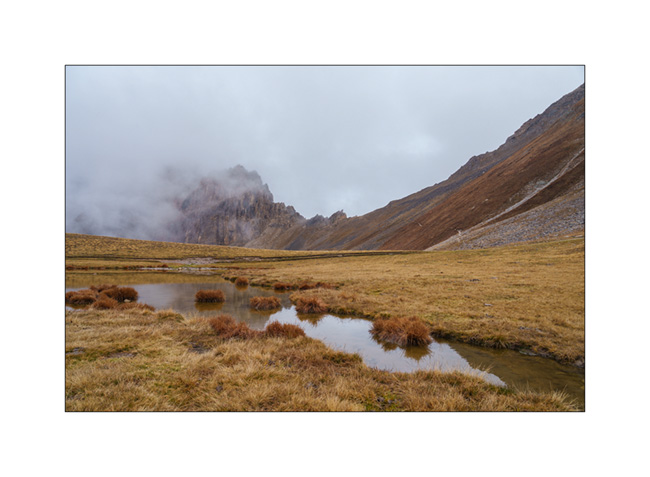
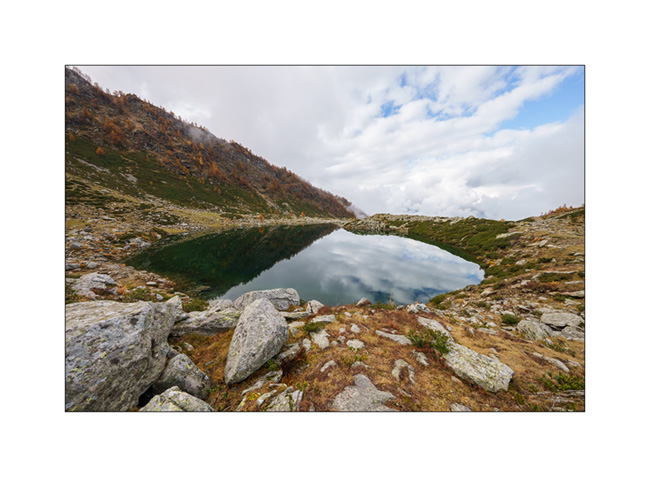
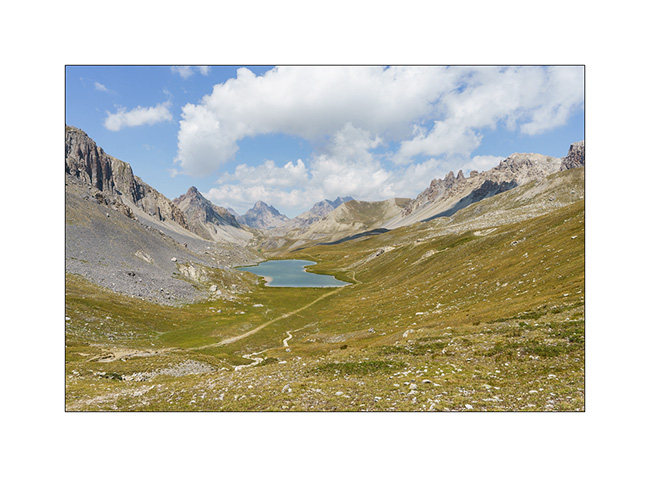
5. Lake Meja.

6. Small mushrooms on a dung.

7. The rain starts again as we go back to VivaLaVida.
8. It’s already time to head back. A short stop on the way up the Maddalena Pass.
In the next update, we will discover a beautiful valley in Haute Ubaye.
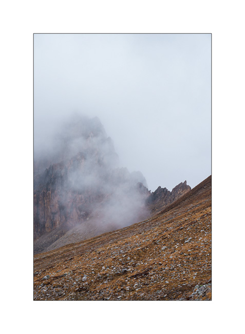
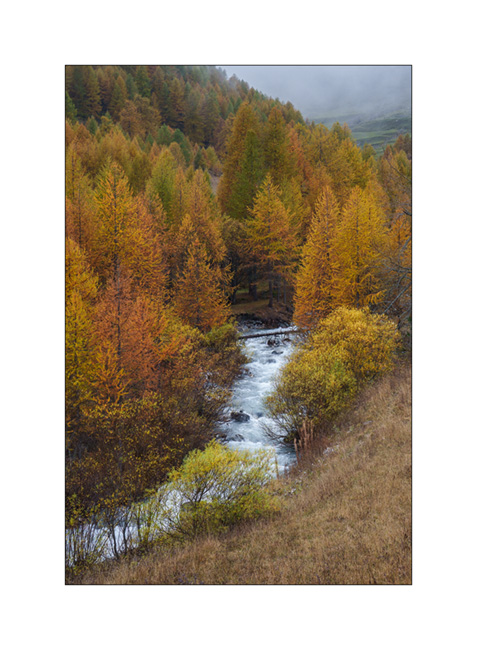
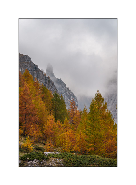
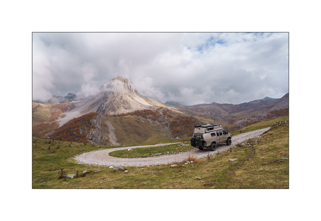
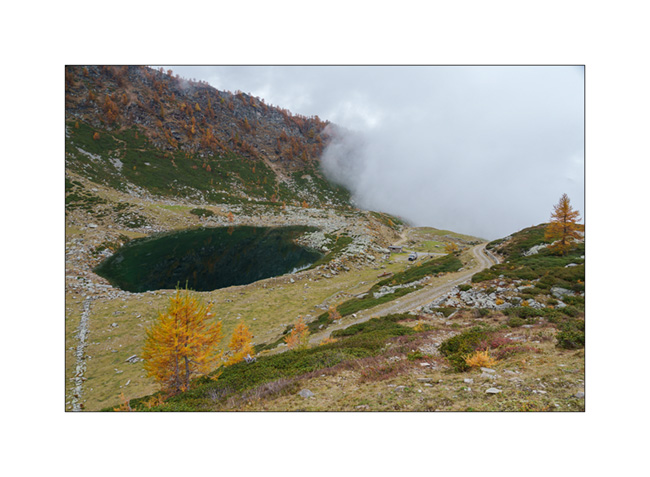
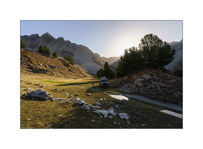
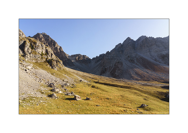
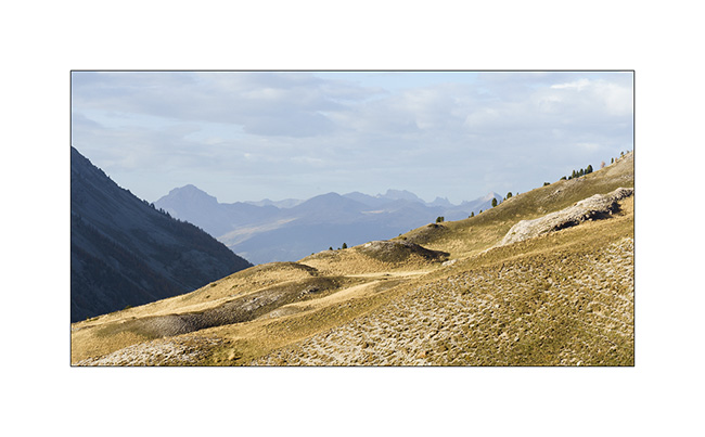
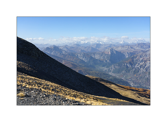
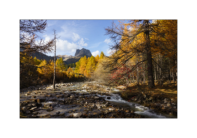
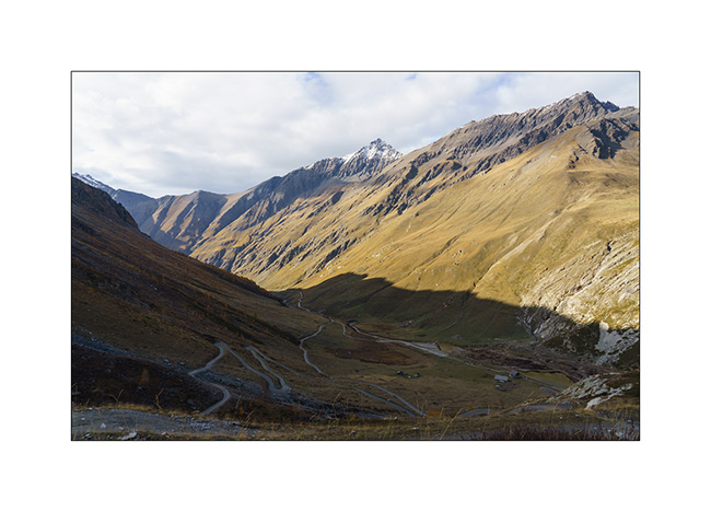
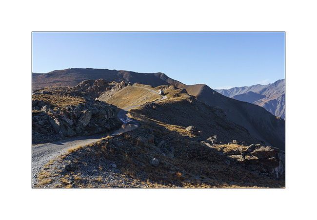
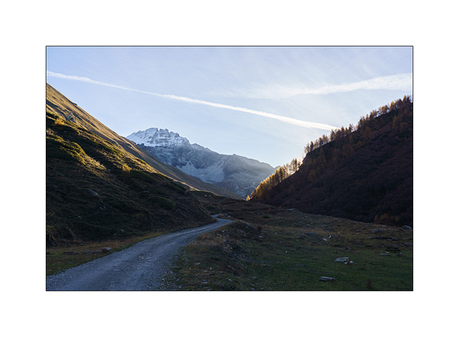
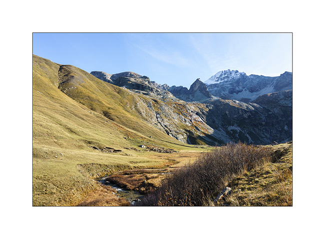
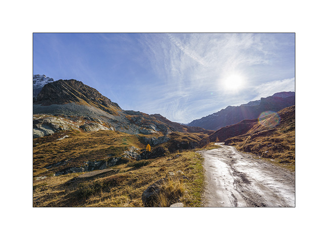
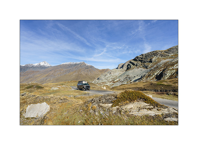
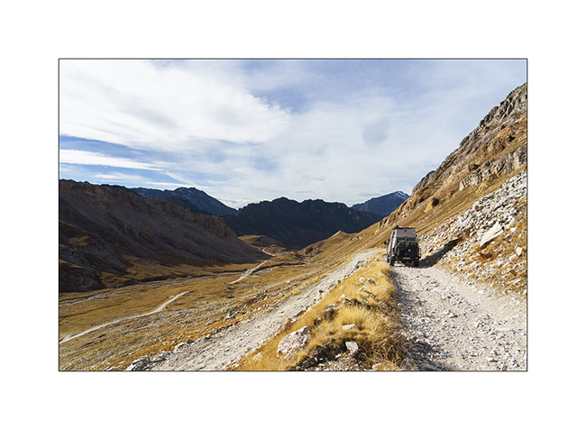
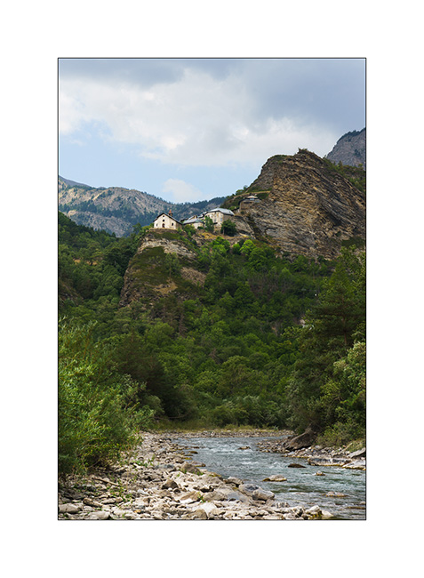
Maira Stura
As announced, we continued South hoping to be able to access the Maira Stura trail which was closed during our last visit in summer.
1. Chapel of San Salvatore, driving up the Val Maira.
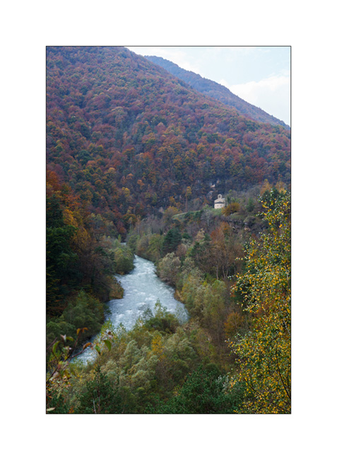
2. Village of Macra, in the same valley.

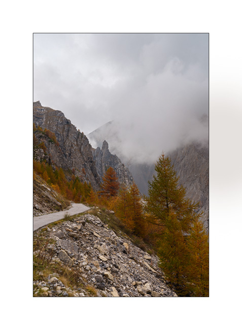
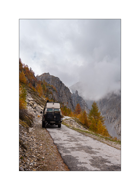
3. Indeed, the gate located after Pian Preit is open at this time of year. We can take the small road towards the Meja Pass.

4. Cloudy weather as the road climbs steep.
5. …
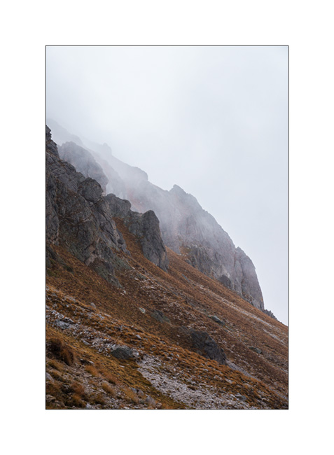
6. The limestone is steep on this side of the valley.
7. Near Meja Pass.

8. We continue on the trail towards refuge Gardetta.
9. Meja Mountain in the clouds.

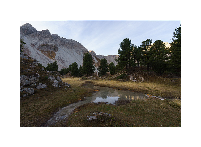
10. Altitude marshes.

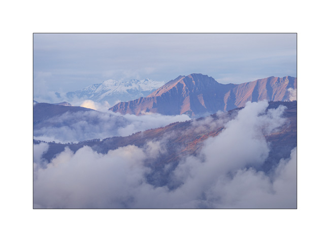
11. The atmosphere is magical with the fog coming in.

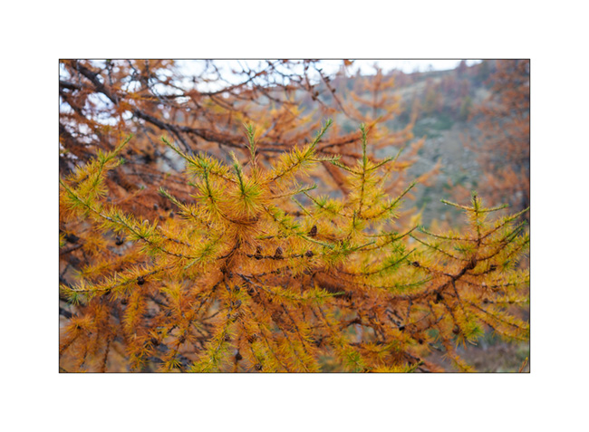
12. Fall colors…
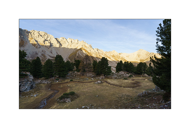
13. Under refuge Gardetta, at almost 7,000 feet elevation.

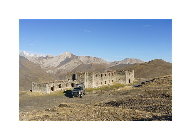
14. We do the entire crossing of the Maira Stura trail via Margherina Pass in the rain. Here, the old Barracks Della Bandia.

15. We find a nice boondocking spot on the edge of a small lake.
16. Rainy and windy twilight.

To be followed soon… 😉
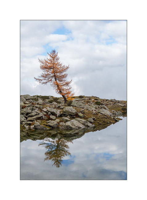
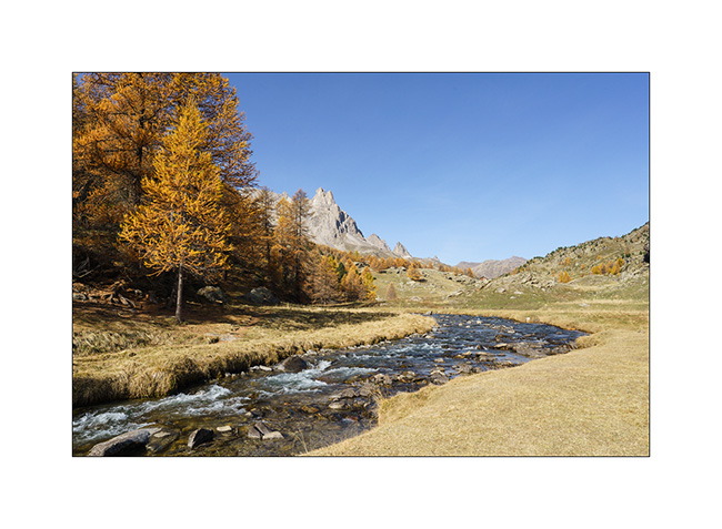
Fall holiday : Lake Lauson
For the second week of Emile’s vacation, we went to discover new alpine spots.
1. Sunset et our first boondocking spot, near Sansicario.
2. Herd going up towards Sestriere.
3. Going down the valley of Cluson river.

4. On the trail going up to Lake Lauson.
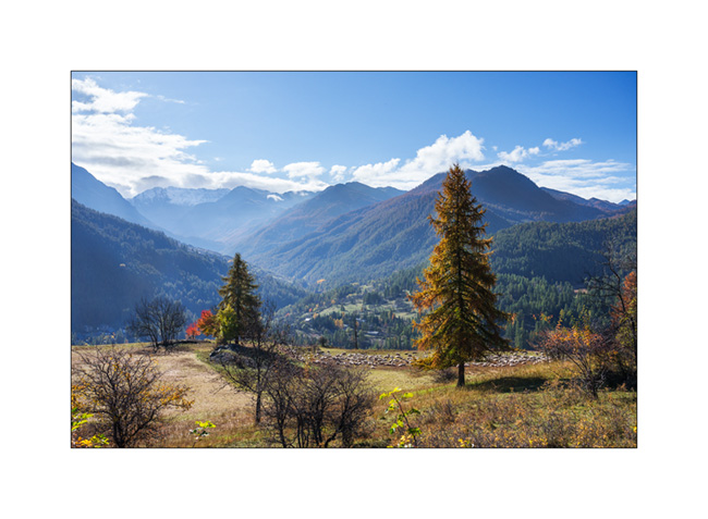
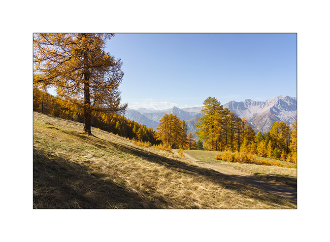
5. At almost 6,000 feet elevation, the larches are gorgeous in their autumn dress.

6. The best of co-pilots!! 😀

7. Lake Lauson.
8. Still a few holes of sunshine as the clouds gather.
9. Lonely tree.
10. Sheepfold under the lake.

11. Shepherd house.

12. Before dinner, we walk up the old military road above the lake, now closed by a gate. We overlook VLV at his camp near the lake.
13. Golden larches…
14. After rain and fog.

15. The view from our camp at sunset…
16. Last colors…
After a wet night, we will continue South…
Last day before heading Home…
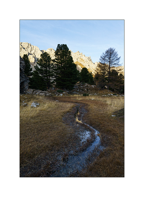
In the early morning, we go discover an altitude marsh spotted during our walk the day before..
1. A source there creates a stream that meanders on a flat.
2. At its end, a small pond formed.
3. We don’t hang around too long because it’s chilly this morning.
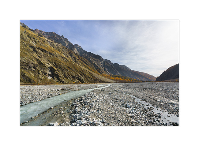
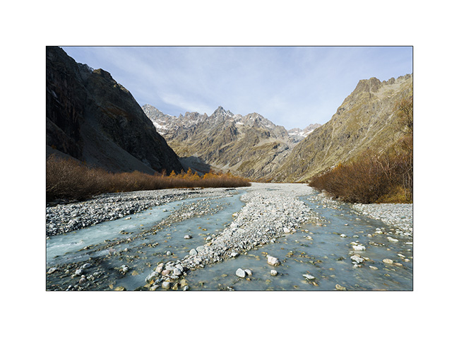
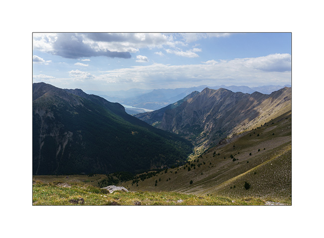
4. Change of place to discover the bottom of the valley of Vallouise Pelvoux, at a place called Le Pré de Madame Carle. We discover a sub-glacial zone where the floods of the river create a gravel bar like those visited in Alaska.
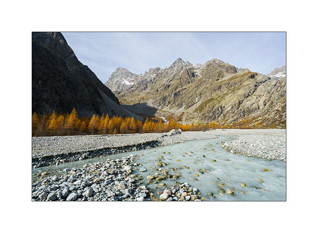
5. We are at the treeline altitude, which causes a certain alpine aridity at this place.
6. View from our lunch spot. They are worse, isn’t it?
7. On the way back, between Briançon and the Lautaret pass.
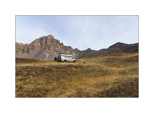
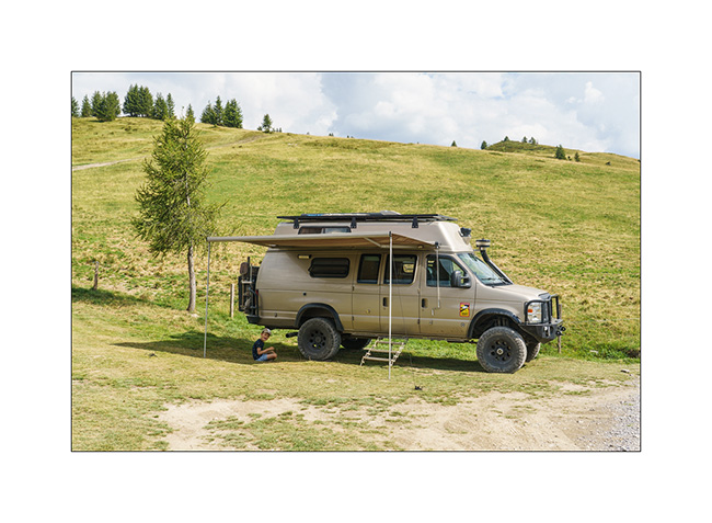
8. Thanks to the off-road capabilities of VivaLaVida, we find a nice promontory to boondock on the northern slope of the Galibier pass.

9. Out of sight of the road, our afternoon end is perfectly quiet there.
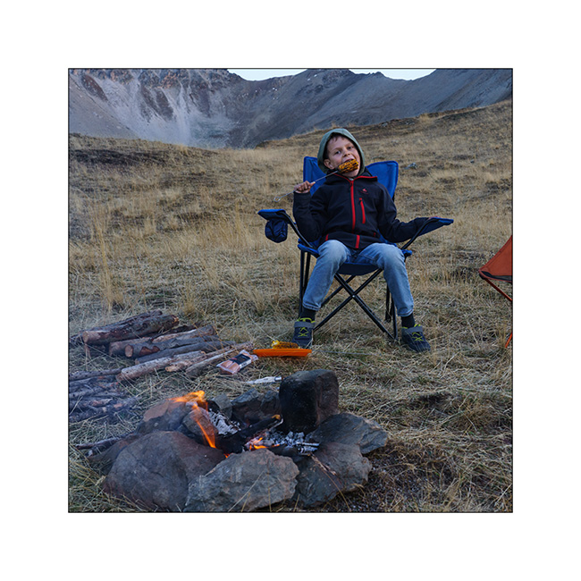
10. A last campfire for grilling some corns and meal.
11. And a last image of this short week of travel with pretty colors at sunrise Sunday morning…
Back at home, we plan one or two more weekend outings before VivaLaVida returns to its wintering place. I’ll tell you about those in a while.
Thank you for your loyalty to follow this little blog! 😀
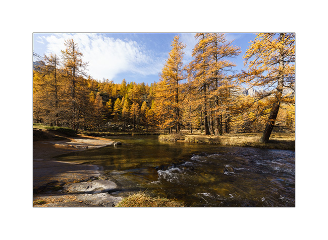
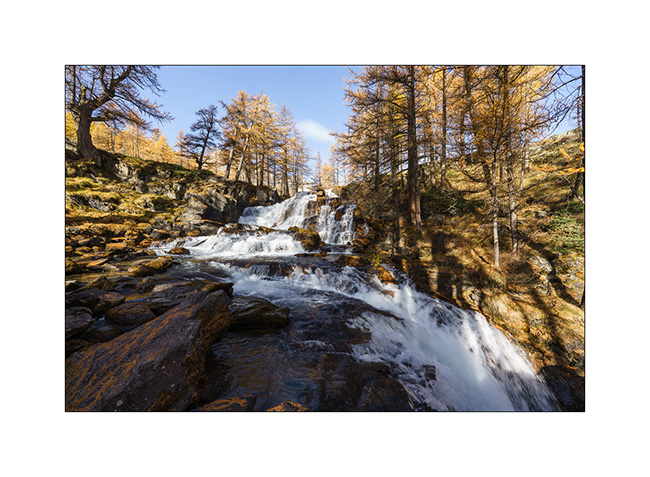
Back to Clarée Valley
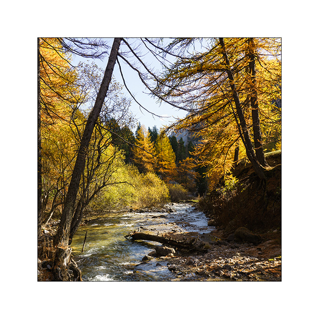
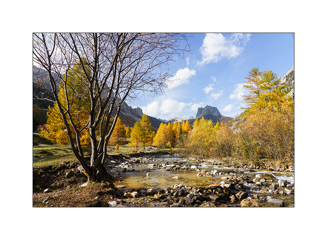
Still unable to walk much because of my sprained ankle, we decide to go back up to the beautiful Clarée Valley that we had discovered last year in the same season and discover the Fontcouverte waterfall, taking advantage of the golden larches to take some pictures.
1. The Clarée River upstream from the waterfall.
2. Fontcouverte waterfall.
3. I’m playing to look for some compositions.
4. Variation.
5. In the morning, we’re almost alone at this season while in summer, it is constantly crowded.
6. A little further up the valley.
7. We have our lunch under a mountain pasture.
8. Last view of this beautiful valley before changing corners… Since last year, signs prohibiting wild camping have grown everywhere and the only campsite there is closed for the season.
9. After a few tens of miles, we are at the very top of the Vallon de l’Orceyrette, above the Chalets de L’Alp. We are completely alone there for a quiet bivouac at about 7,900 feet elevation.
10. We discover the surroundings of the camp. This bottom of the valley is still wild.
11. View looking north.
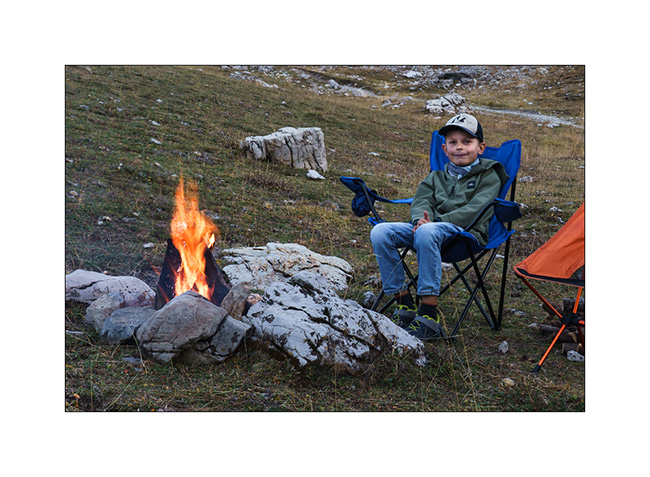
12. We enjoy a nice campfire to cook our meal there.
Continuation and end of this few days trip shortly! 😉
Jafferau fortress, then Vallée étroite (Narrow valley)…
While setting up camp, I badly sprained my ankle. Despite the ointment applied quickly and a bandage to try to succeed in putting the foot on the ground, I will have to revise the plans. Damn! Here I am forced to give up a hike planned in two days. So, after having slept just under Fort Jafferau, we decide to take a look at this fortress in ruins.
1. South portal or what’s left of it…
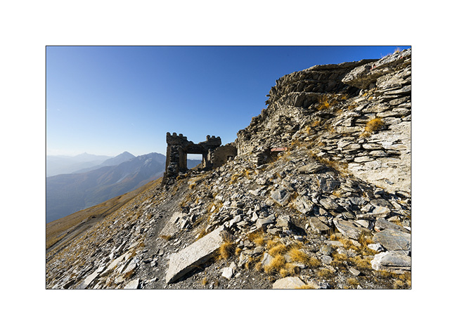
2. Here, canon battery bases with the arcs indicating the directions of fire.
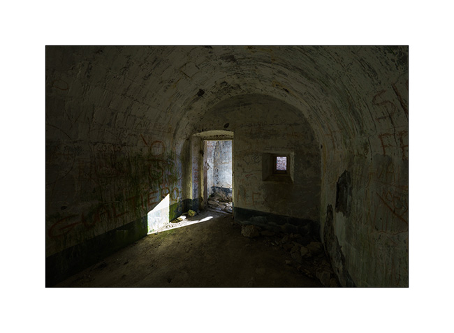
3. And one of the many vaulted chambers which likely served as cantonment.
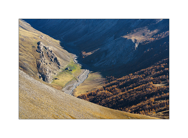
4. Bird’s eye view of an alpine pasture below.
5. Panoramic view of Ecrins mountains to the West.
6. Descent to Bardonecchia via the northwest side.
7. We take advantage of the afternoon to discover the Vallée Etroite (Narrow Valley) straddling the Franco-Italian border. The enfilade towards Mount Thabor is magnificent with the fall colors.

8. Opposite, by where we arrived.

9. The river that carved out this valley, called Narrow Valley Stream.
10. I take advantage of varying the compositions since I can hardly walk. Variation 1.
11. Variation 2.
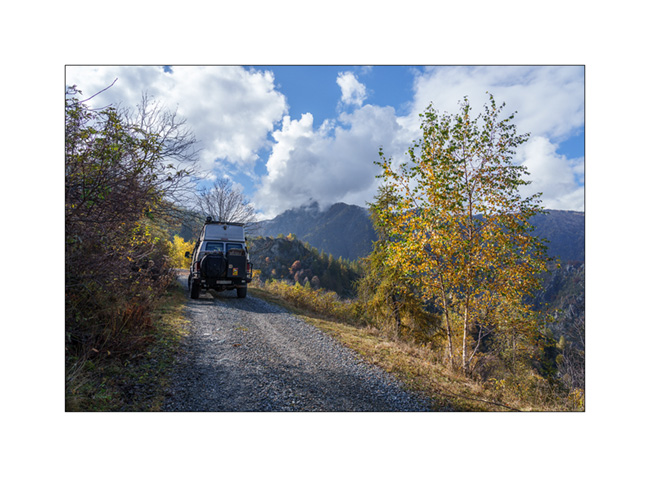
12. And one last before leaving to do some grocery shopping in Bardonecchia and refuel VivaLaVida since the strikes in France make the refill difficult.

The rest with a return into the Clarée Valley in a few days. Thanks! 😀
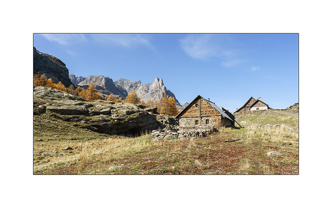
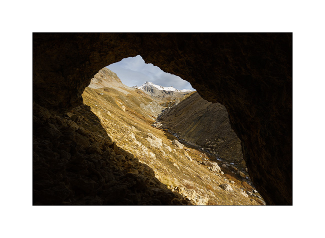
Discovery and re-discovery…
Still going down in the valley that leads to the Col du Sommeiller, we stop to discover a vast alcove created by the collapse of a friable cliff.
1. The cavity visible on the other side of the torrent, at the top of a steep slope.
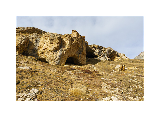
2. Here we are. Emile gives the scale.

3. I take this opportunity to “frame” the landscape…
4. Back to VivaLaVida.
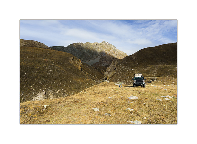
5. VLV in the switchbacks of the track above the Scarfiotti refuge.

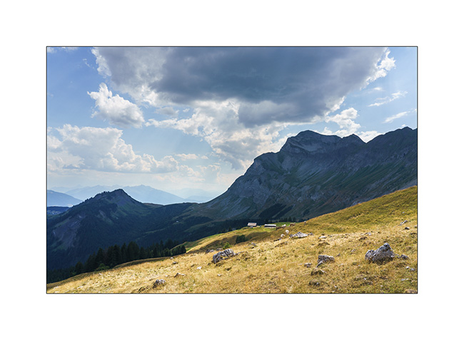
6. The surrounding mountains as the sun slowly turns West.

7. The valley below the refuge.
8. Wake up!
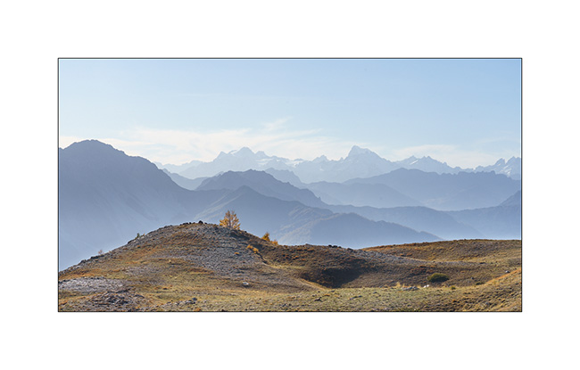
9. This is the period when the larches are all golden!

10. Rochemolle village.

11. Ascent to Colle Basset that we drove in the other direction this summer.
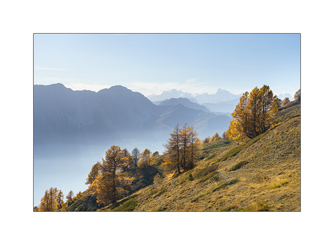
12. As we rise, the view opens up to the distance…
13. VLV on the trail above Colle Basset.
14. Valfredda valley.

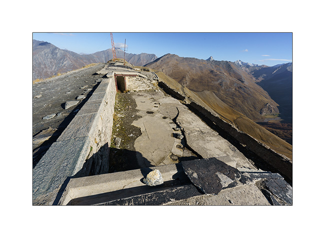
15. Fort in ruins.
16. We sleep just above, with a superb panorama!
NExt to come soon… 😀
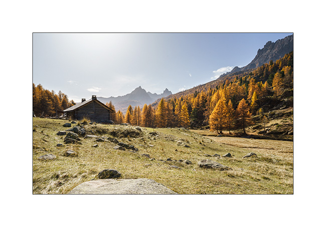
Fall holidays
Our short week of vacation with Emile begins with a rainy day. We make the road to the region of Bardonecchia where I hope to drive the Sommeiller trail that we had not been able to discover the past summer.
1. Rainy boondocking above Rochemolle.
2. The next morning, the clouds have disappeared and the sky is blue when we wake up.
3. Uphill to the Scarfiotti refuge.
4. Higher on the trail…
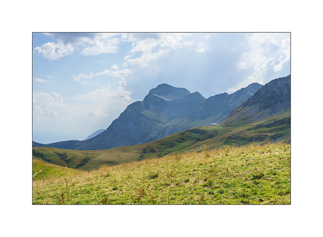
5. The surrounding mountains are gorgeous!

6. High altitude fall colors.

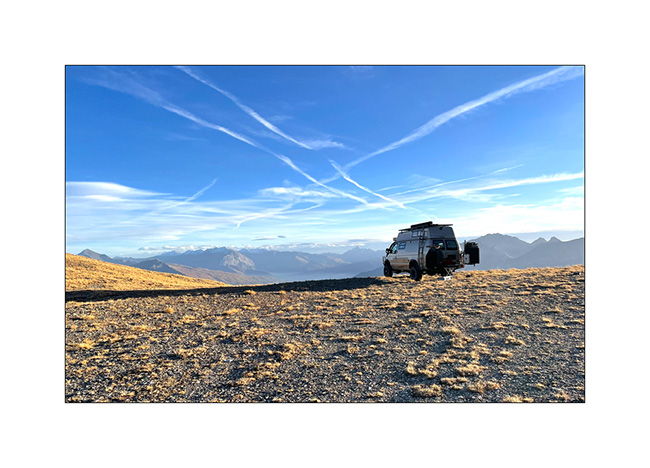
7. VivaLaVida on the trail, at already more than 8,200 feet above sea level.
8. Arrival at the end of the trail whose descent on the other side has never been built.
9. Round altitude (3,000 meters = 9,842 feet), the highest reached by VLV in Europe. As a reminder, she went over 13,000 feet in 2016, in Colorado…

10. The small lake which is just after the pass.
11. And the other side remained empty of trail. Only a footpath leads down to the Ambin Valley.

12. We are close to the first snow that fell a few days before…

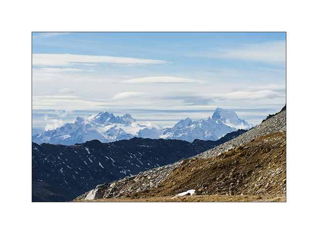
13. View of the peaks of the Parc des Ecrins in the distance…
14. Descending back. We only passed two local motorbikes all day.
To be continued in a few days… 😉
Way back to home…
It’s time to head home, our three weeks coming to an end soon.
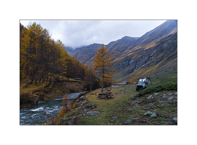
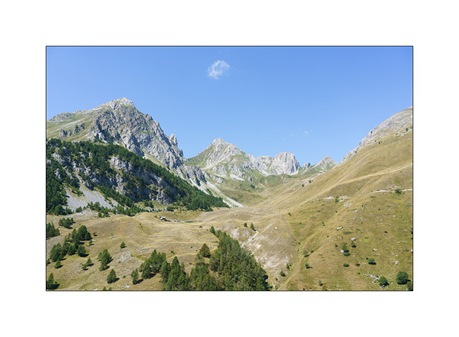
1. From Colle della Maddalena, we go down the Ubaye valley and we stop for a picnic on the banks of this beautiful river.
2. Window from the Girabeau Pass under the Parpaillon Pass, with the Serre-Ponçon Lake in the distance.
3. We make a detour via the Glandon and Croix-de-Fer passes. Obligatory passage by Lake Guichard while the Arves Needles disappear in the storm.
4. Along the trail…
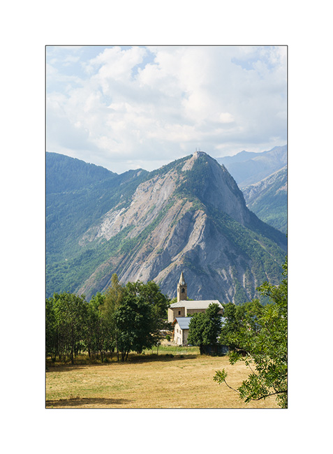
5. Chruch in l’Eglise, above Saint-Martin-de-la-Porte, as we descend after finding a closed barrier on the trail VivaLaVida wanted to drive.
6. We reach Aravis mountain range for a last night in VivaLaVida.
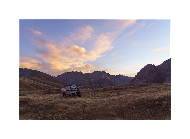
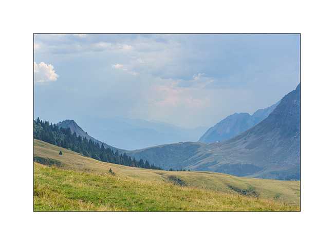
7. In the distance, the Arpettaz Pass as the storm prepares.
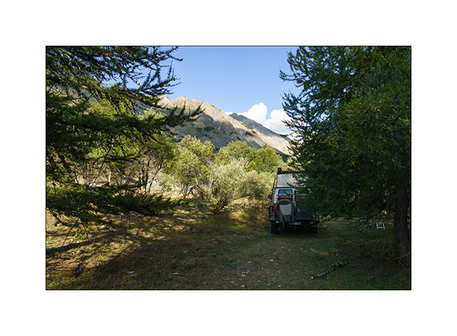
8. Our boondocking spot.
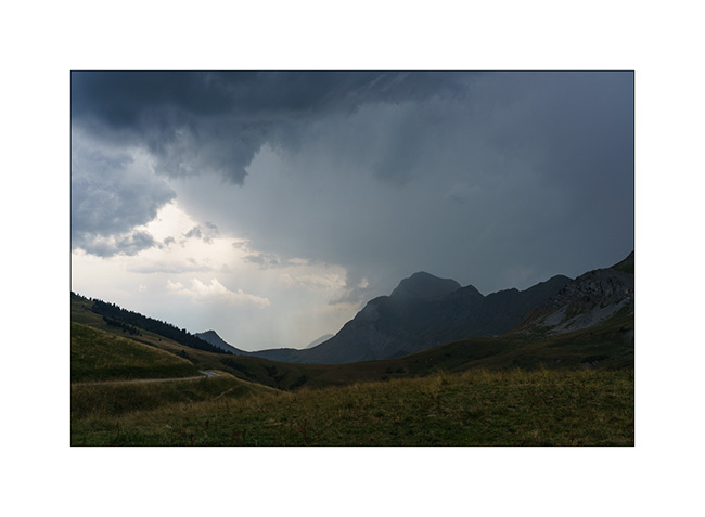
9. Stormy atmosphere…
10. On a walk to discover the surroundings.
11. To shelter before the thunderstorm.
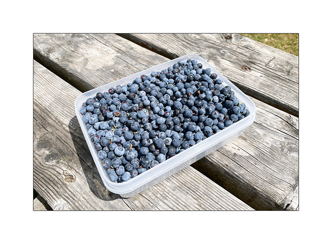
12. The next morning, we go to pick blueberries spotted the day before. Yum!!
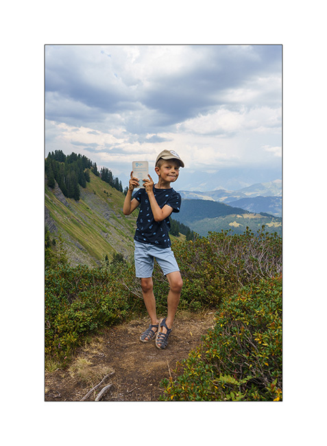
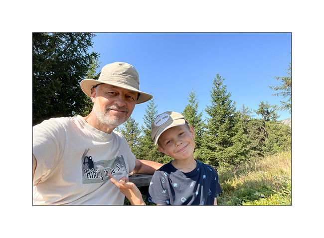
13. End of summer vacation selfie. 😉
That’s it for this little trip obviously too short. Thank you for following us through this little blog.
VivaLaVida will resume service for the next weekends and for the October holidays. I’ll feed this page with new articles during next fall.
See you soon and thanks again for your loyalty ! 🙂
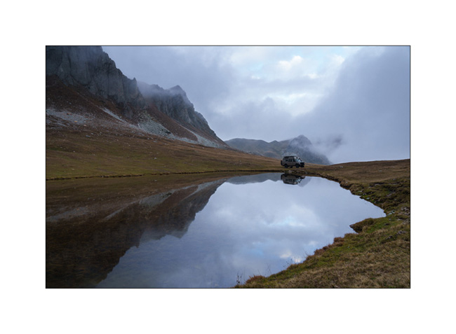
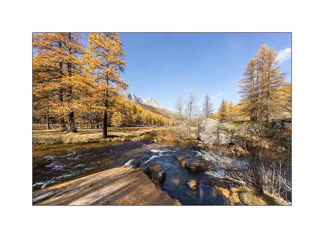
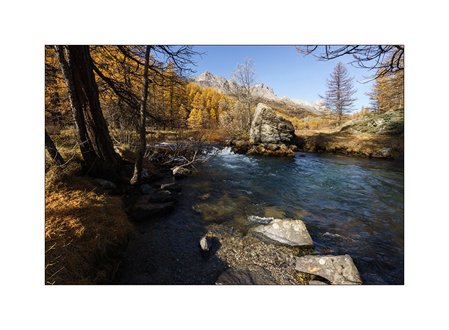
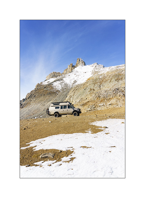
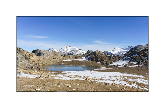
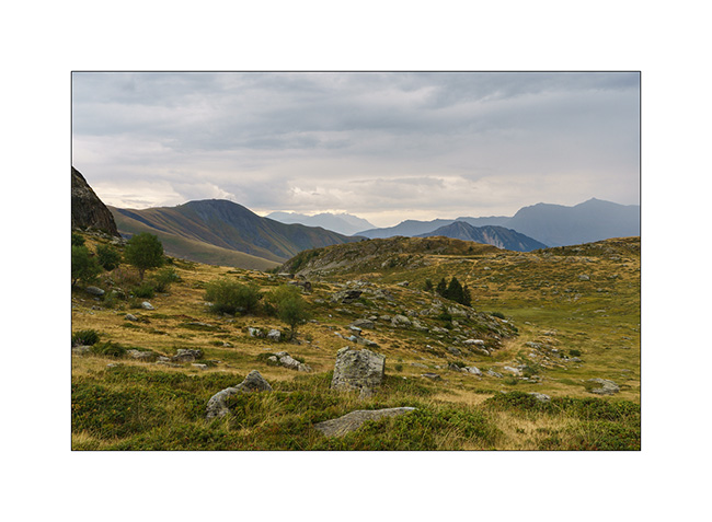
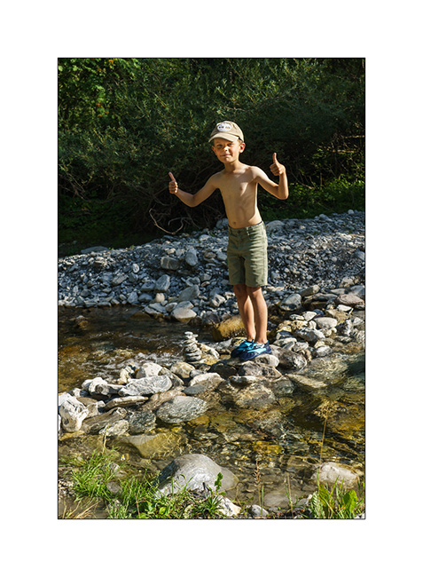
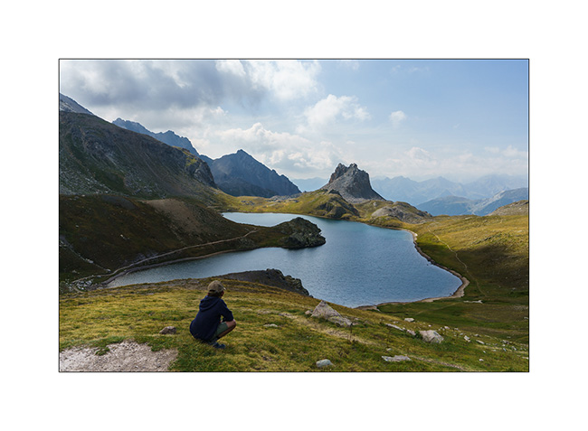
Lakes in Ubaye
We leave this beautiful place to discover others…
1. Going down from Colle Fauniera.
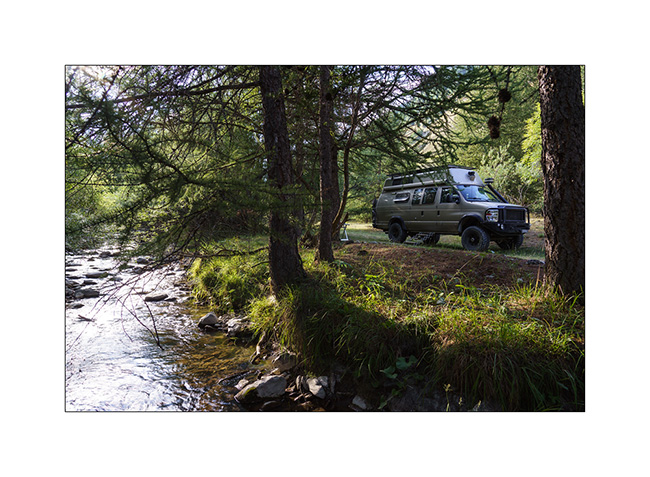
2. We find a boondocking place on the edge of a pretty river, very close to the French border from where we will hike tomorrow.
3. …
4. And we build a dam on the river!
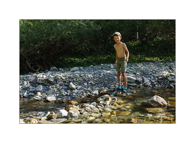
5. …
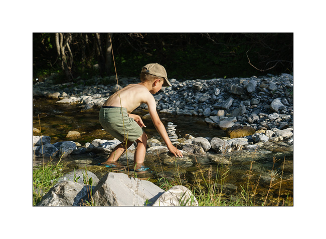
6. …
7. Leaving VivaLaVida early the next day for a nice mountain hike to discover several lakes.
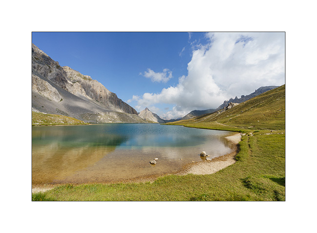
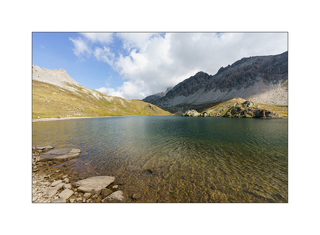
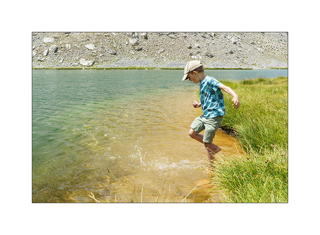
8. The goal of our day: the Lake of Roburent which I wanted to discover for a long time.
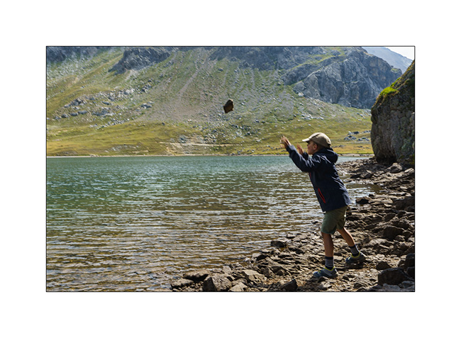
9. That’s where we picnic…
10. .. and Emile plays for a while.
11. We start the way back with a climb to the Col de Roburent.
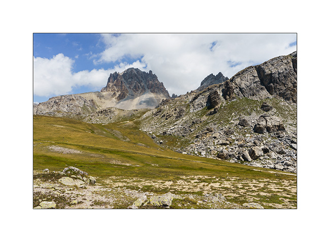
12. Emile frolics like a goat!
13. The valley we descend with the Lake of Orrenaye.
14. We stop there to refresh ourselves before returning to camp at the same place as yesterday…
Continuation and end of our three week trip shortly. 😉