lake
now browsing by tag
First steps with family
My passengers well landed, we discovered the Reykjanes peninsula together before going to Reykjavik the next day to buy warm jackets to Isabelle and Emile.
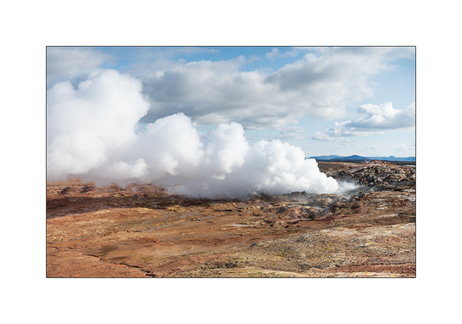
1. Volcanic activity is strong on this promontory.
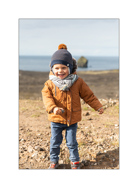
2. Emile is so happy to be back in “Dad’s truck”!
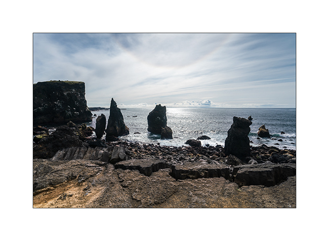
3. The lava that flowed to the sea creates beautiful cliffs.
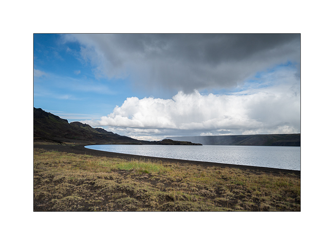
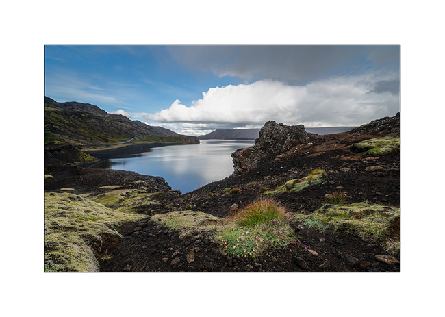
4. Beautiful lake of Kleifarvatn.
5. Despite some showers, the weather is rather beautiful but a little cold, about 46F.
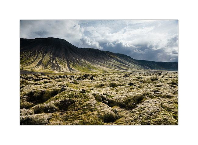
6. Lava fields covered with moss and lichen.
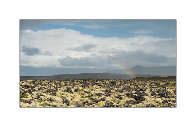
7. Iceland is undoubtedly the land of rainbows. 😉
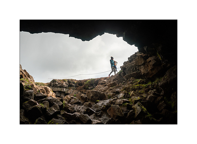
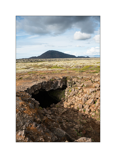
8. Lava tunnel.
9. There are many here.
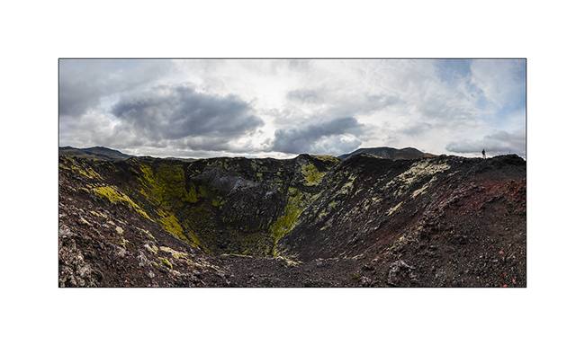
10. Assembly of 5 vertical images to show you a crater that appeared only a few hundred years ago.
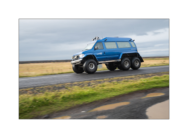
11. After some shopping in Reykjavik, we had a very rainy day stretching the road on the South coast. We cross famous vehicles transformed to ride on the snow. Here, a van similar to VivaLaVida but mounted on huge wheels! VLV looks small compared.
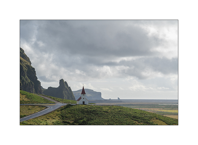
12. The small church of Vik.
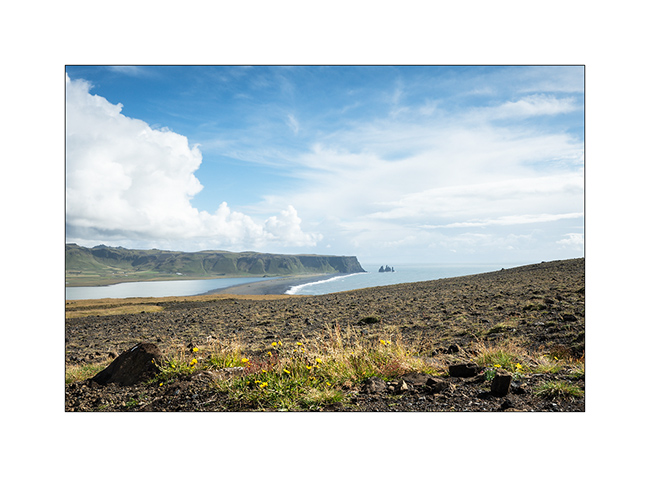
13. Dyrhólaey Promontory and its two natural arches.
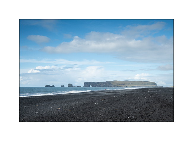
14. Even if the site is very touristy, we take a walk to the Reynisfjara Beach and its needles.
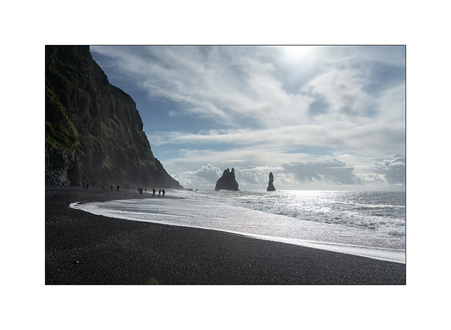
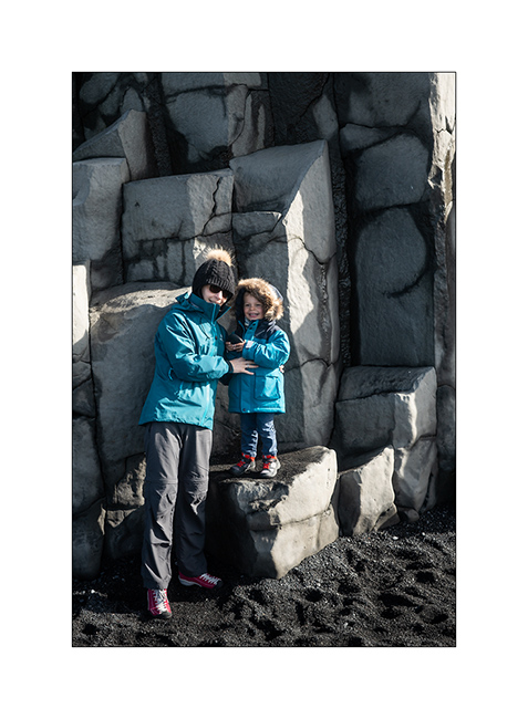
15. Souvenir on the famous basalt pillars.
16. Dyrhólaey Beach.
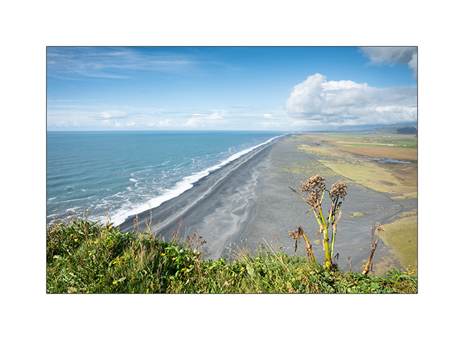
17. On the other side, Reynisfjara.
More of the South Coast in the next update…
Faroes (II)
Here is the continuation of my discovery of the Faroes. These islands are right in the Gulfstream, this warm oceanic current which gives to Scandinavia and more largly to Europe its temperate climate compared to its latitude. As a result, average temperatures vary very little between summer and winter: 48-50 F in summer and 37-39 F in winter. On the other hand, there is on average between 260 and 280 days of rain per year and 300 days with wind! VivaLaVida stopped there for only three days but was treated to her part of rain, sometimes fine drizzle, sometimes heavy rain. No wonder the mountains are dripping everywhere! There is not 100 yards without a stream that comes down.
I took advantage of the good weather of the first day to discover two spots among the best known of these islands…
1. On my way, the wind creates clouds on the cliffs…
2. First spot: Lake Leitisvaten, the largest lake in the Faroes, perched about 40 yards above the ocean !

3. It flows into the Atlantic by a beautiful waterfall.
4. The cliff that I climb is impressive! The silhouette at the top gives the scale, well… if you can see it! 😉
5. From the top, the panorama is breathtaking! This image is an panorama of 4 vertical images.

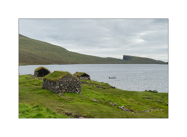
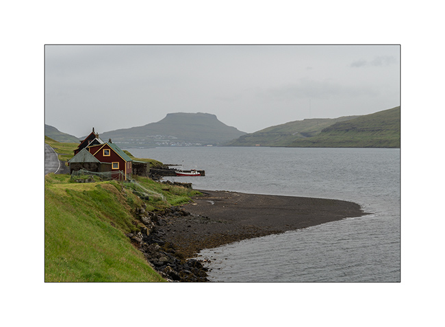
6. Traditional boat garage along the lake, on my hike back.
7. Continuing the road to the North, I discover this small village, just lovely… In the distance, the arch of Drangarnir.

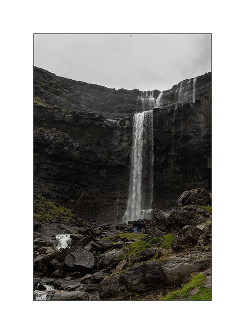
8. And here is the second must-see spot: the Gasadalur waterfall. The small village of the same name was one of the most isolated of the Faroe Islands until the construction of a tunnel in 2006. Before, the only way to reach it during winter was the sea where a summary natural harbour allowed small boats to land by nice weather. In 1962, the village remained isolated for more than 5 consecutive months because of a series of Atlantic depressions.
The waterfall is 50 yards tall.
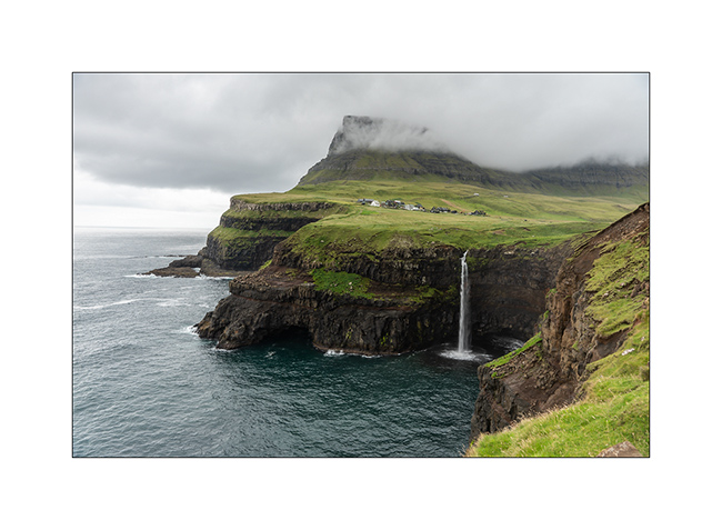
9. View from the top of the waterfall, with at the foot of the cliff, the rocks that allowed the landing…

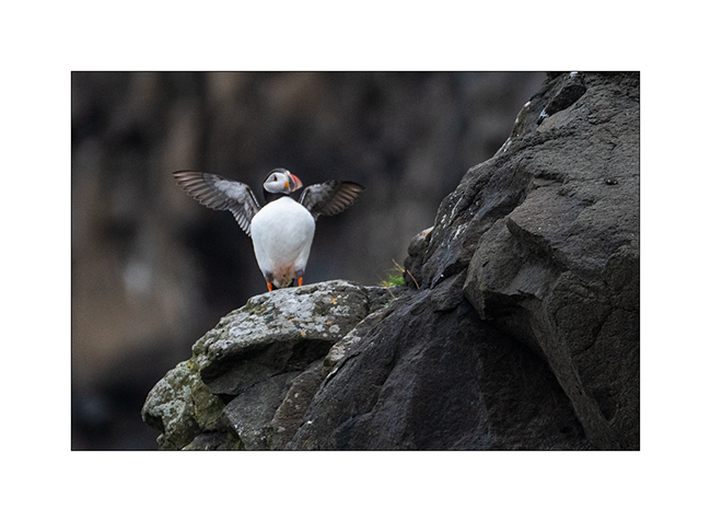
10. First meeting with the puffin in the cliffs…
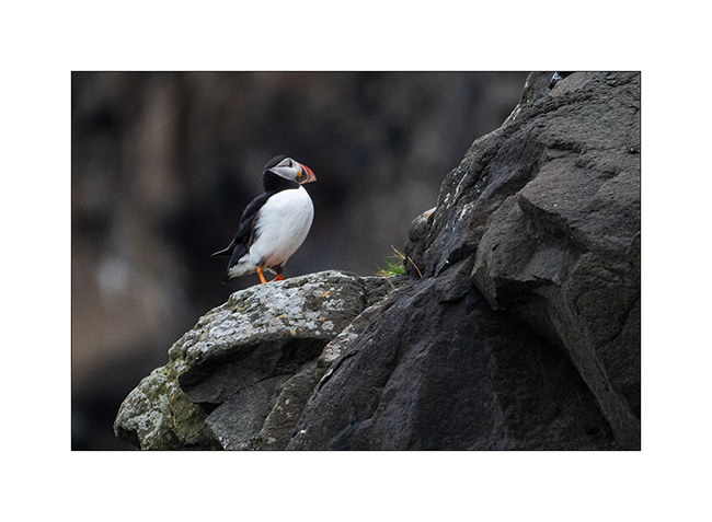
11. What a beautiful bird!
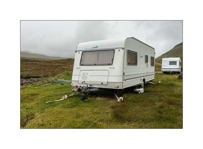
12. Here, people attach caravans so they cannot fly on windy days, that means everything!
13. Going up a fjord towards the village of Tjornuvik.
14. Waterfall along the VivaLaVida’s way.
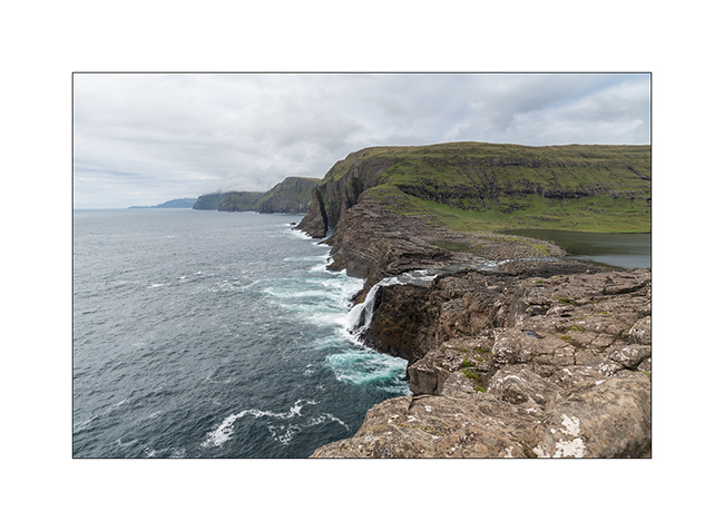
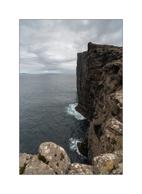
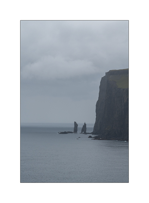
15. Cliffs in the rain. The Faroe Islands have among the highest cliffs in Europe. Some are half a mile high.
In the next update, I will show you the black beach of Tjornuvik and other parts of these beautiful islands. Stay tuned!
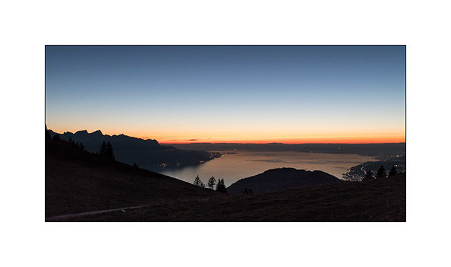
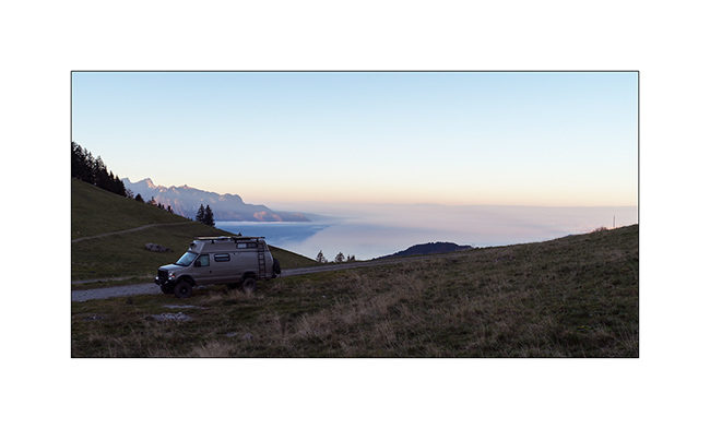
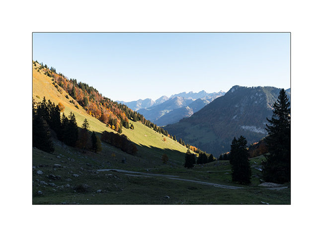
Swiss Alps.
A short overnight getaway to the Pass of Jaman, with a magnificent view.
1. Sunset over Geneva Lake.
2. Chilly awakening for VivaLaVida.
3. Intyamon side view.
4. Descent on alpine paths…
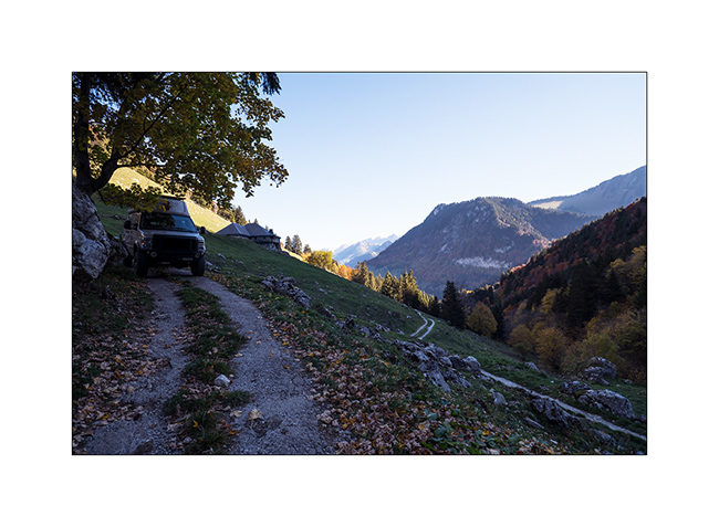
That’s all for today. But there is another week-end gateway coming soon…
Stay tuned 😉
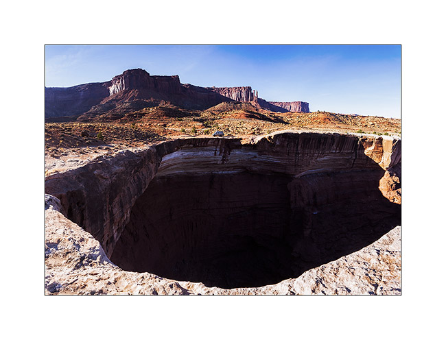
Still Canyonlands…
No way to risk to stay stucked in so much snow, I preferred not to cross the pass that would lead me to the other side of the La Sal Mountains and went to Warner Lake driving around the mountains. I already discovered this little mountain lake in a previous trip and wanted to see it in its winter coat.
1. Late afternoon light on the Warner Campground, obviously empty at this season.
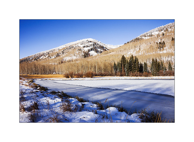
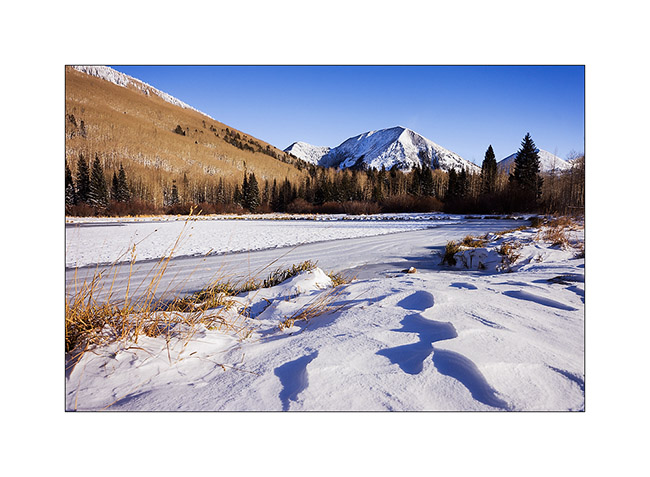
2. Beautiful frozen Warner Lake.
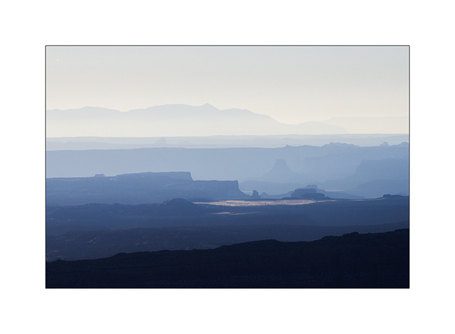
3. As the weather forecast indicated 12 F in Moab, over 3,000 meters below, I went down for me to find a campsite less exposed to cold. The view over Canyonsland and Henry Mountains, over 0 miles away, was splendid.
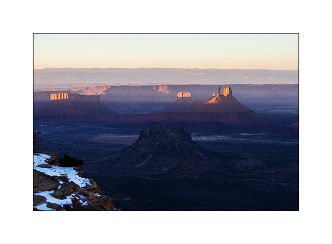
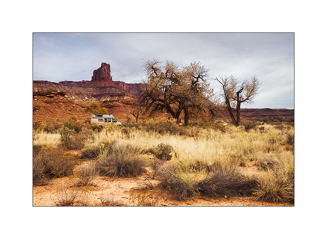
4. I found a better sheltered spot above Sand Flat, near an overlook over Castle Valley, a picture of the Far West at sunset…
The next day, session welding because I discovered that the bracket supporting the engine preheater was broken. Again and again the vibrations of the dirt roads… So I went late to Long Canyon.
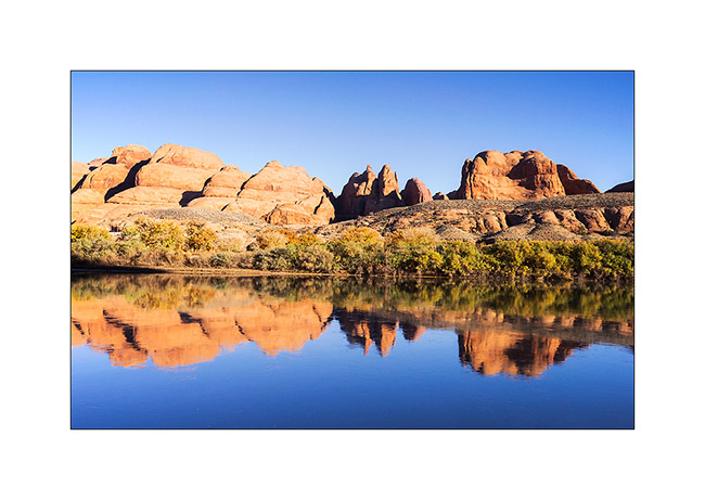
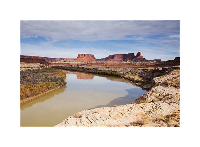
5. The Colorado River reflecting the Moab Rim.
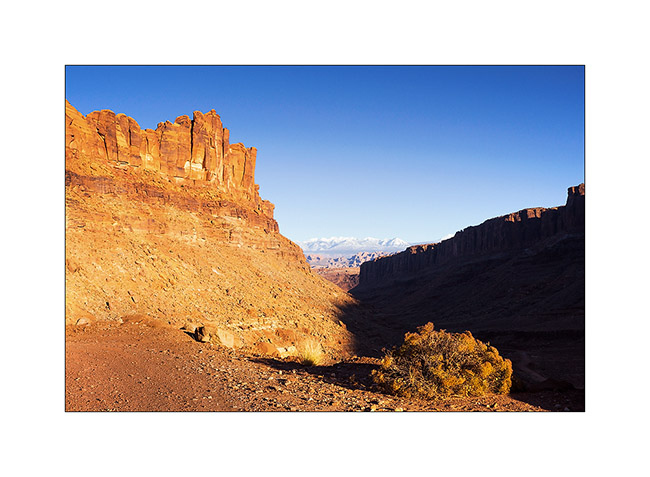
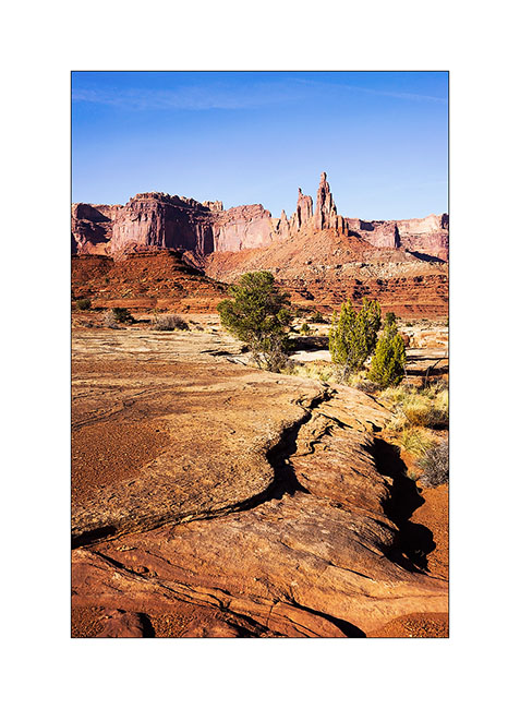
6. Going up in Long Canyon, With La Sal Mountains in the back.
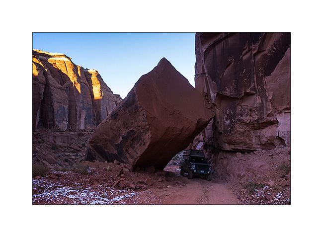
7. The famous spot in Long Canyon ; Souvenir photo stop required! 😉
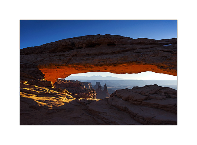
8. The next morning, I got up early to go to Mesa Arch at sunrise. A photo that I’m not the first to do but I like it…
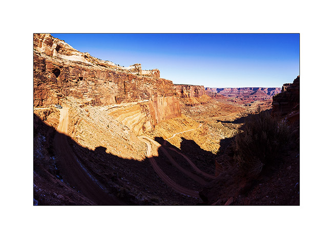
9. VivaLaVida then went down the Schafer Trail to get to the White Rim Trail. Beautiful downhill in the vertical walls! VLV is quite small up there…
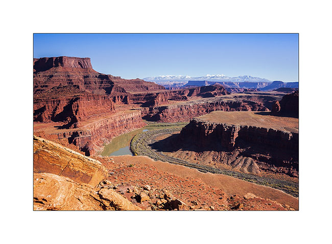
10. One of the meanders of the Colorado from the White Rime Trail.
11. Self-portrait at Musselman Arch, quite aerial… 😉
12. The towers that appear Under Mesa Arch, but this time from the bottom.
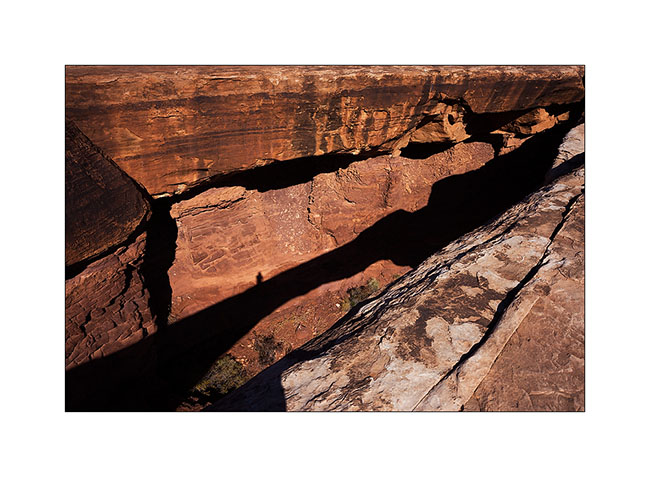
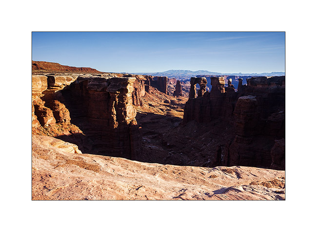
13. One of the huge overhang that crosses the White Rim…
14. In Canyonlands, there are number of canyons and arches everywhere. The White Rim Trail takes its name from the clear limestone layer that it follows over 100 miles.
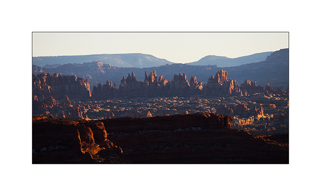
15. From Whitecrack Campground where I spent the night, Sunset over the 20 miles away Needles is gorgious.
16. Under windwos of VivaLaVida too !
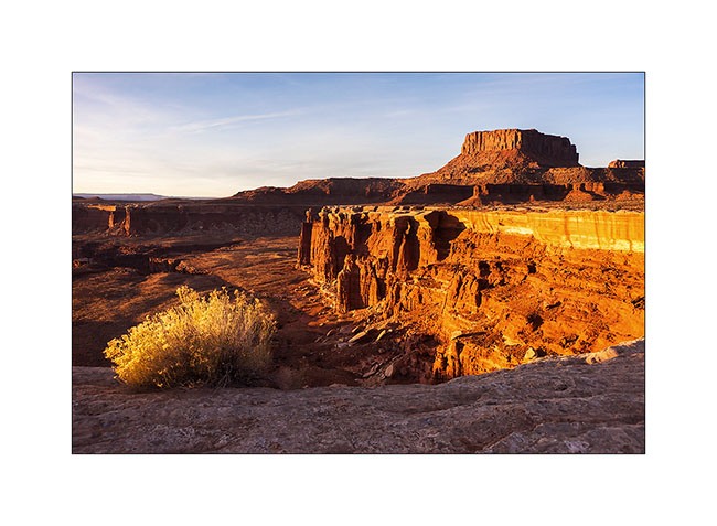
17. Almost the same colors at sunrise…

18. Another of theses giant overhansg with Candelstick Butte in the back.

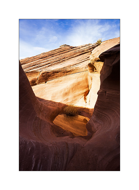
19. A small slot canyon I visited along the trail…
20. I rediscover the Green River…
21. Luch stop at Potato Bottom.
Continuation and end of the White Rim Trail in the next update.