cliff
now browsing by tag
Snæfellsness
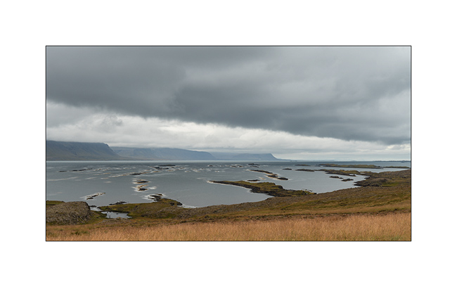
While there are only four days left before Isabelle and Emile go back, VivaLaVida hits the road to the touristic Snæfellsness peninsula and its various natural attractions.
1. Lava flows in the ocean.
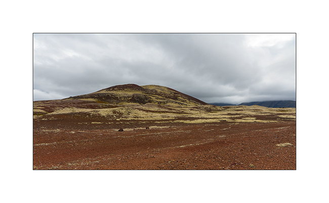
2. Recent volcanic geology…
3. … interspersed with a few small fjords.
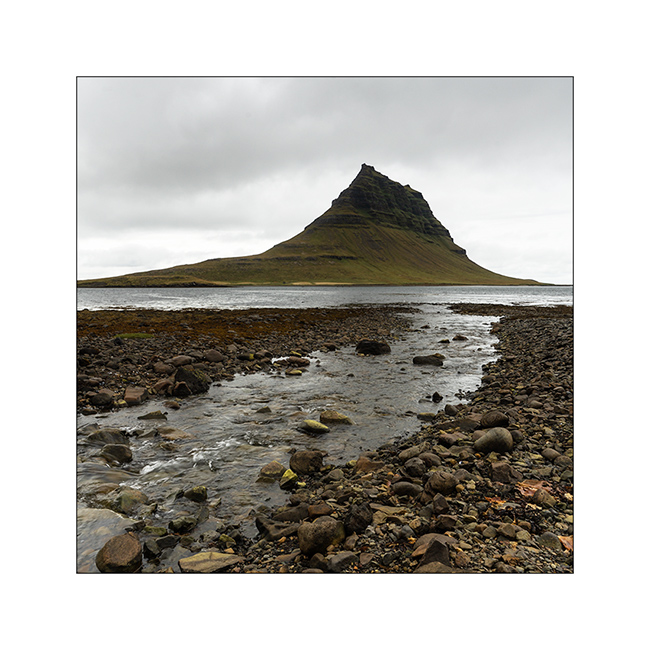
4. The famous Kirkjufell mountain, so photographed but invaded by mass tourism. I chose a different perspective, not doing the same as everyone else… 😉
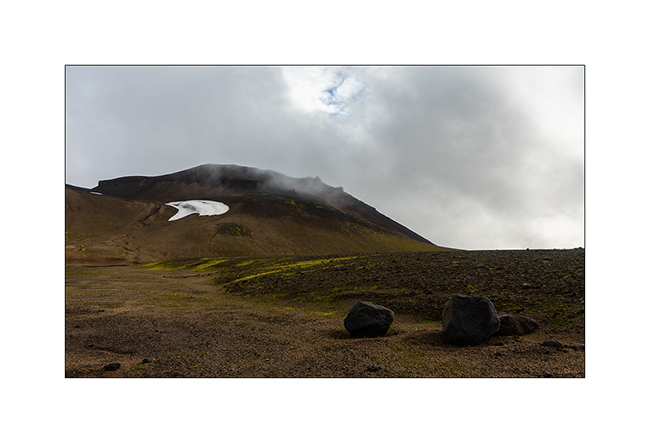
5. To escape the crowd, VivaLaVida climbs to the Snæfellsjökull ice cap for the night.
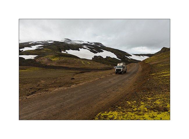
6. Camp at the crossroads of two deserted trails. Do you see VLV all the way down? 😀
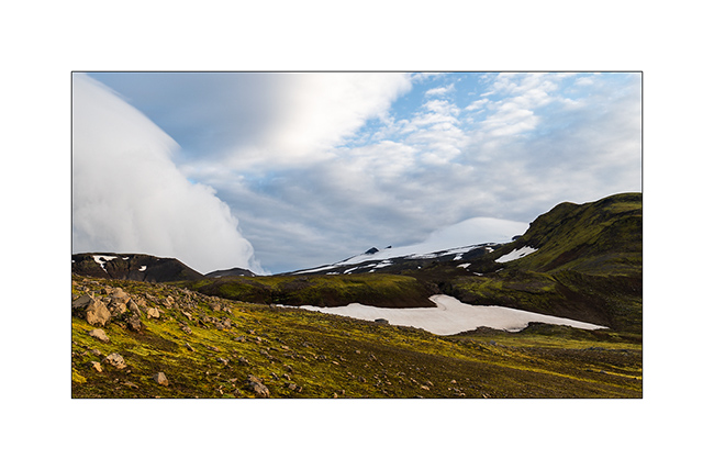
7. Wind clouds while many snowfields persist even if we are only about 2,000 feet above sea level.
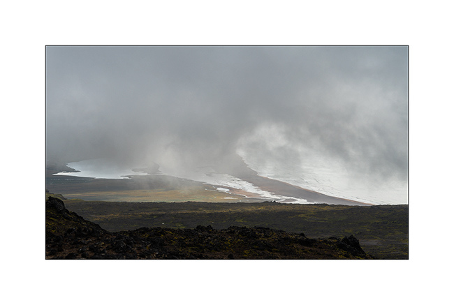
8. The next morning, the cap is hidden in the clouds, to the chagrin of Isabelle.
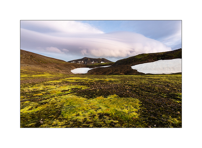
9. But the surroundings are worth seeing…
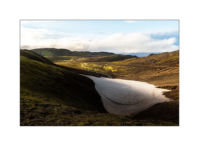
10. … and the view of the beach, 1,800 feet lower under the clouds, is beautiful.
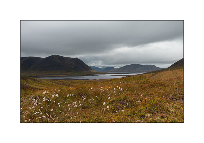
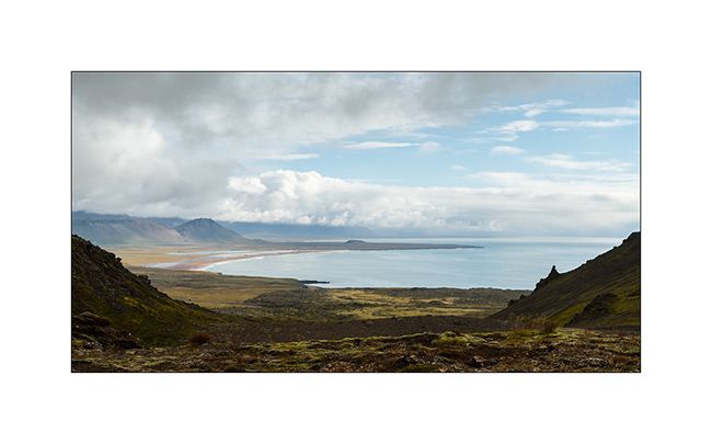
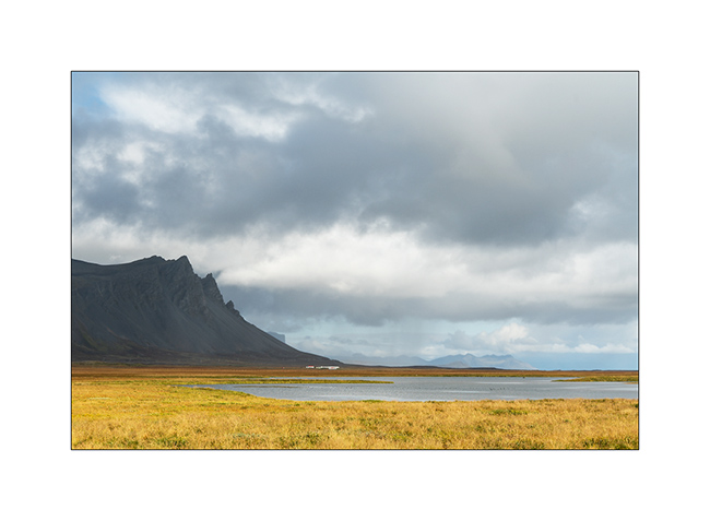
11. Peninsula South coast.
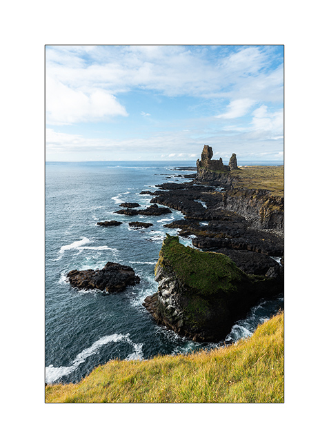
12. Another highly visited spot, the lava cliffs of Londrangar.
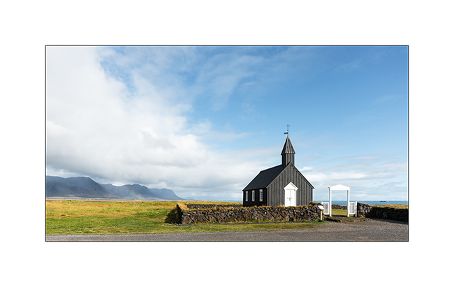
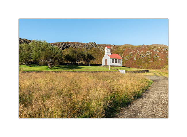
13. The cute little church of Búdir.
14. From the South Coast Road.
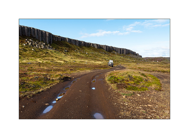
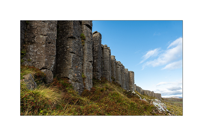
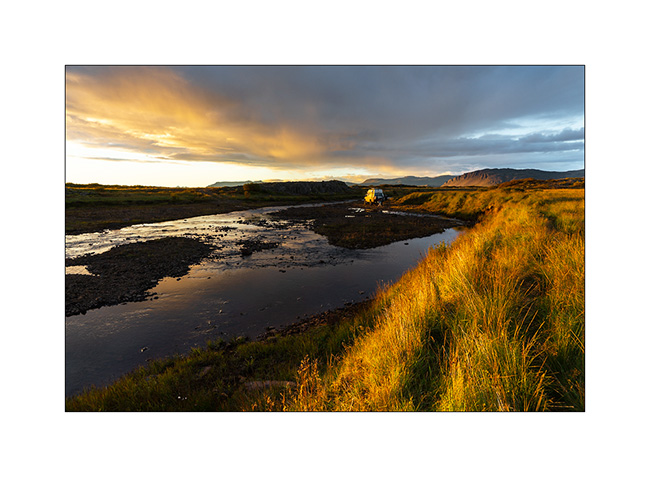
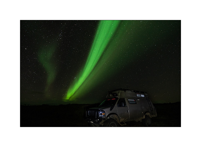
15. Stop near a spectacular wall of basalt columns.
16. These pillars, which have a penta- and hexagonal shape of approx. 3-5 feet in diameter, are between 20 and 60 feet high for their visible part.
17. We walk to a pretty little church nestled at the bottom of a crater.
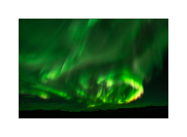
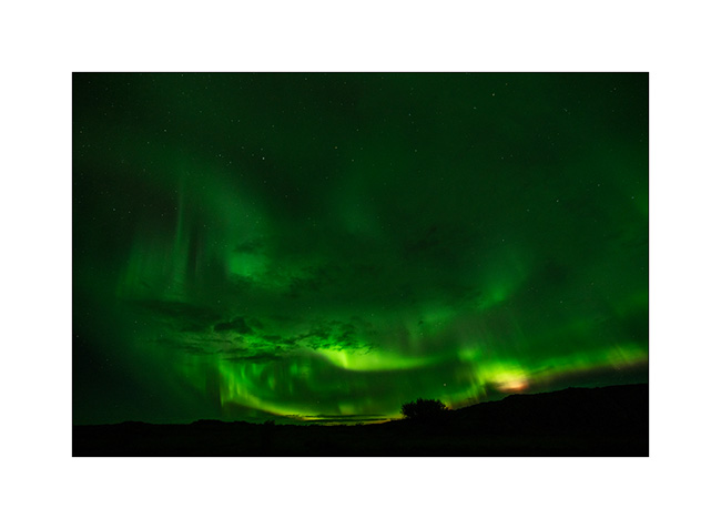
18. Wild camp at the edge of a small river…
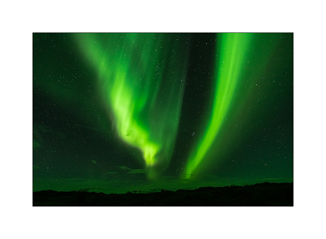
19. At 23:00, while I go out to do some natural needs, surprise, I discover a sky adorned with Northern lights…
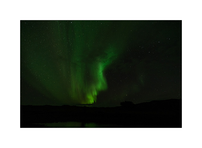
20. … as much in the Northeast as in the Southeast.
21. I hurry up to get camera and tripod. First of limited intensity, aurora intensifies while I frame VLV in the field.
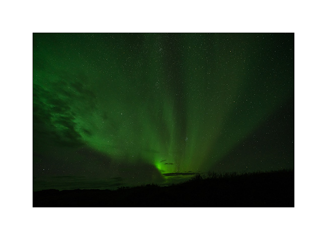
22. Then without warning, in a few moments, it becomes incredibly intense!
23. Colorful purple fringes appear.
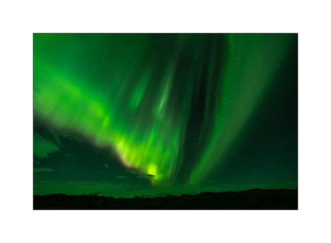
24. And the trails swirl at full speed throughout the sky.
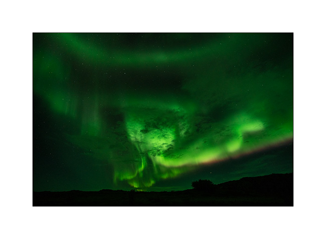
25. Even with an ultra wide angle lens mounted, I can only encompass part of it…
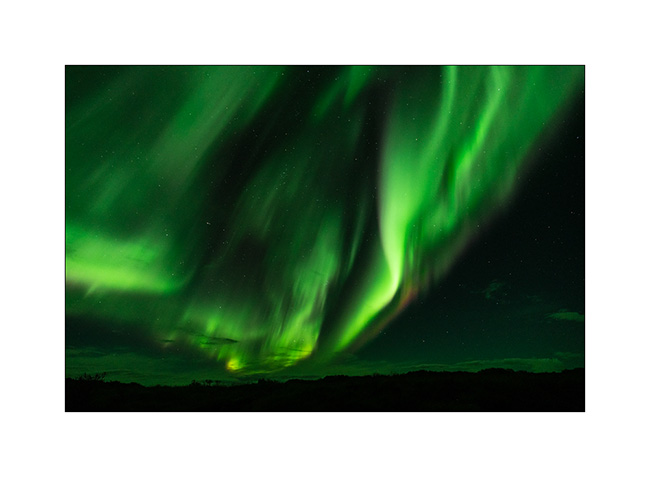
26. I constantly shoot to immortalize this moment of intense contemplative emotion…
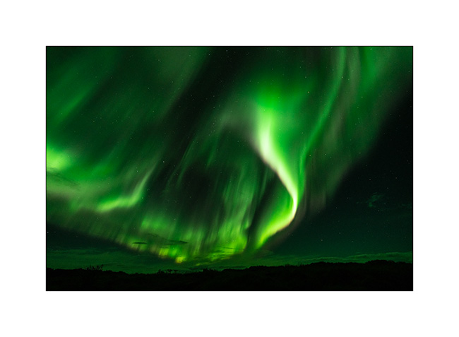
27. I feel so small under so much cosmic energy.
28. Then after a few minutes, the show calms down…
29. …
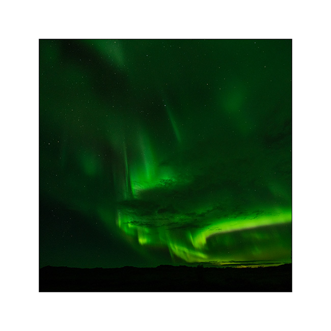
30. I had never been able to see a dawn so bright and dynamic aurora until then.
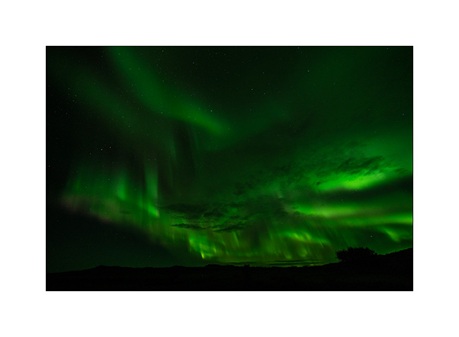
After more than two hours enjoying this beautiful surprise in the cold, frozen, I go back to bed and look forward to the heating in VivaLaVida…
Faroes (II)
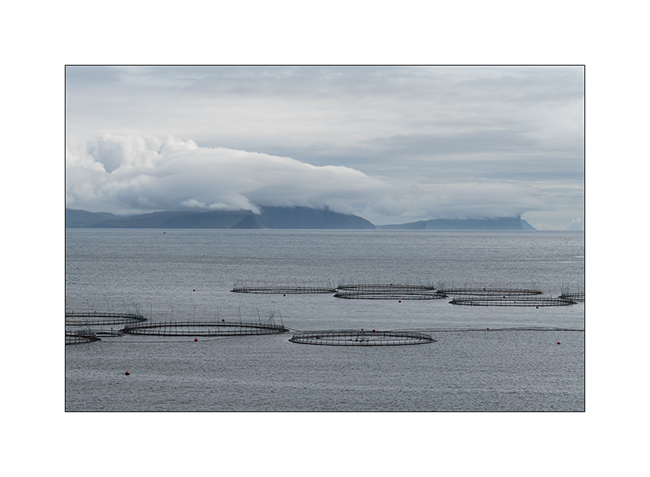
Here is the continuation of my discovery of the Faroes. These islands are right in the Gulfstream, this warm oceanic current which gives to Scandinavia and more largly to Europe its temperate climate compared to its latitude. As a result, average temperatures vary very little between summer and winter: 48-50 F in summer and 37-39 F in winter. On the other hand, there is on average between 260 and 280 days of rain per year and 300 days with wind! VivaLaVida stopped there for only three days but was treated to her part of rain, sometimes fine drizzle, sometimes heavy rain. No wonder the mountains are dripping everywhere! There is not 100 yards without a stream that comes down.
I took advantage of the good weather of the first day to discover two spots among the best known of these islands…
1. On my way, the wind creates clouds on the cliffs…
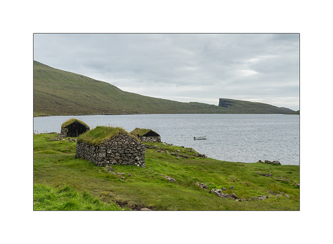
2. First spot: Lake Leitisvaten, the largest lake in the Faroes, perched about 40 yards above the ocean !

3. It flows into the Atlantic by a beautiful waterfall.
4. The cliff that I climb is impressive! The silhouette at the top gives the scale, well… if you can see it! 😉
5. From the top, the panorama is breathtaking! This image is an panorama of 4 vertical images.

6. Traditional boat garage along the lake, on my hike back.
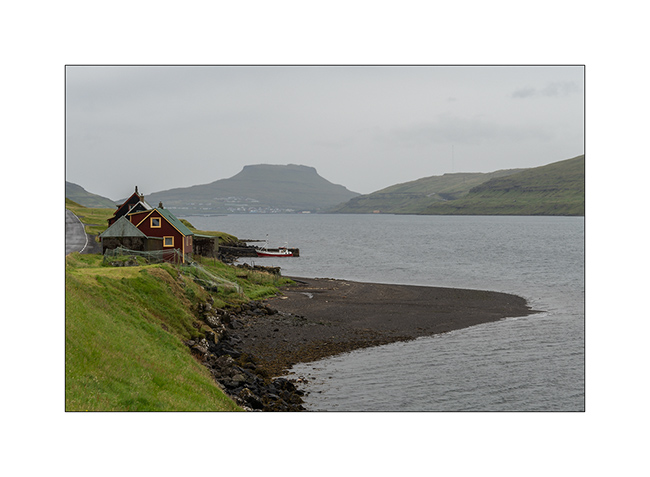
7. Continuing the road to the North, I discover this small village, just lovely… In the distance, the arch of Drangarnir.

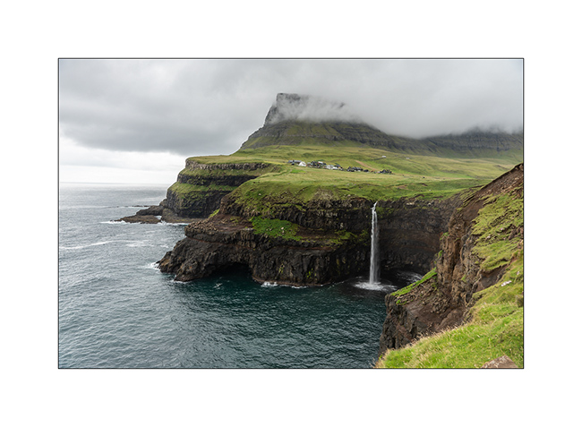
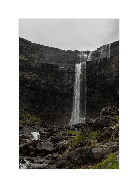
8. And here is the second must-see spot: the Gasadalur waterfall. The small village of the same name was one of the most isolated of the Faroe Islands until the construction of a tunnel in 2006. Before, the only way to reach it during winter was the sea where a summary natural harbour allowed small boats to land by nice weather. In 1962, the village remained isolated for more than 5 consecutive months because of a series of Atlantic depressions.
The waterfall is 50 yards tall.
9. View from the top of the waterfall, with at the foot of the cliff, the rocks that allowed the landing…

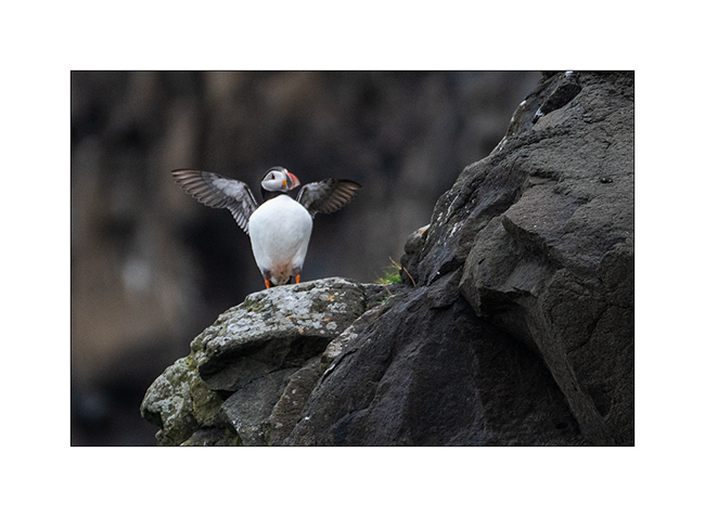
10. First meeting with the puffin in the cliffs…
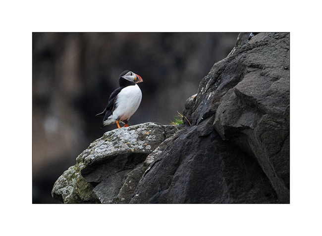
11. What a beautiful bird!
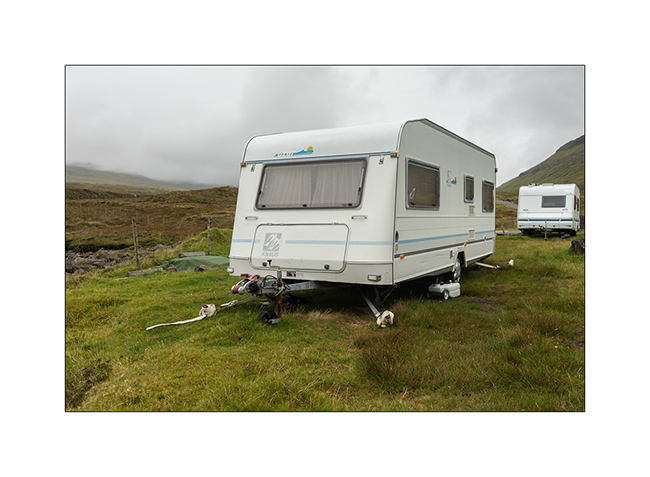
12. Here, people attach caravans so they cannot fly on windy days, that means everything!
13. Going up a fjord towards the village of Tjornuvik.
14. Waterfall along the VivaLaVida’s way.
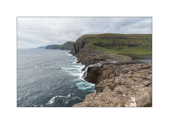
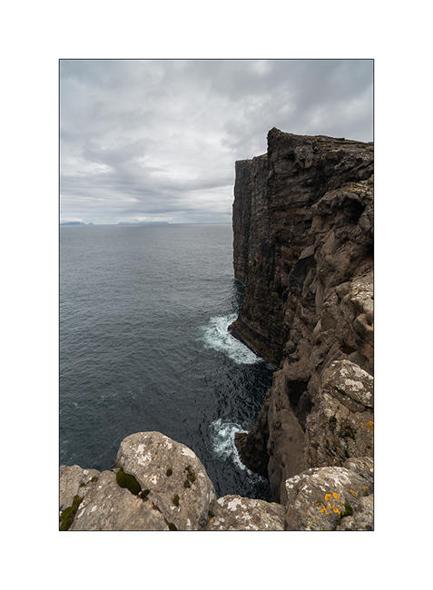
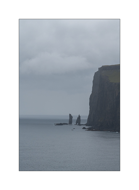
15. Cliffs in the rain. The Faroe Islands have among the highest cliffs in Europe. Some are half a mile high.
In the next update, I will show you the black beach of Tjornuvik and other parts of these beautiful islands. Stay tuned!
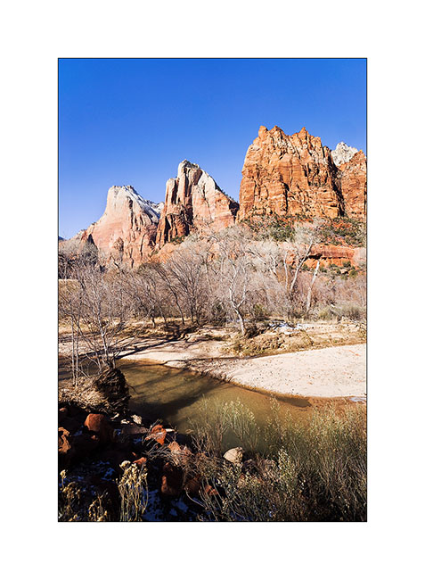
Zion National Park…
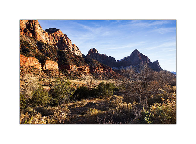
While I’ve been in Utah a few times, I had never gone through Zion yet. The upper third of these mountains consists of Navajo Sandstone. It is a very touristy place and I took advantage of the off-season to discover it.
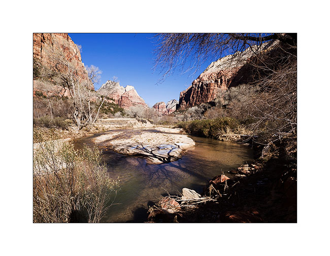
1. Going up in Zion Canyon, accessible by a paved road.
2. Cottonwoods don’t have leaves anymore in this season.
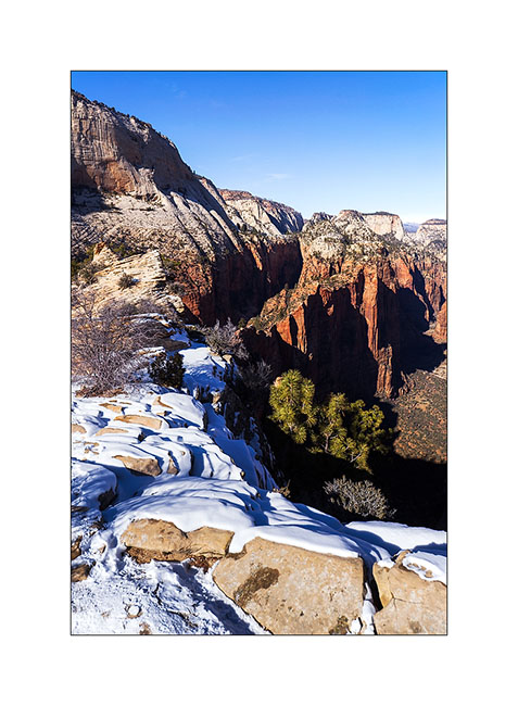
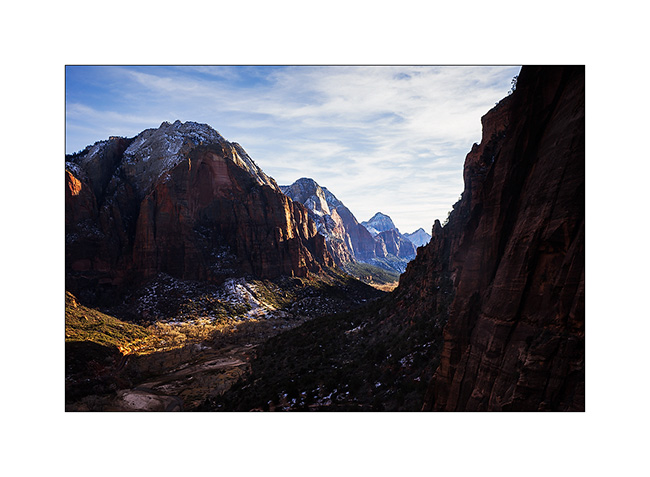
3. Angel Landing. For those who know it, climbing this edge while rock is covered with snow and ice is quite… well… aerial! 😉 I must say that there are a few hundred feet of emptyness on each side and that certain passages are not more than five feet wide.
4. Hiking the West Rim trail…
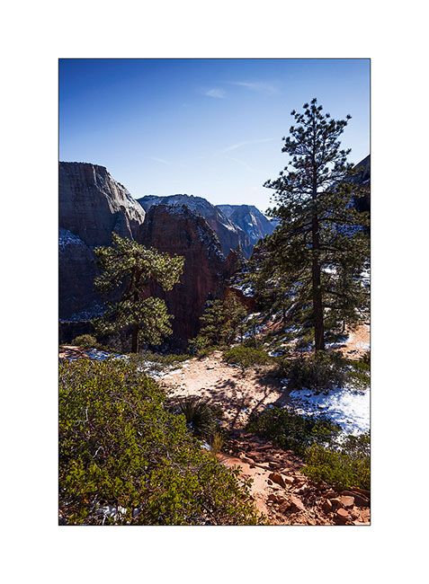
5. Top left, the edge by which one accesses Angel Landing.
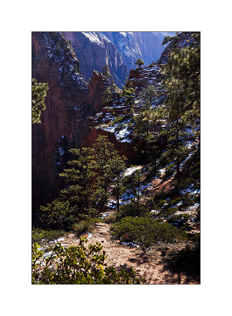
6. Reaching Navajo sandstone in characteristic light color.
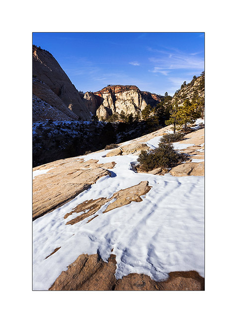
7. Toward South…
8. Lower Zion Canyon in late afternoon.
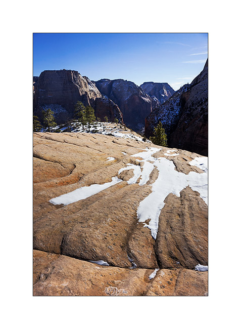
9. From my camp… 😀
The next morning, after obtaining the required permit because the hike is quite engaged, I went for a long hik of about 14 miles. Rather than hiking, I should say a gymkhana! Except for the first two miles, it’s going upstream in a torrent crowling large blocks, constantly going up and down, crossing fifteen times the water at 37F, skating on snow and ice, without any sun… In short, something not to recommend to anyone, especially in this season. Moreover, the ranger looked at me with surprised eyes when I asked him for the permit, saying: “Do you really want to go ther in this season?”. 😀
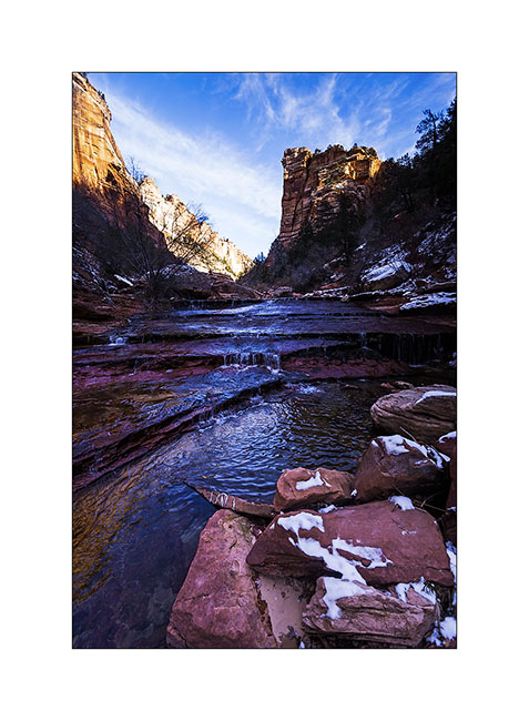
Why this hike you might think. To exploreng a rather exceptional slot canyon, the “Subway” as it’s called.
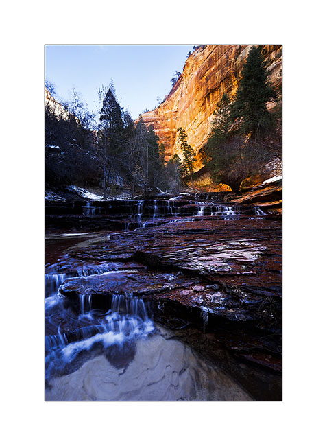
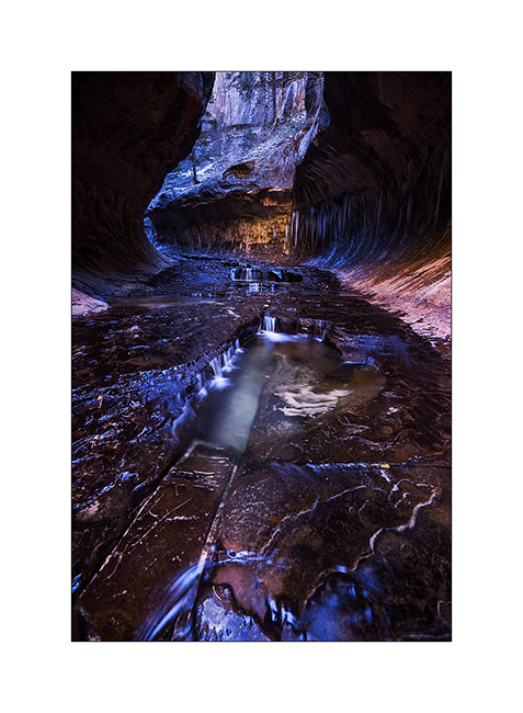
10. While there is still about 2 miles to go, the canyon is still open and small waterfalls jump down rock stairs.
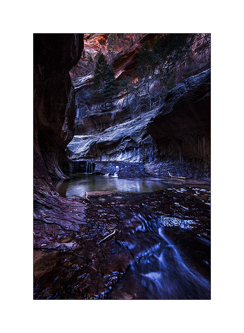
11. The most photographed waterfall, less than 1 mile down the slot canyon.
12. Here is the entrance of the slot canyon with its characteristic form that earned it its name.
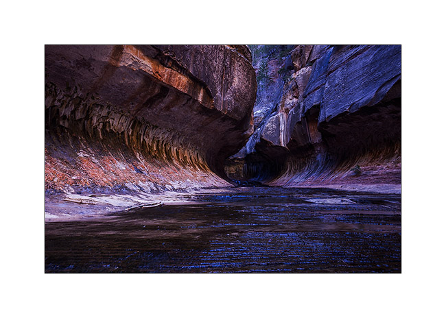
13. Floods of the river dug a kind of tube-shaped hose.
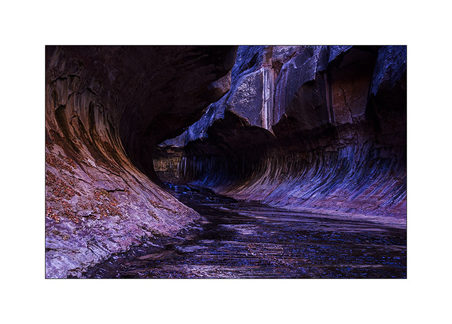
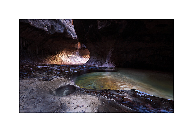
14. The “turning” from downstream.
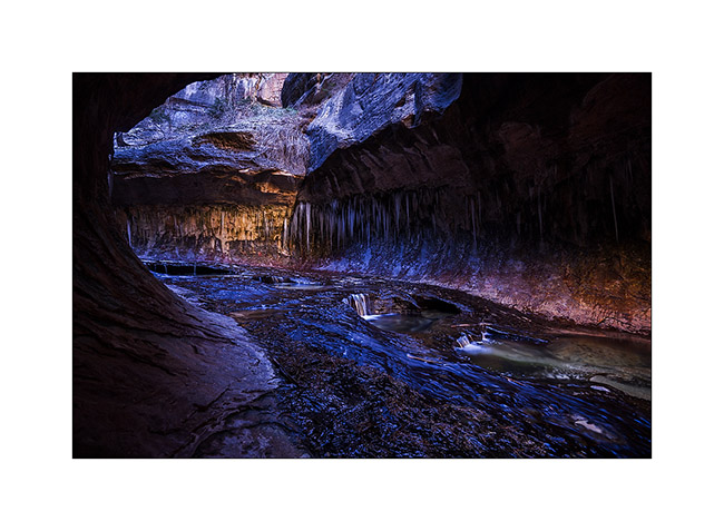
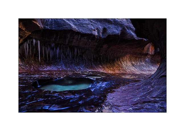
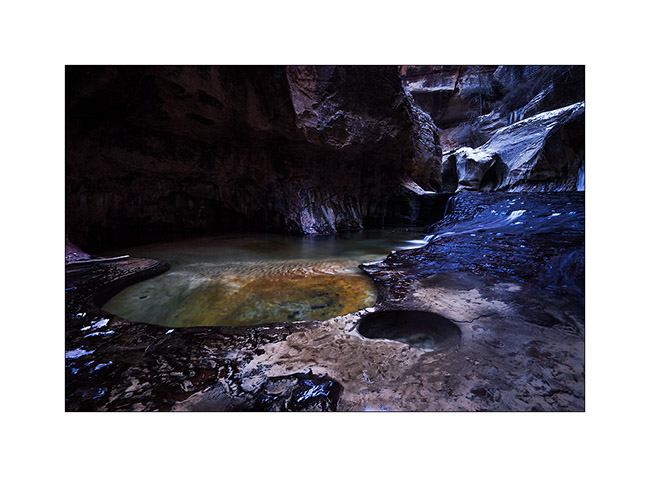
15. Small waterfalls dug a series of pots where the water is emerald.
16. Above, the canyon reopens before closing again. It requires climbing equipment to continue.
17. Beautiful pots.
18. The turning from upstream.
19. Coming out of this incomparable canyon…
That’s it for today! 😉
To be followed in some days…