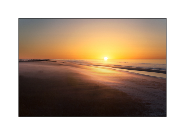
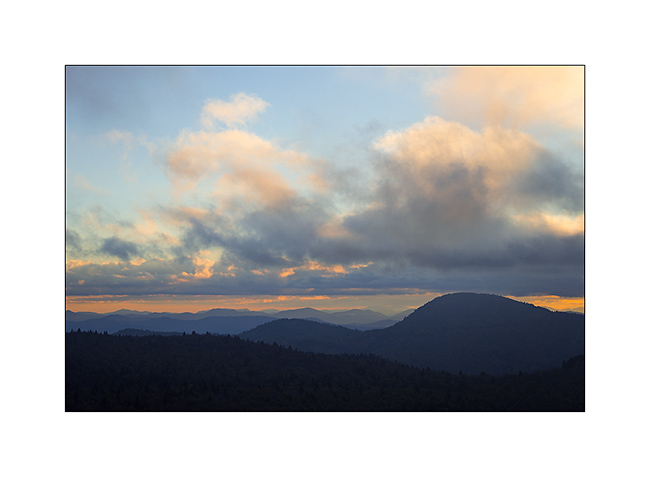
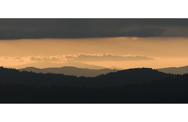
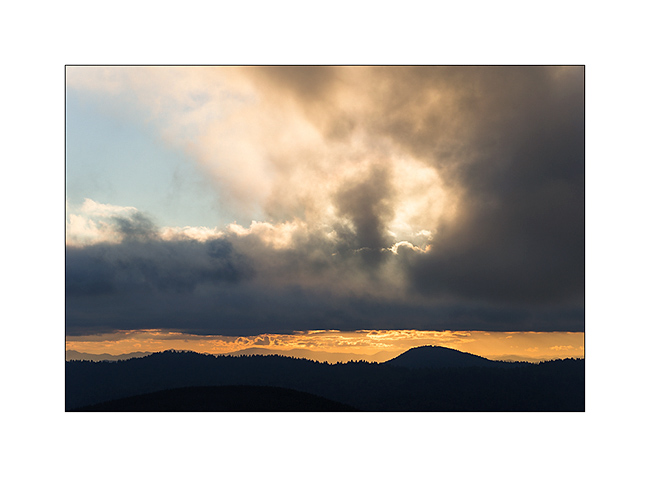
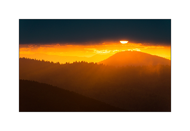
sunset
now browsing by tag
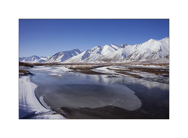
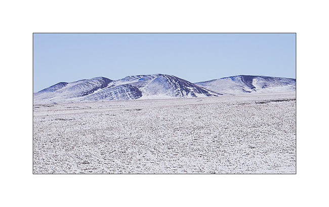
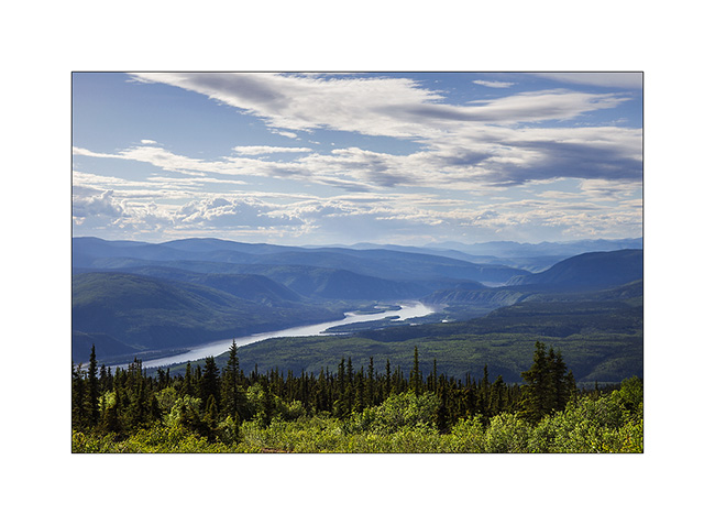
In Canyonlands area…
I went to see other places in Canyonlands NP, first in the beautiful Lavender Canyon.
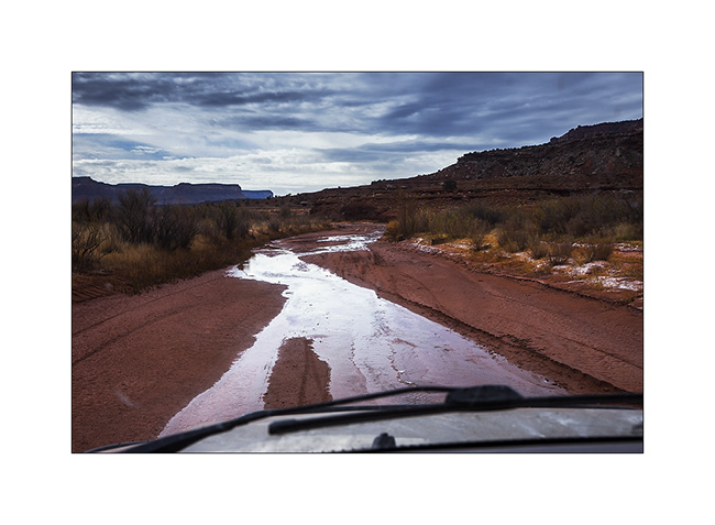
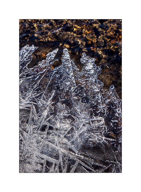
1. The access road goes nearly 20 miles up in a wash. There is some water, partially frozen in places, witness of the recent weather disturbance (the one I had at Black Rock).
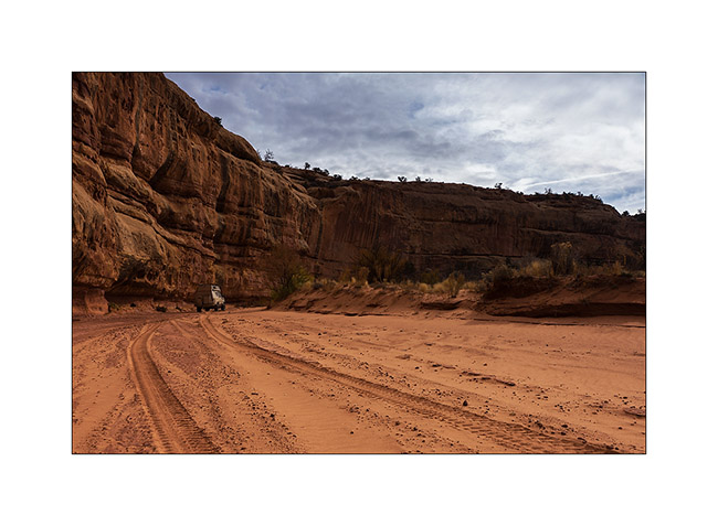
2. VivaLaVida is small under the vertical cliffs of the canyon.
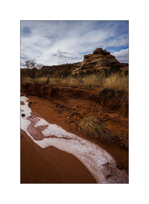
3. Only way to show you that it’s cold in the desert too…
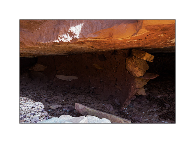
4. In a side canyon that leads me to Long Arch, I discovered some remains of an Indian granary dating from approx. 2,000 years.
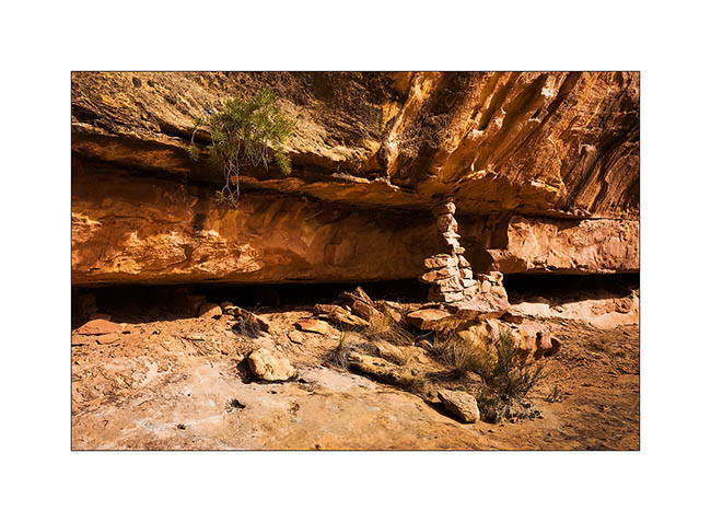
5. They protected their harvest by sheltering it in cliff cavities, closing access to rodents using mud and stones.
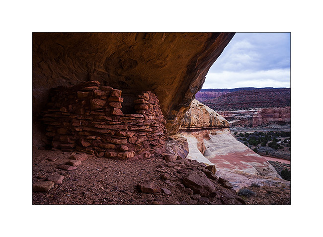
6. Further in the West Fork Lavender Canyon, I discovered a nearly complete shelter in half-wall height.
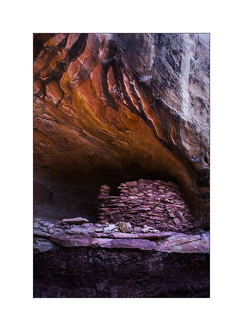
7. It will take me several attempts to find a path leading to it.
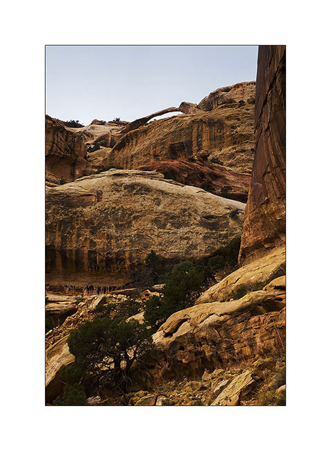
8. After three hours of hiking, I discovered the elegant Long Arch, little known because really remote. I’ll have to study the map to see if there is way to access from the top because no way to get closer down here.
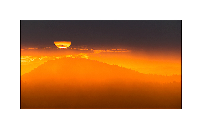
9. I take some showers of sizzles on the way back. But at sunset, a short ray colored cliffs around in this amazing red .
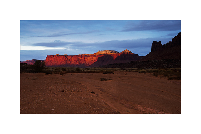
10. After a day of transition, I went to sleep at Anticline Overlook to enjoy the morning light.
11. Scenry over Hourah Pass and Moab Rim is impressive.
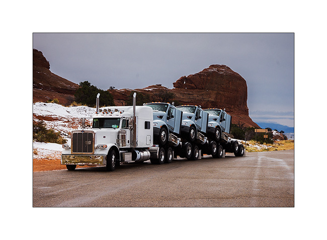
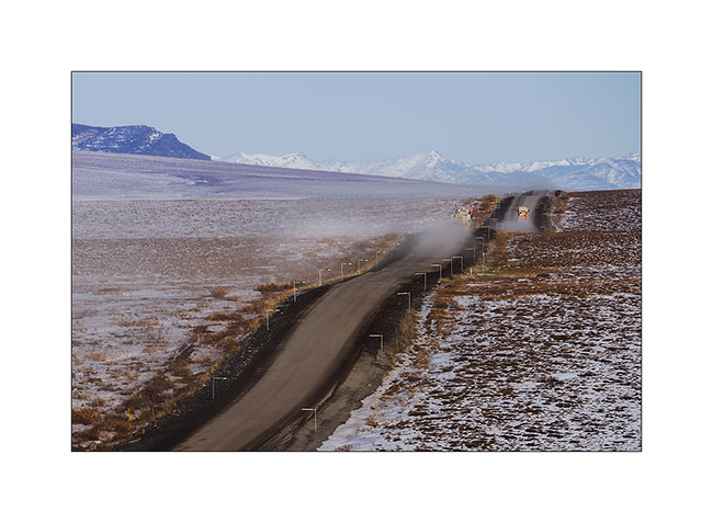
12. The weather get cloudy again and showers of rain/sleet follow one another. But I stop to show you how they transport trucks here! 😀
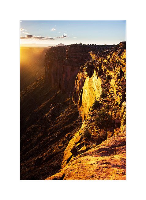
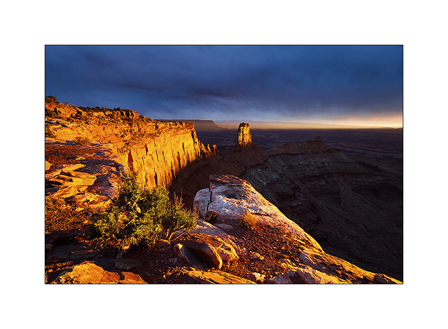
Having spotted the previous day an interesting point of view, I tried the gamble to go there for the sunset despite the rain and stormy Wind that got up, hoping for a sunray at sunset. The track was very bumpy and almost 20 miles long, VLV needed two hours to get to.
Arrived there at around 4PM, I went locate places to try to find a nice composition, aware that if there would be some sunlight, it would be brief. I finally found a composition I like, not without some apprehension because I was on a block overhanging a 600 feet cliff. It’s 16:30, I sit nearby and wait. It is downright cold and I’m beginning to think that I have come all this way for nothing…
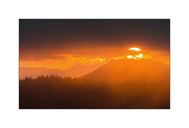
But ultimately, the Gods of Light rewarded me with a moment of insane intensity! It did not last five minutes, just long enough for the sun to go under the clouds before to set. But the light was so intense, contrasting with the dark and low snow skie, gilding the cliff in a so bright yellow-orange..! A moment of pure happiness for my photographer’s eye. 😉
13. Firing…

14. Bis.
At once I prepared a luxury aperitif before processing these images… 😉
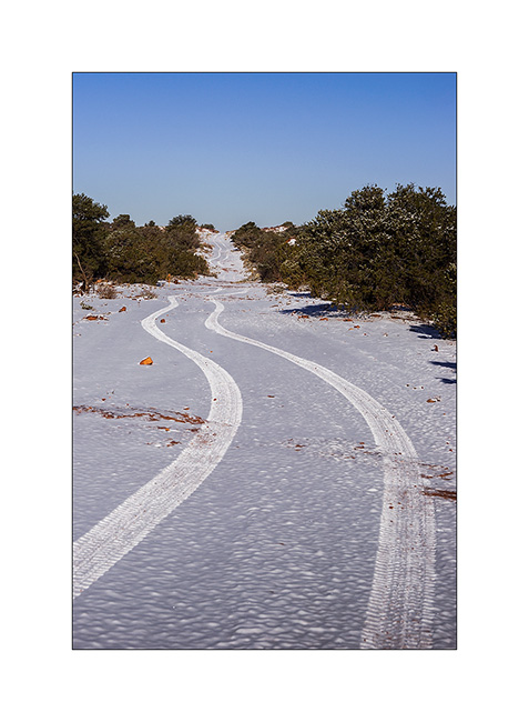
15. The next day, the snow has changed the appearance of the place.
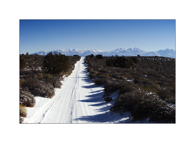
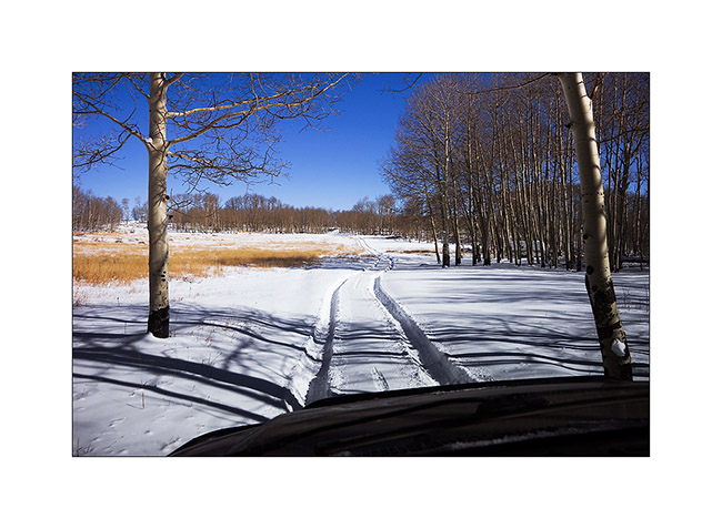
16. The track of VLV, alone on snow, as a symbol of her journey, often trough almost desert places…
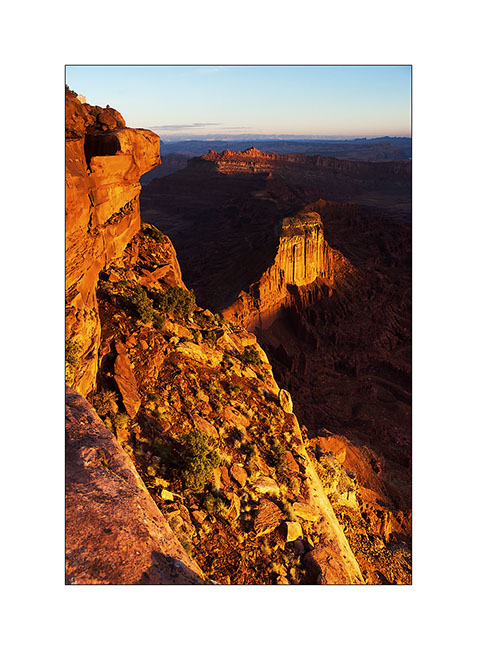
17. Contrast with the red sandstone is striking. Here, the small arch of Looking Glass Rock.
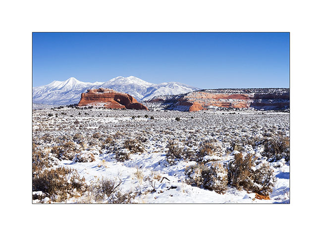
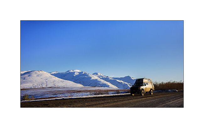
18. VivaLaVida is then went in the La Sal Mountains for a taste of winter.
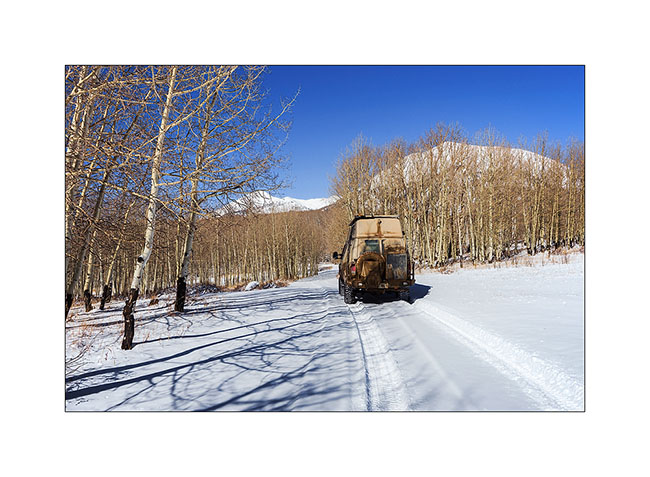
19. Aspens have lost their leaves for some time but proudly raise their silhouettes in the sky.

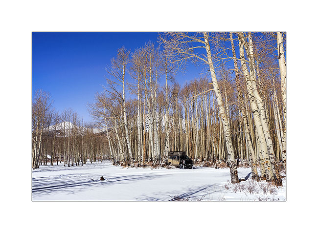
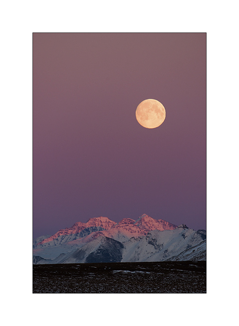
20. There was too much snow for me to cross the La Sal Pass, I had to turn back.
21. Nice place for a small lunch, isn’t it? 😀
More in the next update…
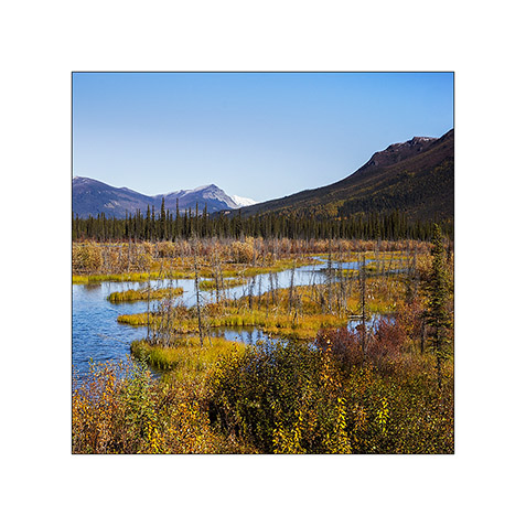
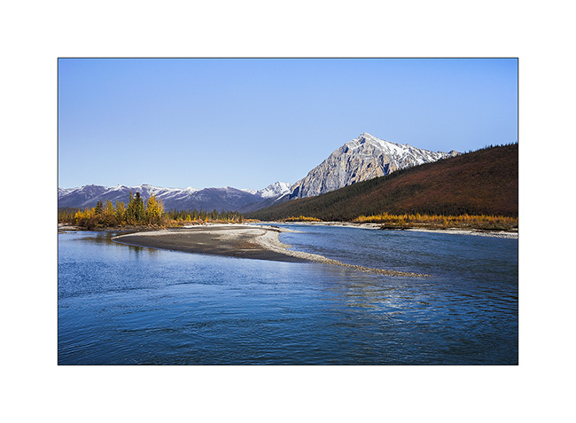
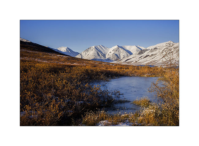
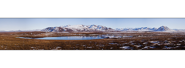
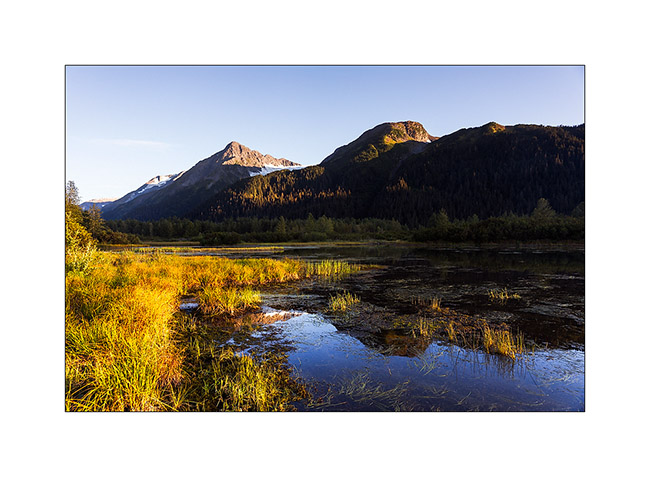
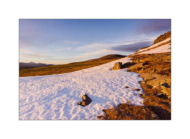
Brooke Range and arctic tundra
We continue farer northward…
1. Nolan valley, a side valley accessible by a really muddy small mining road .
2. At this altitude, the marshes are still not frozen.
3. I found the Brooke Range that bars northern Alaska back.
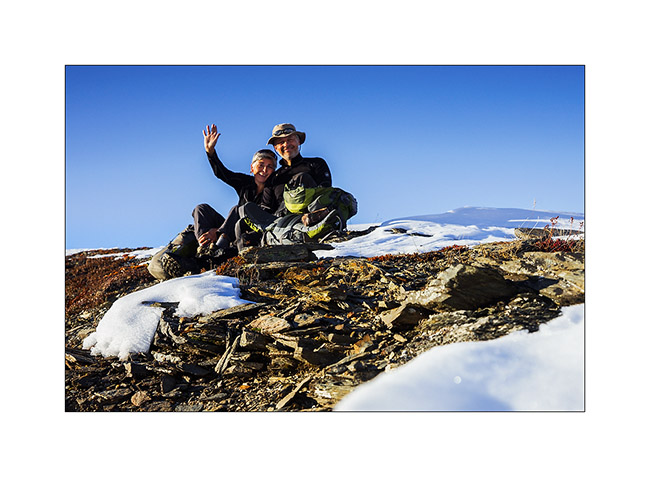
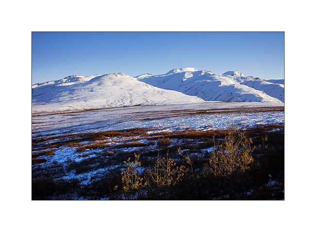
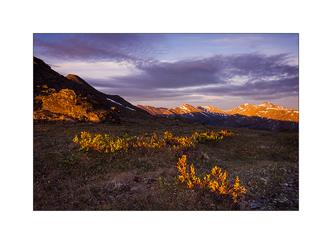
4. We stop a few dozen miles after Coldfoot to go climbing one of the mountains beside the road.
5. While VivaLaVida begins to climb Antigun Pass, the atmosphere becomes wintry.
6. All is already frozen here…
7. … and it is already well below freezing in late afternoon.
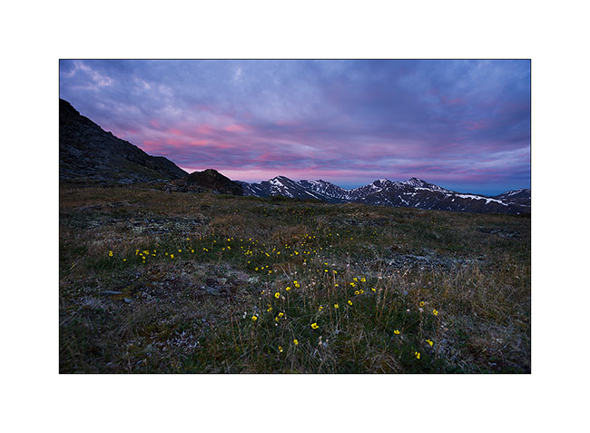
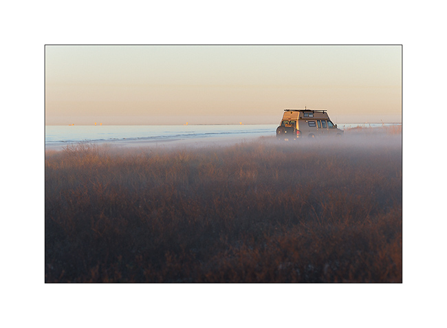
8. As it’s already late, we find a nice boondocking site before Antigun Pass, approx. 4,000 feet elevation on the banks of a small river.
9. Despite the cold, I’m going to make some pictures while Mino is preparing the aperitif!
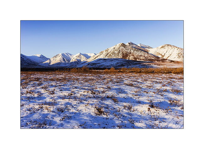
Temp will almost reach 10°F that night and VLV’s heater resume service after resting for a few months…
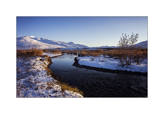
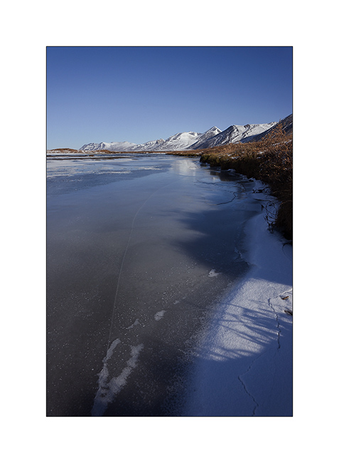
The next morning we cross the Antigun Pass and stop thirty miles down it to go hiking along a beautiful river.
10. The blizzard that blew here two days previously installed winter before autumn has arrived…
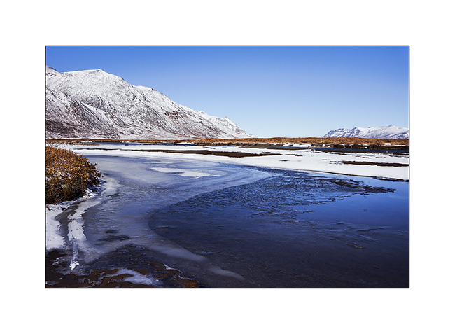
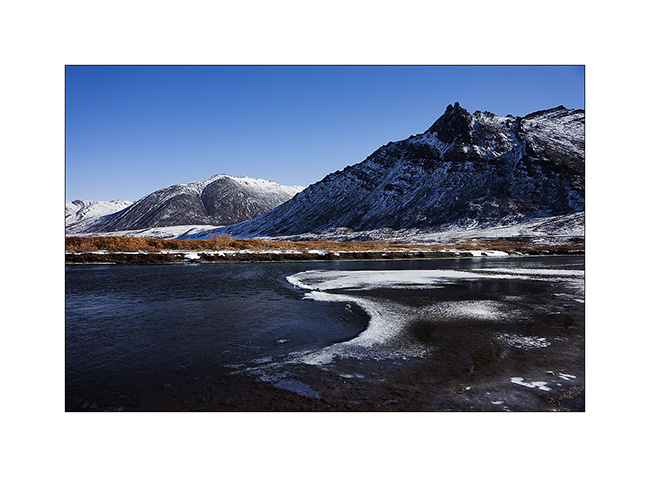
11. Despite a significant current, the banks of the river are well frozen. It was about -5F° in previous days…
12. I enjoy the clear light to play with ice concretions…
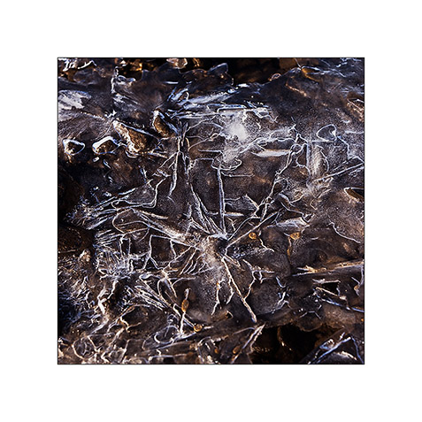
13. … sometimes contrasting and twisted…
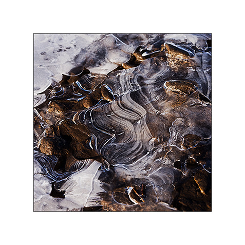
14. … sometimes carved by running water below.
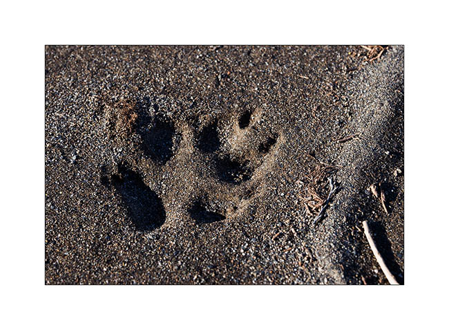
15. On a bank, we find wolf tracks. It happened here less than two days ago, the snow testifies it.
16. The show is sparkling as the river is freezing and carries plates of ice that break in crystal clear sound…
17. … and our eyes feast.
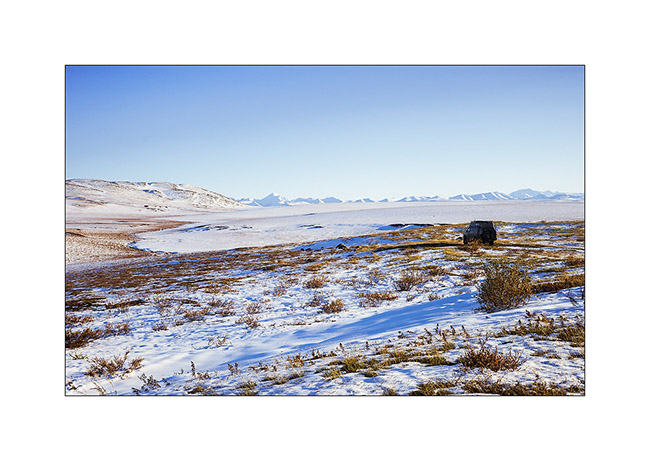
18. Continuing towards the far north, the landscape becomes truly arctic.

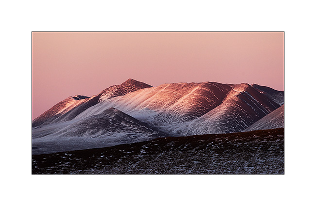
19. Blizzard designed the reliefs.
20. Not sure that the truck drivers who supply Deadhorse and Prudhoe Bay are all aware of this beauty…
21. We leave VivaLaVida to walk on a side track…
22. Perfect lines of the wintry tundra…
23. We will not go to Deadhorse, the last part of the track is less interesting. We stop at the last foothills of the Norths Brooke Range…
24. … and even find a camp on the tundra. What a fantastic place to camp, isn’t it? 😀
25. The Sunset is beautiful again…
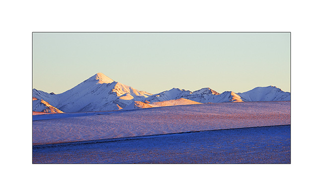
26. … the last rays coloring the hills…
27. … before a magic full moonrise.
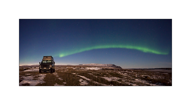
28. And to complete this grandiose day, a northern light came to wish good night to VivaLaVida while the full moon was lighting up the tundra!
We began our descent back to the South the next day. To discover in the next update… 😉
Thanks again for your loyalty!
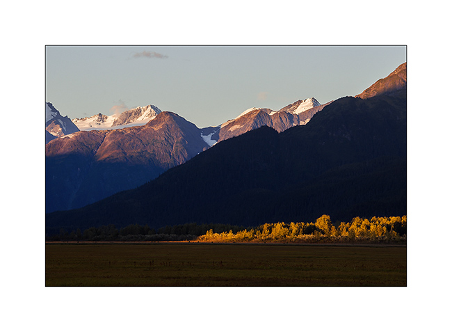
Kenai Peninsula (2)
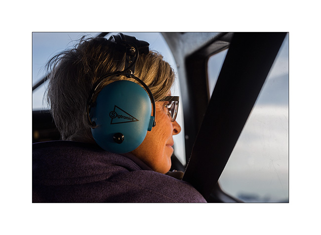
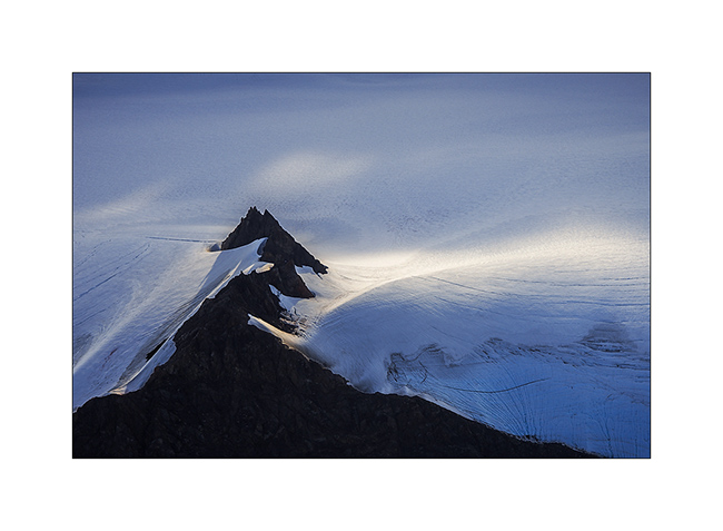
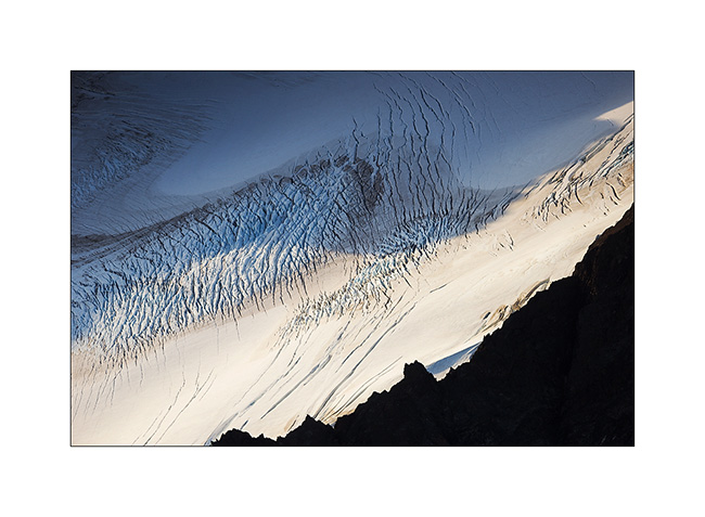
Still near Homer, the next day we decide to flight over the Harding Icefield, one of the giant icefields that covers the southern Alaska. We chose a small seaplane and to fly between 7:30 and 8.30 PM hoping for a nice light.
1. As soon as we take off, we can see some first glaciers.
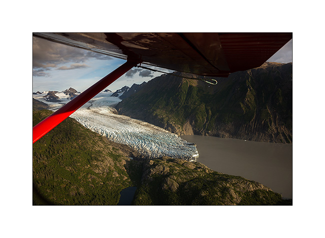
2. Fifteen minutes later, we fly over the Harding Icefield : almost 70 miles long and more than 30 miles wide!
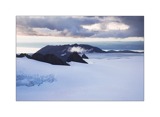
3. Large glaciers go in all directions.

4. Besides the pilot, Mino doesn’t loose a crumb of the show.
5. Some light gaps offer me nice views…
6. Motionless cascade…
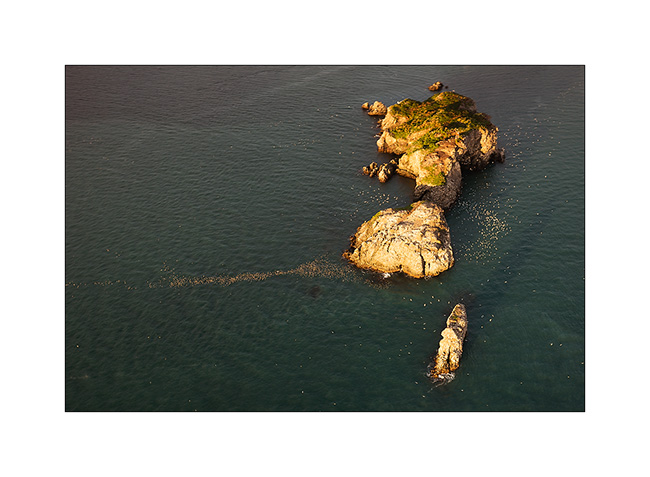
7. On the way back to Beluga Lake, our “sea strip”, we flew over an island, refuge for thousands of birds.
8. We leave Kachemak Bay at sunset…
9. … with a beautiful view of Kodiak Island in the distance…
10. … to find a wild place in the dunes, near Anchor Point.
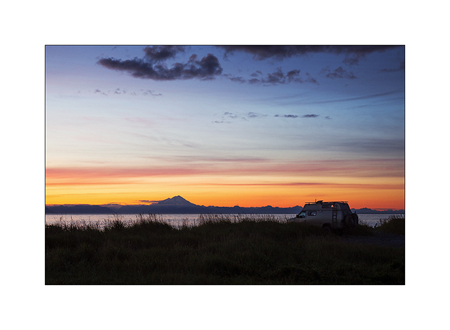
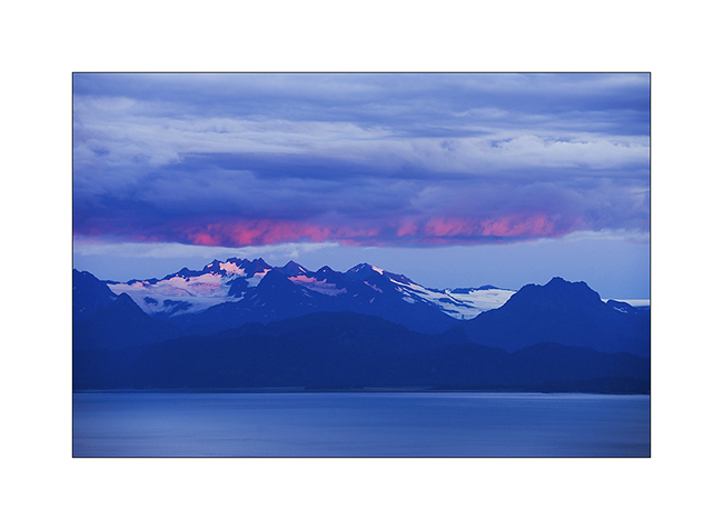
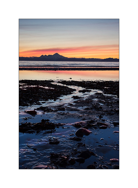
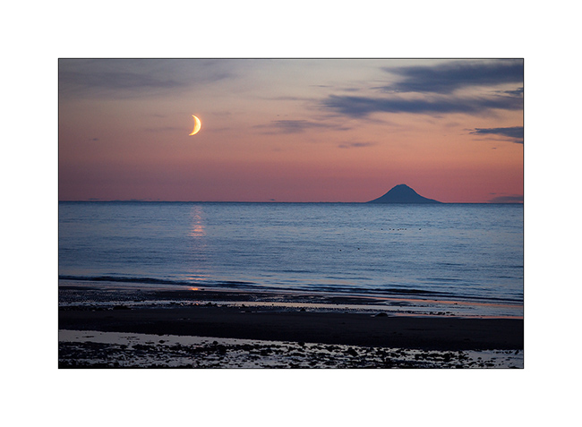
11. Sunset over Cook Inlet and Iliamna volcano; there are worse places to sleep, isn’t it? 😉
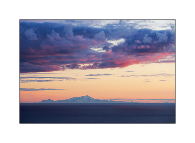
12. The moon also goes to sleep near the volcano island Augustin…
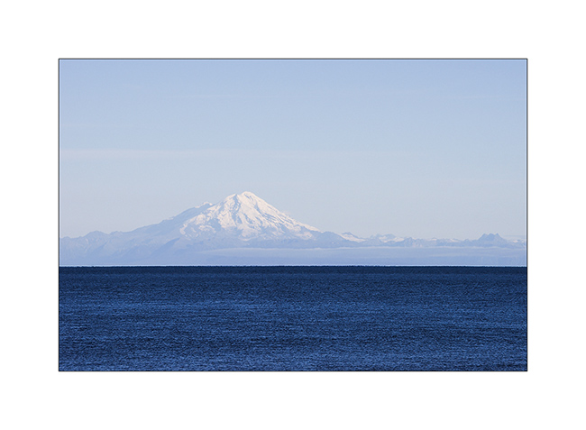
13. An air of Mount Fuji, isn’t it? But it’s another volcano: Mount Redoubt.
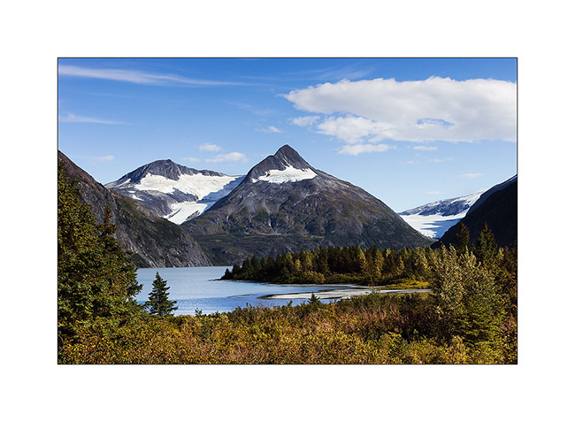
14. Going North to Anchorage, little detour toWhittier and short stop at Portage Lake, a beautiful glacier lake.
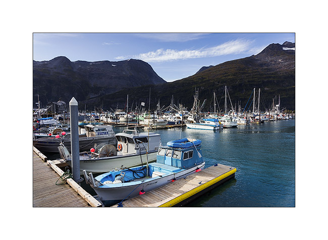
15. Whittier harbour, at the bottom of a fjord in Prince William Sound.
16. While seeking for a place to camp…
17. Late afternoon in the mountains…
After this brief jaunt to the Kenai, we’re back in Anchorage awaiting a response to a possible change of Mino’s return flight that could allow us to stay longer to explore this beautiful Alaska. We will keep you in touch in the next update! 😀
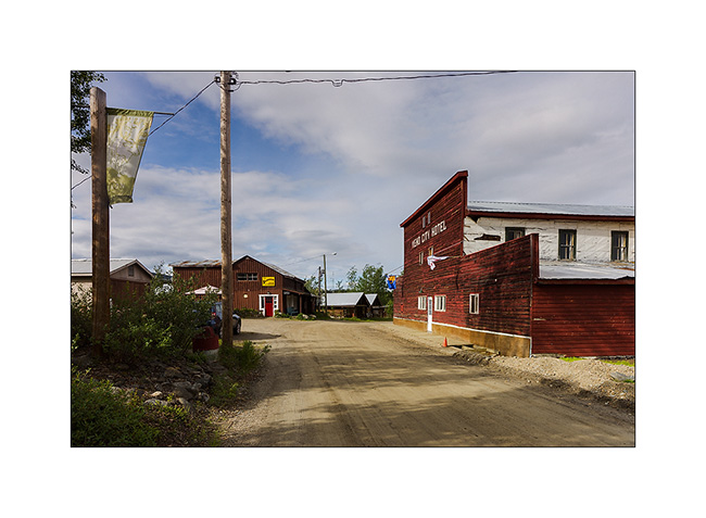
Central Yukon
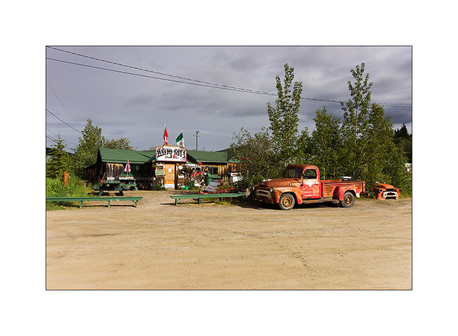
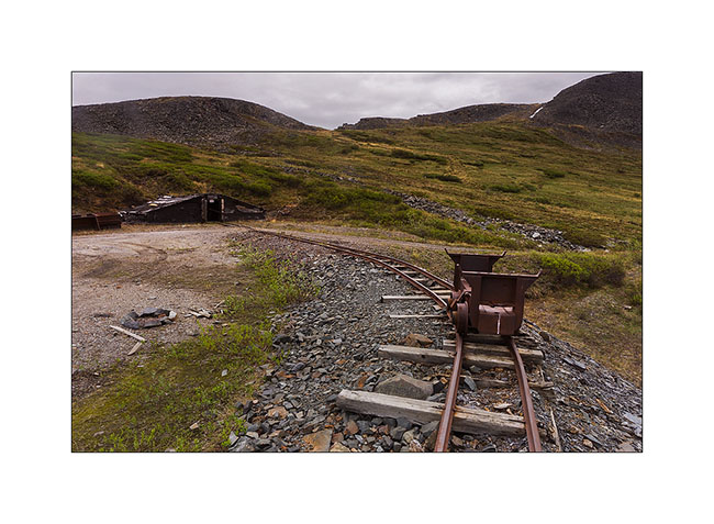
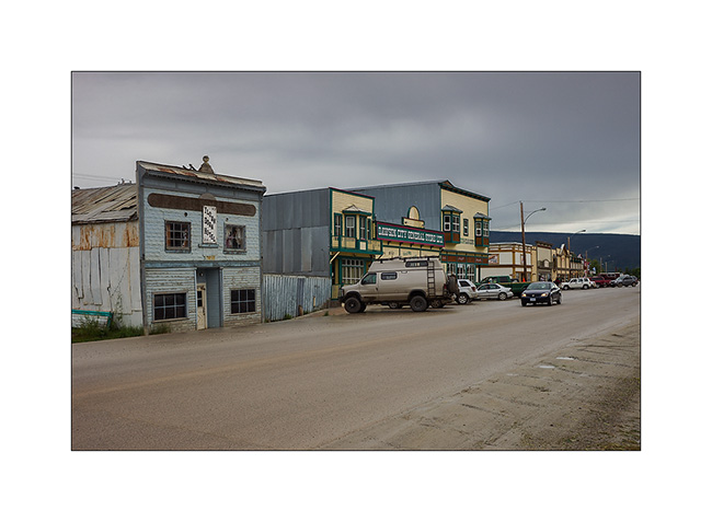
Still in central Yukon, I visited Keno City, a “City” of 21 inhabitants actuelly ! I must say that the price of silver and zinc are really down, so the mines are actually shut down.
1. The hotel and one of the two bars of this quite surprising “like out of the past” village.
2. Service.
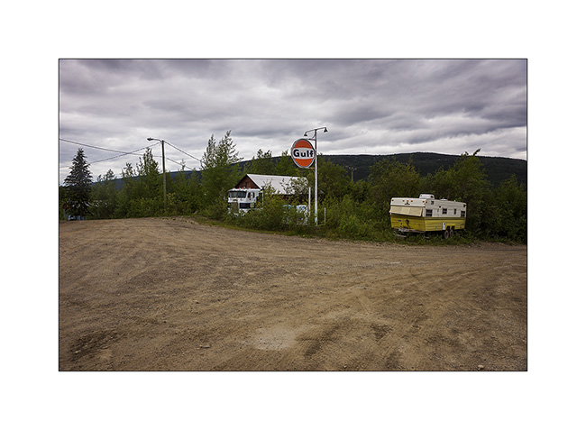
3. The other bar with the owner’s car still running!
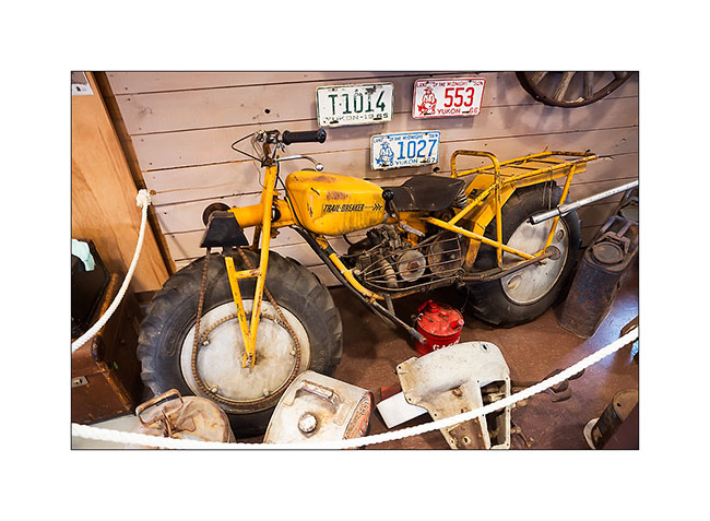
4. In the well-stocked museum on past mining, a two-wheel drive motorcycle for mud terrain!
5. Again up the mountains for the night, I admired a gorgeous sunset.
6. Nice boondocking site, isn’t it?
7. Some snowpatches remain at this elevation.
8. Magic light at midnight…
9. Last gleams under the clouds…
10. Another mining site from early 1900.
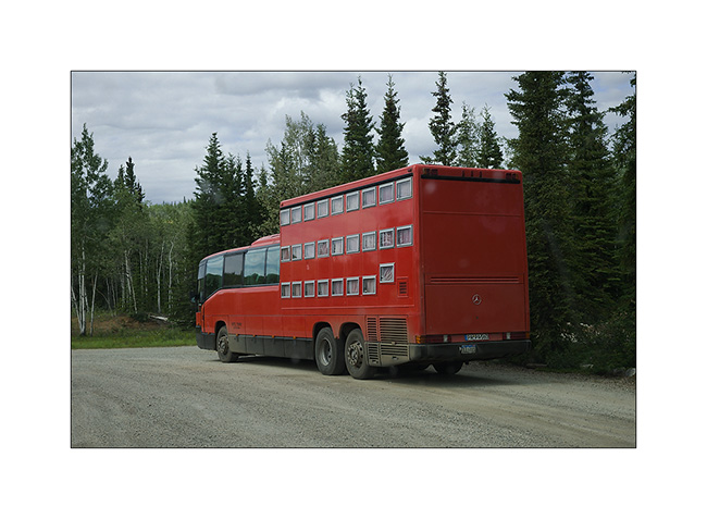
11. Resuming the Klondike Highway to the north-west, I can not believe my eyes! A “rolling hotel” almost like those we had seen in Romania forty years ago. Each passenger has a “drawer” as bed! It is envy, isn’t it..? 😀
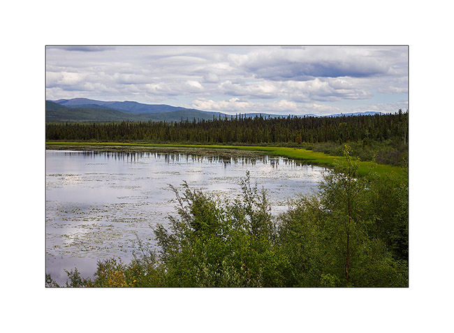
12. One of the many lakes along the journey…
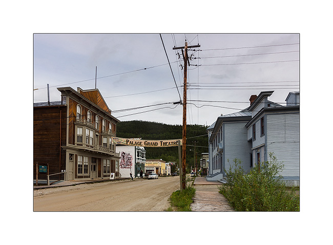
13. Dawson City, a villa quite special, festive, almost without modern building; so far removed from all that many people make quite everything here, especially at night in the local casino or one of the many bars…
14. The “continues to produce Belle Époque-style shows every night.
15. Funny advertising for this store… 😉
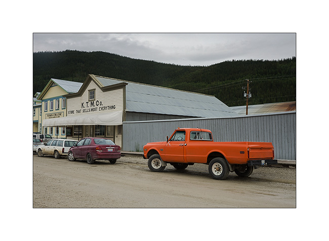
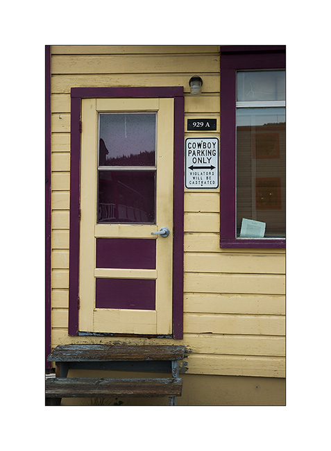
16. Euuhh, can I really park there..?!! 😀
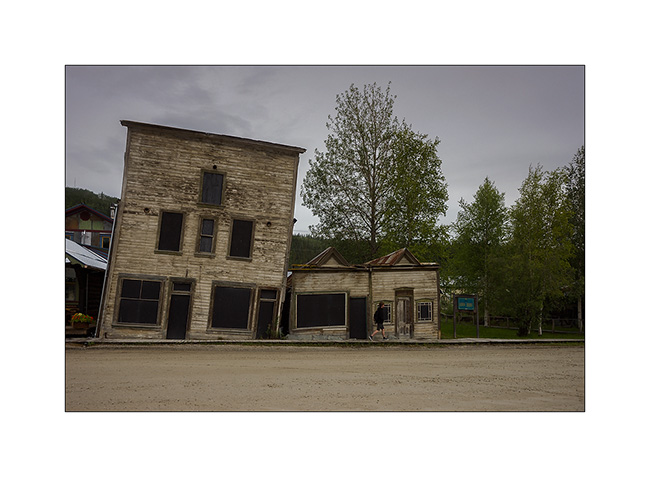
17. An example of the difficulty to build on permafrost. These buildings are a century old. Protecting the soil from the cold during the winter, they make the permafrost melting, destabilizing their poor foundations. So they continue to “sink” into the ground.
18. Overview on the city along the Yukon River…
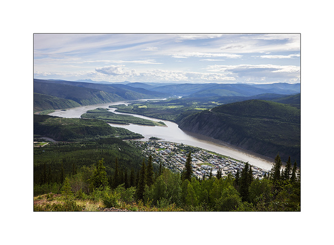
19. … which continues her journey toward North_East.
Vivalavida then took the path of the great north on the Dempster Highway, a road that still frightens many travelers. A thin ribbon of over 750 km through boreal forest and tundra, which turns into slippery mud in the rain, mainly driven by the large trailer trucks supplying Inuvivk at the terminus, with a single service station / motel more or less mid-way… To come soon… 😉
Last update in Texas
As I’m quite late relating the trip of VivaLaVida, I already post a new update…
Leaving the Big Bend area, I went back quietly to the Northwest, taking the path of Southern California where I had to join Andrew for our trip to Baja.
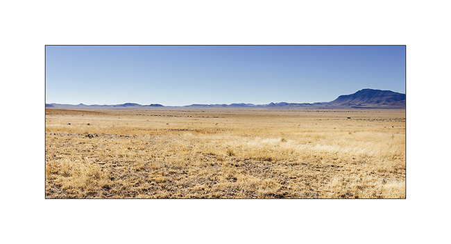
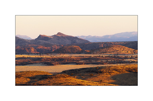
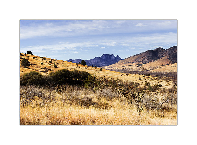
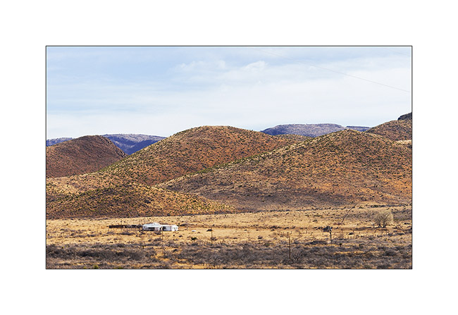
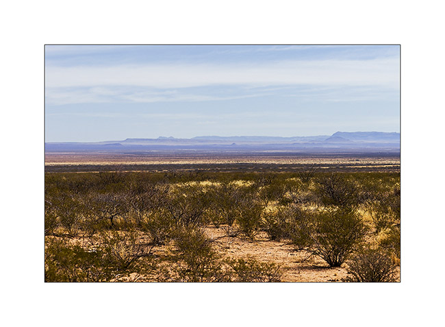
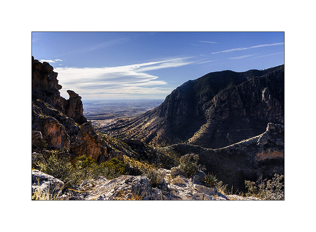
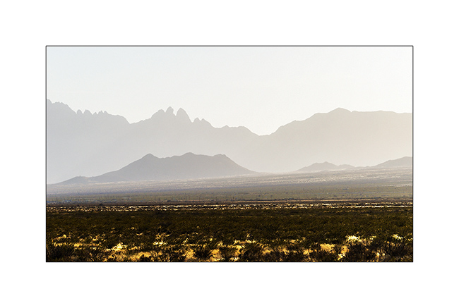
So I went to the Guadaloupe Mountains, an interesting mountain range. However, I stopped several times on the road, this time to Watch a beautiful sunset on the Texas plains…
1. Huge and rather dry pastures…
2. Soft light at sunset…

3. … on these endless plains…
4. … that adorn some rocky hills to counter the monotony.
5. Nice pics!
6. Small remote ranch…
7. Western landscape…
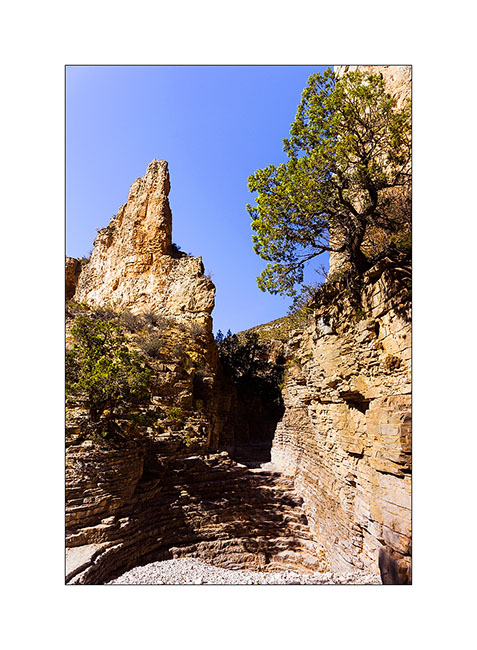
8. Natural stairs in a canyon of Guadaloupe Mountains.
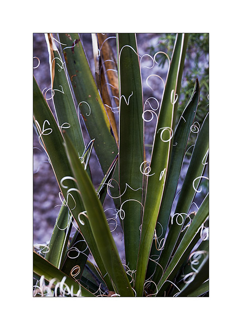
9. Vegetal elegance…
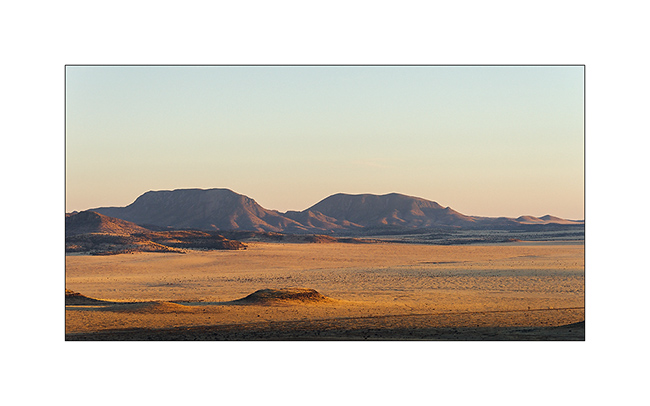
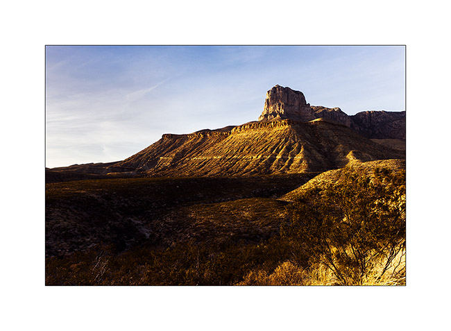
10. El Capitan (Guadaloupe Mountains) at sunset.
11. Immensity…
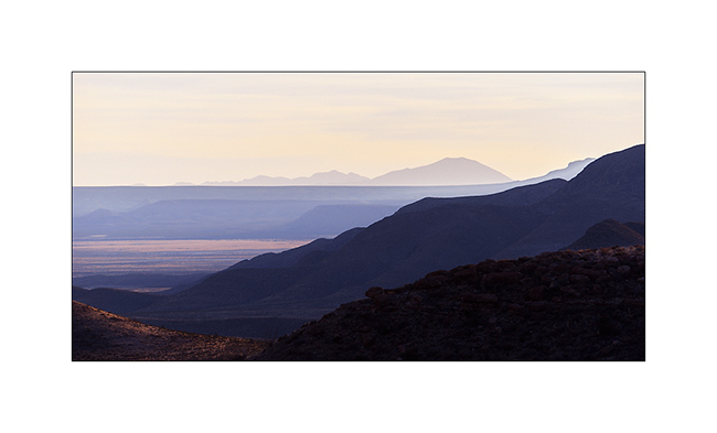
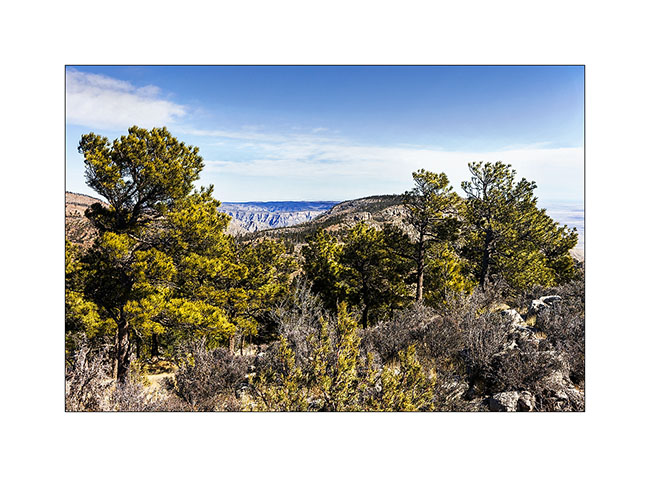
The next morning, I hiked the Guadaloupe Mountains. Mountain range over 8000 feet, it has the distinction of having a depression on top, which holds water and creates an unexpected echosysem in the desert environment.
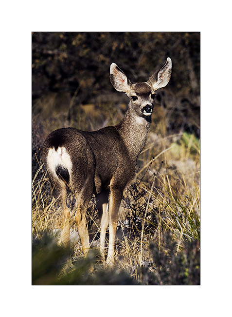
12. A young “mule deer” at sunrise.
13. Long hike uphill…
14. … forest on the summit depression.
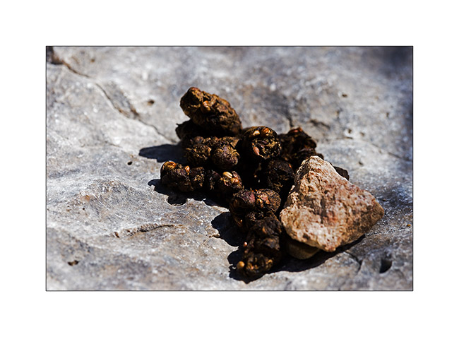
15. Yes, they are bears there! 😀
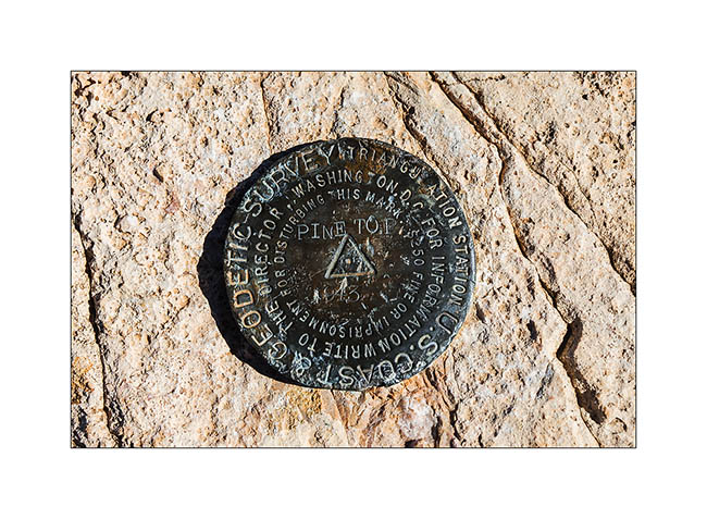
16. Mark at Pine Top summit.
17. The next day, as I left the camp, a wave of polar air was coming. Retained by a ridge, it formed a curious fog seeming to overflow a saucepan. Beautiful but freezing!
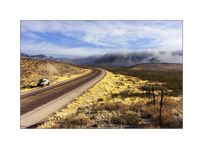
I then headed to White Sands, an erg of white sand.
18. Good dirt road North West of Guadaloupe Mountains.
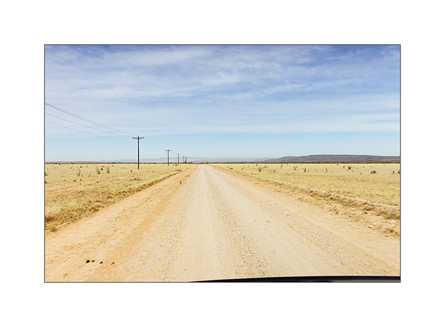
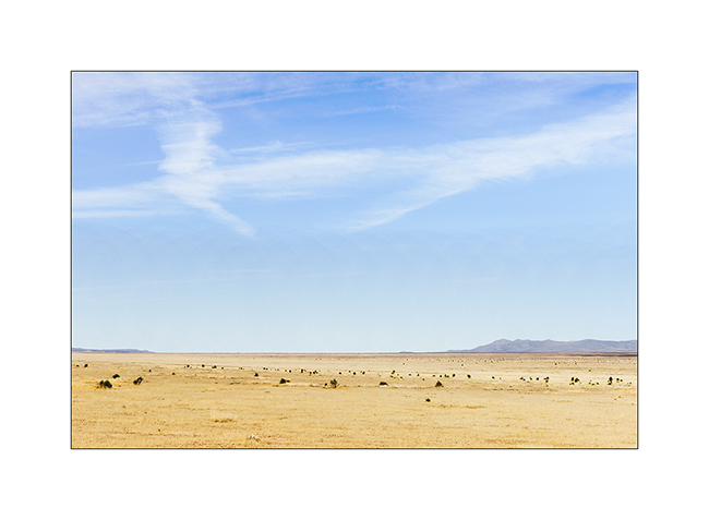
19. Still immense arid plains…
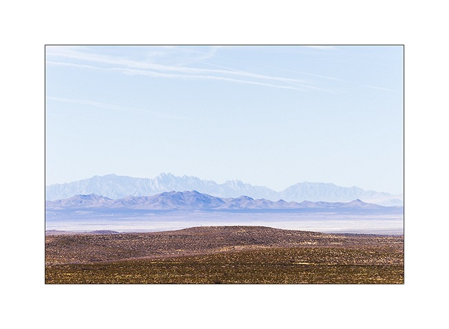
20. Distant view of the White Sands.
Once there, I had a little frustration because the site was closed. An army drone crashed there three days earlier. So I had to continue my journey toward New Mexico…
21. Late afternoon on VivaLaVida’s road…
That’s it for Texas, for now at least. I then went through New Mexico to visit two sites that I will present in the next update.
Mississippi delta
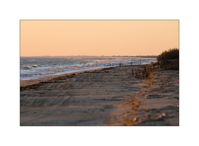
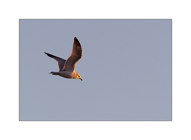
After visiting the nice town of New Orléans, I spent a couple of days in the Mississippi delta, a huge wet zone and totaly flat. VivaLaVida sometimes slept on the beach it-self and I could observe many birds…
1. A nice campsite, isn’t it?
2. Half sun! 😉
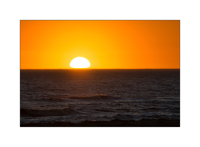
3. A seagull at sunset…
4. Sunrise with sea mist…
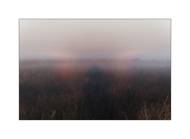
5. Halo in the mist…
6. Work of the night probably…
7. Another campsite…
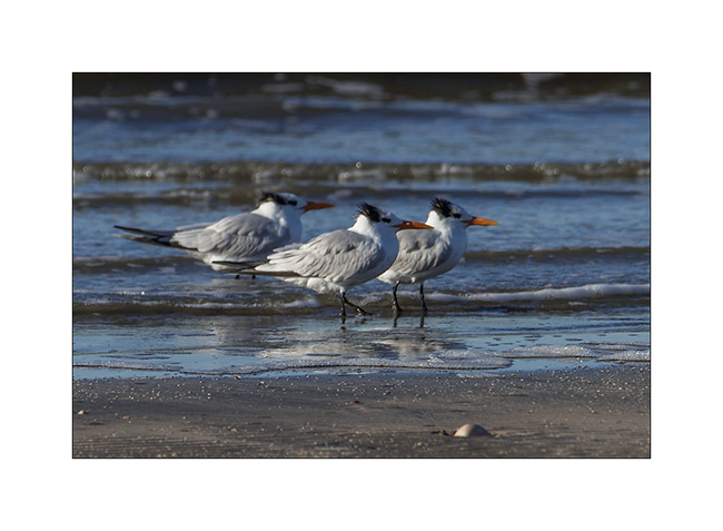
8. Royal terns resting.
The next day, I moved a few tens of kilometers and arrived in Texas in an area where there are freshwater marshes behind the dunes, promise an interesting ornithological fauna.
As I walked there, I met me a retired volunteer. Exchanging a few words with, she said: “From 5, mosquitoes will attack you!”
Me: “Really? Even in the wind?”
Her: “Yes , pray for having wind…”.
I found a place to sleep on the beach and after photographing the sunset, I walked into VLV and have undertaken to postprocess some images. Around 9:30, when I turned on the light, stupor: it was almost impossible to see through the windows as there were so many mosquitoes above! Thousands at least. Then I realized that a good fifty were able to enter VLV, where I’m not sure yet . Perhaps through Dashboard ventilation since all other issues being closed… So I had a pretty mosquito hunt before cooking my diner and after because obviously they continued to enter. The next morning, there was again a good fifty but fortunately, as these little creatures have never loved me, , I had only one bite on a toe… : – D
So much for the story.
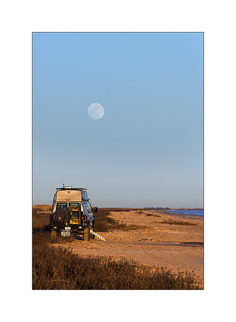
9. The campsite in question under a nearly full moon.
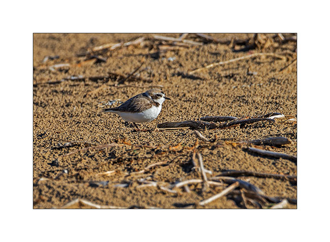
10. A snowy plover.
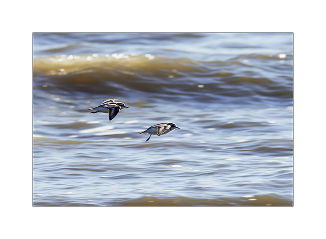
11. Two others…
12. Readheads.
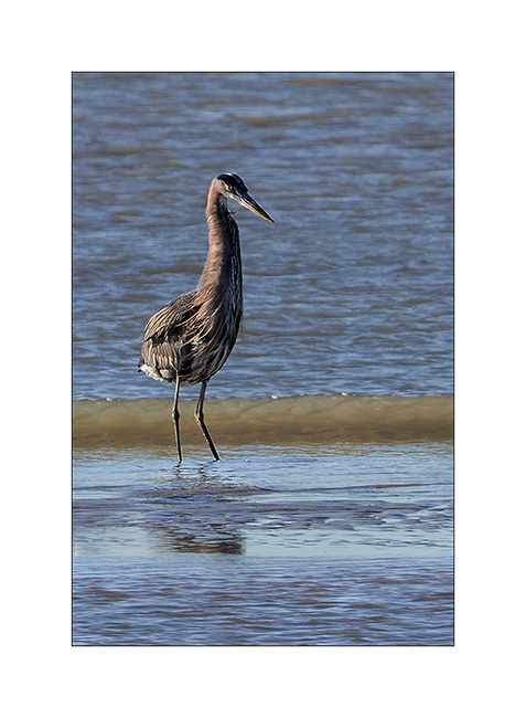
13. A nice heron…
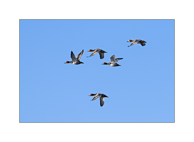
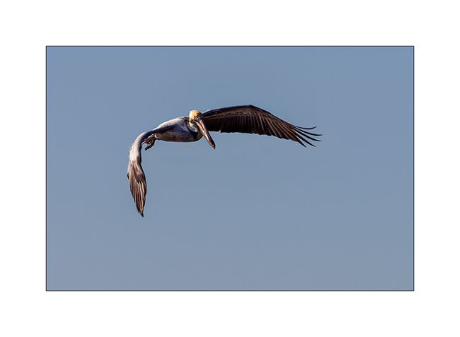
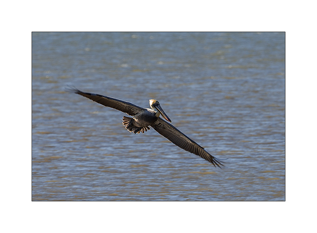
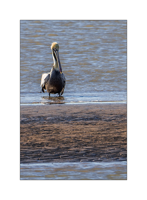
14-16. A small series on the brown pelican, wonderful.
17. A neighbor of my camp…
Bye for now……
Way back from Florida
After a few days on the Gulf of Mexico, I received the long-awaited message: my definitive papers arrived!
So I left the ocean for heading up to Atlanta, not without taking small roads with few detours. I then wiped the cold wave that made twenty deaths in North America, with till -52°F in the East.
1. A march next to the road.
2. A bird seen while a quick stop to eat something. To resist to the temp of 16°, she puffed its feathers…
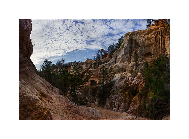
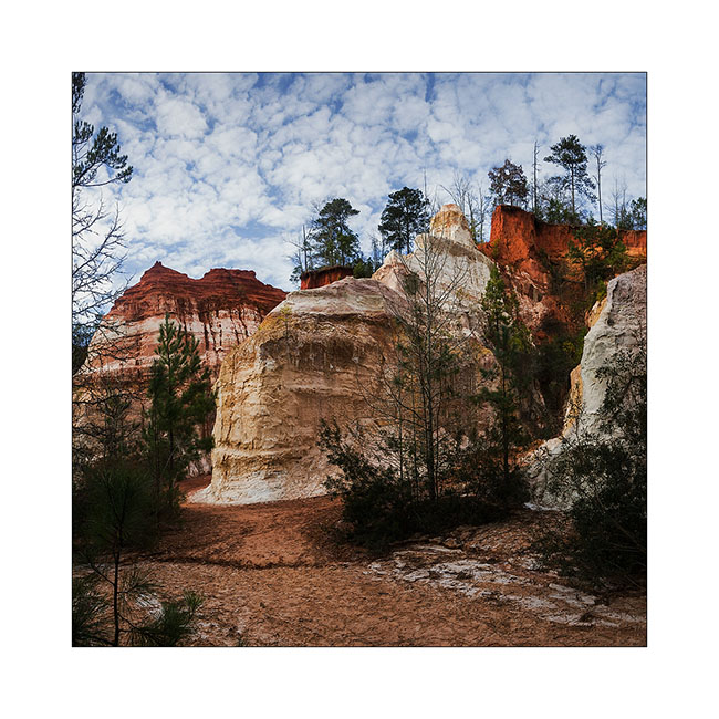
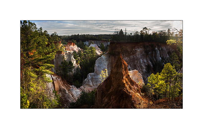
Driving through Alabama, I made a detour to the extreme western Georgia to visit Providence Canyon, a small Bryce Canyon… I got there at 14:30 and it was 14°, the maximum of the day.
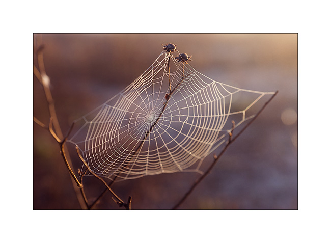
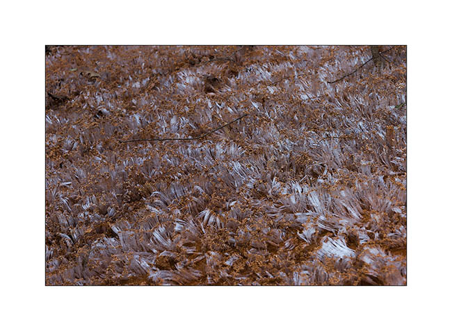
3. The trail strewn with ice flowers. To give the scale, ice rods are approx. inches high..!
4. At the bottom of this pretty little canyon, unfortunately with difficult light (panoramic of three vertical images).
5. I told you: it looks a little like the famous Bryce Canyon (panoramic of two vertical images).
6. View from the top (panoramic of four vertical images).
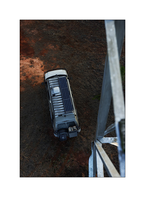
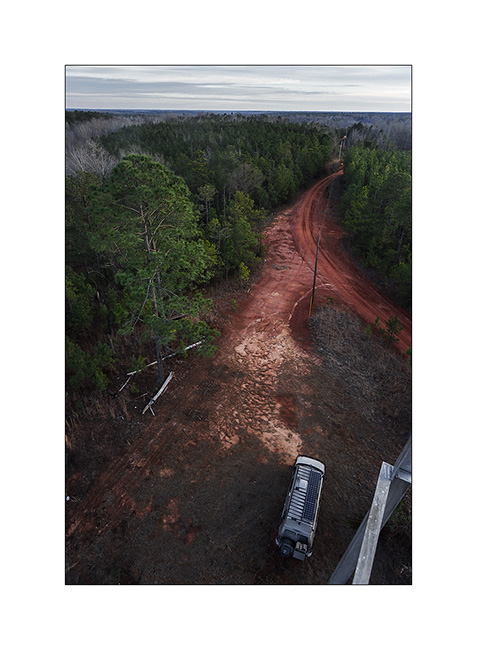
Since I came out around 16:30, I left the tarmac to get a place for the night. I followed a dirt road and came across an old fire watchtower. Usually, the base is surrounded by barbed wire fence that prohibit access to, which wasn’t the case of this one. So I took the opportunity to climb on it, taking precautions for the wooden steps which were well rotten, even some missing…
7. VivaLaVida from an unusual angle…
8. View on the forest around…
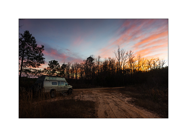
I then continued the small dirt roads and after about thirty mile, I found a place to sleep next to a pond, who booked me a nice surprise. While I was out photographing VLV in a pretty sunset, I heard an unusual noise. I have been listening… Yes, it was the sound of an animal gnawing something. Night falling, I spun seek binoculars and tried to locate it for ten minutes without success. Then I heard a “splash”, still without reaching to locate it… Finally, I discover a beaver swimming in the pond, pulling the small tree he had just cutted! It was so dark that I could picture of him to show you. But I saw him come near the entrance of her hut and dive to enter. Then I heard him shake to drain and move the small tree to his companion, exchanging small pretty cries. He then came pout again and swim away across the pond, disappearing into the darkness… I heard him later continuing to gnaw in the dark night. It was a great emotion to see my first wild beaver..! 😉 It made me forget the cold (10° then) and I haven’t regretted the numb I had back in VLV. That night, VLV’s thermometer got down to -2°F, my coldest night in VLV so far.
9. The picture that got me this beautiful surprise…
I joined Atlanta the next day and found my driving license as well as the Title, the ultimate Sesame for my real start. Unable to invite Colin’s family partly sick to share a last dinner, I took my real flight the next day, already with some unexpected on the first night. To discover soon… 😀
Black Balsam Knob & waterfalls
Still waiting on insurance for VivaLaVida, I enjoyed the nice and cool weather to discover other spots of Appalachian. Some nice waterfalls first.
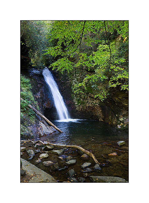
Looking Glass Falls, easy access Under the Blue Ridge Parkway…

The evening coming, I started looking for a place to spend the night that I found at Gloucester Gap, below Looking Glass Rock. Little mishap when I got up after blowing on my campfire to start it, I lost balance, probably helped by a small pressure drop, and falled backwards, knocking my head down! I got up with a big bump on my head and a broken headlamp, not realizing immediately what had happened… But I was lucky not to fall on one of the large boulders surrounding my campfire …
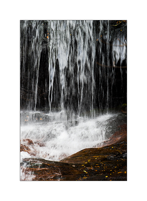
Next morning, I went to discover some other waterfalls. More remote is Courthouse Falls is nestled in a ravine that the sun doesn’t reach this season. This place gave me an impression of hidden oasis…
The Dill Falls race down a cliff of about hundred feet in two steps. An hour and a half small dirt forest roads lead to it. The light was not the best one but the place was remote and really wild.
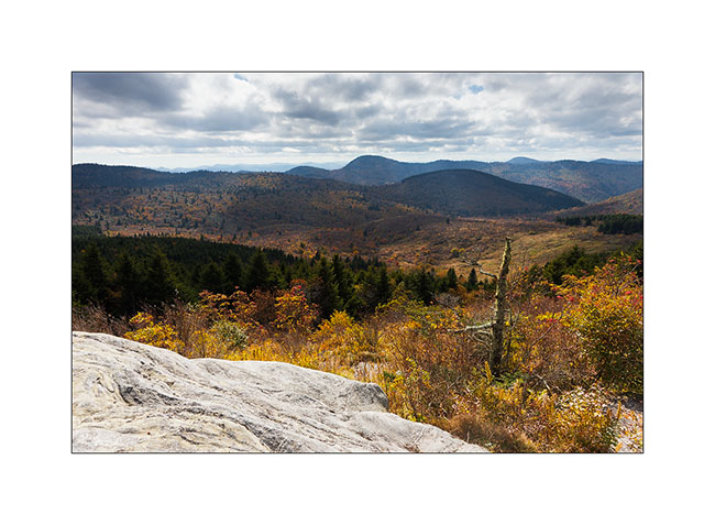
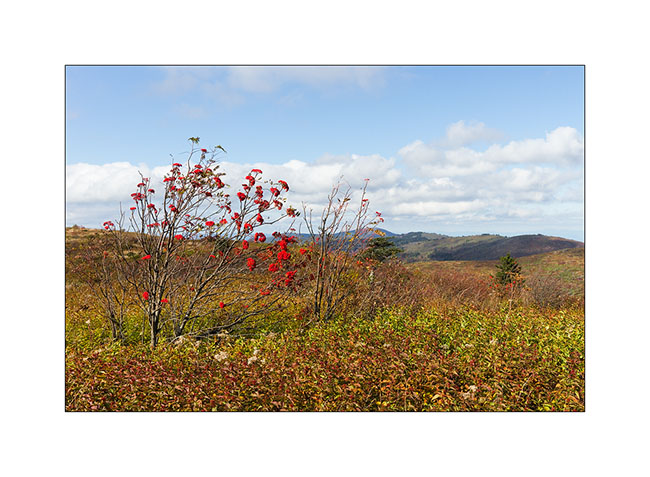
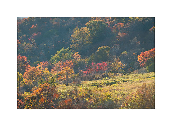
Janet and Jonathan (remember, the couple met last Friday) had advices me the Black Balsam Knob, a summit of the Appalachian with awesome view. Early afternoon, I got there, hoping that it might be the sunset I didn’t have at Max Patch. After an hour drive, I left VivaLaVida on the terminal parking lot at approx. 1,500 meters elevation and took the direction of the ridge trail where I discovered a wonderful vegetation, kind of scrub made of brambles, umbelliferae, blueberries (too late for the berries) and flowers, with small trees with bright red berries. Except at Max Patch, this is the only place without forest, with beautiful fall colors taking place. It extends only the last 600 feets elevation or so, below the forest is everywhere. I really enjoyed these colors throughout my almost five hours walk.
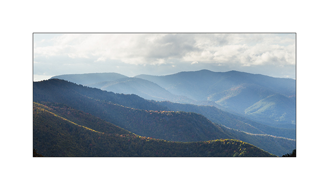
Sun decending to horizon, colors get warmer, light brighter. Moisture lifted by the sun during the day starts to condense, forming cumulus drawn by the well-established wind. Promise of the photogenic sunset?
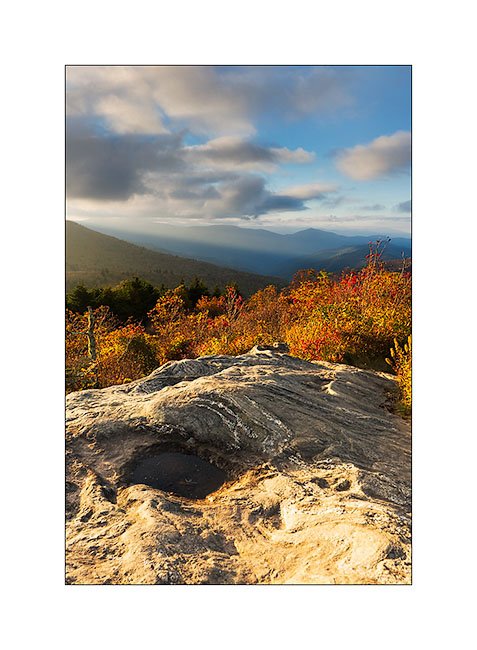
Despite the cold wind starting to erode the only polarshirt brought with me, I was waiting for the sun drops below the clouds and then, just at the lower limit of the lowering clouds, I was invited for some minutes of incredible light, almost an end of the world light! It was gorgious, really ..!
Mesmerized by the show, I stayed still twenty minutes while the sun disappeared just to watch the changing colors…
The descent was somewhat scabrous on a steep trail without headlamp in a very dark forest as night fell. But I found VivalaVida safely after 45 minutes of descent, a little frozen by the 42°F ambient. I slept there in a dense fog. The opportunity to launch the diesel stove cooking some zucchini in small owk I purchased. Warming and delicious.
Today, it is downg to the plain – still waiting for the insurance of VivalaVida and to post this little update from a Starbucks Coffee with a good double shot espresso!
Have all a nice end of the week! 😉
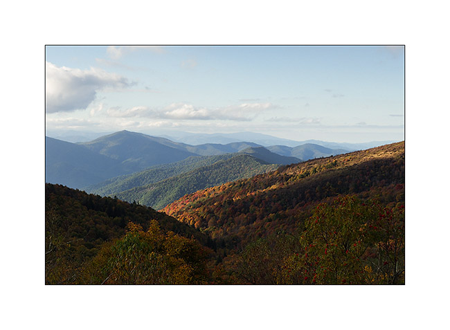
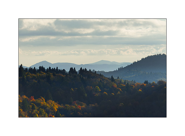
Blue Ridge Parkway
Last week-end I discovered the Blue Ridge Parkway North of Asheville, still in North Carolina. Here are some pictures…
Start of the day at Powhadan Lake where I slept Friday evening
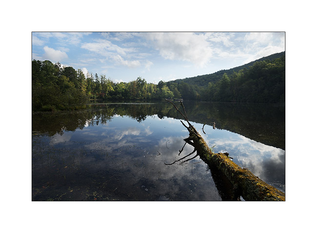
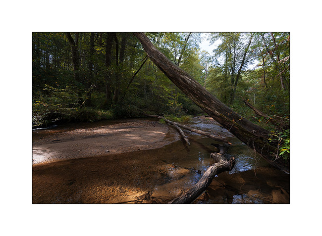
Nice forest river on the trail
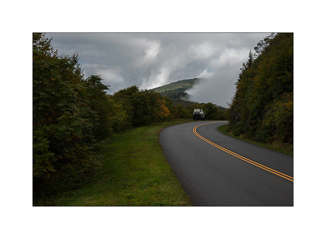
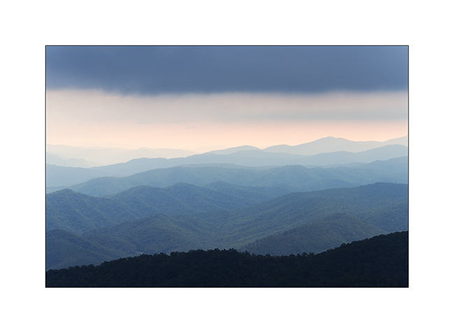
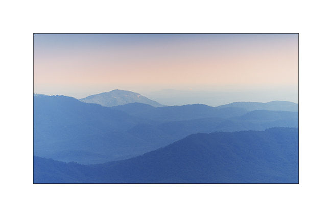
The “Blue Ridge Parkway” is a beautiful sightseeing road all long the Appalachianss. I drove to Mount Mitchell which is the higest mountain of Est America (about 6’500 feets high).
Typical light of dawn…
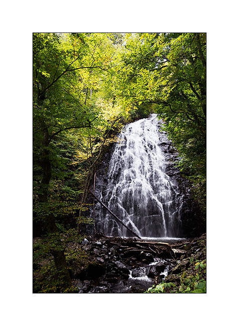
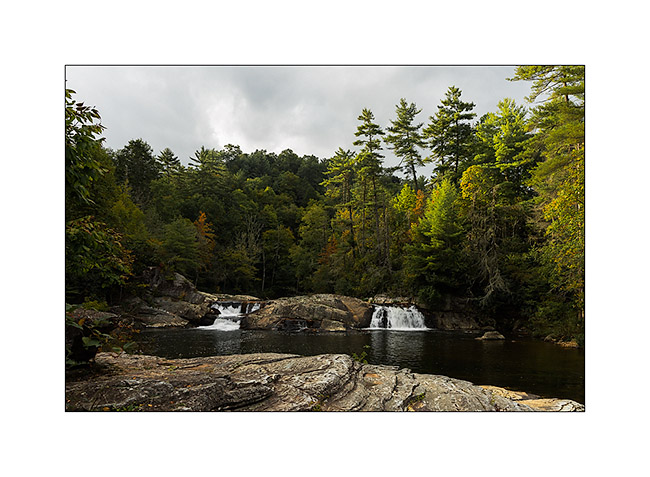
The “Crabtree Falls”
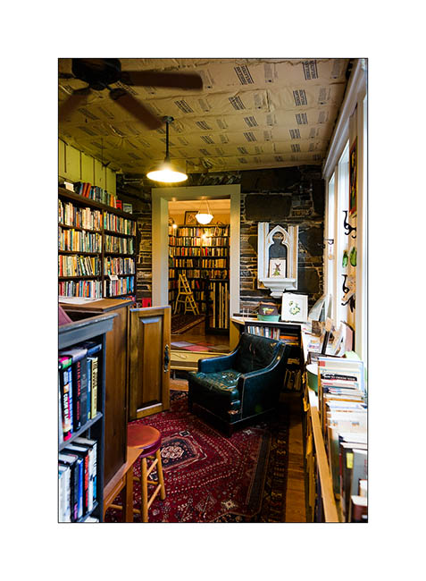
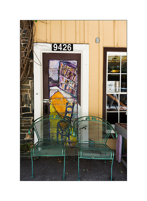
Short stop at “Little Switzerland”… 😉
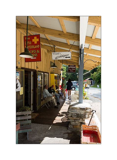
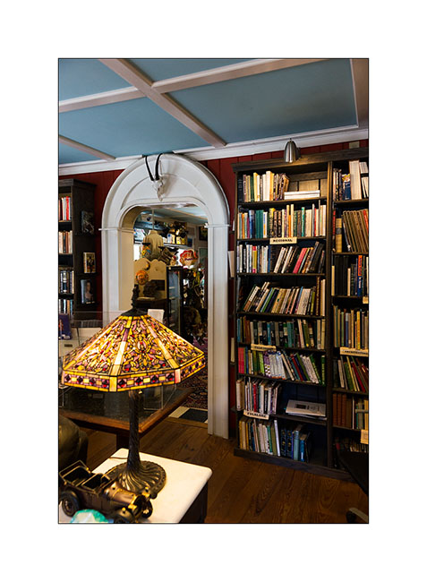
I got a tasty expresso in a nice bokkstore cafe.
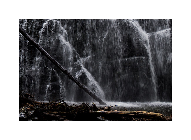
Sunday afternoon atLinville Falls, unfortunately with a poor light. I have to go back there another time…

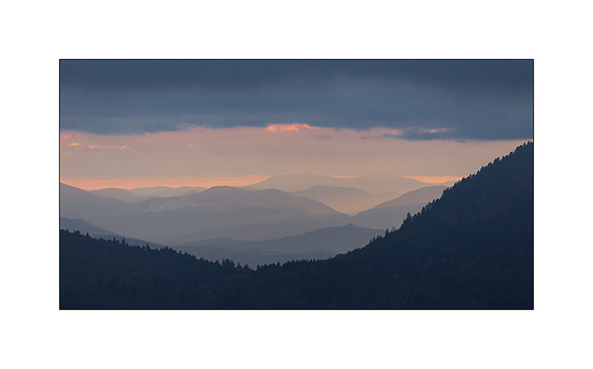
A short ray of light on the way back…
So, that’s all for today… 😀