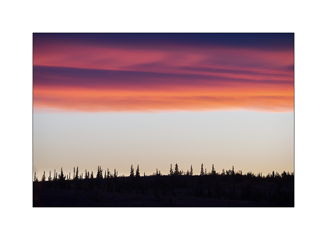
snow
now browsing by tag
Still Canyonlands…
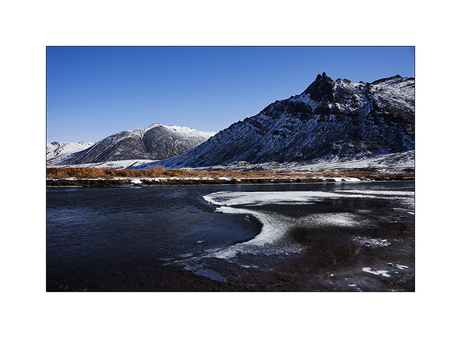
No way to risk to stay stucked in so much snow, I preferred not to cross the pass that would lead me to the other side of the La Sal Mountains and went to Warner Lake driving around the mountains. I already discovered this little mountain lake in a previous trip and wanted to see it in its winter coat.
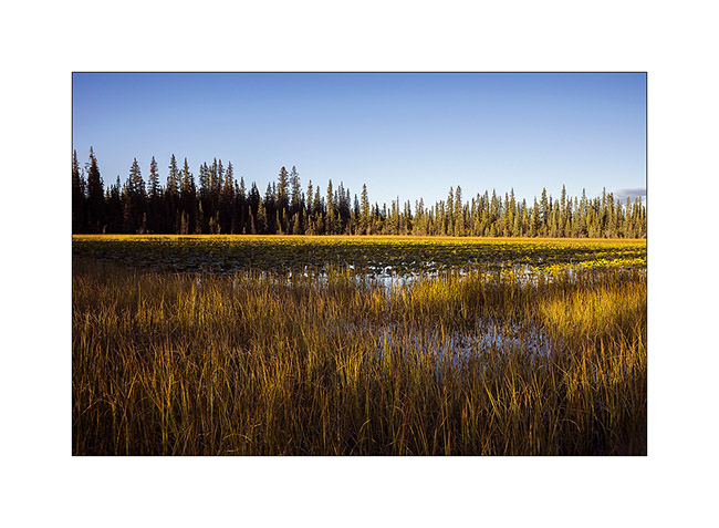
1. Late afternoon light on the Warner Campground, obviously empty at this season.
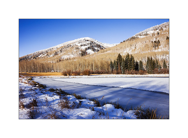
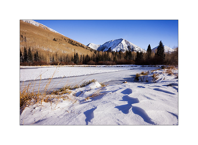
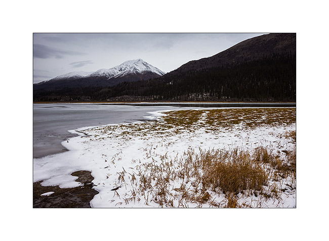
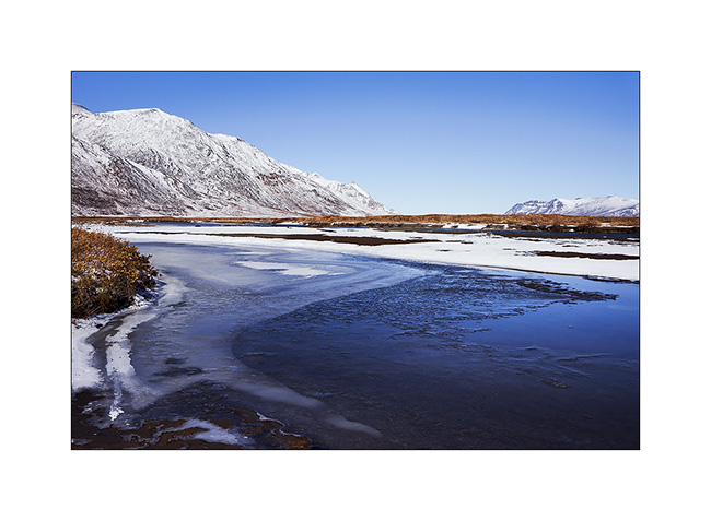
2. Beautiful frozen Warner Lake.
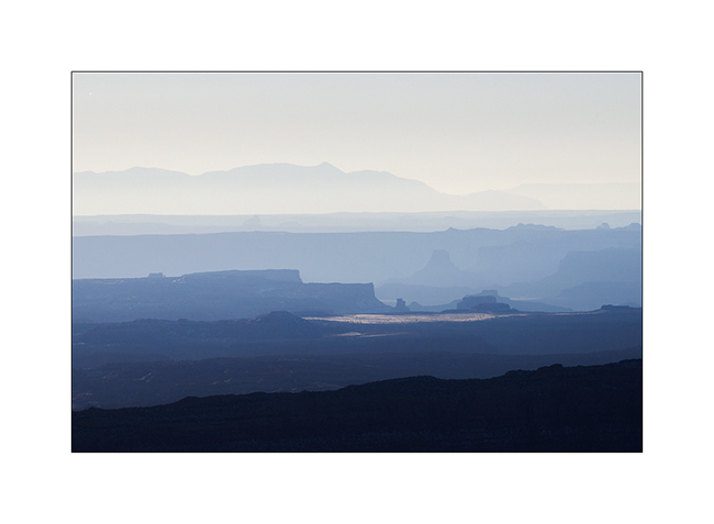
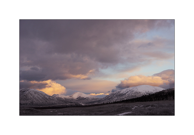
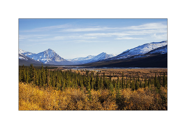
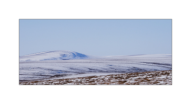
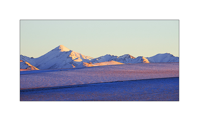
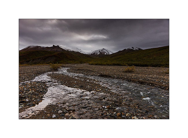
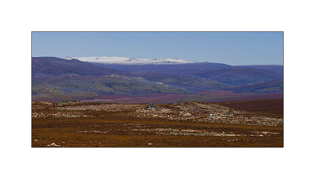
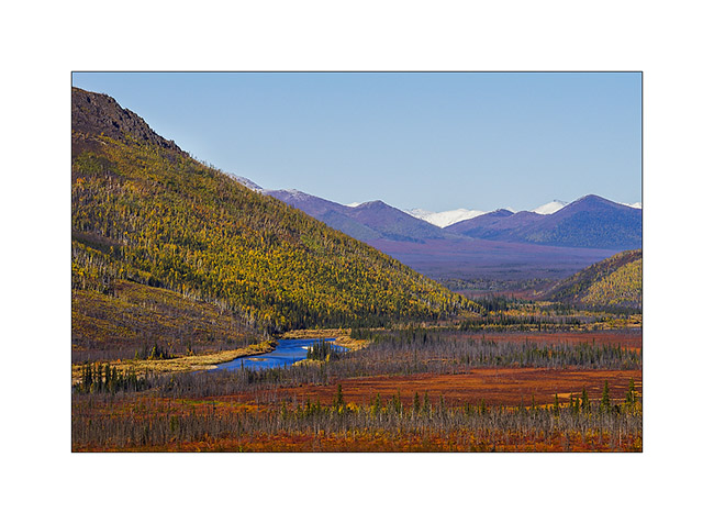
3. As the weather forecast indicated 12 F in Moab, over 3,000 meters below, I went down for me to find a campsite less exposed to cold. The view over Canyonsland and Henry Mountains, over 0 miles away, was splendid.
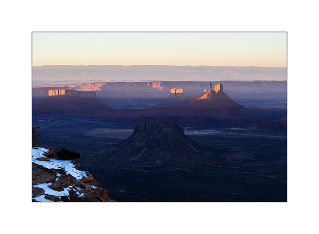
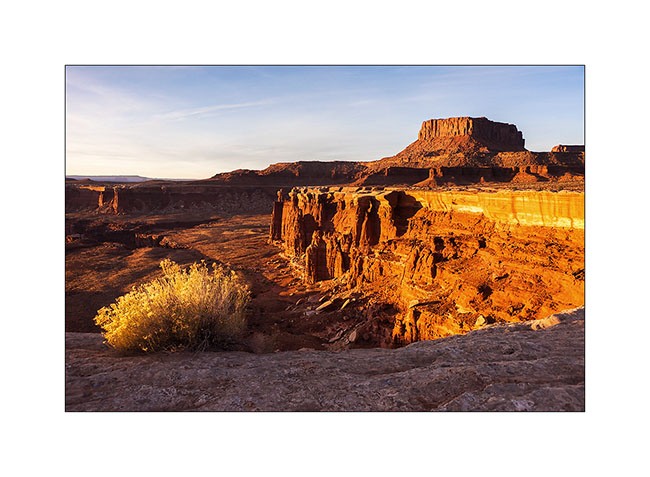
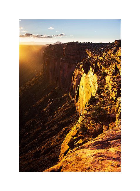
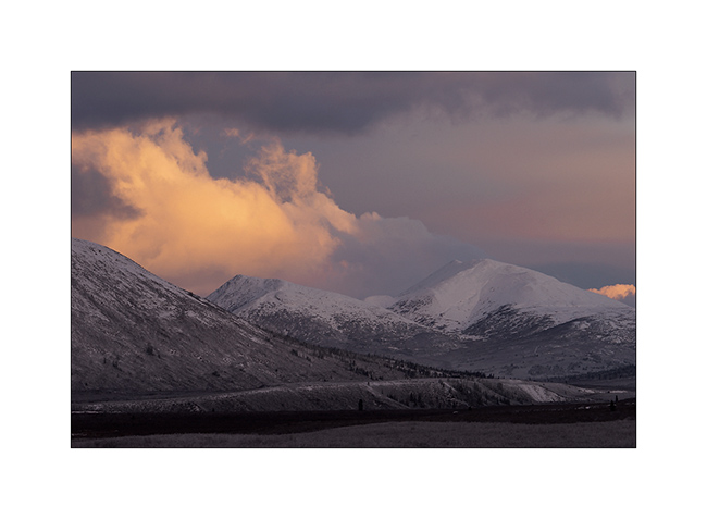
4. I found a better sheltered spot above Sand Flat, near an overlook over Castle Valley, a picture of the Far West at sunset…
The next day, session welding because I discovered that the bracket supporting the engine preheater was broken. Again and again the vibrations of the dirt roads… So I went late to Long Canyon.
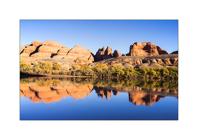
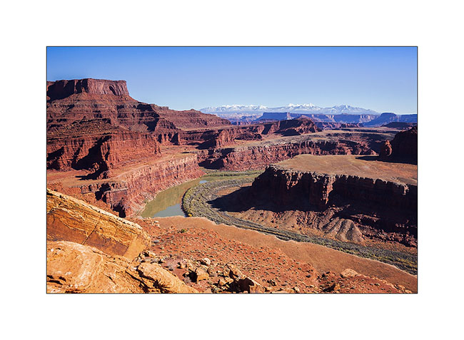
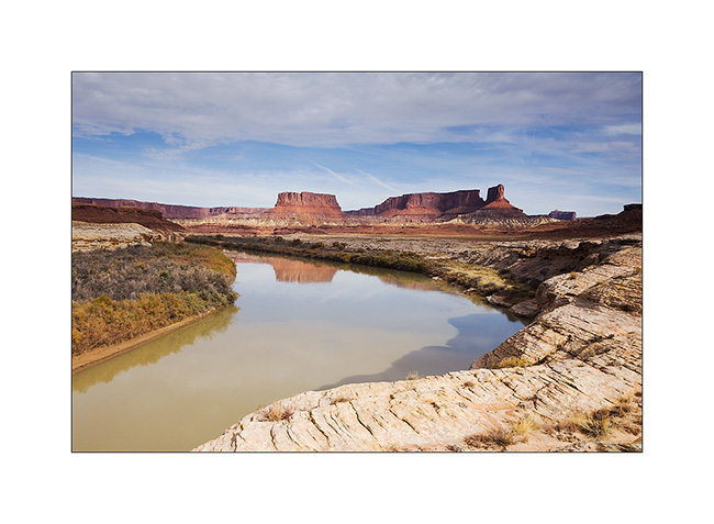
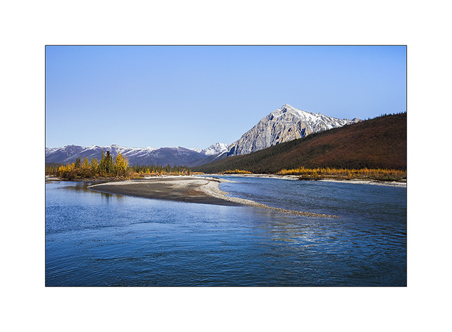
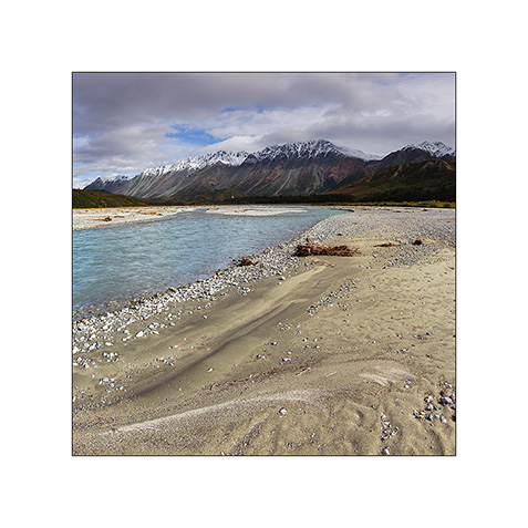
5. The Colorado River reflecting the Moab Rim.
6. Going up in Long Canyon, With La Sal Mountains in the back.
7. The famous spot in Long Canyon ; Souvenir photo stop required! 😉
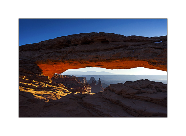
8. The next morning, I got up early to go to Mesa Arch at sunrise. A photo that I’m not the first to do but I like it…
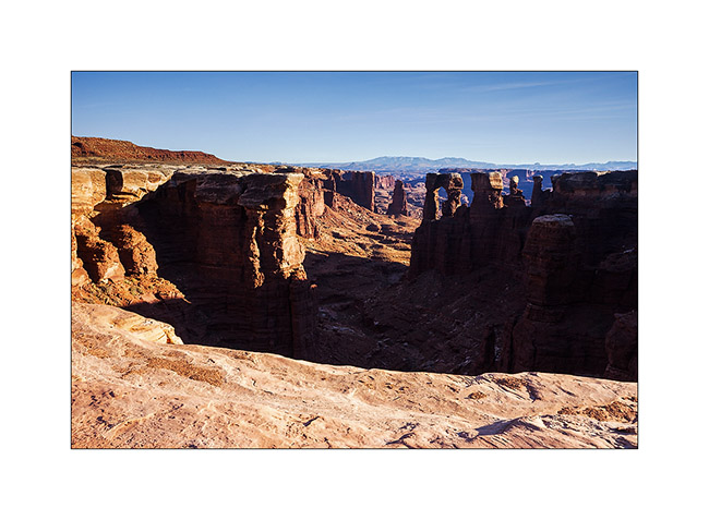
9. VivaLaVida then went down the Schafer Trail to get to the White Rim Trail. Beautiful downhill in the vertical walls! VLV is quite small up there…
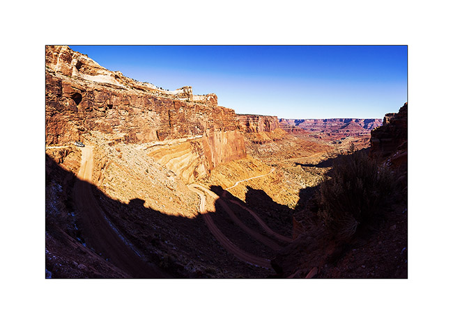
10. One of the meanders of the Colorado from the White Rime Trail.
11. Self-portrait at Musselman Arch, quite aerial… 😉
12. The towers that appear Under Mesa Arch, but this time from the bottom.
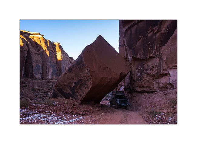
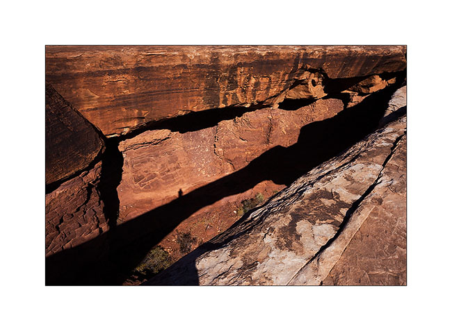
13. One of the huge overhang that crosses the White Rim…
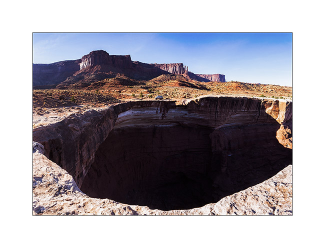
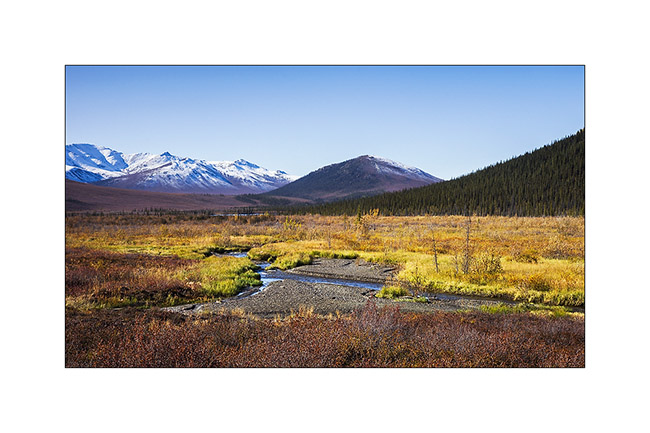
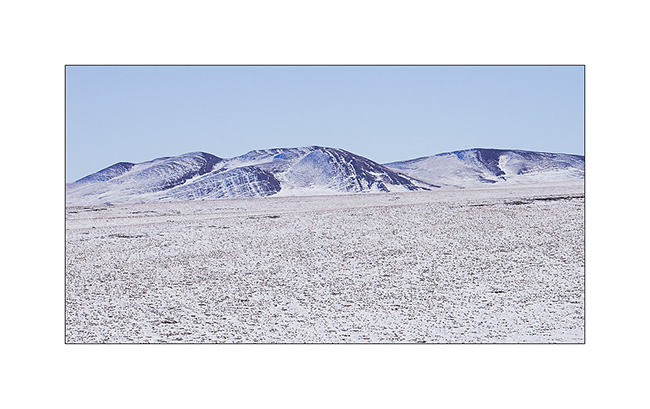
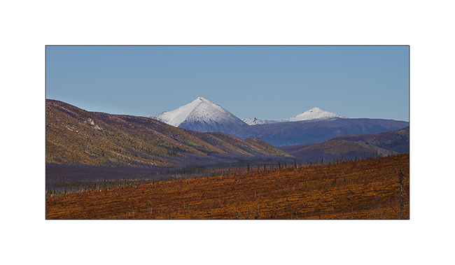
14. In Canyonlands, there are number of canyons and arches everywhere. The White Rim Trail takes its name from the clear limestone layer that it follows over 100 miles.
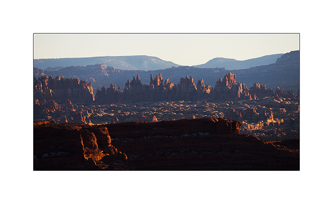
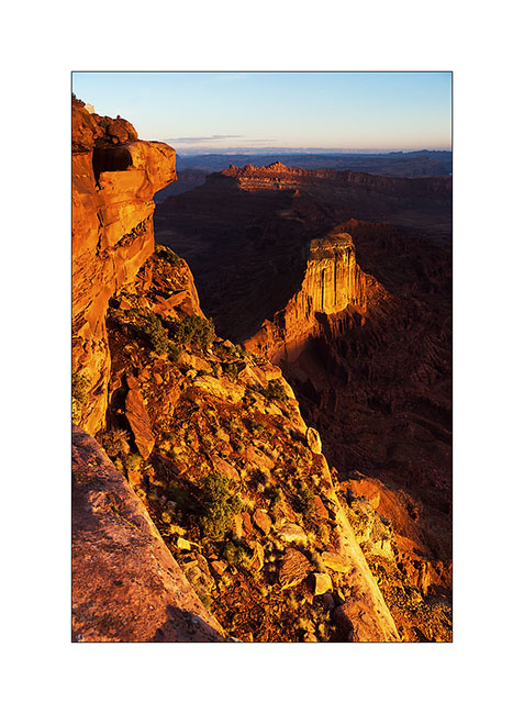
15. From Whitecrack Campground where I spent the night, Sunset over the 20 miles away Needles is gorgious.
16. Under windwos of VivaLaVida too !
17. Almost the same colors at sunrise…

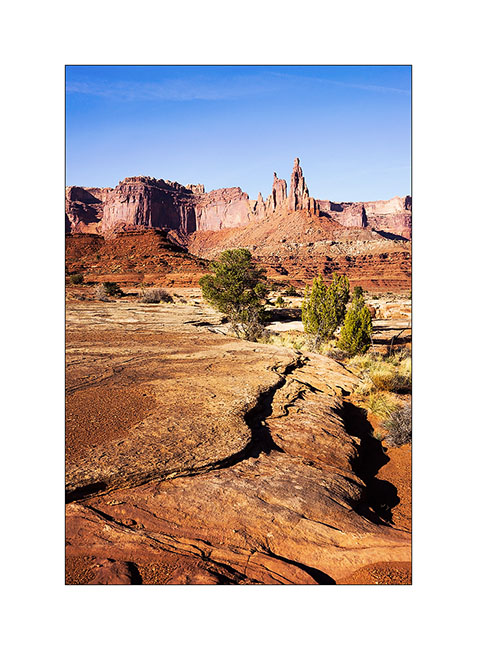
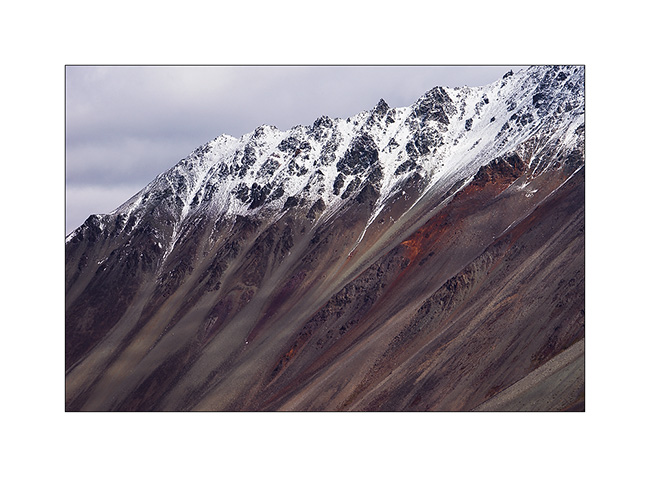
18. Another of theses giant overhansg with Candelstick Butte in the back.

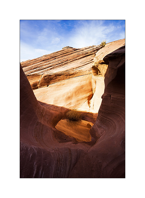
19. A small slot canyon I visited along the trail…
20. I rediscover the Green River…
21. Luch stop at Potato Bottom.
Continuation and end of the White Rim Trail in the next update.
In Canyonlands area…
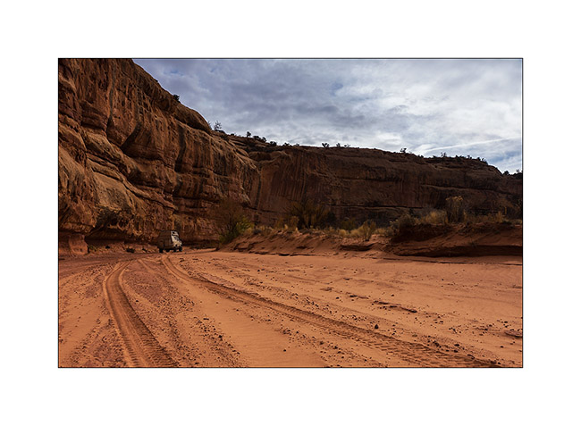
I went to see other places in Canyonlands NP, first in the beautiful Lavender Canyon.
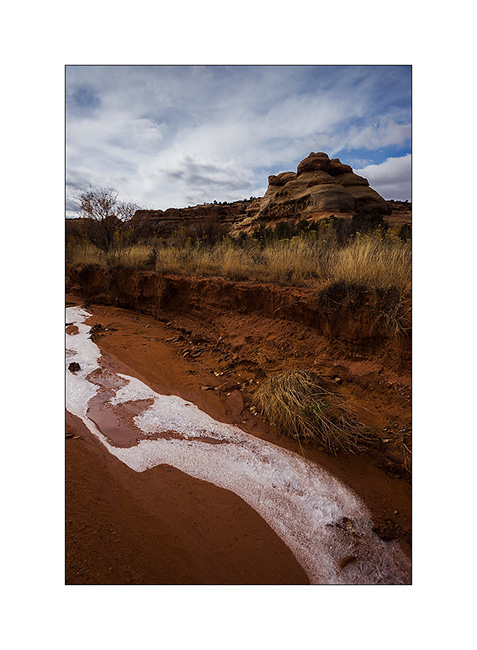
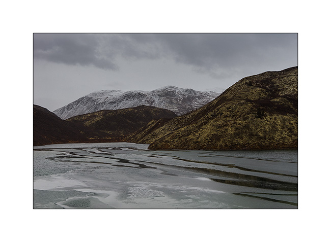
1. The access road goes nearly 20 miles up in a wash. There is some water, partially frozen in places, witness of the recent weather disturbance (the one I had at Black Rock).
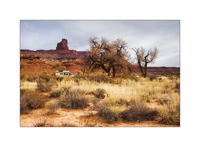
2. VivaLaVida is small under the vertical cliffs of the canyon.
3. Only way to show you that it’s cold in the desert too…
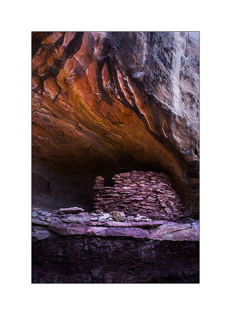
4. In a side canyon that leads me to Long Arch, I discovered some remains of an Indian granary dating from approx. 2,000 years.
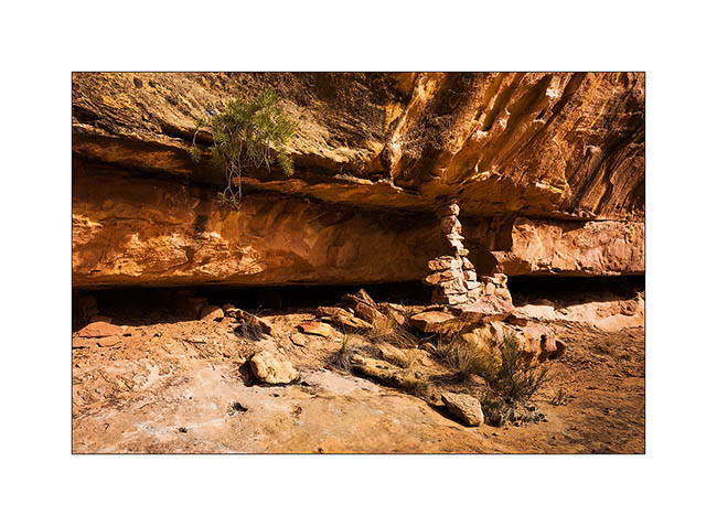
5. They protected their harvest by sheltering it in cliff cavities, closing access to rodents using mud and stones.
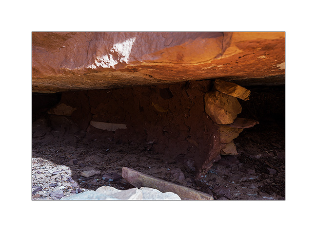
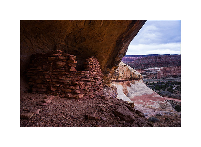
6. Further in the West Fork Lavender Canyon, I discovered a nearly complete shelter in half-wall height.
7. It will take me several attempts to find a path leading to it.
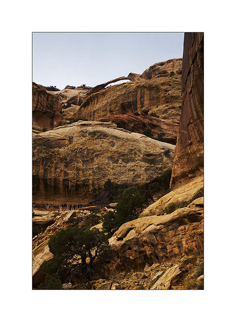
8. After three hours of hiking, I discovered the elegant Long Arch, little known because really remote. I’ll have to study the map to see if there is way to access from the top because no way to get closer down here.
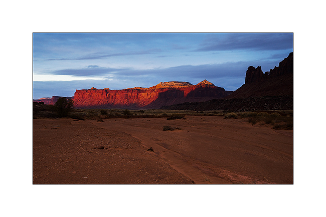
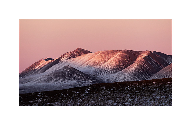
9. I take some showers of sizzles on the way back. But at sunset, a short ray colored cliffs around in this amazing red .
10. After a day of transition, I went to sleep at Anticline Overlook to enjoy the morning light.
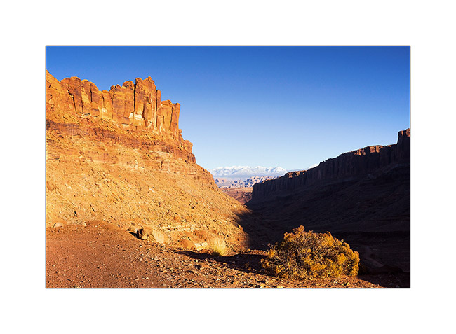
11. Scenry over Hourah Pass and Moab Rim is impressive.
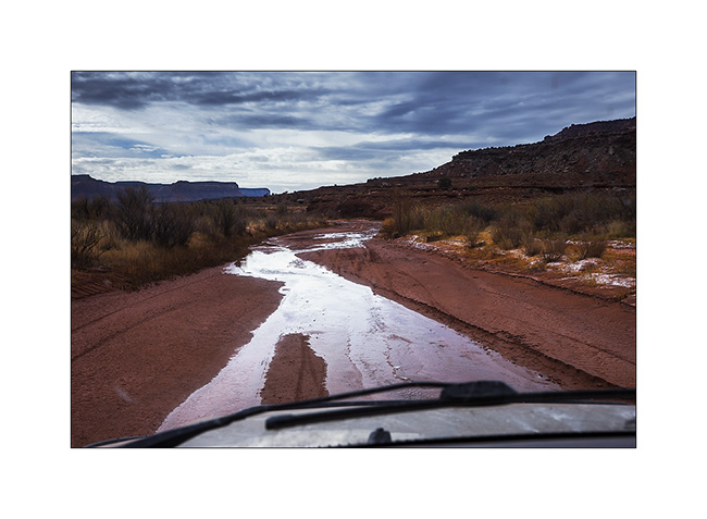
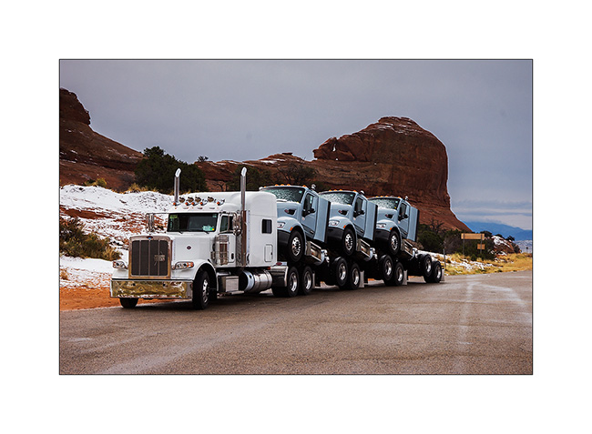
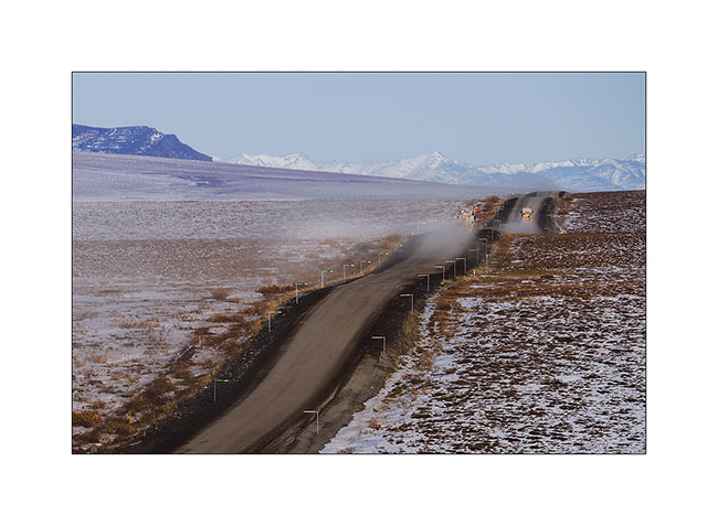
12. The weather get cloudy again and showers of rain/sleet follow one another. But I stop to show you how they transport trucks here! 😀
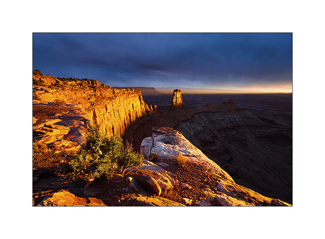
Having spotted the previous day an interesting point of view, I tried the gamble to go there for the sunset despite the rain and stormy Wind that got up, hoping for a sunray at sunset. The track was very bumpy and almost 20 miles long, VLV needed two hours to get to.
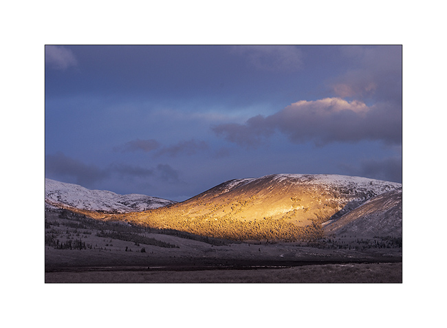
Arrived there at around 4PM, I went locate places to try to find a nice composition, aware that if there would be some sunlight, it would be brief. I finally found a composition I like, not without some apprehension because I was on a block overhanging a 600 feet cliff. It’s 16:30, I sit nearby and wait. It is downright cold and I’m beginning to think that I have come all this way for nothing…
But ultimately, the Gods of Light rewarded me with a moment of insane intensity! It did not last five minutes, just long enough for the sun to go under the clouds before to set. But the light was so intense, contrasting with the dark and low snow skie, gilding the cliff in a so bright yellow-orange..! A moment of pure happiness for my photographer’s eye. 😉
13. Firing…

14. Bis.
At once I prepared a luxury aperitif before processing these images… 😉
15. The next day, the snow has changed the appearance of the place.
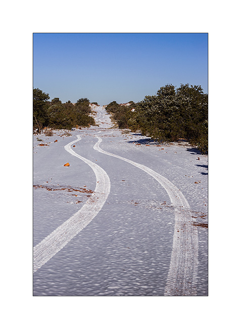
16. The track of VLV, alone on snow, as a symbol of her journey, often trough almost desert places…
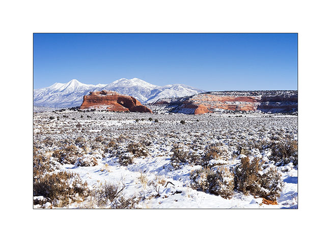
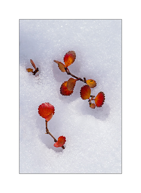
17. Contrast with the red sandstone is striking. Here, the small arch of Looking Glass Rock.
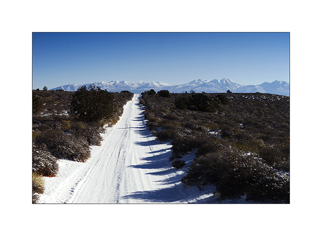
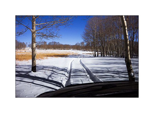
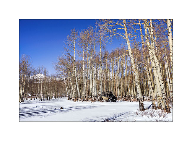
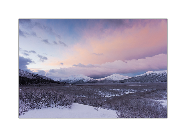
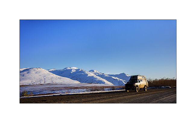
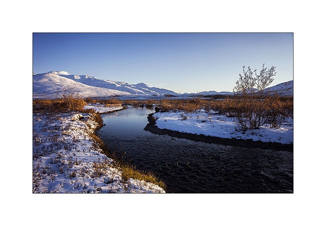
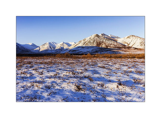
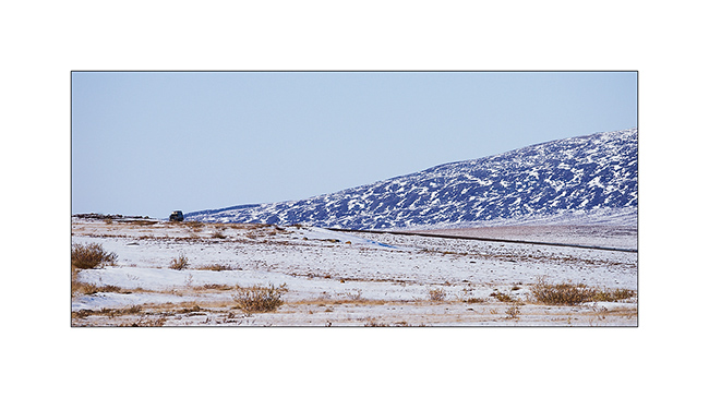
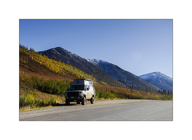
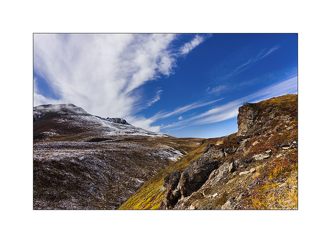
18. VivaLaVida is then went in the La Sal Mountains for a taste of winter.
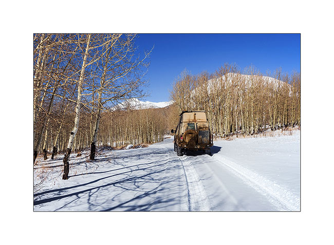
19. Aspens have lost their leaves for some time but proudly raise their silhouettes in the sky.

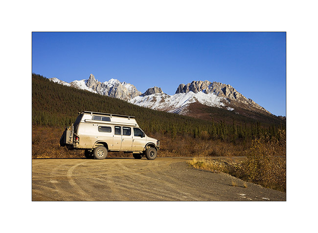
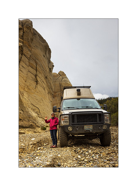
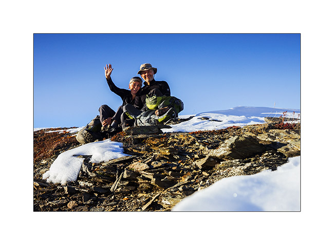
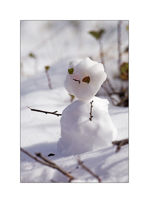
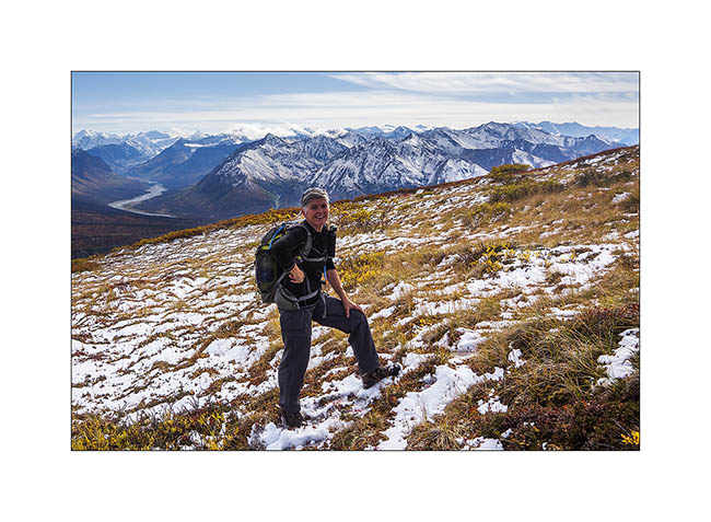
20. There was too much snow for me to cross the La Sal Pass, I had to turn back.
21. Nice place for a small lunch, isn’t it? 😀
More in the next update…
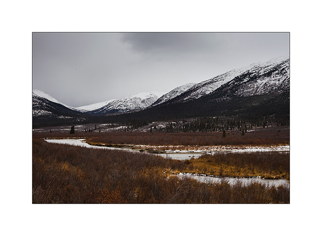
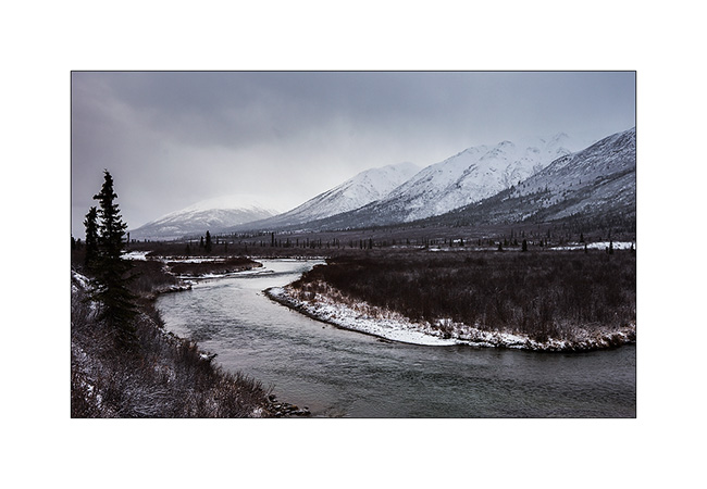
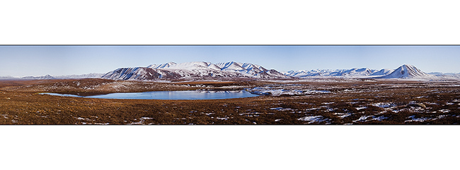
Nahanni Range (still in Yukon)
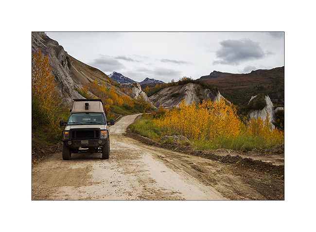
Discover of the second mining road built to access the Canjum Mine, another tungsten mine still active. The Nahanni Range Road, the road that crosses the mountain range of the same name, is much better maintained than the North Canol Road since trucks are borrowing it regularly to supply the miners and take down the tungesten. Yet, at taht time, the activities have stoped for the winter and hunting season is over, so the place was also completely deserted when I was there.
1. Nice river…

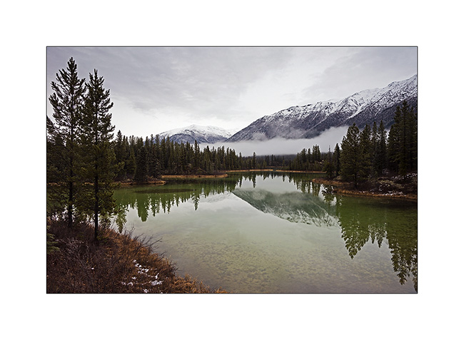
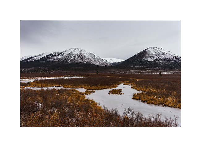
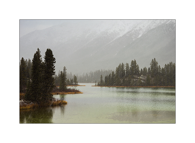
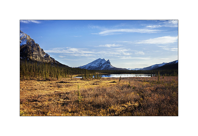
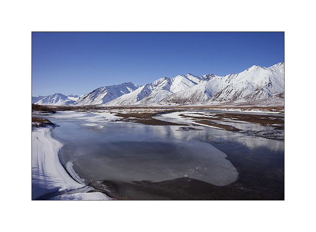
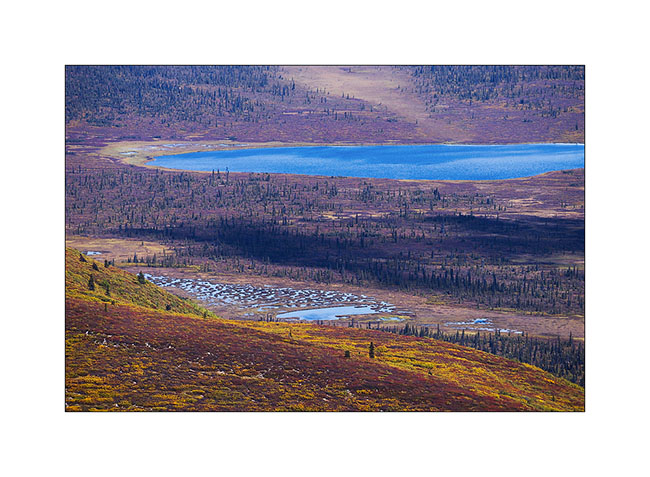
2. A beautiful small green lake that contrasts with the whiteness of the surrounding peaks.
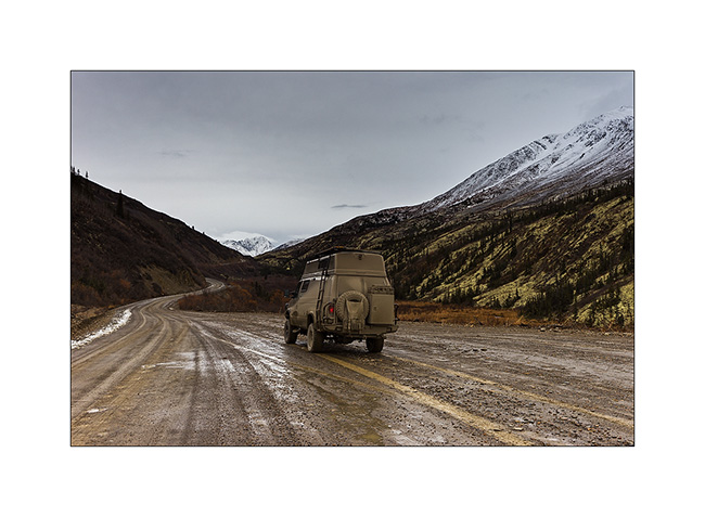
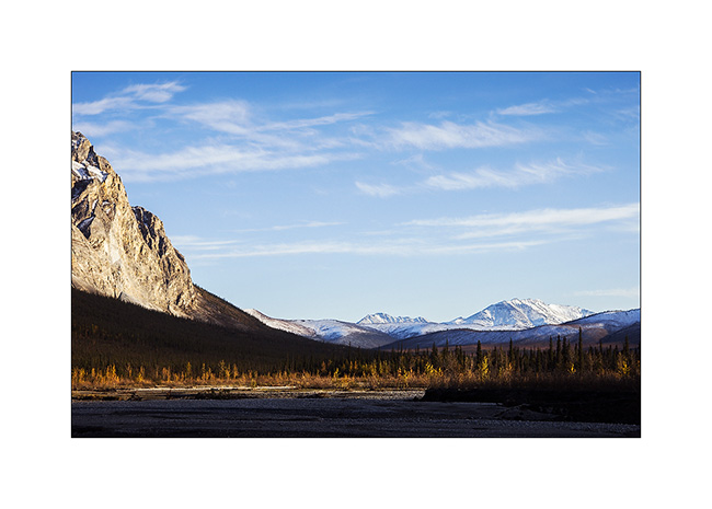
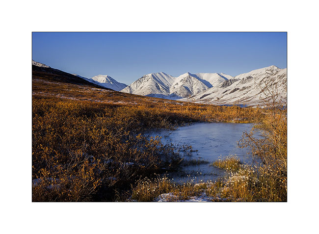
3. VivaLaVida approaches the mountains of the Nahanni Range.
4. I found similar atmospheres to those of the North Canol, about 200 miles to the North.
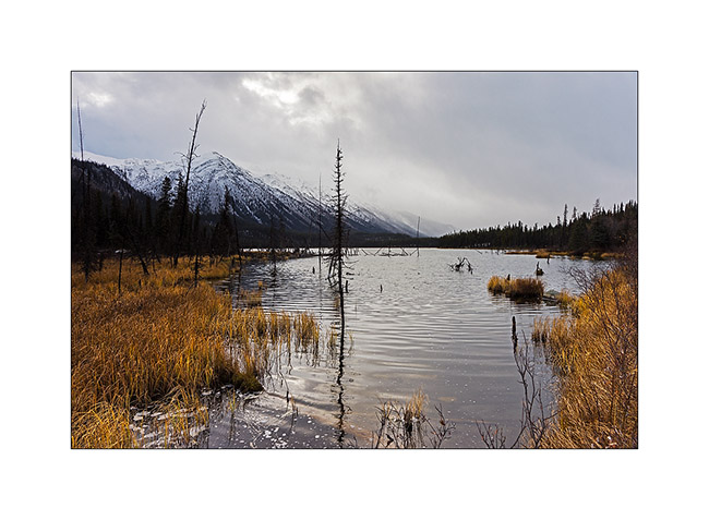
5. The warm tones of the last willow leaves and marsh grasses will soon be covered by winter…
6. VivaLaVida approaches the pass where is the border with the Northwest Territories again, to almost 5,000 feet above sea level on a trail made very muddy and slippery by snow flurries which succeed.
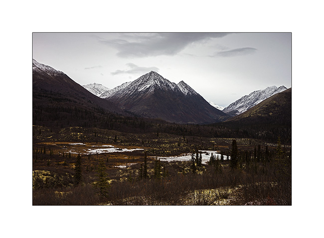
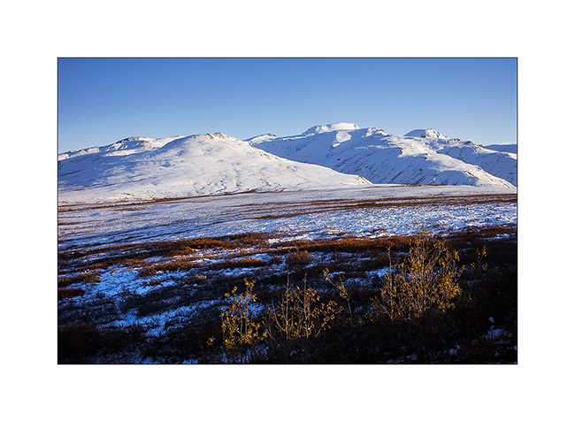
7. On the other side of the pass, mountains look sharper…
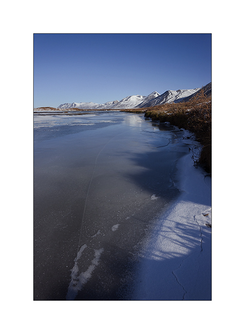
8. … and lakes are already almost completely frozen. We feel that it’s colder here…
9. Small lake just under the summit.
10. The weather starts to snow again while I go hiking to the bottom of the valley.

11. Lichens are everywhere, beautiful and really thick in places.
12. In five minutes, I’ll be in the snow flakes. Seeing nothing anymore, I will have to give up and walk back to VLV, about 4 miles away…
I have also not been able to leave that night, the snowfall turning into real storm by a strong blizzard, depriving me of any visibility. So I slept there, snug in VivaLaVida and without the fear of getting stuck as on the Canol Road.
13. Got up early the next day to discover fantastic colors at dawn, in a true winter atmosphere…
14. The valley where I was hiking when I had to give up yesterday…
15. Sunray on the opposite side.
16. Probably more than two foot of fresh powder blanked the peaks…
17. … while it blew so much on VLV that there is only about 4 inches around.

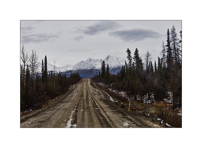
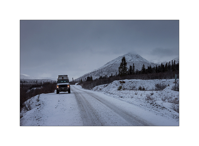
18. Going down towards civilization…
19. … a road in winter conditions.
20. Sometimes some rays sneakly break through the clouds…
21. … before a new snow shower. Here, the small lake of yesterday has changed its face…
That concludes my stay in the Yukon Territory that I loved as much as Alaska. Much less touristy but with the same variety of landscapes and wildlife, they have another thing in common: the lack of access roads to a large part of their lands, making them difficult to reach. One thing is certain: if I have the opportunity, I will come back… 😉
VivaLaVida then proceeded South via the Cassiar Highway rather than the Alaska Highway which we drove up North. Obviously with some detours that I will count you soon.
Thank you for your loyalty over and over again … And feel free to share the address of this blog or my FB page “Vivalavida Photography” with friends or acquaintances, they are welcome. 🙂
Going back South of Alaska
Before quietly thinking about joining back Anchorage where Mino will take his plane, we still made two beautiful hikes.
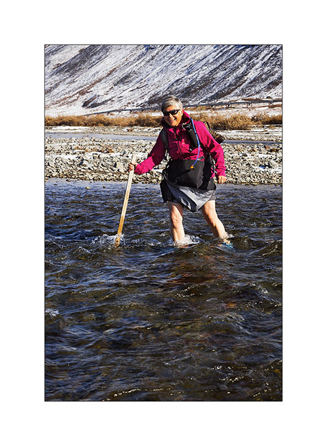
1. I initiate Mino to river crossings! This one was only about 32°F.
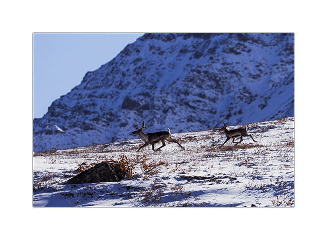
2. Caribou migration southward began, we see several made fearful by the hinting season opened since almost two months.
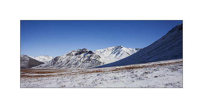
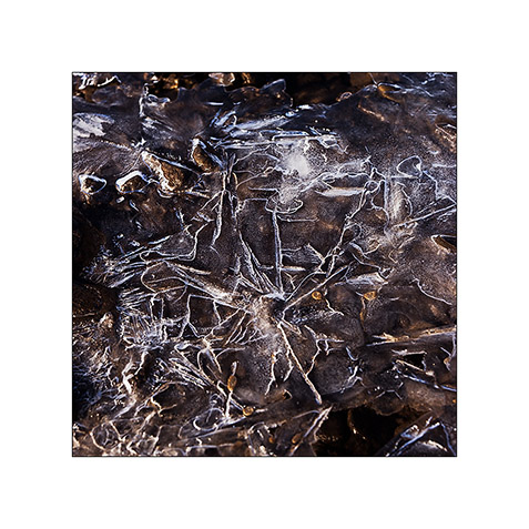
3. I never tire of these landscapes…
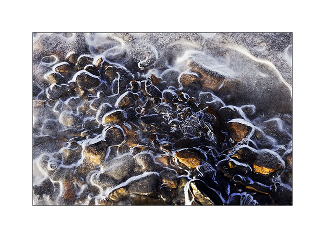
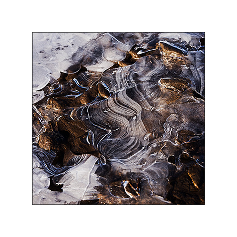
4. I find other paintings of ice…
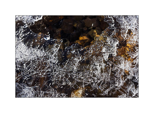
5. … that trap pebbles.
6. The next day, we explored a valley north of Antigun Pass to climb a nearby summit.
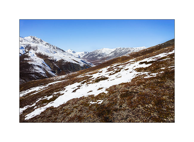
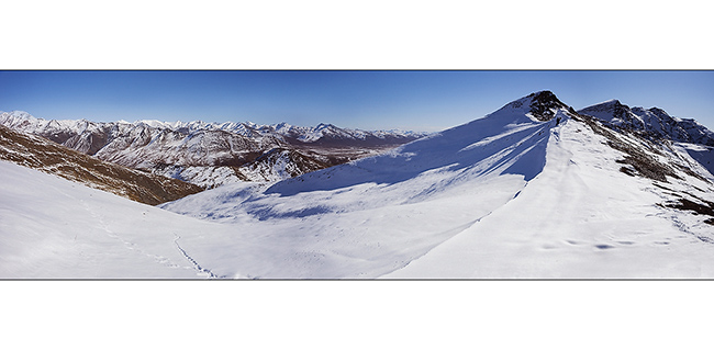
7. We stop at a pass after a hard climb. The view is gorgious.
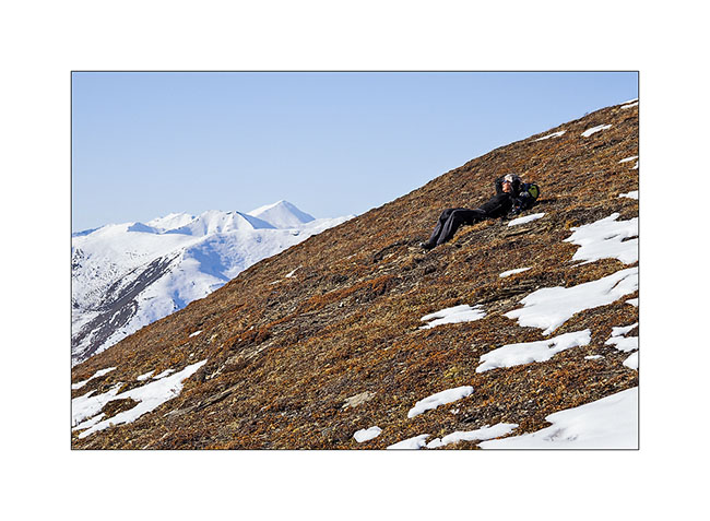
8. Mino rests admiring the scenery.
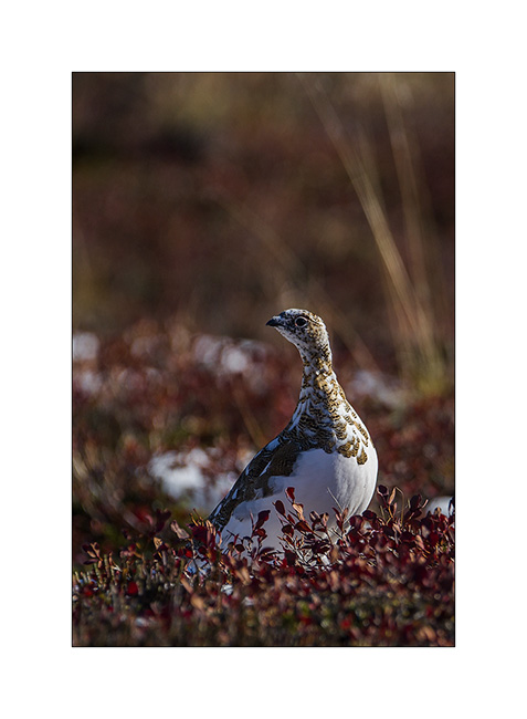
9. Going down, I manage to approach ptarmigans in moult.
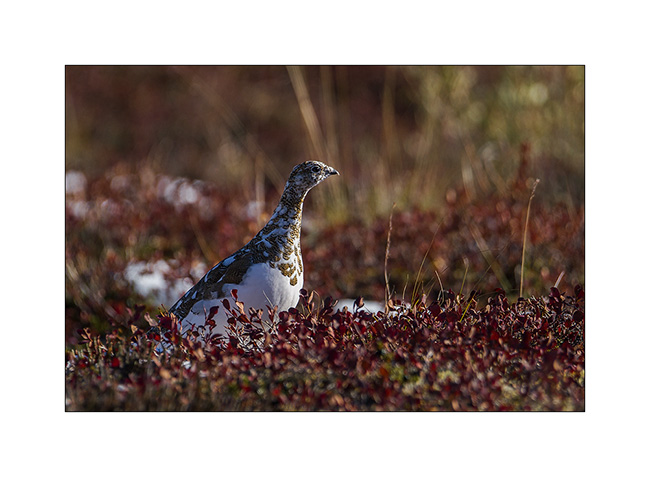
10. This one is already quite white…
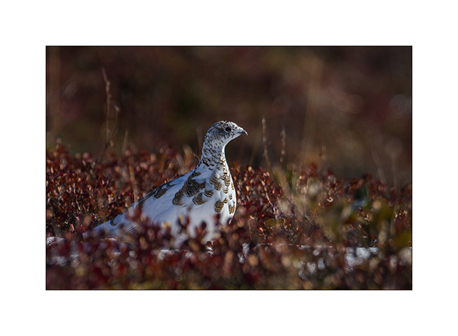
11. … while the neck of that one just starts to lose its summer color.
12. This end of day still reserve us a beautiful light.
13. VivaLaVida along beautiful granite peaks…
14. … and goes down a large valley.
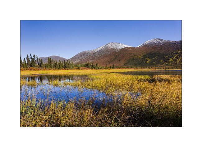
15. A pond that reflects Chugapak Mountain.
16. Crossing the Brooke Range is really beautiful.
This concludes the report of our visit to the Dalton Highway. We continued towards the Denali where we spent the two last days before Mino’s departure.
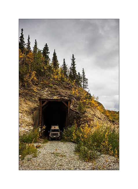
17. VLV strikes a pose in an old railway tunnel.
18. Quick “wild” visit (because unauthorized) of a still active coal mine.
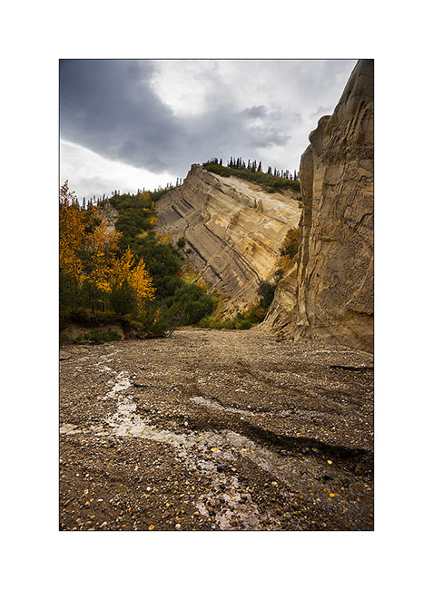
19. In a rather aesthetic side canyon.
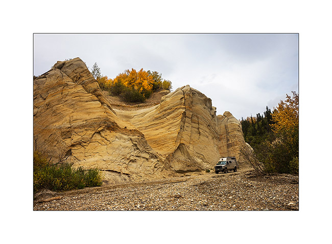
20. VLV has managed to go up the riverbed to pose in front of the cliffs sculpted by wind and rain.
21. Since it is difficult to realize the size of VivaLaVida on pictures – when seeing for the first time, Mino exclaimed “Oh what a monster!” – I took advantage of her presence to give you the scale. She stands under the mirror..! 😀
22. We are approaching a small lake that will give us a nice camp for the night.
23. The south wind blows in gusts but offers me some sunrays.
24. We sleep on the windy shore…
25. The next day, we explore the mine from the top, after a track more than 35% steep !

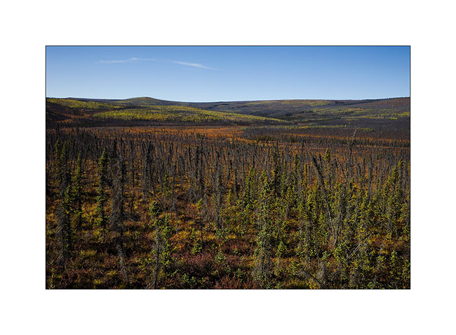
26. The fall colors have invaded the forest…
27. … and the tundra.
28. The sky clears as the sun sets down…
29. … coloring the nearby mountains of the last boondocking for Mino.
30. Last colors on the taïga.
That ended the few weeks when Mino traveled in VivaLaVida. She walk the over 180 miles I hiked during these almost six weeks and has cooked me some really good dinners! Thanks to her. 😀
At the time of this writing, I do not know what will be the road ahead yet; so you will discover it in a future update. 😉
Brooke Range and arctic tundra
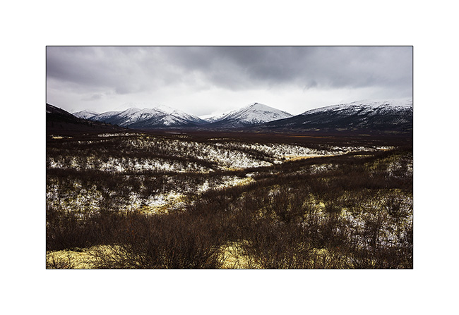
We continue farer northward…
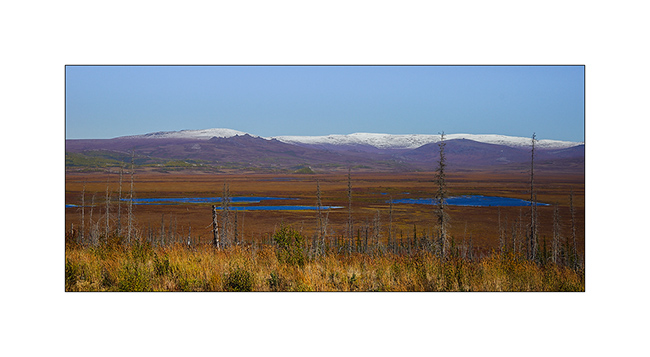
1. Nolan valley, a side valley accessible by a really muddy small mining road .
2. At this altitude, the marshes are still not frozen.
3. I found the Brooke Range that bars northern Alaska back.
4. We stop a few dozen miles after Coldfoot to go climbing one of the mountains beside the road.
5. While VivaLaVida begins to climb Antigun Pass, the atmosphere becomes wintry.
6. All is already frozen here…
7. … and it is already well below freezing in late afternoon.
8. As it’s already late, we find a nice boondocking site before Antigun Pass, approx. 4,000 feet elevation on the banks of a small river.
9. Despite the cold, I’m going to make some pictures while Mino is preparing the aperitif!
Temp will almost reach 10°F that night and VLV’s heater resume service after resting for a few months…
The next morning we cross the Antigun Pass and stop thirty miles down it to go hiking along a beautiful river.
10. The blizzard that blew here two days previously installed winter before autumn has arrived…
11. Despite a significant current, the banks of the river are well frozen. It was about -5F° in previous days…
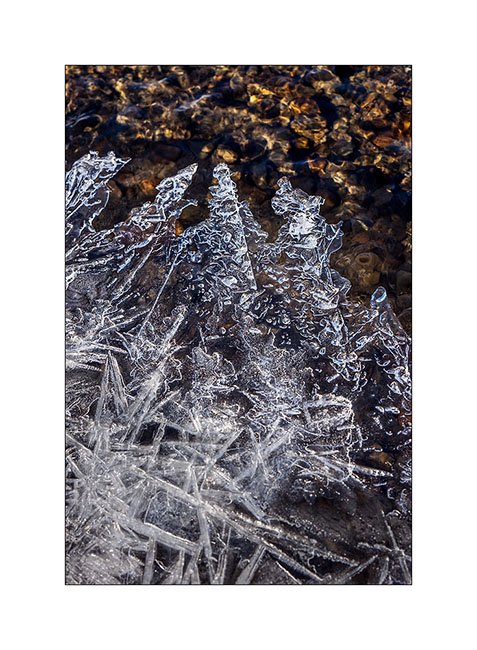
12. I enjoy the clear light to play with ice concretions…
13. … sometimes contrasting and twisted…
14. … sometimes carved by running water below.
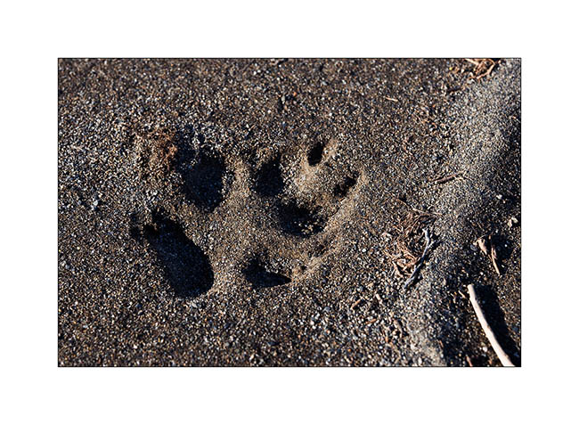
15. On a bank, we find wolf tracks. It happened here less than two days ago, the snow testifies it.
16. The show is sparkling as the river is freezing and carries plates of ice that break in crystal clear sound…
17. … and our eyes feast.
18. Continuing towards the far north, the landscape becomes truly arctic.

19. Blizzard designed the reliefs.
20. Not sure that the truck drivers who supply Deadhorse and Prudhoe Bay are all aware of this beauty…
21. We leave VivaLaVida to walk on a side track…
22. Perfect lines of the wintry tundra…
23. We will not go to Deadhorse, the last part of the track is less interesting. We stop at the last foothills of the Norths Brooke Range…
24. … and even find a camp on the tundra. What a fantastic place to camp, isn’t it? 😀
25. The Sunset is beautiful again…
26. … the last rays coloring the hills…
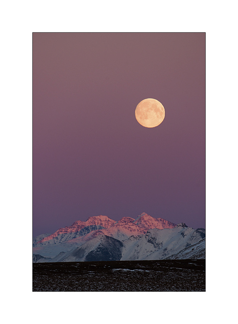
27. … before a magic full moonrise.
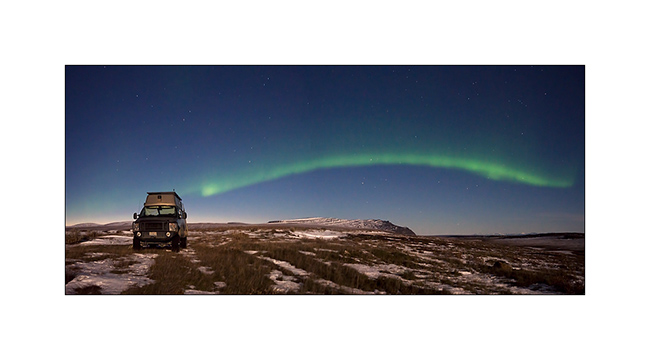
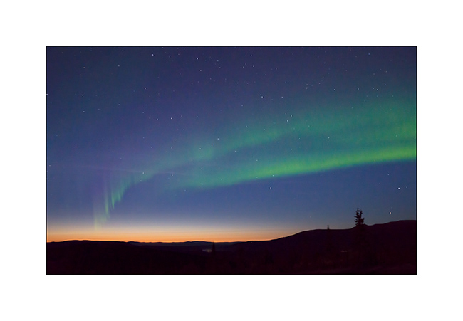
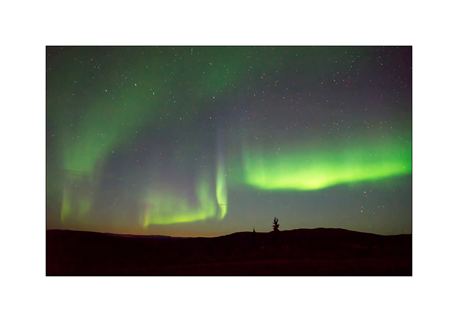
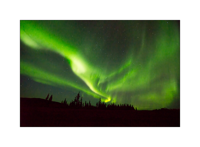
28. And to complete this grandiose day, a northern light came to wish good night to VivaLaVida while the full moon was lighting up the tundra!
We began our descent back to the South the next day. To discover in the next update… 😉
Thanks again for your loyalty!
Richardson & Dalton Highways
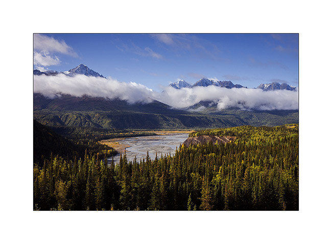
Continuing our journey northward, we cross the Alaska Range covered with fresh snow.
1. Exploring a side valley, not far from our camp.
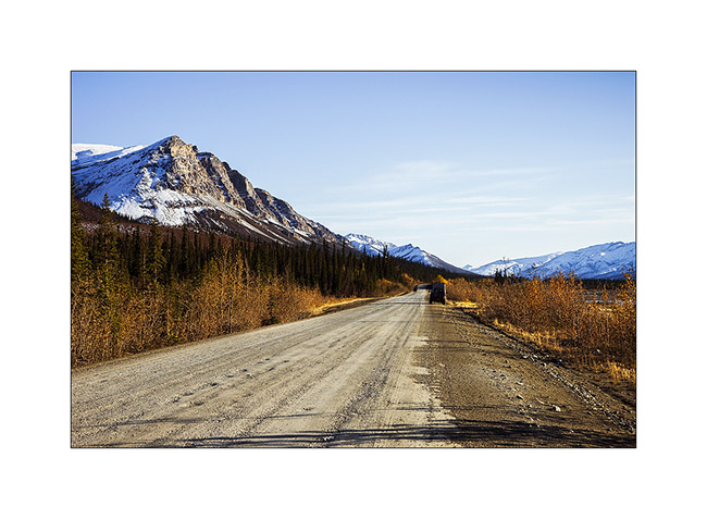
2. The Richardson Highway passes through high mountains with difficult access.
3. Scree dusted with snow…
4. North slope of Alaska Range.
5. In the kitchen, we don’t let go: wild salmon with dill on a bed of spinach, all cooked over our campfire, hummm… 😉

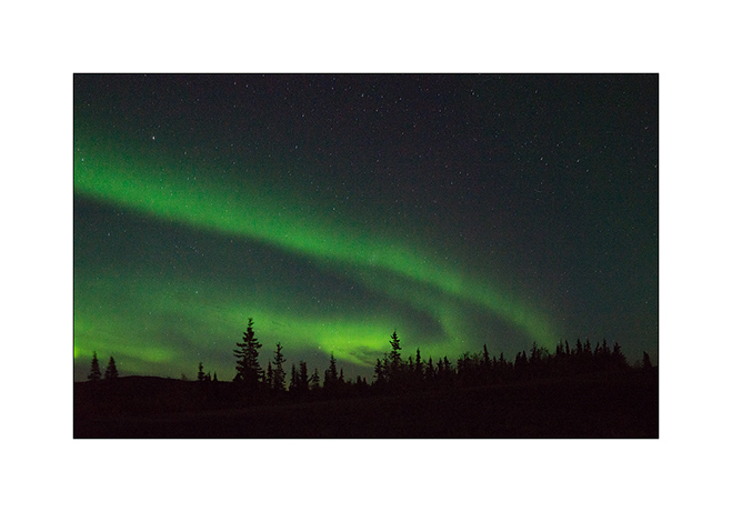
6. After the show of the previous day, we watch the sky and a new northern light appears with the last light of the Sunset still pointing north…
7. We spend almost three hours outside despite a tempestuous wind and biting cold!
8. Paintings are constantly changing…
9. … sometimes very soft…
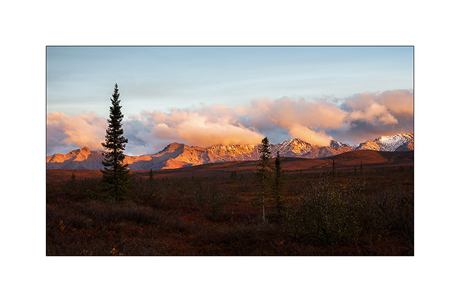
10. … sometimes very intense.
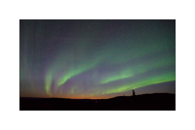
11. Sometimes the aurora crosses the sky with a truly amazing intensity, almost comparable to that of the moon.
12. We are almost hypnotized by the show…
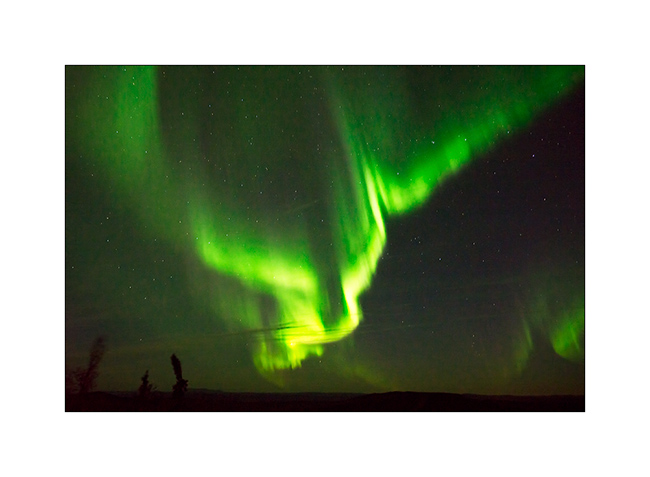
13. … and the grandiose beauty.
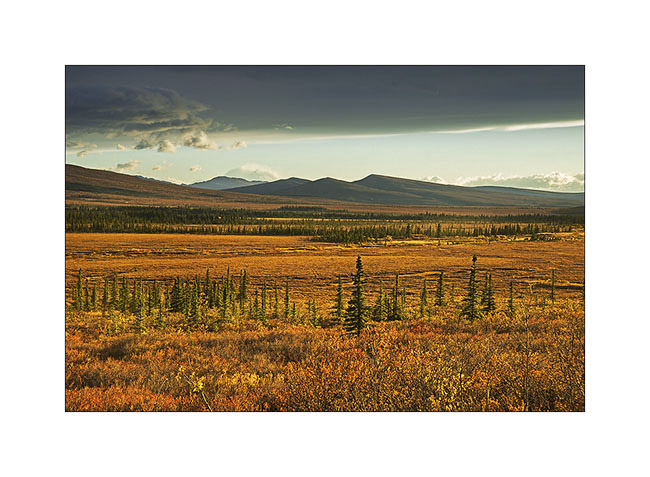
14. After going late to bed, we entered the Dalton Highway the next day. The atmosphere was completely different than during my first visit, I feel like discovering other landscapes…
15. Here too the recent snow still covers the hills.
16. Taiga has completely changed color with warm tones adorning.
17. A picture of Grayling Lake I made during my first visit. If you want, you can compare: it’s the image # 17 ! 😉
18. VivaLaVida on the Dalton Highway.
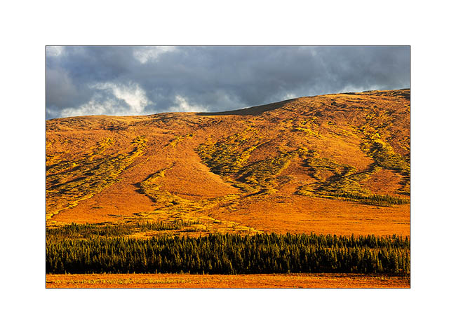
19. Between the orange-red willows and bright yellow aspen and birch, the colors are incredibly saturated…
20. … and snow further strengthens those.
To be followed soon…
Central Alaska
I’m back after a few days of silence due to a lack of network.
Initially, Mino should leave from Seattle. However, to take advantage of the fall in Alaska, at our last update, we were waiting for a confirmation on the ability to change her return flight to leave from Anchorage. The response was positive and, at the time you’ll discover this update, Mino will be on the plane bringing her back the Switzerland…
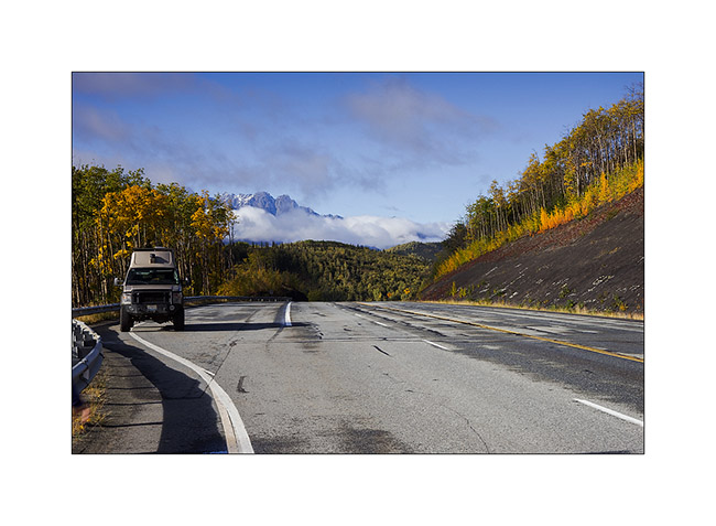
As soon as we got the answer, a favorable weather forecast decided us to move north along the Dalton Highway I had already traveled six weeks before. We hoped to discover the fall colors on the tundra and to hike in Brooke Range. We then headed to the Glenn Highway to Glennallen and after a first night at a hundred miles from Anchorage, we woke up enjoying the first snow fall on the surrounding mountains.
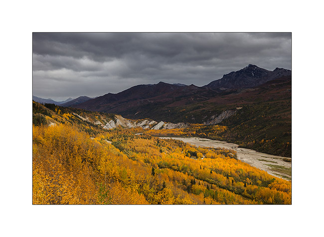
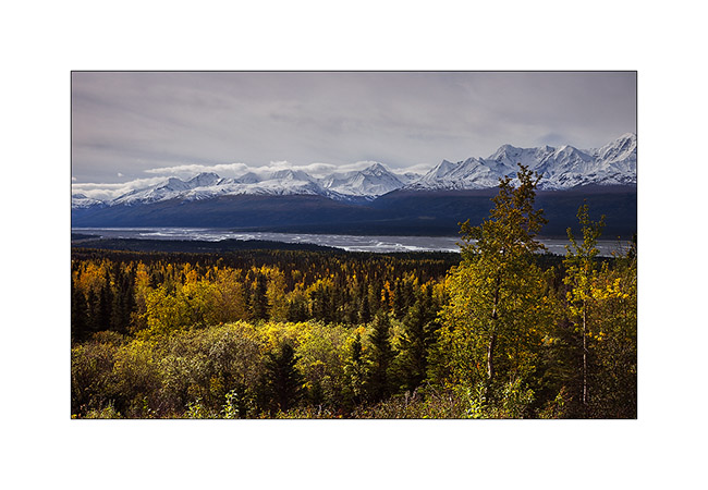
1. Matanuska River in ther morning.
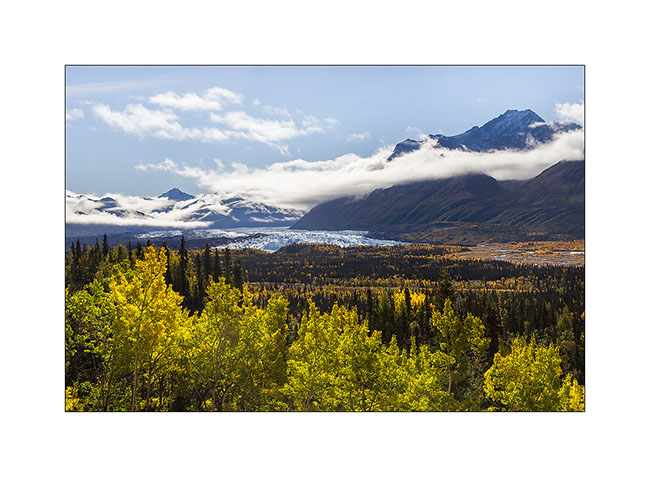
2. They are still many clouds on the mountains.

3. The first frosts begin to color the trees.
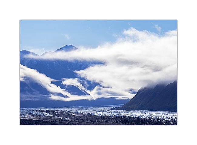
4. We pass near the huge Matanuska Glacier.
5. Clouds plays…
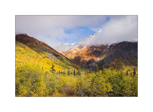
6. Some hills are really colorfull.
7. With such a nice weather, we decided to go hiking and discovered a small altitude lake.

8. The first snow of the season inspires Mino…

9. … who signs its passage ephemerally… 😀
10. … while for my part, I play with the contrast between the snow and the “willows” colored with their characteristic orange-red fall color.
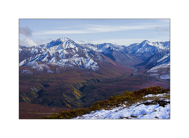
11. As and when we climb, the view extends over the surrounding valleys.
12. The horizon is so wide…
13. Souvenir picture…
14. After nearly three hours to make our way uphill in the tundra, a break is welcome under a beautiful sky of cirrus.
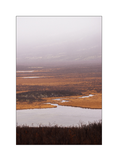
15. A river that flows from one icefield, more than 40 miles away..!

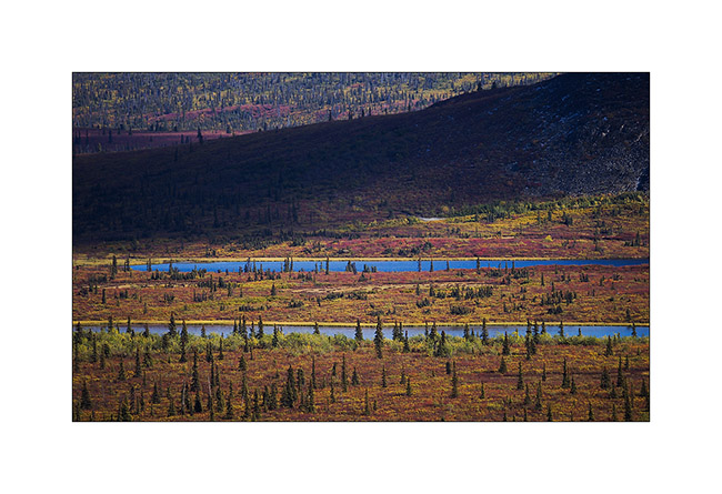
16. From above, tundra reveals so many small lakes and marshes…
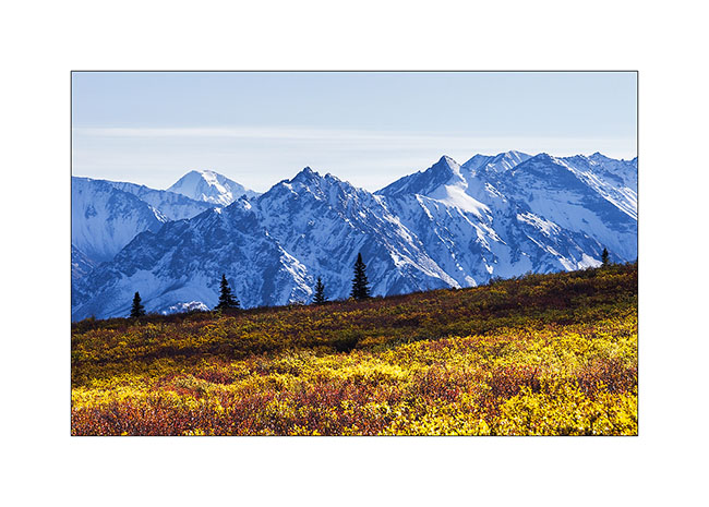
17. The contrast between the warm tones of the autumn tundra and the white snow is beautiful.
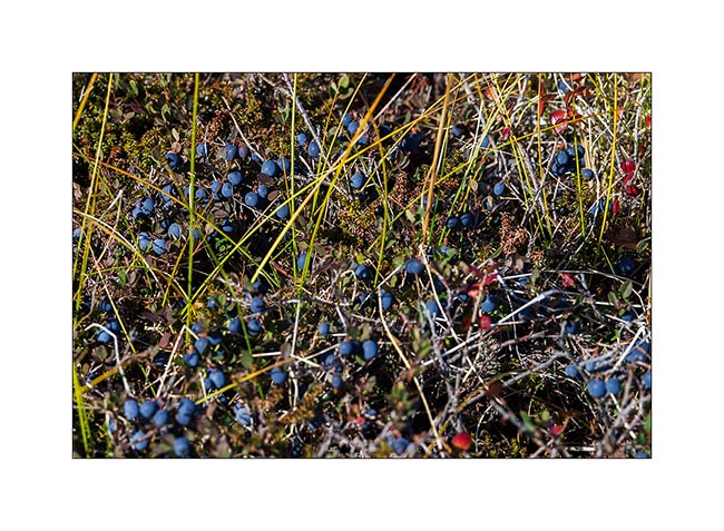
18. We enjoy some of the thousands of blueberries that are everywhere.
19. This mix of colors is so beautiful that I would stay there longer and longer…
20. Other lakes as we descend…
21. It’s getting late, shadows contrasted the opposite side of the valley…
22. Continuing the road, I took a foot bath to take this image in a flooded marsh in beautiful sunset light.
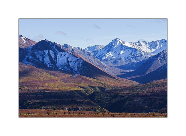
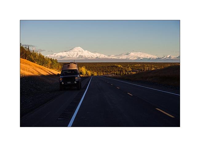
23. Vivalavida goes north. In the distance, Mount Drum, another volcano from the large fault extending from the Aleutian Islands to Mexico, and the huge dome of Mount Jarvis.
24. We find a nice camp site near Paxson.
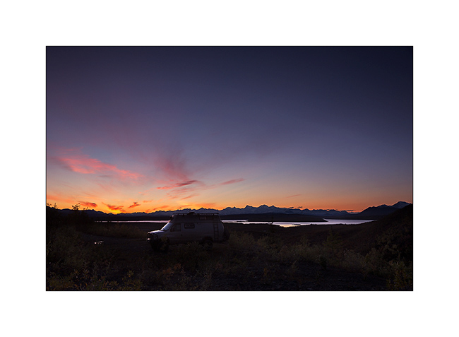
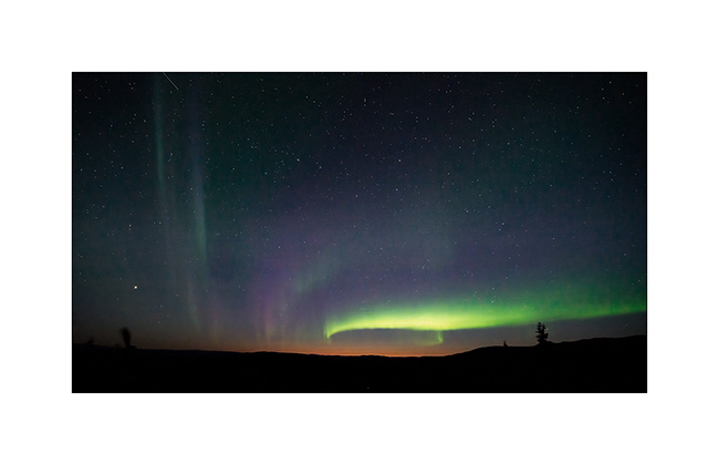
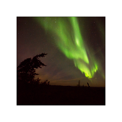
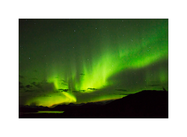
25. And while I’m about to go to bed, surprise: a powerful northern light lights the sky up!

26. This is the first that I have the opportunity to see, what a sublime spectacle… I will lie down only at 2am that night… 😉
The following will take in the far north where we had a small preview of the new winter to come … Coming soon here. 😀
Pinnacles and Kings Canyon NP
Since I had to go through Fresno to change the main tank of Vivalavida which continued to leak despite several repairs, I took the opportunity to visit a few sites on the way to San Francisco. Starting with the Pinnacles National Park, the last National Park created to date.
1. Crossing the mountains behind the Big Sur…

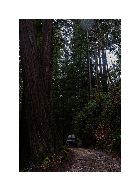
2. … Vivalavida crosses beautiful forest of “red wood” sequoias.
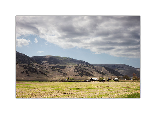
3. Behind these mountains which condense rains of the Pacific, the hills have been cleared to create pastures…
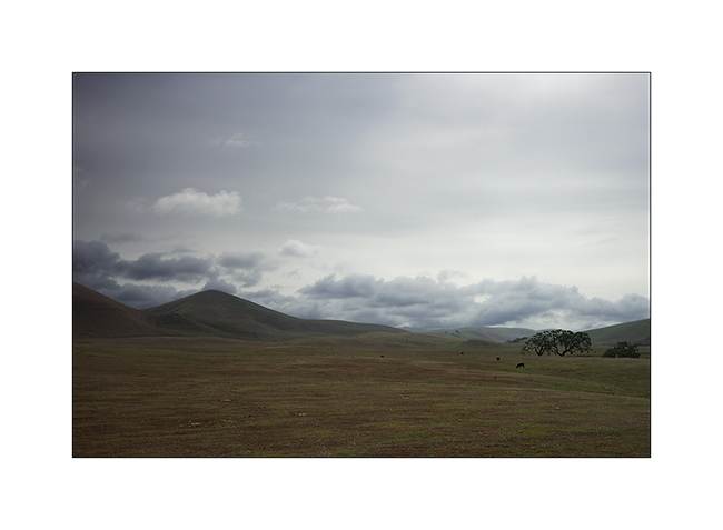
4. … quite photogenic.

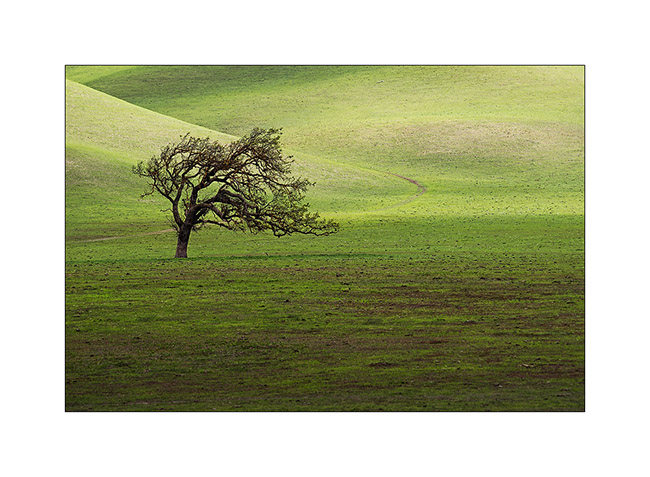
5. A beautiful lone tree … This phicture has earned me the remonstrances of a farmer not happy to find me in his field even if I did not do much wrong.
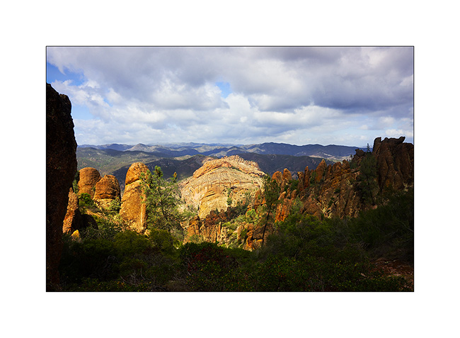
6. In the Pinnacles NP, a mountain range which houses californina condors that I haven’t seen on this occasion…
7. They are already some flowers…

8. Going further on my way, the land looks more desert.
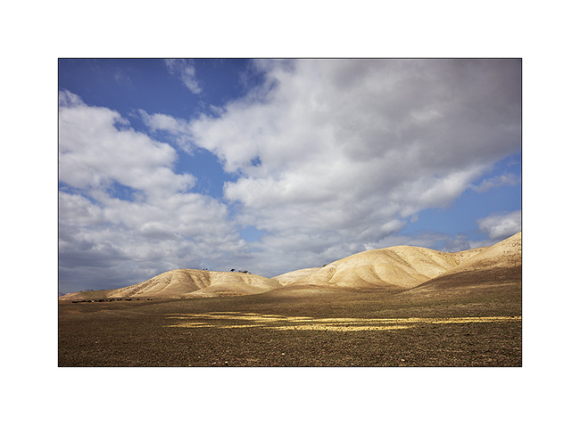
9. However, a few scattered farms try to exploit it.
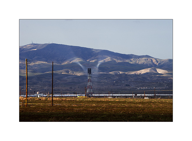
10. Along the road, the Coalinga solar plant and the strange and spectacular concentration of sunlight near the tower.
I then went to see the Kings Canyon National Park and its giant sequoias, not far from Fresno.
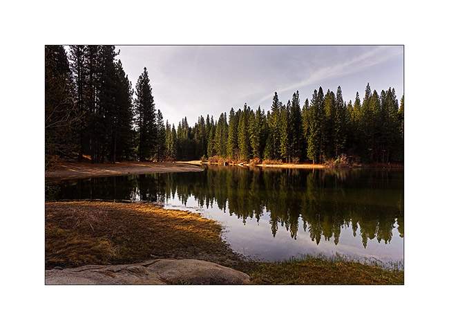
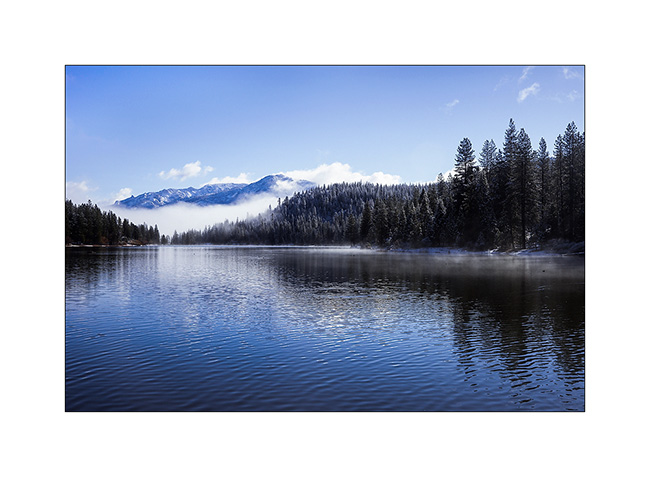
11. Pretty Hume Lake.
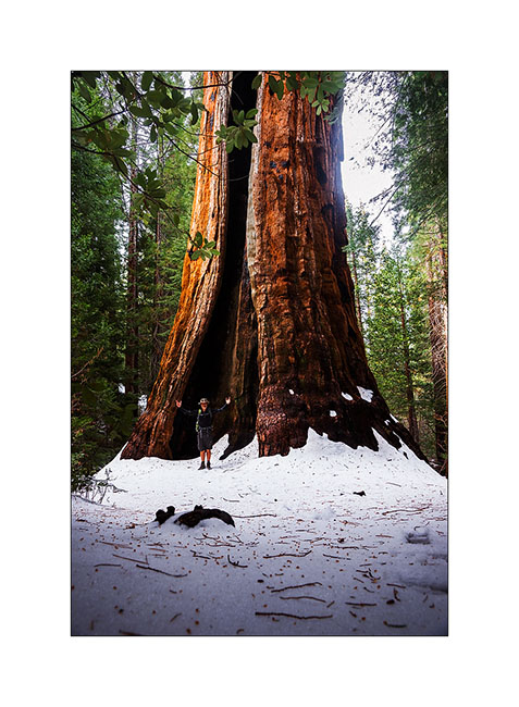
12. VivaLaVida under the giants.

13. And a penguin in front of the 6th largest tree of the USA! About 40 feet in diameter at its base!!!
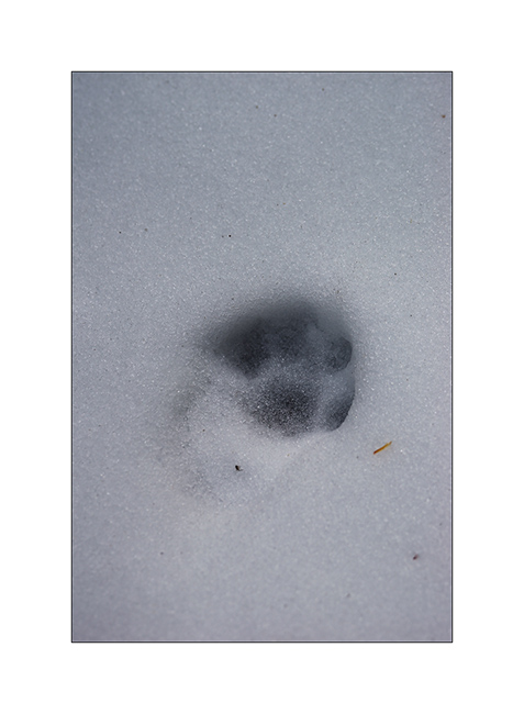
14. Likely tracks of a lynx or a bobcat.
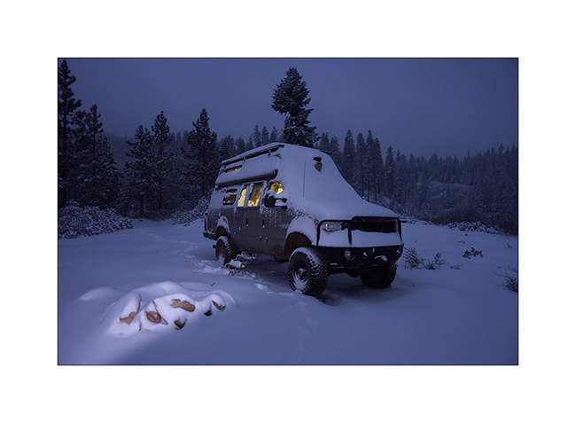
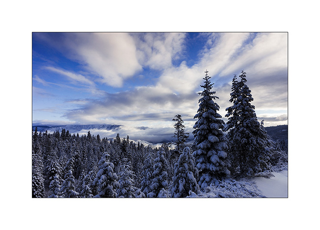
15. I found a nice boondocking area above Lake Hume up a nice 4×4 drive and surprise in the next morning: more than one foot of fresh snow!

16. This is what is called a return of winter!
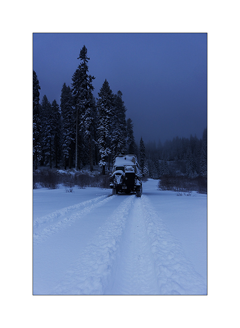
17. I tryed to go through the pass…
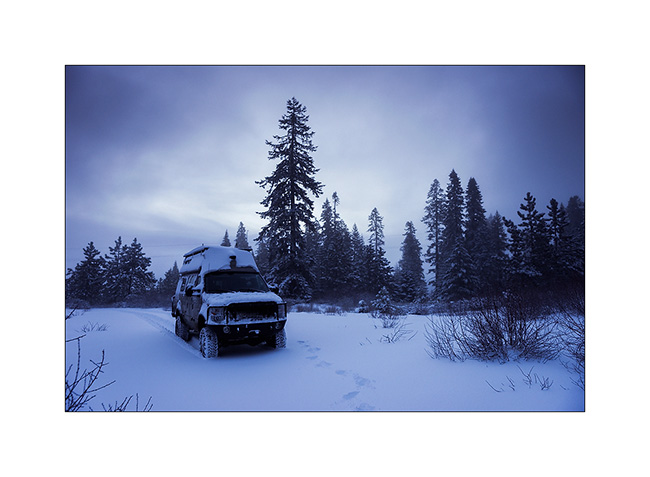
18. … but there was to much snow and I drove back.
19. Lanscape is beautiful…
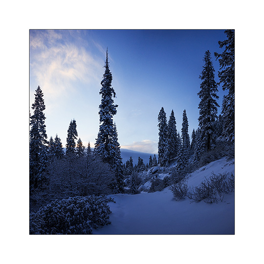
20. … since the weather is getting better.
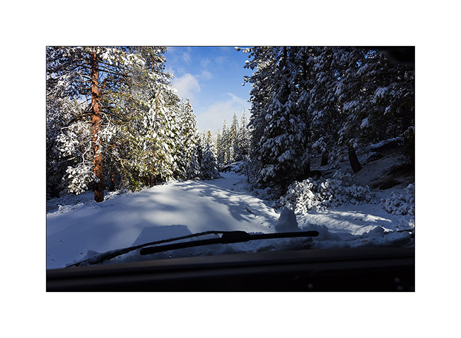
21. I learned that the Highway was closed after having traveled more than twenty miles without a single trace in front of Vivalavida’s wheels. What a pleasure! 😀
22. Back to the Hume Lake that has changed in appearance since yesterday!

23. It feels like the middle of winter…
24. Going back down to Fresno…
To be continued in a few days… Thank you for your loyalty! 😀