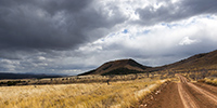
canyon @en

now browsing by tag


Mee Canyon Alcove

zi8ba3wa68

Hikes in Utah…

 
During Memorial Day Weekend, I held waiting for mechanical work on VivaLaVida discovering some surrounding canyons.
 
 
1. Going up Mill Creek canyon in a rainy day…
 
_DSC6999b
 
 
2. … I discover this pretty small waterfall.
 
_DSC6990b
 
 
3. Higher in the canyon, is a cave whose traces of soot on the vault attest that it served as a shelter for Indian people years ago.
 
_DSC7008_sb_b
 
 
4. The next day I went discover the Negro Bill Canyon, renamed since with an unpronounceable name for “political correctness” reasons. The unusually wet spring in this region provides more water and greenery than it’s common here.
 
_DSC7042b
 
 
5. Arriving near Morning Glory Arch.
 
_DSC7037b
 
 
6. It’s a place where tourists offer some thrills rapelling from about 120 feet.
 
_DSC7015b
 
 
7. There is quite some air with a second portion away from the overhanging cliff.
 
_DSC7022b
 
 
8. Giant arch.
 
_DSC7028b
 
 
9. Hiking higher in Negro Bill Canyon, widely flowery.
 
_DSC7048b
 
 
10. Cacti offer many yellow ar roses flowers.
 
_DSC7045b
 
 
11. Small waterfall down the cliffs.
 
_DSC7049b
 
 
12. This one looks like a lys…
 
_DSC7050b
 
 
13. Not far from the mouth of the canyon, water runs on the sandstone.
 
_DSC7053b
 
 
14. The place is wild and desert despite the crowds of Memorial Day.
 
_DSC7059b
 
 
15. Last compo before going back to VLV and heading to Salt Lake City to do the work on VLV.
 
_DSC7056b
 
 
To be followed soon. 😀


Petrogryphs of Arizona and Nevada

Vivalavida went discover another access to the Grand Canyon, also on the North Rim but further west.
 
 
1. Cactus in snow…
 
_DSC5745_800cb
 
 
2. After going down Whitmore Canyon, I reached the end of the trail, approx. 700 feet above the Colorado River.
 
_DSC5748b
 
 
3. Grand Canyon is also gorgious here.
 
_DSC5749b
 
 
4. The site is interesting because it presents a large lava flow clearly visible on this panoramic (3 images stiched). There have been several successive lava flows, the first about 170,000 years ago that created a temporary 250 feet deep lake obstructing the Grand Canyon. This lake has remained approx. 20,000 years before the lava broke, creating a gigantic tidal wave downstream. Since then, there have been seven succesive lava flowa, the last one approx. 20,000 years ago. Do you find VivaLaVida that gives the scale in the image? 😀
 
_DSC5753_pano_b
 
 
5. To the left of the promontory from which I took the previous image, there is a wide collapse that reveals beautiful basalt organ walls. It’s approx. half a mile in diameter and almost 600 feet deep.
 
_DSC5758_pano_b
 
 
6. Details of the cliff with a waterfall that has carved its way.
 
_DSC5760b
 
 
7. Just to the testimony, picture is not great, a “beep beep” surprised in the warmer micro-climate of the canyon.
 
_DSC5763b
 
 
8. Going back up the trail, I pass a small country air strip. Some guys don’t lack humor with this “Whitmore International Airport” sign and the two small escalators… 😉
 
_DSC5766b
 
 
9. VLV near the Mount Trumbull old school. Built in 1922, it was burned by vandals in 2000 and rebuilt in an identical in 2001. It was the only school in the area where the first collons arrived in 1916, growing grains and beans until 1934 where the climate became much drier. Therefore, some og them turned to breeding cattle and sheep while many others left the premises. The school was in operation until 1968 when it was closed for lack of students. the last man living year round in this region died in 1984. Since few ranch remain scattered and inhabited during sommer only.
 
_DSC5768b
 
 
10. Short detour to Little Black Mountain, an interesting petroglyphs site.
 
_DSC5770b
 
 
11. the almost horizontal line is oriented exactly in the axis of the winter solstice; December 21st, the sun rises just above its eastern end.
 
_DSC5769b
 
 
12. One of the big boulders of the site.
 
_DSC5774b
 
 
13. Details…
 
_DSC5775b
 
 
After this escapade in Arizona, I made another into Nevada to spend the evening with my friend Christian who was a few days in Las Vegas for the CES. Heading back to Utah where I should pick up a new compressor for VLV (the actual one being at its 4th beakdown…), I stopped at the Valley of Fire, a small Nevada State Park not far from Lake Mead.
 
 
14. Arch Rock.
 
_DSC5788_sb_b
 
 
15. They are also many petroglyphs, those ar at Altalt Rock.
 
_DSC5784b
 
 
16. Still Altalt Rock.
 
_DSC5783b
 
 
17. Those are in Mouse’s Tank Canyon.
 
_DSC5791b
 
 
18. The road heading to White Domes.
 
_DSC5802b
 
 
19. Sandstone is veined with various mineral colors.
 
_DSC5796b
 
 
20. Like a petrified wave…
 
_DSC5810b
 
 
21. Veining…
 
_DSC5812b
 
 
22. Windstone Arch, rather unusual in an alcove of the rock.
 
_DSC5828b
 
 
23. Late afternoon in Valley of Fire.
 
_DSC5817b
 
 
That’s it for today. Next step of VivaLaVida’s journey in the coming days… 😀


Zion National Park…

While I’ve been in Utah a few times, I had never gone through Zion yet. The upper third of these mountains consists of Navajo Sandstone. It is a very touristy place and I took advantage of the off-season to discover it.
 
 
1. Going up in Zion Canyon, accessible by a paved road.
 
_DSC5548b
 
 
2. Cottonwoods don’t have leaves anymore in this season.
 
_DSC5549b
 
 
3. Angel Landing. For those who know it, climbing this edge while rock is covered with snow and ice is quite… well… aerial! 😉 I must say that there are a few hundred feet of emptyness on each side and that certain passages are not more than five feet wide.
 
_DSC5551b
 
 
4. Hiking the West Rim trail…
 
_DSC5559_sb2_b
 
 
5. Top left, the edge by which one accesses Angel Landing.
 
_DSC5560b
 
 
6. Reaching Navajo sandstone in characteristic light color.
 
_DSC5566b
 
 
7. Toward South…
 
_DSC5569b
 
 
8. Lower Zion Canyon in late afternoon.
 
_DSC5576_sb2_b
 
 
9. From my camp… 😀
 
_DSC5581b
 
 
The next morning, after obtaining the required permit because the hike is quite engaged, I went for a long hik of about 14 miles. Rather than hiking, I should say a gymkhana! Except for the first two miles, it’s going upstream in a torrent crowling large blocks, constantly going up and down, crossing fifteen times the water at 37F, skating on snow and ice, without any sun… In short, something not to recommend to anyone, especially in this season. Moreover, the ranger looked at me with surprised eyes when I asked him for the permit, saying: “Do you really want to go ther in this season?”. 😀
Why this hike you might think. To exploreng a rather exceptional slot canyon, the “Subway” as it’s called.
 
 
10. While there is still about 2 miles to go, the canyon is still open and small waterfalls jump down rock stairs.
 
_DSC5587b
 
 
11. The most photographed waterfall, less than 1 mile down the slot canyon.
 
_DSC5603_sb2_b
 
 
12. Here is the entrance of the slot canyon with its characteristic form that earned it its name.
 
_DSC5654b
 
 
13. Floods of the river dug a kind of tube-shaped hose.
 
_DSC5651b
 
 
14. The “turning” from downstream.
 
_DSC5641b
 
 
15. Small waterfalls dug a series of pots where the water is emerald.
 
_DSC5635b
 
 
16. Above, the canyon reopens before closing again. It requires climbing equipment to continue.
 
_DSC5608b
 
 
17. Beautiful pots.
 
_DSC5627b
 
 
18. The turning from upstream.
 
_DSC5630b
 
 
19. Coming out of this incomparable canyon…
 
_DSC5647b
 
 
That’s it for today! 😉
 
To be followed in some days…


Bryce Canyon in winter…

Finally, not far from Bryce Canyon, snowfall inspired me to go discover it in his winter coat…
 
 
1. Start on Christmas Day. Warmer than the night before but snow and blizzard formed small snowdrifts while rocking me all night long… 😉
 
_DSC5469b
 
 
2. Small lake along a country road, between two flurries…
 
_DSC5478b
 
 
3. It is large enough to not be completely frozen yet. I saw two great eagles, probably on the lookout for some fish to eat.
 
_DSC5479b
 
 
4. Arriving near Bryce, I first discovered a secondary cayon, less known but beautiful too.
 
_DSC5482b
 
 
5. It was partly dug by the water of an irrigation canal built upstream by Mormons a hundred years ago.
 
_DSC5483b
 
 
6. Triple arch on an edge.
 
_DSC5484b
 
 
7. A small waterfall almost completely frozen…
 
_DSC5488b
 
 
8. I arrived on the heights of Bryce Canyon between scathing snow showers and blue sky. It was 15F and for once, there wasn’t many people there, only some Japaneses and Hindous.
 
_DSC5492b
 
 
9. While I go down into it, snow showers give a wintry atmosphere…
 
_DSC5495b
 
 
10. Then shower fades…
 
_DSC5508b
 
 
11. The white-red contrasts give a very different face of this exceptional place…
 
_DSC5514b
 
 
12. The next night was one of the colder than VivaLaVida has had to endure: -10F to her thermometer. Olive oil even froze in the closet… 😉
 
_DSC5542b
 
 
13. Wind creates clouds that cause snowing on the mountains while the rest of the sky his quite blue.
 
_DSC5518b
 
 
14. I went hiking in an annex canyon of Red Canyon, not far from Bryce and less known but also interesting to me.
 
_DSC5527b
 
 
15. Hoodoos are everywhere.
 
_DSC5523b
 
 
16. I even find that unnamed arch.
 
_DSC5526b
 
 
17. Almost ten inches powder snow fell in this wilderness.
 
_DSC5534b
 
 
18. And he still snosw under showers while the wind blows almost as a storm.
 
_DSC5538b
 
 
19. Going down to VLV in late afternoon.
 
_DSC5540b
 
 
20. That road conditions we had at almost 10,000 feet above sea level, near Cedar Break inaccessible due to snow.
 
_DSC5543b
 
 
21. Down to warmer altitudes, an example of bright Christmas decoration that you Americans love. 😉
 
_DSC5545b
 
 
Change of scenery to come in the next update… 😉


Ruins and canyons

At a small meeting with Tom, aka Zeta on Sportsmobile forum, he advised me to visit the Hovenweep National Monument, a site where are grouped different Anasazi ruins. When I went there, it was raining but I still visited seven different sites.
 
 
1. The Twin Towers, on the main site in Utah.
 
_DSC4894b
 
 
2. Hovenweep Castle and Square Tower. These sites were all built on springs and have likely been built to protect those They were all built between 1220 and 1280, were inhabited by three generations before being abandoned for unknown reason.
 
_DSC4895b
 
 
3. Hovenweep Castle, consists of two horseshoe towers and a large main house.
 
_DSC4899b
 
 
4. We go to Colorado, just ten miles away, at Holly site. Amazing how these builders were able to anchor foundations on vertical blocks of sandstone.
 
_DSC4900b
 
 
5. While walking through the canyon of Holly, I spotted this petrograph symbolizing the sun.
 
_DSC4901b
 
 
6. Here is the Horseshoe ruin, an house shaped like a horseshoe with double row walls.
 
_DSC4905b
 
 
7. Farther, the Cutthroat Castle. Yet the Anasazi Indians were farmers, not warriors.
 
_DSC4908b
 
 
8. A well-preserved window. The covered – a large flat stone – is ensured with two poles of juniper.
 
_DSC4910b
 
 
9. At the foot of the sandstone block on which the castle sits, there are other structures, probably granaries.
 
_DSC4912b
 
 
10. Not far away, a known petrograph: Painted Hands. It dates as the ruins of the 13th century.
 
_DSC4913b
 
 
11. On the site of Cajon, again in Utah, the spring still exists and was protected by two walls.
 
_DSC4919b
 
 
12. Some petroglyphs in Cajon Cayon.
 
_DSC4922b
 
 
A part ordered for VLV still not arrived, I went to spend a few days in South San Rafael Swell, beautiful region that contains many canyons.
 
 
13. It is rather gray and very cold when I enter Crack Canyon.
 
_DSC4926b
 
 
14. This is not really a slot canyon but some portions have beautiful overhangs dug by flash floods.
 
_DSC4932b
 
 
15. This is the narrowest part.
 
_DSC4946_sb_b
 
 
16. Columns carved by wind and water…
 
_DSC4950b
 
 
17. Sandstone colors…
 
_DSC4952b
 
 
18. Pot…
 
_DSC4954b
 
 
19. Late afternoon on Temple Mountain with finally some sunshine…
 
_DSC4958b
 
 
More to come in San Rafael Swell soon. 😀


Still Canyonlands…

No way to risk to stay stucked in so much snow, I preferred not to cross the pass that would lead me to the other side of the La Sal Mountains and went to Warner Lake driving around the mountains. I already discovered this little mountain lake in a previous trip and wanted to see it in its winter coat.
 
 
1. Late afternoon light on the Warner Campground, obviously empty at this season.
 
_DSC4523b
 
 
2. Beautiful frozen Warner Lake.
 
_DSC4524b
 
 
3. As the weather forecast indicated 12 F in Moab, over 3,000 meters below, I went down for me to find a campsite less exposed to cold. The view over Canyonsland and Henry Mountains, over 0 miles away, was splendid.
 
_DSC4525b
 
 
4. I found a better sheltered spot above Sand Flat, near an overlook over Castle Valley, a picture of the Far West at sunset…
 
_DSC4527b
 
 
The next day, session welding because I discovered that the bracket supporting the engine preheater was broken. Again and again the vibrations of the dirt roads… So I went late to Long Canyon.
 
 
5. The Colorado River reflecting the Moab Rim.
 
_DSC4535b
 
 
6. Going up in Long Canyon, With La Sal Mountains in the back.
 
_DSC4536b
 
 
7. The famous spot in Long Canyon ; Souvenir photo stop required! 😉
 
_DSC4539b
 
 
8. The next morning, I got up early to go to Mesa Arch at sunrise. A photo that I’m not the first to do but I like it…
 
_DSC4543b
 
 
9. VivaLaVida then went down the Schafer Trail to get to the White Rim Trail. Beautiful downhill in the vertical walls! VLV is quite small up there…
 
_DSC4554_pano_b
 
 
10. One of the meanders of the Colorado from the White Rime Trail.
 
_DSC4555b
 
 
11. Self-portrait at Musselman Arch, quite aerial… 😉
 
_DSC4559b
 
 
12. The towers that appear Under Mesa Arch, but this time from the bottom.
 
_DSC4566b
 
 
13. One of the huge overhang that crosses the White Rim…
 
_DSC4572_pano_b
 
 
14. In Canyonlands, there are number of canyons and arches everywhere. The White Rim Trail takes its name from the clear limestone layer that it follows over 100 miles.
 
_DSC4574b
 
 
15. From Whitecrack Campground where I spent the night, Sunset over the 20 miles away Needles is gorgious.
 
_DSC4581b
 
 
16. Under windwos of VivaLaVida too !
 
_DSC4583b
 
 
17. Almost the same colors at sunrise…
 
_DSC4591b
 
 
18. Another of theses giant overhansg with Candelstick Butte in the back.
 
_DSC4605b
 
 
19. A small slot canyon I visited along the trail…
 
_DSC4610b
 
 
20. I rediscover the Green River…
 
_DSC4614b
 
 
21. Luch stop at Potato Bottom.
 
_DSC4620b
 
 
Continuation and end of the White Rim Trail in the next update.


Way back from Florida

After a few days on the Gulf of Mexico, I received the long-awaited message: my definitive papers arrived!
 
So I left the ocean for heading up to Atlanta, not without taking small roads with few detours. I then wiped the cold wave that made twenty deaths in North America, with till -52°F in the East.
 
 
1. A march next to the road.
 
_DSC4174b
 
 
2. A bird seen while a quick stop to eat something. To resist to the temp of 16°, she puffed its feathers…
 
_DSC4181b
 
 
Driving through Alabama, I made a detour to the extreme western Georgia to visit Providence Canyon, a small Bryce Canyon… I got there at 14:30 and it was 14°, the maximum of the day.
 
 
3. The trail strewn with ice flowers. To give the scale, ice rods are approx. inches high..!
 
_DSC4189b
 
 
4. At the bottom of this pretty little canyon, unfortunately with difficult light (panoramic of three vertical images).
 
_DSC4197_pano_b
 
 
5. I told you: it looks a little like the famous Bryce Canyon (panoramic of two vertical images).
 
_DSC4199_pano_b
 
 
6. View from the top (panoramic of four vertical images).
 
_DSC4206_pano_sb
 
 
Since I came out around 16:30, I left the tarmac to get a place for the night. I followed a dirt road and came across an old fire watchtower. Usually, the base is surrounded by barbed wire fence that prohibit access to, which wasn’t the case of this one. So I took the opportunity to climb on it, taking precautions for the wooden steps which were well rotten, even some missing…
 
 
7. VivaLaVida from an unusual angle…
 
_DSC4207b
 
 
8. View on the forest around…
 
_DSC4208b
 
 
I then continued the small dirt roads and after about thirty mile, I found a place to sleep next to a pond, who booked me a nice surprise. While I was out photographing VLV in a pretty sunset, I heard an unusual noise. I have been listening… Yes, it was the sound of an animal gnawing something. Night falling, I spun seek binoculars and tried to locate it for ten minutes without success. Then I heard a “splash”, still without reaching to locate it… Finally, I discover a beaver swimming in the pond, pulling the small tree he had just cutted! It was so dark that I could picture of him to show you. But I saw him come near the entrance of her hut and dive to enter. Then I heard him shake to drain and move the small tree to his companion, exchanging small pretty cries. He then came pout again and swim away across the pond, disappearing into the darkness… I heard him later continuing to gnaw in the dark night. It was a great emotion to see my first wild beaver..! 😉 It made ​​me forget the cold (10° then) and I haven’t regretted the numb I had back in VLV. That night, VLV’s thermometer got down to -2°F, my coldest night in VLV so far.
 
 
9. The picture that got me this beautiful surprise…
 
_DSC4211b
 
 
I joined Atlanta the next day and found my driving license as well as the Title, the ultimate Sesame for my real start. Unable to invite Colin’s family partly sick to share a last dinner, I took my real flight the next day, already with some unexpected on the first night. To discover soon… 😀