Archives
now browsing by author
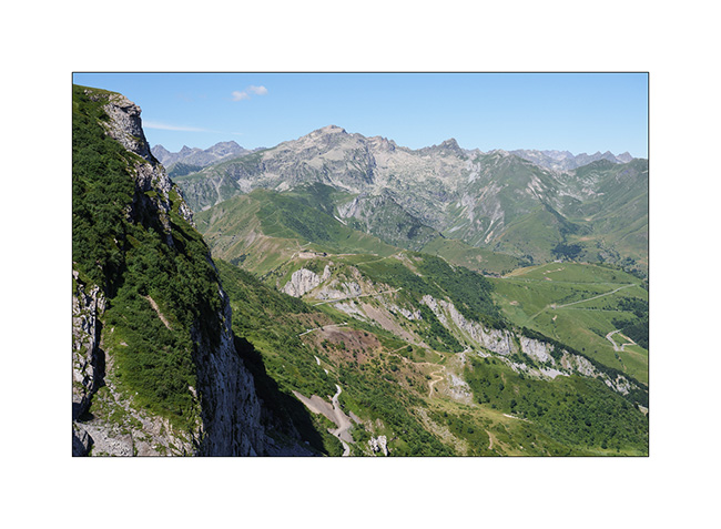
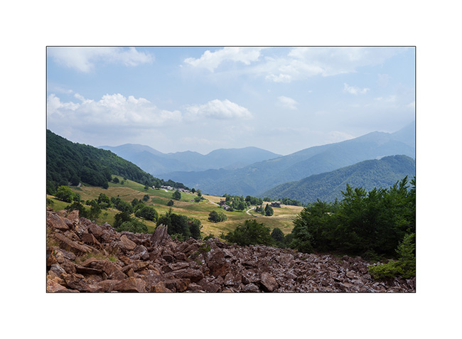
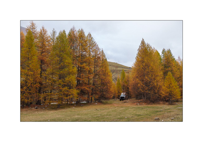
Argentera Valley & Pass of Tende
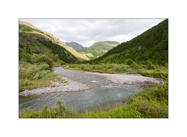
As previously mentioned, we’re delaying our descent to Tende as the weather isn’t favorable. Emile wanted to return, so we head up to the Argentera Valley. Access is now subject to a toll, with a toll booth on the bridge at the entrance to the valley.
We are a little disappointed to discover that major protection works have been undertaken, no doubt following recent heavy storms. Several areas of earthworks aimed at channeling lateral streams disfigure the lower part of the valley and greatly reduce its charm. Fortunately, higher up, nothing has yet been undertaken.
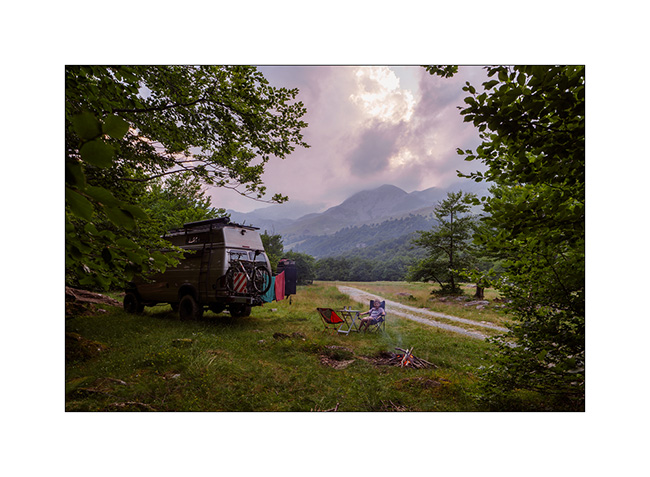
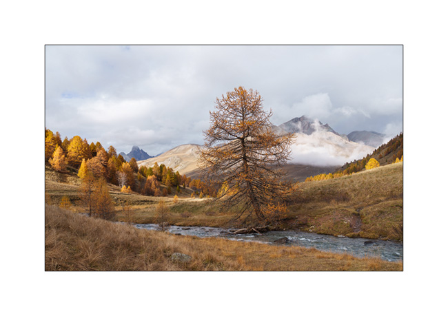
1. We find a nice spot down by the river.
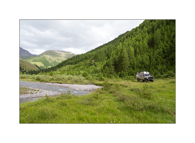
2. View from our camp.
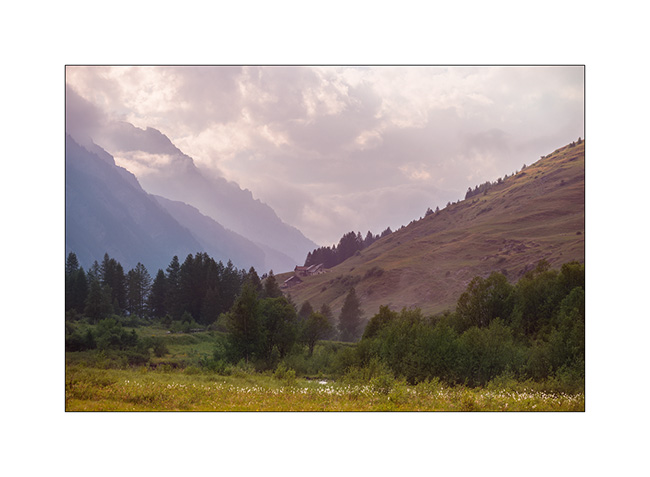
3. End of day tones.
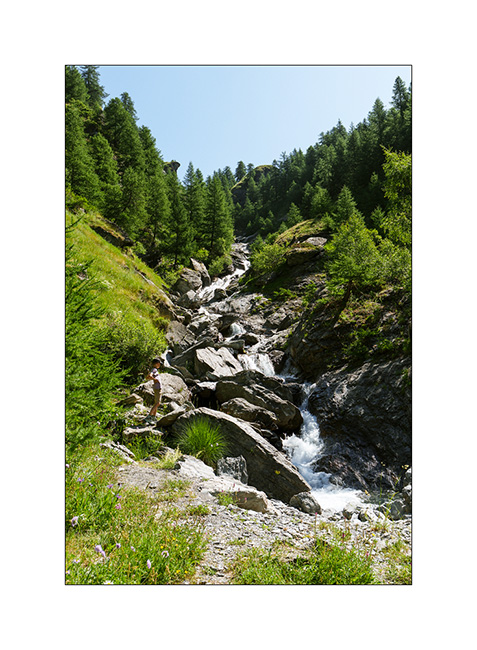
4. The next morning, we take a walk upstream to discover a beautiful torrent.
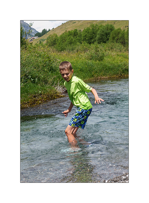
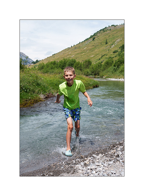
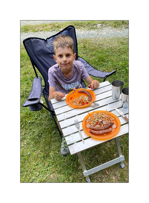
5. Back at our camp, Emile takes the opportunity to cool off in the river.
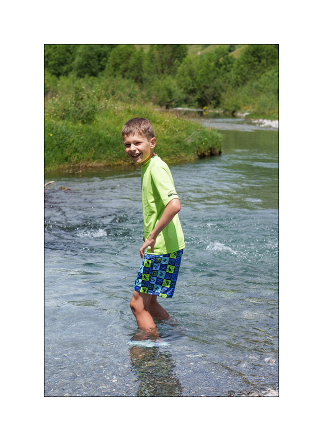
6. Brrrr… it’s cold!
7. …
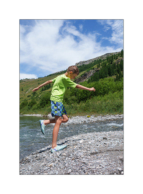
8. But it feels good!
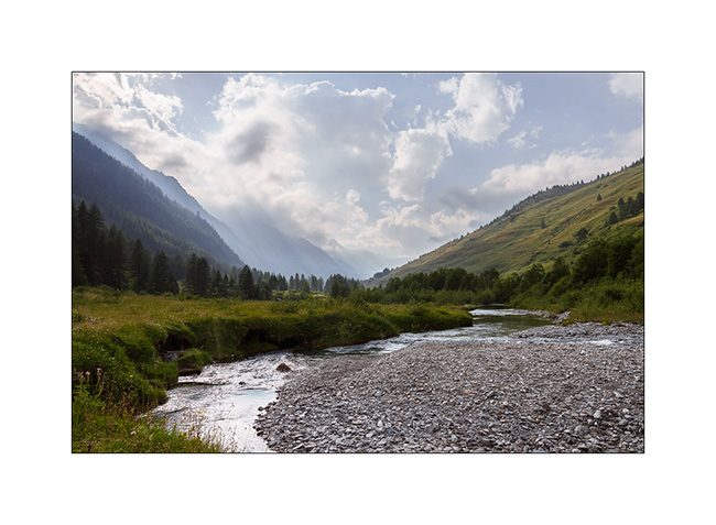
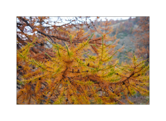
9. The upper part of the valley remains quite wild.
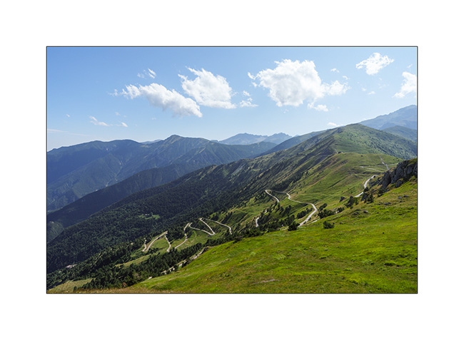
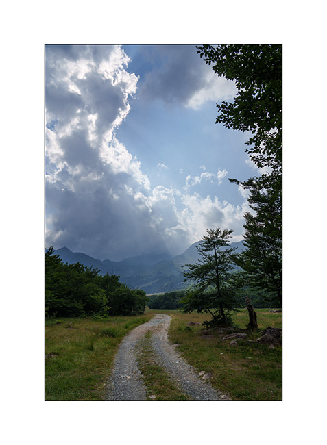
With the weather improving in the South, we head down to Tende where we hope to discover the Alta Via del Sale (High Salt Road), an approximately 55 miles long trail that follows the ridgeline border between Italy and France. We did the Western section in 2017 but not the Eastern loop.
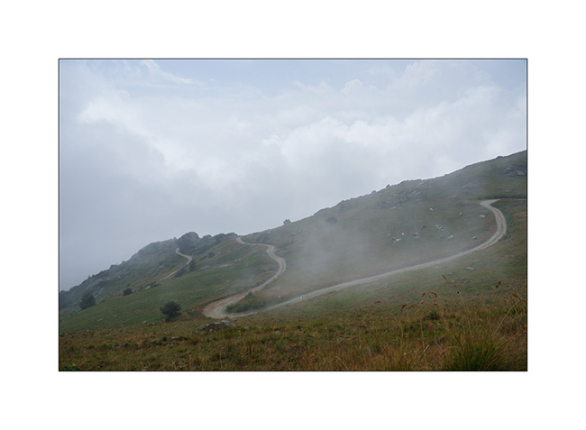
10. The hairpins of the Col de Tende on the French side (South). This trail is closed to traffic for several years.
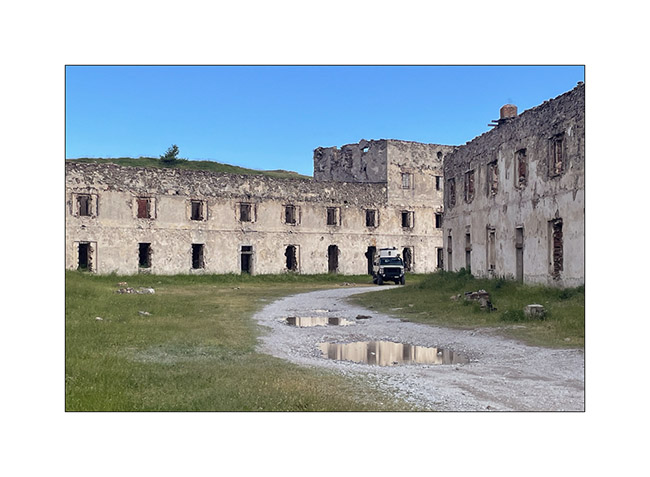
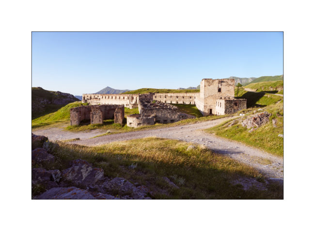
11. Meet upon arrival at Fortress Central.
12. First night in the barracks, alone that evening.
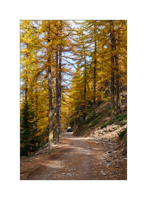
13. Since it’s Tuesday and the regulated section of the Ruta del Sale is reserved for pedestrians and bicycles on Tuesdays and Thursdays, we set off to discover the beginning by bike. Here, on the climb to Campanino Pass, with Fortress Central in the background.
14. Emile is comfortable on his new mountain bike, even on climbs.
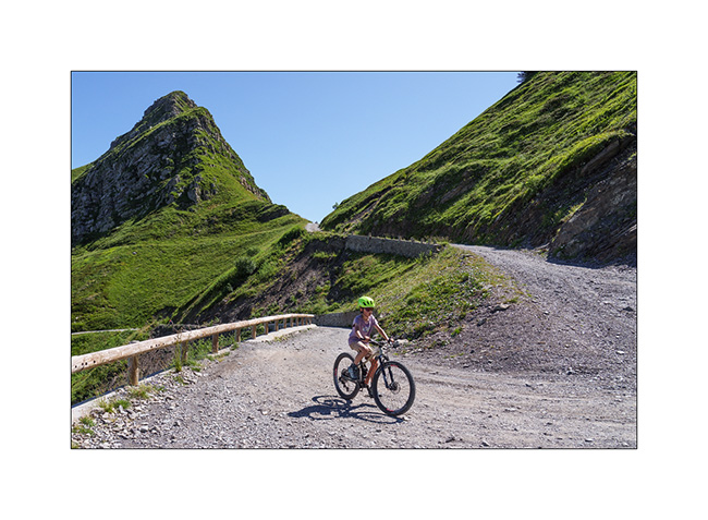
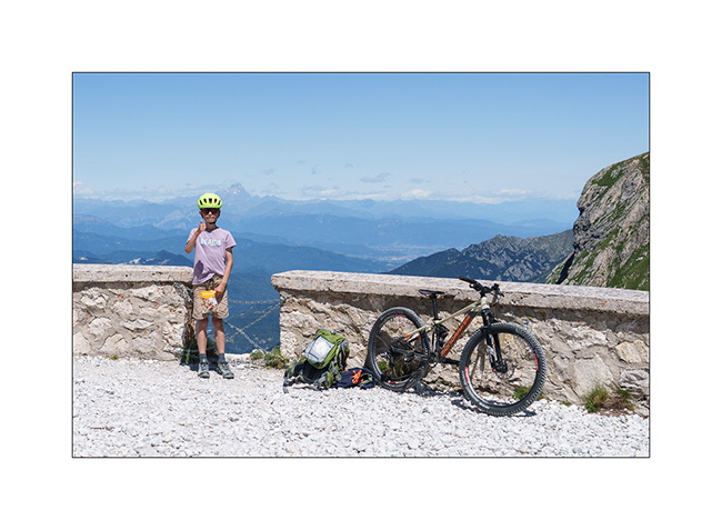
15. In the end, we rided 12 miles and 13,600 feet of elevation gain. Well done to him!
16. Second night in one of the old quarries used to build the barracks, for sheltering as a strong north wind is blowing.
17. Barracks at sunset.
To be followed in a few days…
Technical inspection and start of summer holidays…
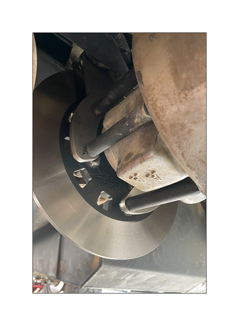
This year began with VivaLaVida’s periodic technical inspection, which was once again refused. Almost every time I presented her, the experts found “something else”: this time, they asked for proof that some non-original equipment – there’s a lot on VLV – was already there when imported in 2016. Another point was the non-compliant rear lighting, even though I had modified it following the DTC guidelines when I imported it and haven’t touched anything since. VLV was also rejected for “insufficient parking brake efficiency,” a classic.
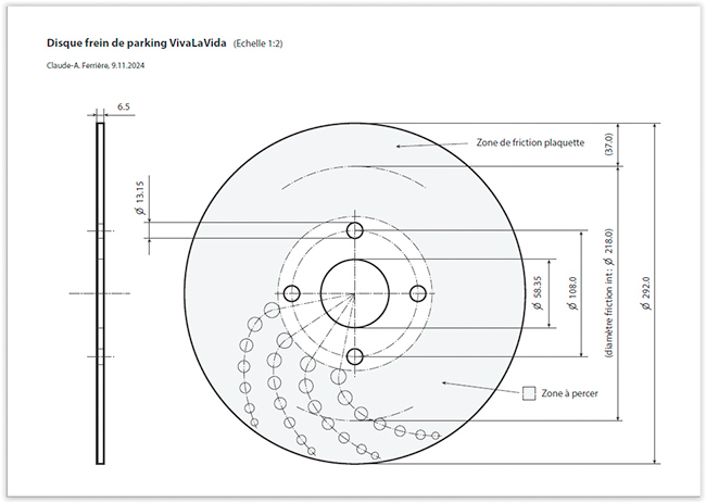
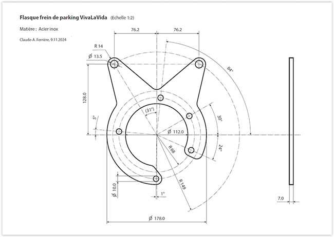
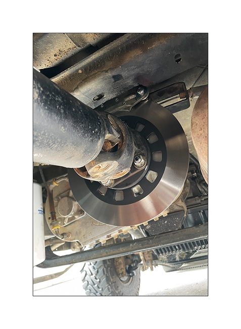
Offroad Accessoires in Geneva – where Andrew, with whom I had done part of the Baja California journey, works and who had carried out the first VLV inspection in Switzerland – kindly issued a certificate indicating that the relevant components were indeed present at the time of importation. On my side, I decided to enlarge the diameter of the parking brake disc to increase its efficiency. The parts were custom machined.
1. Technical drawing of the disc.
2. Caliper flange.
3. Mounted system.
4. …
VivaLaVida presented for a counter-expertise, it was still necessary to go through various administrative procedures before the technical service finally agreed to keep the rear lighting as it was. It was only at the end of June that I was finally able to re-register VLV. Just in time for holidays!
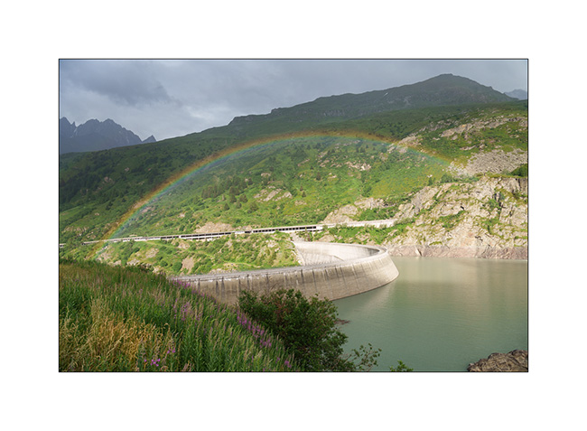
This spring, with Emile staying with me for 4 weeks this summer, I planned to go to Montenegro. But having lost my job at the end of May, unemployment insurance obligations require me to remain available within 48 hours. So I had to change plans and decided to go discover new places in the Italian and French Alps, at a distance that would allow me to return in 2 days if requested.
5. First bivouac in the downpour, above the Toules dam, on the climb to the Grand St-Bernard Pass.
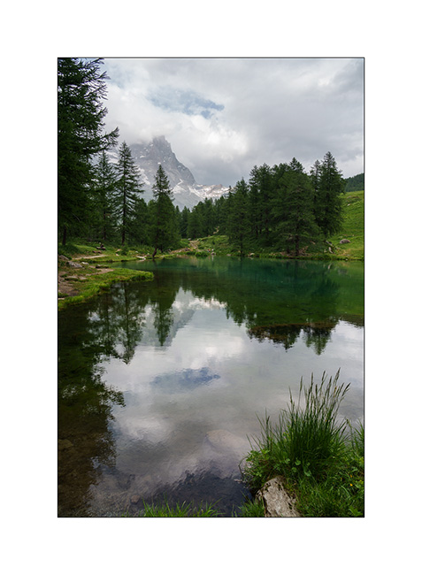
6. The next day, we go to Val Cervinia, which I only know from skiing. The Matterhorn is in the clouds…
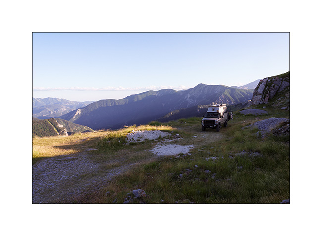
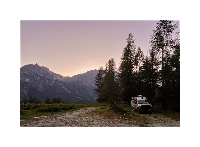
7. Boondocking on the southern slope, below Alpe Champleve.
The next morning, we set off to explore a trail leading to the Pian Fum pass and the Sualera mountain pasture, which I had spotted several months ago through my map research. A barrier had recently been installed, which now blocks access to the pass. But we find a lovely spot to camp below, on Alpe Folere.
8. We are not far from Turin, in the Alpine foothills.
9. Trail…
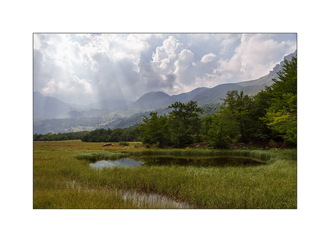
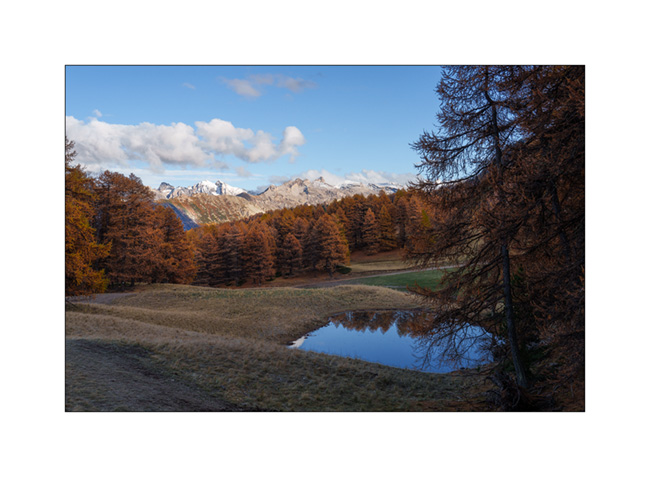
10. Pretty pond near our camp. Top right, the Pian Fum pass.
11. It’s aperitif time!
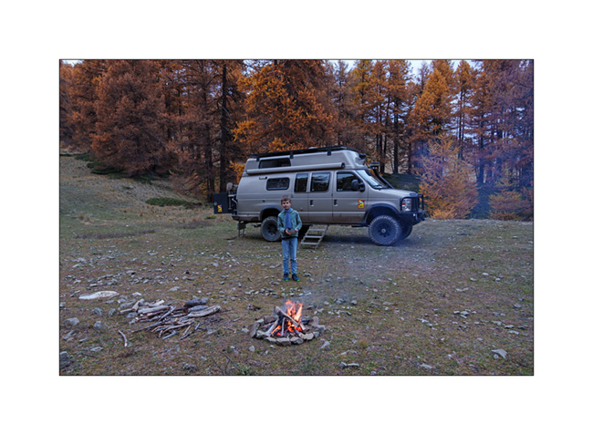
12. After the shower, first campfire of the holidays…
13. With a grill of course!
14. Time to go to bed…
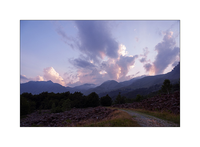
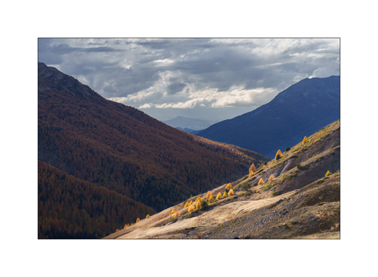
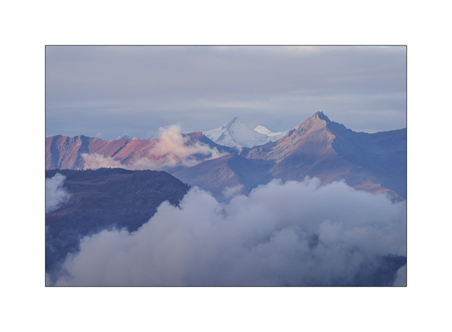
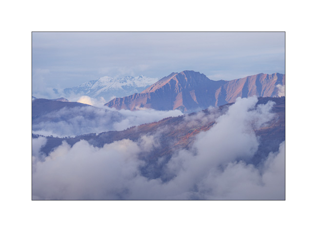
15. The next day, we climb the Colle del Colombardo, which we had first discovered in 2017. But at altitude, the weather was not very favorable…
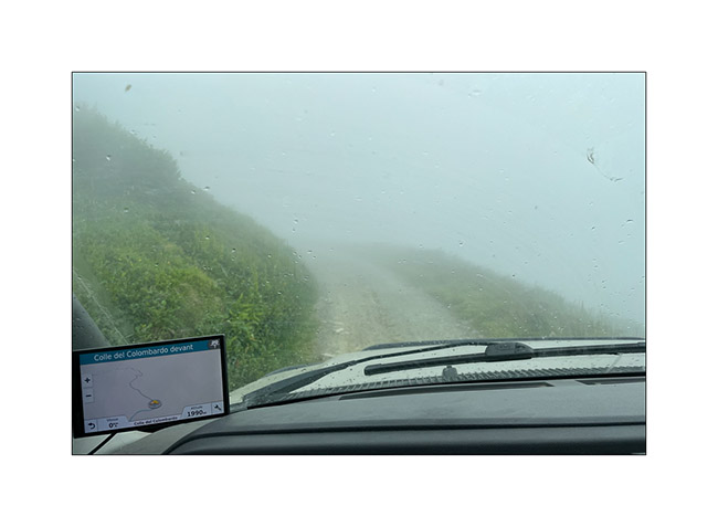
16. It is only when going down the other side that the fog dissipates a little.
With the weather forecast predicts rain in the South, we go spending two days in Valle Argentera, near Sestriere, where Emile wanted to return. We’ll tell you the rest very soon. 😉
Pass of Valbelle
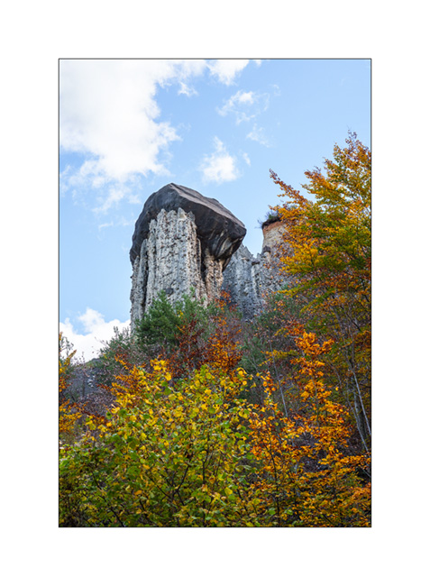
Still on our way back home, we pass by chance near the “Demoiselles coiffees”, some hoodoos on south shore of the Serre-Poncon lake.
1. A short hike takes us near these always impressive concretions.
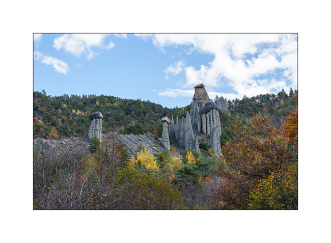
2. The site is evolving fast. Its configuration has changed a lot over the last 50 years.
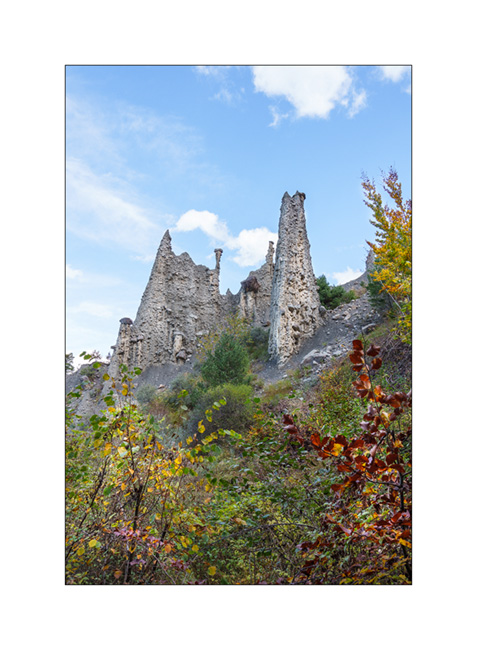
3. Site Overview.
4. Always favoring the back roads, we take a trail passing through Coche and Valbelle passes to reach Guillestre.
5. Summer stable.
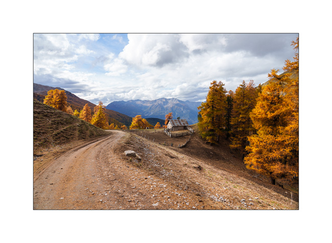
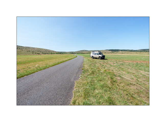
6. VivaLaVida on the trail.

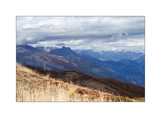
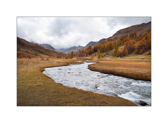
7. View towards the West, shortly before the Pass of Valbelle.
8. From the pass towards North.
9. Some showers are coming.

10. It’s gotten colder, the snow is not far away.

11. We find a boondocking spot above the Risoul 1850 station.
12. Last campfire of the trip.
13. Stop at an abandoned gas station in Maurienne.

And that’s it for our Fall holidays. Shortly after, summoned to the VivaLaVida expertise, I had to remove the licence plates while waiting for the manufacture of parts to increase the power of the parking brake because the efficiency of the current assembly was deemed insufficient by the expert. We were therefore unable to enjoy VLV this late autumn. She returned to her shelter for the winter.
As you read this, I received the ordered parts. I’ll be installing them in the coming weeks before getting the licence plates for the new season.
Thank you for your loyalty in following this little blog and see you soon for the rest of the journey aboard VivaLaVida! 😀
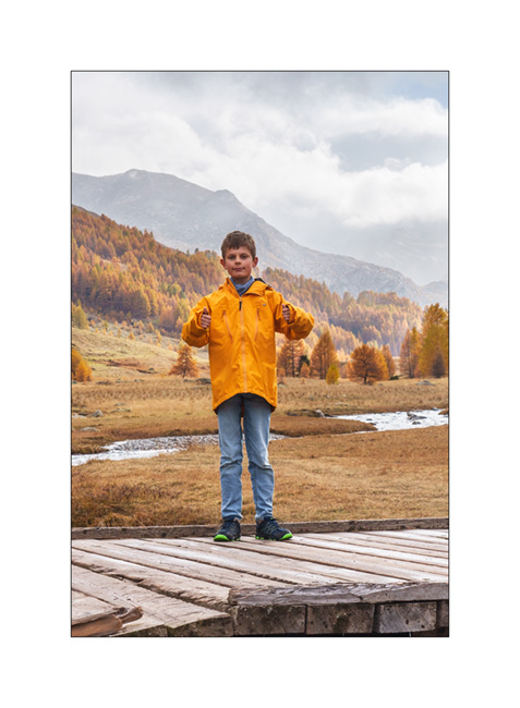
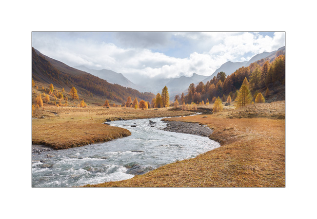
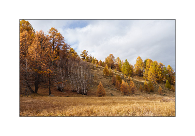
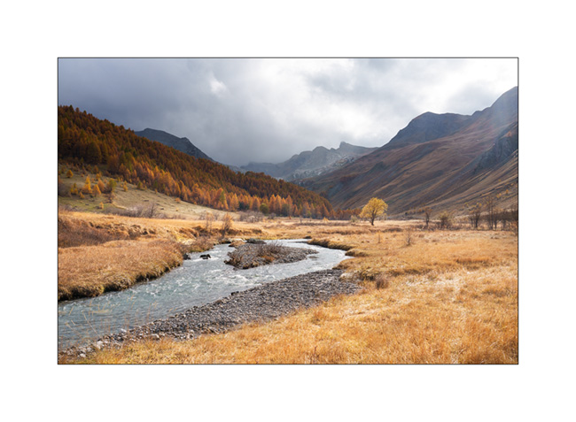
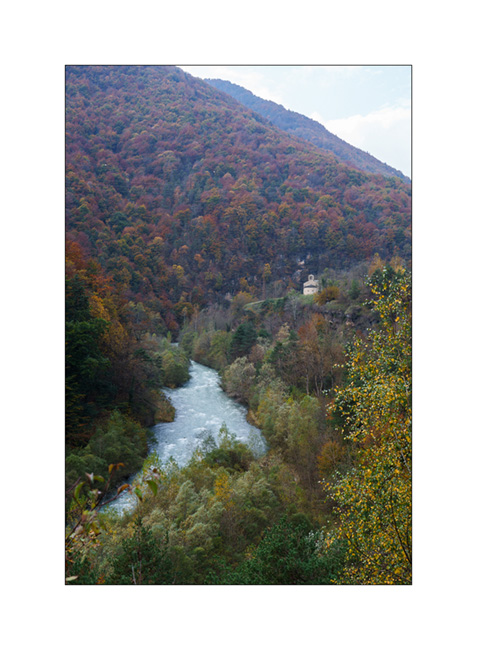
Haute-Ubaye
Coming down from Larche Pass (Colle della Maddalena), we go discover the Lautanier valley.
1. Fall colors are everywhere.
2. Hiking up the valley.
3. Meander.

4. A hiker on the bridge. 😉
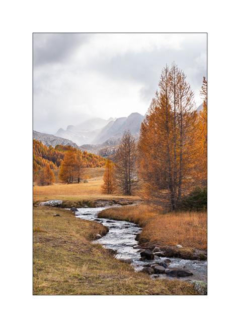
5. Ubayette River which dug the valley.
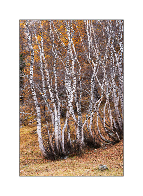
6. Larches and birches.
7. Further up in the valley.
8. Fall atmosphere.
9. Birch trunks.
10. Ubaye Valley.
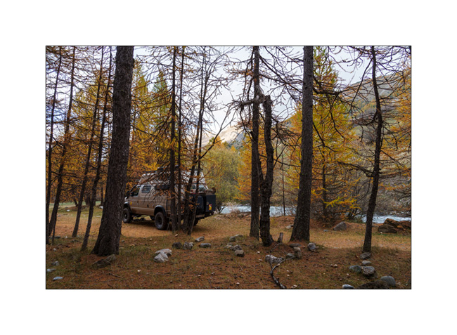
11. Our boondocking spot along the river Ubaye.
12. We made a campfire there between the raindrops.
Continuation of our way back shortly.
Lake Meja
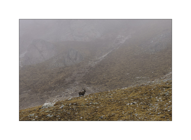
The next morning, we set off on a hike to explore Lake Meja despite the poor weather..
1. Our camp going up towards the small pass which overlooks us.

2. We see a few ibex near the pass.
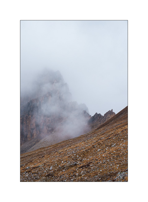
3. Mountains appear and disappear in the clouds.
4. Some marshes along the path.
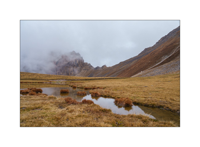
5. Lake Meja.

6. Small mushrooms on a dung.

7. The rain starts again as we go back to VivaLaVida.
8. It’s already time to head back. A short stop on the way up the Maddalena Pass.
In the next update, we will discover a beautiful valley in Haute Ubaye.
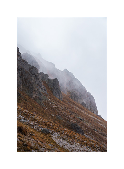
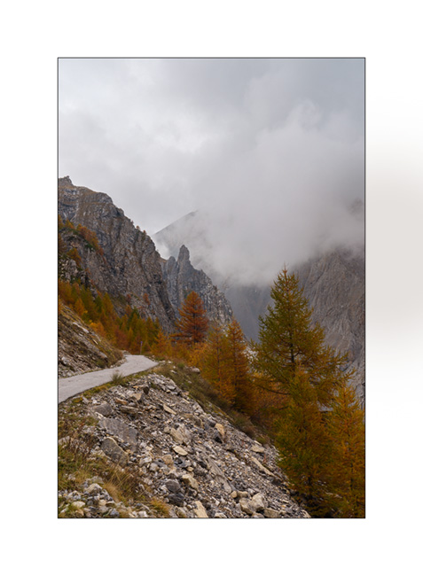
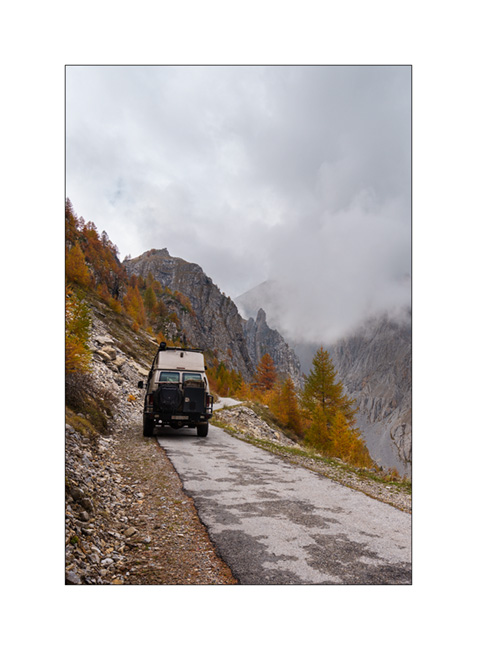
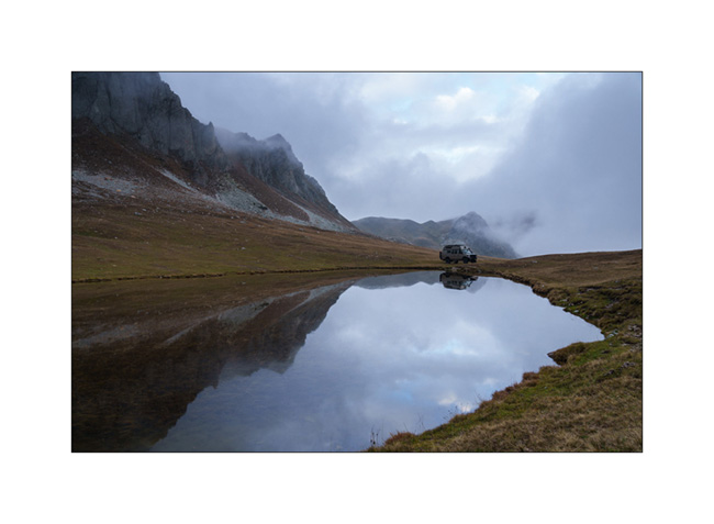
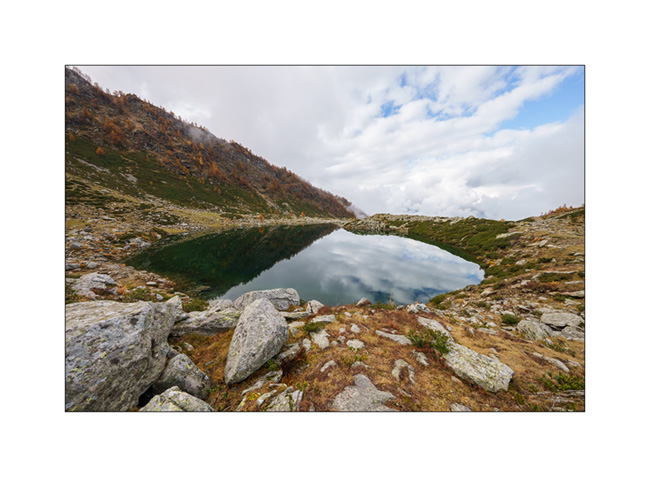
Maira Stura
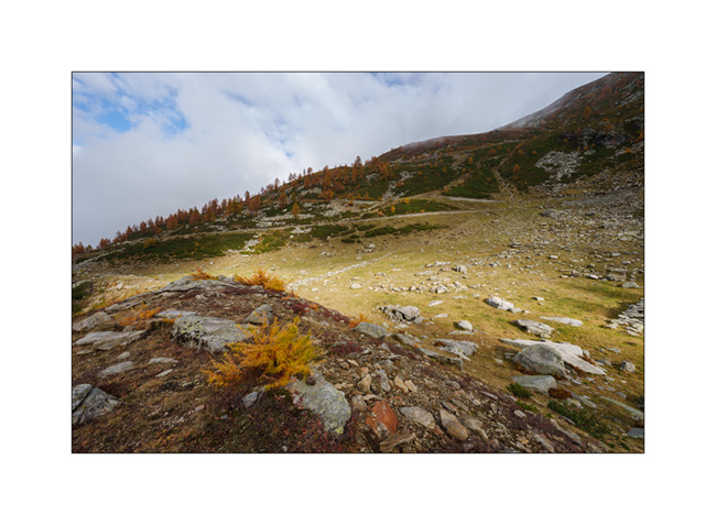
As announced, we continued South hoping to be able to access the Maira Stura trail which was closed during our last visit in summer.
1. Chapel of San Salvatore, driving up the Val Maira.
2. Village of Macra, in the same valley.

3. Indeed, the gate located after Pian Preit is open at this time of year. We can take the small road towards the Meja Pass.

4. Cloudy weather as the road climbs steep.
5. …
6. The limestone is steep on this side of the valley.
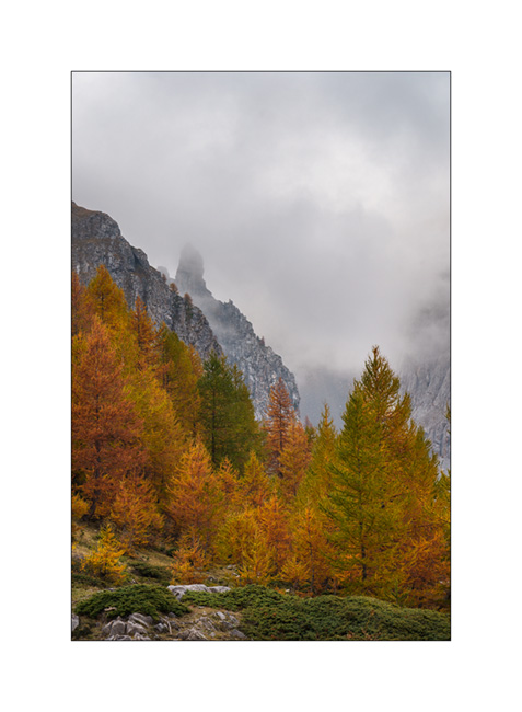
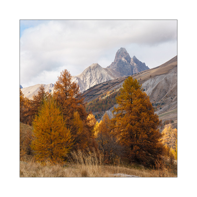
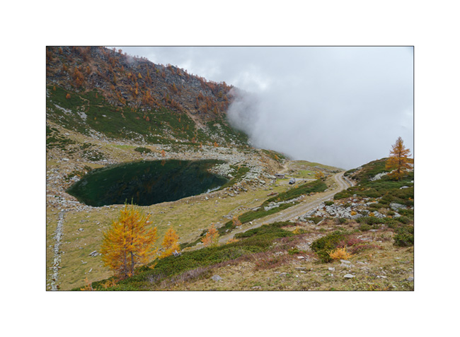
7. Near Meja Pass.

8. We continue on the trail towards refuge Gardetta.
9. Meja Mountain in the clouds.

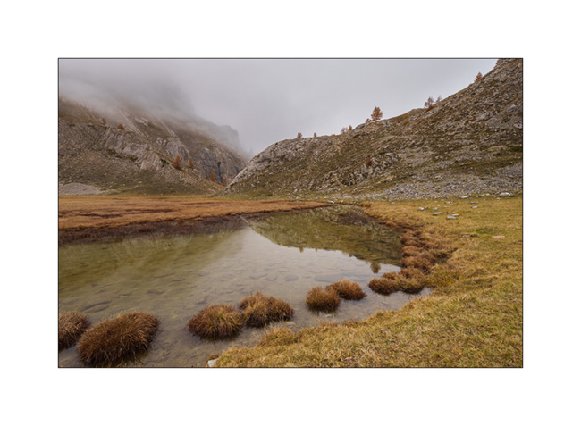
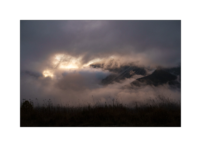
10. Altitude marshes.

11. The atmosphere is magical with the fog coming in.

12. Fall colors…
13. Under refuge Gardetta, at almost 7,000 feet elevation.

14. We do the entire crossing of the Maira Stura trail via Margherina Pass in the rain. Here, the old Barracks Della Bandia.

15. We find a nice boondocking spot on the edge of a small lake.
16. Rainy and windy twilight.

To be followed soon… 😉
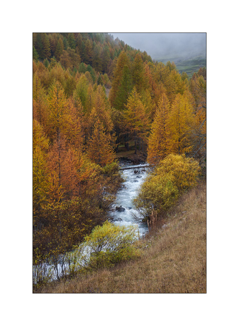
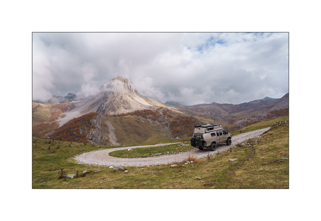
Fall holiday : Lake Lauson
For the second week of Emile’s vacation, we went to discover new alpine spots.
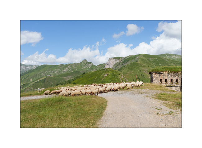
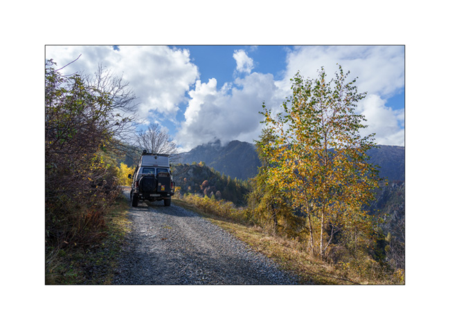
1. Sunset et our first boondocking spot, near Sansicario.
2. Herd going up towards Sestriere.
3. Going down the valley of Cluson river.

4. On the trail going up to Lake Lauson.
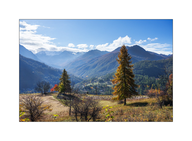
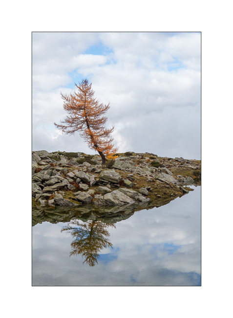
5. At almost 6,000 feet elevation, the larches are gorgeous in their autumn dress.

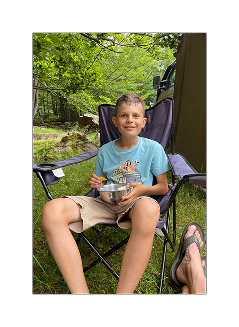
6. The best of co-pilots!! 😀

7. Lake Lauson.
8. Still a few holes of sunshine as the clouds gather.
9. Lonely tree.
10. Sheepfold under the lake.

11. Shepherd house.

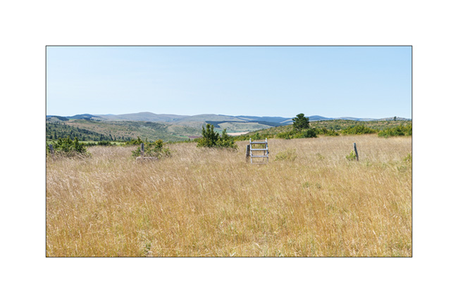
12. Before dinner, we walk up the old military road above the lake, now closed by a gate. We overlook VLV at his camp near the lake.
13. Golden larches…
14. After rain and fog.

15. The view from our camp at sunset…
16. Last colors…
After a wet night, we will continue South…
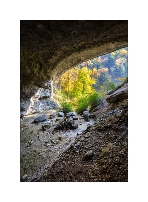
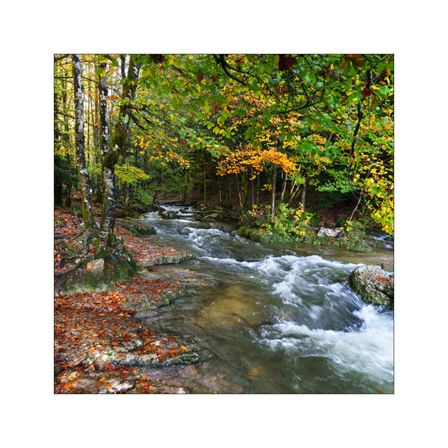
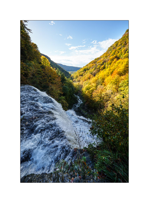
Waterfalls in Jura Mountains…
In mid-October, in Emile’s absence, I went for a little trip to the Hérisson waterfalls, in the neighboring French Jura.
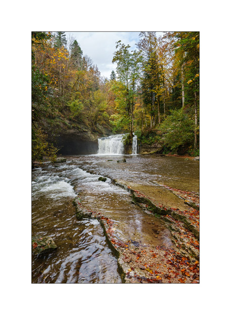
1. Gour Bleu waterfall, horizontal version.
2. Gour Bleu waterfall, vertical version.
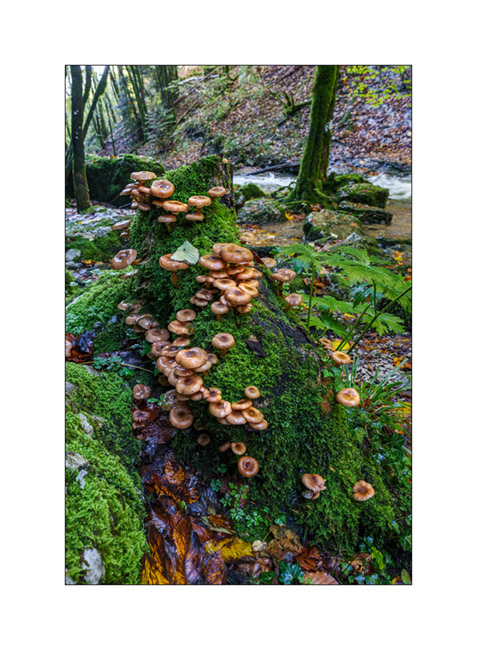
3. Mushrooms…
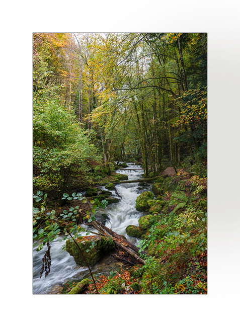
4. Bubbling undergrowth.
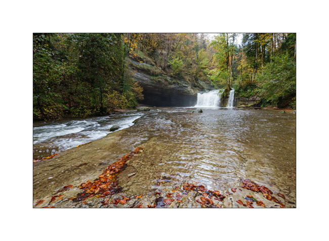
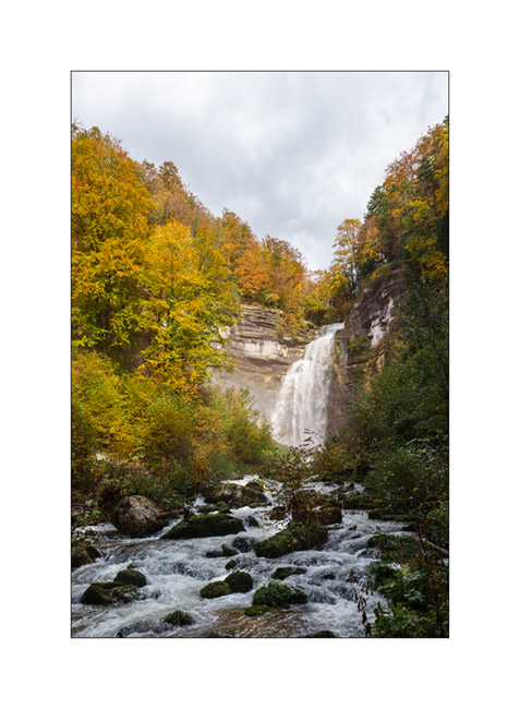
5. Grand Saut waterfall.
6. Alcove.
7. Hrrisson torrent.
8. Above Eventail waterfall.
9. Oops, the forest roads were quite muddy that day! I had to use the winch to get out of that mess!

The next article will take you to discover some new corners of the Italian Alps during our Fall holidays. To come soon.
Return through Lozère, the Cévennes and the Ardèche
It’s time to go home as Emile is flying to America in three days with his mother..
1. Small village not far from our camp.
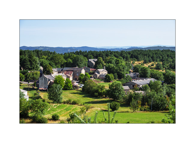
2. Another one, a little further.
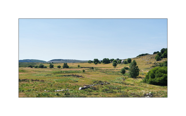
3. Pastures of the Lozère highlands.
4. I love these arid plains…
5. Not far from Florac, on the Causse Méjan.
6. Isolated hamlet.
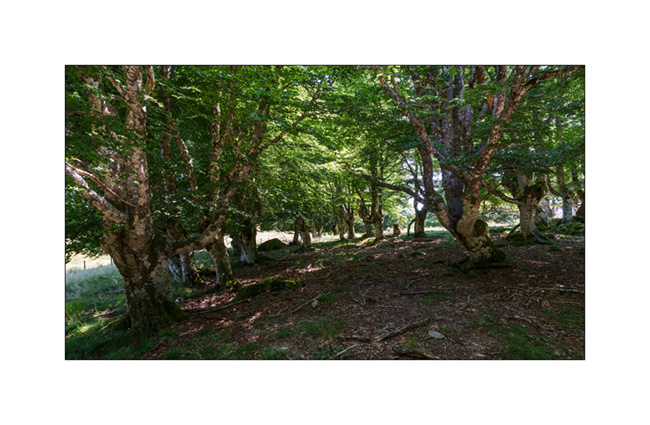
7. Trail under Mont Lozère.

8. Grove.
9. In Ardèche, Baumicou waterfall, actually dry…
10. Last bivouac in Ardèche before the return.

11. Dusk…
That’s it for this too short summer vacation. The next posts will be about fall adventures… 🙂
See you soon here and thank you for your loyalty in following the discoveries of VivaLaVida !
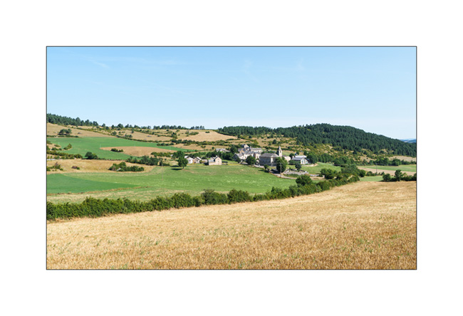
Highlands of Lozère
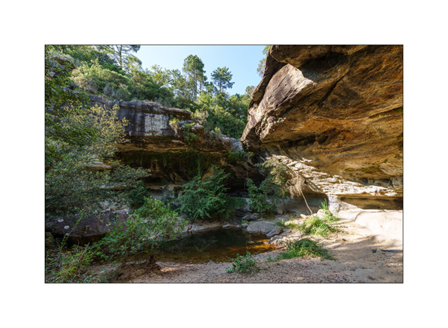
Coming back from Spain, we cross France by small roads, discovering some spots identified during previous research. We arrive in Gorges du Tarn and go up to a first causse (kind of of high plateau) by a very small road. It leads us to a trailhead to discover several natural arches.
1. First spot, a cave in the limestone.

2. A few hundred yards further, a first arch.

3. A hoodoo in the middle of a clearing.

4. Emile poses for the photo.
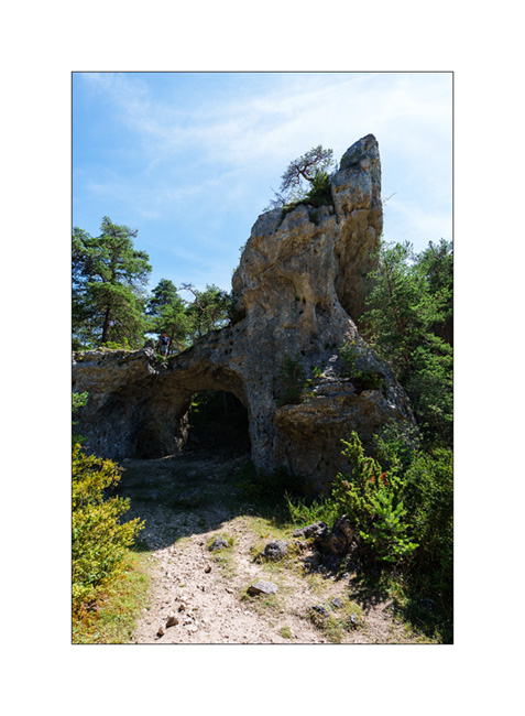
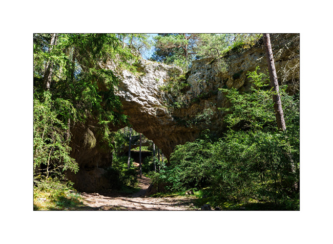
5. At the end of the loop trail, we arrive at the spot called Arcs St-Pierre with three natural arches within a radius of barely 150 yards. The first, which seems to have served as a shelter in ancient times.
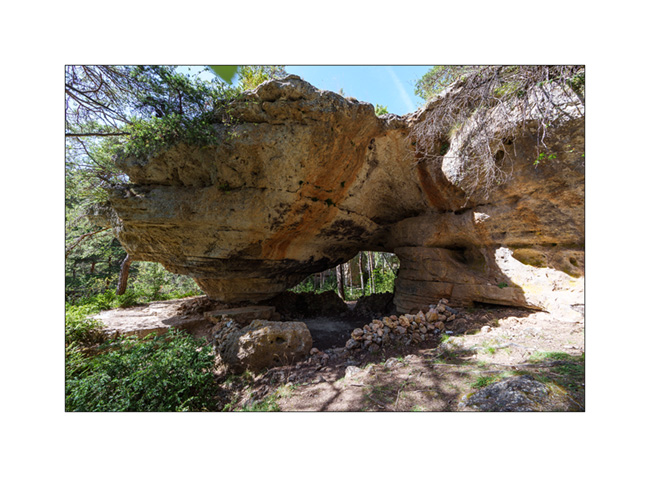
6. The same from the opposite.

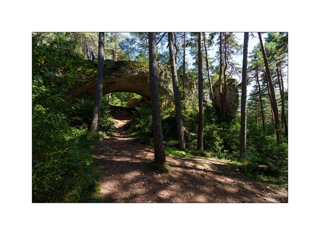
7. The second.
8. …
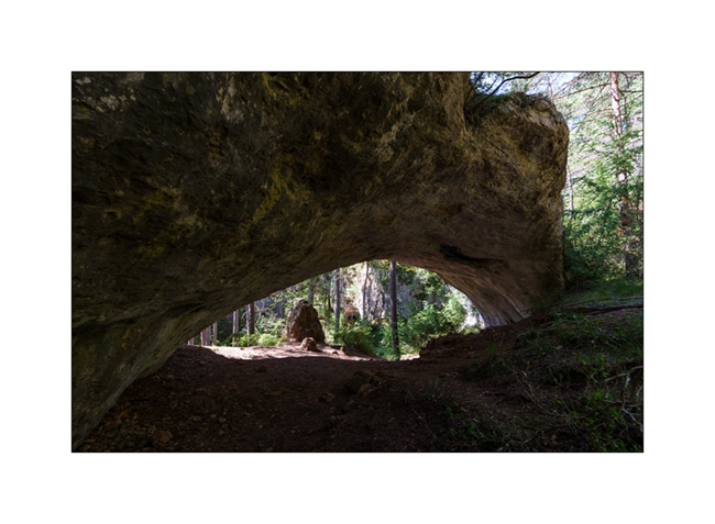
9. The third, the most imposing.

10. Both in a row…
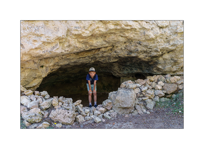
11. Emile in a small cave along the path.
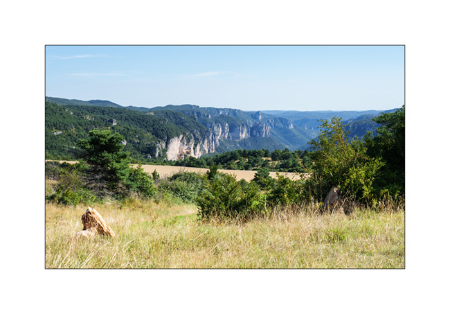
12. View from the plateau.
13. The meadows are quite dry but some flowers remain.

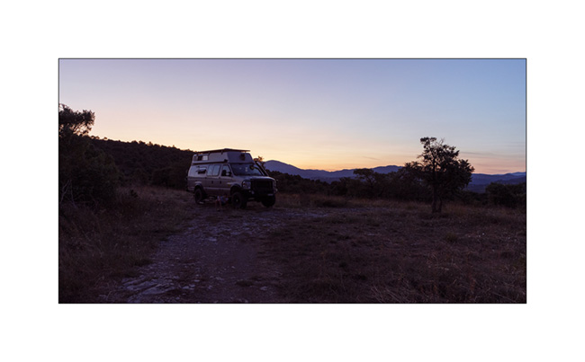
14. Our camp a few miles further; the shower feels good. 😉

Continuation and end of these summer holidays in the next update soon…