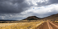
rain

now browsing by tag


Lava and waterfalls of North-East

 
1. In the Lake Mývatn area, a pond along the trail leading to some lava tunnel.


2. Isabelle exceeds her fear and descends into the tunnel entrance.


3. Here, the lava textures are pretty incredible.


4. Flanks of Hverfjall crater.


5. Lake Mývatn and its lava concretions in the rain.


6. …


7. Rainwear, with smile. 😉


8. Rainwear again.


9. Wild camp in some grassland South of the lake.


10. Light beam…


11. Sunset sky.


12. …


13. The next day, we seek to reach Aldeyjarfoss waterfall by a little used trail and, after about 35 miles and some pretty wet swamps, VivaLaVida arrives in front of this powerful river. The abandoned ford doesn’t inspire me much and I give up attempting its crossing, especially as even with binoculars, I cannot distinguish the trail on the other side…


14. Lunch time.


15. Moor to infinity…


16. Here is the spectacular Aldeyjarfoss !


17. The river dives into a deep canyon with basalt organs.


18. I go down in the canyon for a less classic composition.


19. Not far upstream, we discover another waterfall: Hrafnabjargafoss. What a pronunciation! 😉


20. Secondary falls at sunset…


21. Skjálfandafljót River downstream from Aldeyjarfossen.


22. Further downstream, the famous Godafoss, the falls of God, such touristic because located along the road nb1, the paved road that goes around Iceland.


23. A few miles eastward, we visit another waterfall: Detifoss. It is said to be the most powerful waterfall in Europe.


24. Selfoss, a few hundred yards upstream.


We finish the day at the very neat Ásbyrgi campground where the shower is welcomed! The next article will be in a more maritime atmosphere… 🙂


Path less traveled…

 
After the Lakagigar, rather than go directly to the Landmannalaugar on F208, we decided to go to Langisjór Lake via some less traveled trails that proved to be gorgeous…
 
 
1. River in the rain, along Southern F208.


2. Rather curious sign, isn’t it? In fact, the trail goes into the lake on approx. 300 yards.


Here is a video of this unusual path done by Isabelle. The weather was windy, with rain and fog…
 
 
3. In places, everything is only mineral.


4. Langisjór lake in the rain.


5. Trail…


6. …


7. River…


8. Fog…


9. VivaLaVida riding the moon.


10. The rain finally stops.


11. Invisible track. Thank you GPS.


12. Desolation…


13. … and blackness.


14. But these landscapes are amazing.


15. The trail crosses another lake.


16. Contrasts are everywhere.


17. Our trail seen from the top of a hill.


18. After driving in a lake, here we follow the riverbed for nearly one mile to change the valley! 😉


19. …


20. Fairy…


21. …


22. Another ford.


23. … and another.


24. We walk and play too!


25. Selfie 😉


26. Emile loves it.


27. Late afternoon contrasts.


28. …


29. In places, this track less traveled requires a good 4WD transmission, as here in a steep descent.


Here is another short video showing this trail. In video background, we can see the continuation of the track over the river, which goes up in the hills.
 
 
30. Rain showers are back.


31. …


32. …


33. Another particularly saturated rainbow.


34. We spend the night on the shore of a lake, near a shelter already closed for winter…


Hoping that this update won’t have been too long… 😉
 
To be followed in Landmannalaugar soon.


South coast…

 
1. As Gaël requested it, here is the whole family. 😀


2. An example of the language at the checkout of a store, inapprehensible and unpronounceable for us.


And to show you what the rain can be there, here is a short video

of Isabelle made the day before where it rained like that almost all day long..!
 
 
3. Continuation of the South Coast to the East. VivaLaVida crosses many Gravel Bars, large river beds that regular floods clear of all

vegetation.


4. Showers that offer beautiful skies.


5. Waterfall Foss á Síðu along road Nb 1.


6. Rainbow in frontof the Vatnajökull ice cap in the distance.


7. Another one to celebrate VivaLaVida.


8. Gravel bar.


9. Shower on the coast.


10. Vatnajökull ice cap, the largest in Iceland.


11. It is crossed by many volcanoes more or less active.


12. In the evening, VivaLaVida finds a nice boondocking place to camp near a glacial lake.


13. First colors at dawn.


14. Camp of VivaLaVida, close to the glaciers.


15. Light beams…


16. … on raw elements.


17. I couldn’t not show to Isabelle, a jewel fan, the “Diamond Beach”, famous for the icebergs that stand out from the Vatnajökull and flow

into the ocean by Lake Jökulsárlón before stranding on the black beach! 😉


18. Photo souvenir…


19. Jökulsárlón Lake.


20. Larger icebergs must melt before crossing the channel leading to the ocean.


In the next update, we will leave the coast to discover the Lakagigar area where new small volcanoes appeared only some decades ago.


Crossing and first steps in Iceland

 
1. Here arrives the ferry that connects Denmark to Iceland, serving the Faroes.


2. Barely moored as the rear port opens to let out the arrivals before VivaLaVida embarks…


3. Honeymoon on the boarding park! 😉 I will meet the owners of this beautiful Land Cruiser, Kambiz and Filiz, aboard and meet them several times in Iceland.


4. From Tornhavn to Iceland, the ferry passes between the islands of the archipelago.


5. So I went in front of Gjógv again, off the coast this time.


6. Last look before the high seas.


7. The next morning, arrival at Seydisfjordúr, a fjord all teh way East of Iceland. The weather is rainy.


8. En route to pick up my family at the airport in Reykjavik, at the other end of the island or more than 500 miles away, VivaLaVida is quickly in the Highlands that fall colors have already yellowed.


9. These highlands are covered by a few roads or tracks.


10. Ambiance.


11. Canyon.


12. Rain showers.


13. Volcanic geology is omnipresent.


14. Here, water has no choice but to run on soils that are mostly free of all humus.


15. Perspectives are immense.


16. I find by chance Kambiz and Filiz on the track, in front of their first serious river ford, waiting for a vehicle to pass and show them the way. VivalaVida passes and I make some souvenir pictures.


17. Powerfull river carving its way in the basalt.


18. VLV crossing a lava field.


19. Natural pool shortly before night stop…


Well, that’s what I though. By switching on the freshly revised VLV heater, the dashboard displays an error code: defective hot air fan which has just been replaced pre-emptively in Switzerland. It is Thursday night, Isabelle and Emile arrive on Saturday and the only place I can repair is Reykjavik, 500 miles away. I decided to drive at night to be in Reykjavik on Friday. 400 miles until around 3am where I take a 4 hour nap. Arrived Friday morning in Reykjavik, I bring the heating to the Webasto dealer after 2:30 of work to get it out since it is well hidden under the rear cabinet of VLV. The technician discovers that during the work in Switzerland, a wiring harness has not been well attached and is hindering the movement of the fan. After a bill of more than 1’600.- Swiss francs, I was not very happy. But at least, the heating works for the arrival of my passengers tomorrow!
 
Soon to be followed.


Denali National Park (1)

And here we arrived in Denali National Park, a large wilderness that includes Mount McKinley, the highest peak in North America, more than 20,000 feet elevation. This park was the first created in the United States in 1917 by Mr. Sheldon, who fell in love with this wilderness when studying dall sheeps for three years, then struggled for ten years to get this park created. In 1980, President Jimmy Carter has nearly tripled the size of the park.
One road sinks into this wilderness, reserved for public buses to minimize traffic. Vivalavida has obtained a permit to only join and leave the Teklanika Campgroud. I booked four nights for a bit of time to explore this wonderful land. Lottery with the weather that smiled at us, rewarding some good sunny times between showers, with beautiful skies … The low traffic has developed abundant wildlife not to fear the always same vehicles using the road; the “encounters” are frequent and sometimes really close. We’ll see grizzlies on every trip…
 
 
1. It was gray and rainy when we took the road to reach Teklanika…
 
_DSC1499b
 
 
2. … but I still found some photogenic wet environments…
 
_DSC1501b
 
 
3. … sometimes with some light.
 
_DSC1504b
 
 
4. We see a bull caribou near the road.
 
_DSC1513b
 
 
5. The rain is going away…
 
_DSC1515b
 
 
6. … the stop while VivaLaVida is going deeper in the park.
 
_DSC1517b
 
 
7. Sometimes a patch of light plays with reliefs.
 
_DSC1520_sb_b
 
 
8. Arriving in the Teklanika Valley, we are now close to the campground where VLV will remain quietly four days.
 
_DSC1526_sb_b
 
 
9. And to celebrate this arrival, we had a good sweet omelette with wild blueberries! 😉
 
_DSC1530b
 
 
10. The next morning, we only drove a few miles in the bus to meet a first grizzly!
 
_DSC1533b
 
 
11. Imposing Teddy, isn’t it?!! 😀
 
_DSC1534b
 
 
12.Tundra begins to change to fall colors. The “willows” are adorned with a beautiful dark red color.
 
_DSC1552b
 
 
13. Polychrome Mountain.
 
_DSC1554b
 
 
14. A little further, we see a nice “Dall Sheep”, the only white mouflon that exists on Earth. Superbly adapted to the rocky cliffs where he stands away from his predators.
 
_DSC1575b
 
 
15. And here is a new encounter with an adult grizzly that crams berries on the tundra.
 
_DSC1625b
 
 
16. When a bush is finished, it moves to the next.
 
_DSC1603b
 
 
17. This one is almost ready for hibernation, with good fat reserves.
 
_DSC1634b
 
 
18. That first day, Mount McKinley is hidden in the clouds as over 80% of the year. Its mass is such huge that it creates a microclimate, creating clouds on its flanks even some clear days elsewhere.
 
_DSC1641b
 
 
19. A lot of moisture remains of yesterday rain but during the bus journey to the end of the road, more than 80 miles from the campground, we will identify several places to hike the next days. I must admit that I was quite frustrated not being able to stop where I wanted for a few tantalizing compositions…
 
_DSC1647b
 
 
I will relate you our second day in this beautiful park at the next update coming soon… 😉