4×4 @en

now browsing by tag


Death Valley

I went to join Jeff and Janet, an Alaskan couple who wanted discover some places of the Death Valley and preferred to do it in two vehicles. But before that, I installed the new compressor of VivaLaVida.
 
 
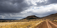
1. Beautiful sky over Arizona strip.
 
_DSC5844b
 
 
2. ARB was kind enough to replace the compressor with a new one, the previous being his fourth failure. Thanks to them.
 
_DSC5838b
 
 
3. To try to prevent this from happening again, I installed a “house made” air filter which should limit the amount of dust that it swallows…
 
Compresseur_2
 
 
4. On the road to Las Vegas Where I met my friend Christian for dinner, I heard a big “bang” and the back of VLV sagged while I was driving at 70 mph.
 
Crevaison_1
 
 
5. A tire suffered a carcass break, probably the result of fatigue of the carcass. Admittedly, these tires have rolled some 10,000 miles of trails at reduced pressure…
 
Crevaison_2
 
 
6. Met Jeff and Janet in Bed Springs Cabin, a pretty little miners cabin.
 
_DSC5853b
 
 
7. Saratoga Springs, south of Death Valley. There were a few ducks and a lot of frogs croaking! 😀
 
_DSC5856b
 
 
8. Arctictraveller going up to Black Magic Mine.
 
_DSC5864b
 
 
9. Wild donkeys or “burros”, presumably a mother and her young.
 
_DSC5868b
 
 
10. Late afternoon on the trail to Owlshead Mountains where we spent the night.
 
_DSC5870b
 
 
11. Diversity of mineral colors is pretty amazing in places.
 
_DSC5872b
 
 
12. One of the few stone cabinss, the Geologist Cabin.
 
_DSC5877b
 
 
13. Camp at about 4,000 feet above sea level, near the Striped Butte.
 
_DSC5884b
 
 
14. Raking light…
 
_DSC5885b
 
 
15. Striped Butte at sunset.
 
_DSC5893b
 
 
16. Twilight on this desert of rocks…
 
_DSC5889b
 
 
17. Jeff & Janet joined me in the night after going to fill Arctictraveller’s tank.
 
_DSC5896b
 
 
18. Jeff on Mengel Pass tral. It is not very experienced in offroading, I have therefore spoted him on tricky places…
 
_DSC5899b
 
 
19. There was quite a few steps!
 
_DSC5902b
 
 
20. And some quite off camber path to…
 
VLV_1
 
 
21. Panamint Valley.
 
_DSC5913b
 
 
22. Dusk from Lookout City, an old mining town over Panamint Valley.
 
_DSC5915b
 
 
And for a change, here are two videos of VLV in action. Thanksu to Jeff for having sent me. 😉

To be follwed in some days… 😉


Sandstone around Moab

 
Leaving the Beef Basin, I had the good surprise to find a message from Hans, a Swiss who lives here with his wife Madeleine for 35 years. I was greeted like a king by this adorable couple, not forgeting to specify that Madeleine is fine cooker. 😉
They explained me how to access a petroglyph site within walking distance of their beautiful home nestled on a sandstone hill.
 
 
1. What a privilege to discover this private site where access is usually closed!
 
_DSC4827b
 
 
2. I have found some symbols already observed elsewhere.
 
_DSC4828b
 
 
3. The next day and despite his 80 years, Hans brought me drive the Sevenmile Ridge Trail, a 4WD trail listed red (the most difficult) which passes near Uranium Arch.
 
_DSC4835_sb_b
 
 
4. It’s a nice medium sized arch.
 
_DSC4839_sb_b
 
 
Near this arch, we met a couple from Colorado, Dave and Leanne, a little lost because their trail description was out of date. They followed us throughout the rest of the trail and took images of VLV in downright cool passages, especially a leaning spot that I really wasn’t sure how to deal with VLV high-pitched on her wheels. They sent me some pictures to discover here…
 
 
5. Steep hill leaving the arch.
 
IMG_1399_b
 
 
6. It’s like David and Goliath, isn’t it? 😉
 
IMG_1416_b
 
 
7. Here is Hans spotting me on the step to access to the leaning spot..
 
IMG_1419_b
 
 
8. It doesn’t seem so but this entry is rather steep, with a good step!
 
IMG_1422_b
 
 
9. and here is the off camber spot. It leans quite a bit despite the left suspension fully inflated and the right one completely down..!
 
IMG_1427_b
 
 
10. After VivaLaVida it’s Dave who goes through in his 50 inches wide only vehicle. I indicated him the line to follow. Well done Dave ! 😀
 
IMG_1430_b
 
 
I want to say a huge thank you to Hans and Madeleine for their so warm welcome. I had such a great time with them. 😉
 
 
Hans recommended me a spot on the Dome Plateau where I had already spotted a natural arch. Leaving them, VivaLaVida took the path of this view that I discovered the next morning.
 
 
11. Colorado River and Castle Valley in early light…
 
_DSC4851b
 
 
12. Not far away, I went to discover La Boca Arch, a small pretty massive arch.
 
_DSC4859b
 
 
13. A bush managed to grow under the arch…
 
_DSC4856b
 
 
14. Castle Valley towers in front of La Sal Mountains.
 
_DSC4861b
 
 
15. On my way to natural shelters, the famous herbs that are seen in Westerns rolled by the wind have almost eliminated the trail… 😉
 
_DSC4863b
 
 
16. Here are sandstone cavities inhabited by Indians several hundreds years ago. One of them houses a source.
 
_DSC4869b
 
 
17. The bluff above is polished by the elements.
 
_DSC4868b
 
 
18. The lower cave is quite deep and some water oozes from the walls in places. The soot of inhabitant’s fires is still present (left of the entrance on this image).
 
_DSC4874_sb_b
 
 
19. The top one’s ceiling is shaped in a quite photogenic circular vault.
 
_DSC4879_pano_b
 
 
20. Back to the overview in late afternoon.
 
_DSC4885b
 
 
21. Very red material of Fisher Towers is colored by the sunset light.
 
_DSC4890b
 
 
22. Last sunrays over Castle Valley.
 
_DSC4886b
 
 
More to come soon. Once again, thanks for your loyalty! 😀


Saline Valley & Eureka Dunes

1. Arrived in the Saline Valley, we made ​​a stop on the shores of the salt lake.
 
_DSC7727b
 
2. The salt crust is impressive.
 
_DSC7731b
 
 
3. Little enjoyable break to relax in one hot springs.
 
_DSC7737b
 
 
4. High Saline Valley towards the Steel Pass.
 
_DSC7744b
 
 
5. Awesome colors…
 
_DSC7745b
 
 
6. High end of the valley…
 
_DSC7746b
 
 
7. A flower which parasites rare bushes.
 
_DSC7748b
 
 
8. Colored lezard.
 
_DSC7753b
 
 
9. Narrow and leaning pasage…
 
IMG_8393b
 
 
10. Going down behind the Steel Pass.
 
_DSC7759b
 
 
11. In the descent, bad noise and Vivalavida stops … Dazed, the rear driveshaft git down. The threads of the flange have been uprooted!
 
_DSC7760b
 
 
12. No other way than taking it appart and prosecute on the front axle only.
 
IMG_8453b
 
 
13. Not obvious because the “Cascade” that we must cross have big steps…
 
IMG_8416b
 
 
14. … Fortunately we went down it.
 
IMG_8418b
 
 
15. Passage narrower than Vivalavida!
 
IMG_8423b
 
 
16. Axle crossing…
 
IMG_8431b
 
 
17. We finally managed to join the Eureka Dunes where we spend the night.
 
_DSC7771b
 
 
18. What a beautiful place!
 
_DSC7769_pano_b
 
 
19. Mineral contrats…
 
_DSC7774b
 
 
20. Sunset light on the dunes…
 
_DSC7778b
 
 
21. .. and Moon rise over the cliffs.
 
_DSC7777b
 
 
22. Last sun ray on our boondocking site…
 
_DSC7783b
 
 
23. … and on the mountains behind us.
 
_DSC7779b
 
 
24. The morning was clear, the light playing with dunes…
 
_DSC7786b
 
 
25. all of curves…
 
_DSC7787b
 
 
26. … and smoothness…
 
_DSC7792b
 
 
27. Back in the valley behind the Sierras, in Bishop, to repair the driveshaft.
 
_DSC7798_pano_b
 
 
To be continued soon… 😉


Baja California (7)

Since Ramsey spoke us about the Mission San Miguel, we decided to reach it the next day, leaving the group which pamed to cross the border the same day. Little backway to Rosarito where we took the trail to San Miguel. In places, the track remained quite muddy after the heavy rains that hit the region a week earlier.
 
 
1. It looks like a volcano…
 
_DSC6916b
 
 
2. “Baja Shaker” driving through some muddy puddles.
 
_DSC6917b
 
 
3. Mission San Miguel is quite different from those we previously visited.
 
_DSC6950_pano_b
 
 
4. Decorated door.
 
_DSC6925b
 
 
5. The interior is sober.
 
_DSC6926b
 
 
6. The main door from the interior.
 
_DSC6930b
 
 
7. It’s a large mission, with many rooms…
 
_DSC6932b
 
 
8. … and a pretty staircase to access to the roof.
 
_DSC6934b
 
 
9. Gardens.
 
_DSC6944b
 
 
10. On the road through the mountains…
 
_DSC6954b
 
 
11. And since it’s cold on the Pacific coast, we decided to push up to Baya Los Angeles for the night.
 
_DSC6960b
 
 
12. VivaLaVida on a natural peninsula…
 
_DSC6962b
 
 
13. … more visible from above!
 
_DSC6977b
 
 
14. The next morning, while Andrew bathes, VivaLaVida explores the area… 😀
 
_DSC6980b
 
 
15. … before to take the road to Pacific coast again.
 
_DSC6981b
 
 
16. Another giant beside the track. Undoubtedly one of the largest we have seen throughout the trip!
 
_DSC6984b
 
 
17. We follow a road sometimes badly damaged by recent rains…
 
IMG_2470_b
 
 
18. … but the nature around is beautiful.
 
_DSC6990b
 
 
19. Here, 4WD where necessary to go through..! 😉
 
IMG_2478_b
 
 
And…! At one point on the trail, the water dug nearly a four feet deep, leaving only a narrow passage against the hill. Vivalavida engages therein while Andrew guided me… but the road collapsed under the weight of VLV missing to fall on the right side! Luckily, he landed on the rear differential, the right rear wheel in vacuo! I was lucky on this one ..!
 
 
20. Bad posture…
 
_DSC6999b
 
 
21. A little more and VLV would lye on the side…
 
_DSC7000b
 
 
It took us three hours to get him out of this trouble. We first secured VLV at the roof rack with a strap at the foot of a large cactus to prevent it tipping if the road continued to collapse. We backfilled under the rear wheel with stones and sand, creating a ramp to the rear. Baja Shaker positioned on the hill as a fixed point and the winch Vivalavida at the rear, it was slowly winched on this ramp. All that was at night because the collapse occurred in the late afternoon.
 
 
22. Baja Shaker as a fixed point to winch from the rear..!
 
_DSC7005b
 
 
23. Almost bailed. Andrew gives the depth scale..! 😀
 
_DSC7003b
 
 
It was not until around 21:30 that we finally got it right and had our meals, camping a few hundred yards away.
 
 
24. The next morning we made a ramp down into the wash and back on the road further.
 
IMG_2490_b
 
 
25. But the wash was very soft. I had to take out the shovel again…
 
IMG_2493_b
 
 
26. Finall ythe obstacle has been crossed!
 
IMG_2495_b
 
 
A final update on the Baja is to come soon…


Georgia : 4WD addition

I received some images from Brian, one of the guys with the Jeep who help to go under the last tree.
 
 
1. Winching the cutted tree.
 
20131217_140137b
 
 
2. Rewinding the line…
 
20131217_140637b
 
 
3. Leaning passage or when VivaLaVida heels quite a bit ..!
 
20131217_141028b
 
 
discovered the ocean for Christmas, on the Atlantic coast, in South Carolina. Featured soon… 😉


North-West Georgia (2)

Here is the continuation of my journey in the mountains of Georgia. I left you in a humid atmosphere … The sun came out later, even gratifying me beautiful colorful skies at sunset, which I didn’t see often here.
 
The serie starts on a cold morning at Unico Lake while I was going to discover the Anna Ruby Falls
 
 
1) Unico Lake
 
_DSC3284b
 
 
The Anna Ruby Falls are probably the best known and most visited of the region. Smith Creek splits into two to form a double waterfall.
 
 
2) The Smith Creek downstream of the waterfalls.
 
_DSC3290b
 
 
3) The waterfalls
 
_DSC3289b
 
 
I then went up a valley to discover one of the few cliffs in the area, named Raven Cliffs. A beautiful walk a about 8 miles “one way” that leads to a small vertical cliff splited by a large vertical crack into which rushes a beautiful waterfall. Quite spectacular! Unfortunately, the light wasn’t there, the strong north wind surrounding mountains with freezing stratus…
 
 
4) The Rave Cliffs (panoramic of three images).
 
_DSC3299_pano_b
 
 
5) Approching the crack
 
_DSC3304b
 
 
6) The waterfall…
 
_DSC3295b
 
 
I then drove for half an hour to go to the Desoto Falls where I spent the night in a nice primitive campground.
 
 
7) frost on the heights…
 
_DSC3315b
 
 
8) Desoto Upper Falls
 
_DSC3316b
 
 
The next day, continuing my exploration, I made another long walk to see the High Shoals Falls, in fact not the most beautiful waterfalls I’ve seen. But the walk was nice: descent into a deep valley, and then down the river about 5 miles to the two falls.
 
 
9) High Shoals Upper Falls
 
_DSC3328b
 
 
It was already the middle of the afternoon when I found Vivalavida back. I followed some forest roads leading me on the hills to find a place to spend the night.
 
 
10) Sunset on the forest
 
_DSC3339b
 
 
11) Great boondocking place
 
_DSC3346b
 
 
12) And nice “Apéritif” at the camp fire! 😀
 
_DSC3355b
 
 
The next day, I planned to go hiking on the Mount Yonah, a mountain which has beautiful cliffs under its summit. Still using my topographic maps, I chose a forest road of about 8 miles leading me to Helen, a small town on the road to Mount Yonah. But my mapss don’t tell the state of the tracks..!
 
While forest roads taken the previous day were fairly nice, this one first appeared narrower and more “rocky” but nothing really serious for Vivalavida even if I could hardly drive faster than 10 m/h. After about 3 miles or so, the road became narrower and stoned, sometimes forcing me to maneuver in tight corners, where size of VLV suddenly seemed more consistent. But progress continued till a hillside where a recent storm seemed to have devastated the forest. Probably 70% of trees were lying, many across the road. I was not too impressed, most of them had small diameter and only partially obstructing the way. So I took out the handsaw and cuted between 10 and 15 of these trees, nothing too bad, Vivalavida continuing his path about one mile. Then appeared a portion where the road was washed away, with a strong lateral slope, forcing me to put the wheels on the right side of the road to avoid VLV to roll over. Pretty impressive when my “house” was left to swing in balance on two wheels with 150 yards of nothing 4 inches to the right of the wheels..!
 
 
13) Unstable balance…
 
_DSC3362b
 
 
I was then about 4 or 5 miles from where I could turn around. And this is where things got fun..! 😀
A hundred yards away, what did I see? Three large trees across the road, separated from 150 yards away! From all evidence, Vivalavida could pass underneath! But what to do? 5 miles back in reverse, with the scabrous place described above? No, I was not really tempted … Cutting trees to open the passage? This is the choice I made.
 
For the first one, clearing the vegetation on hill side, deflating air suspension and tires while squeezing as much as possible the left of the road, I managed to get underneath with one inch clearance.
 
 
14) First tree with few clearance…
 
_DSC3363b
 
 
No way for the second one. Clearance was about 3 feets less thant VLV. So I took the axe! 😀 I neede about 1:15 hour to manage to make a first cut (dry wood his hard !).
 
 
15) Woodcutter work…
 
_DSC3364b
 
 
16) The tree after the first cut.
 
_DSC3365b
 
 
I then used the winch of VLV for the first time, trying to rip the tree in the direction of the road. But the weight of the tree was such that when I tried to pull the base, it got into the ground. No other way than cutting the main trunk above again. Three quarter of an hour later with the axe, it was done! I was able to winch the main trunk to put it parallel to the road and then to rip it to the edge ; handy winch by the way!
Remained the third tree to pass under! The measure seemed to indicate that VLV should just go below to the nearest inch. I moved inch by inch, going out every moment to gauge the clearance between tree and roof rack. 5 iches, then 3… then 1. I deflated the tires to 0.5 bar upstream to win half an inch or so, advanced 15 iches… It was still about 15 inches to pass Under while the right front wheel came in a big hole, about 20 inches deep. Despite taking some of the ground out to get some more clearanceg, VLV’s rack hds contact with the tree in front of stunned two guys arrived in the other direction aboard two Jeep, amazed to see such a van on a 4×4 road. They helped me pushing up a last small tree, allowinf VLV to go underneath. Finally, the rack is solid, VLV escaped without any scratch, leaving a big bleeding under the tree…
 
 
17) Third tree…
 
_DSC3366b
 
 
Finally, I needed almost 6 hours to drive less than 5 miles, a great speed average, isn’t it? 😀
 
 
18) GPS statistics…
 
_DSC3370b
 
 
The two guys took some pictures when i was winching the second tree, I hope to receive it and will post it if.
No need to say that it was much to late to go hiking Mount Yonah. I then find another nice boondocking place to spend the night and
Pas besoin de vous dire qu’il était bien trop tard pour aller gravir le Mont Yonah. J’ai donc trouvé une autre jolie place pour passer la nuit et and rest the Pschitt a little tired..! 😉
 
 
19) Another nice sunset
 
_DSC3375b
 
 
That’s it for today. My next update will soon show you my day at Mount Yonah…


North-West Georgia…

I let you when I headed to Georgia to continue paperworks to obtain VivaLaVida registered Under my name. I first obtained several documents and went to the DMV office to ask for my driver license. Happy to produce all documents needed, My joy was short since immigration didn’t confirmed me again ( similar to my North Carolina episode…). After more than 100 miles to go to immigration services, then to Custom and Border Protection in Atlanta Airport, nothing else to do than waiting for a call of DMV in the next 5 to 30 days..!
 
I then decided to go to North-West Georgia to discover that part of Appalachian.
 
 
1. Leaving Lake Lanier in a cold and sunny morning.
 
_DSC3214b
 
 
2. Pancake time! 😉
 
_DSC3215b
 
 
3. First night in Talluhla Primitive Campground, just next to the river. I was alone there…
 
_DSC3218b
 
 
After a ford river crossing, I drove a forest road mentionned 4WD on the map. Some places were quite washed out by rain, so VivaLaVida had occasion to proof her capability! 😉
 
 
4. First axle crossing
 
_DSC3222b
 
 
5. Steep part!
 
_DSC3223b
 
 
6. leaning curve and Wheel without weight…
 
_DSC3226b
 
 
7. Real axle travel! Even so, no need to lock differentials, quite impressive!
 
_DSC3228b
 
 
8. Nice hike to the le Rocky Knob…
 
_DSC3234b
 
 
The I went to the highest point of Georgia, the Brasstown Bald. Not really exceptional since it’s “only” 4’600 feets elevation. A twenty minutes hike from the parking lot to the summit. There is a small museum presenting some elements of pioniers of that area and wild life information. The sighting is gorgeous all around.
 
 
9. Pastel…
 
_DSC3241b
 
 
10. Visitor Center on the summit
 
_DSC3247b
 
 
11. Nice trout river on the road…
 
_DSC3236b
 
 
After spending the night in a glade, I went to visit two nice waterfalls.
 
 
12. Ice next to the road
 
_DSC3253b
 
 
13. Ephemeral curtain…
 
_DSC3257b
 
 
14. Dukes Creek Falls
 
_DSC3271b
 
 
15. Beautiful vistas East…
 
_DSC3260b
 
 
16. “Who is that guy..?”
 
_DSC3266b
 
 
17. “Well, I prefer to eat befor snow comes again!”
 
_DSC3264b
 
 
18. Horse Trough Falls, far away in Upper Cattahoogee River, a remote wilderness. Since the road was washed out, I hiked the last 6 miles…
 
_DSC3274b
 
 
19. Spending the night in the Upper Cattahoogee River wilderness, I found a nice boondocking site up a small forest road…
 
_DSC3276b
 
 
20. Still better with campfire, isn’t it? 😉
 
_DSC3279b
 
 
Since that night, a lot of rain came down and the downhill of the small forest road was scabrous since very slipery muddy surface. I neede two an a half ours to drive 1.5 miles and 1’550 feets down. But I finally arrived safe down.
 
 
21. Safe down in rain and fog! 😉
 
_DSC3282b
 
 
Next to come in some days… 😀