Archives
now browsing by author
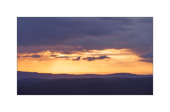
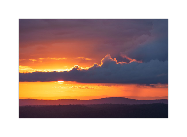
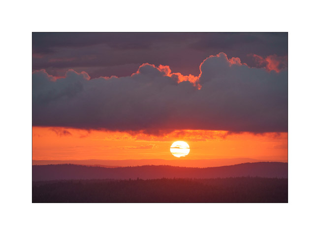
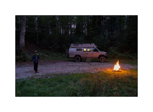
Jura outing
After the start of the school year, we went to enjoy a beautiful sunset over the Jura ridges.
1. Overlooking Chapelle-des-Bois.

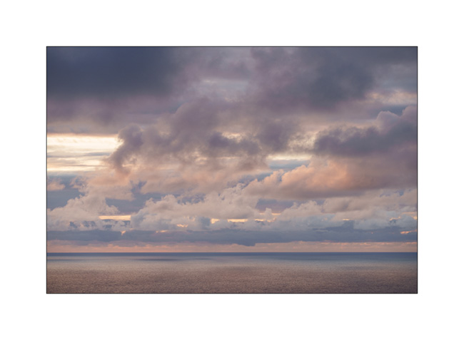
2. The sky isn’t free of clouds.

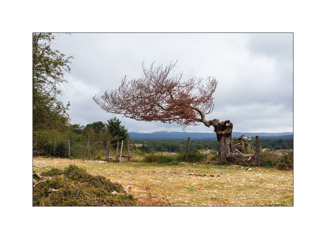
3. … but it seems the sun will pass below.
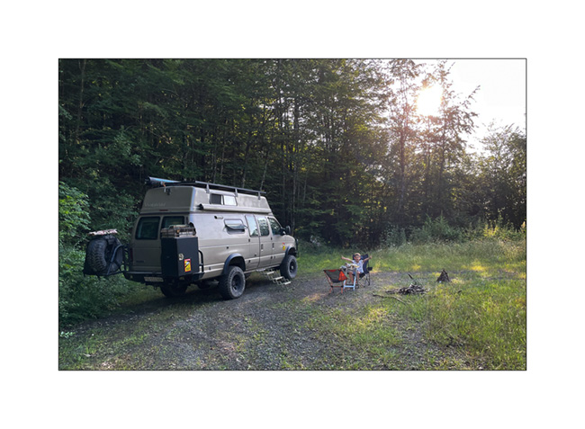
4. Ambiance…
5. Last shine before setting.
6. After night falls, we cook on the campfire before enjoying a quiet night in the forest.
The next update will tell of a little trip to the Loire Valley castles in October.. 😉
Way home…
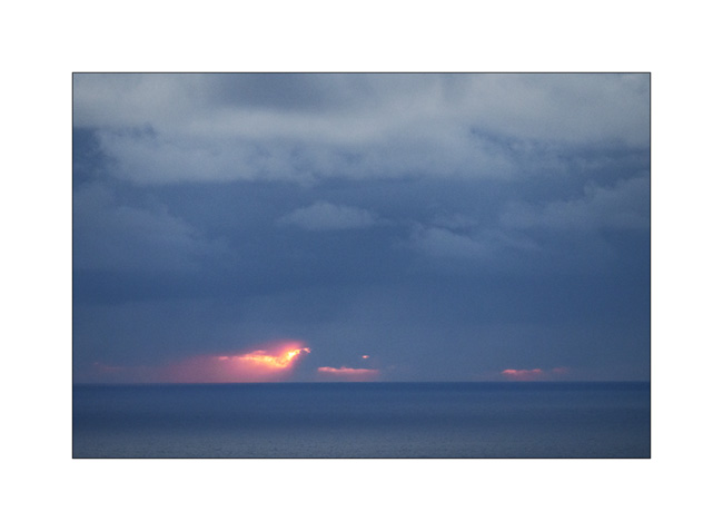
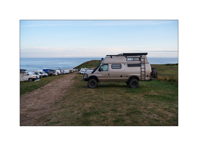
1. Last boondocking with view on the ocean, not far from Bilbao, while it is raining…

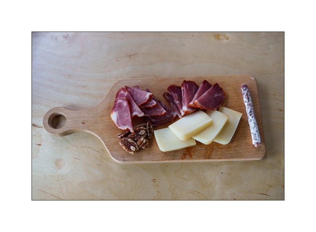
2. Starter with local products!
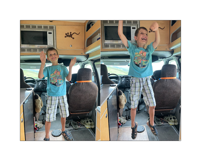
3. Emile’s happy!
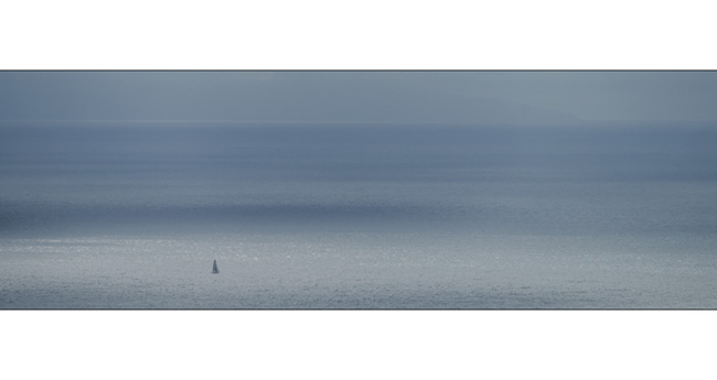
4. Quietness…
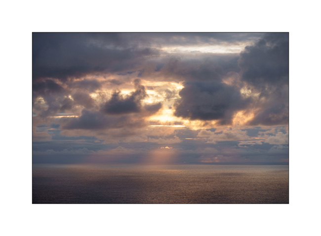
5. The rain stops, giving way to a few colors at sunset.
6. …
7. …

8. …
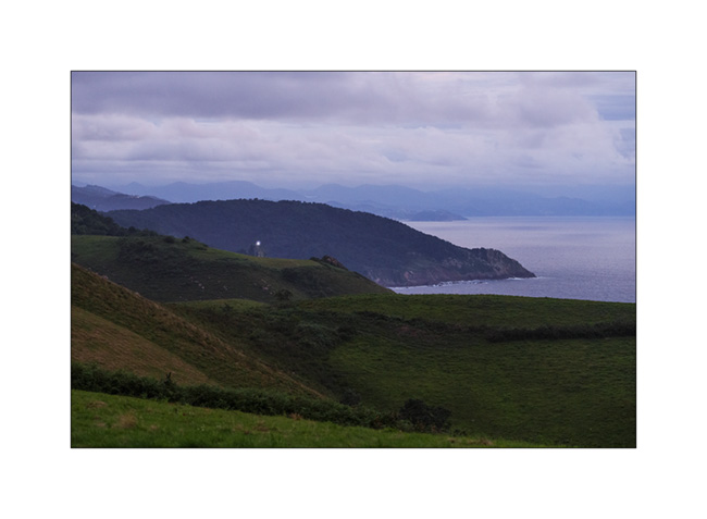
9. … The Basque coast falls asleep..
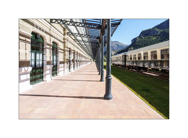
10. I wanted to discover Canfrang train station for a long time, this curiosity nestled on a pass of the Pyrenees, at an altitude of 3,900 feet elevation. I had seen images when it was disused and I’m surprised to discover that it had been completely renovated and rehabilitated into a luxury hotel!
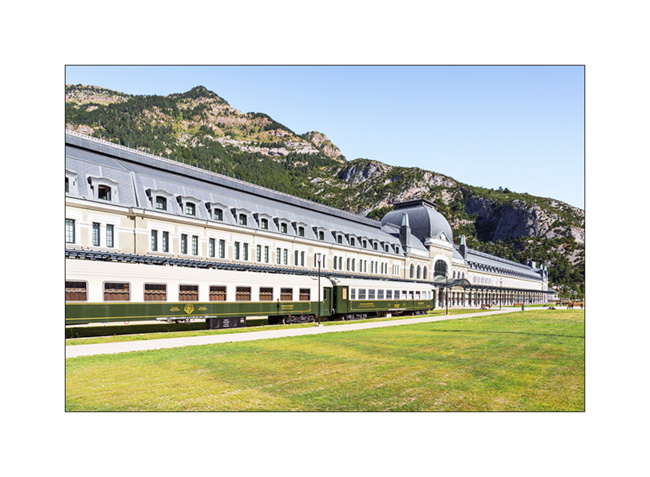
11. Surprising to find such a building in the middle of the mountains, isn’t it?
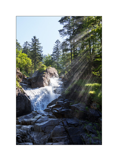
12. We reach Pont d’Espagne where we cannot sleep, the bottom of the valley having been closed to traffic after a huge paid car park in which it’s forbidden to sleep. Here the Cerisey waterfall going down towards Cauterets where we spend the night in a campingpark.
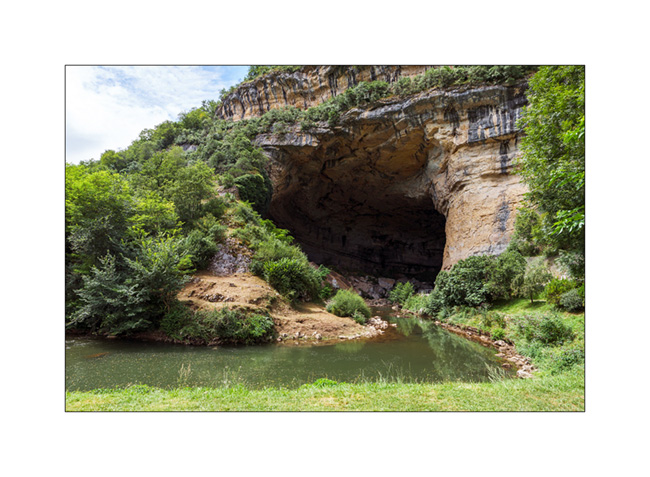
132. We head back towards Switzerland along the northern foot of the Pyrenees and discover a beautiful cave on our route: the Mas d’Azil cave. The cavity was dug by the river which runs through it and it’s so large that the road also crosses it.
14. We sleep north of Carcassone to discover the ruins of the Four Castles of Lastours.

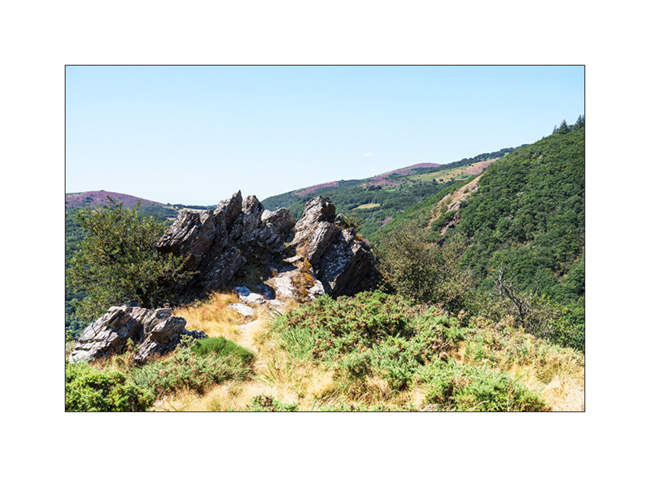
15. It is the small roads of the Cevennes that bring us back home…
16. Crossing the village of Mourèze…
And that’s it for these too short summer vacations where VivaLaVida has covered 2,600 miles.
The next articles will tell you about some fall outings…
Thank you for your loyalty to this little blog! 🙂
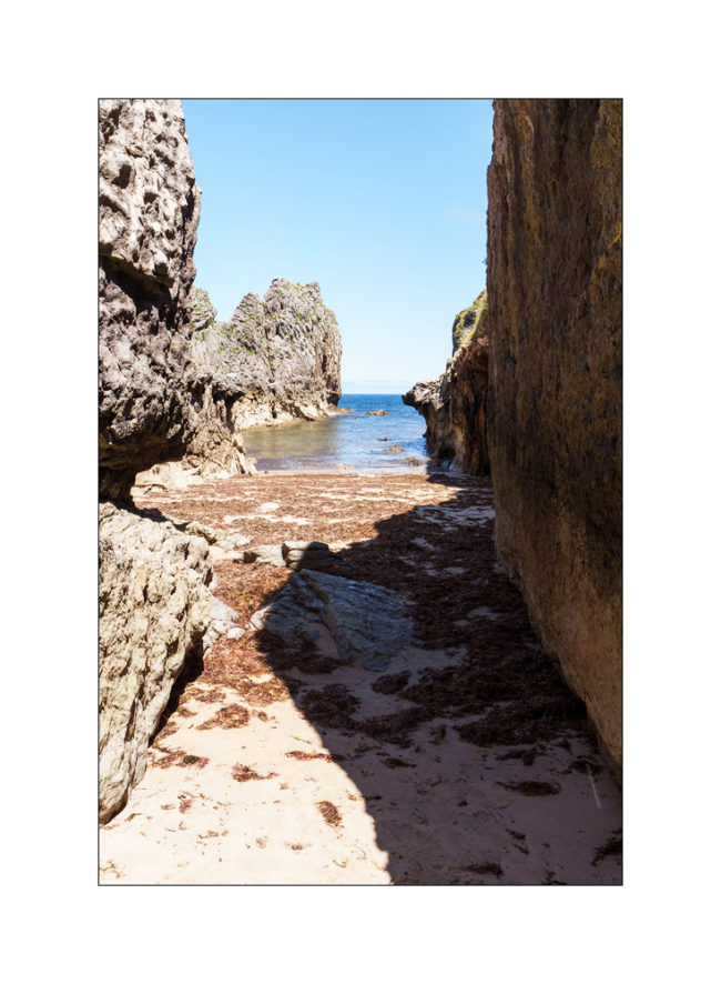
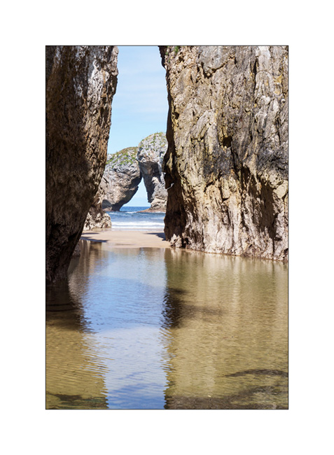
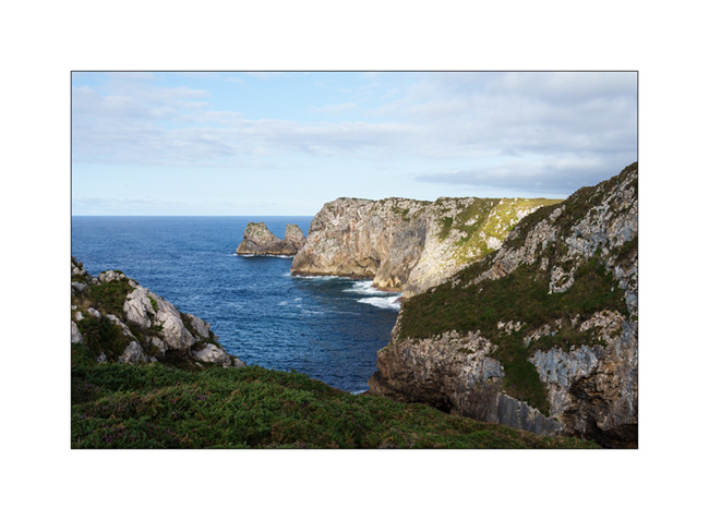
Cantabria and Basque Country (continued)
The next morning, we continue to discover this rocky coast.
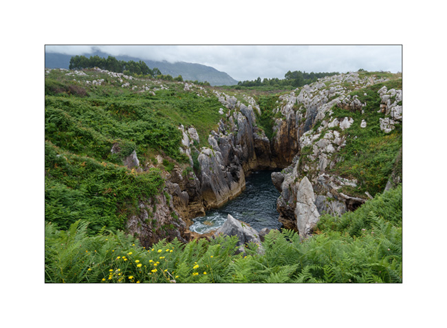
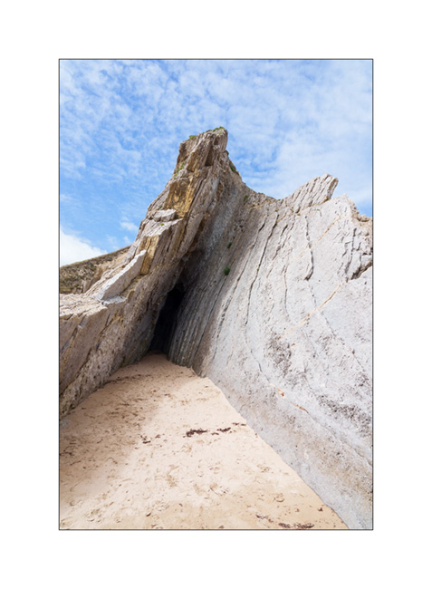
1. The ocean passes through the limestone crevices to create this small lake about three hundred feet from the coast. The swell makes the water move, a rather unusual effect!
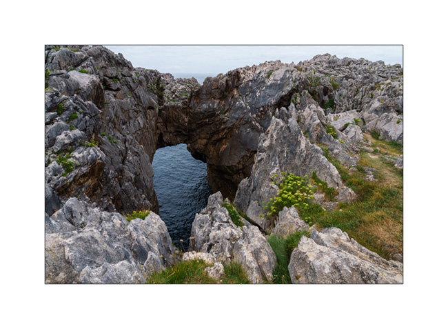
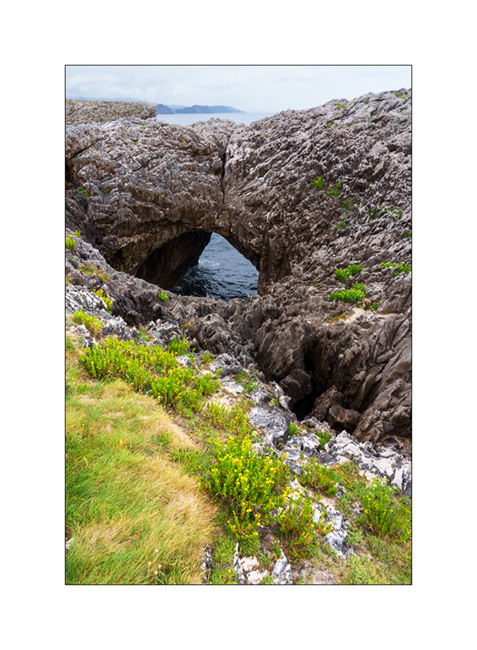
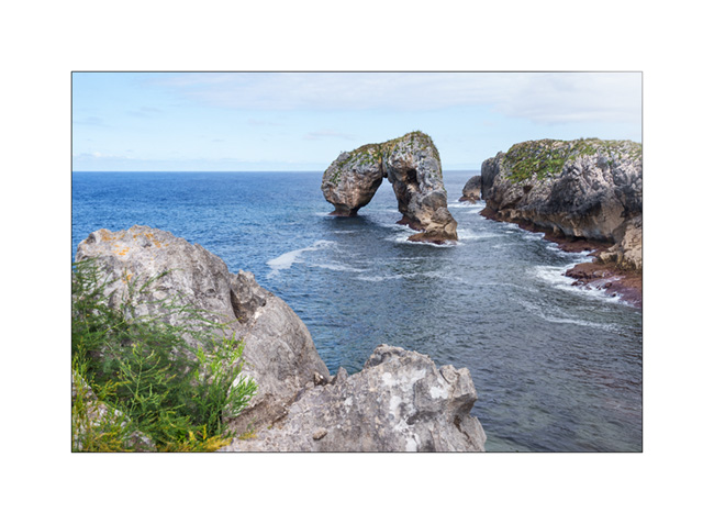
2. Another arch.
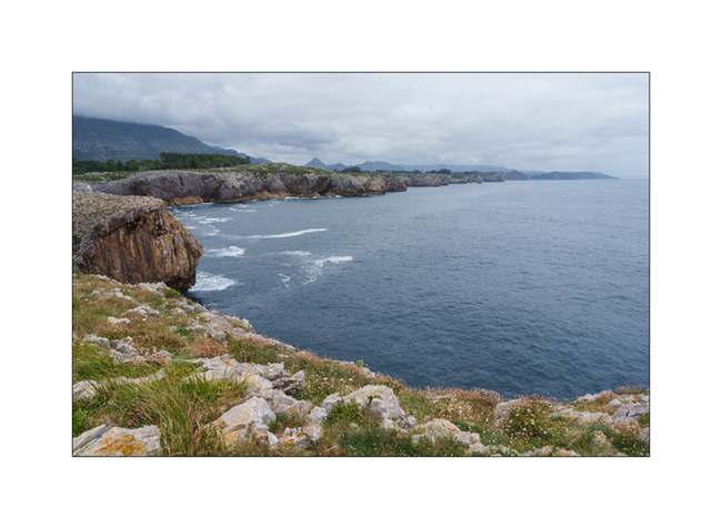
3. The coast towards West from a small peninsula.
4. And one more arch.
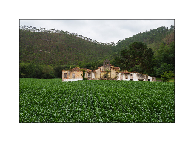
5. There are only a few days left before the end of the vacation, we are heading back east. Abandoned farm along the road…
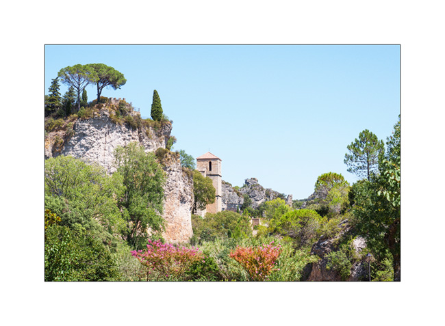
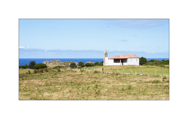
6. Church near the village of Niembru.

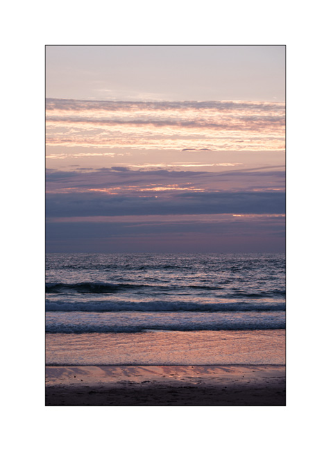
7. We sleep on a surf spot near San Vincente de la Barquera, with beautiful colors at sunset.
8. …

9. …
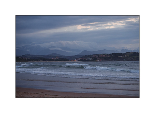
10. VivaLaVida among surfer campers.
11. First light at dawn…

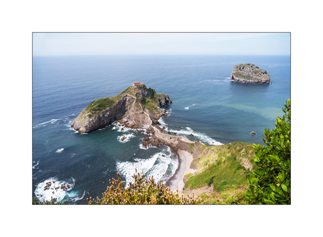
12. We continue our route in the Basque Country and make a short stop at the Hermitage of San Juan de Gaztelugatxe. It’s so crowded that it’s not possible for us to go down because all tickets for the day have been sold.
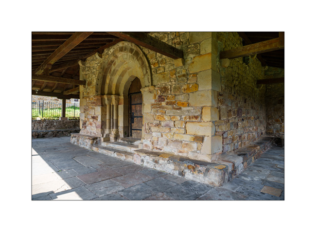
13. Church with covered passageways…

14. Main door.
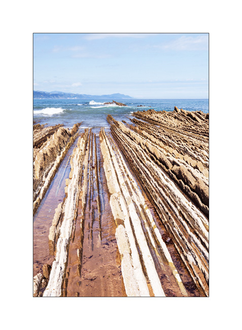
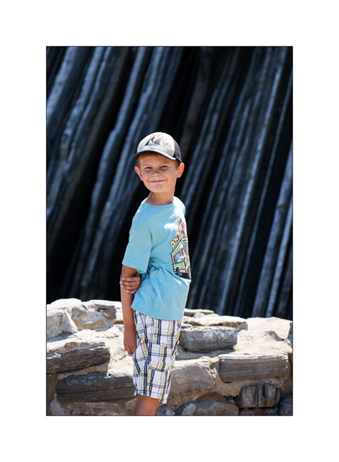
15. Another known spot where we find these layered rocks which have tilted to offer their slices to the ocean, in Zumaia. You don’t see it ont the picture but to my left, there is a beach with probably an average of 1 human per square feet! 😀
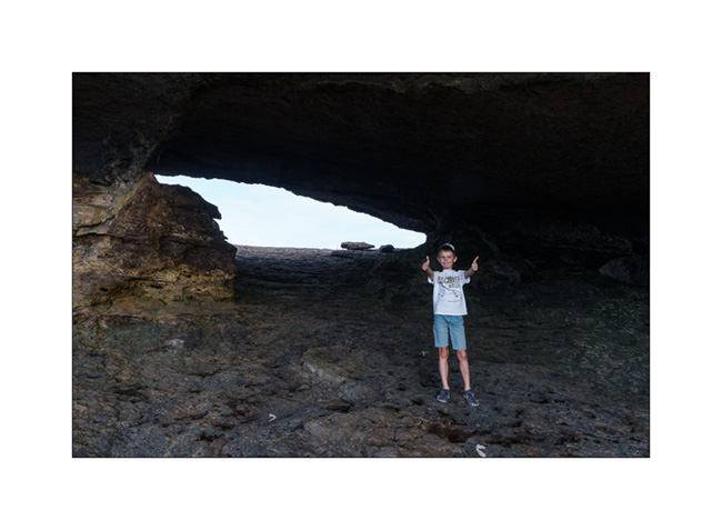
16. My son in discovery mode.
17. Layered cliff…

I will still have one last update to publish in a few days to close the story of this summer trip… See you soon! 😉
Cantabria…
Here is the continuation of our discovery of northern Spain, now in Cantabria.
1. Here we are on the coast of the Atlantic Ocean, in the Golfe de Gascogne where it is blowing strong that day.

2. Walk in the eucalyptus trees.

3. Emile wants to see a lighthouse up close, so we take the coastal path.

4. Ajo lighthouse.

5. We also discover a nearby natural arch.

6. Emile giving the scale.
7. Window on the ocean…

8. After sleeping practically over this arch, we discover a very famous spot the next day: Urros de Liencres.

9. Low tide uncovers rock strata…

10. Little alcove…
11. Another quick hop to discover another natural arch: El Castro de las Gaviotas. We park towards a pretty chapel.
12. Small cove in the cliff…
13. The arch still partially hidden.
14. And here it is complete.
15. After looking for almost two hours for a place to boondock because of the crowds at this time of the year, we finally found a nice place to sleep, at the bottom of the Picos de Europa, near the ocean and accessible only thanks to VivaLaVida’s 4-wheel drive.
16. The ocean is close.

17. The view behind our camp.
18. Pastel twilight…

To be followed soon!
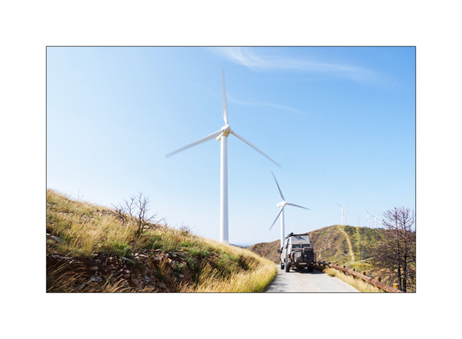
Navarre and Basque Country…
1. As we continue our progress towards the West…
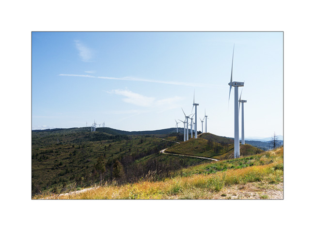
2. … we take a short break in a wind farm.
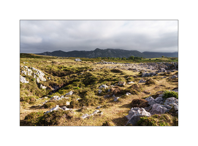
3. Around midday, we reach Urbasa Natural Park, a gorgeous karst plateau between 2,400 and 3,000 feet above sea level.
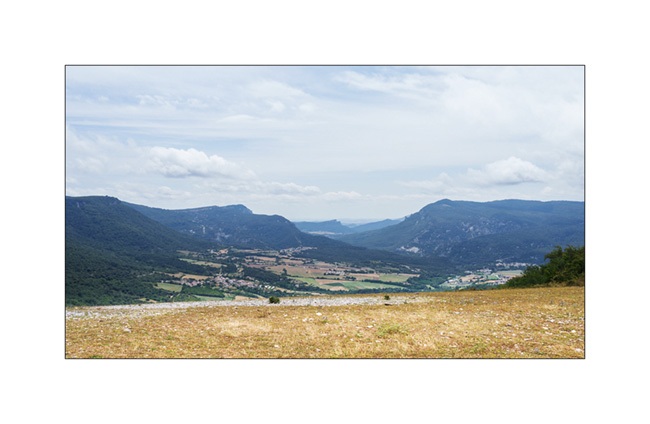
4. After lunch, we go for a walk there.

5. Cliffs…

6. Distorted silhouette…
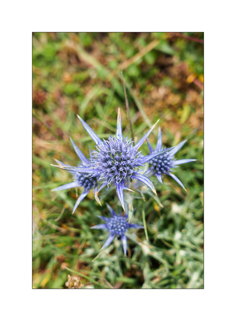
7. Beautiful blue thistles dot these high pastures.
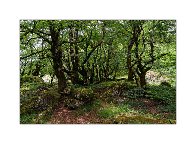
8. Dense forest at the Northwest end of the plateau…

9. …
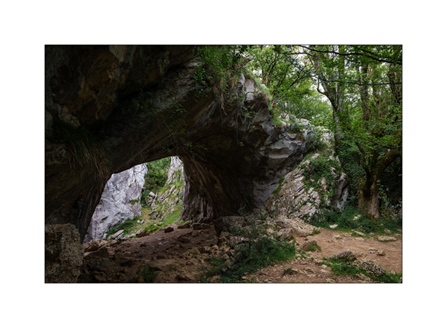
We then head Southeast of Bilbao in search of a natural arch, the Oyo de Aizulo, in the Basque Country.
10. After a walk in a light rain, we arrive at the entrance of this magnificent double arch.
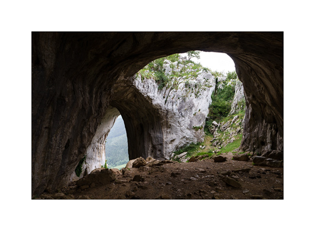
11. Its dimensions are quite impressive! Here the lower arch, probably around ninety feet high.

12. And there the upper arch through which you access the site.

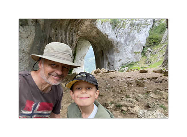
13. The same from above.
14. Selfie ! 😉
15. The next day, after the rain stopped, we go discover an impressive waterfall, the Salto del Nervion which, with its 666 feet, is the highest waterfall in the entire Iberian Peninsula.
As a gate now prohibits access to the trail, it’s after an approx. 2 hours hike that we reach the site to discover a completely dry waterfall! Too bad, it must be quite impressive when the Nervion flows there.

The next post will be more “oceanic” with the arrival of VivaLaVida in the Bay of Biscay… 😉
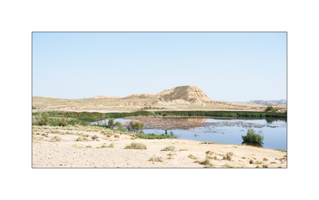
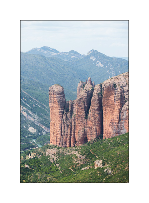
Mallos de Riglos & Bardenas Reales
1. The next morning, we approach the “Mallos de Riglos”, superb red sandstone cliffs..

2. Riglos is the small village built at the foot of these imposing cliffs.

3. We go for a walk in the village…

4. … still deserted this early morning.

5. Towards the top of the village, you can clearly see the impressive height of the Mallos.

6. The church…

7. We continue our way towards West and discover other Mallos, here those of Agüero.

8. Driving towards South-West in the heat of the afternoon, in the village of Uncastillo crushed by the sun.

9. Arrival in the Bardenas Reales desert, one of the few deserts in Spain.
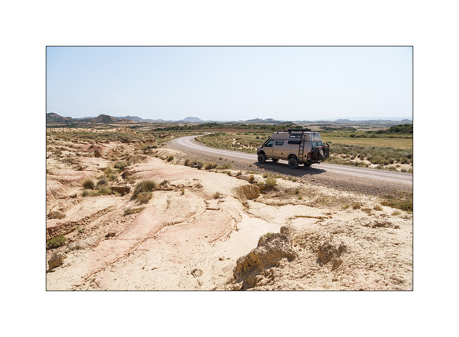
10. It’s over 106°F this afternoon.

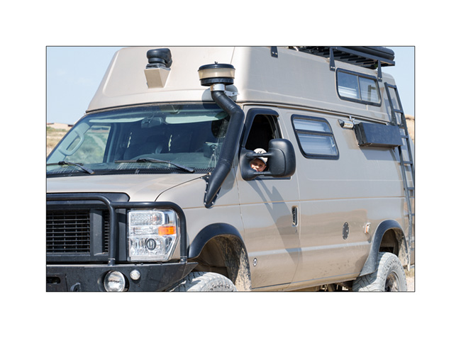
11. With the northern access road washed away by a storm some day earlier, only VivaLaVida and 2-3 4WD vehicules managed to pass through the 15 feet deep canyon dug by the water. As a result, the desert, usually really crowded, is almost free of visitors! 😉

12. Some blooming due to recent rains…
13. Other places remain almost without vegetation.

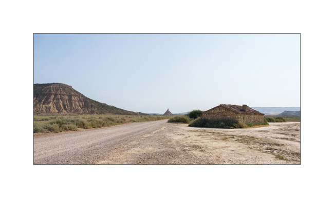
14. Shepherd’s hut.

15. Ephemeral lake…
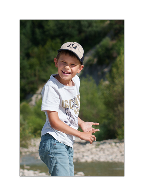
16. Hi Emile! 😀
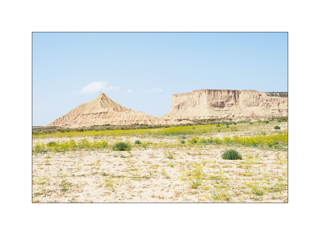
17. The iconic photo of the Bardenas Reales!

18. Another shepherd’s hut.
19. A little touch of Arizona, isn’t it?

In the update coming soon, we will change scenery by continuing towards West and the Basque Country…
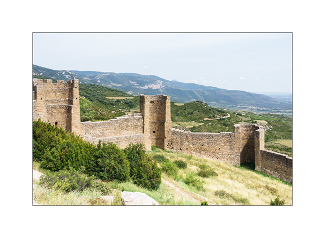
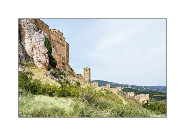
Loarre Castle
1. We stop to discover the superb castle of Loarre.
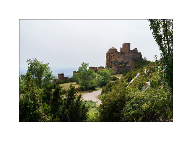
2. Its fortified walls are still almost intact.
3. The main porch…
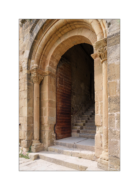
4. …and the staircase which leads to the different courtyards and interior buildings.

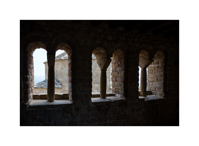
5. Gallery…
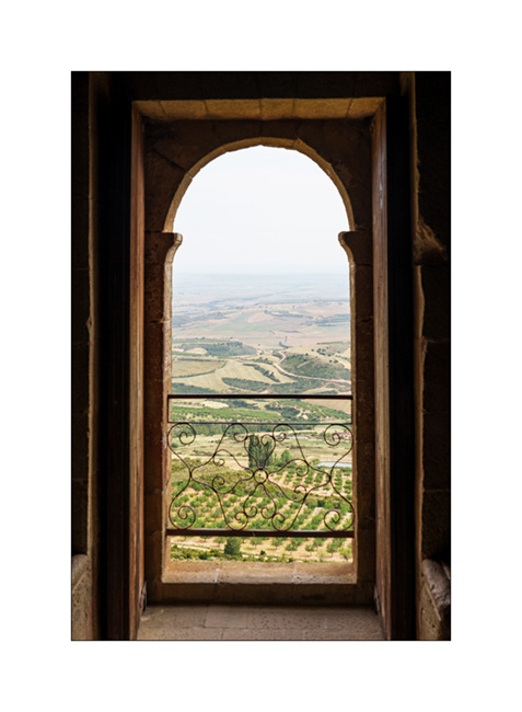
6. View on the plain.
7. Marble stained window…
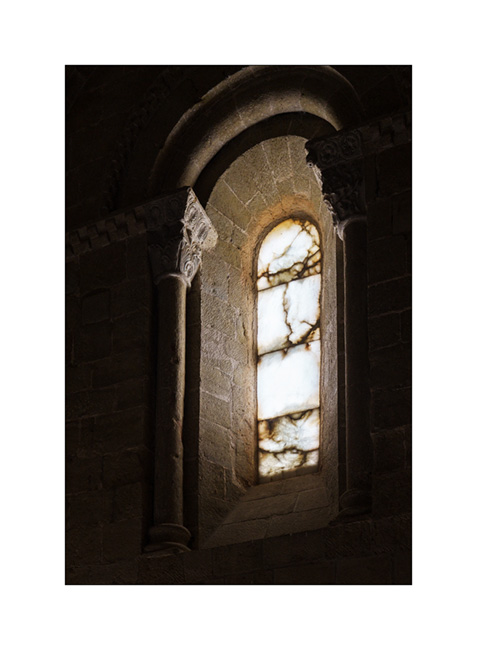
8. Glow…
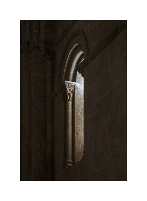
9. Nave…
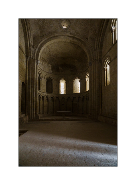
10. Within the walls.
11. Last look as we leave to find a boondocking place.

12. Nice trail in the pine forest…
13. Quiet place under the pines. The shower will be great after a new hot day.

Discovery of the Mallos de Riglos and other curiosities in the next update. 😉
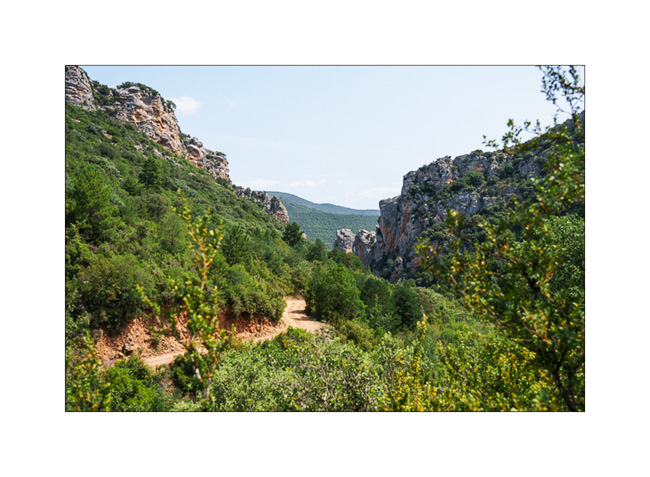
Southern foot of the Pyrenees
To protect ourselves from the heat wave that has been raging for a few days, we decide to discover the Ordesa valley, hoping to find some freshness there. In the summer time, access roads are closed to individual vehicles and after a night in the small campground of the San Nicolás de Bujaruelo refuge, we take the shuttle to the valley.
1. After an hour of hiking, we are in front of the “Cascada del Estrecho”.

2. Continuing up the river…
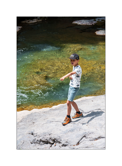
3. Emile playing at our picnic spot. I won’t bring back other images, a heavy rain shower forcing us to shorten our walk.
4. Boondocking near a small river…

5. My son happy to play with his feet in the water. 😉
6. The next day, the track rises in a limestone range.

7. Landscape and geology change rapidly.
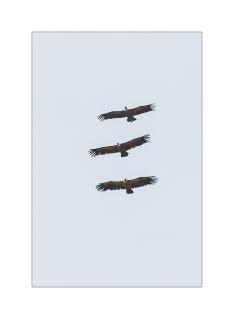
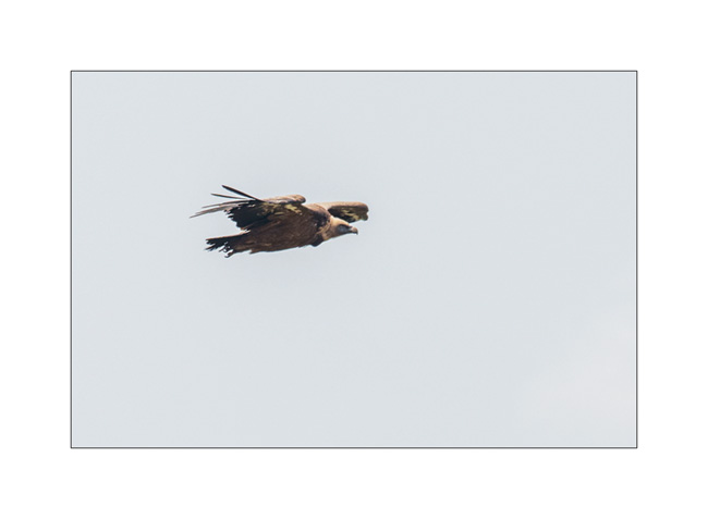
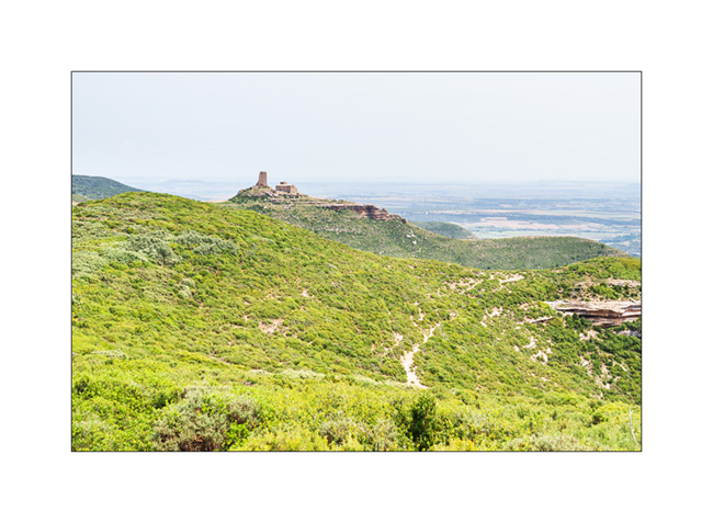
8. We reach the “Mirador de Los Buitres” shortly after noon and enjoy a magnificent view on the “Mallos de Riglos”.
9. As we eat, many vultures fly over us.

10. Squadron…
11. Glider…
12. Ruin along the trail…
13. Late in the afternoon, we arrive in sight of the “Castillo de Loarre”.

Images of our visit are coming in the next article… 😉
Pyrenees: heat and geology…
1. After a quiet night at 8,600 feet above sea level, the good weather is in the game.

2. We take the trail again for the descent.

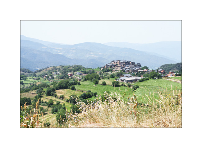
3. We head West through the southern foothills of the Pyrenees, sometimes on small roads, sometimes on trails, discovering pretty villages…
4. It is the hottest day with 110°F in the shade. We camp under the trees, near a river and take advantage of the new VLV shower installed before departure to refresh ourselves. A flock of sheep comes to drink right next to us.

5. The next day, we leave early to avoid the high temperatures. Panorama from Coll de Boixols.

6. And still these beautiful villages…

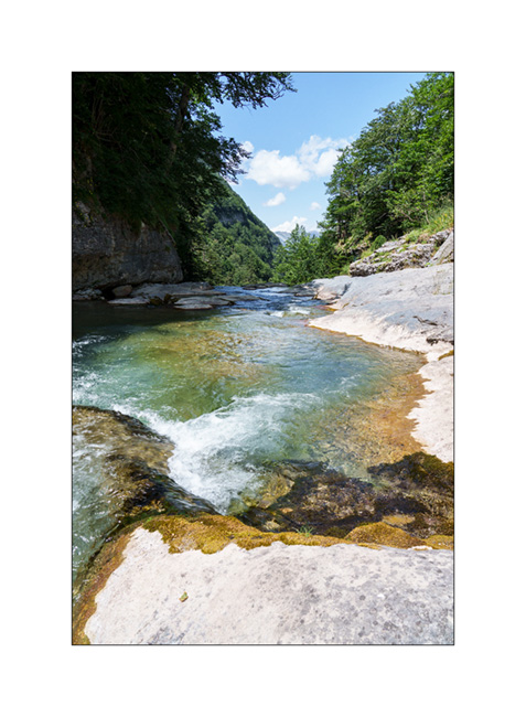
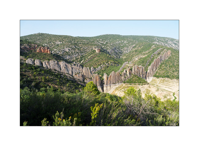
7. We arrive near the Congost de Mont Rebei, a deep canyon of the Noguera Ribagorçana river in which a vertiginous path has been dug. Parking is prohibited to vehicles over 6 feet high and we have to park along of the access road, 1.5 miles from the trailhead. View to the south from the “Mirador de les Lludrigues”.

8. Despite of the 104°F, we leave for the 4 miles leading to the beginning of the path dug in the cliff. Emile crossing a pedestrian suspension bridge.

9. Gradually, the trail rises as you enter the gorge.

10. In the heart of the canyon, the path is aerial !
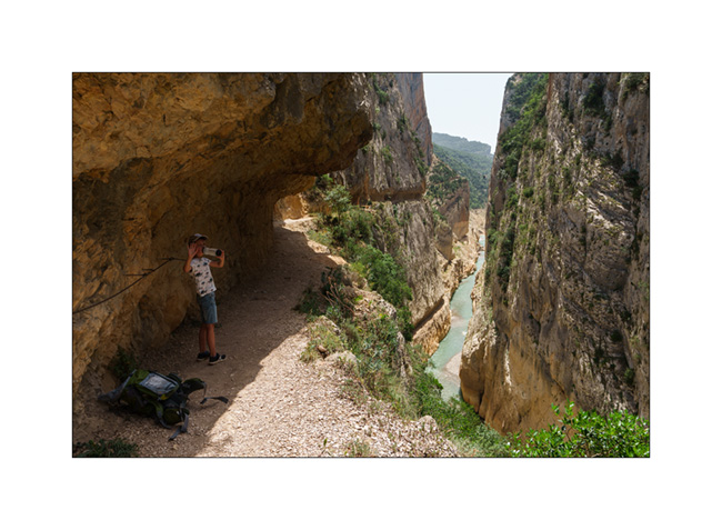
11. Congost de Mont-Rebei in its upper part. The path is 400 feet above the river!
A gust appropriates Emile’s cap; we therefore improvise a headgear for the way back with a small cloth and a lace because the sun always beats down hard!

12. Back to VivaLaVida after 4 hours of hiking under 105°F, we take the road again, then a trail to get to the Muralla de Finestras. We get there in late afternoon as the sun starts to go down…
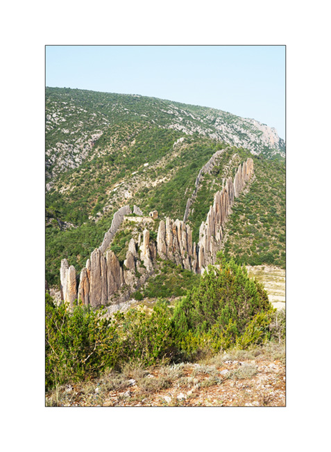
13. The level of the artificial lake which sometimes bathes the foot of this wall is very low this year…

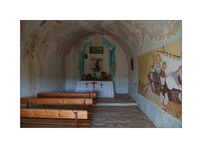
14. From the ghost village at the end of the trail, we hike to the small hermitage of San Marcos which offers a nice viewpoint.
15. A last look at this geological curiosity before going back and finding a nice spot to sleep in the middle of nature and enjoying a shower…
To be followed in a few days…
2023 Holidays, here we go!
After a spring somewhat upset by Emile’s diagnosis, it was not until July that VivaLaVida left its winter quarters to resume service.
Three days for a big engine, transmission and running gear service – thanks to the Garage BN in St-Martin/FR for the loan of the place – two additional days to reload all the stuff and we’re ready to leave towards South on July 15th. Emile is in heaven, he who has been asking me for two months “When are we going to travel again in VivaLaVida?!”. After a first night in the campground where we had waited for the wheel studs two years ago – Emile was hoping to see Lilou again, a little girl he met during our last stay – we continue towards the Pyrenees.
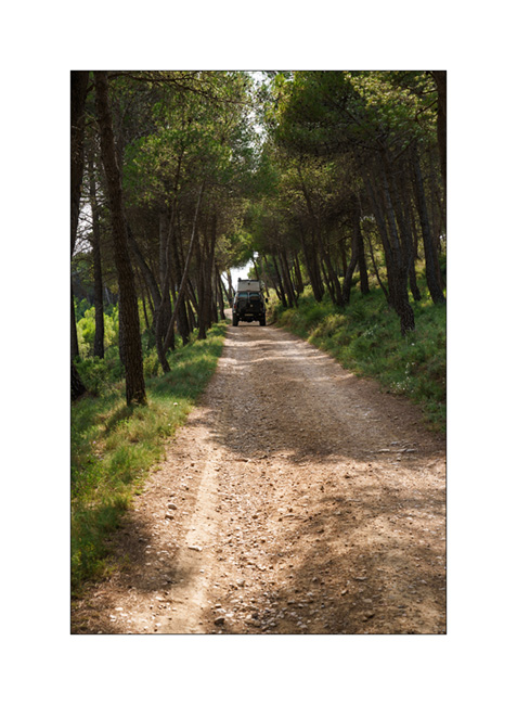
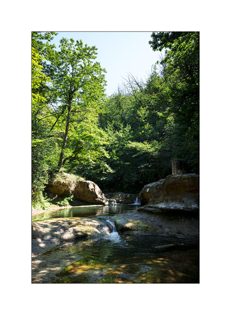
1. First spot that we are gonna discover, the “Fontaine des Amours” (Fountain of Loves), a pretty natural pool.
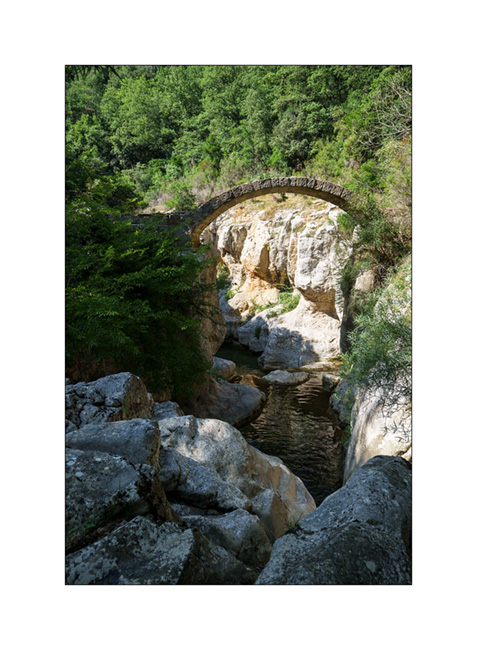
2. Not very far, we explore the remains of a Roman bridge…

3. It was rebuilt identically after a major flood thirty years ago.
4. We find a quiet boondocking place not far to spend the night in the hills of Ariège…
5. … and we make the first and last campfire of this vacation for our barbecue. While it has rained a lot here and the risk of wildfire is non-existent this evening, it won’t be the same later…

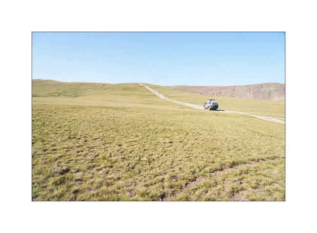
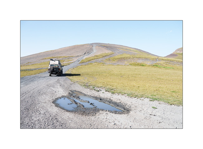
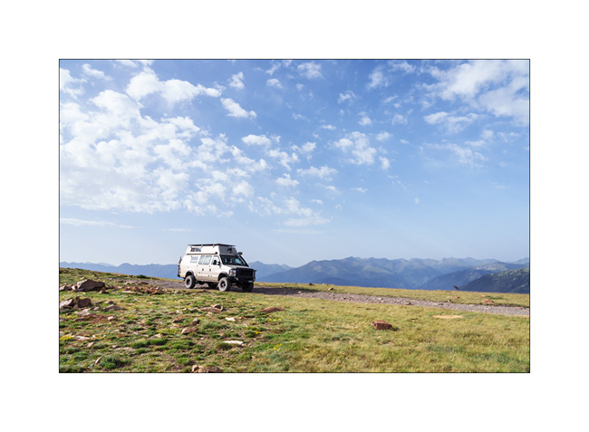
6. After reaching Andorra la Vella where we shop some groceries to fill the fridge, we decide to drive up to Pico Negro. The trail has become so busy that there is a guard of Guarda Civile who charges €25 at the start of the trail. As it’s already late afternoon, VLV climbs without stopping too much on a track in places very washed out by storms and reaches a first flat area at around 7,200 feet elevation. We don’t meet anyone there.
7. After approx. an hour’s drive, she arrives in sight of the summit, at about 8,900 feet above sea level.
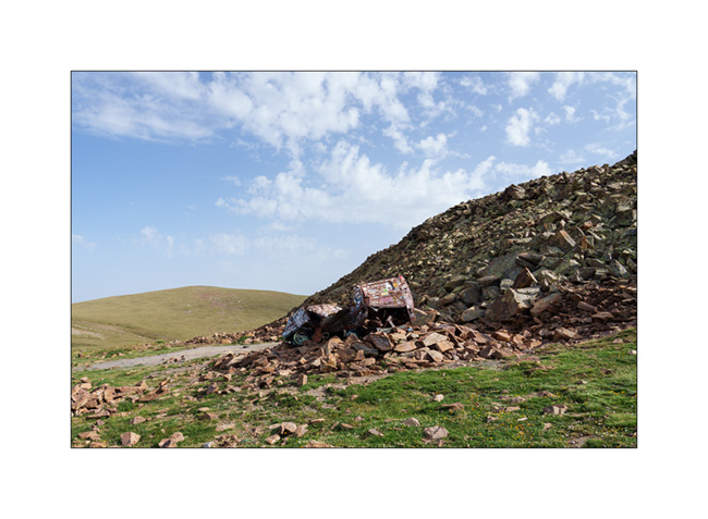
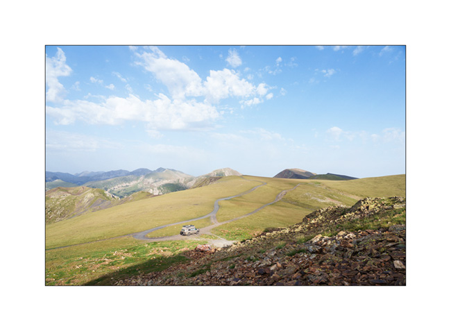
8. After the summit, we go further to the famous VW van carcass near which we spend the night.
9. VLV at the camp…
10. Climbing on the small summit overlooking it…
11. … to enjoy sunset.

12. Evening quietness…
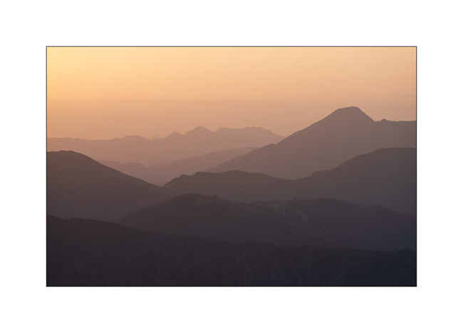
13. See you tomorrow sunshine !

14. Dusk…

See you soon for more! 😀