Archives
now browsing by author
Merry Christmas!
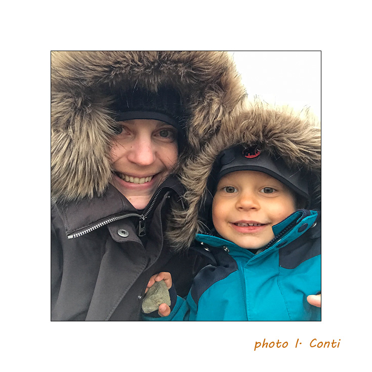
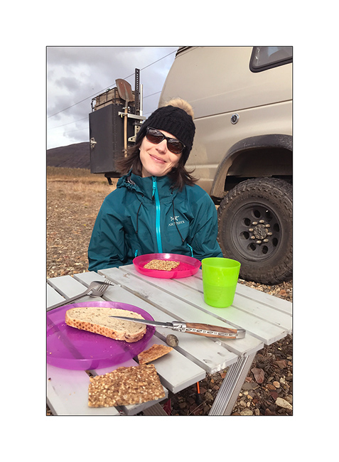
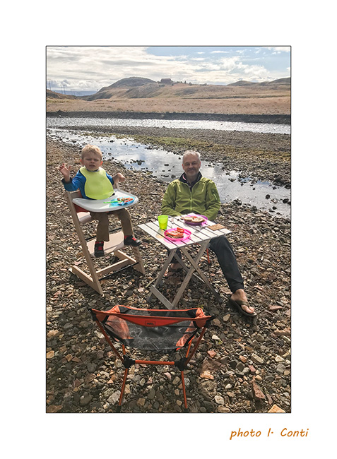
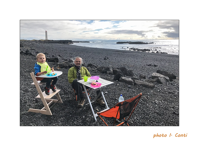
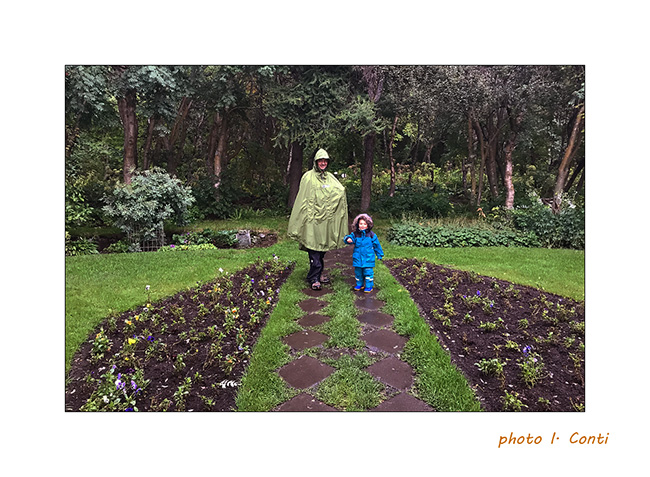
Before the rest of the previous article, here are some Isabelle’s pictures, memories of the journey with my little family…
1. Emile and his mom well wrapped up.
2. A beautiful hot spring…

3. … in which we had a good time of relaxation.

4. Picnic…
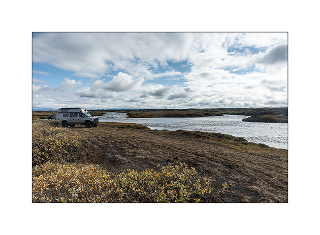
5. … at the edge of a river…
6. … or a beach.
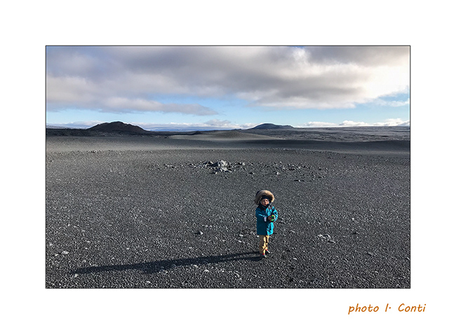
7. Emile alone on the moon 😉
8. And as it is time: Merry Christmas to all of you from us three ! 😀

Following with VivaLaVida’s way back to East Iceland in a few days…
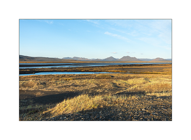
“Golden Circle” and South Reykjaness
Thursday, September 13th, the last day of my family’s trip before flying back home, leaving me alone to bring VivaLaVida back to Switzerland.
We leave to visit some spots of the Golden Circle, not far from Reykjavik.
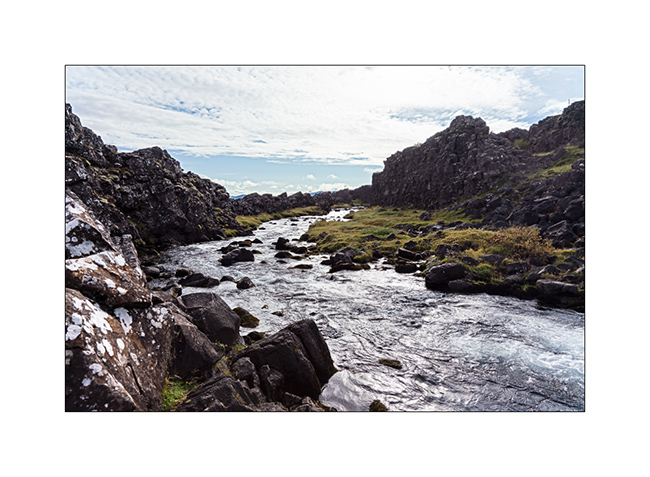
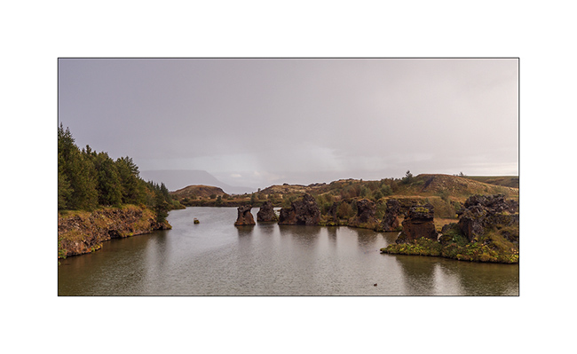
1. Stop at Þingvellir, historic site of the first Icelandic parliament founded in year 930. It has the particularity of being exactly on the divide between the European and the North American tectonic plates. A river flows there on a few hundred yards.
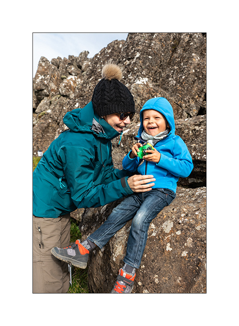
2. Souvenir: Emile is in Europe and Isabelle in America ! 😉
3. On the road to another must-see spot for anyone who has never seen a geyser…
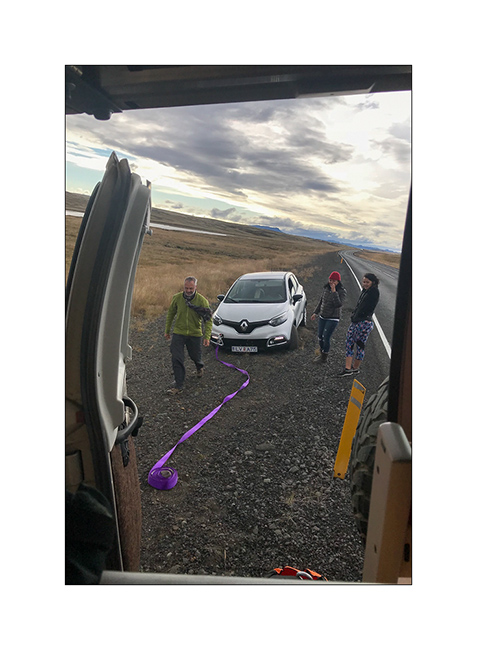
4. Anecdote of the day: we are stopped by two Texan tourists who, having stopped on the aisle to take a picture, got bogged down with their rental Renault and ask VLV to pull them from this bad not. Thank you to Isabelle for the picture! 😉
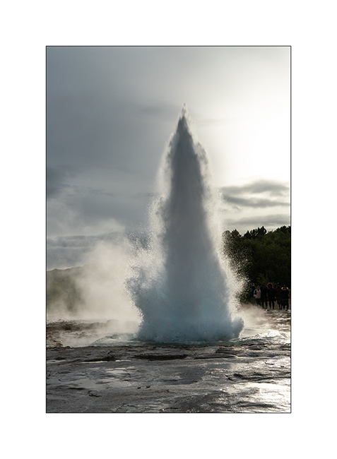
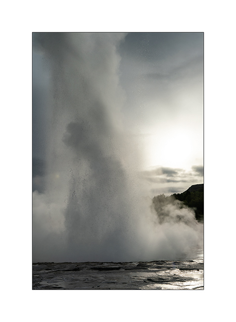
5. NWe arrive at the Geysir site at the end of the day.
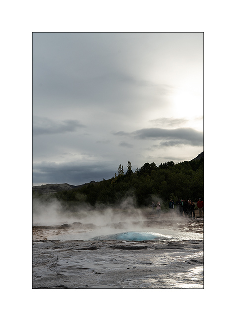
6. This is my version of so photographed Stokkur Gesyr.
7. …
8. We boondock along the F333 trail, away from the crowd to be quiet in nature…
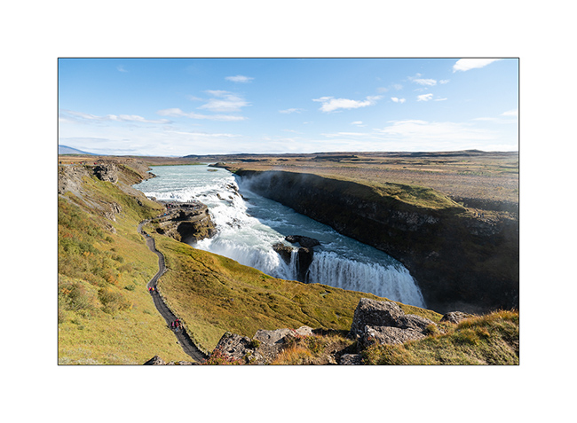
9. Short morning visit in Gullfoss already invaded by mass tourism.
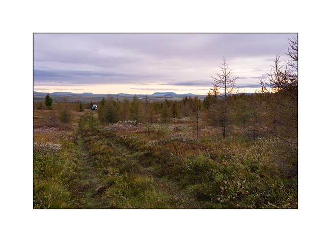
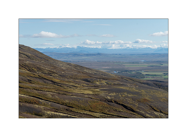
10. Returning to Reykjavik for the return flight of Isa and Emile, short climb of the beginning of the F337 trail to admire the view on the plains.
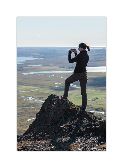
11. In action!
The next morning, we wake up early to go to the airport where the return flight takes off at 7:20. No picture in the rush of an already crowded airport at dawn. The weather being rainy, I took advantage of my Saturday to write several articles of the blog and postprocess some images. The next day, I hit the road toward East where the ferry will wait for VivaLaVida a few days later for bring her back to the mainland. Path through South of Reykjaness, the peninsula on which Keflavik International Airport is located.
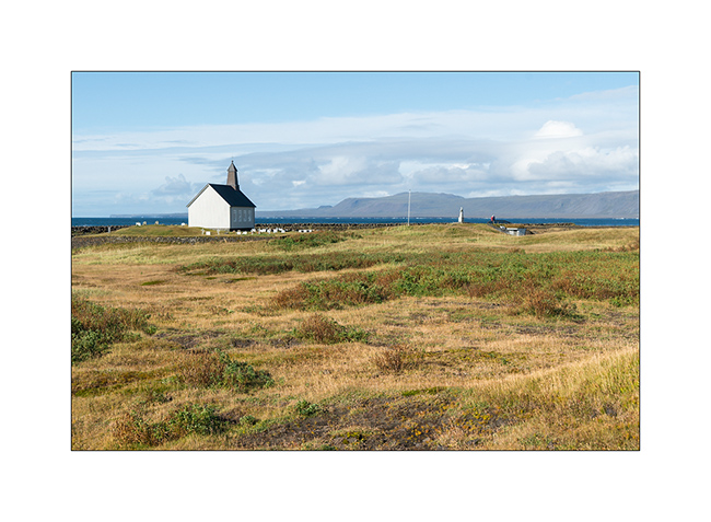
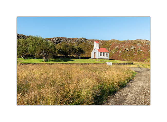
12. Short stop at the pretty Strandakirkja church.
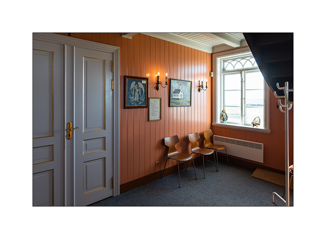
13. Almost all Icelandic churches have a small entrance hall separated of the main nave.
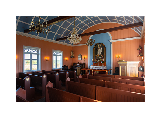
14. Colorful nave.
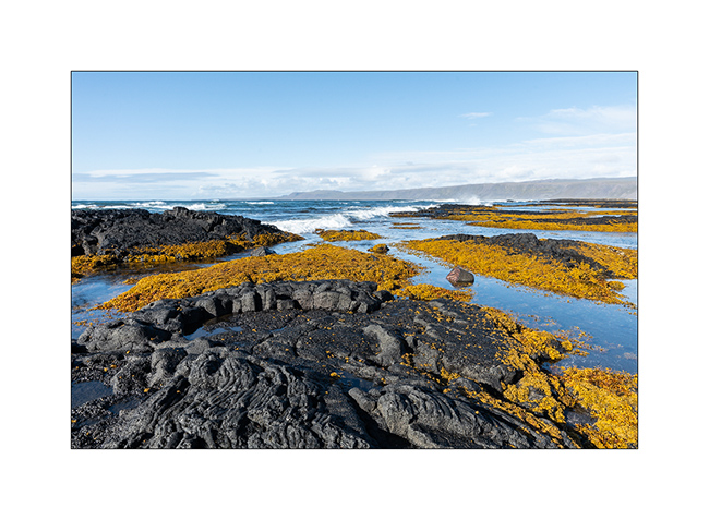
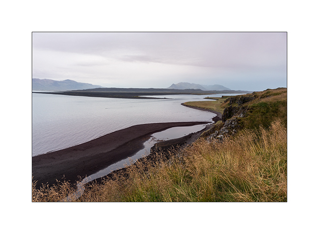
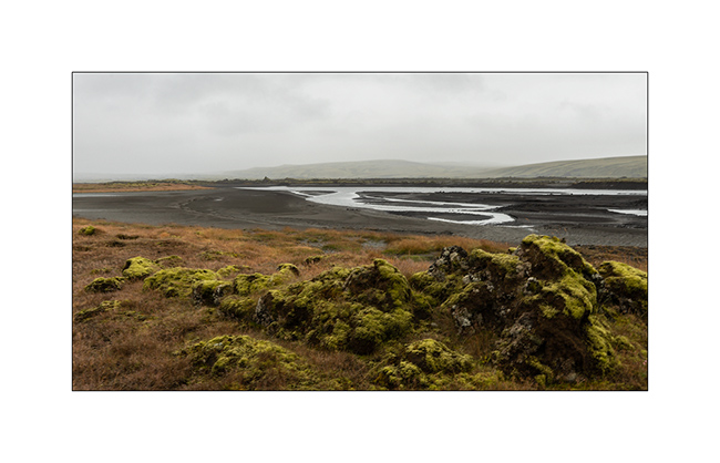
15. On the coast, I enjoy the contrasts between the black lava and the algae that develop there.
VivaLaVida then took a series of F roads to discover the back of the Myrdálsjökull ice cap. Coming soon in the next article.
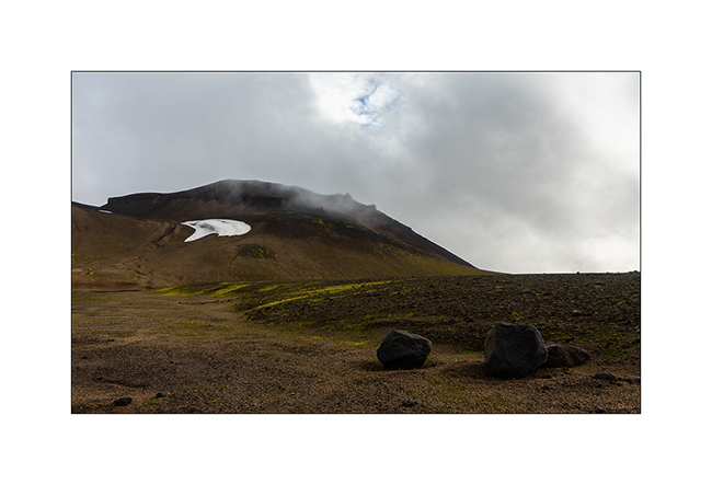
Snæfellsness
While there are only four days left before Isabelle and Emile go back, VivaLaVida hits the road to the touristic Snæfellsness peninsula and its various natural attractions.
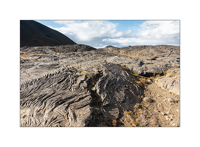
1. Lava flows in the ocean.
2. Recent volcanic geology…
3. … interspersed with a few small fjords.
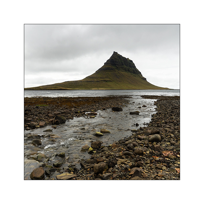
4. The famous Kirkjufell mountain, so photographed but invaded by mass tourism. I chose a different perspective, not doing the same as everyone else… 😉
5. To escape the crowd, VivaLaVida climbs to the Snæfellsjökull ice cap for the night.
6. Camp at the crossroads of two deserted trails. Do you see VLV all the way down? 😀
7. Wind clouds while many snowfields persist even if we are only about 2,000 feet above sea level.
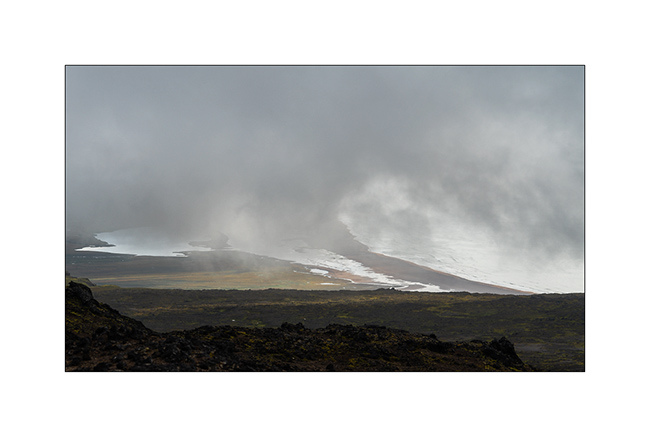
8. The next morning, the cap is hidden in the clouds, to the chagrin of Isabelle.
9. But the surroundings are worth seeing…
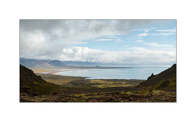
10. … and the view of the beach, 1,800 feet lower under the clouds, is beautiful.
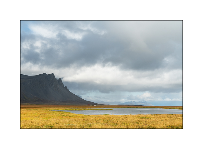
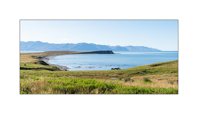
11. Peninsula South coast.
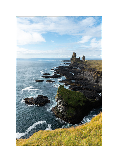
12. Another highly visited spot, the lava cliffs of Londrangar.
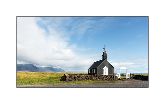
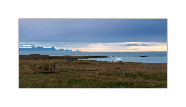
13. The cute little church of Búdir.
14. From the South Coast Road.
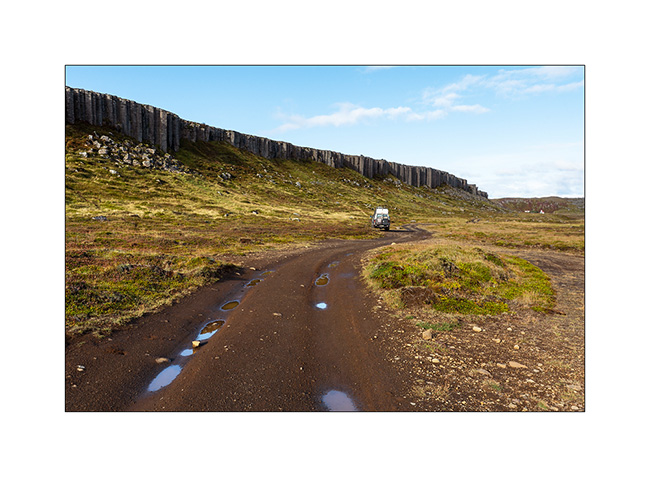
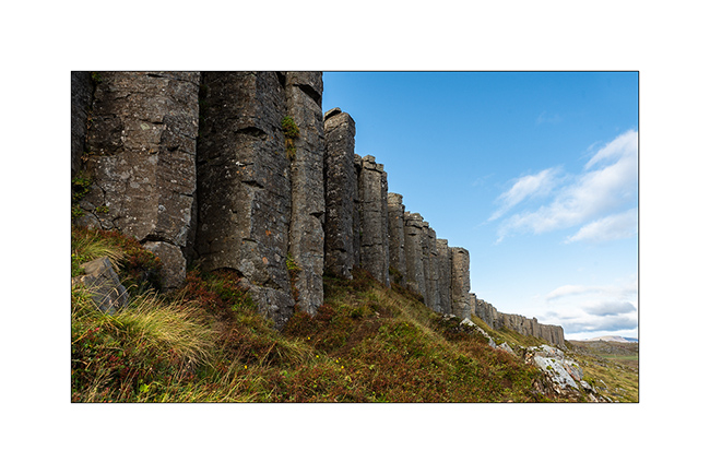
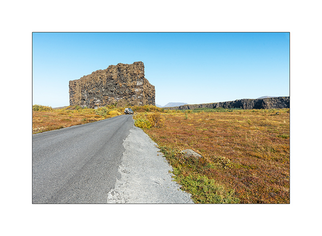
15. Stop near a spectacular wall of basalt columns.
16. These pillars, which have a penta- and hexagonal shape of approx. 3-5 feet in diameter, are between 20 and 60 feet high for their visible part.
17. We walk to a pretty little church nestled at the bottom of a crater.
18. Wild camp at the edge of a small river…
19. At 23:00, while I go out to do some natural needs, surprise, I discover a sky adorned with Northern lights…
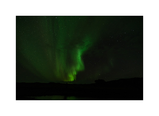
20. … as much in the Northeast as in the Southeast.
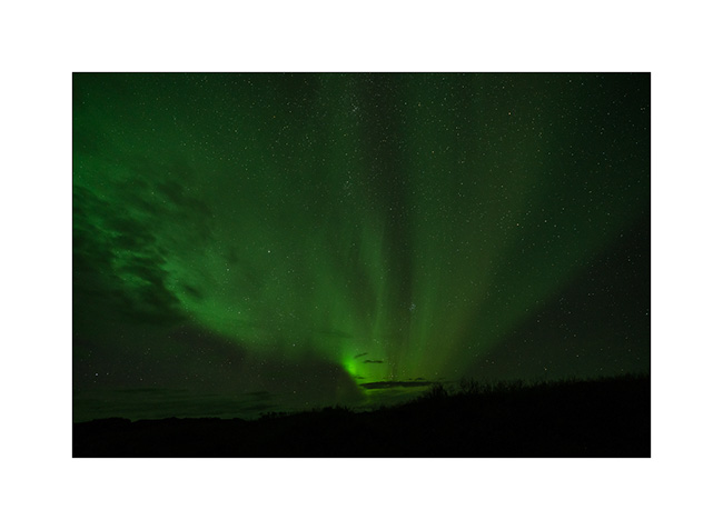
21. I hurry up to get camera and tripod. First of limited intensity, aurora intensifies while I frame VLV in the field.
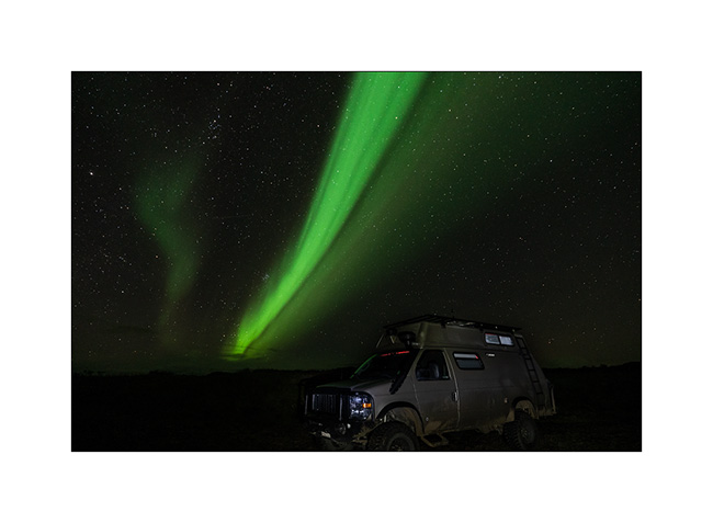
22. Then without warning, in a few moments, it becomes incredibly intense!
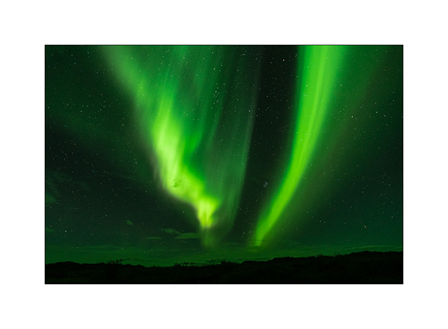
23. Colorful purple fringes appear.
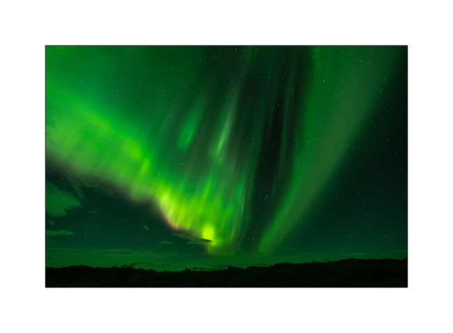
24. And the trails swirl at full speed throughout the sky.
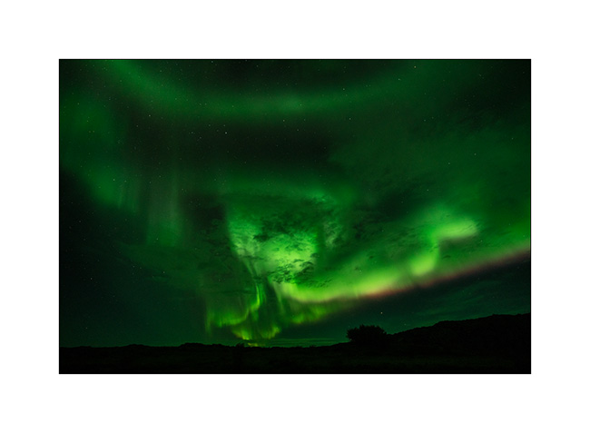
25. Even with an ultra wide angle lens mounted, I can only encompass part of it…
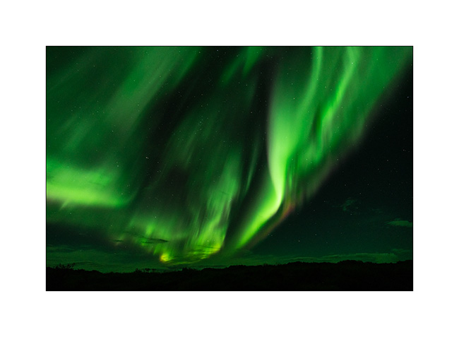
26. I constantly shoot to immortalize this moment of intense contemplative emotion…
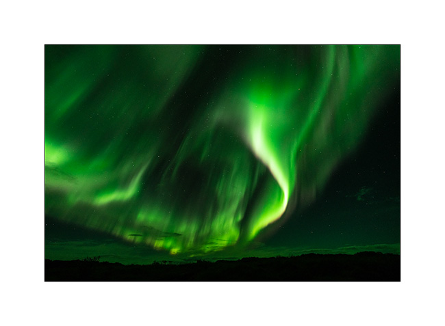
27. I feel so small under so much cosmic energy.
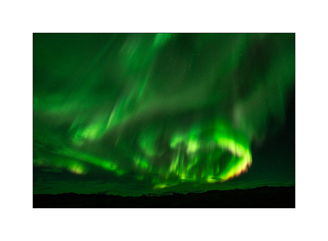
28. Then after a few minutes, the show calms down…
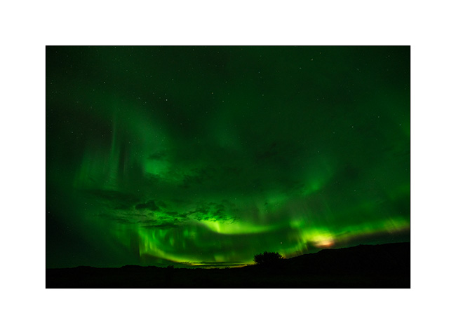
29. …
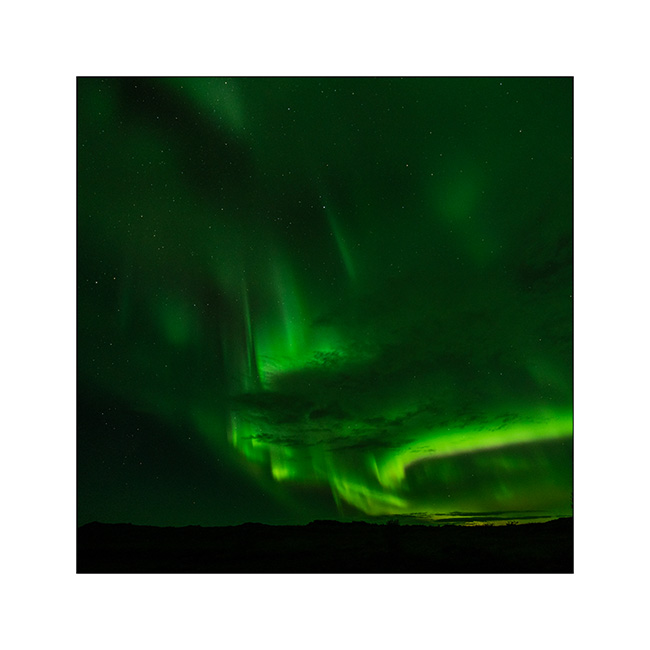
30. I had never been able to see a dawn so bright and dynamic aurora until then.
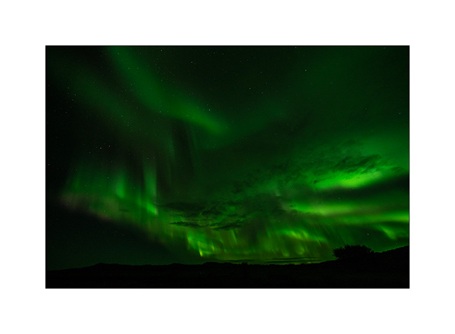
After more than two hours enjoying this beautiful surprise in the cold, frozen, I go back to bed and look forward to the heating in VivaLaVida…
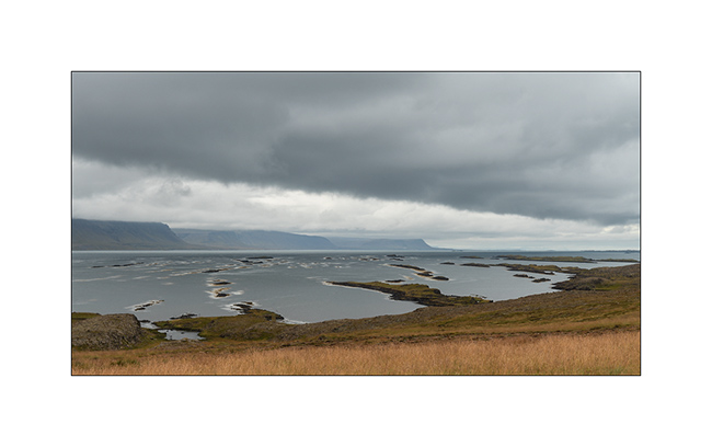
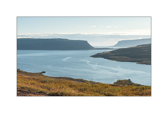
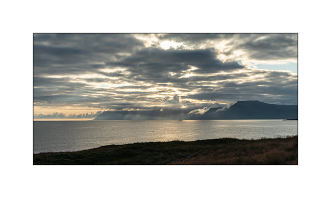
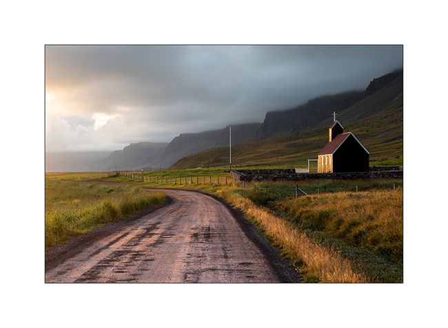
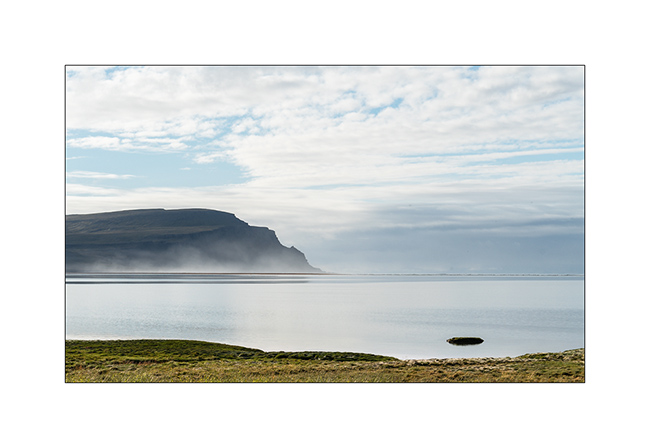
Fjords of North West
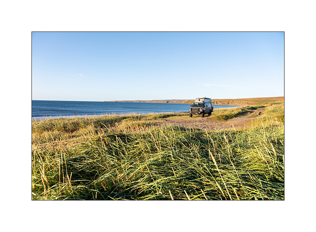
1. Great weather in the morning!
2. Icebergs are still there.
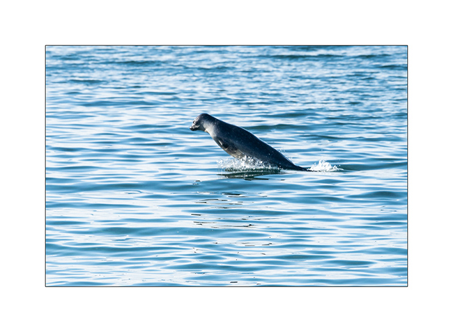
3. Stop on our way to observe seals.
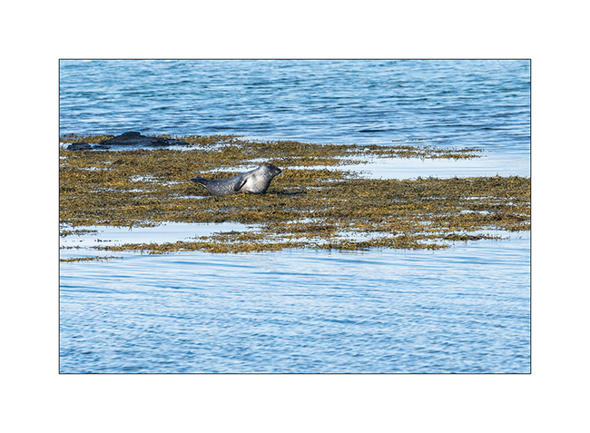
4. When some rest, others seem to play in the water.
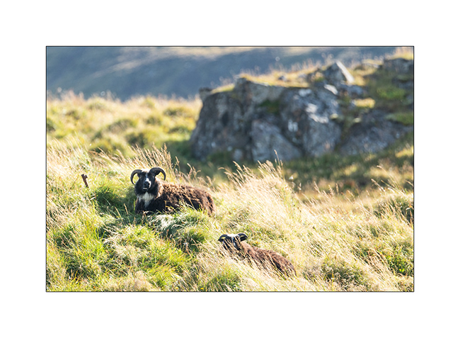
5. Under the eyes of ubiquitous and placid sheeps.
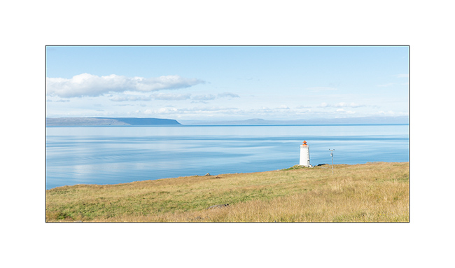
6. Small lighthouse on the coast.
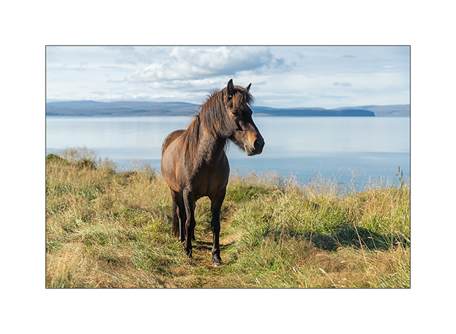
7. I draw the portrait to one of these famous Icelandic small horses with long manes.
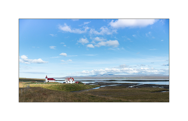
8. Small church along a fjord. There are many, always small and often with only one house around.
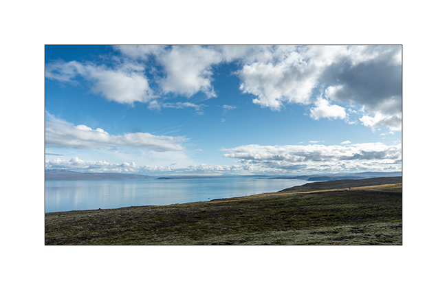
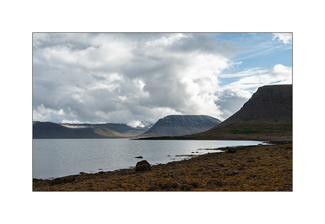
9. As VivaLaVida crosses a small pass between two fjords, the horizon deepens.
10. …
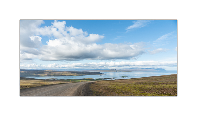
11. To reach a large beach far west of the fjords, the road is endless: while in a straight line, the GPS indicates 55 miles, it will take 125 miles of winding road to get there!
12. The end of day light is spectacular.
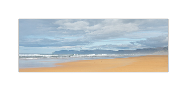
13. Rauðarsandur beach is behind this point…
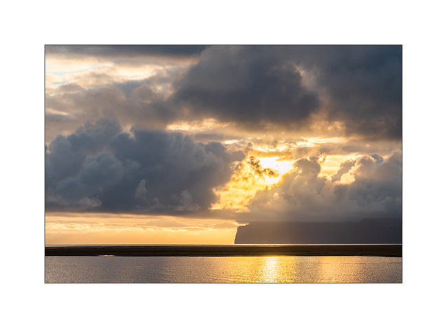
14. VivaLaVida will finally reach it at sunset, enjoying last sun rays on its pretty black church.
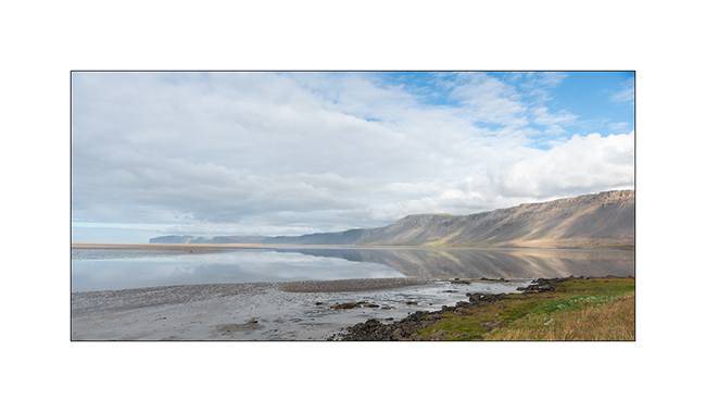
15. Calm morning on the inlet.
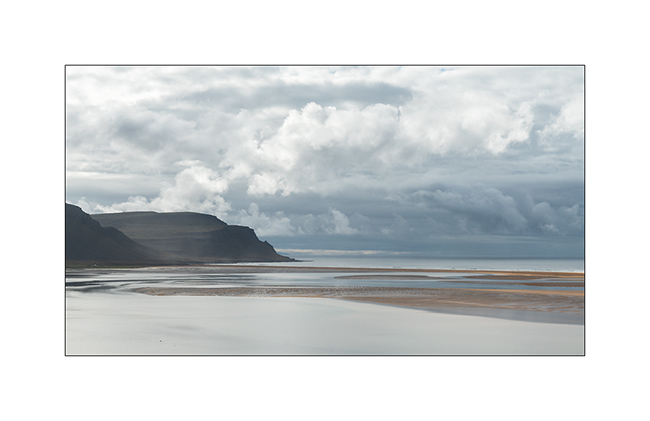
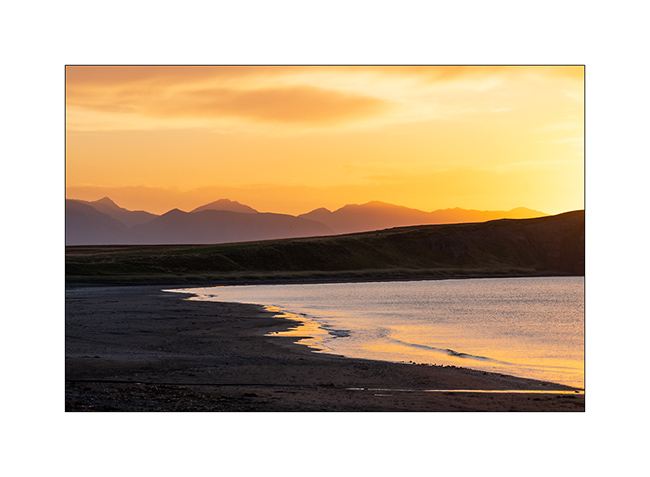
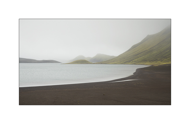
16. Rauðarsandur beach is Iceland’s largest and its color denotes with omnipresent black elsewhere. Wonder where does this colorful sand come from.
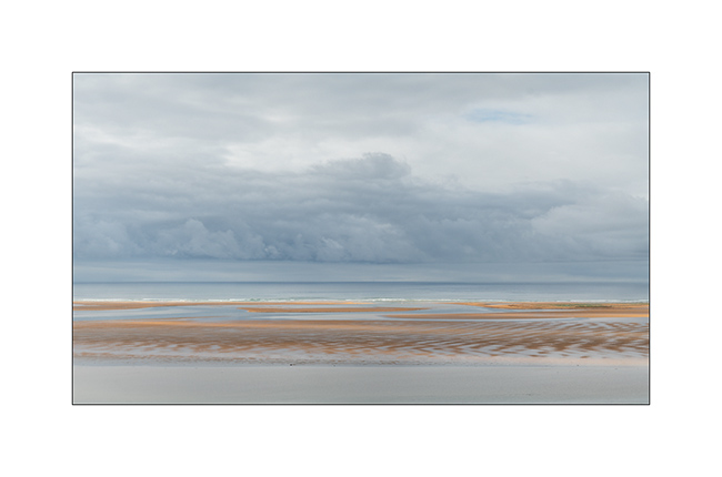
17. Refelction behind the beach.
18. Patchwork at rising tide.
19. Marine atmosphere…
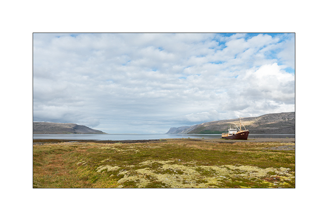
20. In a nearby bay, stop near a ship wreck.
21. These fjords are beautiful and constitute the least visited part of Iceland and let us enjoy more solitude.
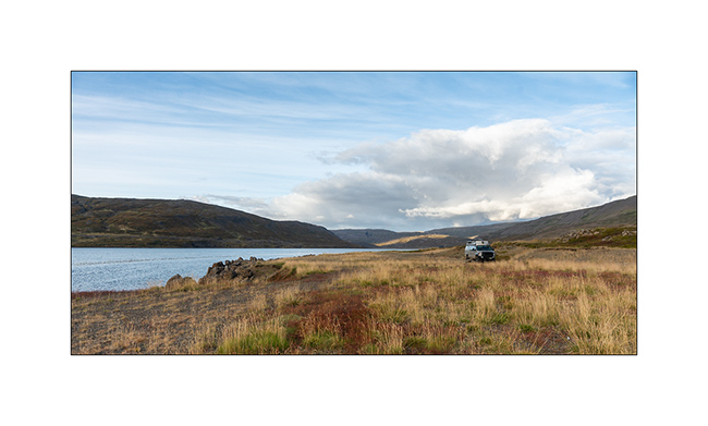
22. We camp on the bank of a fjord sheltering hundreds of swans.
Discovery of Snæfellsness Peninsula coming soon. 😉
North Coast and traditional habitat
1. The Ásbyrgi Canyon is amazing with its high basalt cliffs.
2. Beautiful bay on Arctic Ocean North of Husavik.
3. We stop there for the lunch…

4. … the opportunity for Emile to play on the beach.

5. The small harbor town of Husavik still has some old houses.

6. Its small harbor is famous for whale watching.

7. Old houses on the harbor.
8. We return to the bay to spend the night.
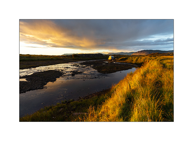
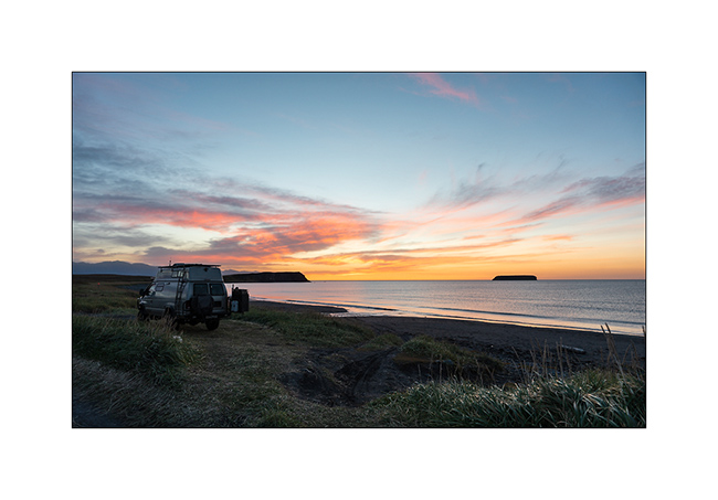
9. Sunset is gorgeous!
10. Deformed sun on the horizon. We even had two sunsets, the first on the cliff then, the race of the sun being almost tangent to the horizon, the second on the ocean.

11. Iceland is not that famous for offering colorful sunsets but this one was an exception.
12. On the road to Akureyi, the big city of the North.

13. Interesting feature: in Akureyri, to support the morale of the population during the last financial crash, the red lights are heart shaped… 😉

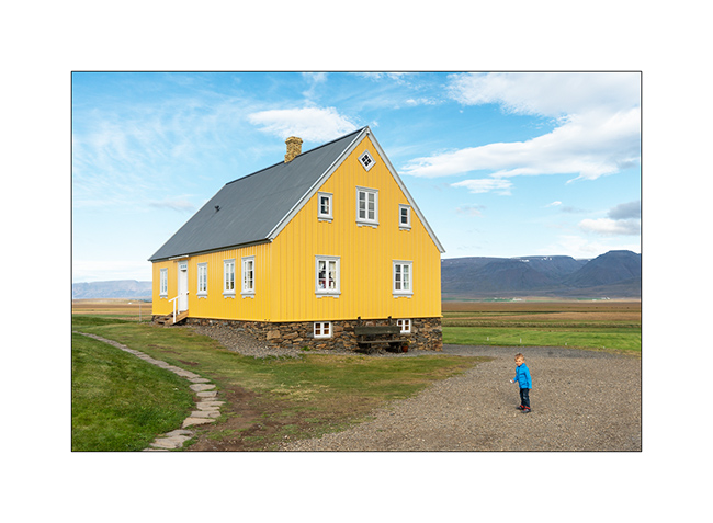
14. At the end of the day, we go to visit the historic Glaumbær farm, one of the few unspoiled which is now a museum.

15. House from the beginning of the last century.
16. The windows often had candles, supposed to limit the heat loss of the little insulated glass…

17. The farm, older, is partially buried for better insulation. Buildings are contiguous to limit areas exposed to cold.

18. Built in peat and covered with peat and moss, it was the best way to protect oneself from the cold for poor people.

19. Not far away, the beautiful old church of Vidimyrarkirkia.

20. Continuing our journey on the north coast, we come across this curious road going directly into the ocean!

21. Arrival at the end of the day on the site of Hvítserkur Rock.
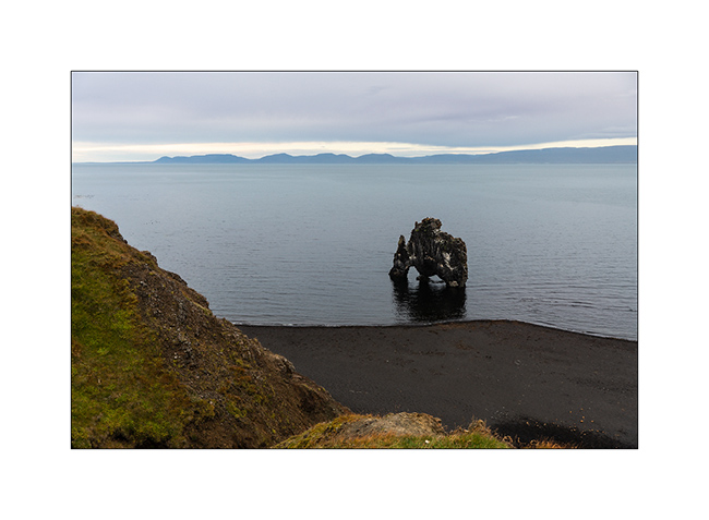
22. A spectacular lava block that rises on the ocean and evokes a troll or some extinct dinosaur grazing algae…

23. Húnafjordur Bay.
24. We camp near this little house…
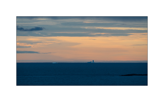
25. … and discover large icebergs far on the horizon.
Next coming soon in the Northwest fjords.
Lava and waterfalls of North-East
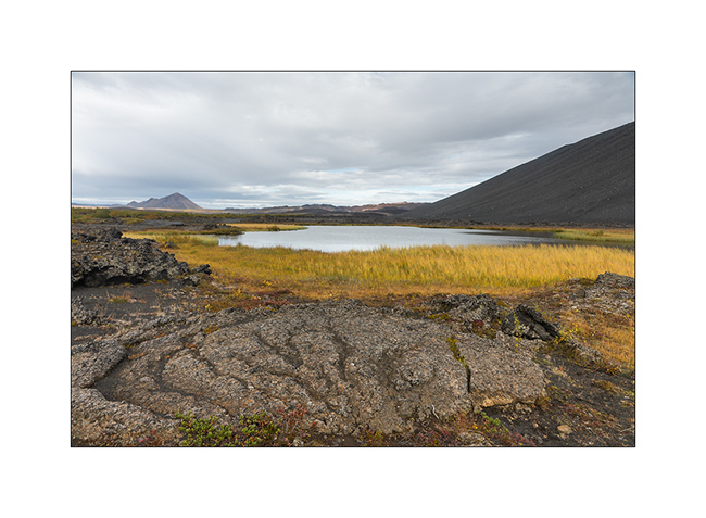
1. In the Lake Mývatn area, a pond along the trail leading to some lava tunnel.
2. Isabelle exceeds her fear and descends into the tunnel entrance.
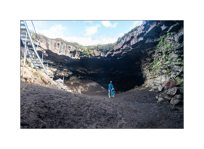
3. Here, the lava textures are pretty incredible.
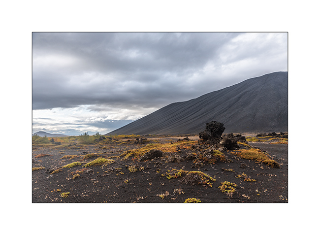
4. Flanks of Hverfjall crater.
5. Lake Mývatn and its lava concretions in the rain.
6. …

7. Rainwear, with smile. 😉
8. Rainwear again.
9. Wild camp in some grassland South of the lake.

10. Light beam…

11. Sunset sky.
12. …
13. The next day, we seek to reach Aldeyjarfoss waterfall by a little used trail and, after about 35 miles and some pretty wet swamps, VivaLaVida arrives in front of this powerful river. The abandoned ford doesn’t inspire me much and I give up attempting its crossing, especially as even with binoculars, I cannot distinguish the trail on the other side…
14. Lunch time.
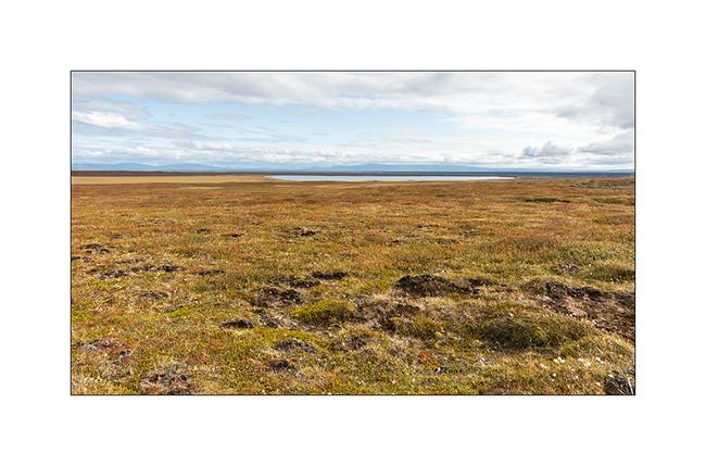
15. Moor to infinity…
16. Here is the spectacular Aldeyjarfoss !

17. The river dives into a deep canyon with basalt organs.
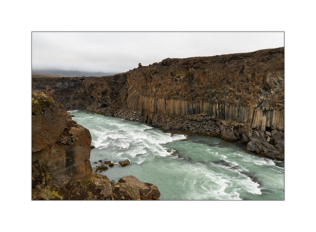
18. I go down in the canyon for a less classic composition.

19. Not far upstream, we discover another waterfall: Hrafnabjargafoss. What a pronunciation! 😉
20. Secondary falls at sunset…

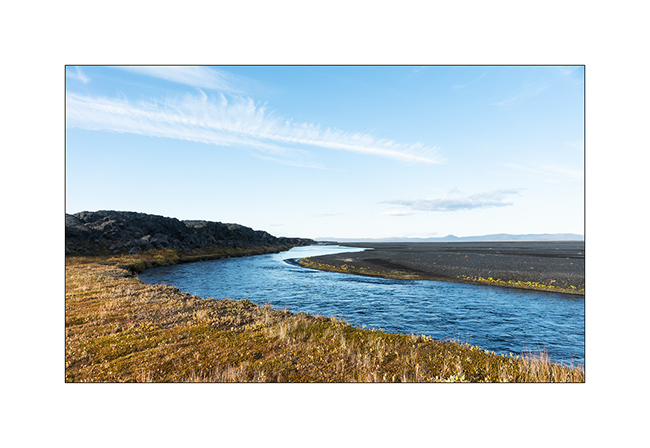
21. Skjálfandafljót River downstream from Aldeyjarfossen.
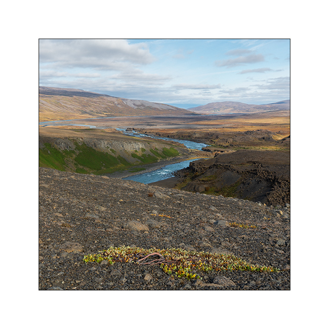
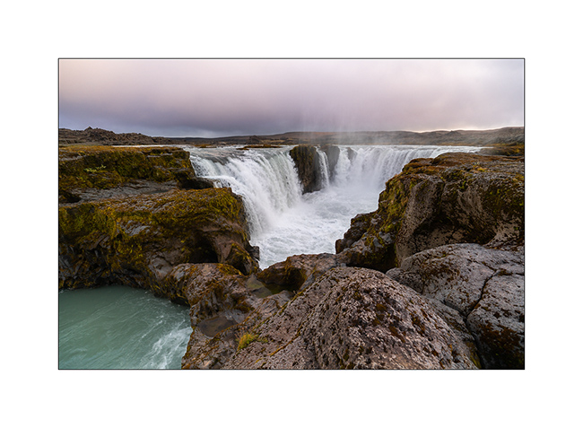
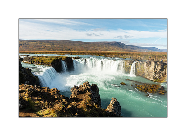
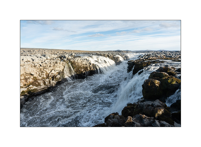
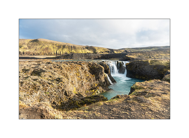
22. Further downstream, the famous Godafoss, the falls of God, such touristic because located along the road nb1, the paved road that goes around Iceland.
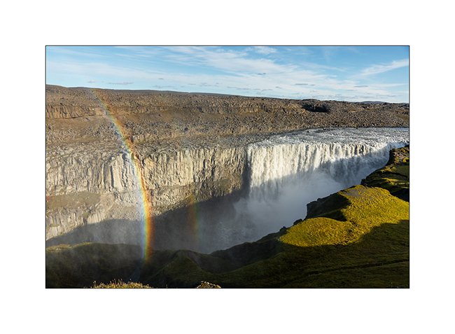
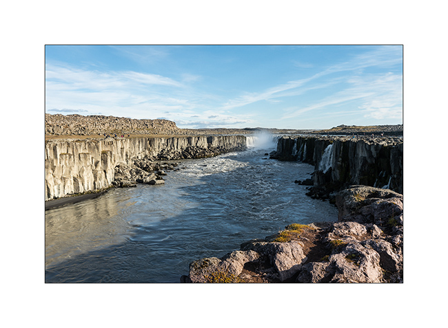
23. A few miles eastward, we visit another waterfall: Detifoss. It is said to be the most powerful waterfall in Europe.
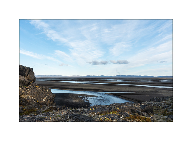
24. Selfoss, a few hundred yards upstream.
We finish the day at the very neat Ásbyrgi campground where the shower is welcomed! The next article will be in a more maritime atmosphere… 🙂
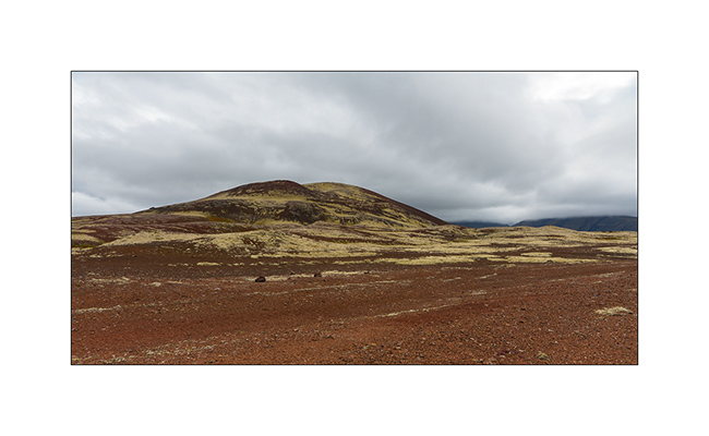
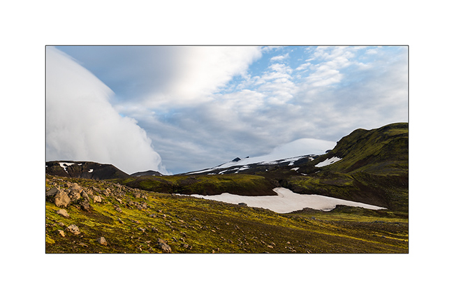
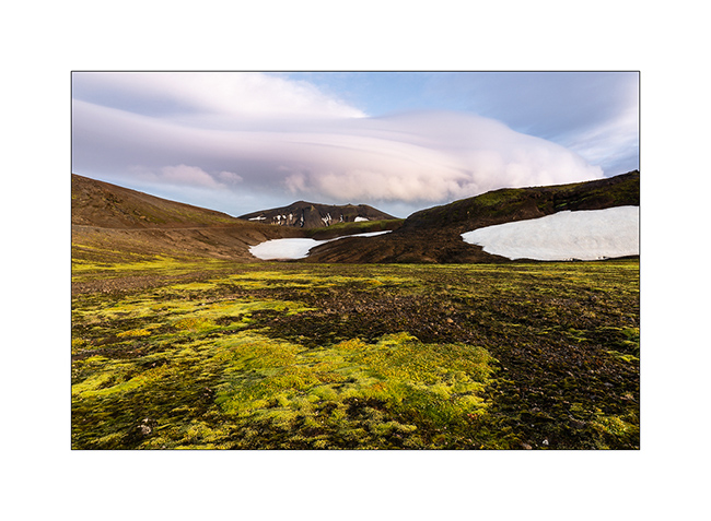
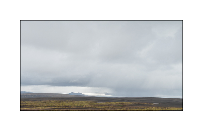
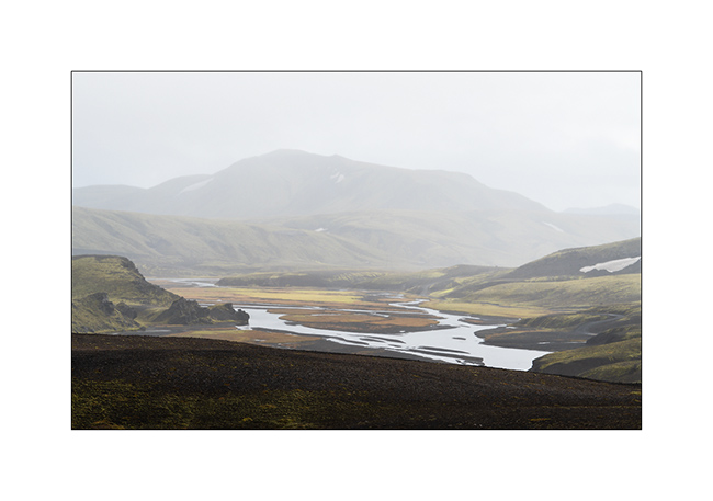
Highlands II, Askja, Viti – F910 / F88
1. The night was cool, 24°F to the thermometer of VivaLaVida.
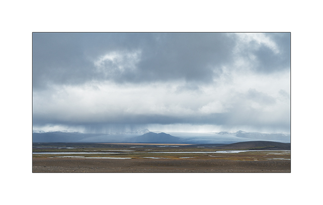
2. The Vatnajökull ice cap is really close.
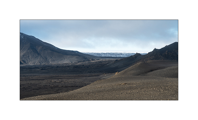
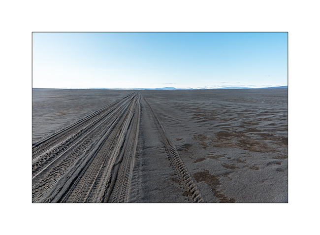
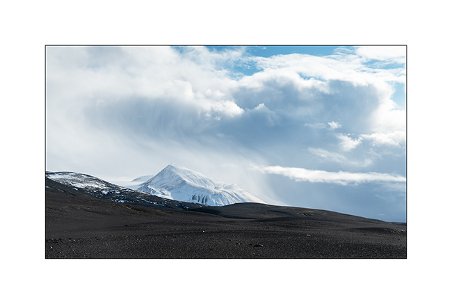
3. At the beginning of the day, as at the end of the previous one, the track was really chaotic through lava fields and screes. VLV did not drive faster than the average of 2 mph to take care of her occupants well shaken!
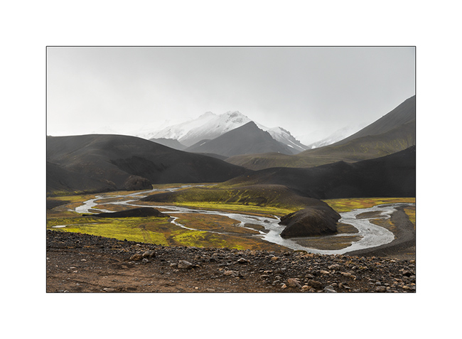
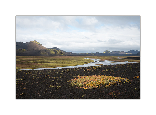
4. We are happy when she found vast alluvial plains…
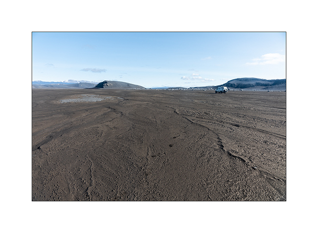
5. Drawings…
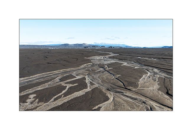
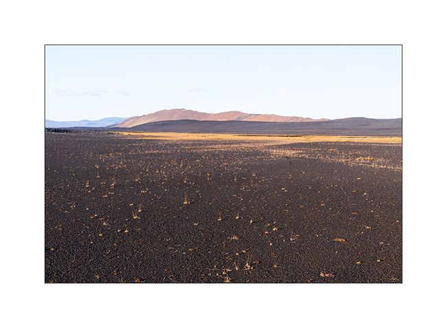
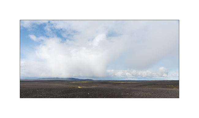
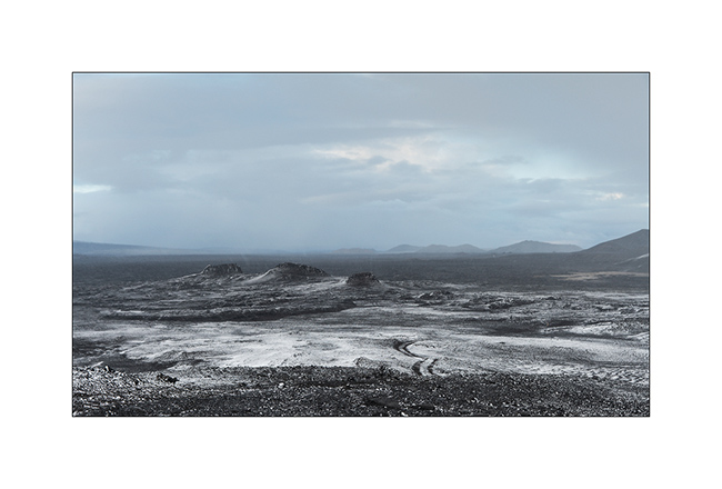
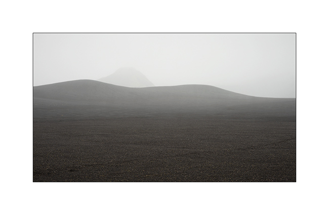
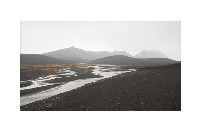
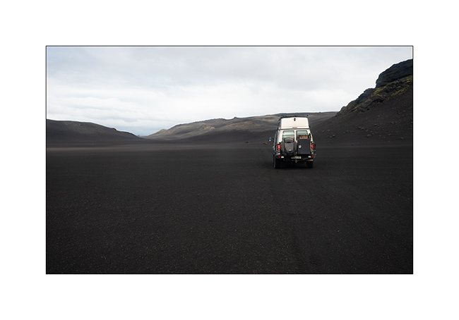
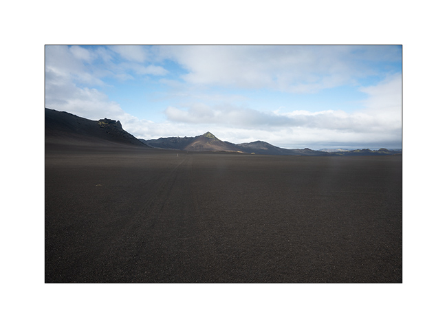
6. We then cross the Black Sand Desert.
7. Lunar…

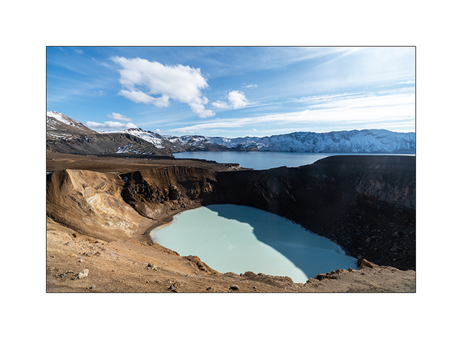
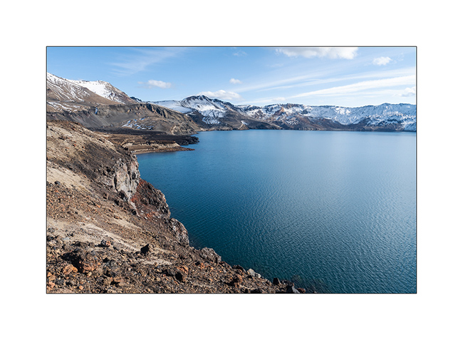
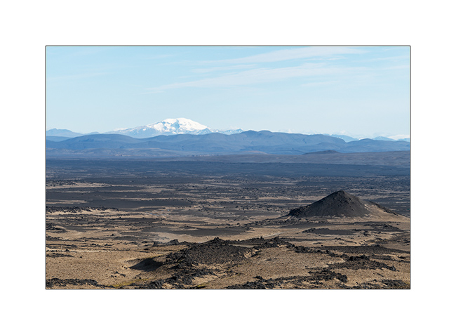
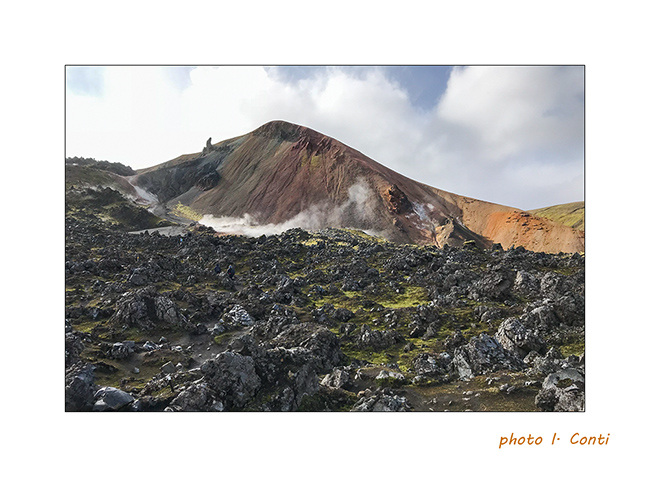
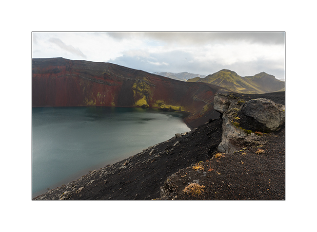
8. We reach the site of Askja, a large caldera of approx. 8 miles in diamete. Part of the crater contains lake Öskjuvatn.
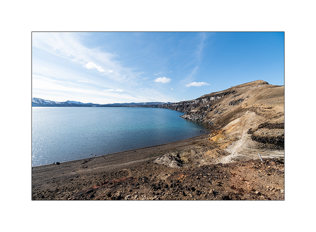
9. The opportunity to go discover the site of Lake Viti.

10. Lake Viti is nestled in a crater on the edge of the lake. Its temperature varies between 75° and 82°F, great for bathing.
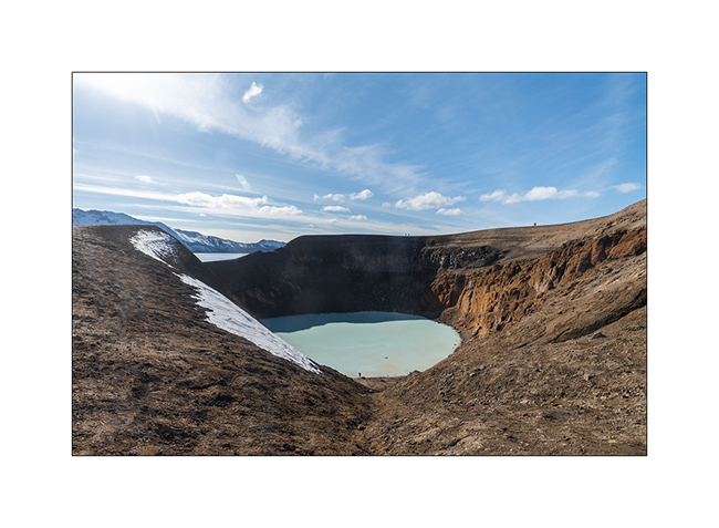
11. Gorgeous!
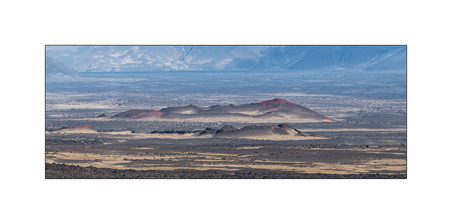
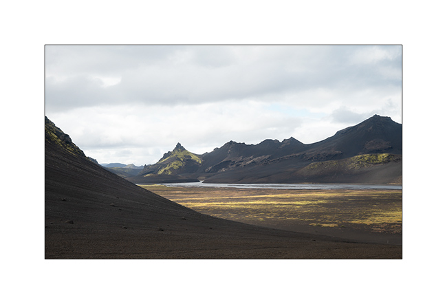
12. Lake Öskjuvatn with several lava flows of different periods.
13. The trail leading to the start of the 2 miles hike crosses another lava fiels.
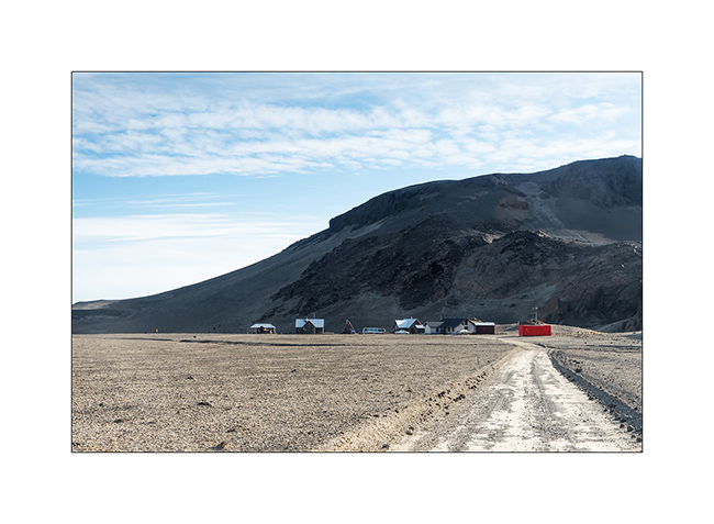
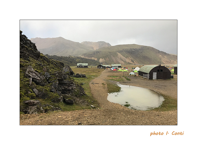
14. The Dreki refuge just outside of the caldera.
15. View on the plain toward East.
16. …
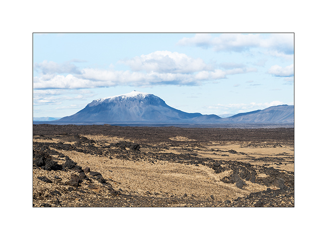
17. The famous mountain Herðubreið looking like a huge pastry.
18. We are now following the F88 track toward North and stop at Gljúfrasmiður canyon.
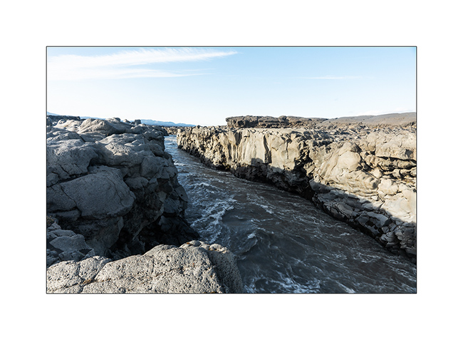
19. The Öskjuleið river rushes into it in pretty falls…
20. … before meandering along a lava flow.
21. …
22. Some iron colors…
23. End of the day light.
We had a nice wild camp in a crater before discovering the Mývatn region. To come soon…
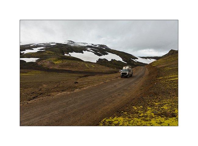
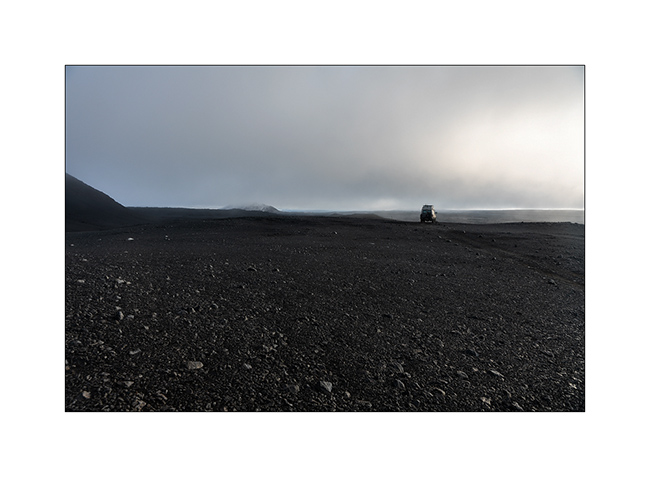
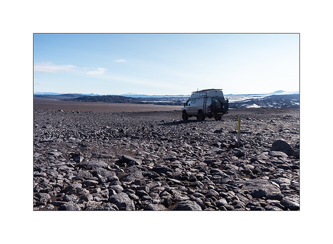
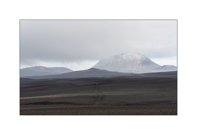
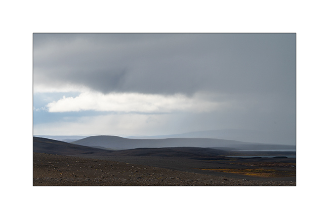
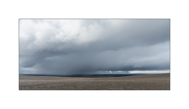
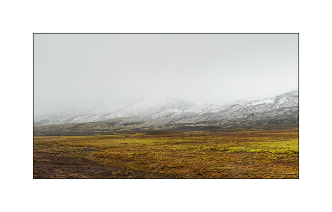
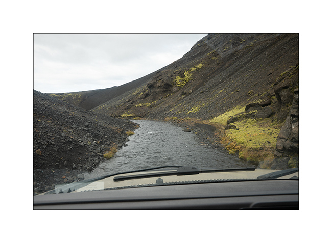
Highlands I – F26 / F910
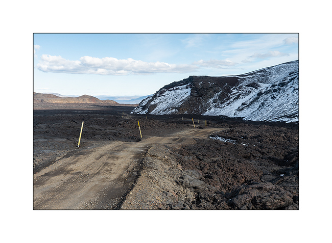
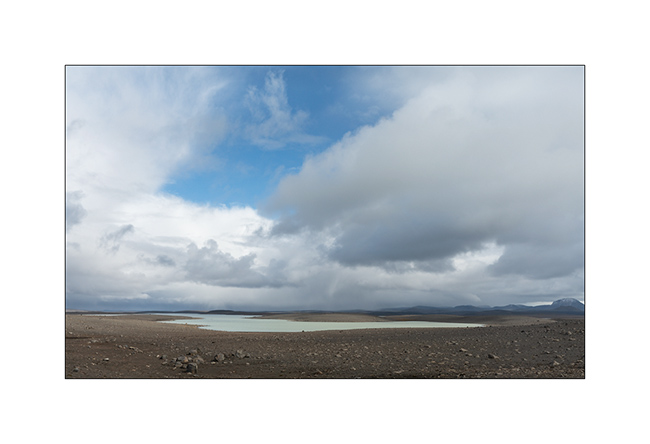
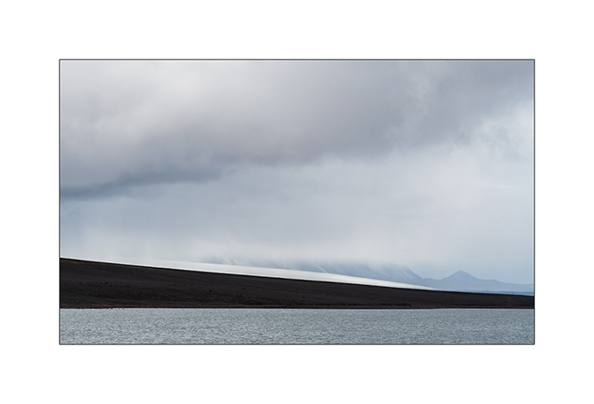
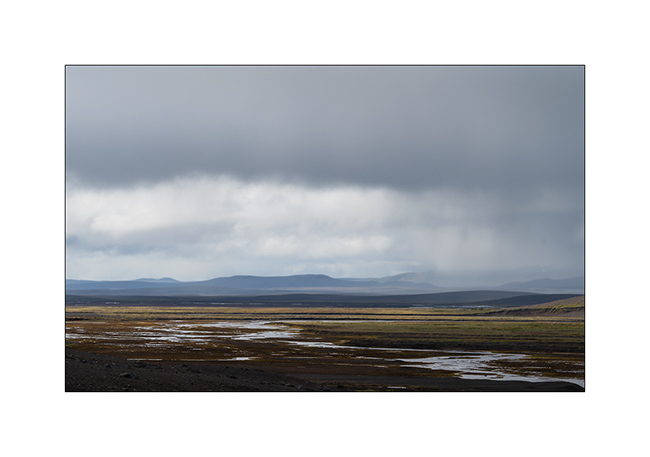
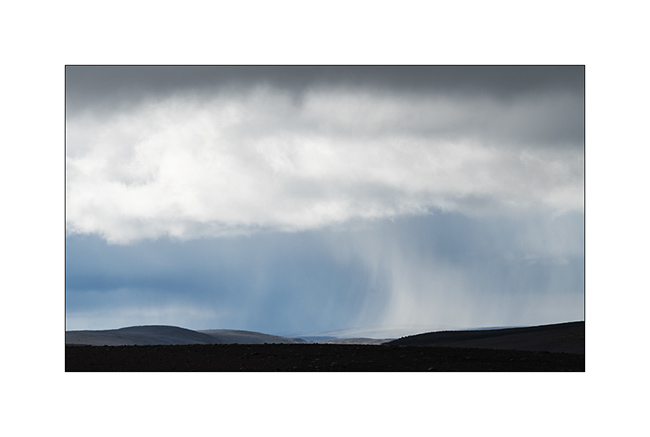
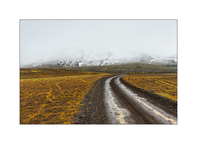
1. After refueling VivaLaVida (with about 10$ a gallon of diesel, it’s more than 400$.- to fill VLV!), we begin the crossing of the Highlands to the Northeast via the F26 road then the F910 which passes north of Vatnajökull.
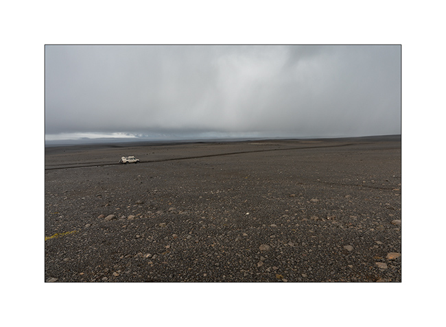
2. We took two days to reach the site of Askja through beautiful and immense landscapes.
3. …
4. …
5. …
6. …
7. Giboulée…
8. Notre piste…
9. …
10. …
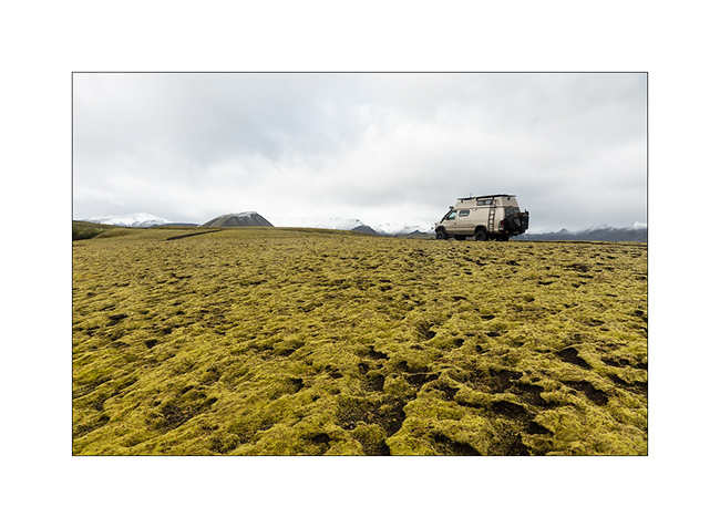
11. After about 150 miles exclusively mineral, we found some vegetal colors again…
12. At 2400 feet elevation, snow is close.
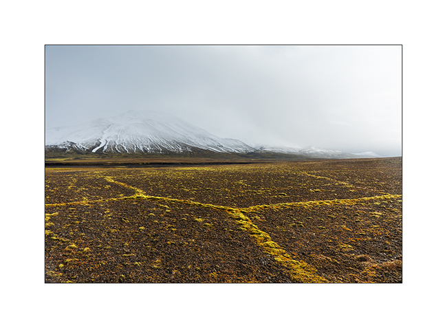
13. Moss grows along furrows carved by surface water, forming geometric shapes.
14. The sky ends up opening to the north.
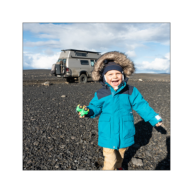
15. The opportunity for Emile to stretch his legs! 😉
16. …
17. …
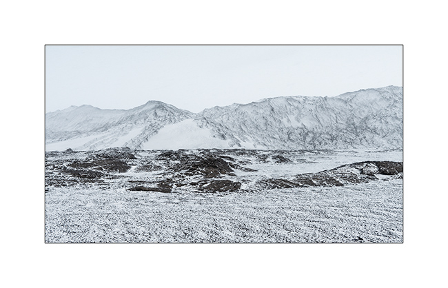
18. As we borrow the Southern variant of F910, as we gain altitude, the weather decays and the snow quickly covers the lava.
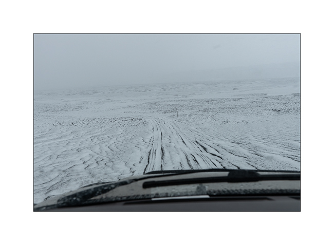
19. While snowing, VLV is the only color note of this landscape.
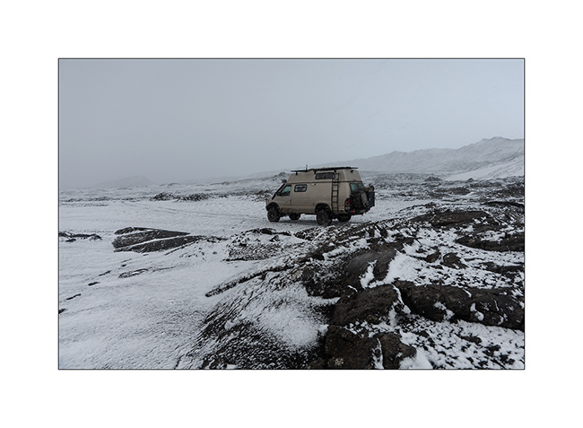
20. Naturally monochrome landscape.
21. …
We spend a cold night not far from the Kistufell refuge, near the Northern end of the VatnaJökull.
Continuation of VivaLaVida’s journey soon! Thank you for your loyalty.
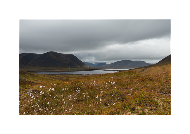
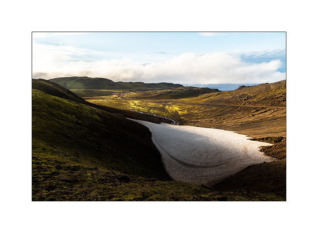
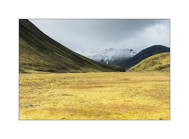
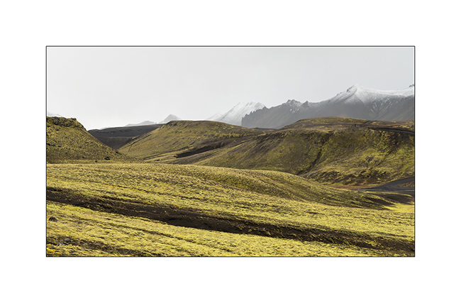
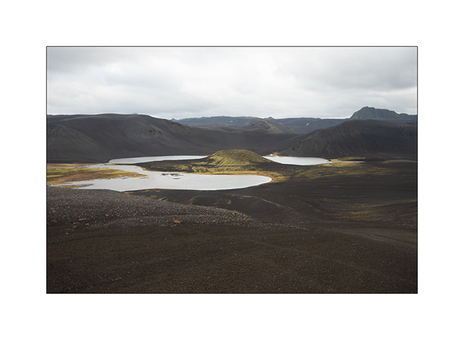
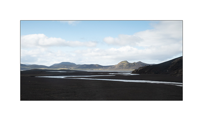
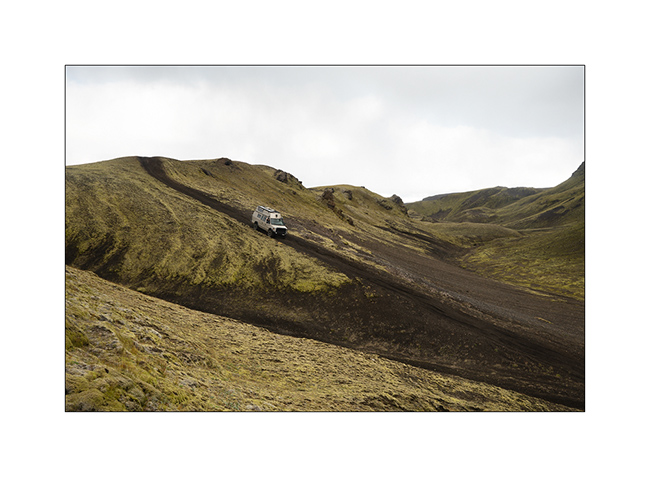
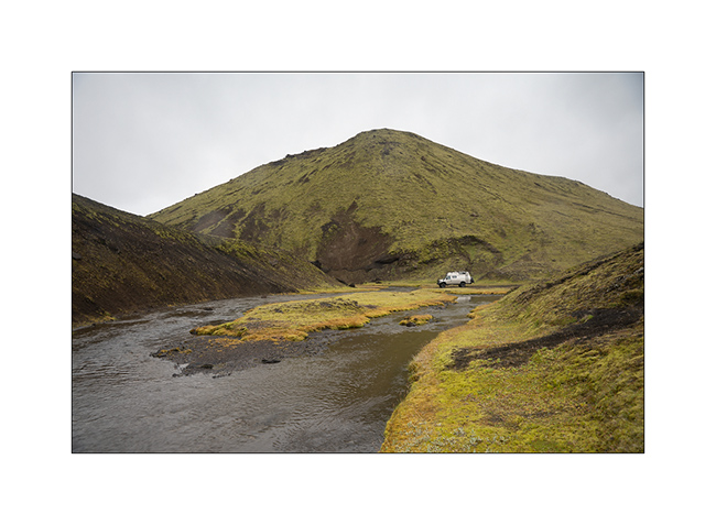
Landmannalaugar and F208
After the gorgeous detour presented in the previous article, we reached the track F208 which leads to Landmannalaugar, a spectacular volcanic site but too touristy for me.
1. The small lake that hosted us for the night.
2. VLV on the trail.
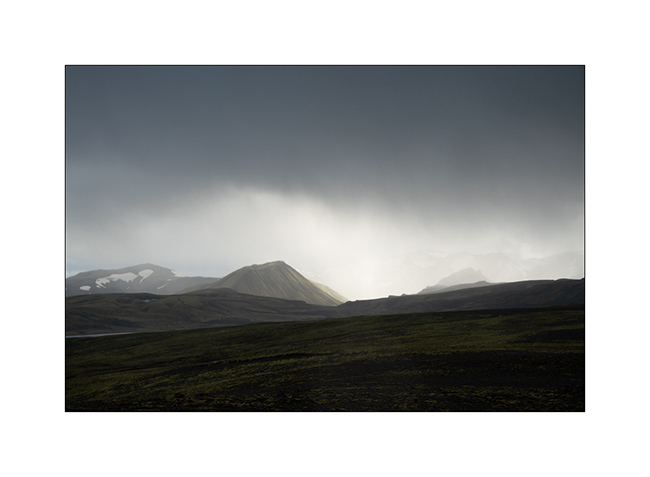
3. It was cold that night and it snowed at about 2,700 feet.
4. Contrasts of shapes and textures…
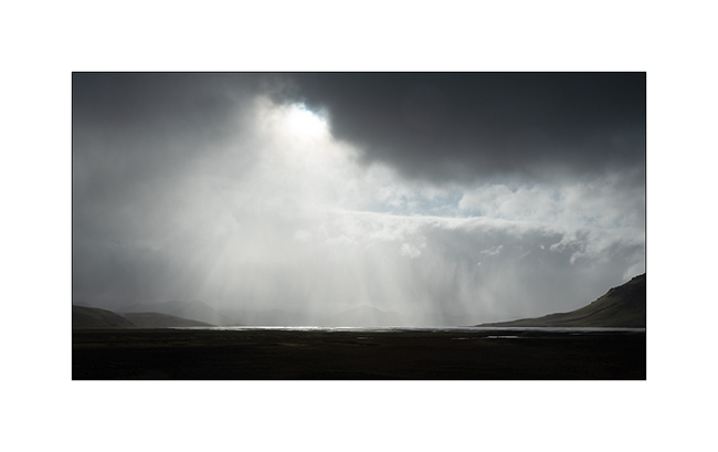
5. The weather is still changing.
6. Following F208.
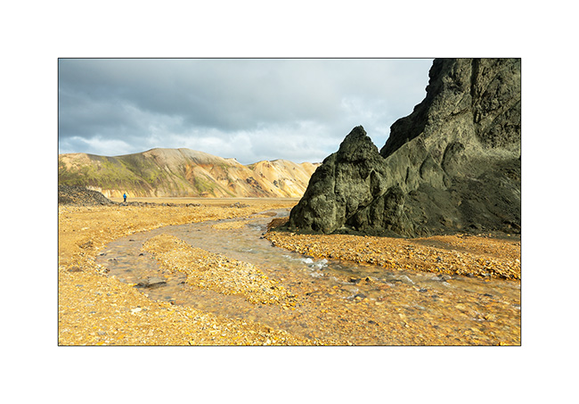
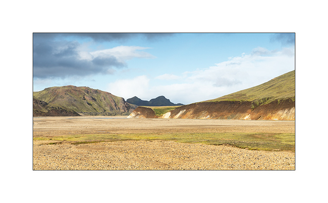
7. Arrival at Landmannalaugar.

8. The colors are very different, definitely warmer.

9. Still contrasts…
10. …
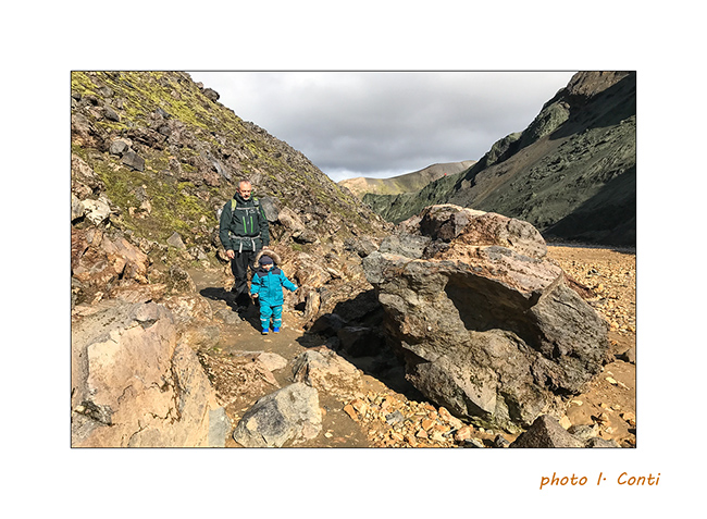
11. Despite our still small Emile, we went for a “hike” of 4 miles km and he did it very well apart from a loss of balance making him fall into a hole at the edge of the trail, which impressed his mom more than him.
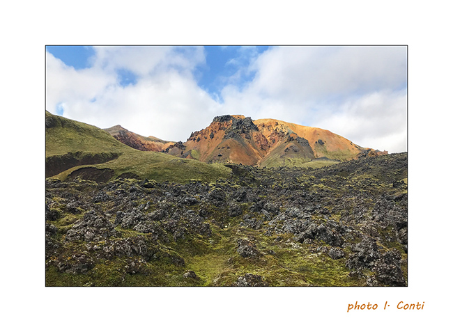
12. The mix of colors and textures is amazing.
13. We go up the bed of a nice stream…
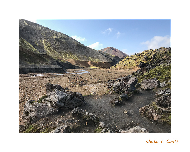
14. … up to sulfur fumaroles.
15. The upper part of the refuge / camping, which is a real small town where too much rooms, tents, buses and camper mingle…
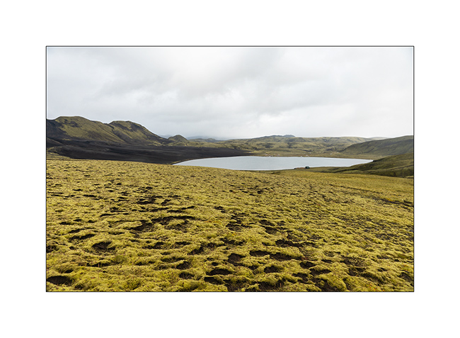
16. As it was difficult to make longer hikes with Emile, still too small for that, we took the trail toward North with a detour to discover the Lake Ljótipollur and its particular blue-green color.
17. …

18. Sigöldufoss, at the North end of road F208.
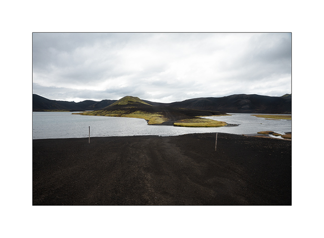
19. We spent the night at the coast of another lake, Fellsendavatn, along the road F228.

The continuation with the crossing of the Highlands all soon.
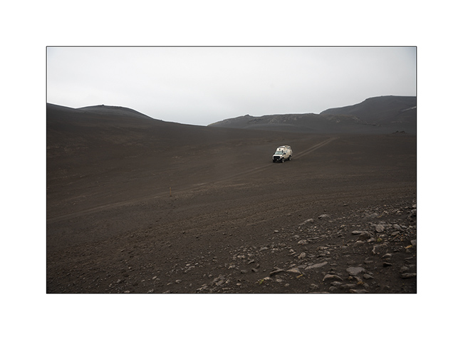
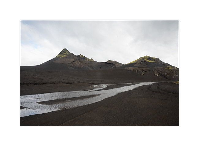
Path less traveled…
After the Lakagigar, rather than go directly to the Landmannalaugar on F208, we decided to go to Langisjór Lake via some less traveled trails that proved to be gorgeous…
1. River in the rain, along Southern F208.
2. Rather curious sign, isn’t it? In fact, the trail goes into the lake on approx. 300 yards.
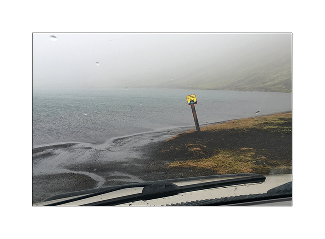
Here is a video of this unusual path done by Isabelle. The weather was windy, with rain and fog…
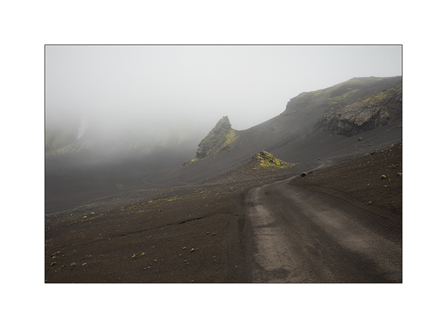
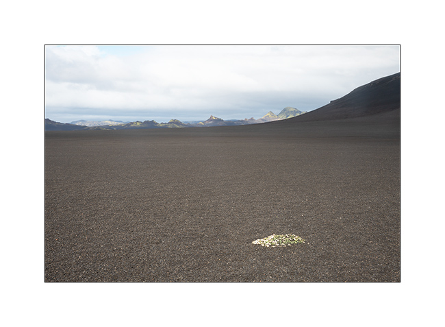
3. In places, everything is only mineral.
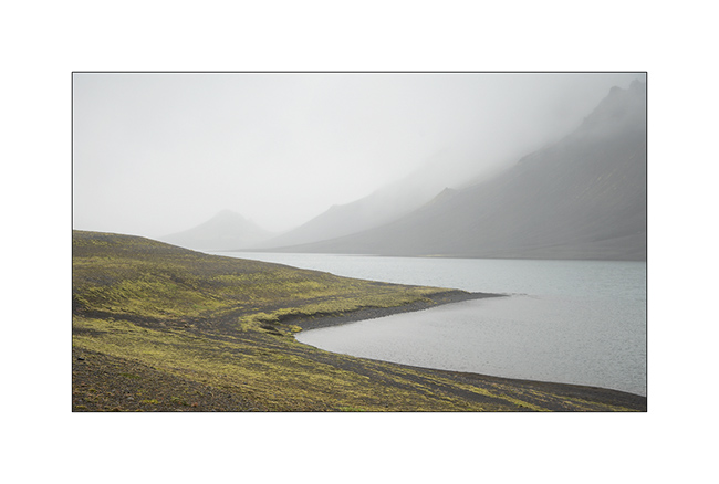
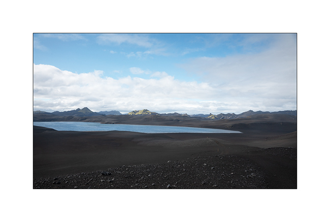
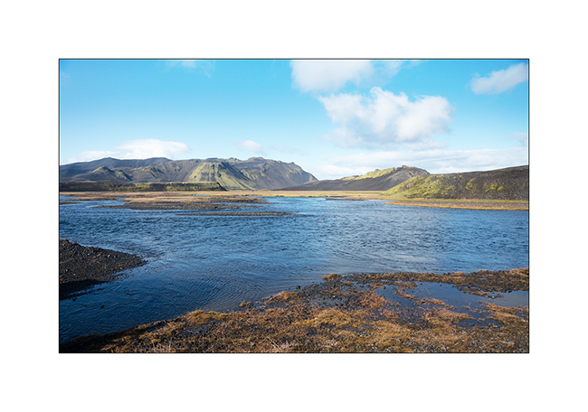
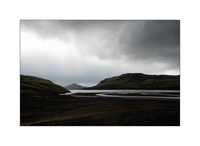
4. Langisjór lake in the rain.
5. Trail…
6. …
7. River…
8. Fog…
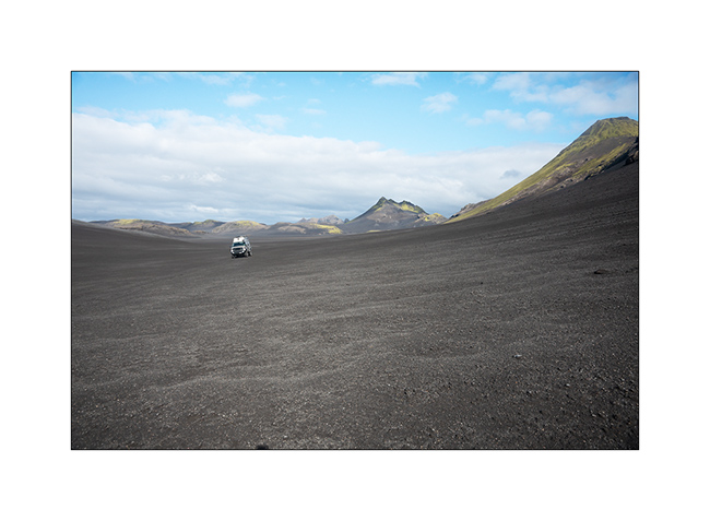
9. VivaLaVida riding the moon.
10. The rain finally stops.
11. Invisible track. Thank you GPS.
12. Desolation…
13. … and blackness.
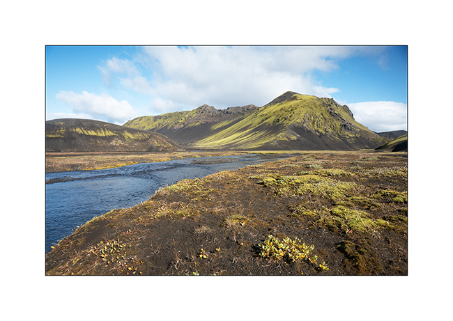
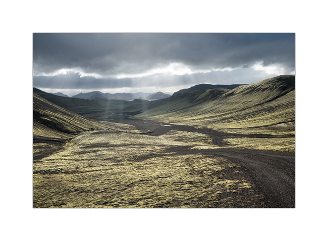
14. But these landscapes are amazing.
15. The trail crosses another lake.
16. Contrasts are everywhere.
17. Our trail seen from the top of a hill.
18. After driving in a lake, here we follow the riverbed for nearly one mile to change the valley! 😉
19. …
20. Fairy…
21. …
22. Another ford.
23. … and another.
24. We walk and play too!
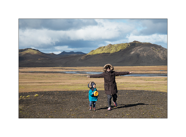
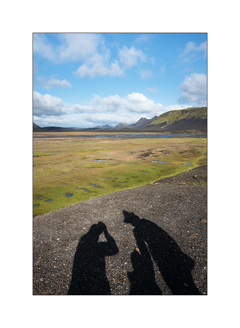
25. Selfie 😉
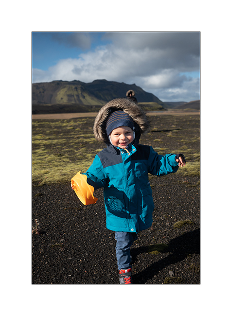
26. Emile loves it.
27. Late afternoon contrasts.
28. …
29. In places, this track less traveled requires a good 4WD transmission, as here in a steep descent.
Here is another short video showing this trail. In video background, we can see the continuation of the track over the river, which goes up in the hills.
30. Rain showers are back.
31. …
32. …
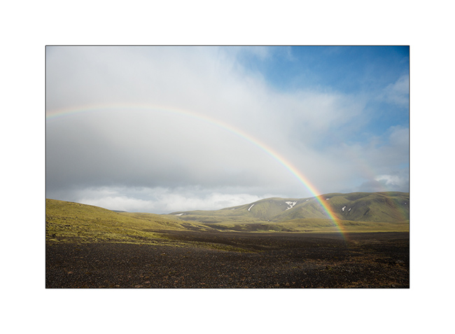
33. Another particularly saturated rainbow.
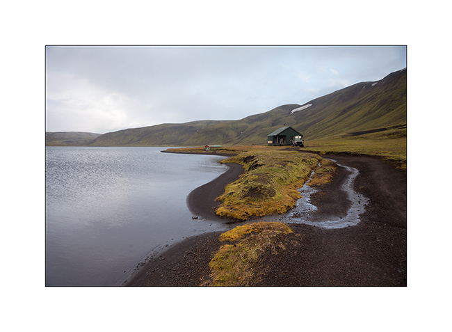
34. We spend the night on the shore of a lake, near a shelter already closed for winter…
Hoping that this update won’t have been too long… 😉
To be followed in Landmannalaugar soon.
 D5 Creation