Utah @en
now browsing by category
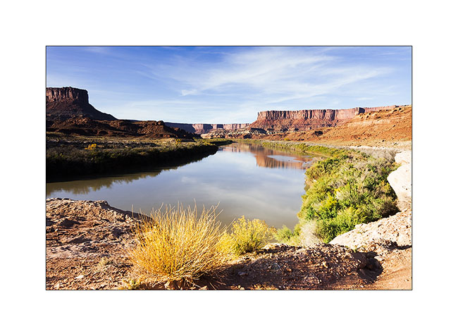
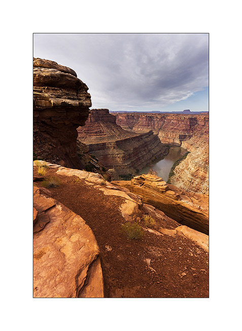
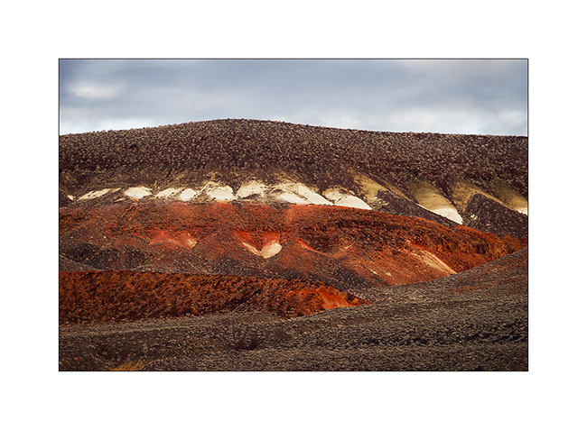
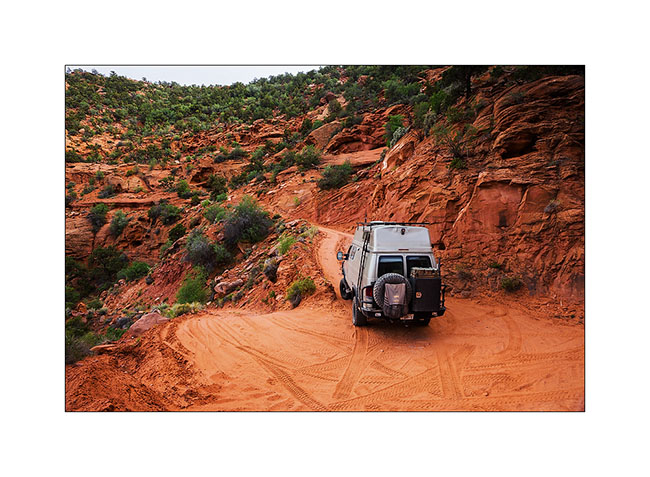
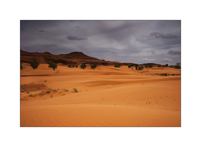
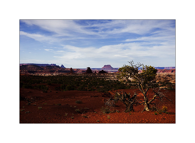
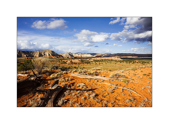
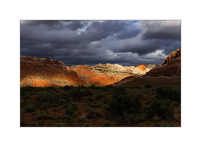
In Canyonlands area…
I went to see other places in Canyonlands NP, first in the beautiful Lavender Canyon.
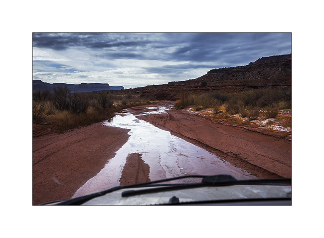
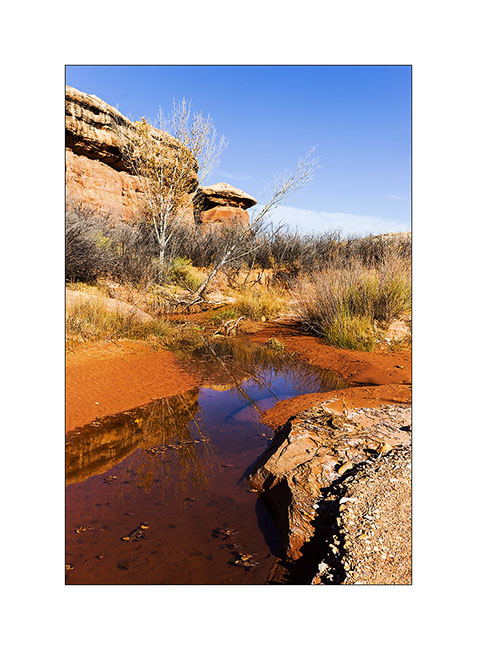
1. The access road goes nearly 20 miles up in a wash. There is some water, partially frozen in places, witness of the recent weather disturbance (the one I had at Black Rock).
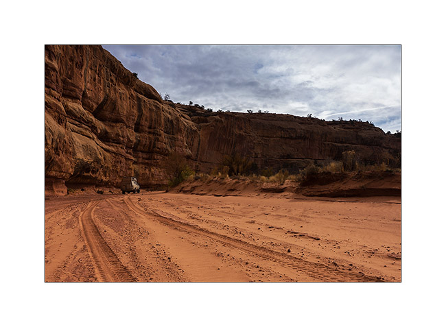
2. VivaLaVida is small under the vertical cliffs of the canyon.
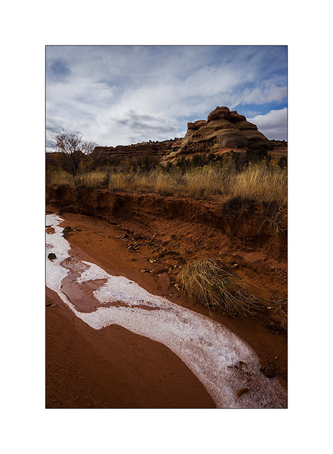
3. Only way to show you that it’s cold in the desert too…
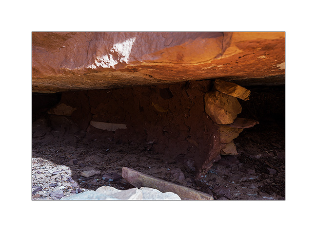
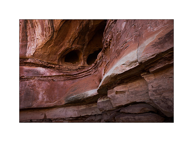
4. In a side canyon that leads me to Long Arch, I discovered some remains of an Indian granary dating from approx. 2,000 years.
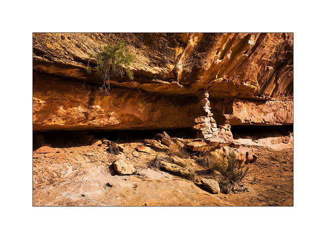
5. They protected their harvest by sheltering it in cliff cavities, closing access to rodents using mud and stones.
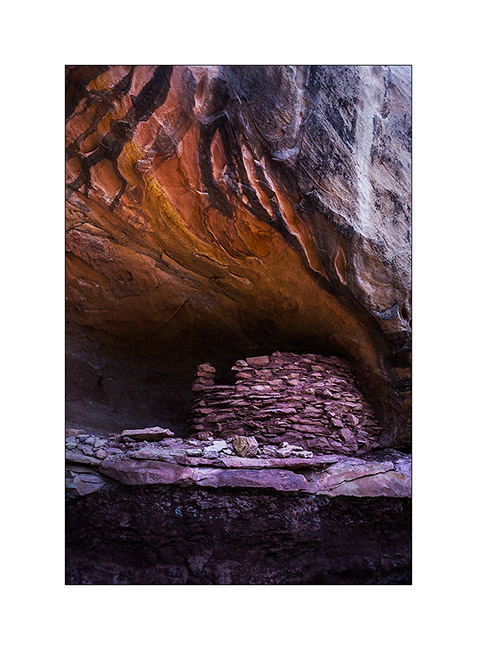
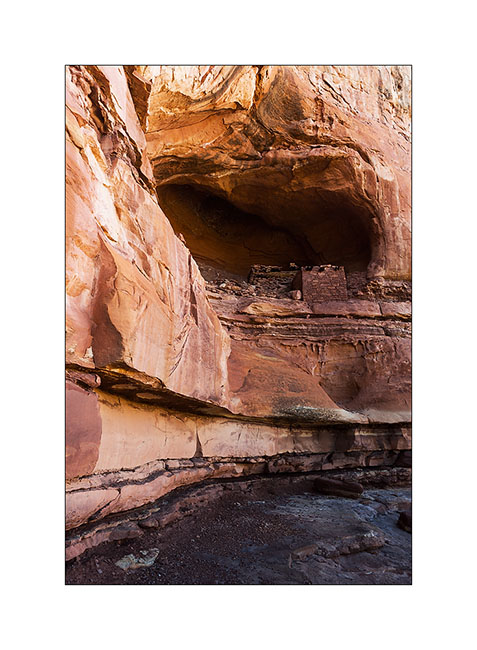
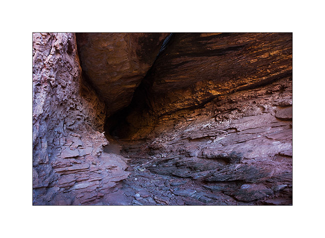
6. Further in the West Fork Lavender Canyon, I discovered a nearly complete shelter in half-wall height.
7. It will take me several attempts to find a path leading to it.
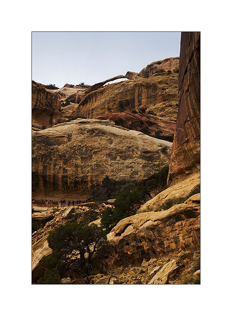
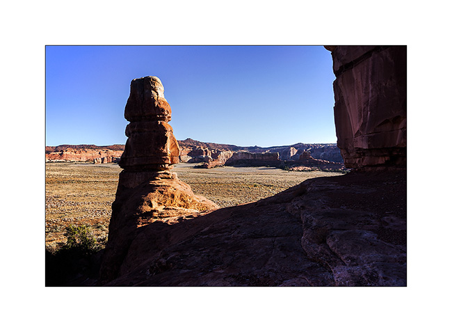
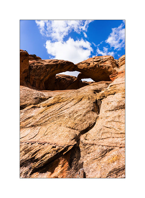
8. After three hours of hiking, I discovered the elegant Long Arch, little known because really remote. I’ll have to study the map to see if there is way to access from the top because no way to get closer down here.
9. I take some showers of sizzles on the way back. But at sunset, a short ray colored cliffs around in this amazing red .
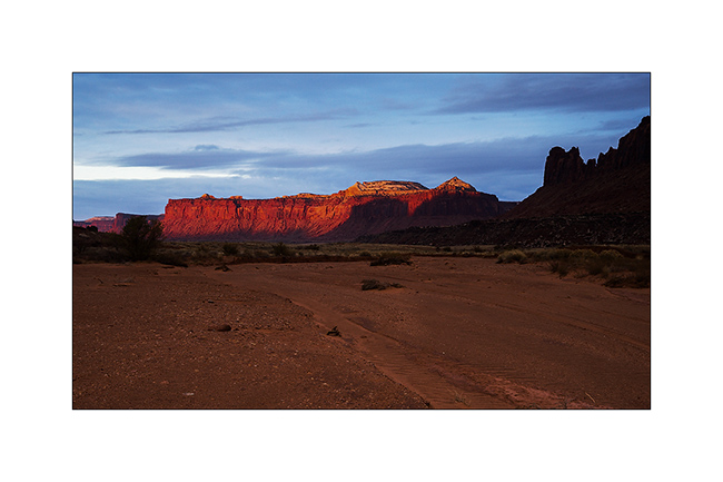
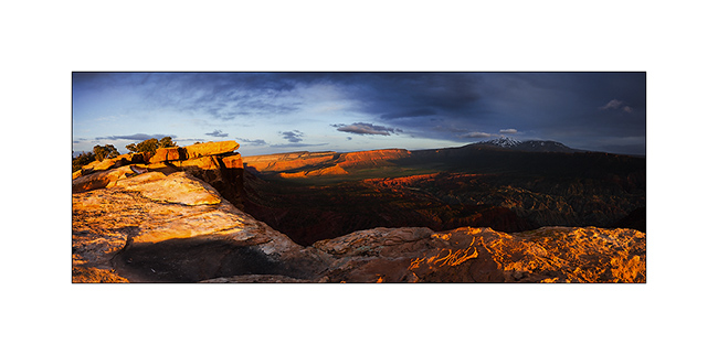
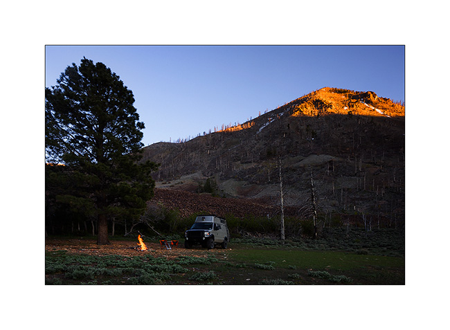
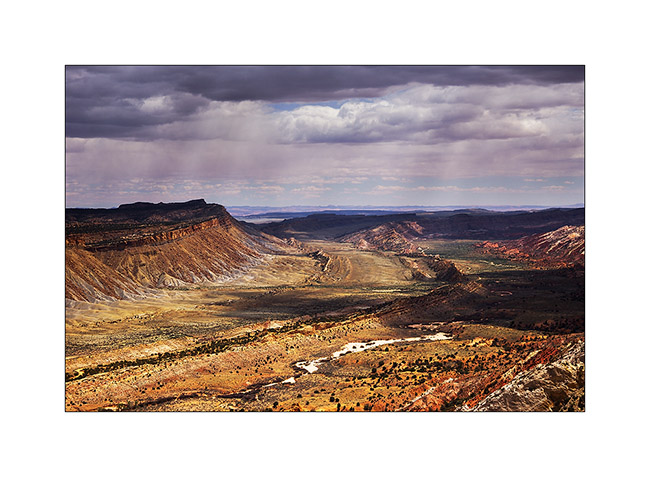
10. After a day of transition, I went to sleep at Anticline Overlook to enjoy the morning light.
11. Scenry over Hourah Pass and Moab Rim is impressive.
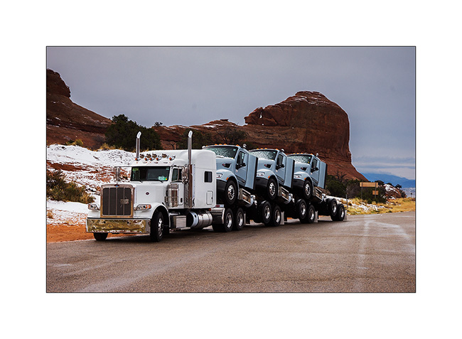
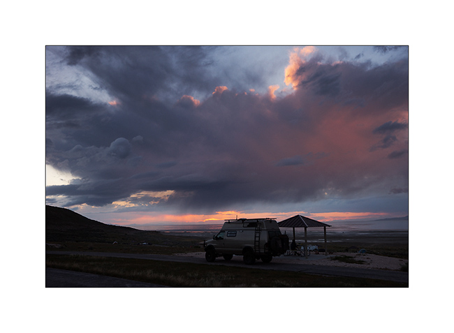
12. The weather get cloudy again and showers of rain/sleet follow one another. But I stop to show you how they transport trucks here! 😀
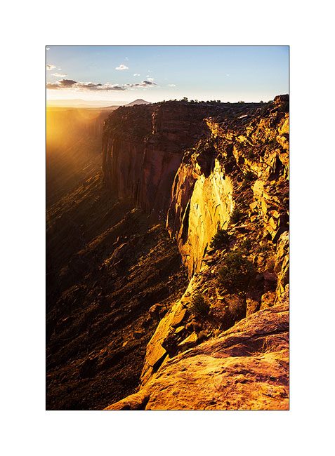
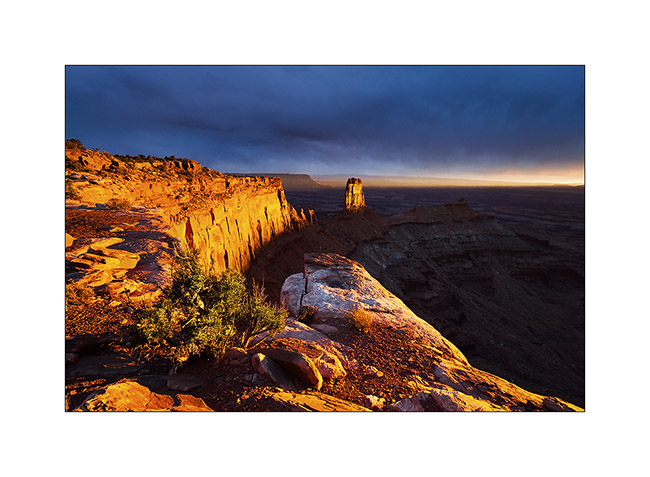
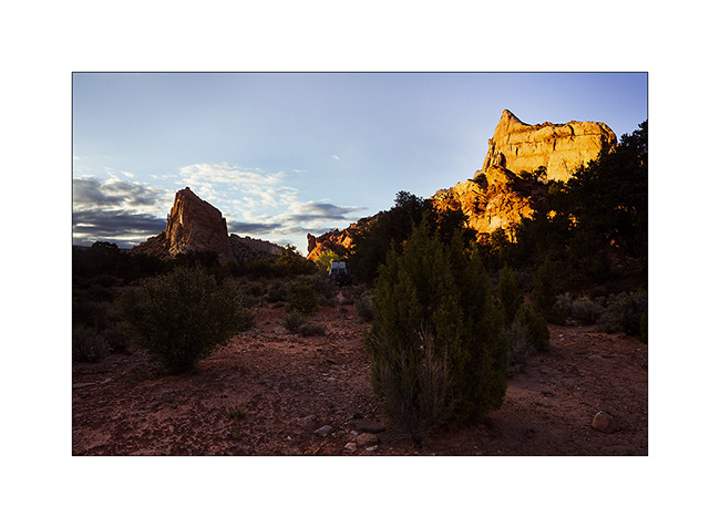
Having spotted the previous day an interesting point of view, I tried the gamble to go there for the sunset despite the rain and stormy Wind that got up, hoping for a sunray at sunset. The track was very bumpy and almost 20 miles long, VLV needed two hours to get to.
Arrived there at around 4PM, I went locate places to try to find a nice composition, aware that if there would be some sunlight, it would be brief. I finally found a composition I like, not without some apprehension because I was on a block overhanging a 600 feet cliff. It’s 16:30, I sit nearby and wait. It is downright cold and I’m beginning to think that I have come all this way for nothing…
But ultimately, the Gods of Light rewarded me with a moment of insane intensity! It did not last five minutes, just long enough for the sun to go under the clouds before to set. But the light was so intense, contrasting with the dark and low snow skie, gilding the cliff in a so bright yellow-orange..! A moment of pure happiness for my photographer’s eye. 😉
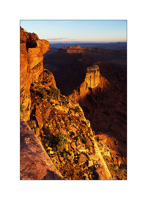
13. Firing…

14. Bis.
At once I prepared a luxury aperitif before processing these images… 😉
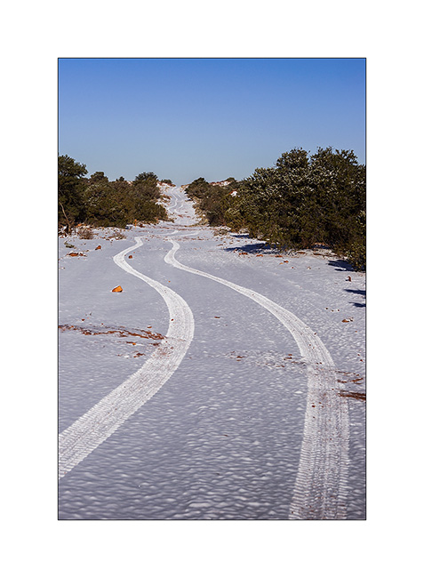
15. The next day, the snow has changed the appearance of the place.
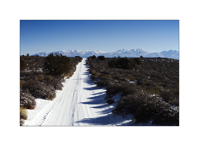
16. The track of VLV, alone on snow, as a symbol of her journey, often trough almost desert places…
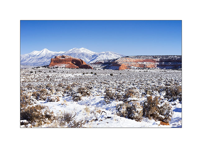
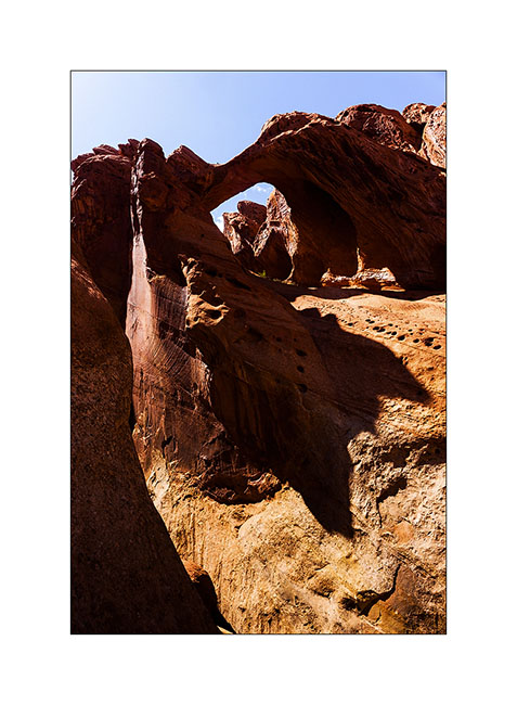
17. Contrast with the red sandstone is striking. Here, the small arch of Looking Glass Rock.
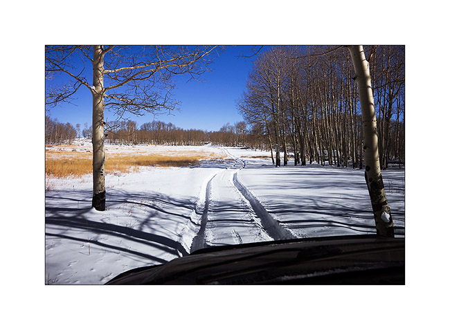
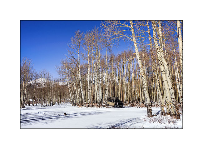
18. VivaLaVida is then went in the La Sal Mountains for a taste of winter.
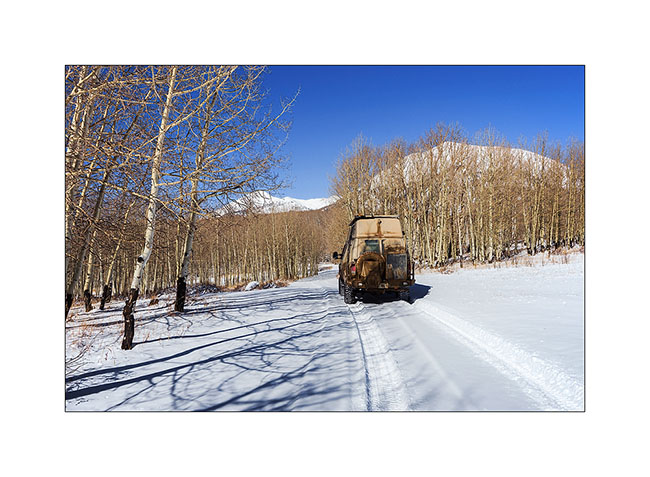
19. Aspens have lost their leaves for some time but proudly raise their silhouettes in the sky.

20. There was too much snow for me to cross the La Sal Pass, I had to turn back.
21. Nice place for a small lunch, isn’t it? 😀
More in the next update…
Back in Utah
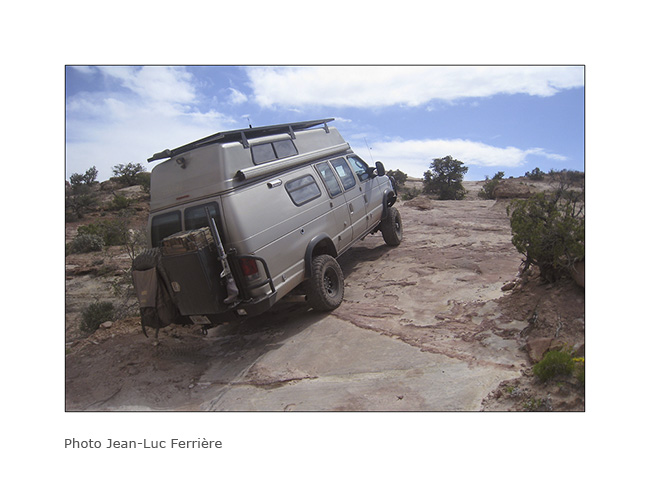
I met Nick and Kim in Moab. I met Nick in North Carolina. He also owns a Ford van, two-wheel drive and shorter than VivaLaVida but well equipped for two. He’s traveling for two and a half weeks with his friend Kim who discovers the West for the first time.
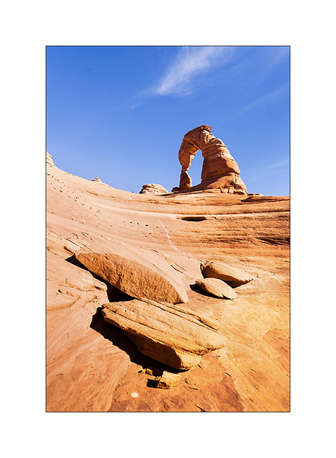
1. We spent the first day in Arches National Park, the opportunity to make an image a little different from Delicate Arch while every picture has been done on the site, one of the most photographed of Utah.
2. The next day, Nick rented a jeep to travel the White Rim Trail, a 100 miles trail that runs north of the Colorado first, then the Green River.
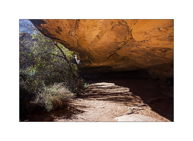
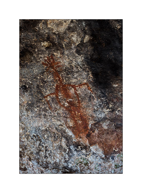
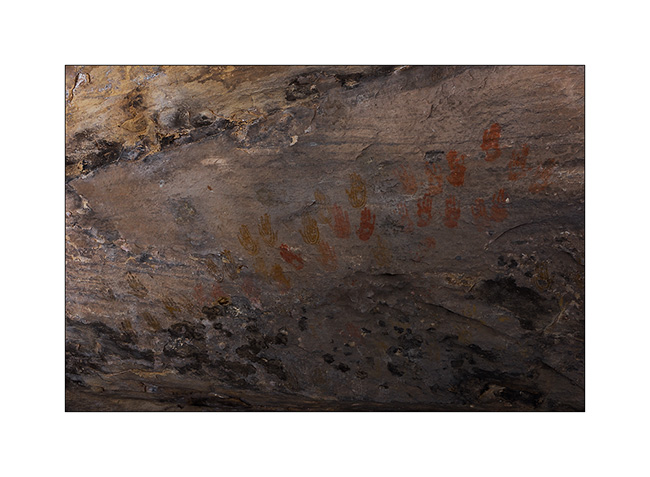
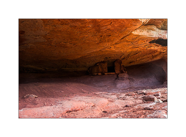
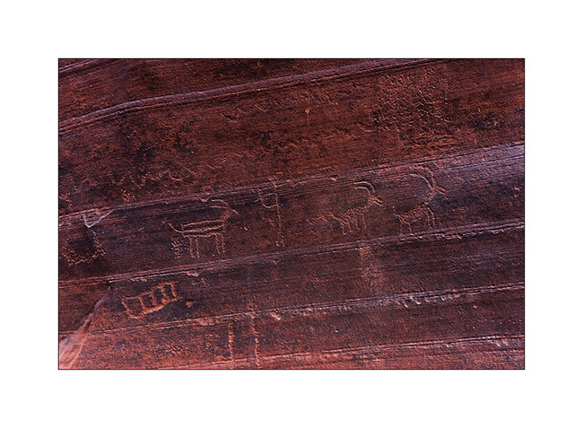
3. Having to wait four days to service VLV, I got back to the Needles, probably my favorite place in Canyonsland NP. I went to see Cave Spring inhabited by the Anasazi Indians from 7,600 years BC.
4. Petrograph in Cave Spring
5. The famous hands of Cave Spring.
6. On the way to Tour Ruins, another spot I discovered.
7. I first discovered granaries on the cliffs.
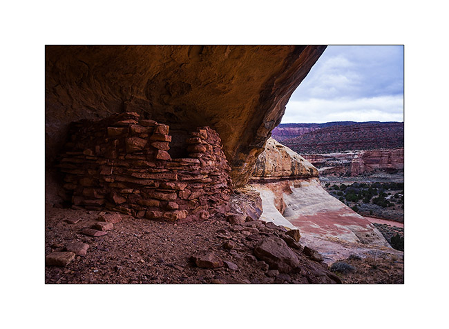
8. Here is the tower which gave its name to the ruins…
9. Here is the ruin, surprisingly well preserved. It was a dwelling place for the summer season.
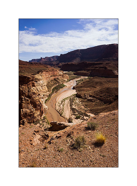
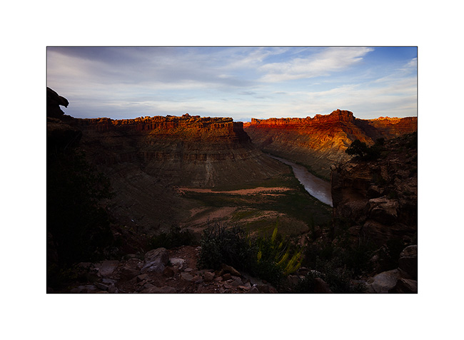
10. I went to sleep above the Colorado and enjoyed the viewpoint the next morning.
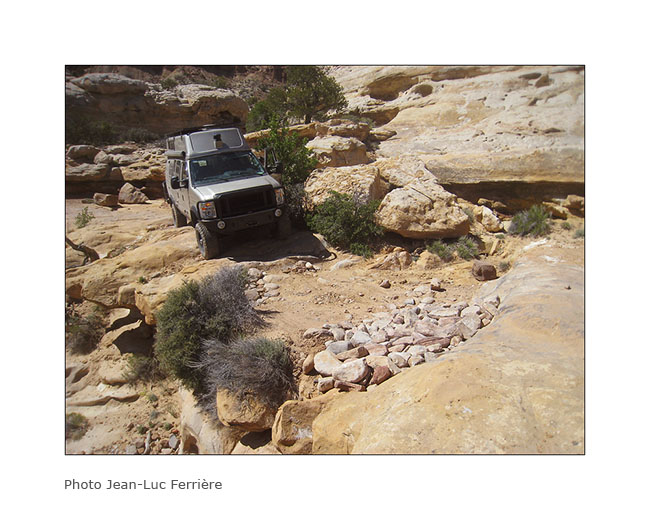
11. The track to get back is quite interesting by place.
12. Axle crossing.
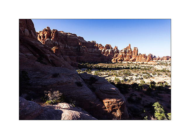
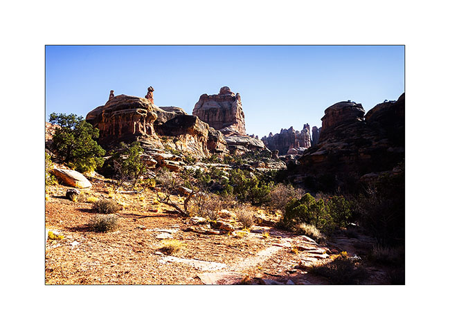
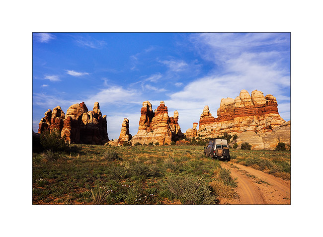
13. In the afternoon, I returned to Chesler Park, a beautiful place.
14. One of the canyons we cross to get there.
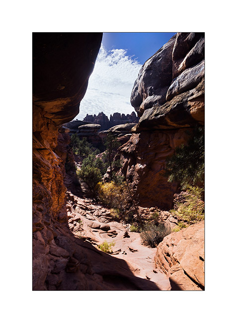
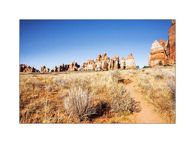
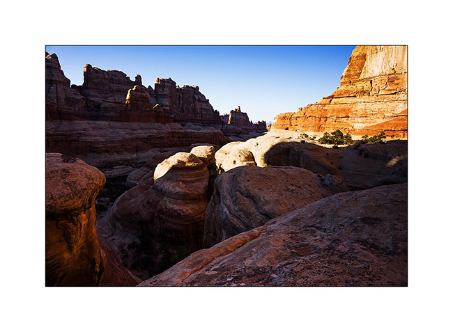
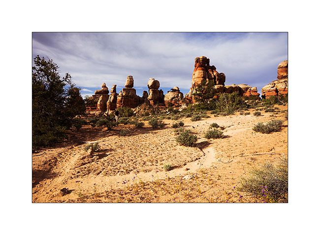
15. I approach the famous Needles.
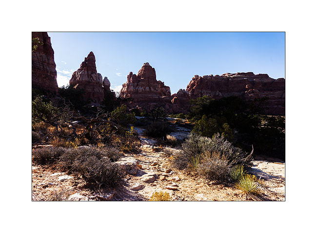
16. And here I am in Chesler Park.
17. The south side is a beautiful meadow that makes me want to camp there.
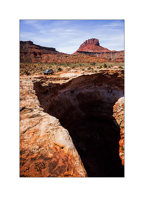
18. In a side canyon to Elephant Canyon, I discovered this fault created by erosion.
19. It’s late but I go up the Elephant Canyon to find a nice arch.
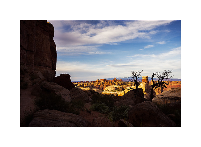
20. Small tree in the cliffs…
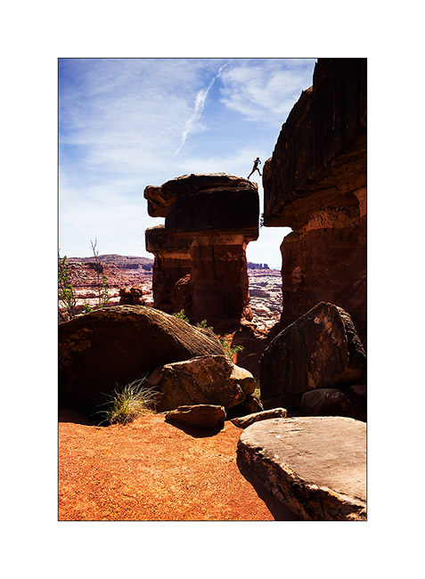
21. After almost running at full speed, here is Druid Arch, a rather unusual double arch.
22. I’m still at the top of Elephant Canyon and I must go down without delay to reach the Trailhead before nightfall, 6.5 miles away.
I reached VivaLaVida at nightfall, a little tired after more than 14 miles on quite uneven terrain.
Some other spots discovered in Utah to come soon…
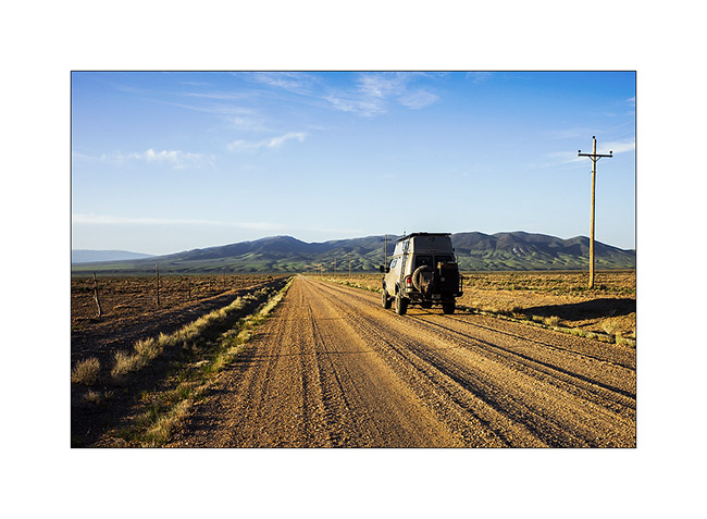
En route to Utah, well… not fast ;-)
1. In the previous update, I left you with this image of Black Rock that I leave it here again, you’re gonna understand why… 😉
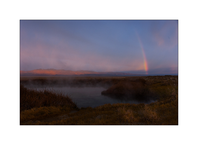
2. The Wake up was quite unexpected with a rainbow in the mist that lasted only a moment.
3. Here is Black Rock again, all crowned with a hairs of rising sun. So you have it in the evening and in the morning! 😀
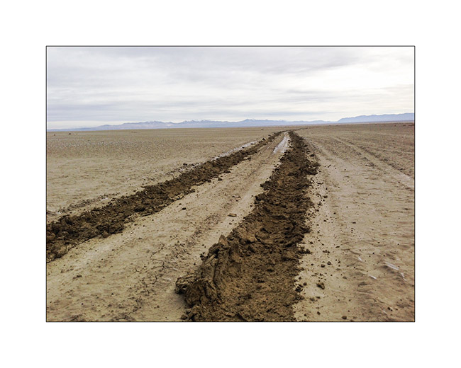
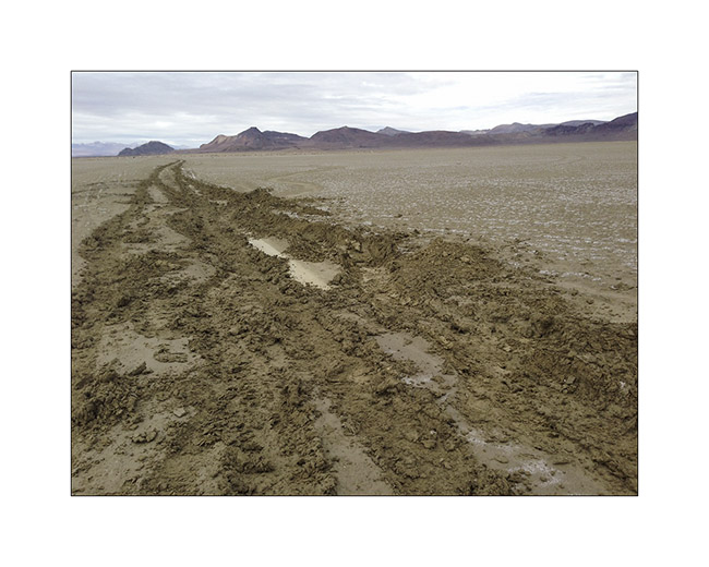
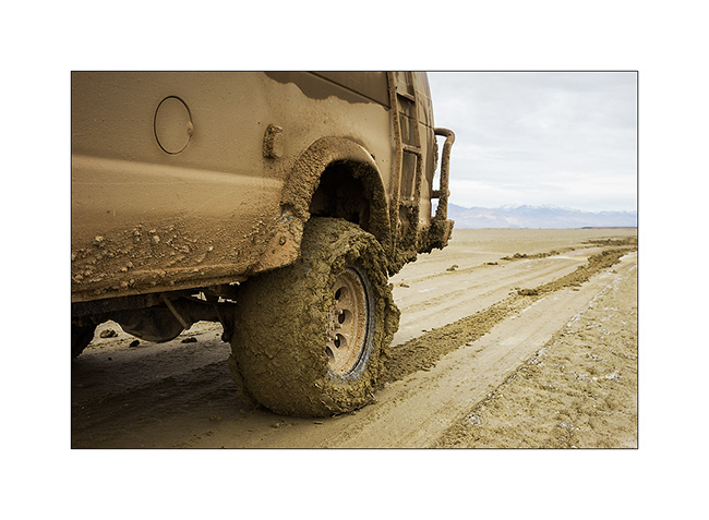
After a walk the day before to see the state of the trail, I decided to cross the high desert of Black Rock which seemed to have dried well four days after rain and snow. At first all went well, about ten miles without a hitch. Then suddenly, without I could notice any change on the track, VivaLaVida lost all grip, as if he was driving on ice! Even at leass than 5 mph, difficult to maintain it on the fine line of the track. Too late to stop, I drove about 3 miles till a simple tilt of 1 ° or so “draged” VLV on the left without the steering wheel reacts. Obviously, out of the trace, the two left wheels were driven into the mud and despite the four-wheel drive and differential locks, VLV has stopped, stucked right..!
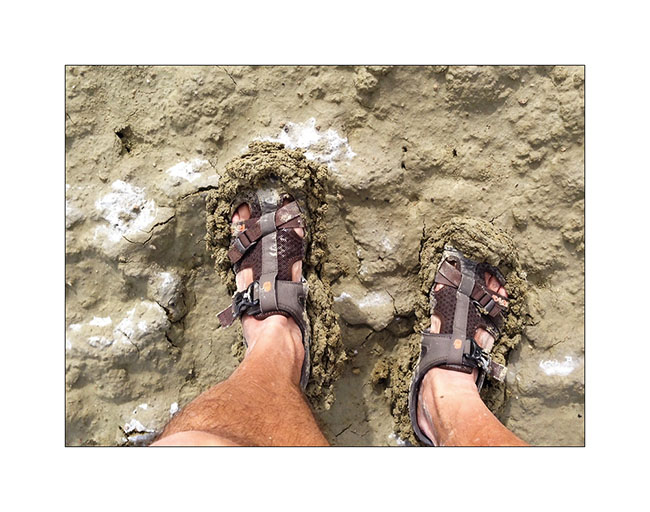
Well, I am alone more than 35 miles away from the first living soul, he’ll have to take out the nearly 5 tons of VLV by myself. So I pulled out the shovel and made a small fitness session to arrange “ramps” to all four wheels, not only to allow VLV out of its gangue but also to guide him back on the track, only trace capable of supporting its weight. I didn’t succeded at the first attempt,you can imagine. But after a few hours of fitness, “muddy” from head to foot, VivaLaVida had regained a semblance of presence with the wheels out of the ruts. 😀
All for nothing as two miles away, a river still flooded prohibited any crossing. So we turned backd and return to the Black Rock Hot Spring with the same trail – to wash Pschitt, shoes and shovel at almost nightfall… 😀
4. Here are the tracks that VLV was doing just before to get stucked, despite largely deflated tires.
5. Gloups, it’s called bogged!
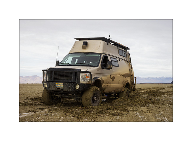
6. Mud is good for the skin, isn’t it? 😀
7. We’re out!
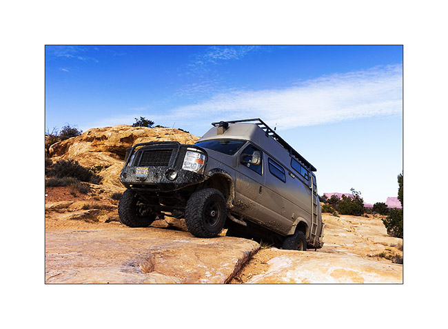
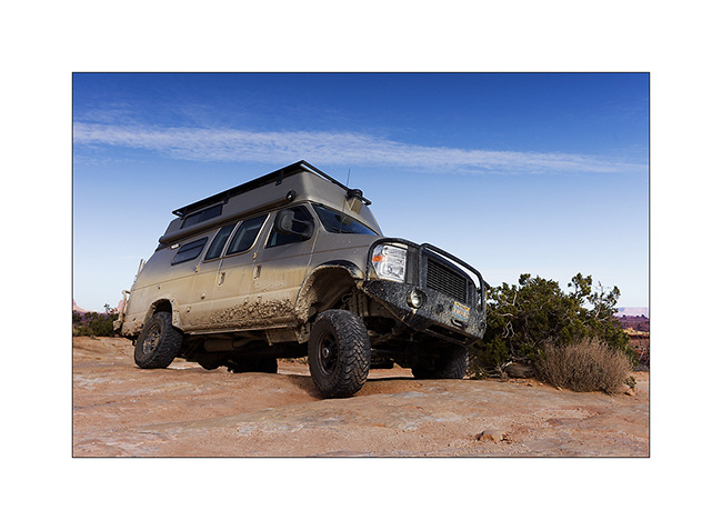
8. No, these are not new wide tires mounted for a better look of VLV… 😉
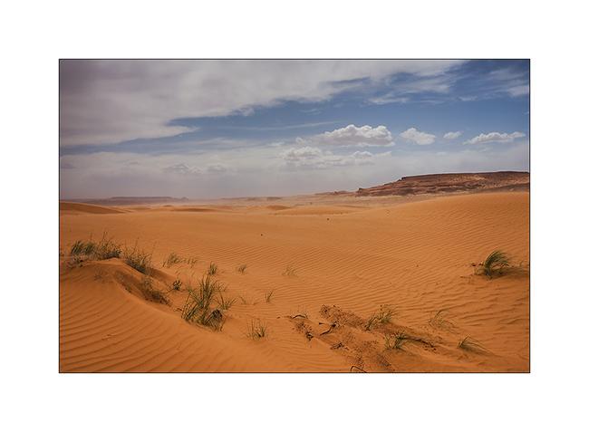
9. After all that, I had to make a detour of more than 150 miles to find the road that would lead me in Utah. However, with stunning scenery.
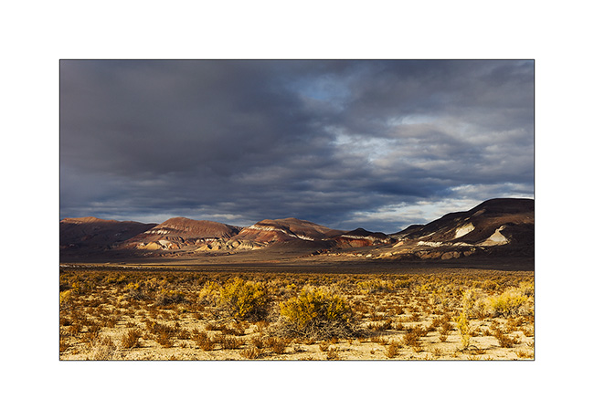
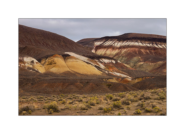
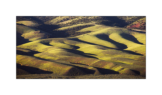
10. In the high Black Rock Desert, mineral colors are impressive…
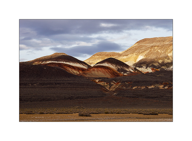
11. … sometimes incredibly saturated.
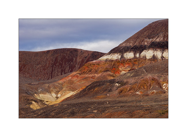
12. It almost sounds like some molten lava, isn’t it?
13. Sometimes softer and pastel…
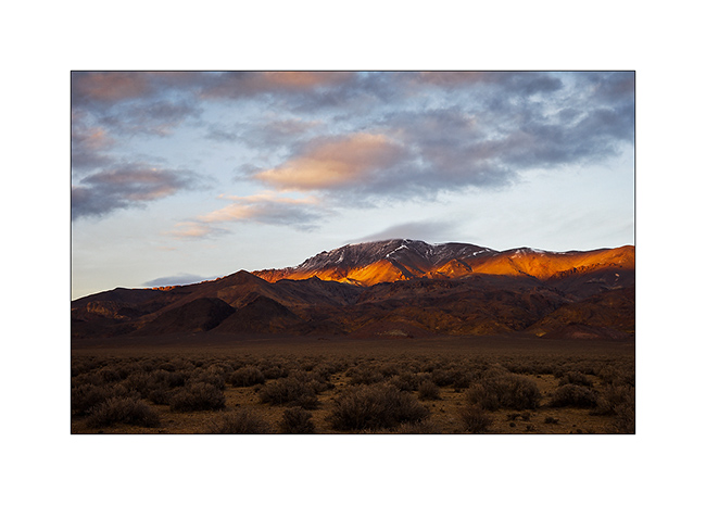
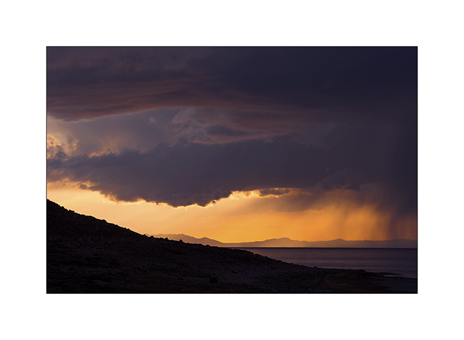
14. Last sunrays over Pahute Peak.
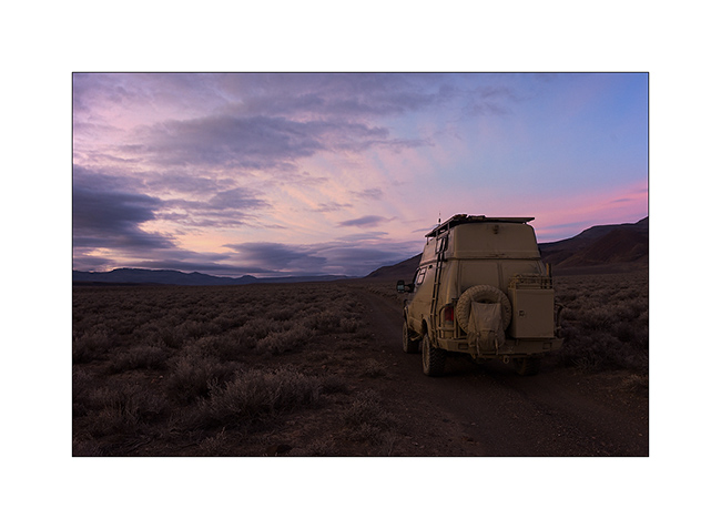
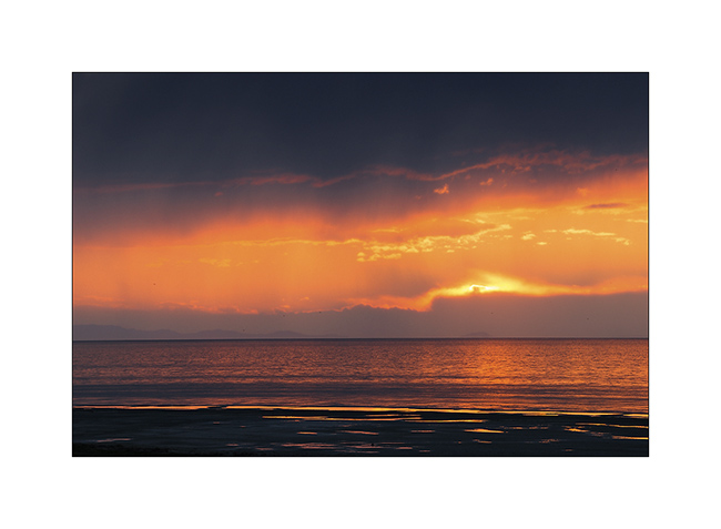
15. The sunset gratified me with very soft pink colors.
16. The next day, when I joined Utah, it was full moon on the plain…
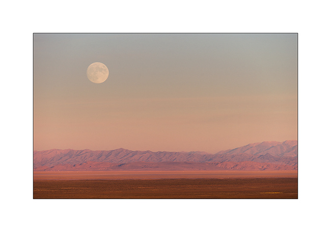
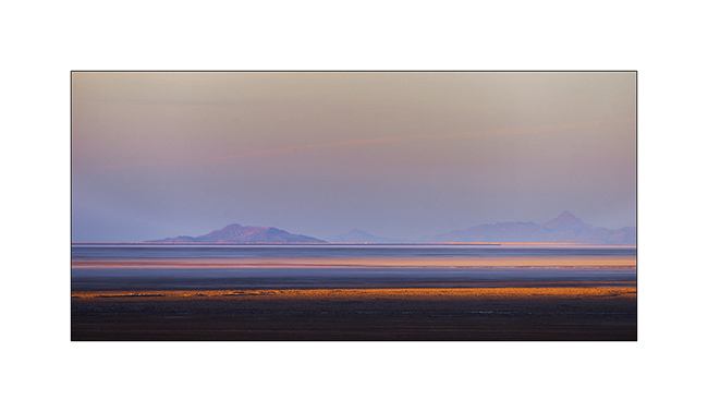
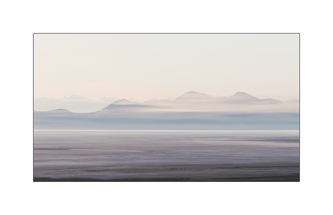
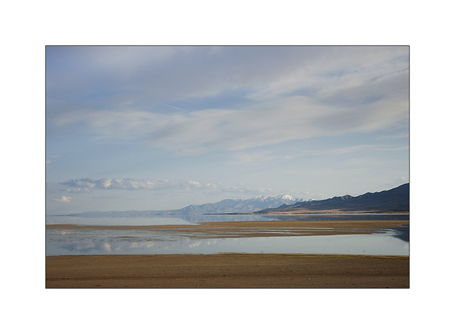
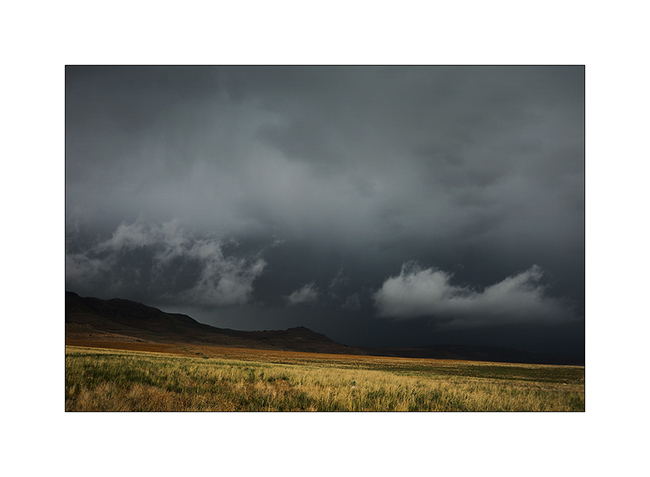
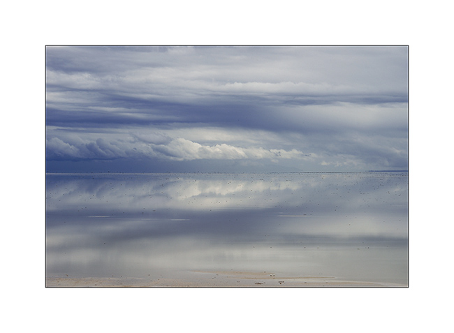
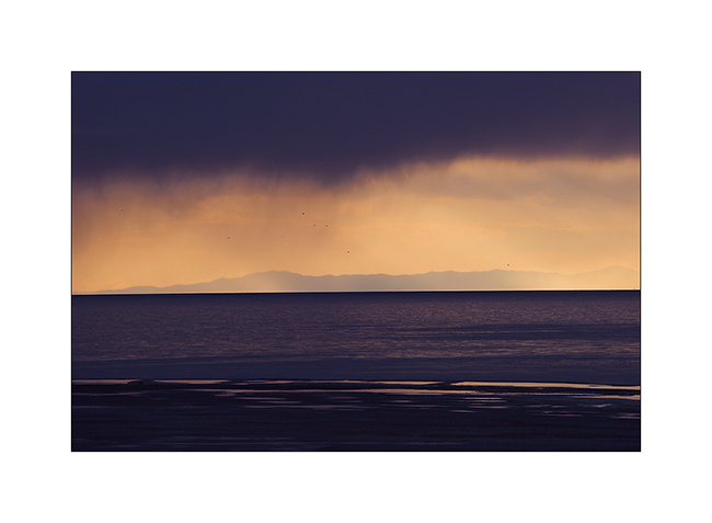
17. The shadows lengthen over the southern Great Salt Lake.
Upcoming episode in a few days…
Grand Lac Salé encore & Sud de l’Idaho
Après plus d’une semaine à Salt Lake City sans parvenir à vraiment résoudre les soucis de chauffe de VivaLaVida, j’ai repris la route en commençant par contourner le Grand Lac Salé par l’ouest…
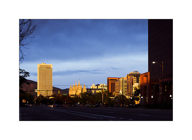
1. Derniers rayons sur le Temple Mormond de Salt Lake City.
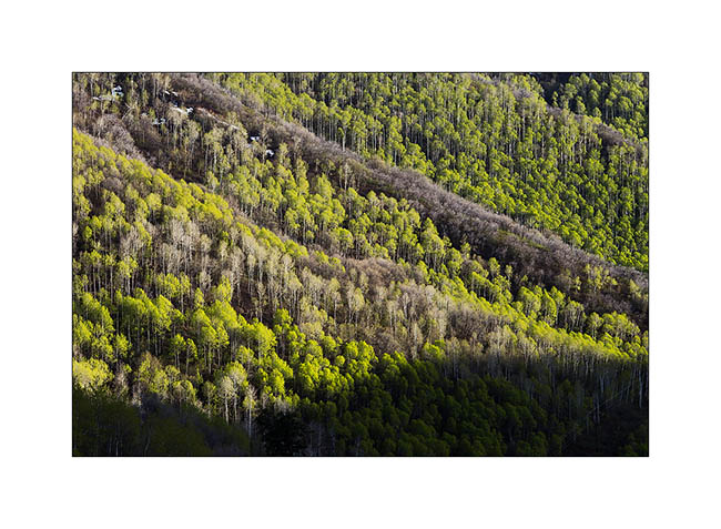
2. Les feuilles fraichement sorties des trembles sont d’un vert tendre magnifique…
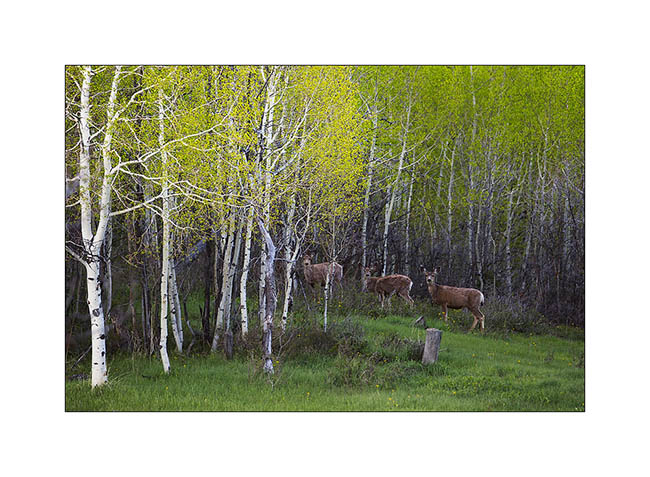
3. Cerfs attentifs à ma présence.
4. Petit matin.
5. J’ai dormi à même la piste.
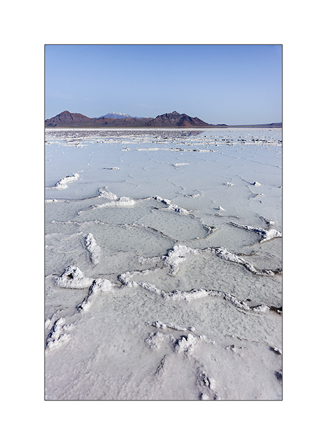
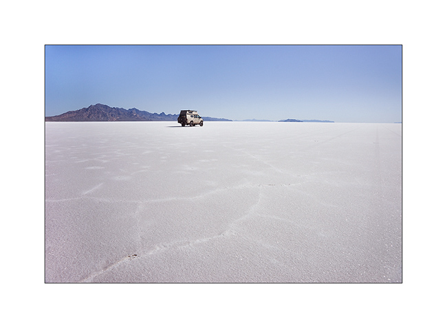
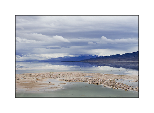
6. J’arrive à Bonneville Flat dont certaines parties sont encore sous l’eau.

7. Concrétions de sel…
8. VivaLaVida sur la célèbre piste de vitesse où bon nombre de records de vitesse ont été établis ou battus.
9. Estampe monochrome ou presque…
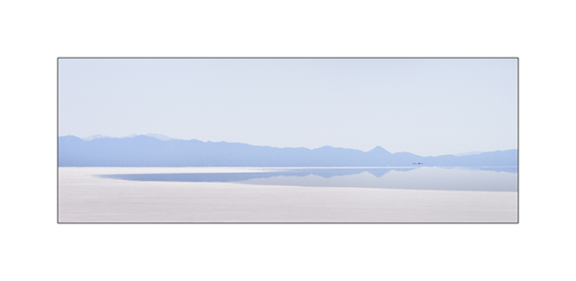
10. Minimalisme ultime…
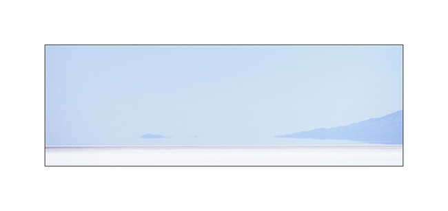
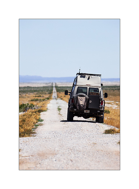
11. VivaLaVida emprunte une voie de chemin de fer du 19ème siècle…
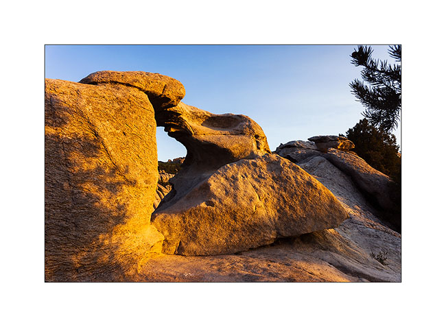
12. Une petite arche naturelle dite “des Chinois”.

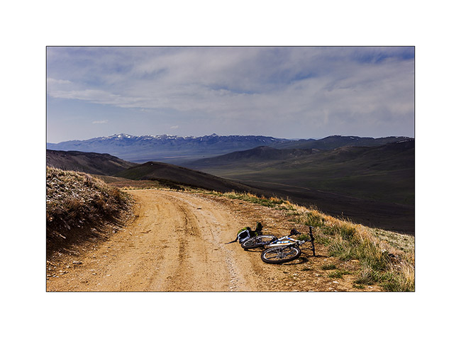
Je suis ensuite passé en Idaho en allant visiter la City of Rocks, un lieu surprenant.
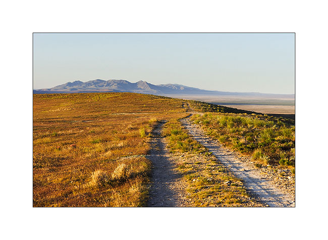
13. Première piste en Idaho.
14. Lumière rasante sur des collines érodées.
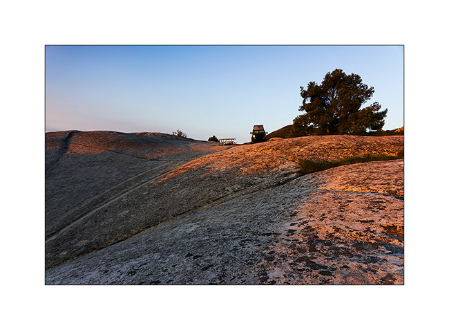
15. Campement à même le granite de City of Rocks.
16. Petite arche sans nom au levant.
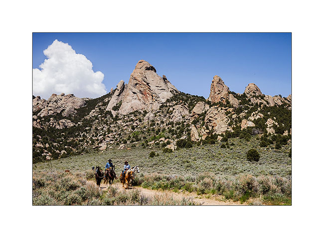
17. Après deux bonnes heures sur la selle, la vue est immense…
18. … mais je suis arrêté par la neige !
19. Le granite de City of Rocks est superbe ! C’est un haut lieu de grimpe, avec plus de 140 voies répertoriées.
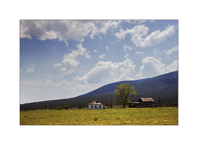
20. Ferme traditionnelle.
Suite de mon périple en Idaho à venir bientôt… 😀
Great Salt Lake
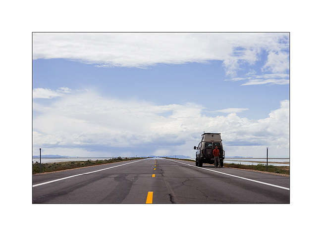
Before Jean_Luc left to fly back to San Fransico, I suggested to bring him see the Great Salt Lake, a place where I saw a lot of birds during my last trip there.
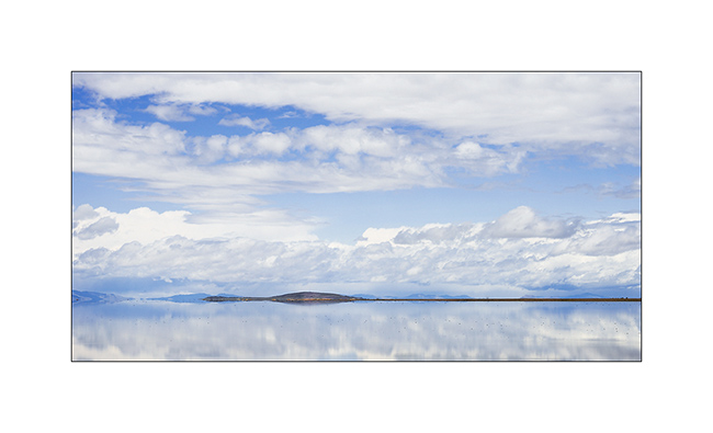
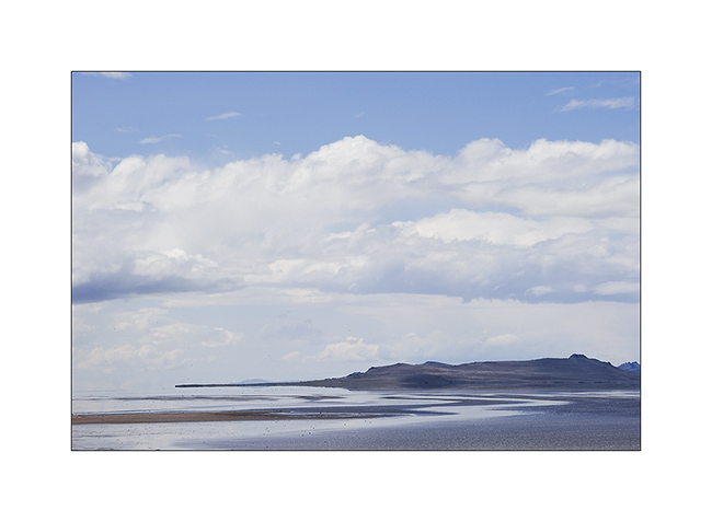
1. Arrival to that so large and quite lake.
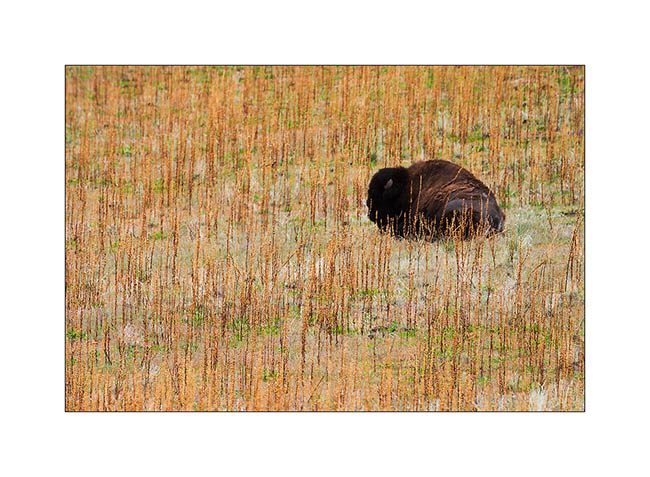
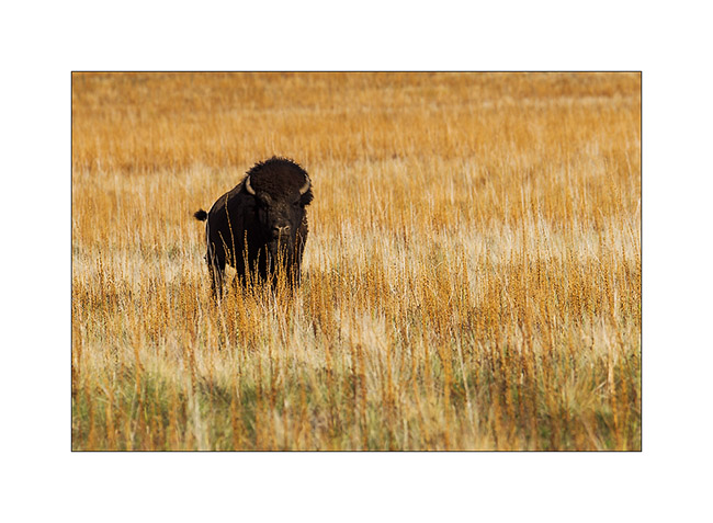
2. In the morning on Antelope Island, an inhabitant. Bisons were reintroduced at the end of 19th century and are several hundreds on the island now.
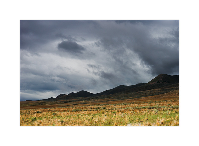
3. The weather is going bad…
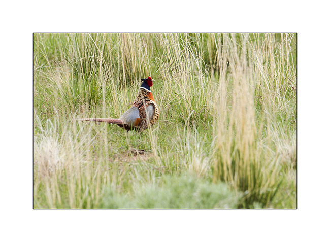
4. It’s his cry which betrayed him!
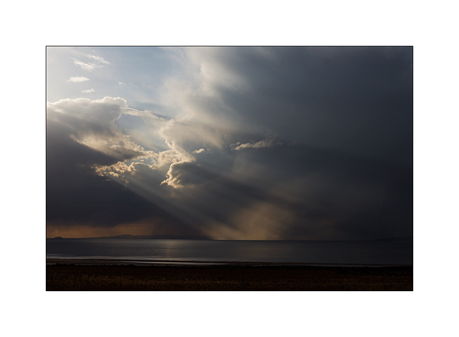
5. A big thunderstorm passed not far away…
6. … then the sky clears.
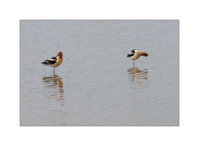
7. American Avocettes.
8. Strange llight…
9. Watercolor on clouds…
10. Stop on the jetty which leads to Antelope Island.
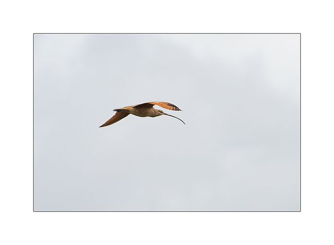
11. (Very) long-beaked curlew.
12. Absolut quietness…
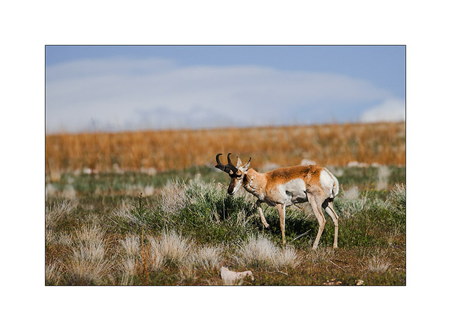
13. Pronghorn antelope.
14. This is the second time during our journey we saw burrowing owls.

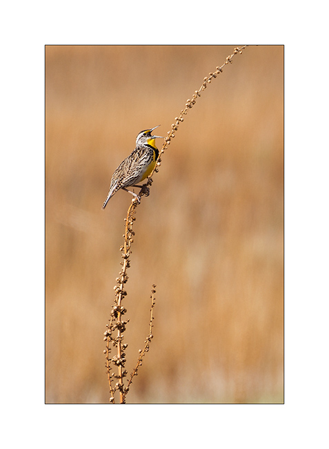
15. This yellow throat meadowlark had a powerful song.
16. Euhhh… we’re only passing, ok?! 😉
17. The lighting effects are quite unlikely, it looks like the picture of a painter…
18. … Under the showers.
19. Grandiose sky!
20. Burning sunset…
21. Lastcamp for Jean-Luc in a dreamfull decor…
That’s the end of the period Jean-Luc travelled with me. I’m now continuing my journey alone, first trying to solve some heat issue of VivaLaVida… :-/
To be continued soon…
Maze Disctrict of Canyonsland NP & Moab area
The next day we decided to walk to the confluence of the Green River and Colorado River, north of Doll House.
1. Along the trail.
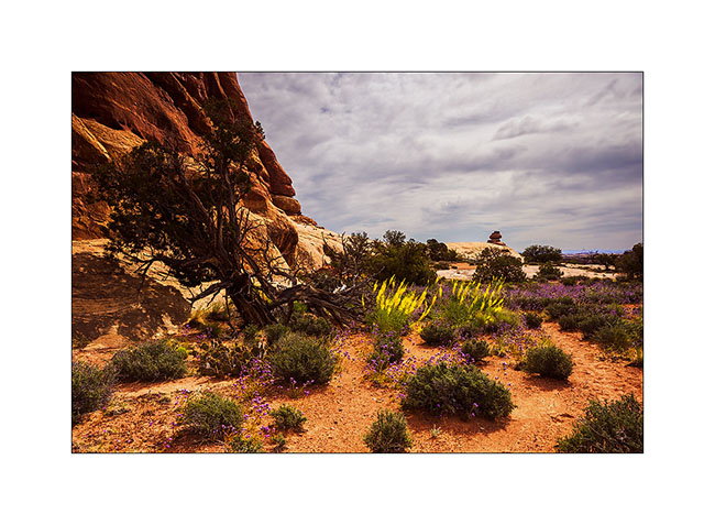
2. Some areas are full of flowers.
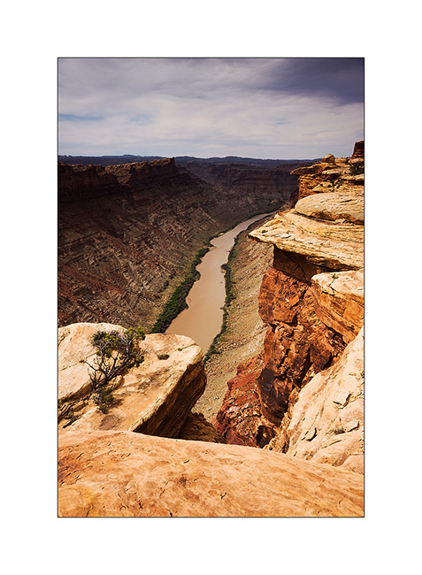
3. Colorado River 1000 feet below.
4. Jean-Luc saw him just before to walk on!
5. Using the Flint Trail to go up on the plateau, some switchbacks were really narrow, requiring maneuver. what an initiative to have drawn a road in such a steep slope!
6. We slept on the plateau…
7. … and saw a gorgious sunset.
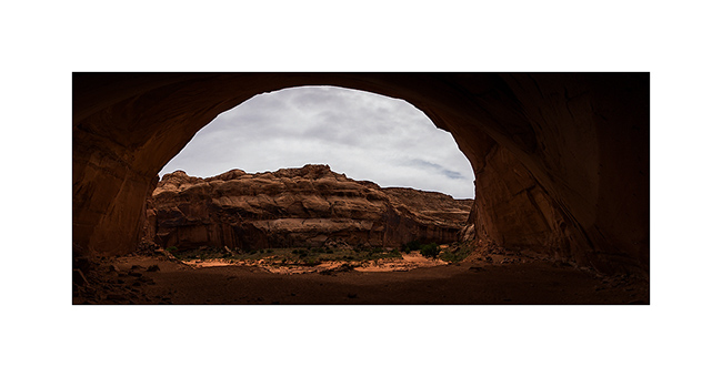
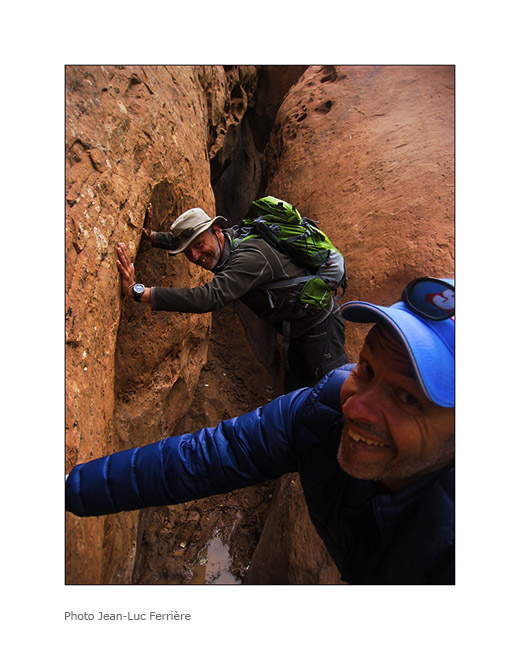
8. We joined the Horseshoe Canyon to discover cave petrographs. Huge overhang! Can you see Jean-Luc ..? 😉
9. Panoramic picture from the bottom of it.
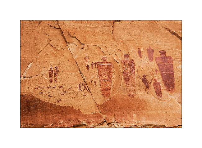
10. The “Great Gallery”.
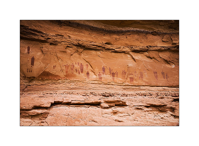
11. Surprising painting…
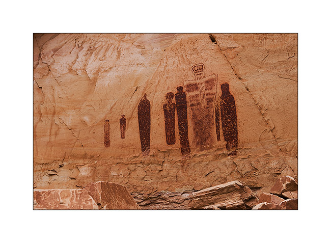
12. … so varied.
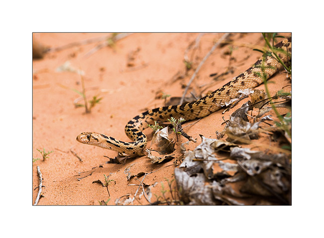
13. Going down the canyon, we saw this beautiful snake (about four feet long), an enemy of rattlesnakes he kills by constriction.
14. At Green River UT…
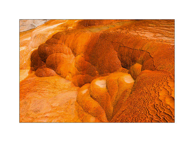
15. Further, a short stop to Crystal Geiser…
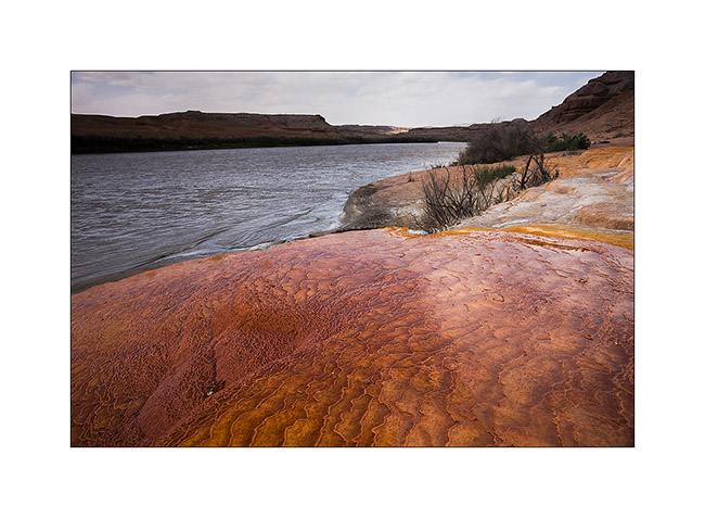
16. Saturated colors!
17. Detour through a smal erg of orange dunes.
18. But the sand Wind will force us to go away.
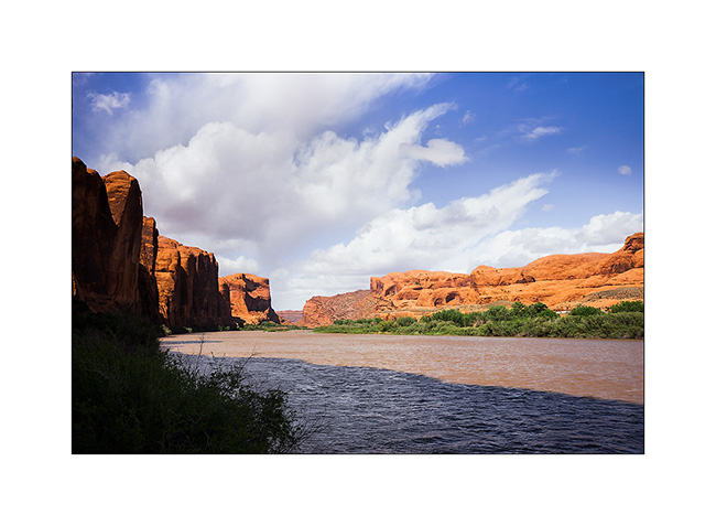
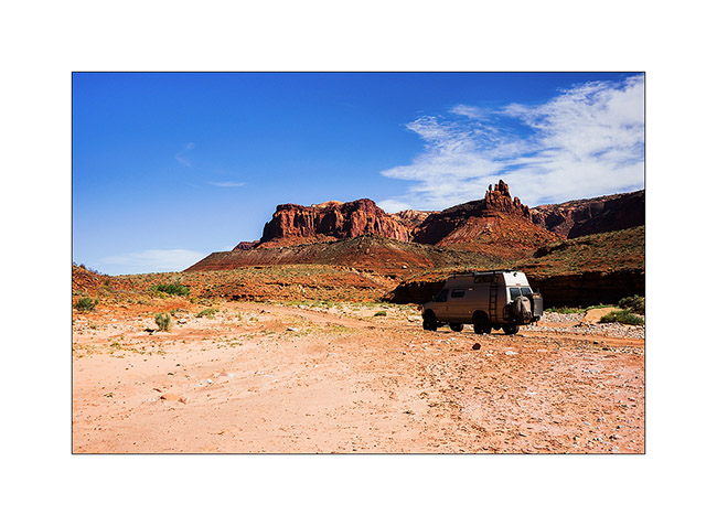
19. Colorado River near Moab.
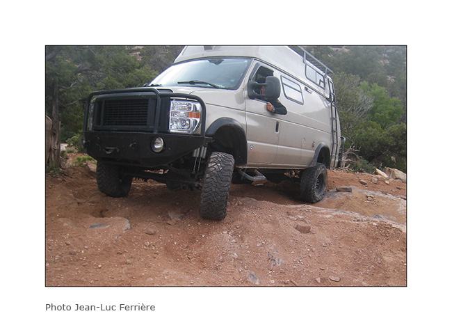
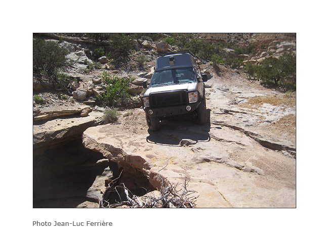
The next day we joined a place called “Top of the World” by another quite rockcrawling track! Here are some images of Vivalavida in action since I had a photographer there. 😉
20. Steep hill…
21. Here, both lockers were necessary! 😀
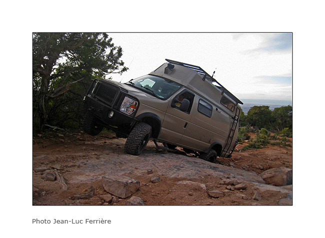
22. big step.
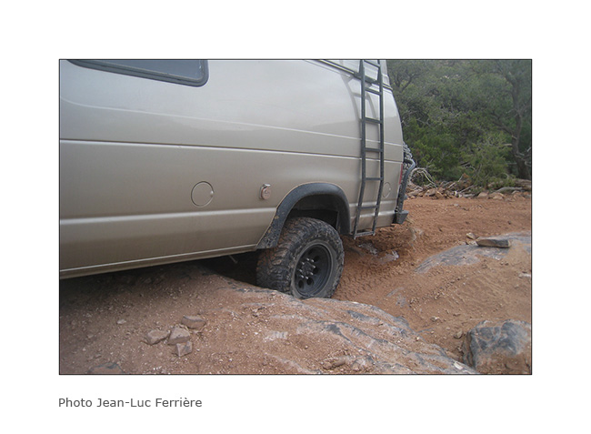
23. Axle crossing.

24. Where is the best way to go..?

25. There! 😀
26. The Sunset was gorgious on this promontory!

27. Jean-Luc over tausend feet emptyness..!
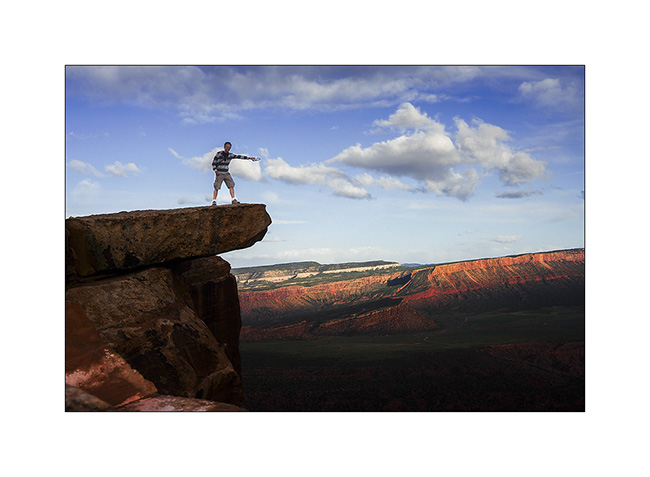
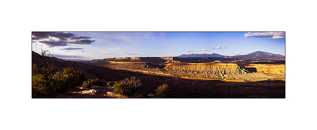
28. A panoramic picture to finish this update…
The next update will bring you to the Great Salt Lake, the last place we wisited with Jean-Luc who then flew back. To come soon.
Henry Mountains & Maze District of Canyonsland NP
Since Jean-Luc decided to take a domestic flight from Salt Lake City to join his international flight to San Francisco, it left us more time to explore Utah. We visited western Canyonsland National Park we reached by crossing the Henry Mountains.
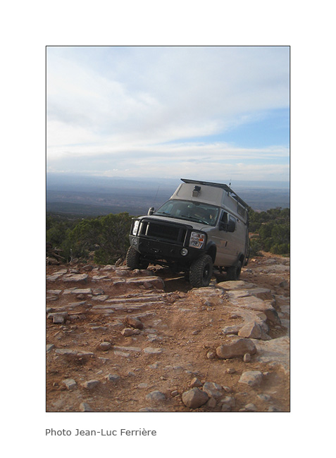
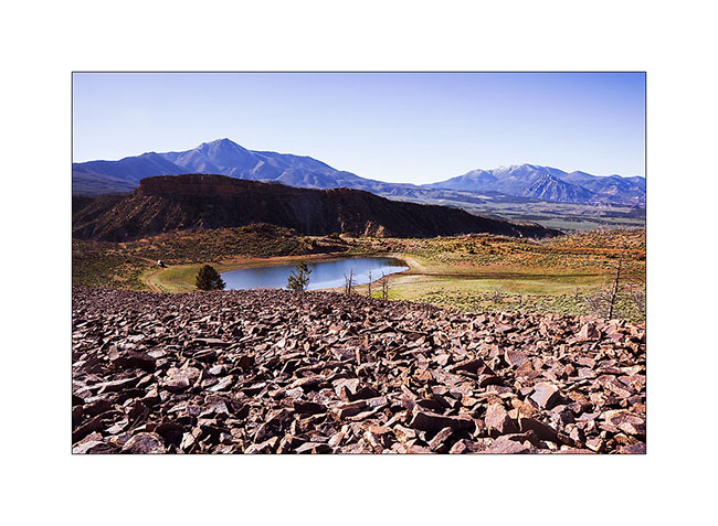
1. Stop for the night at Bastion Reservoir, at about 7,000 feet elevation.
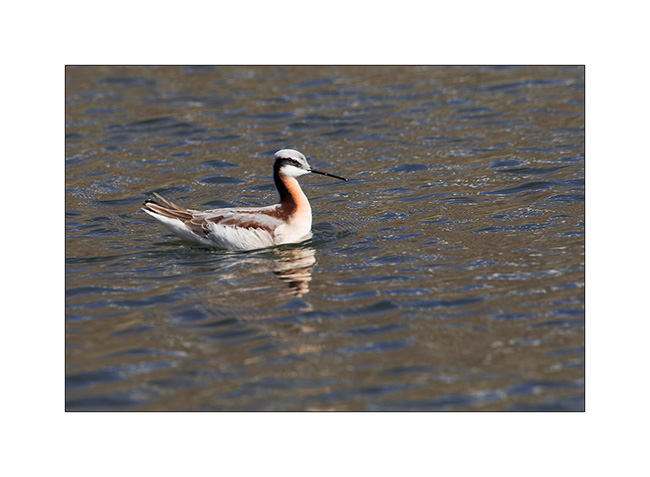
2. Jean-Luc spotted Wilson’s phalarope, an unexpected bird in this region.
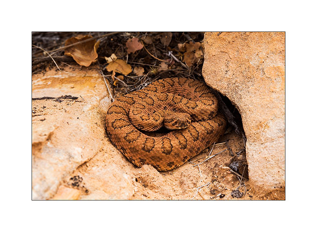
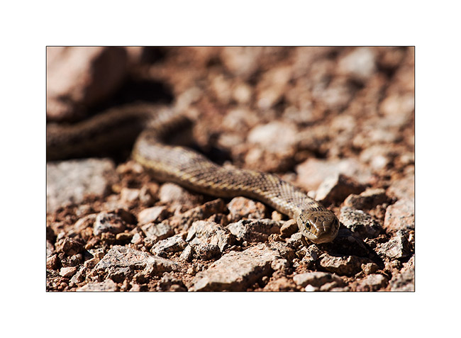
3. I saw this snake without being able to identify it.
4. Campfire under the top that Jean-Luc climbed.
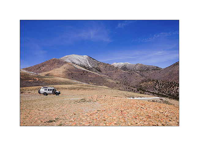
5. Down from Mount Helen, the culmination of Henry Mountains.
6. After going refueling in Hanksville, a really remote and depressed corner, we followed a long path to reach the Maze Overlook, first taking the Devil’s Canyon road.
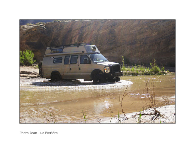
7. Water crossing of the Devil’s River.
8. On the other side of the river.
9. The track is rugher I imagined and we slept at the Sunset Pass…
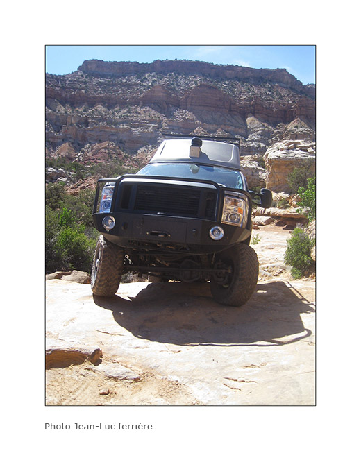
10. VivaLaVida over a huge overhang!
11. My acrobat brother at Maze Overlook. 😉
We then decided to join the Doll House and it took us no less than 6 hours to reach on a track probabliy the most difficult Vivalavida has traveled so far … Here are some pictures to illustrate this incredible journey.
12. Driving on the rock.
13. Sometimes overhanging.
14. It goes steep up…
15. … then down.
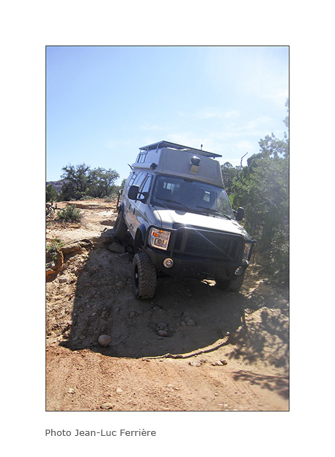
16. Big step.
17. It leans sometimes too…
18. It’s sometimes narrow…
19. … or tight!
20. We will end up to arrive first at Standing Rock…
21. … then the beautiful Doll House that reminds me of the Needles, on the other side of Colorado.
22. We were Lucky to get a camp place just in the middle of Doolhouse ad this is the view we had at sunset;-)
23. Last rays on the Colorado River.
24. Indian granary well protected under an overhang of sndstone.
25. Trail at dusk in the mid of needles…
To be continued…
Cottonwood Road UT
Still dazzled by the beautiful Coyote Butes, we continued our route using the Cottonwood Road northbound. I noticed several spots of interest on this route. The first at which we stopped is entitled Yellow Rock, an orange to yellow sandstome dome….
1. The side canyon to the Cottonwood River I walked to Yellow Rock. Nice to walk barefoot in the cool water… 😉
2. Yellow Rock is well named.
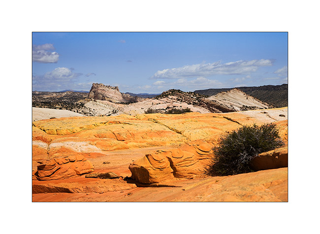
3. The sandstone is veined of colors…
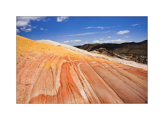
4. Some more color touch…
5. A little further on, we stopped at Lower Cottonwood Narrow.
6. The walls are impressive, probably more than 1000 feet high.
7. We ended the day with a stop at Kodachrome Basin.
8. Jean-Luc on sandstone. 😀
9. Cliffs in late afternoon.
10. Opposition of forms: soft to the anthill, acute to the cliffs.
The next day, I brought Jean-Luc discover Bryce Canyon, the must see. Since I already take quite a lot of pictures of it, I went walking light, leaving my camera in Vivalavida. You so won’t see picture of our hike here…
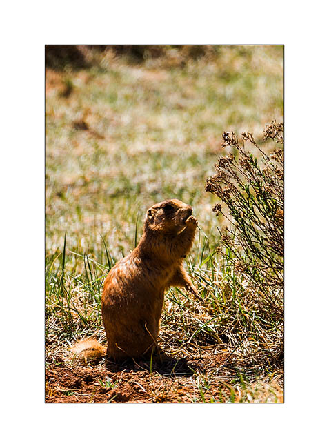
11. An attentive prairie dog.
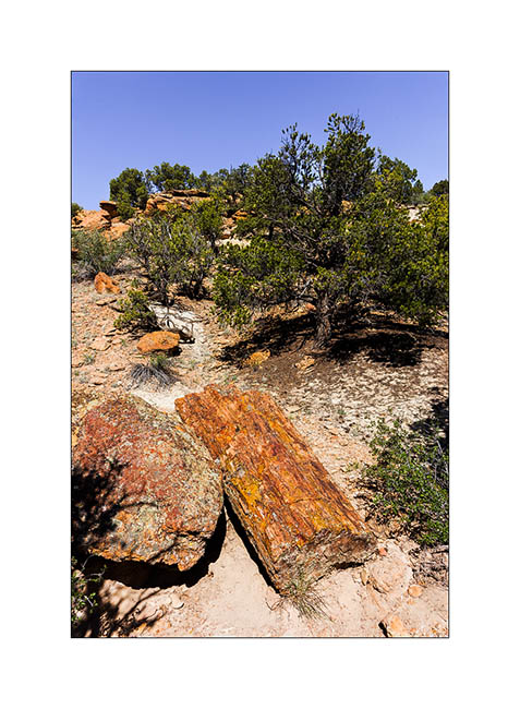
12. Not far from there, a short stop at the Escalante Petrified Forest. Some petrified trunks are impressive!
13. Late afternoon hiking to the Calf Creek Falls.
14. Side canyon to Long Canyon, on the Burr Trail Road.
Arrived in the area of Capitol Reef, we visited the Muley Canyon to discover some natural arches.
15. Cheerios Double Arch.
16. Bells…
17. Saddle Arch.
18. Another natural arch.
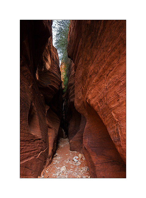
19. We ended in the Muley Twist Canyon, a Slot Canyon where there was still water in places.
20. Fun on passages in opposition.
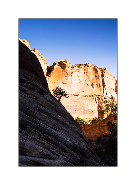
21. Back down at the end of the road where we slept, I went back to the view of the valley of Capitol Reef, grandiose!
22. Mineral colors are everywhere…

23. … while the sun is going down…
24. Camp in Muley Canyon.
The next update will take you all soon in the Henry Mountains and the Maze of Canyonsland Distric National Park… 😉
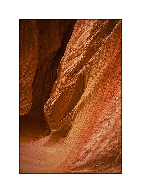
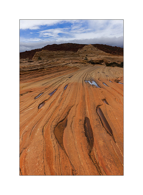
Vermillion Plateau (2)
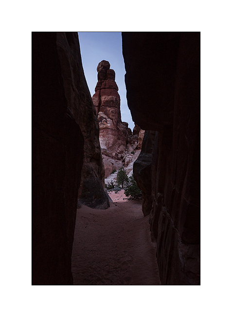
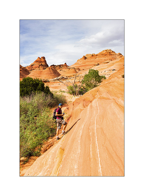
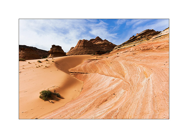
So we continue our journeys in North Coyote Butes.
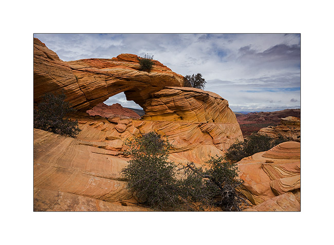
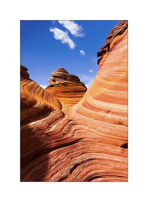
1. The climb takes us near Top Rock Arch…
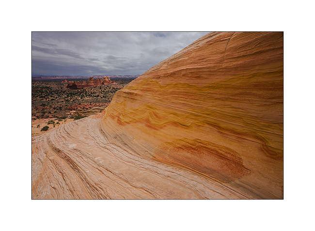
2. Scenery towards the South Coyote Butes.
3. Later, we visit the Alcove, a large cavity excavated by the wind. I find several very graphics compounds…
4. Draperies of sandstone…
5. The top of the North Coyote Butes is a sort of plateau…
6. Reached Melody Arch and its “window” on the South Coyote Butes.
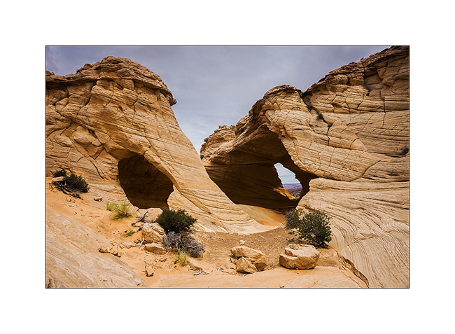
7. Perspective…
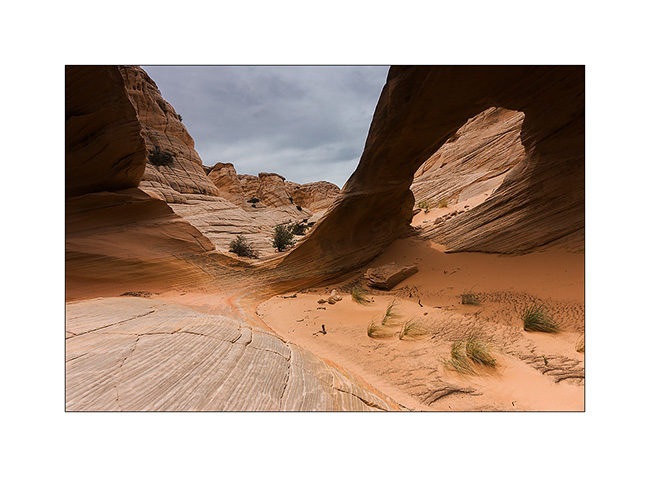
8. Descend of the opposite side.

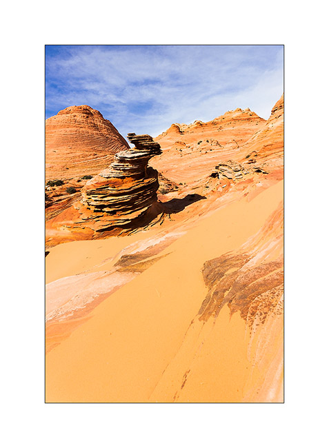
9. Still beautiful…
10. … and even a sombrero ! 😀
11. Lower, the turtle rock seems sweet…
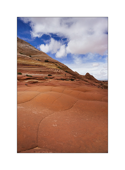
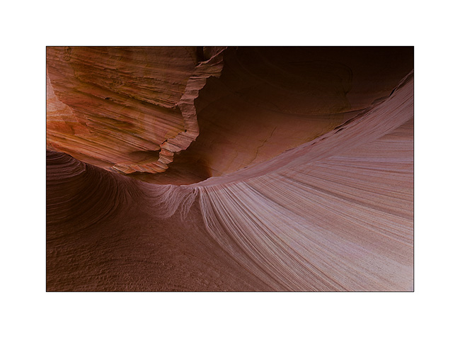
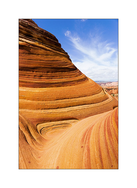
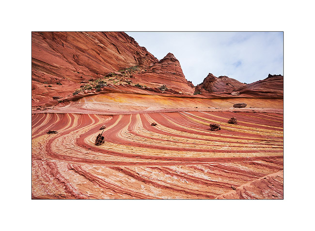
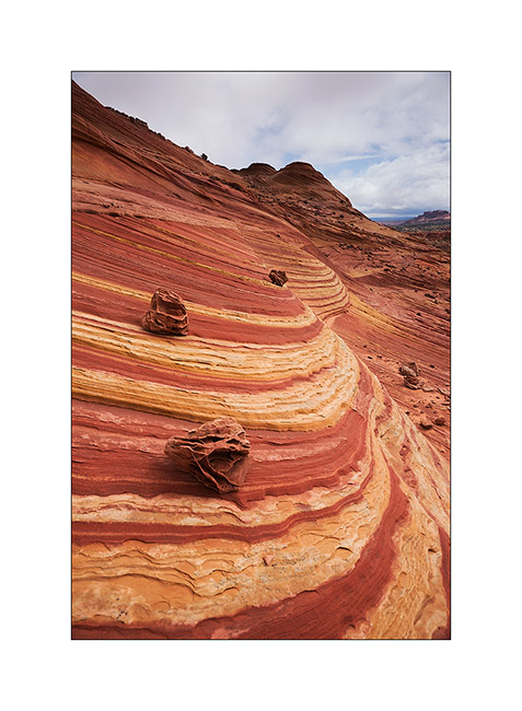
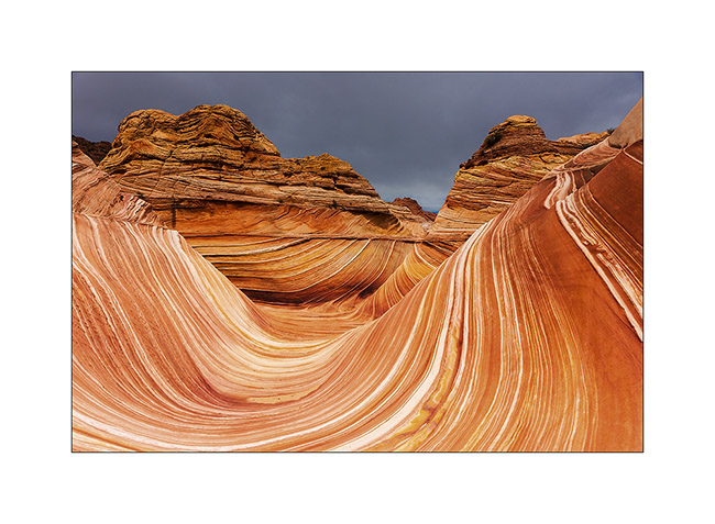
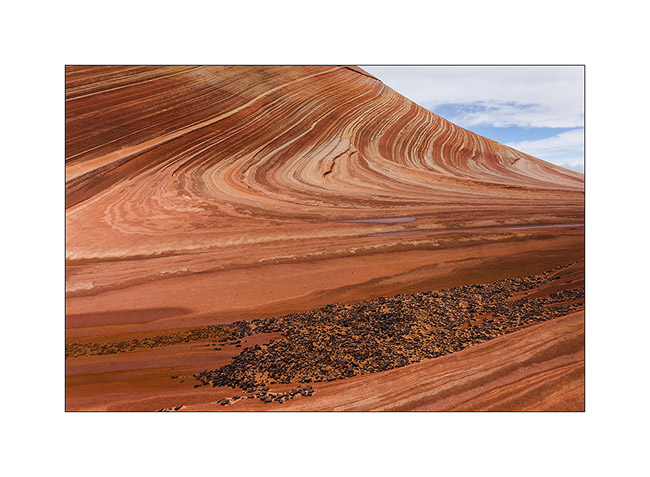
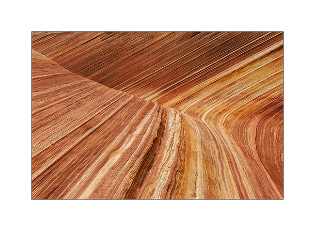
12. Back to the Wave as the light comes.
13. The contrasts are more pronounced but the softnees of lines remains…
14. …
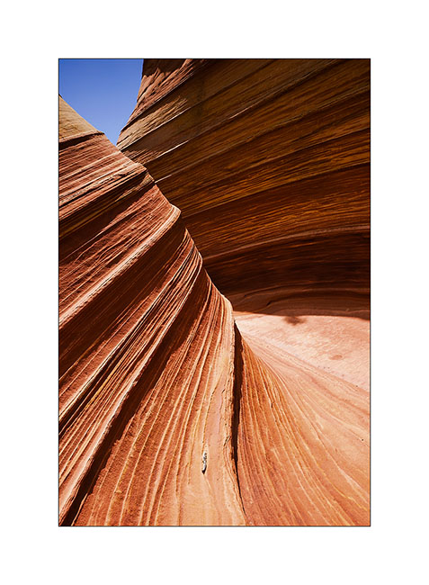
15. …
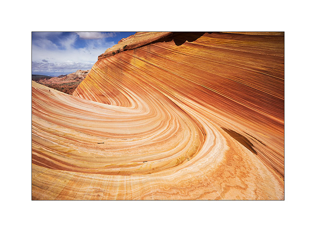
16. On the way back, stop at a small little colorful quadruple teepee.
17. …
We slept in the Paria Town in Paria Canyon, only some miles away.
18. Heavy sky over the trail…
19. … and hard light on the mesas.
20. What a nice place.
21. Contrasts in late afternoon…
Well, I hope you’re not too drunk by the number of images of these beautiful Coyote Butes. The next update will resent the beginning of our journey to Utah. Coming in a few days…
Vermillion Plateau (1)
Having luckily won the draw which gives access to the Wave, we spent the afternoon exploring the Wire Pass and Buckskin Gulch. The first is a slot canyon at Buckskin Gulch side, one of the longest slot canyon with more than 45 miles long.
1. Entry of Wire Pass.
2. Petroglyphs at the intersection Wire Pass/Buckskin Gulch.

3. Some animals are really aesthetic.
4. Going up the upper part of Buckskin Gulch…
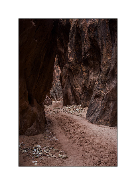
5. … it opens after a few miles in a kind of bowl where some trees manage to grow.
6. When sand and sandstone are one…
7. Sculpted by the wind.
The weather forecast was bad for the next day with a 90% chance of rain for our walk to the Wave. However, we were ready to brave the elements at 8:00 and it was pouring rain as we began our walk. Rather than go directly to the Wave, we made a detour to another site lesser known of North Coyote Butes: Fatali’s Boneyard.
8. Fatali’s Boneyard, all of yello and pink…
9. Kind of sand roses on striped sandstone.
10. Perspective…
11. … and mix of striped rock and plain sand.
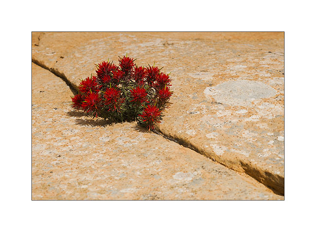
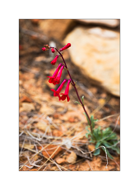
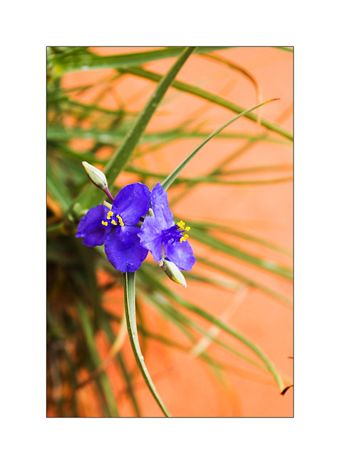
12. A flower, scarce greenery at this location.
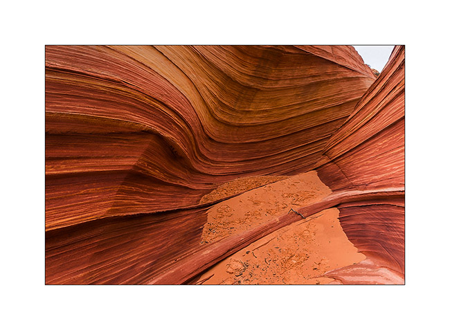
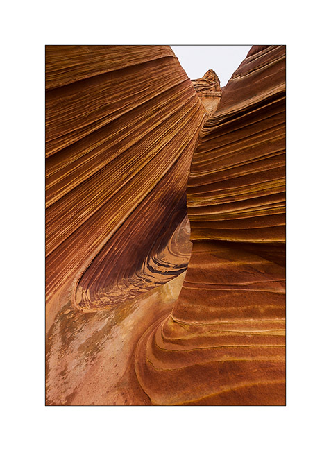
13. Along the walk to the Wave, run by the Second Wave, unfortunately without light despite the rain stopped.
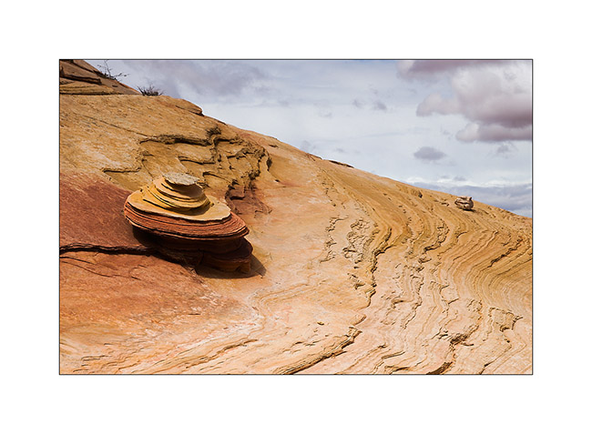
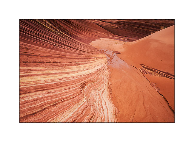
14. Stone waves…
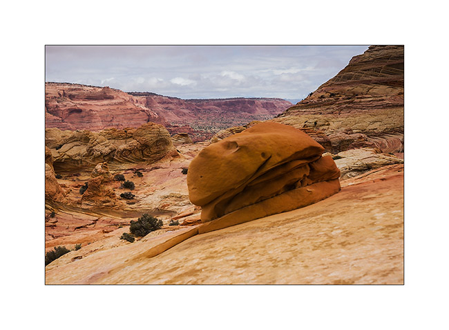
15. Still journeying towards the goal of the day, we found this rock hamburger! 😉
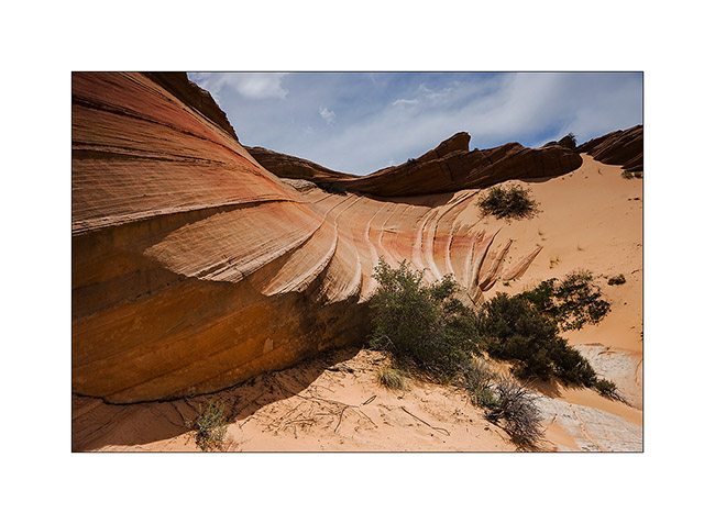
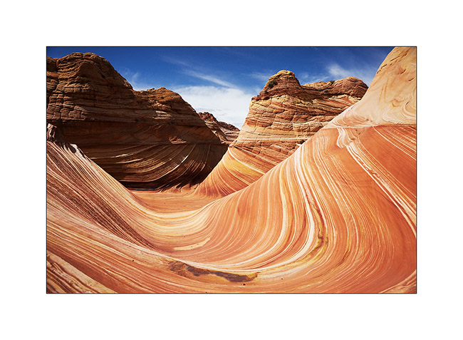
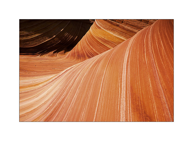
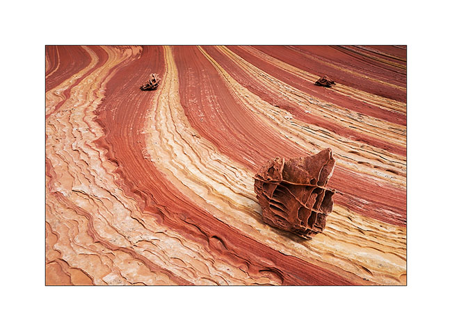
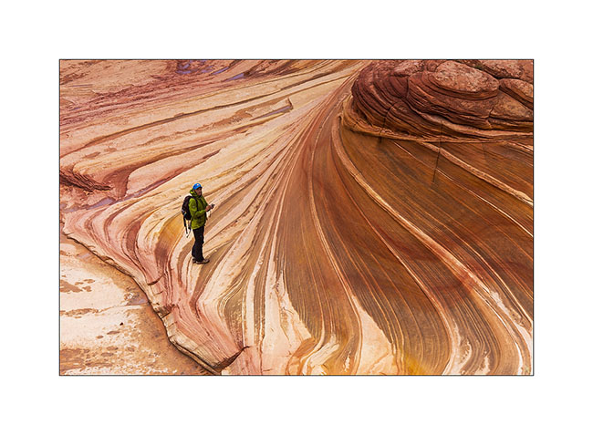
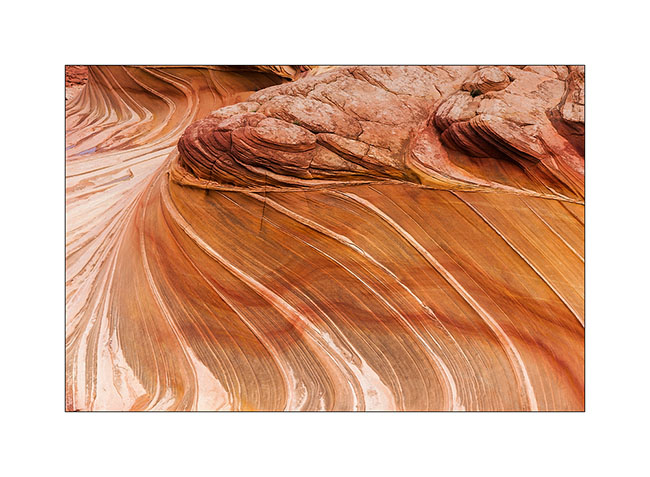
16. It was around noon when we finally reached the Wave.
17. Magic place…
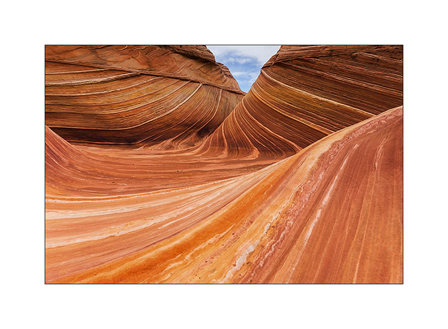
18. …

19. …
20. …
21. …
22. …
The light wass still not at the rendez vous, so we decided to climb higher on the North Coyote Butes looking for Melody Arch. To come very soon…