Archives
now browsing by author
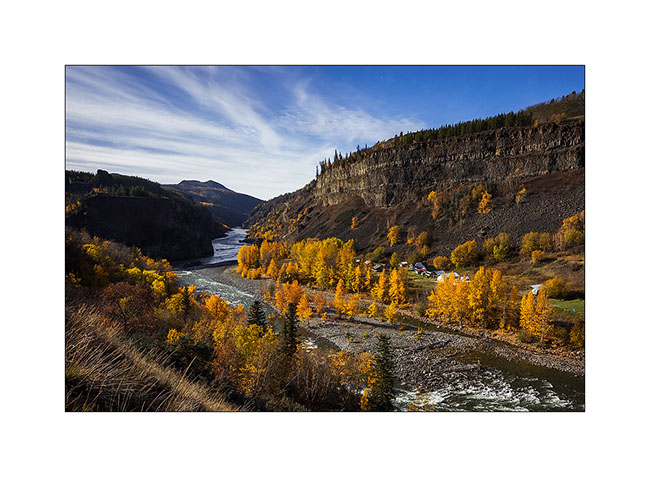
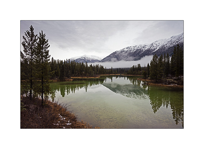
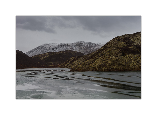
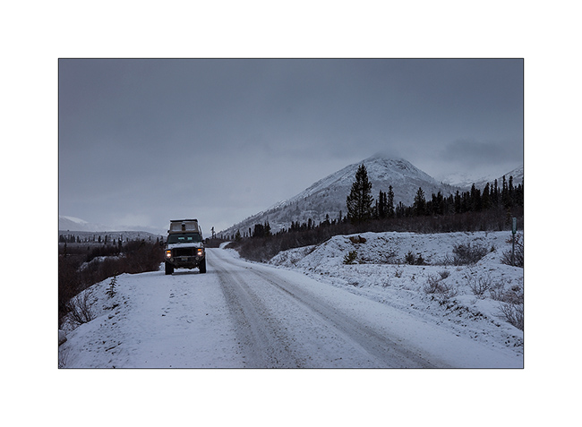
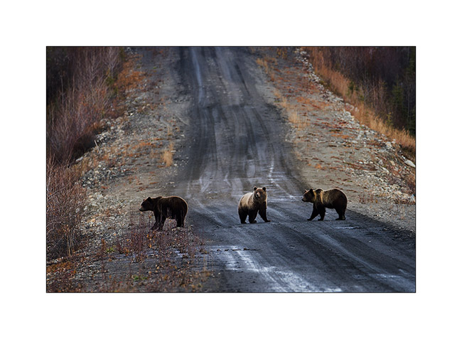
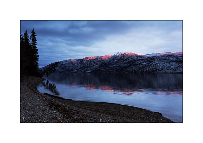
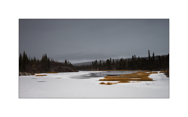
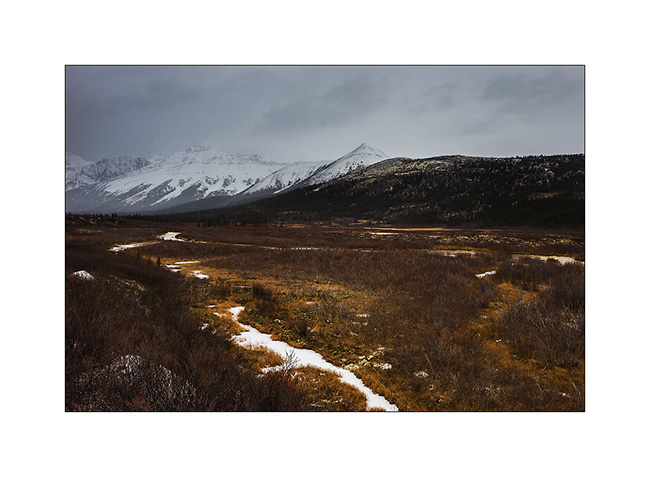
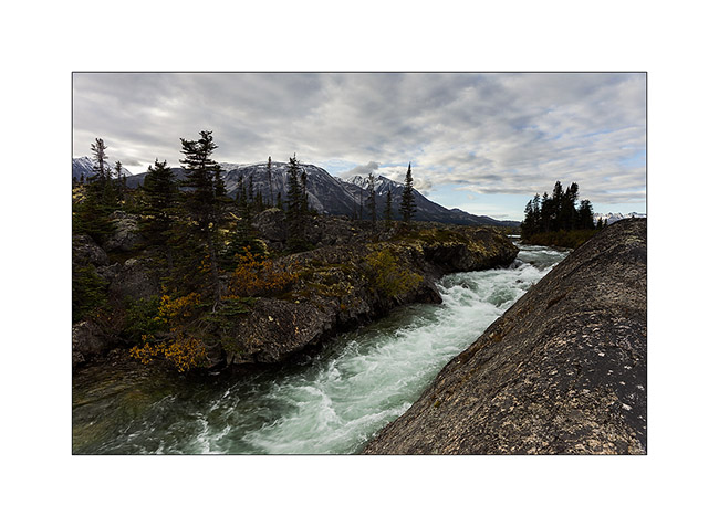
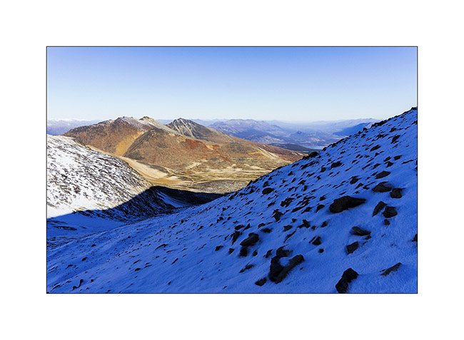
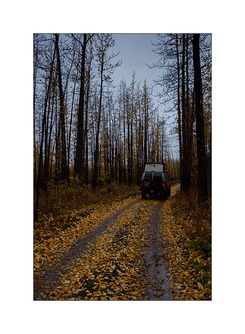
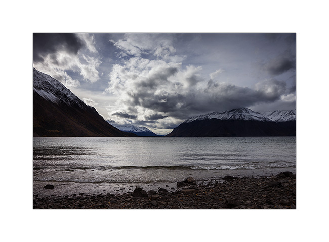
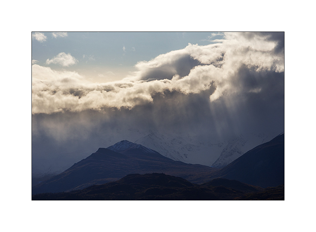
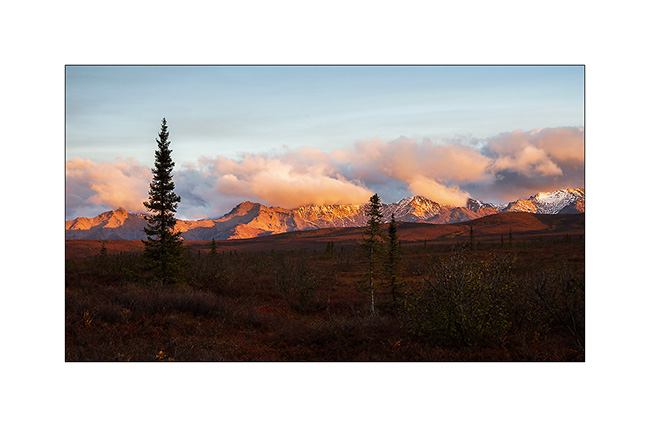
Cassiar & Stewart Highways
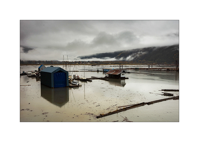
Vivalavida will now wipe six days of almost continuous rain. Indeed, it is the rain season near the Pacific coast, I didn’t really realize it until now…
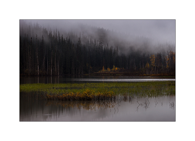
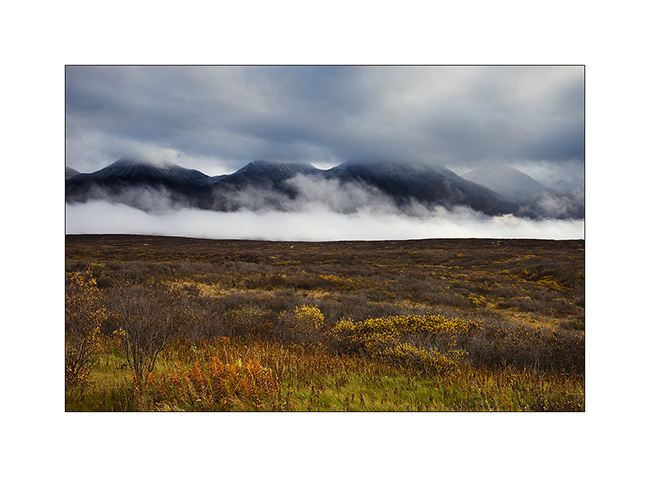
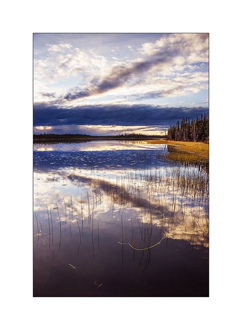
1. A pond in the myst…
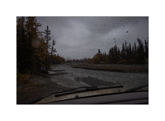
Despite the weather, I went for a detour to Stewart to try to spot some of the many glaciers in the region.
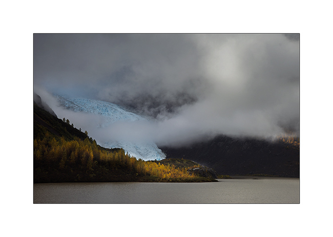
2. The “Bear Glacier”, along the Stewart HWY.
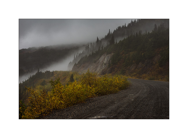
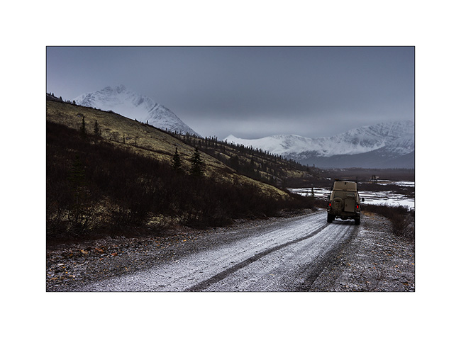
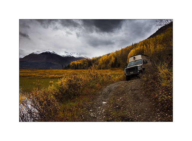
3. The mining road VivaLaVida borrowed in the rain to climb to other glaciers. Funny, we were in Alaska again for a few tens of miles without any customs as it is a dead end! 😀
4. Oups, the road ends here for VLV! I continue riding the mountain bike…
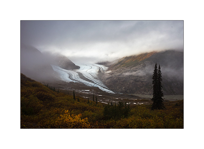
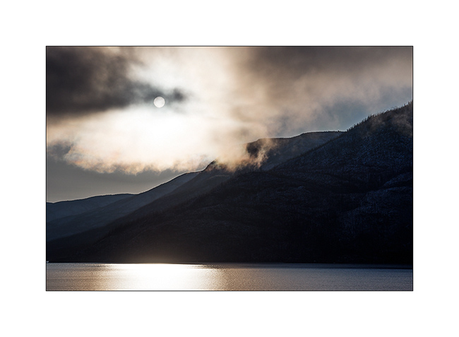
5. I’m lucky, a brief lull allows me to see the Bereton Glacier in the fog, it’s around 16:30.
6. A little later, I even have some sunlight that makes wet rock shining.
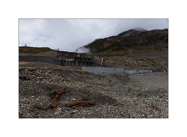
7. The road ends at this abandoned mine…
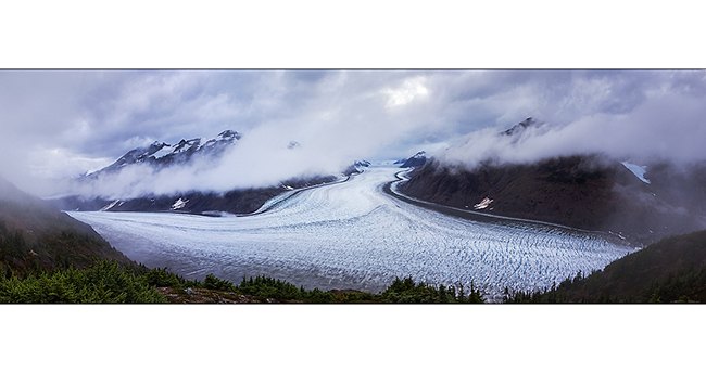
Back to VLV, I turned back to hope to see the Salmon Glacier, a huge glacier in T before night falls.
8. VLV seems very small in front of the giant!

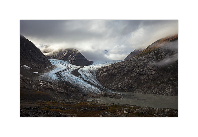
9. Panoramic to attempt to show you the northern branch. The thrust is so strong that ice is pushed several hundred yards over the mountain (bottom right).
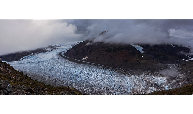
10. A second panoramic to show the immensity of the ice flow; more than 40 miles long and about 6 miles wide for its main part!
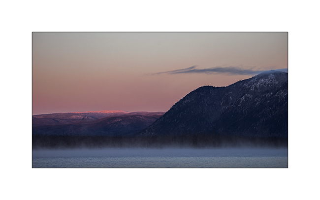
I slept on site, hoping for a better light in the morning but I woke up in a dense fog. I then went back down to Stewart…
11. … here in the middle distance, behind the harbor.
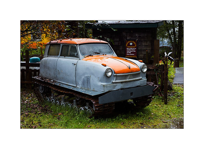
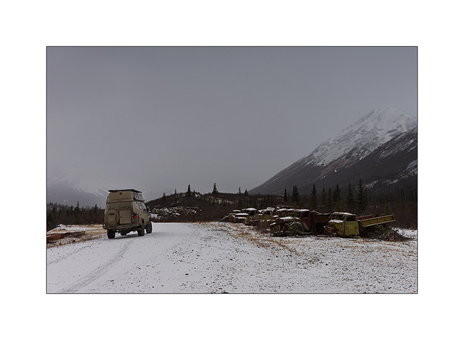
12. Seb, if there’s too much snow this winter in Arzier, I found what you need !! With that, you won’t never remain blocked! 😉 This is a Russian car which I have not been able to understand the brand.
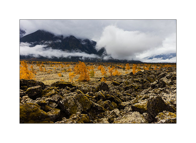
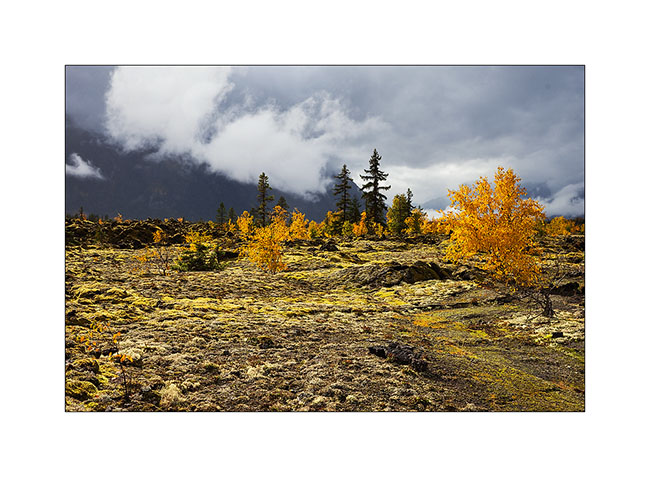
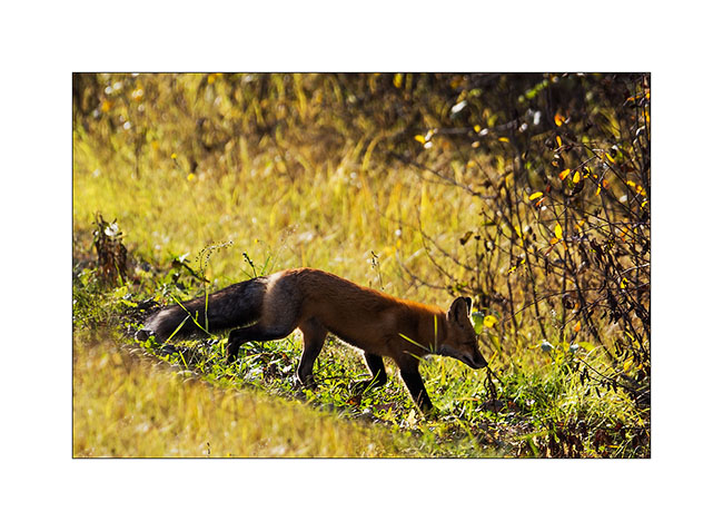
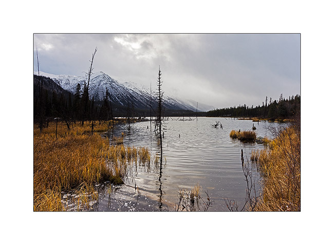
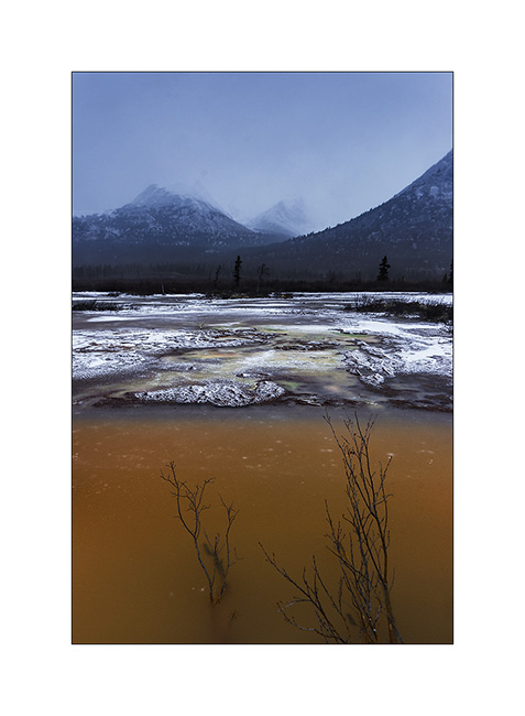
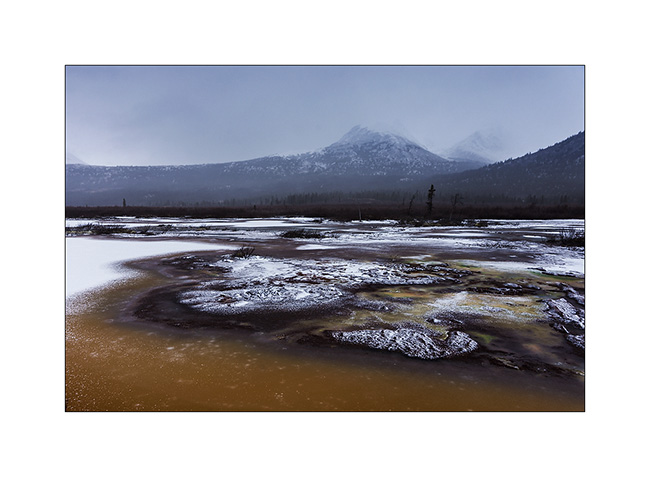
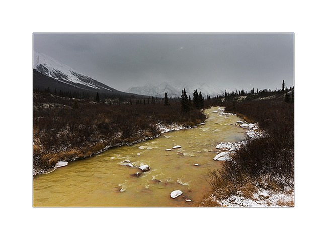
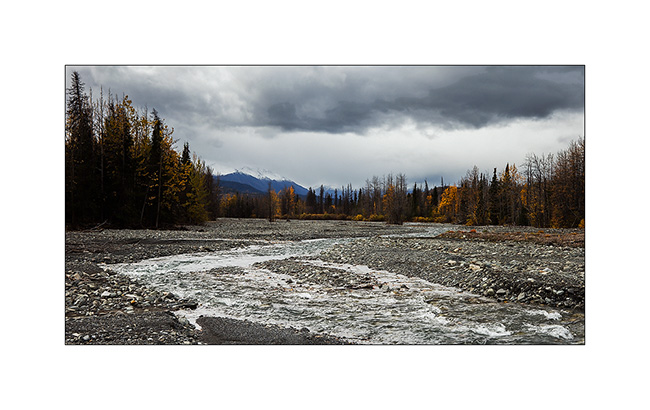
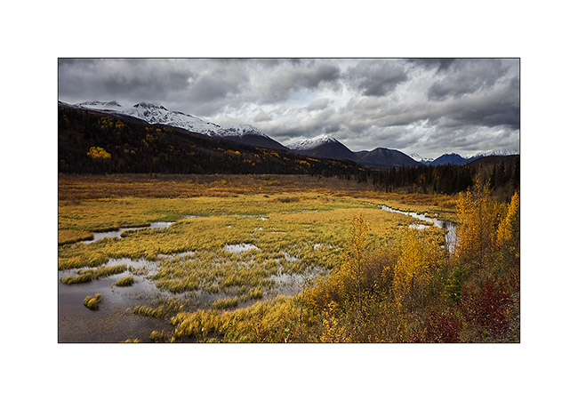
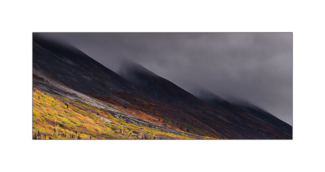
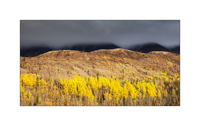
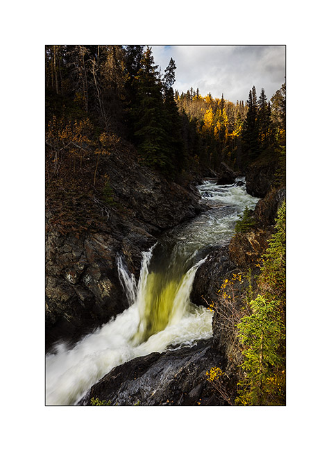
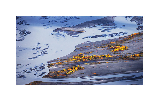
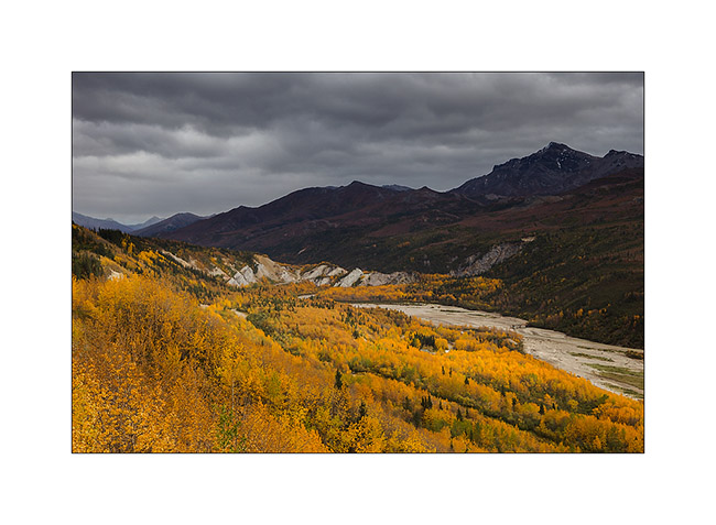
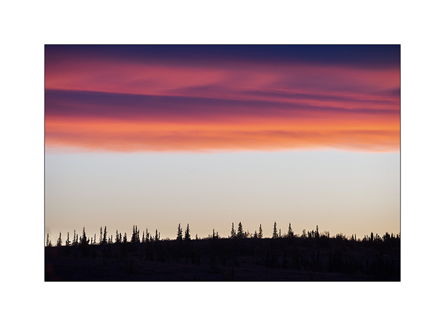
Still in the rain, I continued South with a new detour to the Nisga’a lava fields, theater of the last volcanic eruption in Canada, about 300 years ago. 2,000 Indians were killed, several villages have been swallowed up. The melt is more than 20 miles long and deflected a big river from several miles.
13. The only bright spot of the day on VivaLaVida’s way and still in the rain.
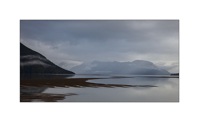
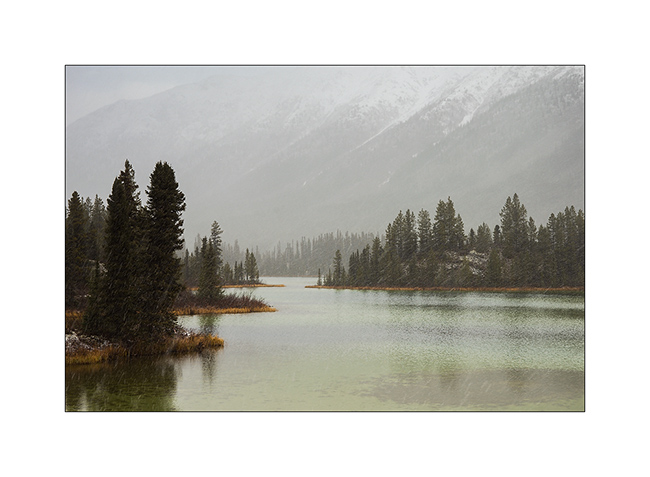
14. Rainy inlet the next day…
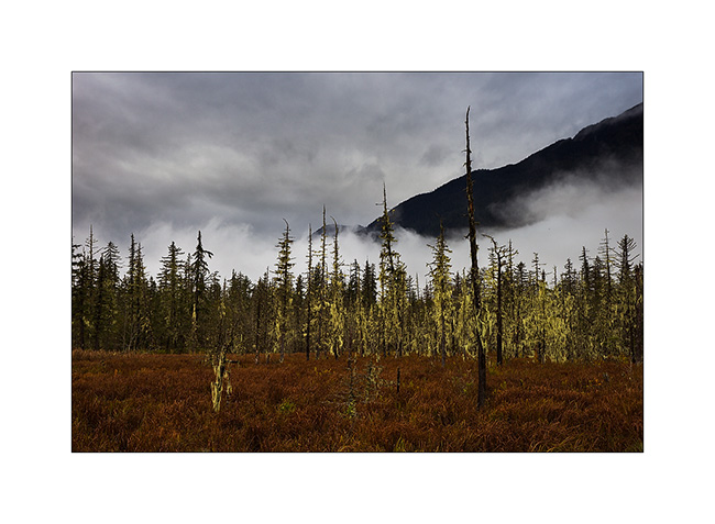
15. Marsesh where lichen took possession of the dead trees. Nice atmosphere, isn’t it? We could see one or two trolls showing up? 😉
16. Arrival at the lava beds, sometimes smooth as in the background, sometimes chaotic. They reach more than 45 feet thick in places.
17. Crack…
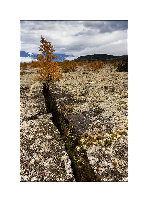
18. Few trees were able to grow in this young and barren rock.
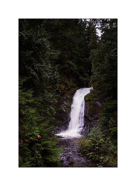
19. A small cascade which drains a lake, also created by the lava flow.
20. Small rainbow as VLV continues heading South.
Continuation of the descent of British Columbia in the next update.
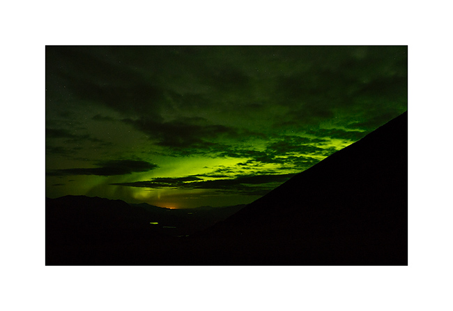
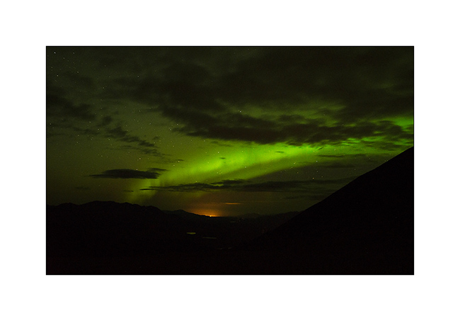
Cassiar Highway
VivaLaVida has left the Yukon and began his journey across British Columbia toward South.
1. First night in BC on the lovely little Boya Lake.
2. A few minutes ago, I was in this beautiful snow shower!
3. Best of all, as a goodbye from the Yukon on which she extends, this beautiful northern light was offered to my eyes as the full moon lit up the shores of the lake.
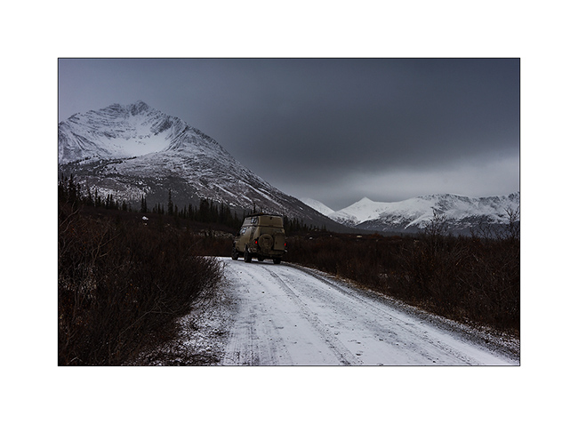
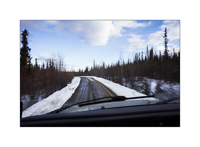
4. The Cassiar Highway isn’t in really good state and snowshowers continue the next day…
5. Graphism of the snow on this lake.
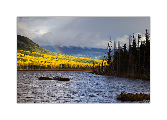
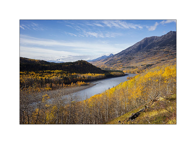
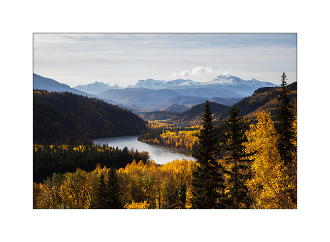
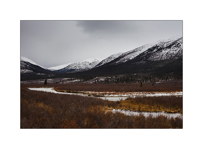
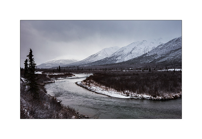
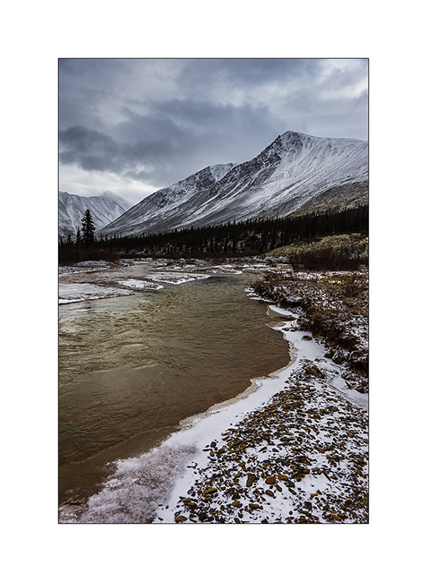
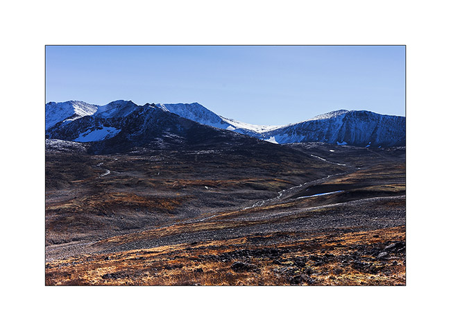
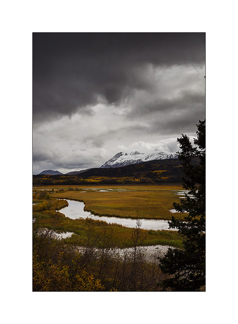
First detour to discover the valley that leads to Telegraph Creek, a samll village. This valley is the lower valley of the Stikine River, a mighty river that carves its canyon through layers of basalt before emptying into the Pacific Ocean.
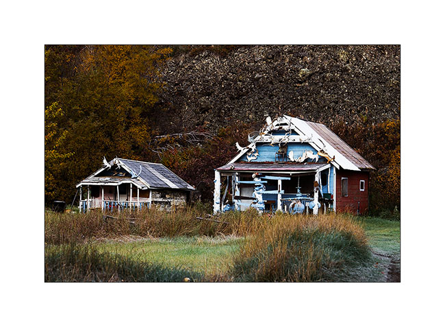
6. Confluence of Tahltan and Stikine rivers, with the summer camp of Tahltan Indians. They spend three months there to catch salmons migrating upstream these rivers.
7. Tahltan cabins.
8. Almost at the end of the road, after Telegraph Creek, there is a nice small lake…
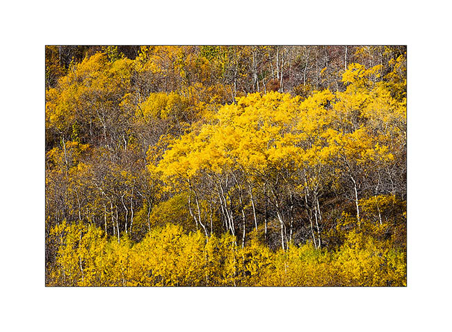
9. … dressed in the colors of autumn that I found back in these warmer latitudes.
10. The Stikine River, powerfull and gorgious…
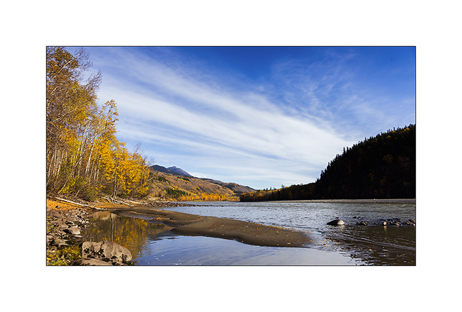
11. … which flows to the Pacific, just behind the distant mountains.
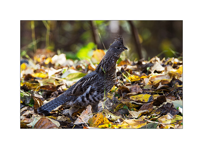
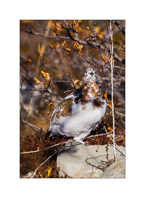
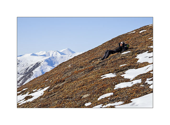
12. It’s the high season for parades of ruffed grouse!
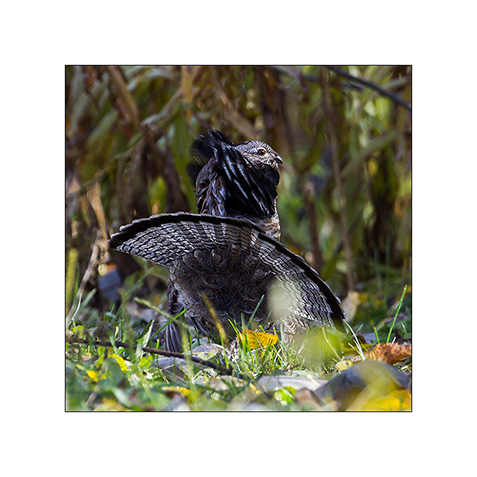
13. This guy don’t care my presence and runs to the female across the road.
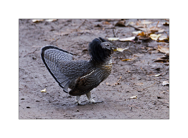
14.Here is one of the coveted female.
15. The road ends here. I hoped to continue on foot but the bad weather forecast for the coming week have made me give up to spend the night here and hike the next day.
16. He was sitting in the middle of the road and went away quietly…
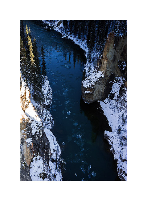
17. VivaLaVida in the Stikine River canyon.
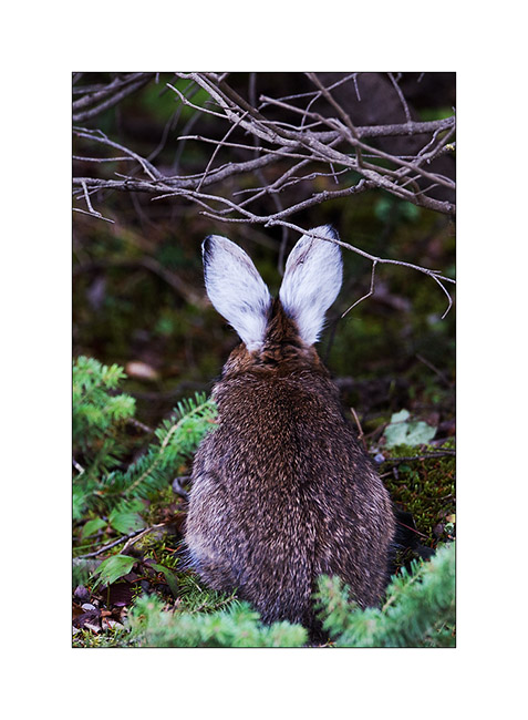
18. And to complete this update, a “snowshoe” hare whose lower legs and ears remain white all summer. This is the main food of the lynx and red fox and as its population has an unchanging cycle of ten years where it almost disappears, predators must rely on squirrels and other small rodents, seeing their population also drastically reducing. It seems that the cycle of snowshoe is from a genetic cause, in part at least…
So much for today! The next miles of VLV to South to come in a few days… 😉
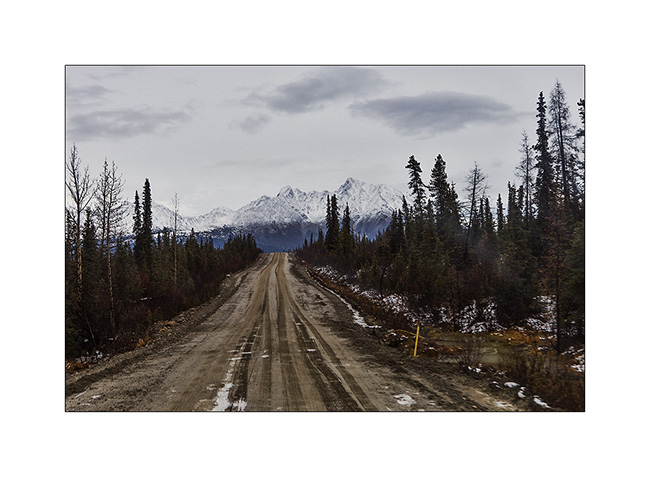
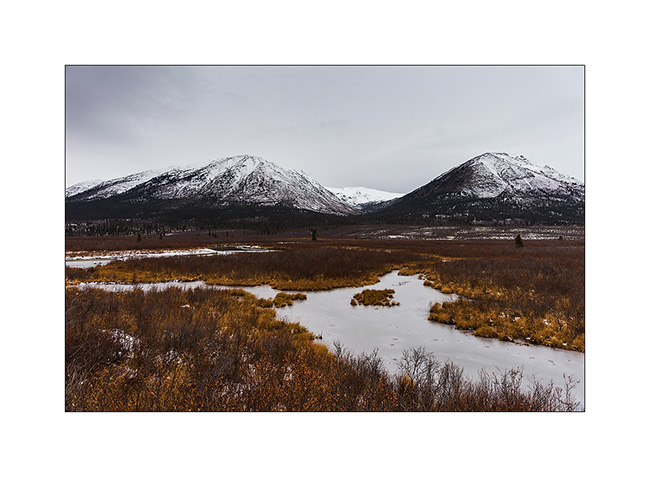
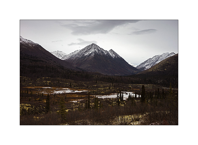
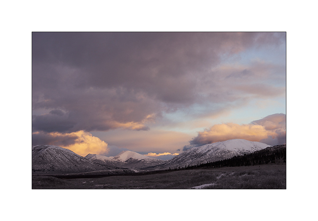
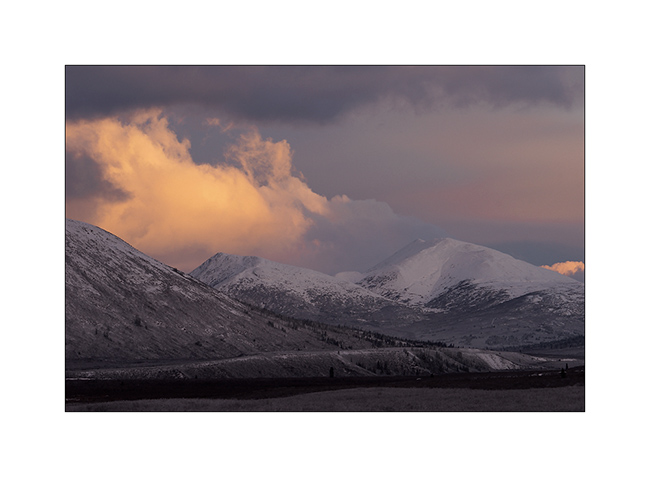
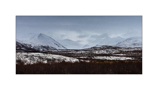
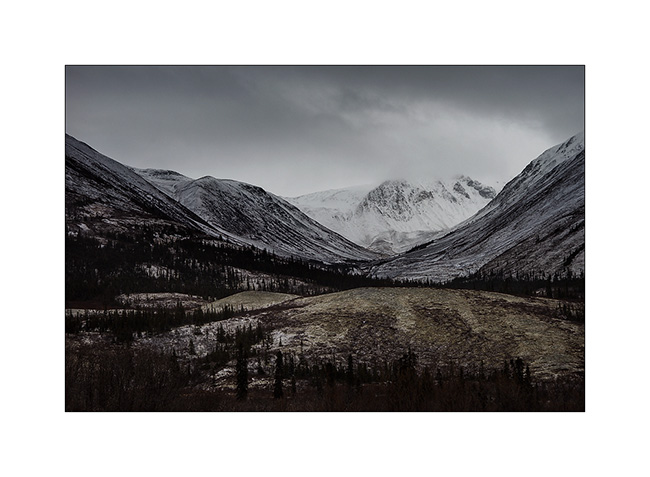
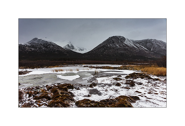
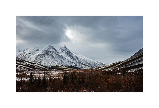
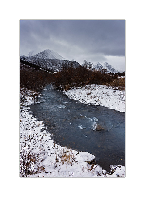
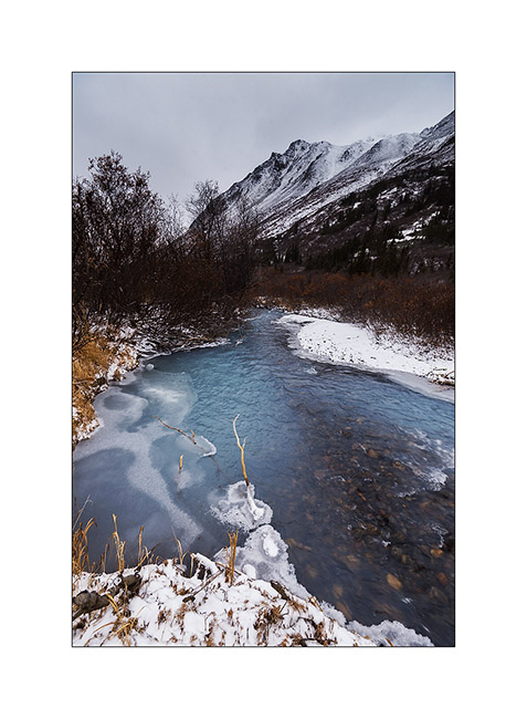
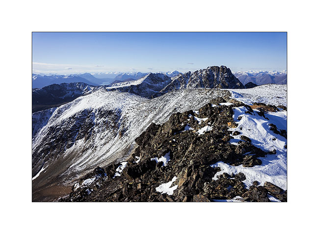
Nahanni Range (still in Yukon)
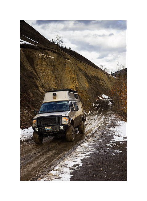
Discover of the second mining road built to access the Canjum Mine, another tungsten mine still active. The Nahanni Range Road, the road that crosses the mountain range of the same name, is much better maintained than the North Canol Road since trucks are borrowing it regularly to supply the miners and take down the tungesten. Yet, at taht time, the activities have stoped for the winter and hunting season is over, so the place was also completely deserted when I was there.
1. Nice river…

2. A beautiful small green lake that contrasts with the whiteness of the surrounding peaks.
3. VivaLaVida approaches the mountains of the Nahanni Range.
4. I found similar atmospheres to those of the North Canol, about 200 miles to the North.
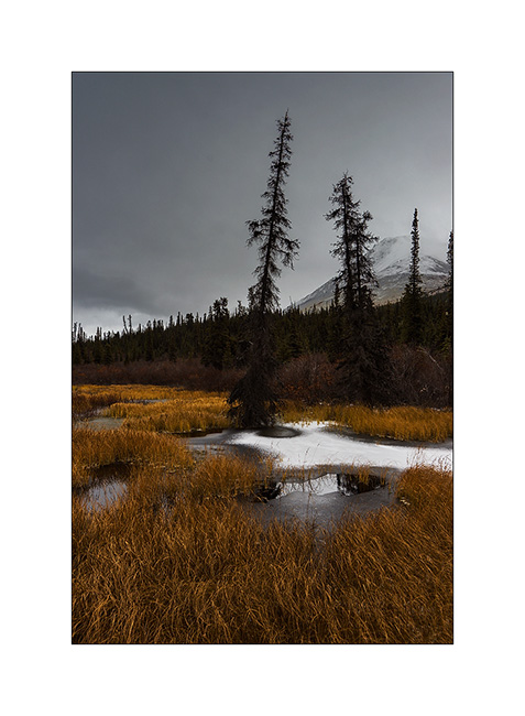
5. The warm tones of the last willow leaves and marsh grasses will soon be covered by winter…
6. VivaLaVida approaches the pass where is the border with the Northwest Territories again, to almost 5,000 feet above sea level on a trail made very muddy and slippery by snow flurries which succeed.
7. On the other side of the pass, mountains look sharper…
8. … and lakes are already almost completely frozen. We feel that it’s colder here…
9. Small lake just under the summit.
10. The weather starts to snow again while I go hiking to the bottom of the valley.

11. Lichens are everywhere, beautiful and really thick in places.
12. In five minutes, I’ll be in the snow flakes. Seeing nothing anymore, I will have to give up and walk back to VLV, about 4 miles away…
I have also not been able to leave that night, the snowfall turning into real storm by a strong blizzard, depriving me of any visibility. So I slept there, snug in VivaLaVida and without the fear of getting stuck as on the Canol Road.
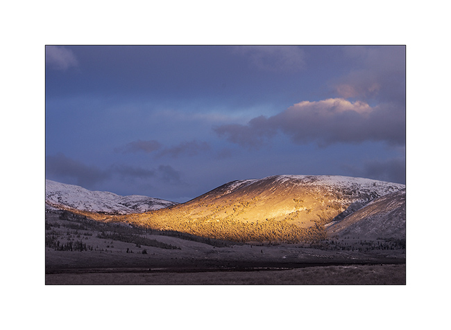
13. Got up early the next day to discover fantastic colors at dawn, in a true winter atmosphere…
14. The valley where I was hiking when I had to give up yesterday…
15. Sunray on the opposite side.
16. Probably more than two foot of fresh powder blanked the peaks…
17. … while it blew so much on VLV that there is only about 4 inches around.

18. Going down towards civilization…
19. … a road in winter conditions.
20. Sometimes some rays sneakly break through the clouds…
21. … before a new snow shower. Here, the small lake of yesterday has changed its face…
That concludes my stay in the Yukon Territory that I loved as much as Alaska. Much less touristy but with the same variety of landscapes and wildlife, they have another thing in common: the lack of access roads to a large part of their lands, making them difficult to reach. One thing is certain: if I have the opportunity, I will come back… 😉
VivaLaVida then proceeded South via the Cassiar Highway rather than the Alaska Highway which we drove up North. Obviously with some detours that I will count you soon.
Thank you for your loyalty over and over again … And feel free to share the address of this blog or my FB page “Vivalavida Photography” with friends or acquaintances, they are welcome. 🙂
North Canol Road (2)
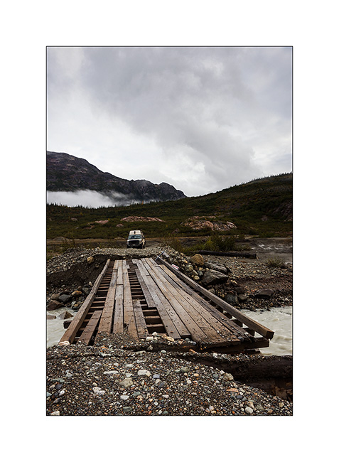
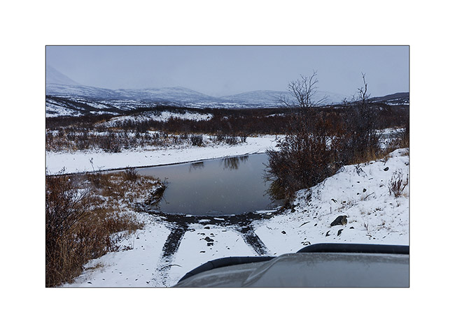
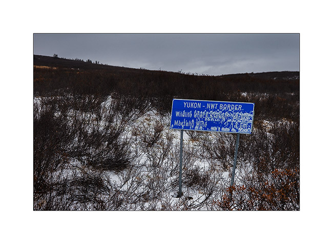
Once past the border of the two provinces, the road divides into two “dead ends”: one leads to Maclung Mine, 9 miles away, the other continues to the northeast to a wildlife management station, some 10 miles along the Canol Heritage Trail (the old trail I mentioned in the previous update). Bridges were washed away and there are thus two water crossing to coolVivaLaVida’s wheels.
1. Arrival to the station already closed for the winter… I think VivaLaVida has never been so far away from any possible support, it’s really the middle of nowhere here!

2. A furtive sunbeam while I eat at the end of the trail.

3. I photographed the water crossing only on the way back. Here is the second partially frozen.
4. The atmosphere of this altitude tundra under a snowy sky is beautiful.
5. And the second water crossing, deeper and longer than it appears here…
I have tryed to reach the Maclung Mine but a wicked side cant covered with snow over one mile mountainside detered me. In addition, on the east side of the mountains, it was snowing hard. So I turn around down to the Macmillen Pass. Not without having seen the first wolf on this trip. To far to take some picture but I was able to observe him with binoculars for about five minutes. What a beautiful animal perfectly adapted to these remote and harsh areas!
I also observed an Arctic fox hunting and catching a ptarmigan, great hunting scene. But I messed up the pictures, there was so few light that handhelds, everything is blurry… 🙁
6. Going down back to the Macmillen Pass, lichens are of a very soft yellow green that contrasts the snow peaks.
7. Another frozen marsh.
8. Looking for a night camp…
9. There must be sources of ocher, some marshes, even frozen, have that characteristic color.
10. Some mosses form a kind of astonishing mosaic.
11. early winter ambiance…
For the record, I found a boondocking site shortly after this picture and the weather forecast (although dated four days) indicating an improvement for the next day, I went to bed around 9 PM as it began to snow. Unable to enable me to get blocked by snow, which would mean abandoning VLV here until early next summer, I set my alarm at midnight to take a look outside. And here I didn’t really hesitate: it had fallen almpost two feet snow in three hours, with the temperature rising to around 33°F! So I restarted and drove nearly four hours at night to get out of the mountains, pretty epic journey in this snowstorm where I sensed more than saw the track completely white…
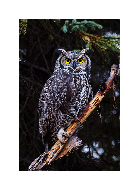
The next day, the snow stopped and then I go out of VLV to eat my snack lunch, I hear the cry of an owl that doesn’t seem far away. So I took the camera and tryed to locate it. Actually not far away, it will prove to be still over 1,500 feet away in the boreal forest and progress was not easy. Besides its calls were not very frequent and I was trying to move slowly so as not to frighten it. In short, it was almost an hour left as I finally saw it. Obviously he saw me but didin’t seem really scared, leting me get close to about 6-7 yards. It was a beautiful Great Horned Owl, the second largest nocturnal bird of prey after the great gray owl.
12. Here I introduce him… 😉
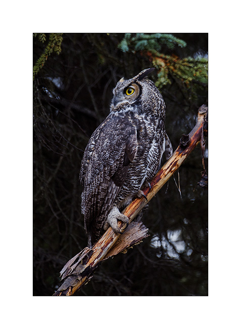
13. Here he is looking somewhere else.
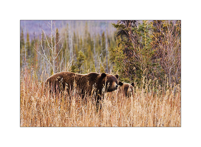
14. Returning to VLV, new encounter: two grizzly bears, probably a mother and calf. Little adrenaline rush as starting “chase” the owl, I left my bear spray” in VLV, which didn’t happen to me often … I was Lucky to be at about ninety feet away and the mother quickly smelt me, launching a sort of growl before running away.
15. VLV is muddy as never after that road, here a quite deep mudd path…
16. Another encounter with grizzlies further on the road.
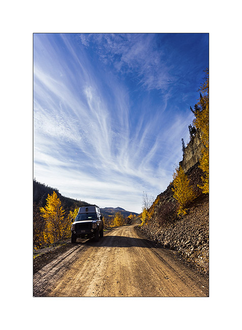
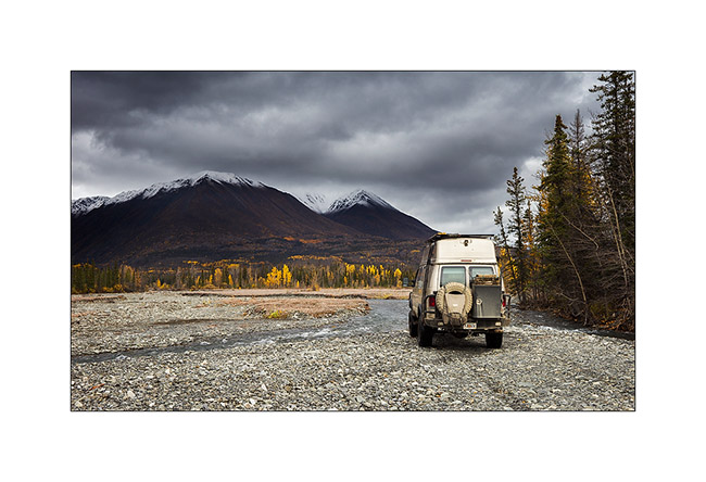
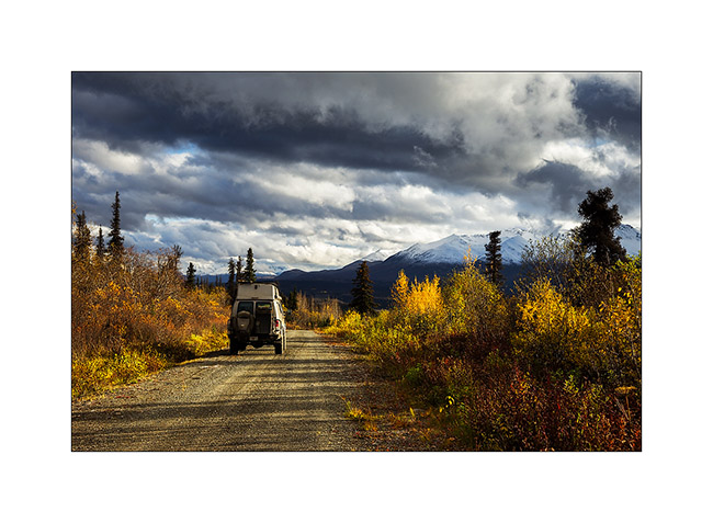
17. After crossing the river back on the ferry, VLV drove the Campbell Highway to the South to get to the second mining road… Blowing snow form welts on the hills.
18. Mud and ice as menu of VivaLaVida !
19. When I said that he was “in mud”..! 😀

20. Snowfall at sunset while I found a nice place to sleep on the edge of Frenchman Lake.
Discover the Nahanni Range coming soon!
Robert Campbell HWY & North Canol Road
Finally, I stayed five days in Whitehorse. First to support a little bit Sarah installing an additional luggage rack on the front wheel of her bike Hercules which will carry the additional stuff that may be imposed by the Canadian winter, partly to prepare the latest update your recently read and to fill up a the empty cabinets of VivaLaVida.
It’s the day after one of the first snowfall that VivaLaVida took the road again to go discovering mountains of Est Yukon. But I decided to go there making a small detour in Carmacks to visit Sharon and Garry, the guys I mett four months earlier. So I arrived in the “Barracks”, the coffe shop and post office of Carmacks and seeing the smile on the face of Sharon when she saw me, I guess it was a good surprise for all of us. It was a real plaesure to see them again and to chat for three hours. When I was goinf to leave, Sharon gave me a large cup of zucchini & galric soup, two pièces of zucchini bread, two oat cookies (the best I ever eat !!) and even a banana muffin. I enjoyed that all the next days. So many thanks Sharon ! 😉
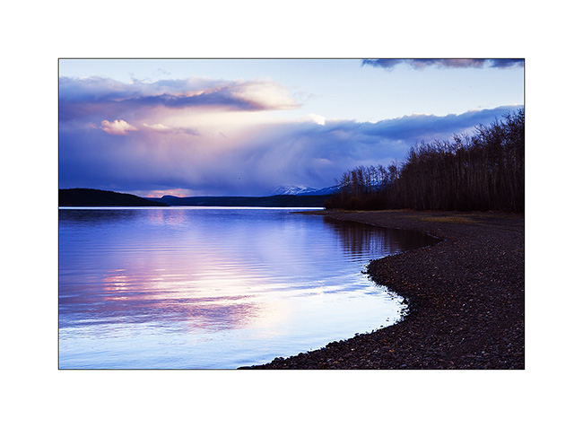
1. End of the day over Little Salmon Lake, along the Campbell Highway.
2. Colorfull sunset despite the clouds…
3. The next morining was quite cold !
4. … but the sky gradually opened…
5. … The sun still playing with clouds.
6. Winter is coming, rivers start to freeze.
Only two roads lead into the East mountains, both built to operate tungsten mines. These Mountains contain in fact nearly 15% of known world reserves of this rare and expensive metal. The first one, the North Canol Road, was built in the 40s and joins the border of the Northwest Territories. Originally, she was leading till Norman Wells. More than 30,000 people worked in construction but maintenance was abandoned just two years after its completion … From the border of the two provinces remains actually the Canol Heritage Trail which is no longer drivable, even with a 4×4 vehicle. Some brave hike through it every year in complete autonomy: 222 miles or 346 km anyway..!
Since Ross River where the North Canol Road starts to the border, there are 185 miles of a muddy and virtually unmaintained trail, which crosses the Mackenzie Mountains, a major mountain range. The mine has been shut down for more than fifteen years. Suffice to say that in early winter, I did not risk to meet many people and had to rely on myself in case of trouble.
First step in Ross River: crossing the river on an old cable ferry. It only works two hours a day from May to early October, so my lunch break has been longer than usual. And there, it immediately puts into it;-) First, despite the sign that says very officially that the crossing is at your own risk, you have to sign a release to get on the ferry; basically, it’s “you cross at your own risk, if you’re sinking, we are not responsible” ..! Once on the ferry that snorts as slowly as a snail and moves in the stream, there is a army lifeboat that accompanies the crossing, 50 feet away downstream, to assist us in case shipwreck !! In short, they seem to have great confidence in this old tub! 😀 And it’s forbidden to take pictures, I do not really know why…
that said, the ferry took VivaLaVida from one edge to the other without trouble, the same on the return way three days later.
7. It snowed about two feet two days before and only two tracks of hunters who came down from the mountains marked the trail.

8. After about 25 miles, no more snow!
9. VivaLaVida is getting close to the mountains as the night falls quickly now.
10. Frozen pond…
11. The road has several bridges over the River Mackenzie and I asked myself if some would carry the weight of VLV…
12. The vehicles used in construction have been left behind.
13. While I arrive in the mountains, I find some snow on the trail and time seems to go bad.
14. Color contrasts are gorgious.
15. Frozen marches…
16. Mackenzie River.
17. The last colors of almost non-existent fall are still in the valley bottom as winter took up residence on the mountains.
18. I discovered a small emerald inflowing of the Mackenzie River…
19. The ice has not fully covered it yet.
20. Arrival at the provincial border at Macmillen Pass at about 4,000 feet above sea level, after 186 miles and more than 15 hours away (in two days)!
To be followed in a few days because the low speed of the only WiFi I found in Stewart tooks me two hours to upload 20 images.. 😉
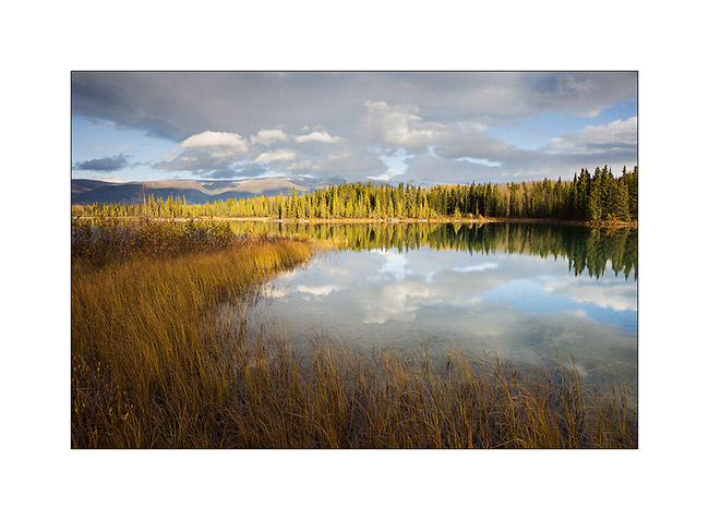
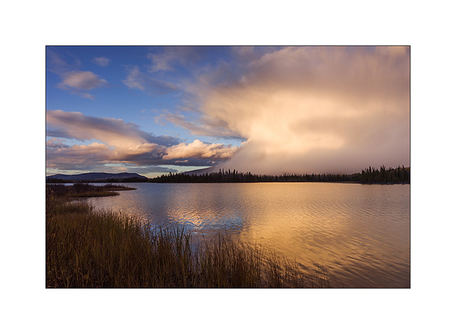
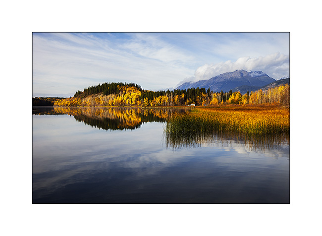
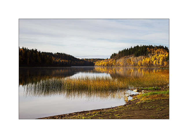
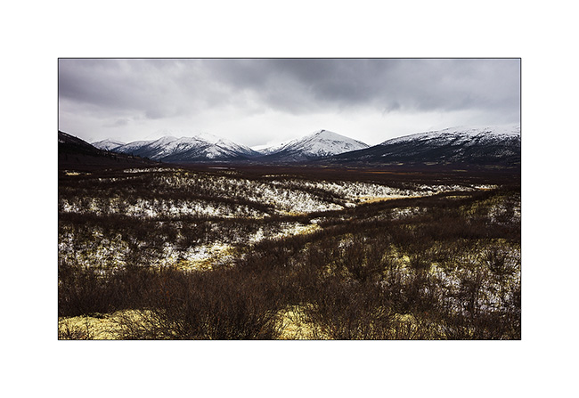
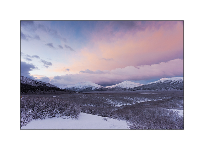
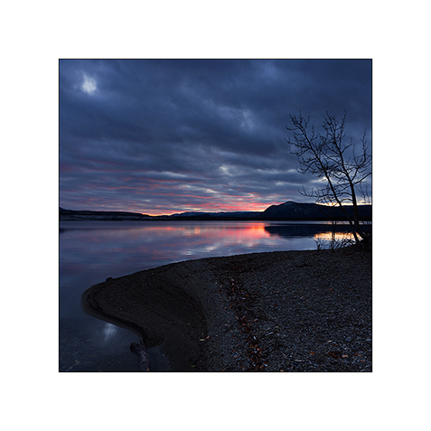
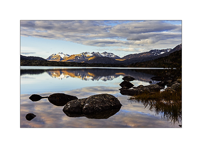
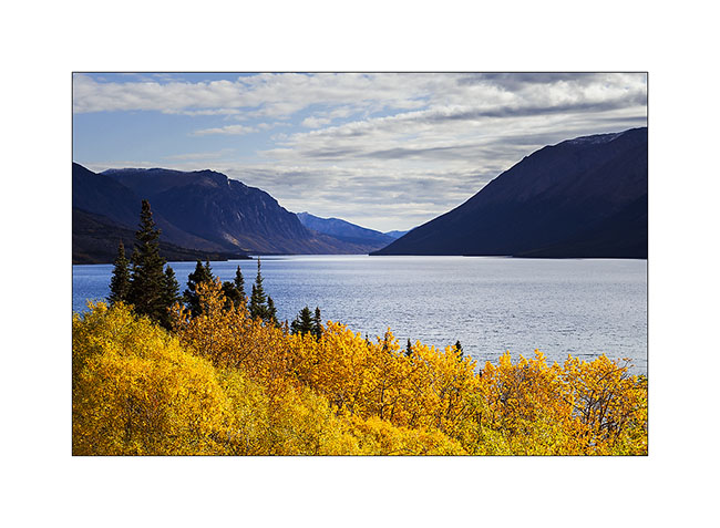
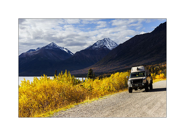
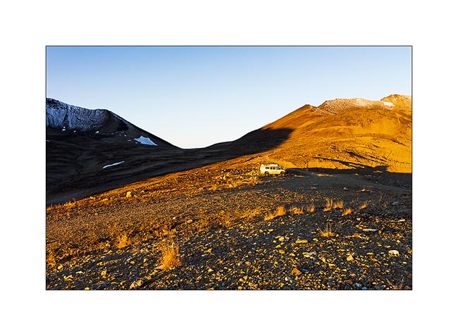
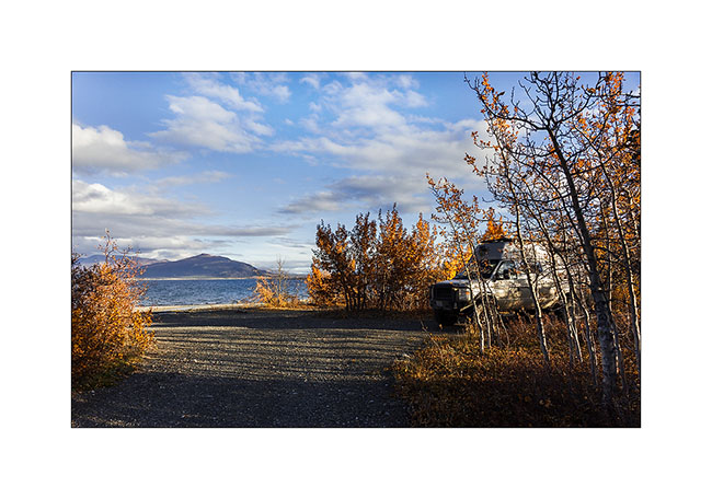
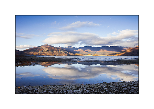
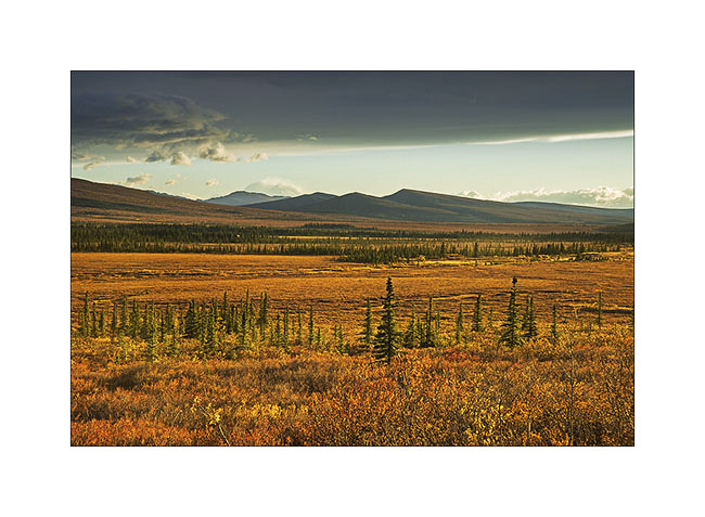
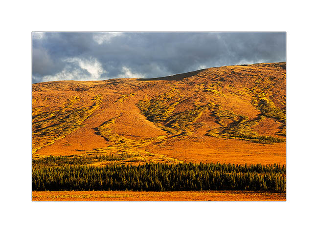
Sud Yukon
1. Up early to enjoy the first sunrays, quite rare however…
2. Some lakes empty into others in tumultuous torrents.
3. As I head to Carcross, fall colors are vibrant again.
4. I make several “photo stop”…
5. … throughout the many lakes of southern Yukon.
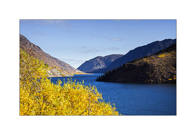
6. They really resemble to fjords.
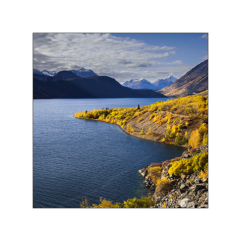
7. And always these incredibly saturated colors!
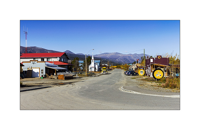
8. Carcross, a very welcoming small village.
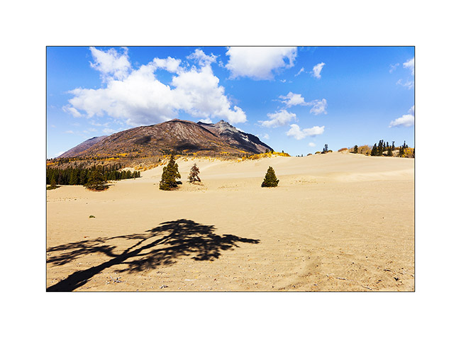
9. Here is the curiosity of the area that people call “the smallest desert in the world!” This is actually a great dune formed by the prevailing winds ammassing sand of Bennett Lake for thousands of years. Rather incongruous amid this mountainous landscape.
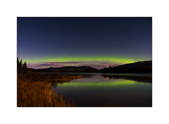
10. I decide to climb the highest surrounding mountain the next day, the Montana Mountain, and VivaLaVida takes me to sleep over 4,500 feet elevation. A nice place to enjoy a northern light over Whitehorse, about 80 miles away.
11. I will go to bed quite late again…
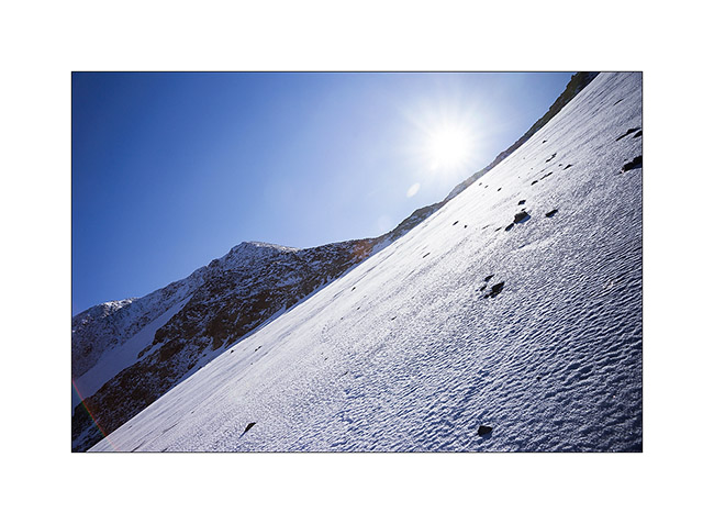
12. Still, I’m up before sunrise, ready to climb the peak that awaits me.
13. After two hours ascending, the conditions turn out almost like in winter. As I have to cross a quite icy snow slope chilled to 40 degrees, I regret that I left my ice ax in VivaLaVida as my only one walking stick don’t give me much assurance … Even hiting my shoes hard in the slope, my sole only grips less than one inch in the snow. I assure each of my steps carefully.
14. but progression continues…
15. … and I soon reach the ridge where I get an incredible panorama.
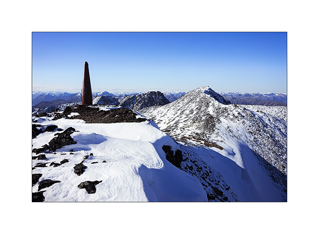
16. After another hour, I finally reach the summit, in the second plane on this image. I continue the ridge til the funny rocket – probably a radio relay – erected on the secondary summit.
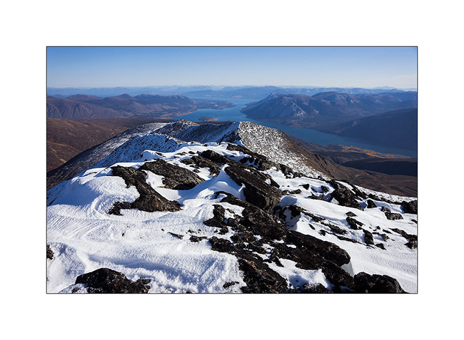
17. The view of the surrounding lakes is just grandiose!
18. Selfie picture despite the bitter cold: 10°F on the thermometer of my watch.

19. Three hours later, geting back to VivaLaVida, a picture of this beautiful mountain that doesn’t seem very impressive from here.
20. Descent by the Mountain Hero Trail partly washed away by rain. Somewhat to remind me bad memories in Baja..!

21. I see many molting willow ptarmigan during this descent.
22. Having discussed with some locals who recommended it to me, I went discovering and sleeping in the Annie Lake Valley, another remote valley…

I then headed to Whitehorse where I spent a weekend of bad weather writing the last updates and does an oïl change to VivaLaVida. Stay tuned for later news of VivaLaVida’s journey… 😉
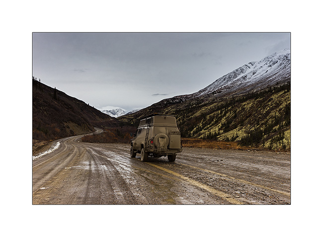
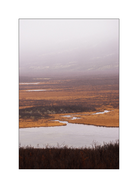
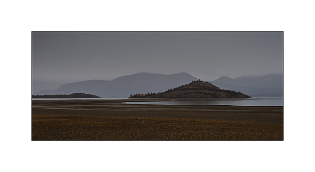
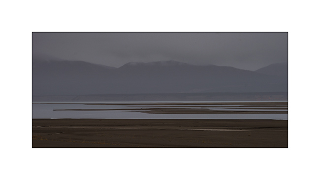
Haines HWY and back to Alaska!
1. Early morning at my camp…
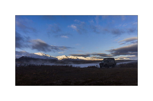
2. Cold and misty atmosphere…
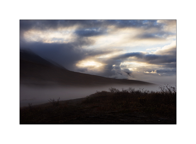
3. … but the fall colors of the tundra remain.
4. Small “mirror lake”….
5. Last pass before to go down to Haines.

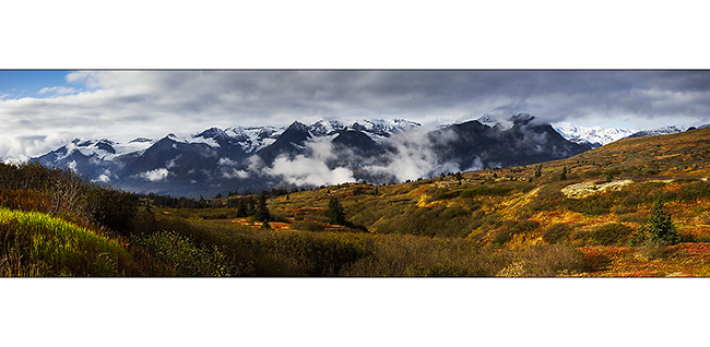
6. Panoramic of mountains and glaciers around.
And surprise down the hill: there is a custom and I end up back in Alaska! My map of this area is definitly imprecise, I’d forgotten that Haines and Skagway are on the thin strip of Alaska along the West border of British Columbia. 😀
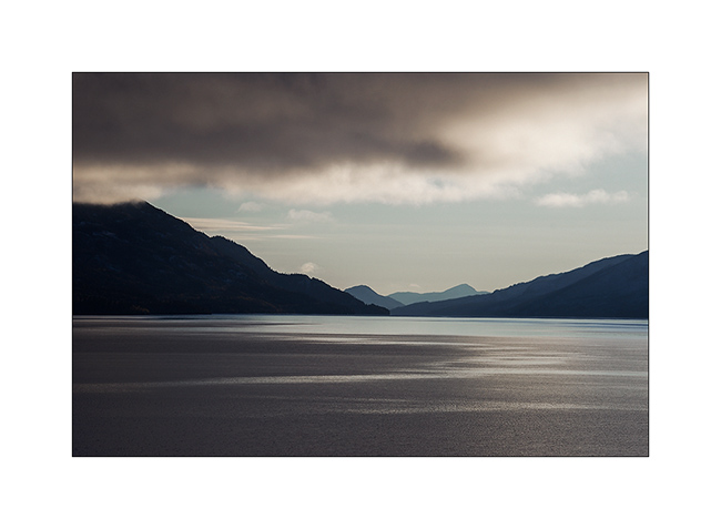
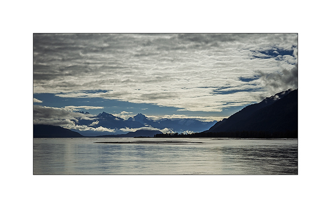
7. I find the Pacific back or at least one of his fjords.
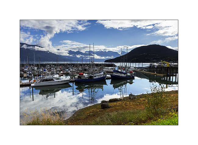
8. Haines, also along a fjord.

9. His small harbor houses as much fishing and pleasure boats.
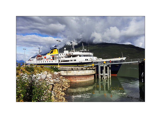
10. Since there is no road between Haines to Skagway, VivaLaVida also took a boat to travel about 18 miles by sea! 😉
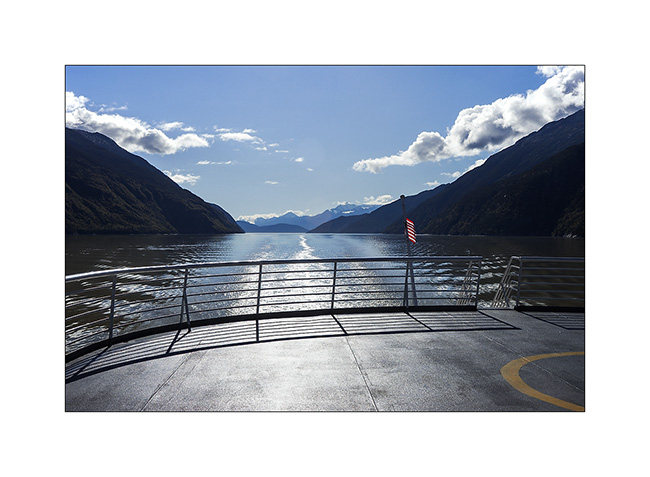
11. Cruise ambiance…
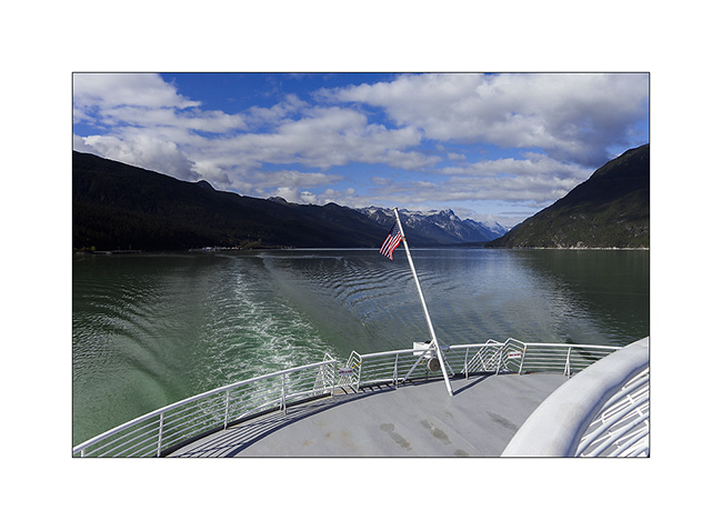
12. … while the ferry navigates to the end of the fjord.
Arriving in Skagway is exotic. It is a very touristy place that keeps memory of the gold rush. It was here that the pioneers landed, then crossed the White Pass by walk before to build boats that took them down to Dawson City by the Yukon River.
13. Main Street with, in succession, a large cruise ship hosting likely thousands of tourists.
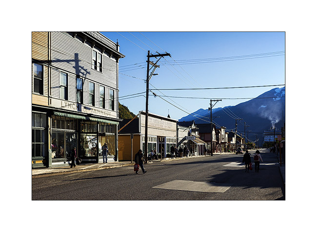
14. Most buildings date from the late 19th century…
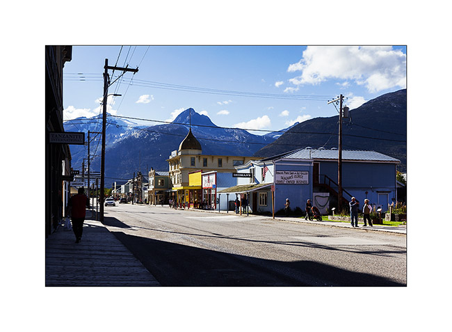
15. … and the atmosphere is a bit of another time.

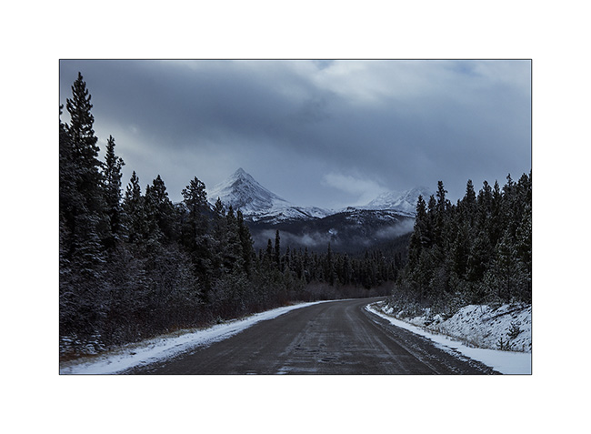
16. I leave Skagway in late afternoon and makes me to the White Pass, about twenty miles North.
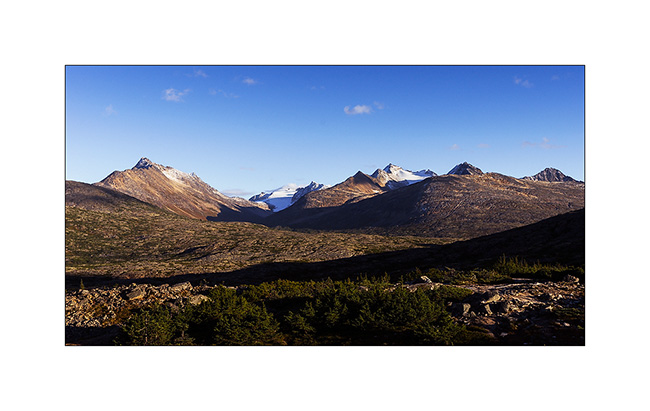
17. These granite mountains eroded by glaciers and dotted with small lakes really makes me think about some landscape of Norway.
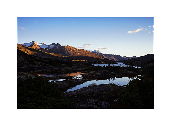
18. I decide to camp between the Alaskan and Canadian borders.
19. Last colors on the mountains…
Second return to Canada in less than a week to come in the next update! 😀
Back in Canada!
So is VivaLaVida back in Canada.
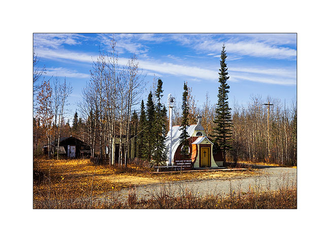
1. Short stop at Beaver Creek, the most western inhabited place in Canada. The church is funny.
2. I decide to head to Haines along Kluane National Park and the lake of the same name.
3. I find a nice boondocking spot for the night…
4. … and enjoy the late afternoon light.
This camp will reserve me a really nice surprise. As I finished preparing my campfire and was in VLV to cut vegetables, I see a cyclist coming. I go out to greet her and she introduced herself. She is a young Englishwoman who performs a solo around the world journey moving only by its own power, human power! She began in London three and a half years ago, first biking through Europe, the former USSR and China, then crossing from China to Japan and from Japan to Aleutian Islands on a rowboat (she has wrecedk in his first attempt, the loss of his ship forcing her to return to England to raise funds and rebuild a new boat) and then padling through all the Aleutian Islands to Homer (Alaska) by kayak where she ride his bike again to go to New York next spring. She will then find his rowing boat again tor cross North Atlantic to London where she will finish her world tour! Really amazing how much energy this young woman has to do this crazy challenge!! Have a look on his website: http://www.sarahouten.com, it’s worth it.
We will share really good time at VivaLaVida’s campfire and having breakfast together. Hector and Miche, a contact given to Sarah in Anchorage, arrived the next morning to resupply Sarahand we sympathized. I will be invited to eat in their house in Whitehorse a few days later while Sarah will have a little break to equip his bike for the coming winter…
The next morning, temperature was only a rainy 38°F and I admit having had much heart ache to see her having to cycle in this wet and cold weather…
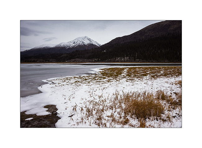
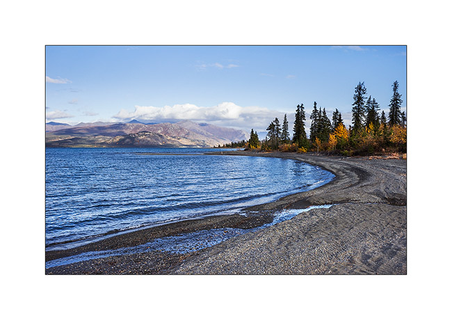
5. Kluane Lake has changed its face in this autumn weather.
6. Gray atmosphere in rain and snow at higher elevations.
7. This time not pleasant for hiking, after a pause in Haines Junction, I decided to go to Mush Lake by a 4×4 route.
8. Left only at about 5 PM, this trail will prove more difficult than I imagined and I reached Mush Lake only at about 9 PM, at night, after some impressive passages of this trail made really slippery by continuous rain. Here, a long water crossing where I wondered which way to take.
9. While the rain stopped during the night, I discovered the lake in the early morning.
10. What a nice camping spot! I’m obviously completely alone there.
11. Back on the same trail…
12. … surrounded by marshes, again and again.
13. Another nice river…
14. … that VivaLaVida crosses without problem.
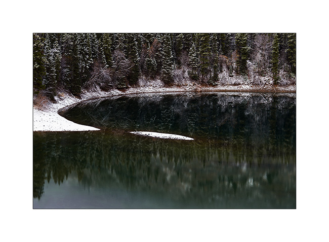
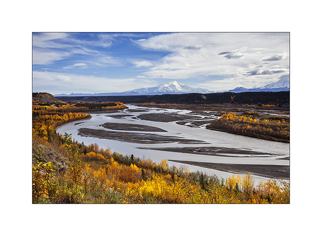
15. Back on pavement, I made a detour to Katlyn Lake while the weather cleared.
16. VLV continues heading South on Haines Highway…
17. … crossing some passes with great ambiances.
18. What colors!
19. It’s still cold up there, no more than 36°F in afternoon, and the clouds hang to the mountain tops.
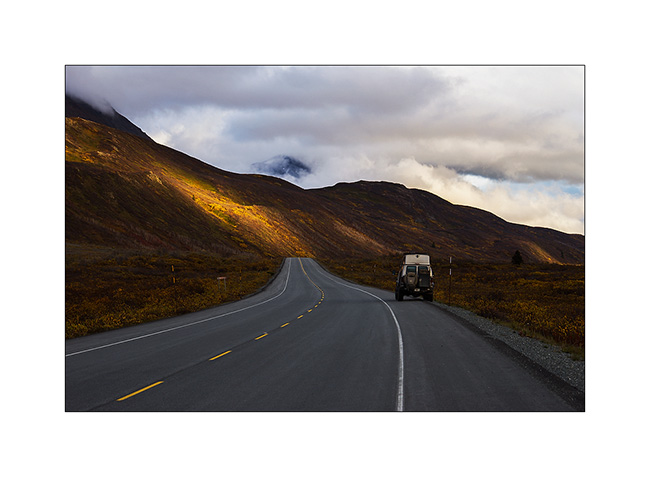
20. VivaLaVida on the Haines HWY.
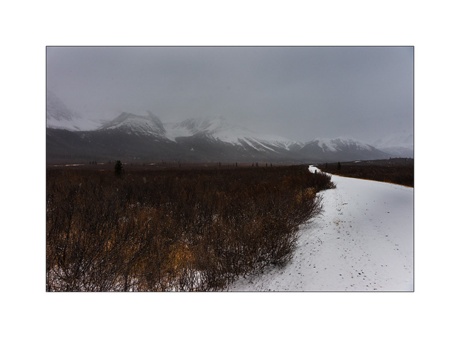
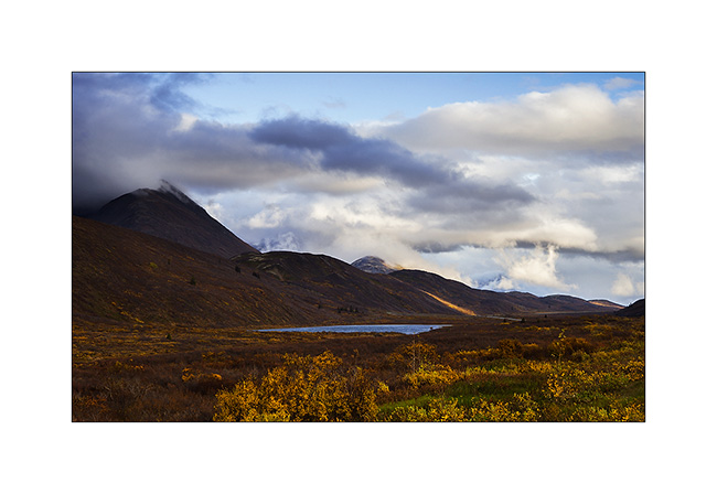
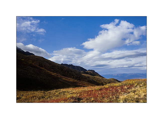
21. Altitude tundra.
22. I make some detours…
23. … here to discover Million Dollars Falls.
24. And go further towards South.
25. …
26. Late afternoon at about 3,300 feet elevation.
Next to come soon… 😀
Last days in Alaska…
As I was writing the last update, I left you in Anchorage without still knowing where VivaLaVida would then head as I wrote the last article.
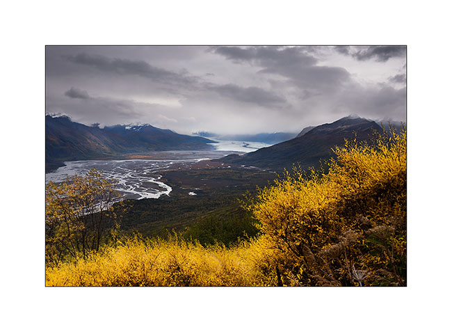
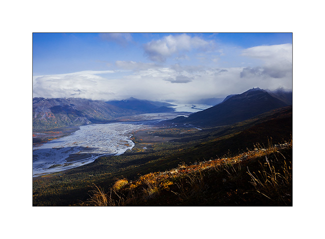
After some cleaning and laundry tasks, a small weather window seemed to open up to Eastern Alaska where I had spotted a few places to discover. So I took the road again but first stopped not far away from Anchorage, in the Knik Valley, hoping to reach the glacier of the same name. The end of the road has been privatized by a Lodge, so I couldn’t access the trail to the glacier. I thus opted to climb one of the mountains along the west side of the valley to get a view on the glacier…
1. It’s gray and cold when I leave VLV. I finally get some view on the long Knik Glacier ice tongue after two hours of steep ascent. Above, I’ll even get two snow showers and the stormy wind will ping my face. Hello winter! 😀
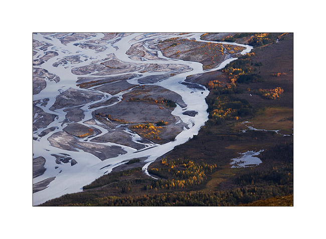
2. I continue the climb and from this plunging point of view, the Knik River reveals beautiful designs.
3. While I go back down in late afternoon, a few light holes below reveals fall colors.
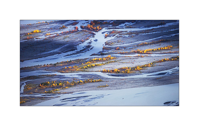
4. The light becomes more generous…
5. Natural graphics…
6. The other side of the valley is only swamps…

7. Looking North, towards the Hatcher Pass.
I followed the journey driving the Glenn Highway again to reach the Nabesna Valley on an old mining road which provides access to this remote place.
8. Fall colors are now everywhere.
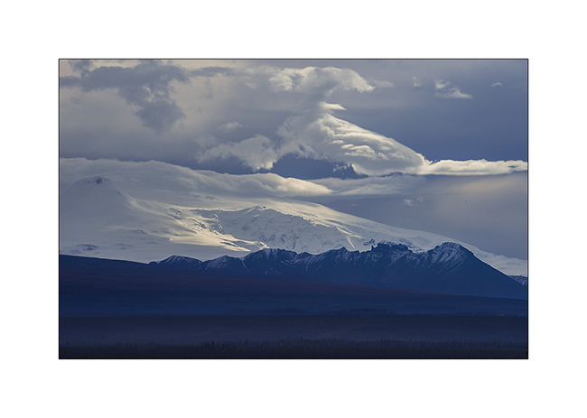
9. I’m on the edge of bad weather that creates a charged atmosphere over volcanoes of the area.
10. The snow is still present in altitude.
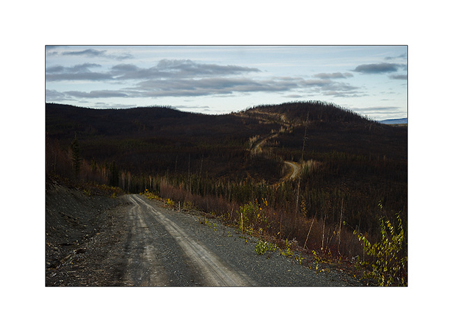
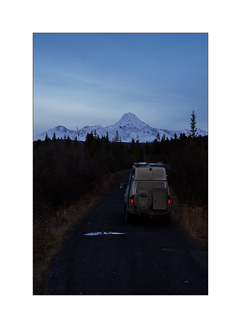
11. VLV sneaks up on the long and remote Nabesna Road…
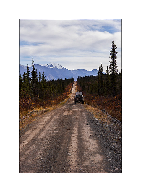
12. Since the road was washed away by some past flood, I will walk the last 6 miles to reach the site of the mine.
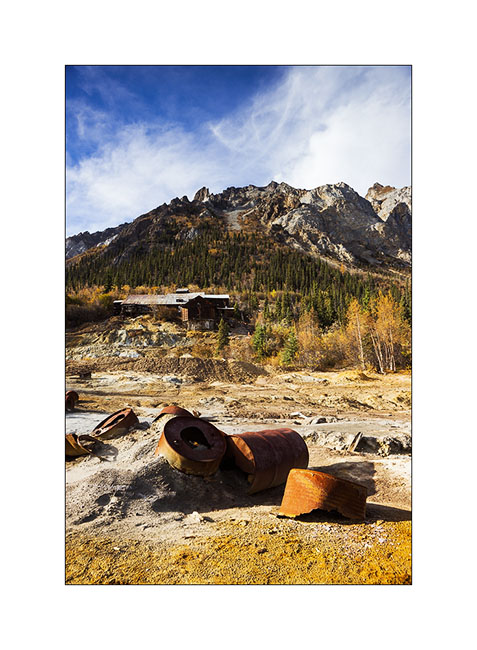
13. On a side trail, I discovered an authentic log cabin from early last century.

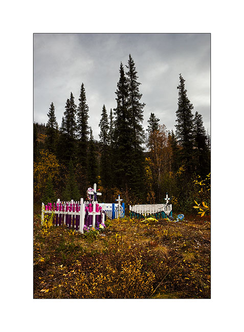
14. A well-colored indigenous cemetery along the road to Mentasta.
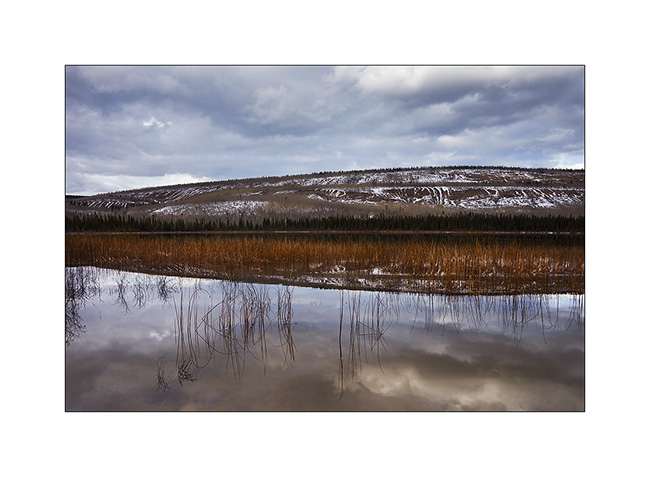
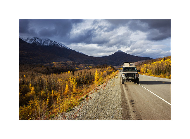
15. Vivalavida then follows the Alaska Highway heading to Canada. Quantities of small lakes and marshes bordering the main road.
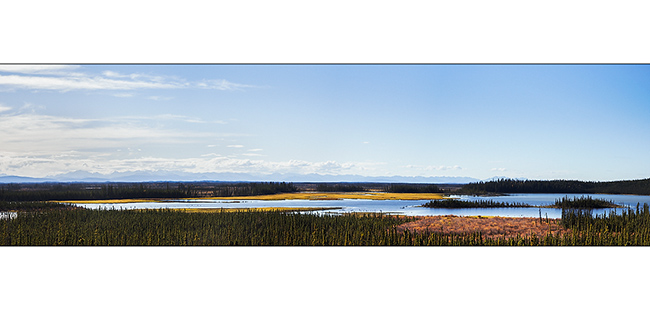
16. I stoped at Deadman Lake and had a nice kayak trip on a completely smooth lake…

17. A female duck…

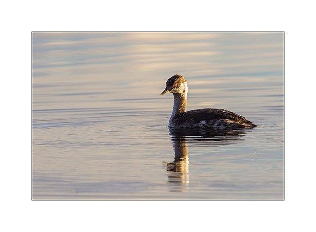
18. … and a little grebe in late afternoon light.
19. The light was awesome when I got the kayak out of the water…
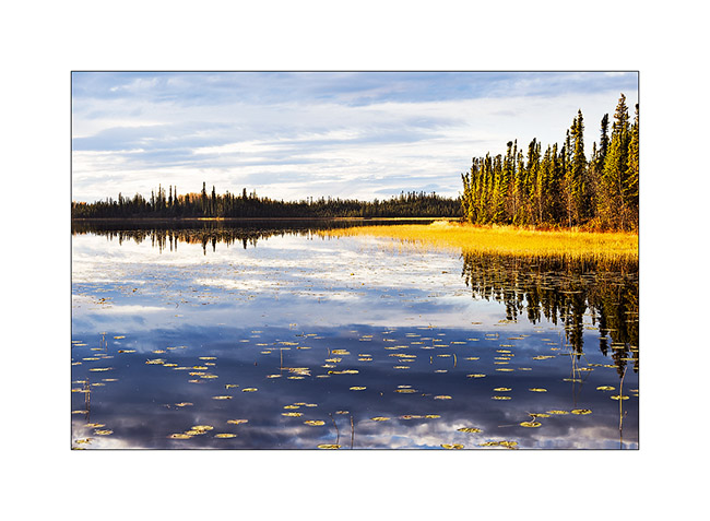
20. … the sun sometimes playing with clouds.
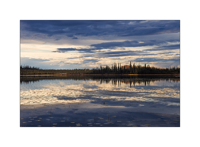
21. Last sun rays on this idyllic lake.
The next day, VivaLaVida left Alaska after more than three months of enchanting discoveries … More from her journey coming soon. 😉
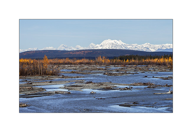
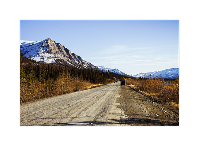
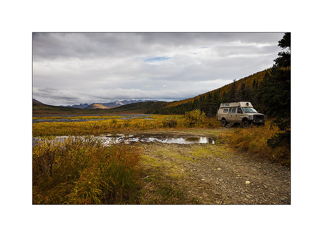
Going back South of Alaska
Before quietly thinking about joining back Anchorage where Mino will take his plane, we still made two beautiful hikes.
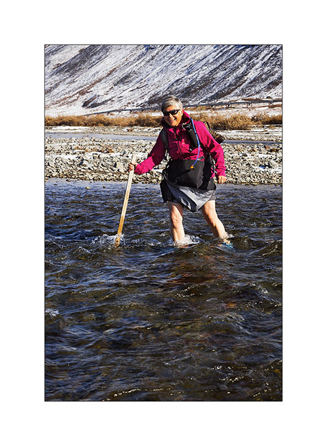
1. I initiate Mino to river crossings! This one was only about 32°F.
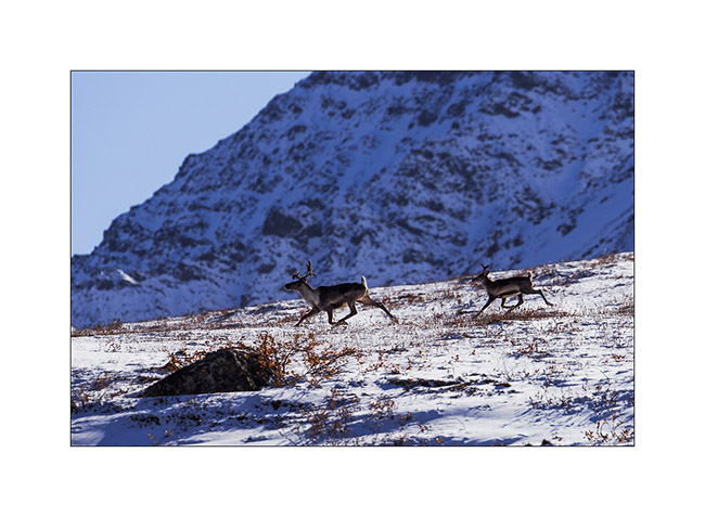
2. Caribou migration southward began, we see several made fearful by the hinting season opened since almost two months.
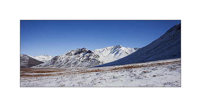
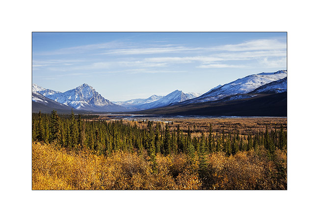
3. I never tire of these landscapes…
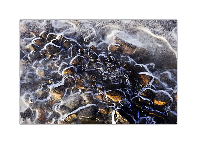
4. I find other paintings of ice…
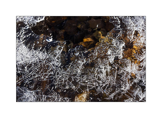
5. … that trap pebbles.
6. The next day, we explored a valley north of Antigun Pass to climb a nearby summit.
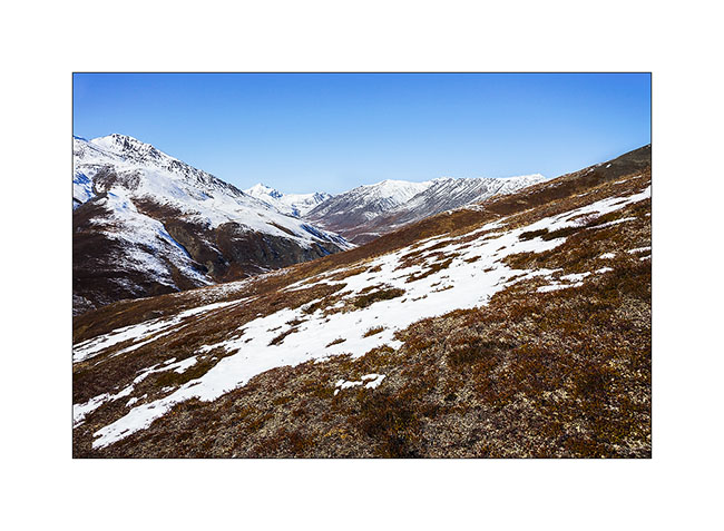
7. We stop at a pass after a hard climb. The view is gorgious.
8. Mino rests admiring the scenery.
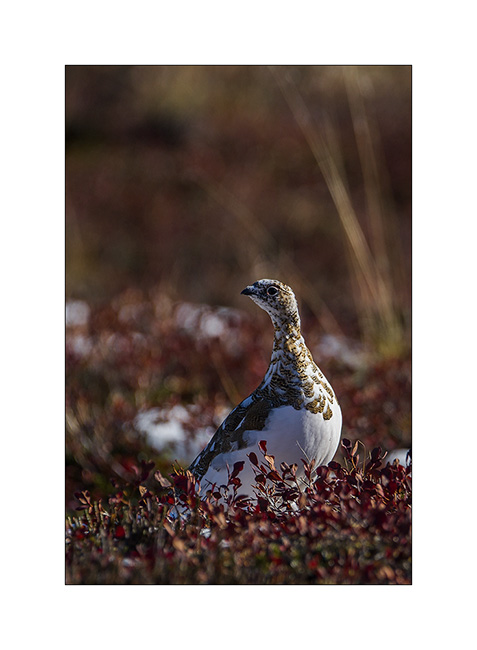
9. Going down, I manage to approach ptarmigans in moult.
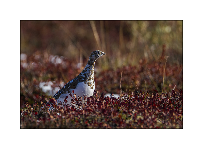
10. This one is already quite white…
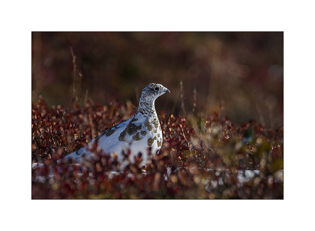
11. … while the neck of that one just starts to lose its summer color.
12. This end of day still reserve us a beautiful light.
13. VivaLaVida along beautiful granite peaks…
14. … and goes down a large valley.
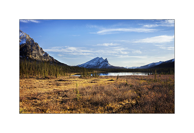
15. A pond that reflects Chugapak Mountain.
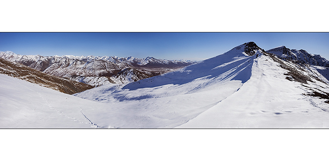
16. Crossing the Brooke Range is really beautiful.
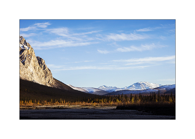
This concludes the report of our visit to the Dalton Highway. We continued towards the Denali where we spent the two last days before Mino’s departure.
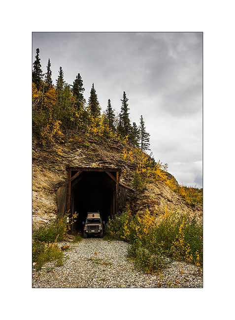
17. VLV strikes a pose in an old railway tunnel.
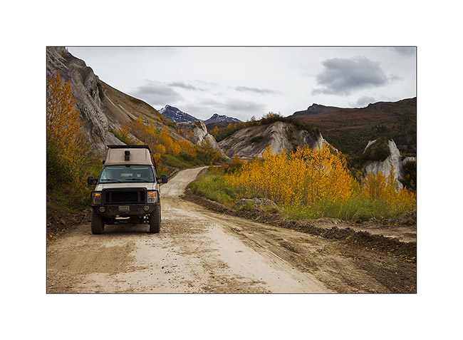
18. Quick “wild” visit (because unauthorized) of a still active coal mine.
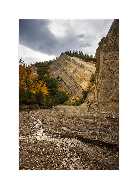
19. In a rather aesthetic side canyon.
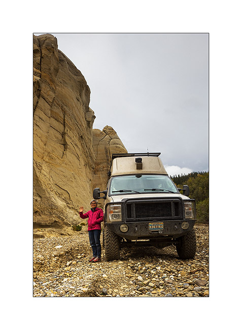
20. VLV has managed to go up the riverbed to pose in front of the cliffs sculpted by wind and rain.
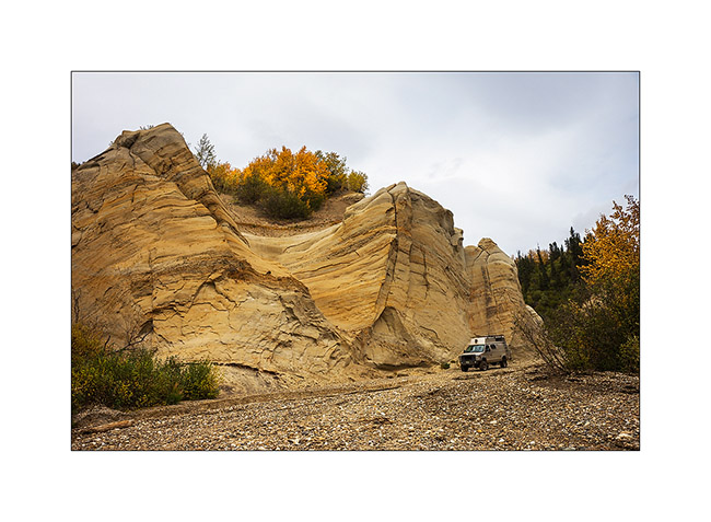
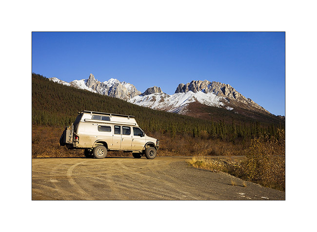
21. Since it is difficult to realize the size of VivaLaVida on pictures – when seeing for the first time, Mino exclaimed “Oh what a monster!” – I took advantage of her presence to give you the scale. She stands under the mirror..! 😀
22. We are approaching a small lake that will give us a nice camp for the night.
23. The south wind blows in gusts but offers me some sunrays.
24. We sleep on the windy shore…
25. The next day, we explore the mine from the top, after a track more than 35% steep !

26. The fall colors have invaded the forest…
27. … and the tundra.
28. The sky clears as the sun sets down…
29. … coloring the nearby mountains of the last boondocking for Mino.
30. Last colors on the taïga.
That ended the few weeks when Mino traveled in VivaLaVida. She walk the over 180 miles I hiked during these almost six weeks and has cooked me some really good dinners! Thanks to her. 😀
At the time of this writing, I do not know what will be the road ahead yet; so you will discover it in a future update. 😉