Archives
now browsing by author
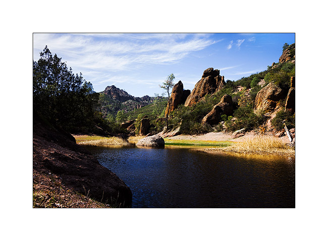
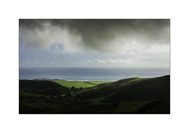
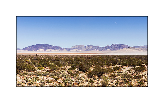
Grand Canyon
It was a wish of Jean-Luc to discover the Grand Canyon, one of the seven wonders of the world…
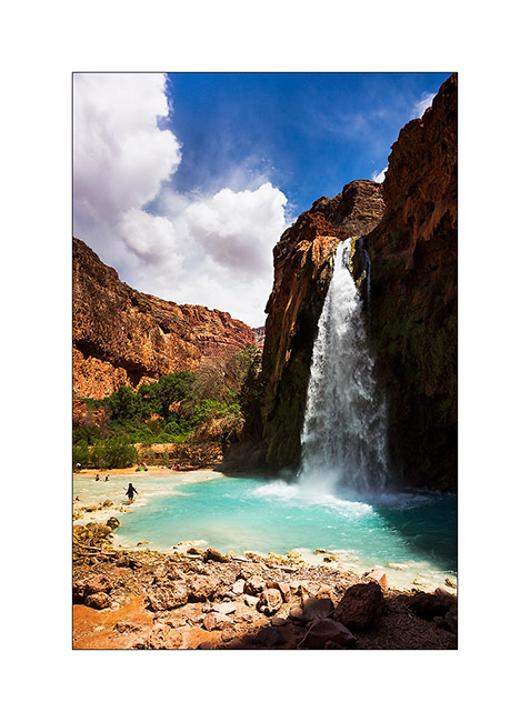
We made a stop to go down to Havasu Canyon, the Havasupai Indian Reservation, tosee the turquoise falls of Havasu Creek. Without tent, we decided to make the round trip in the day, it was a little crazy as we walk over 22 miles that day … But the falls worth the detour !
1. Our camp near a dry reservoir on the plateau above Havasupai.

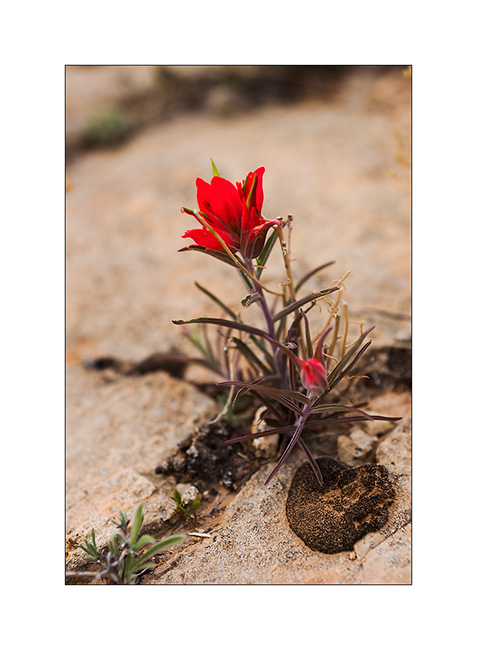
2. Touch of color in a gray afternoon…
3. The Havasu Falls which run of about 140 feet in a large natural pool.
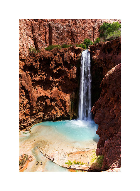
4. Some miles further down, the Mooney Falls, still higher…
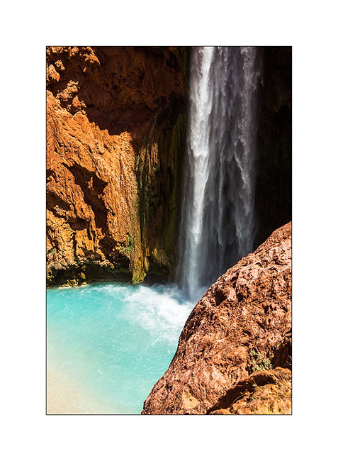
5. Details…
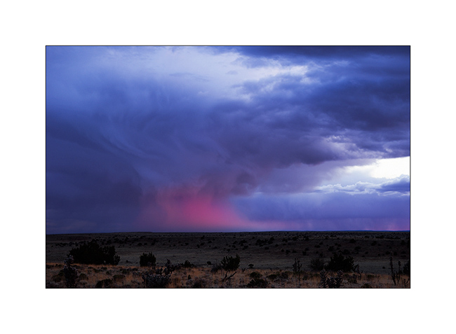
6. back on the plateau, we were rewarded with beautiful lights at sunset…
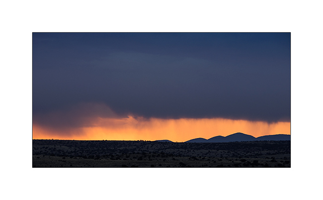
7. … while clouds burst around us.
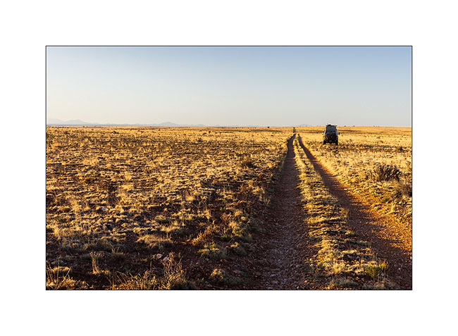
8. Borrowing a track to join the South Rim of the Grand Canyon, we slept on the immense plateau…
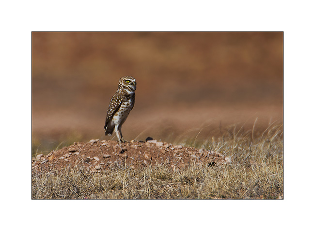
9. Along the trail, meeting with two burrowing owls. Difficult to get close on this terrain…
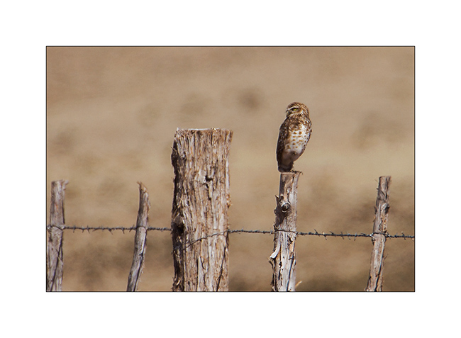
10. Typical straight posture.
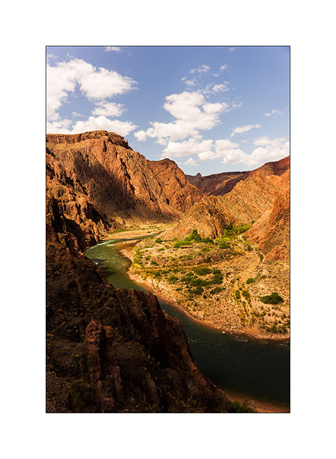
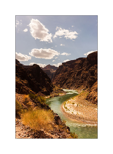
The next day we decided to go down to the bottom of the Grand Canyon. It’s still a long walk ahead of us, with about 5,000 feet of elevation gain. But it is only down there we can perceive the full extent of the giant…
11. Start of the hike down in early morning.

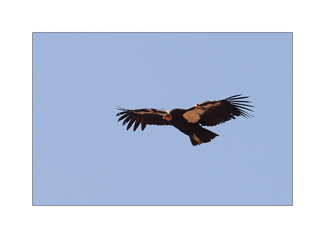
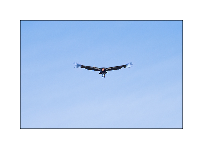
12. We were lucky to see condors reintroduced here too.
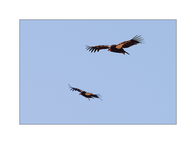
13. What a bird!
14. After 3,000 feet of descent, we’re not at the bottom, far from it, and crossed the caravan of mules which comes from the ranch at the bottom on the other side.
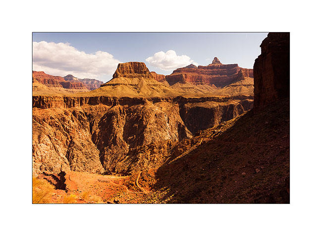
15. The Colorado River is still 1,500 feet below.
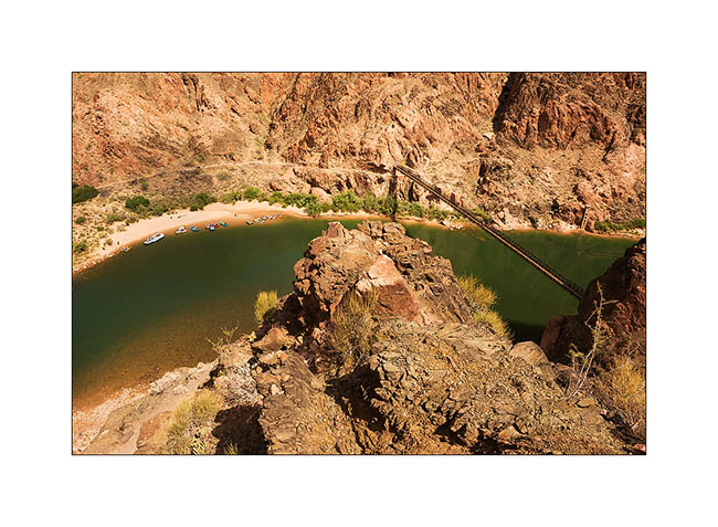
16. It grows as we decend!
17. From the suspension bridge which allows to cross it…
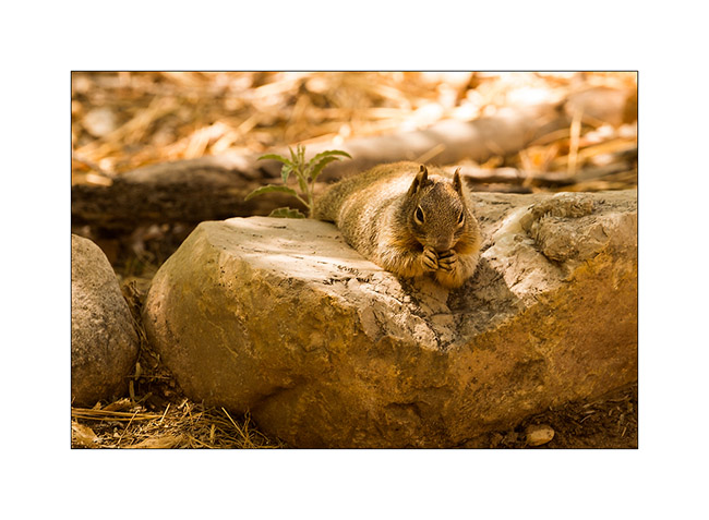
18. A neighbor of our snack break, especially photographed for Isa Belle who will recognize herself. 😉
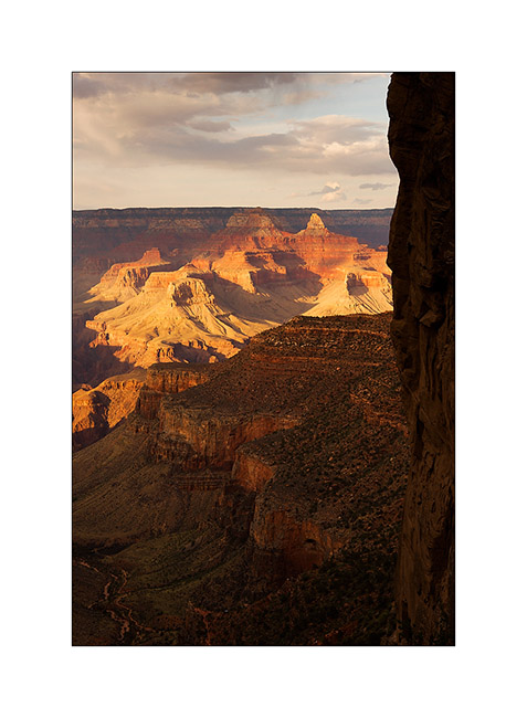
19. He is 4PM and we still have to go up all the canyon, after Jean-Luc has sent a postcard “by mule” from the bottom of the canyon…
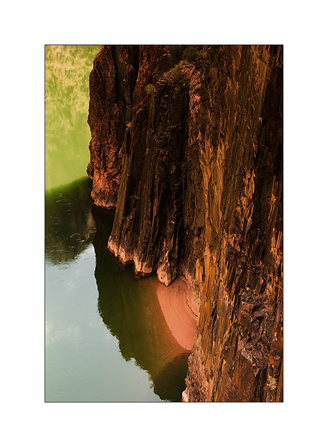
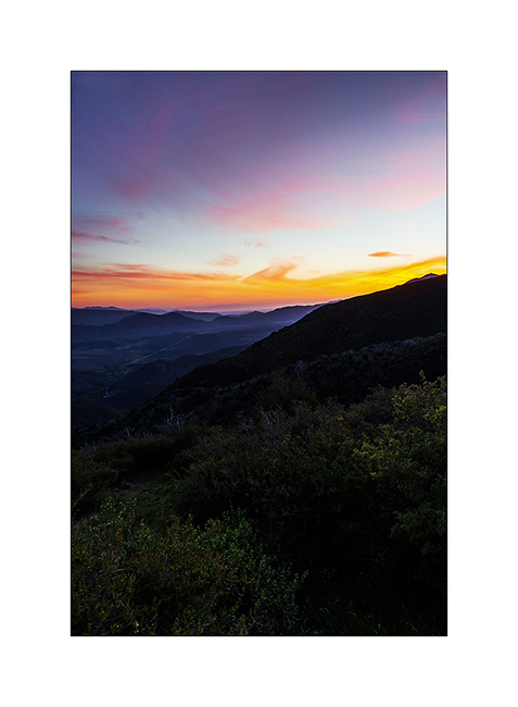
20. The light falls, saturating colors…
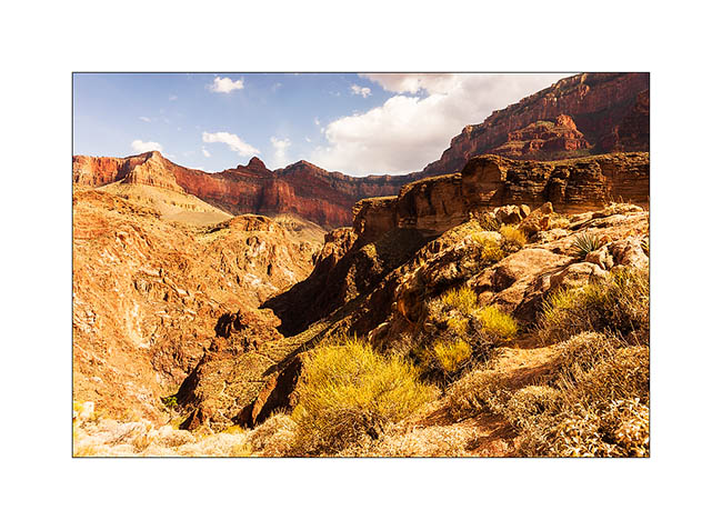
21. … and playing hide and seek with the clouds.
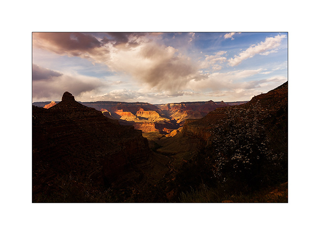
22. Last view of the canyon reaching the top just at sunset.
We then took the road again to join the Page area and I’ll tell you that soon… 😉
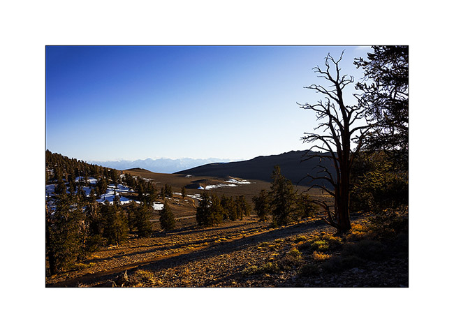
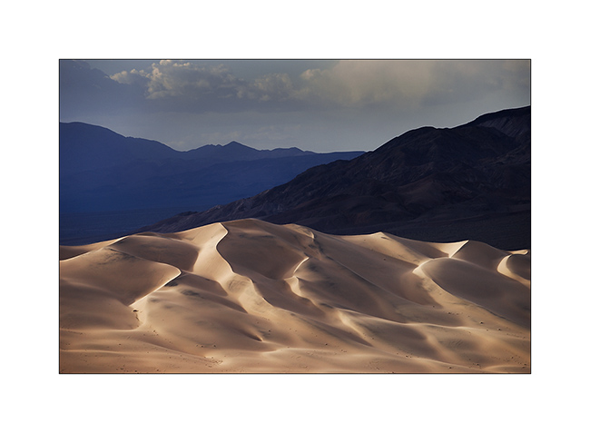
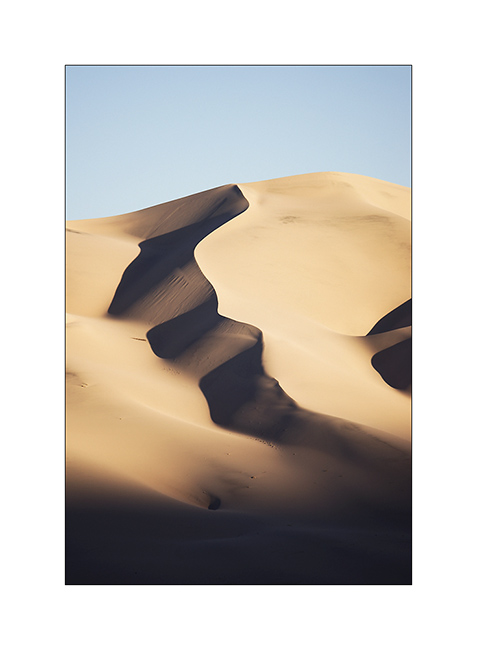
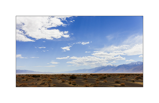
Mono Lake, Bristlecone Pines & Death Valley…
Waiting on the flange that had to be replaced on Vivalavida, we rented a car and went to visit Mono Lake, about seventhy miles north of Bishop. This lake is unusual to see since it have calcareous concretions created by source, like kind of stalagmites visible today. This lake is also very salty, which limits the underwater life.
1. High country near Mono Lake.

2. Salt foam on the shore.

3. Concretions have surprising forms.
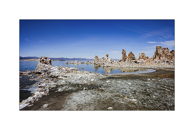
4. Vivid colors created by the minerals dissolved in water.
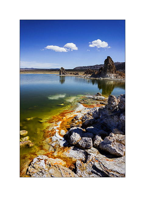
5. Nice cloud in the lake area…

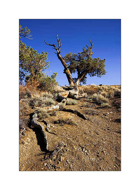
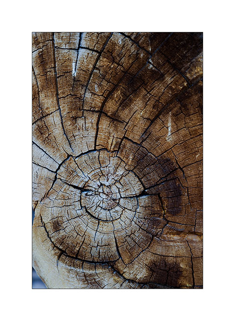
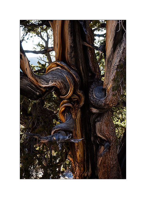
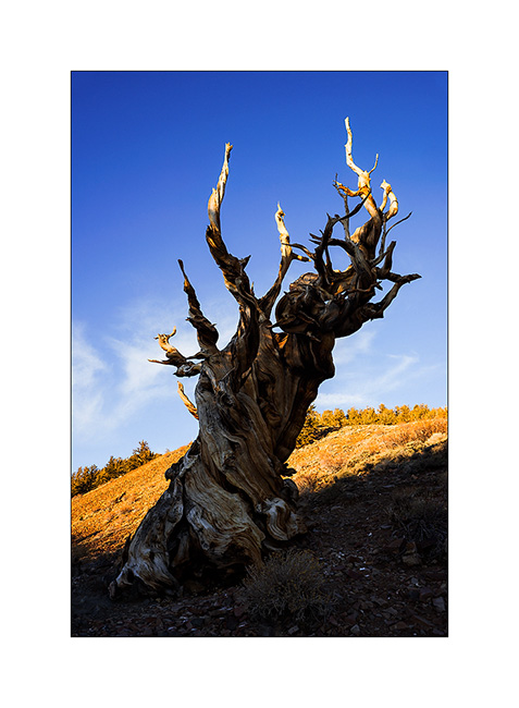
The driveshaft of Vivalavida reinstalled, the next day we drove to the White Mountains to see the Bristlecone Pines, incredible trees since it is actually the oldest known form of life on the planet. Some of them are more than 5,000 years old and still alive!
6. Some roots are exposed, the erosion of loose soil is important here.
7. A section showing the trunk which growths only a few tenths of a millimeter each year. This dead tree lived more than 3,600 years.
8. Plateau at Shulman Grove.
9. Tormented but beautiful growth…
10. This ancestor has ceased to live…
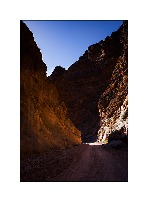
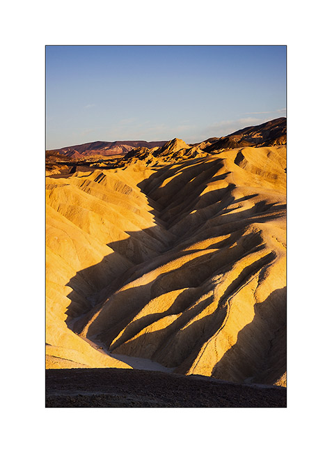
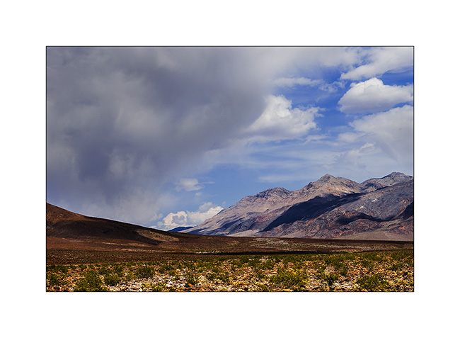
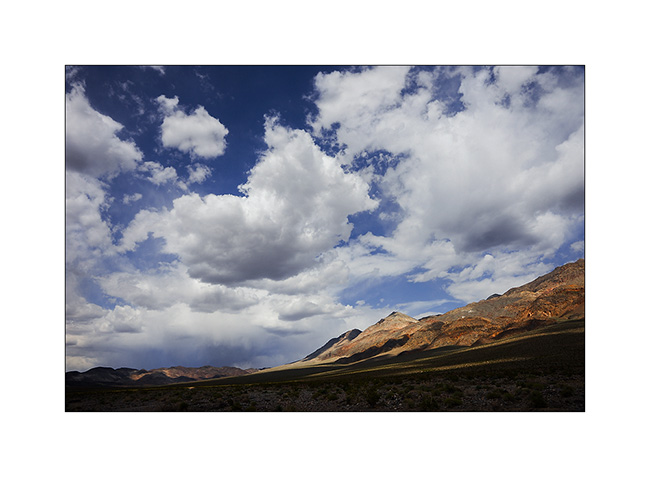
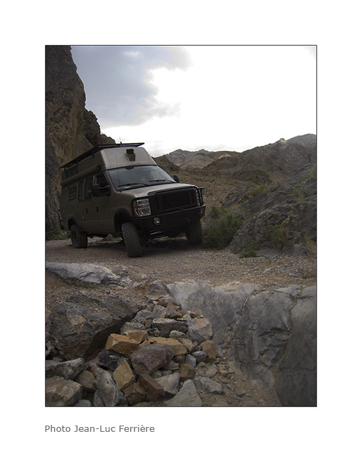
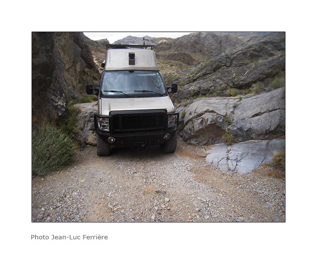
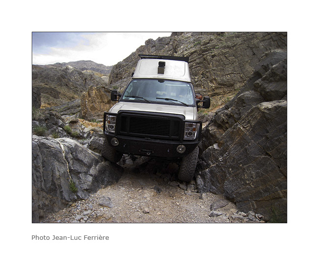
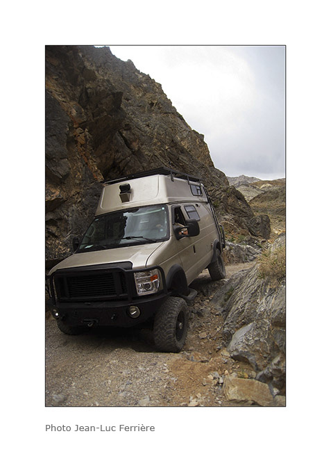
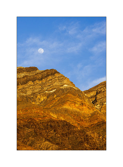
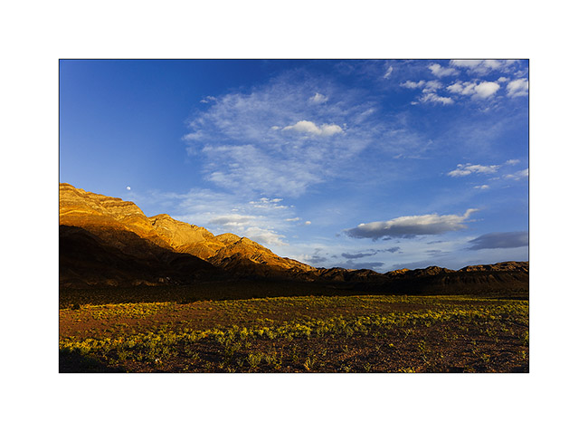
11. Continuing our journey through Death Valley, we took a walk in the Titus Canyon…
12. … before joining the inevitable Zabriskie Point at sunset.
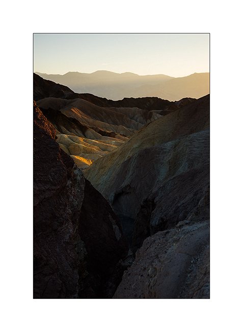
13. Sweetness of these eroded hills…
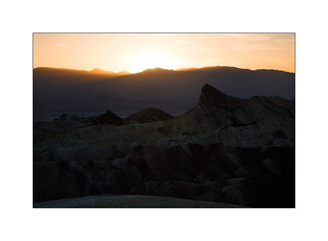
14. The sun disappears for an image a little different from this so much photographed spot.
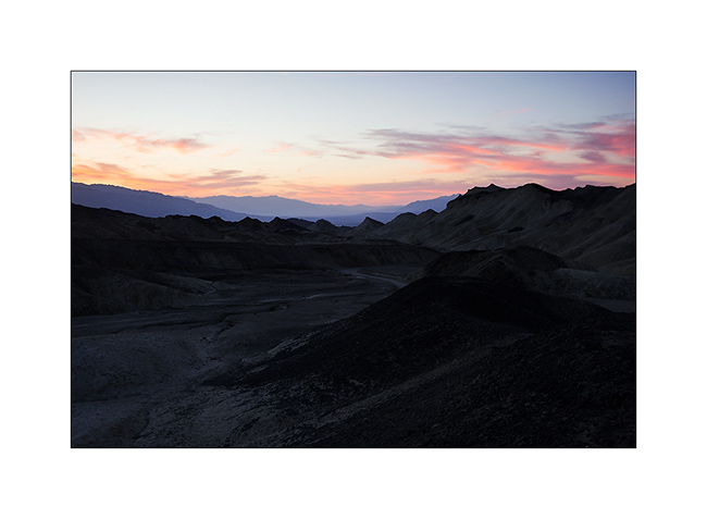
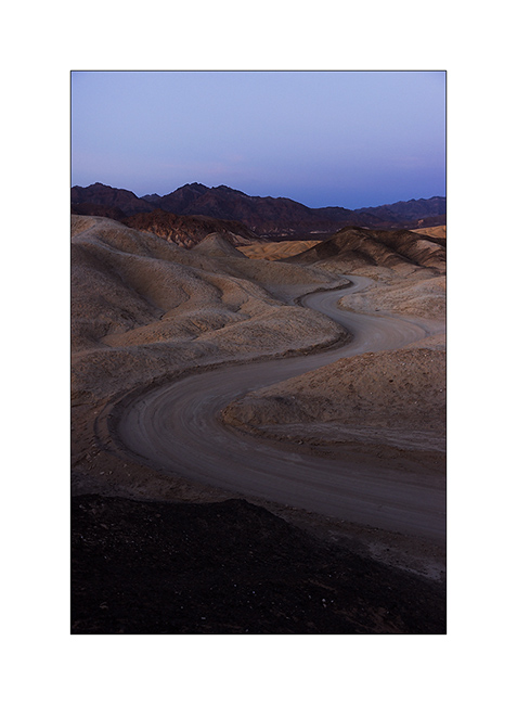
15. We found a place to sleep in the wild near abandoned mines.
16. Track makes pretty curves…
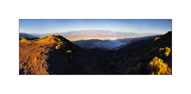
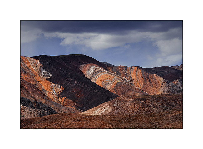
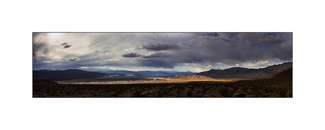
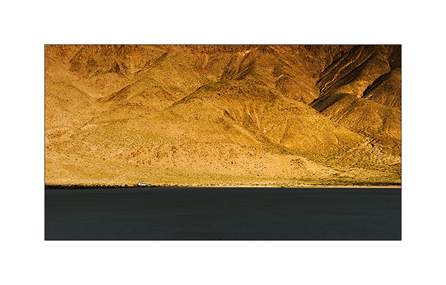
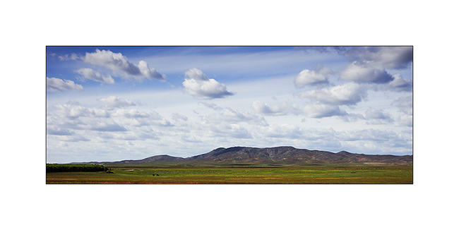
17. The next morning, we went up Dante’s View, a spot overlooking Death Valley that FredW, a friend of mine, adviced me. What a panorama ! (stiched panoramic of 9 vertical images)
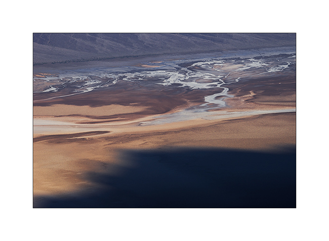
18. Drawings in Death Valley
That’s it for the Death Valley area. We then spent an afternoon in Las Vegas before taking the direction of the Grand Canyon. To Come soon…
PS: The trip map is up to date… 😉
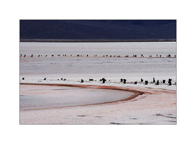
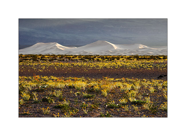
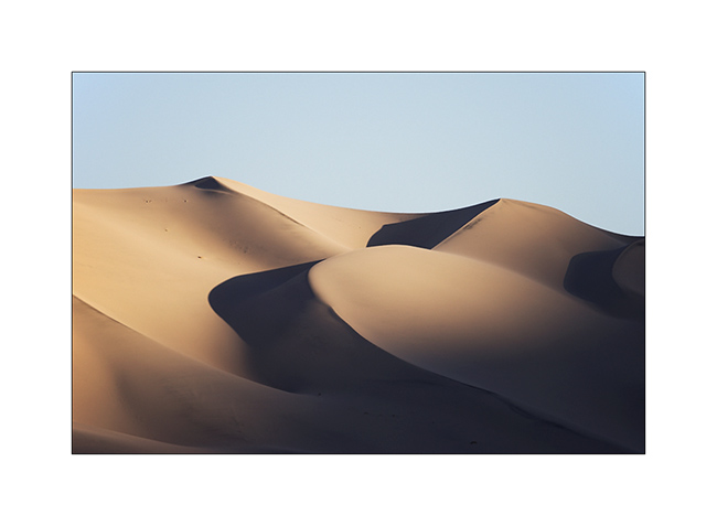
Saline Valley & Eureka Dunes
1. Arrived in the Saline Valley, we made a stop on the shores of the salt lake.
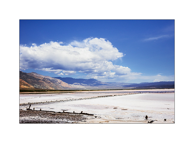
2. The salt crust is impressive.
3. Little enjoyable break to relax in one hot springs.

4. High Saline Valley towards the Steel Pass.
5. Awesome colors…
6. High end of the valley…
7. A flower which parasites rare bushes.
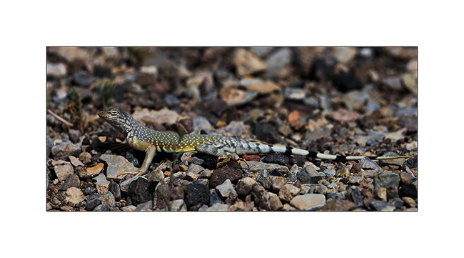
8. Colored lezard.
9. Narrow and leaning pasage…
10. Going down behind the Steel Pass.
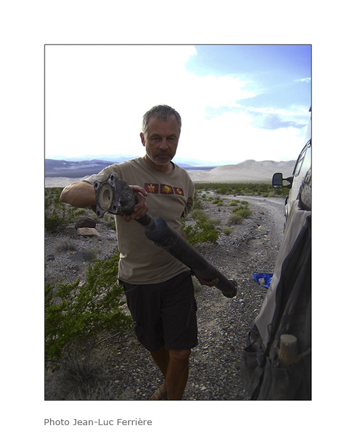
11. In the descent, bad noise and Vivalavida stops … Dazed, the rear driveshaft git down. The threads of the flange have been uprooted!
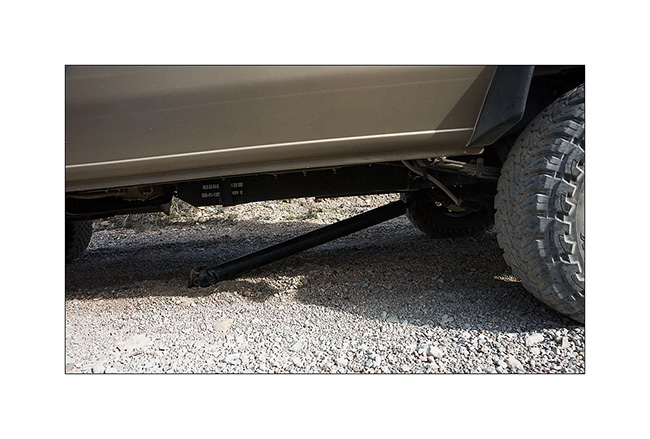
12. No other way than taking it appart and prosecute on the front axle only.
13. Not obvious because the “Cascade” that we must cross have big steps…
14. … Fortunately we went down it.
15. Passage narrower than Vivalavida!
16. Axle crossing…
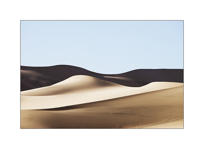
17. We finally managed to join the Eureka Dunes where we spend the night.
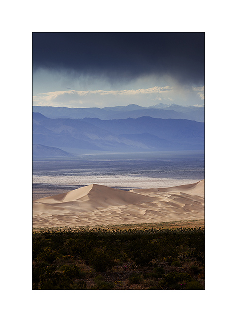
18. What a beautiful place!
19. Mineral contrats…
20. Sunset light on the dunes…
21. .. and Moon rise over the cliffs.
22. Last sun ray on our boondocking site…

23. … and on the mountains behind us.
24. The morning was clear, the light playing with dunes…
25. all of curves…
26. … and smoothness…
27. Back in the valley behind the Sierras, in Bishop, to repair the driveshaft.

To be continued soon… 😉
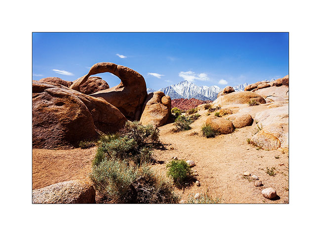
Alabama Hills & Racetrack
Before to cross the border to Canada later today, here is still an update from the US. 😀
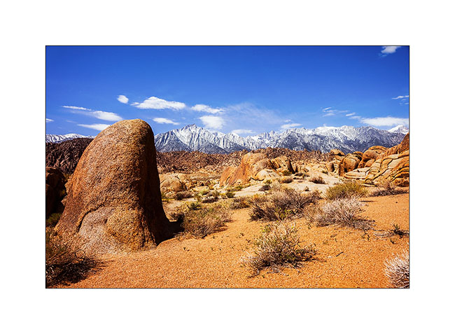
After visiting the Pinnacles, we went East of the Sierra Nevada. We stopped at the Alabama Hills, nice site just next to Lone Pine.
1. Contrasts with the snowy Sierras…
2. Mobius Arch.
3. Valley near Lone Pine.
4. Tiny plant growing in the sand.
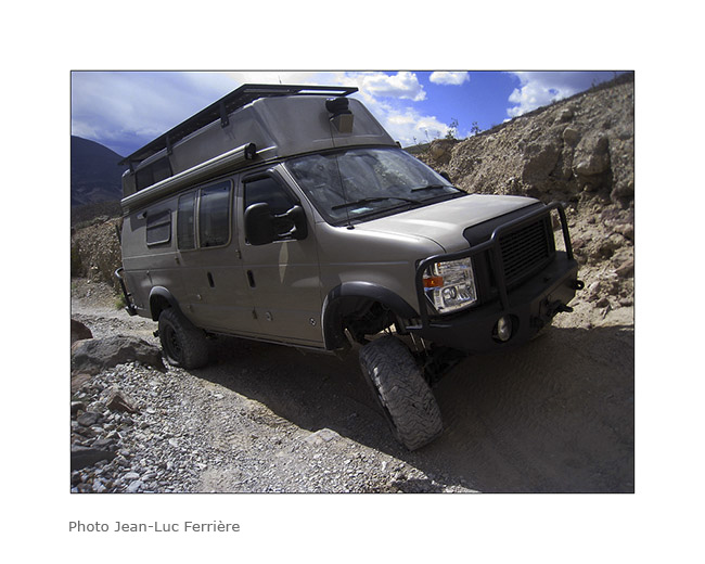
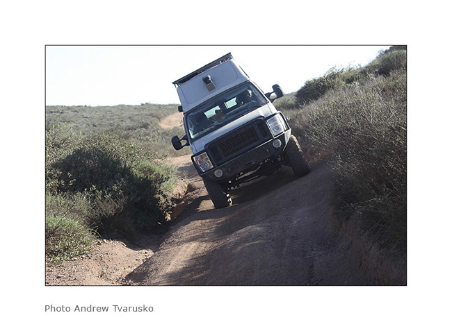
5. VivaLaVida on the Hunter Mountain trail.
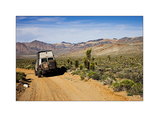
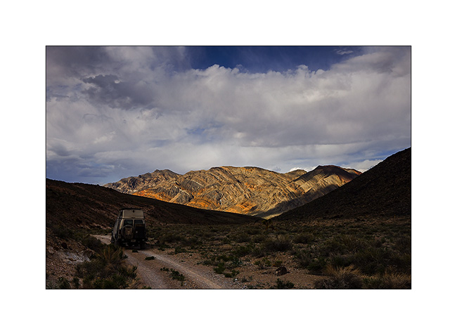
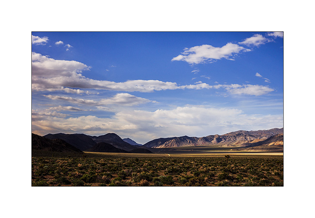
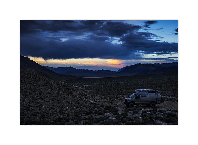
6. We’re now in the Death Valley National Park but in more remote places…
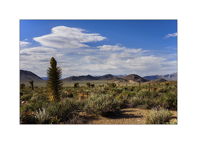
7. Wonderful altitude desert…
8. Photo stop at Tea Pot Junction. Unfortunately we forgot to bring a teapot… 🙁
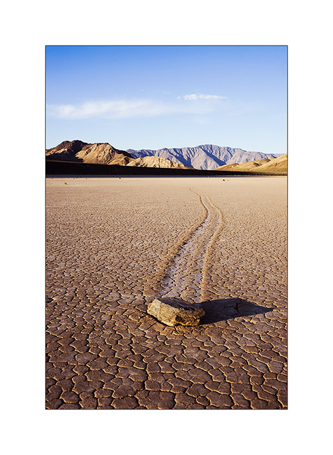
9. Arrival at Racetrack after several hours of stony track and with a leaden sky..!
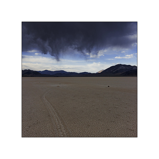
10. Racetrack, this unique site where rocks move leaving traces without anyone being able to date to explain the phenomenon. Some assumptions, such as high winds on a wet and therefore slippery surface, seem plausible…
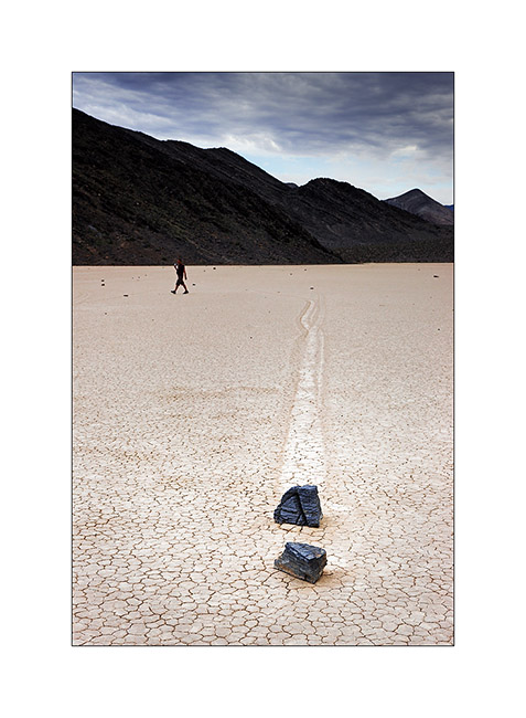
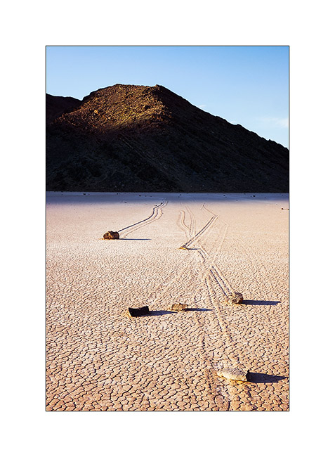
11. Interwoven traces…
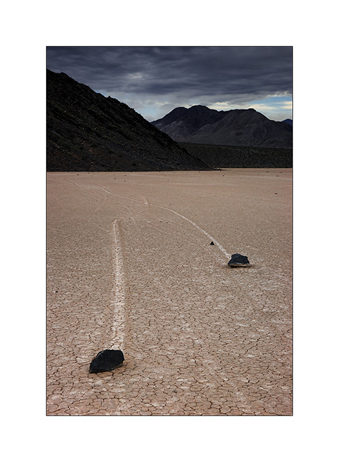
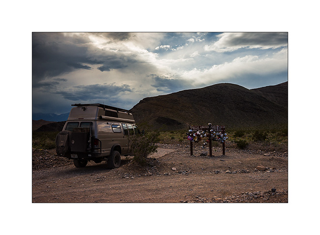
12. We camped on the site of a disused mine just a few miles away to return to Racetrack in the morning hoping for a better light.
13. And it is the sun that welcomes us!
14. VivaLaVida seems so small..!
15. Light highlights the tracks.
16. Don’t they look like they are racing..? 😀
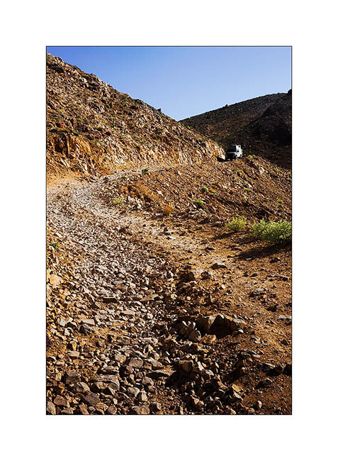
17. We then borrow the Linpintcott Road, a little-used track to join the Saline Valley.
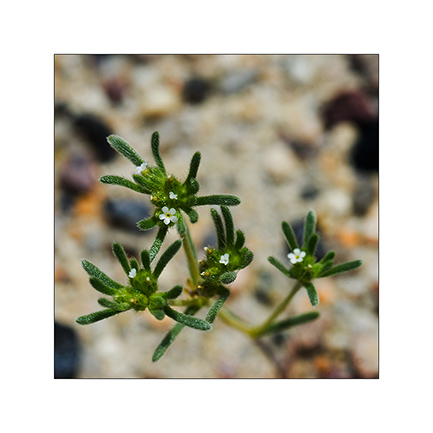
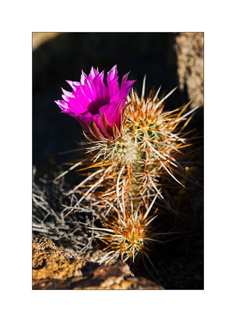
18. Cactus flower.
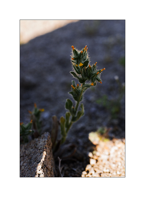
19. Another “hairy” flower…
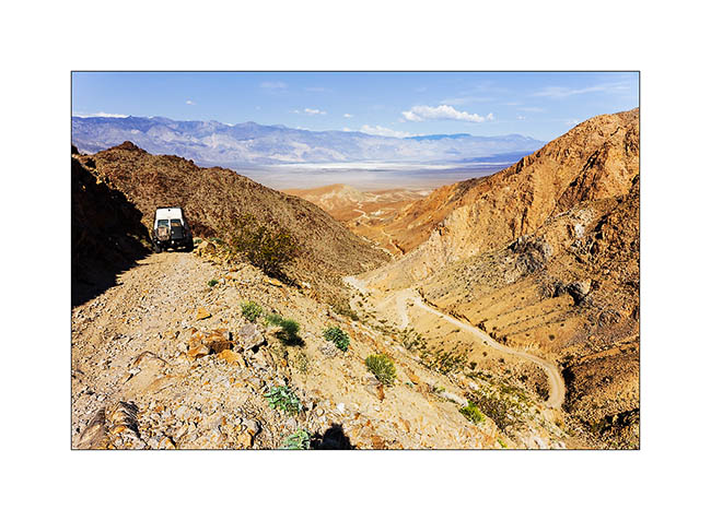
20. Exposed portion of the Linpincott Road. Some passages were quite narrow but Vivalavida managed to crawl through.
Stay tuned for more to come soon in Saline Valley… 😉
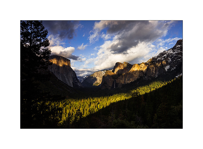
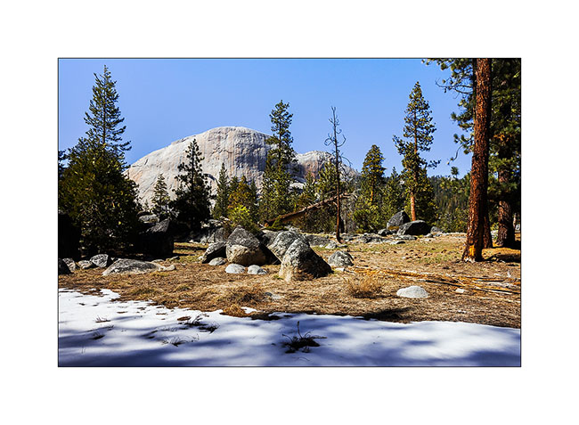
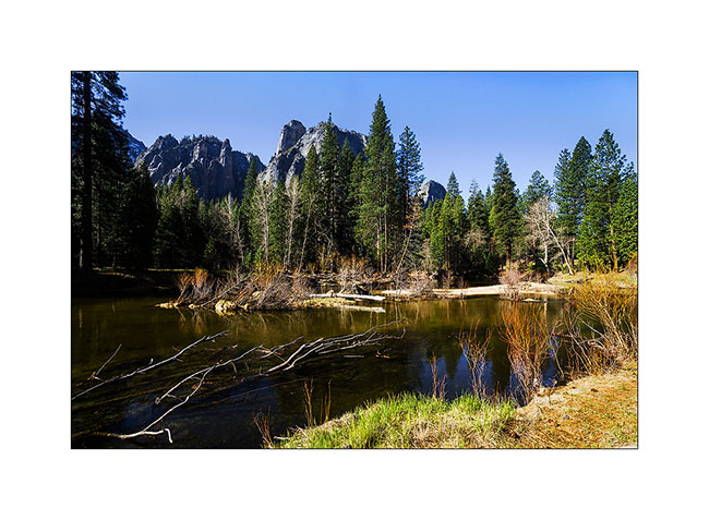
Yosemite NP
I continue with close updates to try to catch a bit of my late…
After replacing VivaLaVida’s tank in Fresno, I had a few days before the arrival of my brother Jean-Luc. So I went in Yosemite Mounains, hoping to see those in the snow…
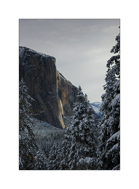
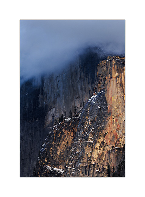
1. Ray of light on El Capitan…
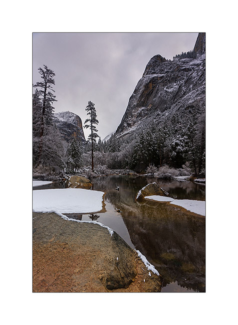
2. Mirror Lake a snowy day.
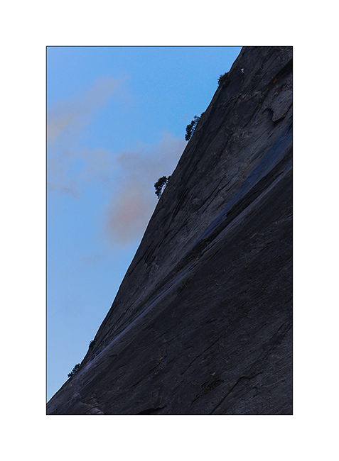
3. Colored rock in monochrome lanscape…
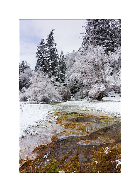
4. Some grass in the meadow.
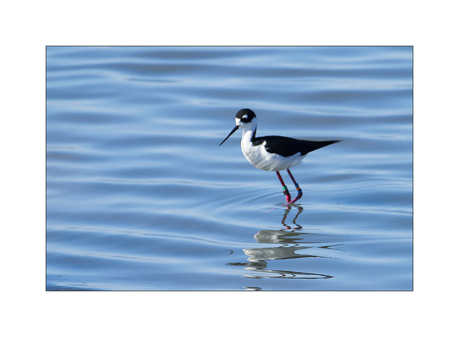
After meeting Jean-Luc in San Francisco, we stopped next to a pond to see the birdlife before returning to Yosemite. It should be mentioned here that Jean-Luc is an avid and well informed birder and an excellent climber..! So Yosemite was a must see!
5. An elegant black-necked stilt.
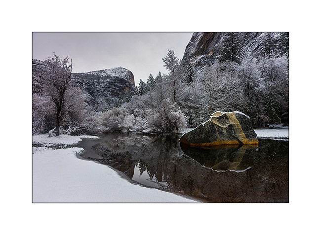
6. Nice light when we arrived in Yosemite Valley !
7. Ray on the cliff.
8. The Half Dome is still in the clouds…
9. Dusk…
10. Hike in Little Yosemite Valley with the Half Dome in the back.
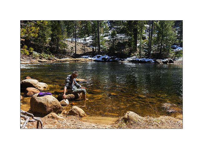
11. Cooling in the Merced River.
The next day, we had a great surprise. Attempting to reach the summit of El Capitan, we gave up after an almost ten miles walk because the snow still there has really become too thick. Every step sank above the knee and at 16:30 we had to take the way back to reach Vivalavida before nightfall.
The sun had set over twenty minutes when I stopped. There, about twenty yards away, I had just seen a bear busy to search some insects on a dead tree. Jean-Luc perceiving it the same time, he had stopped 30 feet behind me. The bear was a big male. He didn’t sens us yet. I walked a few steps back to add some distance so that it doesn’t discover me too closely. Fifteen seconds later, he felt us and turned his head towards us. I then raised the voice and he ran away, turning once to see us before resuming its course further…
What emotion, our first wild bear any two! It lasted only a few seconds but will remain engraved in my memory …
It was too dark for me to attempt to photograph it and the camera was in the bag…
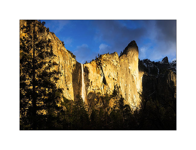
12. The next morning, at the base of El Capitan, a myth for climbers … More than 3,000 feet of superb granite!
13. Merced River.
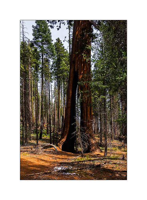
14. We will still visit Mariposa Grove for Jean-Luc to discover giant sequoias…
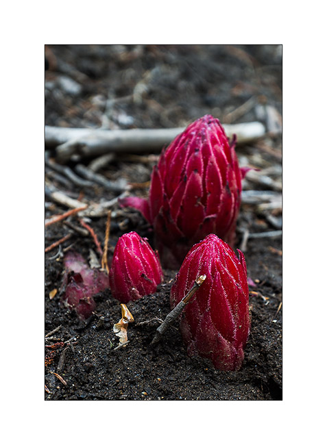
15. Curious plant which doesn’t make photosynthesis, hence its color fuchsia.
We then returned to Pinnacles NP to try to see a condor…
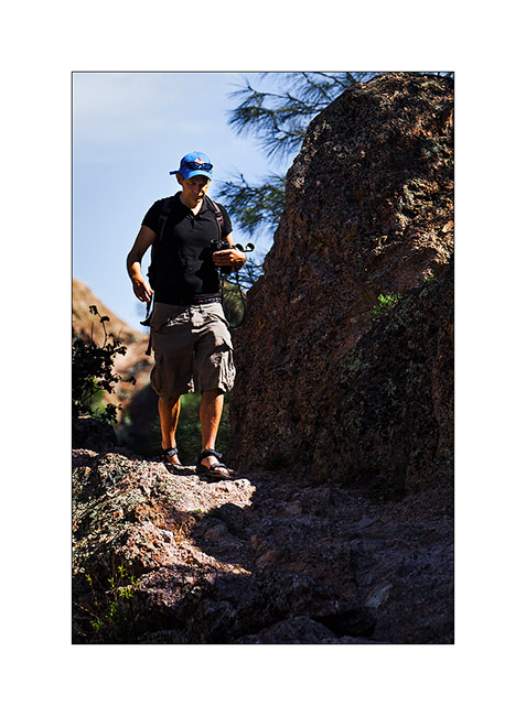
16. Jean-Luc discovering the Pinnacles.
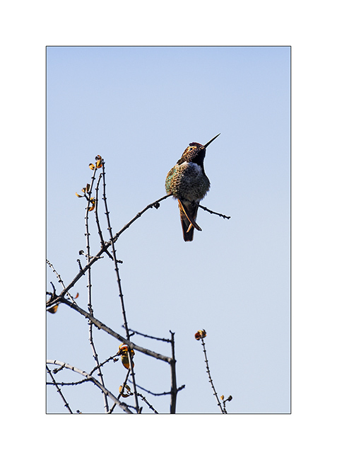
17. Before the condor, we will see the smallest bird here, a hummingbird… 😀
18. There is more flowers than two weeks earlier.

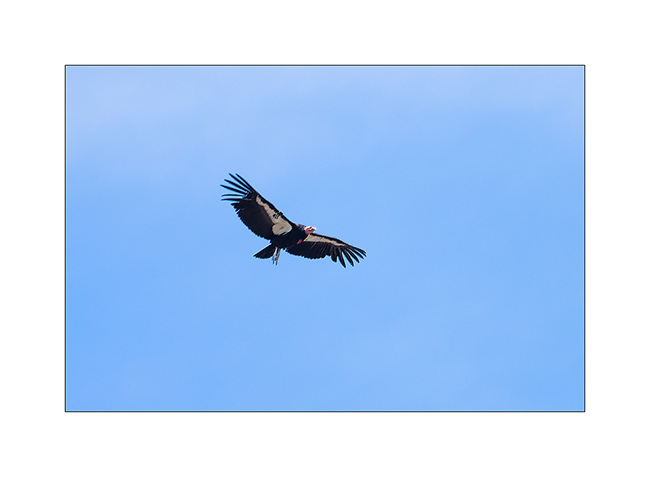
19. While we had a snack break, he arrived, majestic! This is the largest bird in North America. It has almost disappeared and was saved in extremis thirty years ago. Reintroduced in several sites, it is still not out of danger. I quoted his Majesty the Californian condor.
20. A second passed just behind, probably a couple that we have the chance to observe about half an hour.
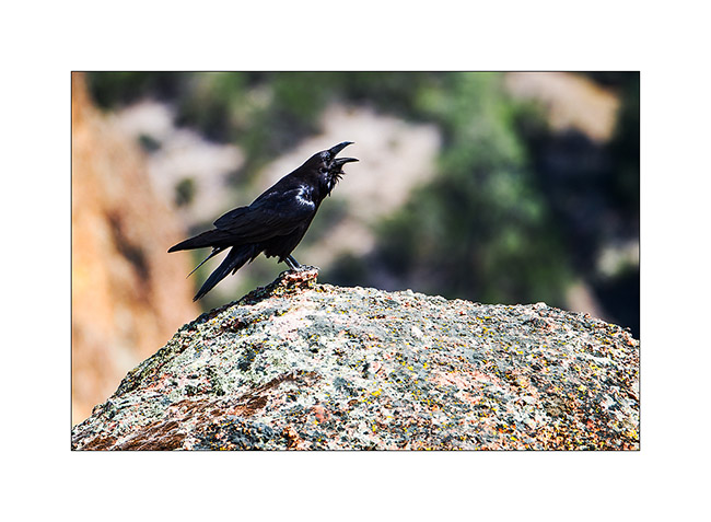
21. Ravens are everywhere here, like crows in Europe.
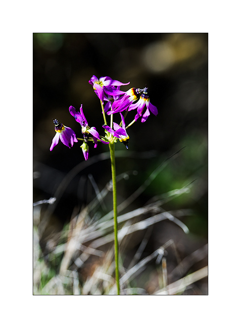
22. Nice flower along the trail.
23. A rather aesthetic reservoir…
24. Meet along the trail which bring us back to VivaLaVida.
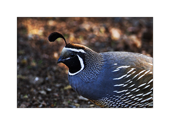
25. Californina quail in our campground, just a few feet away.
The following will take you to discover the Alabama Hills and the famous Racetrack. To come very soon… 😉
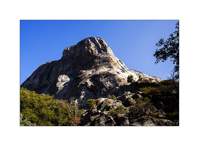
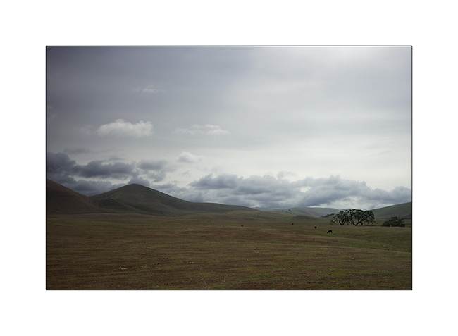
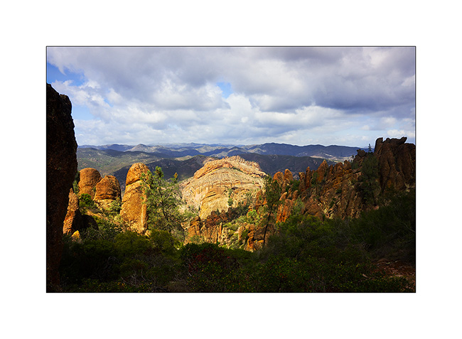
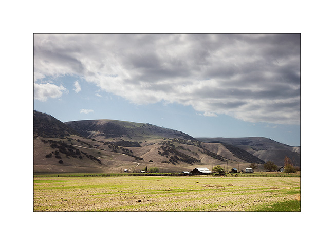
Pinnacles and Kings Canyon NP
Since I had to go through Fresno to change the main tank of Vivalavida which continued to leak despite several repairs, I took the opportunity to visit a few sites on the way to San Francisco. Starting with the Pinnacles National Park, the last National Park created to date.
1. Crossing the mountains behind the Big Sur…

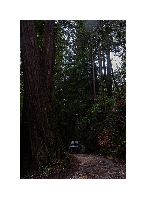
2. … Vivalavida crosses beautiful forest of “red wood” sequoias.
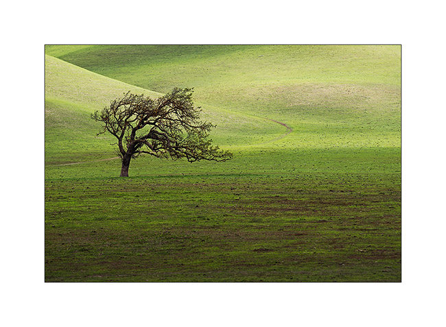
3. Behind these mountains which condense rains of the Pacific, the hills have been cleared to create pastures…
4. … quite photogenic.

5. A beautiful lone tree … This phicture has earned me the remonstrances of a farmer not happy to find me in his field even if I did not do much wrong.
6. In the Pinnacles NP, a mountain range which houses californina condors that I haven’t seen on this occasion…
7. They are already some flowers…

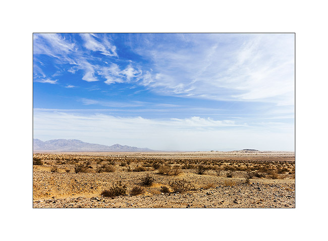
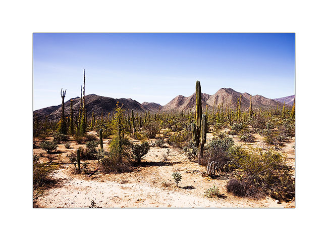
8. Going further on my way, the land looks more desert.
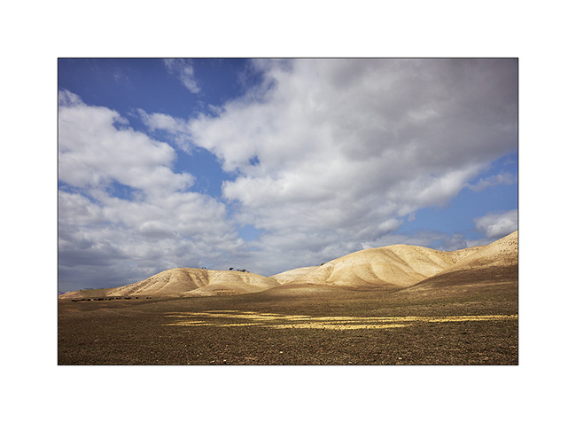
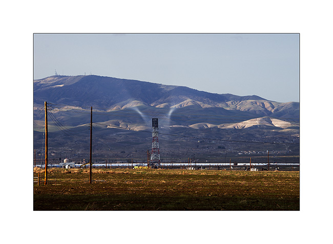
9. However, a few scattered farms try to exploit it.
10. Along the road, the Coalinga solar plant and the strange and spectacular concentration of sunlight near the tower.
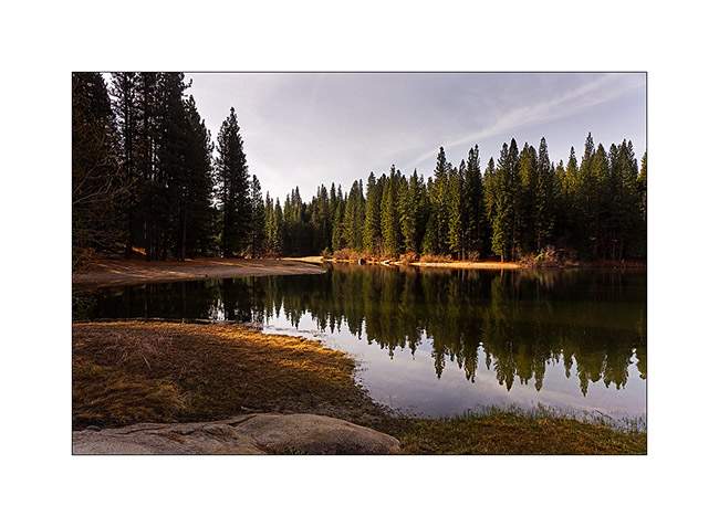
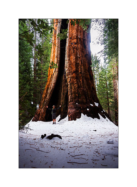
I then went to see the Kings Canyon National Park and its giant sequoias, not far from Fresno.
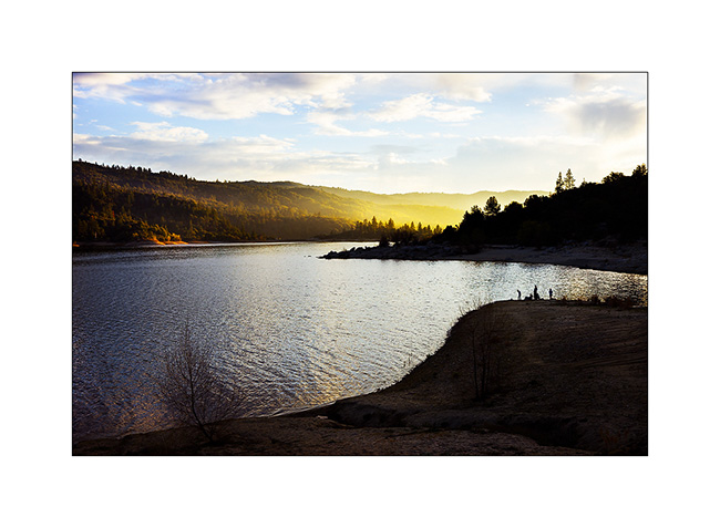
11. Pretty Hume Lake.
12. VivaLaVida under the giants.

13. And a penguin in front of the 6th largest tree of the USA! About 40 feet in diameter at its base!!!
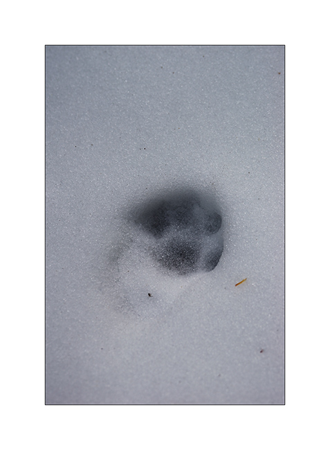
14. Likely tracks of a lynx or a bobcat.
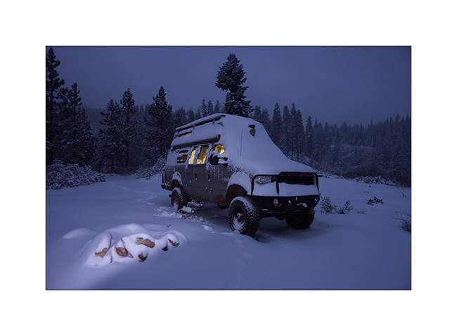
15. I found a nice boondocking area above Lake Hume up a nice 4×4 drive and surprise in the next morning: more than one foot of fresh snow!

16. This is what is called a return of winter!
17. I tryed to go through the pass…
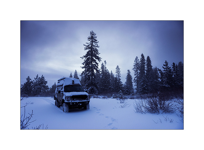
18. … but there was to much snow and I drove back.
19. Lanscape is beautiful…
20. … since the weather is getting better.
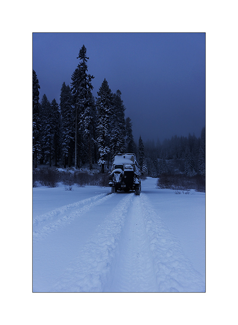
21. I learned that the Highway was closed after having traveled more than twenty miles without a single trace in front of Vivalavida’s wheels. What a pleasure! 😀
22. Back to the Hume Lake that has changed in appearance since yesterday!

23. It feels like the middle of winter…
24. Going back down to Fresno…
To be continued in a few days… Thank you for your loyalty! 😀
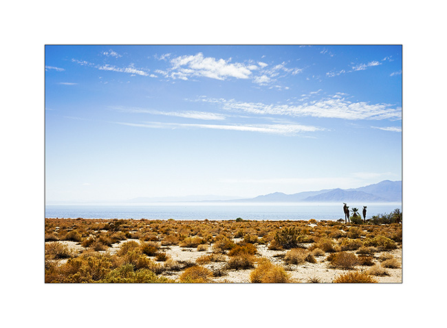
Southern California
So I’m back in the U.S. The contrast is striking after more than four weeks in Baja..!
After having taken care of Vivalavida who needed it after more than 1,500 miles of rough trails, I began my wy North towards San Francisco where I had to meet my twin brother who would travel with me a few weeks. This way began with a visit of Anza Borego desert, an arid region of southern California.
1. Chilly and windy Wake up above the desert.
2. In these mountains over 6,000 feet elevation, landscapes sometimes look like Nordic landscapes.

3. But once you go down behind the mountain barrier holding the rain, it’s a real desert.
4. The Salton Sea is a dead sea nestled in a valley at -213 feet elevation and is the scene of an unsolved mystery: quantities of birds die each year without anyone have clarified why…
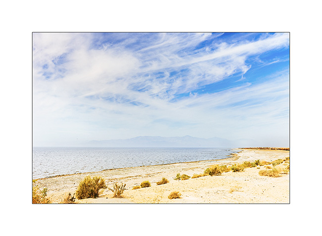
5. But it remains photogenic! 🙂
6. Making a detour to the south of Los Angeles to meet a member of the Sportsmobile forum, I went through the San Jacinto Mountains, southwest of Indio.
7. Beautiful sunset light on the small Hemet Lake…
8. … nice place for a boondocking.
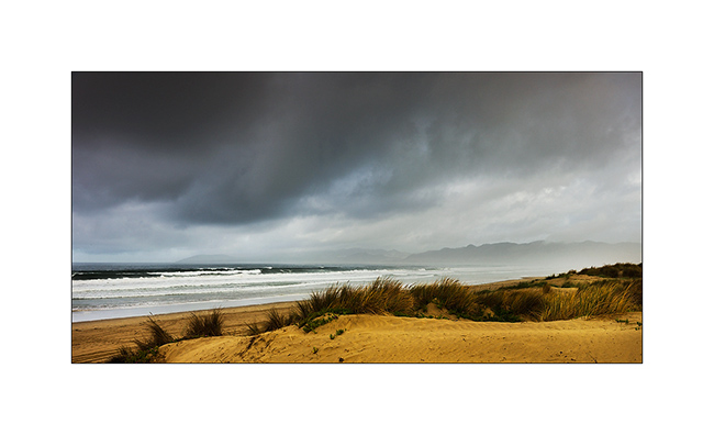
I then decided to follow the coast North and explore the Big Sur, iconic place for the post Flower Power period…
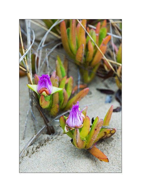
9. South of Moro Bay, showers on Pismo Dunes…
10. Sand flowers…
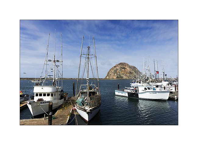
11. Moro Bay harbor and its famous rock.
12. The beach north of Moro Bay…
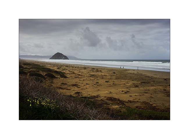
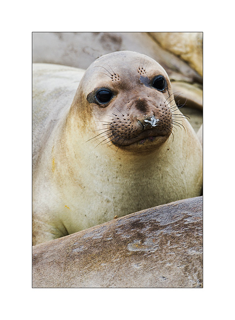
13. … homes colonies of elephant seals. What they stink! 😀
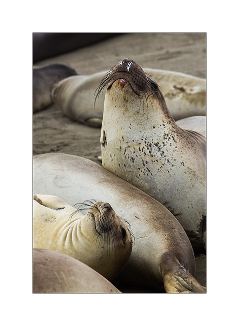
14. Nice face!
15. Lighthouse on the coast…
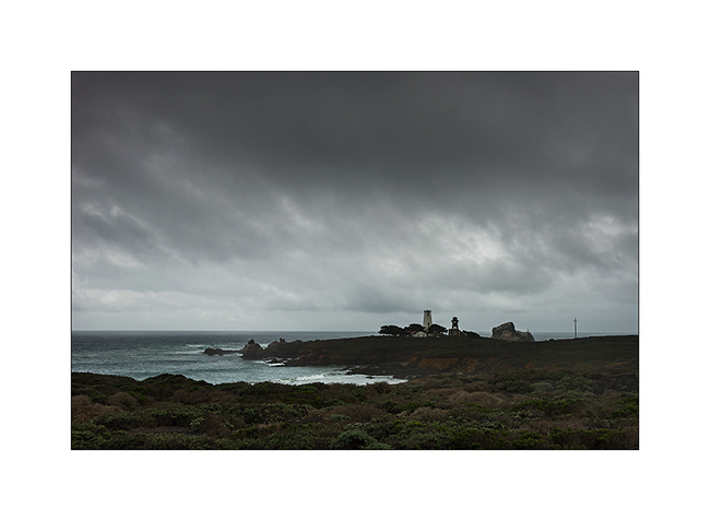
16. … and pastures worthy of Ireland!
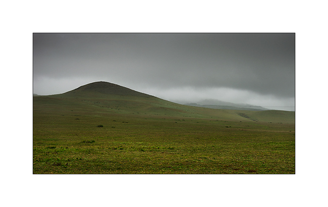
17. Another shower passing.
18. Dark horizon…
19. … but begins to get clearer.
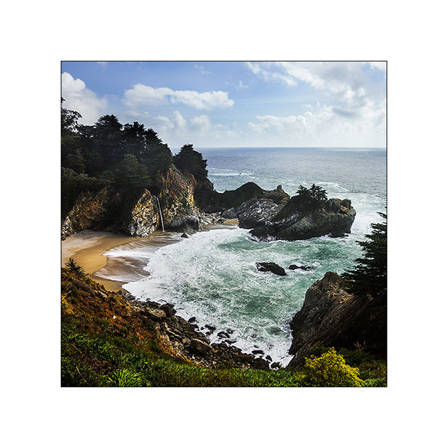
20. One of the marvels of the Big Sur: the McWay Falls, a waterfall that flows directly on the beach. Gorgeous!
21. Clearer late afternoon on this beautiful coast.
Following of my way North in a few days… 😉
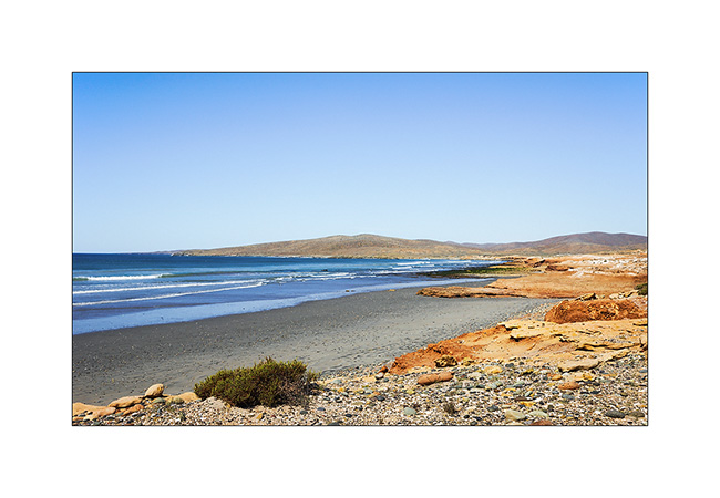
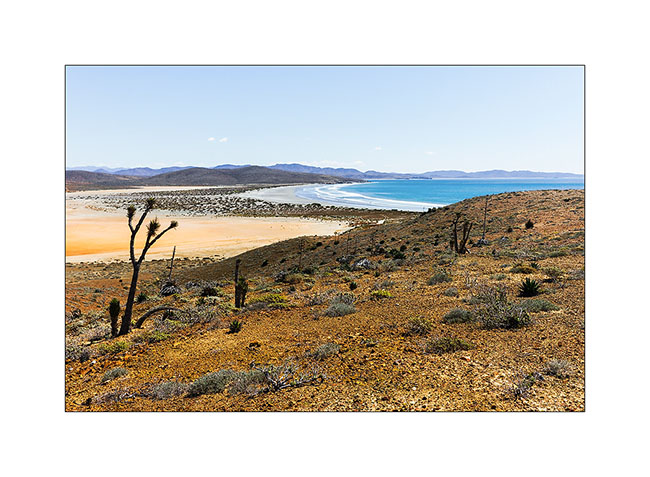
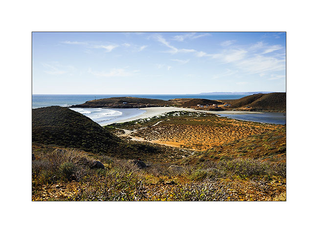
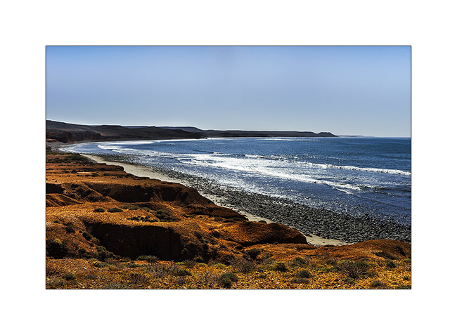
Baja California (8 and end)
Last update about our trip in Baja. We continue heading North.
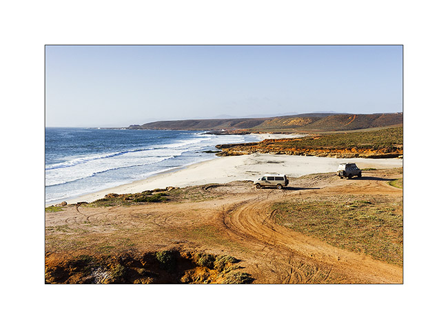
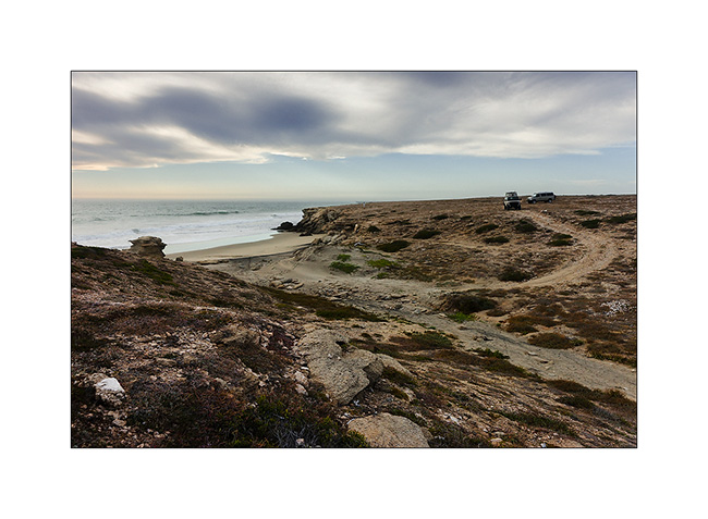
1. Beautiful Pacific coast Under the sun…
2. … with sometimes nice pink lagunas…
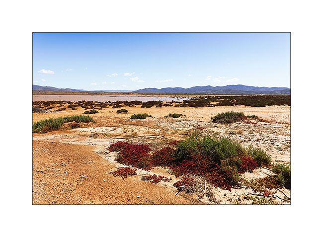
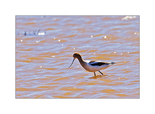
3. … that birds enjoy. Here, an american avocet.
4. The strong Pacific swell.

5. What a view!
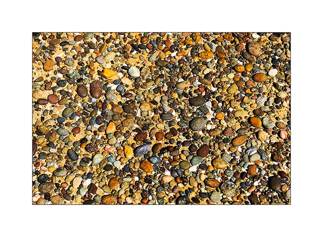
6. Colorful pebbles…
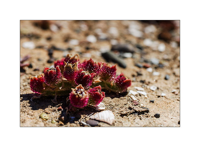
7. … and plants that make one think of strawberries! 😉
8. Another colored laguna…

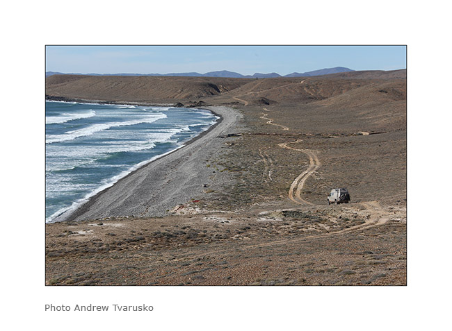
9. VivaLaVida on the roadway, obviously little frequented…
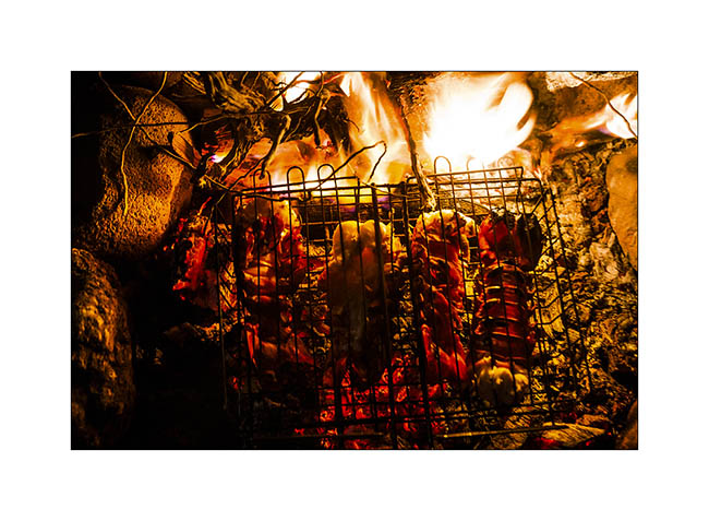
10. Fishing camp where we bought good fish…
11. … and succulent lobster tails! 😀
12. This coast is really wild…
13. Baja Shaker accesses one of our camps…

14. … into the dunes.
15. quiteness of sunset on an island off shore looking like a sombrero…
16. … and a great fish for diner!

17. Finally the discovery of the peninsula, we have driven the highest mountains of the National Park of San Pedro Martir, the highest road almost 8100 feet elevation…
18. … we even found snow there!!
19. The view is amazing and quite unexpected here…

20. … with beautiful coniferous forests.
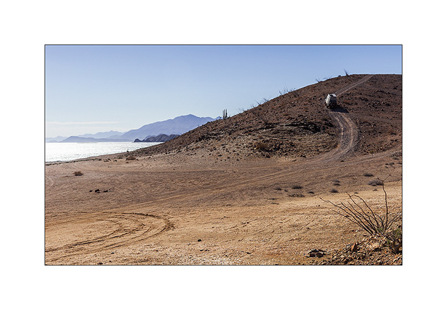
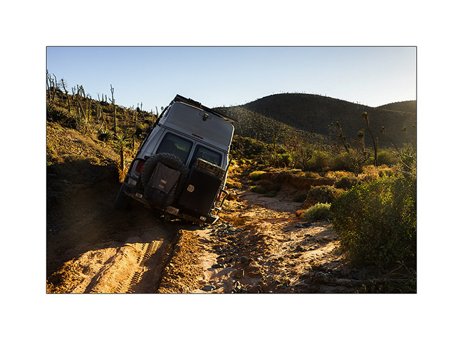
21. After going back down the coast, we took a last track on the Pacific coast, terribly rough. Here, a severe tilt, pretty impressive!
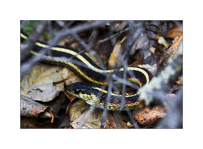
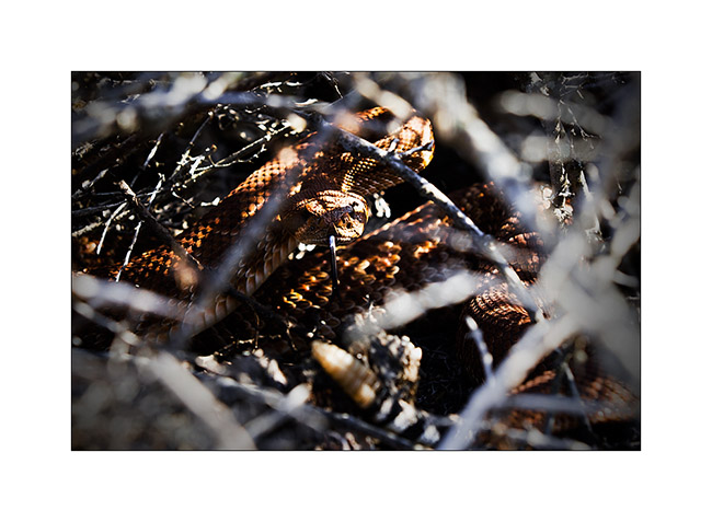
22. He was basking in the sun and refugde in the bush when we arrived, which didin’t not stop me going to photograph him. A big specimen about four feet long and as thick as my arm. Not bad for a rattlesnake!
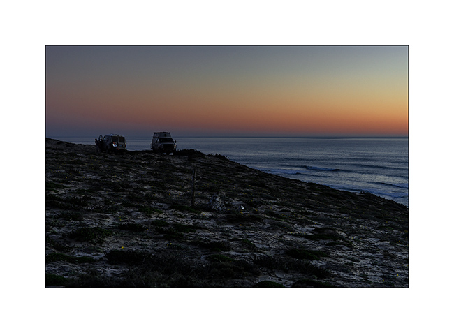
23. Last camp on the Pacific coast…
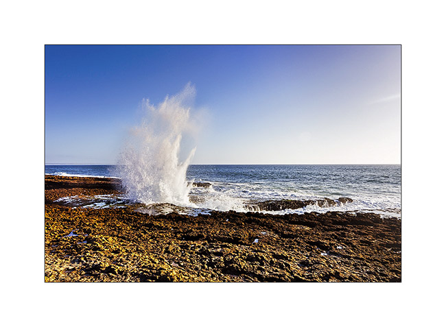
24. … next to a spectacular blowing hole.
25. One bird in the morning light.
26. small Church in a rancho along the road.

27. We spend our last night near hot springs where we relaxed. Here, one of the baths letting regulate the temperature by alowing more or less cold water of the river.
That’s it for the story of our trip in Baja. Many thanks to Andrew for his friendly company and good times spent together. We will go back, he and I likely… 😀
Back in the States is coming soon…
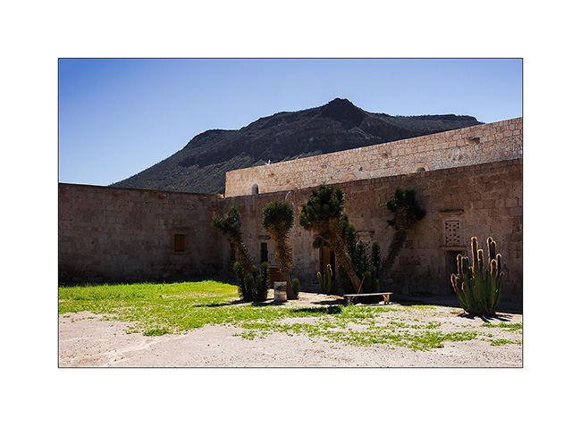
Baja California (7)
Since Ramsey spoke us about the Mission San Miguel, we decided to reach it the next day, leaving the group which pamed to cross the border the same day. Little backway to Rosarito where we took the trail to San Miguel. In places, the track remained quite muddy after the heavy rains that hit the region a week earlier.
1. It looks like a volcano…
2. “Baja Shaker” driving through some muddy puddles.
3. Mission San Miguel is quite different from those we previously visited.

4. Decorated door.

5. The interior is sober.
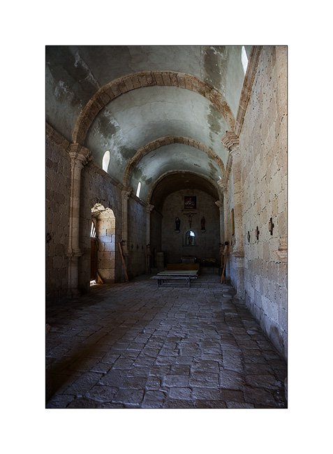
6. The main door from the interior.
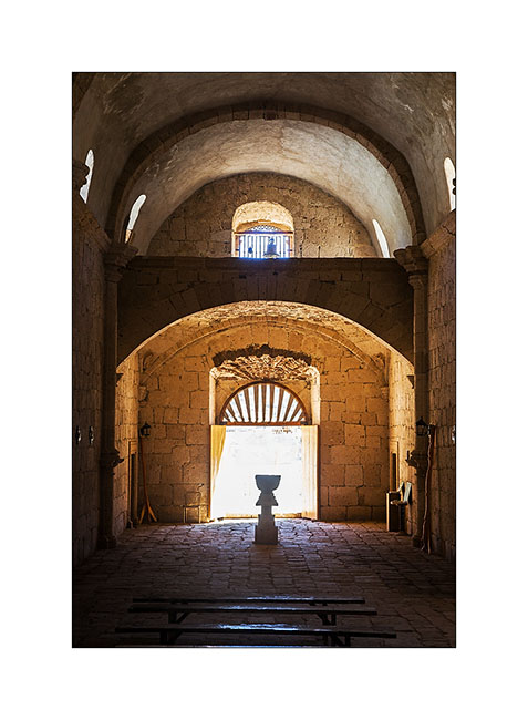
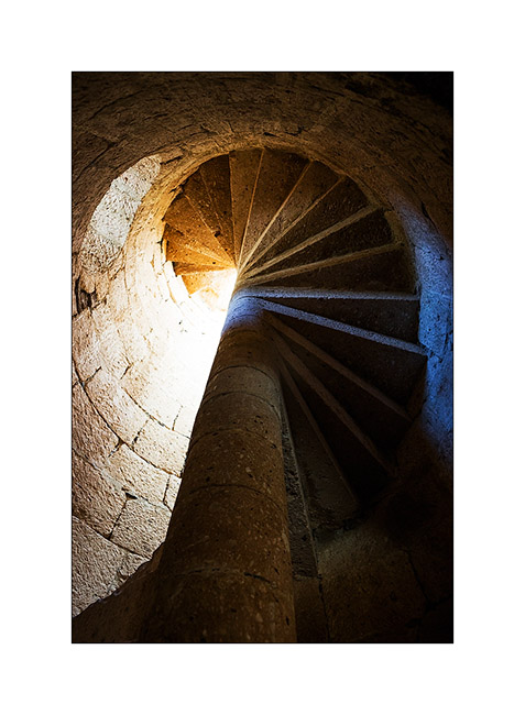
7. It’s a large mission, with many rooms…
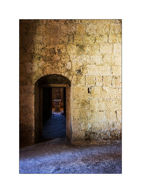
8. … and a pretty staircase to access to the roof.
9. Gardens.
10. On the road through the mountains…
11. And since it’s cold on the Pacific coast, we decided to push up to Baya Los Angeles for the night.
12. VivaLaVida on a natural peninsula…

13. … more visible from above!

14. The next morning, while Andrew bathes, VivaLaVida explores the area… 😀
15. … before to take the road to Pacific coast again.
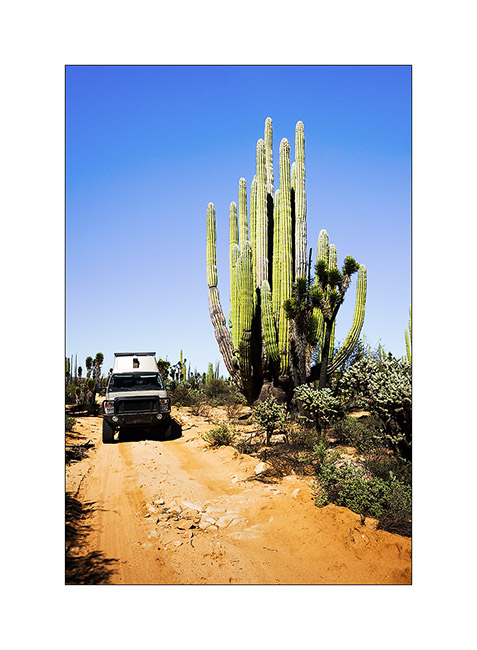
16. Another giant beside the track. Undoubtedly one of the largest we have seen throughout the trip!
17. We follow a road sometimes badly damaged by recent rains…
18. … but the nature around is beautiful.

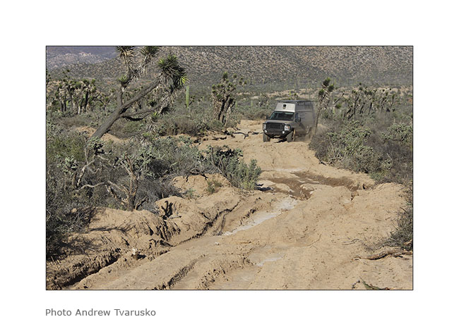
19. Here, 4WD where necessary to go through..! 😉
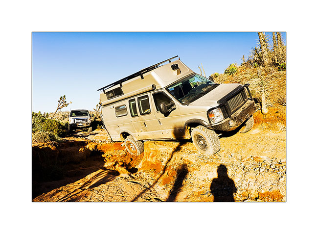
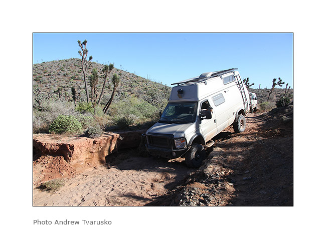
And…! At one point on the trail, the water dug nearly a four feet deep, leaving only a narrow passage against the hill. Vivalavida engages therein while Andrew guided me… but the road collapsed under the weight of VLV missing to fall on the right side! Luckily, he landed on the rear differential, the right rear wheel in vacuo! I was lucky on this one ..!
20. Bad posture…
21. A little more and VLV would lye on the side…
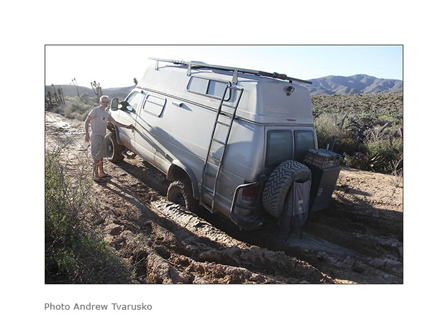
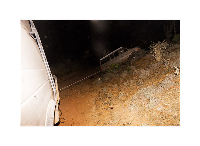
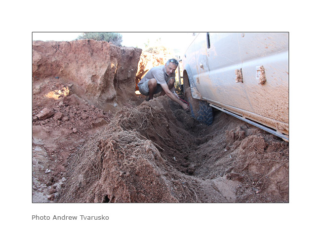
It took us three hours to get him out of this trouble. We first secured VLV at the roof rack with a strap at the foot of a large cactus to prevent it tipping if the road continued to collapse. We backfilled under the rear wheel with stones and sand, creating a ramp to the rear. Baja Shaker positioned on the hill as a fixed point and the winch Vivalavida at the rear, it was slowly winched on this ramp. All that was at night because the collapse occurred in the late afternoon.
22. Baja Shaker as a fixed point to winch from the rear..!
23. Almost bailed. Andrew gives the depth scale..! 😀
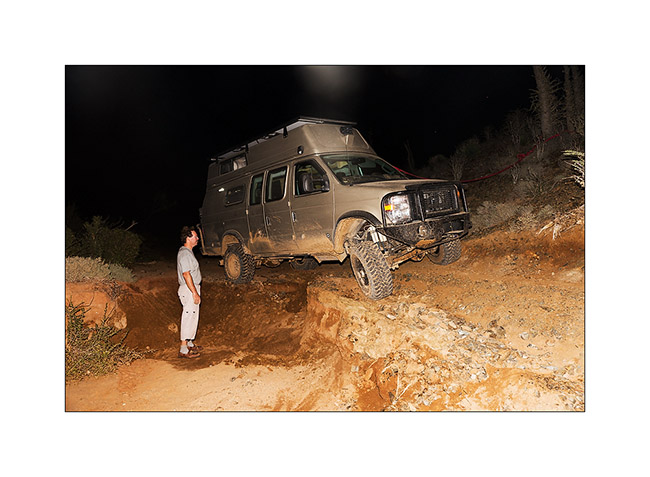
It was not until around 21:30 that we finally got it right and had our meals, camping a few hundred yards away.
24. The next morning we made a ramp down into the wash and back on the road further.
25. But the wash was very soft. I had to take out the shovel again…
26. Finall ythe obstacle has been crossed!

A final update on the Baja is to come soon…
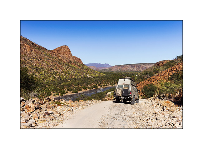
Baja California (6)
As stated at the beginning of the report, we favored the Pacific coast for our ascent.
1. Osprey, common in the Baja.

2. To the west, the climate is very different, oceanic, humid and cold.
3. Therefore the vegetation also changes.

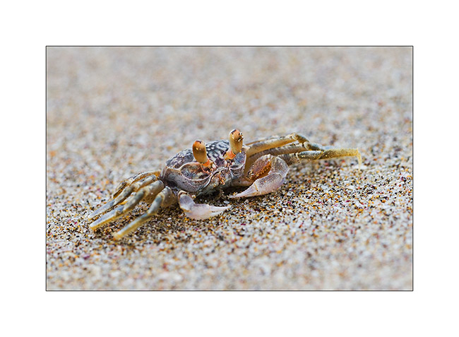
4. Nice inhabitant of the beach…
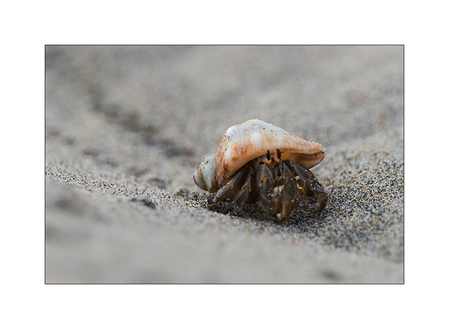
5. … as those big funny crustaceans.
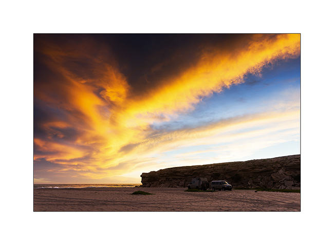
6. Nice camp on the beach next to the waves of Pacific Ocean.

7. Wonderfull sunset at our boondocking.
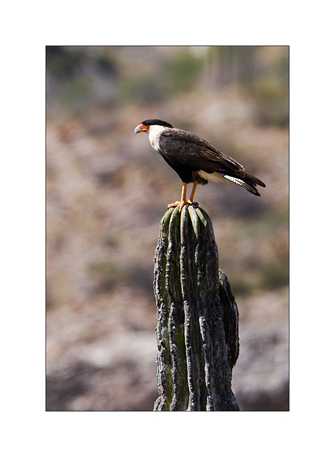
8. A beautiful caracara…
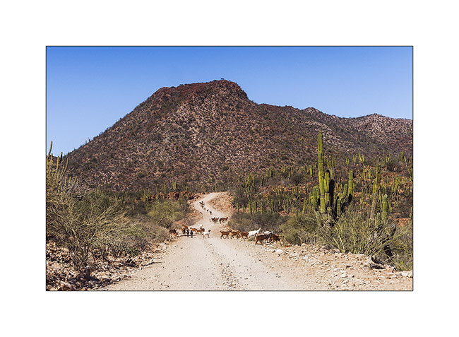
9. Herd of goats on the road.
10. Sometimes, there is some water…
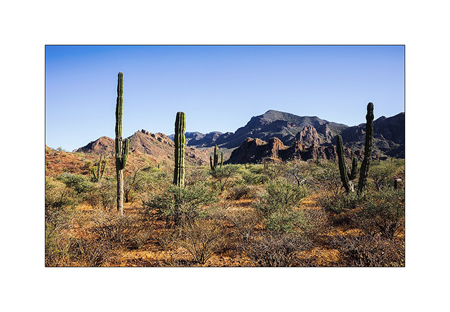
11. And still these arid mountains dotted with many cactus.
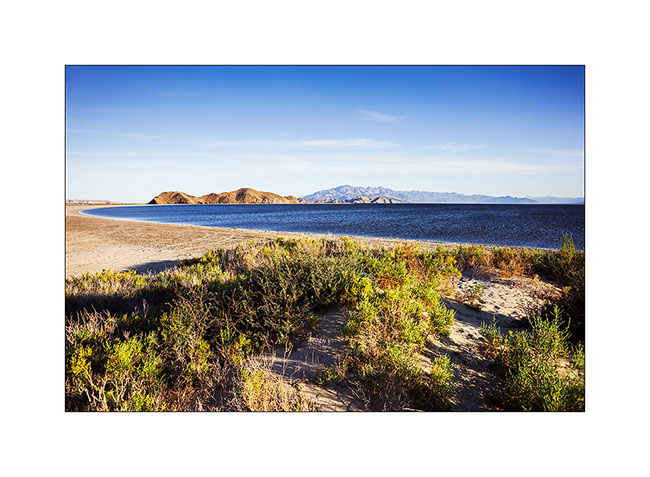
12. The Conception Bay in late afternoon and in strong wind.
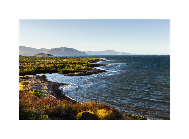
13. Anchorage south of Santa Rosalia
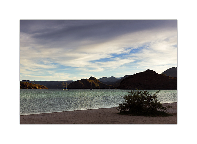
14. Dusk on the Laguna San Ignacio.
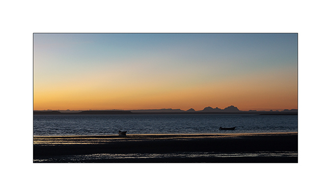
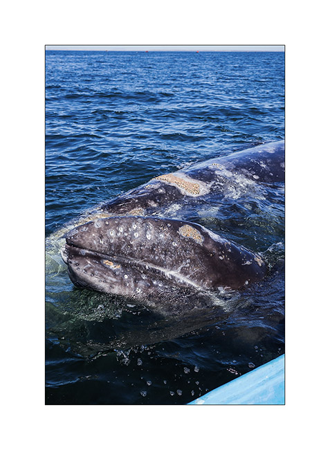
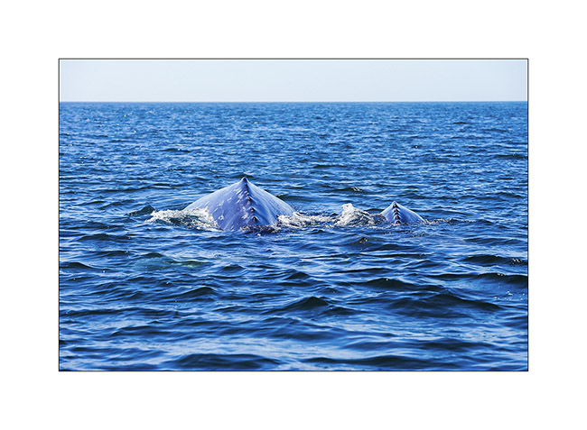
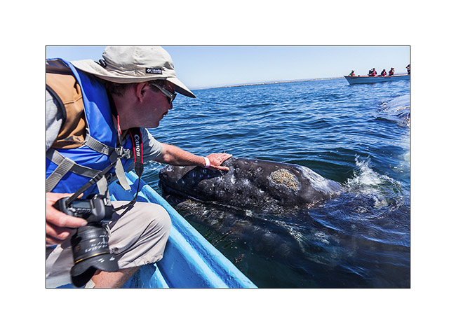
This is where we meet Ramsey, another 4×4 van owner who had organized a trip to Baja via the Sportsmobile forum. He was travelling since one week traveling with a small group of van. He had organized an outing to go seeing the gray whales, which will remain one of the highlights of our trip. So the next day aboard small boats, we met the wales. There has indeed approx. 65 mothers with their jungs and 80 solitary individuals who are spending part of spring in this lagoon.
15. A mother and her young.
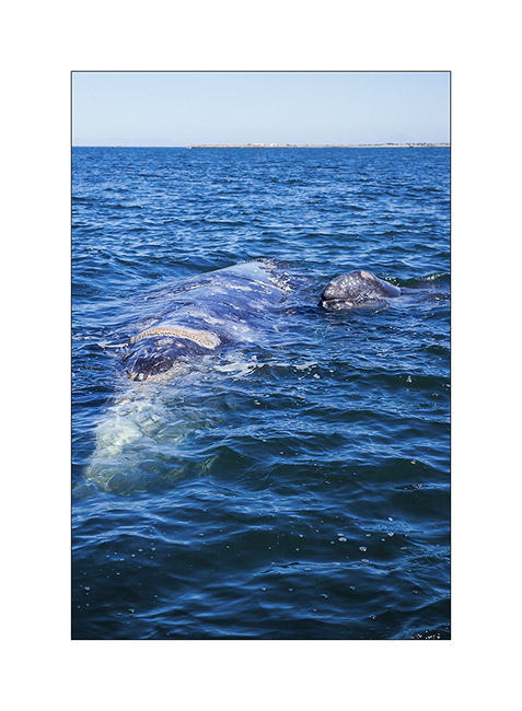
16. She support him at the surface of water…
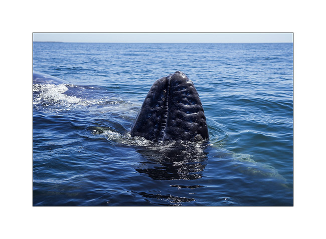
17. A male shows…
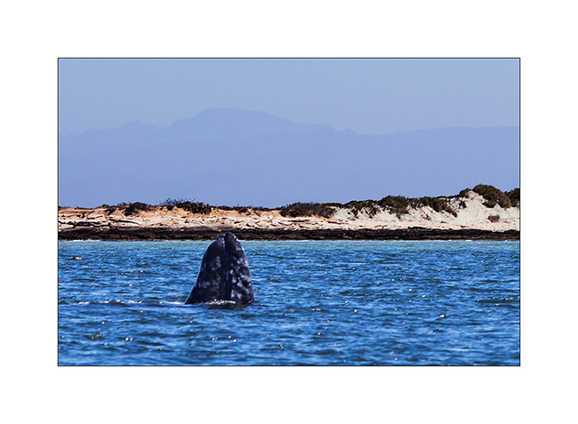
18. … then waved…
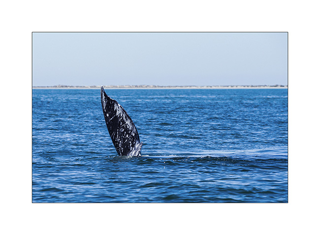
19. … while the mother and her little recede.
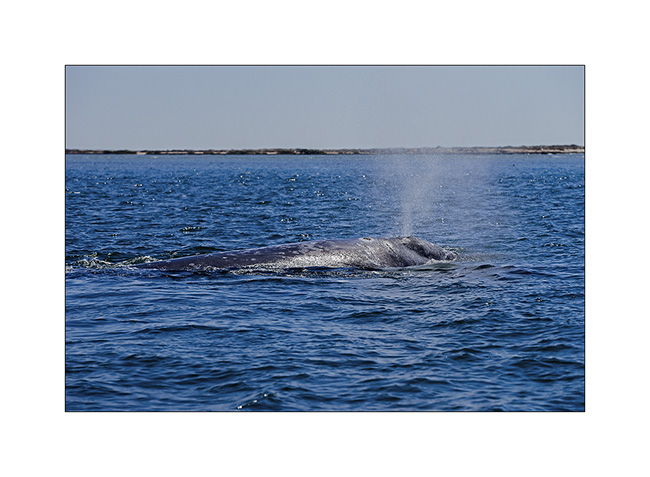
20. Breath…
21. Later, another mother presents her jung, supporting him close of the boat. This jung seems to enjoy being petted on the nose.
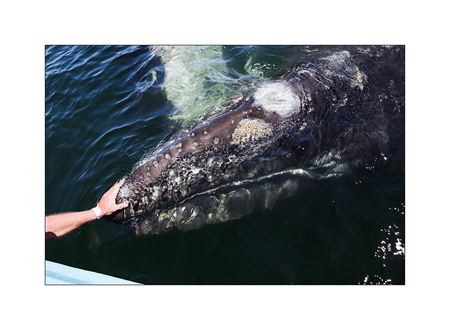
22. Andrew says hello…
23. Candle to say good bye…
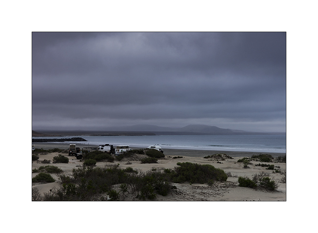
24. After this moment of intense emotions, we camped with the little group in Santa Rosalita, on the Pacific coast under a dark sky. The campfire was really nice, Andrew had even prepared a fondue on the beach! It was a nice evening which allowed us to meet several members of the sportsmobile forum.
To be continued…