Archives
now browsing by author
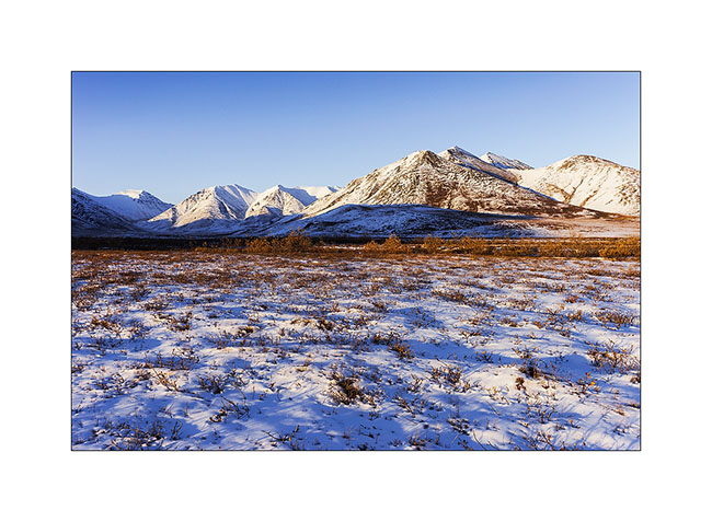
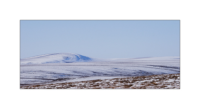
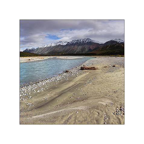
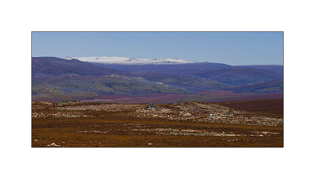
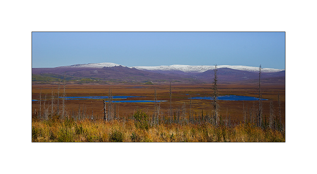
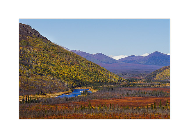
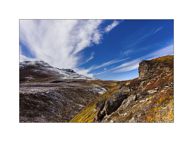
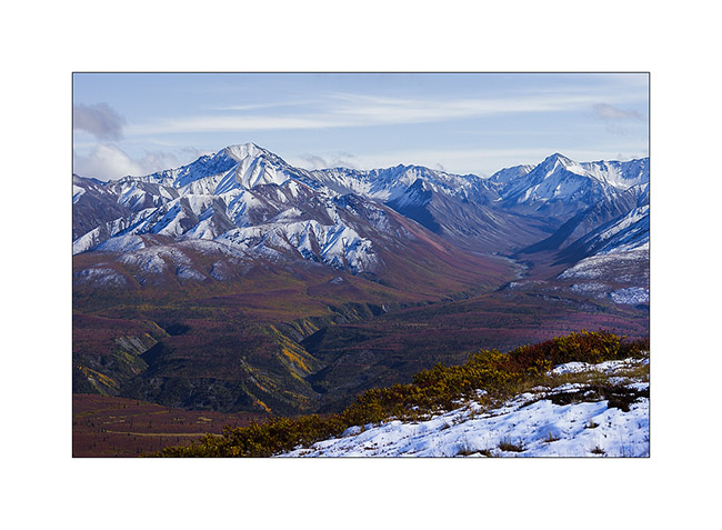
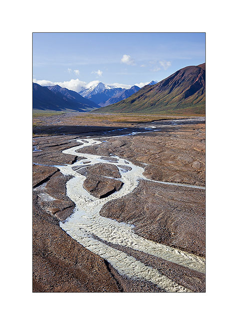
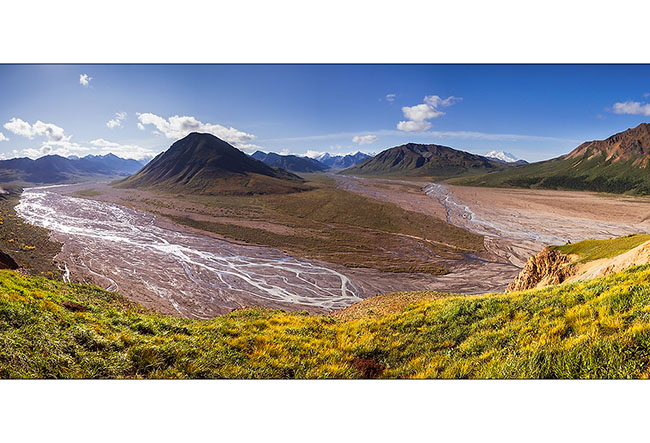
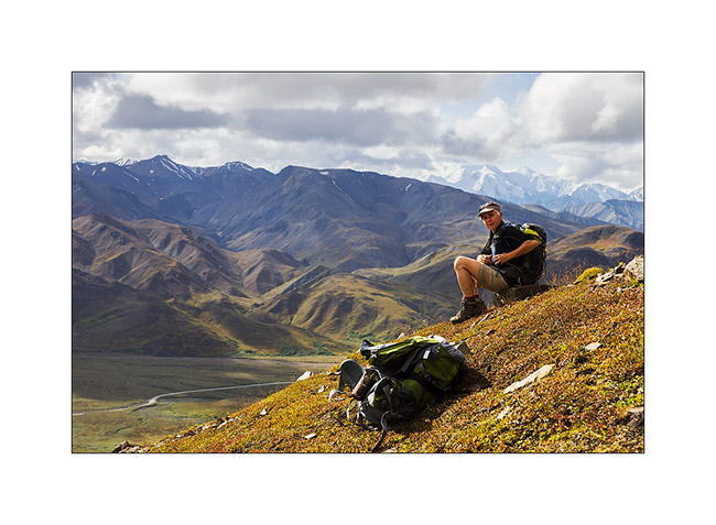
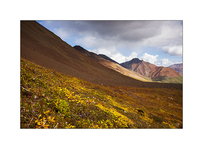
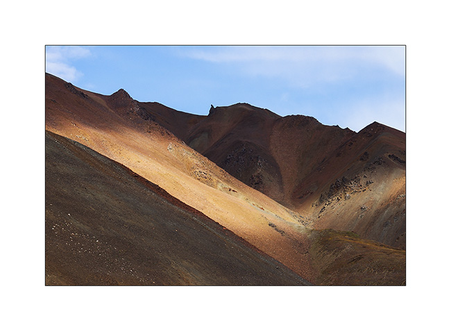
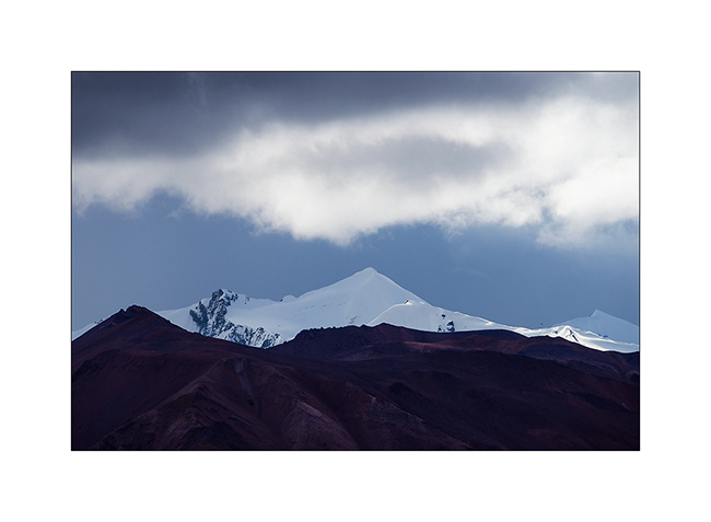
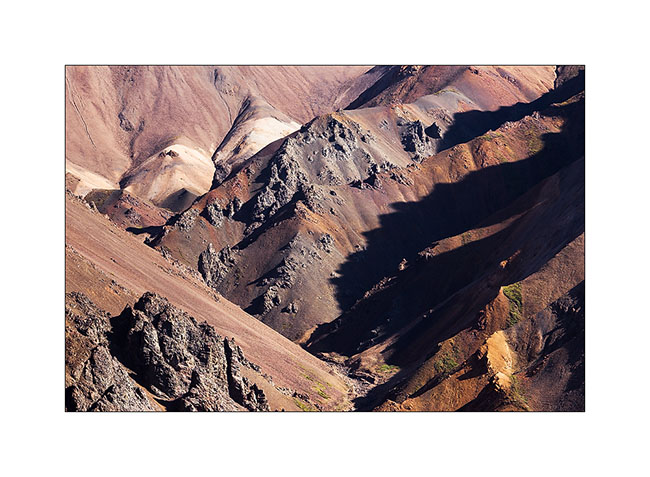
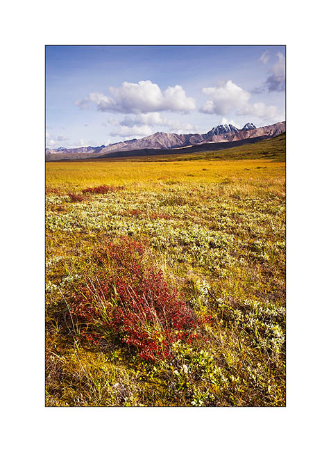
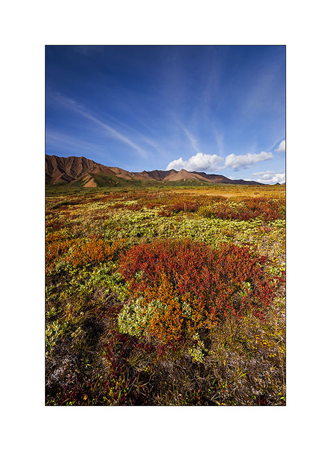
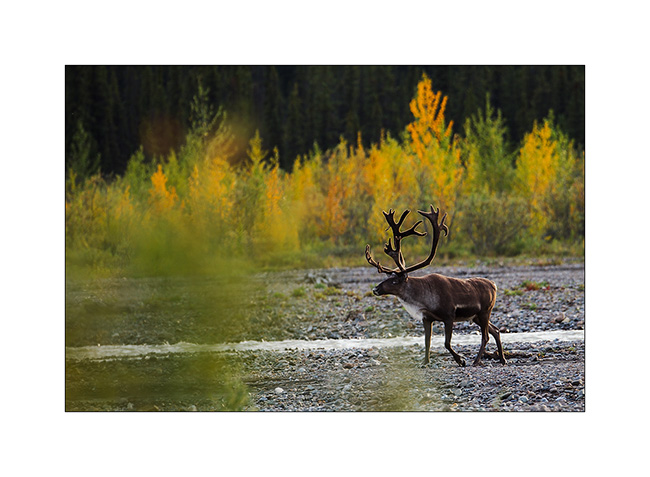
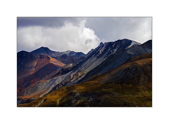
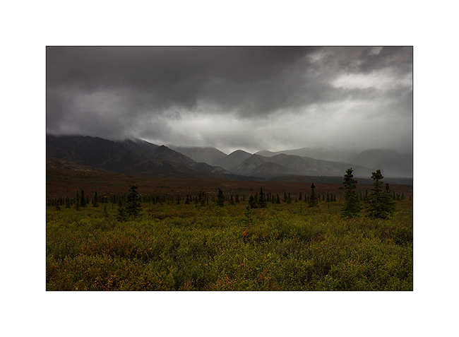
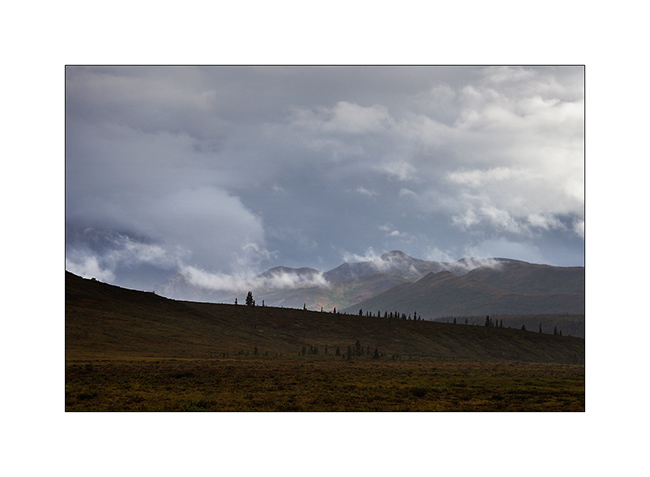
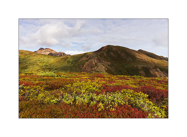
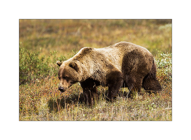
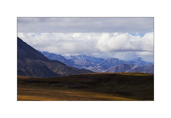
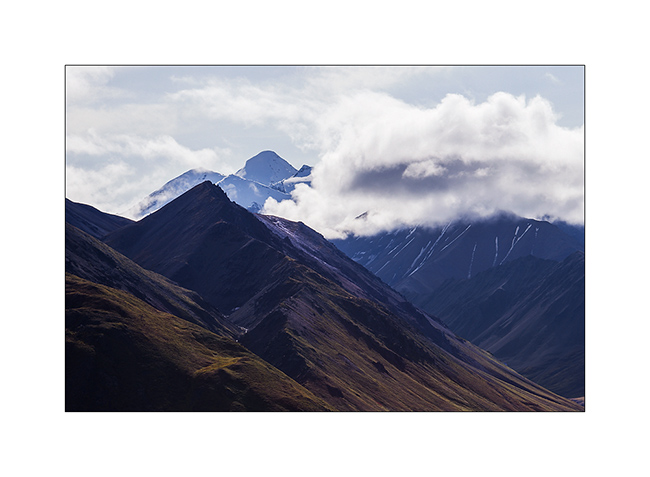
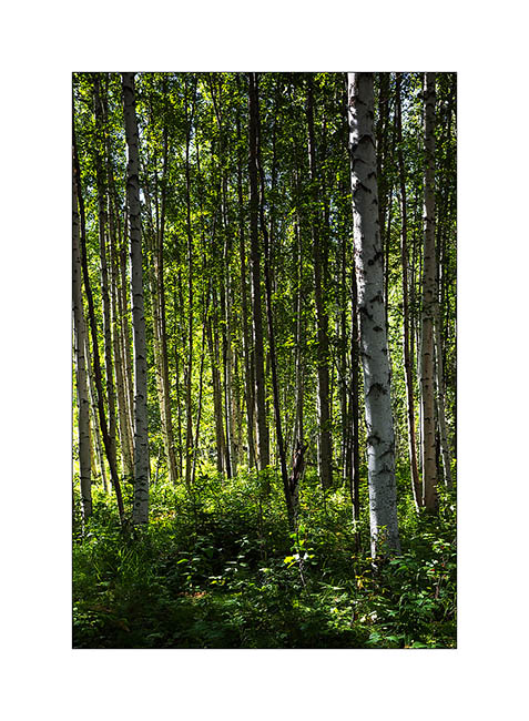
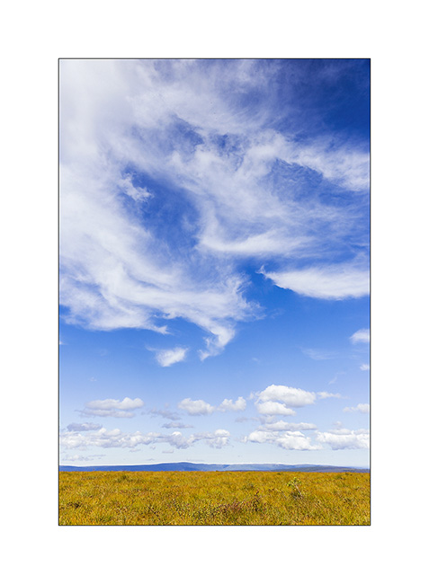
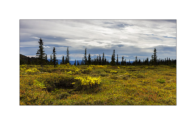
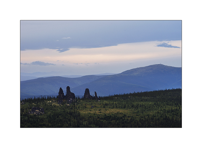
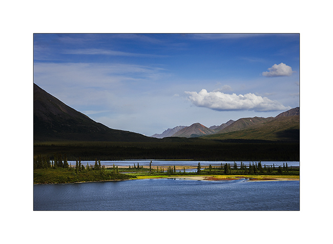
Brooke Range and arctic tundra
We continue farer northward…
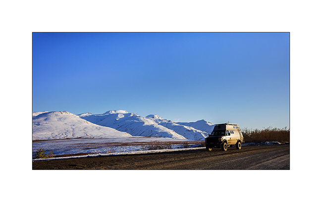
1. Nolan valley, a side valley accessible by a really muddy small mining road .
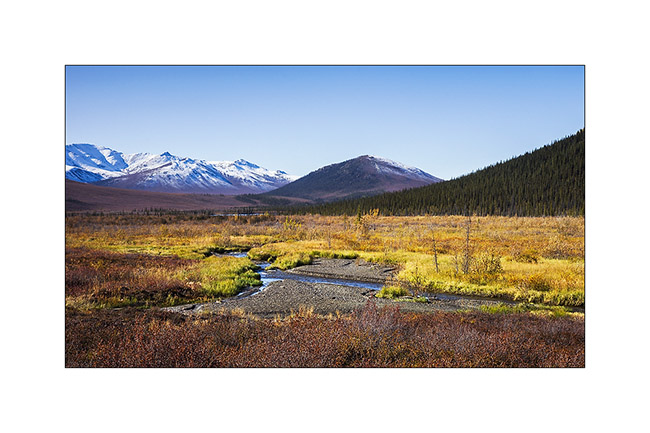
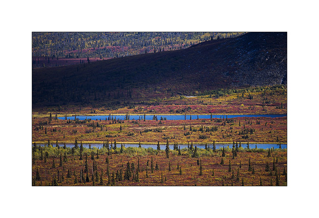
2. At this altitude, the marshes are still not frozen.
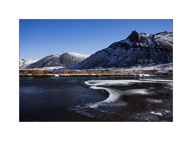
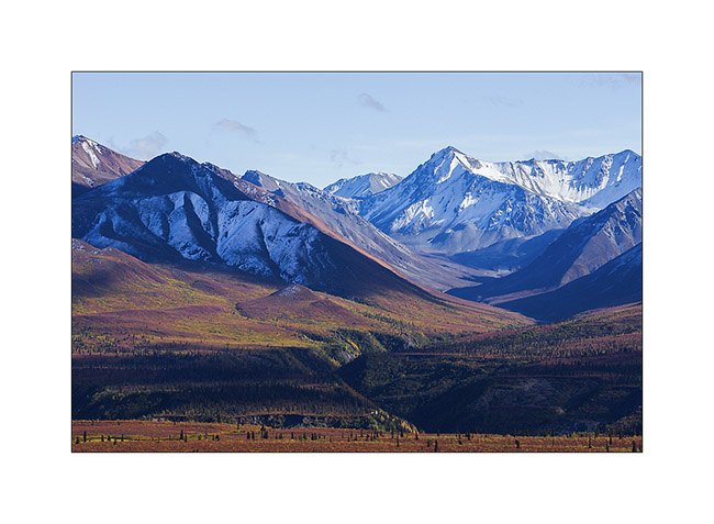
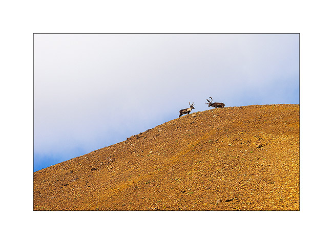
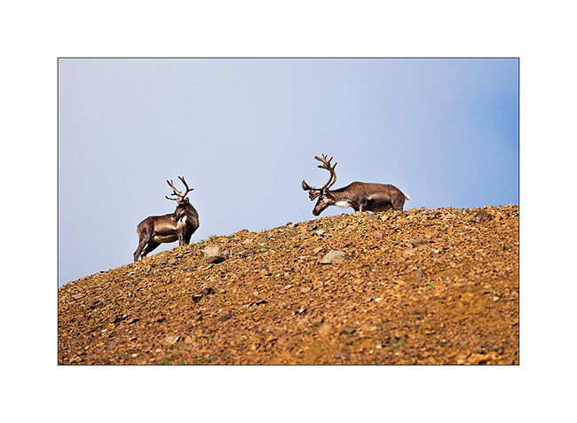
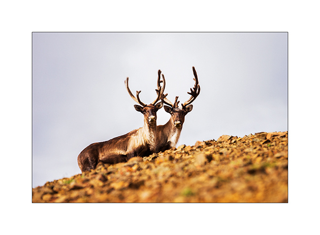
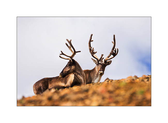
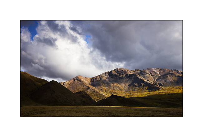
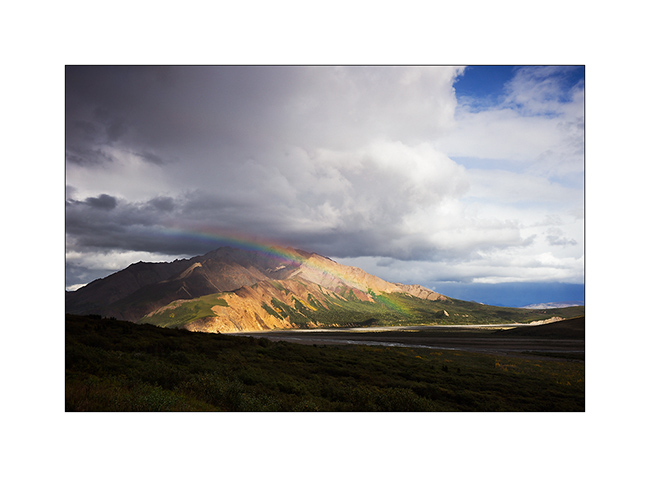
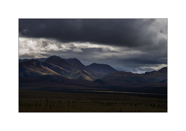
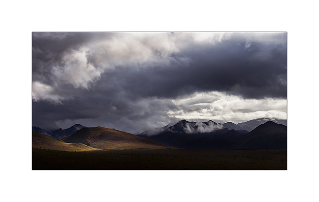
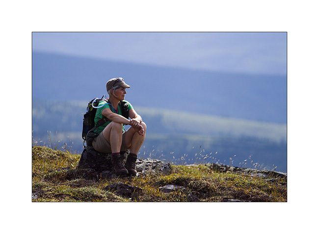
3. I found the Brooke Range that bars northern Alaska back.
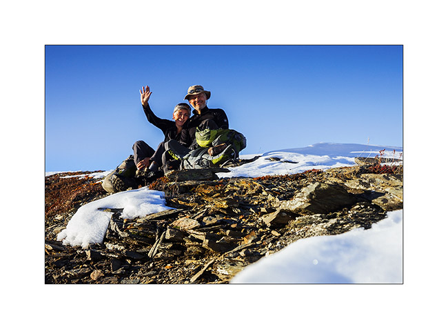
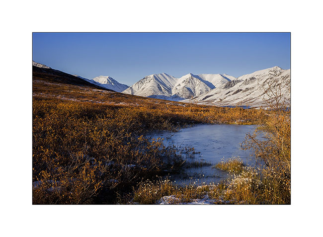
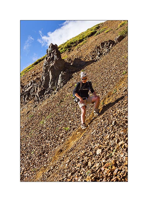
4. We stop a few dozen miles after Coldfoot to go climbing one of the mountains beside the road.
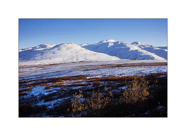
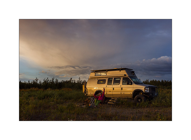
5. While VivaLaVida begins to climb Antigun Pass, the atmosphere becomes wintry.
6. All is already frozen here…
7. … and it is already well below freezing in late afternoon.
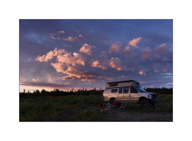
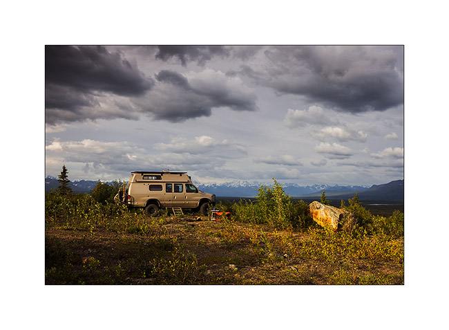
8. As it’s already late, we find a nice boondocking site before Antigun Pass, approx. 4,000 feet elevation on the banks of a small river.
9. Despite the cold, I’m going to make some pictures while Mino is preparing the aperitif!
Temp will almost reach 10°F that night and VLV’s heater resume service after resting for a few months…
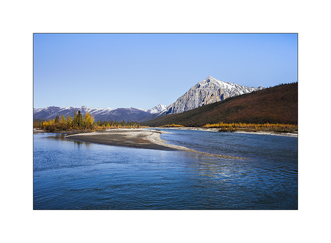
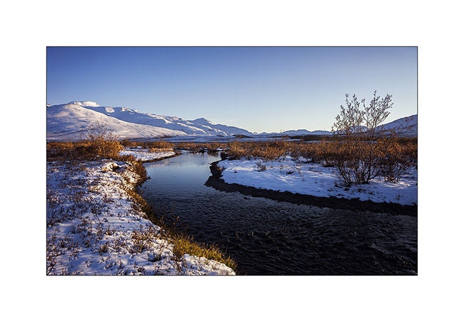
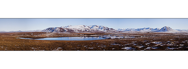
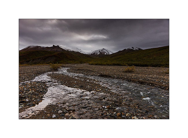
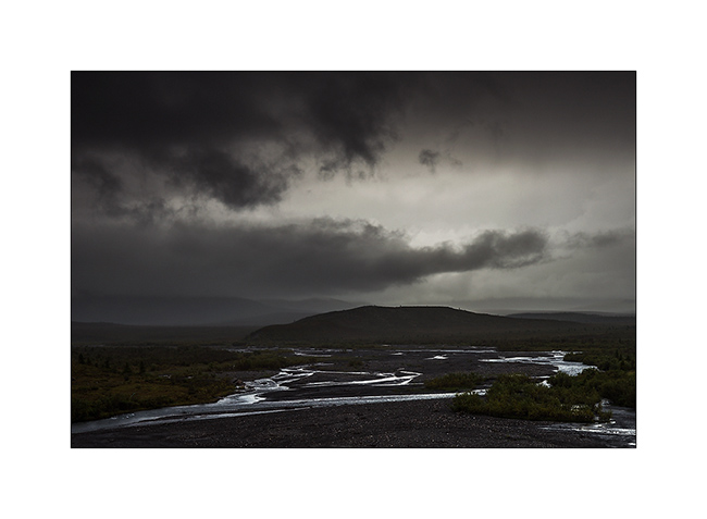
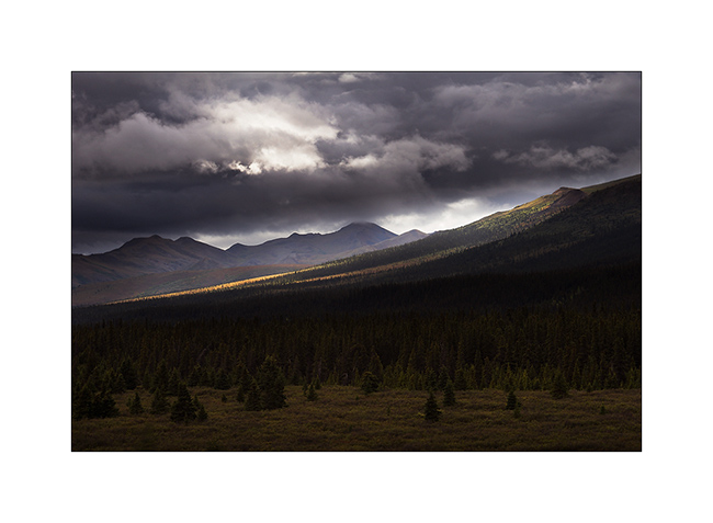
The next morning we cross the Antigun Pass and stop thirty miles down it to go hiking along a beautiful river.
10. The blizzard that blew here two days previously installed winter before autumn has arrived…
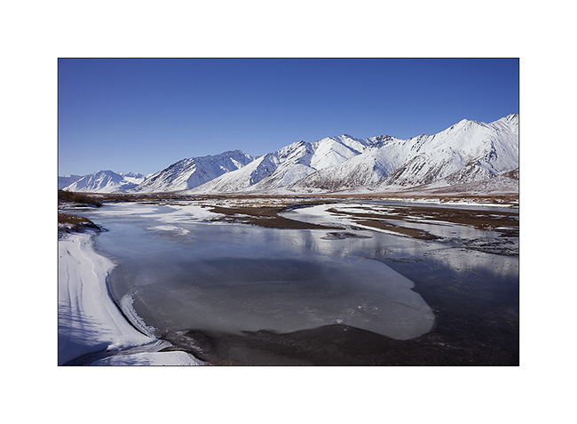
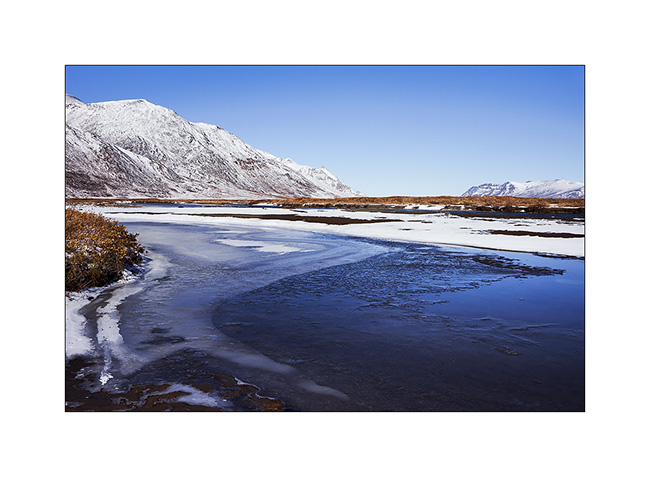
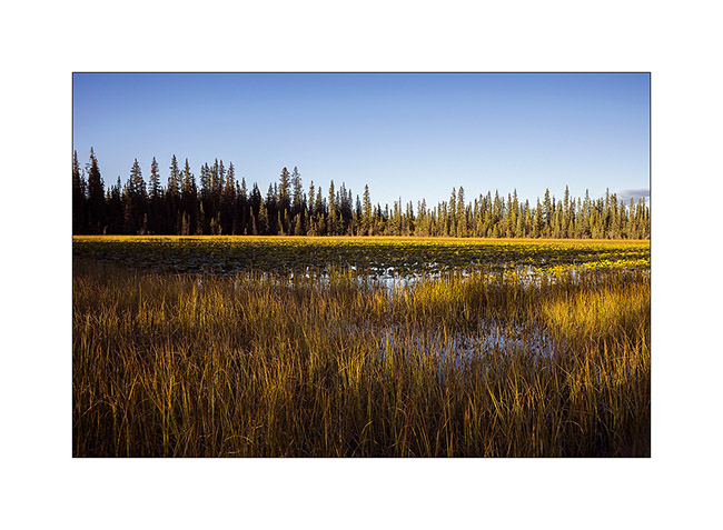
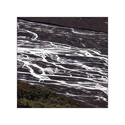
11. Despite a significant current, the banks of the river are well frozen. It was about -5F° in previous days…
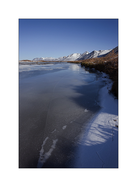
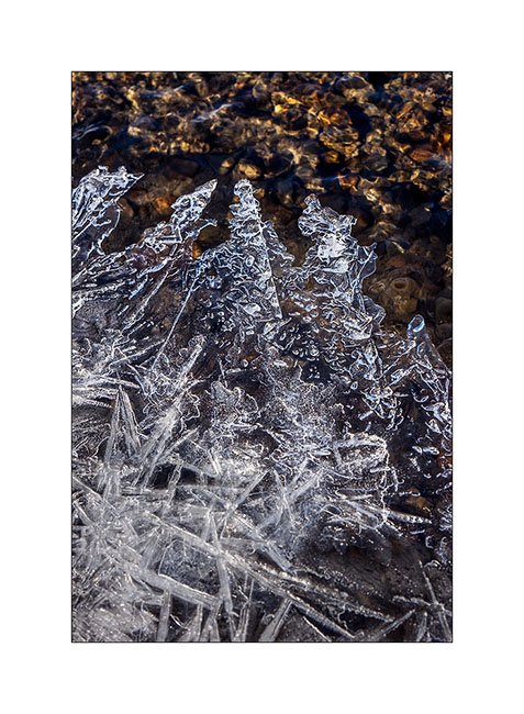
12. I enjoy the clear light to play with ice concretions…
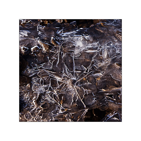
13. … sometimes contrasting and twisted…
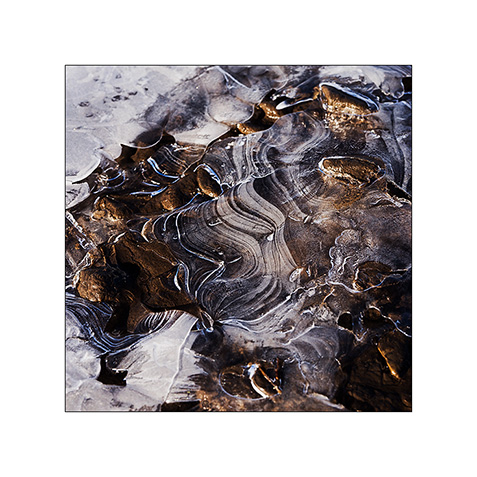
14. … sometimes carved by running water below.
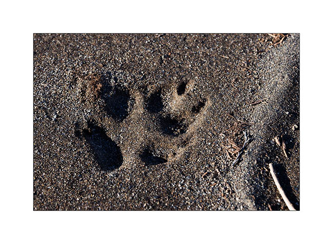
15. On a bank, we find wolf tracks. It happened here less than two days ago, the snow testifies it.
16. The show is sparkling as the river is freezing and carries plates of ice that break in crystal clear sound…
17. … and our eyes feast.
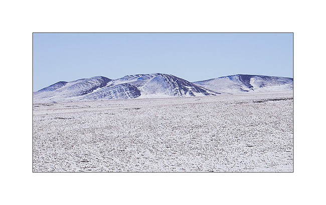
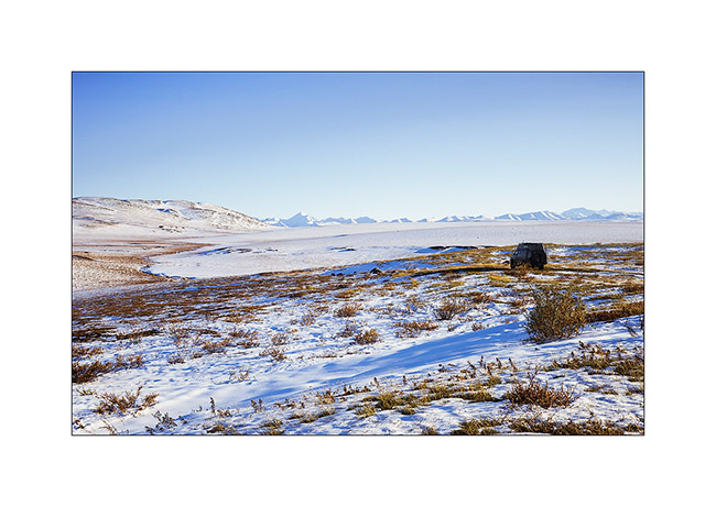
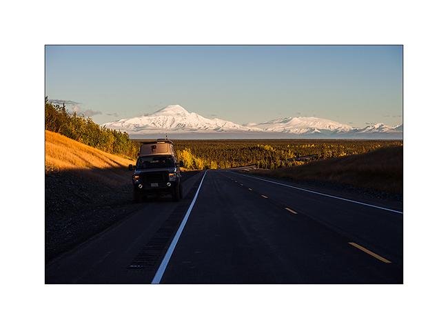
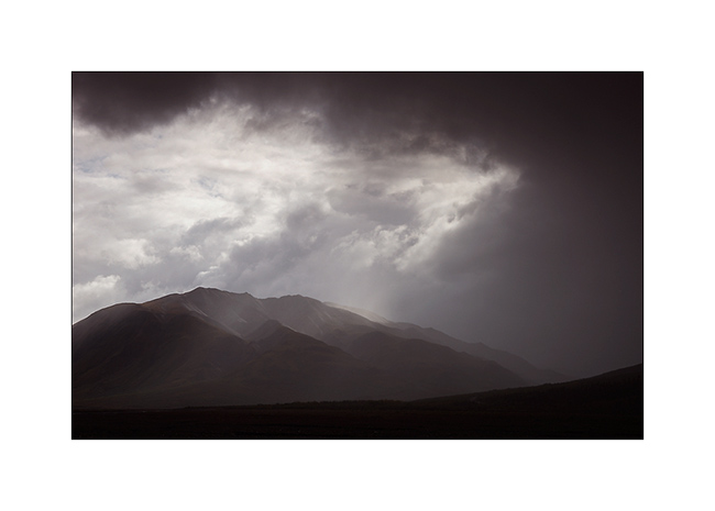
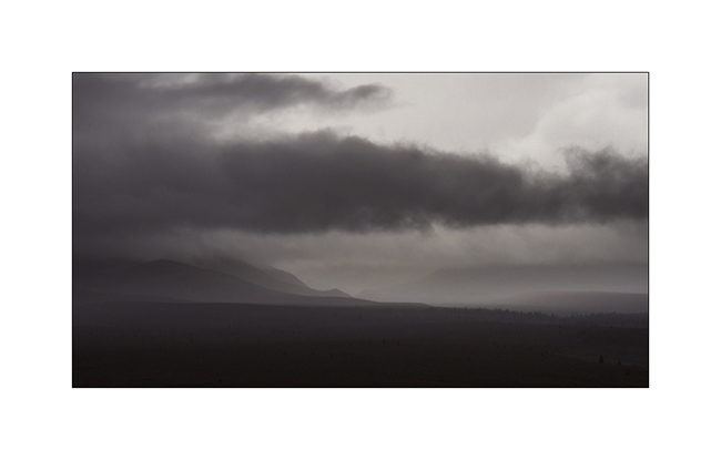
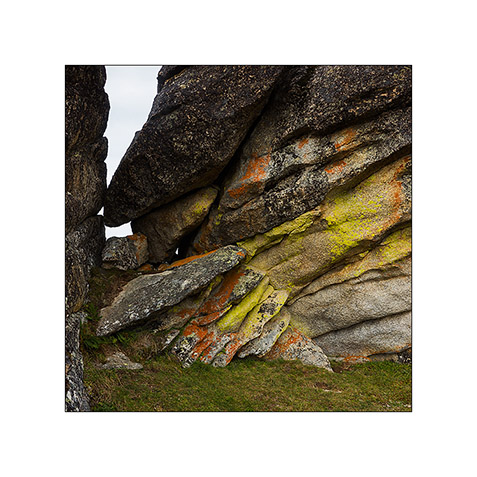
18. Continuing towards the far north, the landscape becomes truly arctic.

19. Blizzard designed the reliefs.
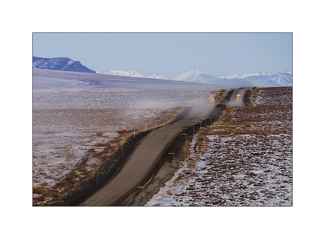
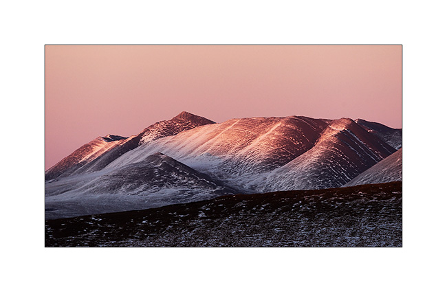
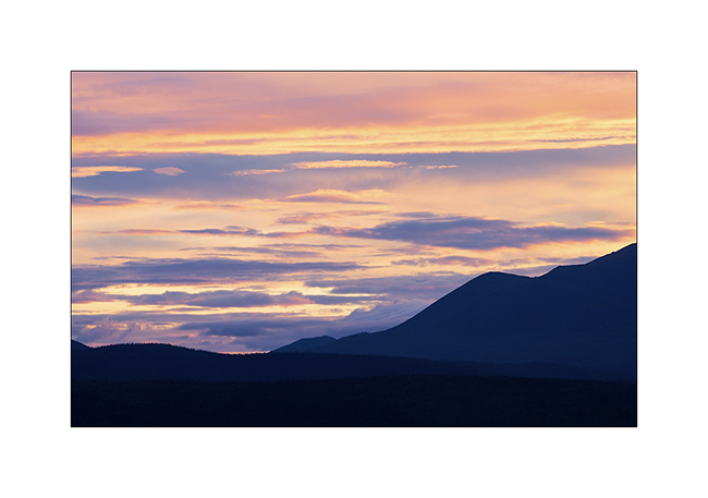
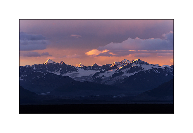
20. Not sure that the truck drivers who supply Deadhorse and Prudhoe Bay are all aware of this beauty…
21. We leave VivaLaVida to walk on a side track…
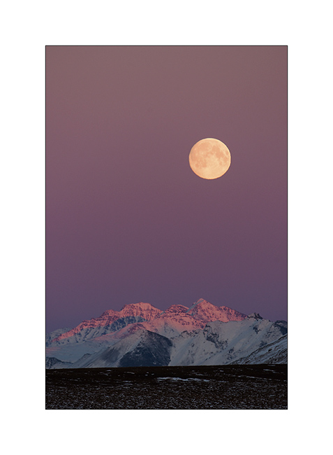
22. Perfect lines of the wintry tundra…
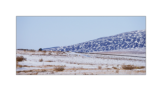
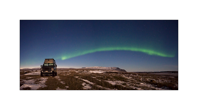
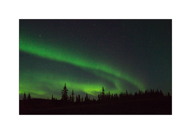
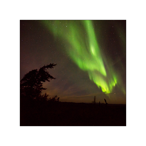
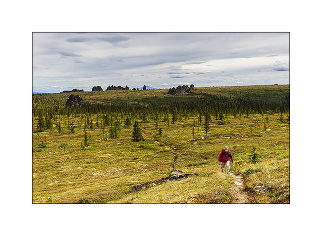
23. We will not go to Deadhorse, the last part of the track is less interesting. We stop at the last foothills of the Norths Brooke Range…
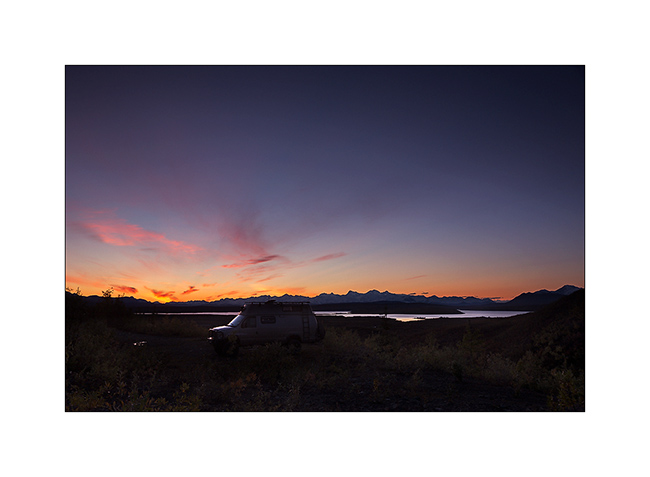
24. … and even find a camp on the tundra. What a fantastic place to camp, isn’t it? 😀
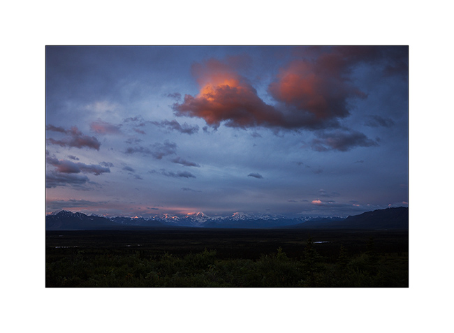
25. The Sunset is beautiful again…
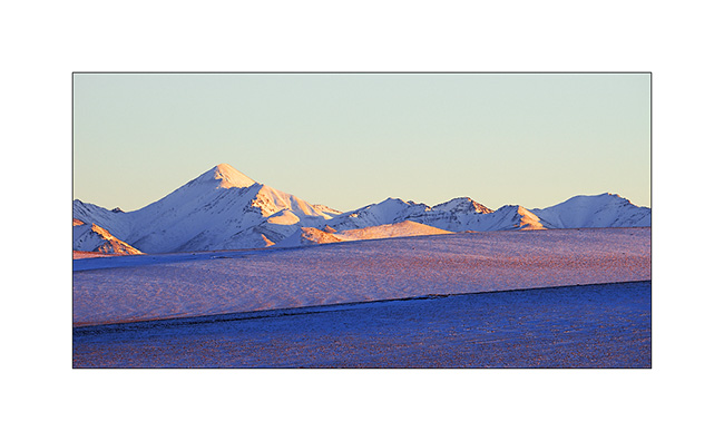
26. … the last rays coloring the hills…
27. … before a magic full moonrise.
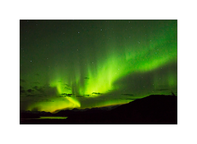
28. And to complete this grandiose day, a northern light came to wish good night to VivaLaVida while the full moon was lighting up the tundra!
We began our descent back to the South the next day. To discover in the next update… 😉
Thanks again for your loyalty!
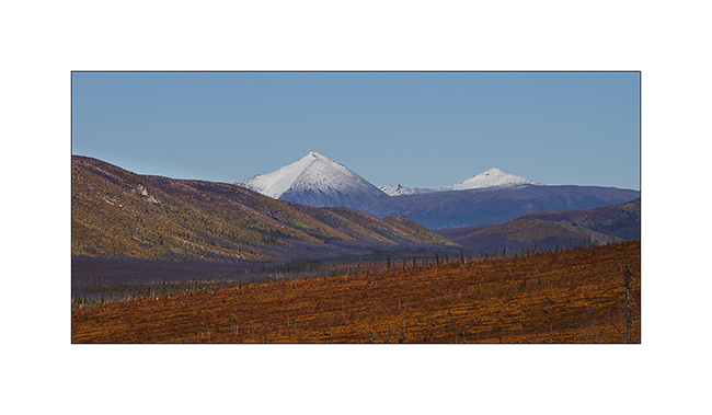
Richardson & Dalton Highways
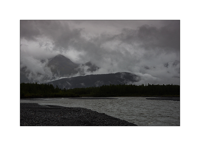
Continuing our journey northward, we cross the Alaska Range covered with fresh snow.
1. Exploring a side valley, not far from our camp.
2. The Richardson Highway passes through high mountains with difficult access.
3. Scree dusted with snow…
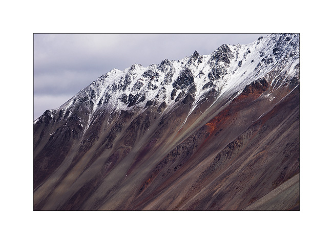
4. North slope of Alaska Range.
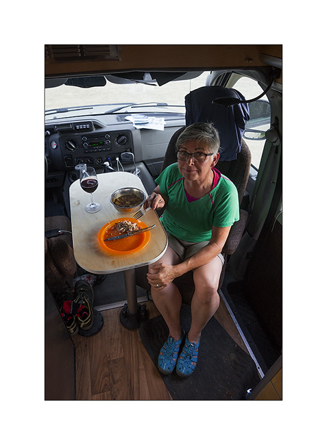
5. In the kitchen, we don’t let go: wild salmon with dill on a bed of spinach, all cooked over our campfire, hummm… 😉

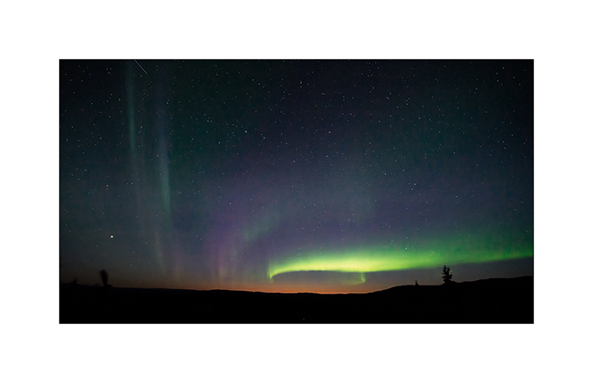
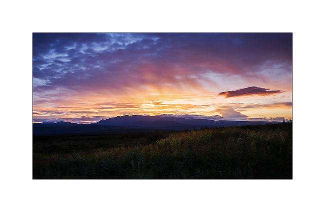
6. After the show of the previous day, we watch the sky and a new northern light appears with the last light of the Sunset still pointing north…
7. We spend almost three hours outside despite a tempestuous wind and biting cold!
8. Paintings are constantly changing…
9. … sometimes very soft…
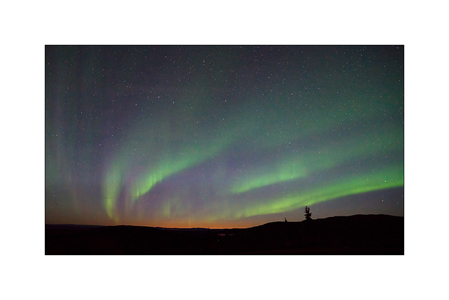
10. … sometimes very intense.
11. Sometimes the aurora crosses the sky with a truly amazing intensity, almost comparable to that of the moon.
12. We are almost hypnotized by the show…
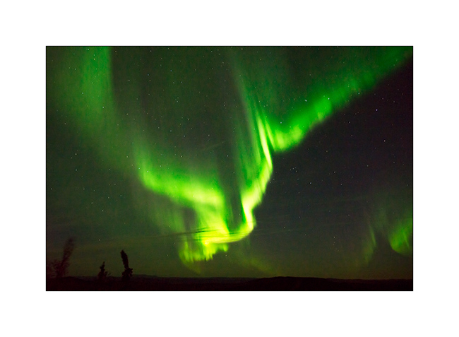
13. … and the grandiose beauty.
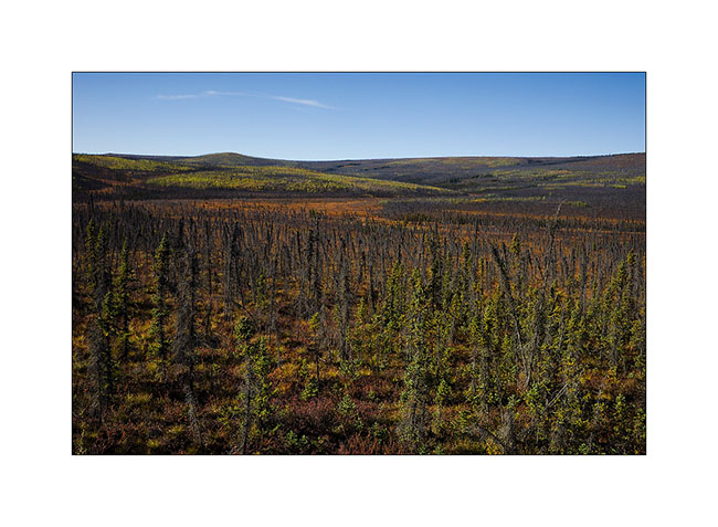
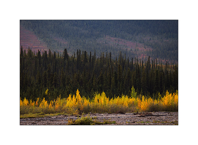
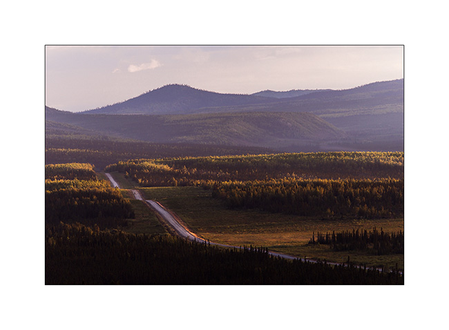
14. After going late to bed, we entered the Dalton Highway the next day. The atmosphere was completely different than during my first visit, I feel like discovering other landscapes…
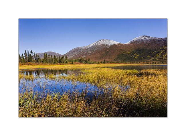
15. Here too the recent snow still covers the hills.
16. Taiga has completely changed color with warm tones adorning.
17. A picture of Grayling Lake I made during my first visit. If you want, you can compare: it’s the image # 17 ! 😉
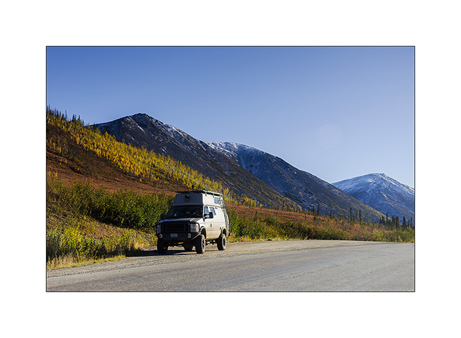
18. VivaLaVida on the Dalton Highway.
19. Between the orange-red willows and bright yellow aspen and birch, the colors are incredibly saturated…
20. … and snow further strengthens those.
To be followed soon…
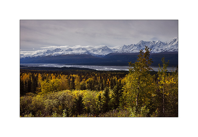
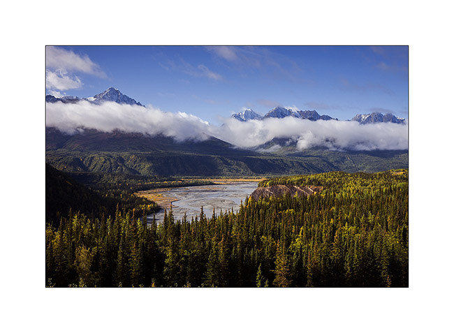
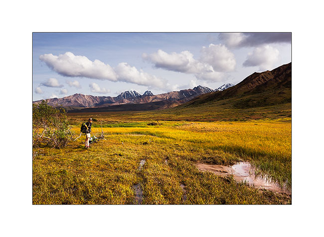
Central Alaska
I’m back after a few days of silence due to a lack of network.
Initially, Mino should leave from Seattle. However, to take advantage of the fall in Alaska, at our last update, we were waiting for a confirmation on the ability to change her return flight to leave from Anchorage. The response was positive and, at the time you’ll discover this update, Mino will be on the plane bringing her back the Switzerland…
As soon as we got the answer, a favorable weather forecast decided us to move north along the Dalton Highway I had already traveled six weeks before. We hoped to discover the fall colors on the tundra and to hike in Brooke Range. We then headed to the Glenn Highway to Glennallen and after a first night at a hundred miles from Anchorage, we woke up enjoying the first snow fall on the surrounding mountains.
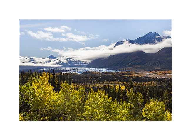
1. Matanuska River in ther morning.
2. They are still many clouds on the mountains.

3. The first frosts begin to color the trees.
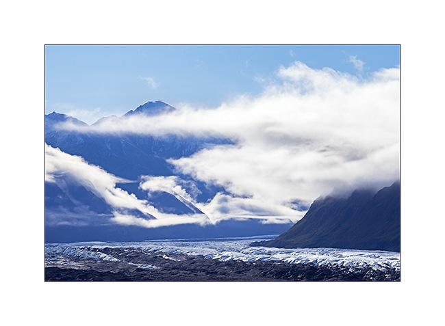
4. We pass near the huge Matanuska Glacier.
5. Clouds plays…
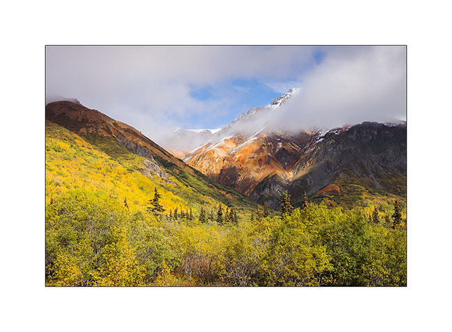
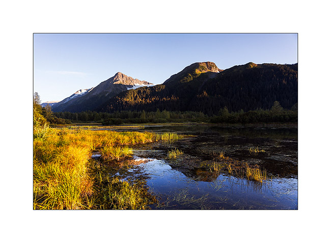
6. Some hills are really colorfull.
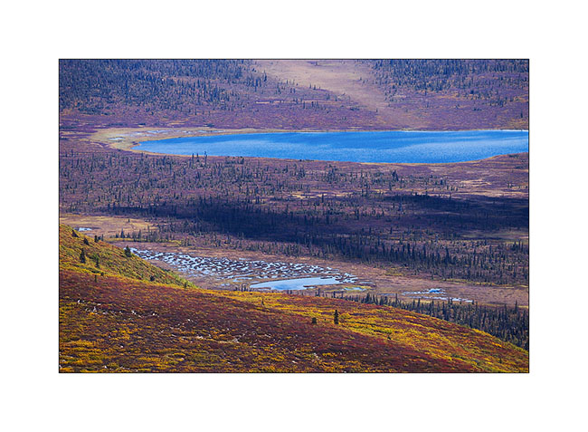
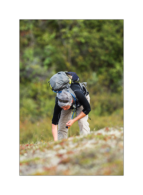
7. With such a nice weather, we decided to go hiking and discovered a small altitude lake.

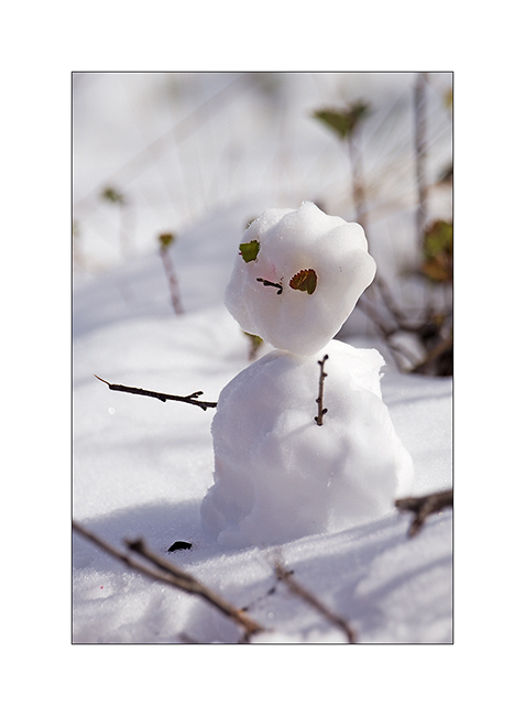
8. The first snow of the season inspires Mino…

9. … who signs its passage ephemerally… 😀
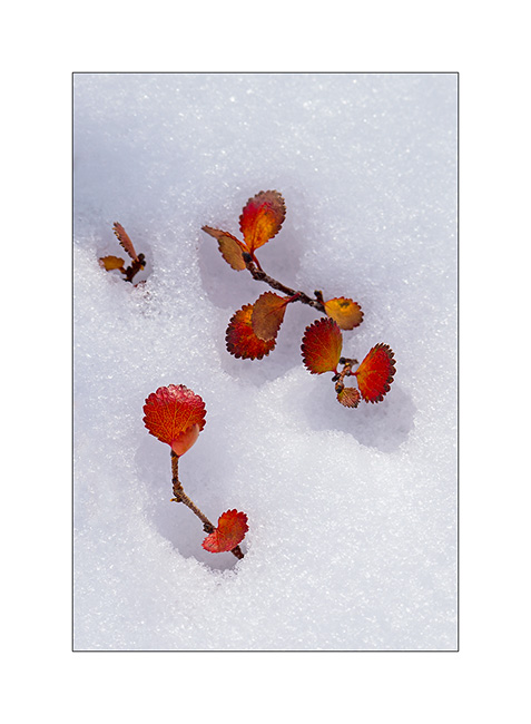
10. … while for my part, I play with the contrast between the snow and the “willows” colored with their characteristic orange-red fall color.
11. As and when we climb, the view extends over the surrounding valleys.
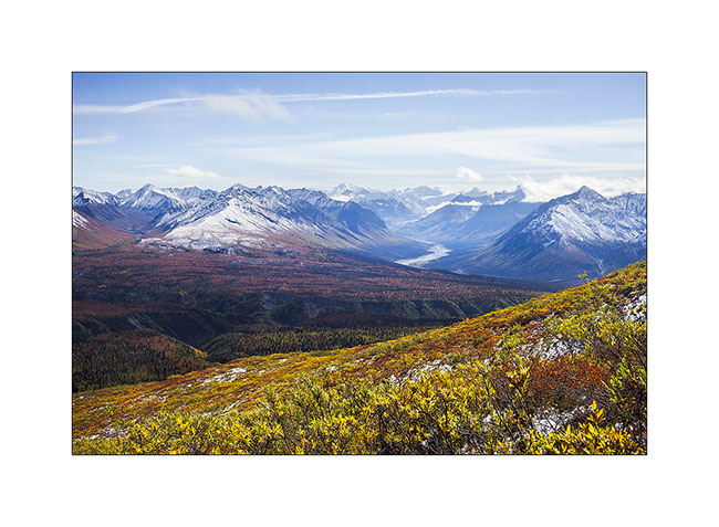
12. The horizon is so wide…
13. Souvenir picture…
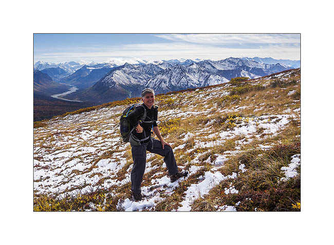
14. After nearly three hours to make our way uphill in the tundra, a break is welcome under a beautiful sky of cirrus.
15. A river that flows from one icefield, more than 40 miles away..!

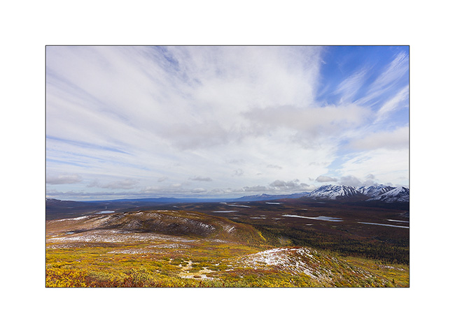
16. From above, tundra reveals so many small lakes and marshes…
17. The contrast between the warm tones of the autumn tundra and the white snow is beautiful.
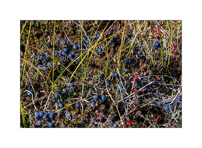
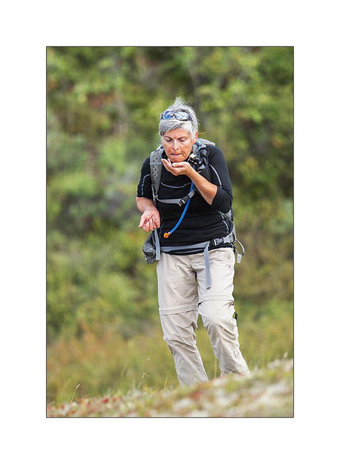
18. We enjoy some of the thousands of blueberries that are everywhere.
19. This mix of colors is so beautiful that I would stay there longer and longer…
20. Other lakes as we descend…
21. It’s getting late, shadows contrasted the opposite side of the valley…
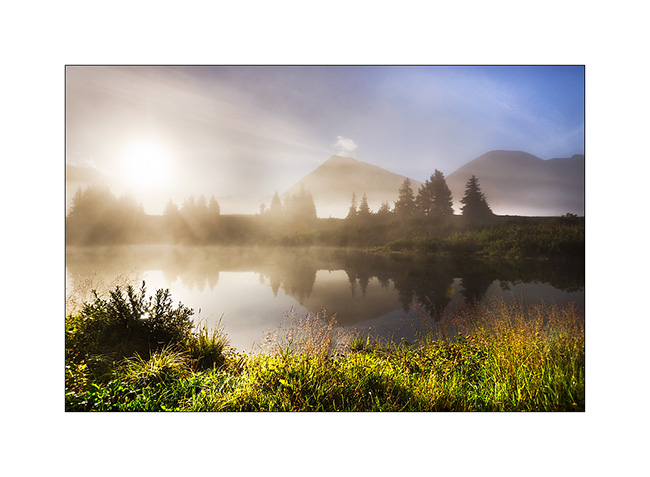
22. Continuing the road, I took a foot bath to take this image in a flooded marsh in beautiful sunset light.
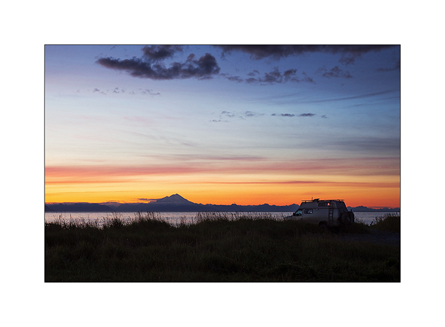
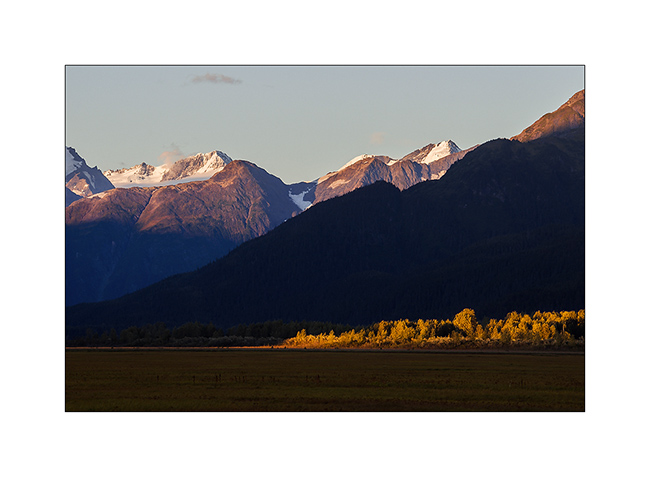
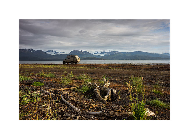
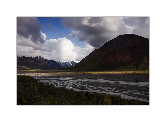
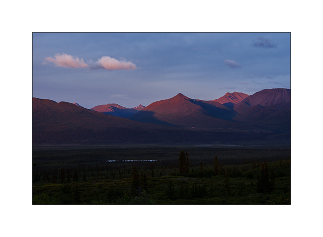
23. Vivalavida goes north. In the distance, Mount Drum, another volcano from the large fault extending from the Aleutian Islands to Mexico, and the huge dome of Mount Jarvis.
24. We find a nice camp site near Paxson.
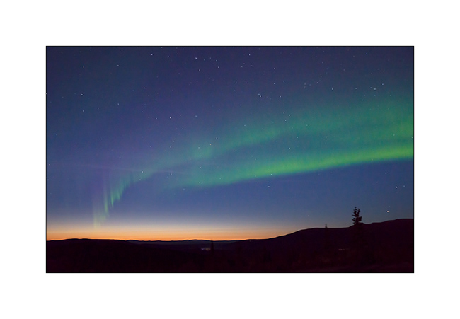
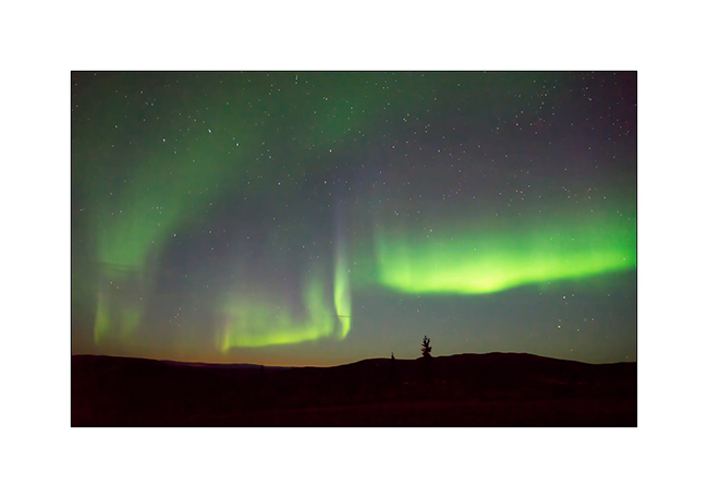
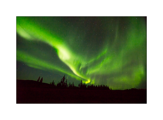
25. And while I’m about to go to bed, surprise: a powerful northern light lights the sky up!

26. This is the first that I have the opportunity to see, what a sublime spectacle… I will lie down only at 2am that night… 😉
The following will take in the far north where we had a small preview of the new winter to come … Coming soon here. 😀
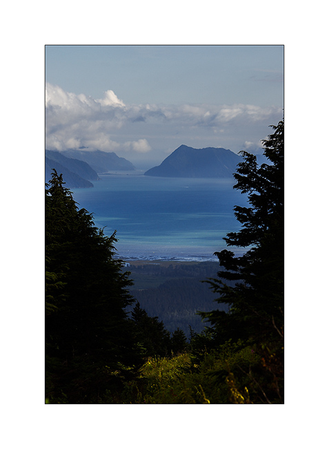
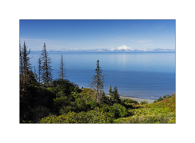
Kenai Peninsula (2)
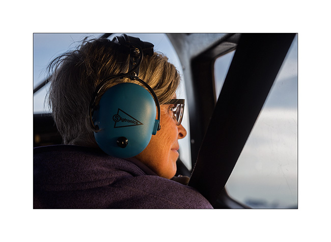
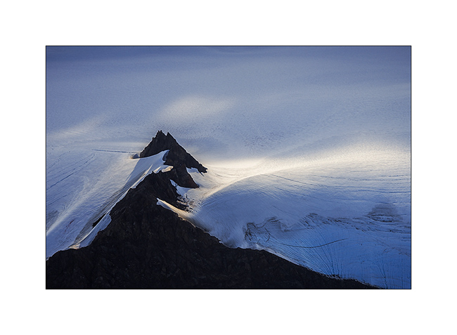
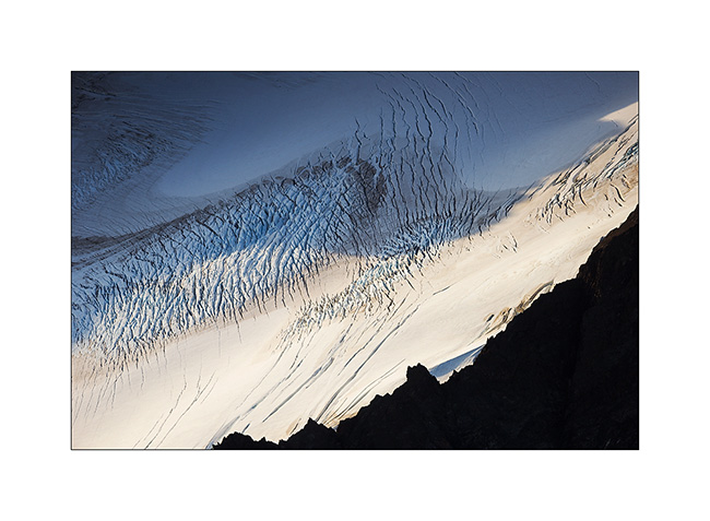
Still near Homer, the next day we decide to flight over the Harding Icefield, one of the giant icefields that covers the southern Alaska. We chose a small seaplane and to fly between 7:30 and 8.30 PM hoping for a nice light.
1. As soon as we take off, we can see some first glaciers.
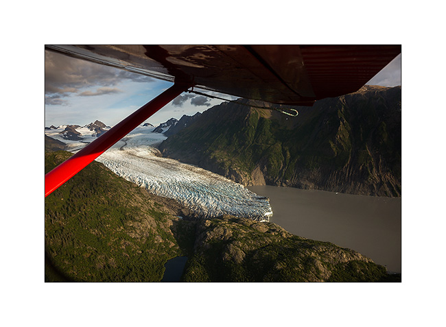
2. Fifteen minutes later, we fly over the Harding Icefield : almost 70 miles long and more than 30 miles wide!
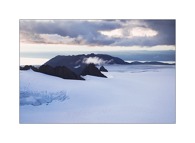
3. Large glaciers go in all directions.

4. Besides the pilot, Mino doesn’t loose a crumb of the show.
5. Some light gaps offer me nice views…
6. Motionless cascade…
7. On the way back to Beluga Lake, our “sea strip”, we flew over an island, refuge for thousands of birds.
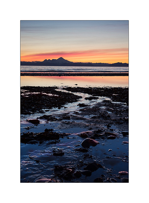
8. We leave Kachemak Bay at sunset…
9. … with a beautiful view of Kodiak Island in the distance…
10. … to find a wild place in the dunes, near Anchor Point.
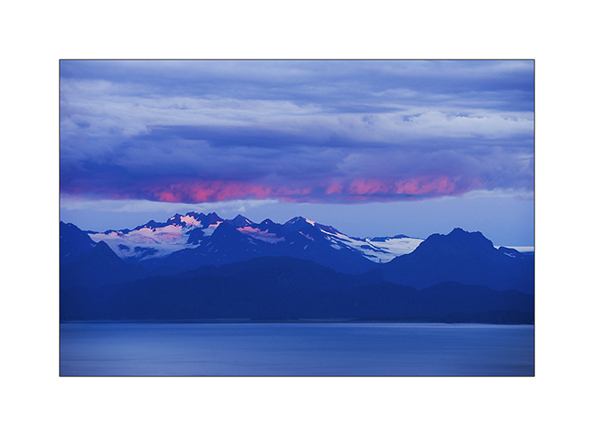
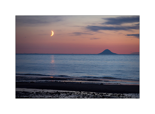
11. Sunset over Cook Inlet and Iliamna volcano; there are worse places to sleep, isn’t it? 😉
12. The moon also goes to sleep near the volcano island Augustin…
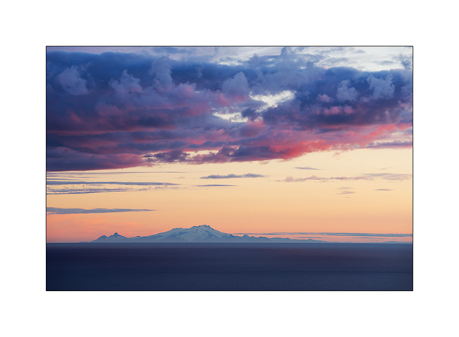
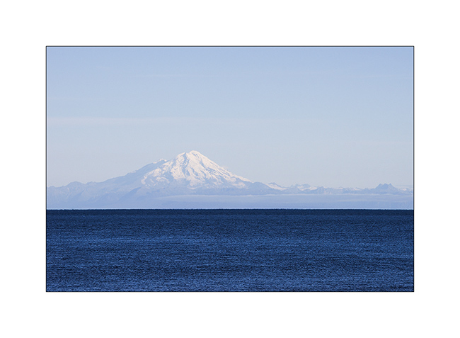
13. An air of Mount Fuji, isn’t it? But it’s another volcano: Mount Redoubt.
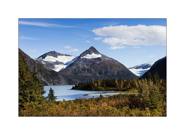
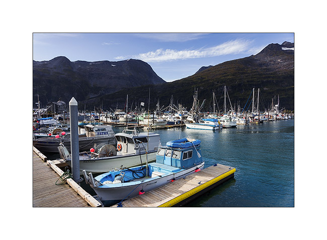
14. Going North to Anchorage, little detour toWhittier and short stop at Portage Lake, a beautiful glacier lake.
15. Whittier harbour, at the bottom of a fjord in Prince William Sound.
16. While seeking for a place to camp…
17. Late afternoon in the mountains…
After this brief jaunt to the Kenai, we’re back in Anchorage awaiting a response to a possible change of Mino’s return flight that could allow us to stay longer to explore this beautiful Alaska. We will keep you in touch in the next update! 😀
Kenai Peninsula (1)
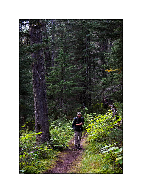
Some better weather taking shape South, VivaLaVida has gone the way of the Kenai Peninsula, South of Anchorage.
1. Sunrise at our boondocking site near Turnagain Pass.
2. I enjoy the morning light…
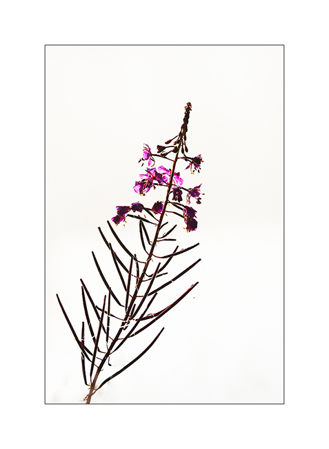
3. A Fireweed.
4. The mist rises…
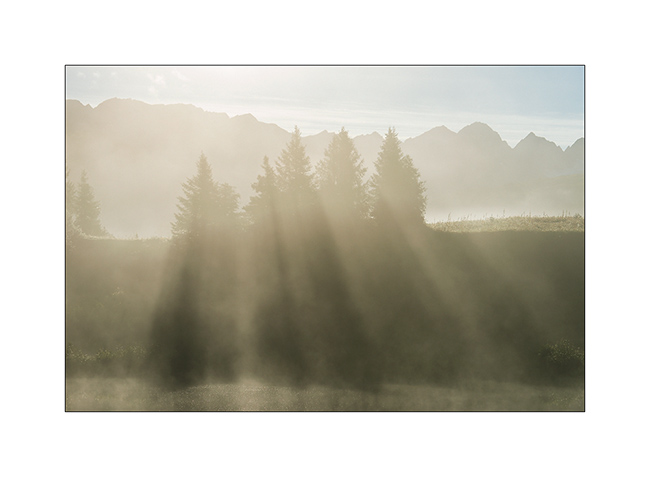
5. … and the sun floods our camp.
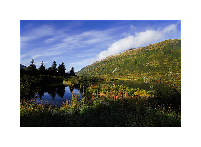
6. On the road to Seward, a small lake nestled in a valley.

7. Returning from a hike to Lost Lake, overlooking the Seward bay and the Gulf of Alaska.
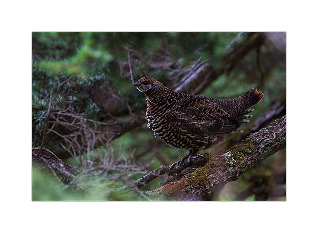
8. It’s already very dark when I saw this forest grouse female…
9. Lichens decorate the trunks in this much wetter forest than in North.

10. The climate is warmer here in the South, there is “only” 0 to -20F in winter because the ocean moderates the polar cold. So are the trees much bigger even if timberline doesn’t exceed about 1,200 feet.
11. Very wet episode. We have still taken a ride to Exit Glacier hidden in the clouds…
12. Since the forecast were better there, we drove to Homer and the next day was sunny. We clearly saw the Iliamna volcano on the other side of Cook Inlet.
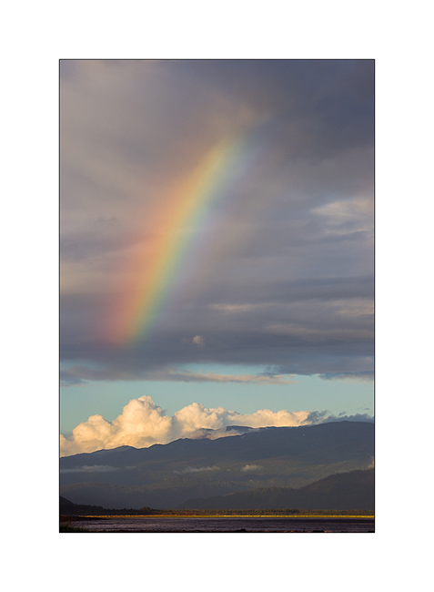
13. We sleep on a beach of Kachemak Bay without forgeting to taste the famous Alaskan Halibut, succulent! 😉
14. A shower at sunset graces us with a nice but short rainbow.
15. On the other side of the bay, the low sun shortly colors mountains.
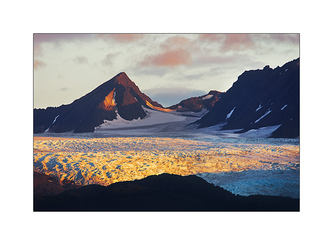
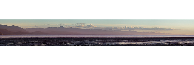
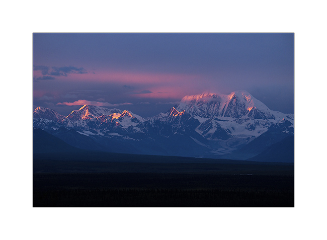
16. Quiet atmosphere as tide is going down.
17. Last rays on glaciers…

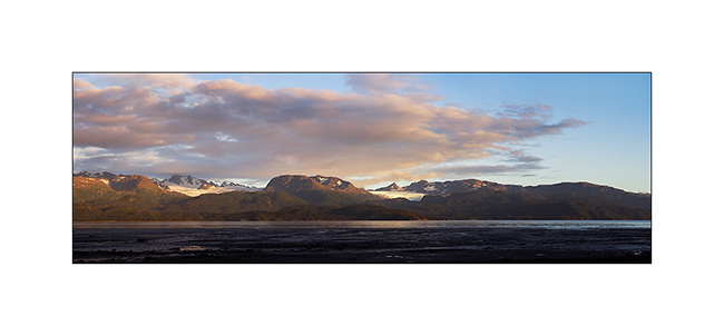
18. And to end this update, a panoramic picture of Kachemak bay.
Following of our discovery of the Kenai to come soon! 😀
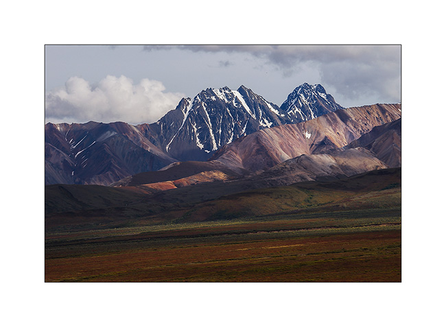
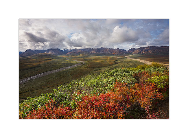
Denali National Park (3)
Third day of discovery still hiking. That time, we leaved the bus at Toklat River to climb Polychrom Mountain.
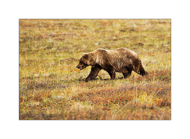
1. New encounter in the morning!
2. He is also ready for a hibernating winter!
3. Starting to climb above the Toklat River.
4. From above, the view is fantastic!
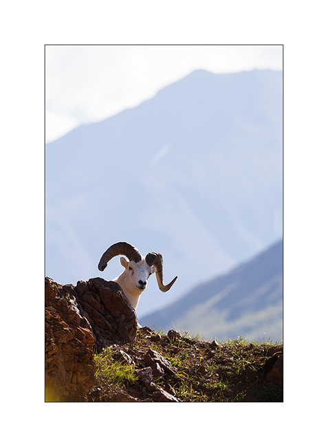
5. As we climb a cliff, we see the same dall sheep with a broken horn than two days earlier.
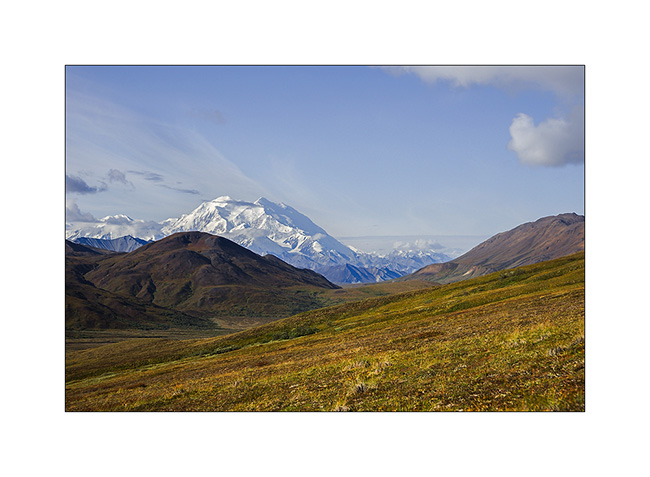
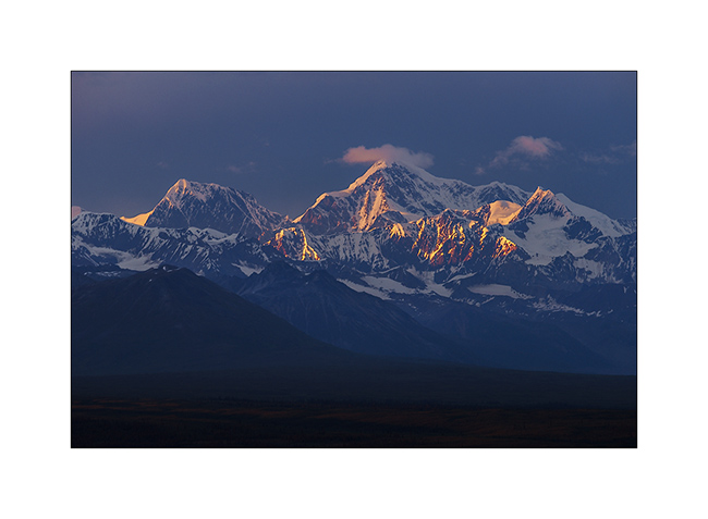
6. In the morning, we enjoy an unobstructed view of the Giant, “Denali” or “the High One”.
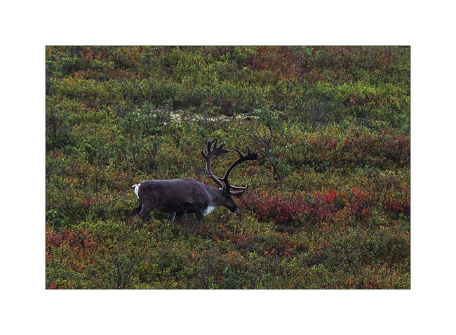
7. Higher in the scree, caribous appear on a ridge.
8. I approached slowly trying to be as quiet as possible…
9. I am now only a dozen yards and when I get up, I discover a two heads caribou! 😀
10. This is a male and a female.
11. Meanwhile, Mino contemplates the landscape…
12. I must say that everything is so beautiful here…
13. These screes bewitch me…
14. I could shoot dozens of times.

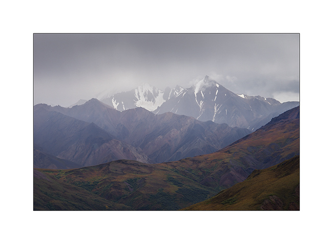
15. Clouds are back over the Alaska Range…
16. … but we still have sun here.
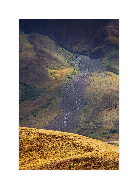
17. From there, the rivers form beautiful designs…

18. Scabrous descent into a steep scree!
19. We continue our journey across the alpine tundra…
20. … dotted with small puddles and swamps.
21. Colors are awesome.
22. It is almost 6 PM but we don’t want to leave.
23. Tundra, I love you…
24. The day ends, we must resolve to take the bus back to Teklanika.
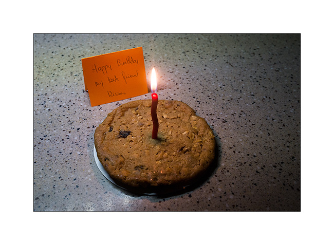
25. Last encounter of the day hiking down the Teklanika River to reach the campground…
26. Contrasts…
27. End of a great day for my birthday eve..! 😉
That’s it for our brief stay in this beautiful park. Following of the discovery of VivaLaVida to come in a few days…
Denali National Park (2)
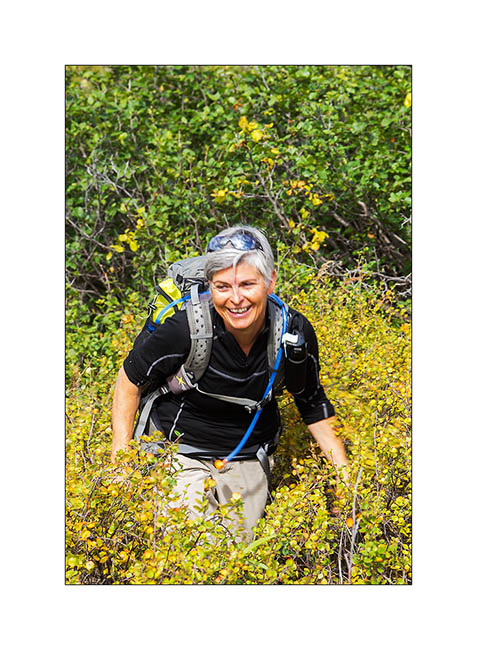
We took a bus the next morning that dropped us near Highpass, the highest point of the road. So we walked over seven hours in wildnature, first under the sun before rain in the afternoon. There are no trails, so we progress in the tundra and freely choose our way.
1. Sometimes, willows are several feet high. Progressing is not always easy but Mino keep smiling! 😀
2. clouds growing rapidely…
3. Berries are everywhere at that time of year, including blueberries that we gather throughout our journey.
4. Oh greedy!! 😉 (Well, I confess, me too! 😀 )
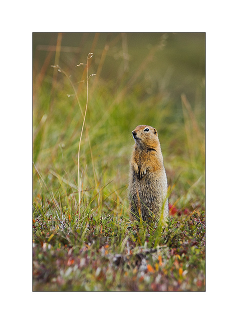
5. They are many ground squirrels that signal our arrival by their characteristic cry.
6. This powerful nature is just beautiful!
7. Atmospheres constantly change with the passing clouds…
8. Some flowers remain on the tundra in the late summer.
9. Rivers have formed large gravel bars by getting silt away from the glacier they flow from…
10. Meanders games…
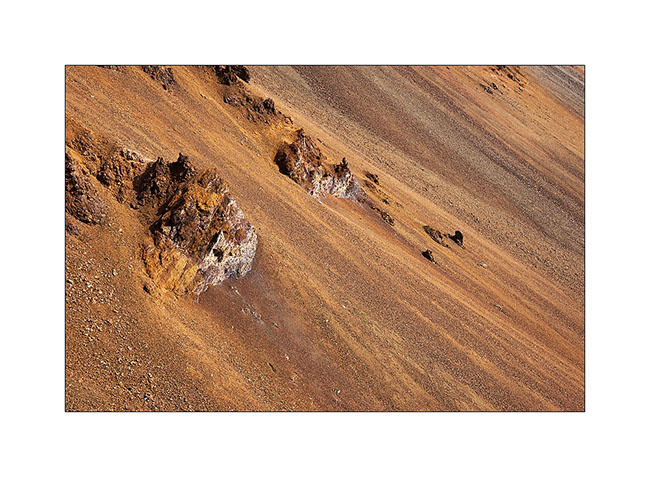
11. The top of the mountains is mostly made from large colorful screes.
12. Plunging perspective…
13. Afternoon showers start again…
14. … and a beautiful rainbow emerges a few moments.
15. Fortunately, our rain suits protect us well!
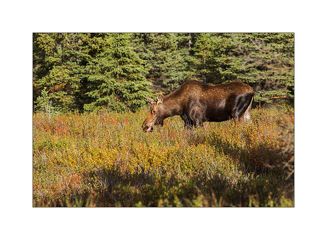
16. While we join Teklanika by bus, we see this female moose.
17. Off the bus a few miles before the campground, we enjoyed the last sun rays going down the bed of Teklanika River.
So much for the second day. To be followed soon.
Denali National Park (1)
And here we arrived in Denali National Park, a large wilderness that includes Mount McKinley, the highest peak in North America, more than 20,000 feet elevation. This park was the first created in the United States in 1917 by Mr. Sheldon, who fell in love with this wilderness when studying dall sheeps for three years, then struggled for ten years to get this park created. In 1980, President Jimmy Carter has nearly tripled the size of the park.
One road sinks into this wilderness, reserved for public buses to minimize traffic. Vivalavida has obtained a permit to only join and leave the Teklanika Campgroud. I booked four nights for a bit of time to explore this wonderful land. Lottery with the weather that smiled at us, rewarding some good sunny times between showers, with beautiful skies … The low traffic has developed abundant wildlife not to fear the always same vehicles using the road; the “encounters” are frequent and sometimes really close. We’ll see grizzlies on every trip…
1. It was gray and rainy when we took the road to reach Teklanika…
2. … but I still found some photogenic wet environments…
3. … sometimes with some light.
4. We see a bull caribou near the road.
5. The rain is going away…
6. … the stop while VivaLaVida is going deeper in the park.
7. Sometimes a patch of light plays with reliefs.
8. Arriving in the Teklanika Valley, we are now close to the campground where VLV will remain quietly four days.
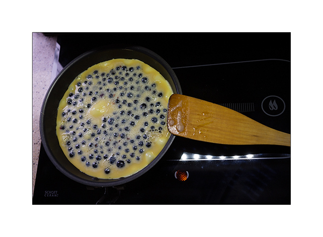
9. And to celebrate this arrival, we had a good sweet omelette with wild blueberries! 😉
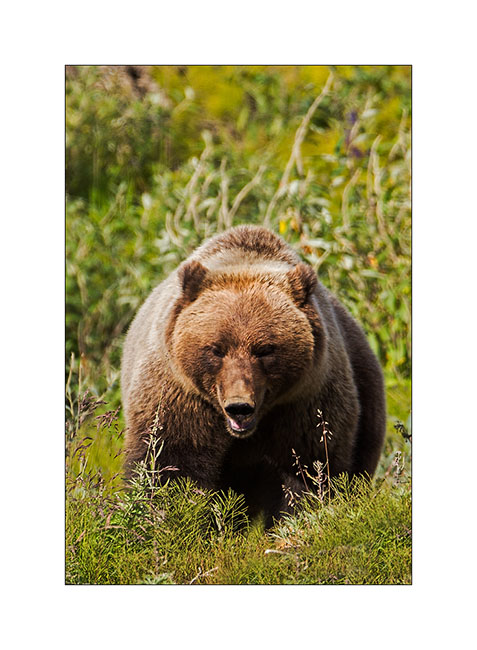
10. The next morning, we only drove a few miles in the bus to meet a first grizzly!
11. Imposing Teddy, isn’t it?!! 😀
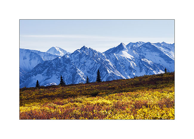
12.Tundra begins to change to fall colors. The “willows” are adorned with a beautiful dark red color.
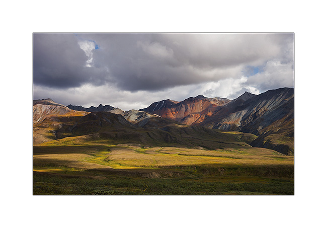
13. Polychrome Mountain.
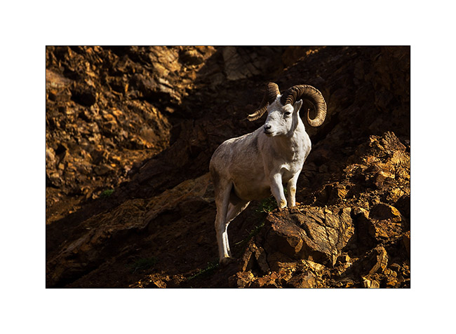
14. A little further, we see a nice “Dall Sheep”, the only white mouflon that exists on Earth. Superbly adapted to the rocky cliffs where he stands away from his predators.
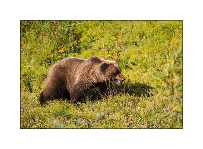
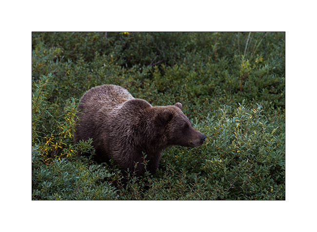
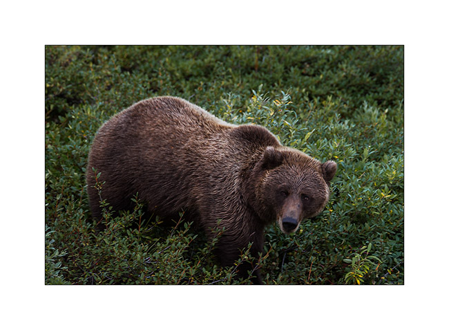
15. And here is a new encounter with an adult grizzly that crams berries on the tundra.
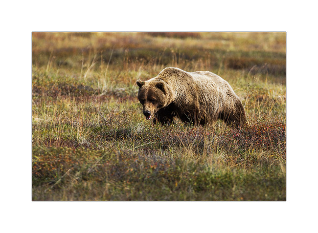
16. When a bush is finished, it moves to the next.
17. This one is almost ready for hibernation, with good fat reserves.
18. That first day, Mount McKinley is hidden in the clouds as over 80% of the year. Its mass is such huge that it creates a microclimate, creating clouds on its flanks even some clear days elsewhere.
19. A lot of moisture remains of yesterday rain but during the bus journey to the end of the road, more than 80 miles from the campground, we will identify several places to hike the next days. I must admit that I was quite frustrated not being able to stop where I wanted for a few tantalizing compositions…
I will relate you our second day in this beautiful park at the next update coming soon… 😉
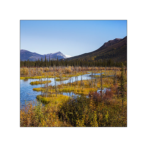
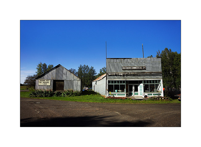
Manley & Chena Valleys
Since the announced weather being bad South, we took the road to the North where the forecast was better and went to visit Manley, a lost hamlet nestled down in a small valley.
1. The storefront of the junkstore, likely…
2. Birch and aspen forest are magnificent.
3. As soon as we reach about 2,300 feet elevation, the trees give way to tundra.
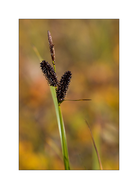
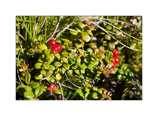
4. In this season, it is covered with berries of all kinds. Here, cranberries.
5. It’s aperitif time!
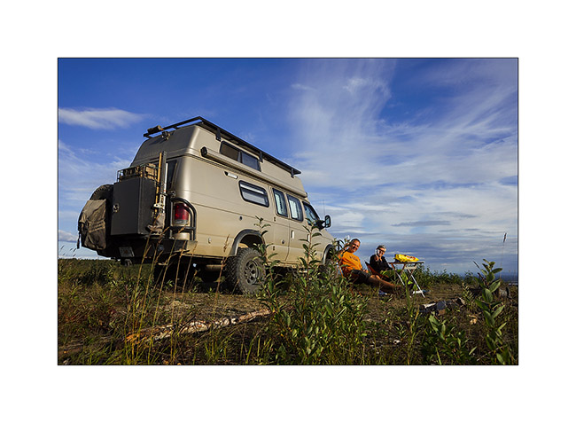
6. And that seems to please Mino! 😉
7. We will have a beautiful sunset!
8. Grazing light…
9. Game of sunset and rain showers…
10. Last gleams…
11. Humid conditions in the morning.

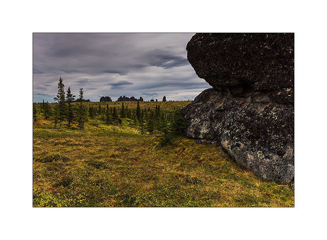
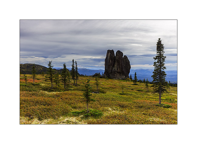
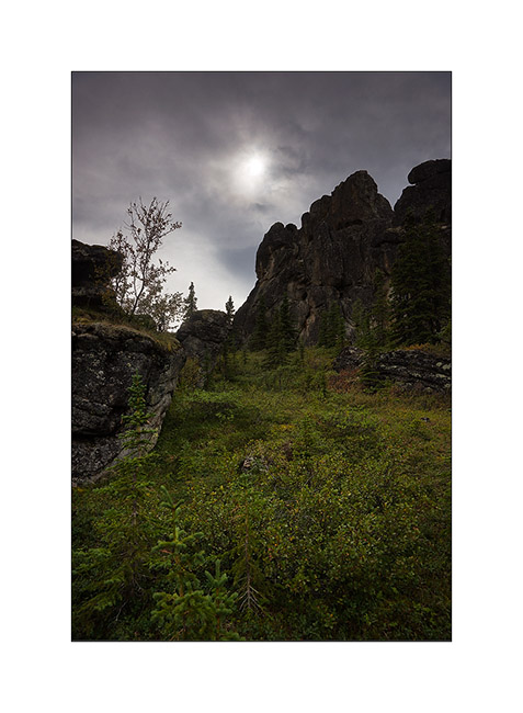
We then moved the Chena Valley there some nice hikes. The first to the Granite Tors, kind of granite towers that slender above the alpine tundra…
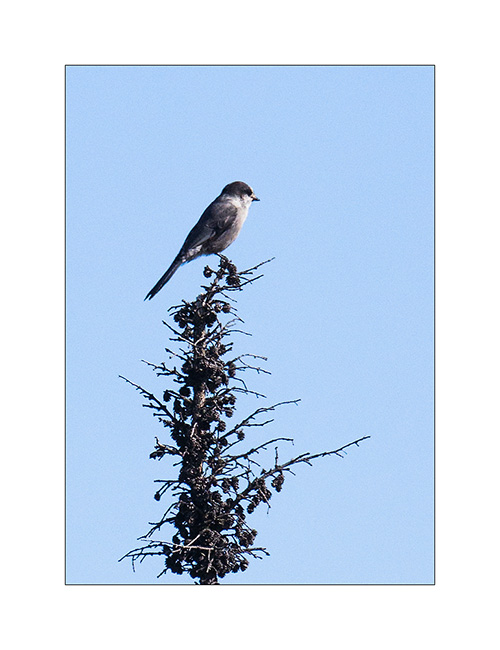
12. A gray jay intrigued by our presence.
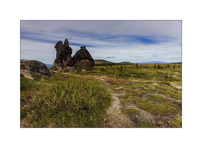
13. After 4 hours up, arrival at Tors.
14.Unfortunately, the light is not with me for pictures…
15. Tundra begins to change color, fall approaching.
16. This mountain plateau is beautiful.
17. Lichens colore granite.
18. Soaring silhouettes…
19. Last look by starting the descent.
20. The sun plays hide and seek.
21. Pretty wild camp on the Chena River.
22. The next day, we make a loop in the still green Angel Valley.
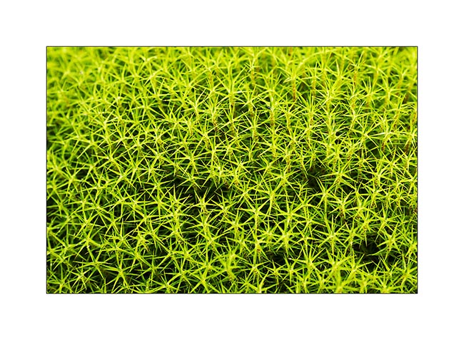
23. Mosses are omnipresent in undergrowth and in the tundra.
24. The way back through the bottom of the valley: 3.5 miles of marsh and a nice bit of fun with wet feet!
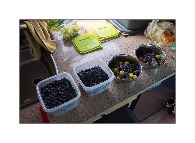
25. Just arrived, we leavd again to go picking blueberries. It takes us half an hour to fill two large boxes as there were so many everywhere!
26. Another wild camp near the Chena River.
27. Last rays before the sun hides behind the hills…
We then moved to the Denali National Park where I had booked a campsite for four days, the only way to get to this wild and unspoilt land. To comeng in the next update soon… 😀
Maclaren Road & Denali Highway
Here is the continuation of our ramble along the Denali HWY.
1. Early light on the Maclaren River.
2. Meandering again…
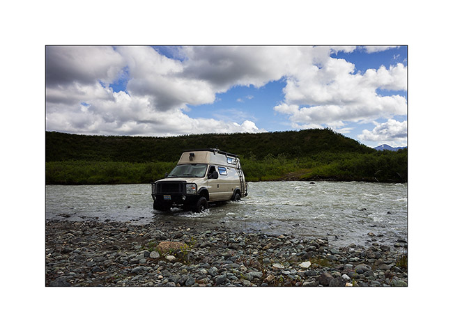
I previously told you that the Maclaren Road is virtually unused and that for good reason: there are some deep enough river crossing to stop many vehicles! But not VivaLaVida. Small sequence of a water crossing where the water reaches the top of the wheels of VLV.
3. Engagings the four-wheel drive because there are large hidden rocks under the turbulent water.
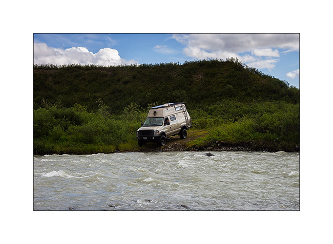
4. The nose in the water!

5. Then the rear. The bumper is quite wet!
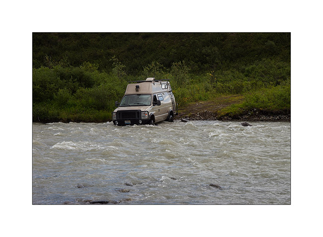
6. Arrival on an island in midstream…
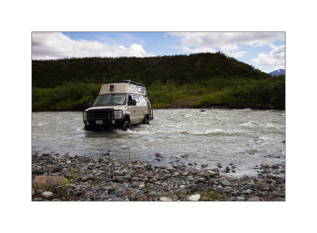
7. … and output. One done!
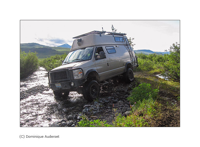
8. A little further, another beaver appropriated the road and turned it into a lake! After removing part of his dam to lower the level of two feet, VLV could cross it.

9. Still further, the road has been totally washed out by a stream.
Reached the end of the road, we had to turn back a little frustrated, shrubs having resumed their rights and destroyed the path leading to the Maclaren Glacier. So we continued to West Denali HWY.
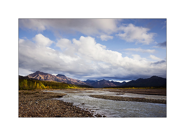
10. The Sultina River, gorgeous in front of Clearwater Mountains.
11. Bonndocking away from the Denali HWY.
12. The sunset over the Alaska Range will be superb.
13. Late-rays on peaks.
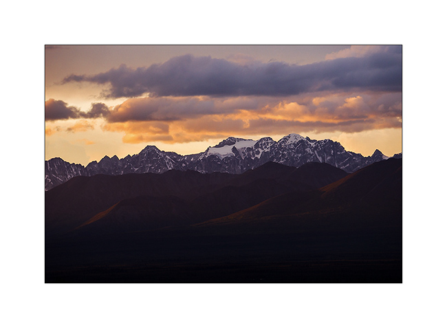
14. Last light of sunset on Clearwater Mountains…
15. … and on the Alaska Range.
16. Dressed in red…
17. Overview of the vastness that surrounds our camp. The Alaska Range is more than 45 miles away…
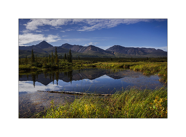
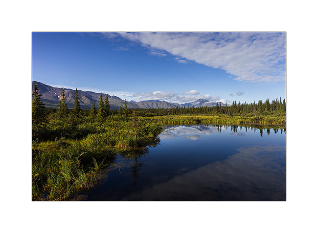
18. Back on the road the next day, discovering beautiful rivers…
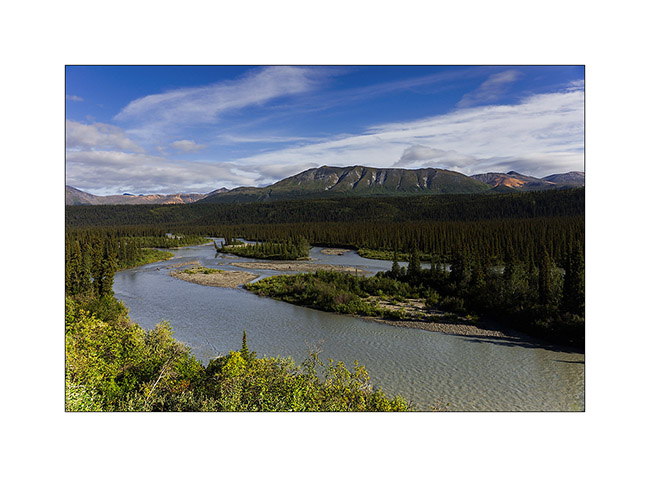
19. … and still beautiful small lakes.
20. Cloud diagonal…
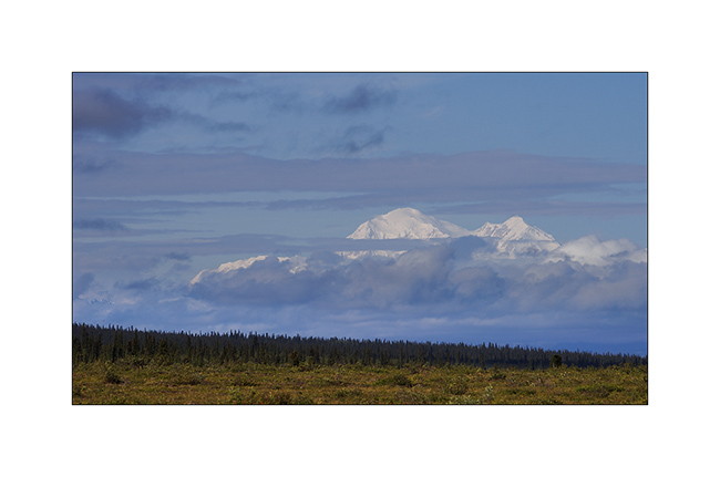
21. A hole in the clouds let us see Mount McKinley, over 100 miles away.
22. Short break during a hike on the Wickersham Dome.
23. The evening is thai dinner: red curry chicken and quinoa, yum!
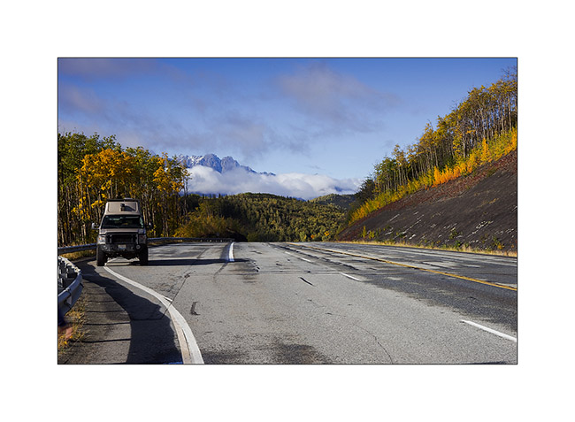
The weather continuing to be unpredictable, we will remain north a few more days, fingers crossed to have beautiful conditions when we’ll go visit Denali National Park, August 20th to 24th, reservation forces…
Stay tuned for more to come in our stroll in handsome Alaska!