Faroes (II)
Here is the continuation of my discovery of the Faroes. These islands are right in the Gulfstream, this warm oceanic current which gives to Scandinavia and more largly to Europe its temperate climate compared to its latitude. As a result, average temperatures vary very little between summer and winter: 48-50 F in summer and 37-39 F in winter. On the other hand, there is on average between 260 and 280 days of rain per year and 300 days with wind! VivaLaVida stopped there for only three days but was treated to her part of rain, sometimes fine drizzle, sometimes heavy rain. No wonder the mountains are dripping everywhere! There is not 100 yards without a stream that comes down.
I took advantage of the good weather of the first day to discover two spots among the best known of these islands…
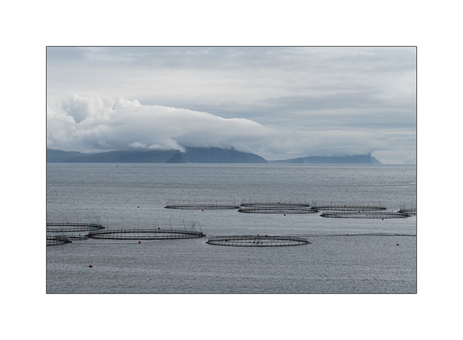
1. On my way, the wind creates clouds on the cliffs…
2. First spot: Lake Leitisvaten, the largest lake in the Faroes, perched about 40 yards above the ocean !

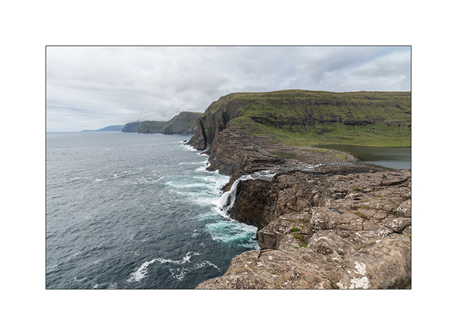
3. It flows into the Atlantic by a beautiful waterfall.
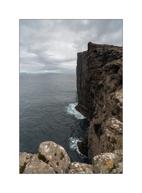
4. The cliff that I climb is impressive! The silhouette at the top gives the scale, well… if you can see it! 😉
5. From the top, the panorama is breathtaking! This image is an panorama of 4 vertical images.

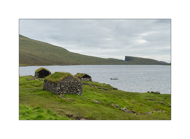
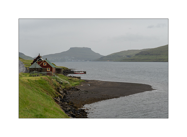
6. Traditional boat garage along the lake, on my hike back.
7. Continuing the road to the North, I discover this small village, just lovely… In the distance, the arch of Drangarnir.

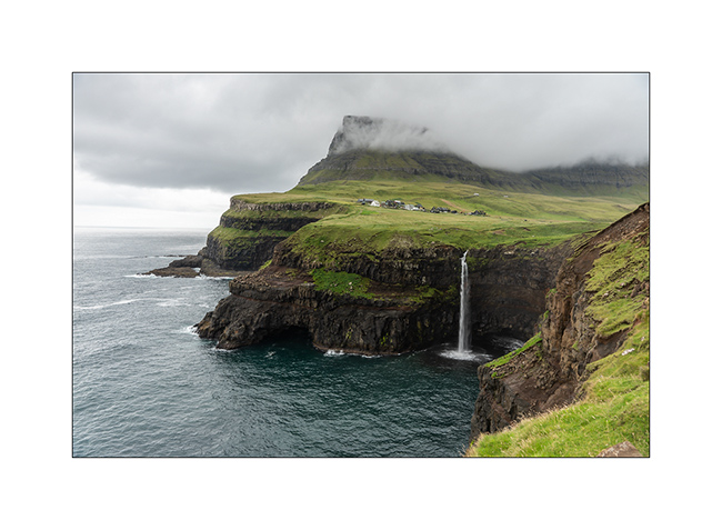
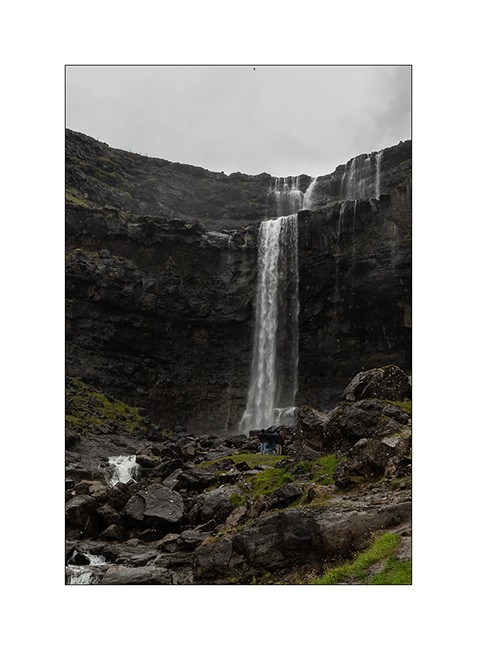
8. And here is the second must-see spot: the Gasadalur waterfall. The small village of the same name was one of the most isolated of the Faroe Islands until the construction of a tunnel in 2006. Before, the only way to reach it during winter was the sea where a summary natural harbour allowed small boats to land by nice weather. In 1962, the village remained isolated for more than 5 consecutive months because of a series of Atlantic depressions.
The waterfall is 50 yards tall.
9. View from the top of the waterfall, with at the foot of the cliff, the rocks that allowed the landing…

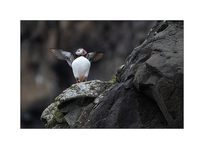
10. First meeting with the puffin in the cliffs…
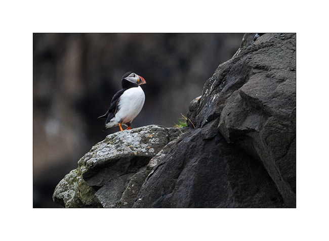
11. What a beautiful bird!
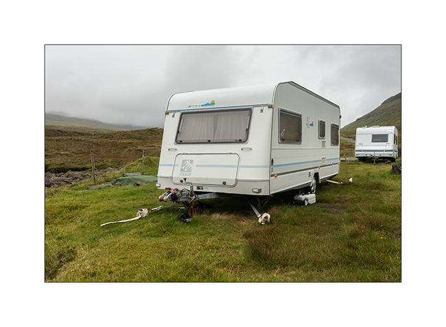
12. Here, people attach caravans so they cannot fly on windy days, that means everything!
13. Going up a fjord towards the village of Tjornuvik.
14. Waterfall along the VivaLaVida’s way.
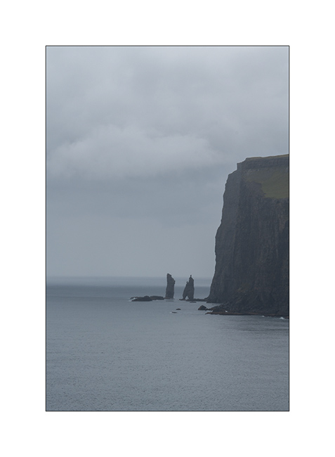
15. Cliffs in the rain. The Faroe Islands have among the highest cliffs in Europe. Some are half a mile high.
In the next update, I will show you the black beach of Tjornuvik and other parts of these beautiful islands. Stay tuned!
 D5 Creation
Sauvage et un climat “vivifiant”, c’est quand même impressionnant comme paysage et ce lac perché!!!!!
Bonne continuation!!
Amic Phil.
PS: j’ai pris un peu de retard pour cause de déménagement.
PS2:salut à toi fred!!
Oui, un spot assez incroyable. Debout au bord de l’abîme pour prendre le pano n°5, c’était juste impressionnant avec le bruit de la houle sur les falaises…
appears to be a strong candidate to receive protection..such a national historical site,limiting harmful activities. Funny how when I pear into certain scenes,as here #7,village,I feel a tremendous pull,a yearning if you will..to sit there,glass of sprite in hand,binoculars in the other,lamb stew in my bowl,all the beauty in the world at my feet
I understand. This place is so peacefull…
Belle ambiance nordique. J’aime beaucoup ces paysages en vert-noir-gris et parfois un peu de bleu.
Amitiés
Moi aussi… 🙂
Hello, c’est magnifique!!!!! Impressionnant !!!! Gigantesque!!!! Que la nature est belle et forte. Respect 🙏
Hello, c’est magnifique!!!!! Impressionnant !!!! Gigantesque!!!! Que la nature est belle et forte. Respect 🙏