September, 2018
now browsing by month
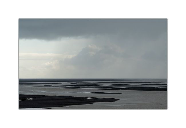
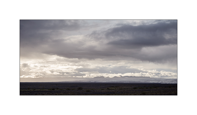
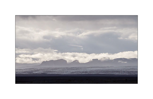
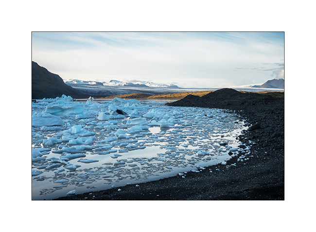
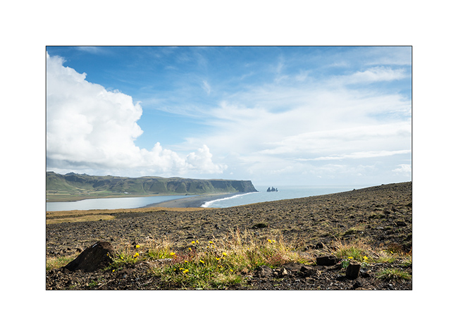
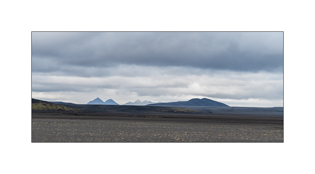
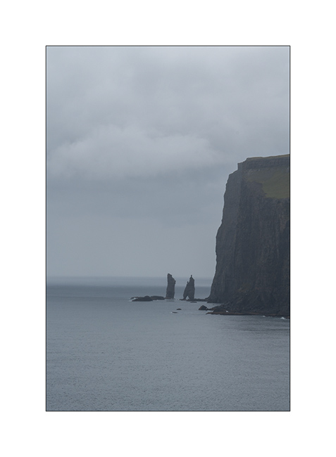
South coast…
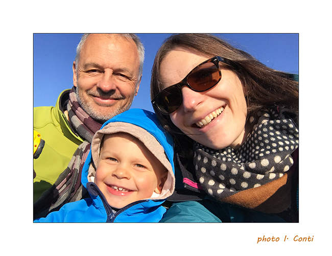
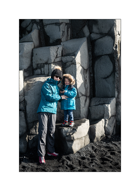
1. As Gaël requested it, here is the whole family. 😀
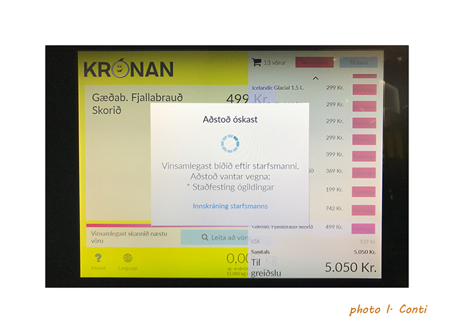
2. An example of the language at the checkout of a store, inapprehensible and unpronounceable for us.
And to show you what the rain can be there, here is a short video
of Isabelle made the day before where it rained like that almost all day long..!
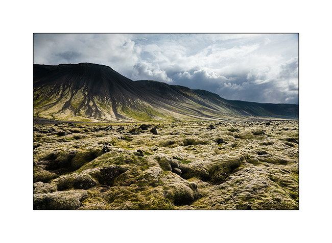
3. Continuation of the South Coast to the East. VivaLaVida crosses many Gravel Bars, large river beds that regular floods clear of all
vegetation.
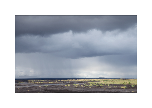
4. Showers that offer beautiful skies.
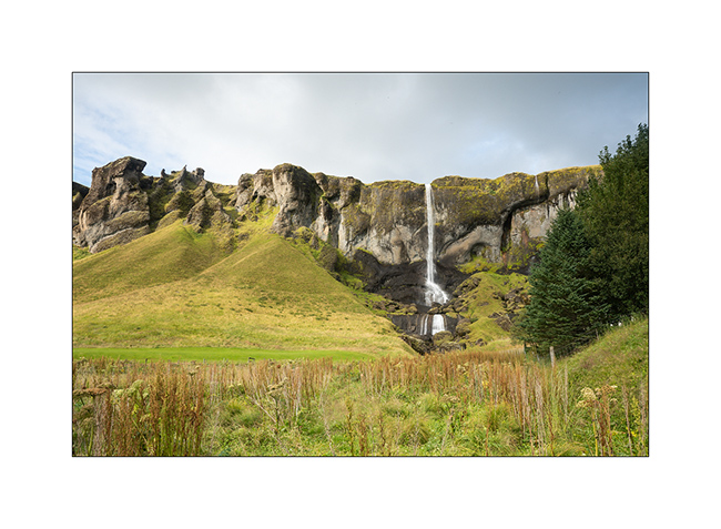
5. Waterfall Foss á Síðu along road Nb 1.
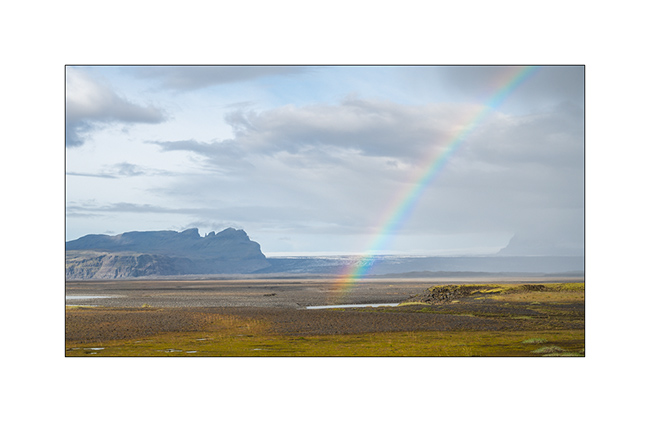
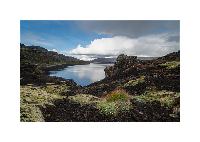
6. Rainbow in frontof the Vatnajökull ice cap in the distance.
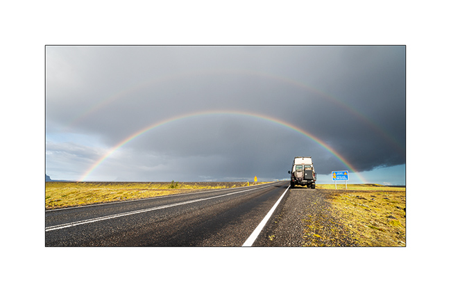
7. Another one to celebrate VivaLaVida.
8. Gravel bar.
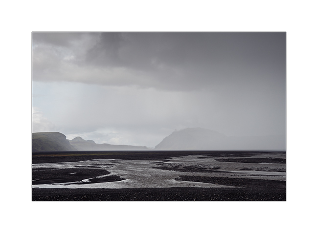
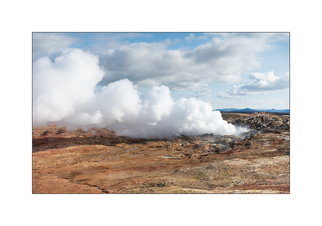
9. Shower on the coast.
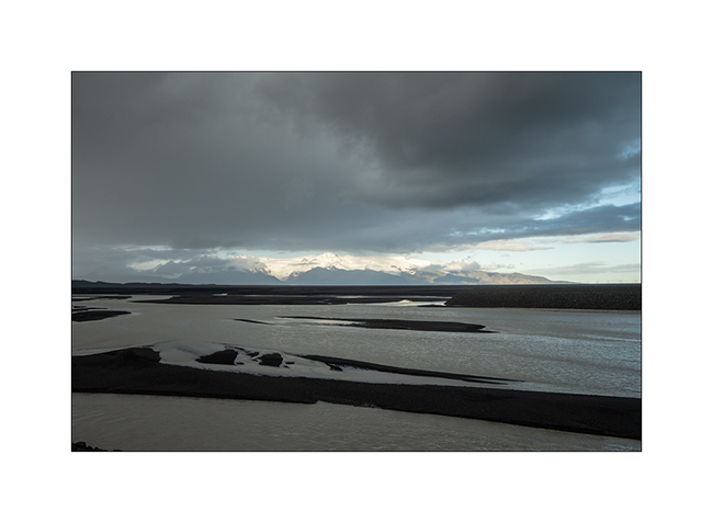
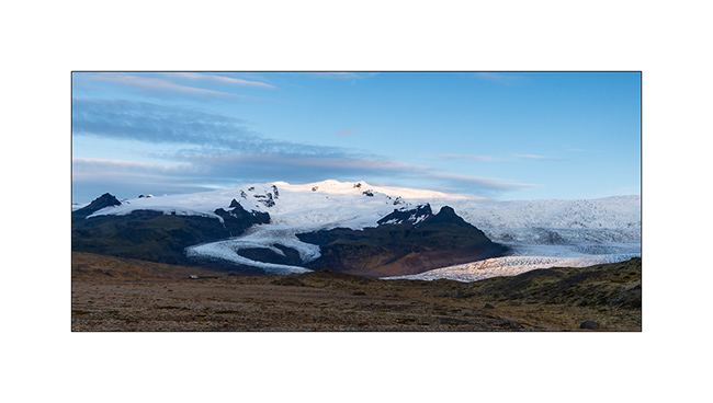
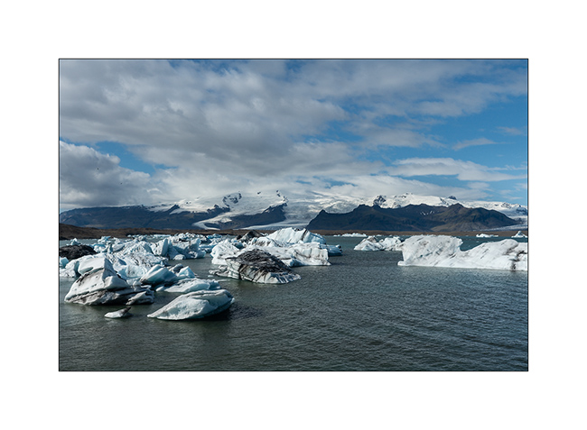
10. Vatnajökull ice cap, the largest in Iceland.
11. It is crossed by many volcanoes more or less active.
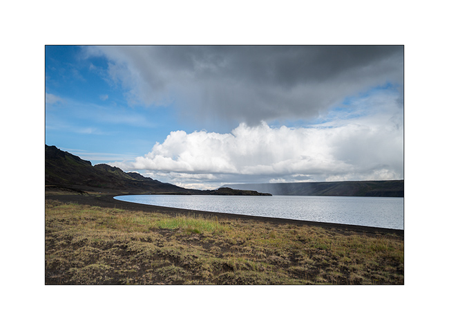
12. In the evening, VivaLaVida finds a nice boondocking place to camp near a glacial lake.
13. First colors at dawn.
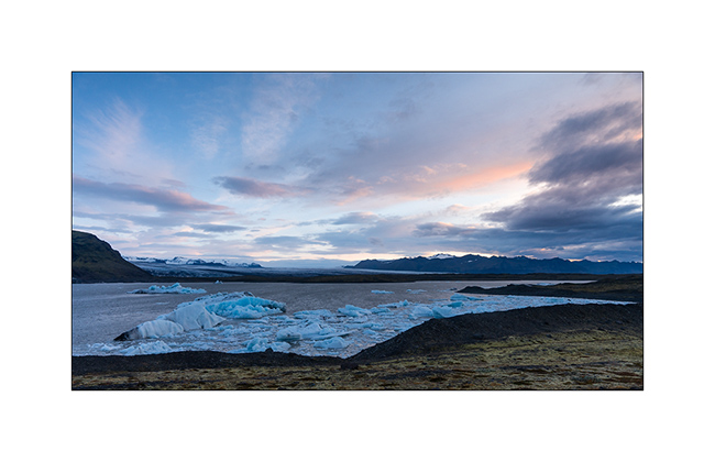
14. Camp of VivaLaVida, close to the glaciers.
15. Light beams…
16. … on raw elements.
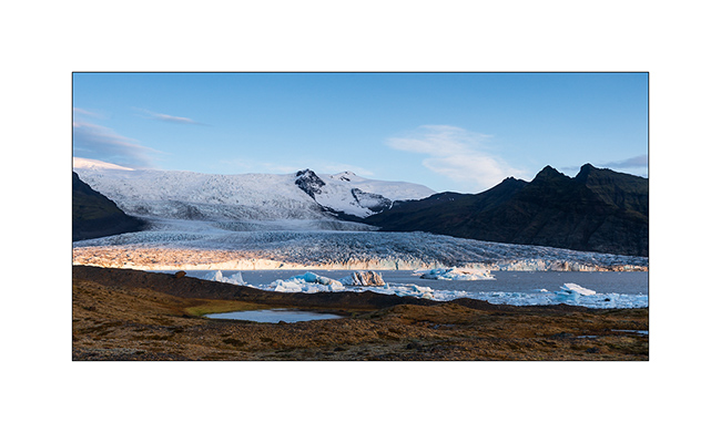
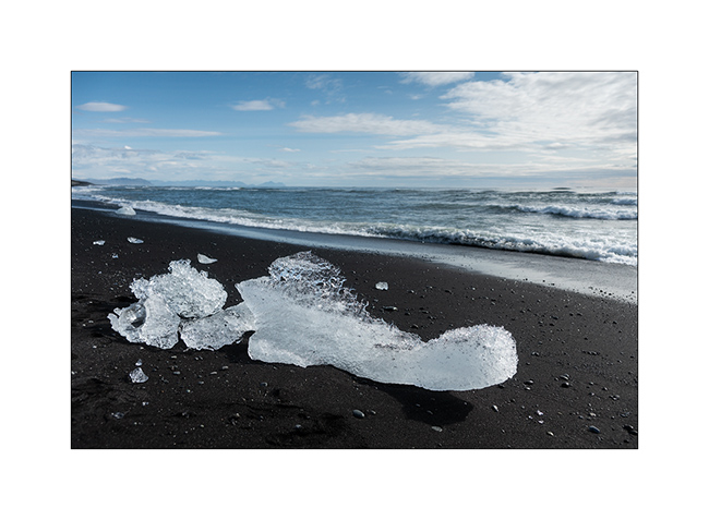
17. I couldn’t not show to Isabelle, a jewel fan, the “Diamond Beach”, famous for the icebergs that stand out from the Vatnajökull and flow
into the ocean by Lake Jökulsárlón before stranding on the black beach! 😉
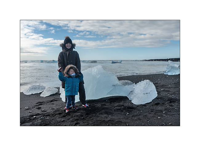
18. Photo souvenir…
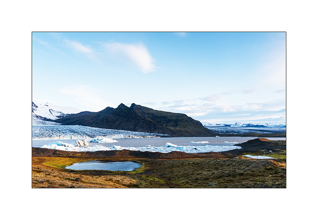
19. Jökulsárlón Lake.
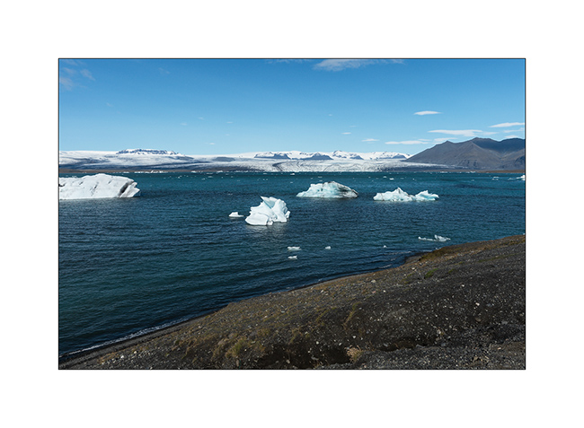
20. Larger icebergs must melt before crossing the channel leading to the ocean.
In the next update, we will leave the coast to discover the Lakagigar area where new small volcanoes appeared only some decades ago.
First steps with family
My passengers well landed, we discovered the Reykjanes peninsula together before going to Reykjavik the next day to buy warm jackets to Isabelle and Emile.
1. Volcanic activity is strong on this promontory.
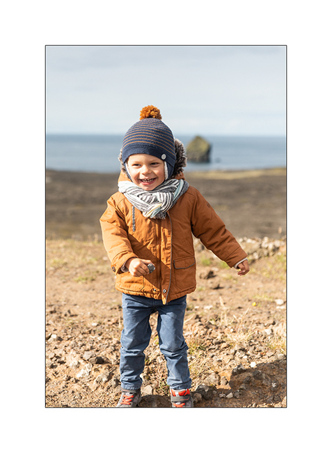
2. Emile is so happy to be back in “Dad’s truck”!
3. The lava that flowed to the sea creates beautiful cliffs.
4. Beautiful lake of Kleifarvatn.
5. Despite some showers, the weather is rather beautiful but a little cold, about 46F.
6. Lava fields covered with moss and lichen.
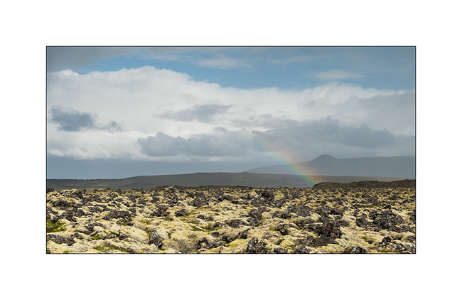
7. Iceland is undoubtedly the land of rainbows. 😉
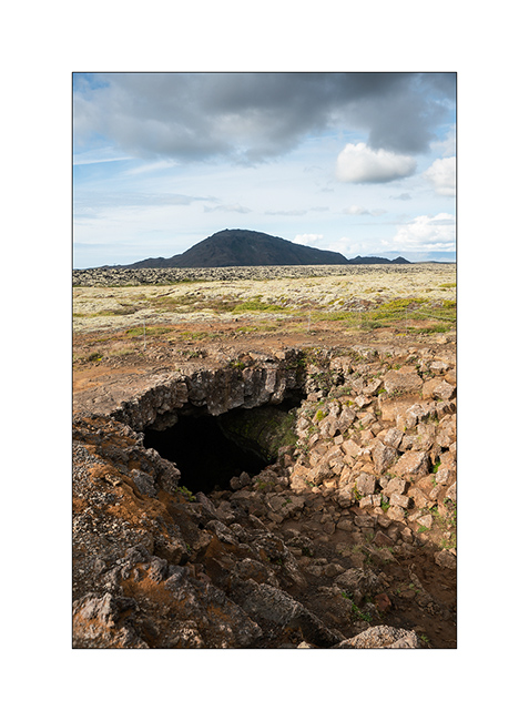
8. Lava tunnel.
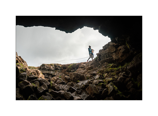
9. There are many here.
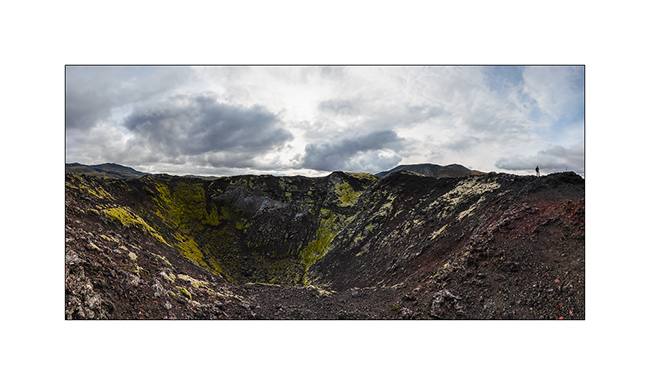
10. Assembly of 5 vertical images to show you a crater that appeared only a few hundred years ago.
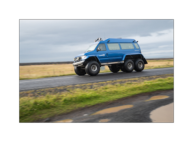
11. After some shopping in Reykjavik, we had a very rainy day stretching the road on the South coast. We cross famous vehicles transformed to ride on the snow. Here, a van similar to VivaLaVida but mounted on huge wheels! VLV looks small compared.
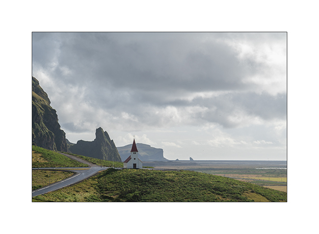
12. The small church of Vik.
13. Dyrhólaey Promontory and its two natural arches.
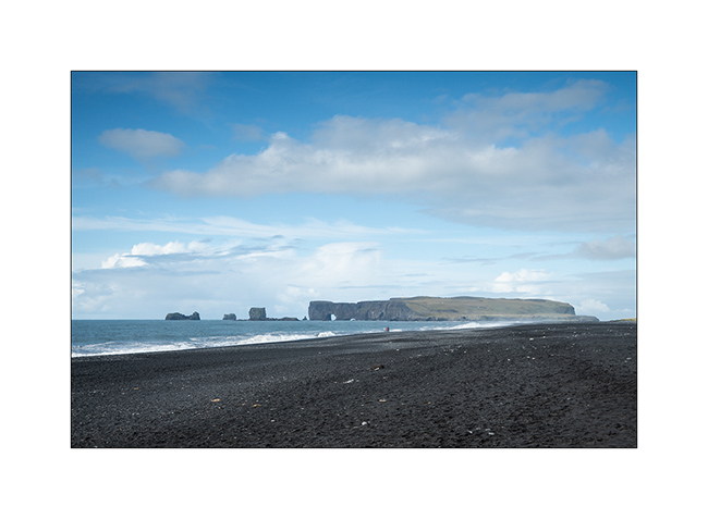
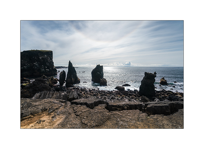
14. Even if the site is very touristy, we take a walk to the Reynisfjara Beach and its needles.
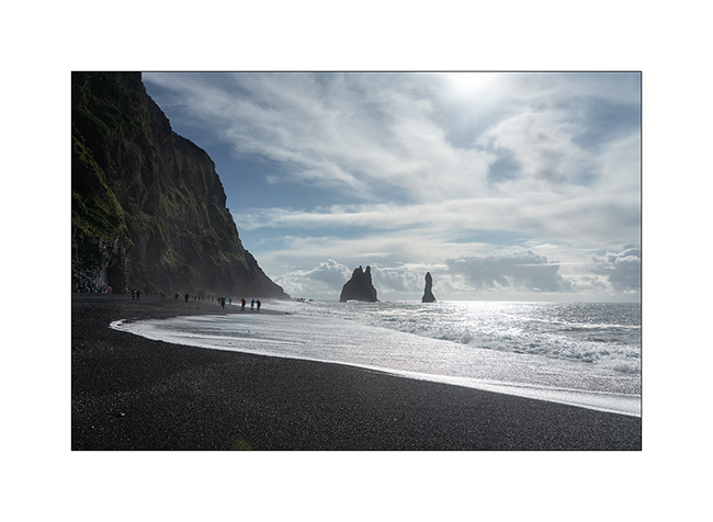
15. Souvenir on the famous basalt pillars.
16. Dyrhólaey Beach.
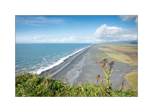
17. On the other side, Reynisfjara.
More of the South Coast in the next update…
Crossing and first steps in Iceland
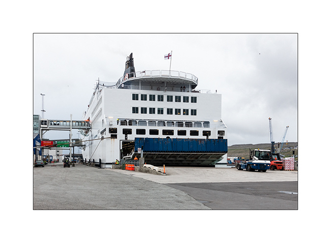
1. Here arrives the ferry that connects Denmark to Iceland, serving the Faroes.
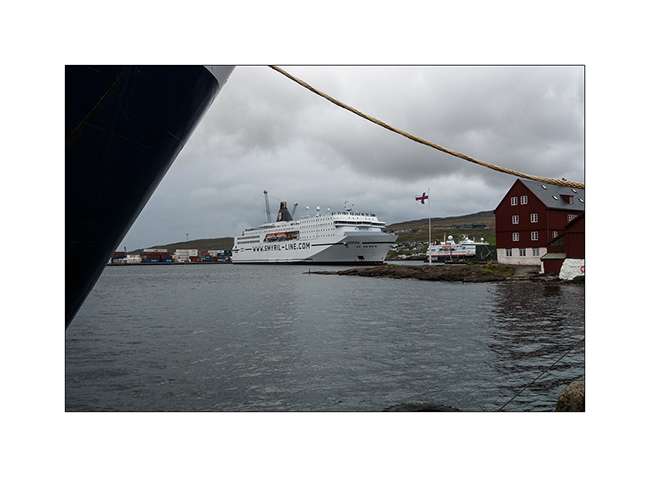
2. Barely moored as the rear port opens to let out the arrivals before VivaLaVida embarks…
3. Honeymoon on the boarding park! 😉 I will meet the owners of this beautiful Land Cruiser, Kambiz and Filiz, aboard and meet them several times in Iceland.
4. From Tornhavn to Iceland, the ferry passes between the islands of the archipelago.
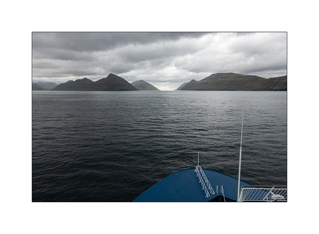
5. So I went in front of Gjógv again, off the coast this time.
6. Last look before the high seas.

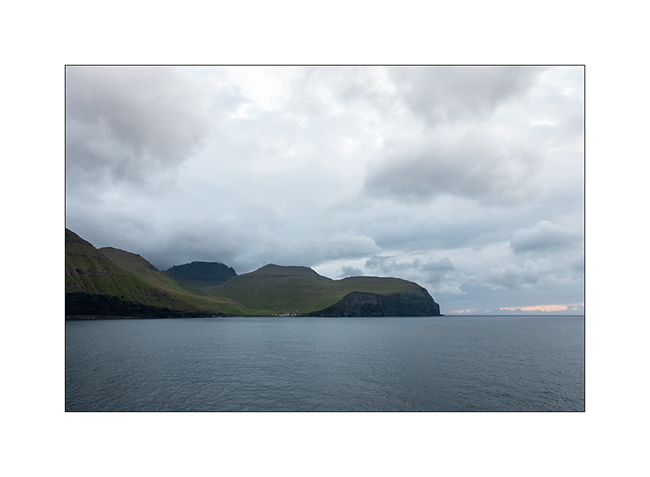
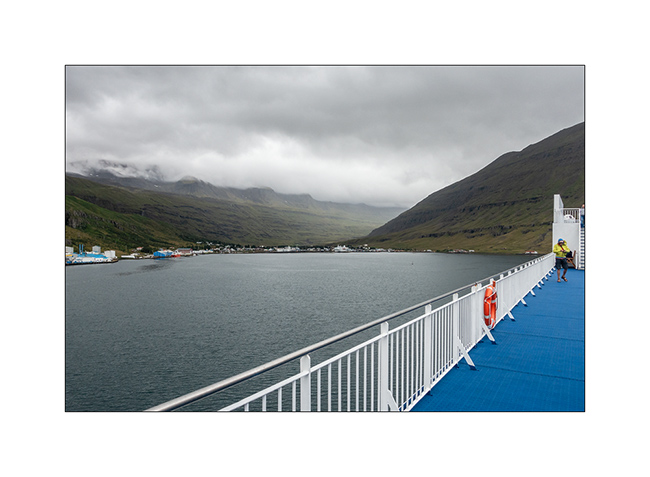
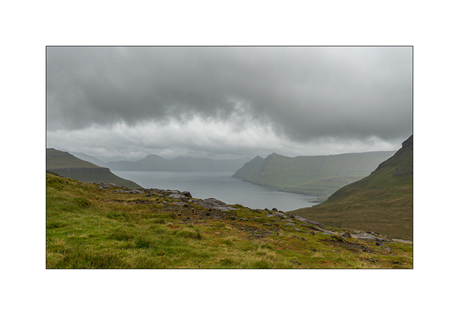
7. The next morning, arrival at Seydisfjordúr, a fjord all teh way East of Iceland. The weather is rainy.
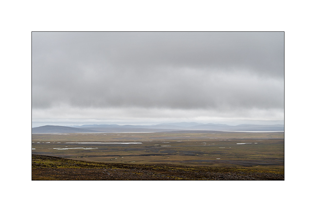
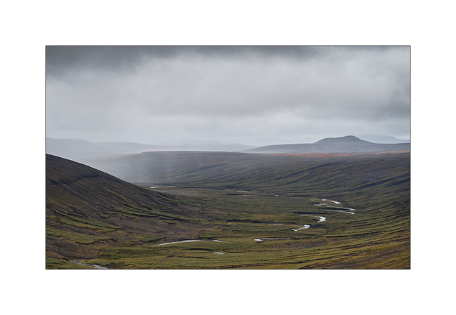
8. En route to pick up my family at the airport in Reykjavik, at the other end of the island or more than 500 miles away, VivaLaVida is quickly in the Highlands that fall colors have already yellowed.

9. These highlands are covered by a few roads or tracks.

10. Ambiance.
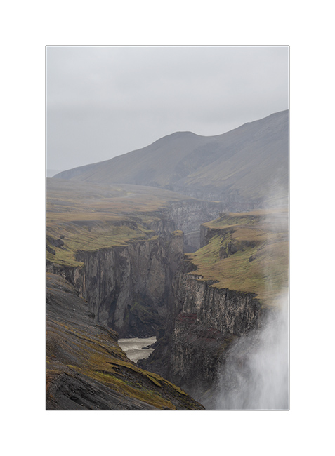
11. Canyon.
12. Rain showers.
13. Volcanic geology is omnipresent.
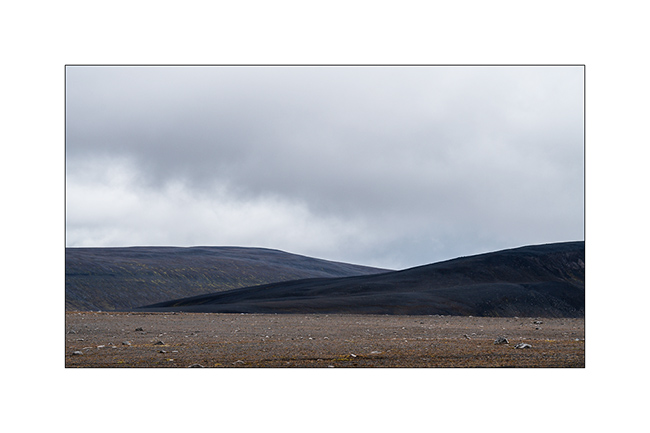
14. Here, water has no choice but to run on soils that are mostly free of all humus.
15. Perspectives are immense.
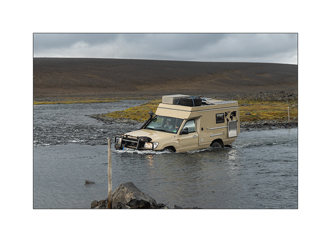
16. I find by chance Kambiz and Filiz on the track, in front of their first serious river ford, waiting for a vehicle to pass and show them the way. VivalaVida passes and I make some souvenir pictures.
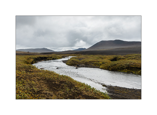
17. Powerfull river carving its way in the basalt.

18. VLV crossing a lava field.

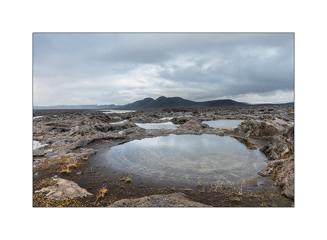
19. Natural pool shortly before night stop…
Well, that’s what I though. By switching on the freshly revised VLV heater, the dashboard displays an error code: defective hot air fan which has just been replaced pre-emptively in Switzerland. It is Thursday night, Isabelle and Emile arrive on Saturday and the only place I can repair is Reykjavik, 500 miles away. I decided to drive at night to be in Reykjavik on Friday. 400 miles until around 3am where I take a 4 hour nap. Arrived Friday morning in Reykjavik, I bring the heating to the Webasto dealer after 2:30 of work to get it out since it is well hidden under the rear cabinet of VLV. The technician discovers that during the work in Switzerland, a wiring harness has not been well attached and is hindering the movement of the fan. After a bill of more than 1’600.- Swiss francs, I was not very happy. But at least, the heating works for the arrival of my passengers tomorrow!
Soon to be followed.
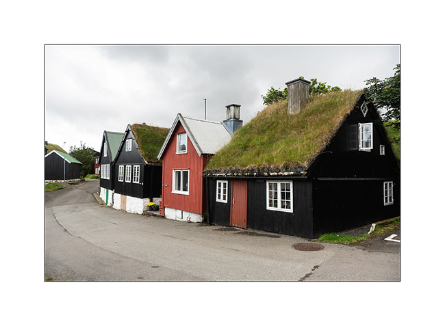
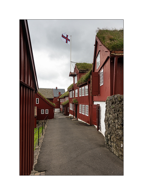
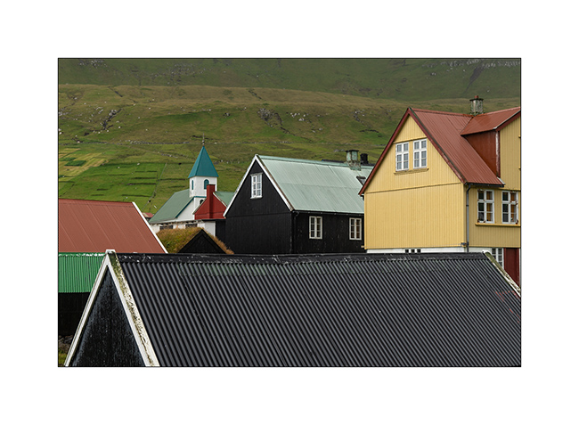
Faroe (IV)
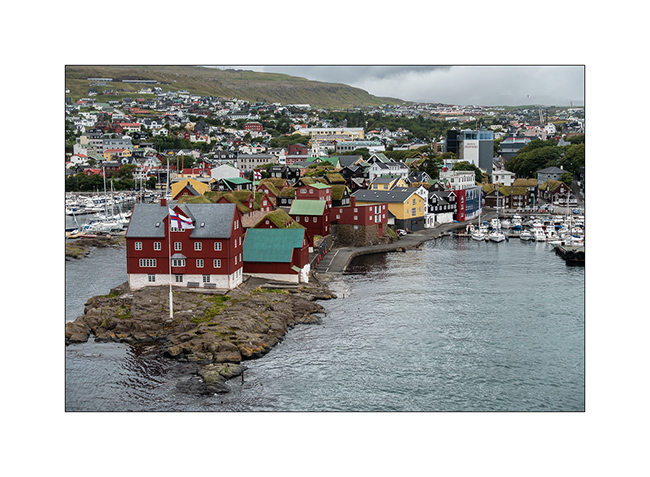
As announced, here is the latest update on the Faroes with some images of the old town of Tórshavn, the “Capital” of the Faroe Islands, an autonomous archipelago of Denmark.
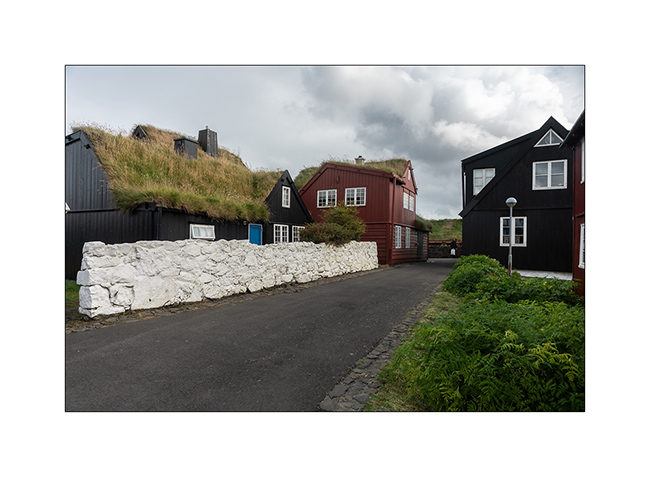
1. The old town is located on a rocky outcrop, sort of peninsula in the harbor.
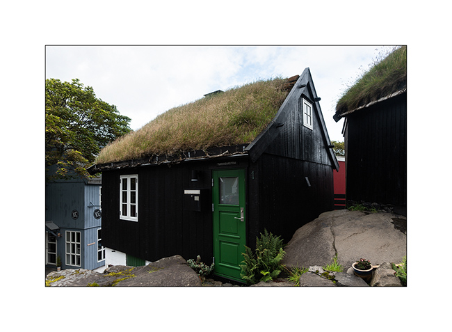
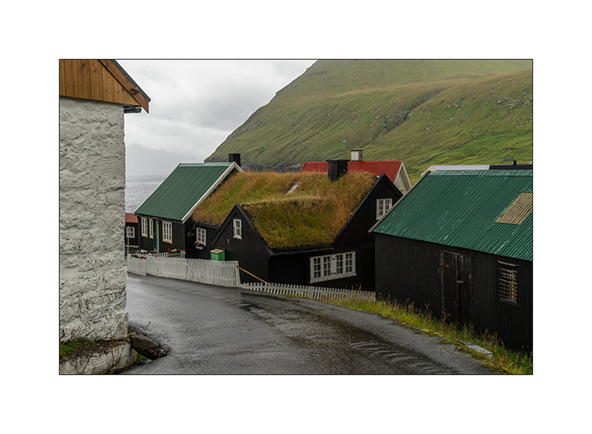
2. There are many traditional houses with their roof covered with moss and grass.
3. “Tiny house” 😉
4. Alley.

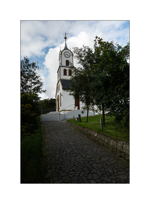
5. The church…
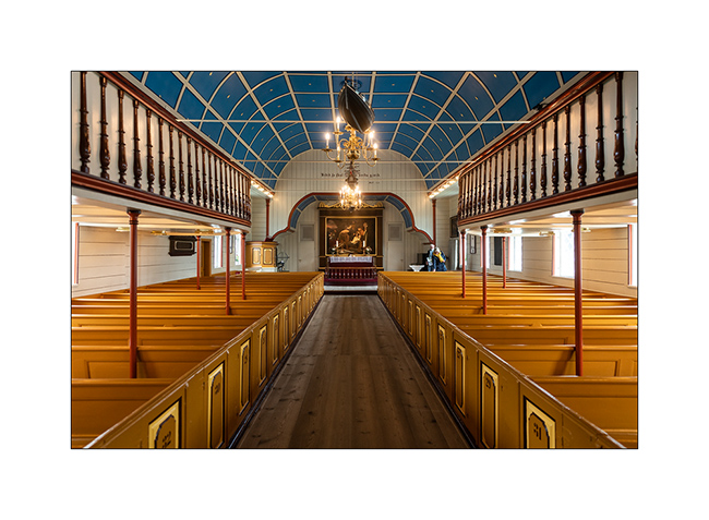
6. … Sober inside.
7. …
8. The oldest part.
9. Entrance…

10. The marina and its lively pediment.

11. Twilight from the VLV camp.

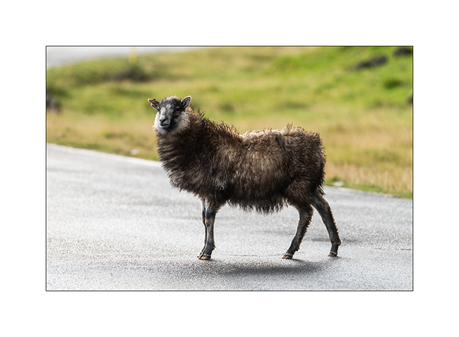
12. Sheep are everywhere and live in freedom.
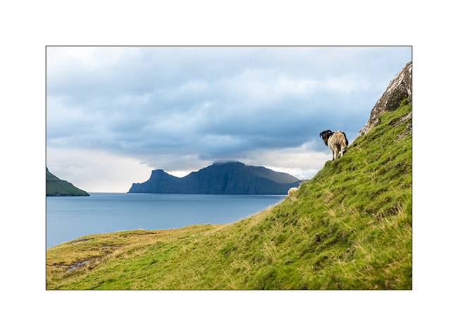
13. Some have escaped mowing for some time!

14. There are many who are all or partially dark.
15. Karsoy Island in the morning.

To be followed in a few days with the crossing to Iceland by ferry. Thank you for following us. 😉
Faroes (III)
Let’s continue the journeye…
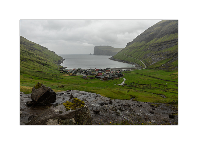
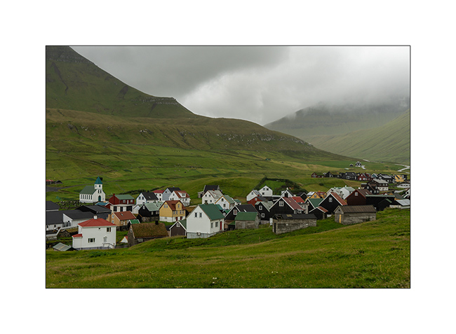
1. Arriving in Tjornuvik, another isolated village known for its black sand beach, one of the very few beaches of the Faroes. The place is famous for surfing because the bay opens on the North Atlantic and have big waves when it’s windy.
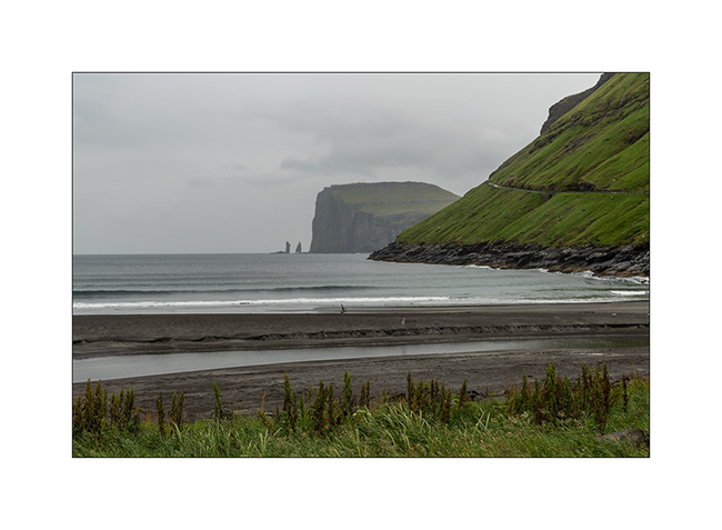
2. The village is nestled at the bottom of the bay.
3. Overview as the rain doubles.
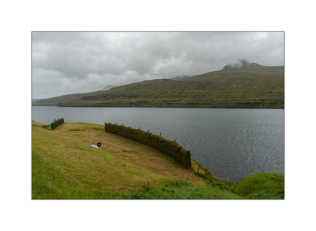
4. Here’s something I hadn’t seen before: a method to dry the hay that will feed the sheeps during the winter. As it rains all the time, it is arranged in walls. The constant wind prevents the grass from rotting and allows it to dry.
5. Rest zone!
6. Little pass on the way to Gjógv.
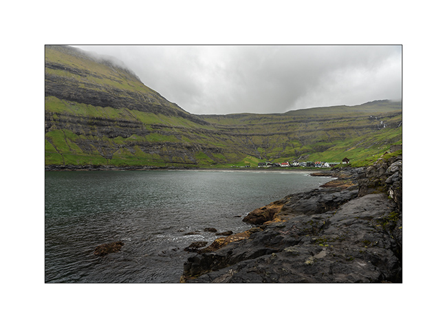
7. Arriving at the village, still in the rain.

8. It has a privileged natural shelter.
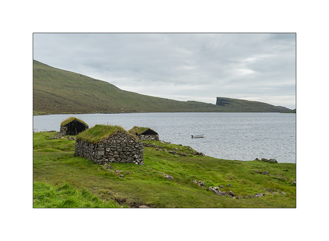
9. Traditional houses…
10. …
11. Last seen before leaving…
Because three days pass quickly, the next article will introduce you to the old city of Tórshavn, the capital, and the ferry crossing.
See you soon here 😀
Faroes (II)
Here is the continuation of my discovery of the Faroes. These islands are right in the Gulfstream, this warm oceanic current which gives to Scandinavia and more largly to Europe its temperate climate compared to its latitude. As a result, average temperatures vary very little between summer and winter: 48-50 F in summer and 37-39 F in winter. On the other hand, there is on average between 260 and 280 days of rain per year and 300 days with wind! VivaLaVida stopped there for only three days but was treated to her part of rain, sometimes fine drizzle, sometimes heavy rain. No wonder the mountains are dripping everywhere! There is not 100 yards without a stream that comes down.
I took advantage of the good weather of the first day to discover two spots among the best known of these islands…
1. On my way, the wind creates clouds on the cliffs…
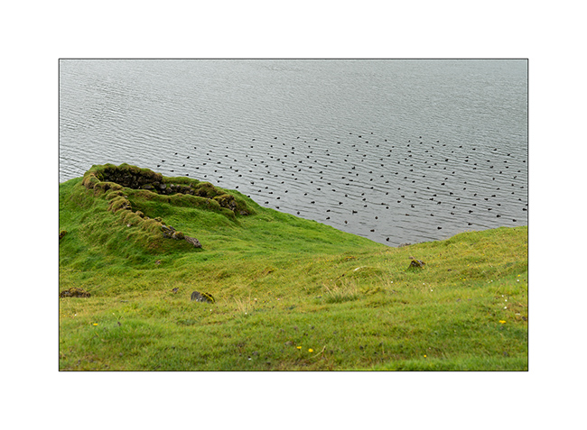
2. First spot: Lake Leitisvaten, the largest lake in the Faroes, perched about 40 yards above the ocean !

3. It flows into the Atlantic by a beautiful waterfall.
4. The cliff that I climb is impressive! The silhouette at the top gives the scale, well… if you can see it! 😉
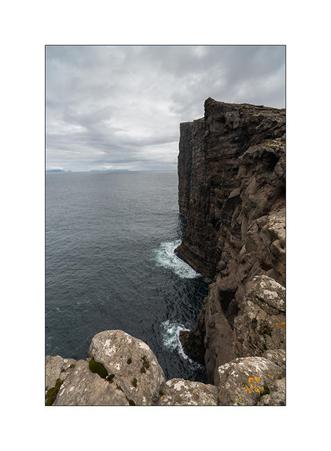
5. From the top, the panorama is breathtaking! This image is an panorama of 4 vertical images.

6. Traditional boat garage along the lake, on my hike back.
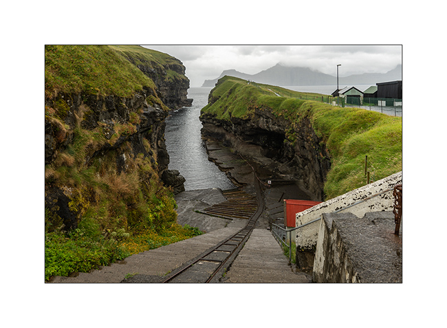
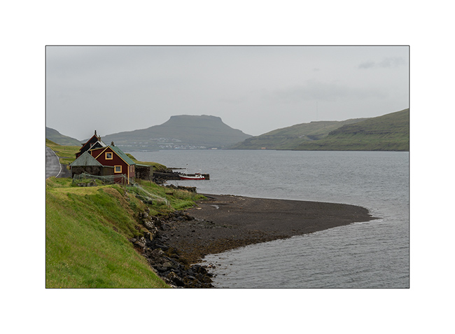
7. Continuing the road to the North, I discover this small village, just lovely… In the distance, the arch of Drangarnir.

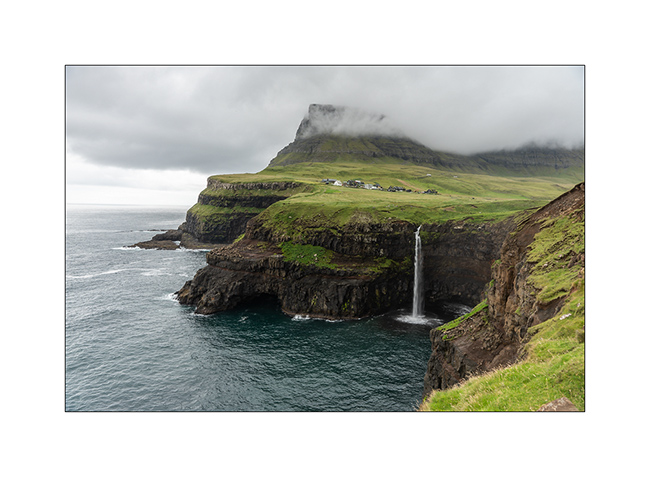
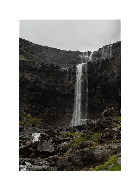
8. And here is the second must-see spot: the Gasadalur waterfall. The small village of the same name was one of the most isolated of the Faroe Islands until the construction of a tunnel in 2006. Before, the only way to reach it during winter was the sea where a summary natural harbour allowed small boats to land by nice weather. In 1962, the village remained isolated for more than 5 consecutive months because of a series of Atlantic depressions.
The waterfall is 50 yards tall.
9. View from the top of the waterfall, with at the foot of the cliff, the rocks that allowed the landing…

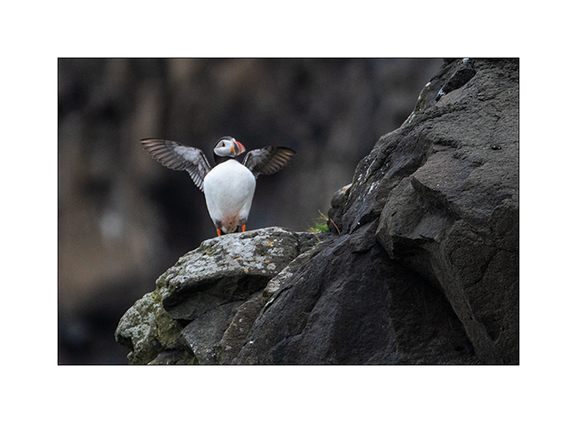
10. First meeting with the puffin in the cliffs…
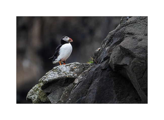
11. What a beautiful bird!
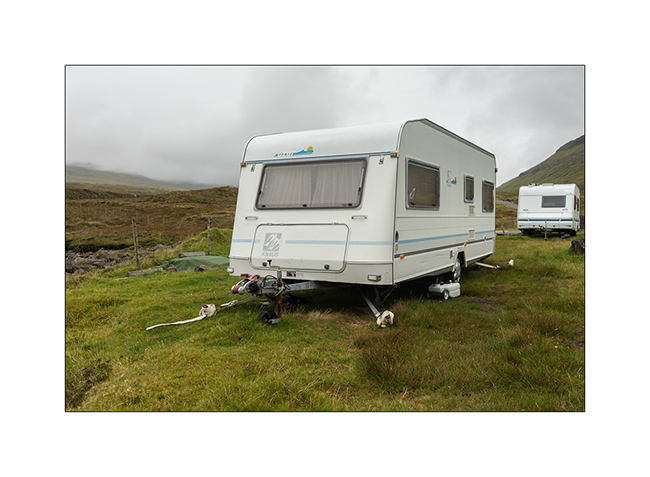
12. Here, people attach caravans so they cannot fly on windy days, that means everything!
13. Going up a fjord towards the village of Tjornuvik.
14. Waterfall along the VivaLaVida’s way.
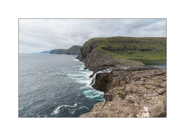
15. Cliffs in the rain. The Faroe Islands have among the highest cliffs in Europe. Some are half a mile high.
In the next update, I will show you the black beach of Tjornuvik and other parts of these beautiful islands. Stay tuned!
 D5 Creation