November, 2014
now browsing by month
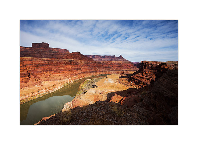
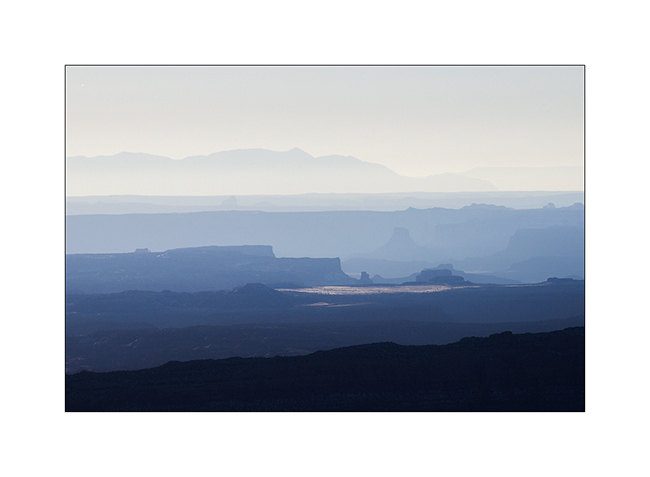
On the left bank of the Colorado…
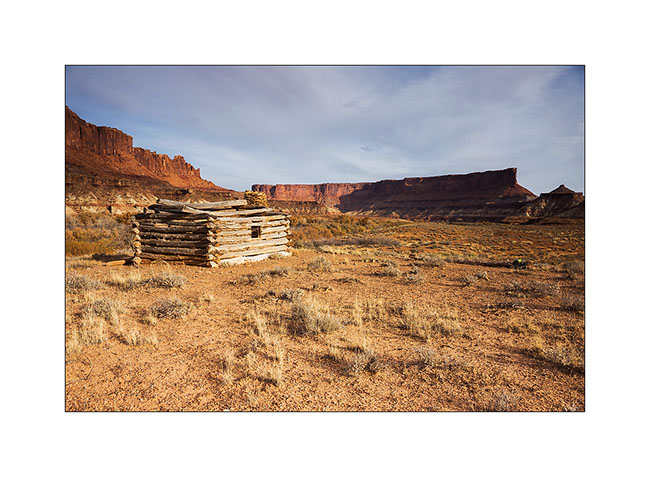
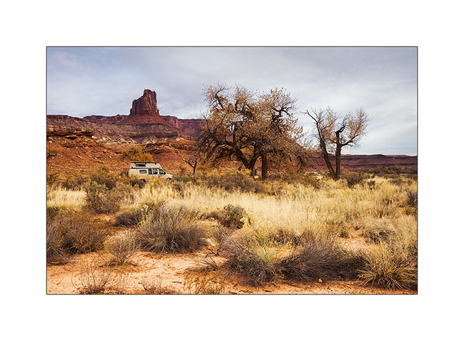
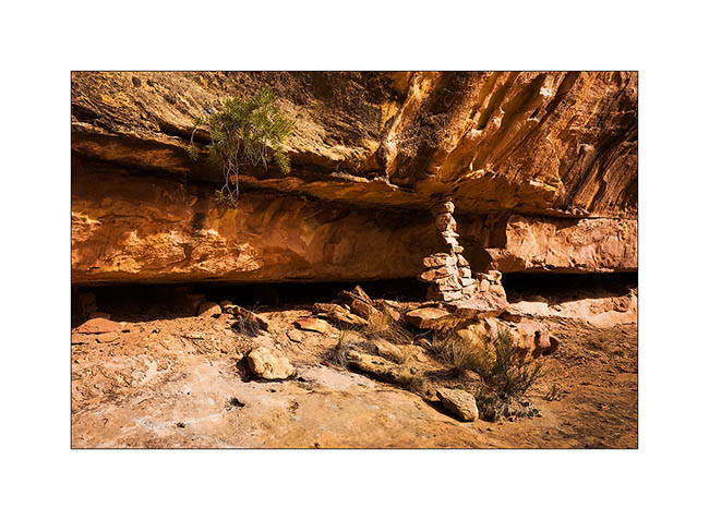
Near the end of the White Rim, I hiked to Fort Bottom, in the middle of a meander of the Green River.
1. Remains the “cabin” on a river bank. It is almost 200 years old and housed tuberculosis patients who were sent here to end their days…
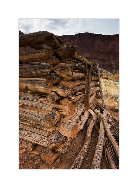
2. Build details.
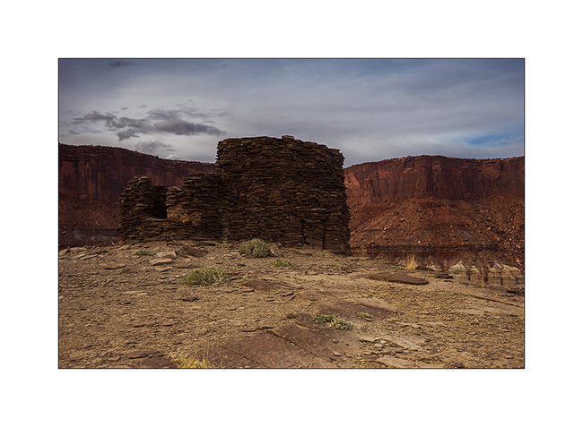
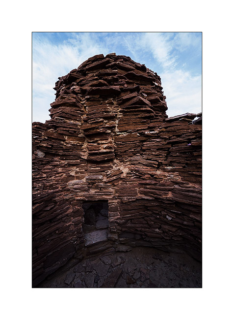
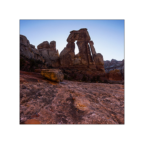
3. On the hill in the middle of one meander of the river, there is this double round tower.
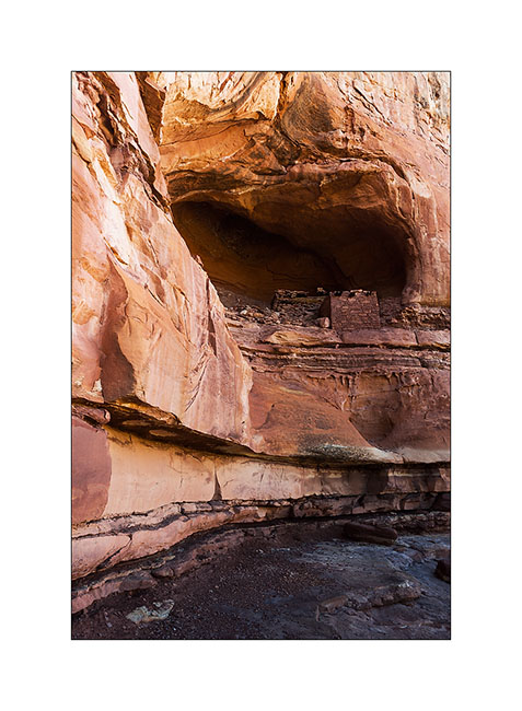
4. Here it’s it closer. This is an Indian building dating back to about 1200. We do not know its function.
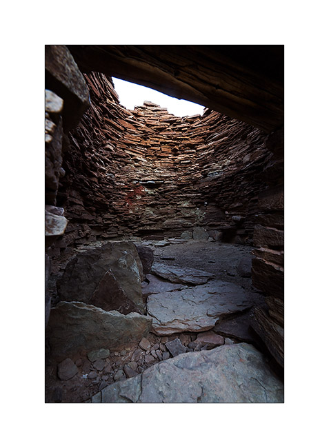
5. I sneaks myself inside, being careful not to shake the fragile ruins.
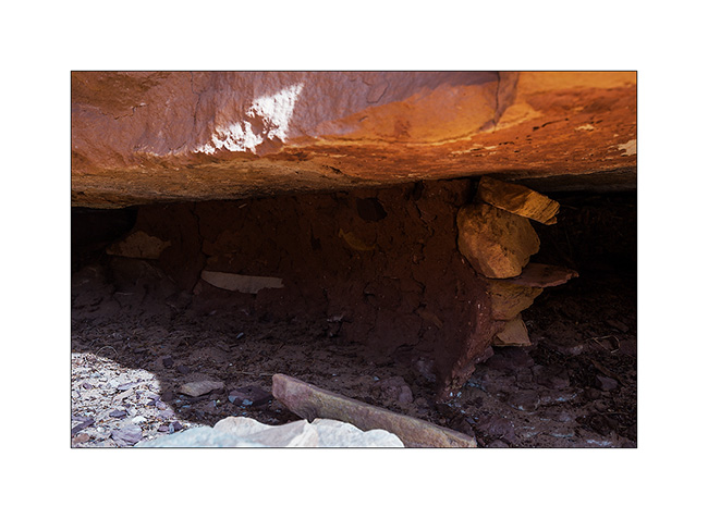
6. The floor of the main tower don’t exist anymore…
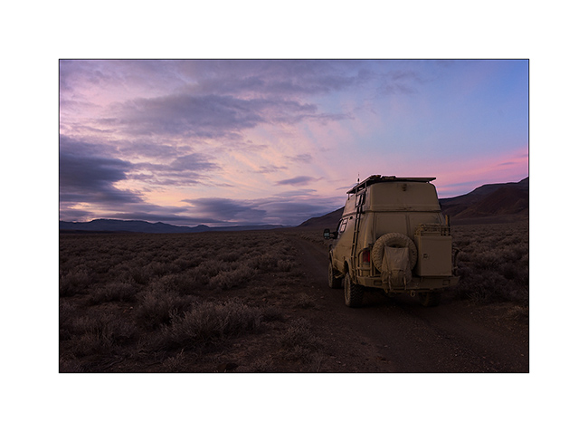
7. While I go back to VivaLaVida, curious clouds catch me up.
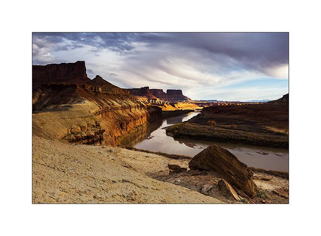
8. But I get some nice light over the river.
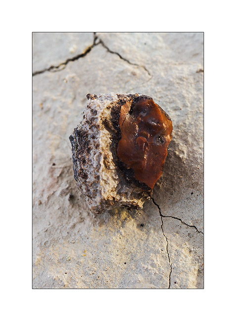
9. Fred, we need your geologist knowledge! 😉 In some areas, there were many stones like this, with a slightly chalky appearance on the outside but inside glassy, that really made me think of red flint including white crystals in zones, almost translucent sometimes. Do you know what it is?
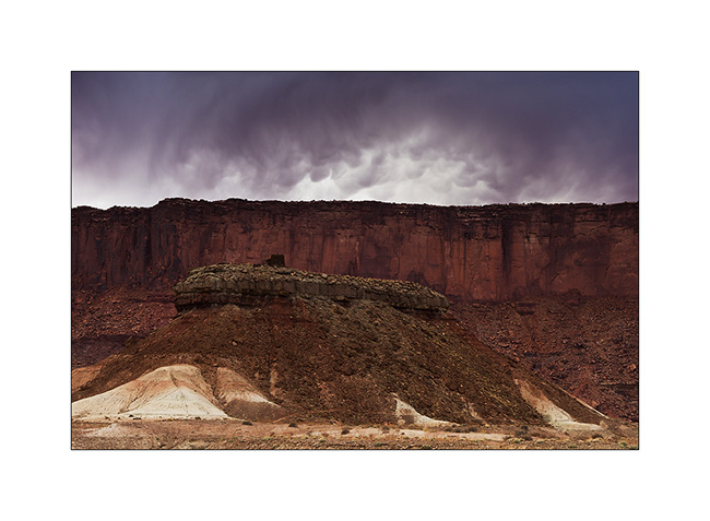
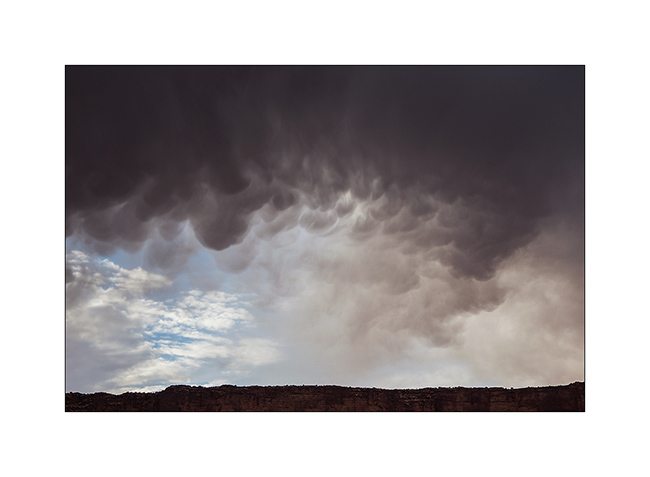
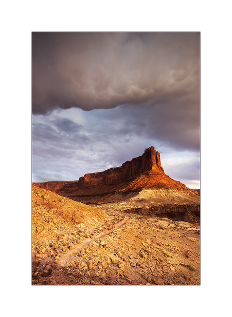
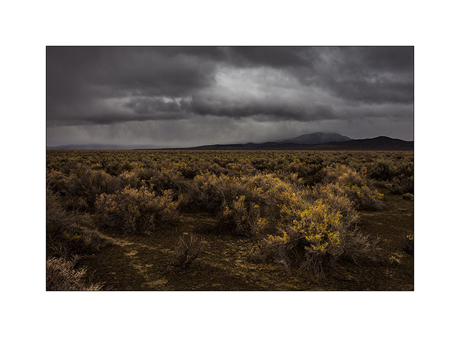
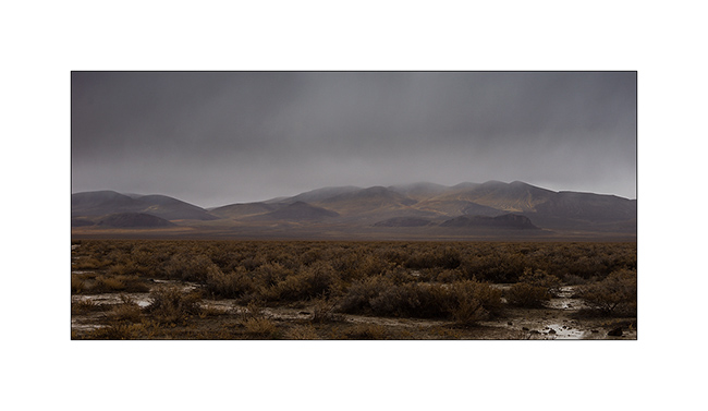
10. Amazing atmosphere of the surrounding cliffs. But no drop will reach the ground…
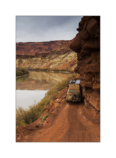
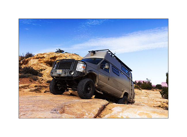
11. Vivalavida coming out of the White Rim trail the next day by a gray sky, with a final passage a little “tricky” for her size.
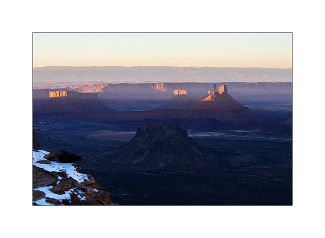
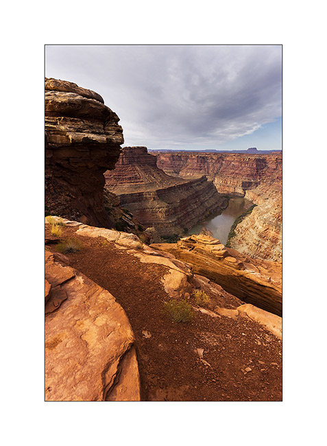
I then went to sleep to Hurrah Pass I reached at night, to go to discover a Colorado viewpoint in the morning.
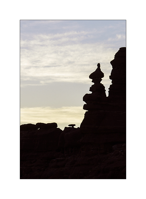
12. Unbelievable! At dawn, he was there, the famous troll I had already thought to glimpse, sitting cross-legged and watching his top spining…! 😀
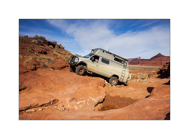
13. A quite hard path of the trail with a nice step.
14. It’s quite high, isn’t it!
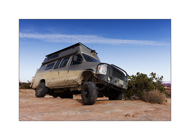
15. But nothing to stop VLV which is already on the next one!
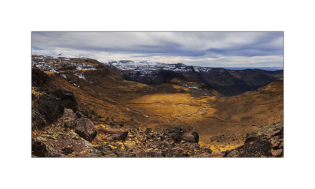
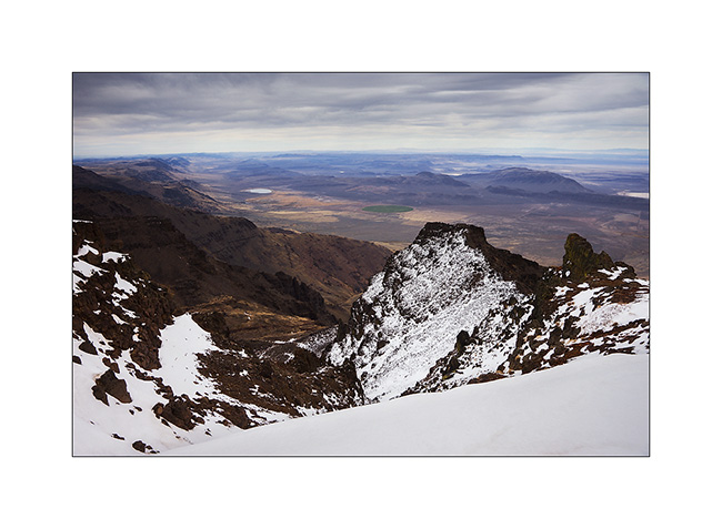
16. The viewpoint was gorgious…
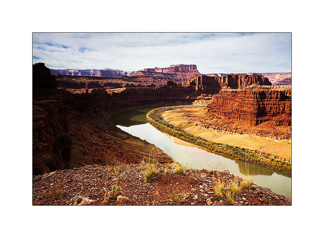
17. … on both sides.
18. Him, it is probably not a troll, but he seemed to look VLV passing, as a kind of alien looking an insect ahead… 😉
That’s it for today. More to come soon…
Still Canyonlands…
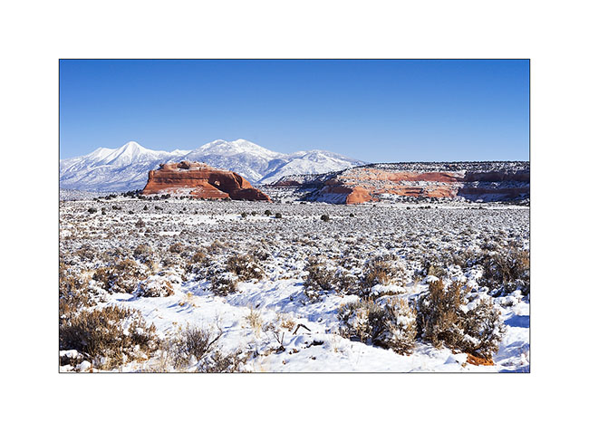
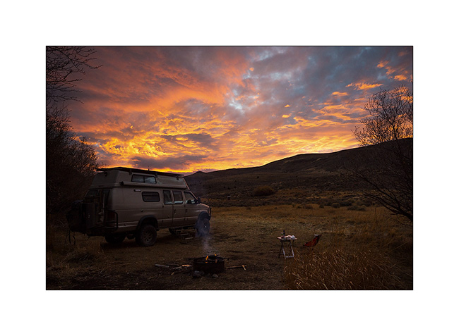
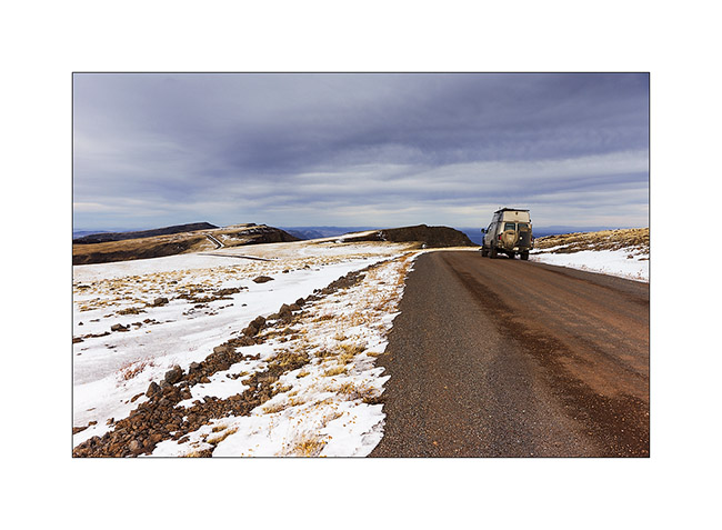
No way to risk to stay stucked in so much snow, I preferred not to cross the pass that would lead me to the other side of the La Sal Mountains and went to Warner Lake driving around the mountains. I already discovered this little mountain lake in a previous trip and wanted to see it in its winter coat.
1. Late afternoon light on the Warner Campground, obviously empty at this season.
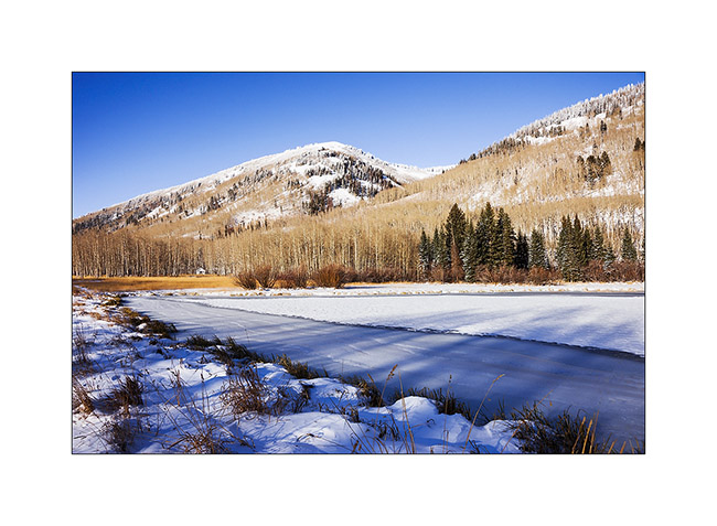
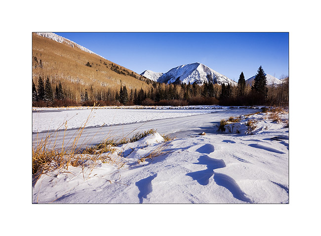
2. Beautiful frozen Warner Lake.
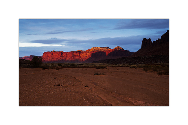
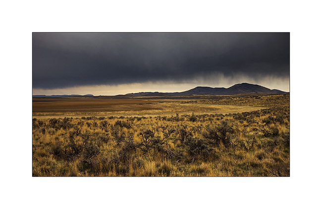
3. As the weather forecast indicated 12 F in Moab, over 3,000 meters below, I went down for me to find a campsite less exposed to cold. The view over Canyonsland and Henry Mountains, over 0 miles away, was splendid.
4. I found a better sheltered spot above Sand Flat, near an overlook over Castle Valley, a picture of the Far West at sunset…
The next day, session welding because I discovered that the bracket supporting the engine preheater was broken. Again and again the vibrations of the dirt roads… So I went late to Long Canyon.
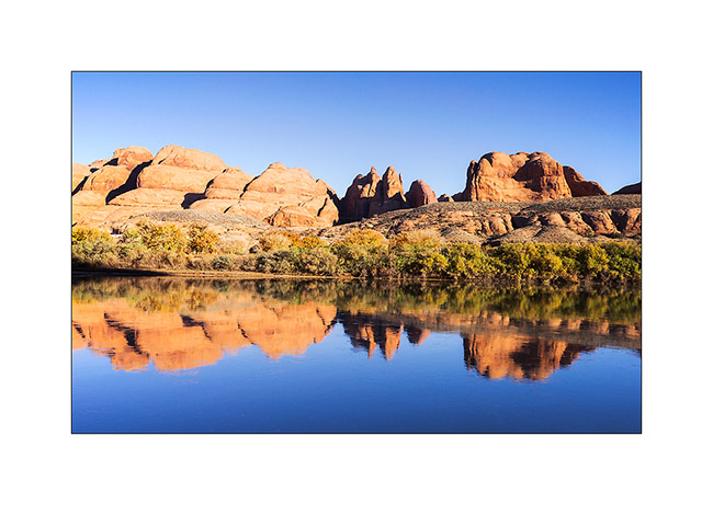
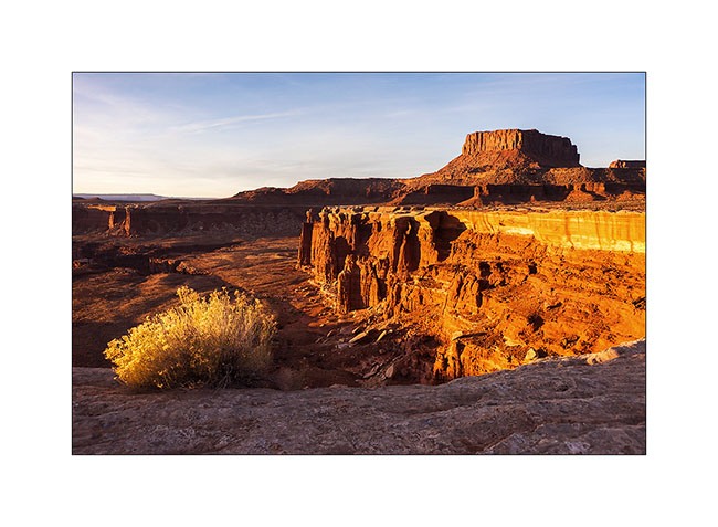
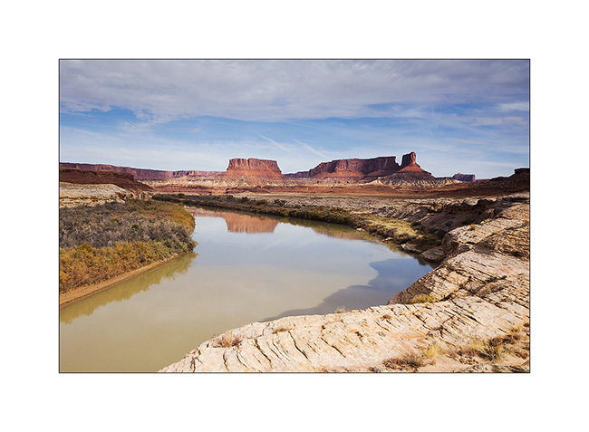
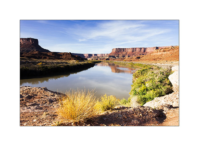
5. The Colorado River reflecting the Moab Rim.
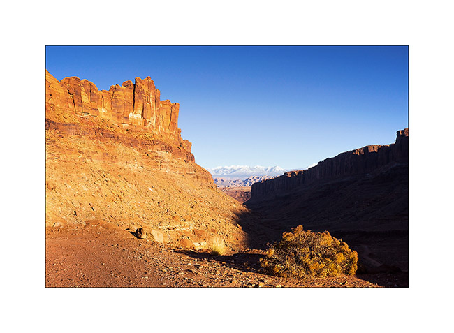
6. Going up in Long Canyon, With La Sal Mountains in the back.
7. The famous spot in Long Canyon ; Souvenir photo stop required! 😉
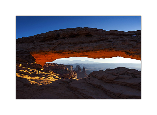
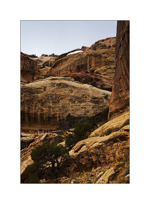
8. The next morning, I got up early to go to Mesa Arch at sunrise. A photo that I’m not the first to do but I like it…
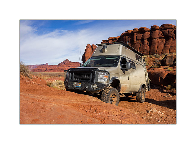
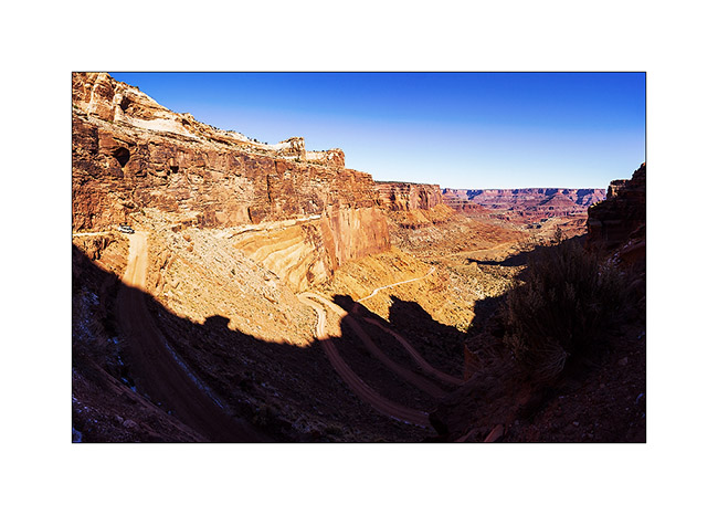
9. VivaLaVida then went down the Schafer Trail to get to the White Rim Trail. Beautiful downhill in the vertical walls! VLV is quite small up there…
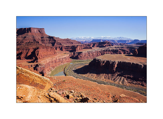
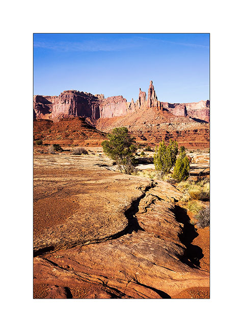
10. One of the meanders of the Colorado from the White Rime Trail.
11. Self-portrait at Musselman Arch, quite aerial… 😉
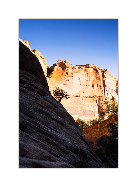
12. The towers that appear Under Mesa Arch, but this time from the bottom.
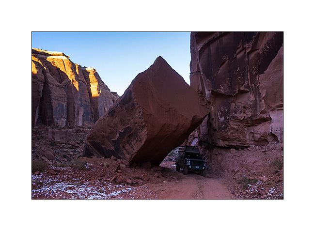
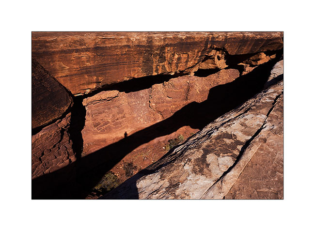
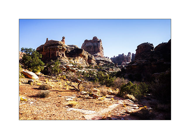
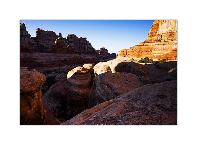
13. One of the huge overhang that crosses the White Rim…
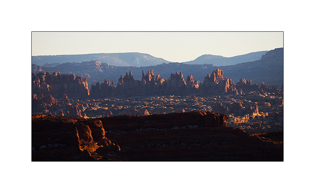
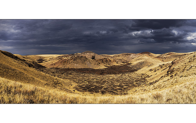
14. In Canyonlands, there are number of canyons and arches everywhere. The White Rim Trail takes its name from the clear limestone layer that it follows over 100 miles.
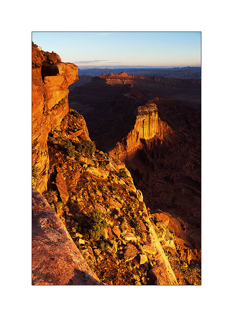
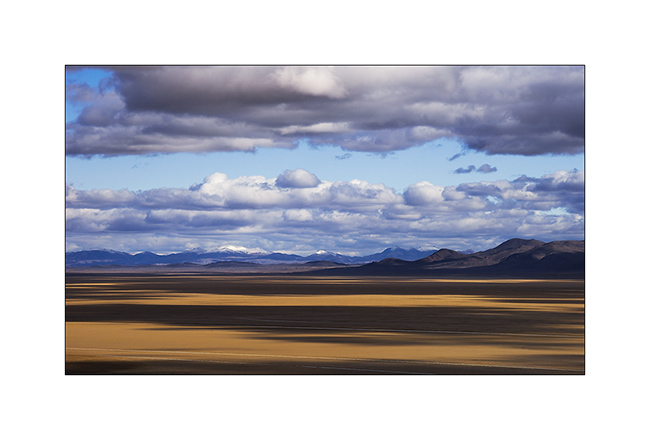
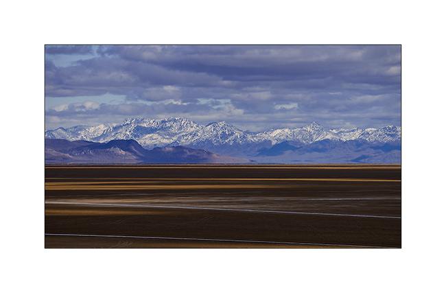
15. From Whitecrack Campground where I spent the night, Sunset over the 20 miles away Needles is gorgious.
16. Under windwos of VivaLaVida too !
17. Almost the same colors at sunrise…

18. Another of theses giant overhansg with Candelstick Butte in the back.

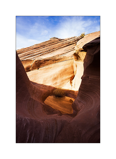
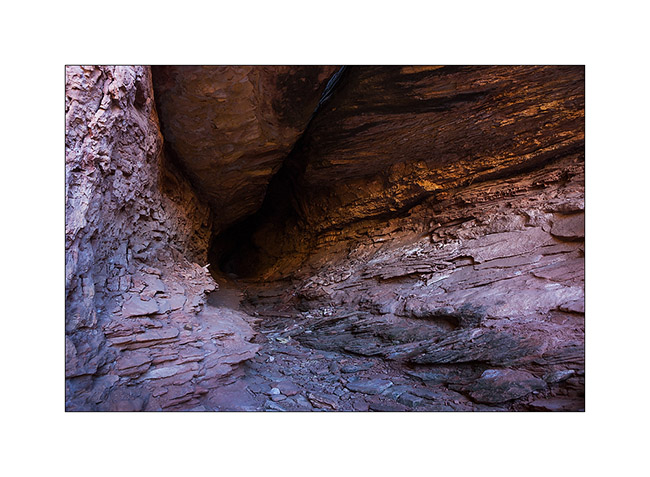
19. A small slot canyon I visited along the trail…
20. I rediscover the Green River…
21. Luch stop at Potato Bottom.
Continuation and end of the White Rim Trail in the next update.
In Canyonlands area…
I went to see other places in Canyonlands NP, first in the beautiful Lavender Canyon.
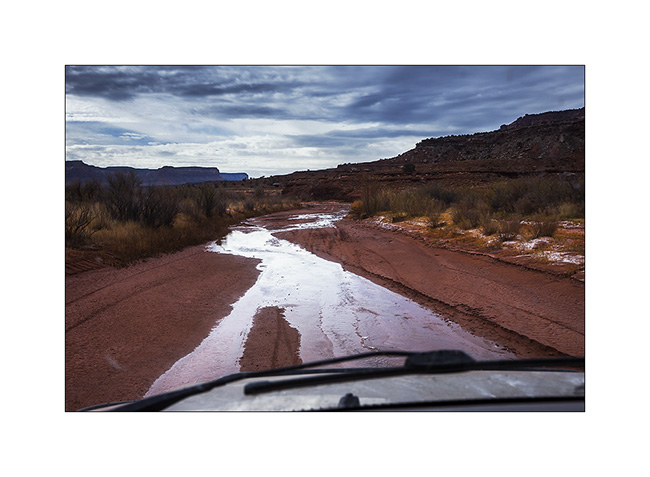
1. The access road goes nearly 20 miles up in a wash. There is some water, partially frozen in places, witness of the recent weather disturbance (the one I had at Black Rock).
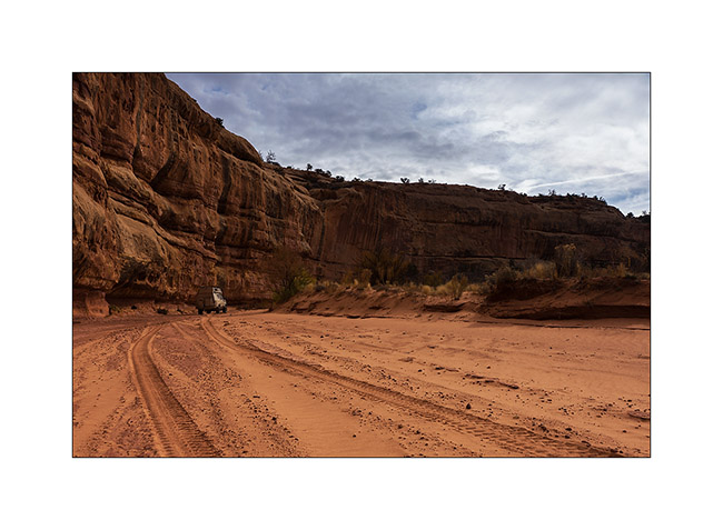
2. VivaLaVida is small under the vertical cliffs of the canyon.
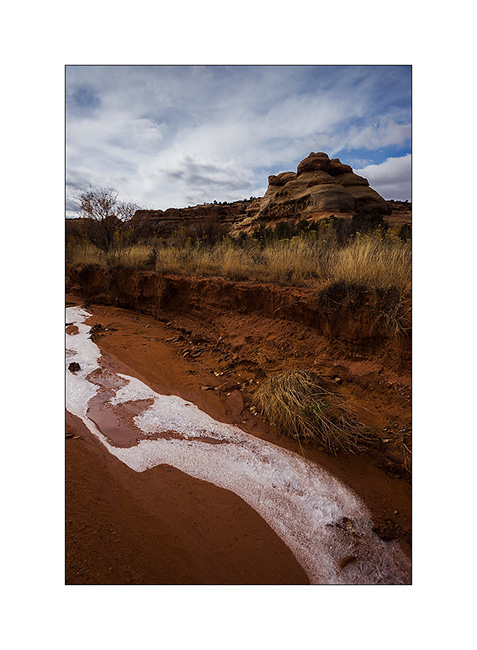
3. Only way to show you that it’s cold in the desert too…
4. In a side canyon that leads me to Long Arch, I discovered some remains of an Indian granary dating from approx. 2,000 years.
5. They protected their harvest by sheltering it in cliff cavities, closing access to rodents using mud and stones.
6. Further in the West Fork Lavender Canyon, I discovered a nearly complete shelter in half-wall height.
7. It will take me several attempts to find a path leading to it.
8. After three hours of hiking, I discovered the elegant Long Arch, little known because really remote. I’ll have to study the map to see if there is way to access from the top because no way to get closer down here.
9. I take some showers of sizzles on the way back. But at sunset, a short ray colored cliffs around in this amazing red .
10. After a day of transition, I went to sleep at Anticline Overlook to enjoy the morning light.
11. Scenry over Hourah Pass and Moab Rim is impressive.
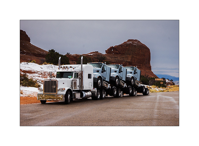
12. The weather get cloudy again and showers of rain/sleet follow one another. But I stop to show you how they transport trucks here! 😀
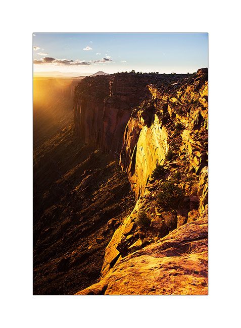
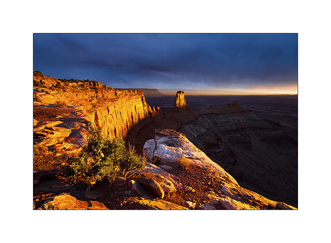
Having spotted the previous day an interesting point of view, I tried the gamble to go there for the sunset despite the rain and stormy Wind that got up, hoping for a sunray at sunset. The track was very bumpy and almost 20 miles long, VLV needed two hours to get to.
Arrived there at around 4PM, I went locate places to try to find a nice composition, aware that if there would be some sunlight, it would be brief. I finally found a composition I like, not without some apprehension because I was on a block overhanging a 600 feet cliff. It’s 16:30, I sit nearby and wait. It is downright cold and I’m beginning to think that I have come all this way for nothing…
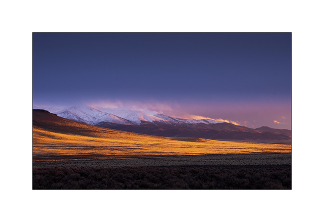
But ultimately, the Gods of Light rewarded me with a moment of insane intensity! It did not last five minutes, just long enough for the sun to go under the clouds before to set. But the light was so intense, contrasting with the dark and low snow skie, gilding the cliff in a so bright yellow-orange..! A moment of pure happiness for my photographer’s eye. 😉
13. Firing…

14. Bis.
At once I prepared a luxury aperitif before processing these images… 😉
15. The next day, the snow has changed the appearance of the place.
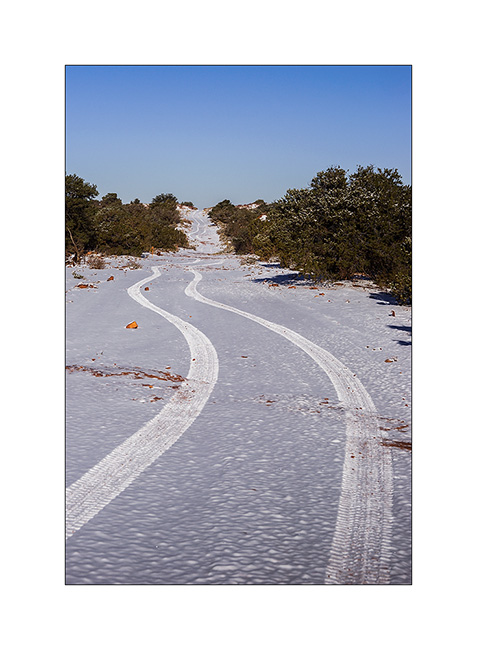
16. The track of VLV, alone on snow, as a symbol of her journey, often trough almost desert places…
17. Contrast with the red sandstone is striking. Here, the small arch of Looking Glass Rock.
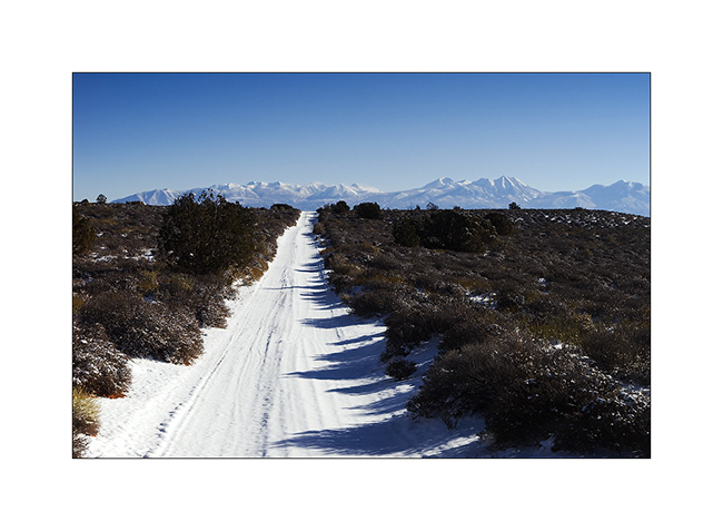
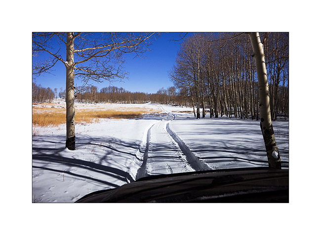
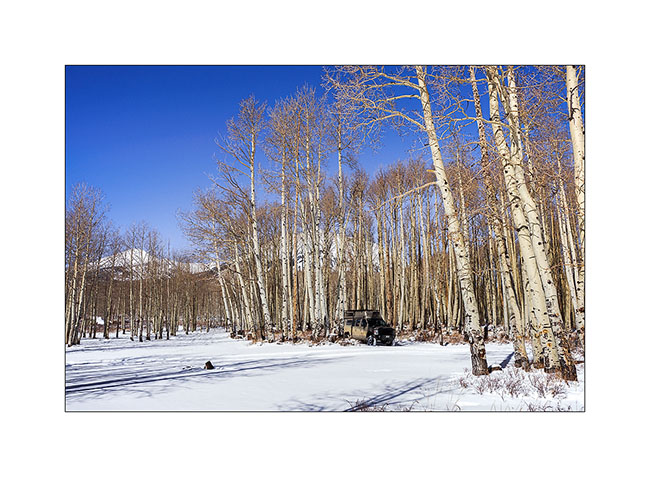
18. VivaLaVida is then went in the La Sal Mountains for a taste of winter.
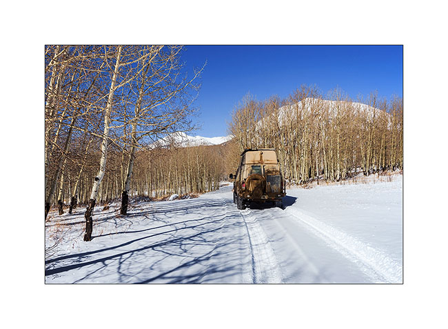
19. Aspens have lost their leaves for some time but proudly raise their silhouettes in the sky.

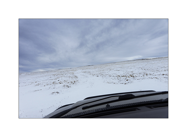
20. There was too much snow for me to cross the La Sal Pass, I had to turn back.
21. Nice place for a small lunch, isn’t it? 😀
More in the next update…
Back in Utah
I met Nick and Kim in Moab. I met Nick in North Carolina. He also owns a Ford van, two-wheel drive and shorter than VivaLaVida but well equipped for two. He’s traveling for two and a half weeks with his friend Kim who discovers the West for the first time.
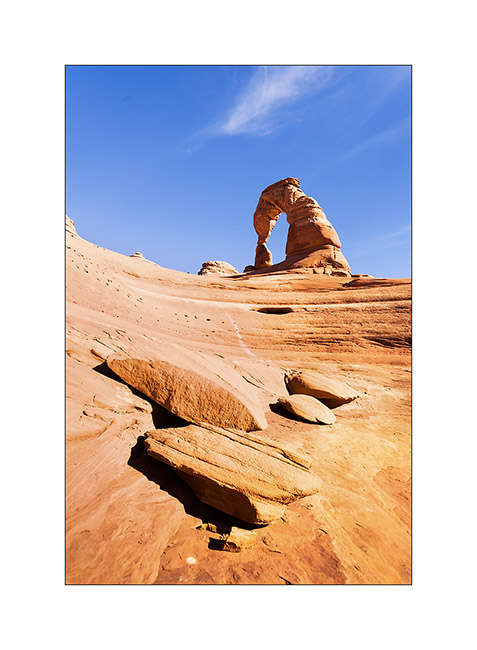
1. We spent the first day in Arches National Park, the opportunity to make an image a little different from Delicate Arch while every picture has been done on the site, one of the most photographed of Utah.
2. The next day, Nick rented a jeep to travel the White Rim Trail, a 100 miles trail that runs north of the Colorado first, then the Green River.
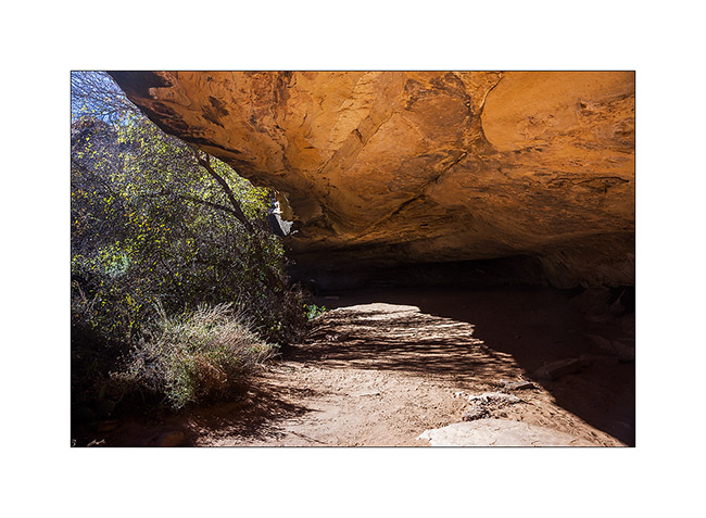
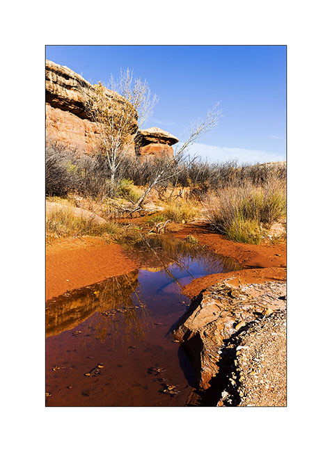
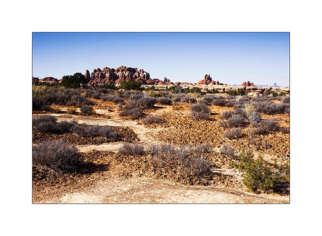
3. Having to wait four days to service VLV, I got back to the Needles, probably my favorite place in Canyonsland NP. I went to see Cave Spring inhabited by the Anasazi Indians from 7,600 years BC.
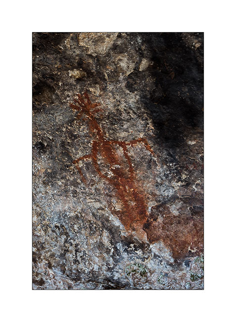
4. Petrograph in Cave Spring
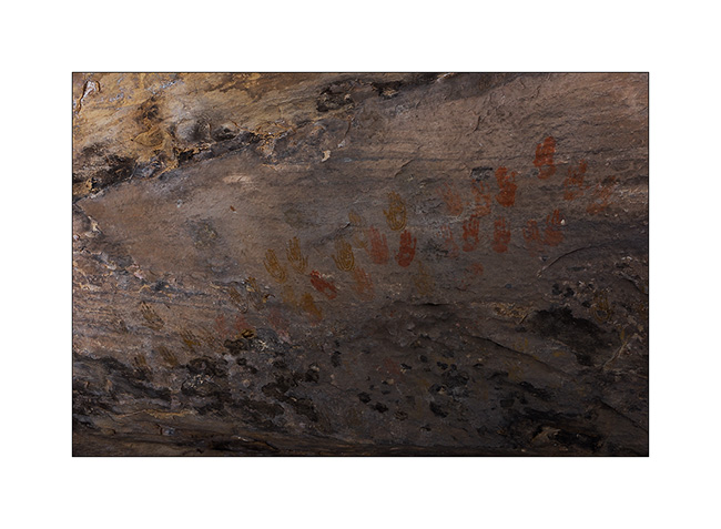
5. The famous hands of Cave Spring.
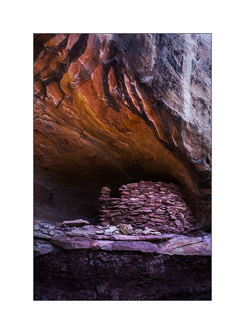
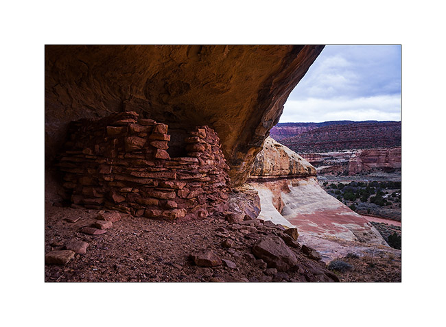
6. On the way to Tour Ruins, another spot I discovered.
7. I first discovered granaries on the cliffs.
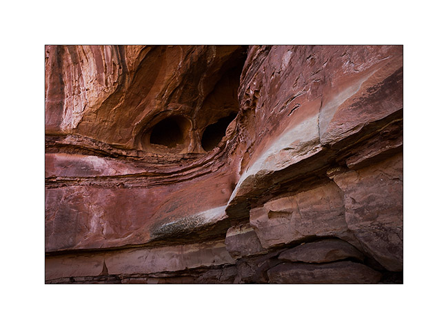
8. Here is the tower which gave its name to the ruins…
9. Here is the ruin, surprisingly well preserved. It was a dwelling place for the summer season.
10. I went to sleep above the Colorado and enjoyed the viewpoint the next morning.
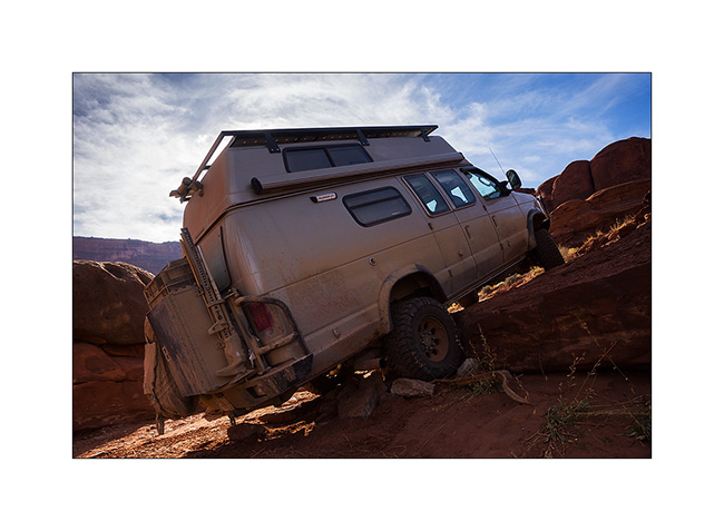
11. The track to get back is quite interesting by place.
12. Axle crossing.
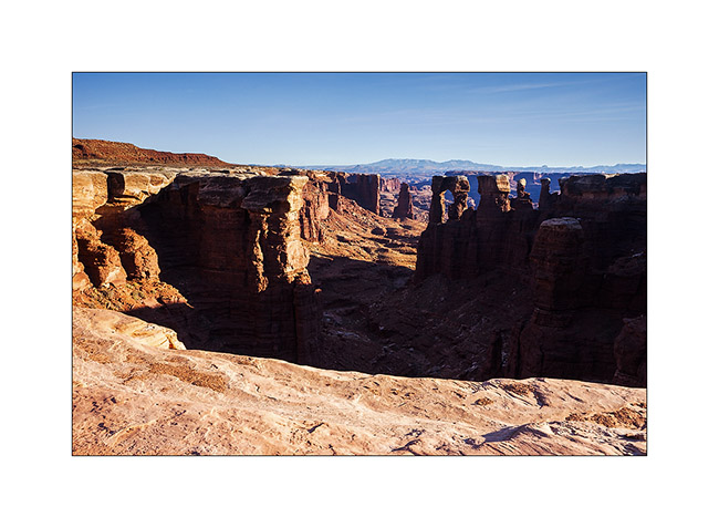
13. In the afternoon, I returned to Chesler Park, a beautiful place.
14. One of the canyons we cross to get there.
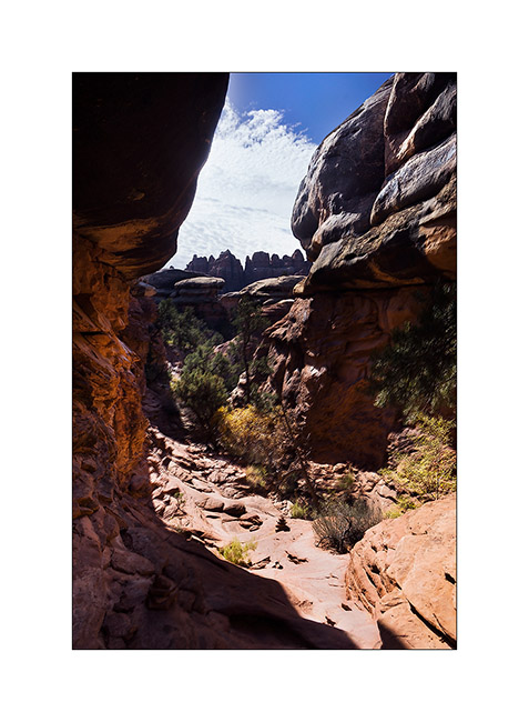
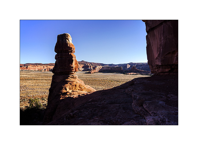
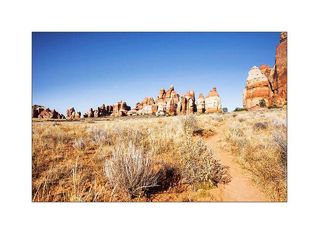
15. I approach the famous Needles.
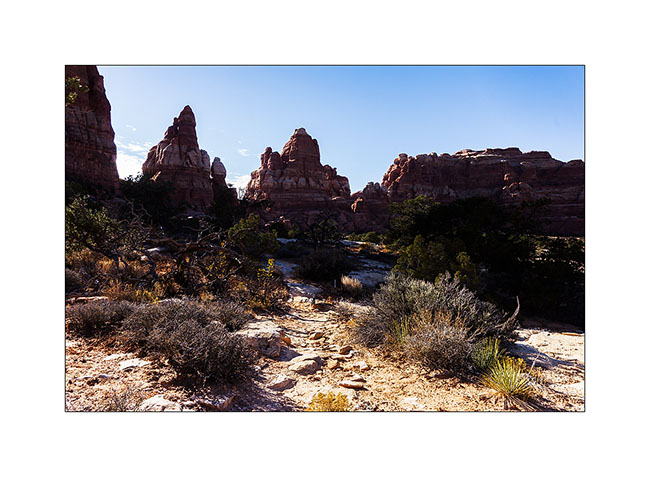
16. And here I am in Chesler Park.
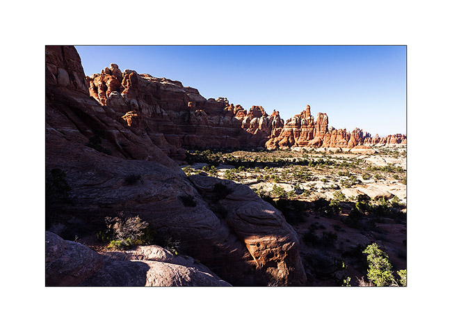
17. The south side is a beautiful meadow that makes me want to camp there.
18. In a side canyon to Elephant Canyon, I discovered this fault created by erosion.
19. It’s late but I go up the Elephant Canyon to find a nice arch.
20. Small tree in the cliffs…
21. After almost running at full speed, here is Druid Arch, a rather unusual double arch.
22. I’m still at the top of Elephant Canyon and I must go down without delay to reach the Trailhead before nightfall, 6.5 miles away.
I reached VivaLaVida at nightfall, a little tired after more than 14 miles on quite uneven terrain.
Some other spots discovered in Utah to come soon…
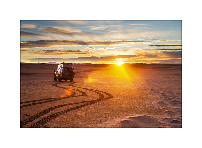
En route to Utah, well… not fast ;-)
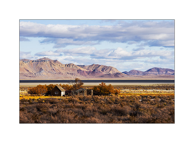
1. In the previous update, I left you with this image of Black Rock that I leave it here again, you’re gonna understand why… 😉
2. The Wake up was quite unexpected with a rainbow in the mist that lasted only a moment.
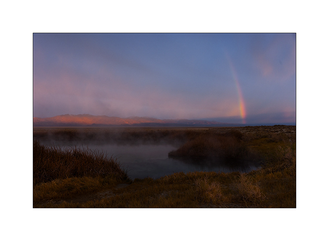
3. Here is Black Rock again, all crowned with a hairs of rising sun. So you have it in the evening and in the morning! 😀
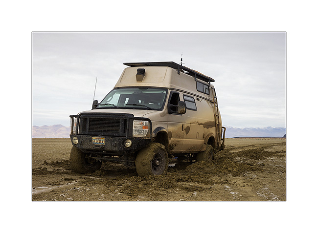
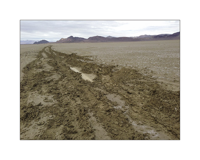
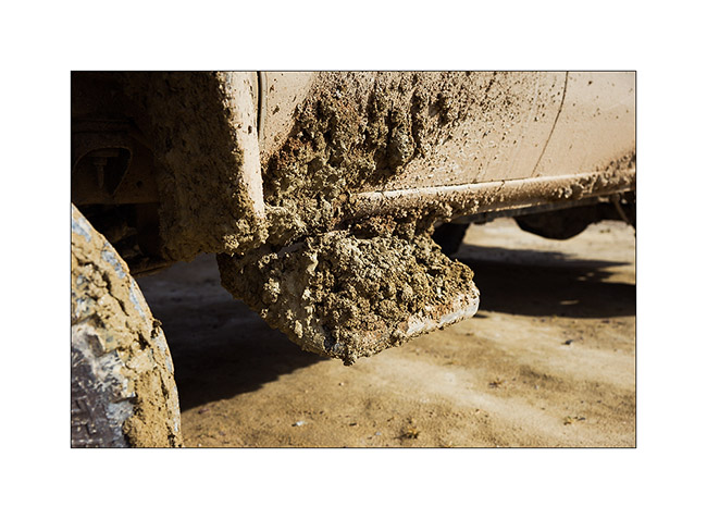
After a walk the day before to see the state of the trail, I decided to cross the high desert of Black Rock which seemed to have dried well four days after rain and snow. At first all went well, about ten miles without a hitch. Then suddenly, without I could notice any change on the track, VivaLaVida lost all grip, as if he was driving on ice! Even at leass than 5 mph, difficult to maintain it on the fine line of the track. Too late to stop, I drove about 3 miles till a simple tilt of 1 ° or so “draged” VLV on the left without the steering wheel reacts. Obviously, out of the trace, the two left wheels were driven into the mud and despite the four-wheel drive and differential locks, VLV has stopped, stucked right..!
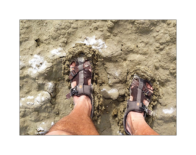
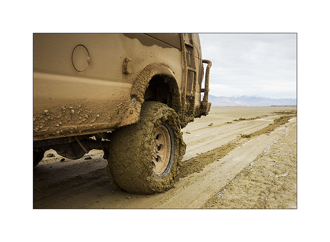
Well, I am alone more than 35 miles away from the first living soul, he’ll have to take out the nearly 5 tons of VLV by myself. So I pulled out the shovel and made a small fitness session to arrange “ramps” to all four wheels, not only to allow VLV out of its gangue but also to guide him back on the track, only trace capable of supporting its weight. I didn’t succeded at the first attempt,you can imagine. But after a few hours of fitness, “muddy” from head to foot, VivaLaVida had regained a semblance of presence with the wheels out of the ruts. 😀
All for nothing as two miles away, a river still flooded prohibited any crossing. So we turned backd and return to the Black Rock Hot Spring with the same trail – to wash Pschitt, shoes and shovel at almost nightfall… 😀
4. Here are the tracks that VLV was doing just before to get stucked, despite largely deflated tires.
5. Gloups, it’s called bogged!
6. Mud is good for the skin, isn’t it? 😀
7. We’re out!
8. No, these are not new wide tires mounted for a better look of VLV… 😉
9. After all that, I had to make a detour of more than 150 miles to find the road that would lead me in Utah. However, with stunning scenery.
10. In the high Black Rock Desert, mineral colors are impressive…
11. … sometimes incredibly saturated.
12. It almost sounds like some molten lava, isn’t it?
13. Sometimes softer and pastel…
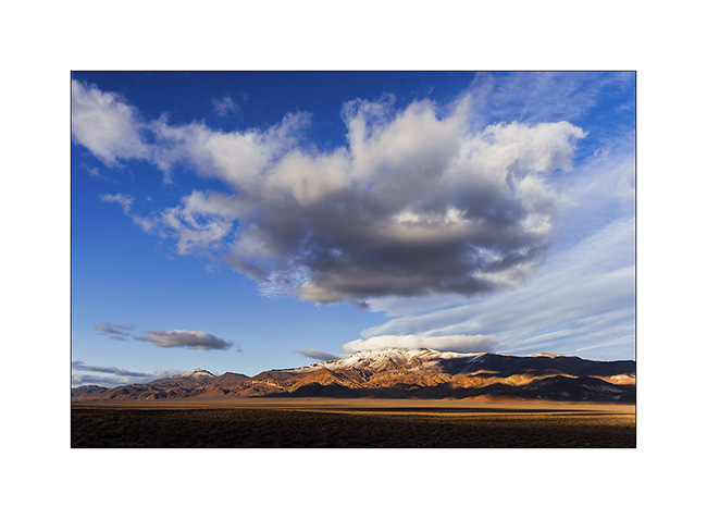
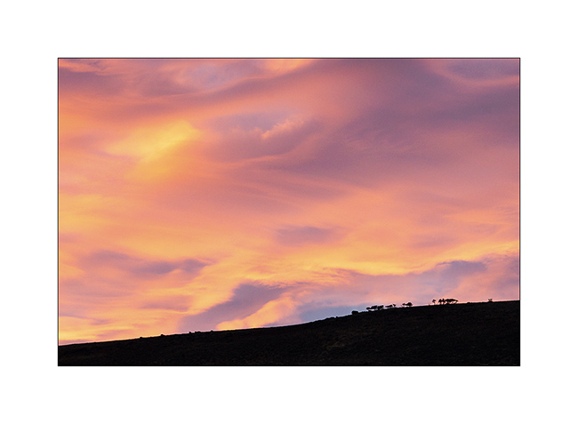
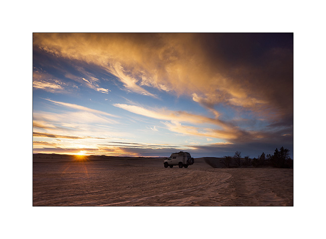
14. Last sunrays over Pahute Peak.
15. The sunset gratified me with very soft pink colors.
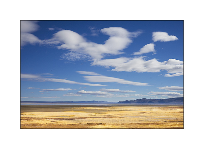
16. The next day, when I joined Utah, it was full moon on the plain…
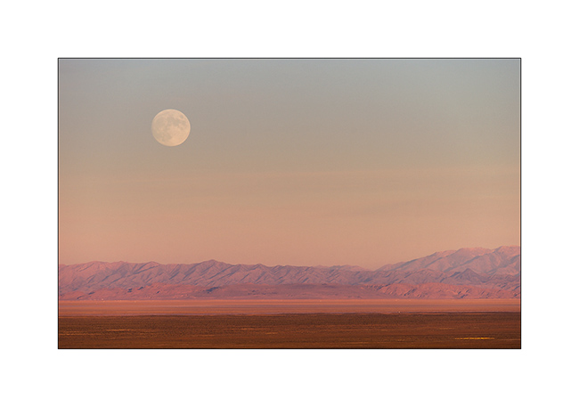
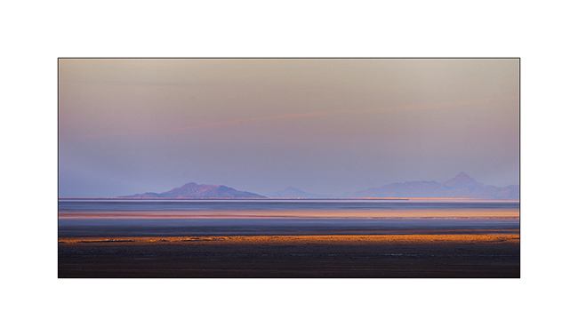
17. The shadows lengthen over the southern Great Salt Lake.
Upcoming episode in a few days…
Nevada : Black Rock Desert
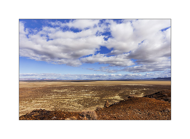
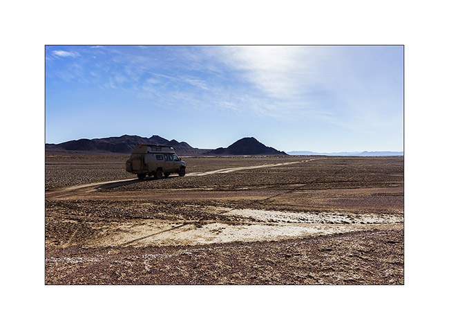
1. Arrival in Black Rock Desert, immense area that a part, the “Playa”, is without any vegetation.
2. Rain and snow have turned up the Playa area in deep mud, prohibiting VivaLaVida to venture there.
3. Contrast is beautiful with the snow on the mountains around.
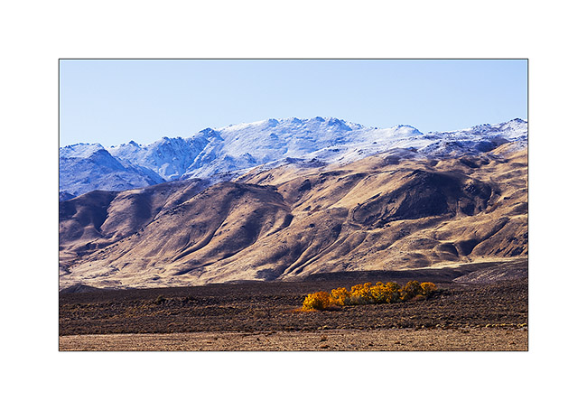
4. A source allows some “cotonwood” to display fall colors.
5. Playa extends over almost 35 miles long and 20 wide.
6. Jackson Ranch.
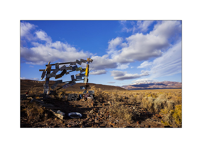
7. Funny sign at a junction in the middle of nowhere…
8. VLV has gone through this rather deep ford..!
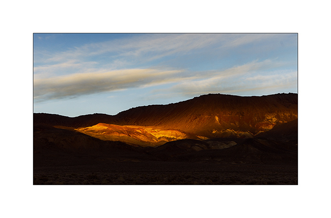
9. Wonderfull lazte afternoon light over Pahute Peak…
10. Difficult to show you how the track was slippery and muddy…
11. Last rays over Black Rock Range.
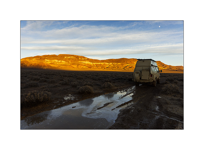
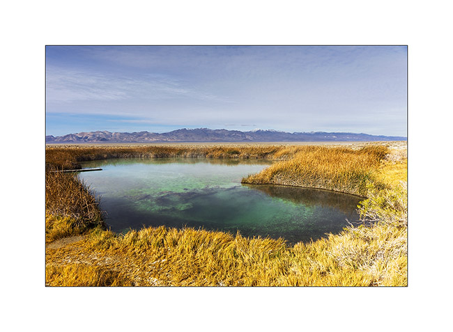
12. I arrived at night at Double Hot Spring what doesn’t stop me from enjoying a relaxing bath under the stars. 😉
13. If you bathe in a tub, it’s that in the above source itself the water is 172 F… A little hot to bathe!
14. Black Rock Desert’s Playa…
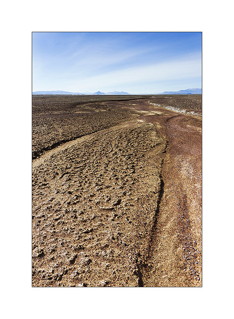
15. VivaLaVida adventures despite the risk of getting bogged down…
16. And changes in mud transportation! 😀
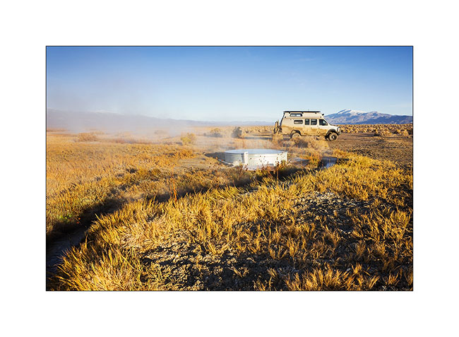
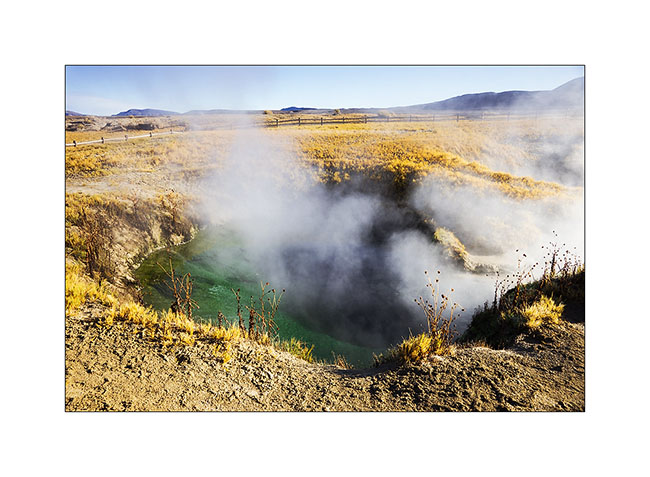
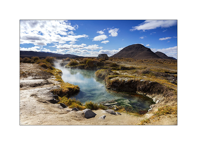
17. A little further, there is that. 😉 One of the most beautiful hot springs I discovered, a real natural pool almost heart shaped from this angle…
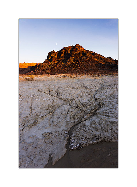
18. Here’s Black Rock Point, this black hill which gave its name to the desert.
19. I camped overnight at this beautiful hot spring, not without enjoying relax baths in evening and morning.
20. Black Rock Point adorn itself in orange, the moon rising above to wish good night to the only spectator of the place I am…
After this short tour of Northern Nevada, I headed to Utah to go meet a friend with some adventures that I will tell you soon… 😀
Transit trough Nevada
On my way to Utah, as usual I made a few detours, still in Oregon and then in Nevada.
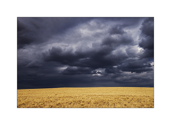
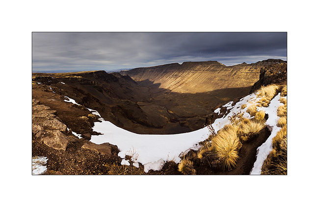
1. I approach the site of Diamond Crater while the sky becomes dark.
2. Panoramic of a secondary craters with VivaLaVida (left) giving the scale.
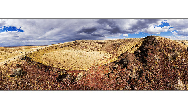
3. The main crater or what remains of it after a big explosion. Last erupted 17,000 years ago.
4. The showers continued but hardly wet the soil.
5. The next day, snow replaces rain over 4,000 feet elevation.
6. Small house in Demio, North Nevada.
7. The sky is constantly changing as the temperature drops to 35 F.
8. Atmosphere is beautiful despite the gloom.
9. Then VivaLaVida tastes snow…
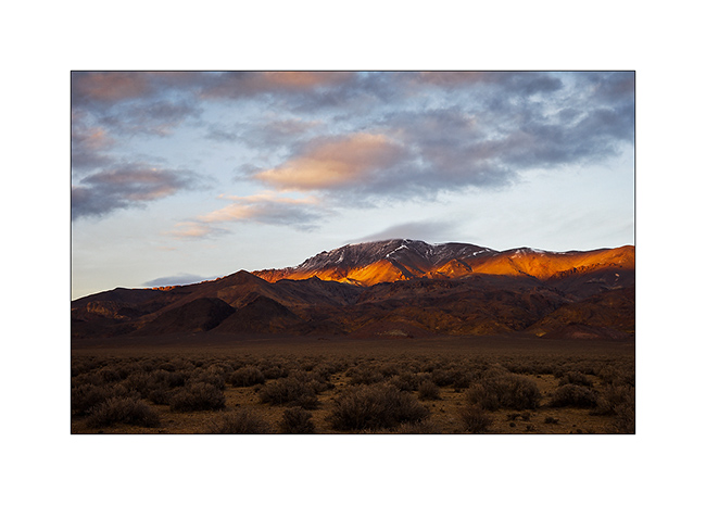
10. At the very end of the day, while the perturbation is nearing its end, a ray illuminates the mountain…
11. … that will only last a moment.
12. The next morning, mountain tops are white.
13. … and the track turned into a morass!
14. Short stop at Trevo Hot Springs.
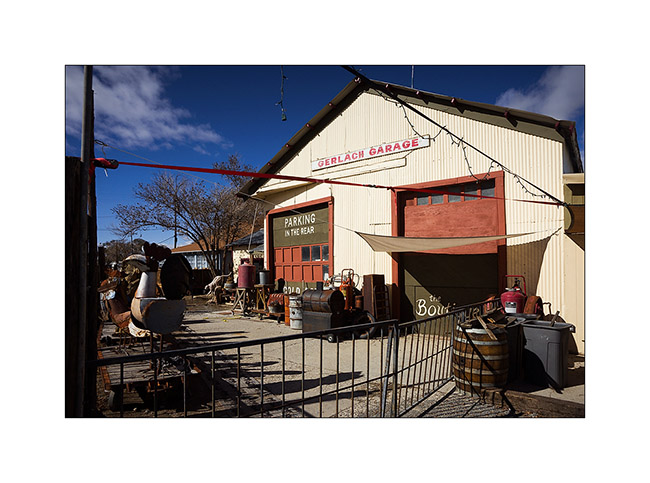
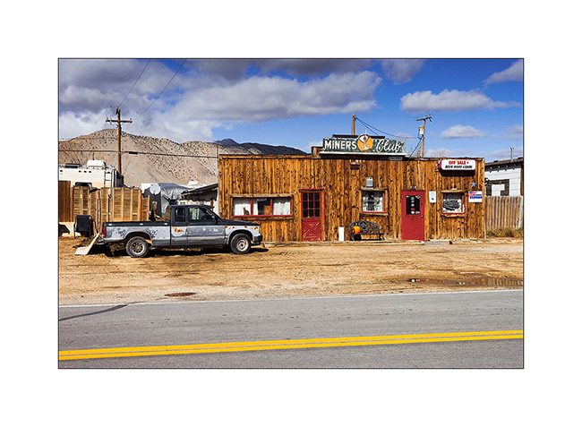
15. I arrive at the Black Rock Desert in Gerlach, a small village that smells good Flower Power time.

16. A garage winking the Swiss Gerlach. 😉
17. Local saloon…
Discovery of the Black Rock Desert soon here…
Some more of Oregon
Continuing my way quietly from one discovery to thw other, I reached south eastern Oregon where the landscape is rather desert…
1. “Summer Lake” – named in the mid-19th century by French trappers who have found a more temperate climate after a harsh winter during their crossing of the highlands – is almost dry.
2. From above, we can see that there is still some water.
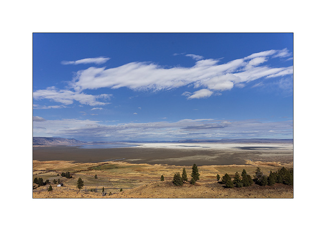
3. A little further on my way, Abert Lake looks having some more water.
4. On my way to the Warner Valley where there should be some “wet lands” areas where I should have opportunities to observe migratory birds, this rainbow greets us…
5. So I get on the Hart Mountain in the late afternoon, I discovered that the wet lands are completely drained to the point that grass replaces the lakes!
6. Showers offer e a nice sunset sky…
7. … and impressive clouds.
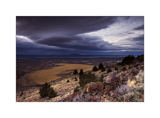
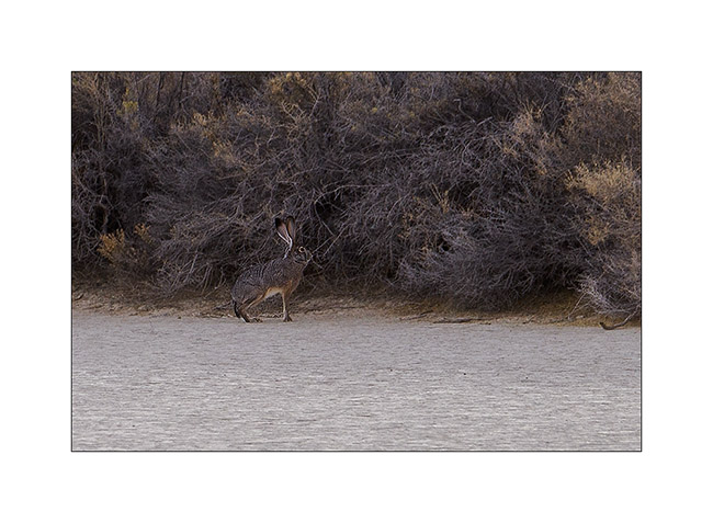
8. The next day, I went walking in the wet lands that are desperately dry. I only meet this hare…
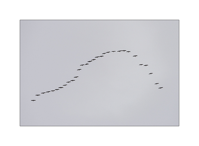
9. … and saw only two flights of cranes taht don’t stop as they did when these places were wet.
10. Unlucky for bird observations, I’ll try my luck elsewhere trying to spot a hot spring on the Hart Mountain. Having found it, I spent the afternoon and relaxed me.

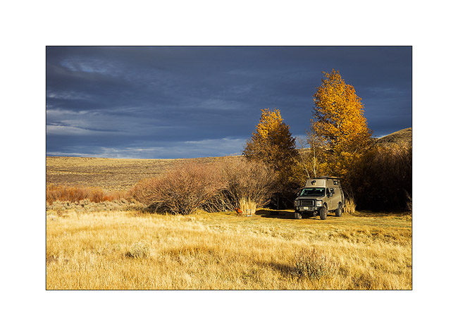
11. The nice camp of VivaLaVida, right next to the hot spring.
12. A very bright and colorful sunset concluded the day before I go soaking a little more under the stars…
13. Silhouettes on golden sky…
14. The following day, not without taking advantage of the starry night bathing me in the spring, I did a short hop toward the Steens Mountains.
15. They are culminating at at over 9,000 feet and there was snow on the last portion of track.
16. From the top, the scenery is gorgious.
17.5,000 feet lower, dry Alvord Lake on land sailing come when there is wind.

18. The trail follows the ridge for a few miles. Unfortunately I hade a gray sky gumming contrasts… 🙁
19. After two hours of waiting, a shy sunbeam just gives a little relief to the Kiger Gorge.
More to come soon… 😉
Still in Oregon…
Here are some other spots I discovered in Oregon.
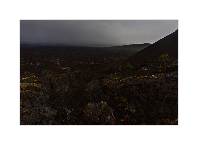
I told you, we’re right on the “Ring of Fire” and there are many sites of volcanic geology. One of them is the Newberry National Monument, a Hawaiian type volcano whose last erupted 6,000 years ago.
1. I first discovered the end of the lava field, about 6 miles away from the crater…
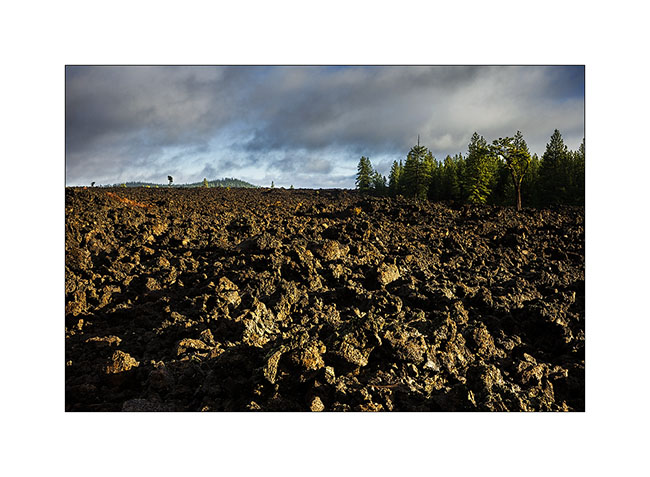
2. Here is the crater. Not more than 600 feet high, formed of falling slag from its explosions and expulsions of lava.
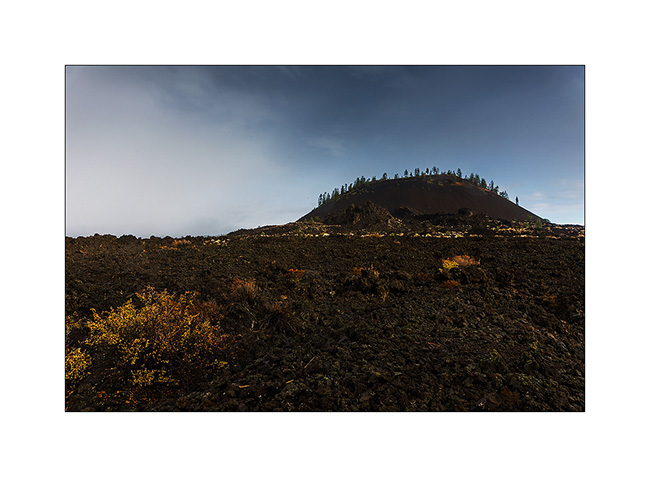
3. Nearby, virtually nothing was able to grow from 6,000 years, the particular combination of austere basalt and dry climate minimizing the creation of humus.
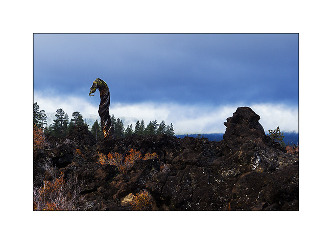
4. And I had the amazing and unexpected opportunity to finally solve the mystery of the Loch Ness monster. In fact, Sherlock Holmes and all the others could look far; they couldn’t know that Nessie had moved and was now living in the lava fields of Newberry! 😀
5. The basalt of Newberry diverted the Deschutes River, forcing it to dig its canyon in the more friable rock than basalt.
6. VivaLaVida then continued its way south-west across the highlands, vast horizons penetrated by only some few popular backroads.
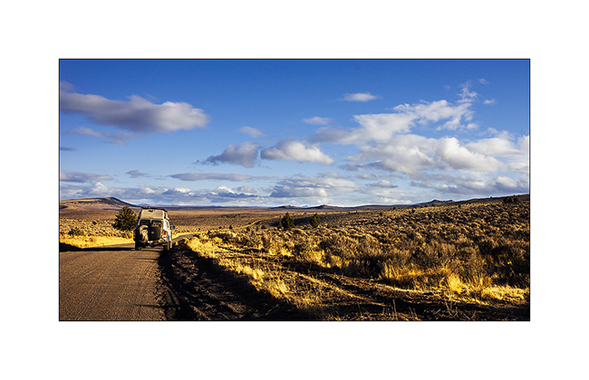
7. I drove later than usual to sleep close to the next site…
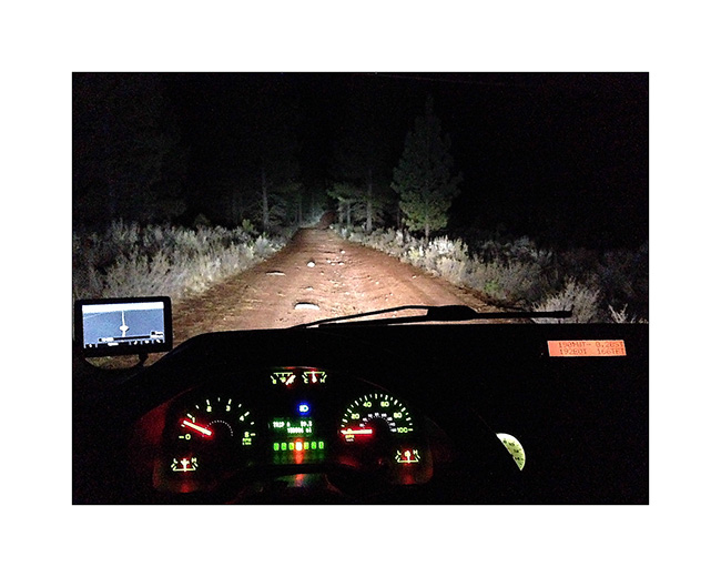
… which is a lava tunnel called Derrick Cave.
8. Arrival in the morning.
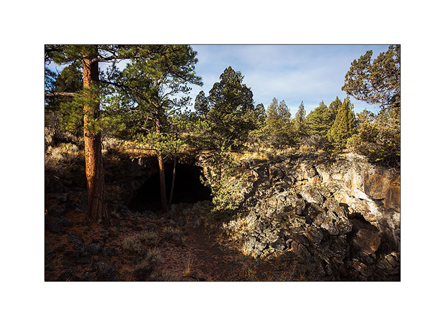
9. This tunnel is impressive, about 30 feet wide and 15 in height to its input.
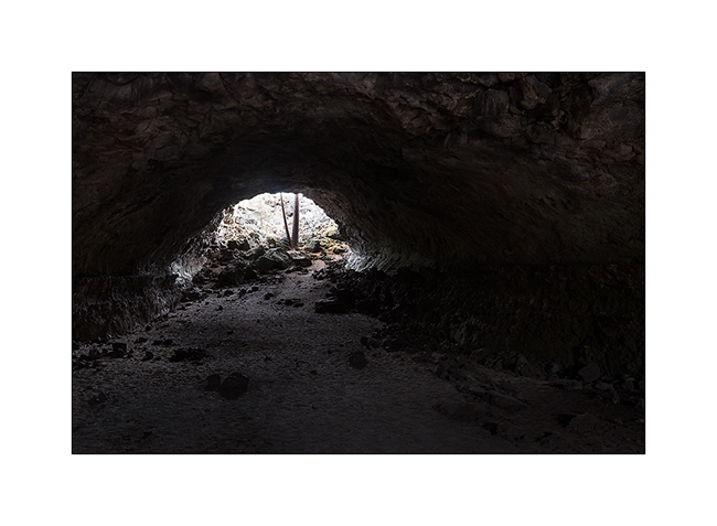
10. The roof collapsed in places, letting the light entering in the first 300 feet.
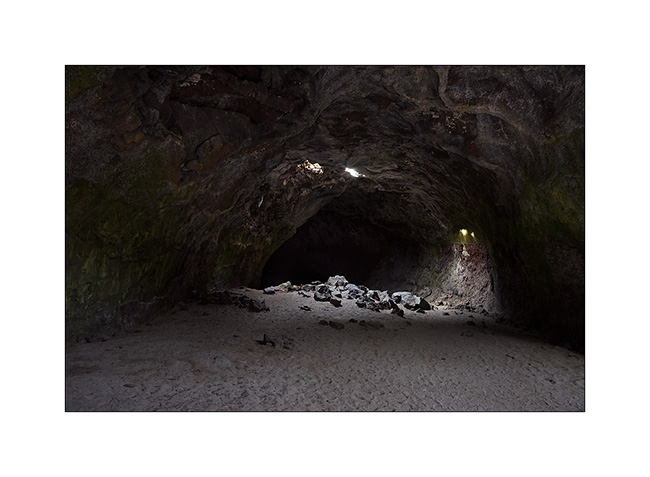
11. A photo with the penguin to give you the scale. 😉

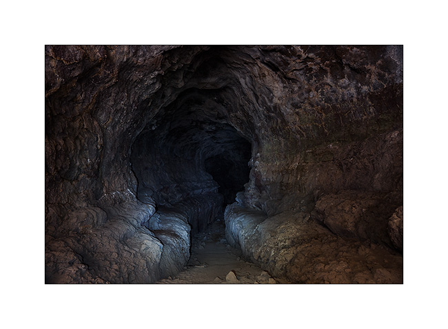
12. After 200 meters, the tunnel plunges underground, without any light. This photo was taken with the only light of small torch light. The tunnel is here more than fourty feet high, impressive. But without a second light, I didn’t go much further, didn’t want to find myself in there without light…
Still another site to discover another geological phenomenon or rather sysmic: “Crack in the Ground,” a crack in the rock created by an earthquake a few thousand years ago.
13. His visble part is almost one mile long…
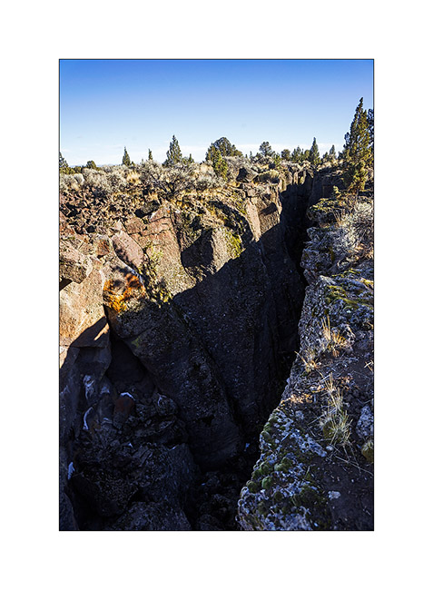
14. … portions of which are accessible by walk.
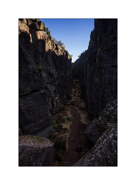
15. Some blocks are really in precarious balance!
16. I cannot show you but you can really see that this layer wass opened, the shapes of the rocks are similar in positive/negative on opposite sides.
17. After these discoveries related to volcanoes of this region, I went to sleep in sand dunes close to “Lost Forest”.
18. The sunset was beautiful.
Stay tuned for more to come soon… 😀
Some spot in Oregon…
As announced here are a few spots that VivaLaVida and I visited in Oregon, a state with varied and attractive scenery. The wet Pacific coast (where I didn’t go because of rainy weather) covered with beautiful forests, especially those of “red wood”. Moving 100 mile to the East, past the mountain range of South Cascades, they are highlands where the altitude ranges between 2,500 and 4,500 feet, dry because protected from rain by the Cascades range.
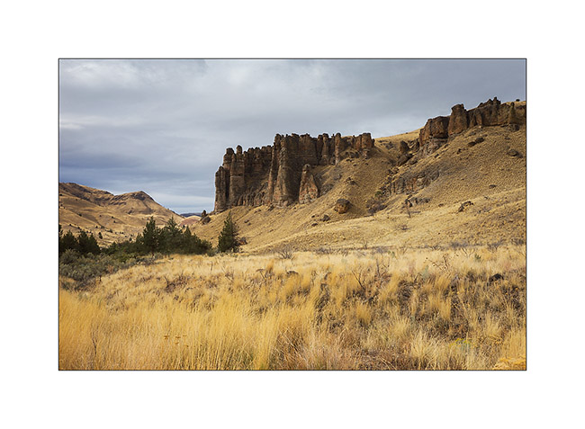
First spot visited, the Palissades, a cliff created by the erosion of volcanic mud dating from 40 million years ago.
1. The Palissades.
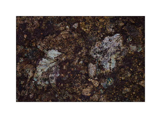
2. This site is part of the John Day National Monument, known for the fossils it contains. Here, prints of fossilized leaves which show that there was a very different landscape millions of years ago.
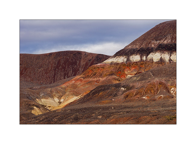
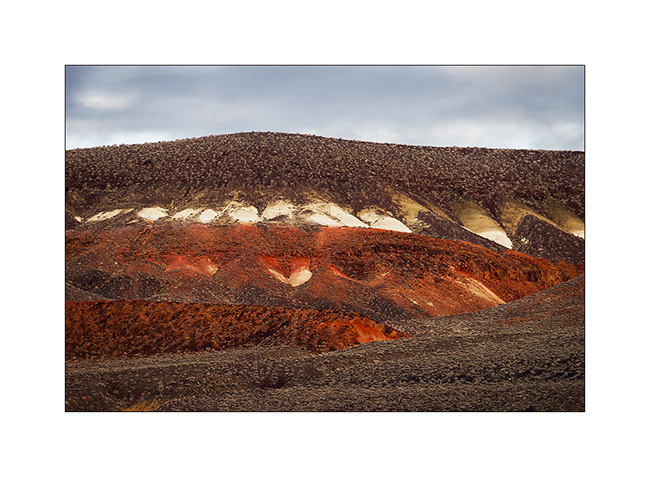
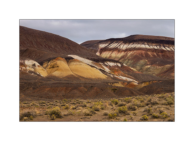
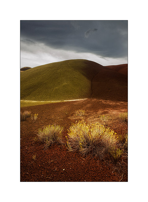
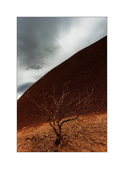
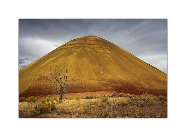
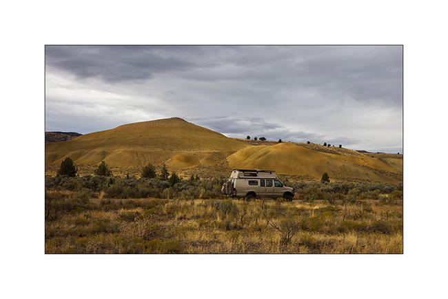
Then another site still within the John Day National Monument. It’s the “Painted Hills” which are aptly named.
3. Overview.
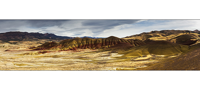
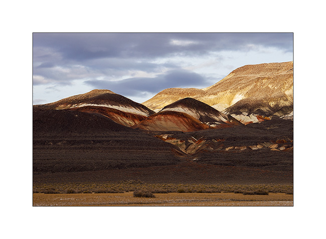
4. There’s something alive in these unusually rounded forms of a mineral landscape, don’t you find?
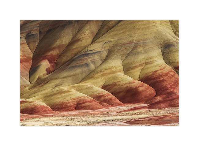
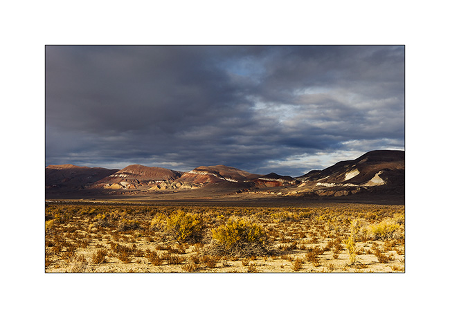
5. The red is rich in iron (iron oxide, such as rust), yellow-green substrate is dating from dry ages and black is manganese, set by various plants in wetter periods.
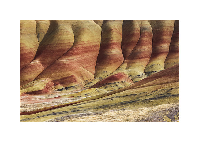
6. These hills are made of clay that pumps all the water and makes them inhospitable to any plant that would colonize.
7. Slip of the clay created by the few heavy showers or thunderstorms are even dying plants at their feet.
8. No, it’s not a volcano! 😀
9. VLV is well camouflaged in these colors…
We now move to the west of Bend, in the Cascades, up the bed of the McKenzie River. This mountain is part of the Pacific Rim where the tectonic plates of the Pacific and North America meet; it comprises of numerous volcanoes, many still considered active, and several volcanic sites, including many recent lava field.
10. Let’s begin with a small wonder difficult to access, Tamolithe Pool. There is a resurgence of the McKenzie River which disappears in a lava field about one mile upstream.
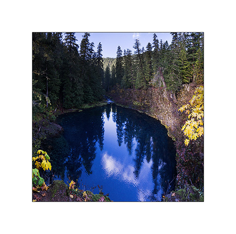
11. The color and clarity of the water are just stunning!
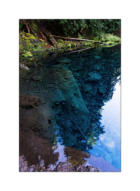
12. After much effort, I finally managed to go down one of the cliffs for a the bottom view. Difficult to realize the depth of this hole; but this image is a stitched panorama of vertical images taken at 16 mm of focal length, an ultra wide-angle, and it barely fit in height!

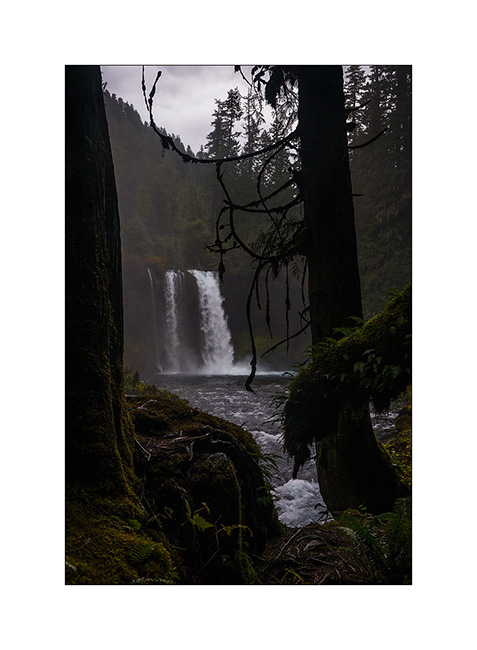
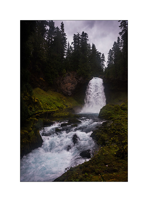
Going up the river, there are two beautiful waterfalls created by a lava flow of about 3,000 years ago.
13. The Koosah Falls jumping about 90 feet. Unfortunately, the rain is back when I arrived there.
14. McKenzie River upstream from Falls Koosah.
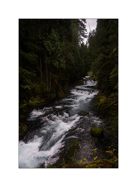
15. Above, Sahalie Falls, best known as the accessis easy, jumping nearly 120 feet in a rather deafening uproar. Note the amount of foam that covers thelava arround.
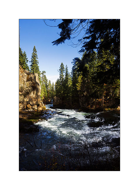
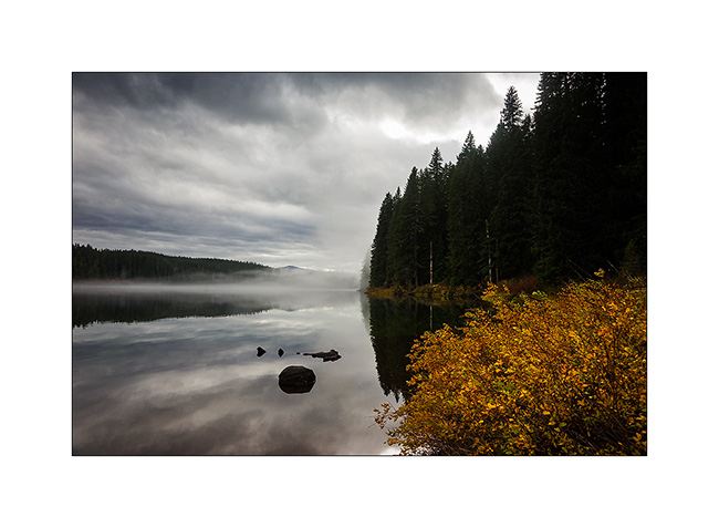
16. Finally, I ended my walk at Clear Lake where the McKenzie river exits from. With almost 100% humidity, it was partially embedded in the mist…
That’s it for the Cascades that allowed me to redo a long walk after more than two weeks of bad weather. It was good! 😀
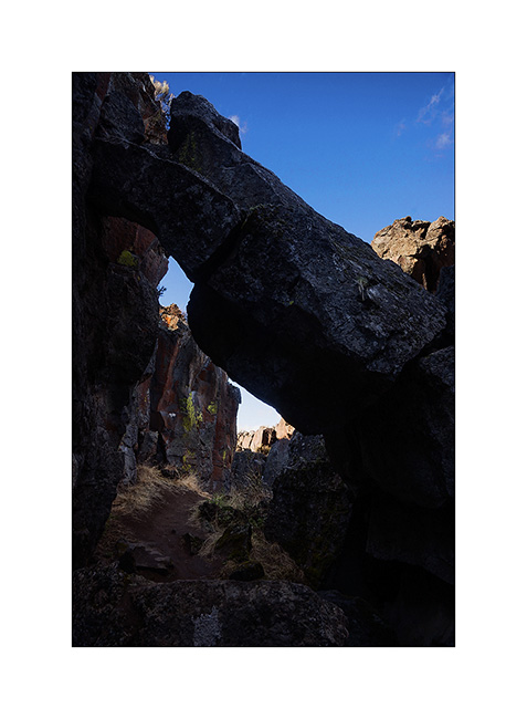
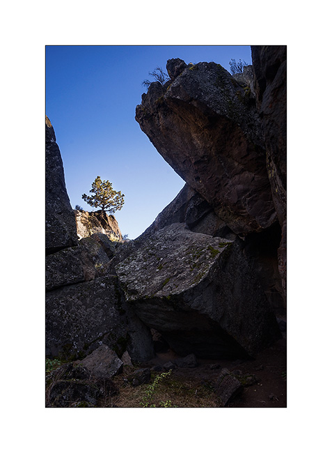
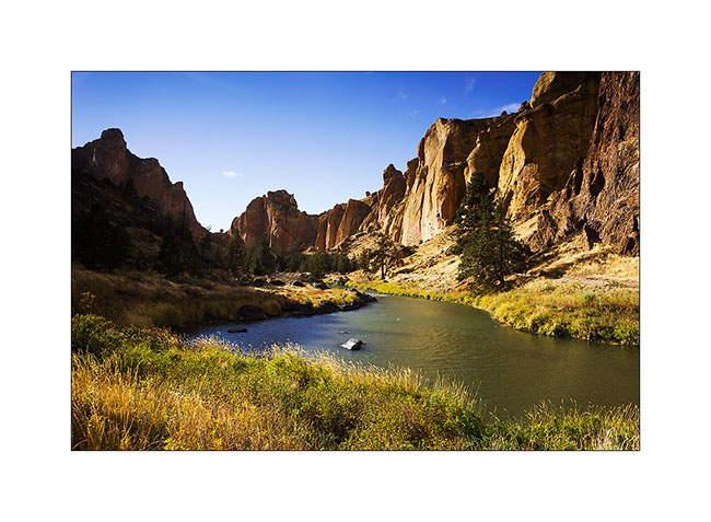
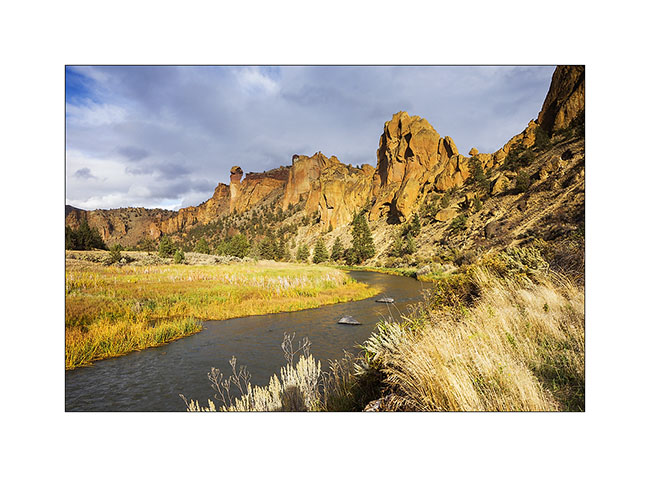
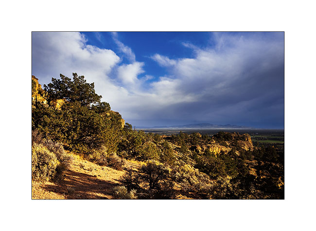
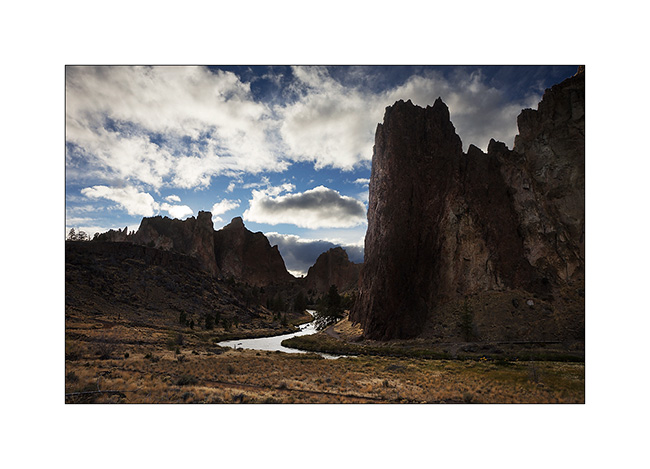
Radical change of scenery just about seventy miles to the east, on the site of Smith Rock in the sun while it was still raining on the Cascades. Other volcanic site created by two separate events: first a big explosion, creating tuffa peaks, a relatively porous but solid rock, then a flood of basalt that has spread around the peaks. The river that runs through the site dug its bed between the two, carving a rather exceptional landscape.
17. It’s rare to see such a river in a semi-desert landscape…
18. The tuff is solidified in veins sometimes really vertical.
19. From the high peaks, the highlands are immense.
20. Here we see the basalt plateau to the left and the tuff peaks to the right.
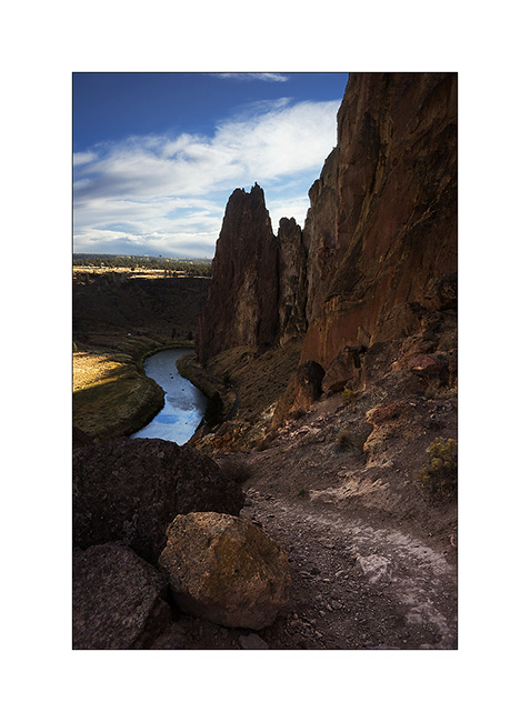
21. I discovered that these peaks are a mecca for climbing, with dozens of pathes. There were also dozens of strung this afternoon.
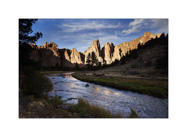
22. The sun goes down behind the mountain for a pretty special atmosphere…
that’s it for today. I’ll let you discover other sites in Oregon soon.
Thank you for all your comments, it’s nice to react to my images. 😉
 D5 Creation