Archives
now browsing by author
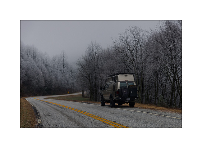
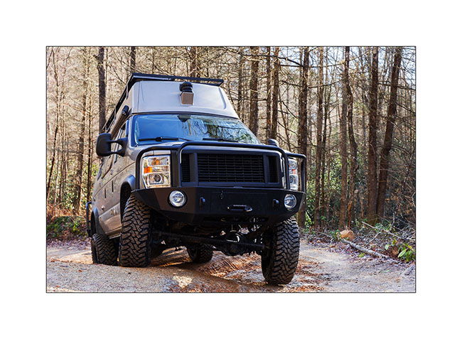
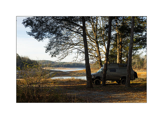
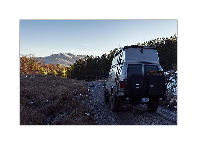
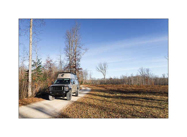
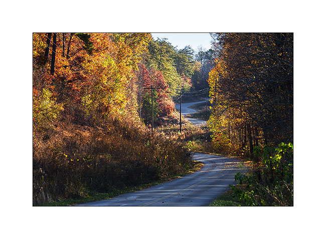
Georgia : 4WD addition
I received some images from Brian, one of the guys with the Jeep who help to go under the last tree.
1. Winching the cutted tree.
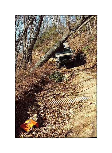
2. Rewinding the line…
3. Leaning passage or when VivaLaVida heels quite a bit ..!
discovered the ocean for Christmas, on the Atlantic coast, in South Carolina. Featured soon… 😉
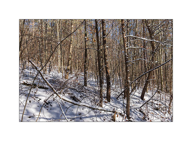
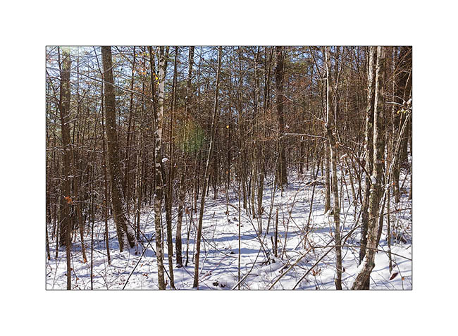
North-West Georgia (3)
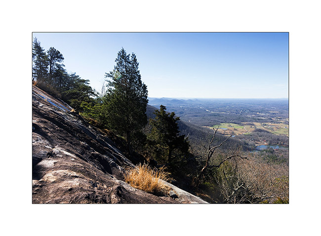
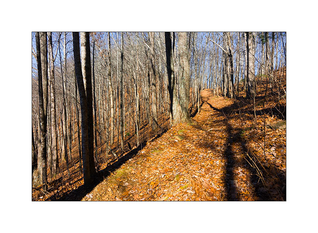
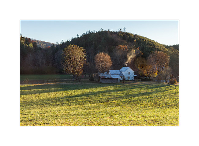
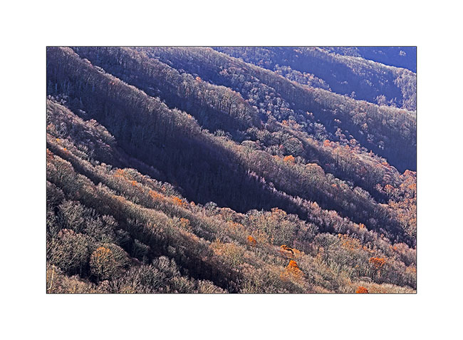
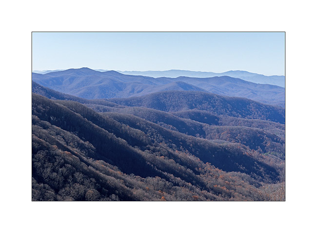
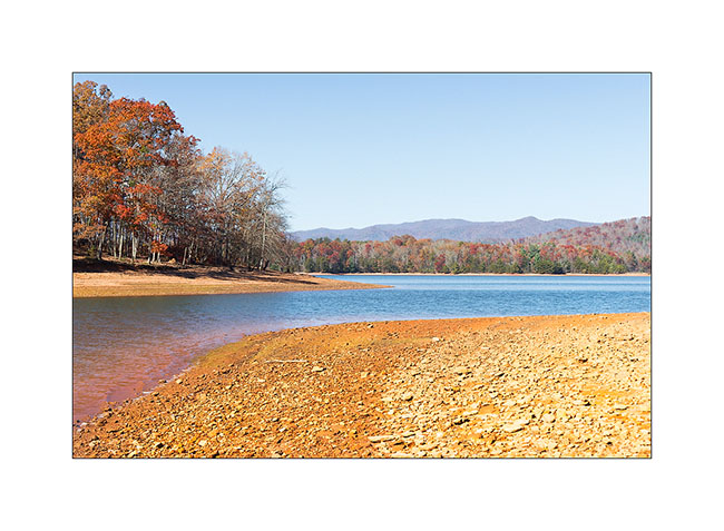
Here is the end of my journey in the mountains of Georgia. I hiked the Mount Yonah, a beautiful mountain situated at the end of Appalchian and offering great sighting.
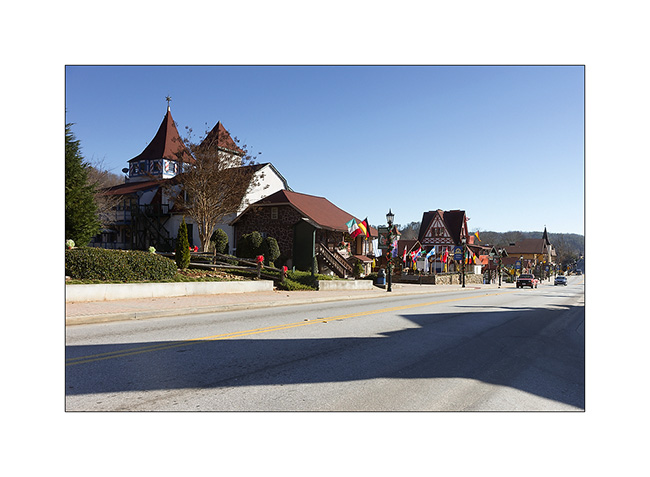
I start with an image of Helen, small atypical village built by the Germans at the end of the 19th century and conscientiously maintained in the German architectural style. It has become a tourist attraction and I must admit that it is quite exotic here!
1. Helen
Then my hike on Mount Yonah
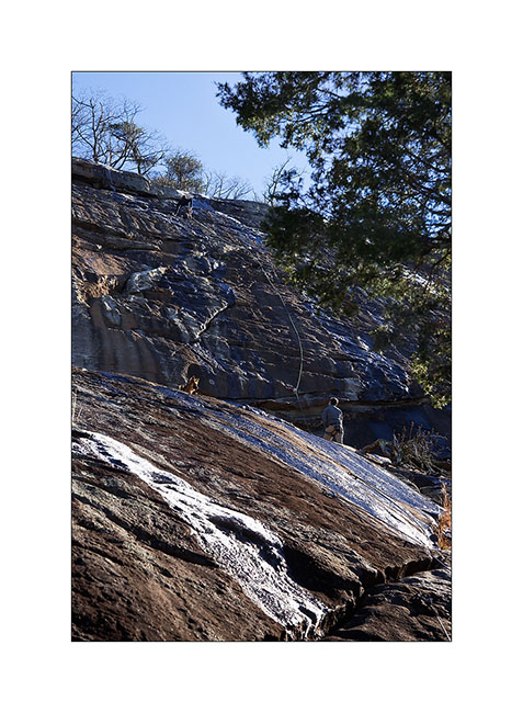
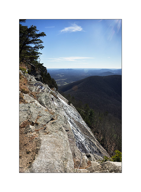
2. I reached the bottom of the cliffs after 1800 feets elevation.
3. A picture for my twin brother ! 😉 It’s a place where climbers can play.
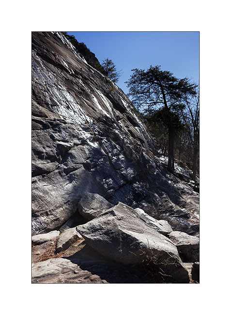
4. Ice created by runoff water largely covered the rock … Despite the cable, I had some difficulties to reach the top of the cliff.
 
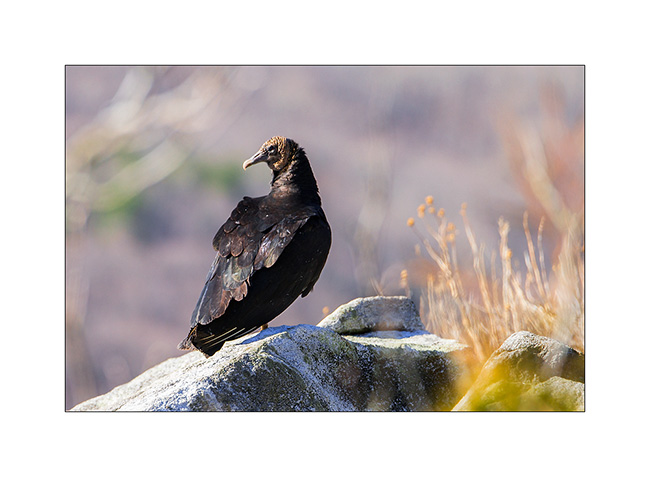
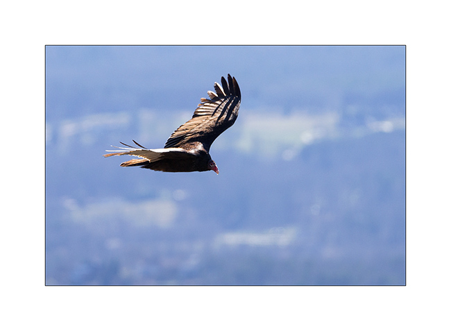
I was lucky to be able to observe the “great buzard”, a mythological bird for Cherokee .
5. Landed…
6. In flight, with the characteristic dihedral that the wings make.
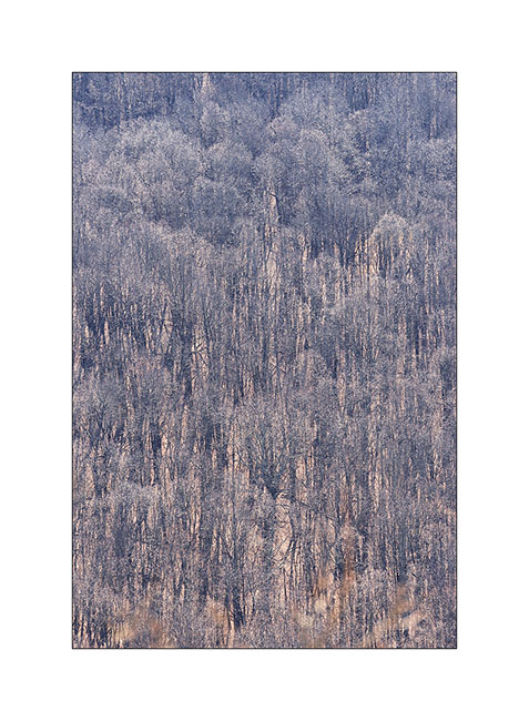
7. From this promontory, the forest at the bottom of the mountain is like a tapestry…
8. Great sighting!
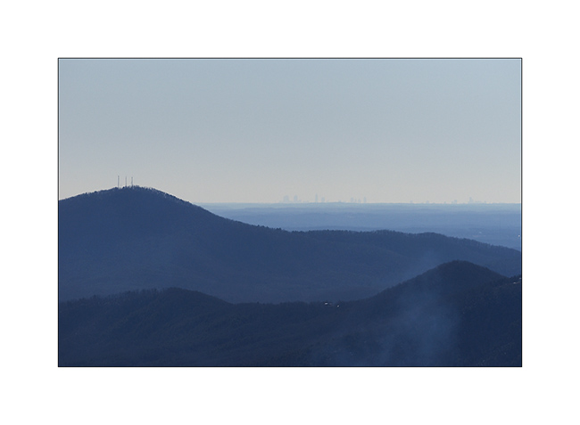
9. I could even see buildings of Downtown Atlanta, more than 70 miles away..!
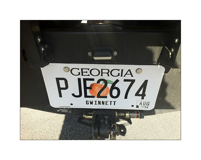
I then hit the road to Atlanta to see if I could get my drivers license. And finally, I got it ! 😀 That’s my Christmas gift, end of more than three months of paperworks.
10. Then I was able to register VivaLaVida under my name and get the plate!
I don’t know yet what I’ll do during the two weeks to wait on définitives documents. You will discover it in a nest update.
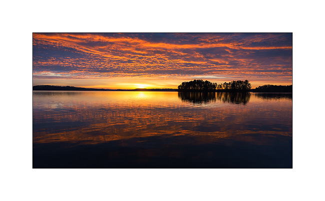
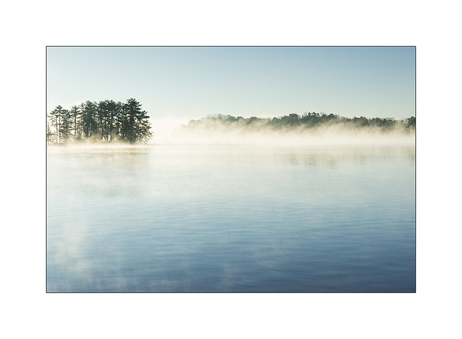
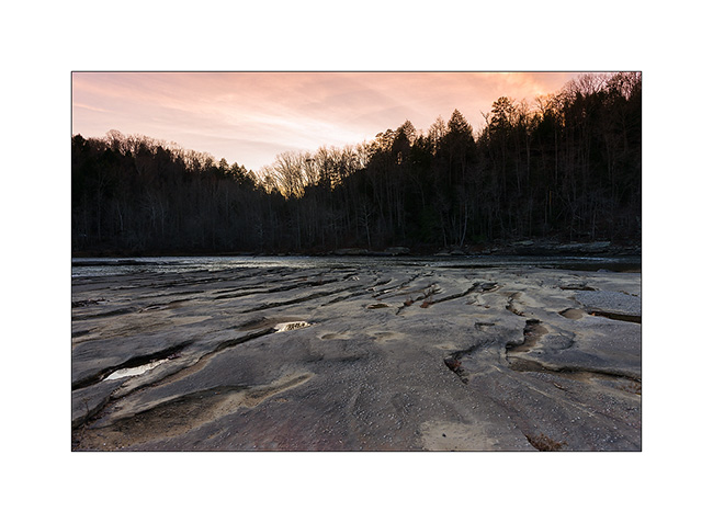
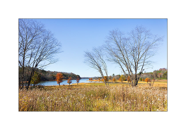
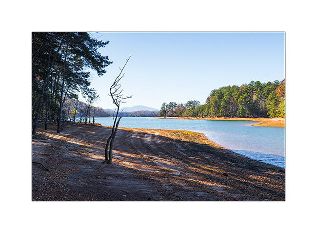
11. And to say you Merry Christmas, here a lst image of a gorgious sunrise on Lake Lanier, two days ago.
See you later…
Claude-Alain
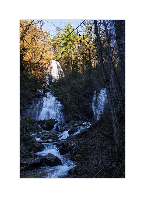
North-West Georgia (2)
Here is the continuation of my journey in the mountains of Georgia. I left you in a humid atmosphere … The sun came out later, even gratifying me beautiful colorful skies at sunset, which I didn’t see often here.
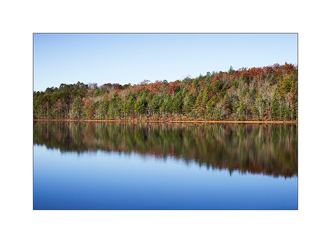
The serie starts on a cold morning at Unico Lake while I was going to discover the Anna Ruby Falls
1) Unico Lake
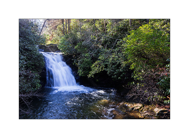
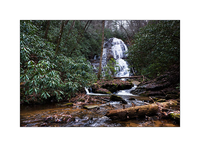
The Anna Ruby Falls are probably the best known and most visited of the region. Smith Creek splits into two to form a double waterfall.
2) The Smith Creek downstream of the waterfalls.
3) The waterfalls
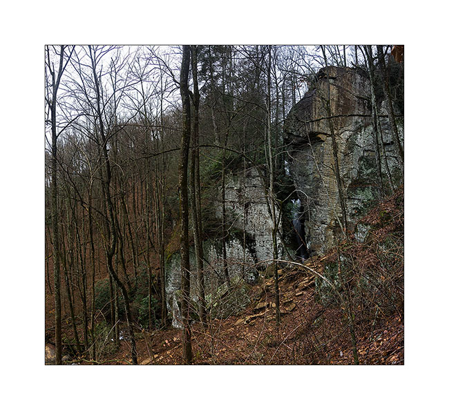
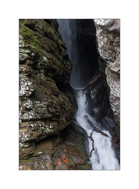
I then went up a valley to discover one of the few cliffs in the area, named Raven Cliffs. A beautiful walk a about 8 miles “one way” that leads to a small vertical cliff splited by a large vertical crack into which rushes a beautiful waterfall. Quite spectacular! Unfortunately, the light wasn’t there, the strong north wind surrounding mountains with freezing stratus…
4) The Rave Cliffs (panoramic of three images).
5) Approching the crack
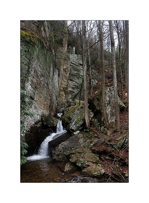
6) The waterfall…
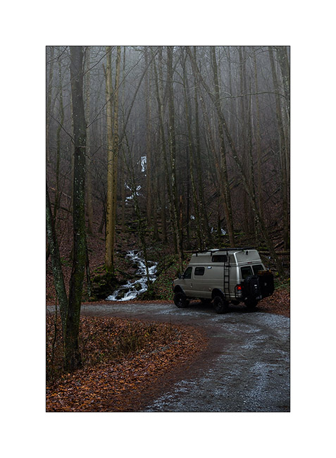
I then drove for half an hour to go to the Desoto Falls where I spent the night in a nice primitive campground.
7) frost on the heights…
8) Desoto Upper Falls
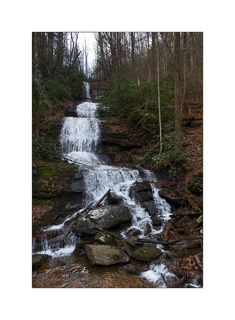
The next day, continuing my exploration, I made another long walk to see the High Shoals Falls, in fact not the most beautiful waterfalls I’ve seen. But the walk was nice: descent into a deep valley, and then down the river about 5 miles to the two falls.
9) High Shoals Upper Falls
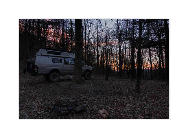
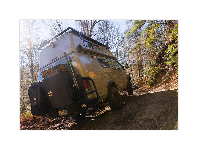
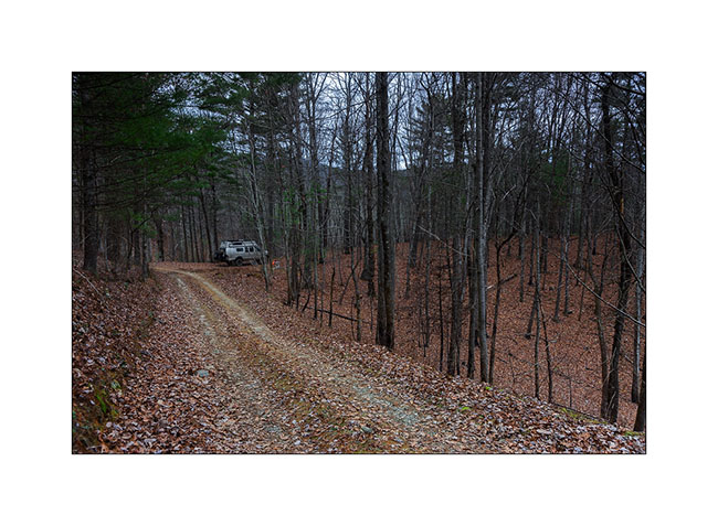
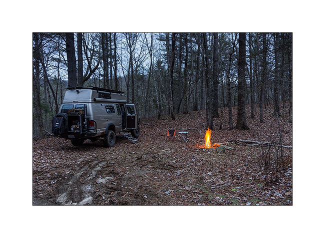
It was already the middle of the afternoon when I found Vivalavida back. I followed some forest roads leading me on the hills to find a place to spend the night.
10) Sunset on the forest
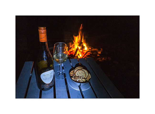
11) Great boondocking place
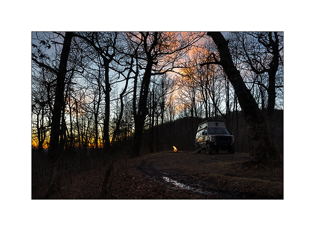
12) And nice “Apéritif” at the camp fire! 😀
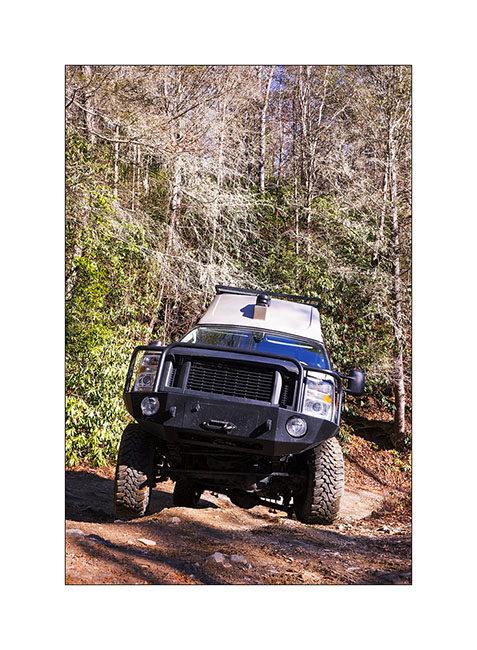
The next day, I planned to go hiking on the Mount Yonah, a mountain which has beautiful cliffs under its summit. Still using my topographic maps, I chose a forest road of about 8 miles leading me to Helen, a small town on the road to Mount Yonah. But my mapss don’t tell the state of the tracks..!
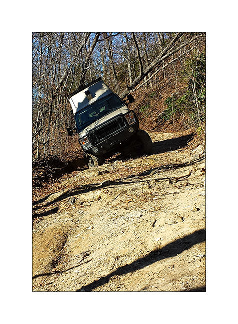
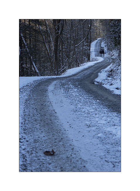
While forest roads taken the previous day were fairly nice, this one first appeared narrower and more “rocky” but nothing really serious for Vivalavida even if I could hardly drive faster than 10 m/h. After about 3 miles or so, the road became narrower and stoned, sometimes forcing me to maneuver in tight corners, where size of VLV suddenly seemed more consistent. But progress continued till a hillside where a recent storm seemed to have devastated the forest. Probably 70% of trees were lying, many across the road. I was not too impressed, most of them had small diameter and only partially obstructing the way. So I took out the handsaw and cuted between 10 and 15 of these trees, nothing too bad, Vivalavida continuing his path about one mile. Then appeared a portion where the road was washed away, with a strong lateral slope, forcing me to put the wheels on the right side of the road to avoid VLV to roll over. Pretty impressive when my “house” was left to swing in balance on two wheels with 150 yards of nothing 4 inches to the right of the wheels..!
13) Unstable balance…
I was then about 4 or 5 miles from where I could turn around. And this is where things got fun..! 😀
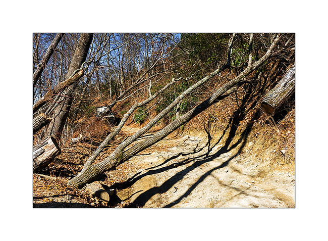
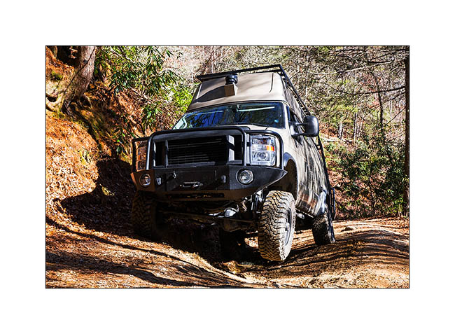
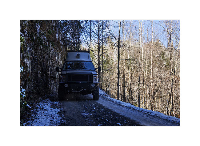
A hundred yards away, what did I see? Three large trees across the road, separated from 150 yards away! From all evidence, Vivalavida could pass underneath! But what to do? 5 miles back in reverse, with the scabrous place described above? No, I was not really tempted … Cutting trees to open the passage? This is the choice I made.
For the first one, clearing the vegetation on hill side, deflating air suspension and tires while squeezing as much as possible the left of the road, I managed to get underneath with one inch clearance.
14) First tree with few clearance…
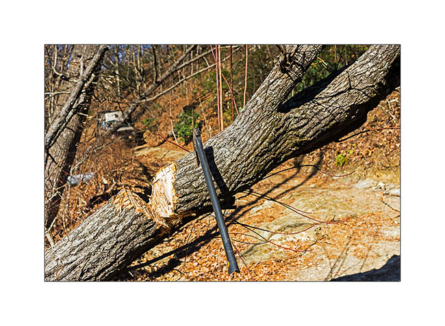
No way for the second one. Clearance was about 3 feets less thant VLV. So I took the axe! 😀 I neede about 1:15 hour to manage to make a first cut (dry wood his hard !).
15) Woodcutter work…
16) The tree after the first cut.
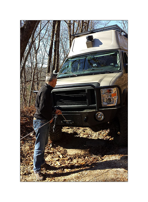
I then used the winch of VLV for the first time, trying to rip the tree in the direction of the road. But the weight of the tree was such that when I tried to pull the base, it got into the ground. No other way than cutting the main trunk above again. Three quarter of an hour later with the axe, it was done! I was able to winch the main trunk to put it parallel to the road and then to rip it to the edge ; handy winch by the way!
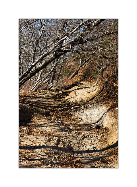
Remained the third tree to pass under! The measure seemed to indicate that VLV should just go below to the nearest inch. I moved inch by inch, going out every moment to gauge the clearance between tree and roof rack. 5 iches, then 3… then 1. I deflated the tires to 0.5 bar upstream to win half an inch or so, advanced 15 iches… It was still about 15 inches to pass Under while the right front wheel came in a big hole, about 20 inches deep. Despite taking some of the ground out to get some more clearanceg, VLV’s rack hds contact with the tree in front of stunned two guys arrived in the other direction aboard two Jeep, amazed to see such a van on a 4×4 road. They helped me pushing up a last small tree, allowinf VLV to go underneath. Finally, the rack is solid, VLV escaped without any scratch, leaving a big bleeding under the tree…
17) Third tree…
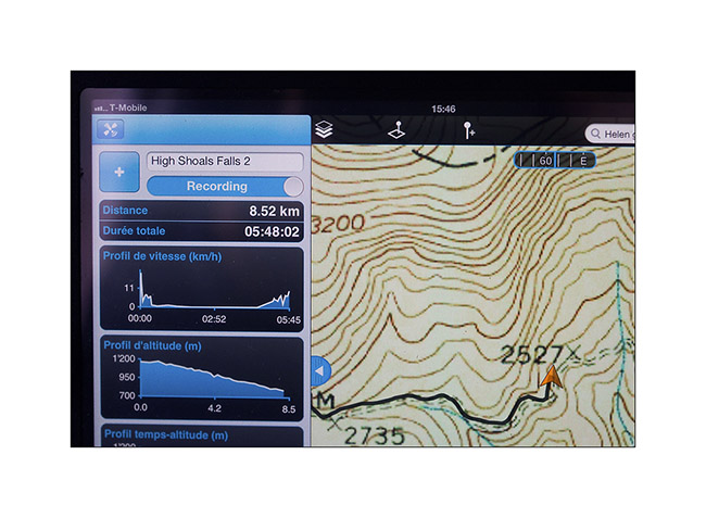
Finally, I needed almost 6 hours to drive less than 5 miles, a great speed average, isn’t it? 😀
18) GPS statistics…
The two guys took some pictures when i was winching the second tree, I hope to receive it and will post it if.
No need to say that it was much to late to go hiking Mount Yonah. I then find another nice boondocking place to spend the night and
Pas besoin de vous dire qu’il était bien trop tard pour aller gravir le Mont Yonah. J’ai donc trouvé une autre jolie place pour passer la nuit et and rest the Pschitt a little tired..! 😉
19) Another nice sunset
That’s it for today. My next update will soon show you my day at Mount Yonah…
North-West Georgia…
I let you when I headed to Georgia to continue paperworks to obtain VivaLaVida registered Under my name. I first obtained several documents and went to the DMV office to ask for my driver license. Happy to produce all documents needed, My joy was short since immigration didn’t confirmed me again ( similar to my North Carolina episode…). After more than 100 miles to go to immigration services, then to Custom and Border Protection in Atlanta Airport, nothing else to do than waiting for a call of DMV in the next 5 to 30 days..!
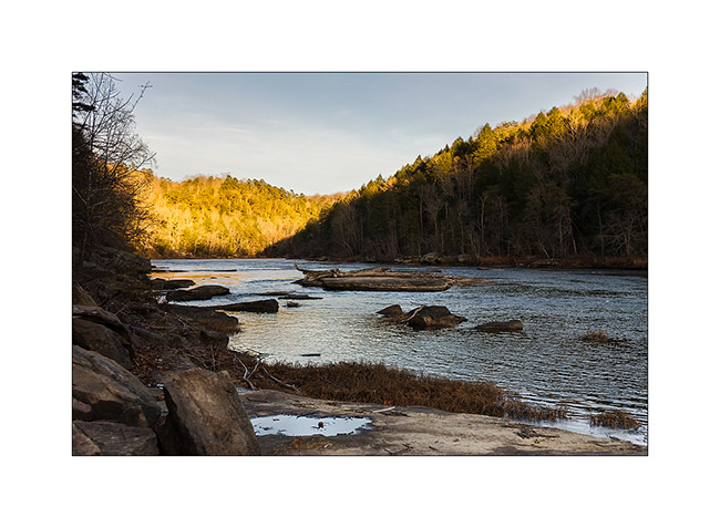
I then decided to go to North-West Georgia to discover that part of Appalachian.
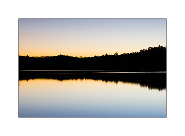
1. Leaving Lake Lanier in a cold and sunny morning.
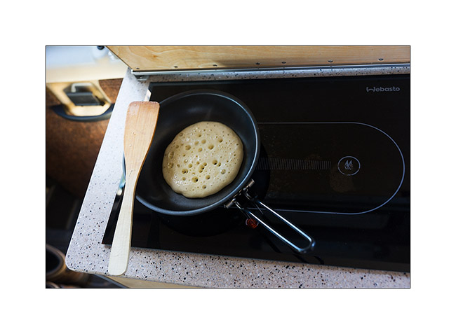
2. Pancake time! 😉
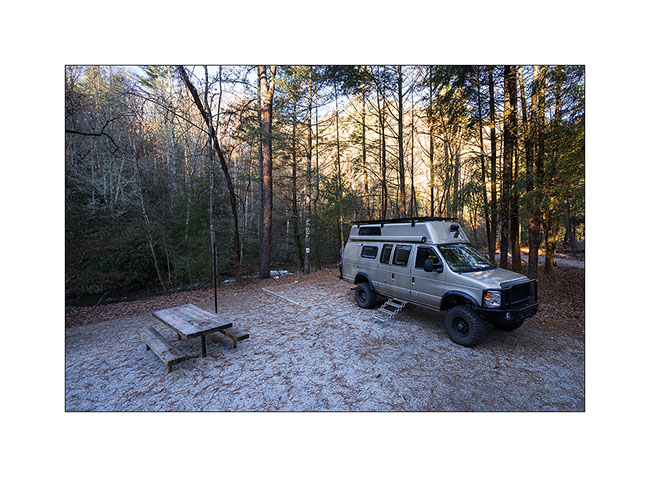
3. First night in Talluhla Primitive Campground, just next to the river. I was alone there…
After a ford river crossing, I drove a forest road mentionned 4WD on the map. Some places were quite washed out by rain, so VivaLaVida had occasion to proof her capability! 😉
4. First axle crossing
5. Steep part!
6. leaning curve and Wheel without weight…
7. Real axle travel! Even so, no need to lock differentials, quite impressive!
8. Nice hike to the le Rocky Knob…
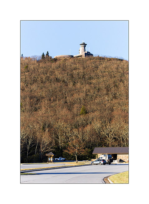
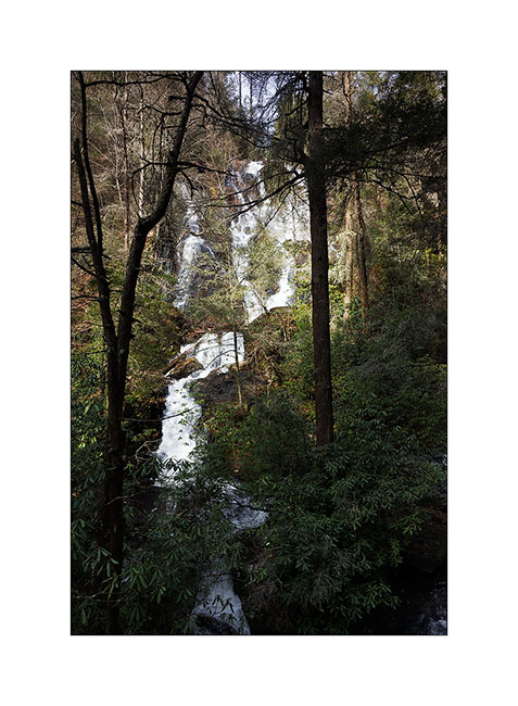
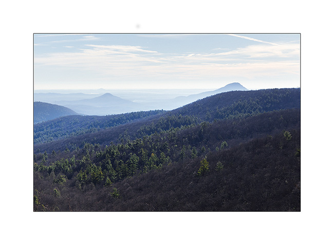
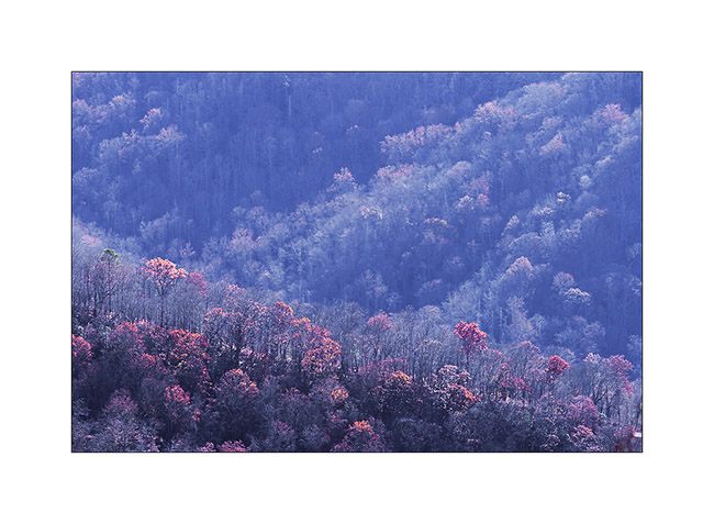
The I went to the highest point of Georgia, the Brasstown Bald. Not really exceptional since it’s “only” 4’600 feets elevation. A twenty minutes hike from the parking lot to the summit. There is a small museum presenting some elements of pioniers of that area and wild life information. The sighting is gorgeous all around.
9. Pastel…

10. Visitor Center on the summit
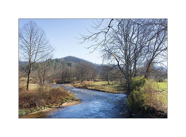
11. Nice trout river on the road…
After spending the night in a glade, I went to visit two nice waterfalls.
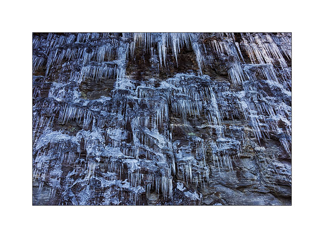
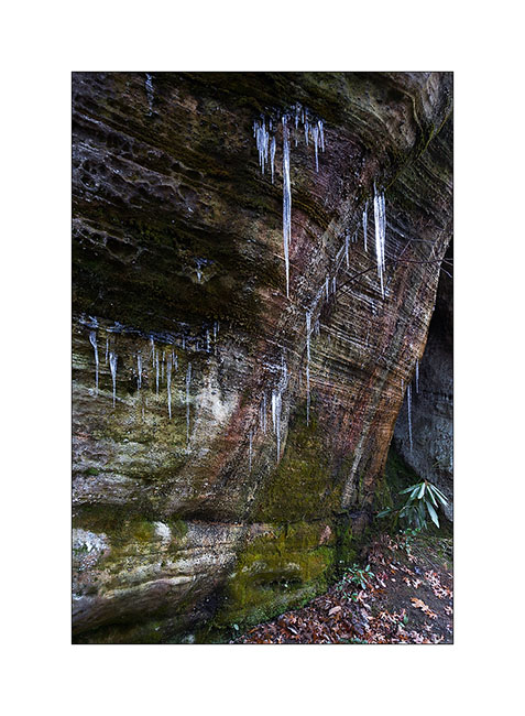
12. Ice next to the road

13. Ephemeral curtain…
14. Dukes Creek Falls
15. Beautiful vistas East…
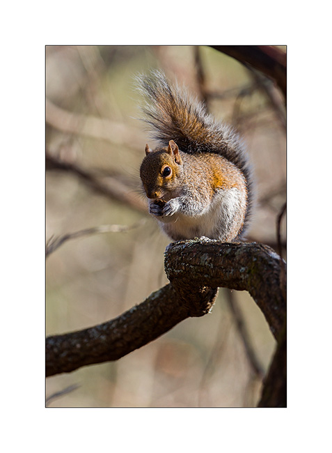
16. “Who is that guy..?”
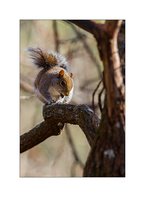
17. “Well, I prefer to eat befor snow comes again!”
18. Horse Trough Falls, far away in Upper Cattahoogee River, a remote wilderness. Since the road was washed out, I hiked the last 6 miles…
19. Spending the night in the Upper Cattahoogee River wilderness, I found a nice boondocking site up a small forest road…
20. Still better with campfire, isn’t it? 😉
Since that night, a lot of rain came down and the downhill of the small forest road was scabrous since very slipery muddy surface. I neede two an a half ours to drive 1.5 miles and 1’550 feets down. But I finally arrived safe down.
21. Safe down in rain and fog! 😉
Next to come in some days… 😀
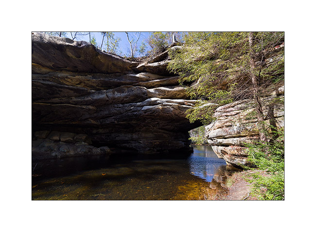
Tennessee (4 and end)
Here it is, the new Title of Vivalavida arrived! So I’m back to Fletcher to pass technical inspection by the seller – Chris in this case – necessary for subsequent registration. I will then be able to go to Georgia where the following steps are still to be done: get proof of residence, a certificate stating that I am not “eligible” for social security, obtain my Georgian driving lisence (it will be easier since I already have a US driver license) and finally register VLV Under my name. Still many steps, hoping they will not be as long as the previous…
I take this opportunity to update the blog with some of the last images brought from Tennessee. I left you at the Big South Fork …
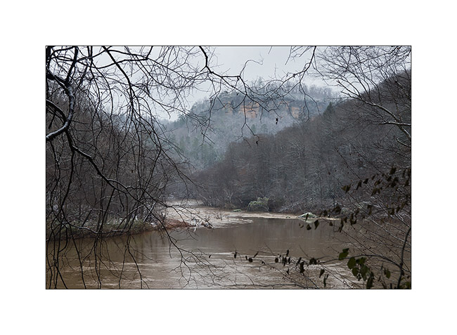
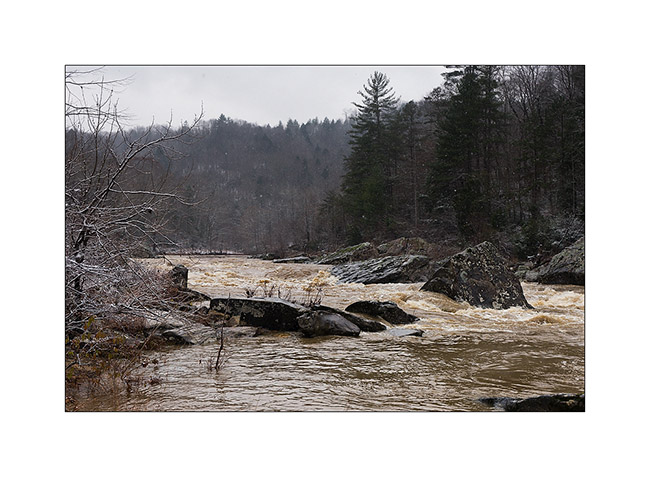
The next morning, the snow had whited the country and the clouds were very low. I went to see the Angel Falls on the Big South Fork River, flooded after two days of almost uninterrupted heavy rains. A beautiful wild atmosphere …
I saw two pileated woodpecker, too fearful that I could photograph without a tent.
1) Flooded Big South Fork River

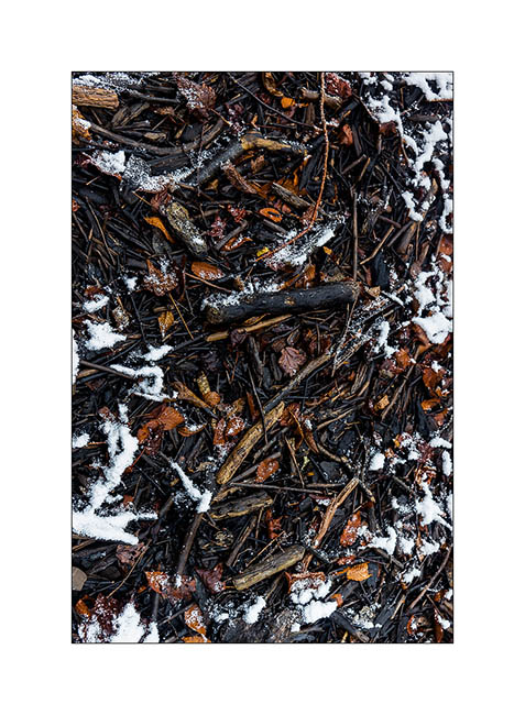
3) driftwood…
4) Angel Falls transformed in powerful rapids…
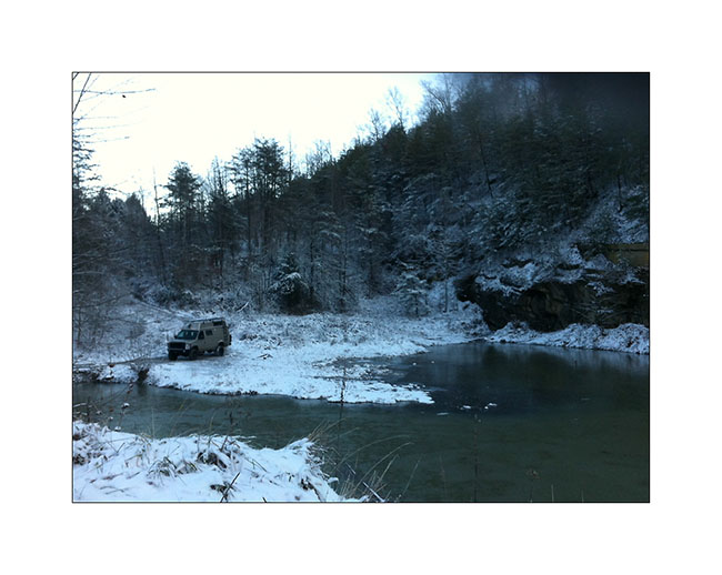
I then did a bit of road eastward to explore two beautiful natural arches the next day. Arrived when the night was well fallen, I declined to pursue the trail marked on the map which was washed out and completely frozen by the ambient 16°. I stopped near a small lake to spend a night.
The next day, I was somehow baptized by that winter! 😉
First by a really frosty morning: 7° to the outside thermometer, 27° to Vivalavida’s dash thermometer, behind the front curtain. First night that the heater, set to 40° to protect the bowels from freezing, has started at 3.30 am.
5) Morning at my campsite with 7°: cold! (taken with my iPhone…)
In the daylight, I was able to continue the snowy trail and I stopped at the hiking trailhead. After having equipped myself for “cold” weather, with my waterproof pants, my jacket on three polar layers, I started the trail. After a little more than a mile, I discovered a river to cross! Not very big, probably 20-25 feets wide, but deep enough for the water to enter in my shoes, which was excluded given the temperature. So, no other choice than taking my shoes off and cross barefoot! believe me, it was an exhilarating experience! 😀 A beautiful baptism, isn’t it?
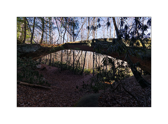
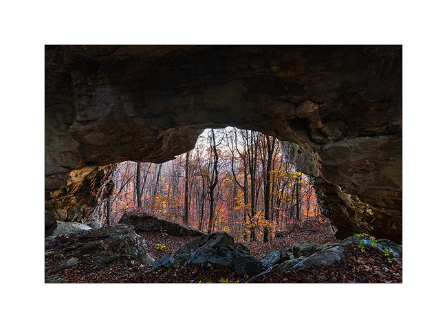
After walking a few feets in the snow to dry my feet, I puted socks and shoes again and had good warm feet for the whole hike! A little more than one hour later, I discovered Primroy Arch, beautiful in that snowy day. I don’t know if it’s because of its name but it is unfortunately widely tagged with lovers names … A shame for such a great natural monument even if the symbol is pretty…
6) Primeroy Arch
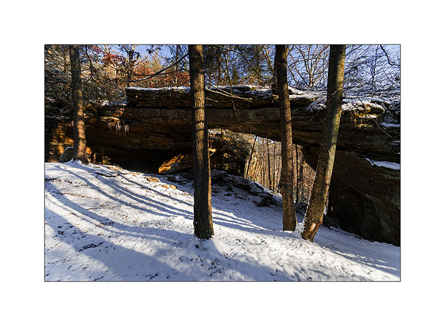
7) Primeroy Arch (2)
8) Thanksgiving decoration..! 😉
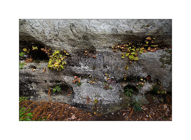
9) Pretty colors under the arch, portion that taggers didn’t reach…
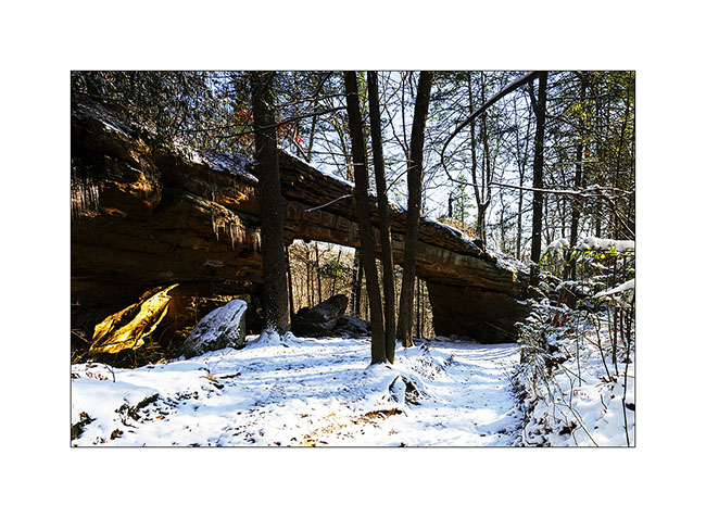
I continued the hike to the beautiful “Drive’in Triple Arch”, rather sought my way through the forest, which was a little difficult to find with the recently fallen snow…
10) do you see the trail..?
11) end there..? 🙂
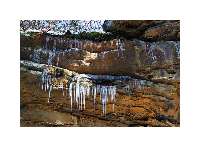
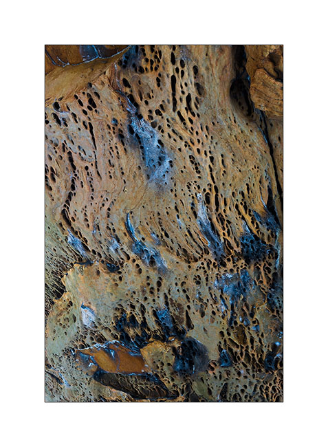
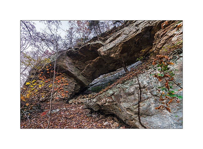
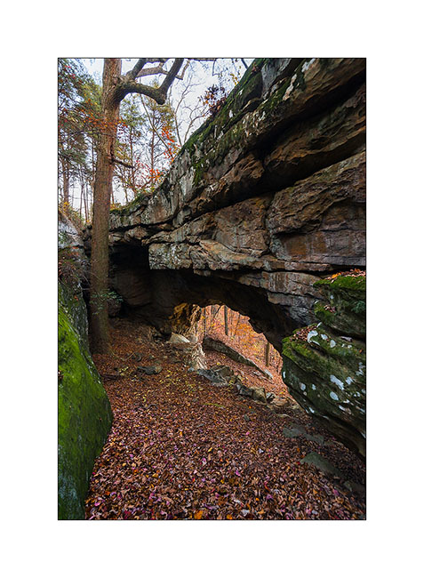
In fact, it was more a GPS navigation than anything else .. I also had some trouble finding the arch nestled at the bottom of a long cliff, or more exactly to access it. I made several attempts to down the cliff of about hundred feet, finding me every time over a impassable sheer. In the end, I made a detour of nearly an hour to reach the end of this long cliff, then walk down of it the other way. I discovered this beautiful arch which is actually a double arch. It is a good example of how these arches appear: water seeps into cracks of the cliff and the frost breaks the rock above, the keystone of the arch preventing it from breaking below. Ice present that day highlight water infiltration.
12) Dirve’in triple Arch
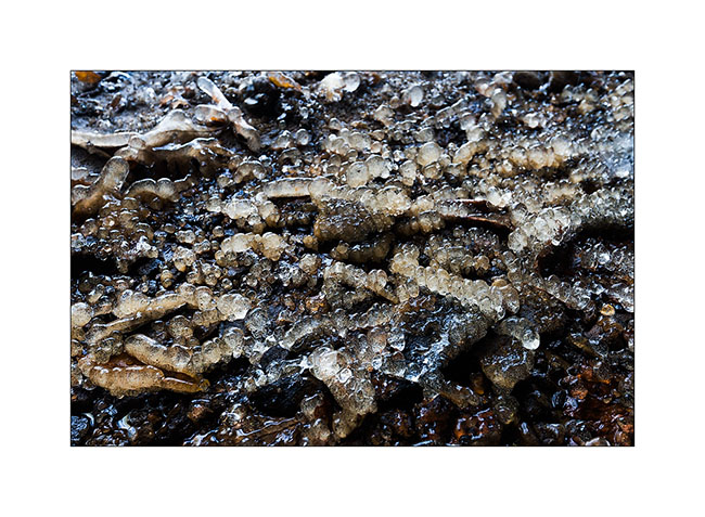
13) ice stalagmites under the arch…
The return went without particular problem – in recrossing the river of course – and when I found Vivalavida at about 3PM back, the roads were still frozen by 26° ambiance…
14) winter on the raos…
15) narrow passage…
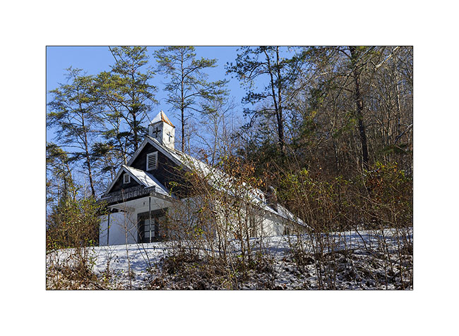
16) small Church on the road
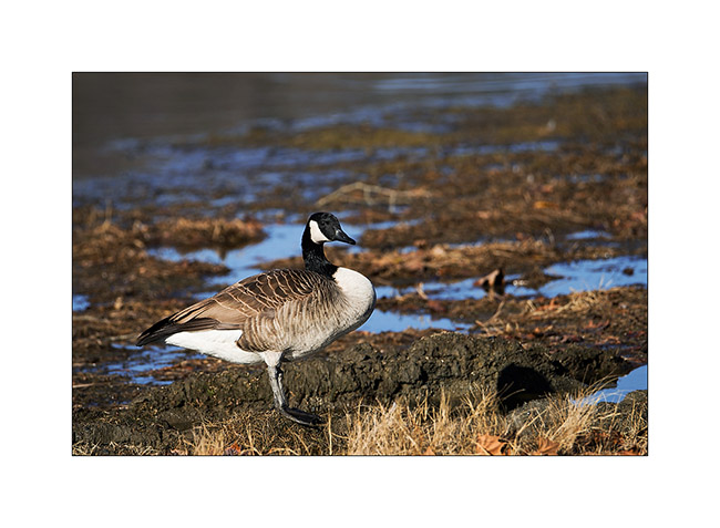
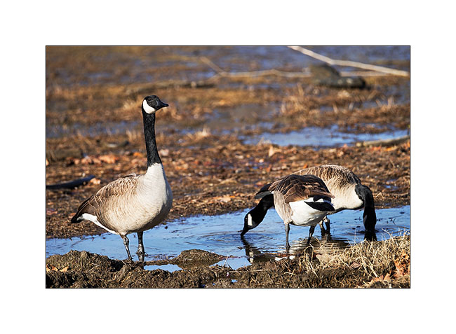
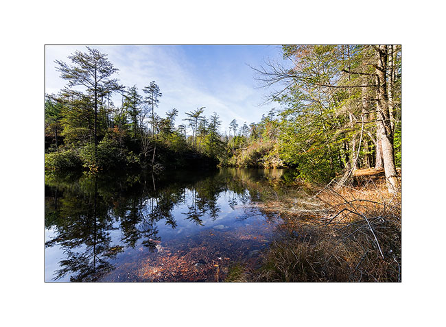
I then spent two days next to an artificial lake, enjoying watching the birds. First, a large group of Canadian Geese, about 80 individuals. What a noise they make! 😀
17) Canadian Goose
18) this was a little worried about my presence…
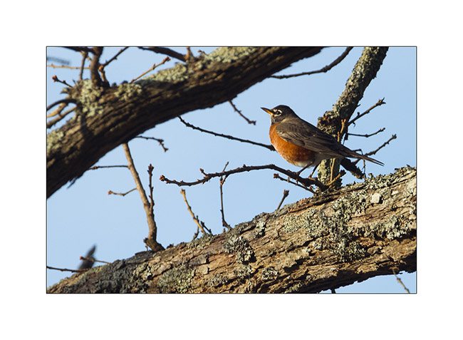
19) an American robin
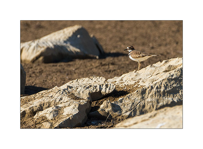
20) a plower killdeer, quite difficult to approach…
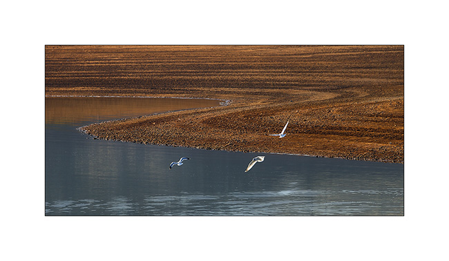
21) seagulls..
22) my campsite thèses two days. Nice, isn’t it?
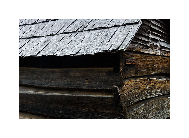
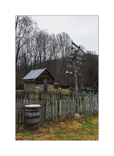
At the announcement of the arrival of the Title, I took the road back to North Carolina, stopping to visit some relics of the past…
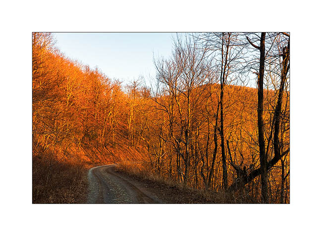
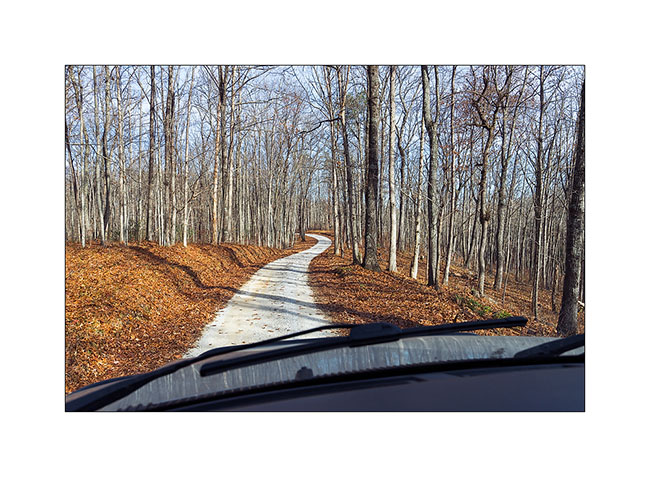
23) muddy road…
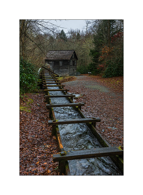
24) One of the first l’un des premiers weight-mill, a column of water driving a turbine. This one was built in late 19th century.
25) old preserved house, a relic of the 19th century (1860 for it)
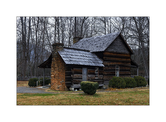
26) construction details…
27) traditional barriers; durable and which don’t need nails to build..!

28) traditional birdhouses made in calabashes and an apples house in the background.
29) And finally, a photo taken by Eric during our meeting in Maryville. It was he who advised me to visit the Big South Fork, many thanks to him!
Still in Tennessee
Here is the following of my Tennesse trip., with a poor light because of the not very pleasant weather.
I went to Kentucky to visit a natural Bridge, just North of the Big South Fork area.
1) Natural Bridge
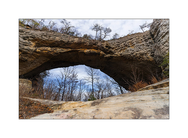
2) Temp was about 16°, difficult to show without these icy formations!
3) Natural hanging gardens…
4) Along the road, I sometime see nice traces of the past…
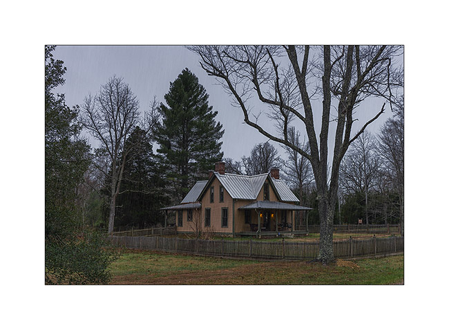
5) Small house rebuilt as it was in 1850…
The next night, Vivalavida was entitled to his snow baptism. I woke up Under the rain by 29° and went to discover Northrup Falls, probably one of the falls that are my favorite so far.
6) Freezing rain…
7) Pine forest Under the rain…
The fall jumps a high oberhanging cliff about 200 yards long. Athmosphere was really wild, with rain and fog, and a deafening noise, reinforced by the echo of the cliff as I approached the falls.
8) The overhanging cliff…
9) Discover of these amaising falls
10) Details…
11) Northrup Falls
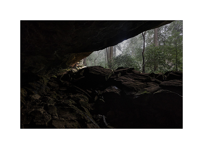
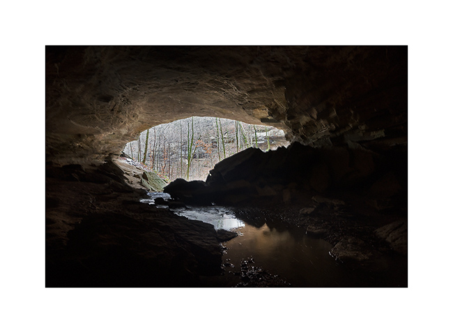
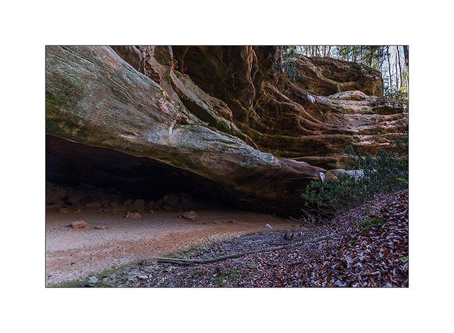
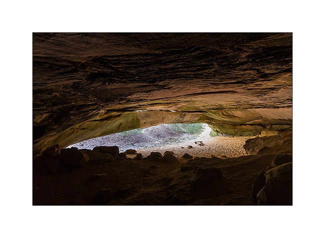
The rain still heavy, I went to visit the Bunkum Cave, not very far away.
12) Nice last fall colors in this wet forest
13) Entry of the cave, with the surprise to discover that a small river is coming out of it…
14) Exploring the cave is forbidden to protect endemic bats from a parasite killing them. So I couldn’t venture beyond daylight…
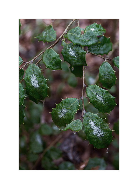
15) Holly…
There are still some pictures of my discovery of the North Tennessee to come soon…
Great week to all! 😀
Tennesse again (2)
Still waiting for VivaLaVida’s new title, I get to Tennesse again since last Saturday. I found there the winter with low temps and some snow, the first one for VivaLaVida! 🙂
this time, I’m visiting the Big South Fork, North-East of the state. they are several natural arches and bridges I wanted to discover…
the first I visited were Twin Arches, two arches only about hundred yards one from the other on the same ridge, easy to access by a nice forest road. the morining I was there and even it doesn’t seem on the pictures, temp was 16°..!
1) The South arch, the largest one : about 95 feets high and 135 wide.
2) The North arch is smaller but thiner.
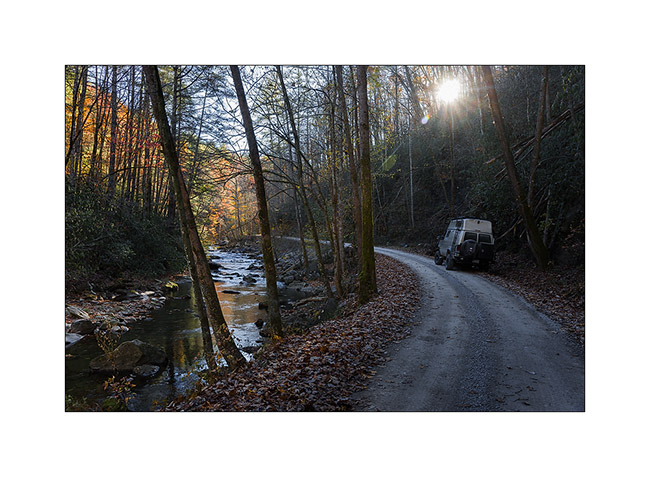
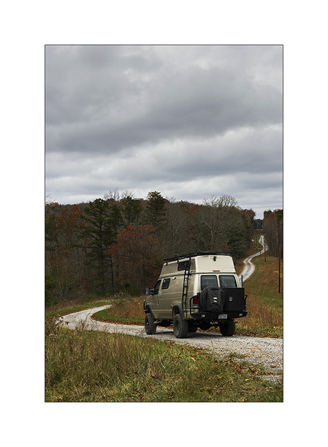
3) VivaLaVida on nice forest roads…
then I followed the trail to the Slave Falls, thin waterfall jumbing from a overhanging cliff.
4) Slave Falls
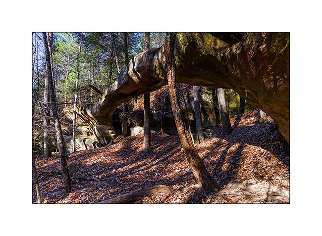
5) Further on the same trail, the very elegant Needle Arch.
On the way back, I discussed with a ranger – the only person I saw during three days- and he adviced me two other arches in the area, one over. The first one is just called Natural Bridge and is very thin in the middle. I had to climb a little to go down to it.
6) Natural Bridge
The seconde one is over the Picket Lake. Not easy to find a nice spot to shoot it without walking in the watter, what I refused to do since the cold temp, 26° at that time. 😉
6) Picket Arch
7) Nice Picket Lake…
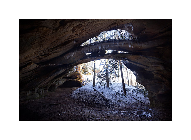
8) The next morning, I drove another nice forest road, about 28 miles long, to visit a cave used long time ago par Indians Cherokee.
9) Entry of the cave
10) New arch in formation over the entry
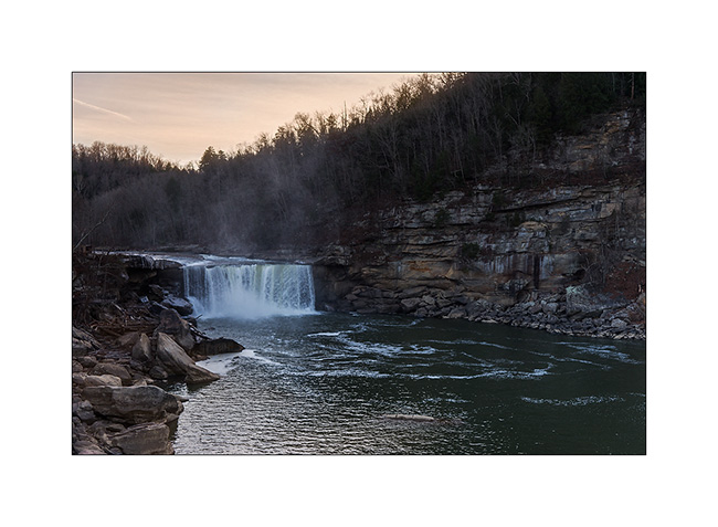
Some road again to the Knetucky to visite the Cumberland Falls, known as the most powerful waterfalls of North-East America excepted Niagara .
11) Arrival at Sunset, a little too late for the right light…
12) The Cumberland River jumps 120 feets , making a permanent water cloud…
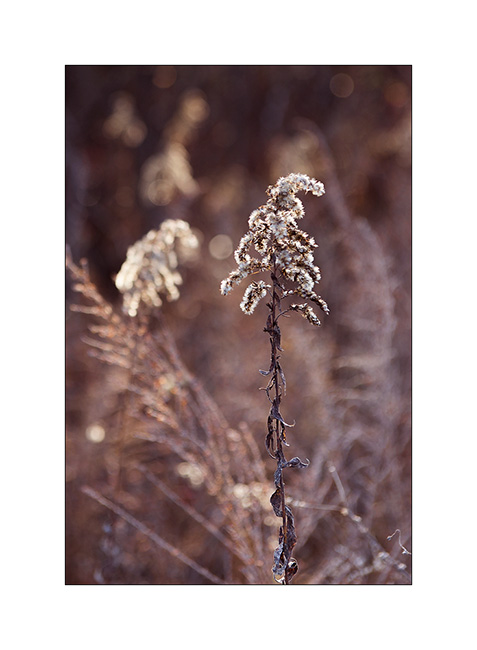
13) Grass…
14) Sunset on the Cumberland River
Following of these Tennessee discovery soon… 😉
Happy Thanks Giving to all ! 😀
Tennesse (2)
Here is the continuation of my first visit to Tennessee. On the way back, I made a quick stop to meet Eric, the owner of a van and member of the Sportsmobile forum. We ate together at Maryville and he told me about a few places worth to visit. So I went to sleep in the wetlands of the Little Tennessee River, meadows and swamps in which the small Tennessee River meander…
1) Twilight…
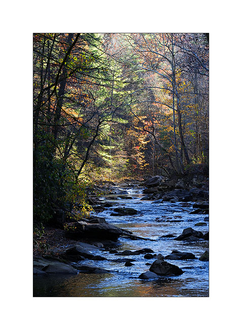
2) Going up the Citico River…
3) Morning atmosphere…
4) Small country road…
5) Typical house…
6) Reflections…
7) Approaching the Skyway…

The Skyway is a kind of Blue Ridge Parkway, a scenic route traced on the ridges, connecting Tennessee to North Carolina. Better than Highway 40 to return to Fletcher! 😉
Tree leaves are now almost fell, the atmosphere is different, more austere…
8) Last colors…
9) Vegetal waves…
10) This gorgious forest, everywhere…

11) South Appalachian
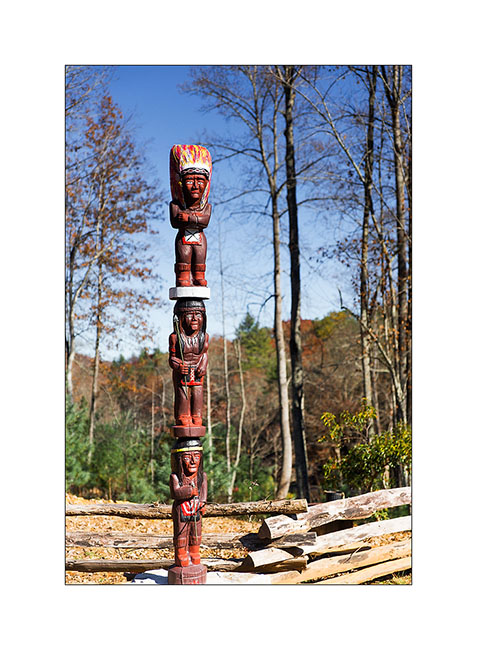
12) In this Cherokee territory, I saw several totems…
Back to North Carolina, Justin and Heather met me in the forest for a rainy camping week-end…
13) Forest camp…
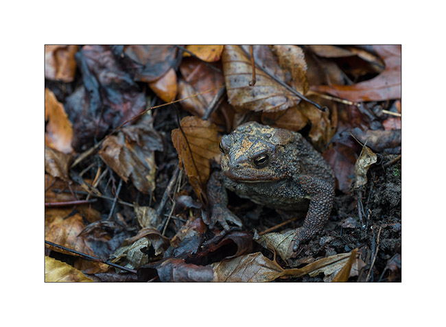
14) In the morning, looking for wood, I saw him looking at me…
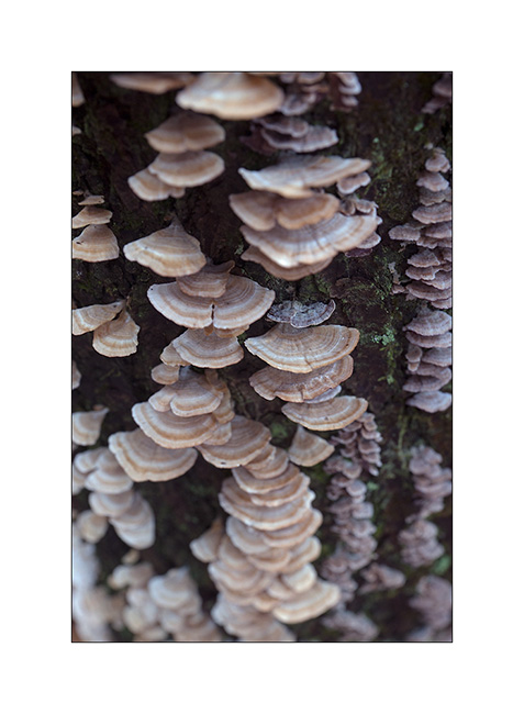
15) Fungus (1)

16) Fungus (2)
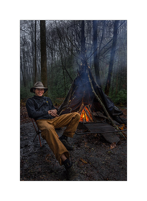
And finally, Justin posing in front of our protective fire teepee (it was raining so much!). Done with a few branches and an old air mattress found in the river … On this last image for today, Justin poses casual while raining verses! 😀
17) Justin and the fire teepee!
That’s it for today. To be followed with a new trip to Tennessee in a few days… 😉
Hello Tennessee!
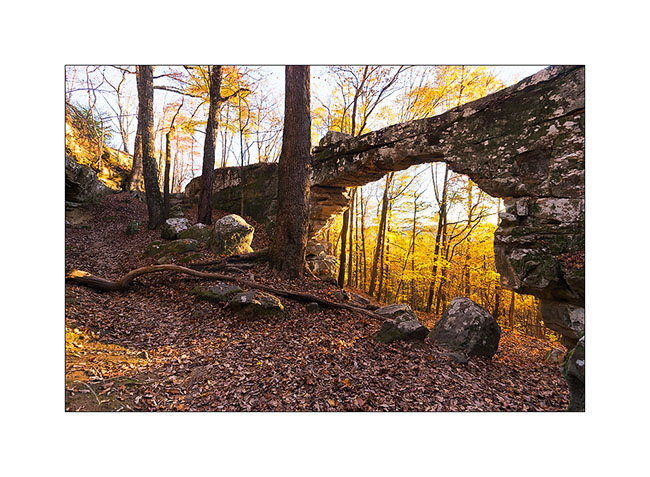
As anounced, here is a short return about my last week in Tennessee. I went there to discover two nice natural bridges and two spectacular waterfalls, quite different from the preceding ones, you will see…
To go there, I drove through extreme western North Carolina and stopped at Catochee Lake, so nice with the last fall colors…
1. Arrival at Catochee Lake…
2. … Nobody there in this season…
3. … and nice fall colors.
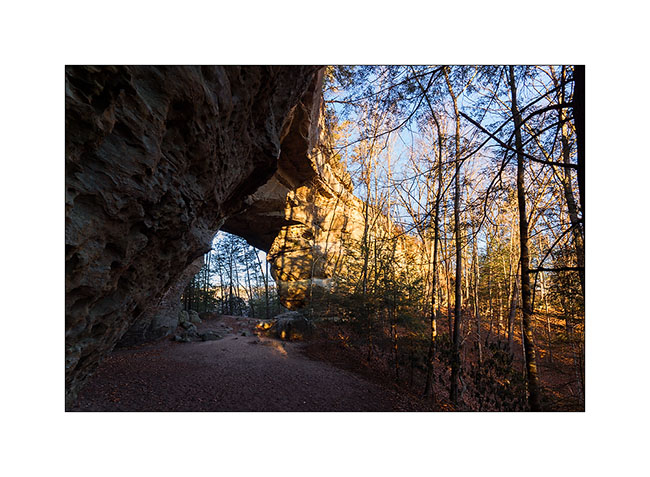
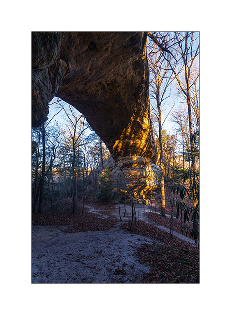
I drove further and arrived late in the night at my camp to be on site for the sunrise on the Sewanee Natural Bridge.
4. To go under the bridge, no other way than crossing it. I say hello, can you see me..?! 😉
5. Sewanee Natural Bridge (1)
6. Sewanee Natural Bridge (2) : what a wonderful natural bridge!
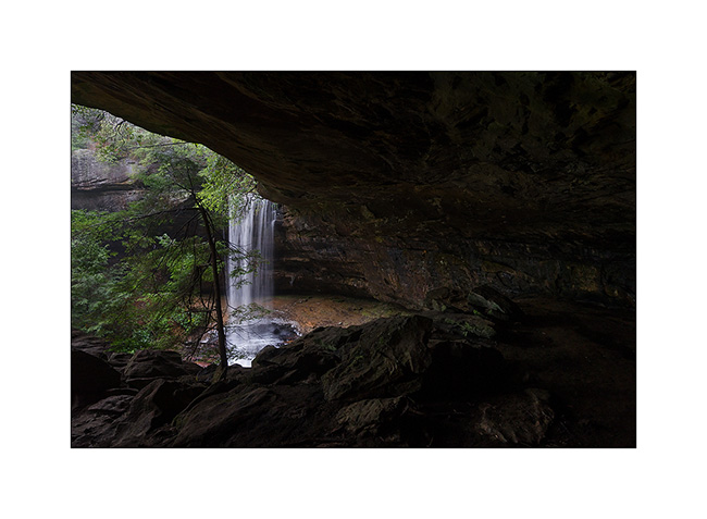
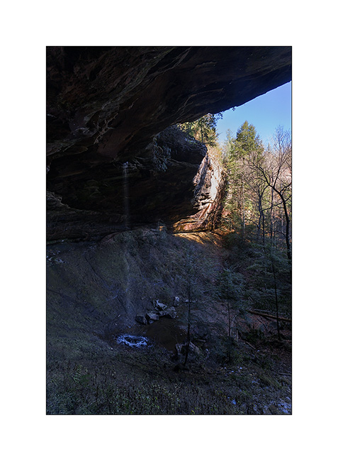
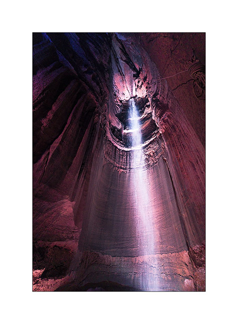
Then on the way to the second natural bridge, I made the tourist and stopped at the Ruby Falls. This waterfall is in a cave and is 145 feets high! Rare and spectacular at about 1’000 feets under the mountain. It was discovered in 1926 and open to the public in 1936 after a 29 stages elevator was built.
7. Ruby Falls
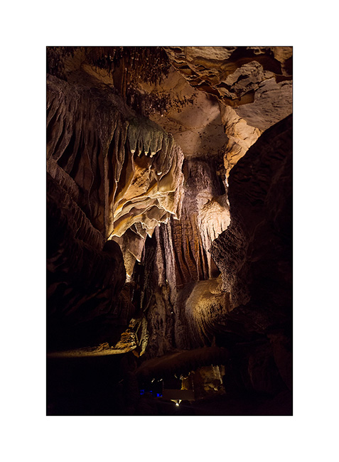
8. The cave we go through tout access to the falls have nice formations.
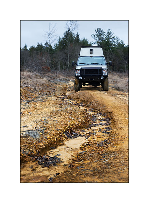
Then I drove again to go discover the Craw Creek Natural Bridge. It wasn’t easy to find an access, the forest road I noticed on my map was closed by a gate. The 10 miles forest road I drove was washed out by thunderstorms in some places but it’s not a problem with VivaLaVida.
9. Forest roads…
I finally started late for the 2:30 hours hike to go to the bridge. I arrived there as the sun was just disapearing. Light was then difficult…
10. Arrival under the bridge in a steep slope… Rather impressive like that, isn’t it?!
11. Just under tons of rock…
12. A more standard picture taken in very low light.
The hike back was quite unusual, in the night with the only light of my flashlight, in a roaring forest by the strong wind and a temperature of about 40 degrees. I saw my first rattlesnake, dark brown and about three feets long, which desappear when I walked. I was surprised to see one with such low temp.
Another funny story, I saw pairs of small bright spots in the beam of my flashlight, sometimes ten at a time. As I approached to see what it was, I found that it was reflection of my light in the eyes of small spiders that live in dead leaves. I had the impression of being watched from all sides! 😉
But I found back VivaLaVida safely at around 20:30, not without having to use my GPS to find two directions not so easy to find in the dark forest at night ..! I slept there with the feeling of being away from all…
Wake up in the rain and cold with a very low ceiling of clouds … But VivalaVida doesn’t care of that, it led me to a beautiful waterfall by small “dirt roads” found on great topographical maps that the GAIA apps allows me to download (I’m not doing advertising but it is really great!).
13. Dirt roads…
And guess why I went to see the waterfall in particular? … Can you not find it? 😀
It is called “Pinot Falls”! Yeah Caro, I do not know if you have ancestors in Tennessee … 😉
This waterfall is beautiful, nestled at the bottom of a deep ravine, at the end of a steep and really wild trail, jumping off a semicircle cliff. The rain hadn’t left me, so the light was really not optimal but it’s the vagaries of traveling photographer …
14. Arrival at “Pinot Falls”
15. Semicircle view…
16. Last fall leaves against the cliff…
I will present the second part of that Tennessee trip in my next article… 😀
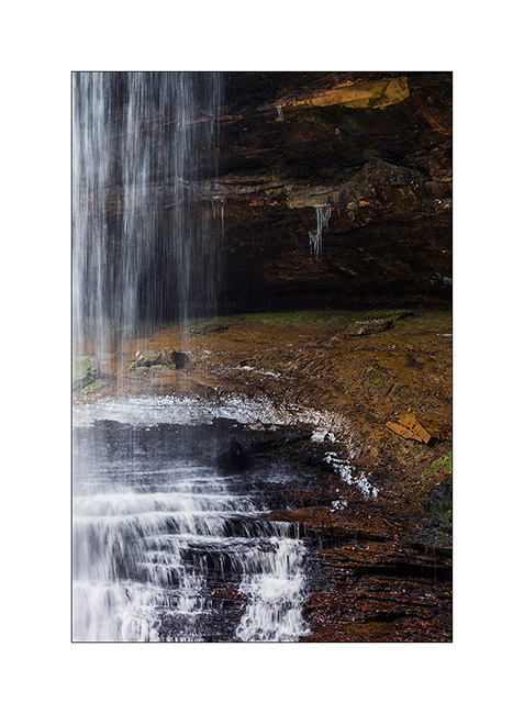
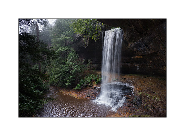
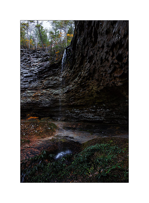
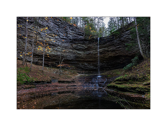
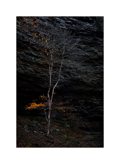
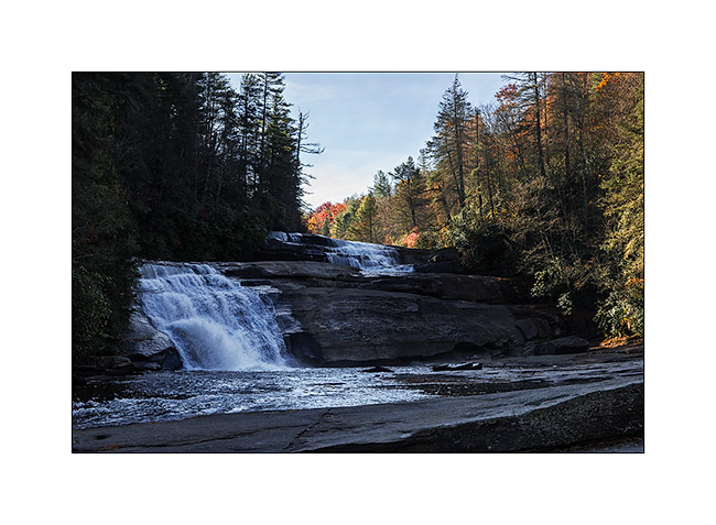
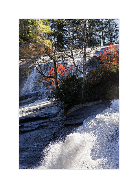
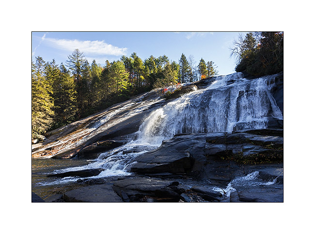
Dupont State Park (NC)
I’m a little behind with the processing of my images… Here is a series I took a few days ago. I went to a nice little State Park allowing access to two beautiful waterfalls, the Dupont State Park. Christian, I didn’t know you’re so well known over here! 😉
1) cold early morning…
2) arrival at the very beautiful Triple Falls
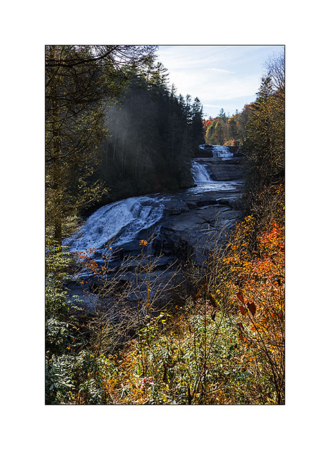
3) the top two jumps
4) upstream, the great High Falls
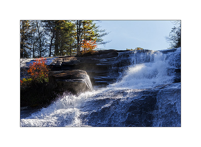
5) liquid sculpture (1)
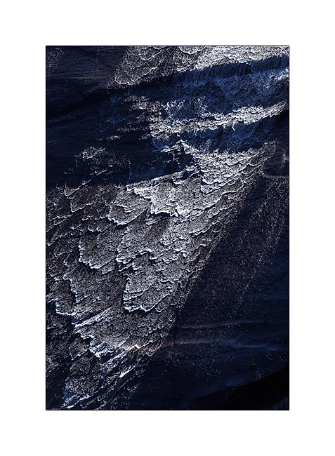
6) liquid sculpture (2)
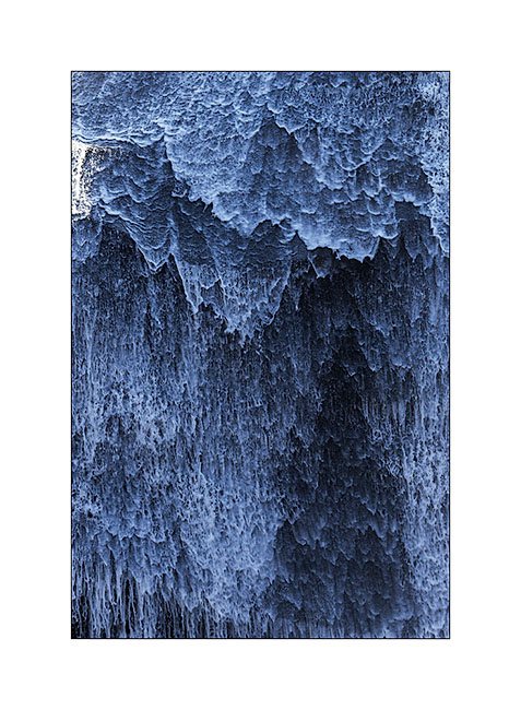
7) liquid sculpture (3)
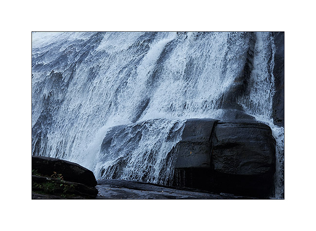
8) contrasts…
9) overview
In my next update, I’ll bring you take a tour in Tennessee… 😀
 D5 Creation