White Rim Trail @en
now browsing by tag
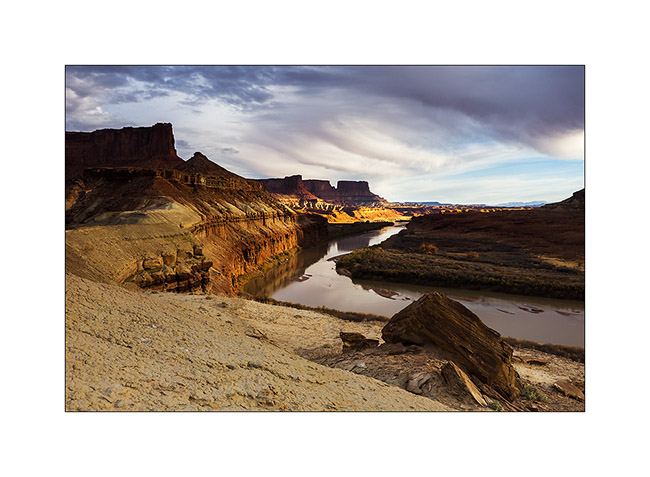
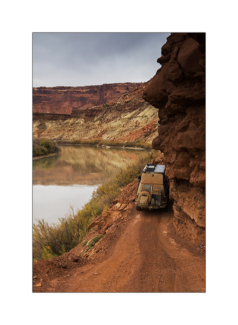
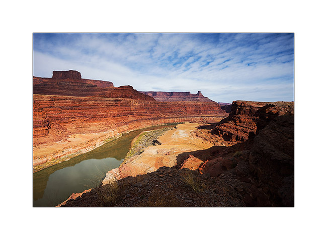
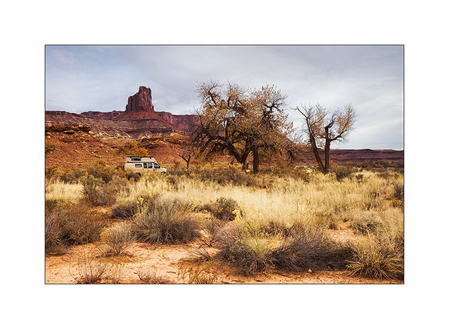
On the left bank of the Colorado…
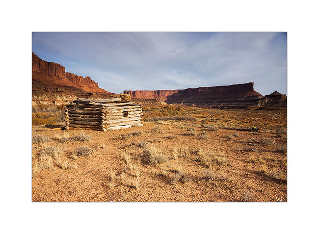
Near the end of the White Rim, I hiked to Fort Bottom, in the middle of a meander of the Green River.
1. Remains the “cabin” on a river bank. It is almost 200 years old and housed tuberculosis patients who were sent here to end their days…
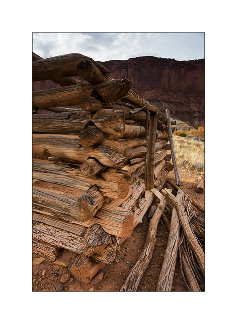
2. Build details.
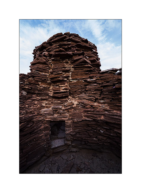
3. On the hill in the middle of one meander of the river, there is this double round tower.
4. Here it’s it closer. This is an Indian building dating back to about 1200. We do not know its function.
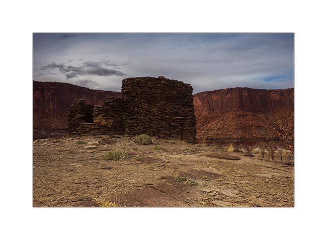
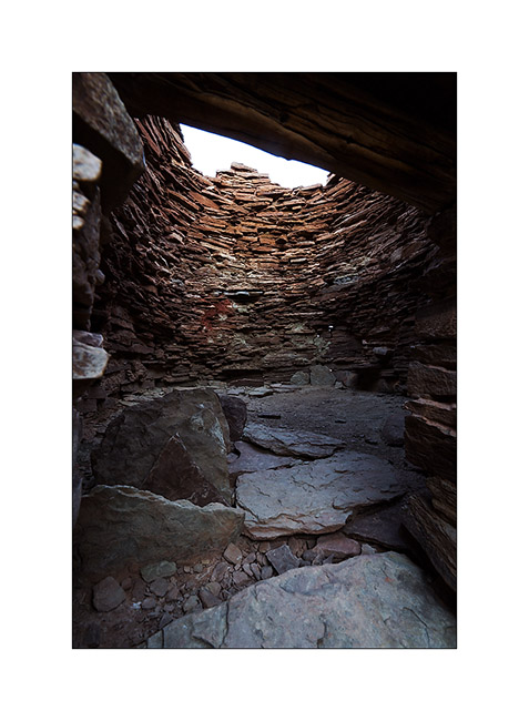
5. I sneaks myself inside, being careful not to shake the fragile ruins.
6. The floor of the main tower don’t exist anymore…
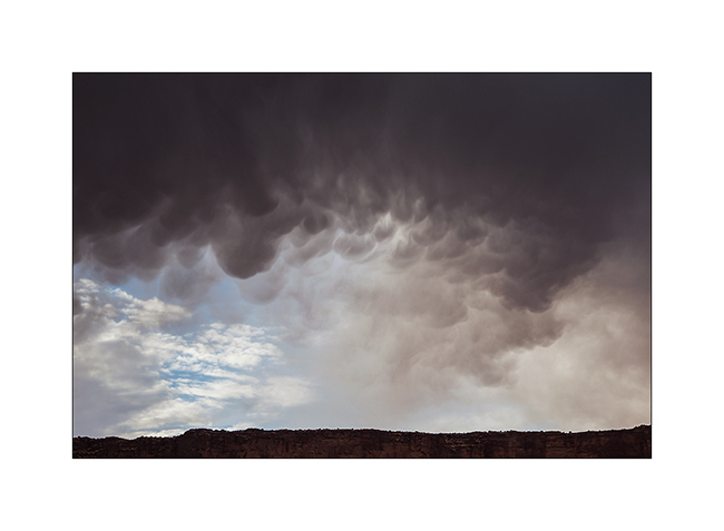
7. While I go back to VivaLaVida, curious clouds catch me up.
8. But I get some nice light over the river.
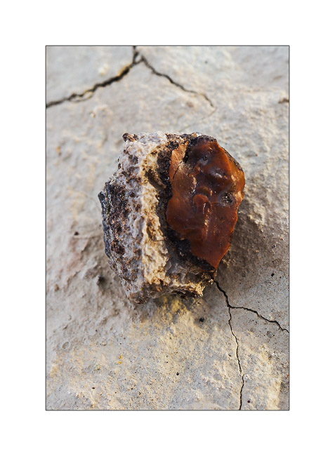
9. Fred, we need your geologist knowledge! 😉 In some areas, there were many stones like this, with a slightly chalky appearance on the outside but inside glassy, that really made me think of red flint including white crystals in zones, almost translucent sometimes. Do you know what it is?
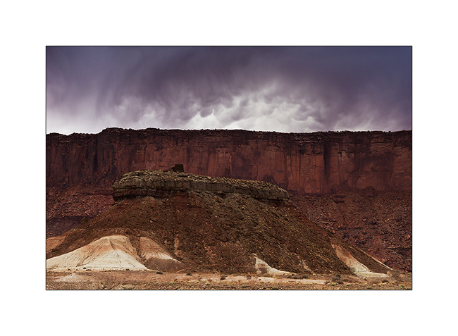
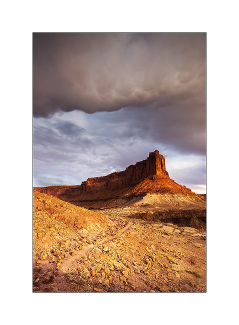
10. Amazing atmosphere of the surrounding cliffs. But no drop will reach the ground…
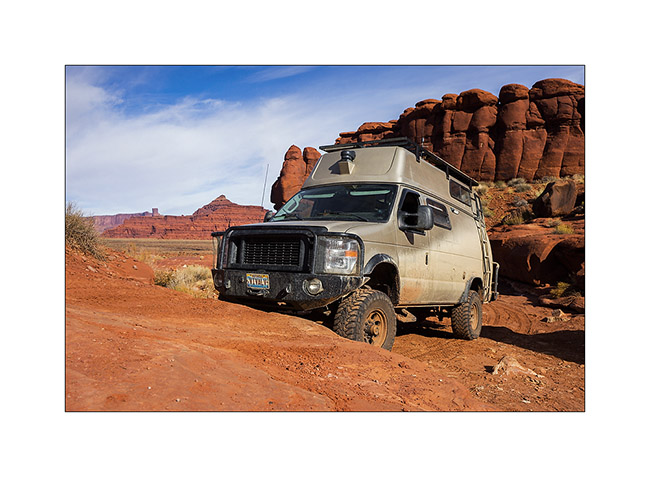
11. Vivalavida coming out of the White Rim trail the next day by a gray sky, with a final passage a little “tricky” for her size.
I then went to sleep to Hurrah Pass I reached at night, to go to discover a Colorado viewpoint in the morning.
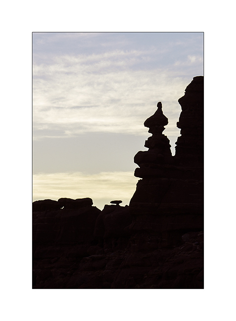
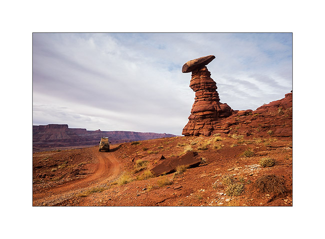
12. Unbelievable! At dawn, he was there, the famous troll I had already thought to glimpse, sitting cross-legged and watching his top spining…! 😀
13. A quite hard path of the trail with a nice step.
14. It’s quite high, isn’t it!
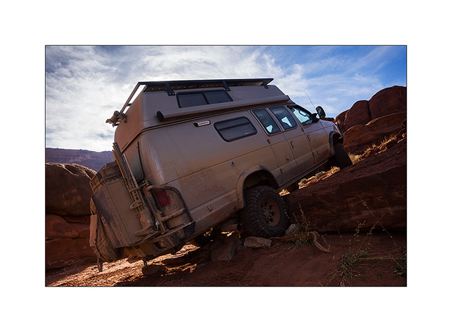
15. But nothing to stop VLV which is already on the next one!
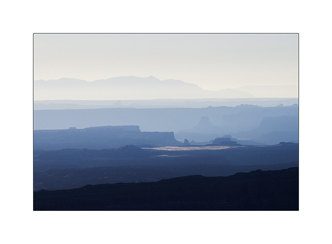
16. The viewpoint was gorgious…
17. … on both sides.
18. Him, it is probably not a troll, but he seemed to look VLV passing, as a kind of alien looking an insect ahead… 😉
That’s it for today. More to come soon…
Still Canyonlands…
No way to risk to stay stucked in so much snow, I preferred not to cross the pass that would lead me to the other side of the La Sal Mountains and went to Warner Lake driving around the mountains. I already discovered this little mountain lake in a previous trip and wanted to see it in its winter coat.
1. Late afternoon light on the Warner Campground, obviously empty at this season.
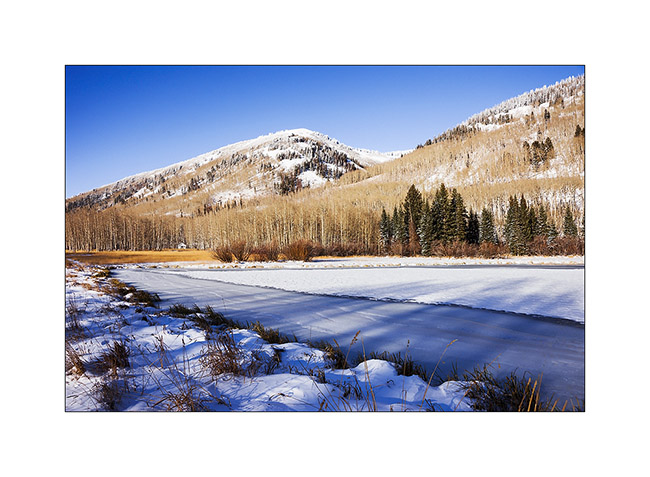
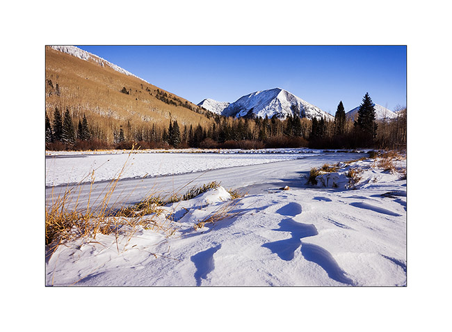
2. Beautiful frozen Warner Lake.
3. As the weather forecast indicated 12 F in Moab, over 3,000 meters below, I went down for me to find a campsite less exposed to cold. The view over Canyonsland and Henry Mountains, over 0 miles away, was splendid.
4. I found a better sheltered spot above Sand Flat, near an overlook over Castle Valley, a picture of the Far West at sunset…
The next day, session welding because I discovered that the bracket supporting the engine preheater was broken. Again and again the vibrations of the dirt roads… So I went late to Long Canyon.
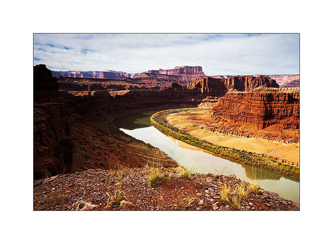
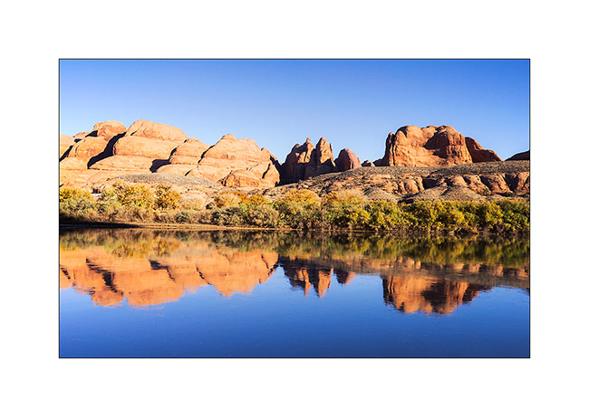
5. The Colorado River reflecting the Moab Rim.
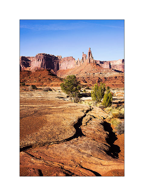
6. Going up in Long Canyon, With La Sal Mountains in the back.
7. The famous spot in Long Canyon ; Souvenir photo stop required! 😉
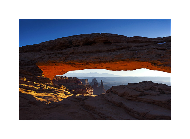
8. The next morning, I got up early to go to Mesa Arch at sunrise. A photo that I’m not the first to do but I like it…
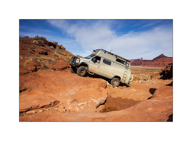
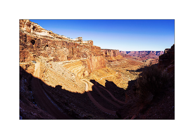
9. VivaLaVida then went down the Schafer Trail to get to the White Rim Trail. Beautiful downhill in the vertical walls! VLV is quite small up there…
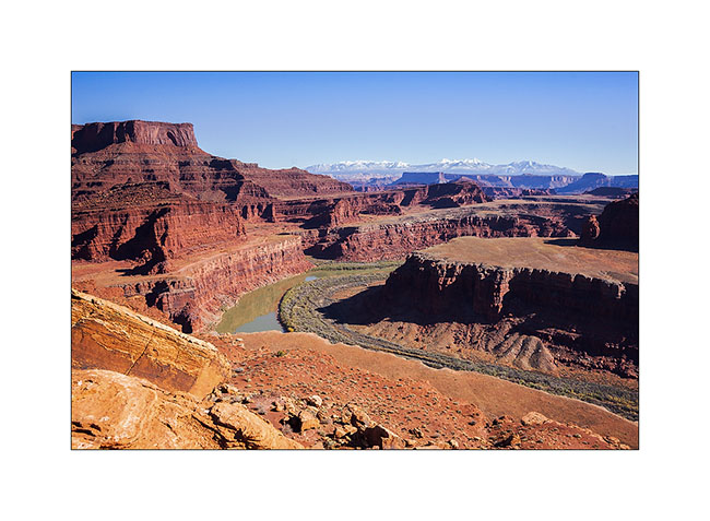
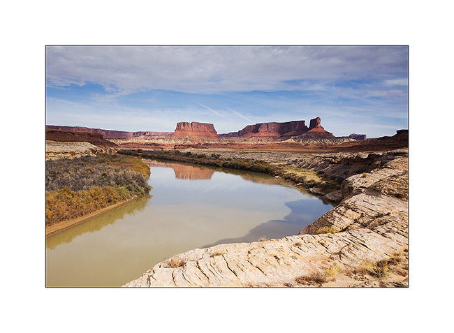
10. One of the meanders of the Colorado from the White Rime Trail.
11. Self-portrait at Musselman Arch, quite aerial… 😉
12. The towers that appear Under Mesa Arch, but this time from the bottom.
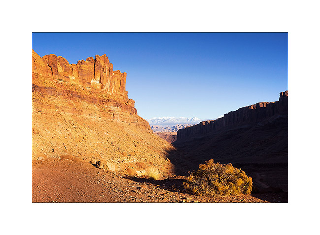
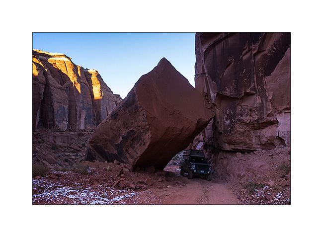
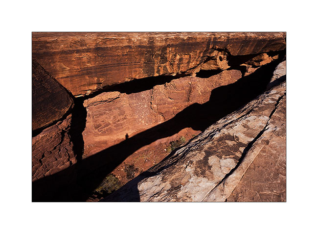
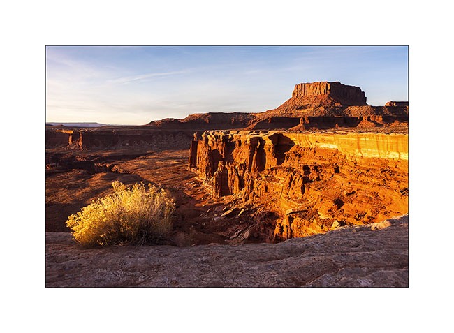
13. One of the huge overhang that crosses the White Rim…
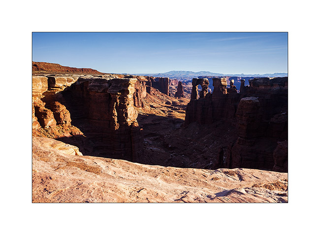
14. In Canyonlands, there are number of canyons and arches everywhere. The White Rim Trail takes its name from the clear limestone layer that it follows over 100 miles.
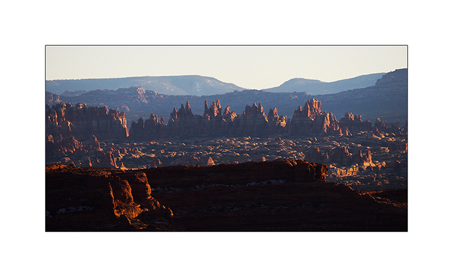
15. From Whitecrack Campground where I spent the night, Sunset over the 20 miles away Needles is gorgious.
16. Under windwos of VivaLaVida too !
17. Almost the same colors at sunrise…

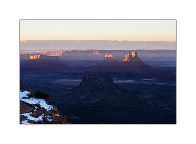
18. Another of theses giant overhansg with Candelstick Butte in the back.

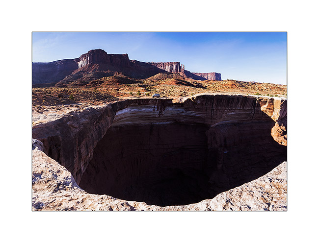
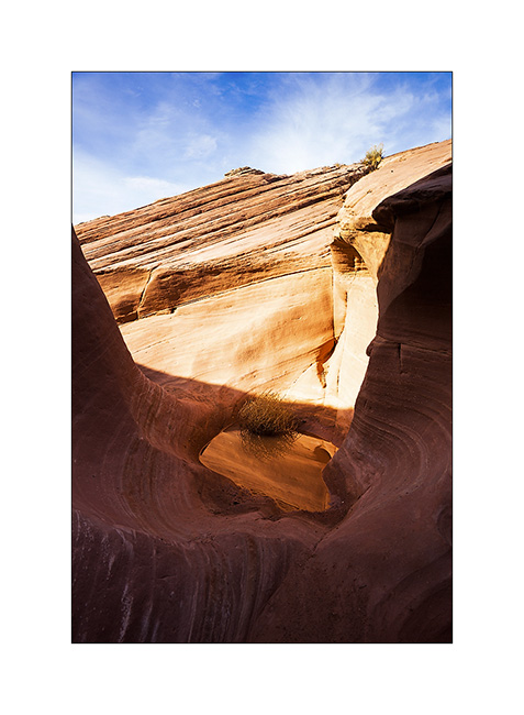
19. A small slot canyon I visited along the trail…
20. I rediscover the Green River…
21. Luch stop at Potato Bottom.
Continuation and end of the White Rim Trail in the next update.
 D5 Creation