video @en
now browsing by tag
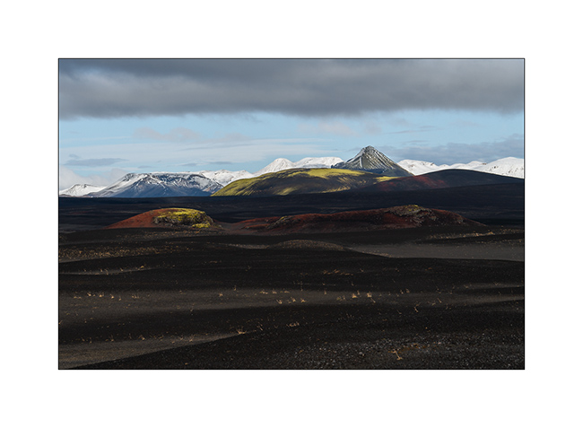
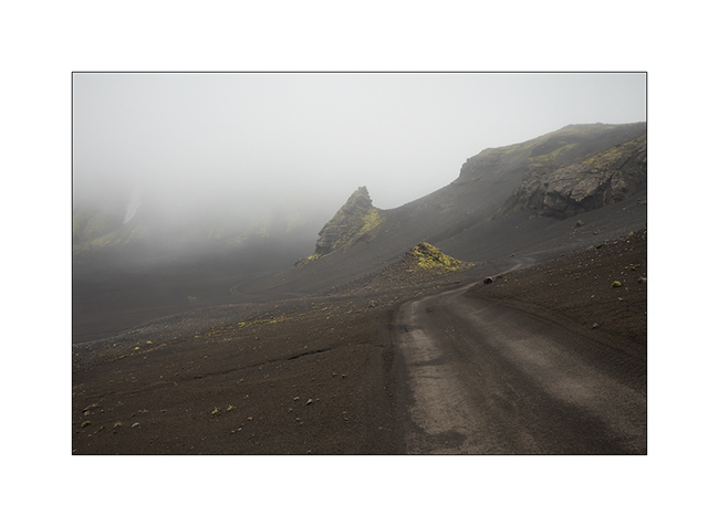
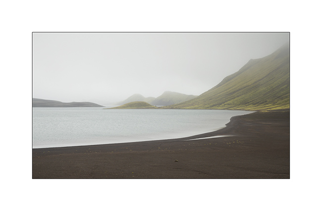
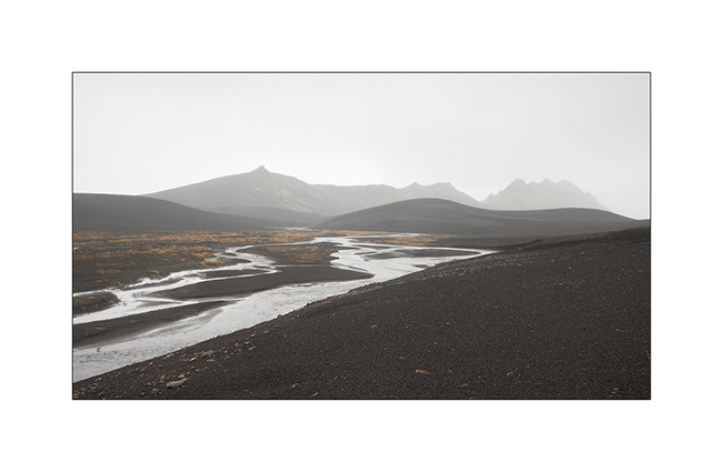
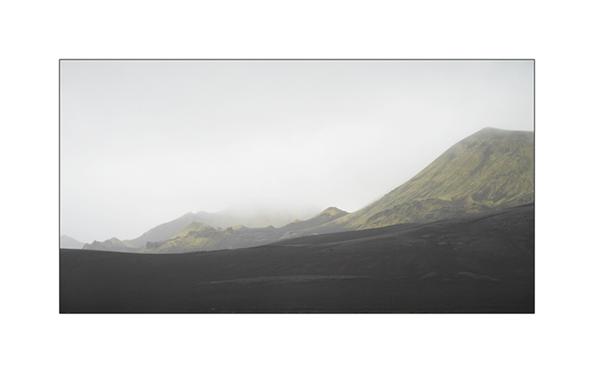
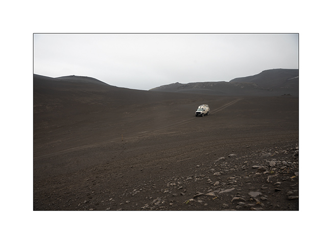
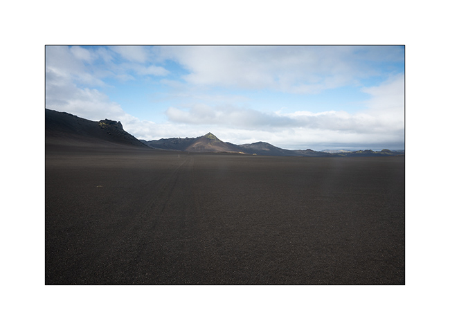
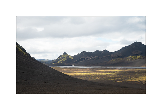
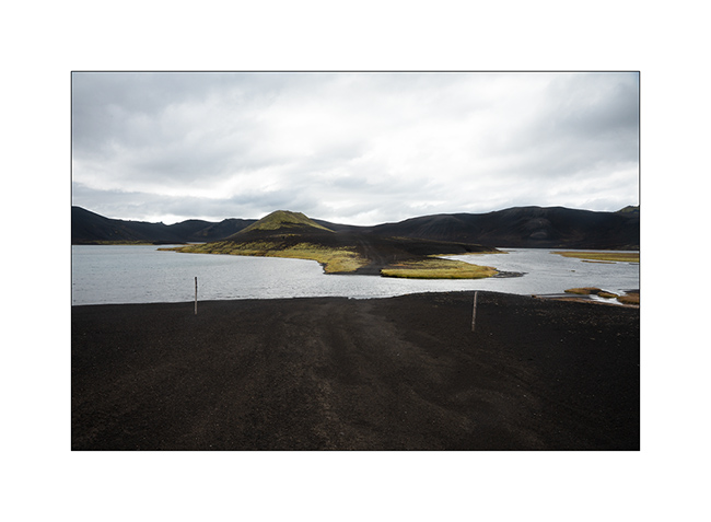
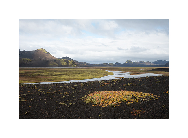
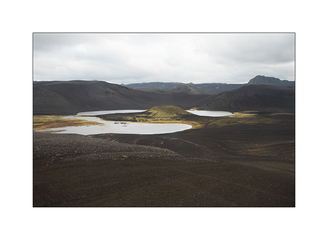
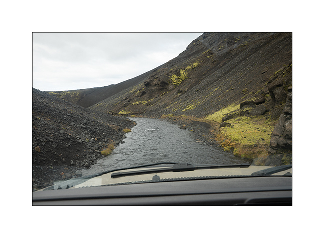
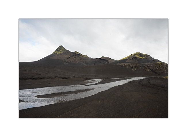
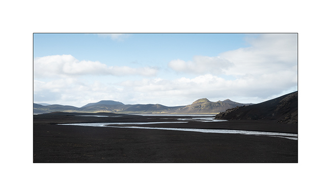
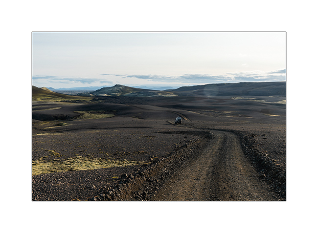
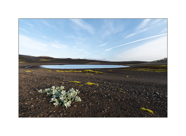
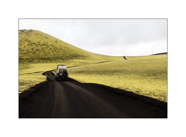
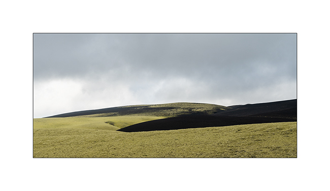
F210 – F232
Before continuing the journey, it is time to wish you all Happy New Year 2019! full of new informative and rewarding adventures, beautiful encounters, unexpected discoveries. A special thought to a close friend who has been battling a serious cancer for many months without being able to overcome it yet and who I wish to see soon the end of the tunnel…
But let’s continue the story. II enjoyed some light at sunrise… 😀
1. First glow…

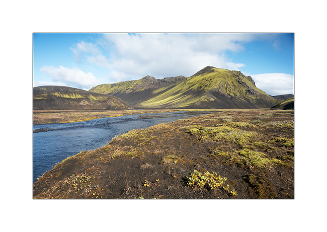
2. Mýrdalsjökull is really close.
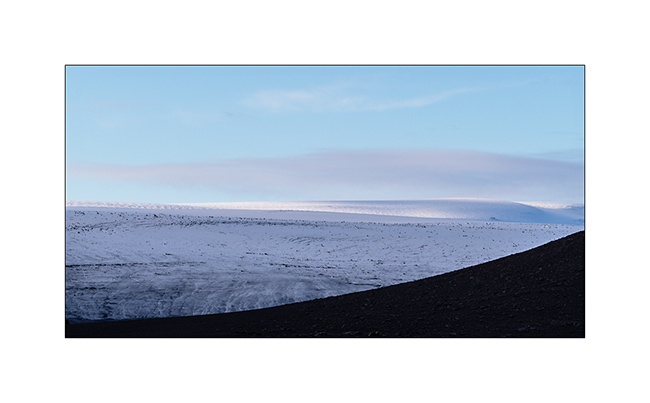
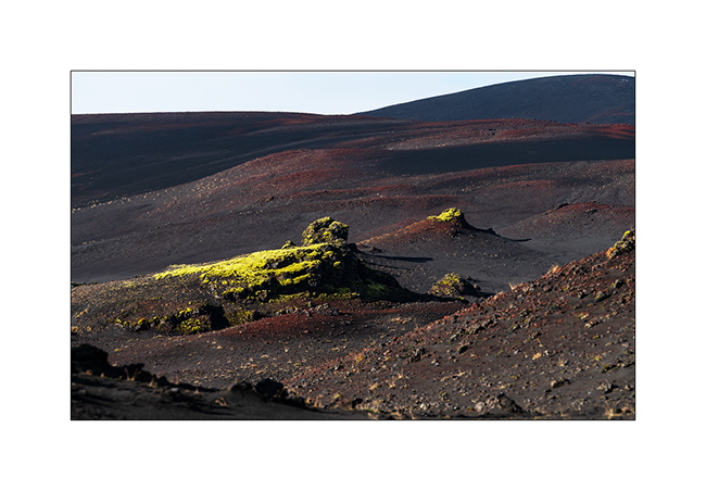
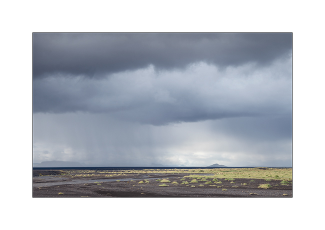
3. There was some snow fall tonight.

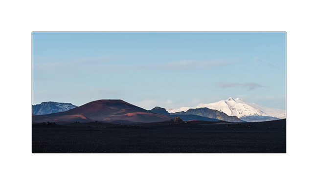
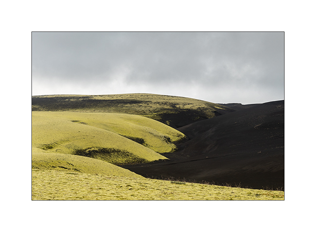
4. Iron oxide colors some hills in red.
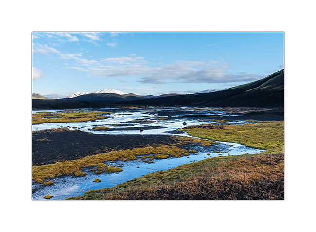
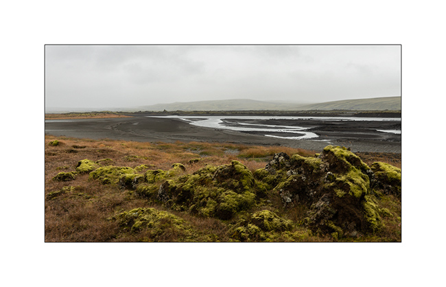
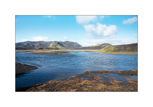
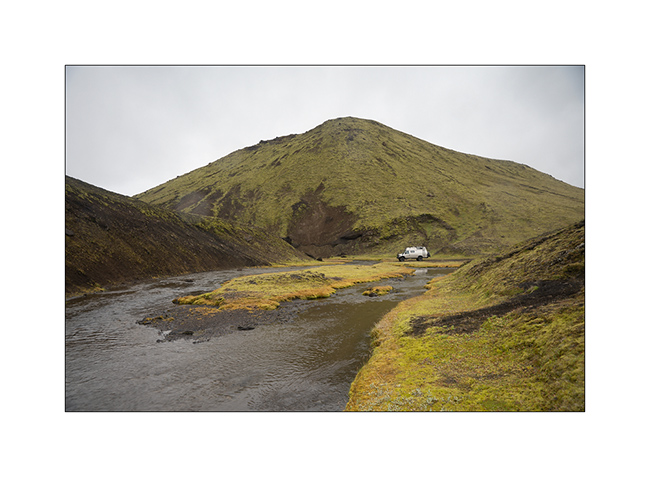
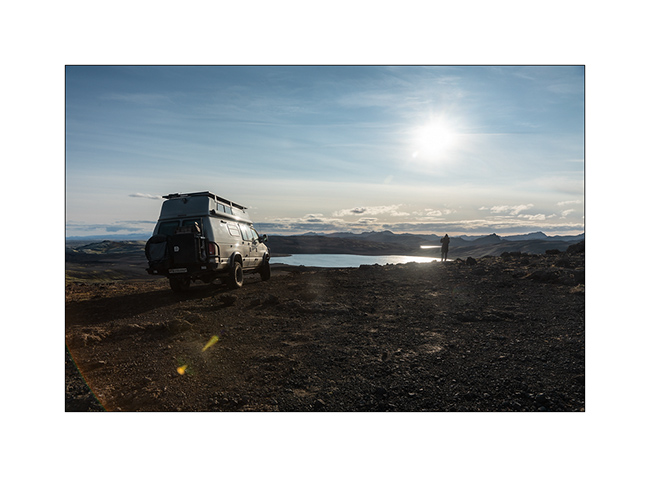
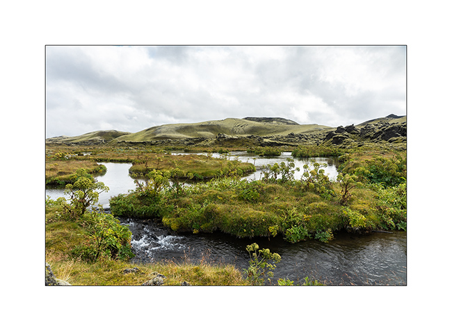
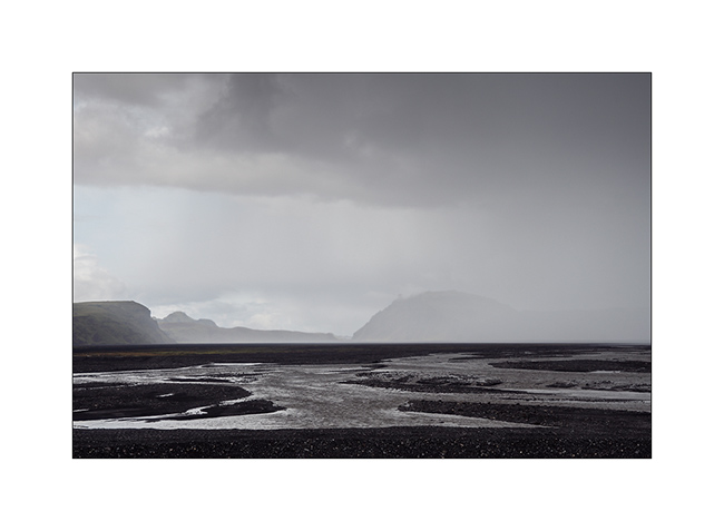
5. One of the many fords crossed.
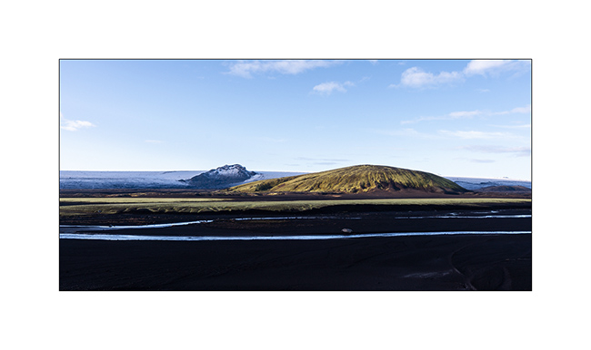
6. Sand / foam / ice contrast.
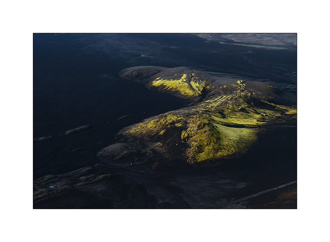
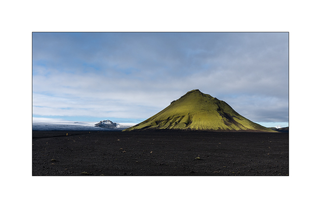
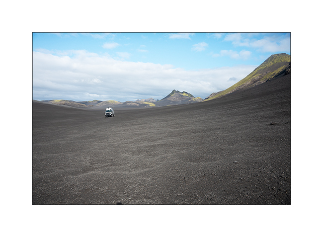
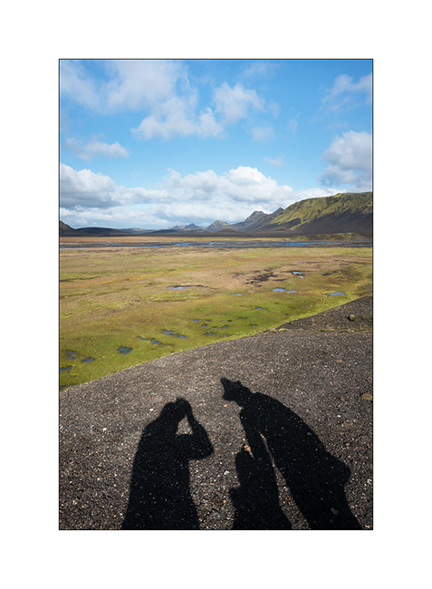
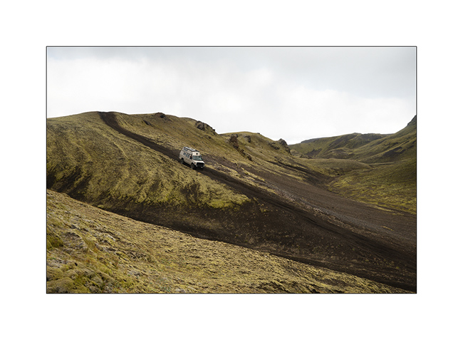
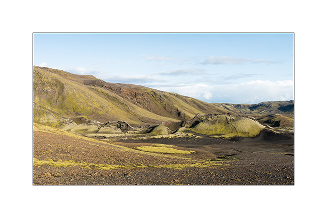
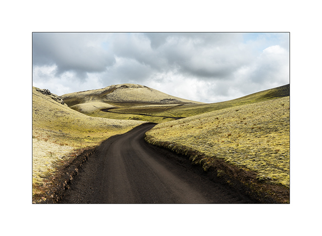
7. At the end of the F210, I decide to take some height on the Maelifell, an old volcano in the middle of the plain. VivaLaVida stays down. 😉
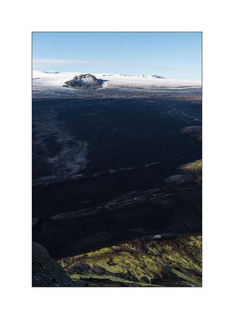
8. As I go up, the immensity slowly reveals itself.
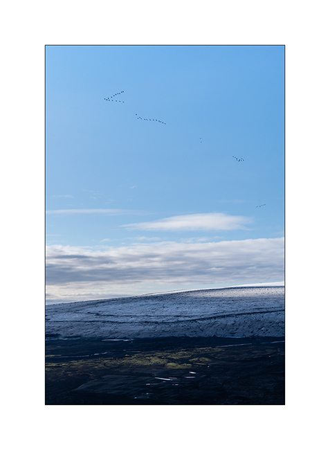
9. A flight of wild geese begining their migration goes through the sky…
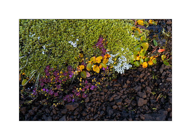
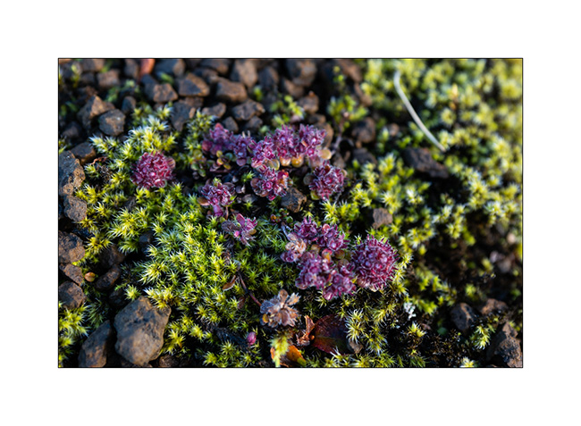
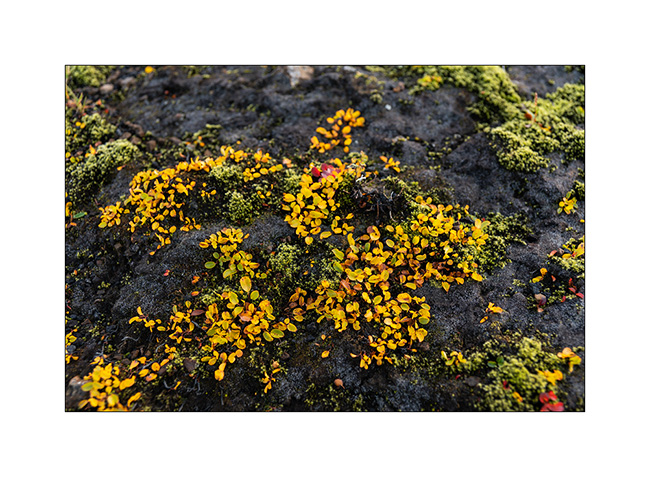
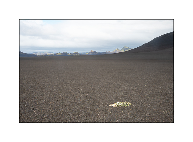
10. I take the opportunity to show you a small sample of the main plants of these arid regions, starting with this sometimes almost fluorescent foam.
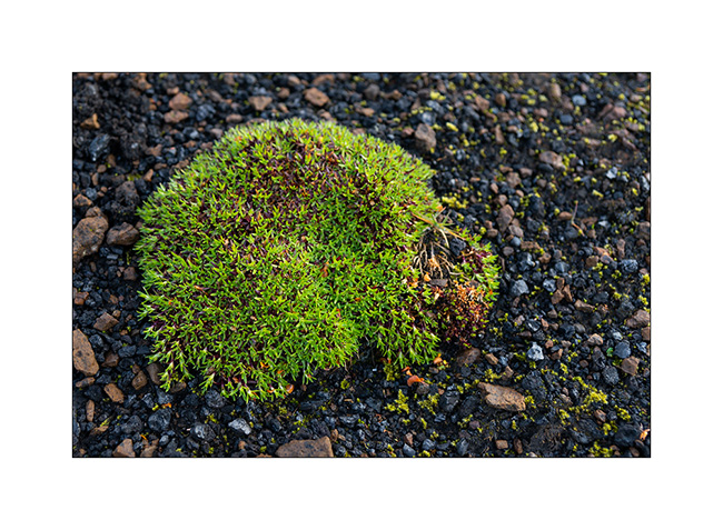
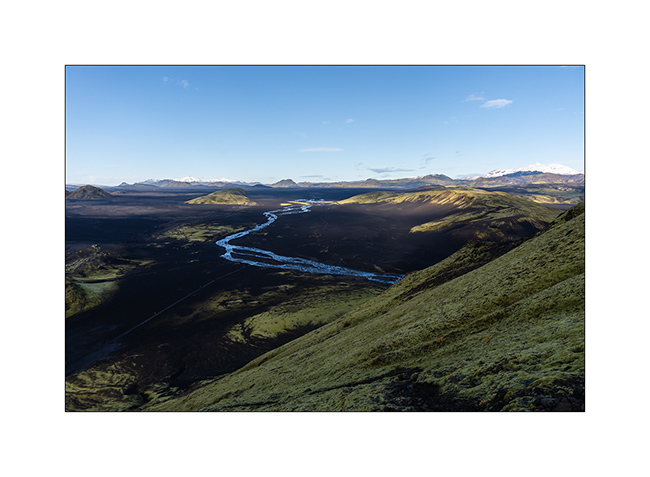
11. It shares the space with other species, creating colorful beds at this fall period.
12. …
13. …
14. …

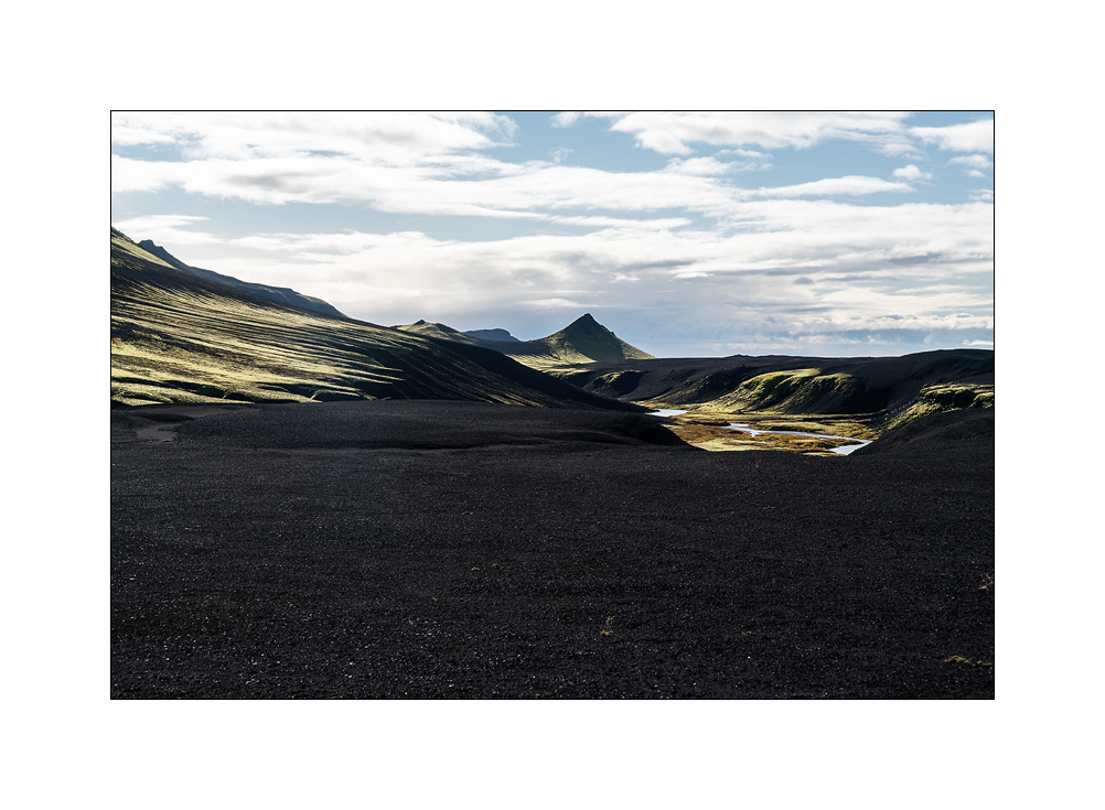
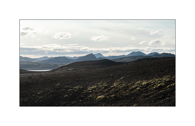
15. Arrived at the top, the panorama is breathtaking! (panoramic assembly of 9 bracketed images –> 27 images for this softblending!)
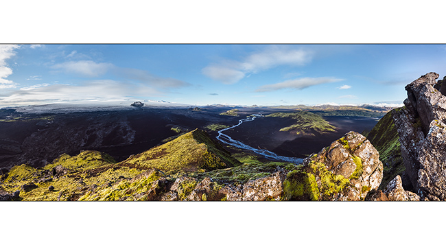
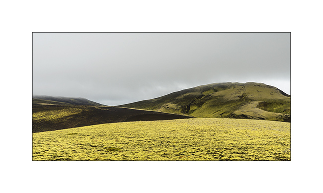
16. View from above…
17. The mountain I just climbed.
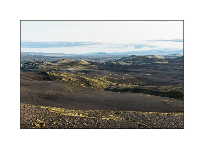
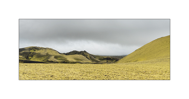
18. Still contrasts…
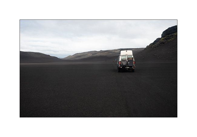
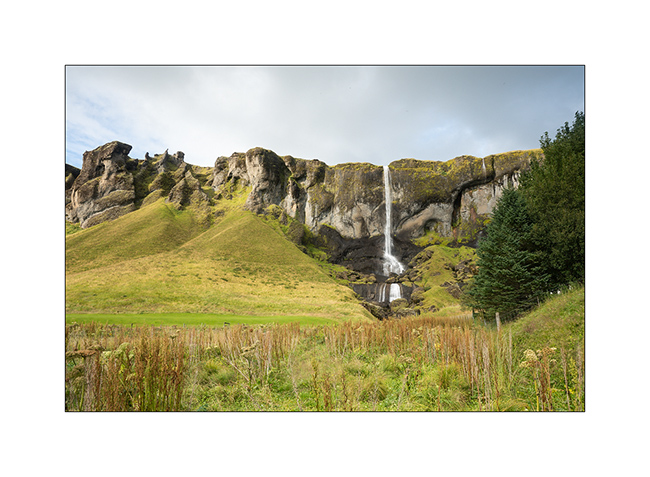
19. VLV follows the less traveled F232 road now.

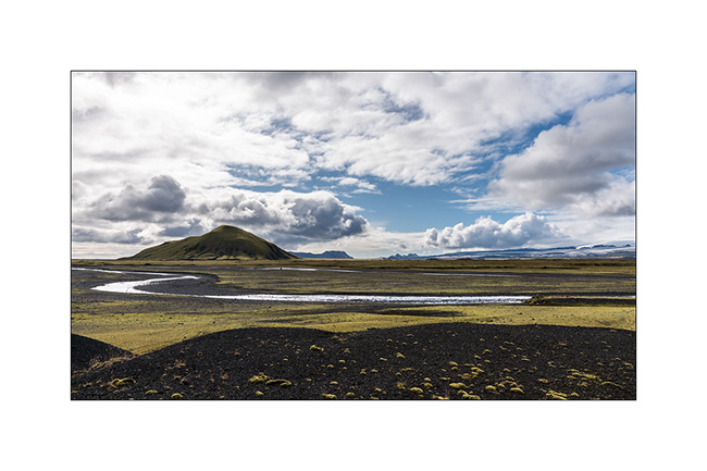
20. As we descend gradually towards the south coast, greenery becomes more present again.
21. The colors of autumn are also more and more present, for my greatest pleasure.

22. How beautiful ! I am in permanent contemplation…
23. A ford just above a waterfall
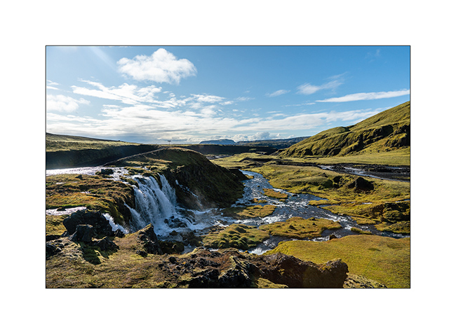
Here is the link of a short video of this ford for those who want to discover it… 😉
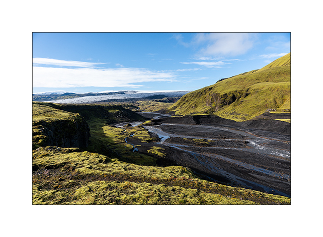
24. One of the glacial rivers, meltwater from the ice cap, digs its canyon.
25. Further down the trail, other waterfalls that look like small and less touristy “Godafoss”.

26. Backlight at the end of F232.
To be followed soon… 😉
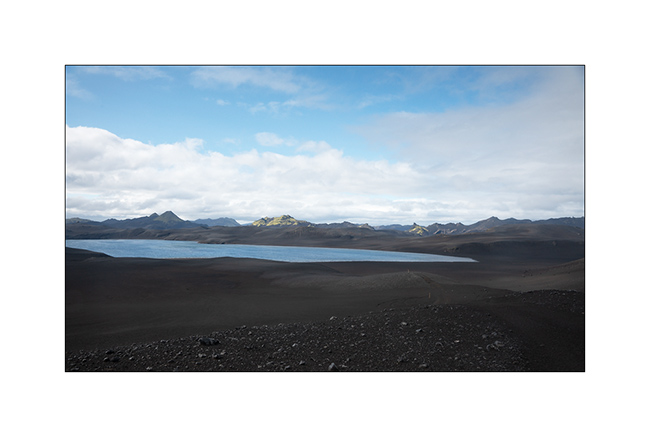
Path less traveled…
After the Lakagigar, rather than go directly to the Landmannalaugar on F208, we decided to go to Langisjór Lake via some less traveled trails that proved to be gorgeous…
1. River in the rain, along Southern F208.
2. Rather curious sign, isn’t it? In fact, the trail goes into the lake on approx. 300 yards.
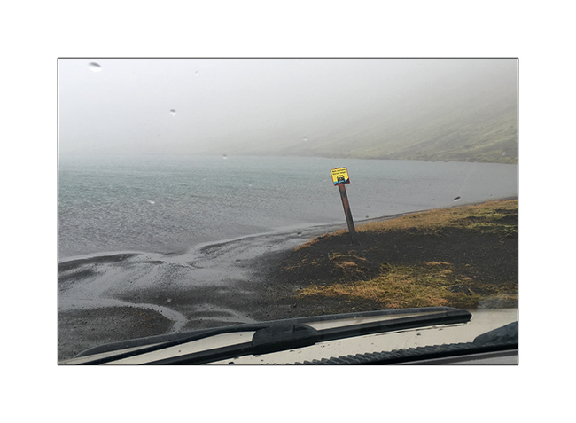
Here is a video of this unusual path done by Isabelle. The weather was windy, with rain and fog…
3. In places, everything is only mineral.
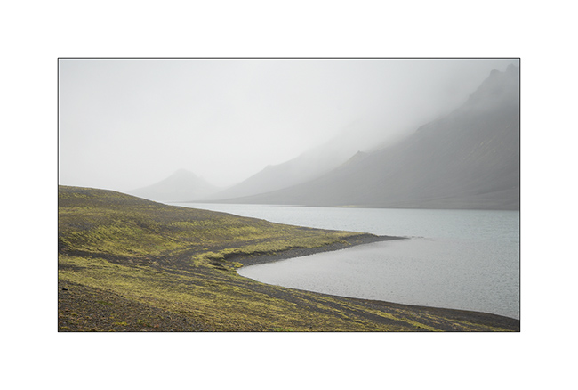
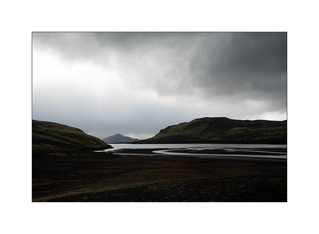
4. Langisjór lake in the rain.
5. Trail…
6. …
7. River…
8. Fog…
9. VivaLaVida riding the moon.
10. The rain finally stops.
11. Invisible track. Thank you GPS.
12. Desolation…
13. … and blackness.
14. But these landscapes are amazing.
15. The trail crosses another lake.
16. Contrasts are everywhere.
17. Our trail seen from the top of a hill.
18. After driving in a lake, here we follow the riverbed for nearly one mile to change the valley! 😉
19. …
20. Fairy…
21. …
22. Another ford.
23. … and another.
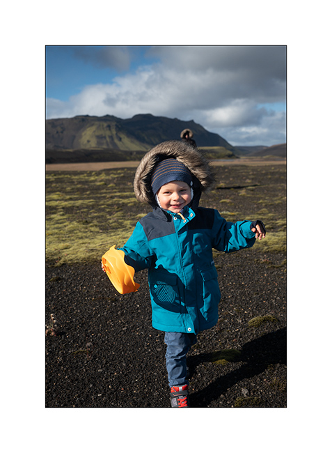
24. We walk and play too!
25. Selfie 😉
26. Emile loves it.
27. Late afternoon contrasts.
28. …
29. In places, this track less traveled requires a good 4WD transmission, as here in a steep descent.
Here is another short video showing this trail. In video background, we can see the continuation of the track over the river, which goes up in the hills.
30. Rain showers are back.
31. …
32. …
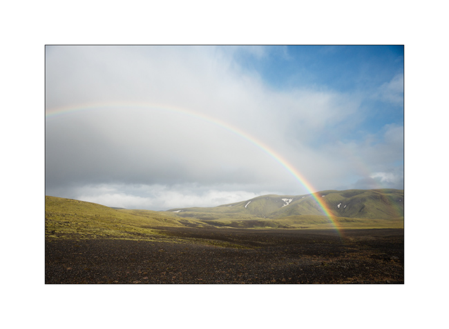
33. Another particularly saturated rainbow.
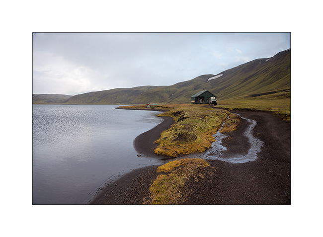
34. We spend the night on the shore of a lake, near a shelter already closed for winter…
Hoping that this update won’t have been too long… 😉
To be followed in Landmannalaugar soon.
Lakagigar – F206 / F207
Here we are to discover the Lakagigar region, driving our first “F Roads”, trails reserved for 4×4 because of deep fords and “in principles”
prohibited to rental vehicles. In principle because we saw many “unauthorized” rental SUV on these tracks.
1. F206
2. As in the Faroe Islands, sheep live in freedom everywhere.

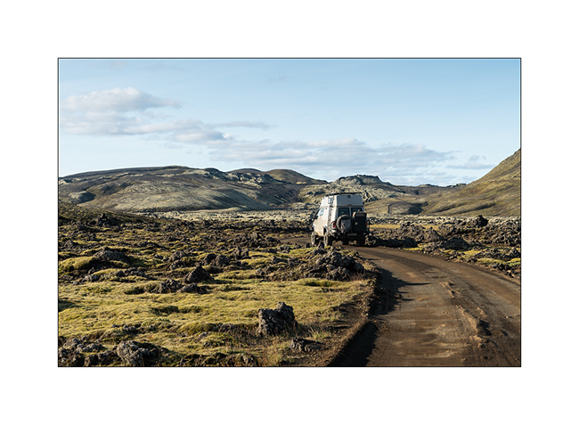
3. VivaLaVida crosses completely mineral landscapes.

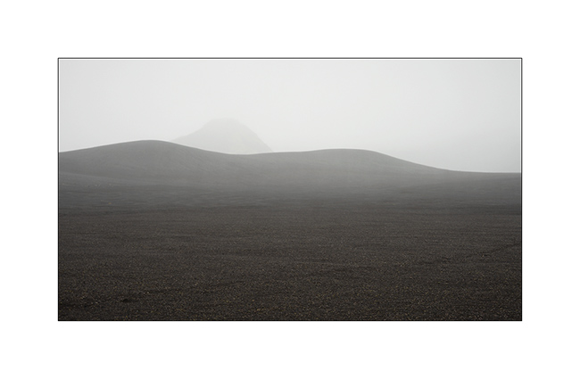
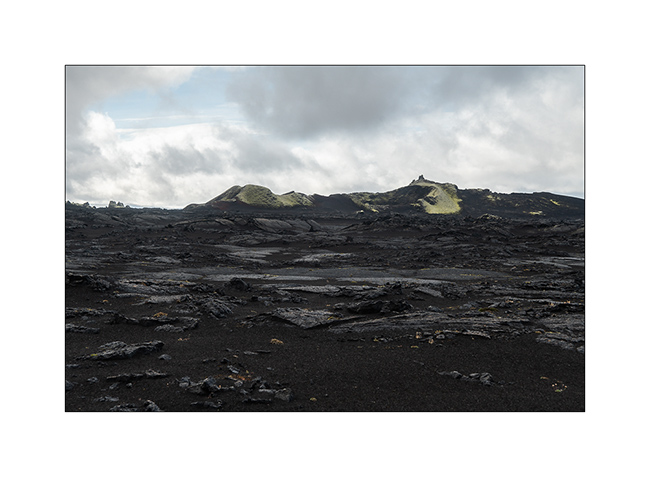
4. Here is the Lakagigar range, volcanoes that appeared only a few decades ago.

5. Small lake stuck between mountain and lava flow.

6. The F206 was created in the lava.
7. Only mosses and lichens manage to develop on volcanic slags.
8. The summits, more exposed, are often virgin of vegetation.
9. Enjoying the panorama in late afternoon.
10. And what a panorama!
11. F207
12. We boondocked on the shore of a small lake.

13. Sweetness of the evening light.
14. The next day, despite the light of a gray sky, the contrasts are amazing. The moss looks almost fluorescent.
15. …
16. …
17. Laki volcano.
18. … and one of the new craters around.
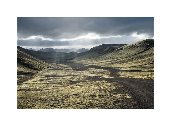
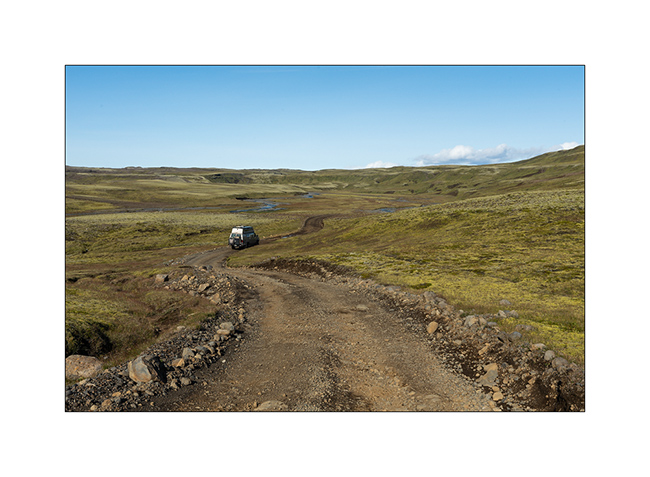
19. The F207 winds between the hills.

20. Raw lava.
21. Ground is very dark.

22. The trail is sometimes not very marked.

23. Looking to North West towards Landmannalaugar.

24. …

25. Crossing a river with water temperated by some hot springs, the vegetation changes.
I posted a short video of a F207 ford here for those interested. 😉
26. The Fragifoss waterfall along the F206.

27. Last sight of these pretty volcanic hills.
To be followred on the side of the famous Landmannalaugar, probably the most visited interior site in Iceland.
South coast…
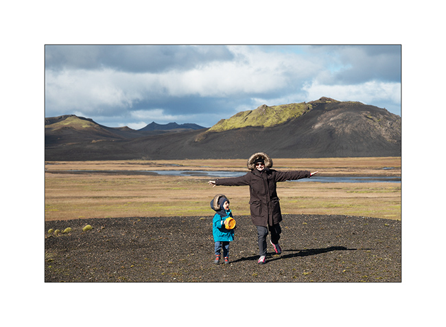
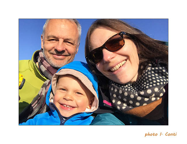
1. As Gaël requested it, here is the whole family. 😀
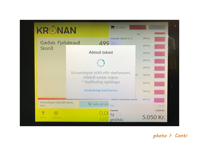
2. An example of the language at the checkout of a store, inapprehensible and unpronounceable for us.
And to show you what the rain can be there, here is a short video
of Isabelle made the day before where it rained like that almost all day long..!
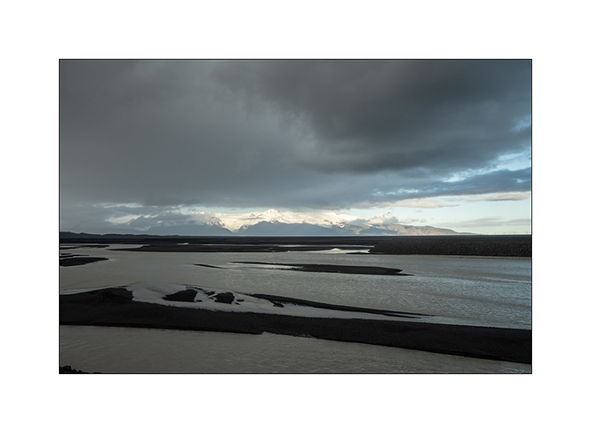
3. Continuation of the South Coast to the East. VivaLaVida crosses many Gravel Bars, large river beds that regular floods clear of all
vegetation.
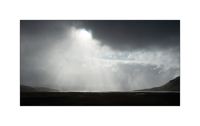
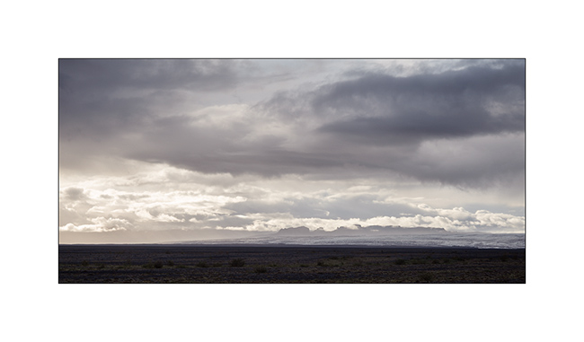
4. Showers that offer beautiful skies.
5. Waterfall Foss á Síðu along road Nb 1.
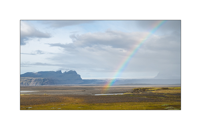
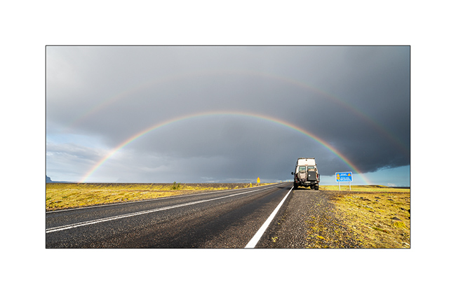
6. Rainbow in frontof the Vatnajökull ice cap in the distance.
7. Another one to celebrate VivaLaVida.
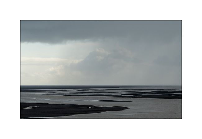
8. Gravel bar.
9. Shower on the coast.
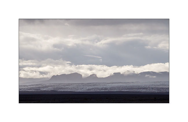
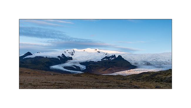
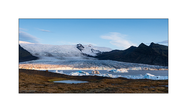
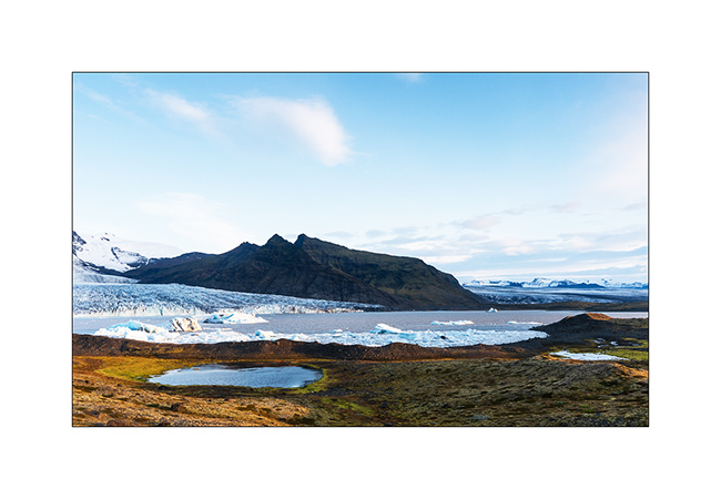
10. Vatnajökull ice cap, the largest in Iceland.
11. It is crossed by many volcanoes more or less active.
12. In the evening, VivaLaVida finds a nice boondocking place to camp near a glacial lake.
13. First colors at dawn.
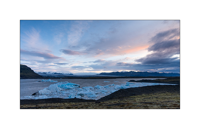
14. Camp of VivaLaVida, close to the glaciers.
15. Light beams…
16. … on raw elements.
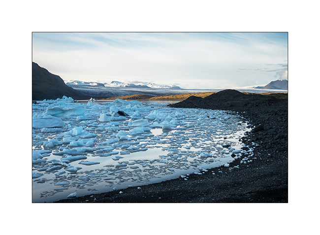
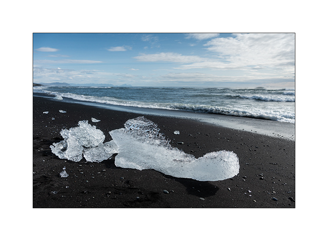
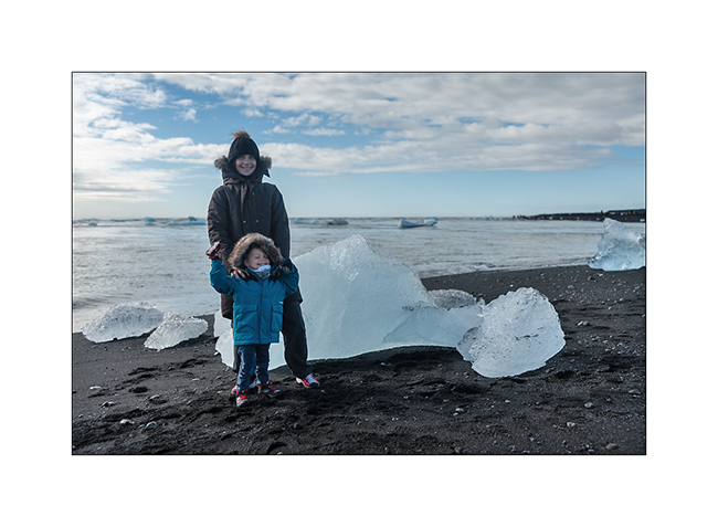
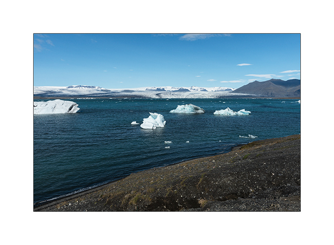
17. I couldn’t not show to Isabelle, a jewel fan, the “Diamond Beach”, famous for the icebergs that stand out from the Vatnajökull and flow
into the ocean by Lake Jökulsárlón before stranding on the black beach! 😉
18. Photo souvenir…
19. Jökulsárlón Lake.
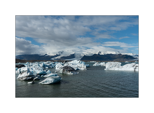
20. Larger icebergs must melt before crossing the channel leading to the ocean.
In the next update, we will leave the coast to discover the Lakagigar area where new small volcanoes appeared only some decades ago.
Californian varieties
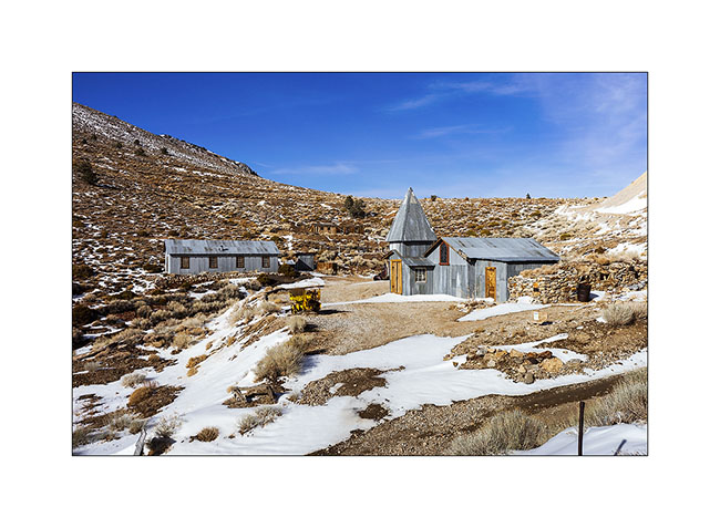
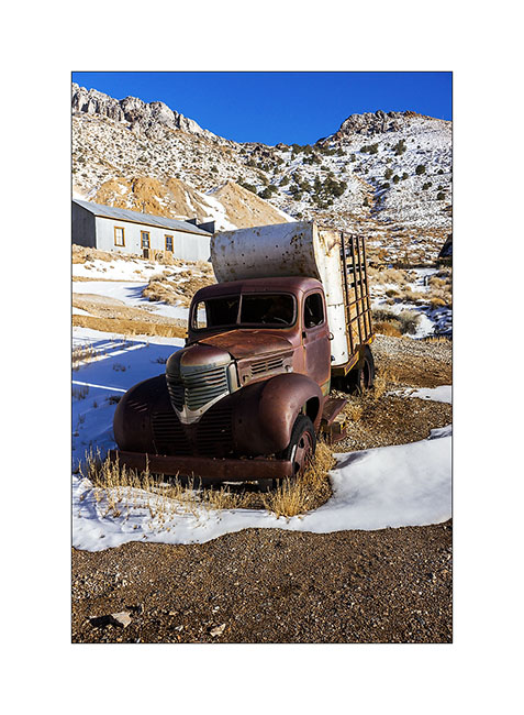
Having failed to reach Cerro Gordo through the ridge road blocked by snow, we drove up the classic route. This is an abandoned mining town that was home to 2,000 people between 1856 and 1930. It had up to 7 saloons and the basement is dug over 35 miles (55 km) of galleries. It generated the largest amounts of silver from all the American West at this time.
1. Some buildings of this mining Ghost Town are made of corrugated sheet.
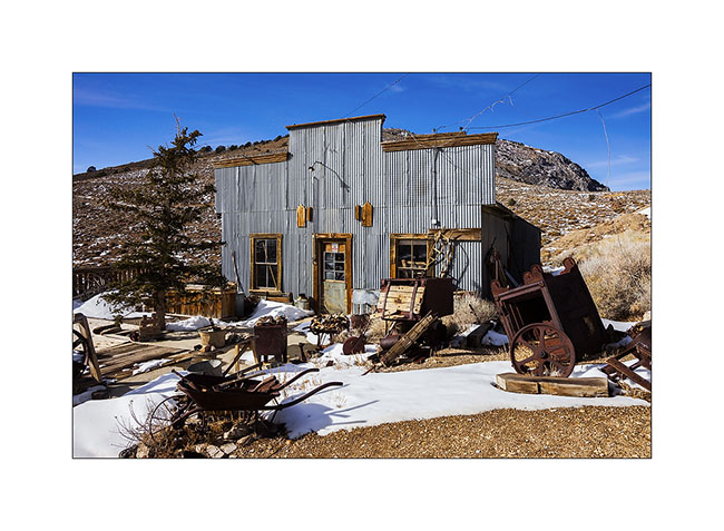
2. General Store transformed in a museum.
3. A 1946 truck.
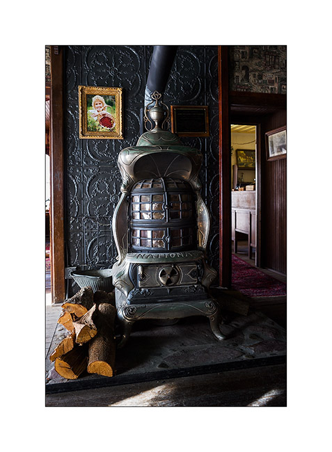
4. Splendid furnace in hotel.
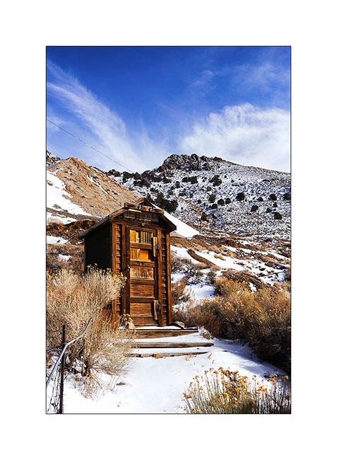
5. A restroom…
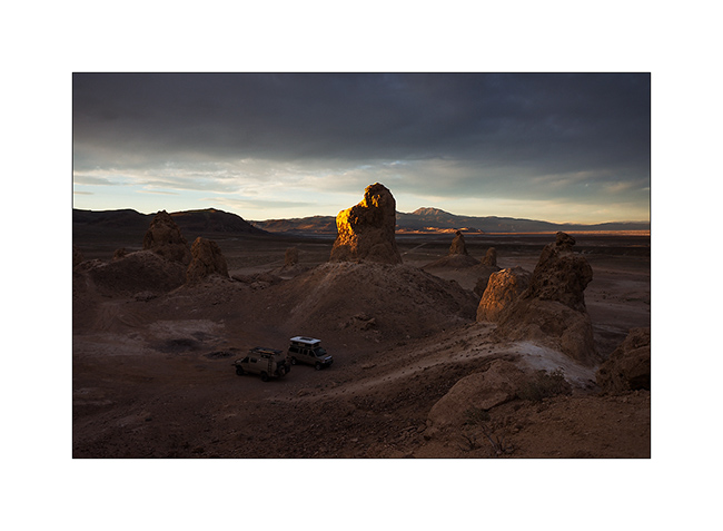
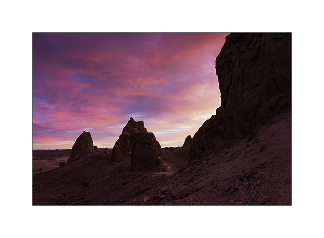
6. The next day, we stopped at Trona Pinnacles.
7. the sun is going Under the clouds.
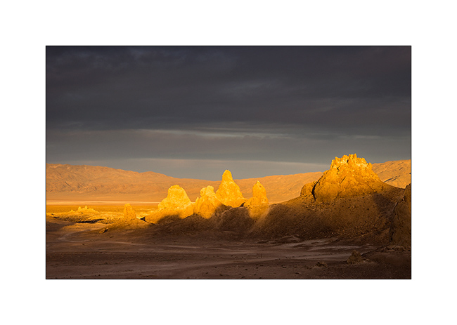
8. This is tuff chimneys such as Mono Lake, which formed in a lake between 100,000 and 10,000 years before our area.
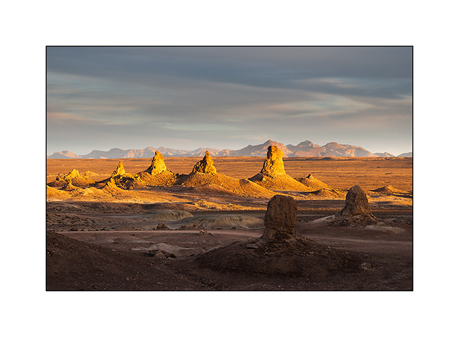
9. Some are 140 feet high.
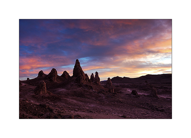
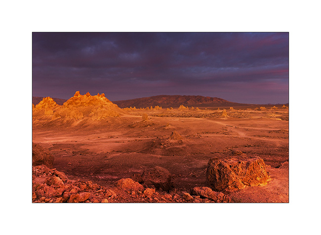
10. Flaming sunset.
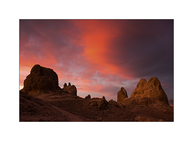
11. Unlikely colors…
12. Light reflected by the purpled clouds…
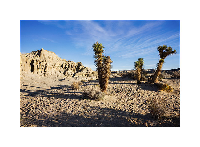
13. Another discovery : Red Cliffs Canyon.

14. The errosion sculpted amazing forms, sometimes colored…
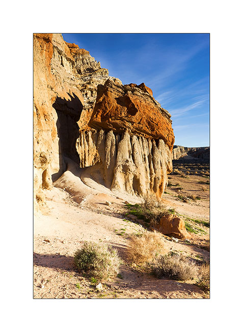
15. … sometimes gray.
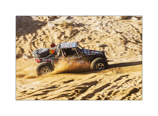
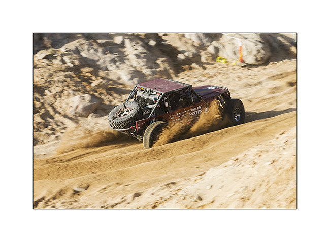
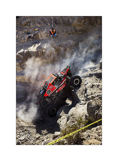
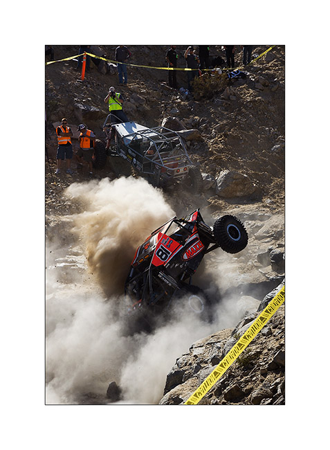
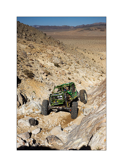
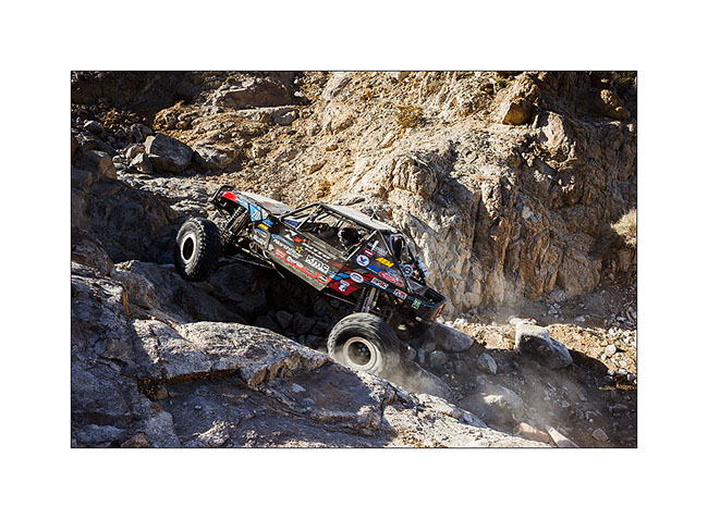
Change of scenery! We stayed for three days at the “King of the Hammers”, an off road race! The event takes place in the desert and alternates very fast sections on sandy tracks and pure rock crowling passages in canyons full of large blocks and obstacles. The winner took almost 9 hours to browse through three rounds of 45 miles.
16. Vehicles are buggies which most are between 800 and 1,000 hp!
17. This one has a distant silhouette of Jeep…
18. Back Door canyon entry.
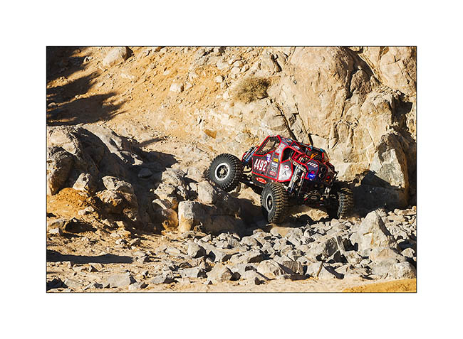
19. Winching an obstacle, here a more than 10 feet high step! The co-driver is also the one that will tie the winch.
20. Some buggies are single seater.
21. Power passing…
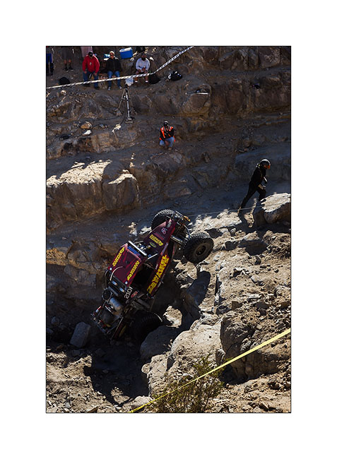
22. Up in Back Door canyon, more than 600 feet above the desert.
23. Another obstacle that seems less impressive than reality on this image.
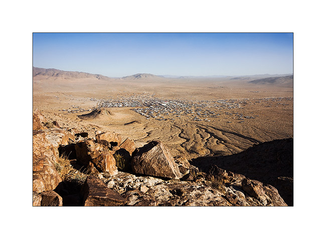
24. It is a city of nearly 30,000 inhabitants that rises from the desert during the race week.
Here is a short video taken with my cell phone…
Once the race is over, dozens of private vehicles are trying to hit obstacles of the race with the encouragement of hundreds of spectators that beer makes quite noisy ..! Here are two more videos, just to give you an idea of the atmosphere. They were shot around midnight…
After this fun experience, VivaLaVida began his eastward migration toward East travelling back to Arizona for a few days, still followed by Baja Shaker… To come soon. 😉
 D5 Creation