sunset
now browsing by tag
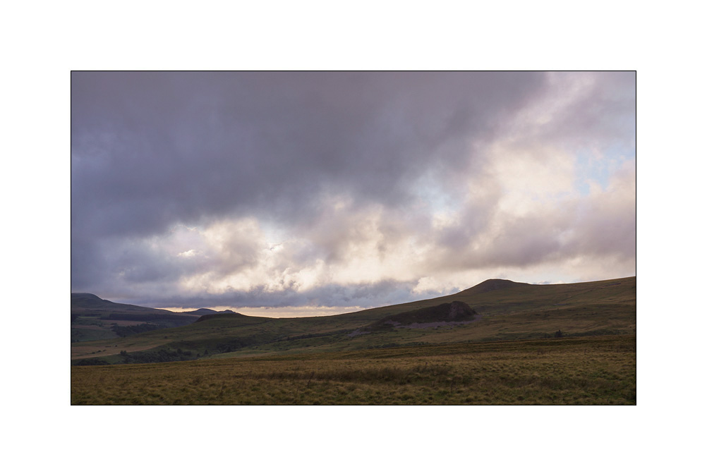
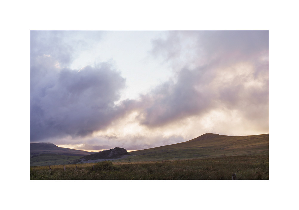
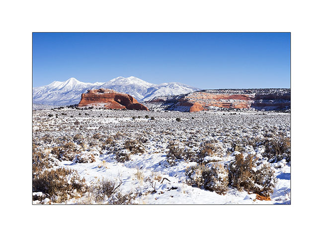
Way home…
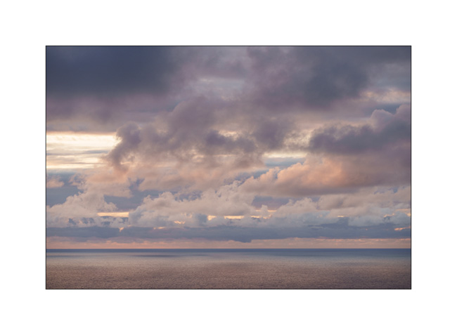
1. Last boondocking with view on the ocean, not far from Bilbao, while it is raining…

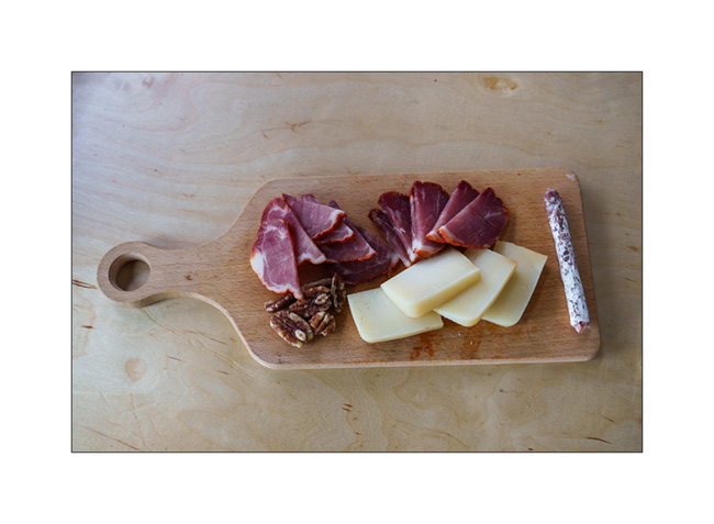
2. Starter with local products!
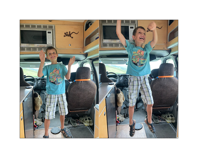
3. Emile’s happy!
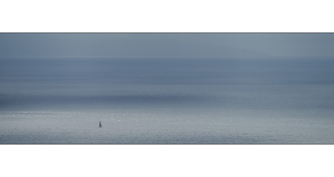
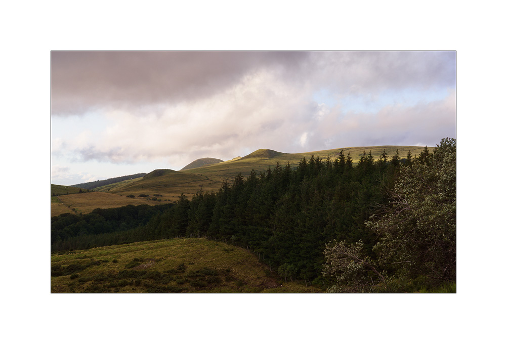
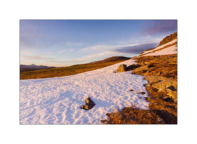
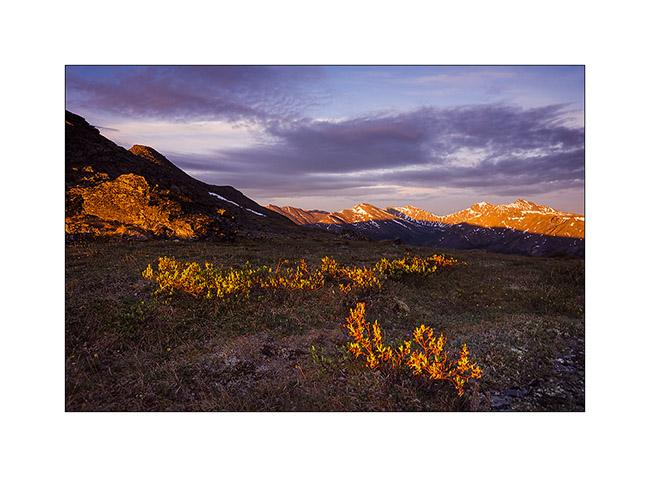
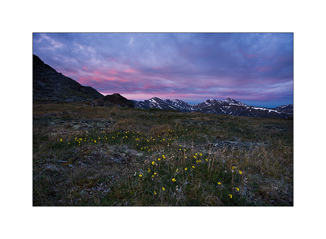
4. Quietness…
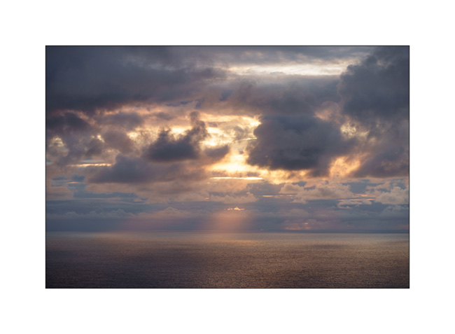
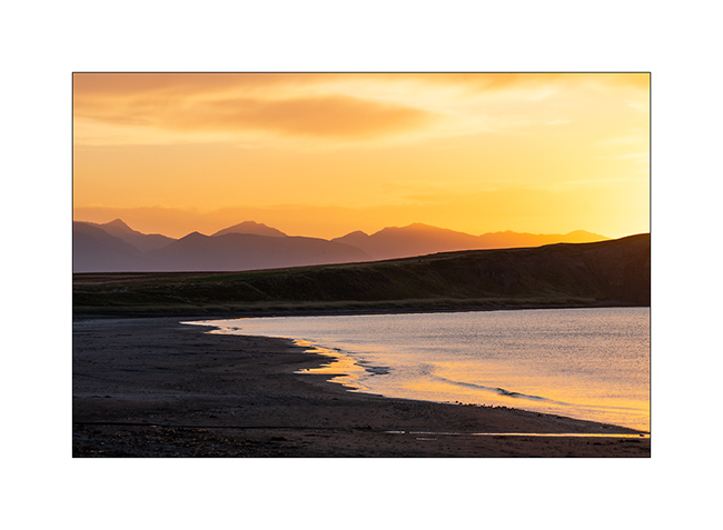
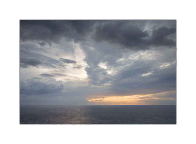
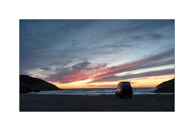
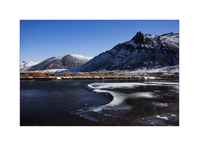
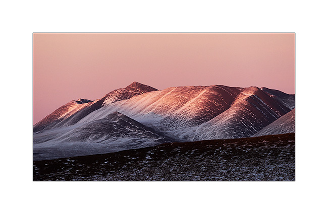
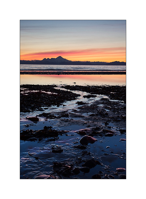
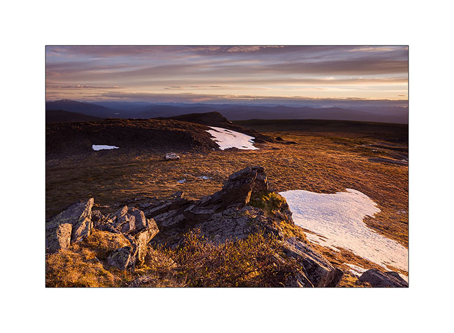
5. The rain stops, giving way to a few colors at sunset.
6. …
7. …

8. …
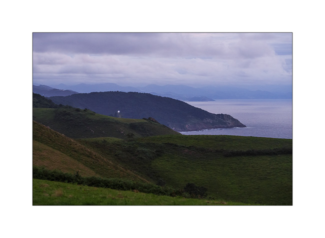
9. … The Basque coast falls asleep..
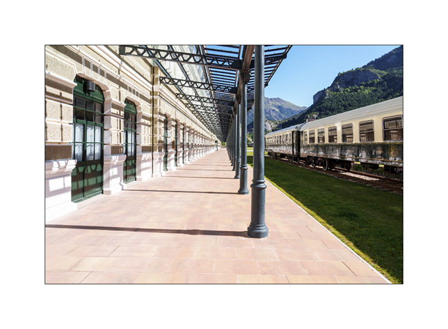
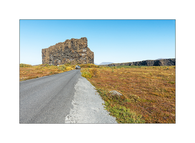
10. I wanted to discover Canfrang train station for a long time, this curiosity nestled on a pass of the Pyrenees, at an altitude of 3,900 feet elevation. I had seen images when it was disused and I’m surprised to discover that it had been completely renovated and rehabilitated into a luxury hotel!
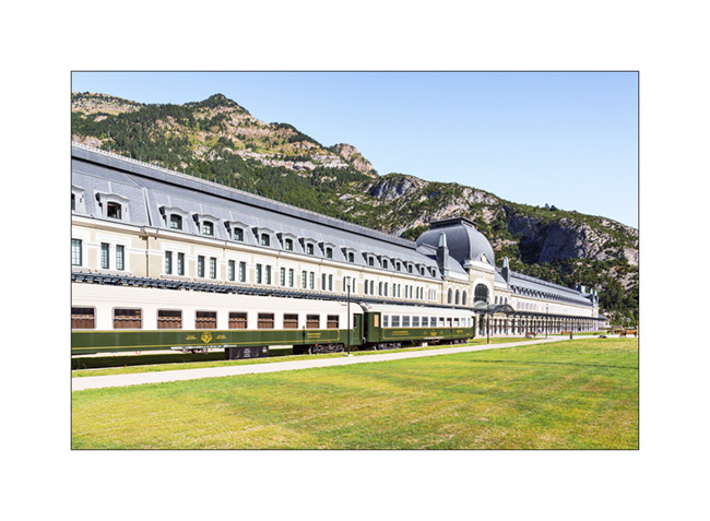
11. Surprising to find such a building in the middle of the mountains, isn’t it?
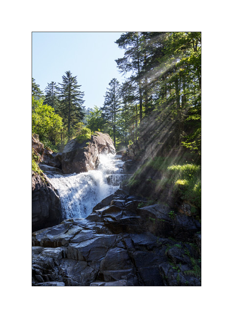
12. We reach Pont d’Espagne where we cannot sleep, the bottom of the valley having been closed to traffic after a huge paid car park in which it’s forbidden to sleep. Here the Cerisey waterfall going down towards Cauterets where we spend the night in a campingpark.
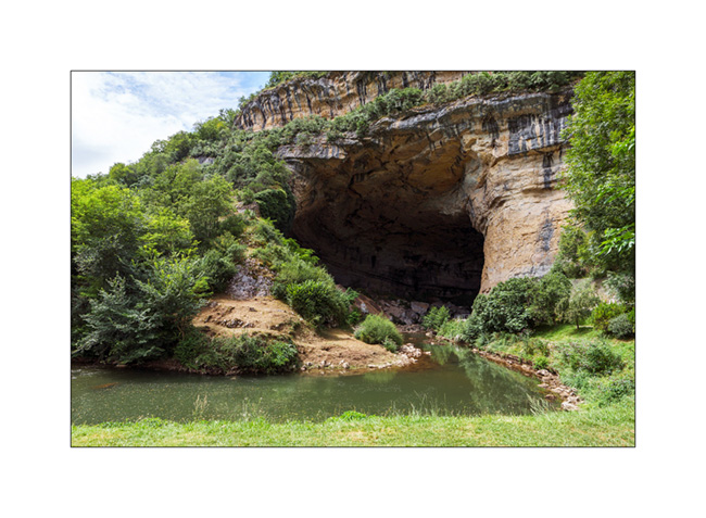
132. We head back towards Switzerland along the northern foot of the Pyrenees and discover a beautiful cave on our route: the Mas d’Azil cave. The cavity was dug by the river which runs through it and it’s so large that the road also crosses it.
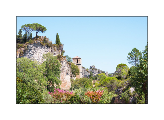
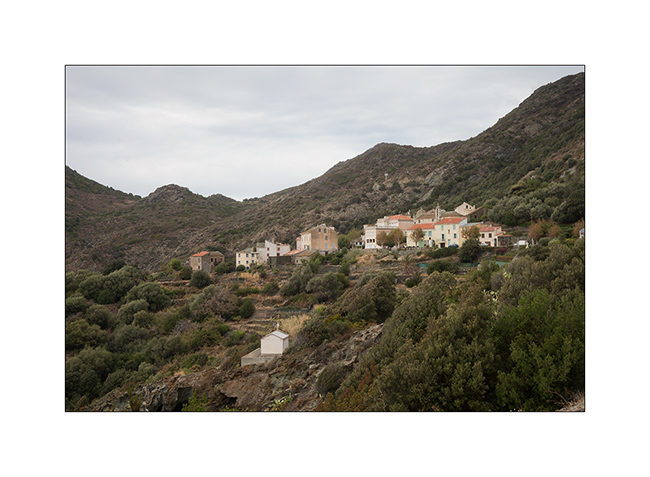
14. We sleep north of Carcassone to discover the ruins of the Four Castles of Lastours.

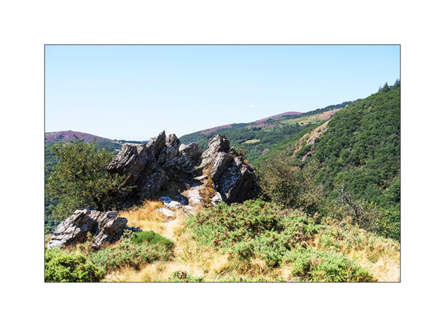
15. It is the small roads of the Cevennes that bring us back home…
16. Crossing the village of Mourèze…
And that’s it for these too short summer vacations where VivaLaVida has covered 2,600 miles.
The next articles will tell you about some fall outings…
Thank you for your loyalty to this little blog! 🙂
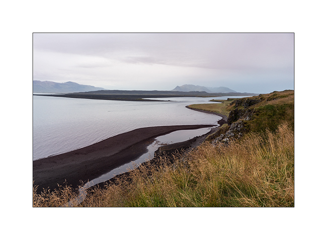
Cantabria and Basque Country (continued)
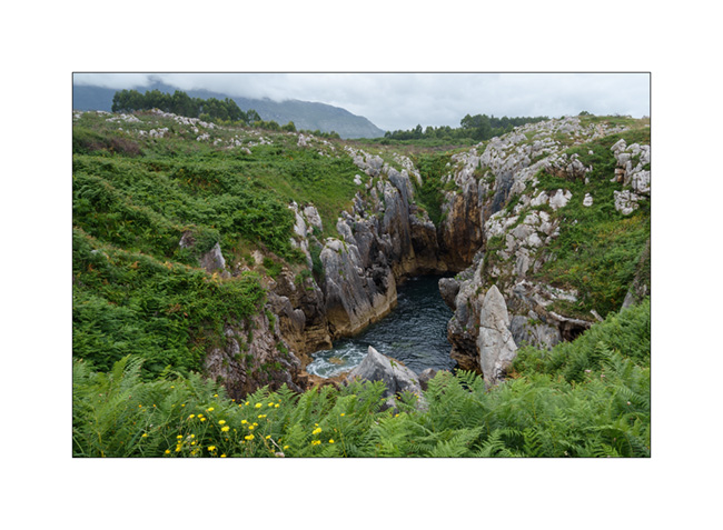
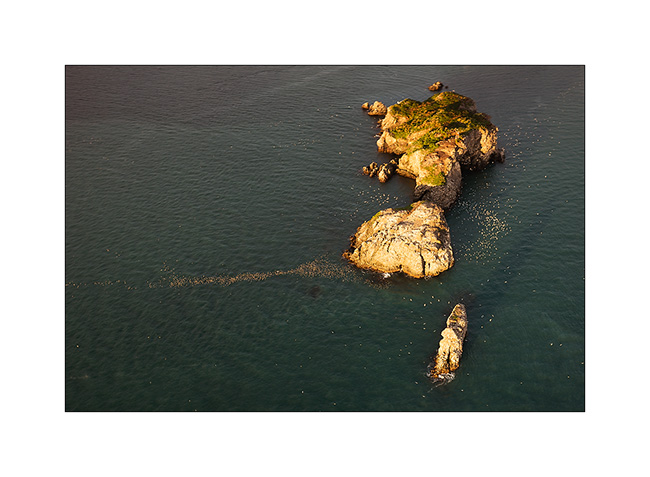
The next morning, we continue to discover this rocky coast.
1. The ocean passes through the limestone crevices to create this small lake about three hundred feet from the coast. The swell makes the water move, a rather unusual effect!
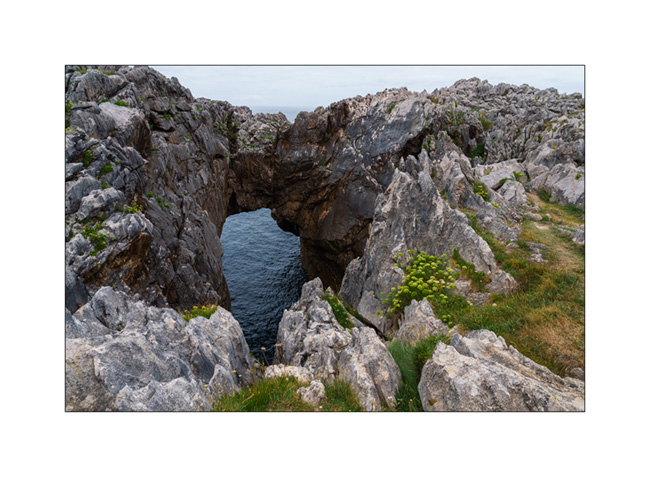
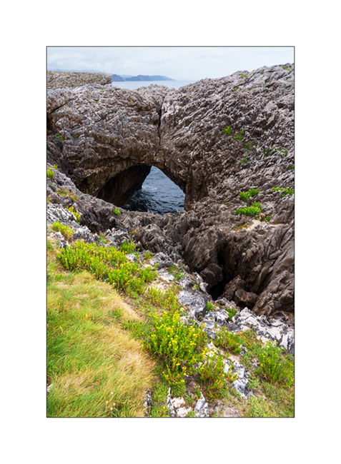
2. Another arch.
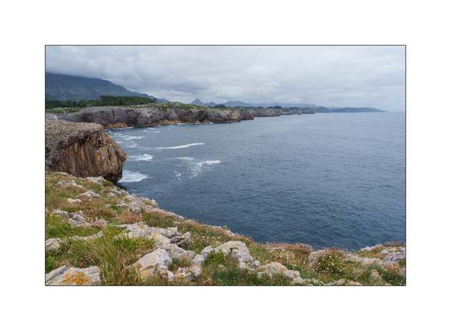
3. The coast towards West from a small peninsula.
4. And one more arch.
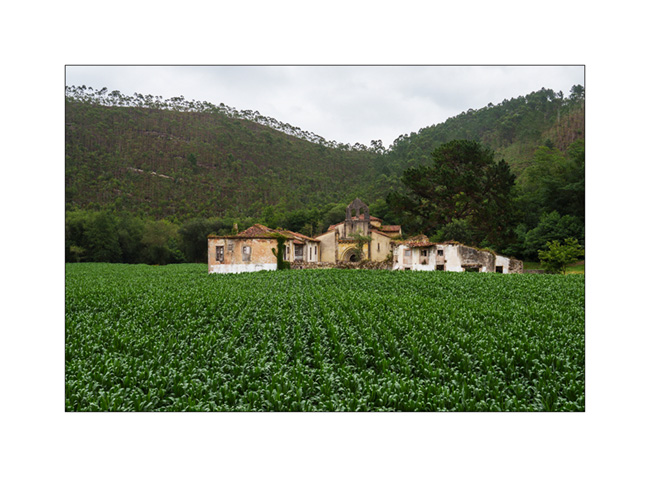
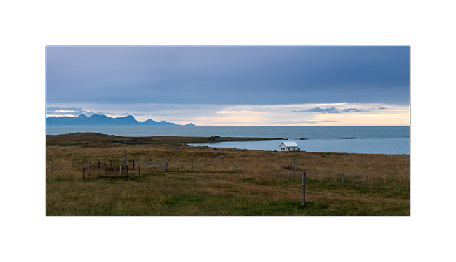
5. There are only a few days left before the end of the vacation, we are heading back east. Abandoned farm along the road…
6. Church near the village of Niembru.

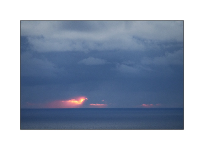
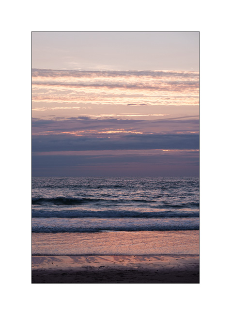
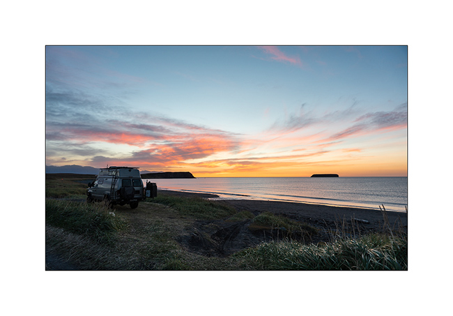
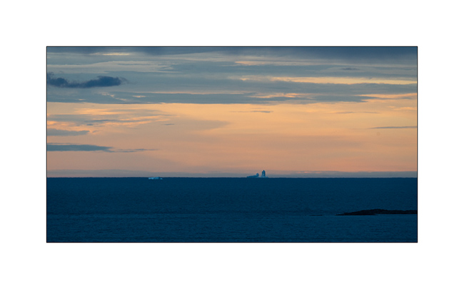
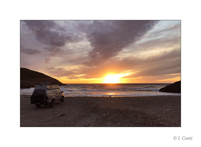
7. We sleep on a surf spot near San Vincente de la Barquera, with beautiful colors at sunset.
8. …

9. …
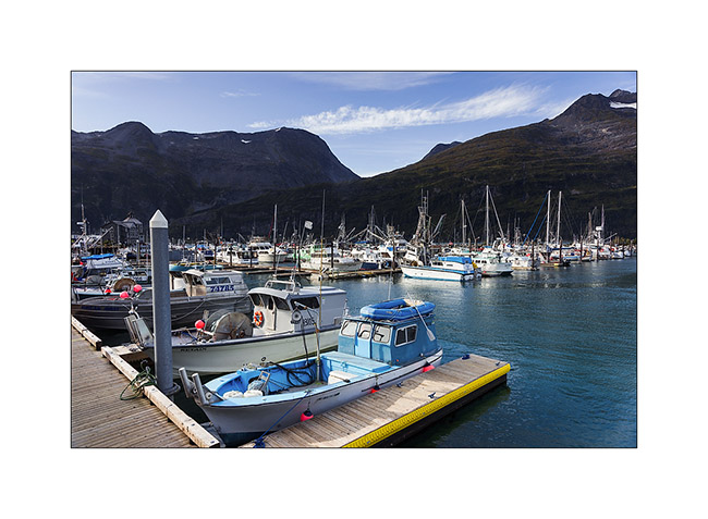
10. VivaLaVida among surfer campers.
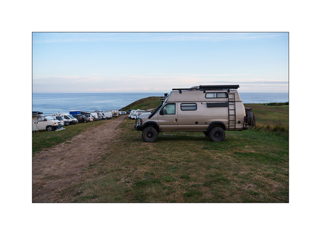
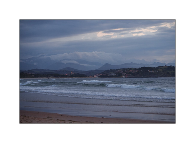
11. First light at dawn…

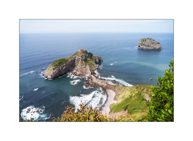
12. We continue our route in the Basque Country and make a short stop at the Hermitage of San Juan de Gaztelugatxe. It’s so crowded that it’s not possible for us to go down because all tickets for the day have been sold.
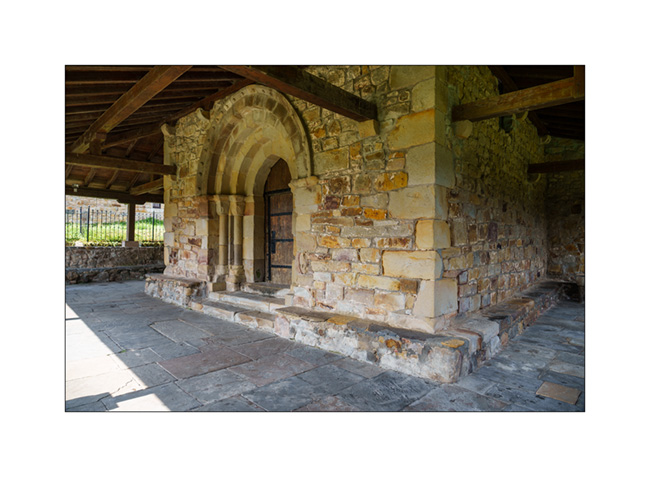
13. Church with covered passageways…

14. Main door.
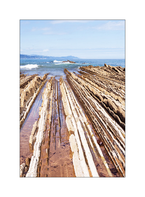
15. Another known spot where we find these layered rocks which have tilted to offer their slices to the ocean, in Zumaia. You don’t see it ont the picture but to my left, there is a beach with probably an average of 1 human per square feet! 😀
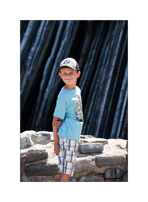
16. My son in discovery mode.
17. Layered cliff…

I will still have one last update to publish in a few days to close the story of this summer trip… See you soon! 😉
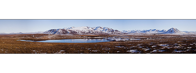
Cahors and Massif Central
It is now time to leave the Pyrenees with a taste of the unfinished while our forced stop in Valence greatly reduced our stay in Spain…
1. Leaving Montgarri in a sunny morning.
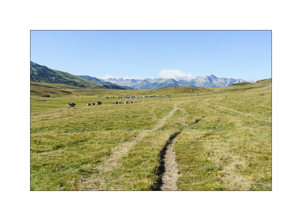
2. Pla de Beret.
3. …
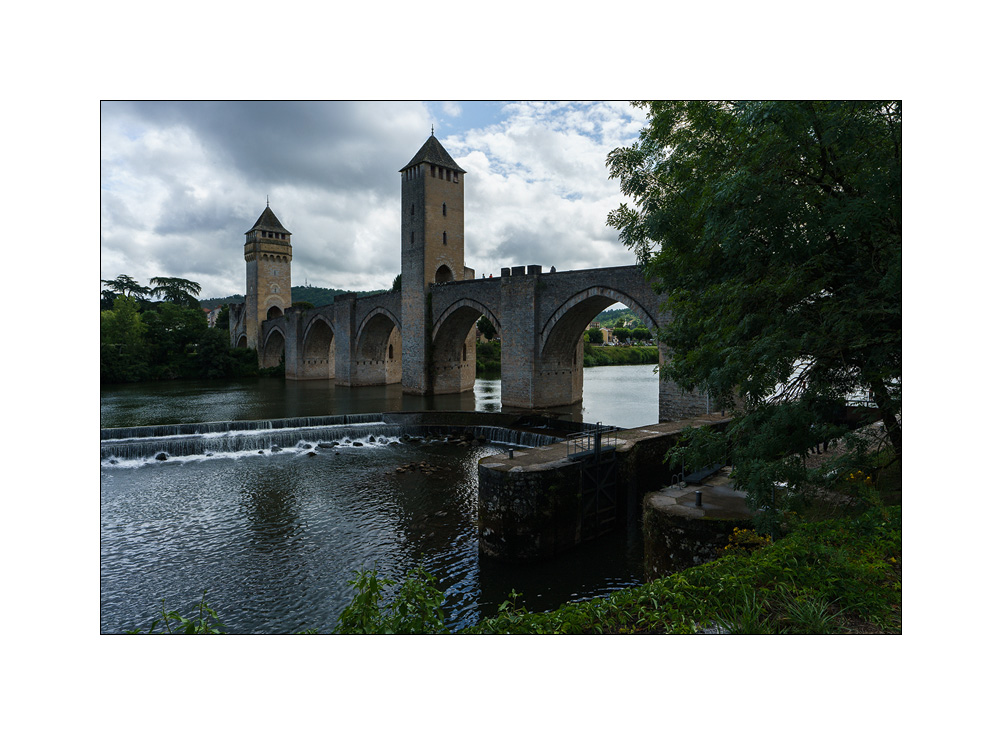
4. After a night in a forest of the Gers, we stop in Cahors to discover its famous Pont Valentré.
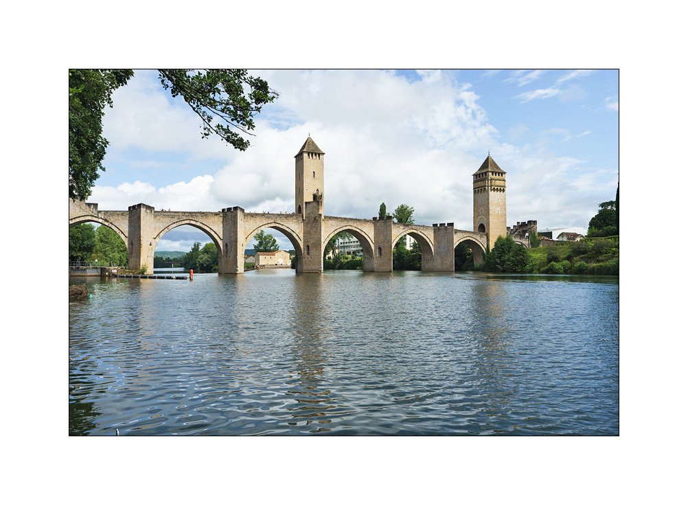
5. Quite impressive and well maintained.
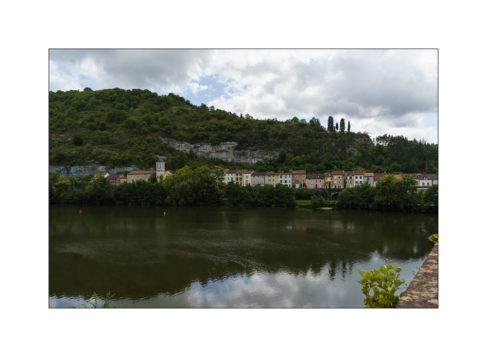
6. Neighborhood on the edge of the Lot, the river which surrounds the old town by one of its meanders.
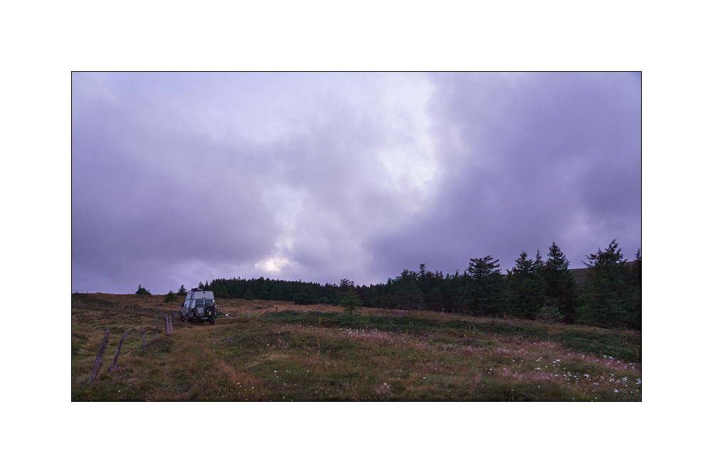
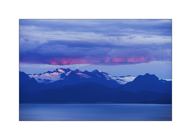
After dropping off Emile in Corrèze, on the way back, I go to sleep in the Monts du Sancy, in the Massif Central.
7. Arrival at the end of the day, when the North wind blows in gusts.
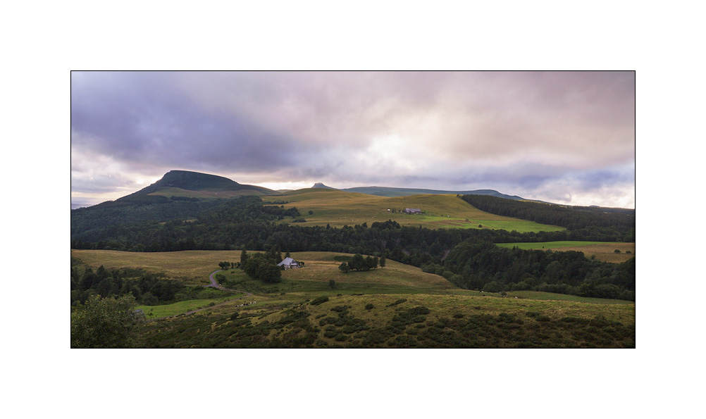
8. The mood is wonderful.
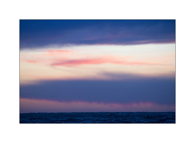
9. Sunset sky.
10. …
11. I find a corner between two hills to spend a windy night.
The next day, I will go iscover some beautiful spots in the massif. I will tell you that in a last update dedicated to these summer holidays.
Thank you for your loyalty to follow this little blog. 😀
North Coast and traditional habitat
1. The Ásbyrgi Canyon is amazing with its high basalt cliffs.
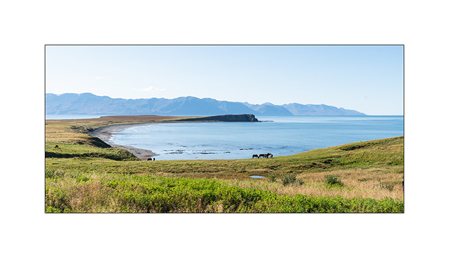
2. Beautiful bay on Arctic Ocean North of Husavik.
3. We stop there for the lunch…

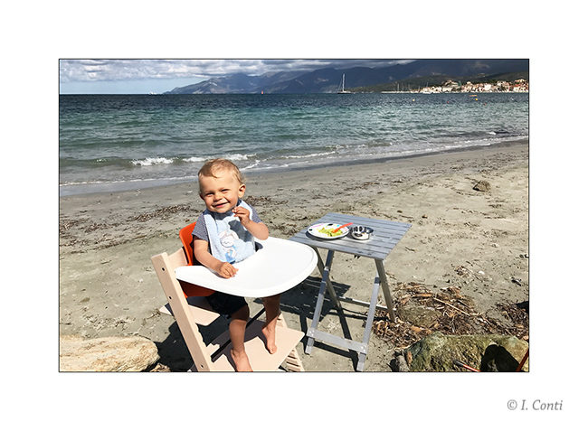
4. … the opportunity for Emile to play on the beach.

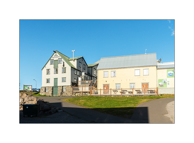
5. The small harbor town of Husavik still has some old houses.

6. Its small harbor is famous for whale watching.

7. Old houses on the harbor.
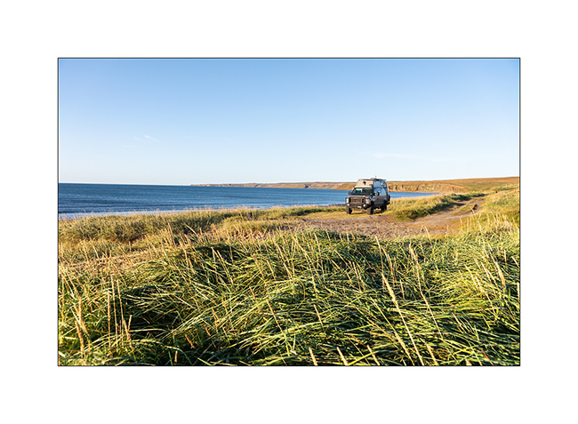
8. We return to the bay to spend the night.
9. Sunset is gorgeous!
10. Deformed sun on the horizon. We even had two sunsets, the first on the cliff then, the race of the sun being almost tangent to the horizon, the second on the ocean.

11. Iceland is not that famous for offering colorful sunsets but this one was an exception.
12. On the road to Akureyi, the big city of the North.

13. Interesting feature: in Akureyri, to support the morale of the population during the last financial crash, the red lights are heart shaped… 😉

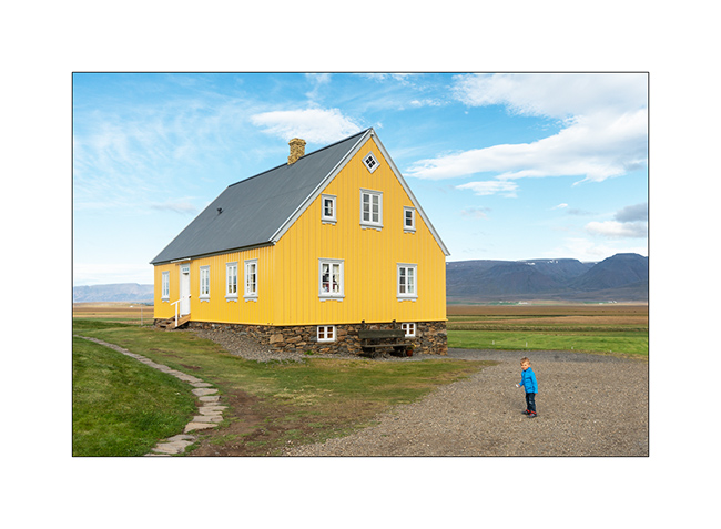
14. At the end of the day, we go to visit the historic Glaumbær farm, one of the few unspoiled which is now a museum.

15. House from the beginning of the last century.
16. The windows often had candles, supposed to limit the heat loss of the little insulated glass…

17. The farm, older, is partially buried for better insulation. Buildings are contiguous to limit areas exposed to cold.

18. Built in peat and covered with peat and moss, it was the best way to protect oneself from the cold for poor people.

19. Not far away, the beautiful old church of Vidimyrarkirkia.

20. Continuing our journey on the north coast, we come across this curious road going directly into the ocean!

21. Arrival at the end of the day on the site of Hvítserkur Rock.
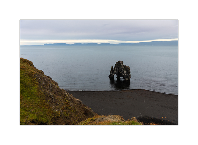
22. A spectacular lava block that rises on the ocean and evokes a troll or some extinct dinosaur grazing algae…

23. Húnafjordur Bay.
24. We camp near this little house…
25. … and discover large icebergs far on the horizon.
Next coming soon in the Northwest fjords.
North West shore
Our stay in Corsiaca continues…
1. Familly walk on the coast.
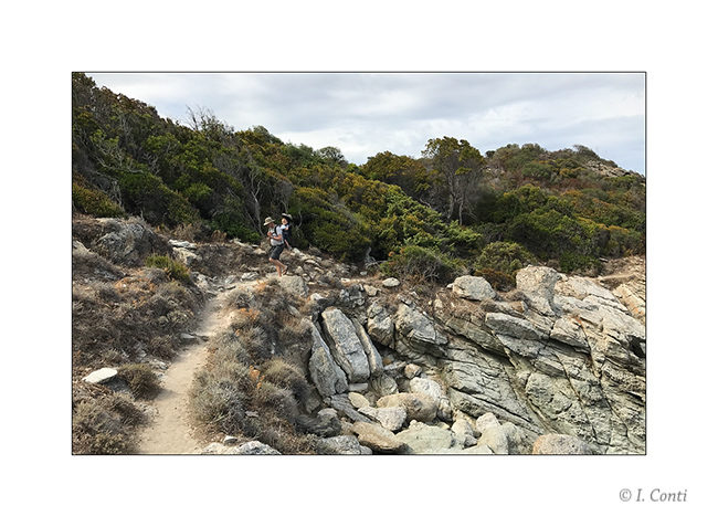
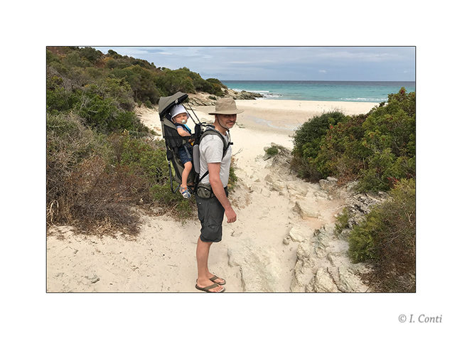
2. Emile still loves the baby carrier !
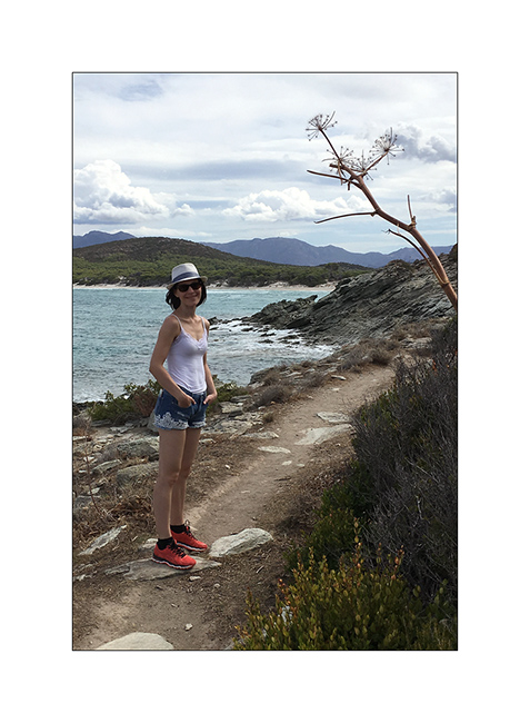
3. And Isabelle appreciates these landscapes
4. But the rain catches up…
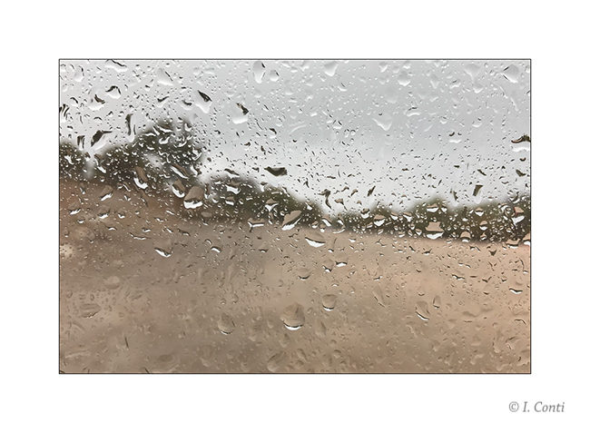
5. Fortunately, it will only last an afternoon and a night.
6. Breakfast.
7. Outdoor lunch.
8. St-Florent again…
9. La fantasmagorique plage noire de Nonza, en remontant la côte ouest du Cap Corse.
10. Sea clouds…
11. Pino, small village in Cap Corse
12. Boondocking in a pretty cove.
13. Horizon…
14. Afterglow…
Next of our Cape Corse discovery to come soon…
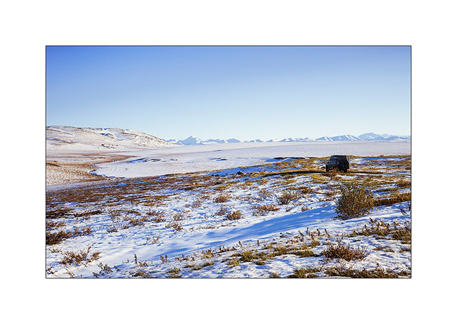
In Canyonlands area…
I went to see other places in Canyonlands NP, first in the beautiful Lavender Canyon.
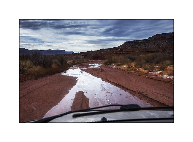
1. The access road goes nearly 20 miles up in a wash. There is some water, partially frozen in places, witness of the recent weather disturbance (the one I had at Black Rock).
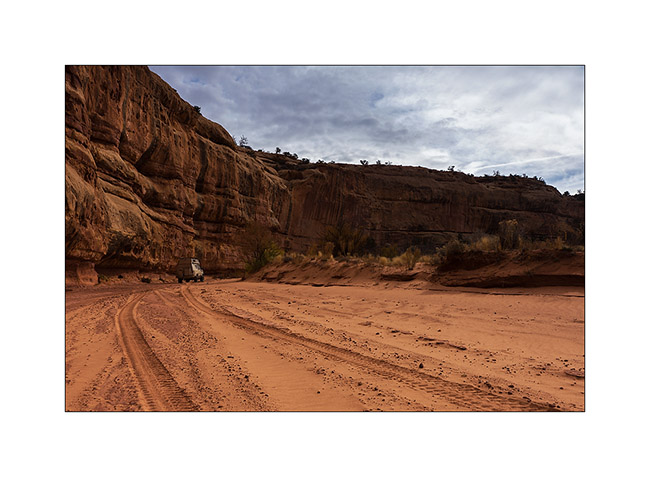
2. VivaLaVida is small under the vertical cliffs of the canyon.
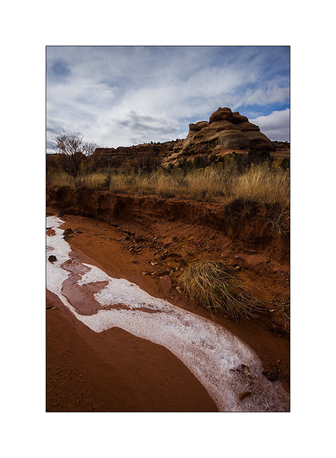
3. Only way to show you that it’s cold in the desert too…
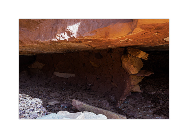
4. In a side canyon that leads me to Long Arch, I discovered some remains of an Indian granary dating from approx. 2,000 years.
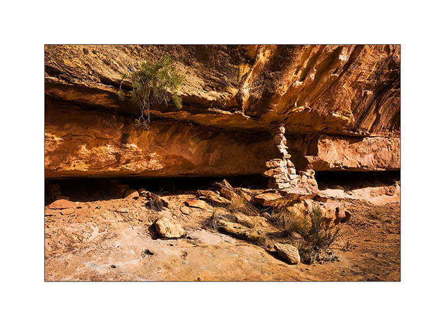
5. They protected their harvest by sheltering it in cliff cavities, closing access to rodents using mud and stones.
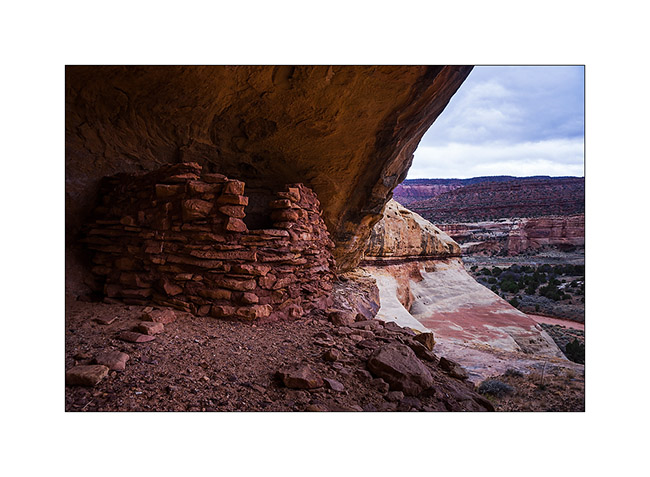
6. Further in the West Fork Lavender Canyon, I discovered a nearly complete shelter in half-wall height.
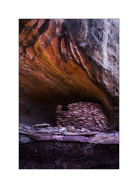
7. It will take me several attempts to find a path leading to it.
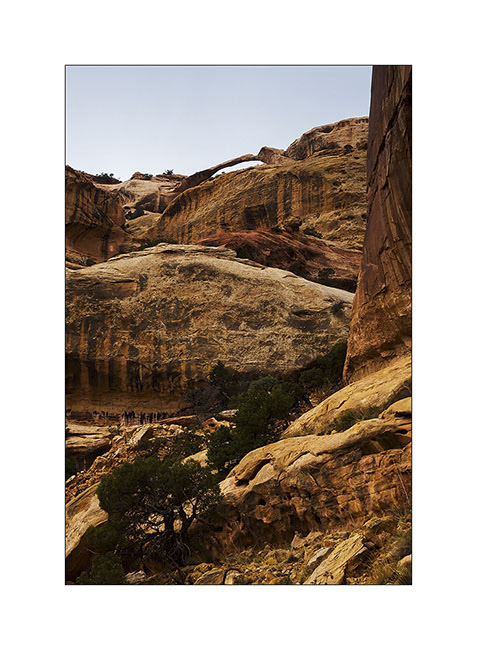
8. After three hours of hiking, I discovered the elegant Long Arch, little known because really remote. I’ll have to study the map to see if there is way to access from the top because no way to get closer down here.
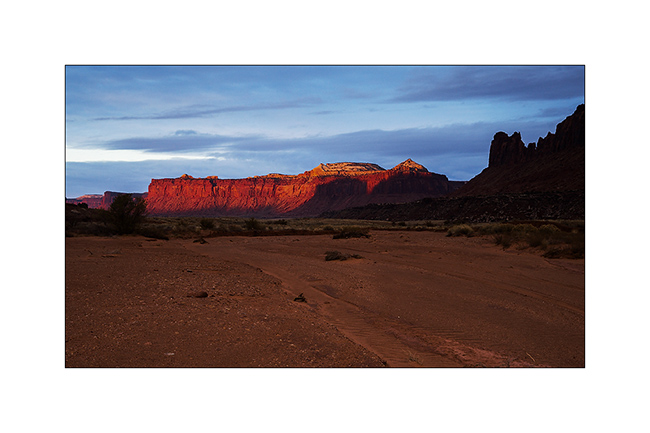
9. I take some showers of sizzles on the way back. But at sunset, a short ray colored cliffs around in this amazing red .
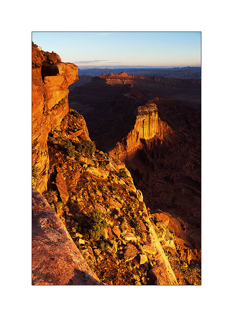
10. After a day of transition, I went to sleep at Anticline Overlook to enjoy the morning light.
11. Scenry over Hourah Pass and Moab Rim is impressive.
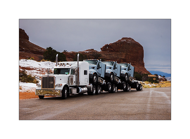
12. The weather get cloudy again and showers of rain/sleet follow one another. But I stop to show you how they transport trucks here! 😀
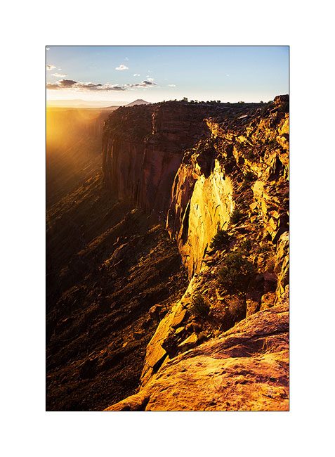
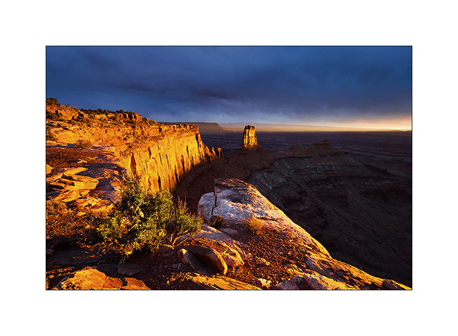
Having spotted the previous day an interesting point of view, I tried the gamble to go there for the sunset despite the rain and stormy Wind that got up, hoping for a sunray at sunset. The track was very bumpy and almost 20 miles long, VLV needed two hours to get to.
Arrived there at around 4PM, I went locate places to try to find a nice composition, aware that if there would be some sunlight, it would be brief. I finally found a composition I like, not without some apprehension because I was on a block overhanging a 600 feet cliff. It’s 16:30, I sit nearby and wait. It is downright cold and I’m beginning to think that I have come all this way for nothing…
But ultimately, the Gods of Light rewarded me with a moment of insane intensity! It did not last five minutes, just long enough for the sun to go under the clouds before to set. But the light was so intense, contrasting with the dark and low snow skie, gilding the cliff in a so bright yellow-orange..! A moment of pure happiness for my photographer’s eye. 😉
13. Firing…

14. Bis.
At once I prepared a luxury aperitif before processing these images… 😉
15. The next day, the snow has changed the appearance of the place.
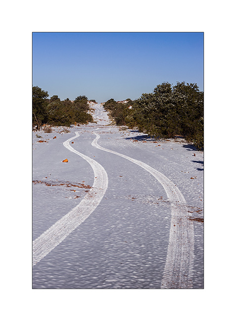
16. The track of VLV, alone on snow, as a symbol of her journey, often trough almost desert places…
17. Contrast with the red sandstone is striking. Here, the small arch of Looking Glass Rock.
18. VivaLaVida is then went in the La Sal Mountains for a taste of winter.
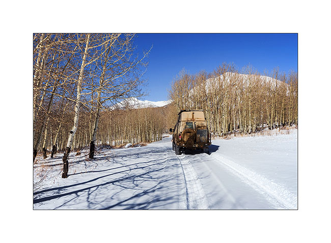
19. Aspens have lost their leaves for some time but proudly raise their silhouettes in the sky.

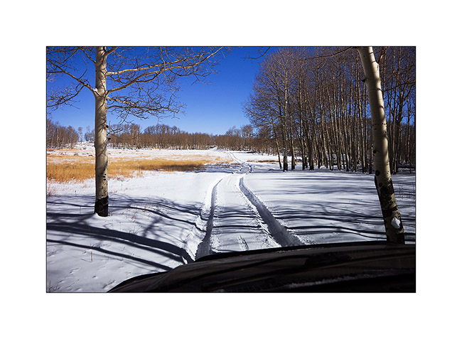
20. There was too much snow for me to cross the La Sal Pass, I had to turn back.
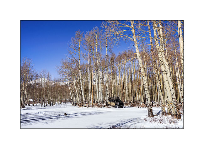
21. Nice place for a small lunch, isn’t it? 😀
More in the next update…
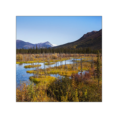
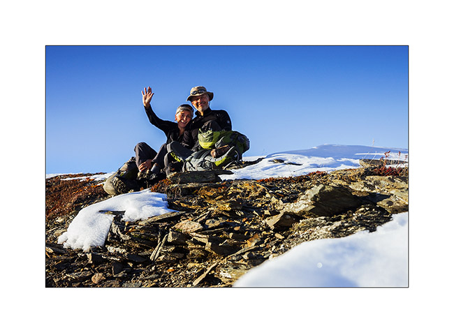
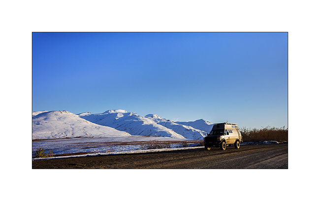
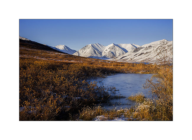
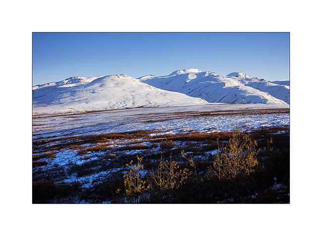
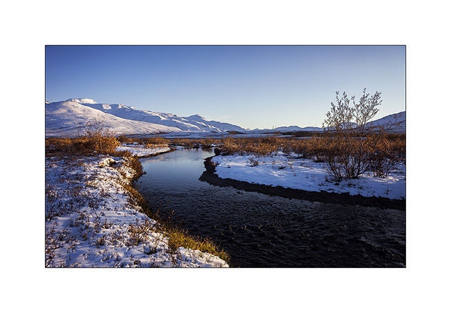
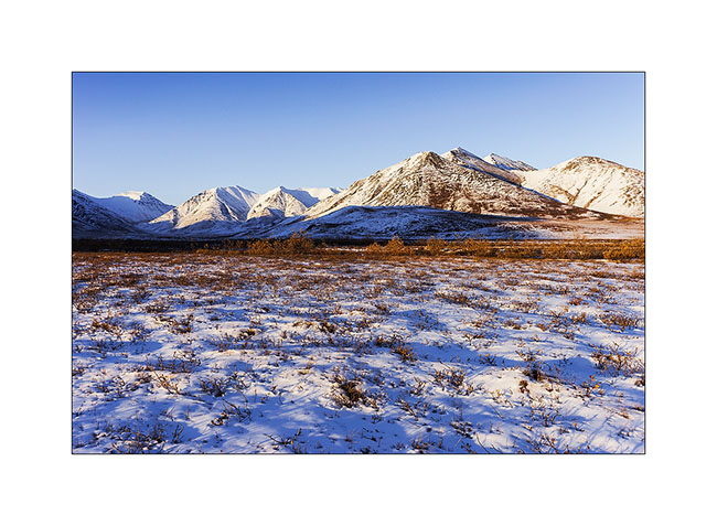
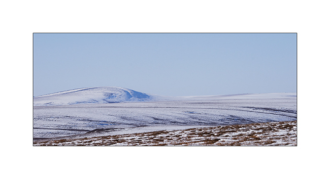
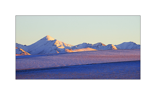
Brooke Range and arctic tundra
We continue farer northward…
1. Nolan valley, a side valley accessible by a really muddy small mining road .
2. At this altitude, the marshes are still not frozen.
3. I found the Brooke Range that bars northern Alaska back.
4. We stop a few dozen miles after Coldfoot to go climbing one of the mountains beside the road.
5. While VivaLaVida begins to climb Antigun Pass, the atmosphere becomes wintry.
6. All is already frozen here…
7. … and it is already well below freezing in late afternoon.
8. As it’s already late, we find a nice boondocking site before Antigun Pass, approx. 4,000 feet elevation on the banks of a small river.
9. Despite the cold, I’m going to make some pictures while Mino is preparing the aperitif!
Temp will almost reach 10°F that night and VLV’s heater resume service after resting for a few months…
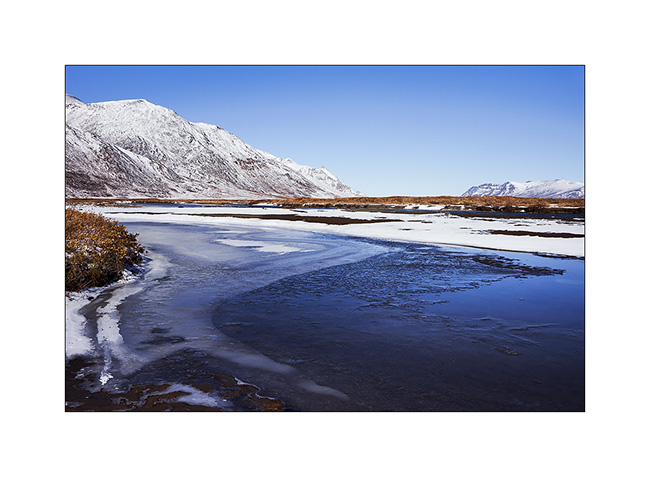
The next morning we cross the Antigun Pass and stop thirty miles down it to go hiking along a beautiful river.
10. The blizzard that blew here two days previously installed winter before autumn has arrived…
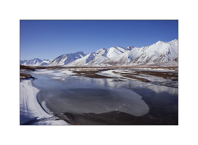
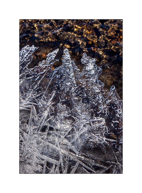
11. Despite a significant current, the banks of the river are well frozen. It was about -5F° in previous days…
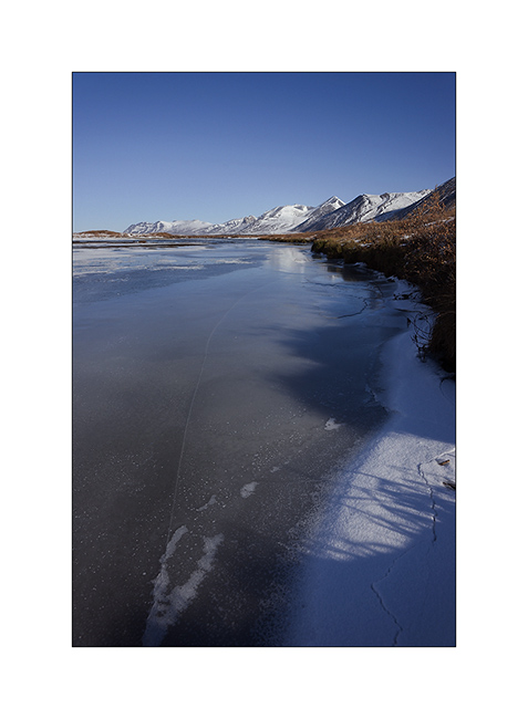
12. I enjoy the clear light to play with ice concretions…
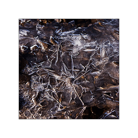
13. … sometimes contrasting and twisted…
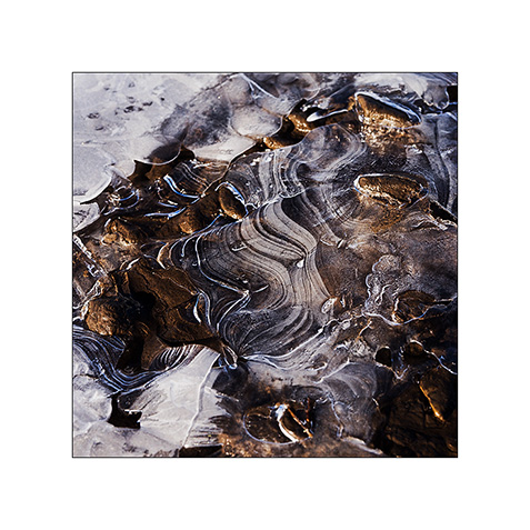
14. … sometimes carved by running water below.
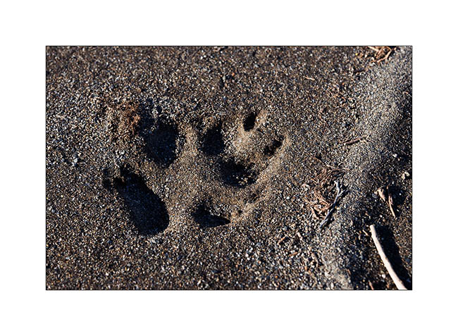
15. On a bank, we find wolf tracks. It happened here less than two days ago, the snow testifies it.
16. The show is sparkling as the river is freezing and carries plates of ice that break in crystal clear sound…
17. … and our eyes feast.
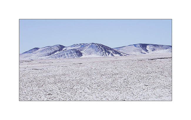
18. Continuing towards the far north, the landscape becomes truly arctic.

19. Blizzard designed the reliefs.
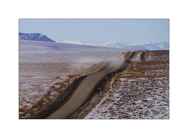
20. Not sure that the truck drivers who supply Deadhorse and Prudhoe Bay are all aware of this beauty…
21. We leave VivaLaVida to walk on a side track…
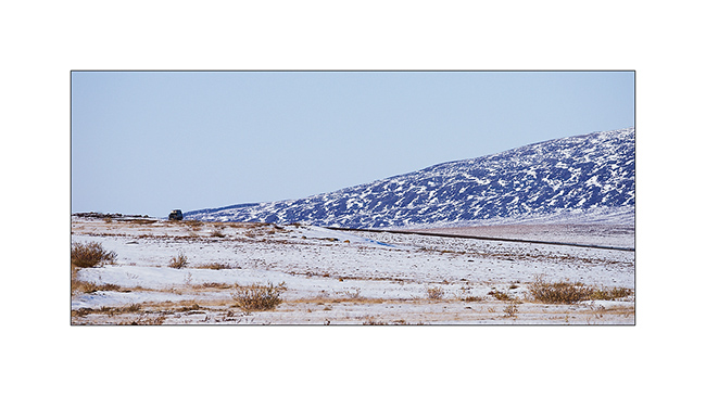
22. Perfect lines of the wintry tundra…
23. We will not go to Deadhorse, the last part of the track is less interesting. We stop at the last foothills of the Norths Brooke Range…
24. … and even find a camp on the tundra. What a fantastic place to camp, isn’t it? 😀
25. The Sunset is beautiful again…
26. … the last rays coloring the hills…
27. … before a magic full moonrise.
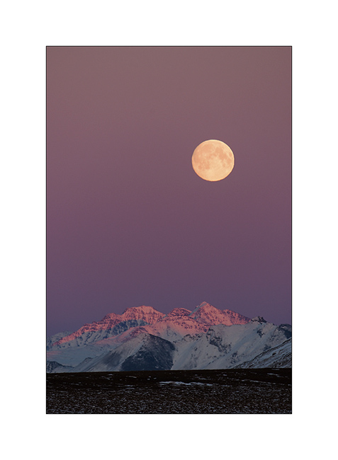
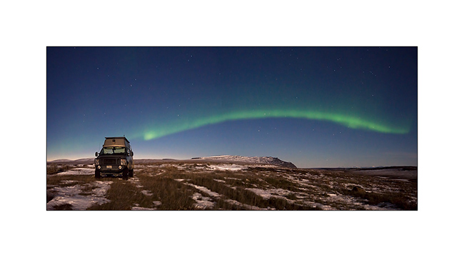
28. And to complete this grandiose day, a northern light came to wish good night to VivaLaVida while the full moon was lighting up the tundra!
We began our descent back to the South the next day. To discover in the next update… 😉
Thanks again for your loyalty!
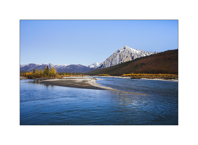
Kenai Peninsula (2)
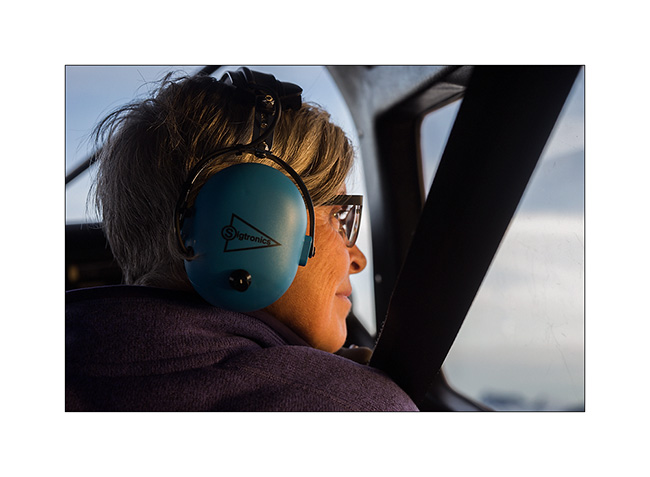
Still near Homer, the next day we decide to flight over the Harding Icefield, one of the giant icefields that covers the southern Alaska. We chose a small seaplane and to fly between 7:30 and 8.30 PM hoping for a nice light.
1. As soon as we take off, we can see some first glaciers.
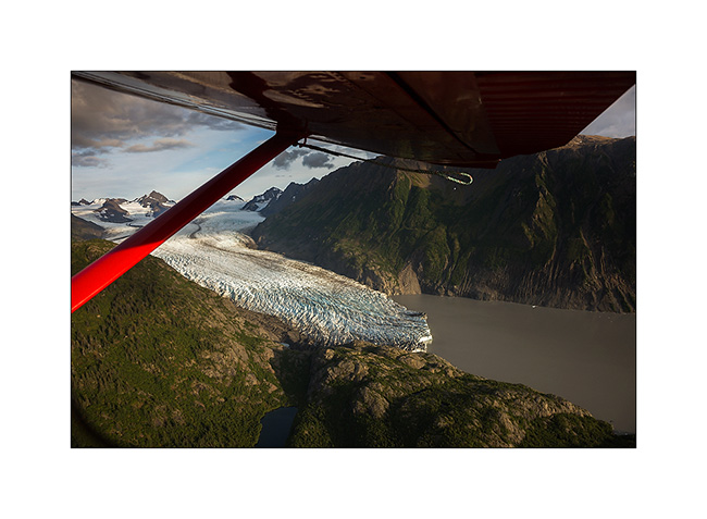
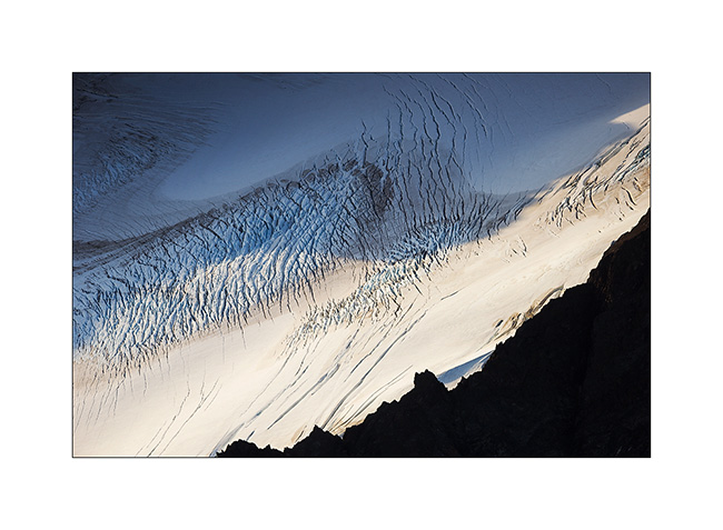
2. Fifteen minutes later, we fly over the Harding Icefield : almost 70 miles long and more than 30 miles wide!
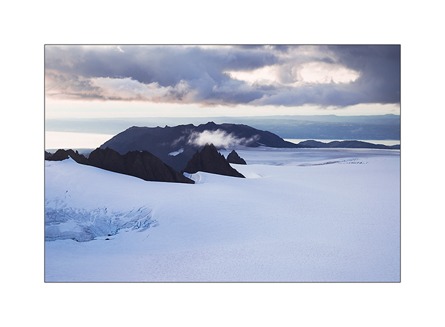
3. Large glaciers go in all directions.

4. Besides the pilot, Mino doesn’t loose a crumb of the show.
5. Some light gaps offer me nice views…
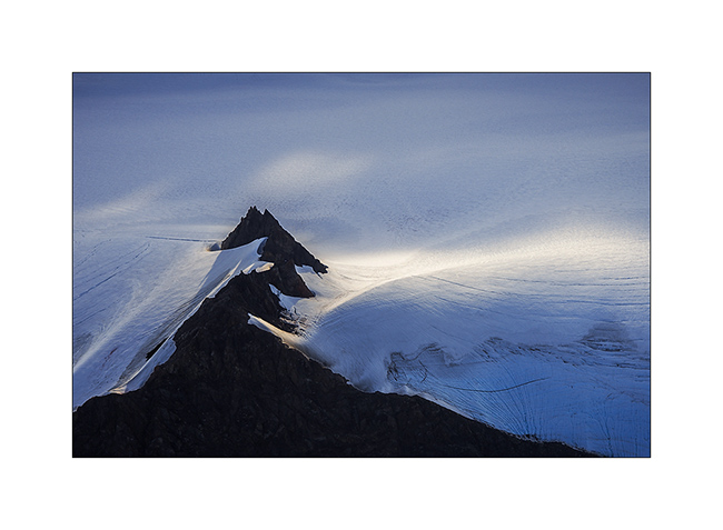
6. Motionless cascade…
7. On the way back to Beluga Lake, our “sea strip”, we flew over an island, refuge for thousands of birds.
8. We leave Kachemak Bay at sunset…
9. … with a beautiful view of Kodiak Island in the distance…
10. … to find a wild place in the dunes, near Anchor Point.
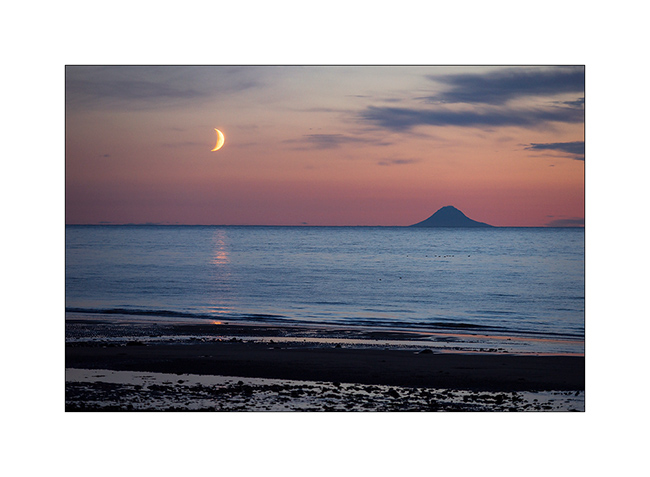
11. Sunset over Cook Inlet and Iliamna volcano; there are worse places to sleep, isn’t it? 😉
12. The moon also goes to sleep near the volcano island Augustin…
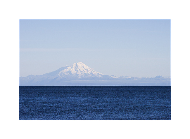
13. An air of Mount Fuji, isn’t it? But it’s another volcano: Mount Redoubt.
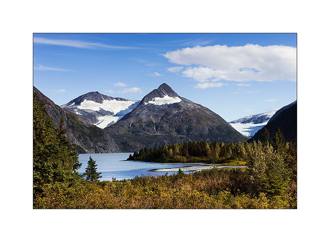
14. Going North to Anchorage, little detour toWhittier and short stop at Portage Lake, a beautiful glacier lake.
15. Whittier harbour, at the bottom of a fjord in Prince William Sound.
16. While seeking for a place to camp…
17. Late afternoon in the mountains…
After this brief jaunt to the Kenai, we’re back in Anchorage awaiting a response to a possible change of Mino’s return flight that could allow us to stay longer to explore this beautiful Alaska. We will keep you in touch in the next update! 😀
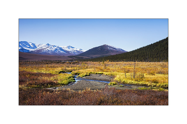
Central Yukon
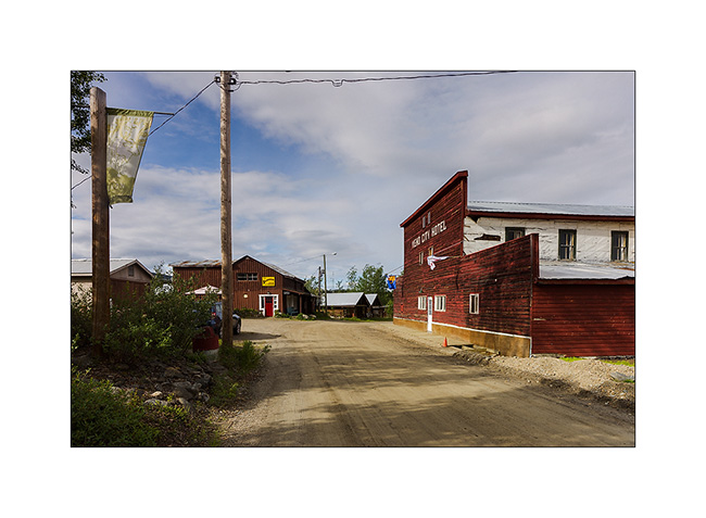
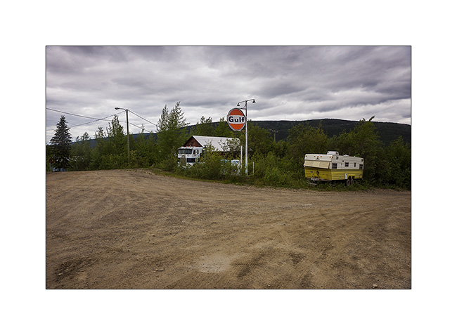
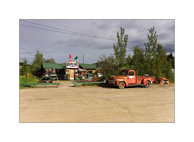
Still in central Yukon, I visited Keno City, a “City” of 21 inhabitants actuelly ! I must say that the price of silver and zinc are really down, so the mines are actually shut down.
1. The hotel and one of the two bars of this quite surprising “like out of the past” village.
2. Service.
3. The other bar with the owner’s car still running!
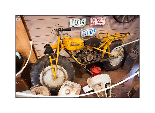
4. In the well-stocked museum on past mining, a two-wheel drive motorcycle for mud terrain!
5. Again up the mountains for the night, I admired a gorgeous sunset.
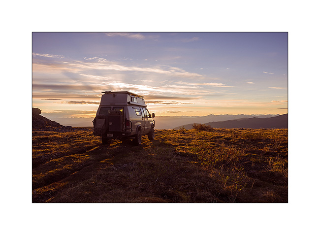
6. Nice boondocking site, isn’t it?
7. Some snowpatches remain at this elevation.
8. Magic light at midnight…
9. Last gleams under the clouds…
10. Another mining site from early 1900.
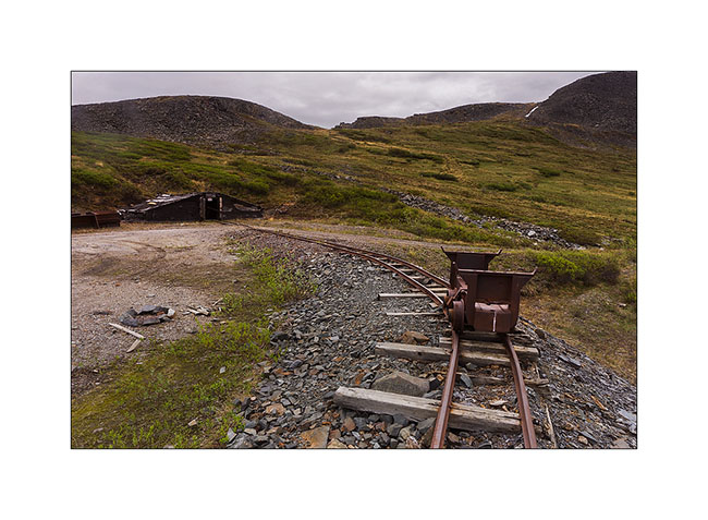
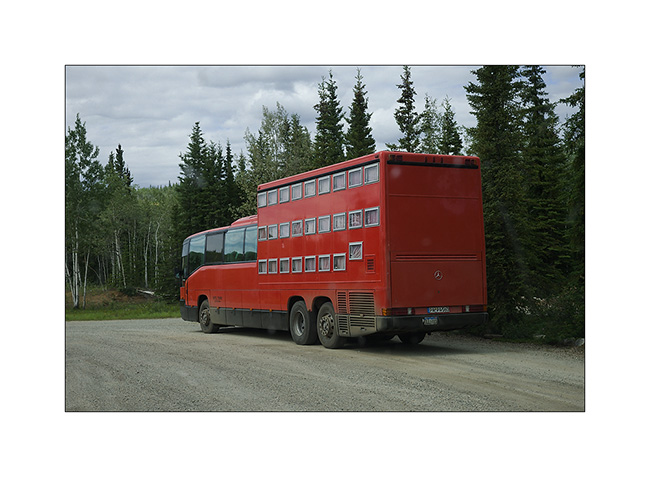
11. Resuming the Klondike Highway to the north-west, I can not believe my eyes! A “rolling hotel” almost like those we had seen in Romania forty years ago. Each passenger has a “drawer” as bed! It is envy, isn’t it..? 😀
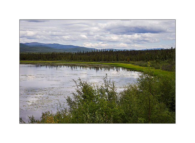
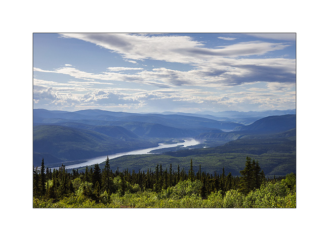
12. One of the many lakes along the journey…
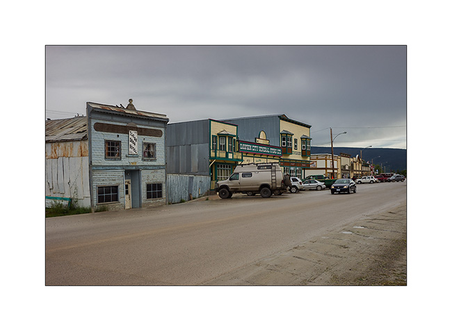
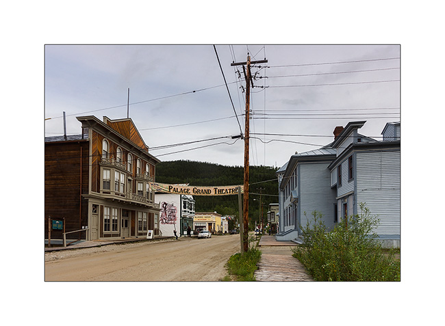
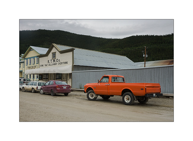
13. Dawson City, a villa quite special, festive, almost without modern building; so far removed from all that many people make quite everything here, especially at night in the local casino or one of the many bars…
14. The “continues to produce Belle Époque-style shows every night.
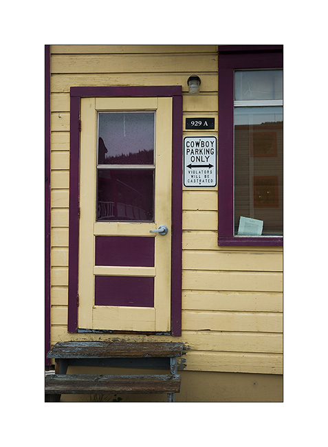
15. Funny advertising for this store… 😉
16. Euuhh, can I really park there..?!! 😀
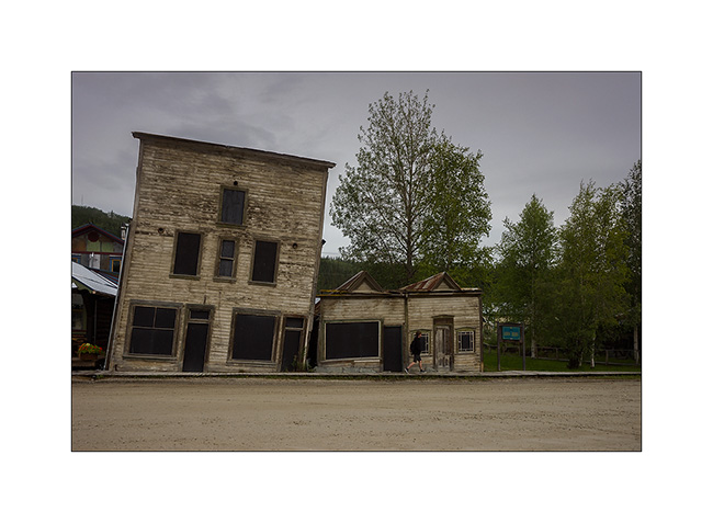
17. An example of the difficulty to build on permafrost. These buildings are a century old. Protecting the soil from the cold during the winter, they make the permafrost melting, destabilizing their poor foundations. So they continue to “sink” into the ground.
18. Overview on the city along the Yukon River…
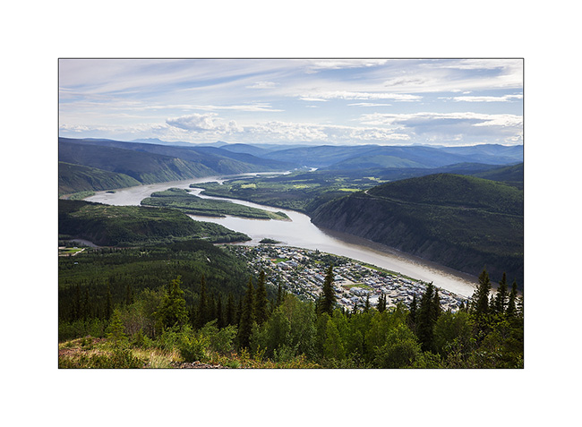
19. … which continues her journey toward North_East.
Vivalavida then took the path of the great north on the Dempster Highway, a road that still frightens many travelers. A thin ribbon of over 750 km through boreal forest and tundra, which turns into slippery mud in the rain, mainly driven by the large trailer trucks supplying Inuvivk at the terminus, with a single service station / motel more or less mid-way… To come soon… 😉
 D5 Creation