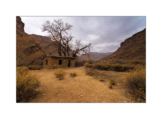
ruin
now browsing by tag
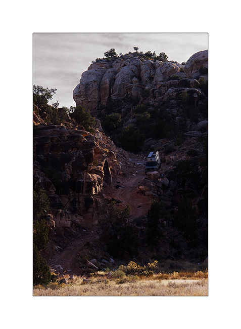
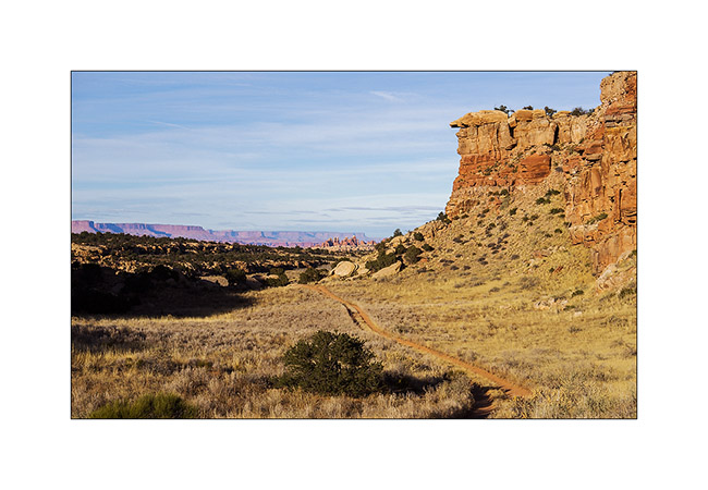
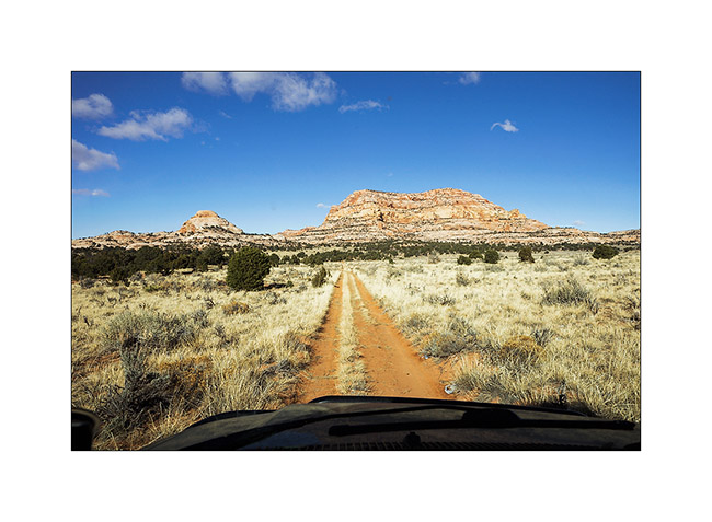
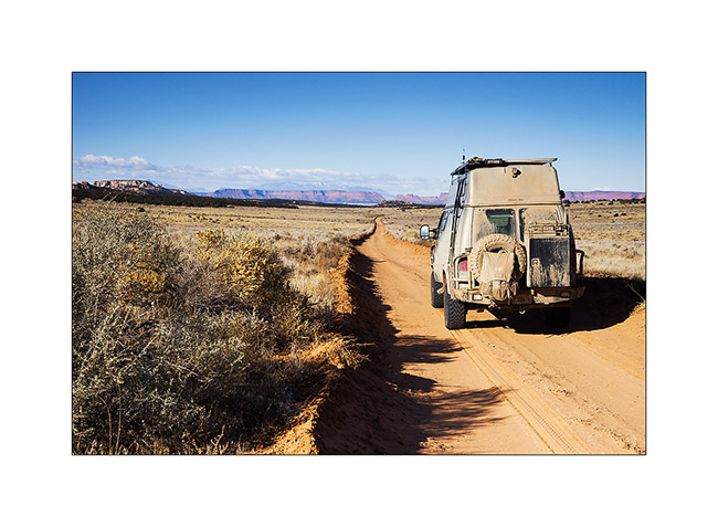
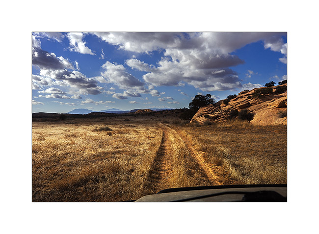
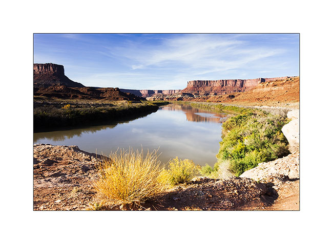
The crossing to the east continues…
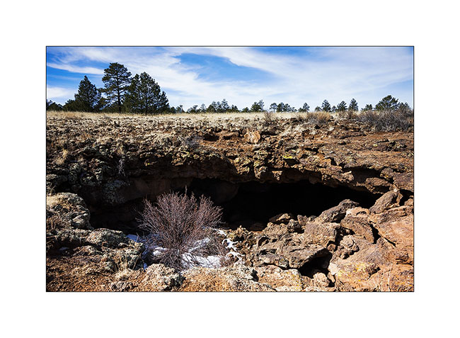
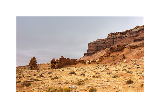
Still in New Mexico, I crossed the El Malpais area – “the bad country” – a volcanic site that spread a large lava flow approx. 3,000 years ago…
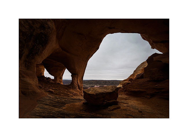
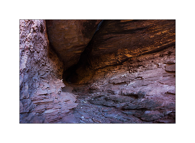
1. A lava tunnel revealed by the partial collapse of its vault. Its access was closed to protect bats that overwinter there.
2. View the gigantic lava flow from El Malpais, an Hawaiian type volcano. It covers nearly 35 miles.
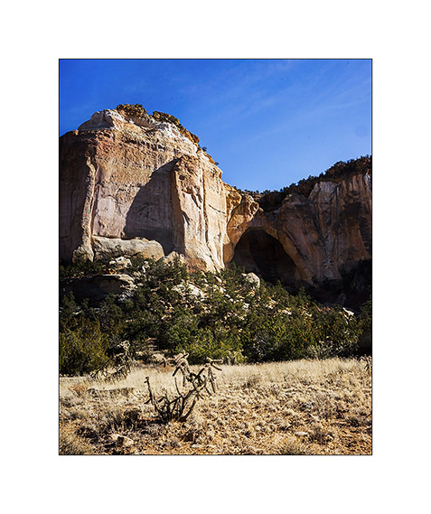
3. La Ventana Arch, one of the largest natural arch in New Mexico.
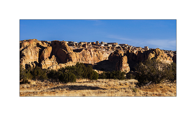
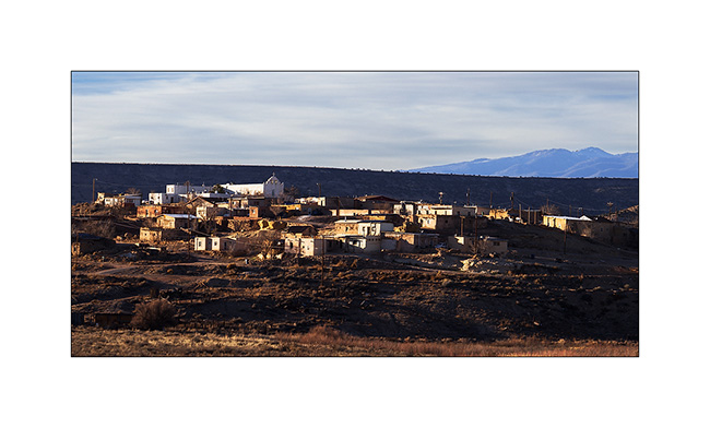
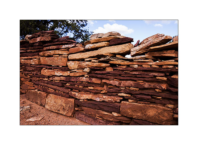
4. The Pueblo Acoma on a hill of sandstone. I have not been allowed to visit it, the access being restricted, paying and … suspended for the winter!
5. Further, the Pueblo Laguna Library and its Hispanic-style church.
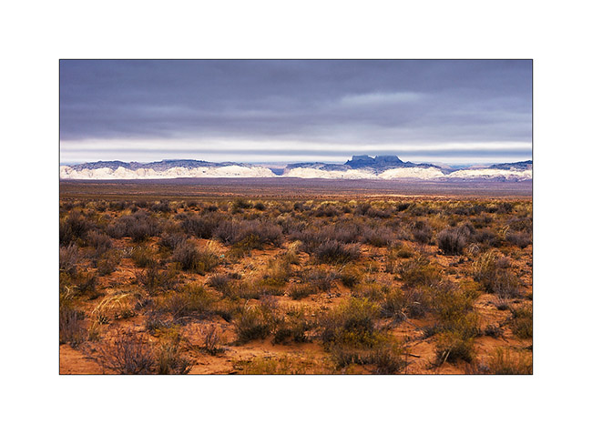
6. The next morning I woke up on the Valdez Caldera, remains of a giant volcano that collapsed on itself. This caldera is 14 miles in diameter!
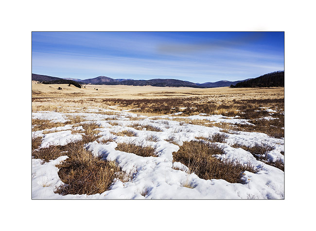
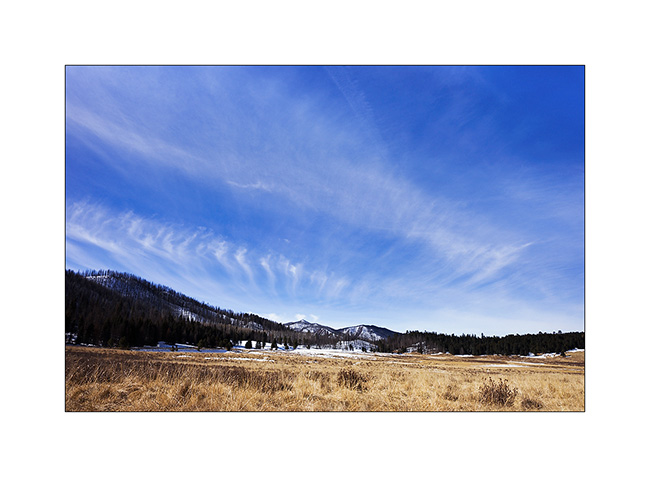
7. Beautiful sky while there is still a few snow at over 7,000 feet. Yet, for 5-6 years, the place doesn’t receive the usual 6-10 feet snow…
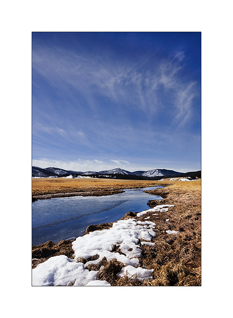
8. East Fork River.
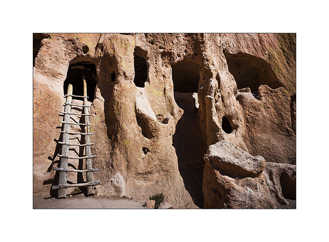
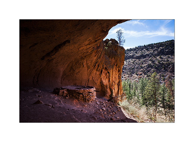
9. By collapsing, the volcano has poured an incredible amount of tuff nearly 55 miles around, sometimes more than 600 feet thick. It’s in a canyon carved in the tuff that are the Bandelier Dwellings. In addition to the cavities in the tuff, the Indian built houses at the foot of the walls. Note the horizontal rows of holes that allowed to fix the frames on the wall.
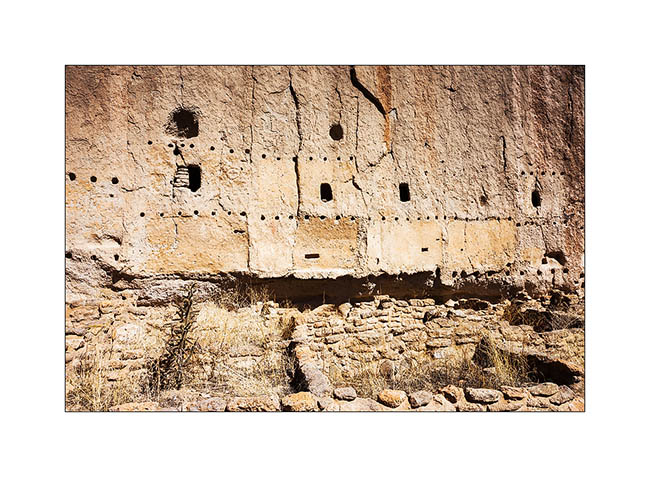
10. Natural cavities.
11. They were connected by passages duged into the tuff. Note soot that still covers the vaults.
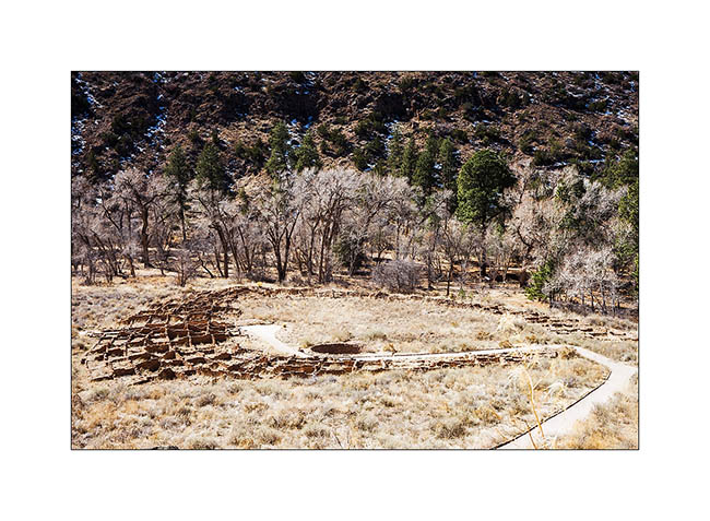
12. At the bottom of the canyon, the ruins of an impressive semi-circular pueblo.
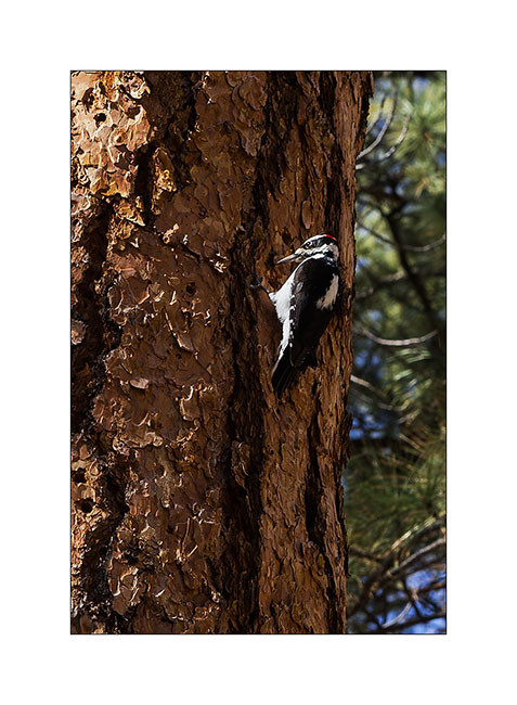
13. A local resident who allowed me to approach, which is rare for a woodpecker.
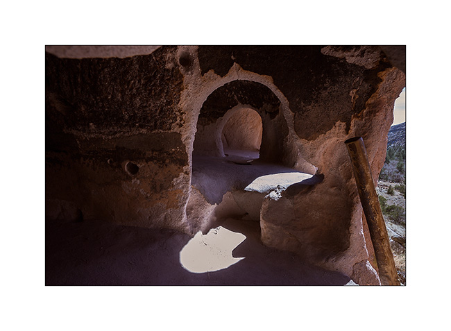
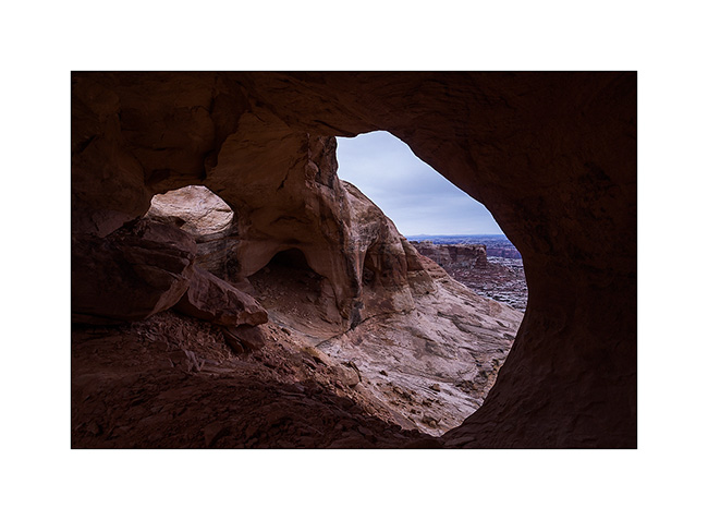
Further upstream, there is a kiva – a room for rituals and ceremonies – found almost intact under a large overhang; only the roof was rebuilt there sixty years ago. It is 140 feet above the canyon and you have to climb on long ladders to get there.
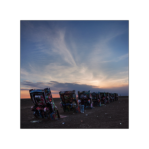
15. Detour in Oklahoma to discover the original work of an artistic collective: 10 old cars planted in the ground from the front…
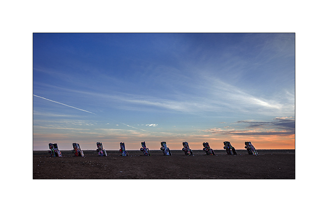
16. Quite original, it must be said. Too bad, I arrived a little late, the light wasn’t great…
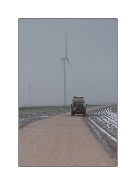
17. Winter wake up in the middle of a Wind mill field in which I spent the night. It was blowing a strong blizzard (announced between 50 and 60 mph!) and actual temperature was 15F…
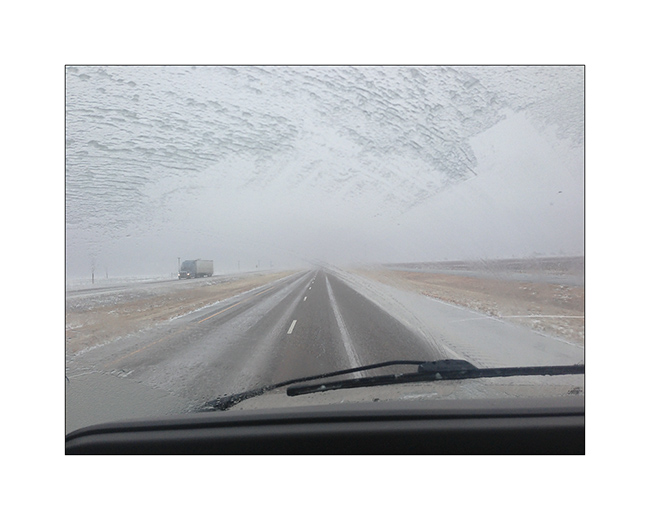
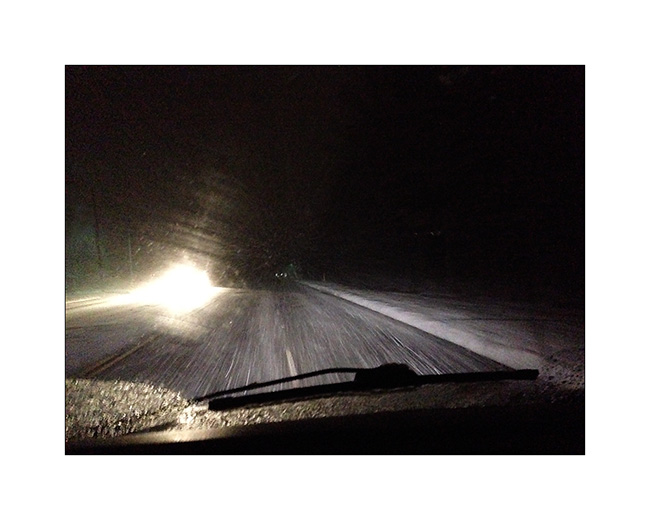
18. Hellish road conditions! Freeway was just a carpet of ice, the few inches of snow fell during the night was packed with trucks before freezing. VivaLaVida traveled almost 450 miles in these conditions, a little tiring for her driver…
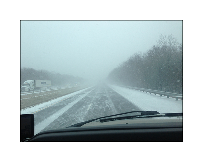
19. The next day in Arkansas, it was not much better: snowed all day to more than 400 miles. I stopped counting the vehicles out of the road at 50…
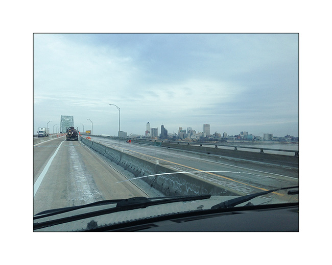
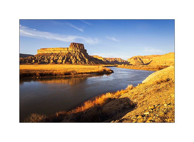
20. It improved a bit as I crossed the Mississippi River in Memphis TN.
Without showing it that much, this update relates to a three-day trip and more than 1,300 miles in very difficult conditions. After a stop at Maryville TN to eat with a couple of friends, I found the snow back on the road to cross the Appalachians but arrived in the region of Asheville safely.
I’ll be on the departure to Switzerland when you’ll discover these lines…
This blog will then be quiet for a few weeks … but will continue to relate VivaLaVida’s journey from early May no doubt!
Thank you for following this journey, I’m always very pleased to read your comments. 😉
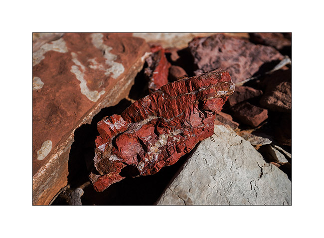
Minerality…
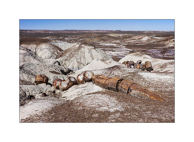
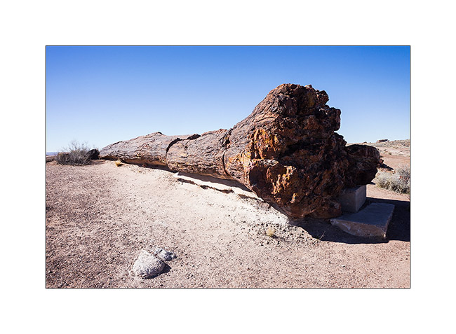
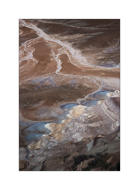
Still in Arizona, I made a short stop at Petrified Forest National Park. 225 million years ago, the current Arizona was nearly 3,500 miles South of his actual location, in a tropical climate and thus covered with tropical forests. During large floods on clay areas, trees fell and were buried in the clay that protected them from putrefaction. Over hundreds of thousands years that followed, the clay was covered with new sediment layers totaling till 1.5 miles thickness. The pressure thus exerted generated petrification of wood. Then the continental drift has gradually dried up the soil of Arizona allowing wind and rain to erode the upper sediments and leaving the petrified trunk now appear in the bentonite layers.
In places, the amount of petrified wood is staggering.
1. Bentonite which erosion reveals petrified trunks.
2. The colors are amazing! The density of this stone is such that it takes 4 times longer to a silica carbide saw to cut the same thickness as in granite.
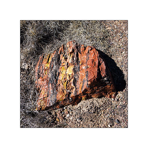
3. Most of the time, erosion causes trunks to break. On some, the petrified bark is still present.
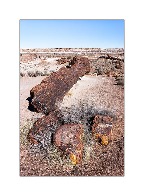
4. A giant! His strain is over 8 feet high.
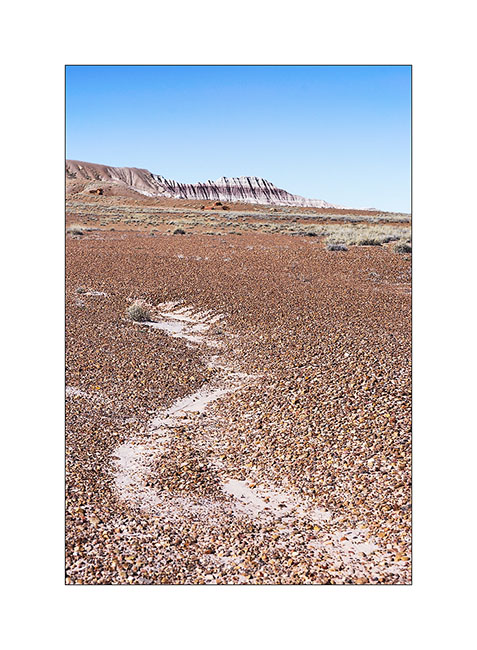
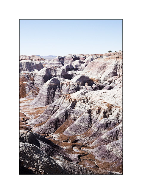
5. The desert surrounding area is varied.
6. Undulation…
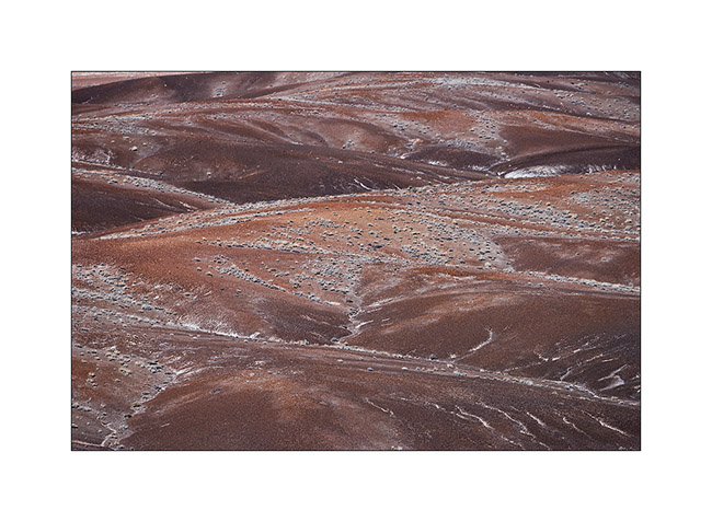
7. Mixes…
8. Amazing colors and shapes.
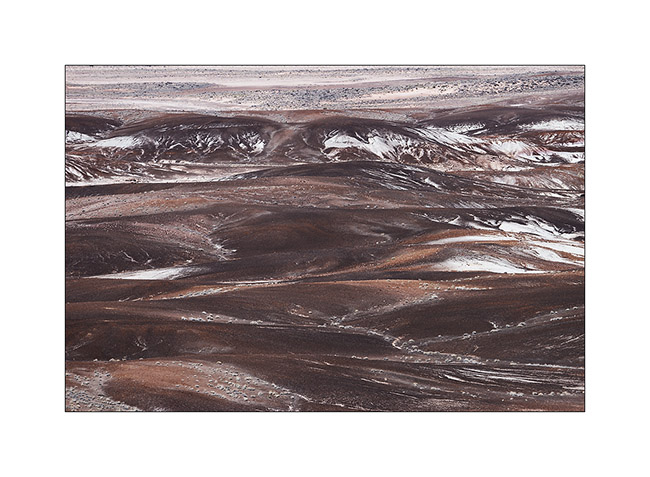
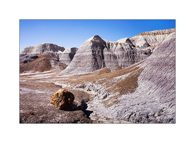
9. Edge of a bentonite mesa taht erosion carves.
10. This bentonite is less colorful than in other places but the presence of petrified trunks contrasts with the soft shapes of clay.
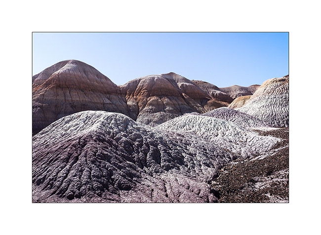
11. The eroded texture reminds me of some corals…
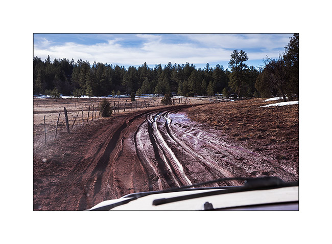
12. Vivalavida then moved to New Mexico, spending a first night at over 7,000 feet above sea level in the forests of the Zuni Mountains.
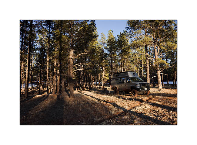
13. The next morning we crossed the Zuni Mountains with sometimes quite rutted and muddy roads…
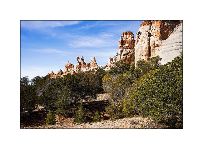
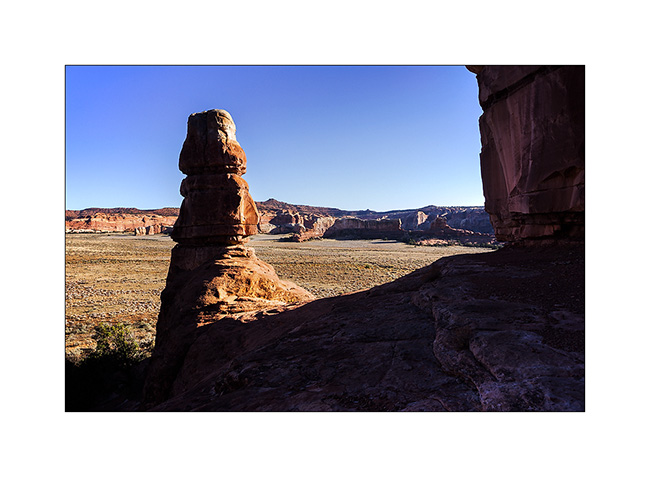
14. Discovery of the pinnacles of Los Gigantes by chance…
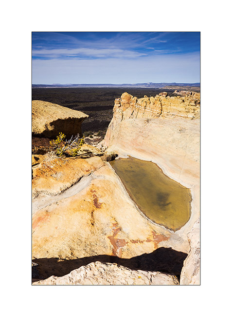
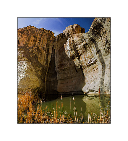
15. A guelta sheltered against a cliff of El Morro.
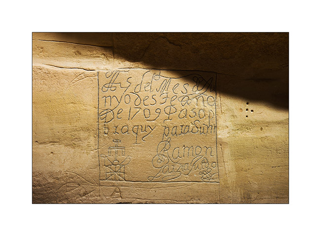
16. Etching in sandstone describing the passage of some Spanish in 1706.
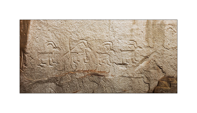
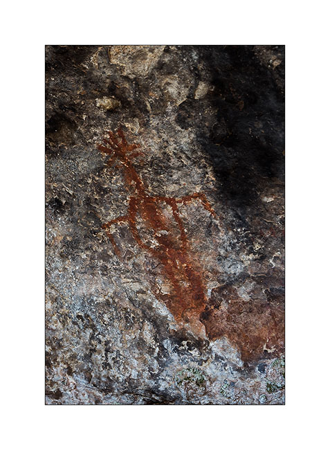
17. Petroglyph much older, probably around the year 1200.
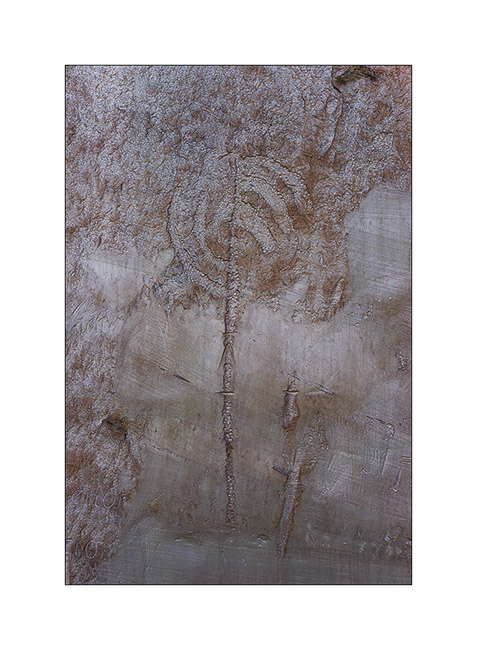
18. Another petroglyph estimated at 1,400 years BC.
19. “Woodpecker” natural arch.
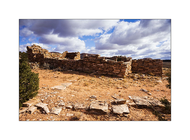
20. Pueblo ruins in El Morro National Monument.
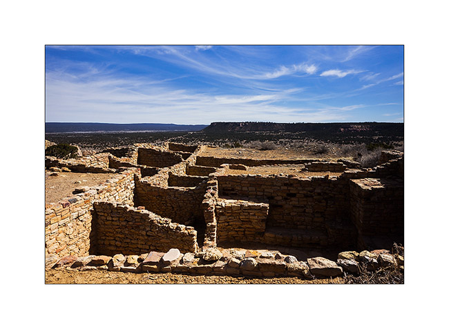
21. Another ruin of the same area.
Further discoveries along the East crossing of VivaLaVida to come soon… 😉
Around Moab, and then leaving Moab…
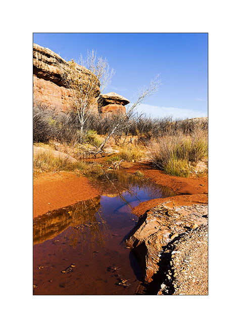
1. Three days later, I spent the night near a giant mushroom. Believe me, the dawn will reveal it. 😉
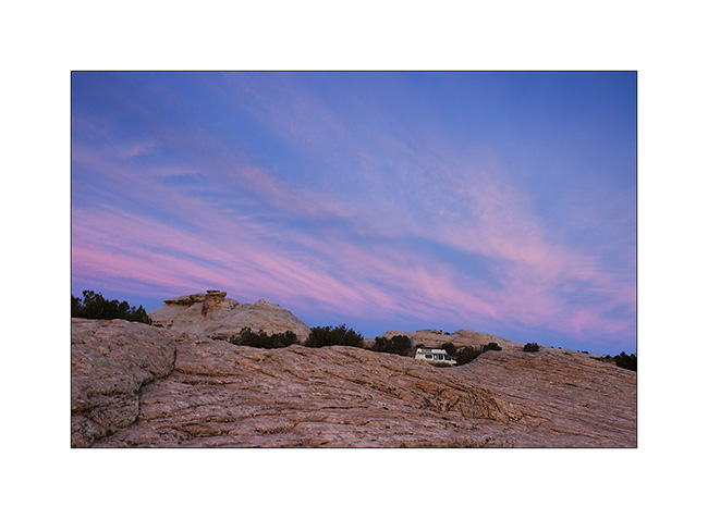
2. Here he appears…
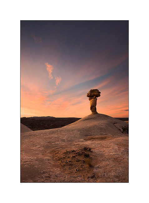
3. Fifteen minutes later, the diverging sky makes me think about the brilliance of a lighthouse…
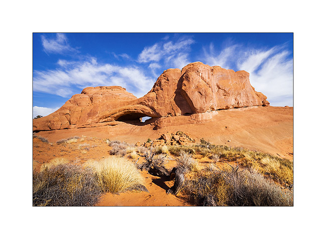
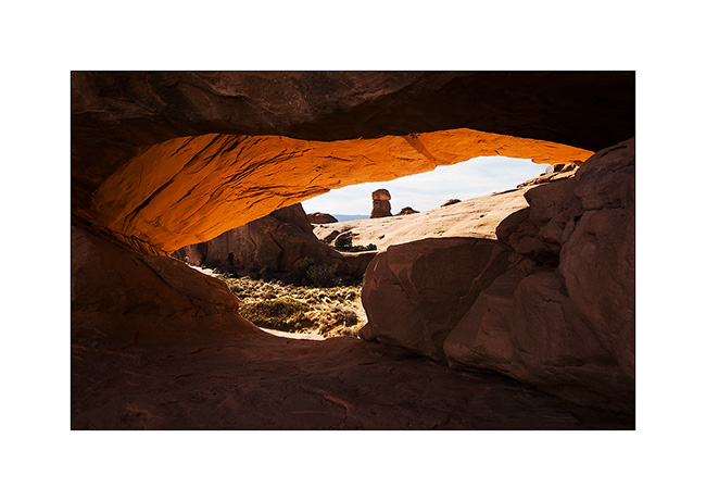
4. Still waiting for VivaLaVida’s door handle to replace the broken one, I did another little journey around Moab… I went to find an arch named Eye of the Wale. And it looks really like one. 😀
5. In the eye…
6. Farther on the trail, the Marching Men, in the Klondike Bluf.
7. I drove that trail in 2011 and it is much more ruff than three years ago, much more than it appears in this image!
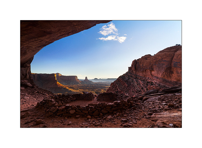
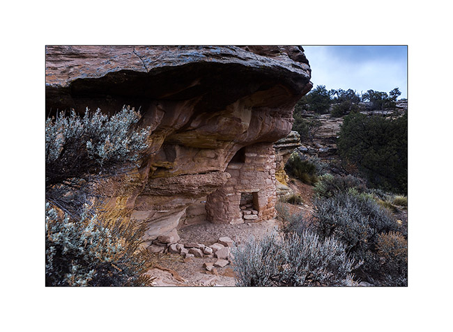
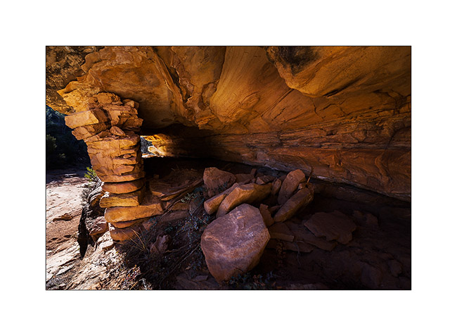
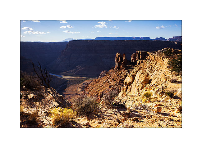
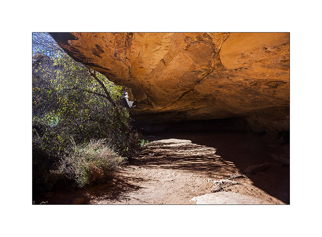
8. Another quick getaway the next day in Canyonlands National Park to discover a ruin located under the overhang of a huge cliff … Not shown on maps of the park, this spot is still unspoiled by mass tourism. A fantastic place with a wonderful view of Candelstick Butte.
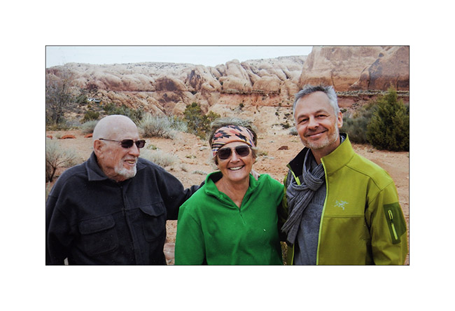
9. Souvenir picture with Madeleine and Hans who welcomed me at their home like a king. I left Moab the Friday before Christmas, VLV’s handle finally being fixed. (Picture of another picture, sorry for the quality)
10. I then drove upstream the Green River hoping to see Desert Big Horn Sheep which live in cliffs of mesas. Late afternoon light in the entrance of Gray Canyon.
11. The next day it’s really gray over the Gray Canyon. I didn’t see any Big Horn… :-/
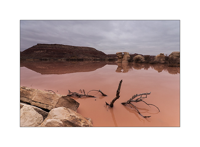
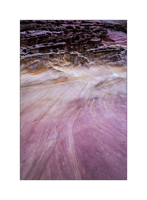
12. Returning to the San Rafael Swell, I made a detour to discover a rather unique triple arch. Along the track, when the water meets the bentonite…
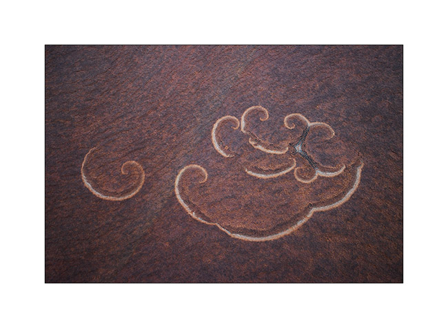
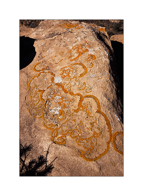
13. Natural arabesques of some lichen on sandstone.
14. Here is Colonnade Arch, above the canyon of the Green River.
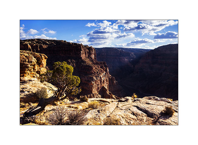
15. Almost a cathedral, unfortunately without light that evening…
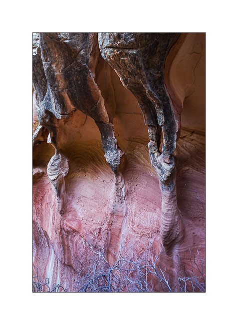
16. While going back to VivaLaVida, I spoted by chance these sandstone stalagmites at nightfall.
The next day, the weather was still very gray, so I took over the direction of the San Rafael Swell to discover petrographs in Dark Dragon Canyon.
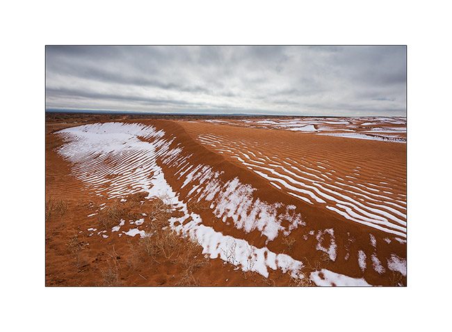
17. Small dune area where snow remains in place.
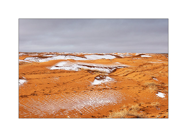
18. The contrast between orange dunes and white snow is beautiful.
19. I pass close to Goblin Valley and discovered almost similar concretions.
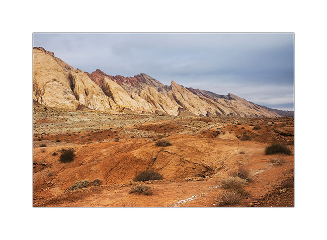
20. Ray of light on the reef of San Rafael Swell.
21. VivaLaVida runs along the spectacular reef.
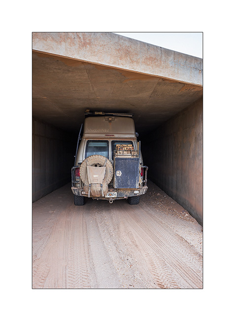
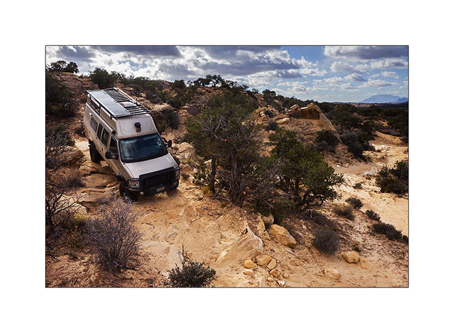
22. Path Under I-70 ; there is one inch margin with suspensions maximum lowered and tires deflated for trail! 😀
Discovery of petrographs in the next update.
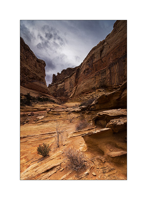
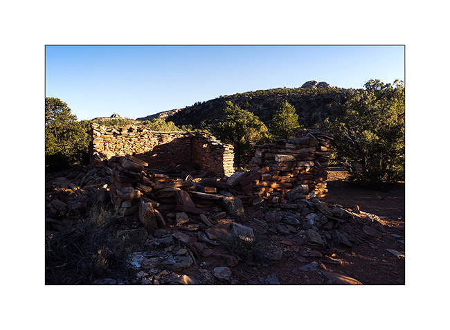
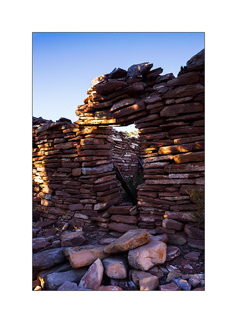
Ruins and canyons
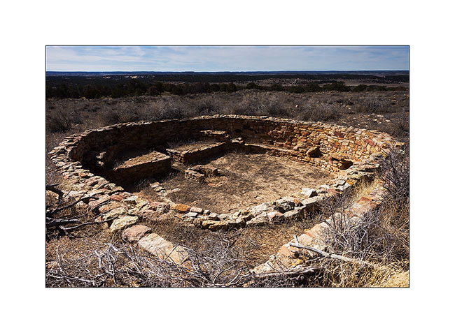
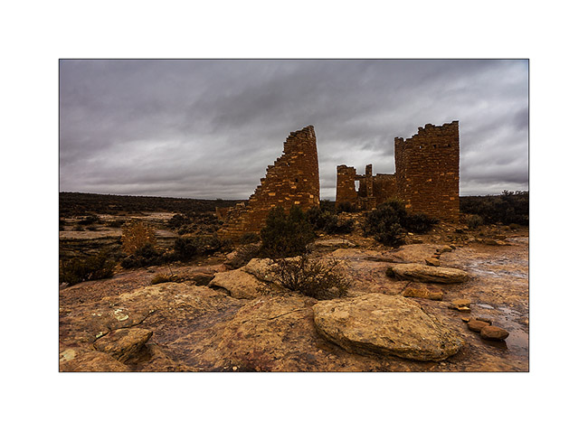
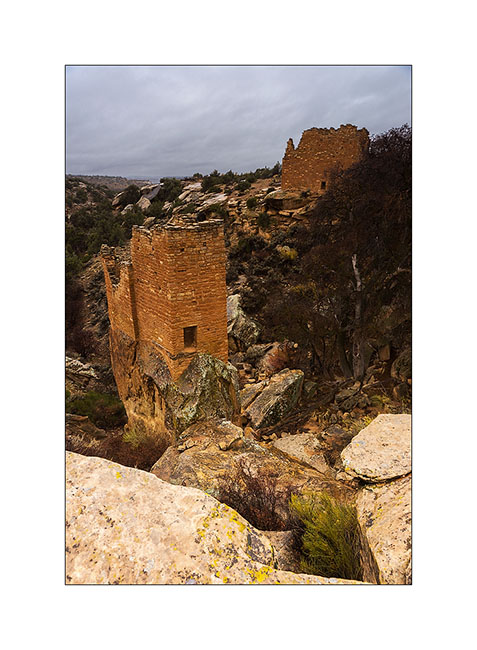
At a small meeting with Tom, aka Zeta on Sportsmobile forum, he advised me to visit the Hovenweep National Monument, a site where are grouped different Anasazi ruins. When I went there, it was raining but I still visited seven different sites.
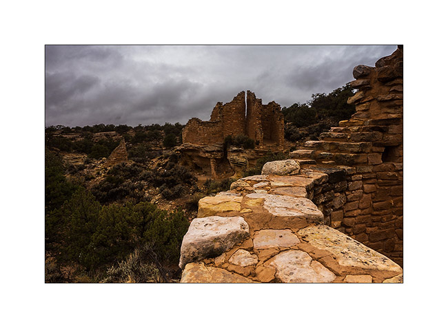
1. The Twin Towers, on the main site in Utah.
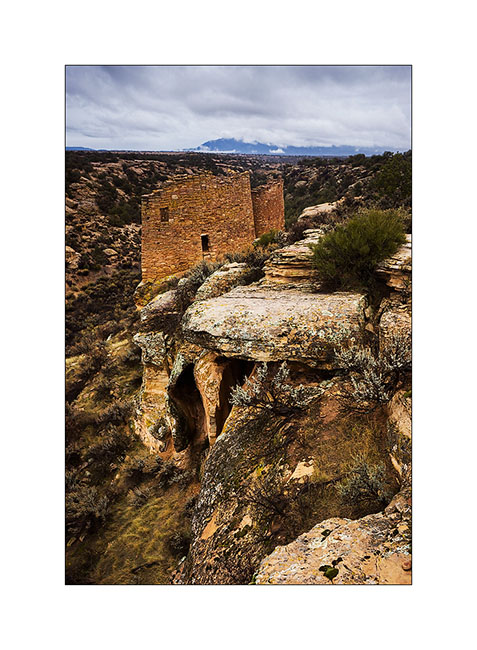
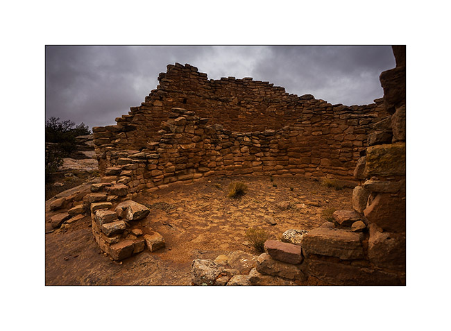
2. Hovenweep Castle and Square Tower. These sites were all built on springs and have likely been built to protect those They were all built between 1220 and 1280, were inhabited by three generations before being abandoned for unknown reason.
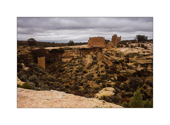
3. Hovenweep Castle, consists of two horseshoe towers and a large main house.
4. We go to Colorado, just ten miles away, at Holly site. Amazing how these builders were able to anchor foundations on vertical blocks of sandstone.
5. While walking through the canyon of Holly, I spotted this petrograph symbolizing the sun.
6. Here is the Horseshoe ruin, an house shaped like a horseshoe with double row walls.
7. Farther, the Cutthroat Castle. Yet the Anasazi Indians were farmers, not warriors.
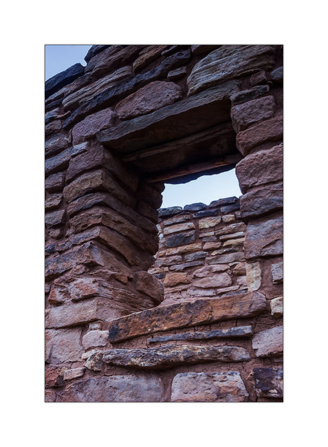
8. A well-preserved window. The covered – a large flat stone – is ensured with two poles of juniper.
9. At the foot of the sandstone block on which the castle sits, there are other structures, probably granaries.
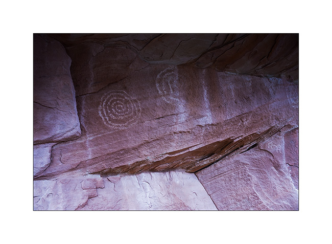
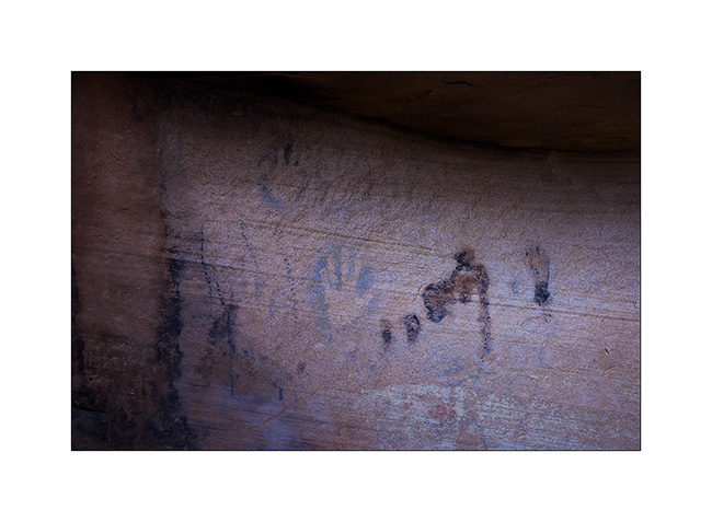
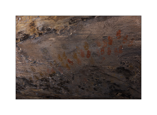
10. Not far away, a known petrograph: Painted Hands. It dates as the ruins of the 13th century.
11. On the site of Cajon, again in Utah, the spring still exists and was protected by two walls.
12. Some petroglyphs in Cajon Cayon.
A part ordered for VLV still not arrived, I went to spend a few days in South San Rafael Swell, beautiful region that contains many canyons.
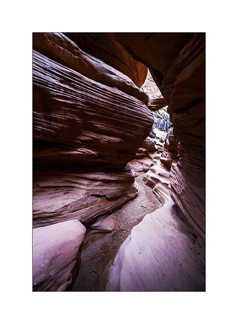
13. It is rather gray and very cold when I enter Crack Canyon.
14. This is not really a slot canyon but some portions have beautiful overhangs dug by flash floods.

15. This is the narrowest part.
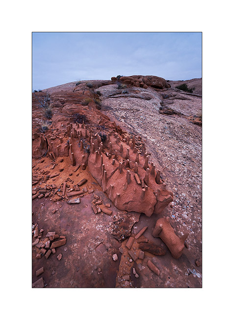
16. Columns carved by wind and water…
17. Sandstone colors…
18. Pot…
19. Late afternoon on Temple Mountain with finally some sunshine…
More to come in San Rafael Swell soon. 😀
Still in Beef Basin…
1. It begins with a blurry picture! 😉 Just to show that it was chilly that morning…

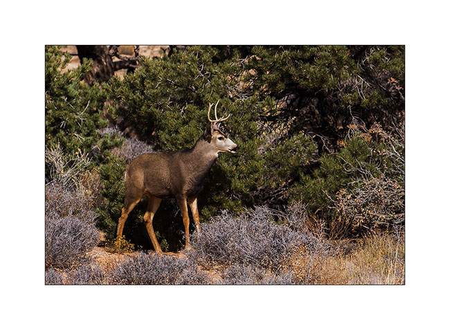
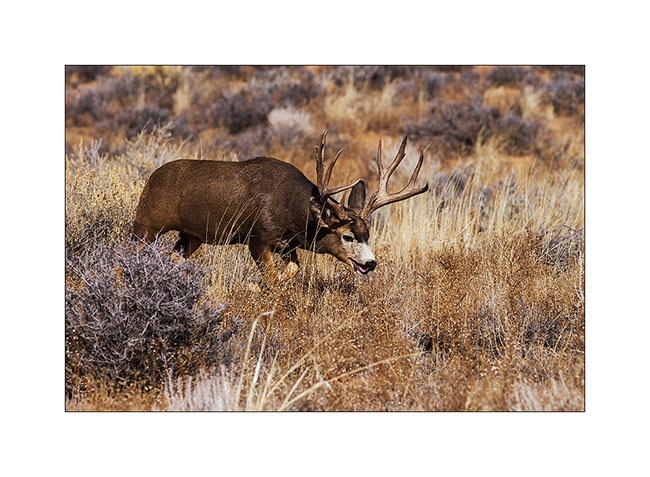
While I was getting ready to break camp, I noticed a young stag who seemed a little nervous. I decided to approach it to try to photograph it.
 
2. After 15 minutes of approach, I crouched beneath a juniper not far.
3. Forty minutes later, as I tell myself I’m gonna go back to VivaLaVida, I saw a large male tumbling.
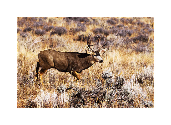
4. In fact, he was folloing a female as it’s the full rutting season. And the female had the good idea to walk fifteen feet in front of me without seeing me!
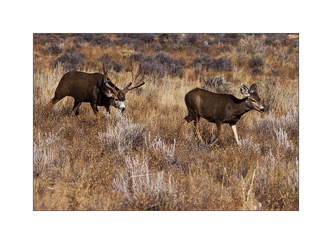
5. What an animal and what a meet… I’ll even get to see a mating the next day, about thirty feet away.
6. VLV have now to drive the trail back…
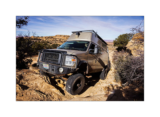
7. Nice wheel up… 😀
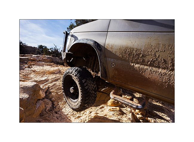
8. … And quite steep downhill.
9. That’s where we’re coming back.
10. On the other side of the Colorado River, Orange Cliffs and Sunset Pass where we slept with Jean-Luc last Spring.
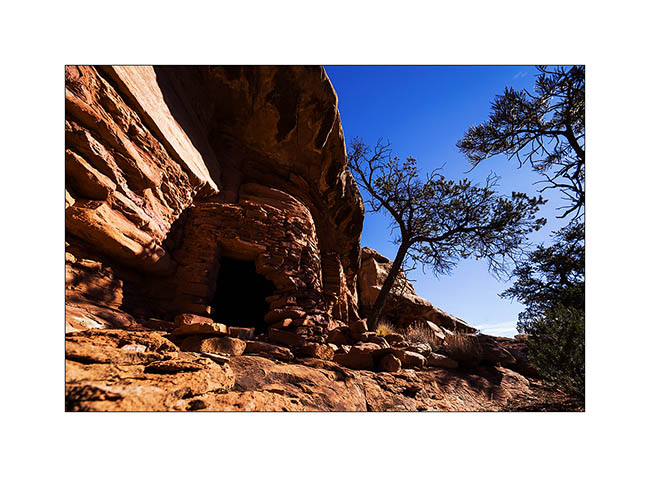
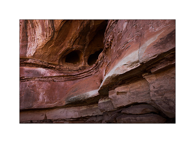
11. Still in Beef Basin, while going down a side canyon to discover a permanent spring, I saw this Indian granary on a cliff.
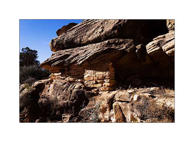
12. I manage to go up the cliff to show you the inside. Both ends have collapsed or have been opened.
13. A pretty lichens and fungi that can be seen on certain blocks of sandstone.
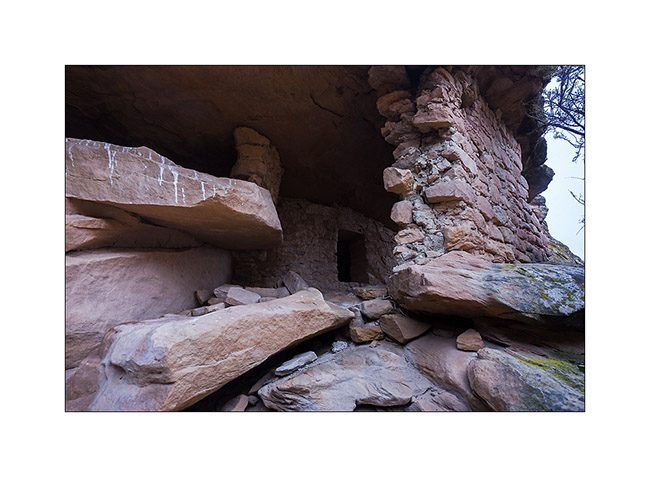
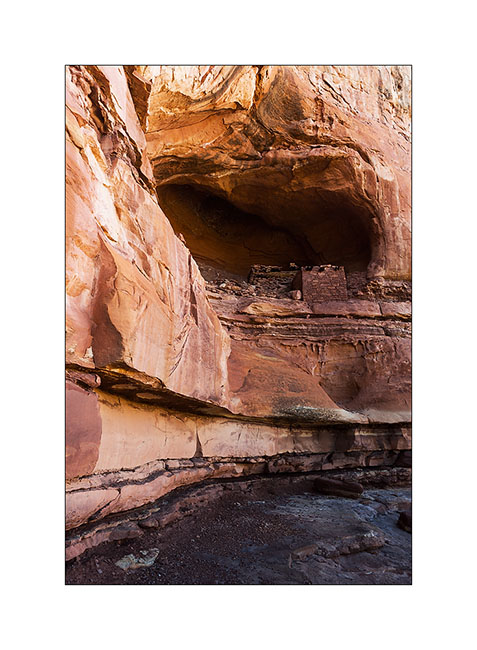
14. Having spotted a very red cliff I went to explore, I had the chance to discover on the way this beautiful Indian granary. It is not on any map and excepted archaeologists who studied the area, few people must have seen it as it is away from everything.
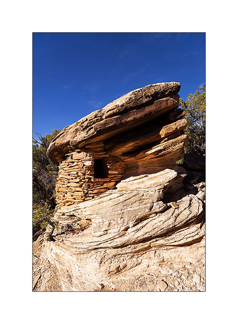
15. This is certainly one of the most aesthetic that I could see to date.

16. Nearby, there are several ruins of houses.
17. The cliff above have a very red layer of the same rock I saw in Fort Bottom called Chert, a kind of silex.
18. And I’m still discovering another granary also almost intact.
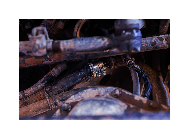
19. Time to leave Beef Basin but on the road, a strong antifreeze smell made me stop. A powerful jet escapes from one of the pipes of the VivaLaVida’s engine preheater!
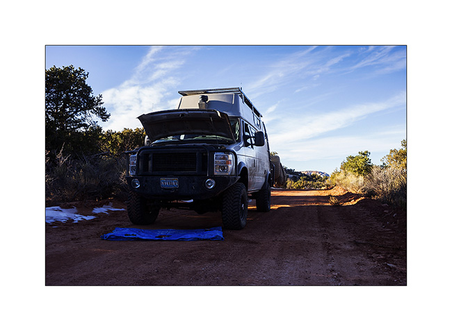
20. Temporary repairs with duck tape and hose clamps. We need to join Moab, a almos 100 miles away…
I will succeed the next morning and replace the pipe in question, which rubbed against a piece of metal because of a broken ziptie. I take this opportunity to do some other small works and replace the heim joints of the sway bar that had taken much of play.
That’s it for my exploration of the beautiful Beef Basin, a place that is worth the trip. See you soon. 😉
Ruins in Beef Basin.
Despite snow announced in the mountains, VivaLaVida headed south of Moab in the Beef Basin, an area which was the wintering place for Atabascan Indians between 2,000 and 700 years ago. It contains many relics like ruins and petroglyphs or petrographs.
1. Some tracks that VLV borrows are not hardly frequented…
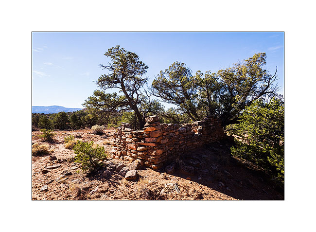
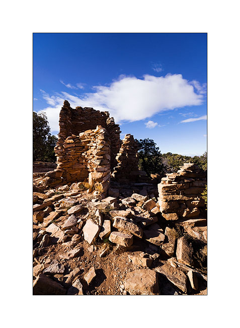
2. Here is a first ruin Southwest of Beef Basin. It dates from the end of the period, about 700 years ago; its rectangular shape attests.
3. Remains a doorway of which the covered stays by the force of the Holy Spirit..!
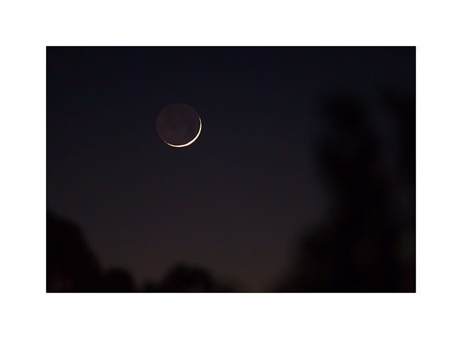
4. First day after the black moon…
5. As it was already 24F around 7 PM, I cooked a good vegetables stew to warm me up!

6. Arrival in the grasslands of Beef Basin.You cannot see it but it was 20F when I took this picture.
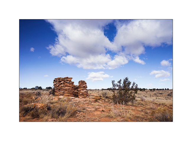
7. The most well known ruin as it’s close to the trail. An ancient tower which there remains a wall angle.
8. Further away, here’s a small round tower.
9. After a short walk, I arrive to one of the best preserved ruins of those I had spotted the coordinates. There are still two windows intact.
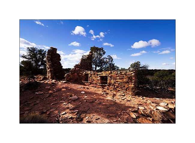
10. There is also still the mud to stanch the walls.

11. Wall details.
12. Here is a community farm, larger, with different rooms.
13. I decided to lead VivaLaVida to a promontory above Gypsum Cayon, with a rather chaotic trail.
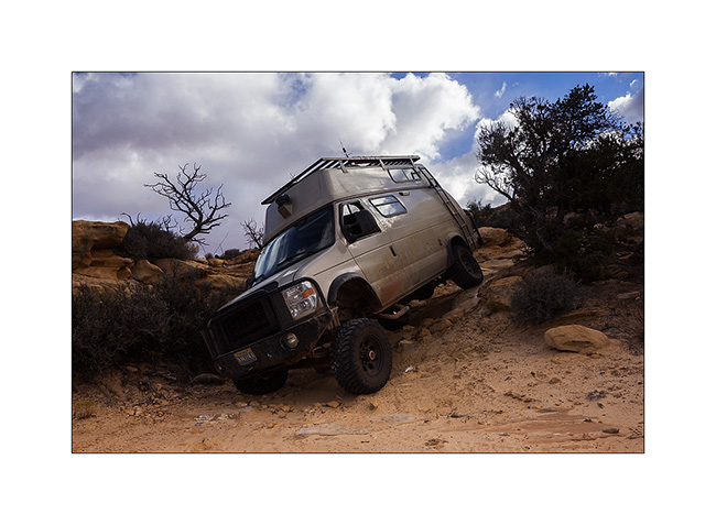
14. Fortunately is wheel travel huge!
15. Approaching the end of the trail, the prairie stretches before us again.
16. The mouth of Gypsum Canyon on the Colorado River.
17. Gypsum Canyon deep, inaccessible from here.
A nice meeting to tell you in the next update. 😉
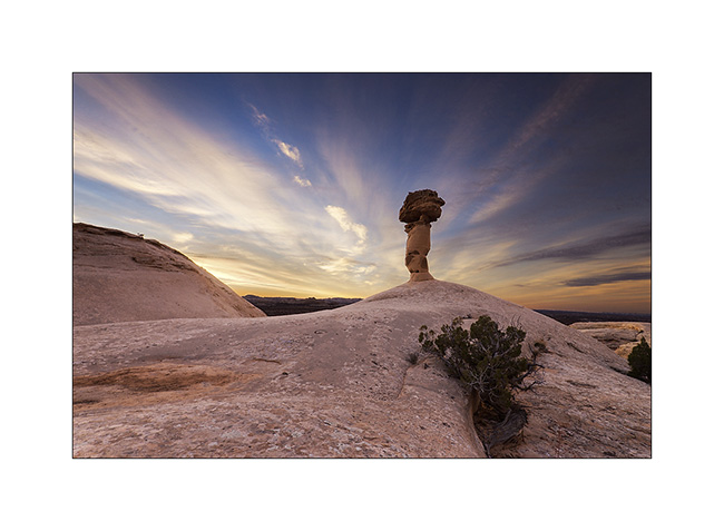
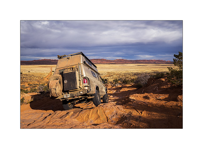
Back in Utah
I met Nick and Kim in Moab. I met Nick in North Carolina. He also owns a Ford van, two-wheel drive and shorter than VivaLaVida but well equipped for two. He’s traveling for two and a half weeks with his friend Kim who discovers the West for the first time.
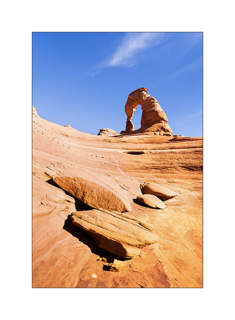
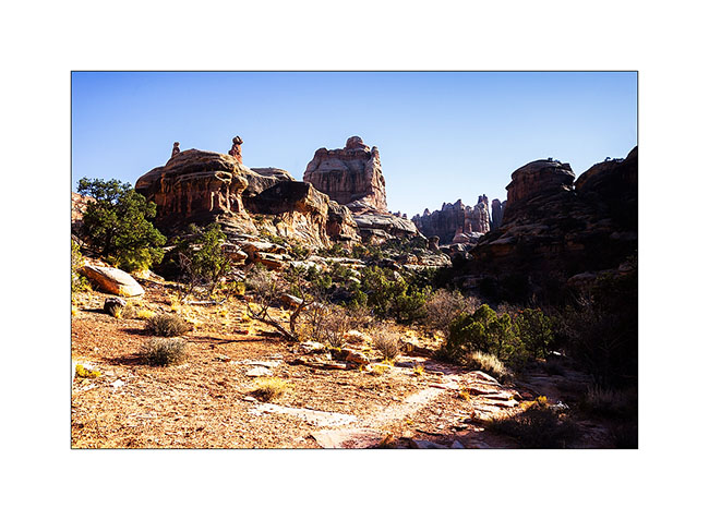
1. We spent the first day in Arches National Park, the opportunity to make an image a little different from Delicate Arch while every picture has been done on the site, one of the most photographed of Utah.
2. The next day, Nick rented a jeep to travel the White Rim Trail, a 100 miles trail that runs north of the Colorado first, then the Green River.
3. Having to wait four days to service VLV, I got back to the Needles, probably my favorite place in Canyonsland NP. I went to see Cave Spring inhabited by the Anasazi Indians from 7,600 years BC.
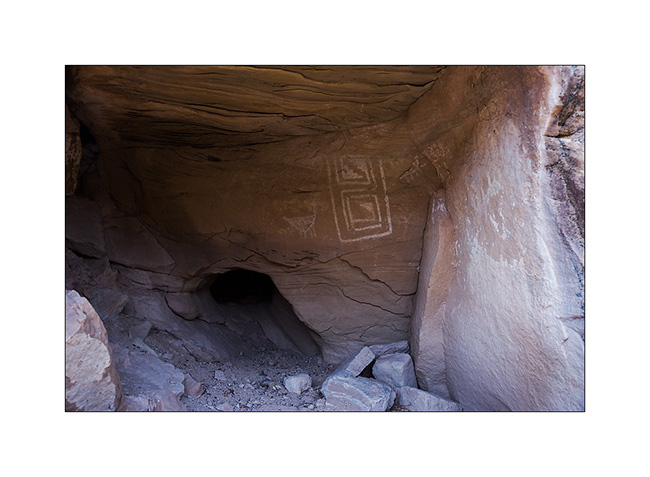
4. Petrograph in Cave Spring
5. The famous hands of Cave Spring.
6. On the way to Tour Ruins, another spot I discovered.
7. I first discovered granaries on the cliffs.
8. Here is the tower which gave its name to the ruins…
9. Here is the ruin, surprisingly well preserved. It was a dwelling place for the summer season.
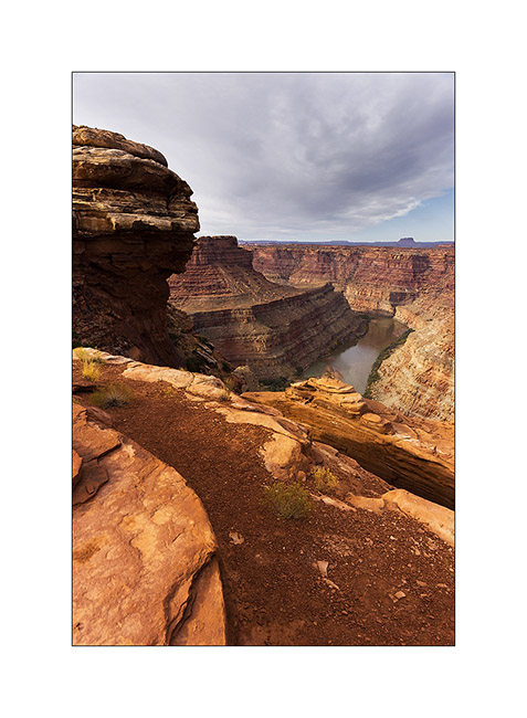
10. I went to sleep above the Colorado and enjoyed the viewpoint the next morning.
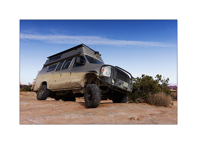
11. The track to get back is quite interesting by place.
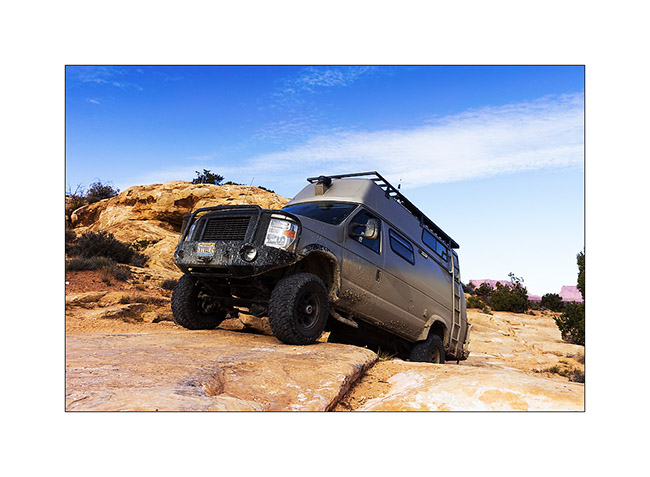
12. Axle crossing.
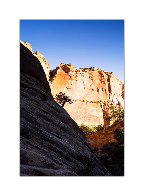
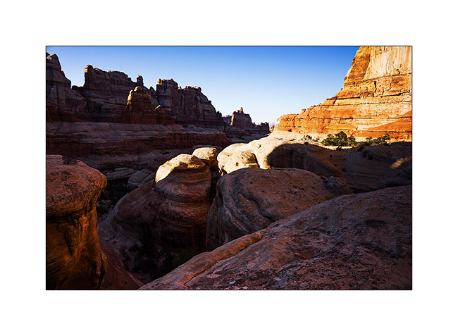
13. In the afternoon, I returned to Chesler Park, a beautiful place.
14. One of the canyons we cross to get there.
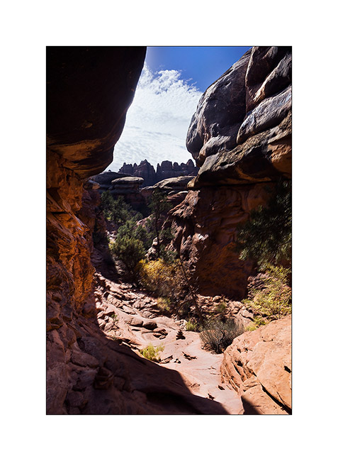
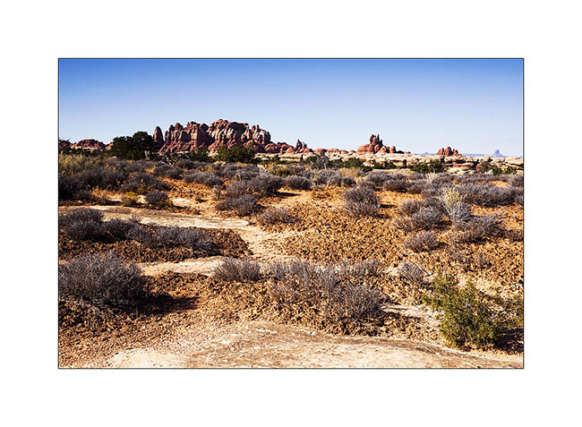
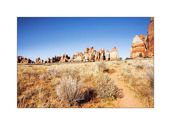
15. I approach the famous Needles.
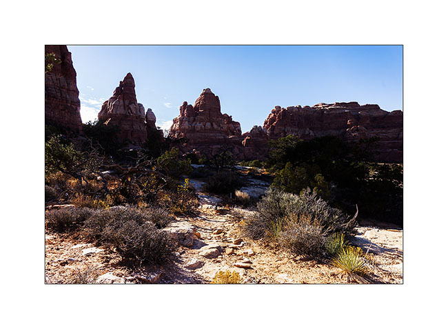
16. And here I am in Chesler Park.
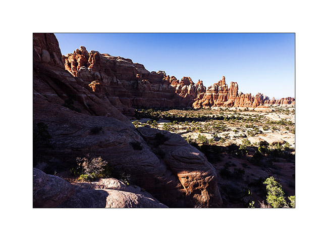
17. The south side is a beautiful meadow that makes me want to camp there.
18. In a side canyon to Elephant Canyon, I discovered this fault created by erosion.
19. It’s late but I go up the Elephant Canyon to find a nice arch.
20. Small tree in the cliffs…
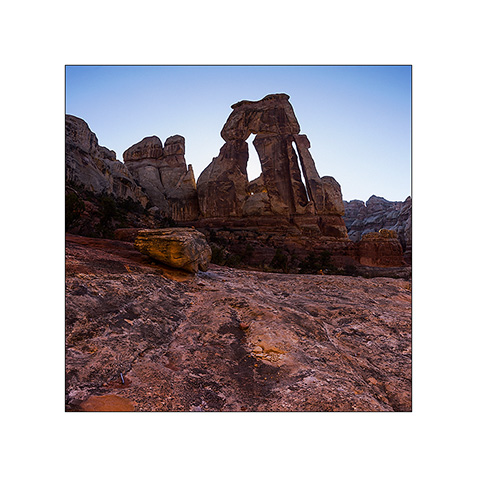
21. After almost running at full speed, here is Druid Arch, a rather unusual double arch.
22. I’m still at the top of Elephant Canyon and I must go down without delay to reach the Trailhead before nightfall, 6.5 miles away.
I reached VivaLaVida at nightfall, a little tired after more than 14 miles on quite uneven terrain.
Some other spots discovered in Utah to come soon…
 D5 Creation