North Canol Road @en
now browsing by tag
North Canol Road (2)
Once past the border of the two provinces, the road divides into two “dead ends”: one leads to Maclung Mine, 9 miles away, the other continues to the northeast to a wildlife management station, some 10 miles along the Canol Heritage Trail (the old trail I mentioned in the previous update). Bridges were washed away and there are thus two water crossing to coolVivaLaVida’s wheels.
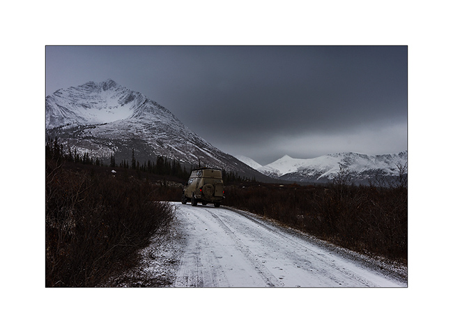
1. Arrival to the station already closed for the winter… I think VivaLaVida has never been so far away from any possible support, it’s really the middle of nowhere here!

2. A furtive sunbeam while I eat at the end of the trail.

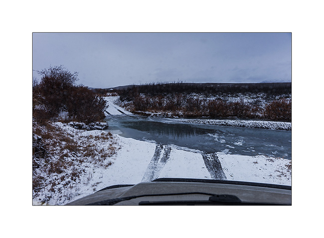
3. I photographed the water crossing only on the way back. Here is the second partially frozen.
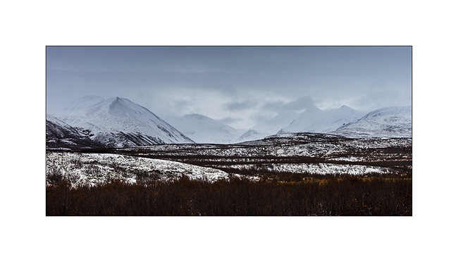
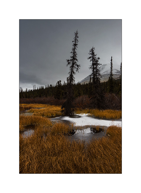
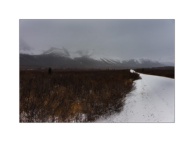
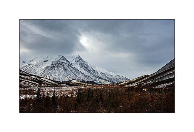
4. The atmosphere of this altitude tundra under a snowy sky is beautiful.
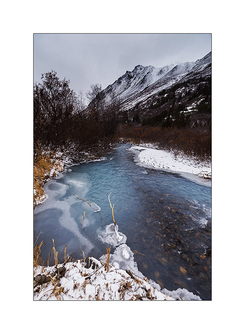
5. And the second water crossing, deeper and longer than it appears here…
I have tryed to reach the Maclung Mine but a wicked side cant covered with snow over one mile mountainside detered me. In addition, on the east side of the mountains, it was snowing hard. So I turn around down to the Macmillen Pass. Not without having seen the first wolf on this trip. To far to take some picture but I was able to observe him with binoculars for about five minutes. What a beautiful animal perfectly adapted to these remote and harsh areas!
I also observed an Arctic fox hunting and catching a ptarmigan, great hunting scene. But I messed up the pictures, there was so few light that handhelds, everything is blurry… 🙁
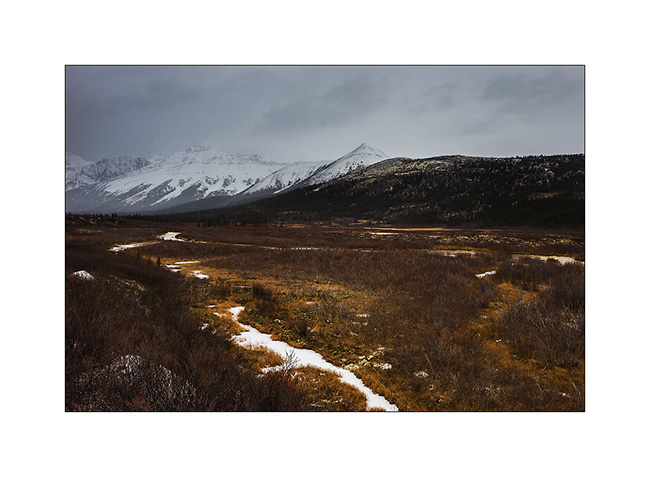
6. Going down back to the Macmillen Pass, lichens are of a very soft yellow green that contrasts the snow peaks.
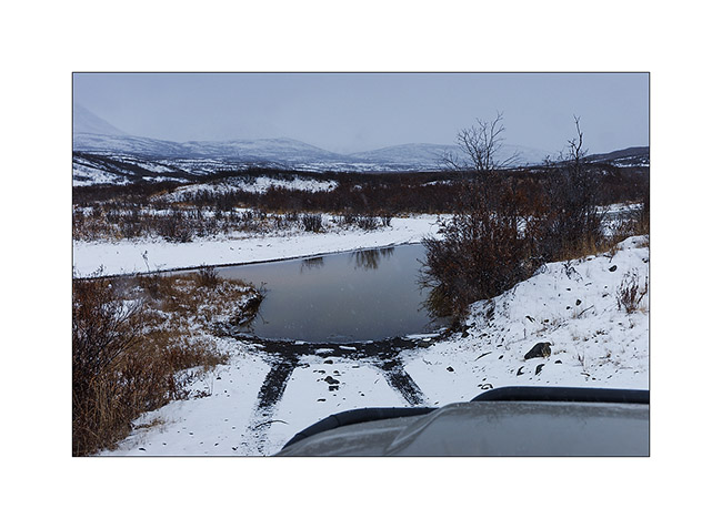
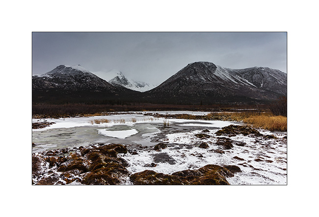
7. Another frozen marsh.
8. Looking for a night camp…
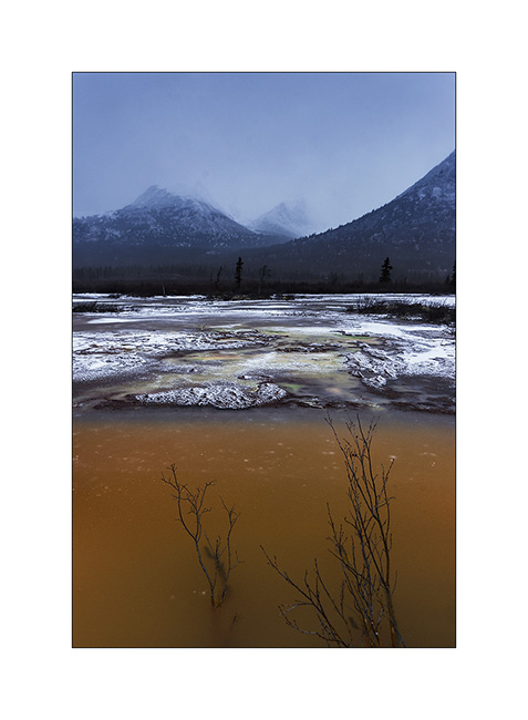
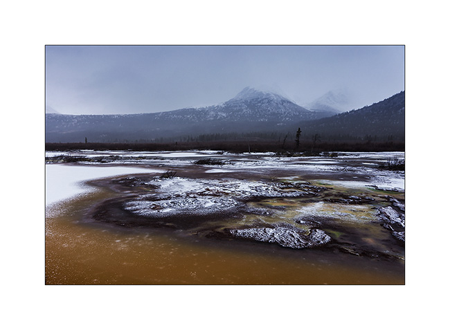
9. There must be sources of ocher, some marshes, even frozen, have that characteristic color.
10. Some mosses form a kind of astonishing mosaic.
11. early winter ambiance…
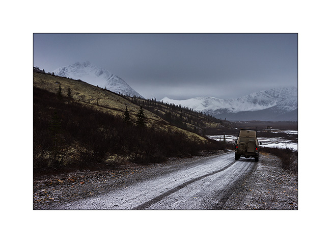
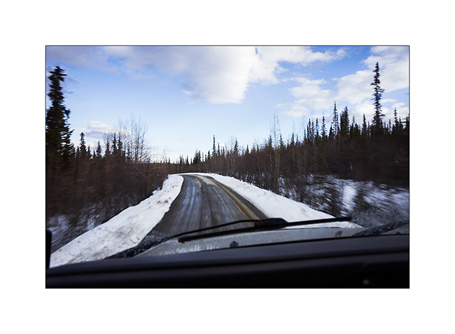
For the record, I found a boondocking site shortly after this picture and the weather forecast (although dated four days) indicating an improvement for the next day, I went to bed around 9 PM as it began to snow. Unable to enable me to get blocked by snow, which would mean abandoning VLV here until early next summer, I set my alarm at midnight to take a look outside. And here I didn’t really hesitate: it had fallen almpost two feet snow in three hours, with the temperature rising to around 33°F! So I restarted and drove nearly four hours at night to get out of the mountains, pretty epic journey in this snowstorm where I sensed more than saw the track completely white…
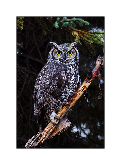
The next day, the snow stopped and then I go out of VLV to eat my snack lunch, I hear the cry of an owl that doesn’t seem far away. So I took the camera and tryed to locate it. Actually not far away, it will prove to be still over 1,500 feet away in the boreal forest and progress was not easy. Besides its calls were not very frequent and I was trying to move slowly so as not to frighten it. In short, it was almost an hour left as I finally saw it. Obviously he saw me but didin’t seem really scared, leting me get close to about 6-7 yards. It was a beautiful Great Horned Owl, the second largest nocturnal bird of prey after the great gray owl.
12. Here I introduce him… 😉
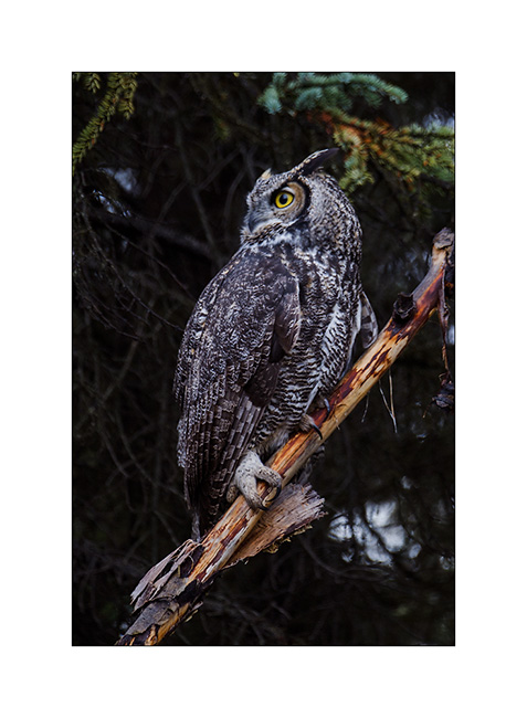
13. Here he is looking somewhere else.
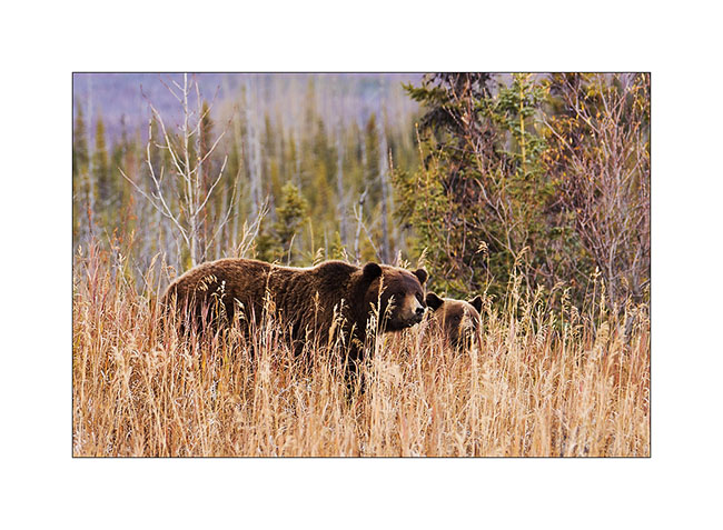
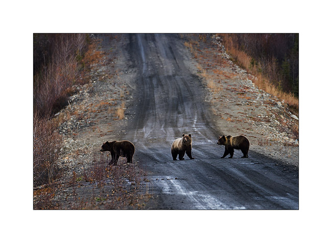
14. Returning to VLV, new encounter: two grizzly bears, probably a mother and calf. Little adrenaline rush as starting “chase” the owl, I left my bear spray” in VLV, which didn’t happen to me often … I was Lucky to be at about ninety feet away and the mother quickly smelt me, launching a sort of growl before running away.
15. VLV is muddy as never after that road, here a quite deep mudd path…
16. Another encounter with grizzlies further on the road.
17. After crossing the river back on the ferry, VLV drove the Campbell Highway to the South to get to the second mining road… Blowing snow form welts on the hills.
18. Mud and ice as menu of VivaLaVida !
19. When I said that he was “in mud”..! 😀

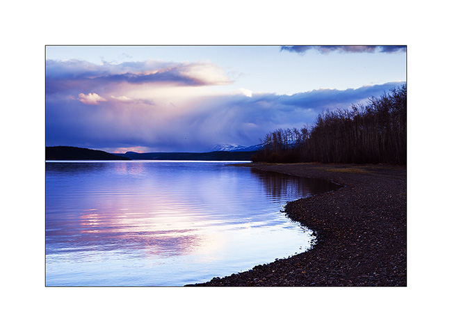
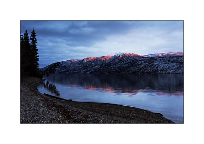
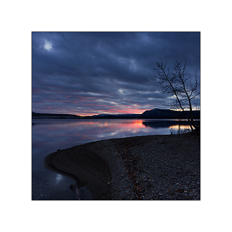
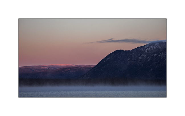
20. Snowfall at sunset while I found a nice place to sleep on the edge of Frenchman Lake.
Discover the Nahanni Range coming soon!
Robert Campbell HWY & North Canol Road
Finally, I stayed five days in Whitehorse. First to support a little bit Sarah installing an additional luggage rack on the front wheel of her bike Hercules which will carry the additional stuff that may be imposed by the Canadian winter, partly to prepare the latest update your recently read and to fill up a the empty cabinets of VivaLaVida.
It’s the day after one of the first snowfall that VivaLaVida took the road again to go discovering mountains of Est Yukon. But I decided to go there making a small detour in Carmacks to visit Sharon and Garry, the guys I mett four months earlier. So I arrived in the “Barracks”, the coffe shop and post office of Carmacks and seeing the smile on the face of Sharon when she saw me, I guess it was a good surprise for all of us. It was a real plaesure to see them again and to chat for three hours. When I was goinf to leave, Sharon gave me a large cup of zucchini & galric soup, two pièces of zucchini bread, two oat cookies (the best I ever eat !!) and even a banana muffin. I enjoyed that all the next days. So many thanks Sharon ! 😉
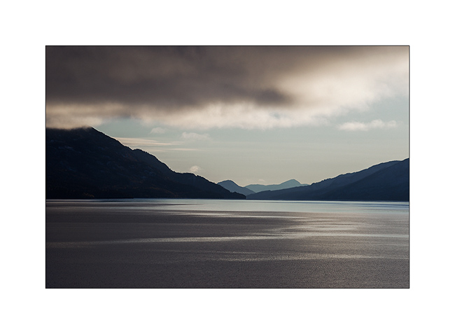
1. End of the day over Little Salmon Lake, along the Campbell Highway.
2. Colorfull sunset despite the clouds…
3. The next morining was quite cold !
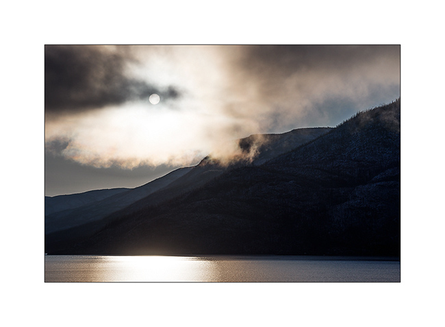
4. … but the sky gradually opened…
5. … The sun still playing with clouds.
6. Winter is coming, rivers start to freeze.
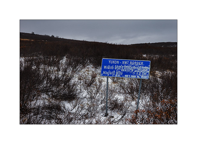
Only two roads lead into the East mountains, both built to operate tungsten mines. These Mountains contain in fact nearly 15% of known world reserves of this rare and expensive metal. The first one, the North Canol Road, was built in the 40s and joins the border of the Northwest Territories. Originally, she was leading till Norman Wells. More than 30,000 people worked in construction but maintenance was abandoned just two years after its completion … From the border of the two provinces remains actually the Canol Heritage Trail which is no longer drivable, even with a 4×4 vehicle. Some brave hike through it every year in complete autonomy: 222 miles or 346 km anyway..!
Since Ross River where the North Canol Road starts to the border, there are 185 miles of a muddy and virtually unmaintained trail, which crosses the Mackenzie Mountains, a major mountain range. The mine has been shut down for more than fifteen years. Suffice to say that in early winter, I did not risk to meet many people and had to rely on myself in case of trouble.
First step in Ross River: crossing the river on an old cable ferry. It only works two hours a day from May to early October, so my lunch break has been longer than usual. And there, it immediately puts into it;-) First, despite the sign that says very officially that the crossing is at your own risk, you have to sign a release to get on the ferry; basically, it’s “you cross at your own risk, if you’re sinking, we are not responsible” ..! Once on the ferry that snorts as slowly as a snail and moves in the stream, there is a army lifeboat that accompanies the crossing, 50 feet away downstream, to assist us in case shipwreck !! In short, they seem to have great confidence in this old tub! 😀 And it’s forbidden to take pictures, I do not really know why…
that said, the ferry took VivaLaVida from one edge to the other without trouble, the same on the return way three days later.
7. It snowed about two feet two days before and only two tracks of hunters who came down from the mountains marked the trail.

8. After about 25 miles, no more snow!
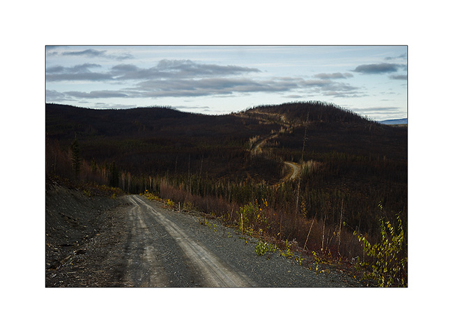
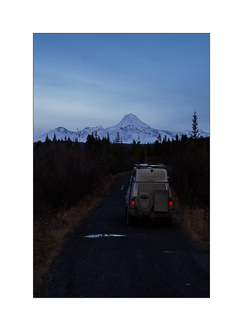
9. VivaLaVida is getting close to the mountains as the night falls quickly now.
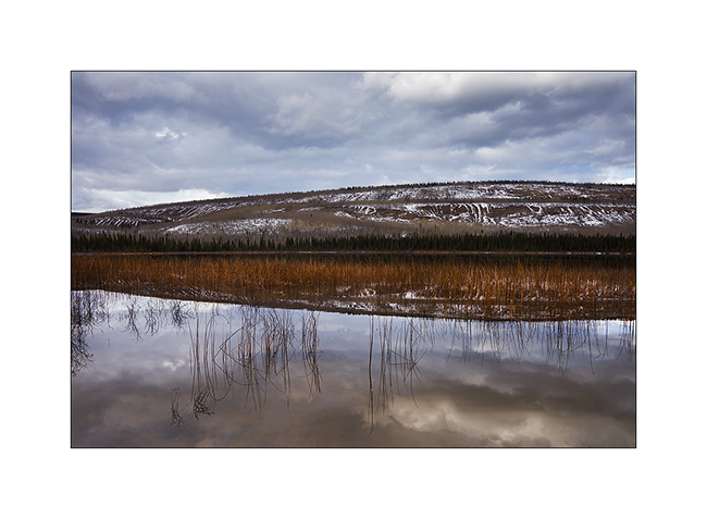
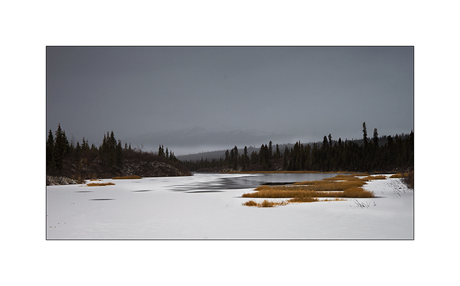
10. Frozen pond…
11. The road has several bridges over the River Mackenzie and I asked myself if some would carry the weight of VLV…
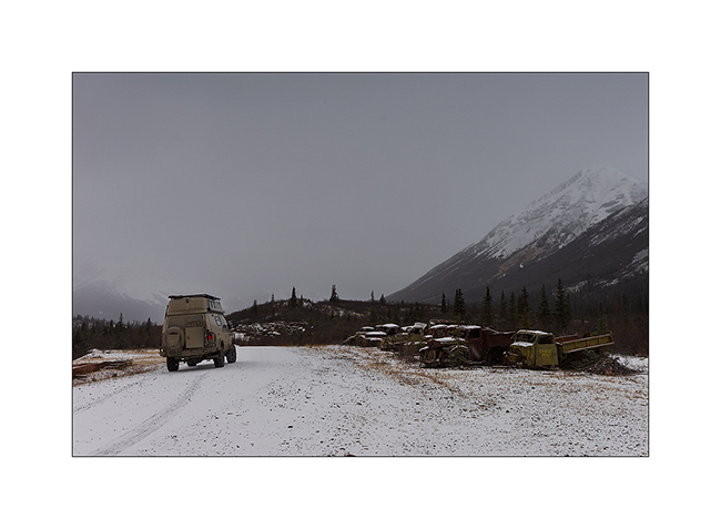
12. The vehicles used in construction have been left behind.
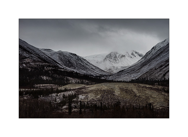
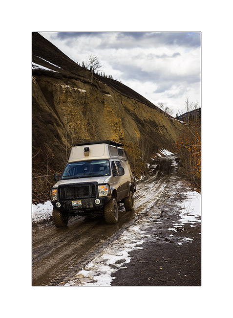
13. While I arrive in the mountains, I find some snow on the trail and time seems to go bad.
14. Color contrasts are gorgious.
15. Frozen marches…
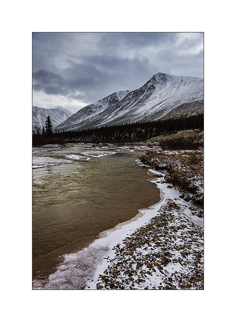
16. Mackenzie River.
17. The last colors of almost non-existent fall are still in the valley bottom as winter took up residence on the mountains.
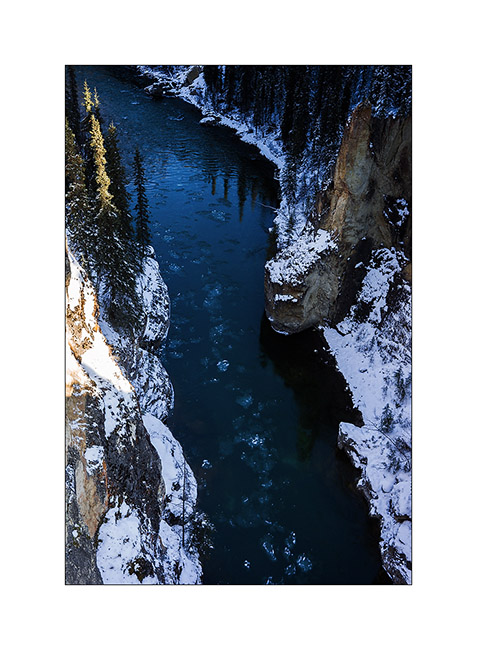
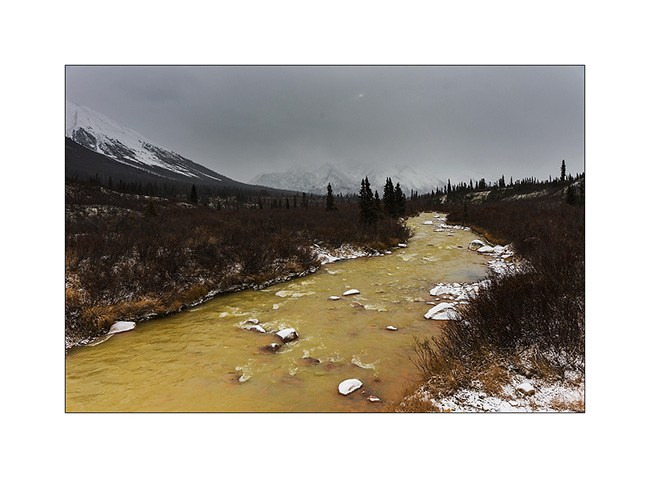
18. I discovered a small emerald inflowing of the Mackenzie River…
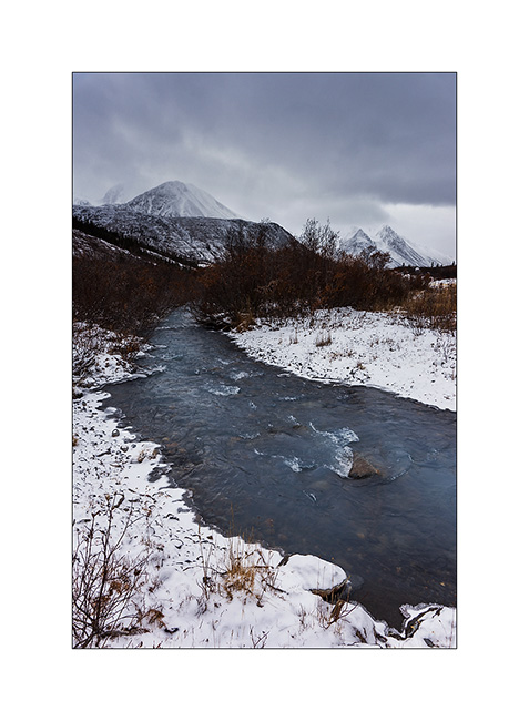
19. The ice has not fully covered it yet.
20. Arrival at the provincial border at Macmillen Pass at about 4,000 feet above sea level, after 186 miles and more than 15 hours away (in two days)!
To be followed in a few days because the low speed of the only WiFi I found in Stewart tooks me two hours to upload 20 images.. 😉
 D5 Creation