Kennicott @en
now browsing by tag
Glaciers & McCarthy Road
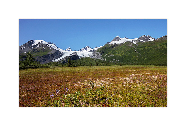
Better weather announced for two days, I drove the McCarthy Road, which sinks for about hundred miles between large ice areas. But on the road from Valdez to get there, I made a stop to walk to the bottom of the Worthington Glacier, easily accessible.
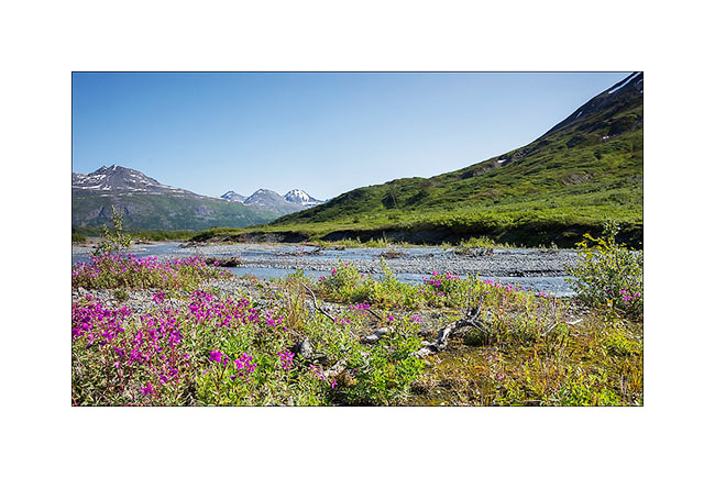
1. Glacial river near Thompson Pass.
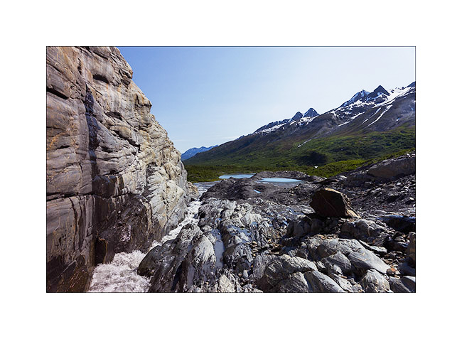
2. The glacier tongue is divided in two by a lock of granite.
3. Hiking along the granite.
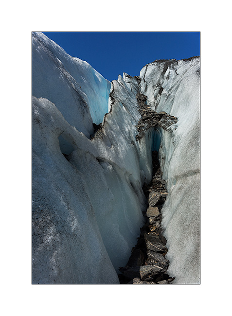
4. The ice also recedes every year here… In 1950, she was almost half a mile below.

5. Ice carved by melting…
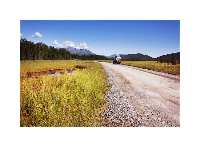
6. Going up the McCarthy road, near the confluence of two beautiful rivers…
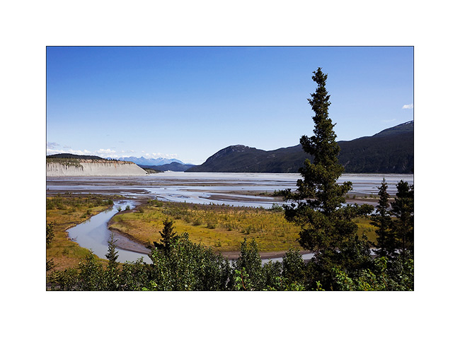
7. The road passes through beautiful landscapes of taiga alternating spruce forests and swamps…
8. … and numerous small lakes.

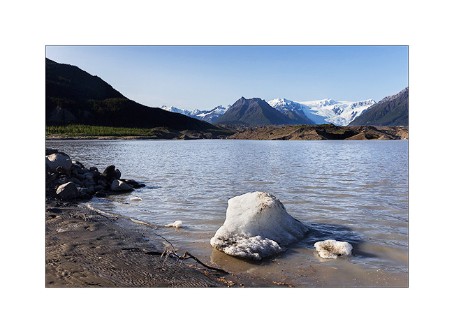
9. Arrived in McCarthy – on the other side of the river that crosses a footbridge to reach this little city – I slept at the foot of the gigantic Roos Glacier, near the small lake which ended his over 30 miles long tongue.
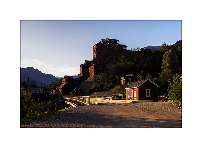
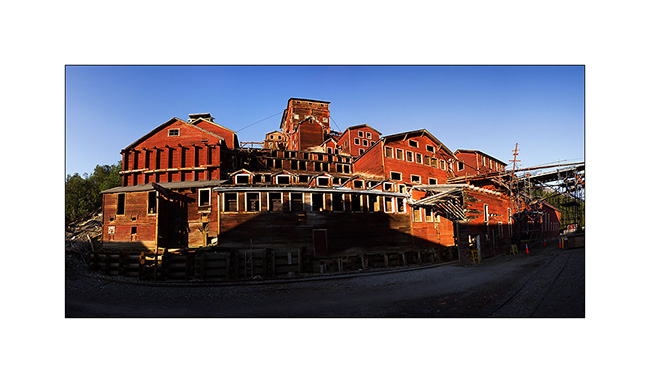
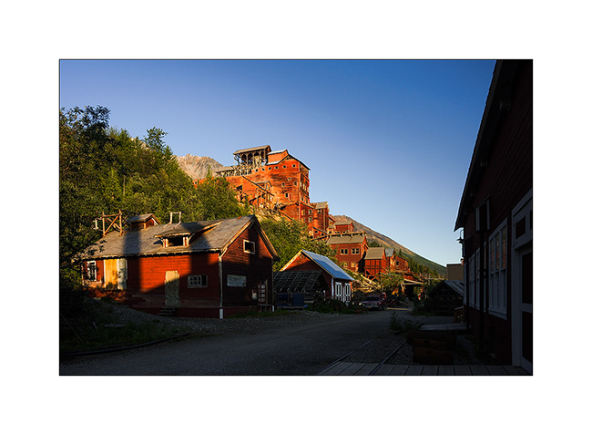
Enjoying the light of late afternoon, I took my Mountain Bike to for explore the Kennicott Mine, one of Alaska’s largest mines operated at the beginning of the last century.
10. This historical heritage is being renovated.
11. The construction of the mill itself is really huge. Even this panoramic of 6 stiiched images don’t manage to show you how large it is.
12. Several outbuildings surround it…
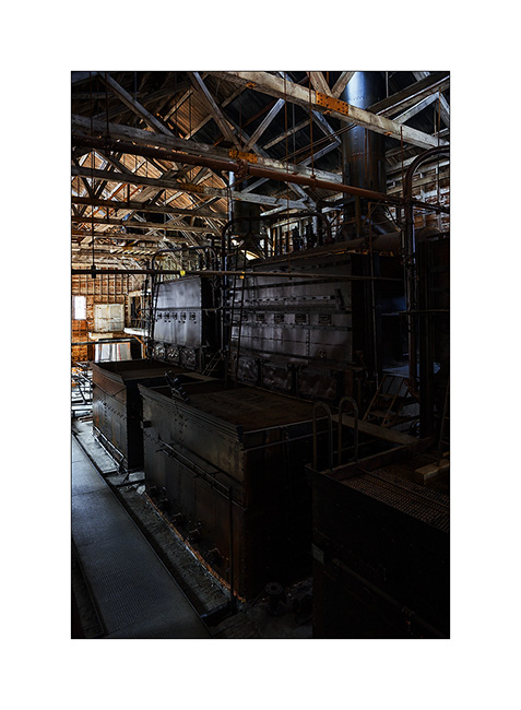
13. … whose thermal plant that produced the electricity needed in a real coal power plant.

14. The four huge boilers are impressive!
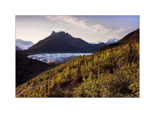
15. This mine is built on the lateral moraine of Roos Glacier which descends more than 5 miles downstream.
The next day will be a hard day: I decided to go up the glacier as far as I could. I made more than 30 miles, mountain biking first, then hiking. I arrive much only as half of the glacier…
16. A panoramic shot of 8 images in an attempt to show you that immensity. By itself, this glacier is larger than Rhode Island!

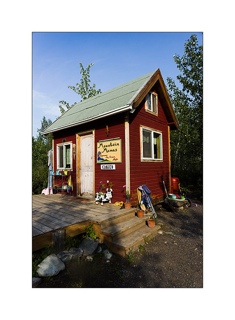
17. Back by the McCarthy Road and even there, I founnd a swiss cow!! 😀
18. VivaLaVida would almoast fly..! 😉
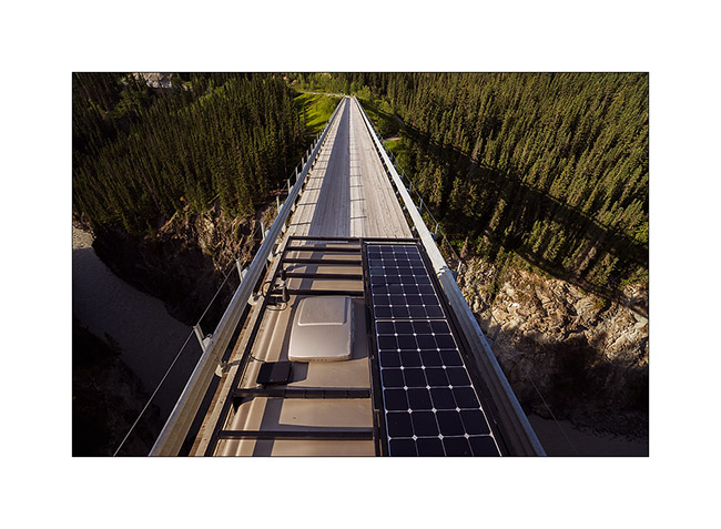
19. This is actually a high and narrow bridge over a deep gorge. It was built in 1905 for the railway route which allowed to bring coal to Kennicott Mine and transport gold mined.

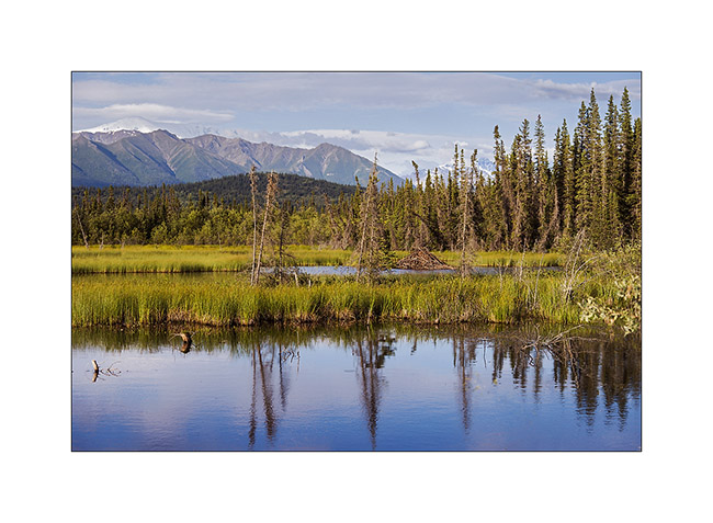
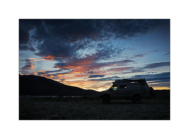
20. Beaver lodge in a pond near the road.
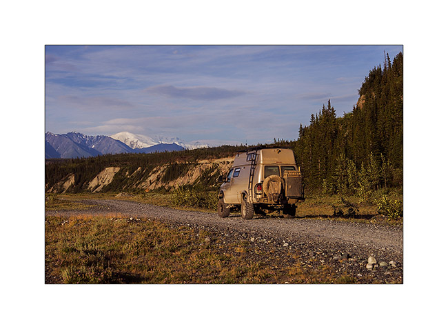
21. VivaLaVida approaches his camp of the day…
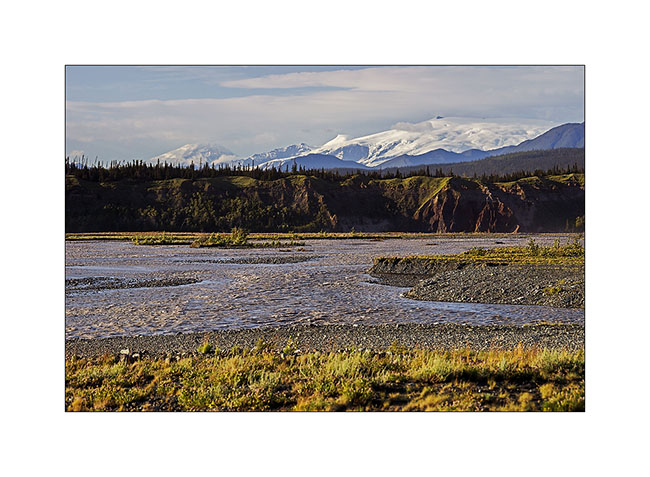
22. … along a beautiful river… The large icy dome in the background is Mount Wrangell, a dome volcano.
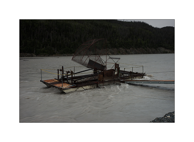
23. … where salmon fishing is going well. There were a dozen of these catch-machine driven by the current.
24. I still see the large dome that gives rise to Roos Glacier, more than 60 miles as the crow flies.

25. The Sunset was beautiful, the bad weather coming again and bringing some clouds…
The rain will follow me again during several days. So I headed to Anchorage for some maintenance work on VLV and to prepare the last updates before the arrival of Mino who’ll have landed when you’ll discover these lines. 😉
 D5 Creation