house
now browsing by tag
Faroes (III)
Let’s continue the journeye…
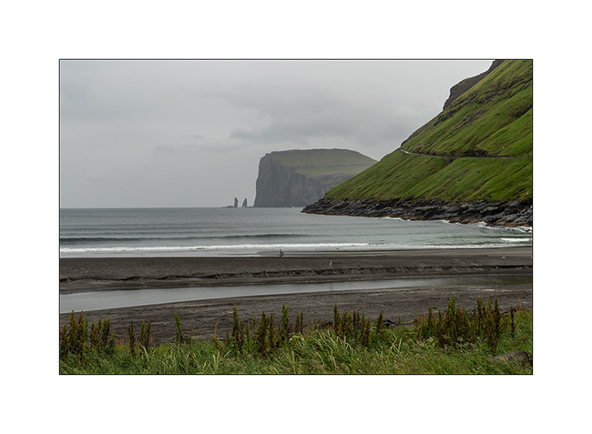
1. Arriving in Tjornuvik, another isolated village known for its black sand beach, one of the very few beaches of the Faroes. The place is famous for surfing because the bay opens on the North Atlantic and have big waves when it’s windy.
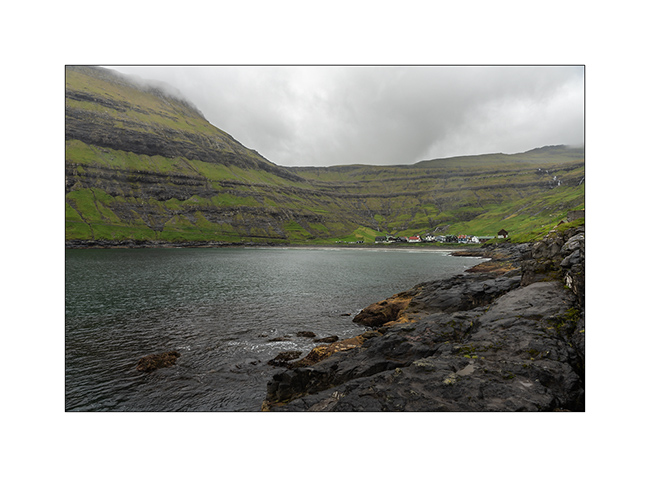
2. The village is nestled at the bottom of the bay.
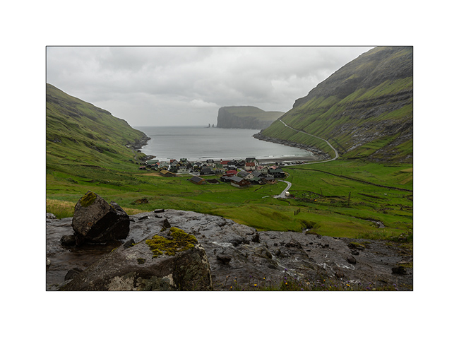
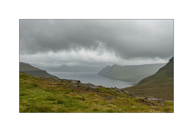
3. Overview as the rain doubles.
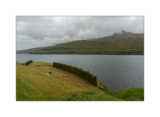
4. Here’s something I hadn’t seen before: a method to dry the hay that will feed the sheeps during the winter. As it rains all the time, it is arranged in walls. The constant wind prevents the grass from rotting and allows it to dry.
5. Rest zone!
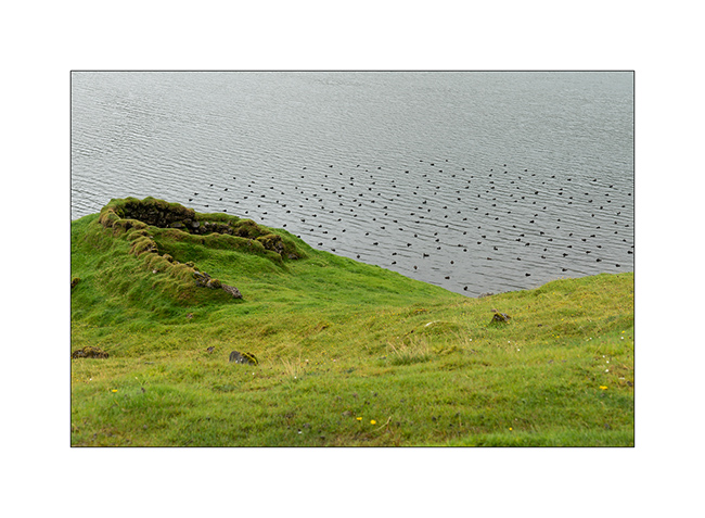
6. Little pass on the way to Gjógv.
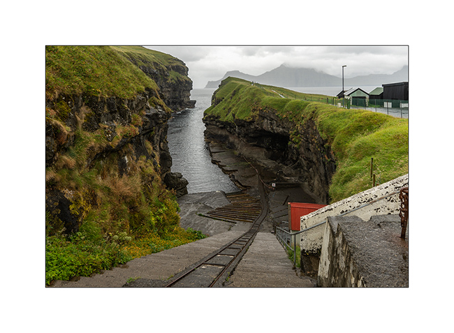
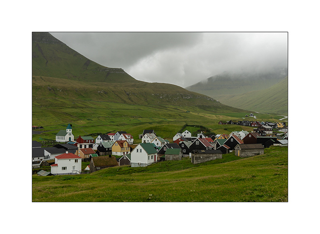
7. Arriving at the village, still in the rain.

8. It has a privileged natural shelter.
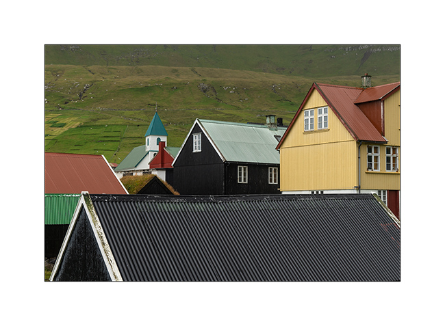
9. Traditional houses…
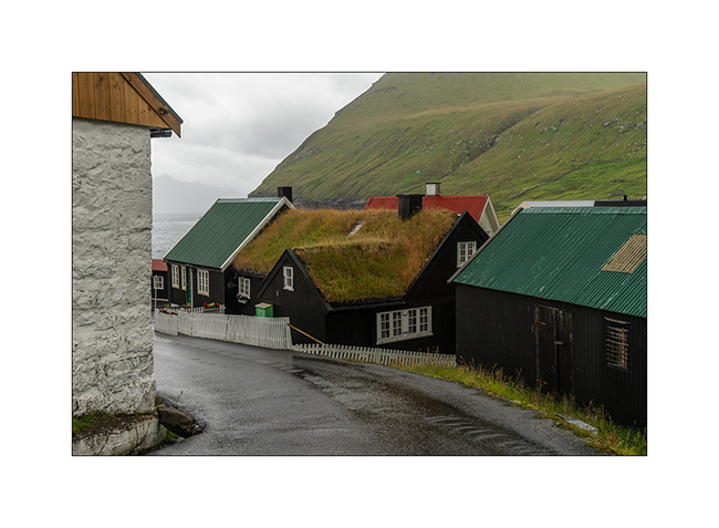
10. …
11. Last seen before leaving…
Because three days pass quickly, the next article will introduce you to the old city of Tórshavn, the capital, and the ferry crossing.
See you soon here 😀
Alpine Loop (2)
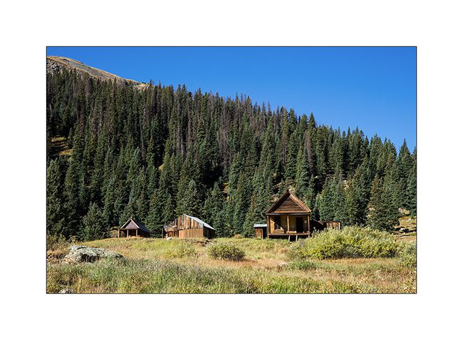
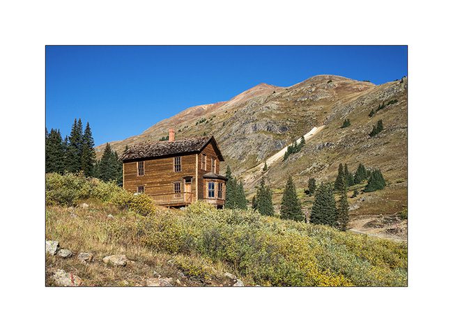
I slept in Animas Fork. This is an old mining town founded in 1880 and which was abandoned around 1920 when the fall of the metal rate during the great depression made their extraction unprofitable. The village hosted up to 450 people during the summer of 1887.
1. The village transformed into a Ghost Town but an association keeps the remains in a state close to the original.
2. The “mill” that served to separate ore by block sizes collapsed.

3. Well preserved house that housed two families (one per floor).
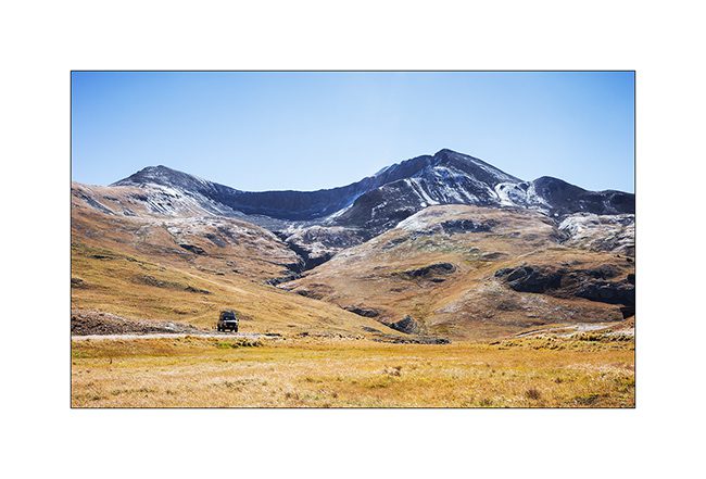
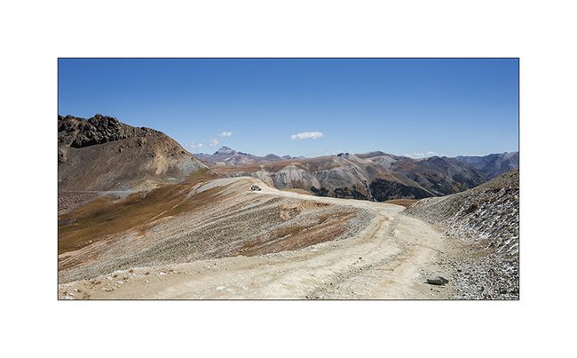
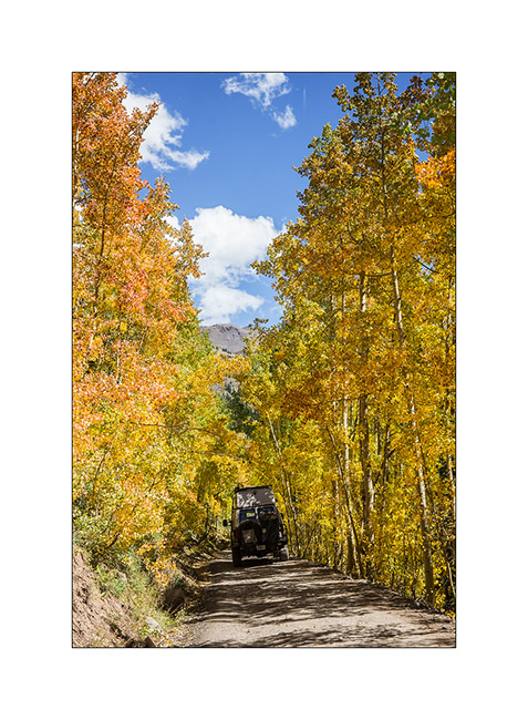
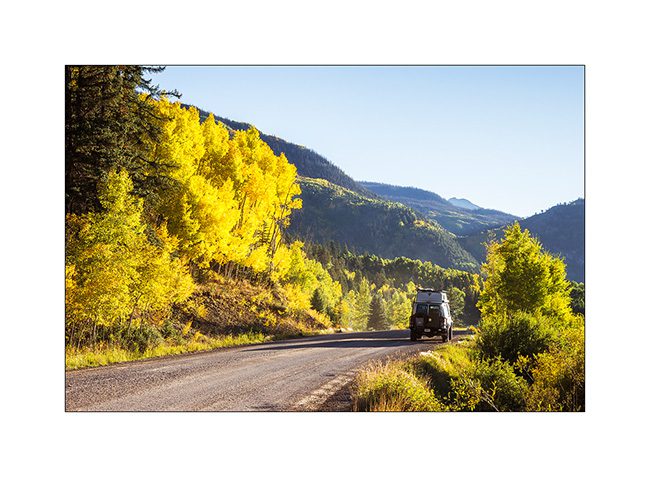
4. VivaLaVida heading to another pass over 13,000 feet : Engineer Pass.
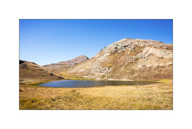
5. Small alpine lake…
6. The track rises in the tundra. It doesn’t seem but some sections are quite steep.
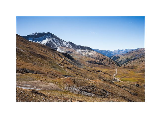
7. Reaching the pass.
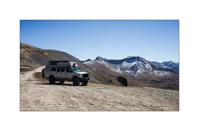
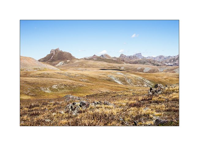
8. Grandiose panorama…

9. VivaLaVida looks small up there!
10. Tundra and Snowy rocks.
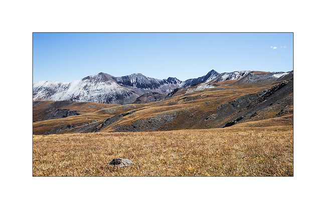
11. Touch of vegetal color…

12. Facing to the North…
13. … there is a “Matterhorn Peak”! Funny Americans! 😉
14. Descent into the aspens I so love and who, on this slope, began to take their fall colors, such intense orange yellow !
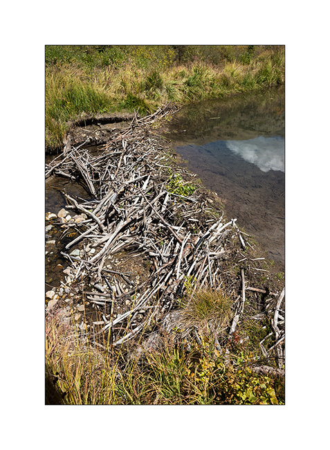
15. A small lake made by Mr. Beaver!
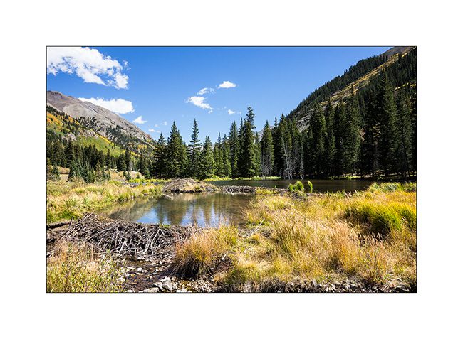
16. Dam builder.
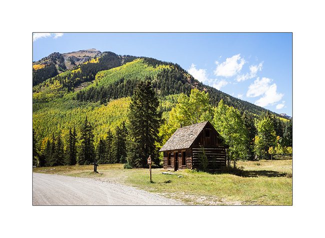
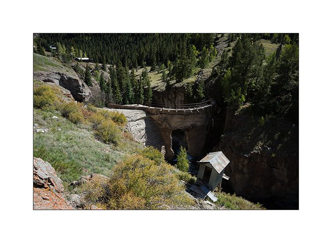
17. Capitol City.
18. Indicator of past industrial activity, an arch dam built around 1890 or what is left…
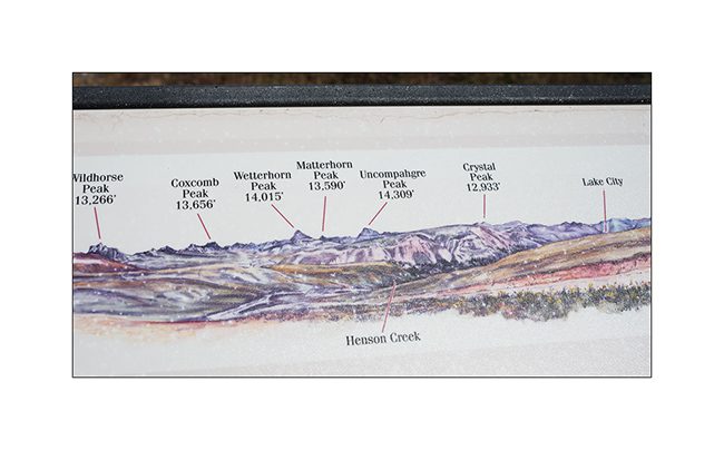
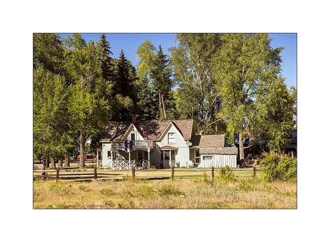
19. Beautiful house in the picturesque small mining town of Lake City.
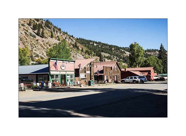
20. 2nd street…
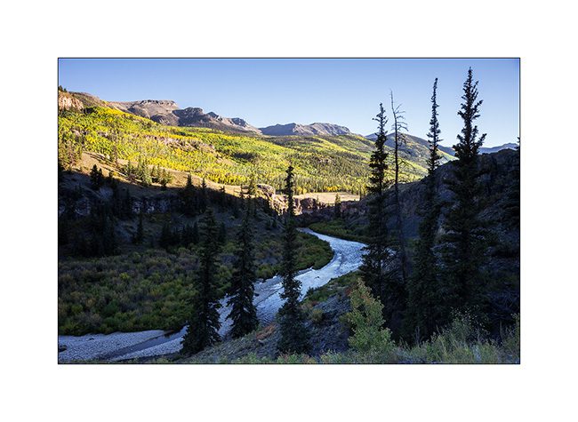
21. Cinnamon Valley in late afternoon.
22. Aspens.
23. last sunrays on the road.

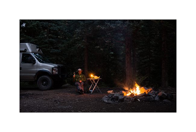
24. Cheers from my camp along the Lake Fork Gunnison River.
It continues with some other places of Colorado in a few days. Thank you for your loyalty to follow this blog! 😀
Tennessee (4 and end)
Here it is, the new Title of Vivalavida arrived! So I’m back to Fletcher to pass technical inspection by the seller – Chris in this case – necessary for subsequent registration. I will then be able to go to Georgia where the following steps are still to be done: get proof of residence, a certificate stating that I am not “eligible” for social security, obtain my Georgian driving lisence (it will be easier since I already have a US driver license) and finally register VLV Under my name. Still many steps, hoping they will not be as long as the previous…
I take this opportunity to update the blog with some of the last images brought from Tennessee. I left you at the Big South Fork …
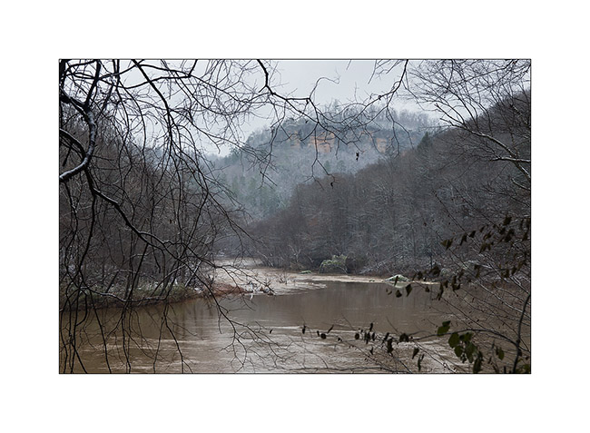
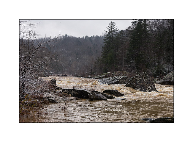
The next morning, the snow had whited the country and the clouds were very low. I went to see the Angel Falls on the Big South Fork River, flooded after two days of almost uninterrupted heavy rains. A beautiful wild atmosphere …
I saw two pileated woodpecker, too fearful that I could photograph without a tent.
1) Flooded Big South Fork River

3) driftwood…
4) Angel Falls transformed in powerful rapids…
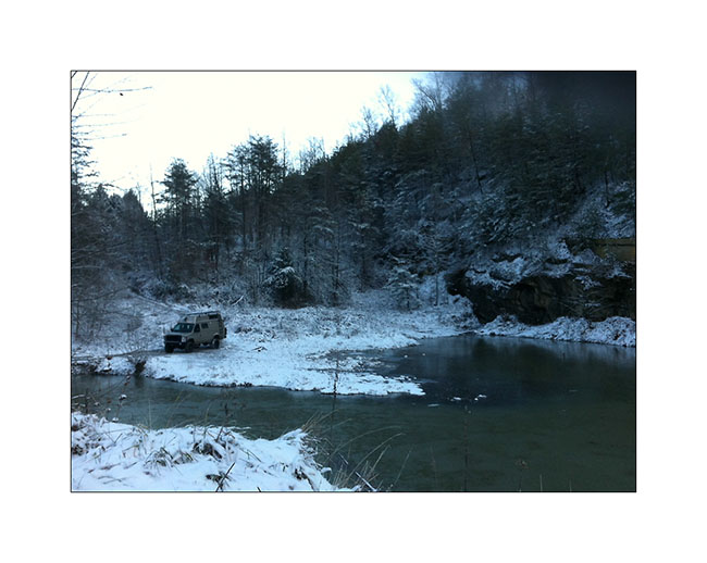
I then did a bit of road eastward to explore two beautiful natural arches the next day. Arrived when the night was well fallen, I declined to pursue the trail marked on the map which was washed out and completely frozen by the ambient 16°. I stopped near a small lake to spend a night.
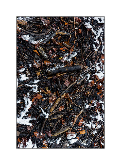
The next day, I was somehow baptized by that winter! 😉
First by a really frosty morning: 7° to the outside thermometer, 27° to Vivalavida’s dash thermometer, behind the front curtain. First night that the heater, set to 40° to protect the bowels from freezing, has started at 3.30 am.
5) Morning at my campsite with 7°: cold! (taken with my iPhone…)
In the daylight, I was able to continue the snowy trail and I stopped at the hiking trailhead. After having equipped myself for “cold” weather, with my waterproof pants, my jacket on three polar layers, I started the trail. After a little more than a mile, I discovered a river to cross! Not very big, probably 20-25 feets wide, but deep enough for the water to enter in my shoes, which was excluded given the temperature. So, no other choice than taking my shoes off and cross barefoot! believe me, it was an exhilarating experience! 😀 A beautiful baptism, isn’t it?
After walking a few feets in the snow to dry my feet, I puted socks and shoes again and had good warm feet for the whole hike! A little more than one hour later, I discovered Primroy Arch, beautiful in that snowy day. I don’t know if it’s because of its name but it is unfortunately widely tagged with lovers names … A shame for such a great natural monument even if the symbol is pretty…
6) Primeroy Arch
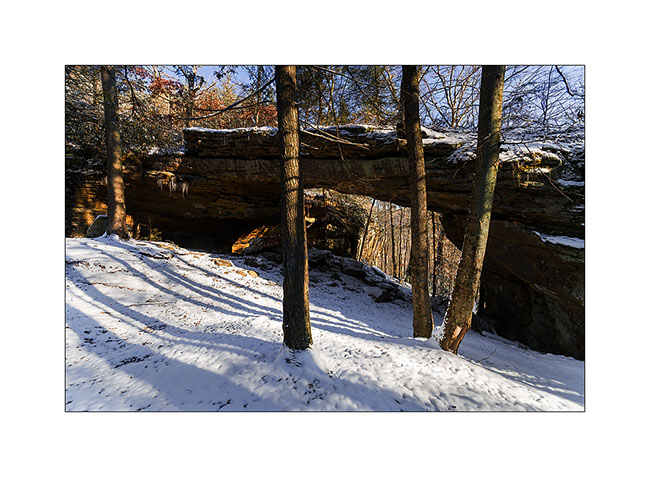
7) Primeroy Arch (2)
8) Thanksgiving decoration..! 😉
9) Pretty colors under the arch, portion that taggers didn’t reach…
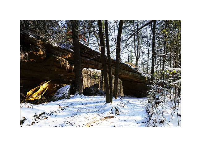
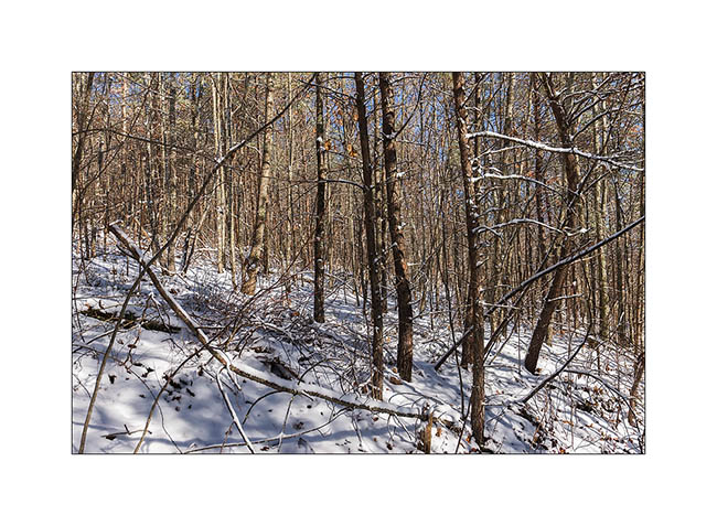
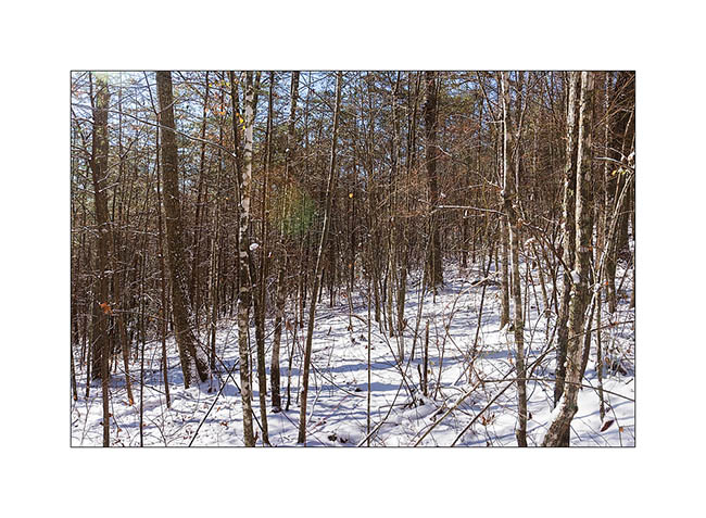
I continued the hike to the beautiful “Drive’in Triple Arch”, rather sought my way through the forest, which was a little difficult to find with the recently fallen snow…
10) do you see the trail..?
11) end there..? 🙂
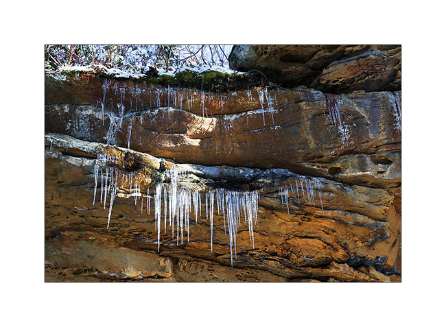
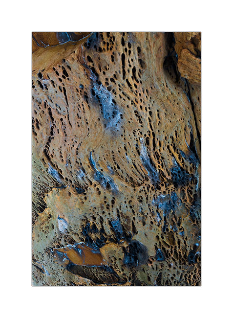
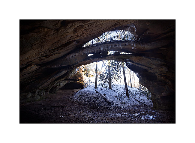
In fact, it was more a GPS navigation than anything else .. I also had some trouble finding the arch nestled at the bottom of a long cliff, or more exactly to access it. I made several attempts to down the cliff of about hundred feet, finding me every time over a impassable sheer. In the end, I made a detour of nearly an hour to reach the end of this long cliff, then walk down of it the other way. I discovered this beautiful arch which is actually a double arch. It is a good example of how these arches appear: water seeps into cracks of the cliff and the frost breaks the rock above, the keystone of the arch preventing it from breaking below. Ice present that day highlight water infiltration.
12) Dirve’in triple Arch
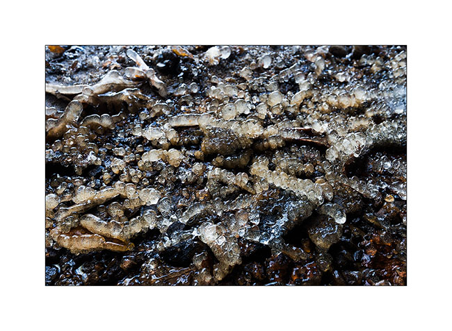
13) ice stalagmites under the arch…
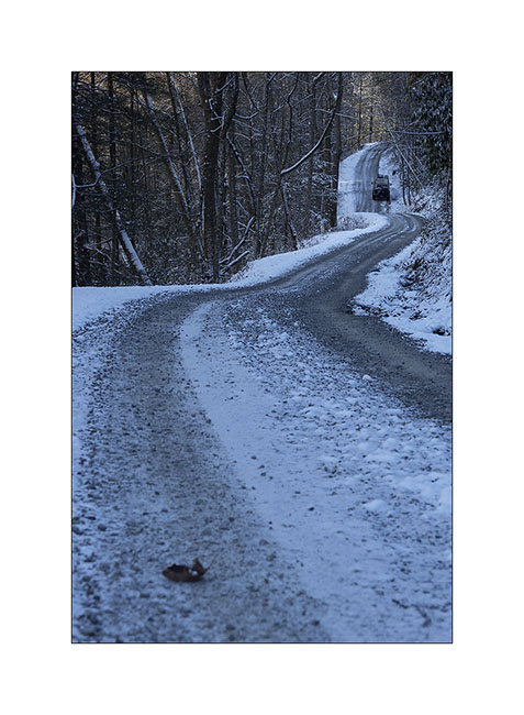
The return went without particular problem – in recrossing the river of course – and when I found Vivalavida at about 3PM back, the roads were still frozen by 26° ambiance…
14) winter on the raos…
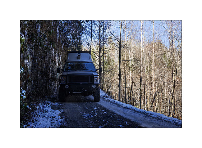
15) narrow passage…
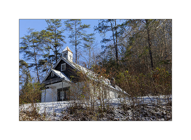
16) small Church on the road
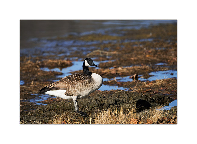
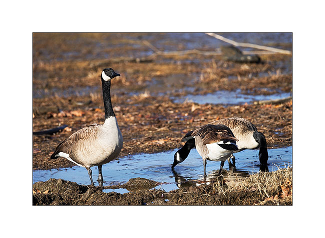
I then spent two days next to an artificial lake, enjoying watching the birds. First, a large group of Canadian Geese, about 80 individuals. What a noise they make! 😀
17) Canadian Goose
18) this was a little worried about my presence…
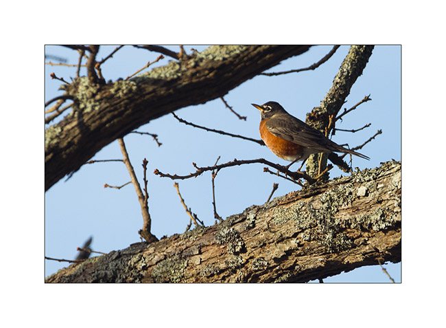
19) an American robin
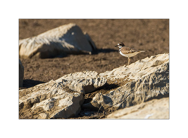
20) a plower killdeer, quite difficult to approach…
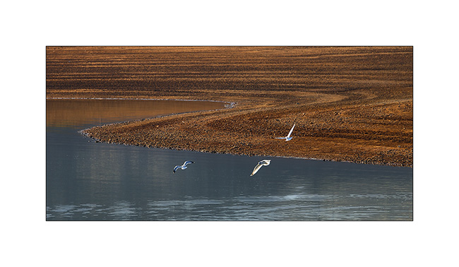
21) seagulls..
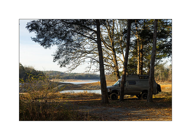
22) my campsite thèses two days. Nice, isn’t it?
At the announcement of the arrival of the Title, I took the road back to North Carolina, stopping to visit some relics of the past…
23) muddy road…
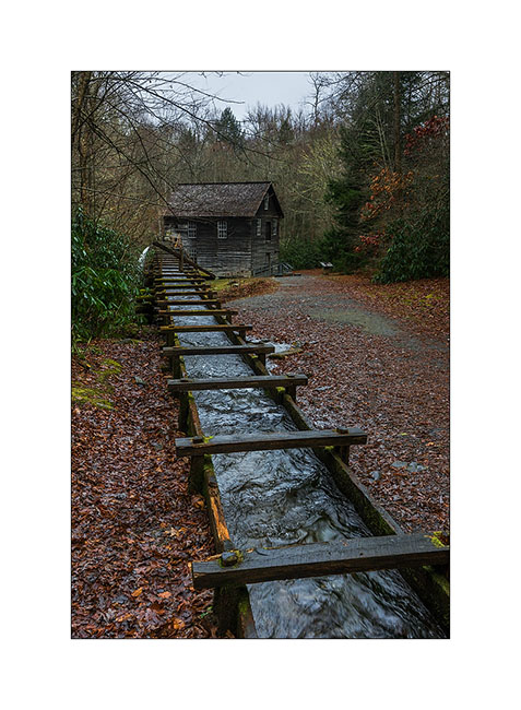
24) One of the first l’un des premiers weight-mill, a column of water driving a turbine. This one was built in late 19th century.
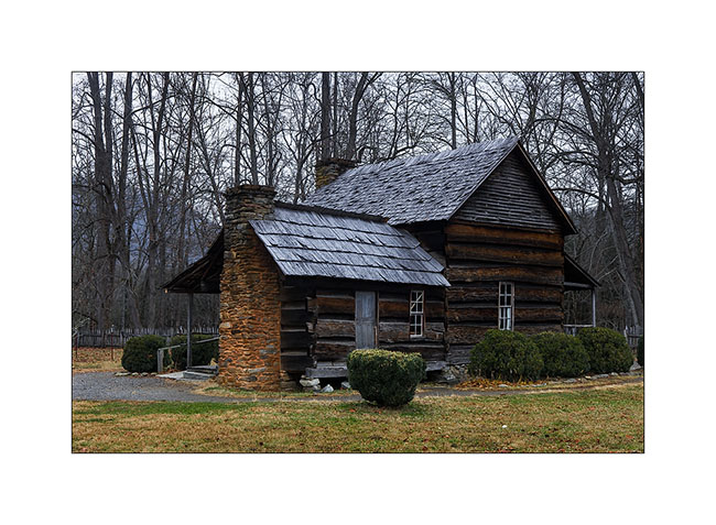
25) old preserved house, a relic of the 19th century (1860 for it)
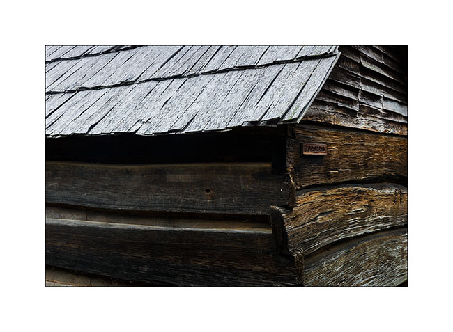
26) construction details…
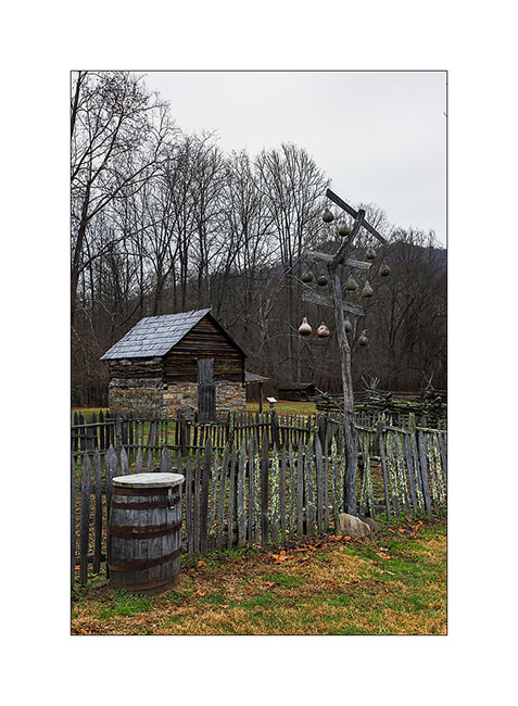
27) traditional barriers; durable and which don’t need nails to build..!

28) traditional birdhouses made in calabashes and an apples house in the background.
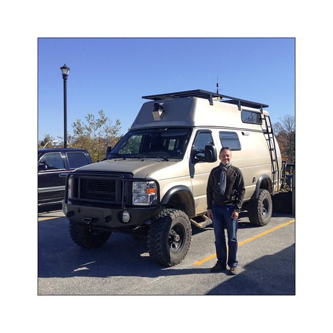
29) And finally, a photo taken by Eric during our meeting in Maryville. It was he who advised me to visit the Big South Fork, many thanks to him!
 D5 Creation