glacier @en
now browsing by tag
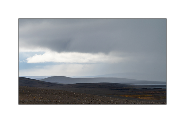
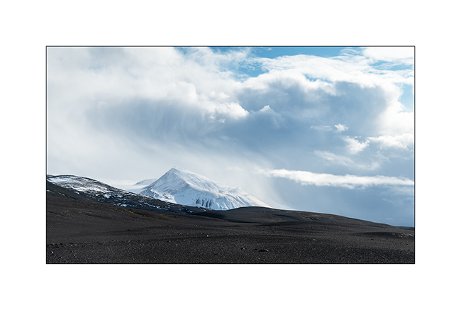
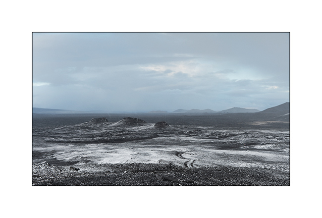
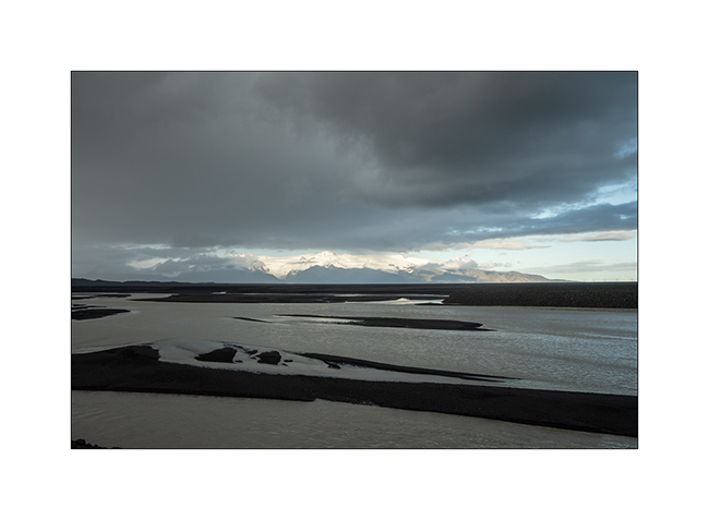
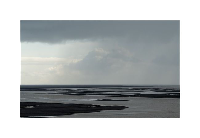
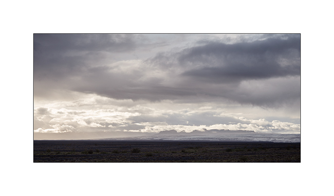
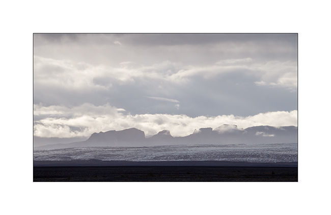
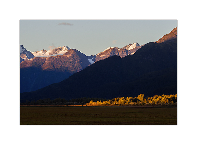
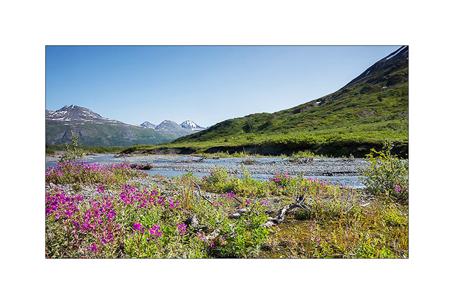
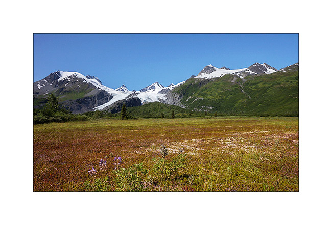
Highlands I – F26 / F910
1. After refueling VivaLaVida (with about 10$ a gallon of diesel, it’s more than 400$.- to fill VLV!), we begin the crossing of the Highlands to the Northeast via the F26 road then the F910 which passes north of Vatnajökull.
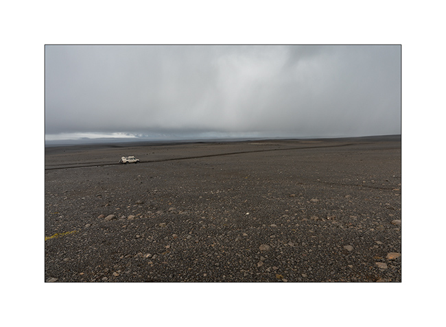
2. We took two days to reach the site of Askja through beautiful and immense landscapes.
3. …
4. …
5. …
6. …
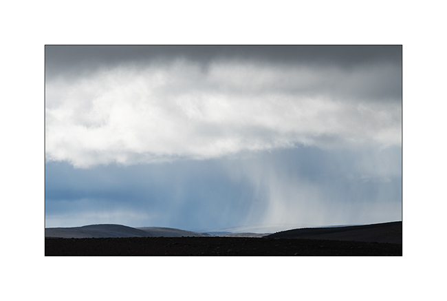
7. Giboulée…
8. Notre piste…
9. …
10. …
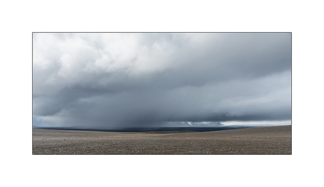
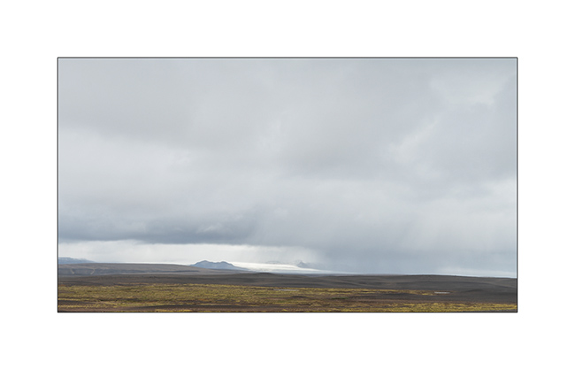
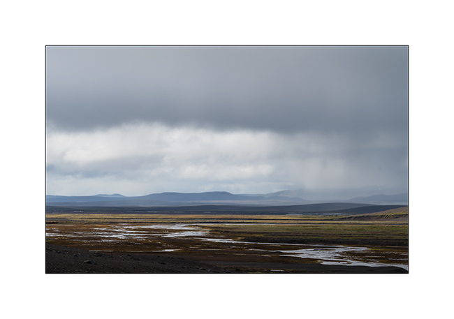
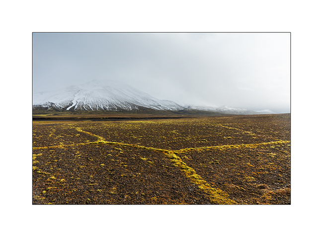
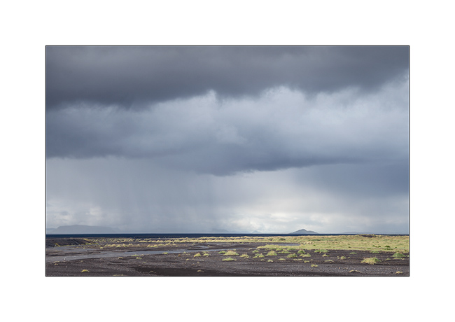
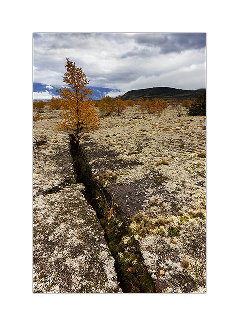
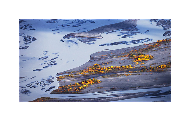
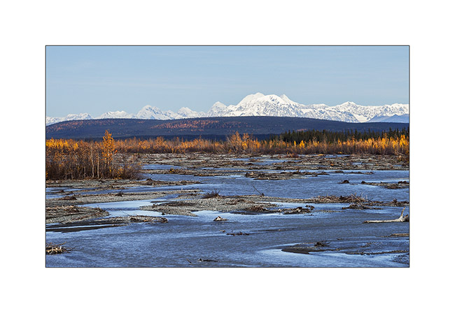
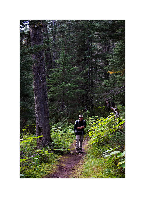
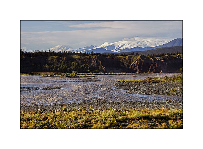
11. After about 150 miles exclusively mineral, we found some vegetal colors again…
12. At 2400 feet elevation, snow is close.
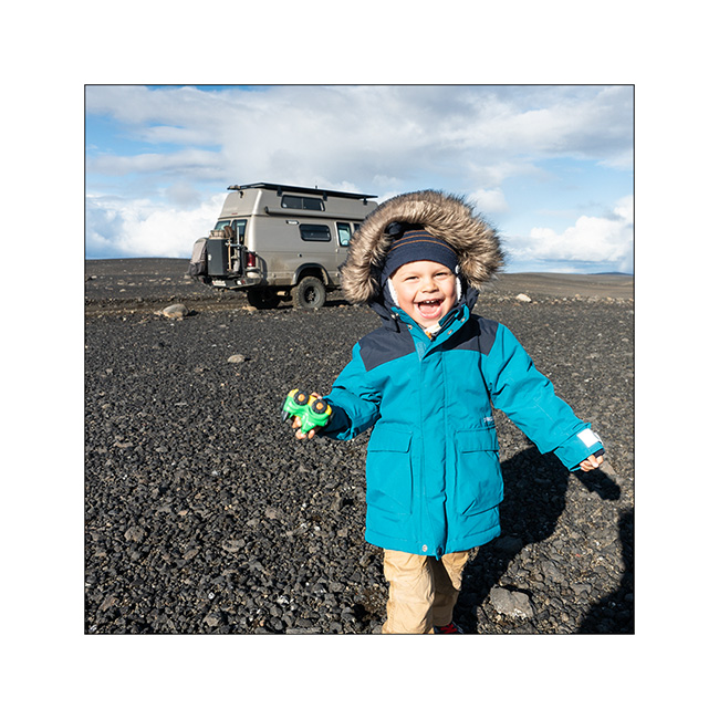
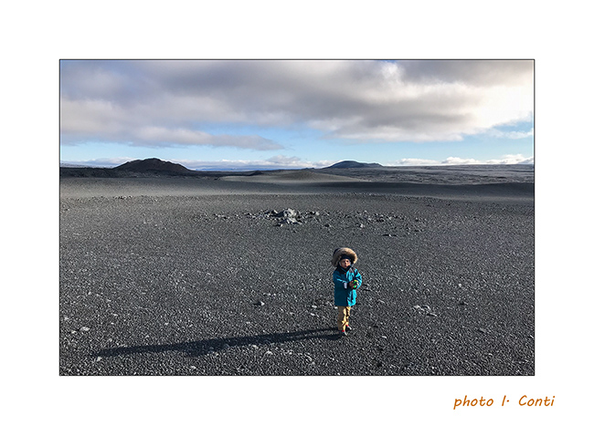
13. Moss grows along furrows carved by surface water, forming geometric shapes.
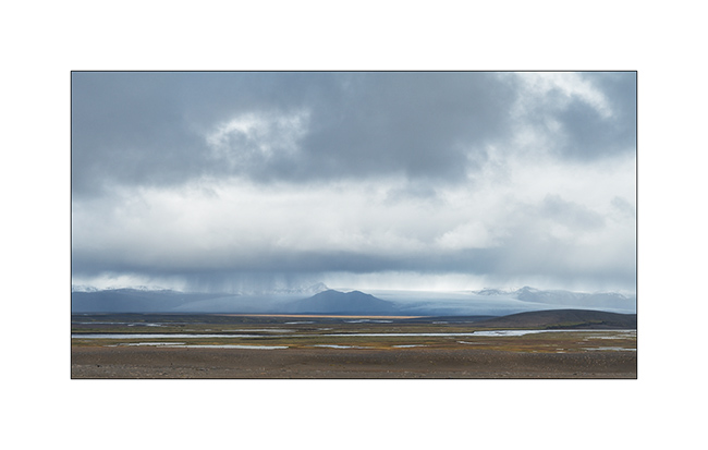
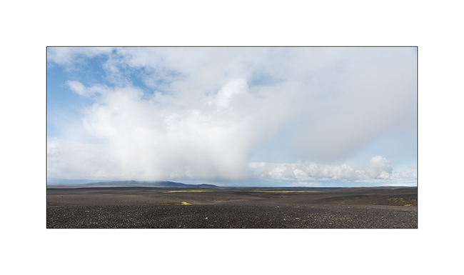
14. The sky ends up opening to the north.
15. The opportunity for Emile to stretch his legs! 😉
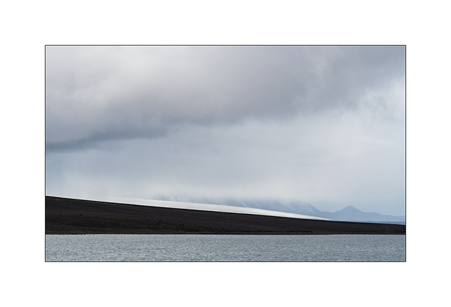
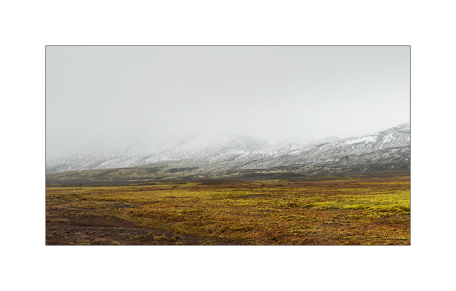
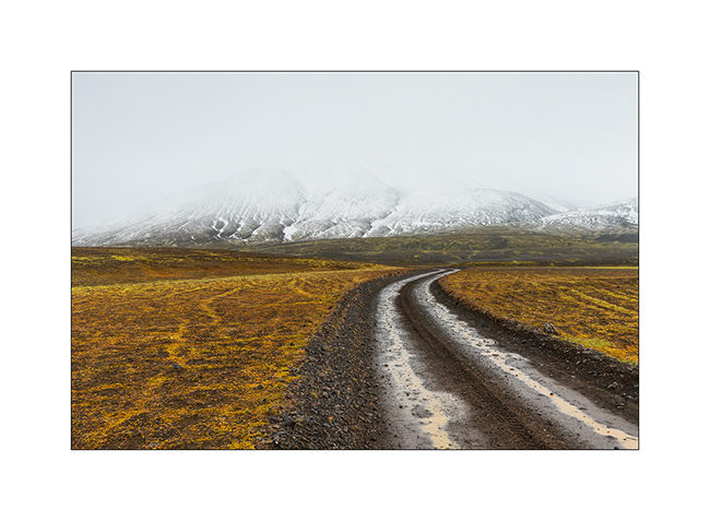
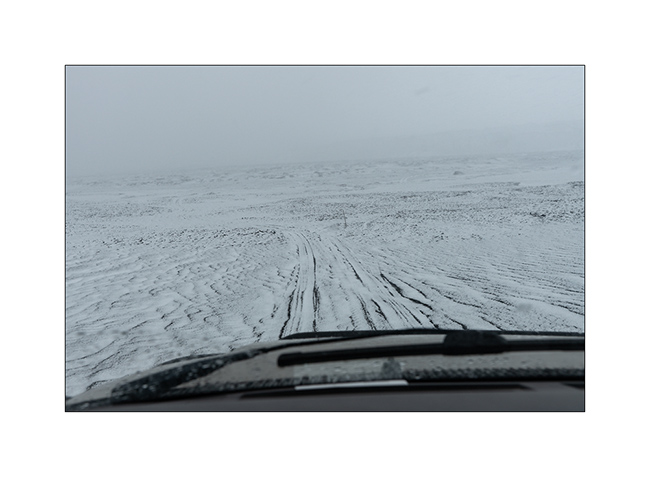
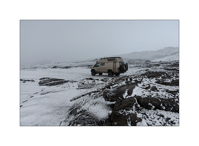
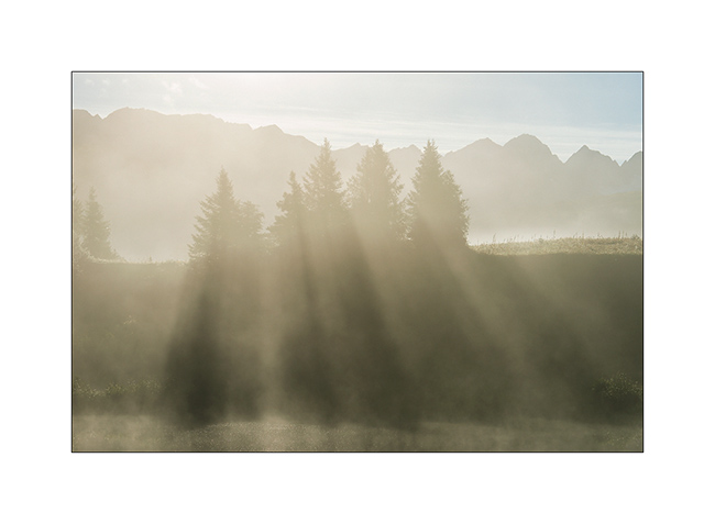
16. …
17. …
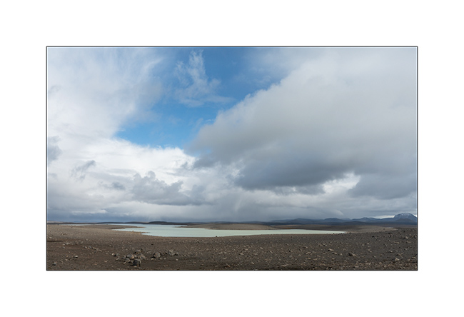
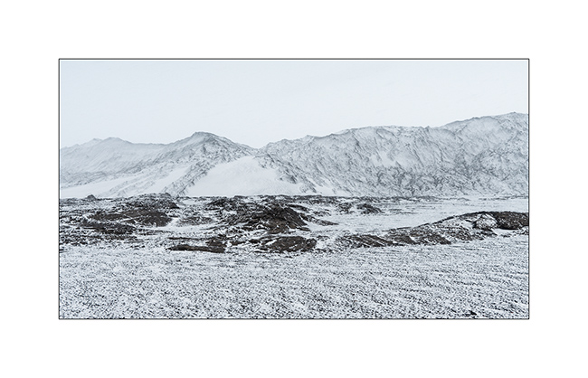
18. As we borrow the Southern variant of F910, as we gain altitude, the weather decays and the snow quickly covers the lava.
19. While snowing, VLV is the only color note of this landscape.
20. Naturally monochrome landscape.
21. …
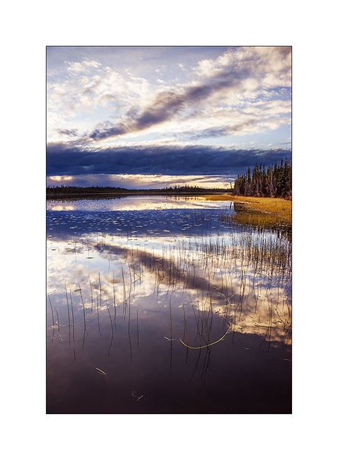
We spend a cold night not far from the Kistufell refuge, near the Northern end of the VatnaJökull.
Continuation of VivaLaVida’s journey soon! Thank you for your loyalty.
South coast…
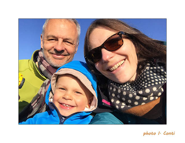
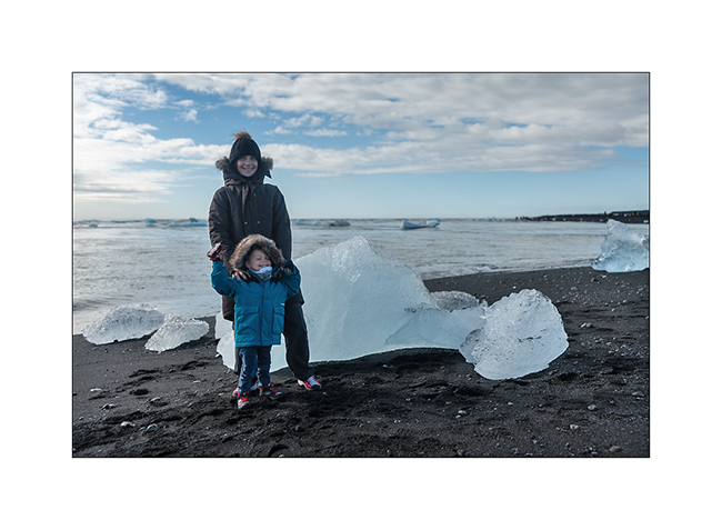
1. As Gaël requested it, here is the whole family. 😀
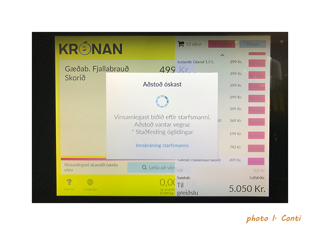
2. An example of the language at the checkout of a store, inapprehensible and unpronounceable for us.
And to show you what the rain can be there, here is a short video
of Isabelle made the day before where it rained like that almost all day long..!
3. Continuation of the South Coast to the East. VivaLaVida crosses many Gravel Bars, large river beds that regular floods clear of all
vegetation.
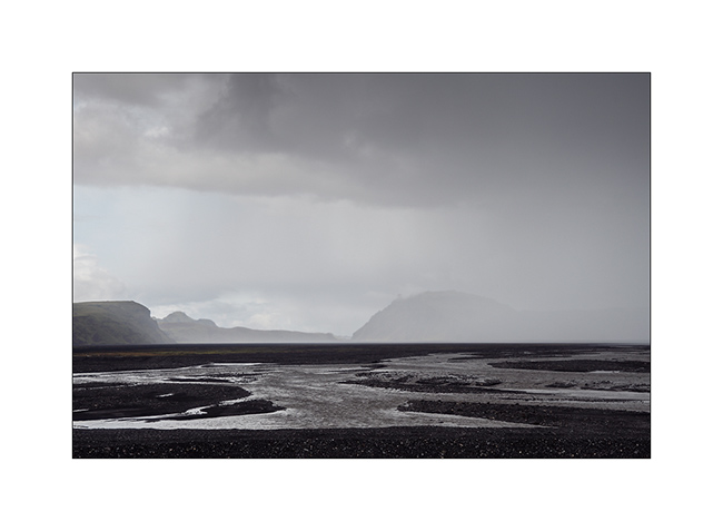
4. Showers that offer beautiful skies.
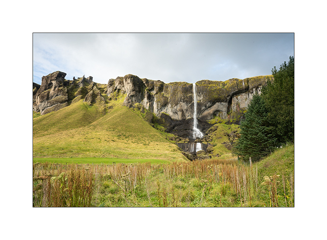
5. Waterfall Foss á Síðu along road Nb 1.
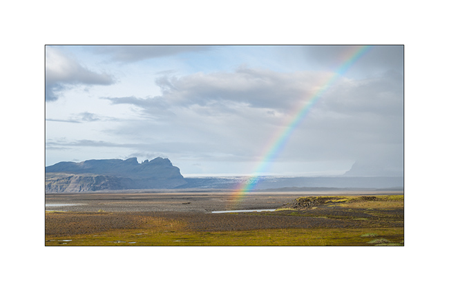
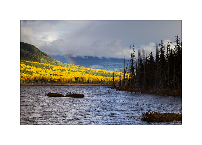
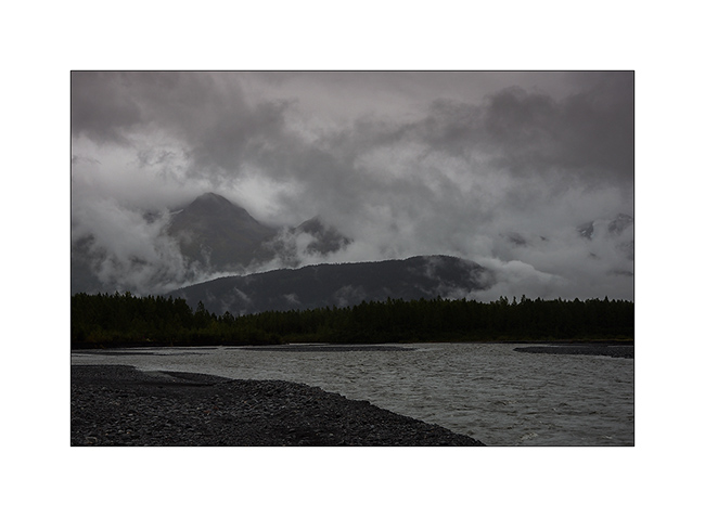
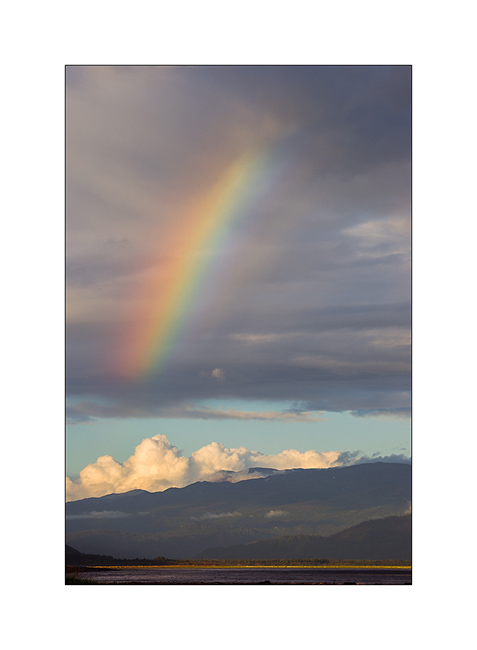
6. Rainbow in frontof the Vatnajökull ice cap in the distance.
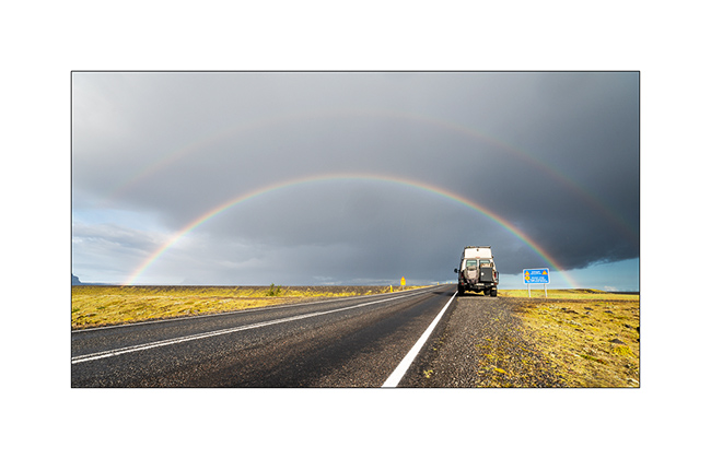
7. Another one to celebrate VivaLaVida.
8. Gravel bar.
9. Shower on the coast.
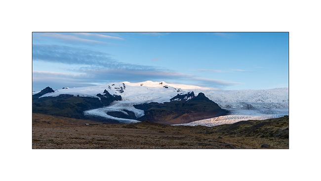
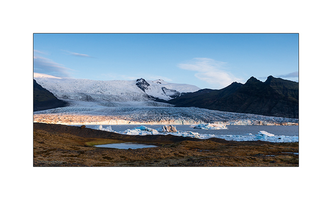
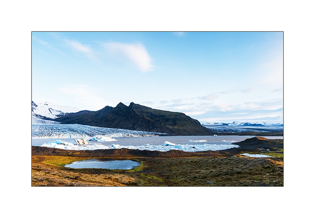
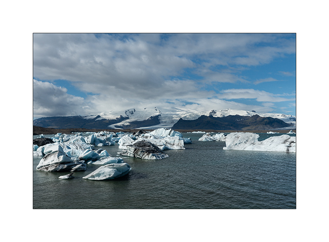
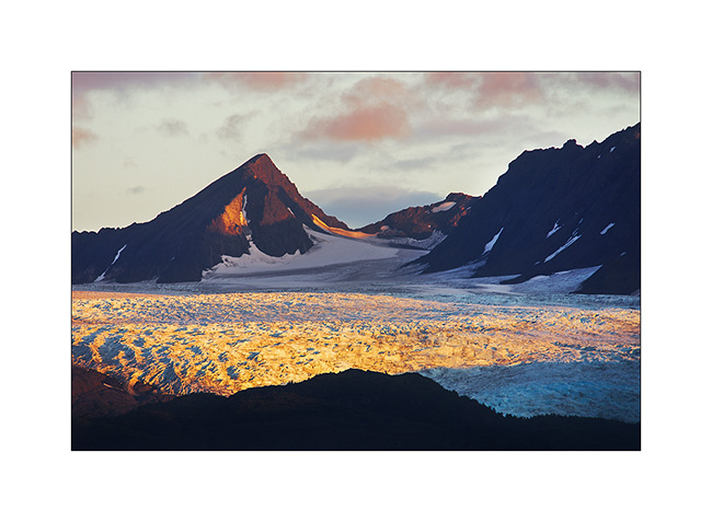
10. Vatnajökull ice cap, the largest in Iceland.
11. It is crossed by many volcanoes more or less active.
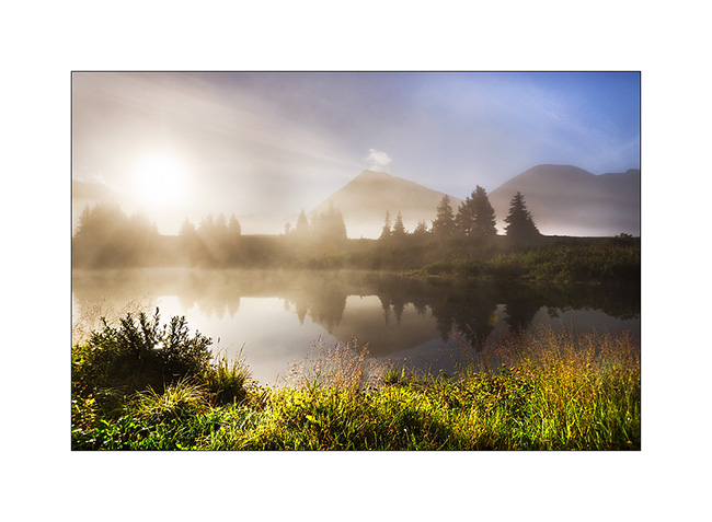
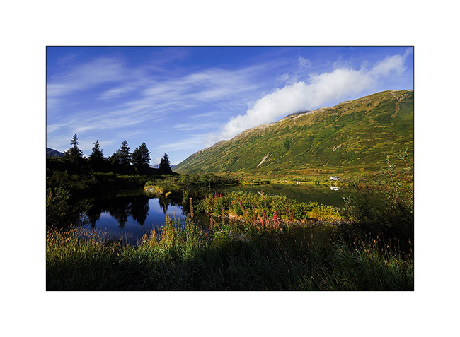
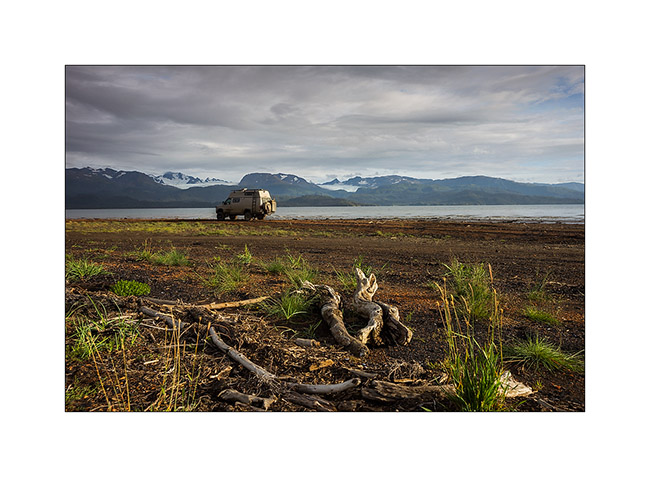
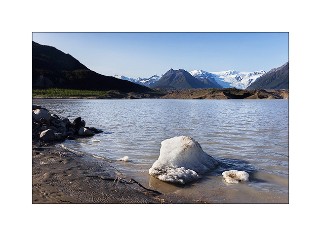
12. In the evening, VivaLaVida finds a nice boondocking place to camp near a glacial lake.
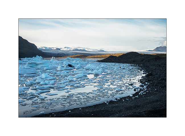
13. First colors at dawn.
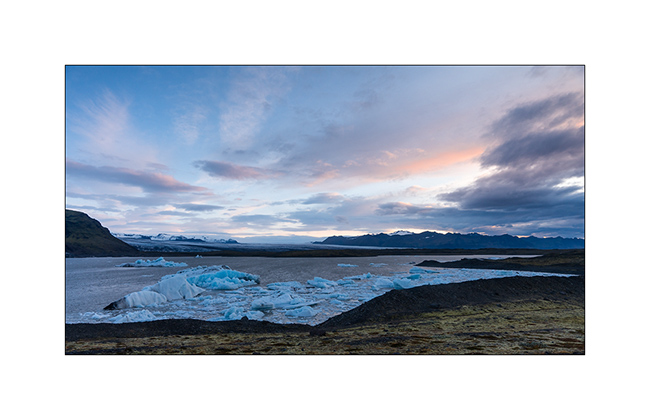
14. Camp of VivaLaVida, close to the glaciers.
15. Light beams…
16. … on raw elements.
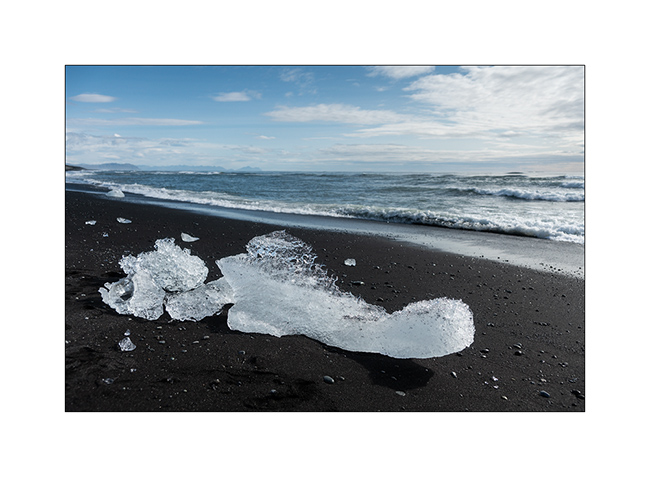
17. I couldn’t not show to Isabelle, a jewel fan, the “Diamond Beach”, famous for the icebergs that stand out from the Vatnajökull and flow
into the ocean by Lake Jökulsárlón before stranding on the black beach! 😉
18. Photo souvenir…
19. Jökulsárlón Lake.
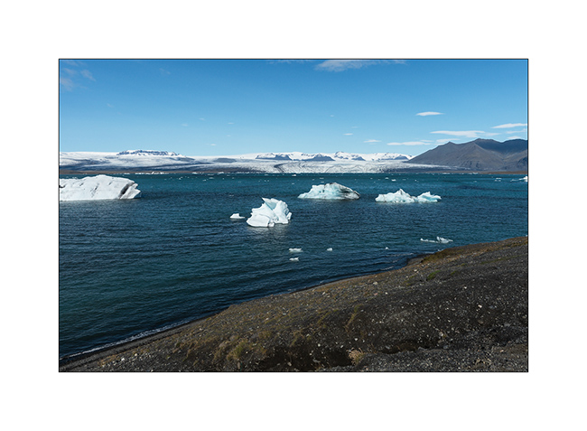
20. Larger icebergs must melt before crossing the channel leading to the ocean.
In the next update, we will leave the coast to discover the Lakagigar area where new small volcanoes appeared only some decades ago.
Cassiar & Stewart Highways
Vivalavida will now wipe six days of almost continuous rain. Indeed, it is the rain season near the Pacific coast, I didn’t really realize it until now…
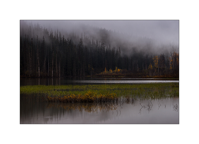
1. A pond in the myst…
Despite the weather, I went for a detour to Stewart to try to spot some of the many glaciers in the region.
2. The “Bear Glacier”, along the Stewart HWY.
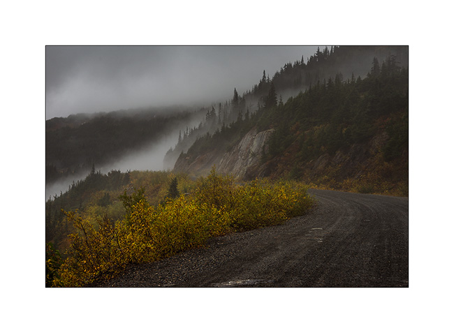
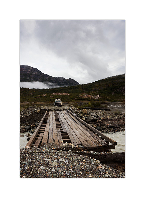
3. The mining road VivaLaVida borrowed in the rain to climb to other glaciers. Funny, we were in Alaska again for a few tens of miles without any customs as it is a dead end! 😀
4. Oups, the road ends here for VLV! I continue riding the mountain bike…
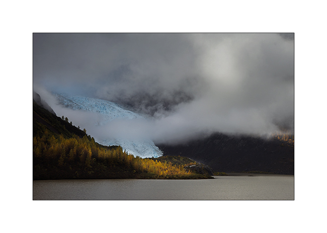
5. I’m lucky, a brief lull allows me to see the Bereton Glacier in the fog, it’s around 16:30.
6. A little later, I even have some sunlight that makes wet rock shining.
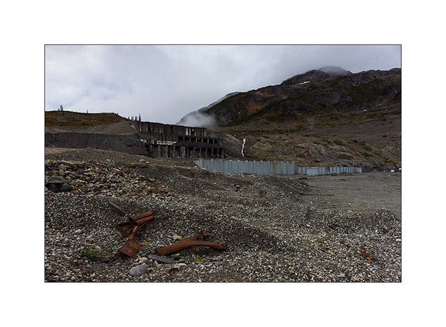
7. The road ends at this abandoned mine…
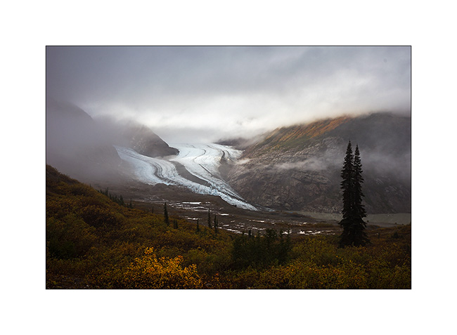
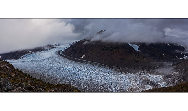
Back to VLV, I turned back to hope to see the Salmon Glacier, a huge glacier in T before night falls.
8. VLV seems very small in front of the giant!

9. Panoramic to attempt to show you the northern branch. The thrust is so strong that ice is pushed several hundred yards over the mountain (bottom right).
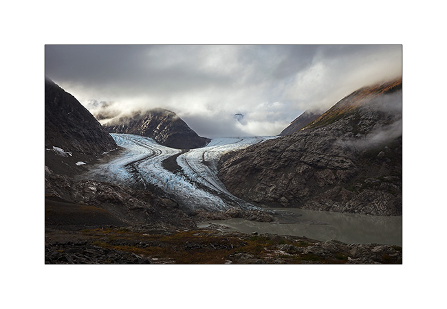
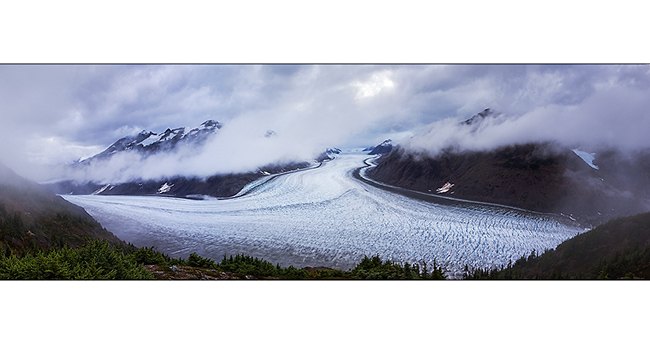
10. A second panoramic to show the immensity of the ice flow; more than 40 miles long and about 6 miles wide for its main part!
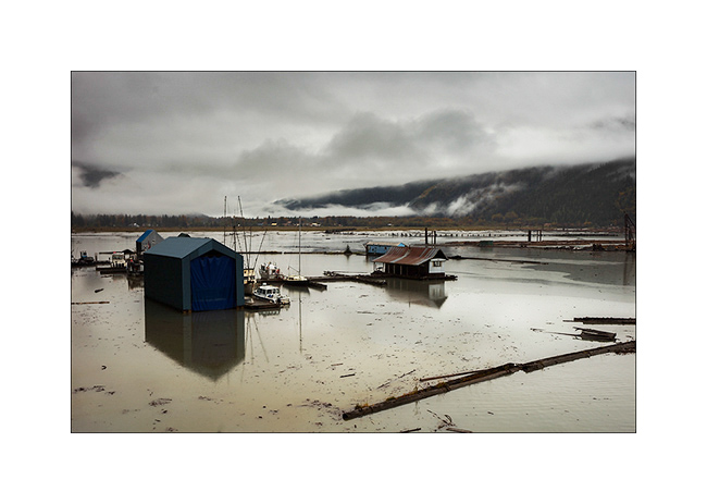
I slept on site, hoping for a better light in the morning but I woke up in a dense fog. I then went back down to Stewart…
11. … here in the middle distance, behind the harbor.
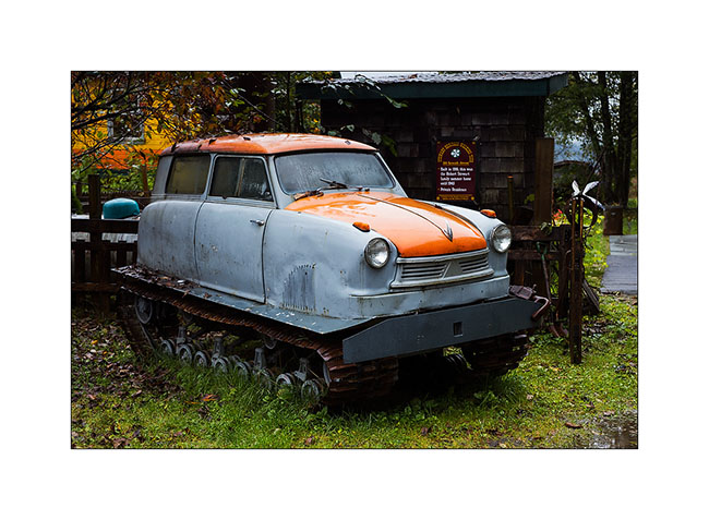
12. Seb, if there’s too much snow this winter in Arzier, I found what you need !! With that, you won’t never remain blocked! 😉 This is a Russian car which I have not been able to understand the brand.
Still in the rain, I continued South with a new detour to the Nisga’a lava fields, theater of the last volcanic eruption in Canada, about 300 years ago. 2,000 Indians were killed, several villages have been swallowed up. The melt is more than 20 miles long and deflected a big river from several miles.
13. The only bright spot of the day on VivaLaVida’s way and still in the rain.
14. Rainy inlet the next day…
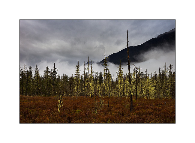
15. Marsesh where lichen took possession of the dead trees. Nice atmosphere, isn’t it? We could see one or two trolls showing up? 😉
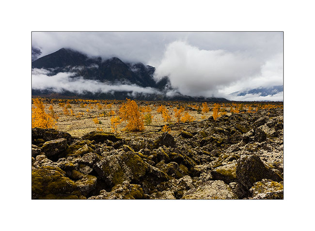
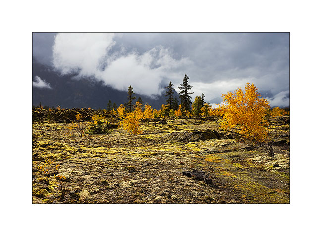
16. Arrival at the lava beds, sometimes smooth as in the background, sometimes chaotic. They reach more than 45 feet thick in places.
17. Crack…
18. Few trees were able to grow in this young and barren rock.
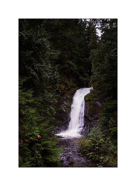
19. A small cascade which drains a lake, also created by the lava flow.
20. Small rainbow as VLV continues heading South.
Continuation of the descent of British Columbia in the next update.
Last days in Alaska…
As I was writing the last update, I left you in Anchorage without still knowing where VivaLaVida would then head as I wrote the last article.
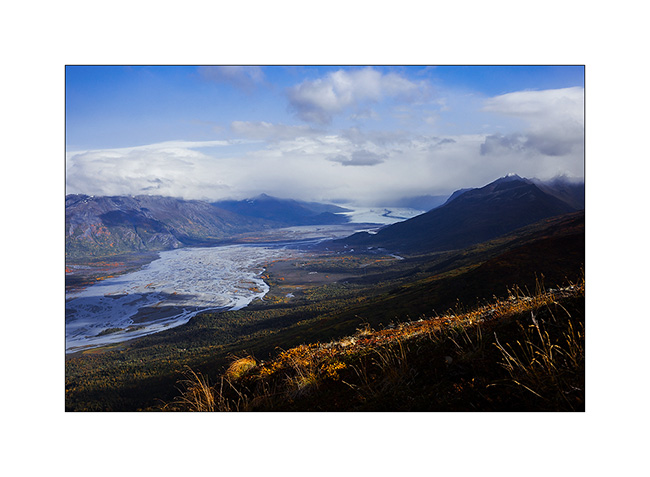
After some cleaning and laundry tasks, a small weather window seemed to open up to Eastern Alaska where I had spotted a few places to discover. So I took the road again but first stopped not far away from Anchorage, in the Knik Valley, hoping to reach the glacier of the same name. The end of the road has been privatized by a Lodge, so I couldn’t access the trail to the glacier. I thus opted to climb one of the mountains along the west side of the valley to get a view on the glacier…
1. It’s gray and cold when I leave VLV. I finally get some view on the long Knik Glacier ice tongue after two hours of steep ascent. Above, I’ll even get two snow showers and the stormy wind will ping my face. Hello winter! 😀
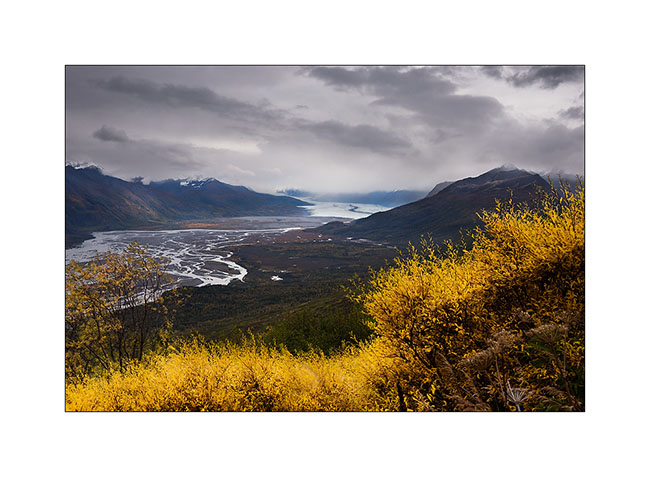
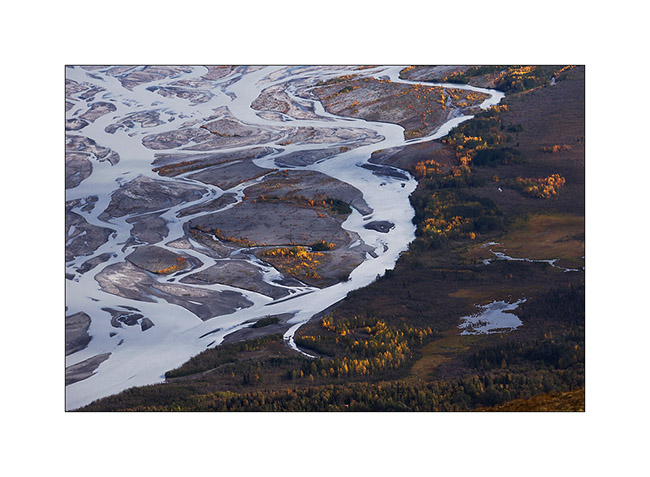
2. I continue the climb and from this plunging point of view, the Knik River reveals beautiful designs.
3. While I go back down in late afternoon, a few light holes below reveals fall colors.
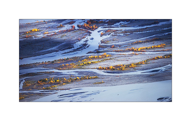
4. The light becomes more generous…
5. Natural graphics…
6. The other side of the valley is only swamps…

7. Looking North, towards the Hatcher Pass.
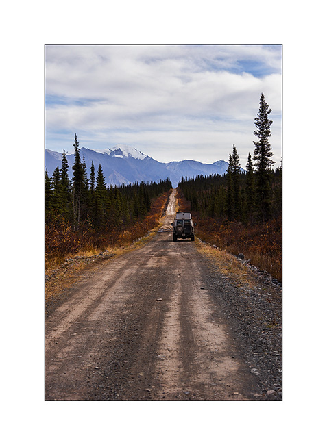
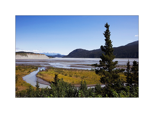
I followed the journey driving the Glenn Highway again to reach the Nabesna Valley on an old mining road which provides access to this remote place.
8. Fall colors are now everywhere.
9. I’m on the edge of bad weather that creates a charged atmosphere over volcanoes of the area.
10. The snow is still present in altitude.
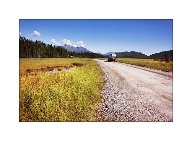
11. VLV sneaks up on the long and remote Nabesna Road…
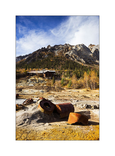
12. Since the road was washed away by some past flood, I will walk the last 6 miles to reach the site of the mine.
13. On a side trail, I discovered an authentic log cabin from early last century.

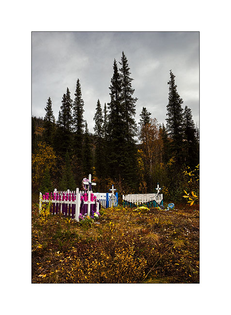
14. A well-colored indigenous cemetery along the road to Mentasta.
15. Vivalavida then follows the Alaska Highway heading to Canada. Quantities of small lakes and marshes bordering the main road.
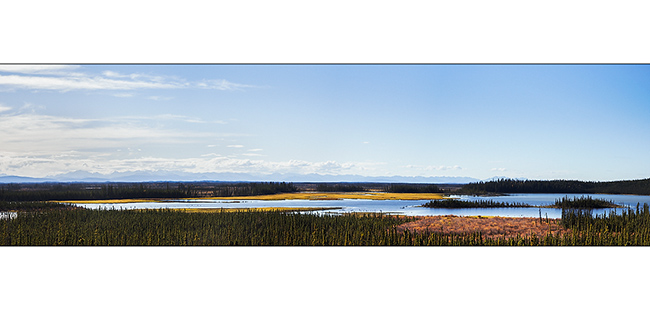
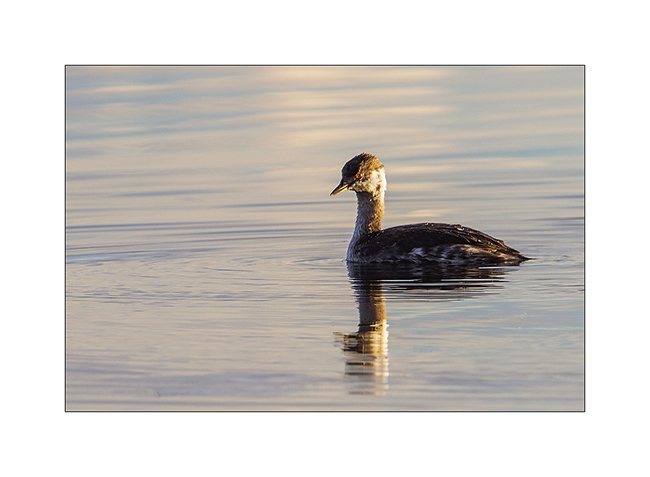
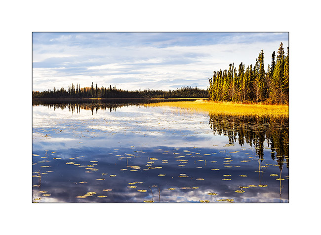
16. I stoped at Deadman Lake and had a nice kayak trip on a completely smooth lake…

17. A female duck…

18. … and a little grebe in late afternoon light.
19. The light was awesome when I got the kayak out of the water…
20. … the sun sometimes playing with clouds.
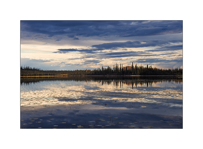
21. Last sun rays on this idyllic lake.
The next day, VivaLaVida left Alaska after more than three months of enchanting discoveries … More from her journey coming soon. 😉
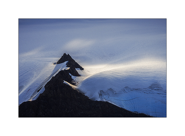
Kenai Peninsula (2)
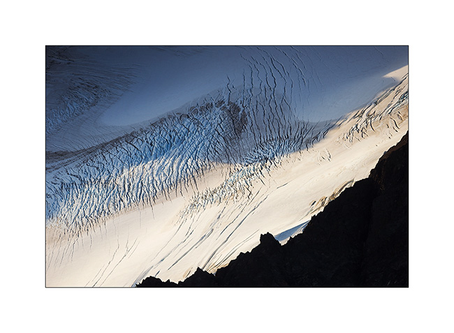
Still near Homer, the next day we decide to flight over the Harding Icefield, one of the giant icefields that covers the southern Alaska. We chose a small seaplane and to fly between 7:30 and 8.30 PM hoping for a nice light.
1. As soon as we take off, we can see some first glaciers.
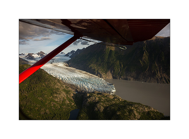
2. Fifteen minutes later, we fly over the Harding Icefield : almost 70 miles long and more than 30 miles wide!
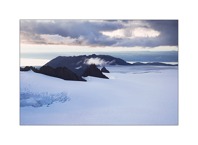
3. Large glaciers go in all directions.

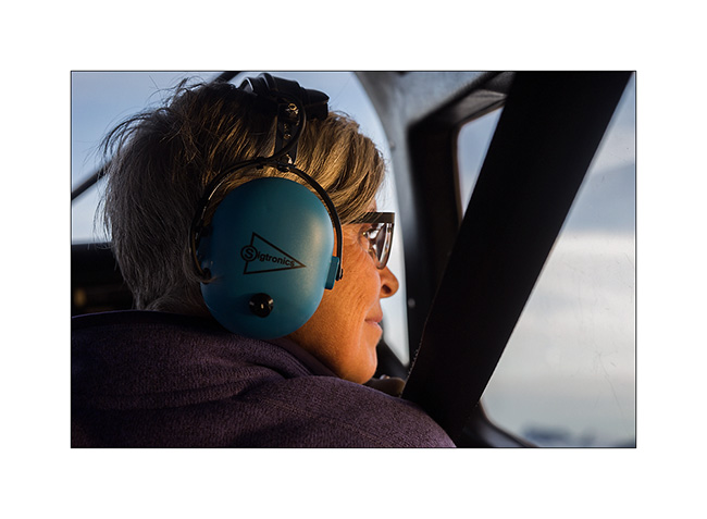
4. Besides the pilot, Mino doesn’t loose a crumb of the show.
5. Some light gaps offer me nice views…
6. Motionless cascade…
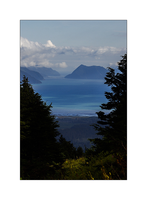
7. On the way back to Beluga Lake, our “sea strip”, we flew over an island, refuge for thousands of birds.
8. We leave Kachemak Bay at sunset…
9. … with a beautiful view of Kodiak Island in the distance…
10. … to find a wild place in the dunes, near Anchor Point.
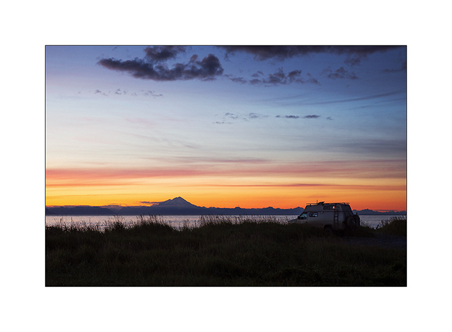
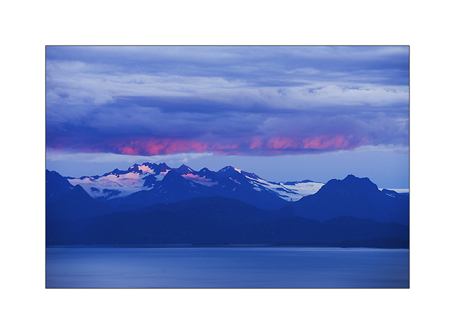
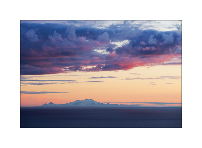
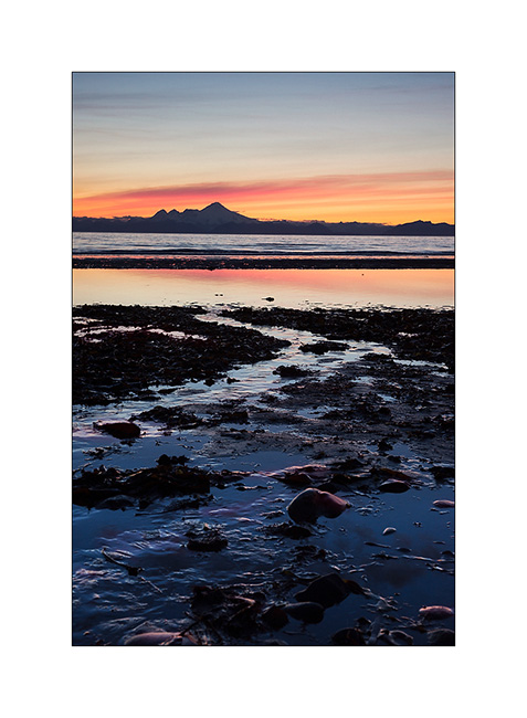
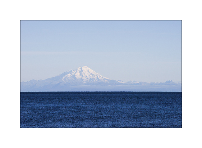
11. Sunset over Cook Inlet and Iliamna volcano; there are worse places to sleep, isn’t it? 😉
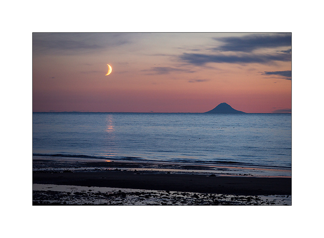
12. The moon also goes to sleep near the volcano island Augustin…
13. An air of Mount Fuji, isn’t it? But it’s another volcano: Mount Redoubt.
14. Going North to Anchorage, little detour toWhittier and short stop at Portage Lake, a beautiful glacier lake.
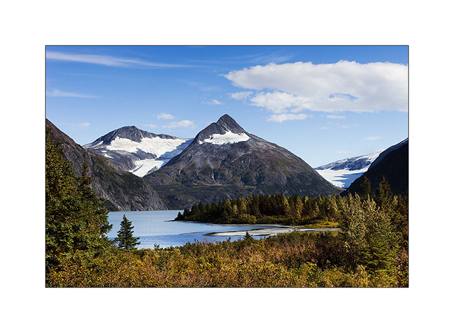
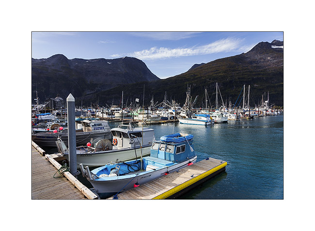
15. Whittier harbour, at the bottom of a fjord in Prince William Sound.
16. While seeking for a place to camp…
17. Late afternoon in the mountains…
After this brief jaunt to the Kenai, we’re back in Anchorage awaiting a response to a possible change of Mino’s return flight that could allow us to stay longer to explore this beautiful Alaska. We will keep you in touch in the next update! 😀
Kenai Peninsula (1)
Some better weather taking shape South, VivaLaVida has gone the way of the Kenai Peninsula, South of Anchorage.
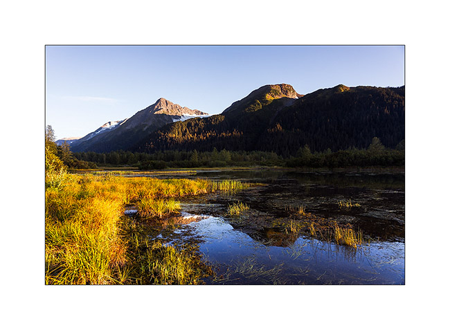
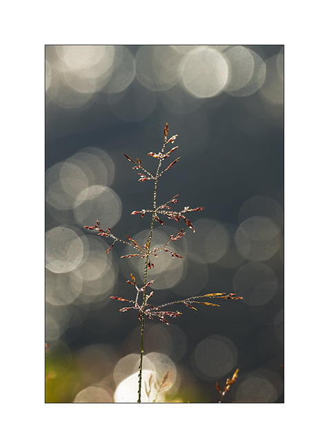
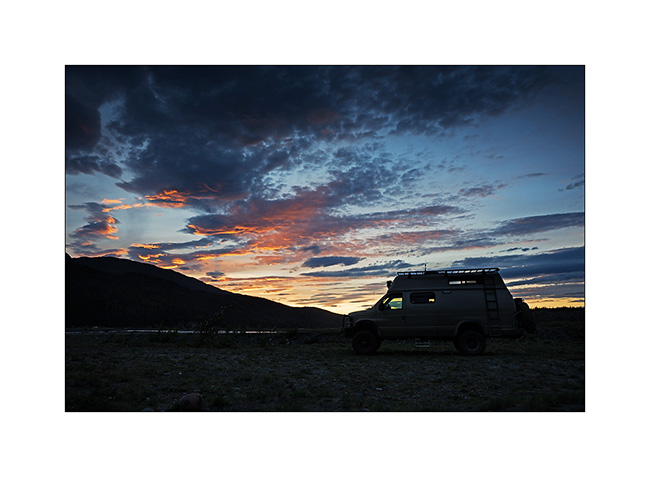
1. Sunrise at our boondocking site near Turnagain Pass.
2. I enjoy the morning light…
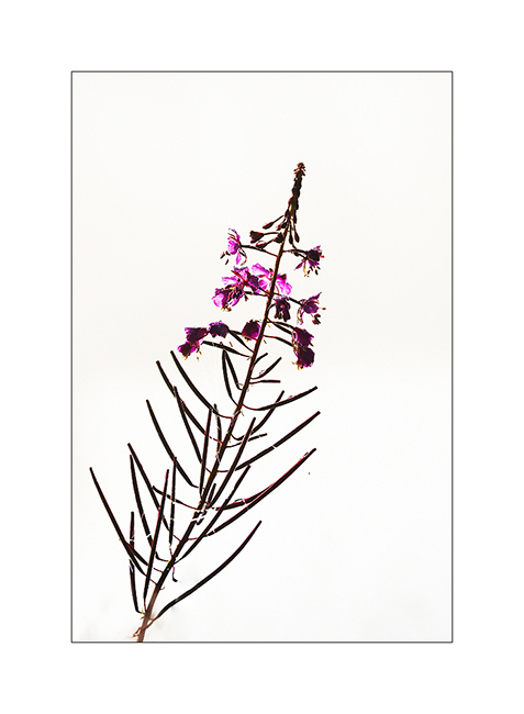
3. A Fireweed.
4. The mist rises…
5. … and the sun floods our camp.
6. On the road to Seward, a small lake nestled in a valley.

7. Returning from a hike to Lost Lake, overlooking the Seward bay and the Gulf of Alaska.
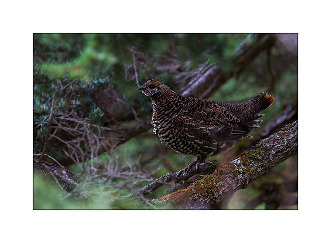
8. It’s already very dark when I saw this forest grouse female…
9. Lichens decorate the trunks in this much wetter forest than in North.

10. The climate is warmer here in the South, there is “only” 0 to -20F in winter because the ocean moderates the polar cold. So are the trees much bigger even if timberline doesn’t exceed about 1,200 feet.
11. Very wet episode. We have still taken a ride to Exit Glacier hidden in the clouds…
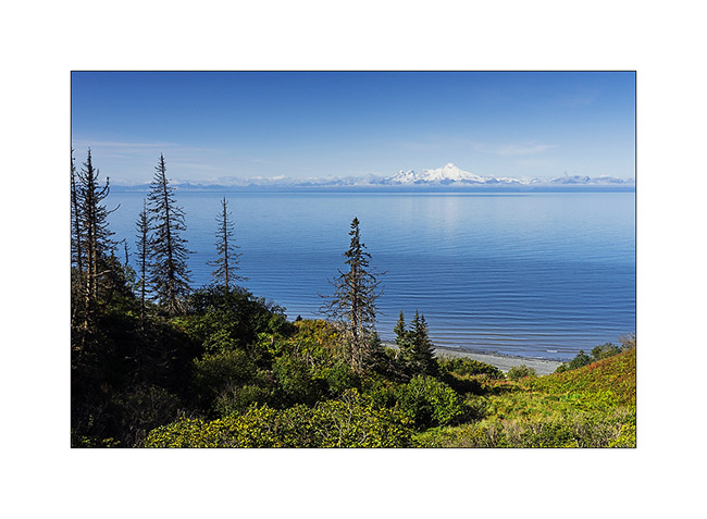
12. Since the forecast were better there, we drove to Homer and the next day was sunny. We clearly saw the Iliamna volcano on the other side of Cook Inlet.
13. We sleep on a beach of Kachemak Bay without forgeting to taste the famous Alaskan Halibut, succulent! 😉
14. A shower at sunset graces us with a nice but short rainbow.
15. On the other side of the bay, the low sun shortly colors mountains.
16. Quiet atmosphere as tide is going down.
17. Last rays on glaciers…

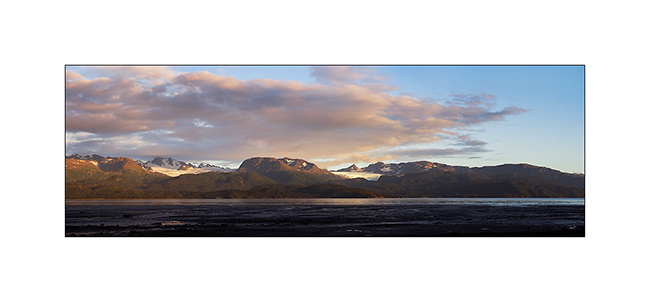
18. And to end this update, a panoramic picture of Kachemak bay.
Following of our discovery of the Kenai to come soon! 😀
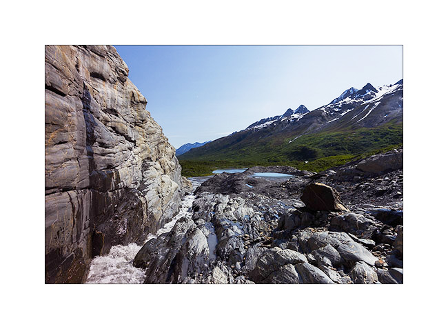
Glaciers & McCarthy Road
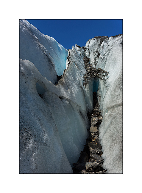
Better weather announced for two days, I drove the McCarthy Road, which sinks for about hundred miles between large ice areas. But on the road from Valdez to get there, I made a stop to walk to the bottom of the Worthington Glacier, easily accessible.
1. Glacial river near Thompson Pass.
2. The glacier tongue is divided in two by a lock of granite.
3. Hiking along the granite.
4. The ice also recedes every year here… In 1950, she was almost half a mile below.

5. Ice carved by melting…
6. Going up the McCarthy road, near the confluence of two beautiful rivers…
7. The road passes through beautiful landscapes of taiga alternating spruce forests and swamps…
8. … and numerous small lakes.

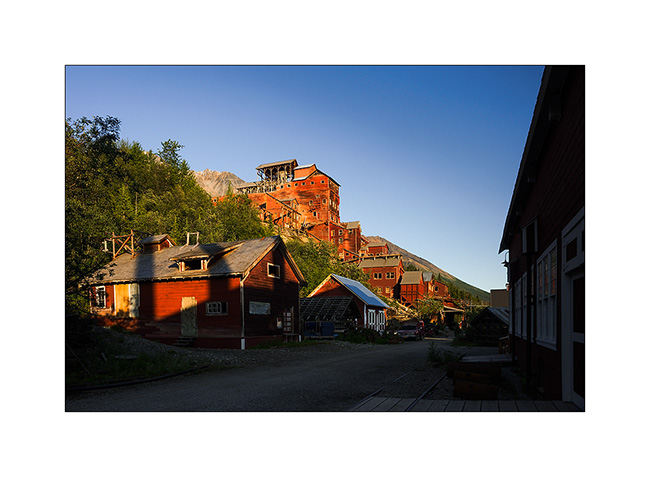
9. Arrived in McCarthy – on the other side of the river that crosses a footbridge to reach this little city – I slept at the foot of the gigantic Roos Glacier, near the small lake which ended his over 30 miles long tongue.
Enjoying the light of late afternoon, I took my Mountain Bike to for explore the Kennicott Mine, one of Alaska’s largest mines operated at the beginning of the last century.
10. This historical heritage is being renovated.
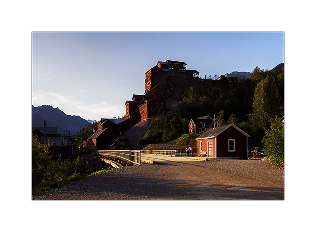
11. The construction of the mill itself is really huge. Even this panoramic of 6 stiiched images don’t manage to show you how large it is.
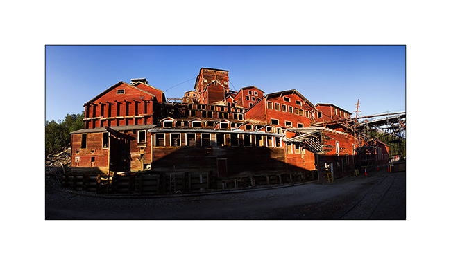
12. Several outbuildings surround it…
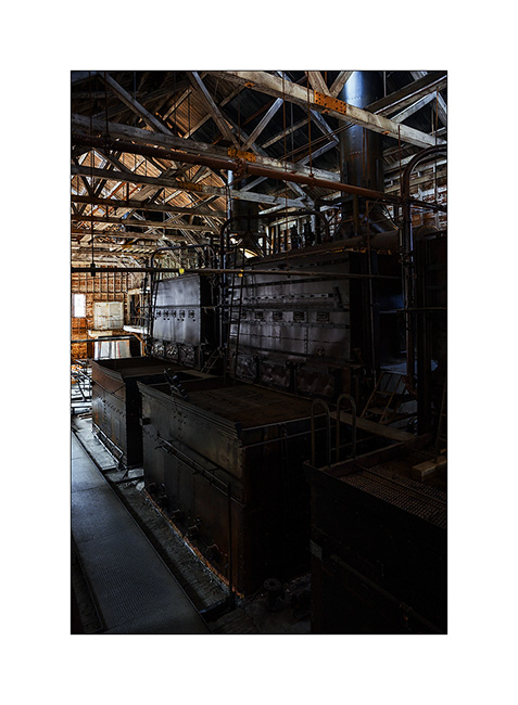
13. … whose thermal plant that produced the electricity needed in a real coal power plant.

14. The four huge boilers are impressive!
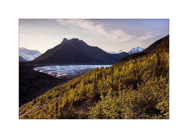
15. This mine is built on the lateral moraine of Roos Glacier which descends more than 5 miles downstream.
The next day will be a hard day: I decided to go up the glacier as far as I could. I made more than 30 miles, mountain biking first, then hiking. I arrive much only as half of the glacier…
16. A panoramic shot of 8 images in an attempt to show you that immensity. By itself, this glacier is larger than Rhode Island!

17. Back by the McCarthy Road and even there, I founnd a swiss cow!! 😀
18. VivaLaVida would almoast fly..! 😉
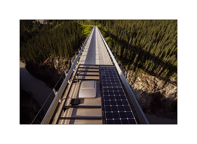
19. This is actually a high and narrow bridge over a deep gorge. It was built in 1905 for the railway route which allowed to bring coal to Kennicott Mine and transport gold mined.

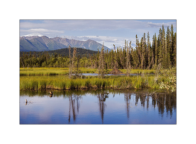
20. Beaver lodge in a pond near the road.
21. VivaLaVida approaches his camp of the day…
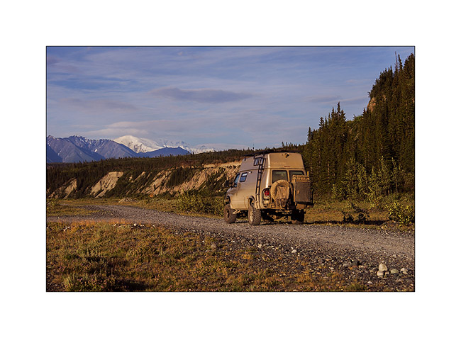
22. … along a beautiful river… The large icy dome in the background is Mount Wrangell, a dome volcano.
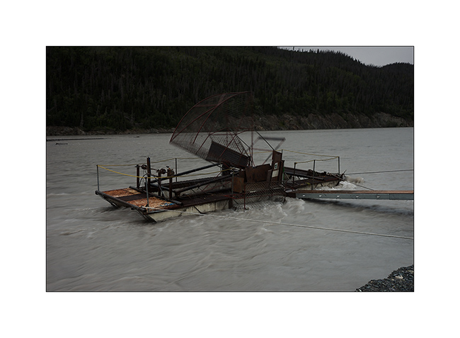
23. … where salmon fishing is going well. There were a dozen of these catch-machine driven by the current.
24. I still see the large dome that gives rise to Roos Glacier, more than 60 miles as the crow flies.

25. The Sunset was beautiful, the bad weather coming again and bringing some clouds…
The rain will follow me again during several days. So I headed to Anchorage for some maintenance work on VLV and to prepare the last updates before the arrival of Mino who’ll have landed when you’ll discover these lines. 😉
 D5 Creation