June, 2014
now browsing by month
Henry Mountains & Maze District of Canyonsland NP
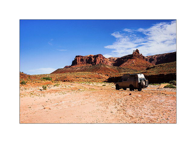
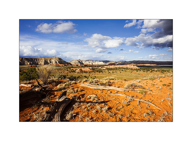
Since Jean-Luc decided to take a domestic flight from Salt Lake City to join his international flight to San Francisco, it left us more time to explore Utah. We visited western Canyonsland National Park we reached by crossing the Henry Mountains.
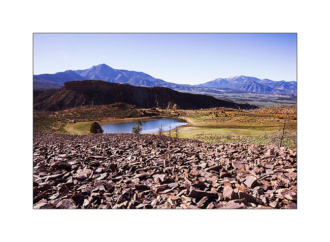
1. Stop for the night at Bastion Reservoir, at about 7,000 feet elevation.
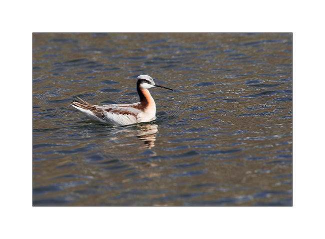
2. Jean-Luc spotted Wilson’s phalarope, an unexpected bird in this region.
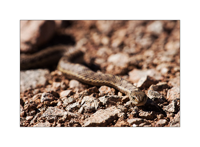
3. I saw this snake without being able to identify it.
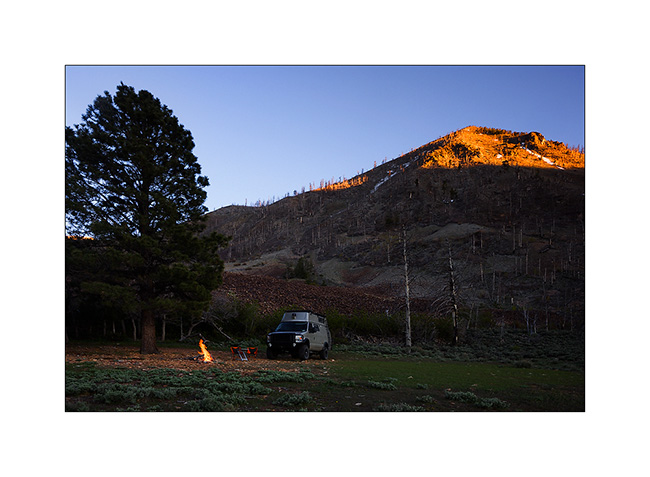
4. Campfire under the top that Jean-Luc climbed.
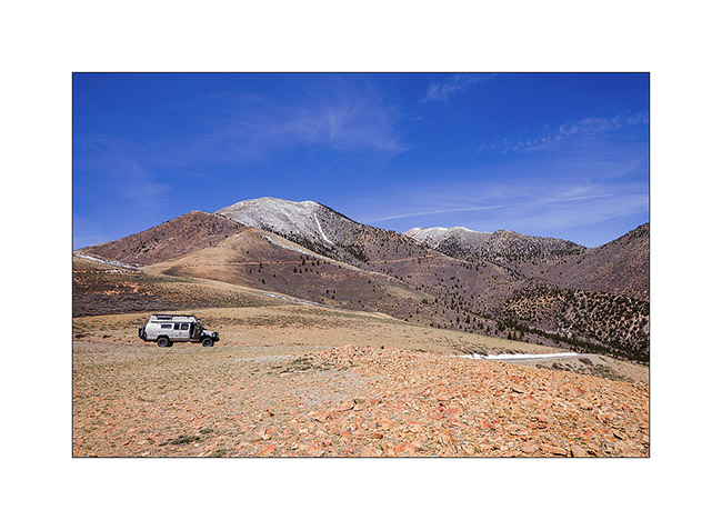
5. Down from Mount Helen, the culmination of Henry Mountains.
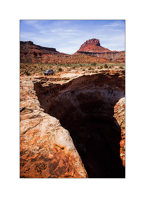
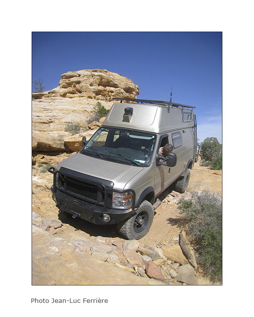
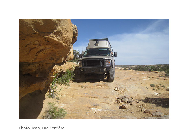
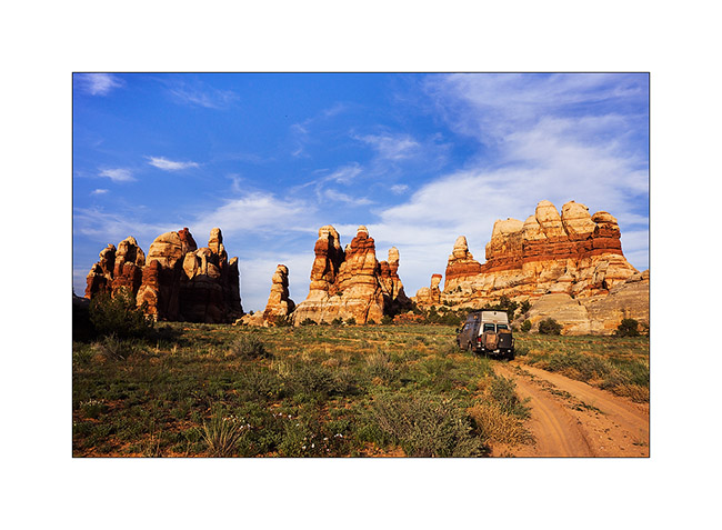
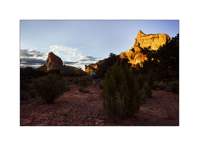
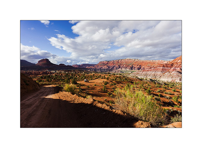
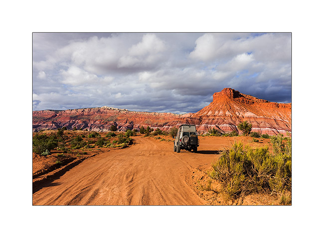
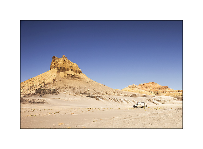
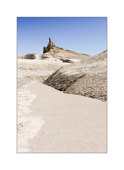
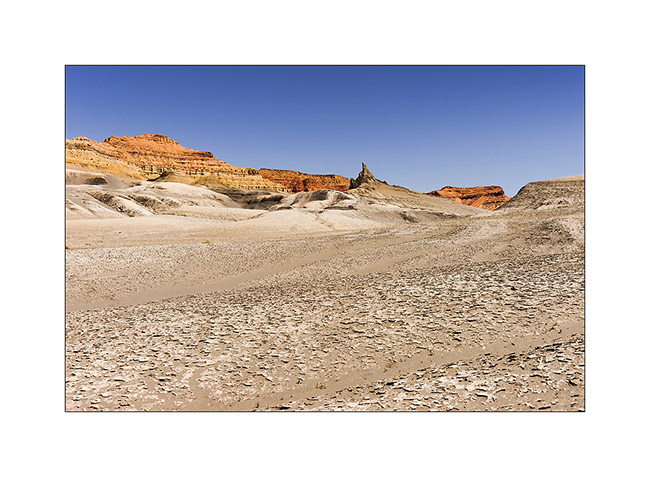
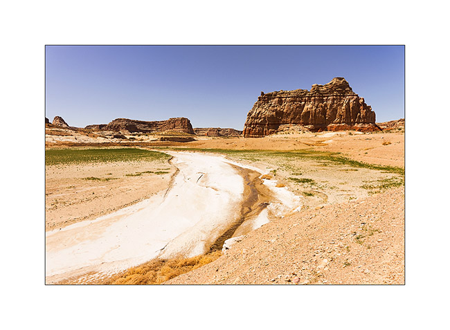
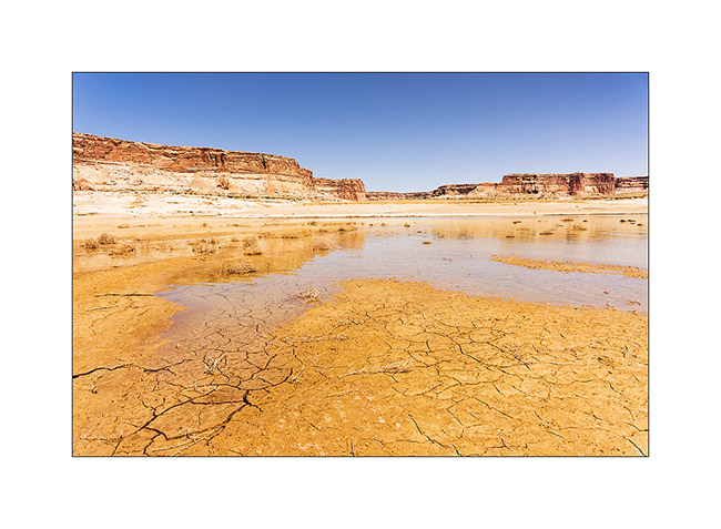
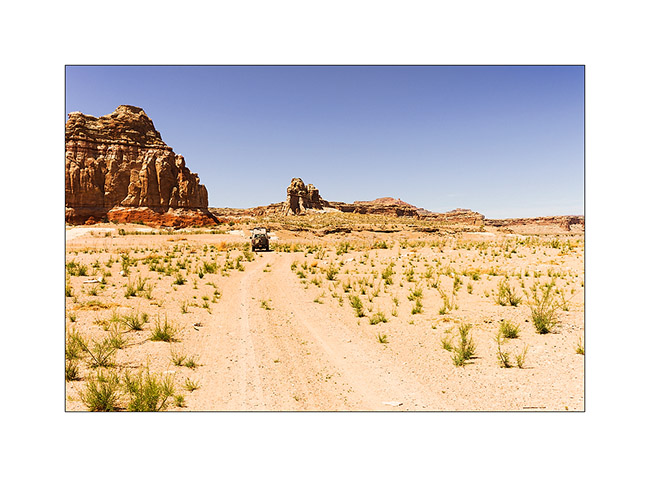
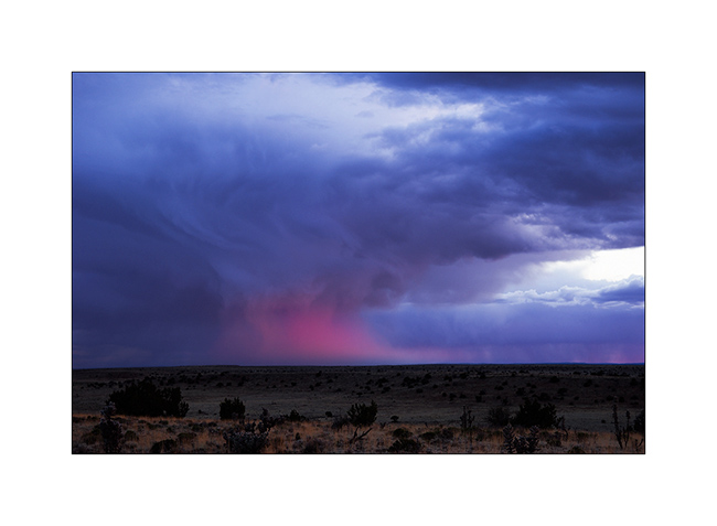
6. After going refueling in Hanksville, a really remote and depressed corner, we followed a long path to reach the Maze Overlook, first taking the Devil’s Canyon road.
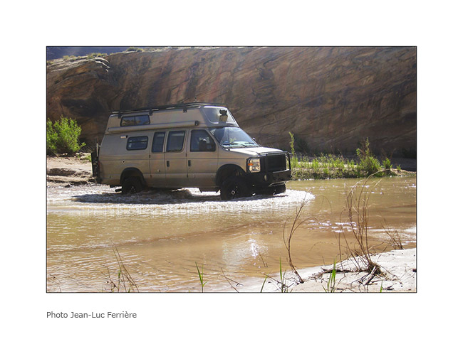
7. Water crossing of the Devil’s River.
8. On the other side of the river.
9. The track is rugher I imagined and we slept at the Sunset Pass…
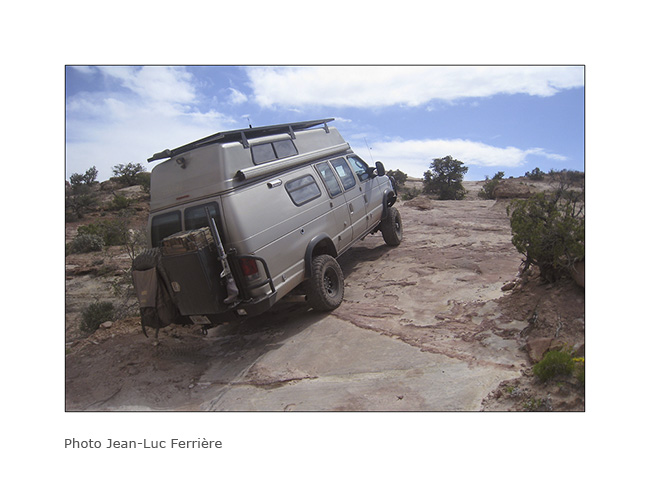
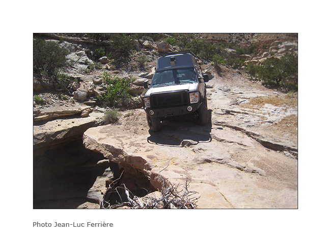
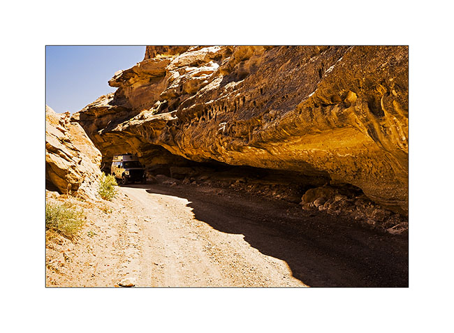
10. VivaLaVida over a huge overhang!
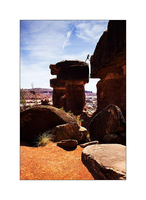
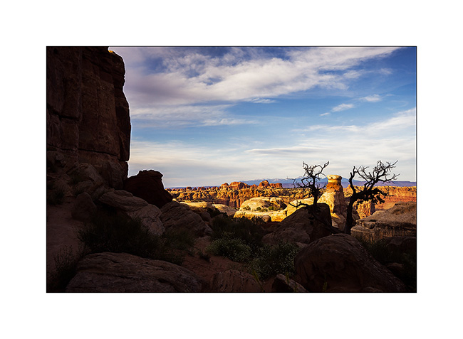
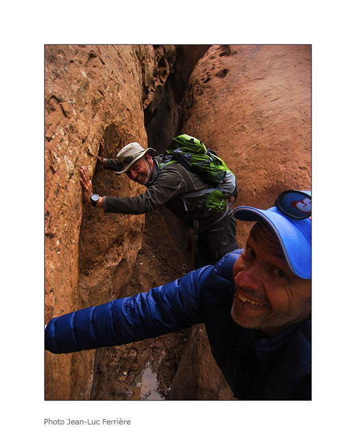
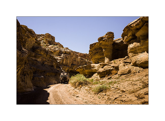
11. My acrobat brother at Maze Overlook. 😉
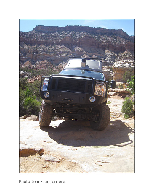
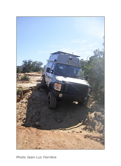
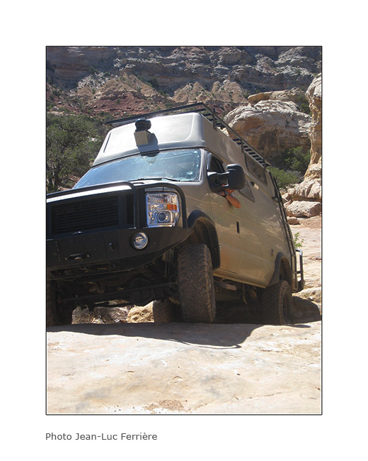
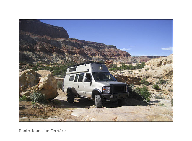
We then decided to join the Doll House and it took us no less than 6 hours to reach on a track probabliy the most difficult Vivalavida has traveled so far … Here are some pictures to illustrate this incredible journey.
12. Driving on the rock.
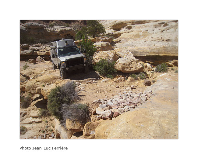
13. Sometimes overhanging.
14. It goes steep up…
15. … then down.
16. Big step.
17. It leans sometimes too…
18. It’s sometimes narrow…
19. … or tight!
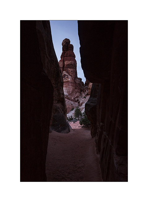
20. We will end up to arrive first at Standing Rock…
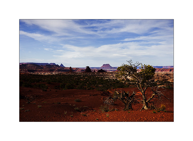
21. … then the beautiful Doll House that reminds me of the Needles, on the other side of Colorado.
22. We were Lucky to get a camp place just in the middle of Doolhouse ad this is the view we had at sunset;-)
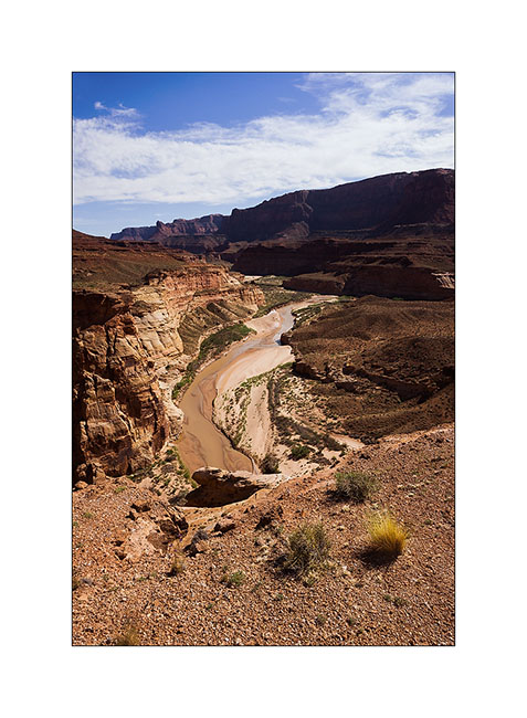
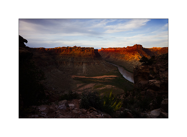
23. Last rays on the Colorado River.
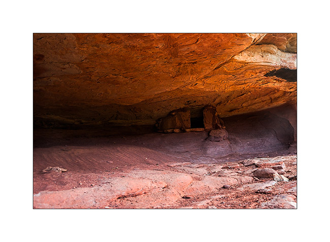
24. Indian granary well protected under an overhang of sndstone.
25. Trail at dusk in the mid of needles…
To be continued…
Next updates…
I just found out how to publish updates without having Internet connexion.
I will so be able to reduce the difference between updates and the place I’m actually. Not sure it also works for translation, so sorry if you English speaking guys could see updates in French only, I will fix it later… 😉
Cottonwood Road UT
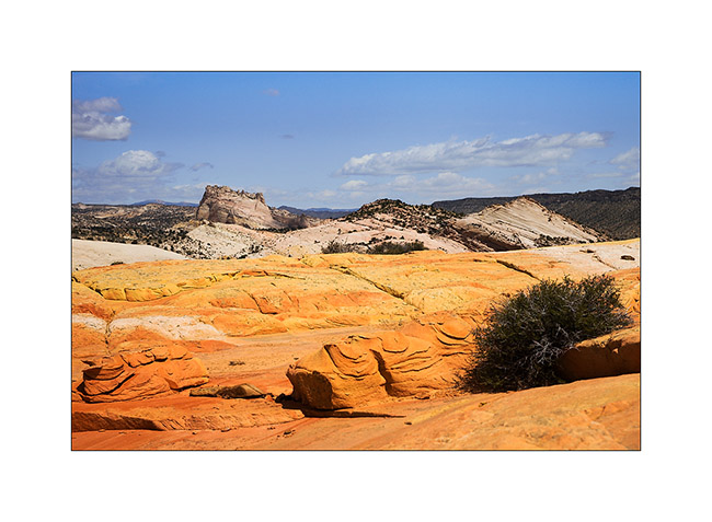
Still dazzled by the beautiful Coyote Butes, we continued our route using the Cottonwood Road northbound. I noticed several spots of interest on this route. The first at which we stopped is entitled Yellow Rock, an orange to yellow sandstome dome….
1. The side canyon to the Cottonwood River I walked to Yellow Rock. Nice to walk barefoot in the cool water… 😉
2. Yellow Rock is well named.
3. The sandstone is veined of colors…
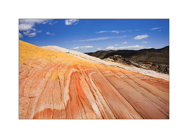
4. Some more color touch…
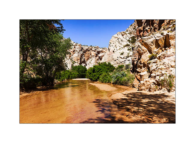
5. A little further on, we stopped at Lower Cottonwood Narrow.
6. The walls are impressive, probably more than 1000 feet high.
7. We ended the day with a stop at Kodachrome Basin.
8. Jean-Luc on sandstone. 😀
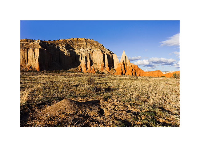
9. Cliffs in late afternoon.
10. Opposition of forms: soft to the anthill, acute to the cliffs.
The next day, I brought Jean-Luc discover Bryce Canyon, the must see. Since I already take quite a lot of pictures of it, I went walking light, leaving my camera in Vivalavida. You so won’t see picture of our hike here…
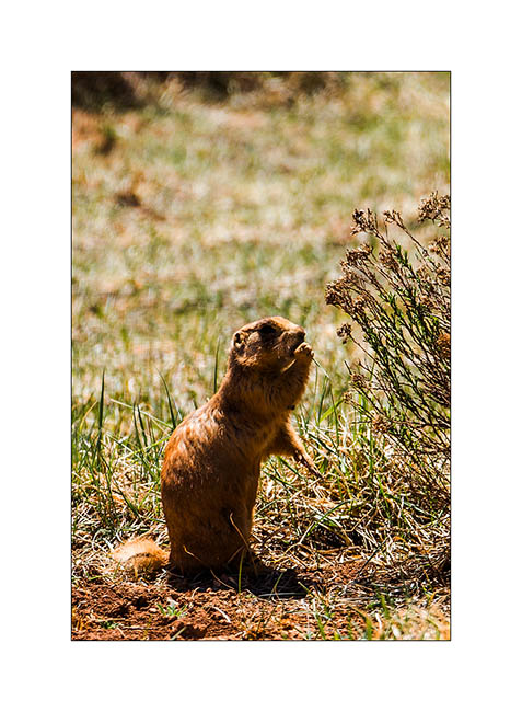
11. An attentive prairie dog.
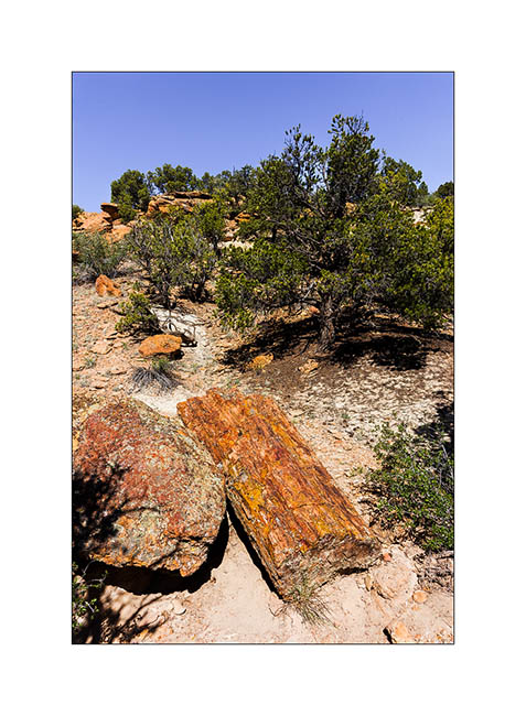
12. Not far from there, a short stop at the Escalante Petrified Forest. Some petrified trunks are impressive!
13. Late afternoon hiking to the Calf Creek Falls.
14. Side canyon to Long Canyon, on the Burr Trail Road.
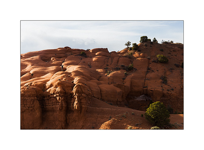
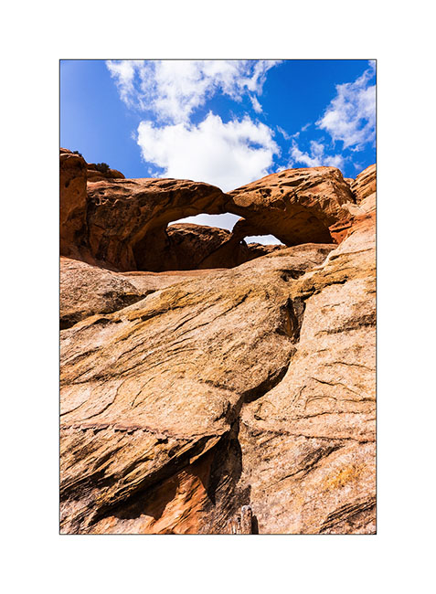
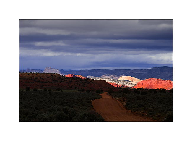
Arrived in the area of Capitol Reef, we visited the Muley Canyon to discover some natural arches.
15. Cheerios Double Arch.
16. Bells…
17. Saddle Arch.
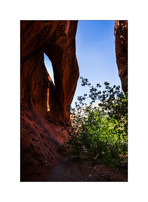
18. Another natural arch.
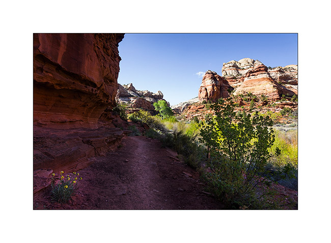
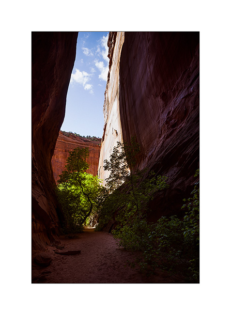
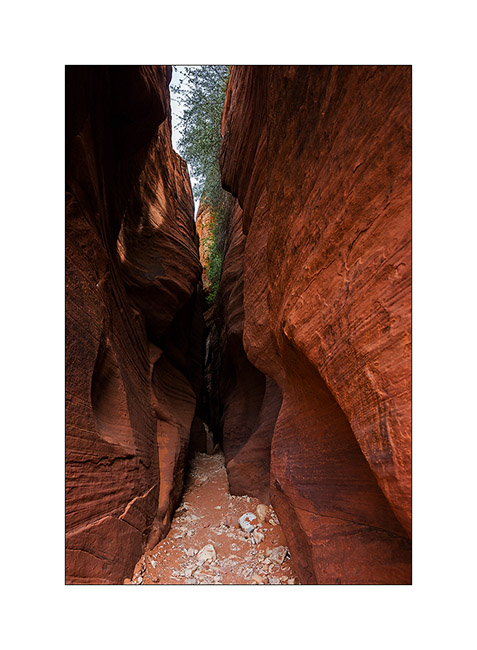
19. We ended in the Muley Twist Canyon, a Slot Canyon where there was still water in places.
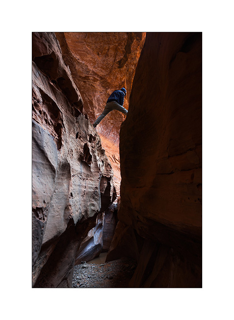
20. Fun on passages in opposition.
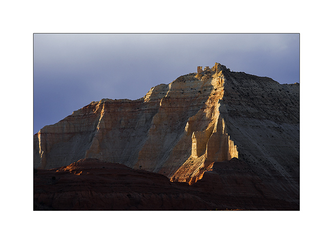
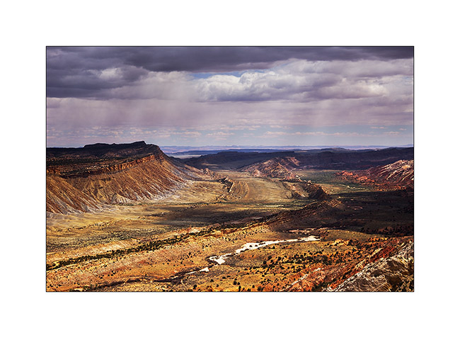
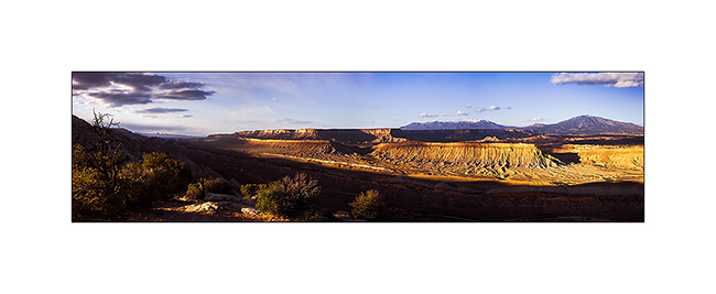
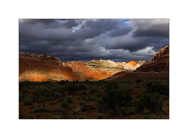
21. Back down at the end of the road where we slept, I went back to the view of the valley of Capitol Reef, grandiose!
22. Mineral colors are everywhere…

23. … while the sun is going down…
24. Camp in Muley Canyon.
The next update will take you all soon in the Henry Mountains and the Maze of Canyonsland Distric National Park… 😉
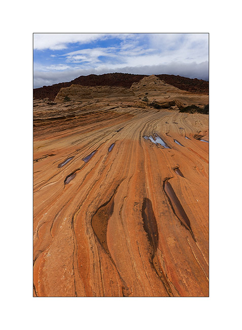
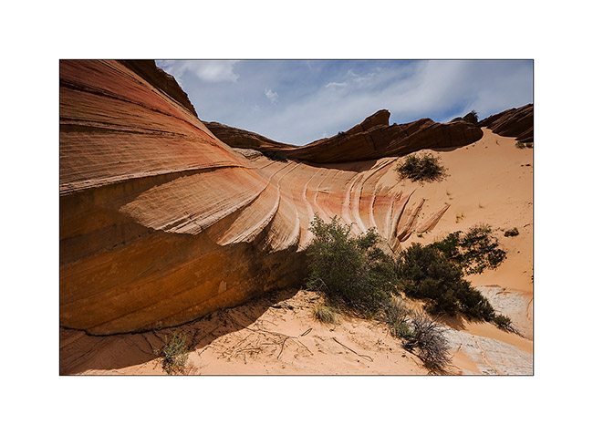
Vermillion Plateau (2)
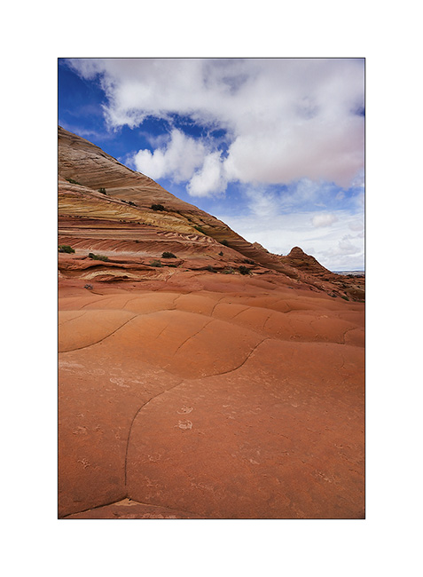
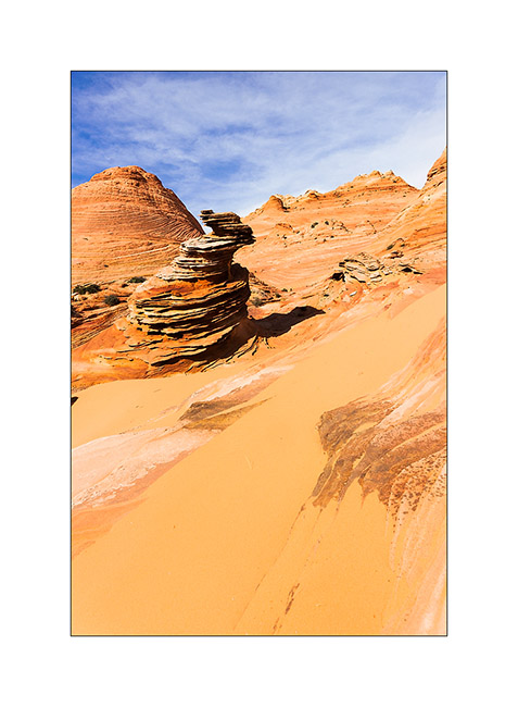
So we continue our journeys in North Coyote Butes.
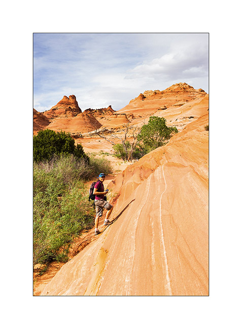
1. The climb takes us near Top Rock Arch…
2. Scenery towards the South Coyote Butes.
3. Later, we visit the Alcove, a large cavity excavated by the wind. I find several very graphics compounds…
4. Draperies of sandstone…
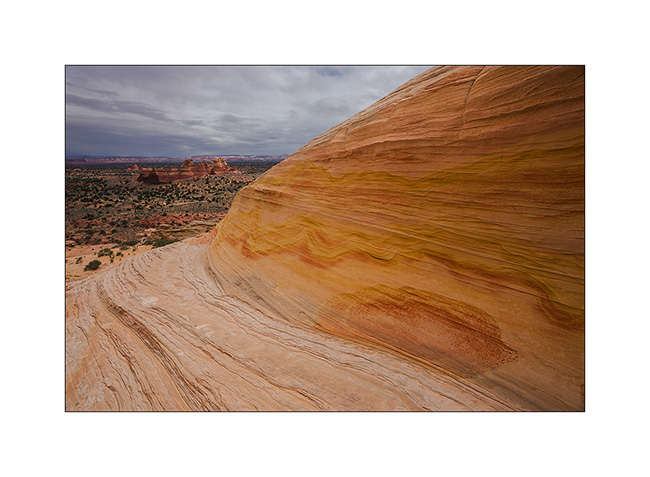
5. The top of the North Coyote Butes is a sort of plateau…
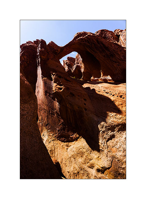
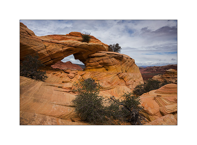
6. Reached Melody Arch and its “window” on the South Coyote Butes.
7. Perspective…
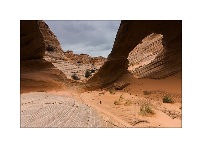
8. Descend of the opposite side.

9. Still beautiful…
10. … and even a sombrero ! 😀
11. Lower, the turtle rock seems sweet…
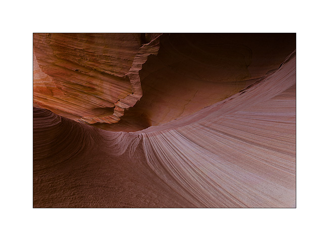
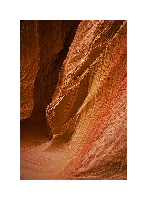
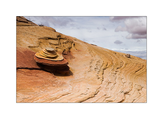
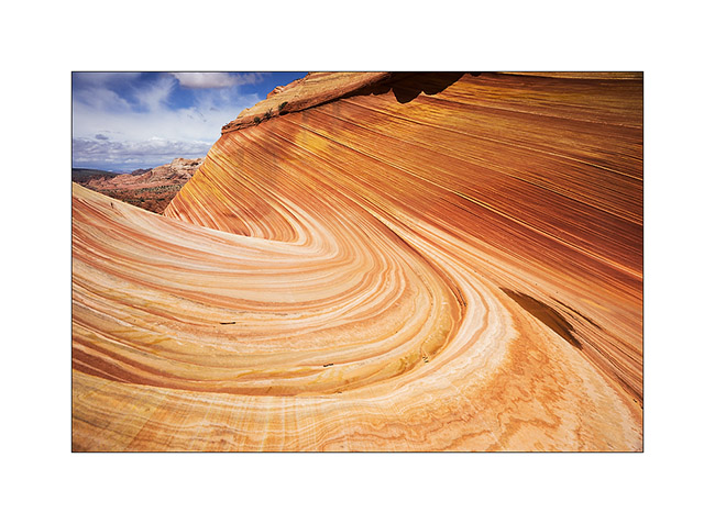
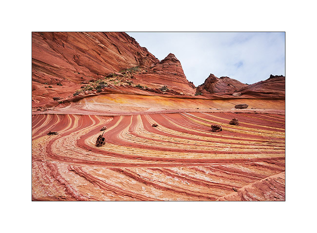
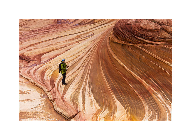
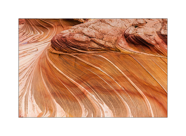
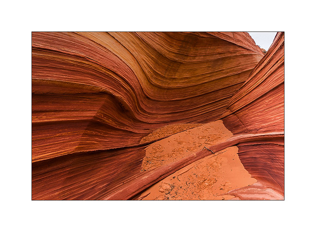
12. Back to the Wave as the light comes.
13. The contrasts are more pronounced but the softnees of lines remains…
14. …
15. …
16. On the way back, stop at a small little colorful quadruple teepee.
17. …
We slept in the Paria Town in Paria Canyon, only some miles away.
18. Heavy sky over the trail…
19. … and hard light on the mesas.
20. What a nice place.
21. Contrasts in late afternoon…
Well, I hope you’re not too drunk by the number of images of these beautiful Coyote Butes. The next update will resent the beginning of our journey to Utah. Coming in a few days…
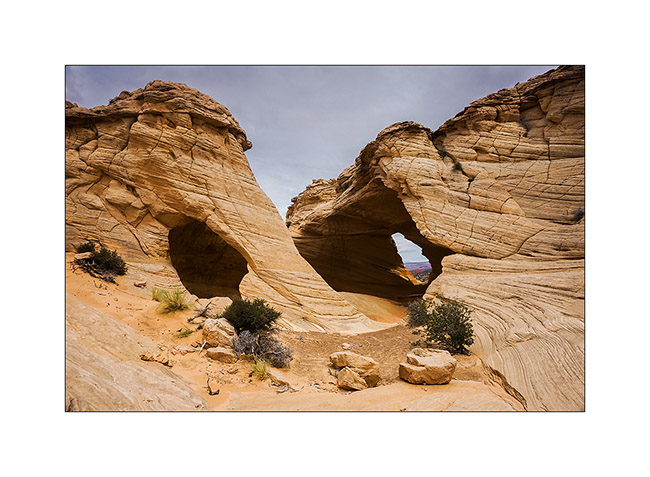
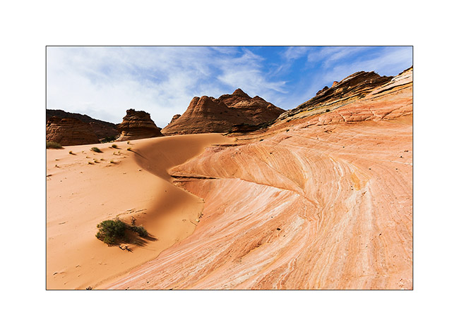
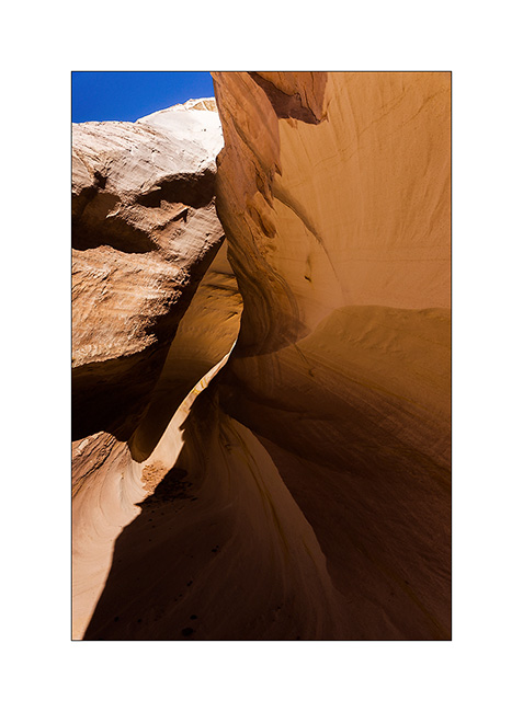
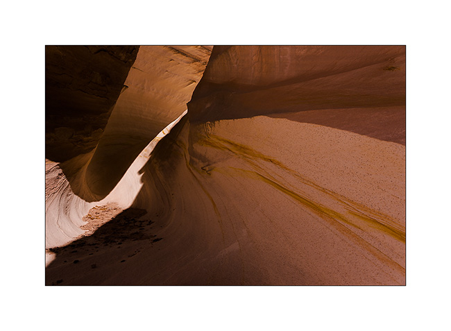
Vermillion Plateau (1)
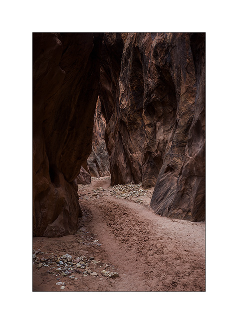
Having luckily won the draw which gives access to the Wave, we spent the afternoon exploring the Wire Pass and Buckskin Gulch. The first is a slot canyon at Buckskin Gulch side, one of the longest slot canyon with more than 45 miles long.
1. Entry of Wire Pass.
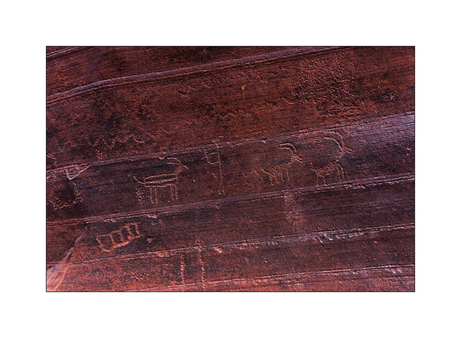
2. Petroglyphs at the intersection Wire Pass/Buckskin Gulch.

3. Some animals are really aesthetic.
4. Going up the upper part of Buckskin Gulch…
5. … it opens after a few miles in a kind of bowl where some trees manage to grow.
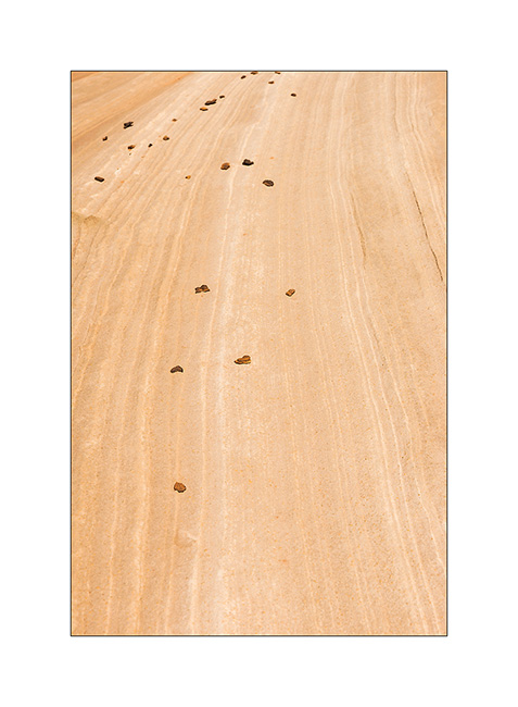
6. When sand and sandstone are one…
7. Sculpted by the wind.
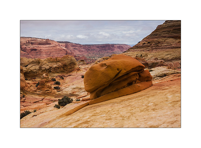
The weather forecast was bad for the next day with a 90% chance of rain for our walk to the Wave. However, we were ready to brave the elements at 8:00 and it was pouring rain as we began our walk. Rather than go directly to the Wave, we made a detour to another site lesser known of North Coyote Butes: Fatali’s Boneyard.
8. Fatali’s Boneyard, all of yello and pink…
9. Kind of sand roses on striped sandstone.
10. Perspective…
11. … and mix of striped rock and plain sand.
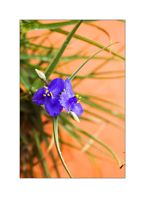
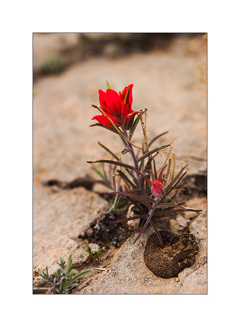
12. A flower, scarce greenery at this location.
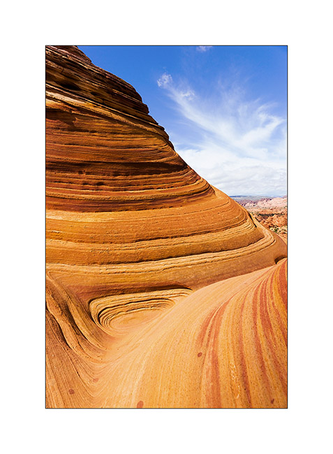
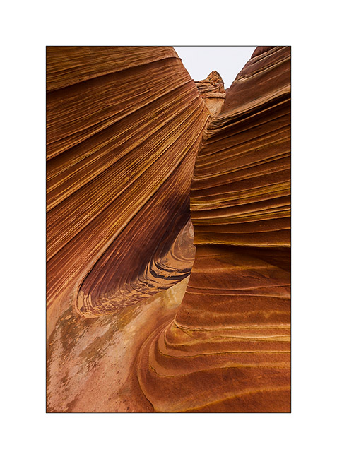
13. Along the walk to the Wave, run by the Second Wave, unfortunately without light despite the rain stopped.
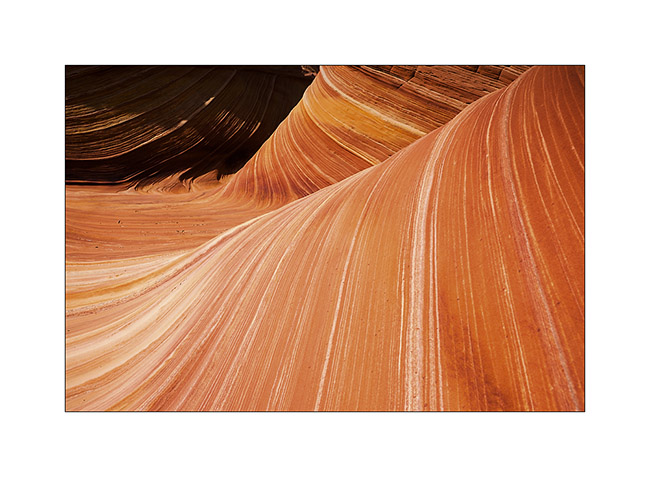
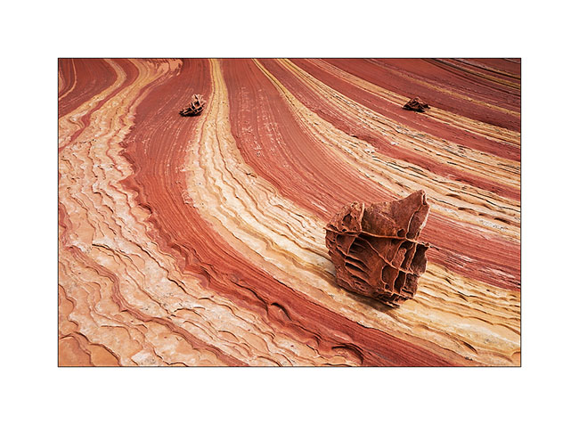
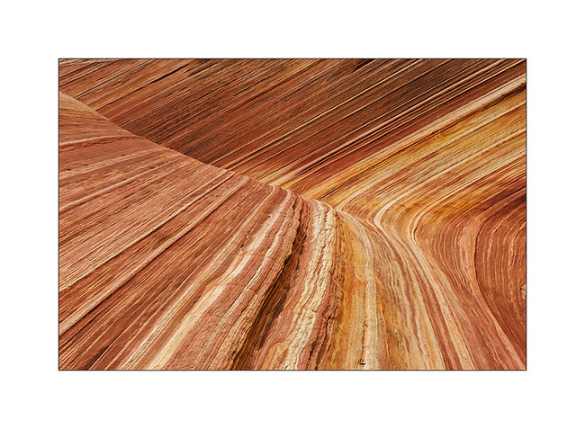
14. Stone waves…
15. Still journeying towards the goal of the day, we found this rock hamburger! 😉
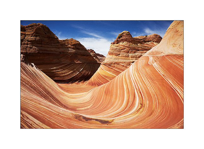
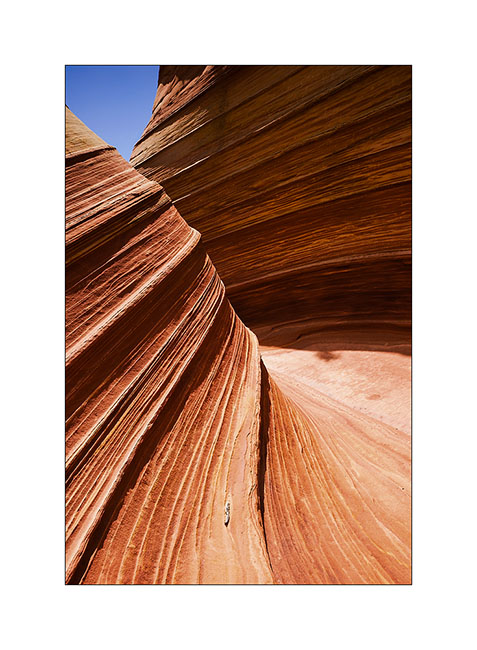
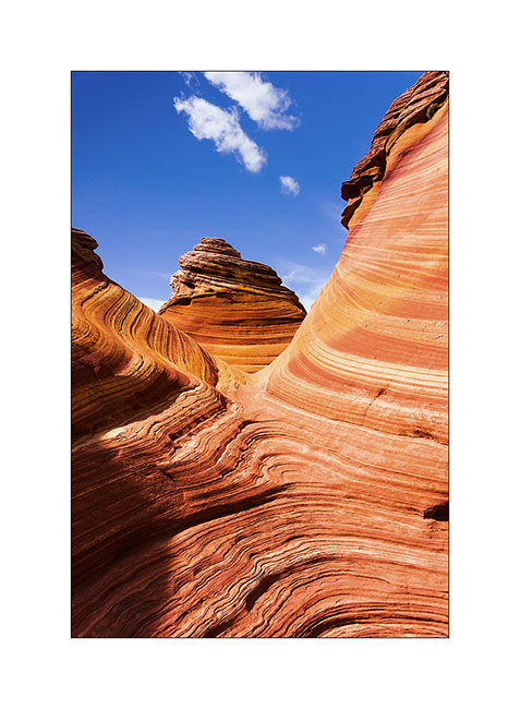
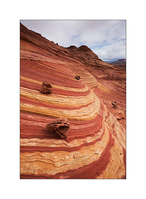
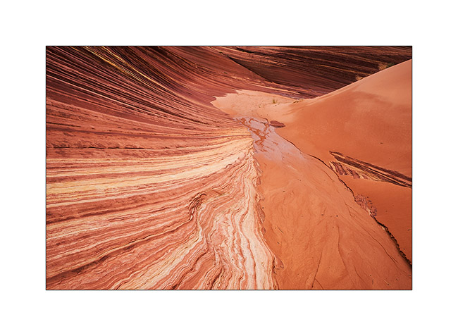
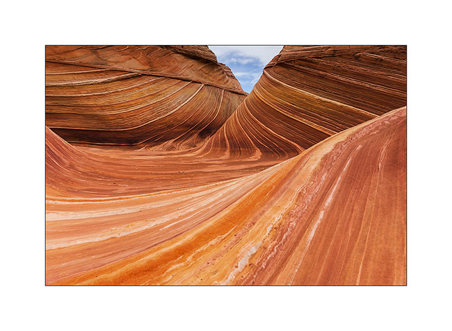
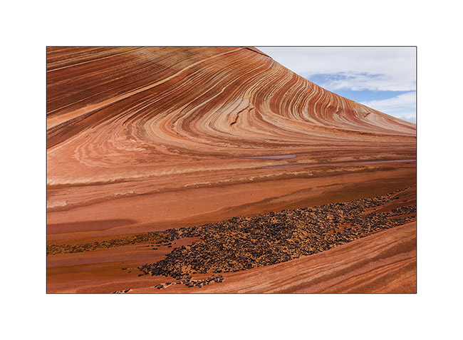
16. It was around noon when we finally reached the Wave.
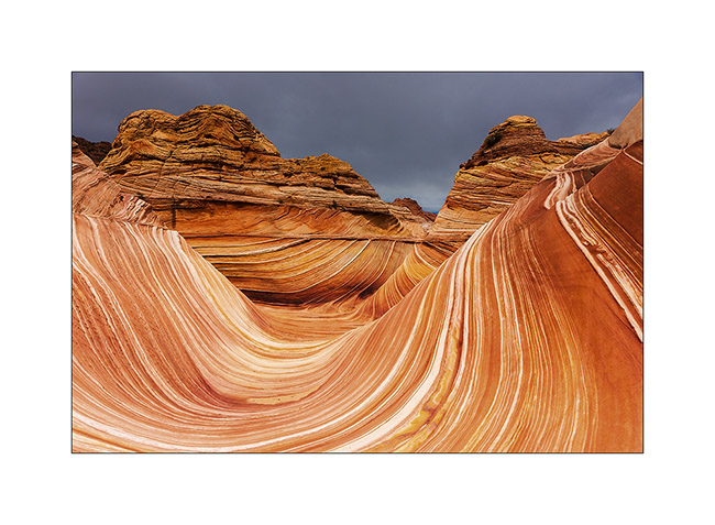
17. Magic place…
18. …

19. …
20. …
21. …
22. …
The light wass still not at the rendez vous, so we decided to climb higher on the North Coyote Butes looking for Melody Arch. To come very soon…
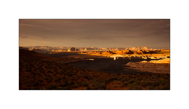
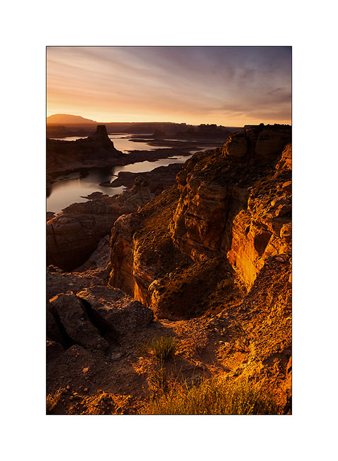
Alstrom Point & Crosby Canyon
After a visit to make Jean-Luc discover Antelope Canyon, where I didn’t take my camera, having already widely photographed this place, we had a beautiful light on Lake Powell.
1. The sun is going Under the clouds…
2. … illuminating the surrounding cliffs.
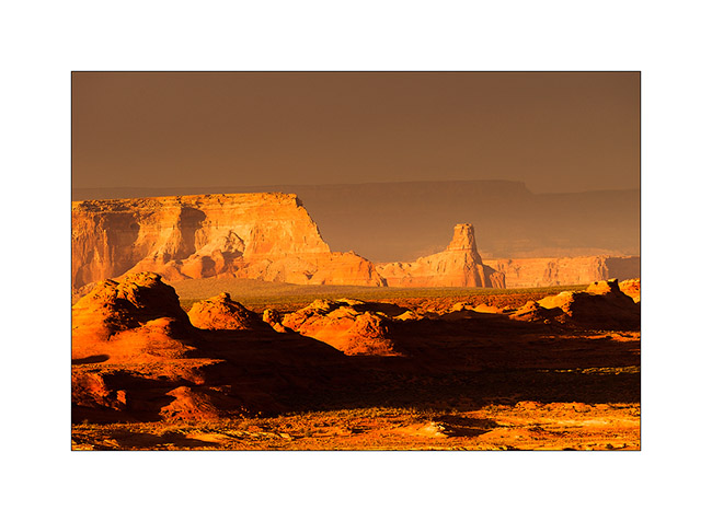
We decided to go to Alsrtom Point, a fantastic view of Lake Powell. We arrive too late for sunset but sunrise was beautiful.
Anecdote. While we are having dinner in Vivalavida, I couldn’t believe my eyes: I see a mouse pointing the nose from under the fridge! It disappears as I move and we must wait for a few quiet minutes to see it looking at us again. But how was she able to get here..? We then organized a mice hunt. Do not laugh, ok? 😉 Not a chance, after more than an hour when she always escapes us, we decided to go to bed.
About three o’clock in the morning, I was awakened by an unusual noise: it was Mrs mice that have reached the trash and was walking in the bowl, in the plastic bag she started cutting. This was the opportunity that I expected! I get up as quite as possible and I took the bowl that contained the trash. She was then trapped, unable to jump from so high. Before she decides anyway, I opened the door and walked away a few feet. As I crouched down, she jumped up and ran away in the bushes. I had only to go back to bed…
It will be seen later that it was probably mounted the stairs while at Doll House, one of his fellows had already reached the second step when I saw her… We will take care now…!
3. First sunrays on Lake Powell, nice play to live when you’re a mouse! 😀
4. Boondocking over the cliff!
5. Yes, it was a trip to the moon! 😉
6. Monochrome…
7. … or almost…
8. Going down the Crosby Canyon towards the lake.
9. The level of Lake Powell is much lower since some years.
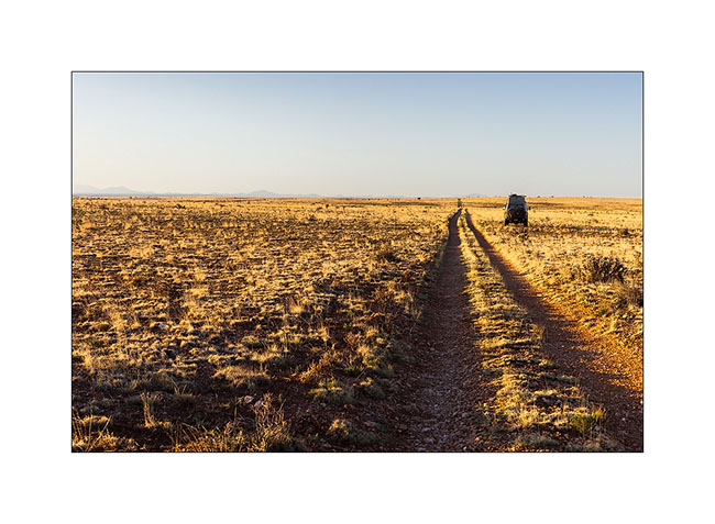
10. VLV on this uncrowded track .
11. Some shade for the snack break…
12. … in this pretty canyon.
13. We’ll also discover a small wonder, the Nodele. This is a crack made by wind and water erosion in the sandstone.
14. Graphic elements…
15. Details…
After this lovely visit, we decided to try – try again for me after seven unsuccessful attempts – our luck in the lottery that assigns every day ten places to visit the famous Wave. Jean-Luc brought me luck because we have learned to go in the second round. We then spent the afternoon walking the Buckskin Gulsh, preparing for the next day. to come soon …:-D
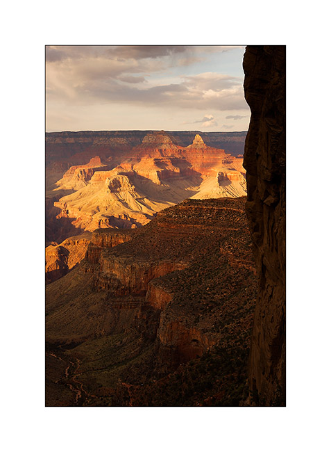
Grand Canyon
It was a wish of Jean-Luc to discover the Grand Canyon, one of the seven wonders of the world…
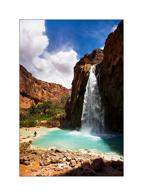
We made a stop to go down to Havasu Canyon, the Havasupai Indian Reservation, tosee the turquoise falls of Havasu Creek. Without tent, we decided to make the round trip in the day, it was a little crazy as we walk over 22 miles that day … But the falls worth the detour !
1. Our camp near a dry reservoir on the plateau above Havasupai.

2. Touch of color in a gray afternoon…
3. The Havasu Falls which run of about 140 feet in a large natural pool.
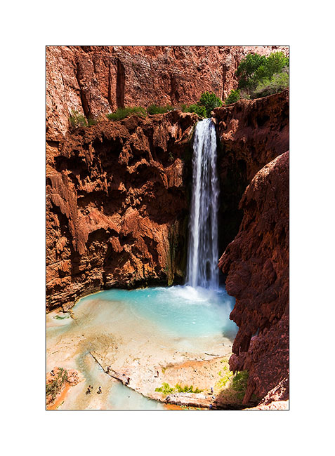
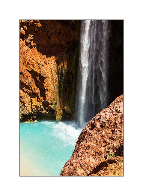
4. Some miles further down, the Mooney Falls, still higher…
5. Details…
6. back on the plateau, we were rewarded with beautiful lights at sunset…
7. … while clouds burst around us.
8. Borrowing a track to join the South Rim of the Grand Canyon, we slept on the immense plateau…
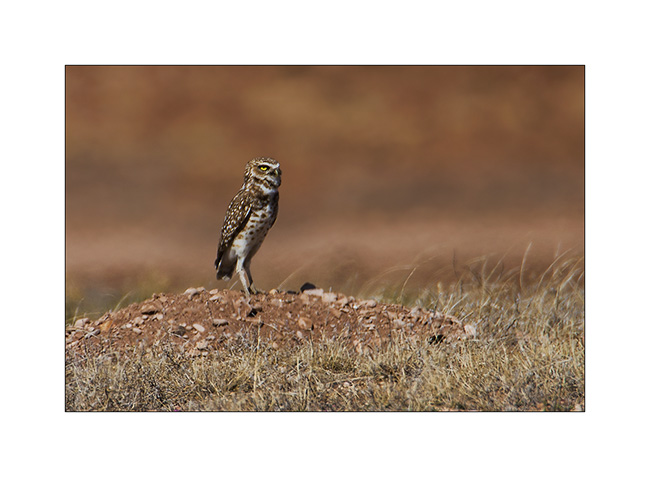
9. Along the trail, meeting with two burrowing owls. Difficult to get close on this terrain…
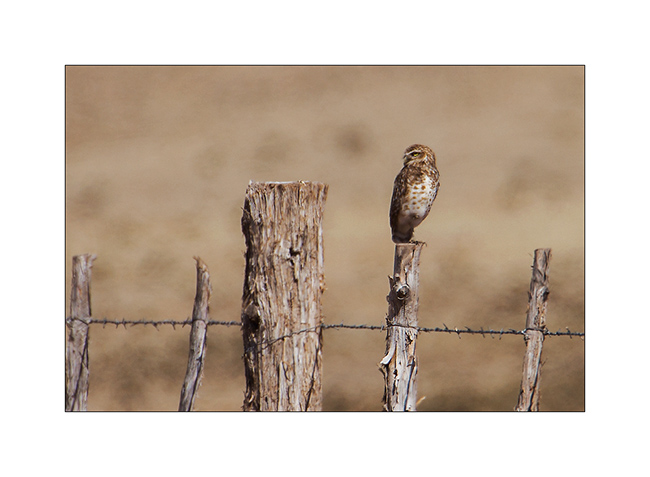
10. Typical straight posture.
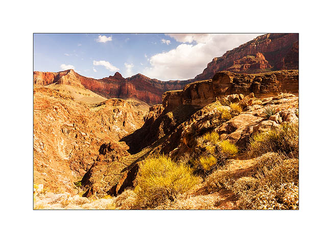
The next day we decided to go down to the bottom of the Grand Canyon. It’s still a long walk ahead of us, with about 5,000 feet of elevation gain. But it is only down there we can perceive the full extent of the giant…
11. Start of the hike down in early morning.

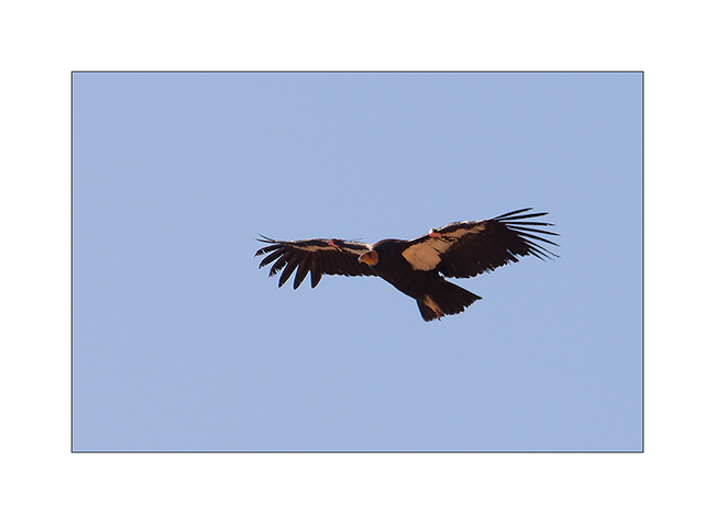
12. We were lucky to see condors reintroduced here too.
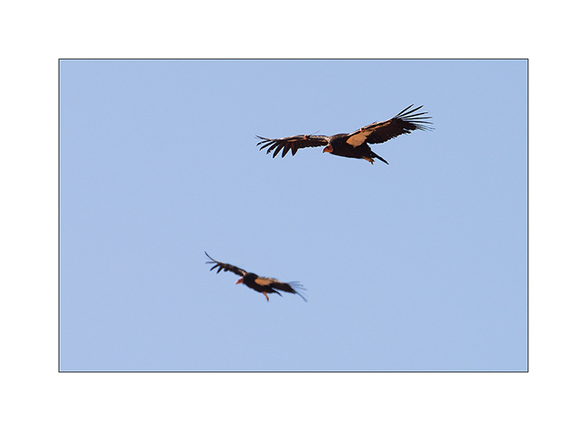
13. What a bird!
14. After 3,000 feet of descent, we’re not at the bottom, far from it, and crossed the caravan of mules which comes from the ranch at the bottom on the other side.
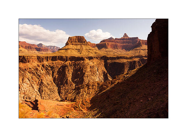
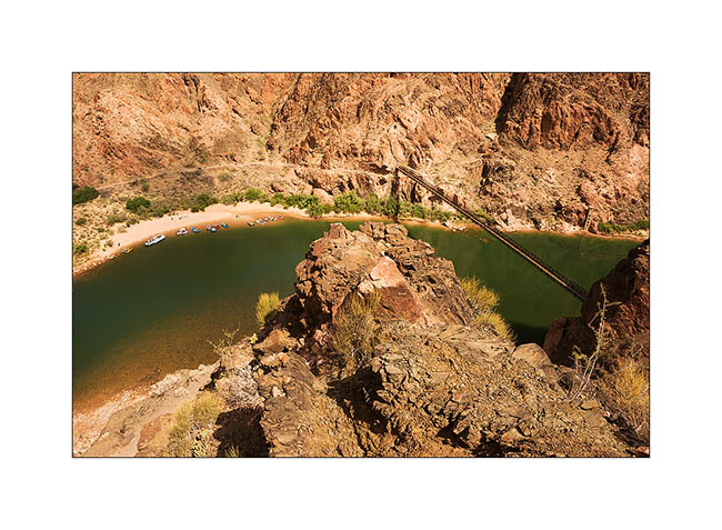
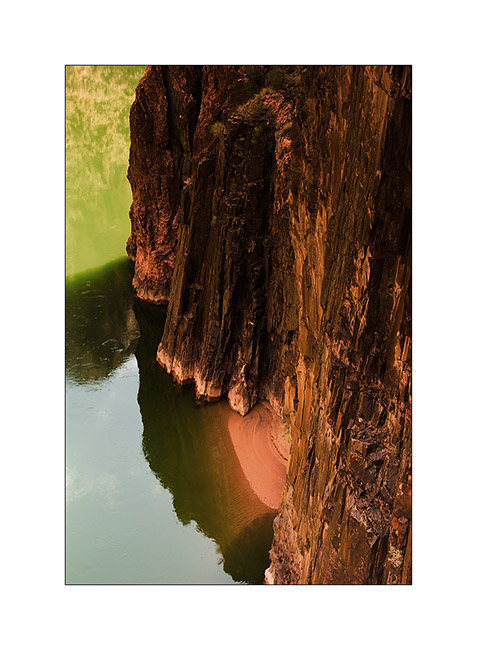
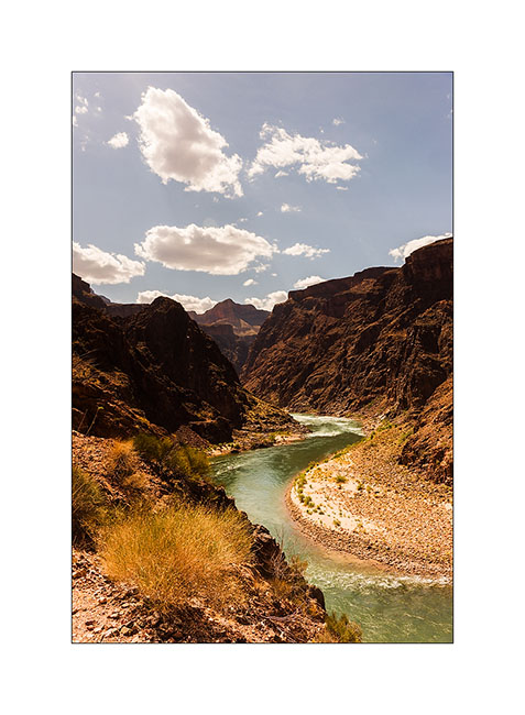
15. The Colorado River is still 1,500 feet below.
16. It grows as we decend!
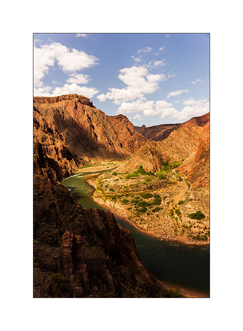
17. From the suspension bridge which allows to cross it…
18. A neighbor of our snack break, especially photographed for Isa Belle who will recognize herself. 😉
19. He is 4PM and we still have to go up all the canyon, after Jean-Luc has sent a postcard “by mule” from the bottom of the canyon…
20. The light falls, saturating colors…
21. … and playing hide and seek with the clouds.
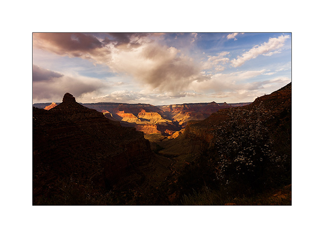
22. Last view of the canyon reaching the top just at sunset.
We then took the road again to join the Page area and I’ll tell you that soon… 😉
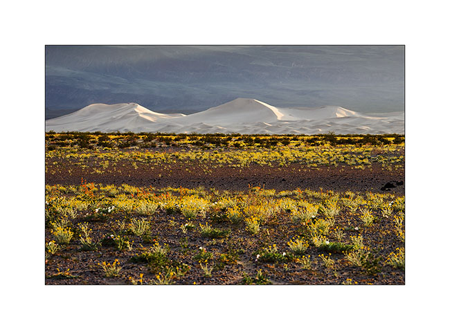
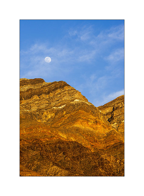
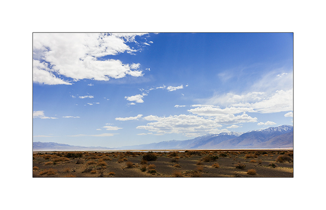
Mono Lake, Bristlecone Pines & Death Valley…
Waiting on the flange that had to be replaced on Vivalavida, we rented a car and went to visit Mono Lake, about seventhy miles north of Bishop. This lake is unusual to see since it have calcareous concretions created by source, like kind of stalagmites visible today. This lake is also very salty, which limits the underwater life.
1. High country near Mono Lake.

2. Salt foam on the shore.

3. Concretions have surprising forms.
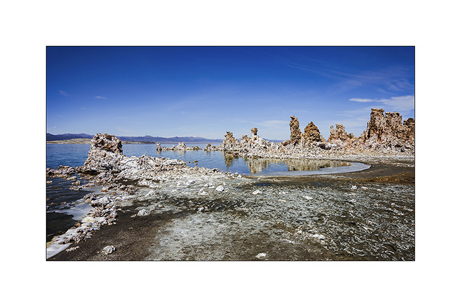
4. Vivid colors created by the minerals dissolved in water.
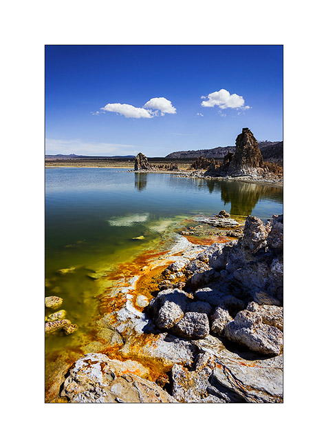
5. Nice cloud in the lake area…

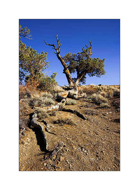
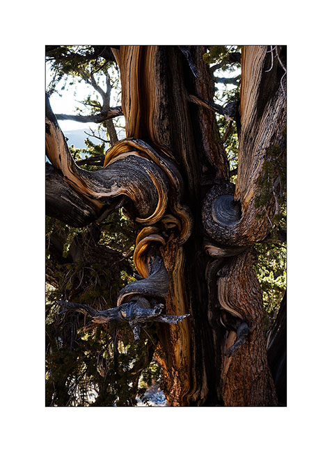
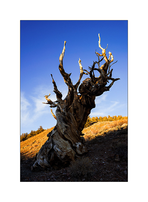
The driveshaft of Vivalavida reinstalled, the next day we drove to the White Mountains to see the Bristlecone Pines, incredible trees since it is actually the oldest known form of life on the planet. Some of them are more than 5,000 years old and still alive!
6. Some roots are exposed, the erosion of loose soil is important here.
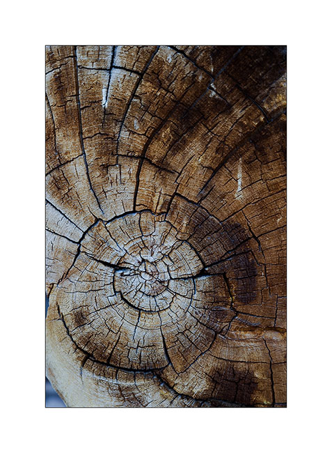
7. A section showing the trunk which growths only a few tenths of a millimeter each year. This dead tree lived more than 3,600 years.
8. Plateau at Shulman Grove.
9. Tormented but beautiful growth…
10. This ancestor has ceased to live…
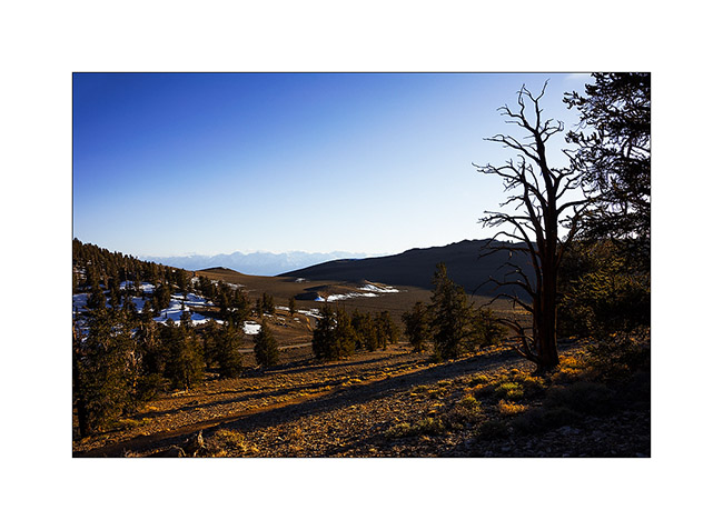
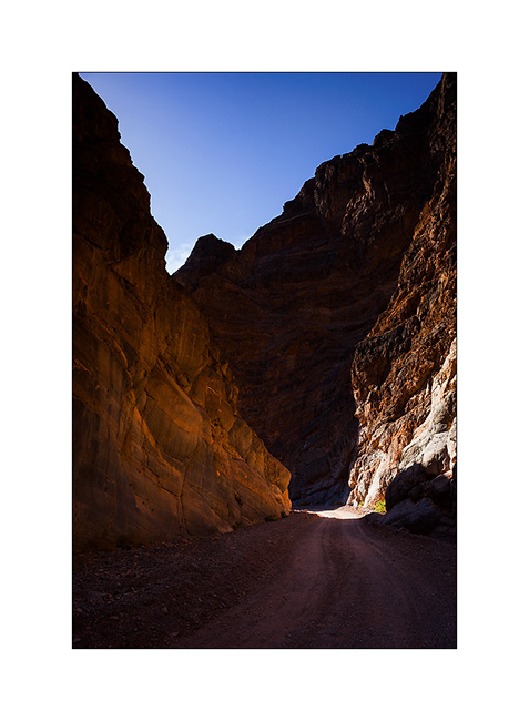
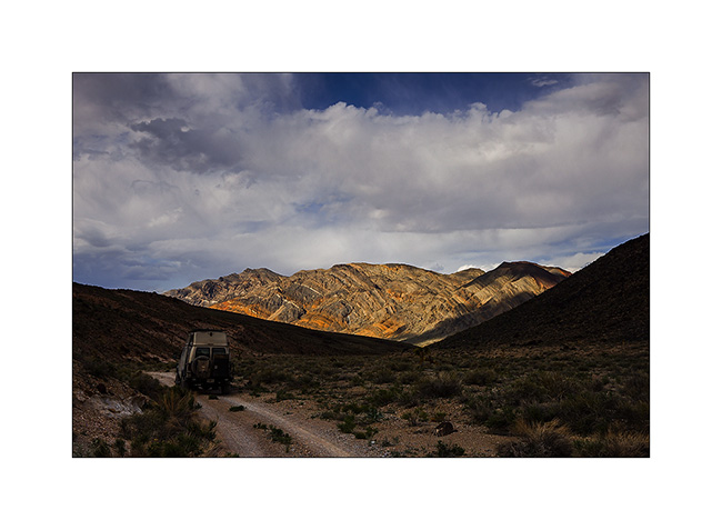
11. Continuing our journey through Death Valley, we took a walk in the Titus Canyon…
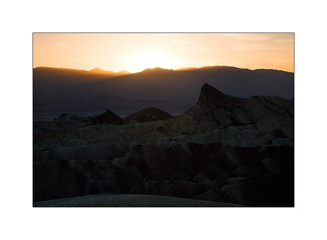
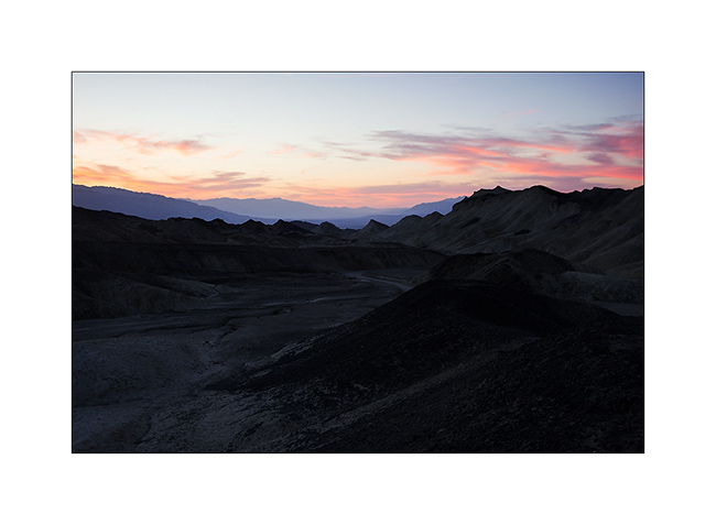
12. … before joining the inevitable Zabriskie Point at sunset.
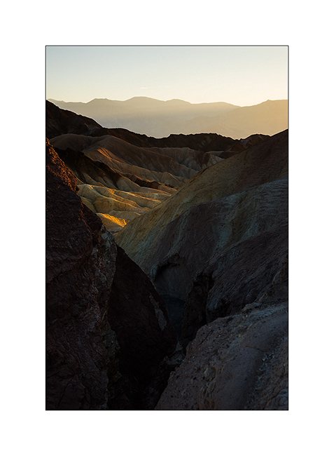
13. Sweetness of these eroded hills…
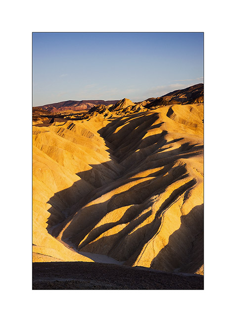
14. The sun disappears for an image a little different from this so much photographed spot.
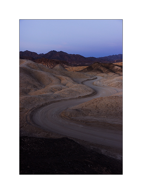
15. We found a place to sleep in the wild near abandoned mines.
16. Track makes pretty curves…
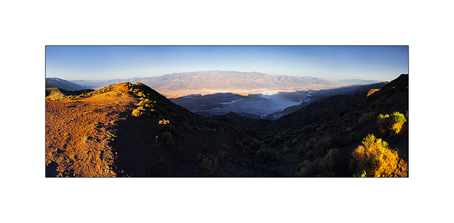
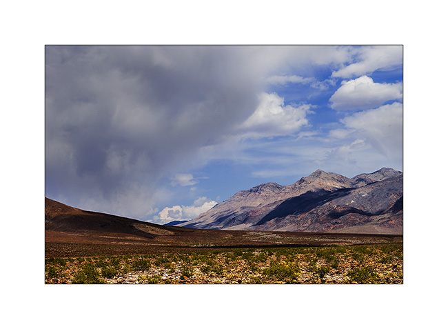
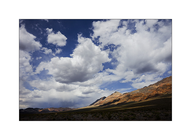
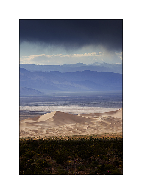
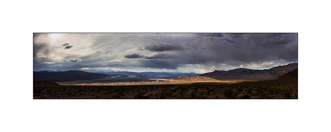
17. The next morning, we went up Dante’s View, a spot overlooking Death Valley that FredW, a friend of mine, adviced me. What a panorama ! (stiched panoramic of 9 vertical images)
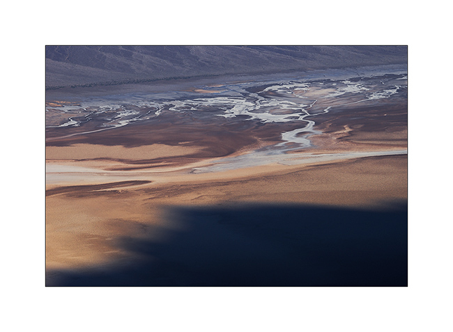
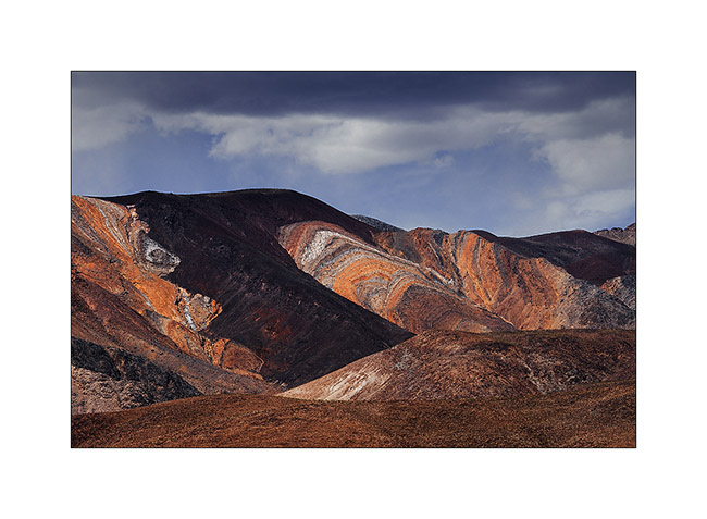
18. Drawings in Death Valley
That’s it for the Death Valley area. We then spent an afternoon in Las Vegas before taking the direction of the Grand Canyon. To Come soon…
PS: The trip map is up to date… 😉
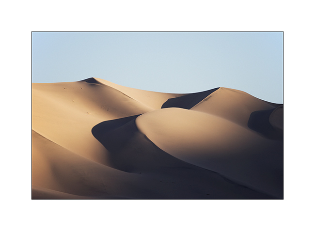
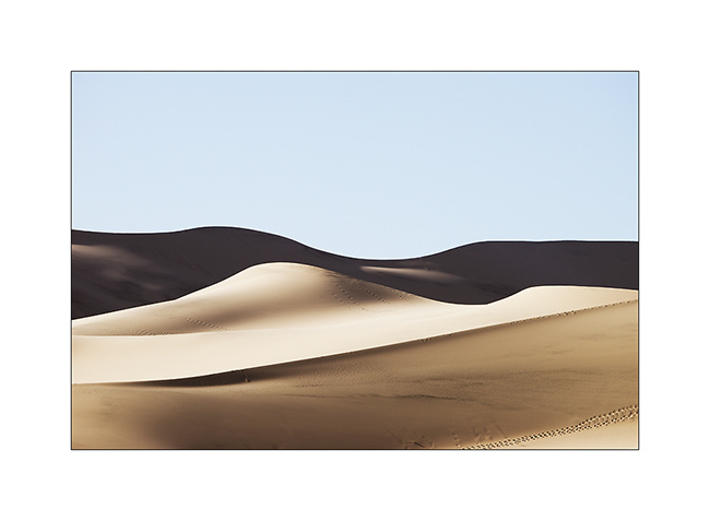
Saline Valley & Eureka Dunes
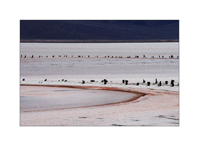
1. Arrived in the Saline Valley, we made a stop on the shores of the salt lake.
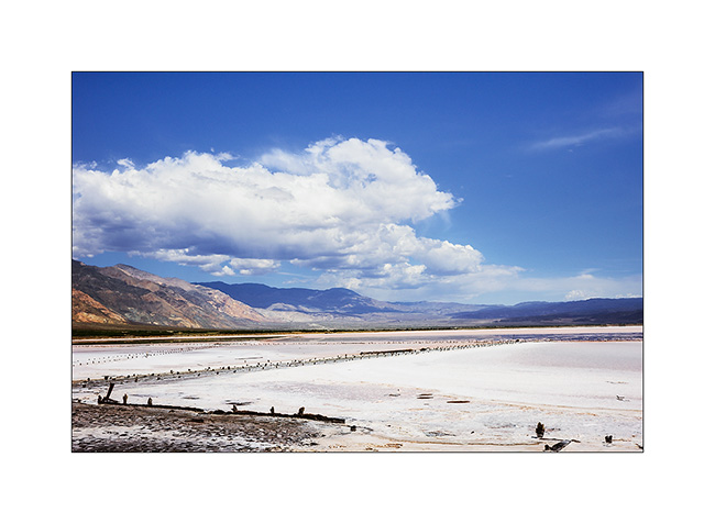
2. The salt crust is impressive.
3. Little enjoyable break to relax in one hot springs.

4. High Saline Valley towards the Steel Pass.
5. Awesome colors…
6. High end of the valley…
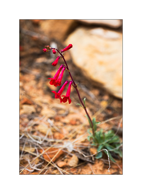
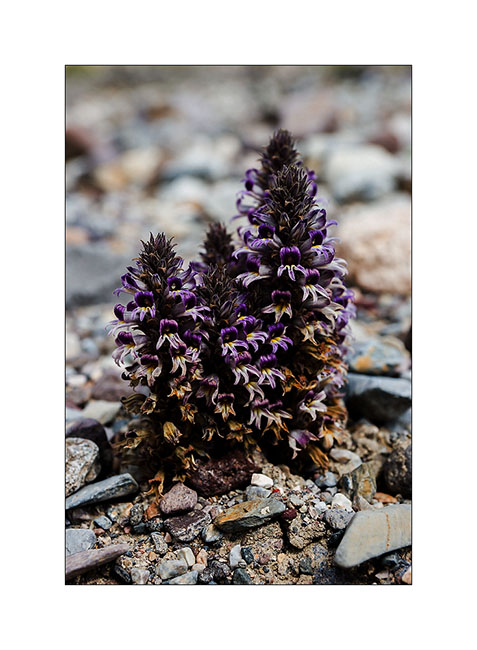
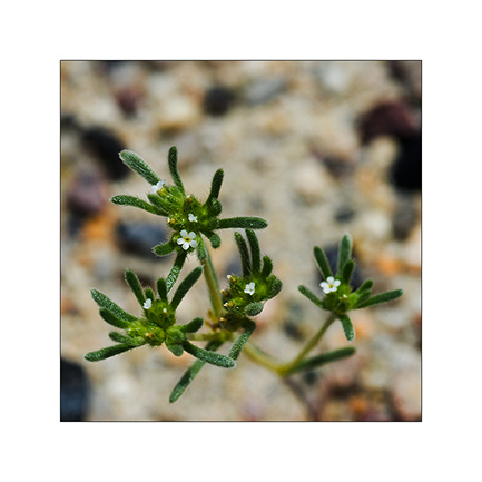
7. A flower which parasites rare bushes.
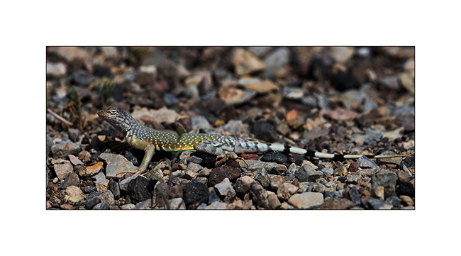
8. Colored lezard.
9. Narrow and leaning pasage…
10. Going down behind the Steel Pass.
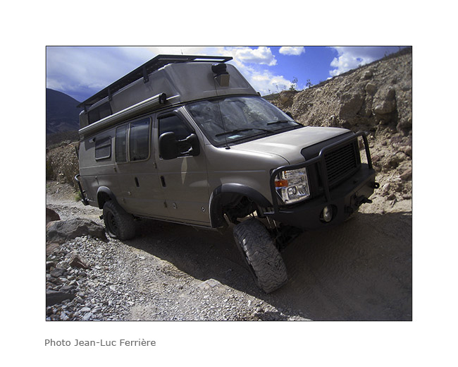
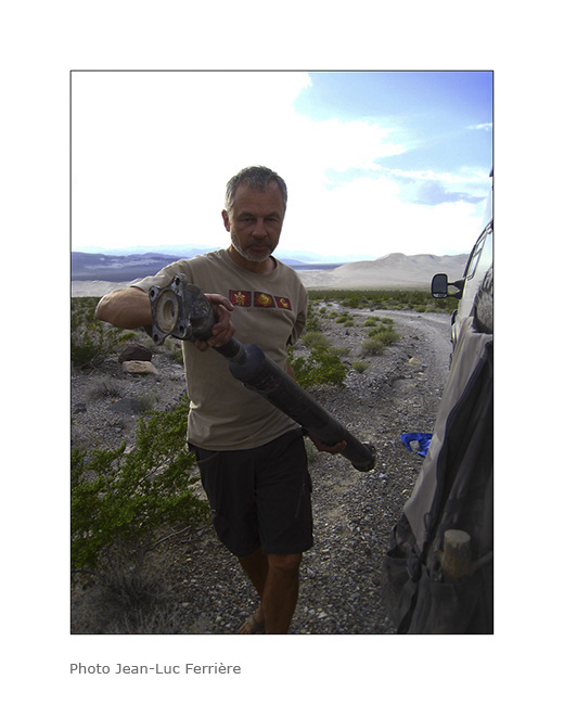
11. In the descent, bad noise and Vivalavida stops … Dazed, the rear driveshaft git down. The threads of the flange have been uprooted!
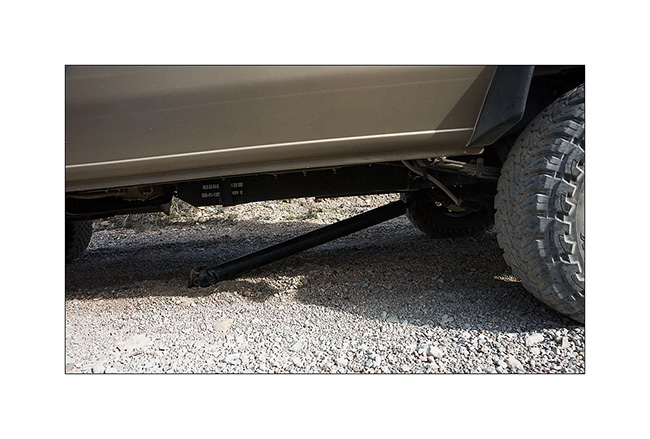
12. No other way than taking it appart and prosecute on the front axle only.
13. Not obvious because the “Cascade” that we must cross have big steps…
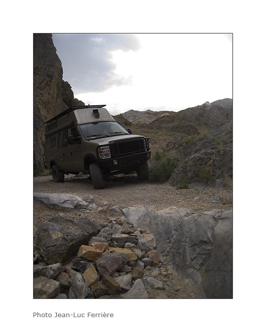
14. … Fortunately we went down it.
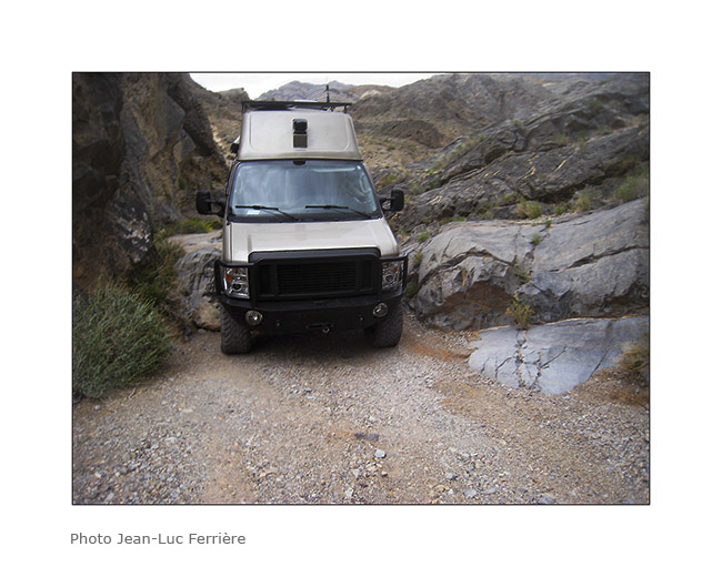
15. Passage narrower than Vivalavida!
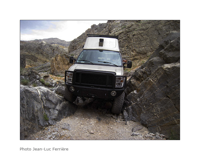
16. Axle crossing…
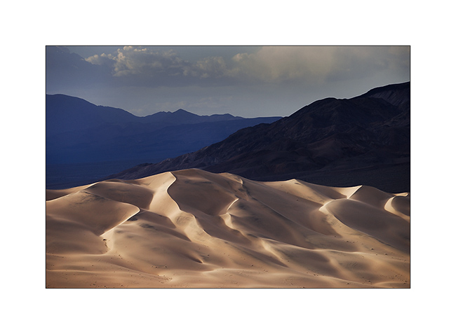
17. We finally managed to join the Eureka Dunes where we spend the night.
18. What a beautiful place!
19. Mineral contrats…
20. Sunset light on the dunes…
21. .. and Moon rise over the cliffs.
22. Last sun ray on our boondocking site…

23. … and on the mountains behind us.
24. The morning was clear, the light playing with dunes…
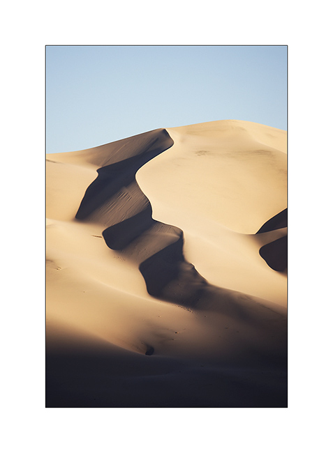
25. all of curves…
26. … and smoothness…
27. Back in the valley behind the Sierras, in Bishop, to repair the driveshaft.

To be continued soon… 😉
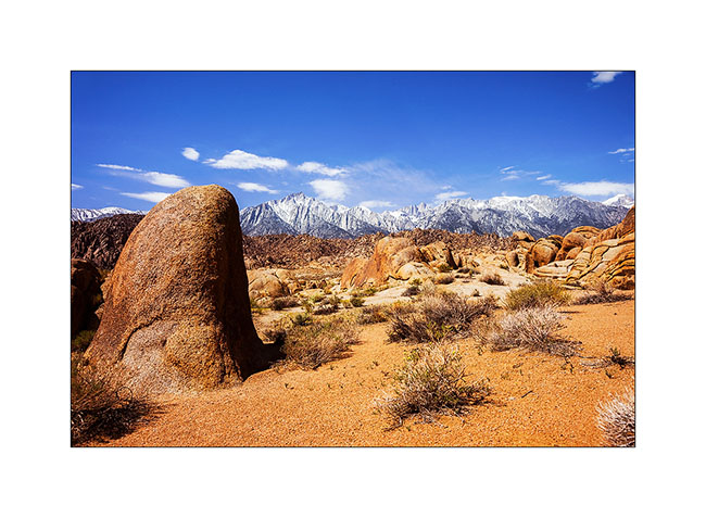
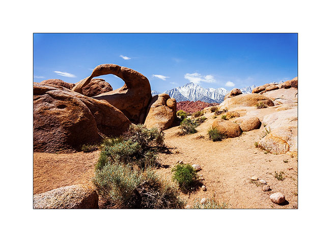
Alabama Hills & Racetrack
Before to cross the border to Canada later today, here is still an update from the US. 😀
After visiting the Pinnacles, we went East of the Sierra Nevada. We stopped at the Alabama Hills, nice site just next to Lone Pine.
1. Contrasts with the snowy Sierras…
2. Mobius Arch.
3. Valley near Lone Pine.
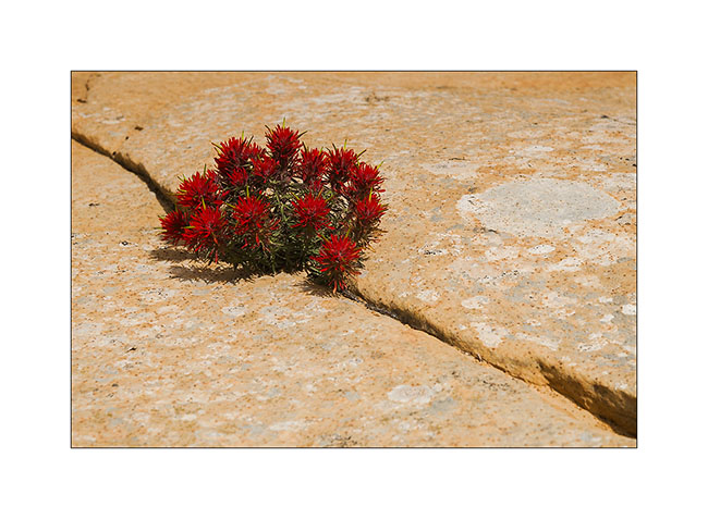
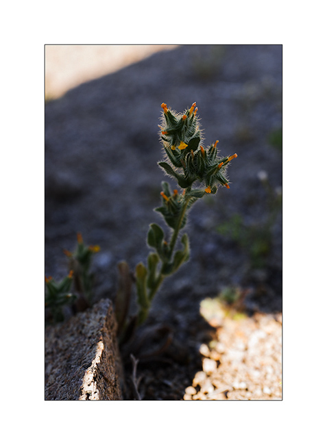
4. Tiny plant growing in the sand.
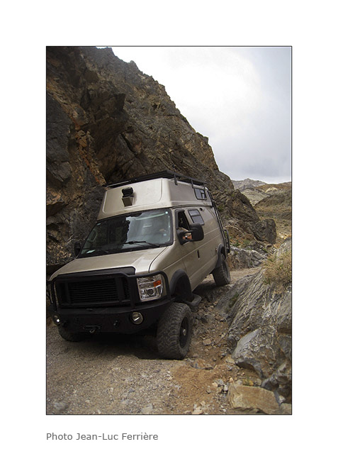
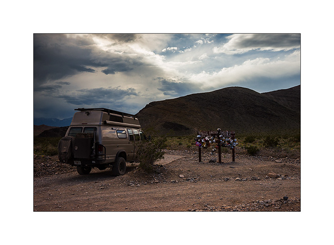
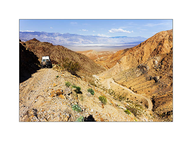
5. VivaLaVida on the Hunter Mountain trail.
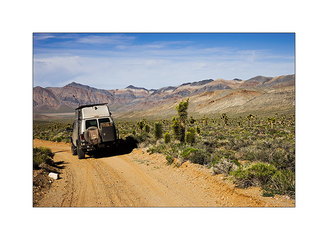
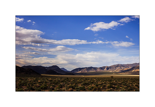
6. We’re now in the Death Valley National Park but in more remote places…
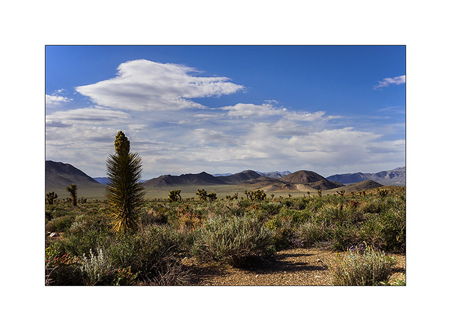
7. Wonderful altitude desert…
8. Photo stop at Tea Pot Junction. Unfortunately we forgot to bring a teapot… 🙁
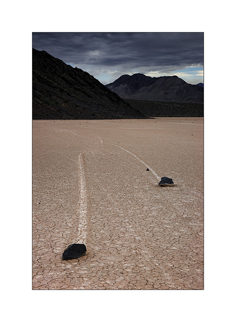
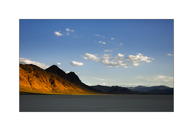
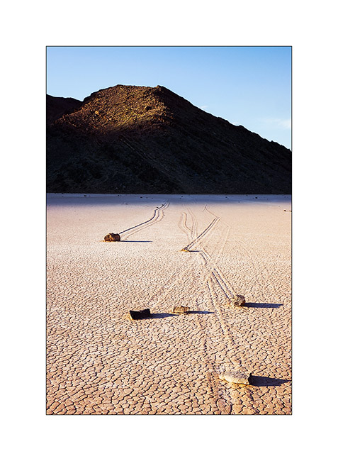
9. Arrival at Racetrack after several hours of stony track and with a leaden sky..!
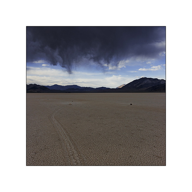
10. Racetrack, this unique site where rocks move leaving traces without anyone being able to date to explain the phenomenon. Some assumptions, such as high winds on a wet and therefore slippery surface, seem plausible…
11. Interwoven traces…
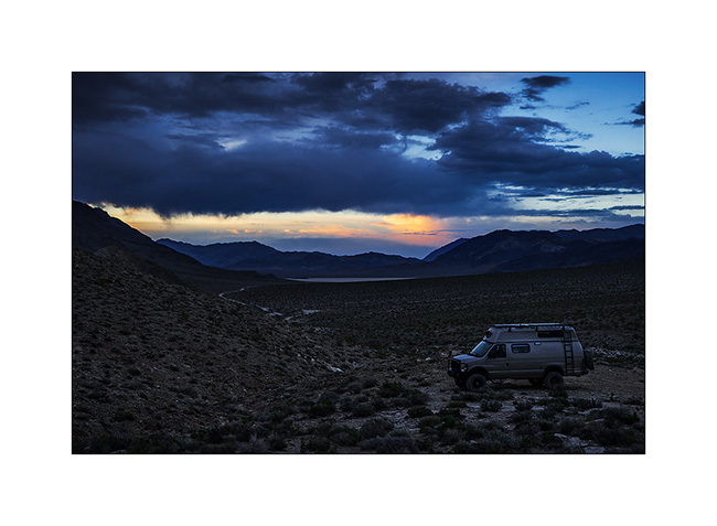
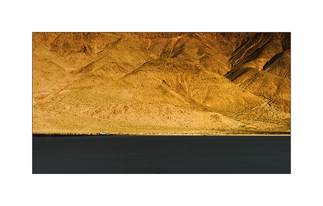
12. We camped on the site of a disused mine just a few miles away to return to Racetrack in the morning hoping for a better light.
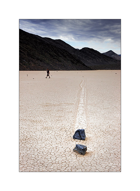
13. And it is the sun that welcomes us!
14. VivaLaVida seems so small..!
15. Light highlights the tracks.
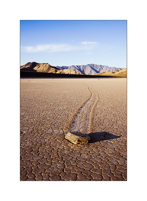
16. Don’t they look like they are racing..? 😀
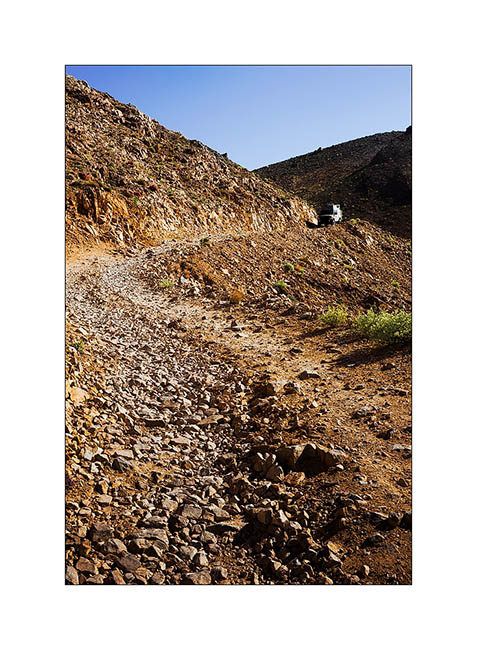
17. We then borrow the Linpintcott Road, a little-used track to join the Saline Valley.
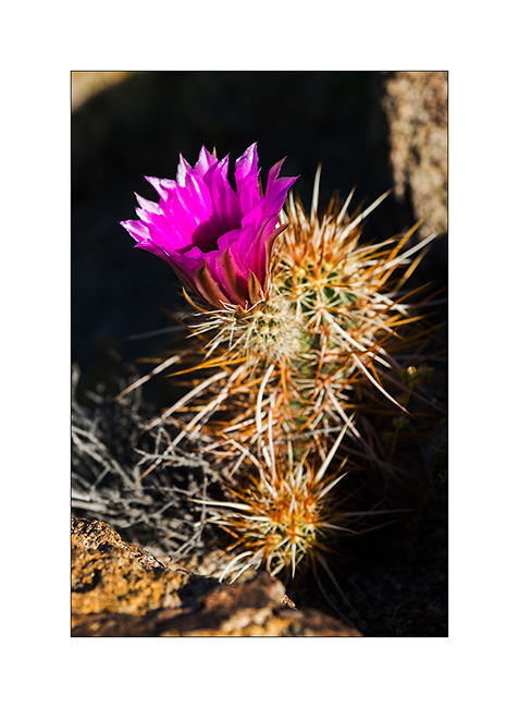
18. Cactus flower.
19. Another “hairy” flower…
20. Exposed portion of the Linpincott Road. Some passages were quite narrow but Vivalavida managed to crawl through.
Stay tuned for more to come soon in Saline Valley… 😉
 D5 Creation