April, 2014
now browsing by month
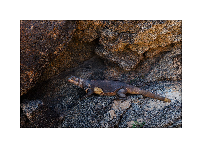
Baja California (1)
Here is the time to count the trip of Vivalavida in Baja California. We went there with Andrew, a Swiss friend already met in Geneva whoh also has a 4×4 Ford van. He came to the U.S. for a about two months and we agreed to meet at the Mexican border for exploring the Baja California together. It was a first trip there for both of us and given the remoteness of some places, driving two vehicles was a real advantage in case of failure.
I called his van “Baja Shaker” because its suspensions are much harder than those of VivaLaVida and rocked him not just a little on some bumpy tracks! 😉
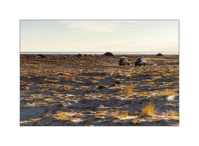
We met at Ocotillo for a first night in the Anza Borrego Desert before crossing the border the next day in Mexicalli. From the first meters on Mexican territory, all immediately changes. It is like we were thirty years ago, with old cars, homes in bad state, even if the big american brands seem present in the cities at least. We had been advised not to stop us near the border and sleep at least 100 miles away to the south. So we drove south along the Sea of Cortez since we had decided to go down on the east side of the peninsula and back along the Pacific coast.
1. First night on the beach not for away from San Felipe.
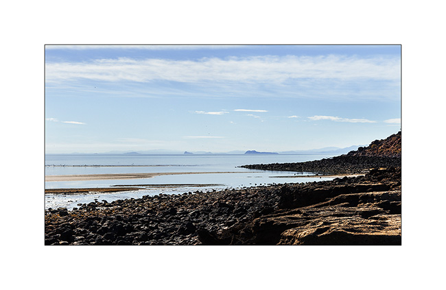
2. Puertecitos, small fisherman village…
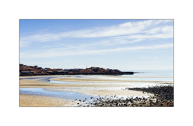
3. … where teh view was quite different of the deserts through VivaLaVida travelled during the preceding weeks.
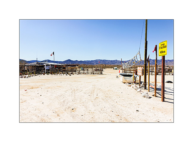
4. A stop at Coco’s Corner, a wellknown road junction of that area.
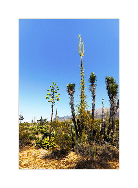
5. It’s a mountain area…
6. … with many washes which don’t see rain often.
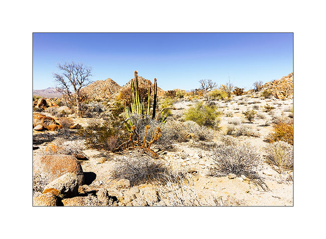
7. Almost everything that grows here has thorns!
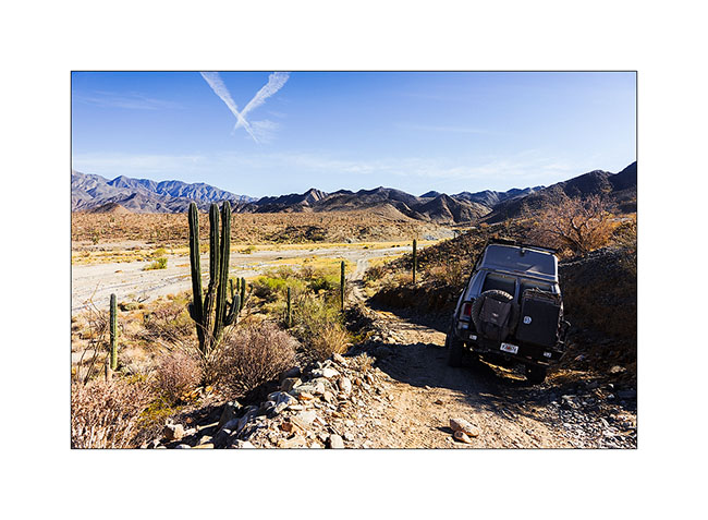
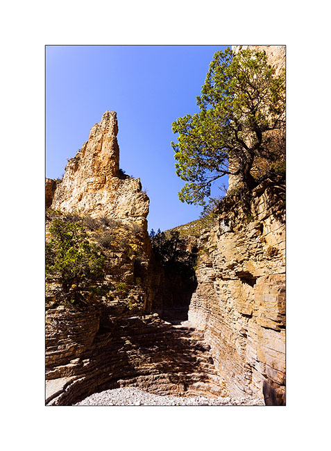
8. Vivalavida going down into a wash to access the bottom of a gorge. We camped on the opposite rim just next to the ruins of a 19th century mission.
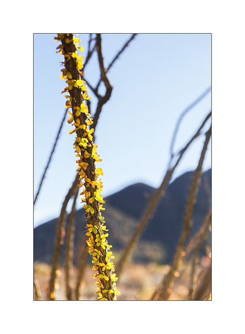
9. Cactus flower.
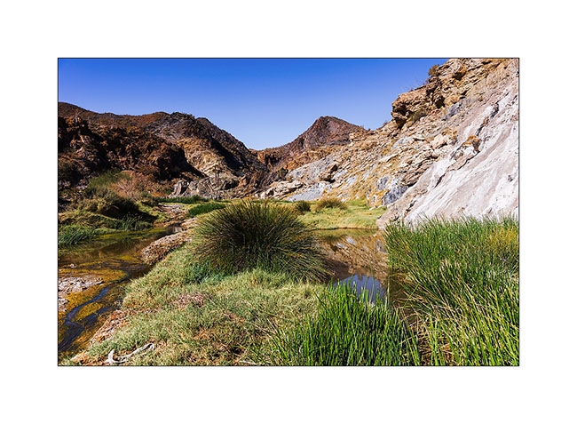
10. Going up the gorge, we found some water…
11. Sometimes I had to use the shears..! 🙂
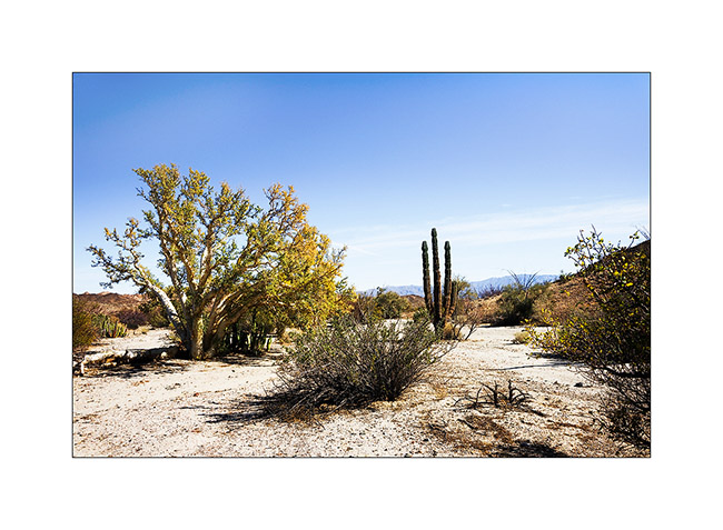
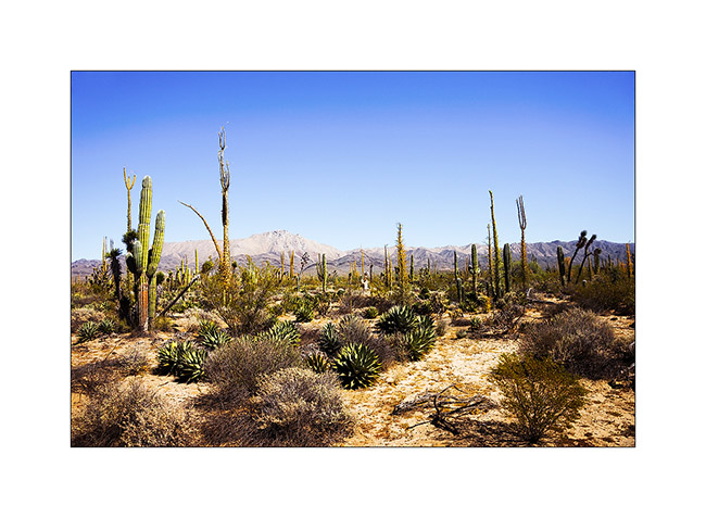
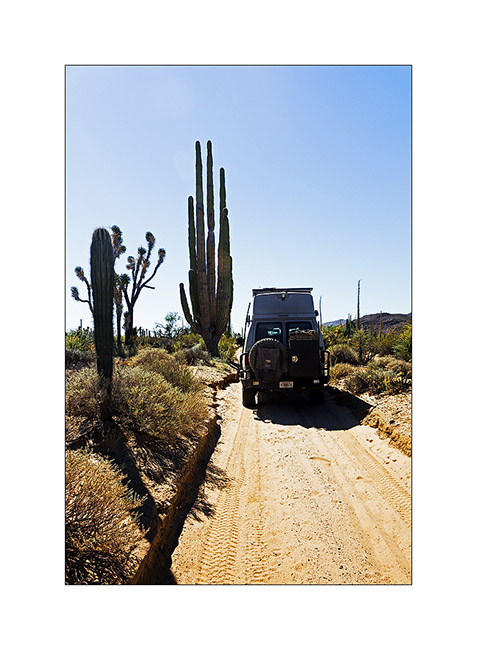
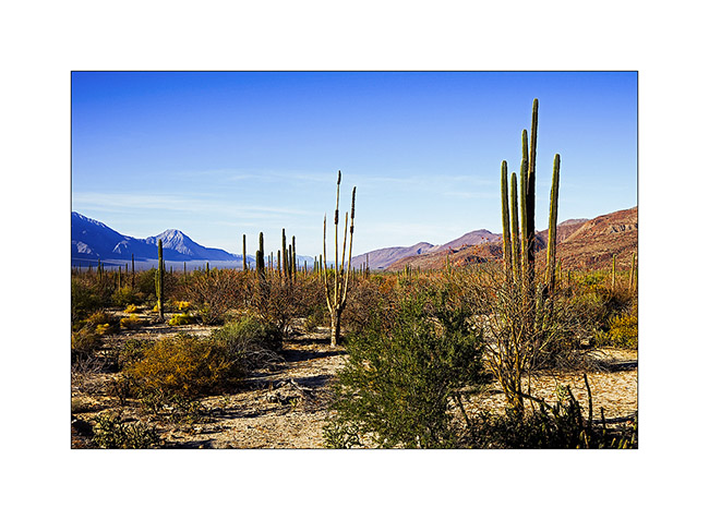
12. A beautiful cactus forest !
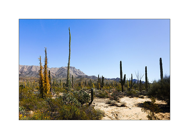
13. Really exotic !
14. My feet remember of a few large spines..! 😉
15. They are also giants..!
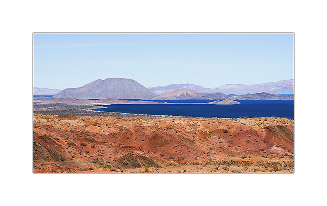
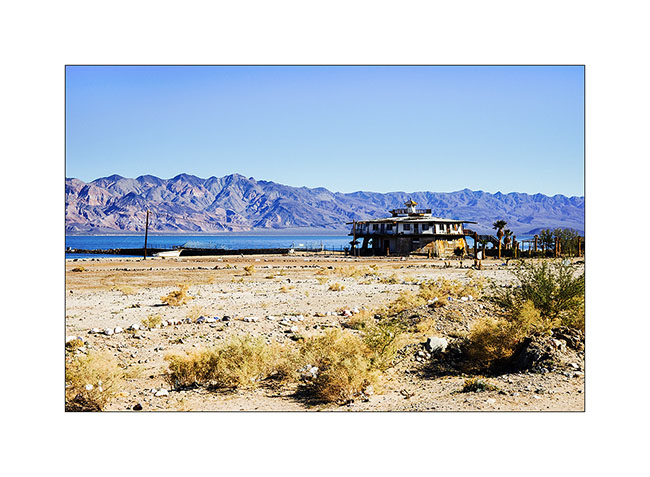
16. Descent to Baya Los Angeles.
17. Funny circular house at Baya Los Angeles.
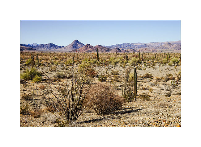
18. Continuing south, the scenery is magnificent.
19. The sun goes down…
20. Last rays. We slept on the beach of Las Animas that we reached only at night…
Next to come soon…
Arizona
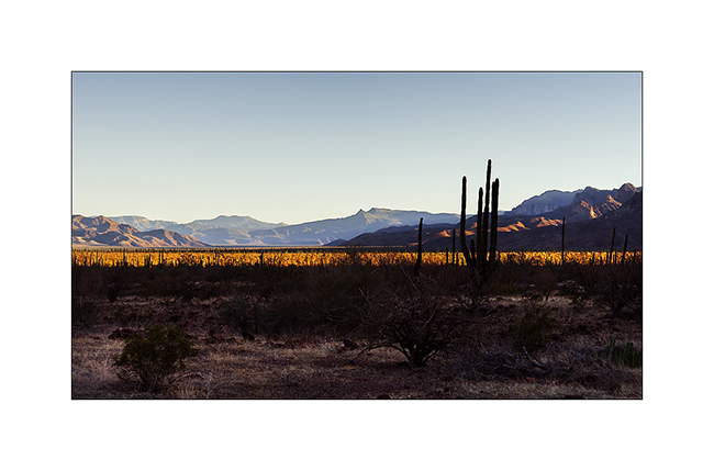
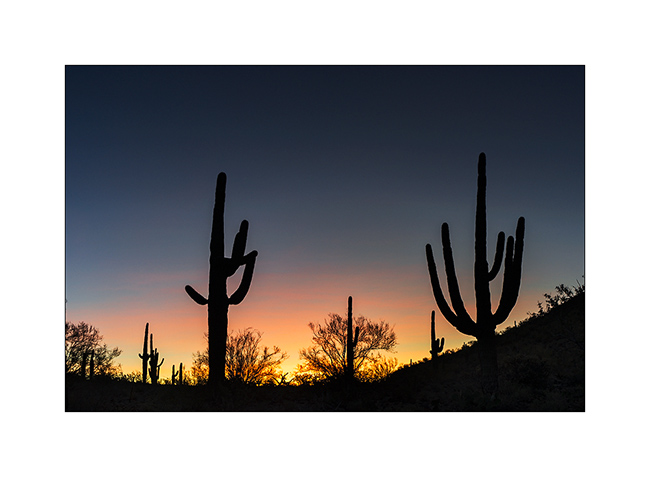
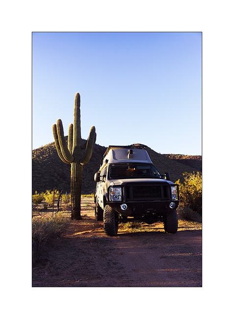
Last update on the road to Baja, I crossed Arizona in one day, in some desert places where are saguaro, the giant cactus.
1. Symbol of Arizona!
2. VivaLaVida gives the scale.
3. A deep coat of fech-fech dust in this wash…
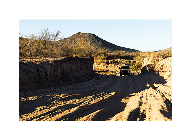
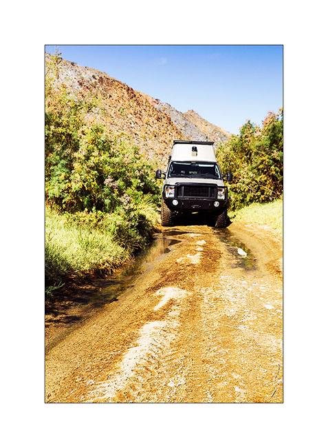
4. … then a river crossing quite deep too!
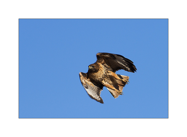
5. A Swainson’s hawk.
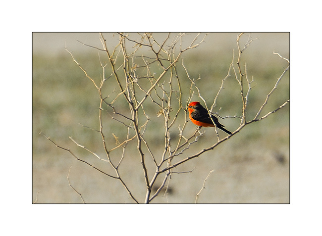
6. Nice small red bird.
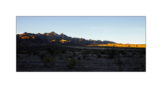
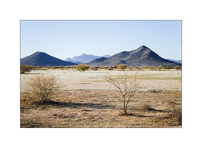
7. Nice desert landscape.
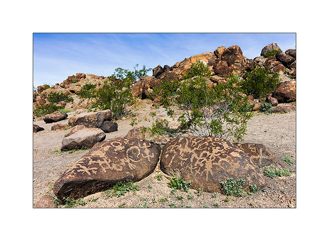
8. A petroglyph site.
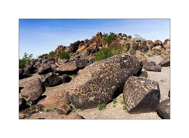
9. Representation…

10. … and model!
11. This represents the sun.
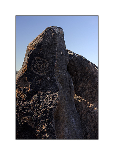
12. More petroglyphs.
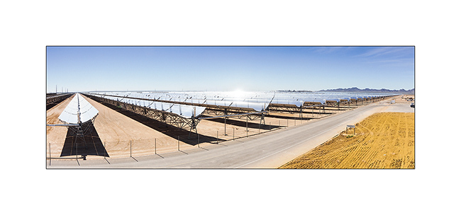
13. On the road, I stoped to see that solar plant.
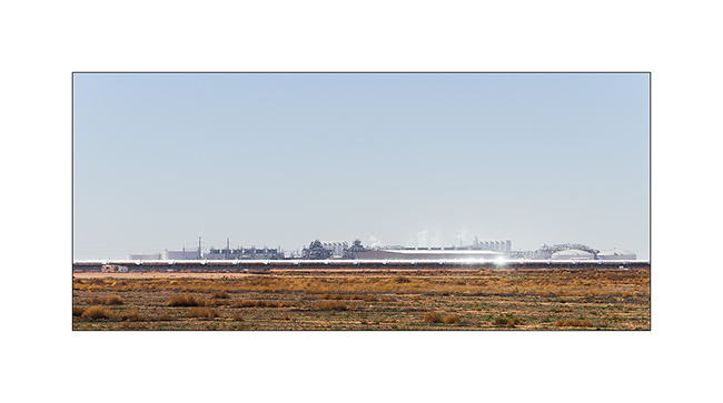
14. Each parabolic mirror is more than 3/4 mile long and moves to follow the path of the sun, focusing the rays onto the pipe located in his focus. Thus, water is converted into steam under pressure which makes a turbine turn, similar to those used incoal plants.
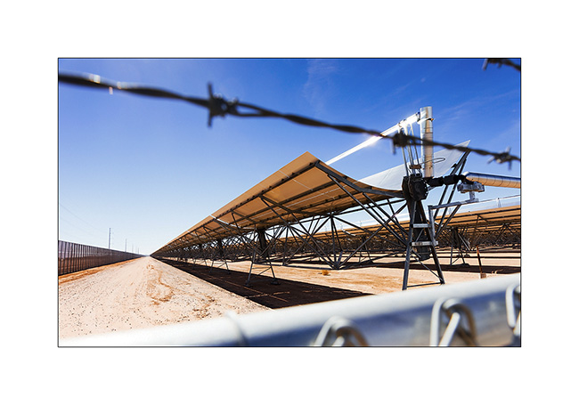
15. Surface is huge. I estimated it at about one square mile.
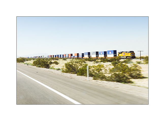
16. And especially for Patrick and Claudia who drive trains, a picture of the huge convoys crossing the U.S. by the southern route, driven by large Union Pacific diesel locomotive. The photo, taken while driving is not terrible,, sorry…
That is it for my crossing of the southern United States. The following will take you to Baja Mexico where I spent four weeks with Andrew that I will present to you soon.
New Mexico
I’m then in New Mexico where I visited two sites even I had very few time to hit the road to the Baja.
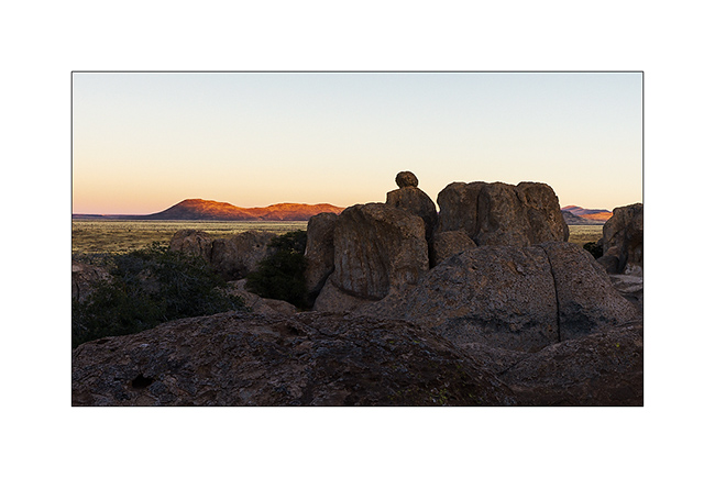
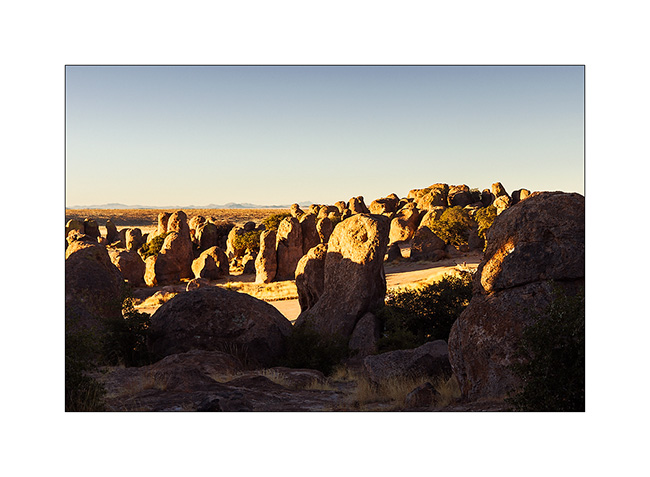
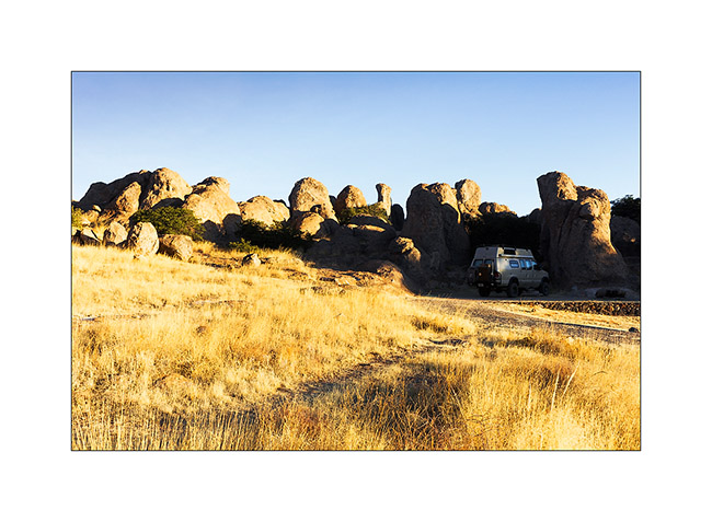
The first one is a small State Park called City of the Rocks. an area of about one mile long by half a mile large where hundreds of eroded rocks make pinacles where it’s allowed to camp. I arrived at Sunset end enjoyed the last rays of light…
1. On the road, just before arriving at City of the Rocks.
2. Sunset on the pinacles…
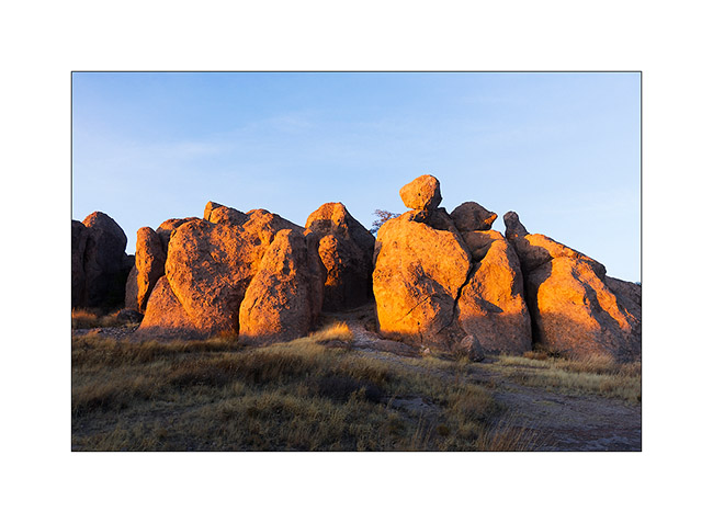
3. … and sunrise the next morning.
4. A real labyrinth!
5. First light on dry grass.
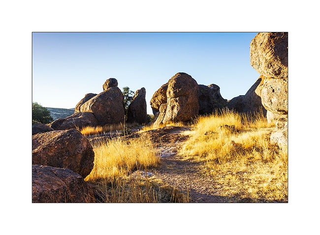
6. Where VivaLaVida camped.
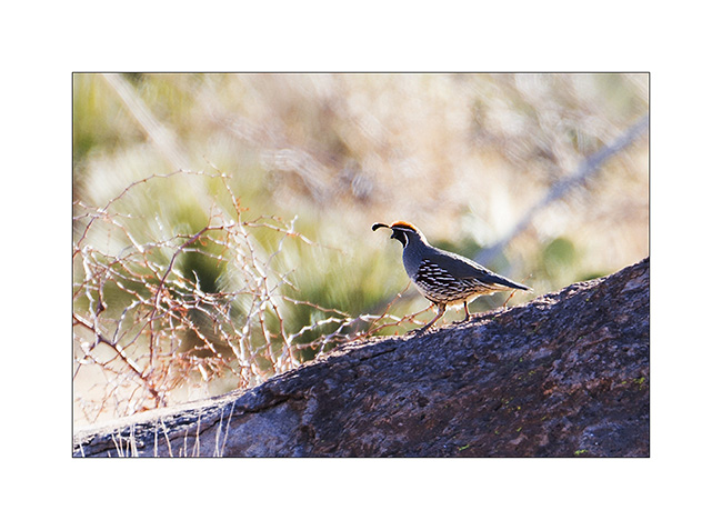
7. California quail, spectacular but not easy to approach.
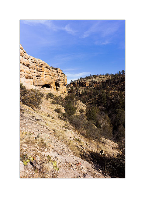
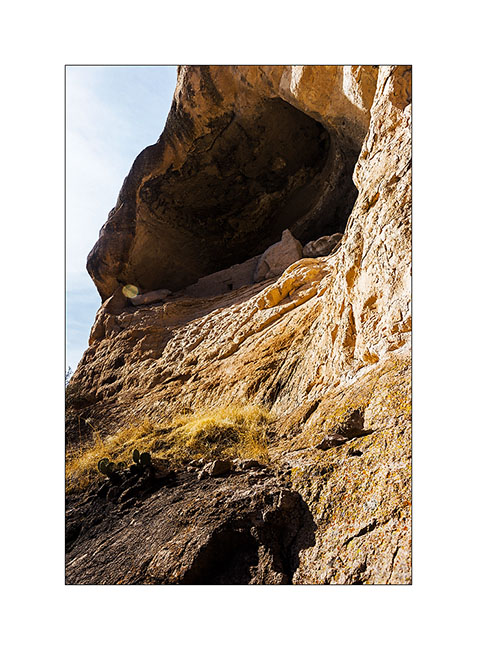
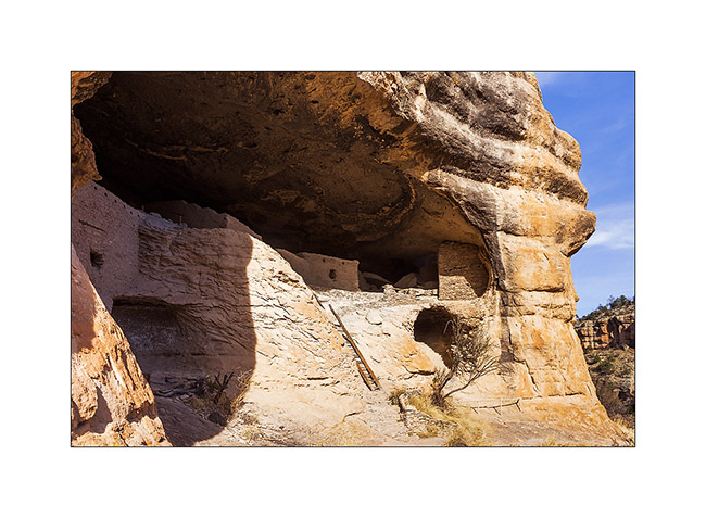
I then went to a site where about 800 years aga, indians used to live in cliff houses.
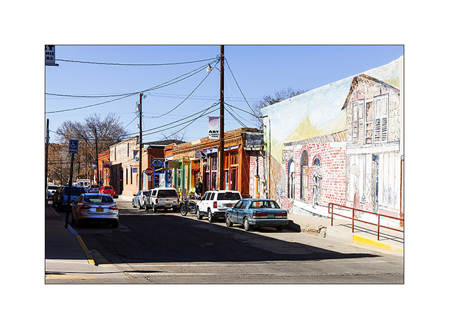
8. Short stop in the charming town of Silver City
9. Arrival on the site of Gila Cliff Dwellings.
10. Bowl created by crushing of grains.
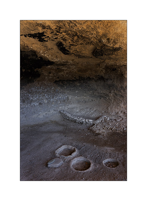
11. Wall were partially closing the overhangs…
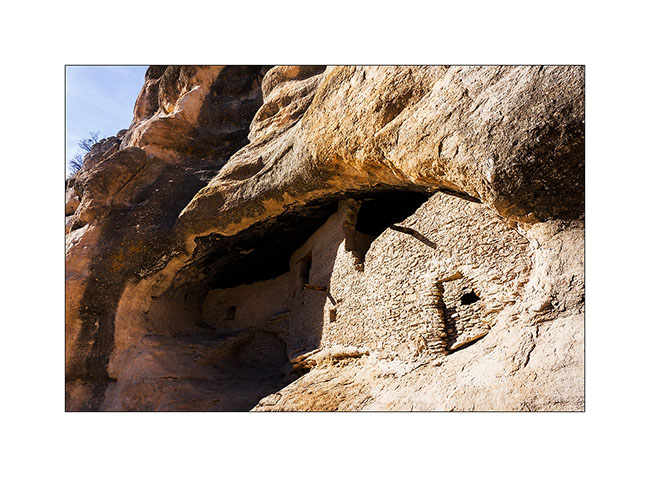
12. … to create rooms…

13. … sometimes really high in the cliff.
14. Another view of the interior.
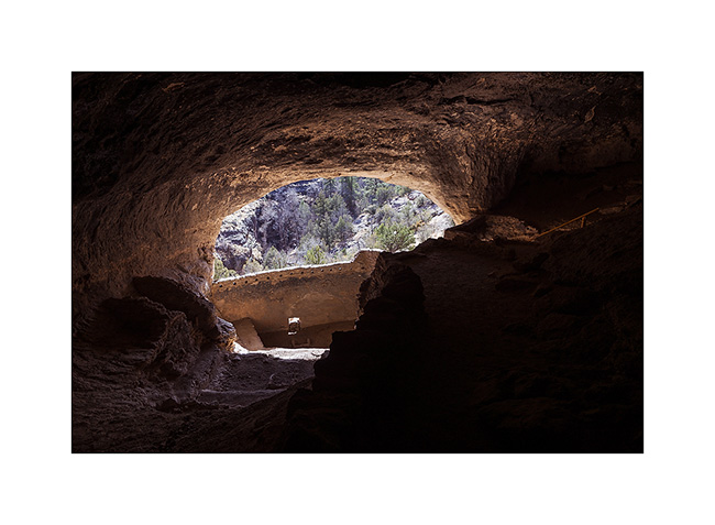
15. It’s one of the largest sites of cliff houses with le Mesa Verde National Park.
16. I slept a few tens of miles away in a beautiful mountain pine forest at nearly 6,000 feets above sea level.
Thats’s it for today. There will still be an update on my road crossing Arizona before offering you the story of our trip to Baja… 😀
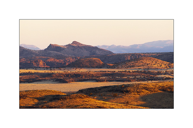
Last update in Texas
As I’m quite late relating the trip of VivaLaVida, I already post a new update…
Leaving the Big Bend area, I went back quietly to the Northwest, taking the path of Southern California where I had to join Andrew for our trip to Baja.
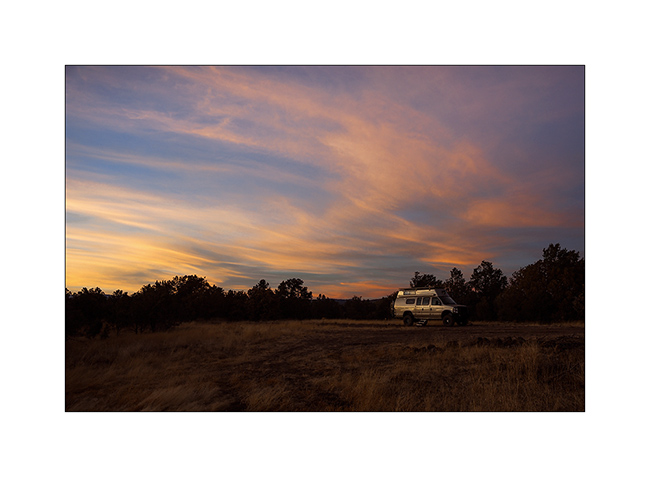
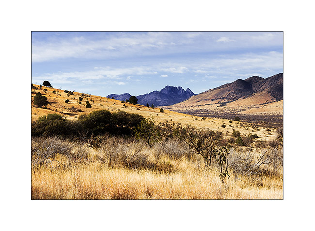
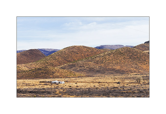
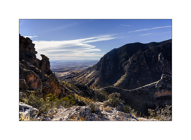
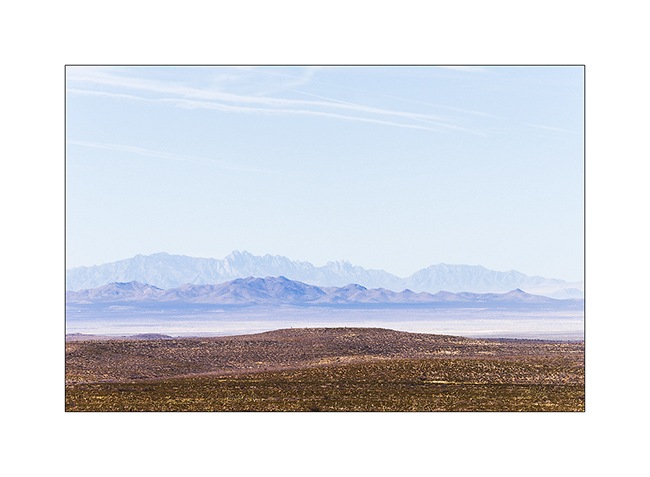
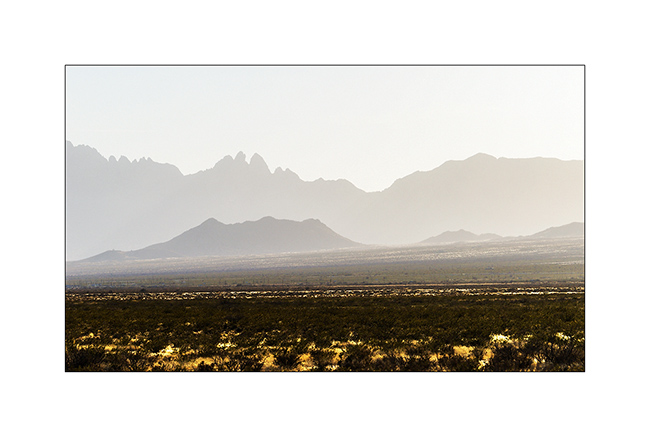
So I went to the Guadaloupe Mountains, an interesting mountain range. However, I stopped several times on the road, this time to Watch a beautiful sunset on the Texas plains…
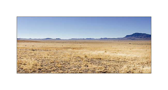
1. Huge and rather dry pastures…
2. Soft light at sunset…

3. … on these endless plains…
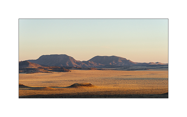
4. … that adorn some rocky hills to counter the monotony.
5. Nice pics!
6. Small remote ranch…
7. Western landscape…
8. Natural stairs in a canyon of Guadaloupe Mountains.
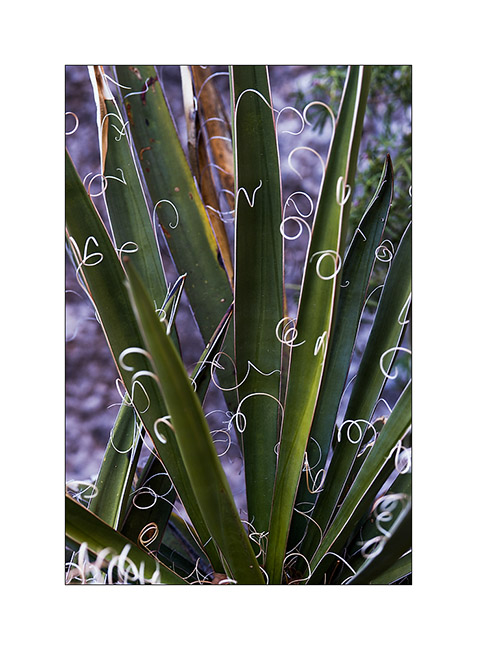
9. Vegetal elegance…
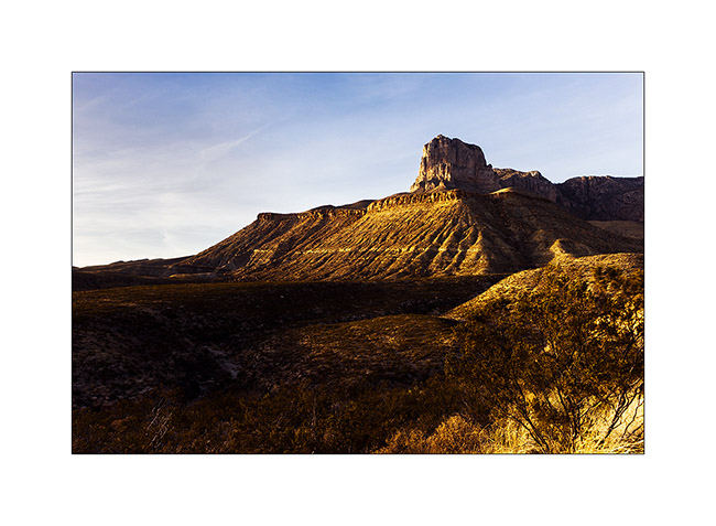
10. El Capitan (Guadaloupe Mountains) at sunset.
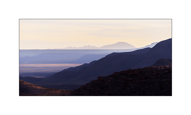
11. Immensity…
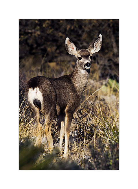
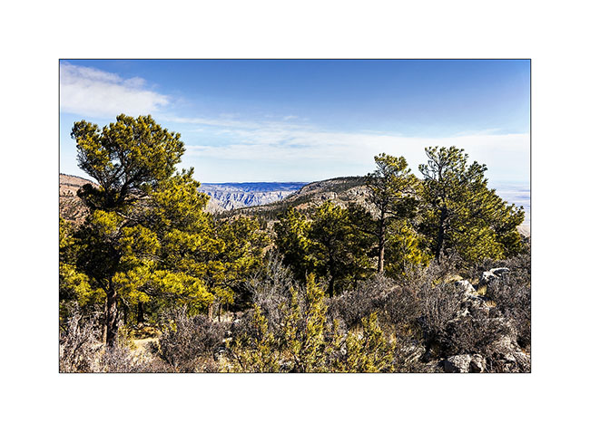
The next morning, I hiked the Guadaloupe Mountains. Mountain range over 8000 feet, it has the distinction of having a depression on top, which holds water and creates an unexpected echosysem in the desert environment.
12. A young “mule deer” at sunrise.
13. Long hike uphill…
14. … forest on the summit depression.
15. Yes, they are bears there! 😀
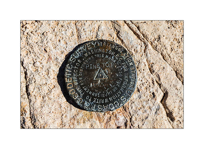
16. Mark at Pine Top summit.
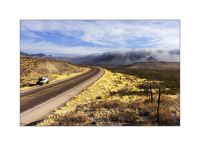
17. The next day, as I left the camp, a wave of polar air was coming. Retained by a ridge, it formed a curious fog seeming to overflow a saucepan. Beautiful but freezing!
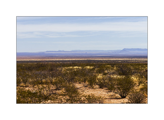
I then headed to White Sands, an erg of white sand.
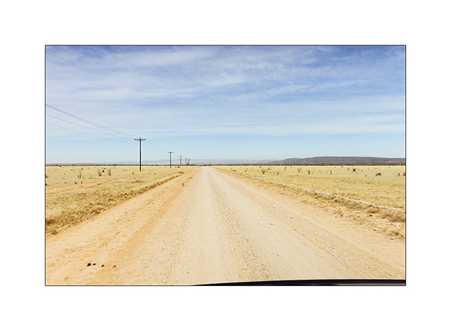
18. Good dirt road North West of Guadaloupe Mountains.
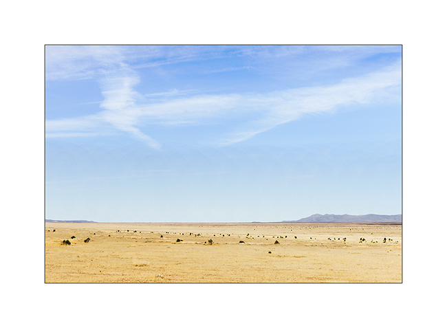
19. Still immense arid plains…
20. Distant view of the White Sands.
Once there, I had a little frustration because the site was closed. An army drone crashed there three days earlier. So I had to continue my journey toward New Mexico…
21. Late afternoon on VivaLaVida’s road…
That’s it for Texas, for now at least. I then went through New Mexico to visit two sites that I will present in the next update.
Big Bend Ranch State Park (2 and end)
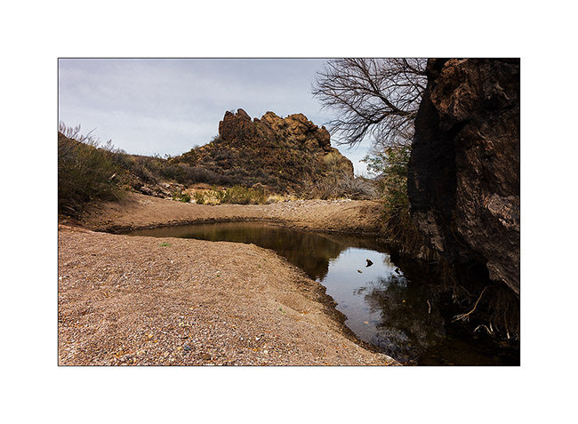
Some more report about Big Bend Ranch State Park. The next day, I hiked to discover the “Cinco Tinajas” and “Los Banos de la Leyva”, a long hike in several washes where walking is really hard in the soft sand.
1. Discovering the Cinco Tinajas… I took my shoes off and the water was so cold, partially frozen…
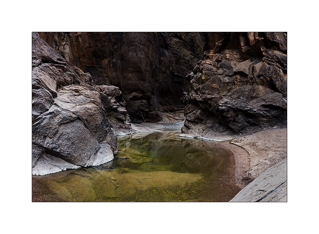
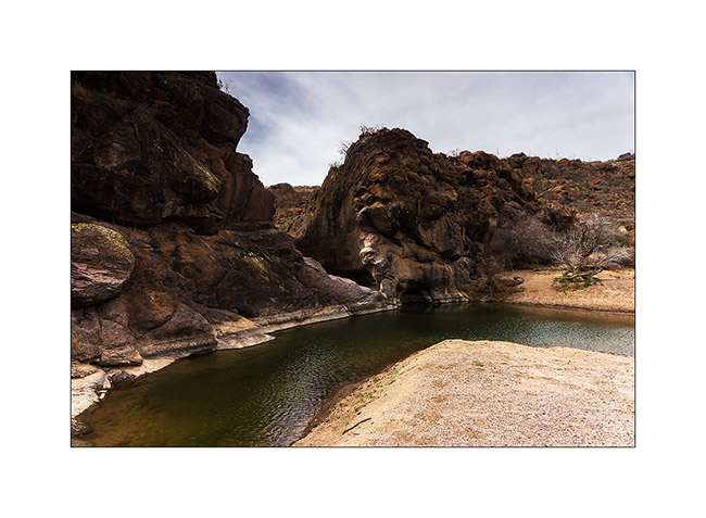
2. Going down the wash, arrival at the first pool of Los Banos de la Leyva.
3. Several hundred yards further, the second one…
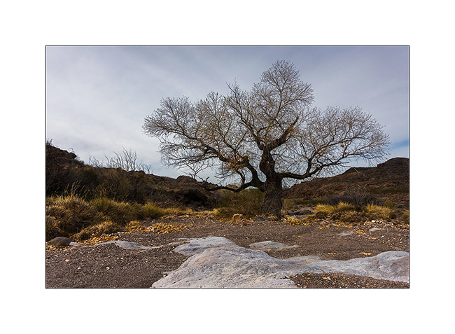
4. A beautiful tree going up another wash…
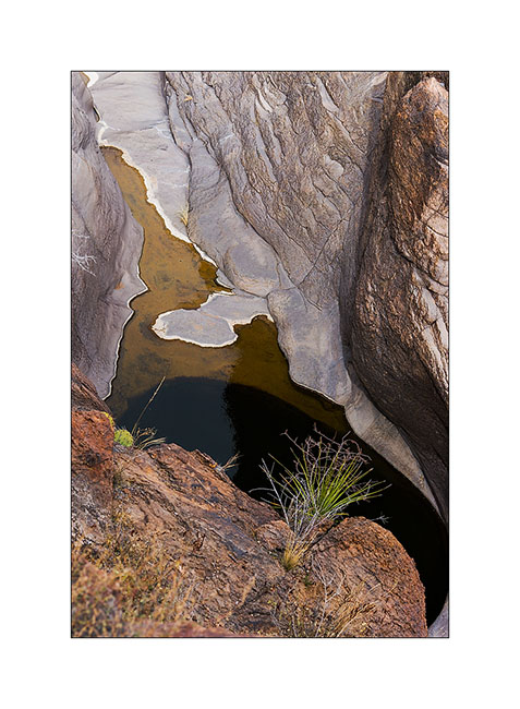
5. Arriving at Cinco Tinajas from the top that time.
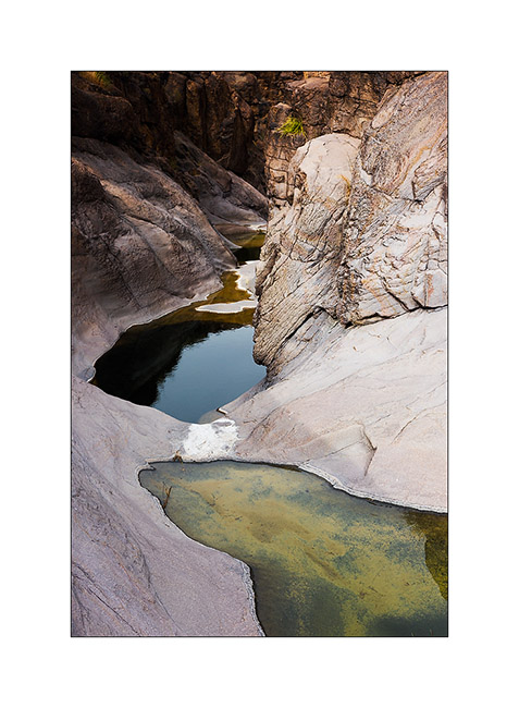
6. Limestone carved by water.
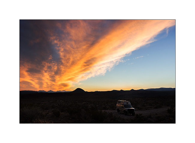
7. After a cloudy day, nice ray at sunset at my camp.
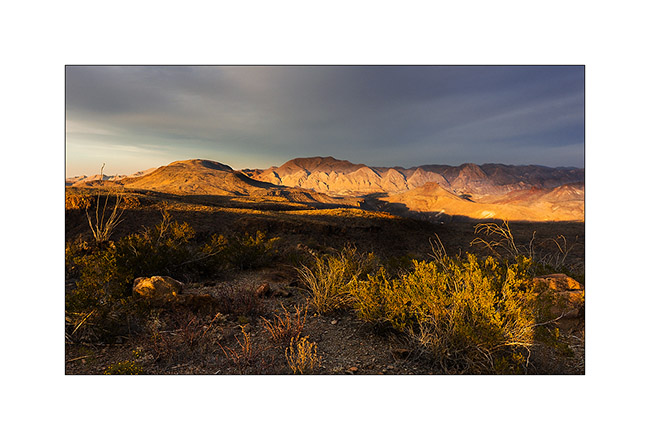
8. Another cactus in sunset light.

9. What a view!
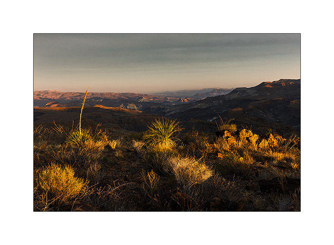
10. Last gleams…
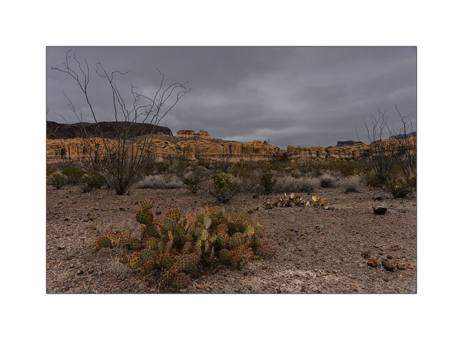
11. The next morning, I woke up in a freezing fog. Amazing to see cactus covered with frost…
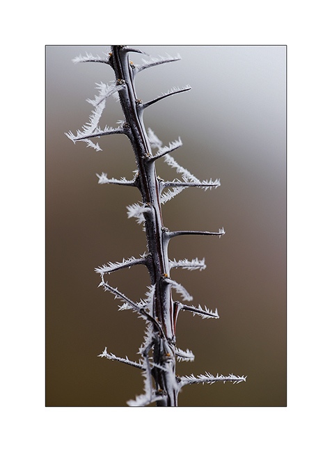
12. Gray and icy atmosphere…
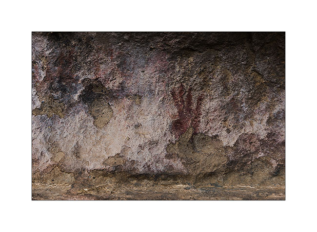
13. Petroglyph…
14. The weather has come to improve for a truly unexpected frosty landscape.
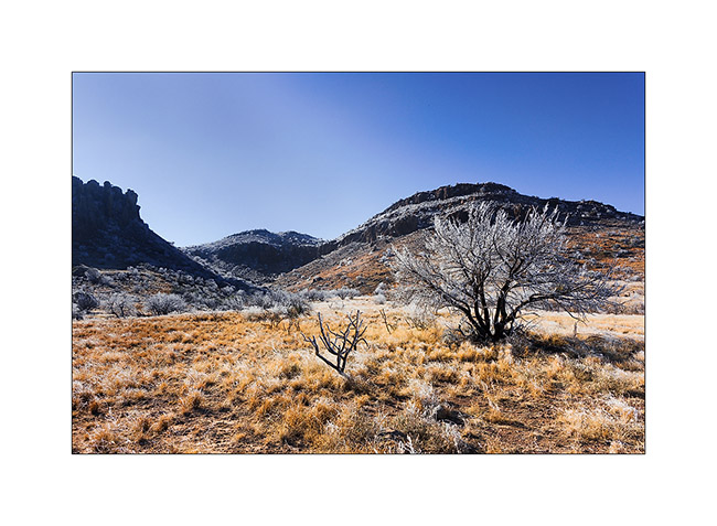
I then drove back on Alpine TX to search a General Delivery mail that was not there..! The next update will take you in the Davis Mountains where I spent one night before going to the Guadalupe Mountains, another National Park in the extreme west Texas. Coming soon… 😀
 D5 Creation