New Mexico @en
now browsing by category
The journey resumes…
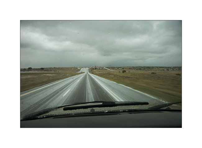
Thank you for your latest messages triggered by the long rest of the blog. Vivalavida received important works, including the modification of the entire oil system to try to improve cooling. The oïl to water exchanger has been removed and replaced by a large oil cooler controlled by a thermostat. I hope that recurring heat problems will be if not solved at least reduced.
After the long break period, VivaLaVida has hit the road again.
1. Heavy thunderstorms dot the plains of New Mexico.
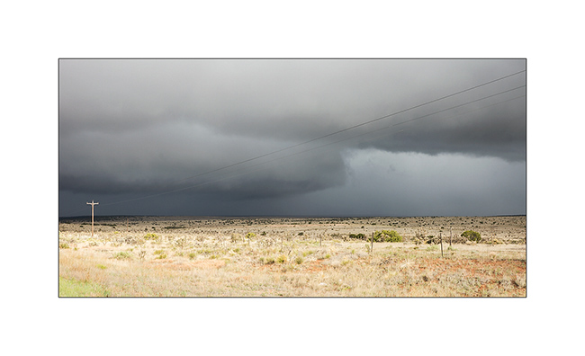
2. Some dump hail..!
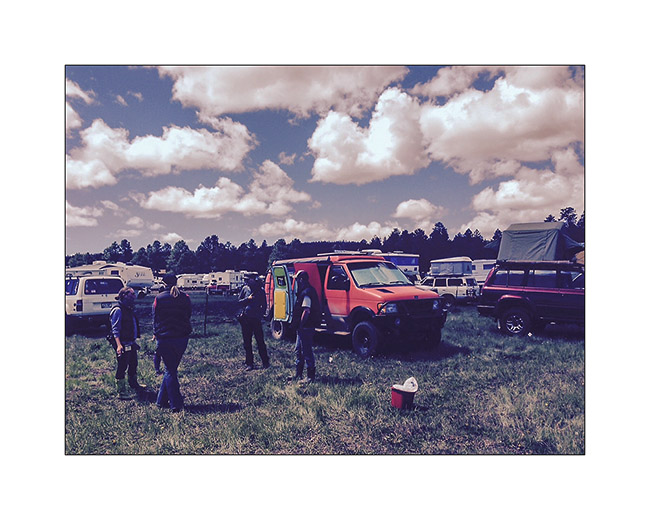
3. I make a stop at the Overland Expo West, South of Flagstaff, where I see John & Mandi again who started their journey since two weeks for their Pan American: from Alaska to Patagonia…
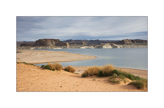
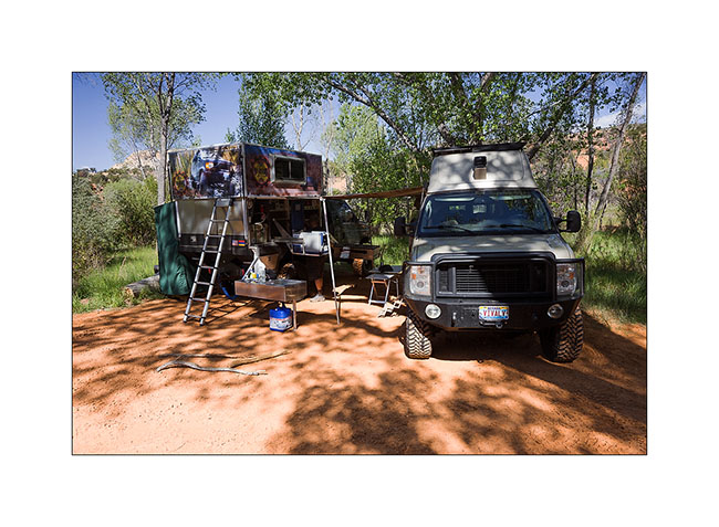
4. Camping stop with Chris and Jennifer on the shore of Lake Powel.
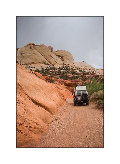
5. V4 with the “Sherpa” installed, the Chris’s very special van going up the Grade Kelly on the Smoky Mountain Road.
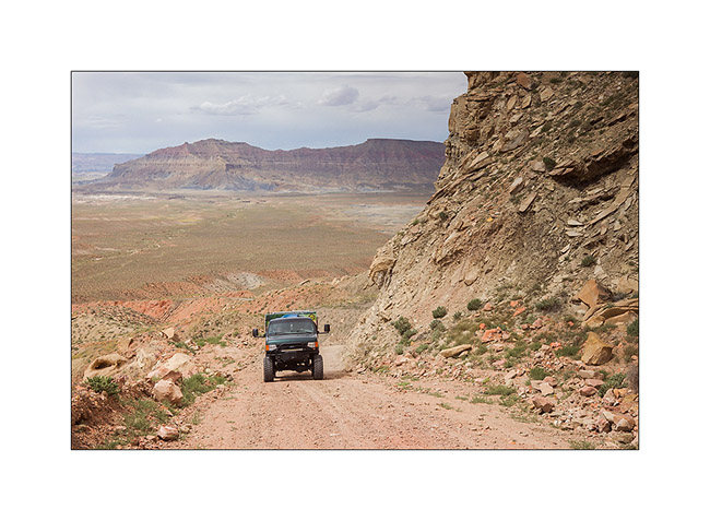
6. Camping at Deer Creek, along the Blurr Trail. The Sherpa is a base station for group camping. It offers a double bed in the upper part once lifted.
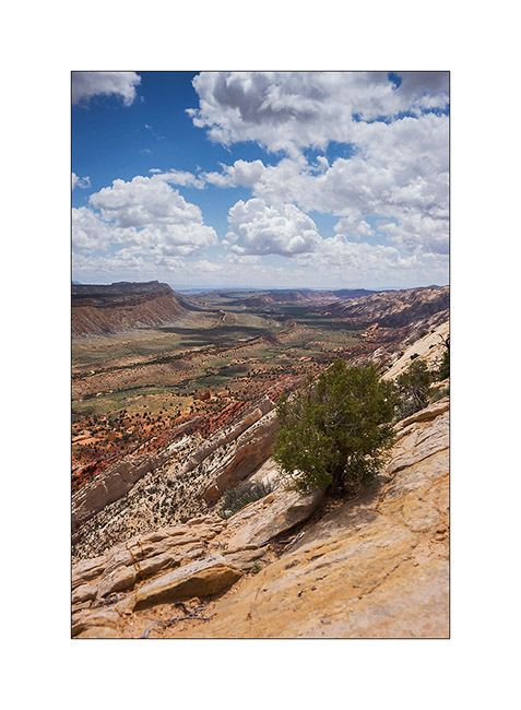
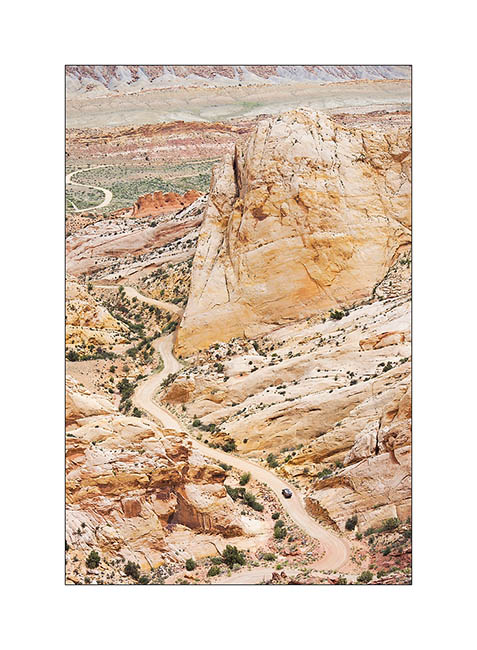
7. Fantastic view over the north of Capitol Reef and the Water Pocket Fault.
8. View toward South.
9. VLV in the Upper Muley Twist Canyon.
10. V4 going down the Blurr Trail.
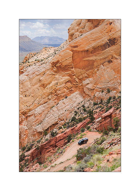
11. A few hundred feet below, it is only a small point…
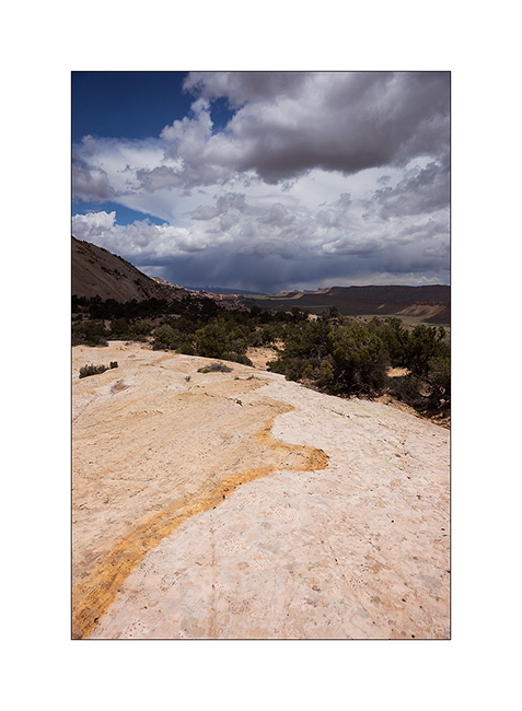
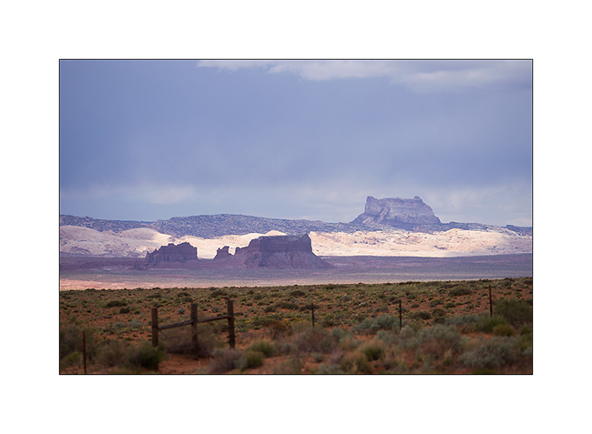
12. Temple Mountain Under thundersotrms.
Vivalavida is gonna stop again for some technical changes, the oil cooler mounted recently needs to be repositioned. If it significantly lowers the oil temperature, the hot air flow is building heat in the transmission. We must find another solution.
So expect a few delays before new updates… 😉
Minerality…
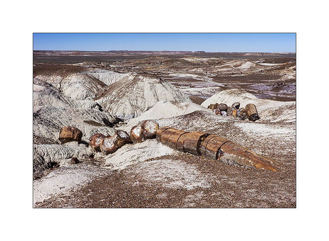
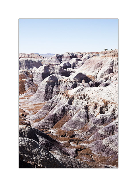
Still in Arizona, I made a short stop at Petrified Forest National Park. 225 million years ago, the current Arizona was nearly 3,500 miles South of his actual location, in a tropical climate and thus covered with tropical forests. During large floods on clay areas, trees fell and were buried in the clay that protected them from putrefaction. Over hundreds of thousands years that followed, the clay was covered with new sediment layers totaling till 1.5 miles thickness. The pressure thus exerted generated petrification of wood. Then the continental drift has gradually dried up the soil of Arizona allowing wind and rain to erode the upper sediments and leaving the petrified trunk now appear in the bentonite layers.
In places, the amount of petrified wood is staggering.
1. Bentonite which erosion reveals petrified trunks.
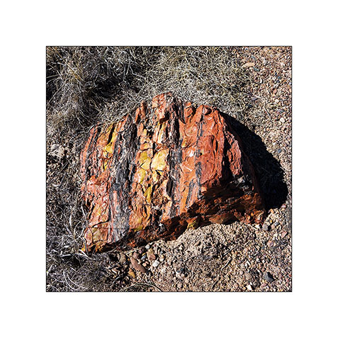
2. The colors are amazing! The density of this stone is such that it takes 4 times longer to a silica carbide saw to cut the same thickness as in granite.
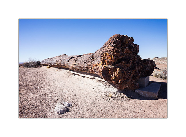
3. Most of the time, erosion causes trunks to break. On some, the petrified bark is still present.
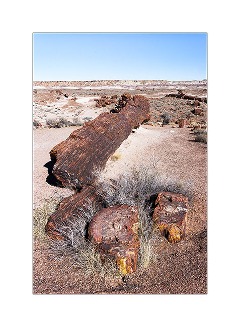
4. A giant! His strain is over 8 feet high.
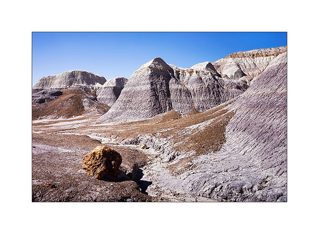
5. The desert surrounding area is varied.
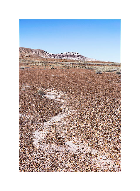
6. Undulation…
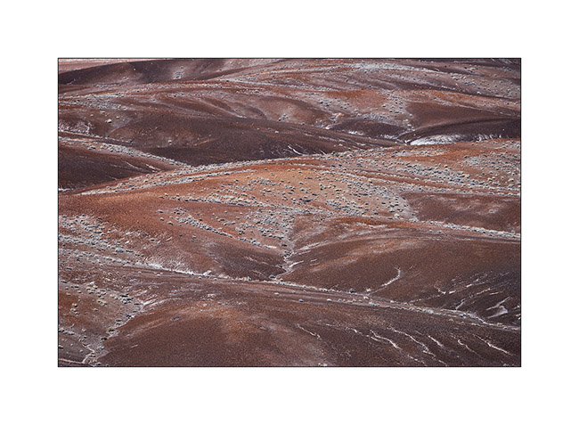
7. Mixes…
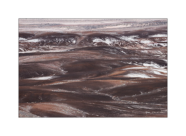
8. Amazing colors and shapes.
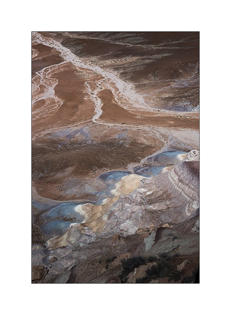
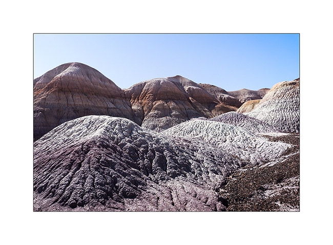
9. Edge of a bentonite mesa taht erosion carves.
10. This bentonite is less colorful than in other places but the presence of petrified trunks contrasts with the soft shapes of clay.
11. The eroded texture reminds me of some corals…
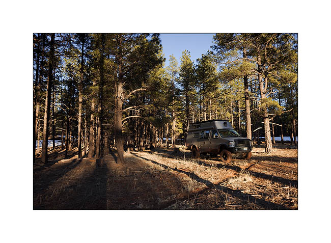
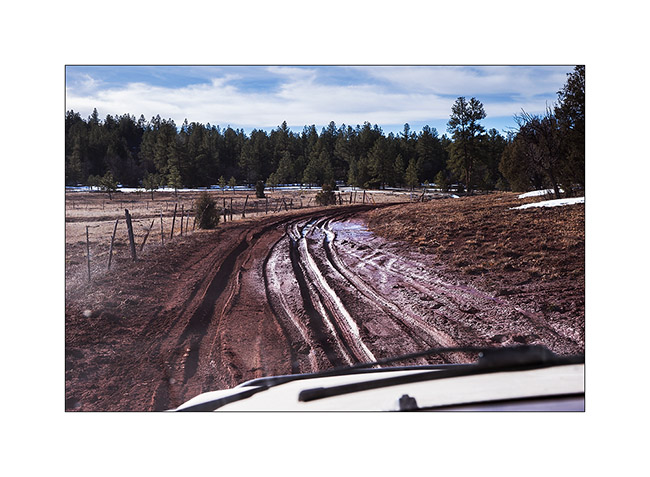
12. Vivalavida then moved to New Mexico, spending a first night at over 7,000 feet above sea level in the forests of the Zuni Mountains.
13. The next morning we crossed the Zuni Mountains with sometimes quite rutted and muddy roads…
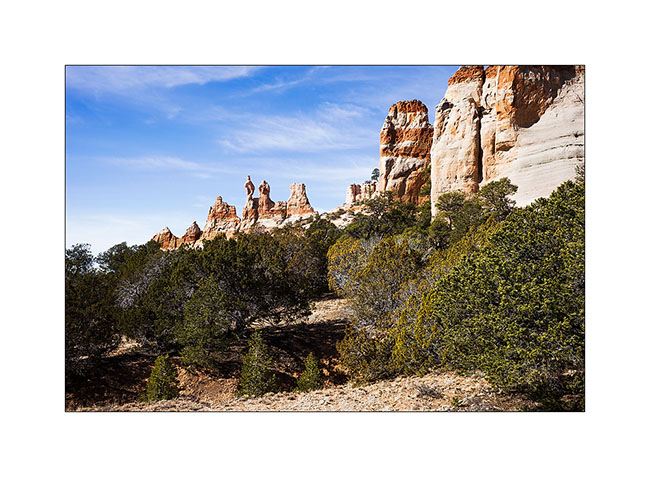
14. Discovery of the pinnacles of Los Gigantes by chance…
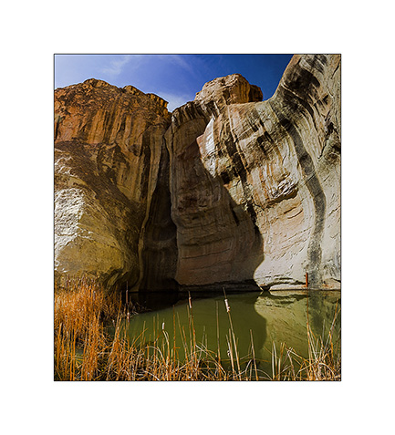
15. A guelta sheltered against a cliff of El Morro.
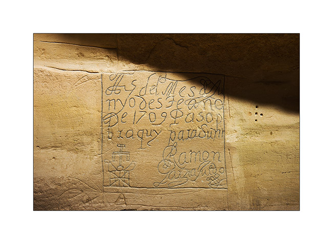
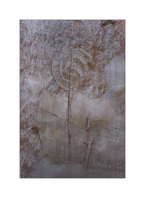
16. Etching in sandstone describing the passage of some Spanish in 1706.
17. Petroglyph much older, probably around the year 1200.
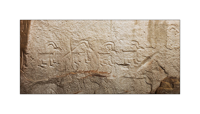
18. Another petroglyph estimated at 1,400 years BC.
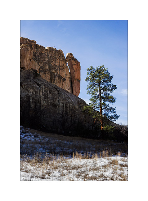
19. “Woodpecker” natural arch.
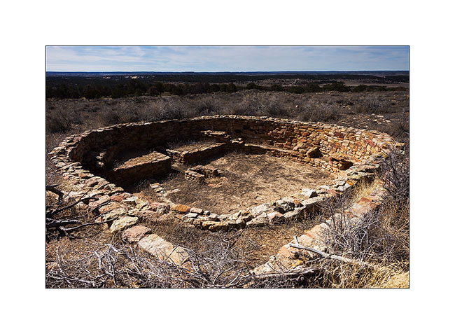
20. Pueblo ruins in El Morro National Monument.
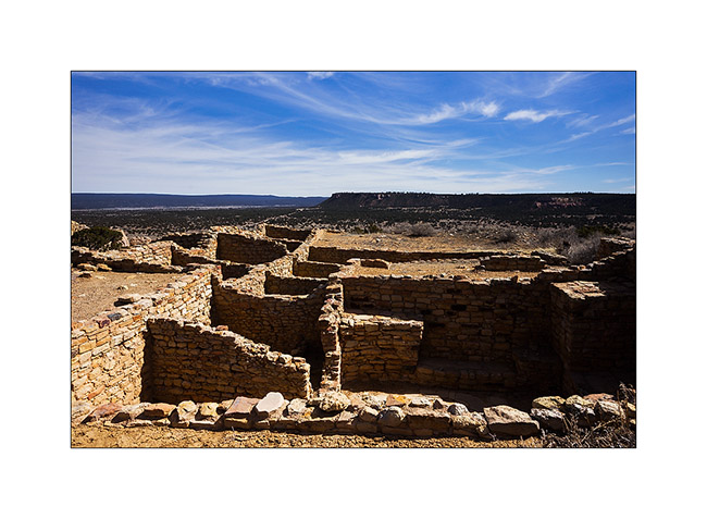
21. Another ruin of the same area.
Further discoveries along the East crossing of VivaLaVida to come soon… 😉
New Mexico
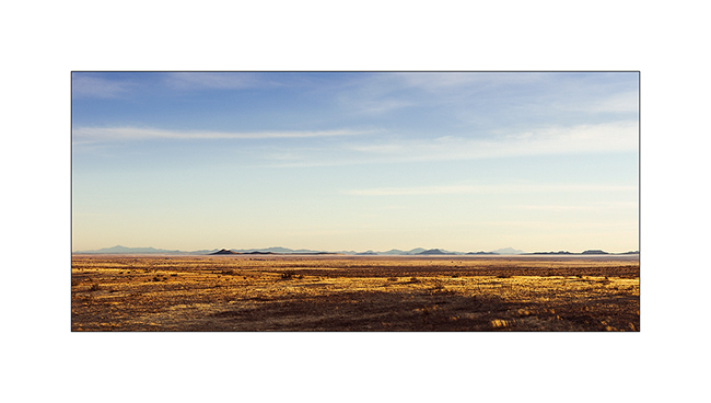
I’m then in New Mexico where I visited two sites even I had very few time to hit the road to the Baja.
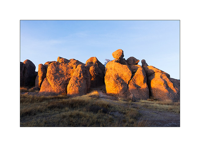
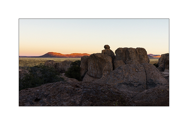
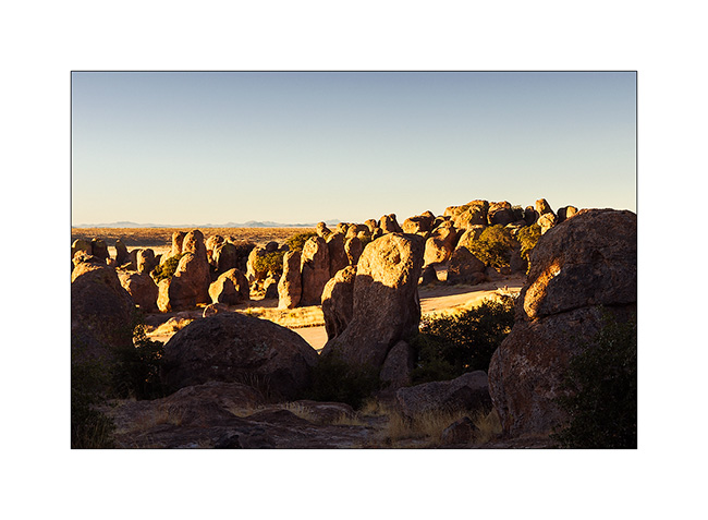
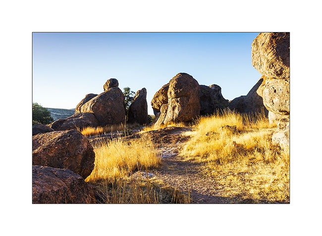
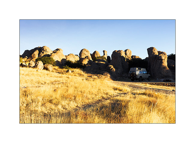
The first one is a small State Park called City of the Rocks. an area of about one mile long by half a mile large where hundreds of eroded rocks make pinacles where it’s allowed to camp. I arrived at Sunset end enjoyed the last rays of light…
1. On the road, just before arriving at City of the Rocks.
2. Sunset on the pinacles…
3. … and sunrise the next morning.
4. A real labyrinth!
5. First light on dry grass.
6. Where VivaLaVida camped.
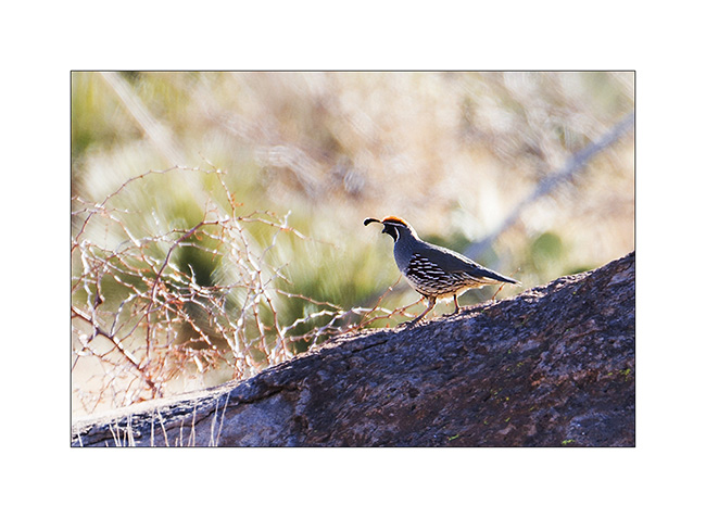
7. California quail, spectacular but not easy to approach.
I then went to a site where about 800 years aga, indians used to live in cliff houses.
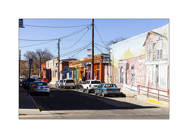
8. Short stop in the charming town of Silver City
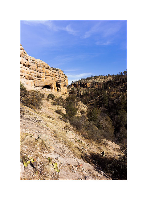
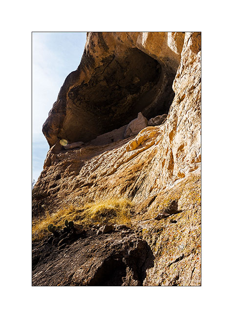
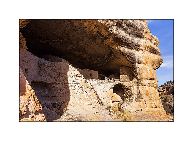
9. Arrival on the site of Gila Cliff Dwellings.
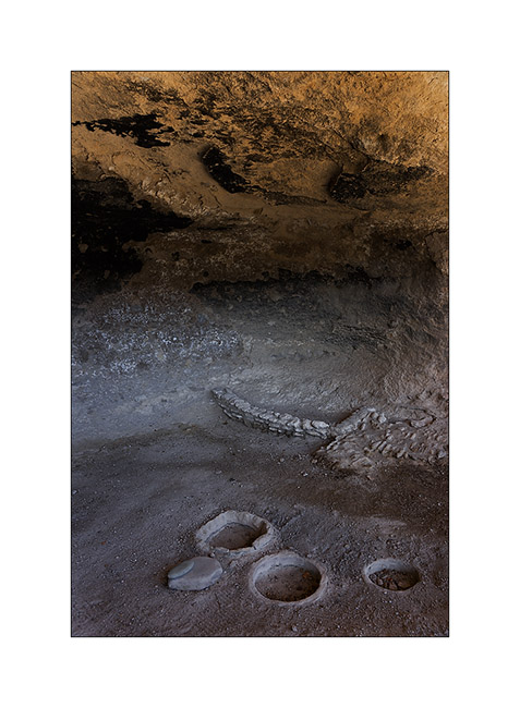
10. Bowl created by crushing of grains.
11. Wall were partially closing the overhangs…
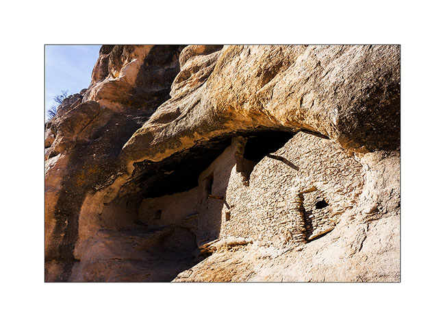
12. … to create rooms…

13. … sometimes really high in the cliff.
14. Another view of the interior.
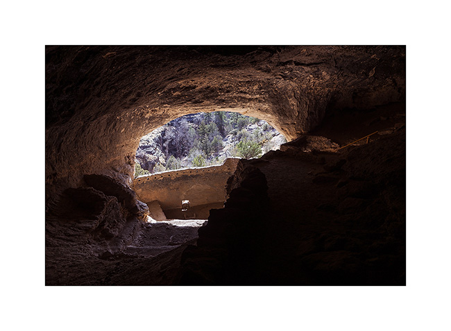
15. It’s one of the largest sites of cliff houses with le Mesa Verde National Park.
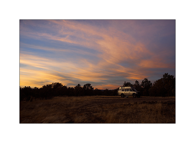
16. I slept a few tens of miles away in a beautiful mountain pine forest at nearly 6,000 feets above sea level.
Thats’s it for today. There will still be an update on my road crossing Arizona before offering you the story of our trip to Baja… 😀
 D5 Creation