France @en
now browsing by category
Way home…
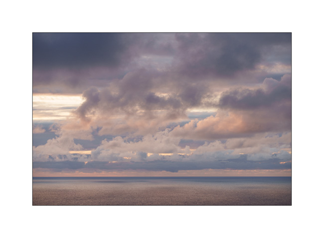
1. Last boondocking with view on the ocean, not far from Bilbao, while it is raining…

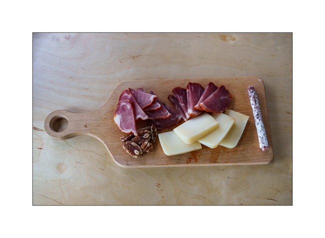
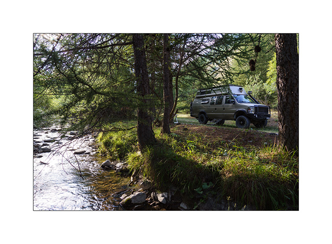
2. Starter with local products!
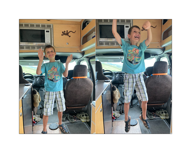
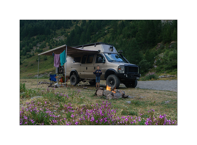
3. Emile’s happy!
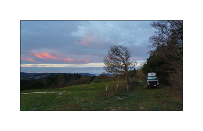
4. Quietness…
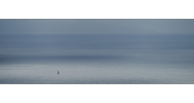
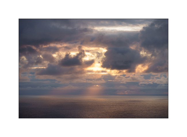
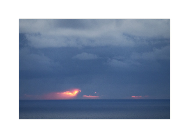
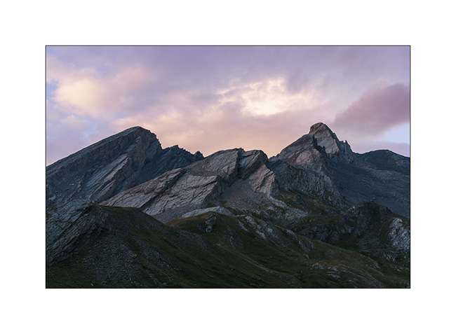
5. The rain stops, giving way to a few colors at sunset.
6. …
7. …

8. …
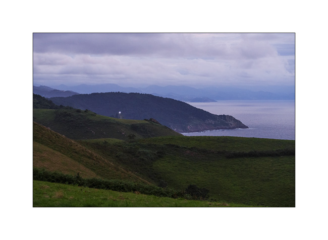
9. … The Basque coast falls asleep..
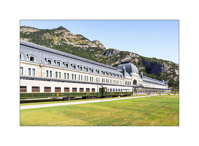
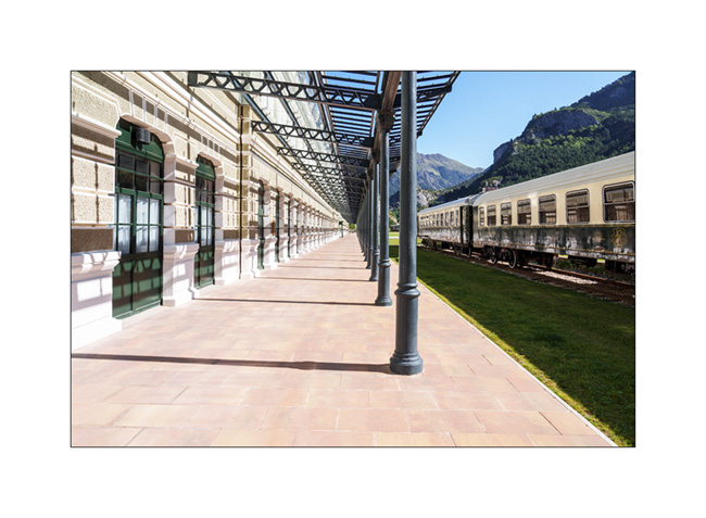
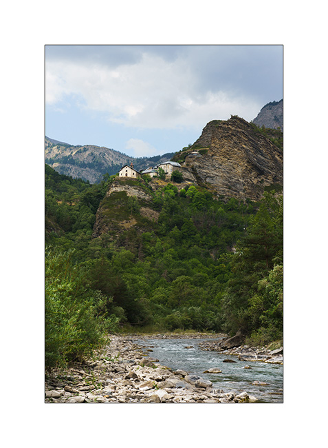
10. I wanted to discover Canfrang train station for a long time, this curiosity nestled on a pass of the Pyrenees, at an altitude of 3,900 feet elevation. I had seen images when it was disused and I’m surprised to discover that it had been completely renovated and rehabilitated into a luxury hotel!
11. Surprising to find such a building in the middle of the mountains, isn’t it?
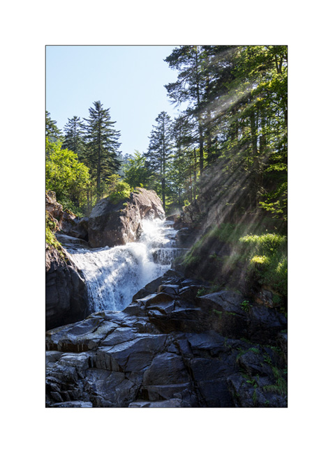
12. We reach Pont d’Espagne where we cannot sleep, the bottom of the valley having been closed to traffic after a huge paid car park in which it’s forbidden to sleep. Here the Cerisey waterfall going down towards Cauterets where we spend the night in a campingpark.
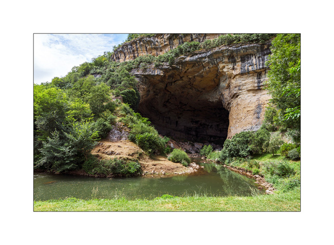
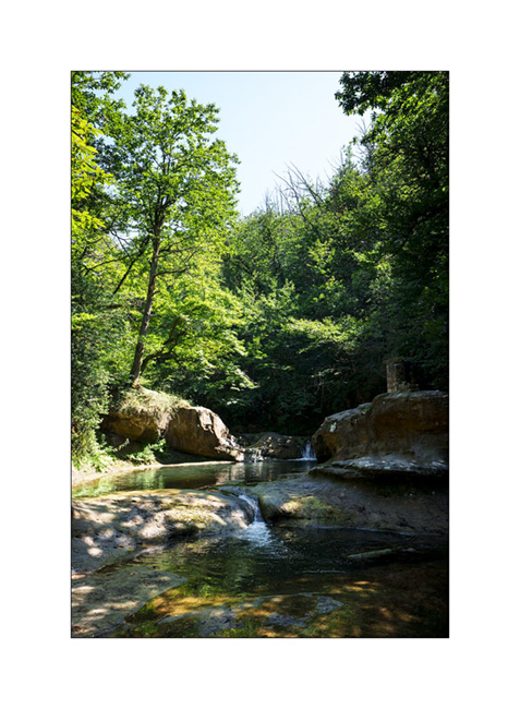
132. We head back towards Switzerland along the northern foot of the Pyrenees and discover a beautiful cave on our route: the Mas d’Azil cave. The cavity was dug by the river which runs through it and it’s so large that the road also crosses it.
14. We sleep north of Carcassone to discover the ruins of the Four Castles of Lastours.

15. It is the small roads of the Cevennes that bring us back home…
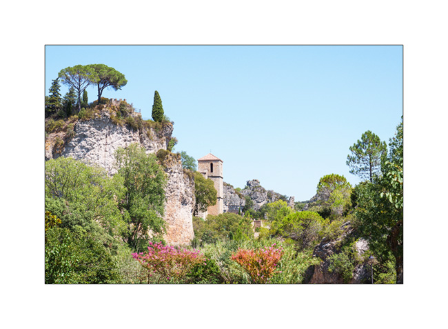
16. Crossing the village of Mourèze…
And that’s it for these too short summer vacations where VivaLaVida has covered 2,600 miles.
The next articles will tell you about some fall outings…
Thank you for your loyalty to this little blog! 🙂
2023 Holidays, here we go!
After a spring somewhat upset by Emile’s diagnosis, it was not until July that VivaLaVida left its winter quarters to resume service.
Three days for a big engine, transmission and running gear service – thanks to the Garage BN in St-Martin/FR for the loan of the place – two additional days to reload all the stuff and we’re ready to leave towards South on July 15th. Emile is in heaven, he who has been asking me for two months “When are we going to travel again in VivaLaVida?!”. After a first night in the campground where we had waited for the wheel studs two years ago – Emile was hoping to see Lilou again, a little girl he met during our last stay – we continue towards the Pyrenees.
1. First spot that we are gonna discover, the “Fontaine des Amours” (Fountain of Loves), a pretty natural pool.
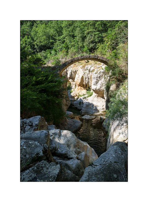
2. Not very far, we explore the remains of a Roman bridge…

3. It was rebuilt identically after a major flood thirty years ago.
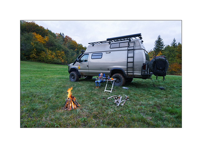
4. We find a quiet boondocking place not far to spend the night in the hills of Ariège…
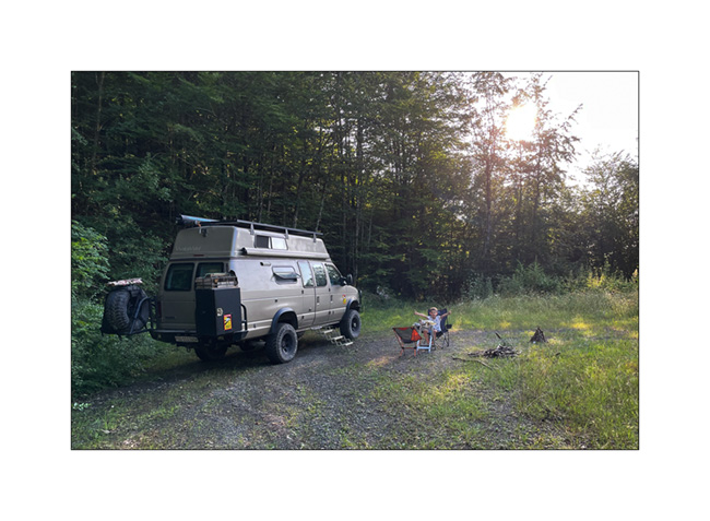
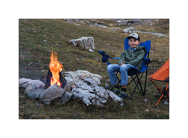
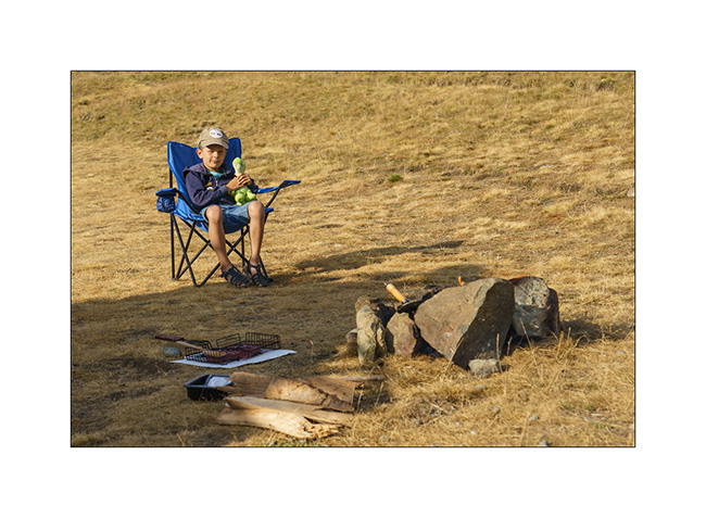
5. … and we make the first and last campfire of this vacation for our barbecue. While it has rained a lot here and the risk of wildfire is non-existent this evening, it won’t be the same later…

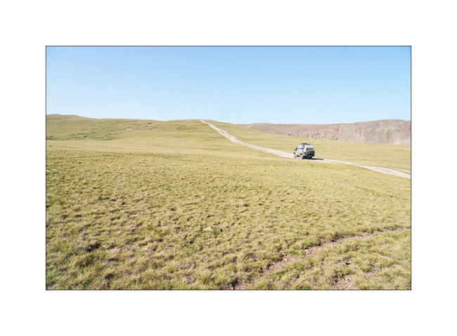
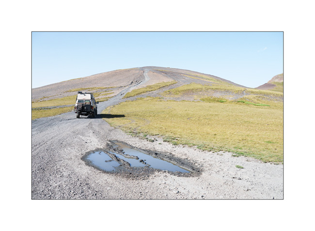
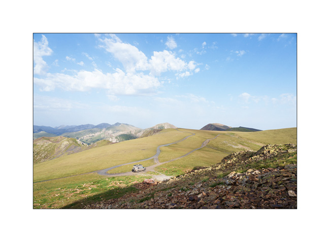
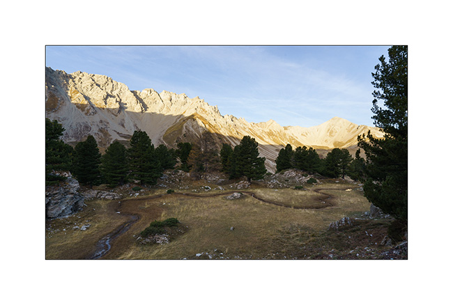
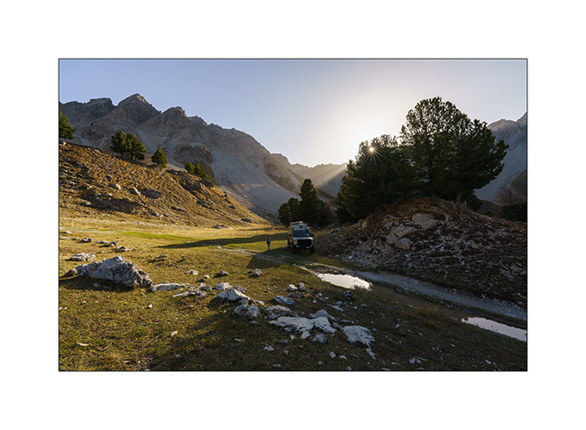
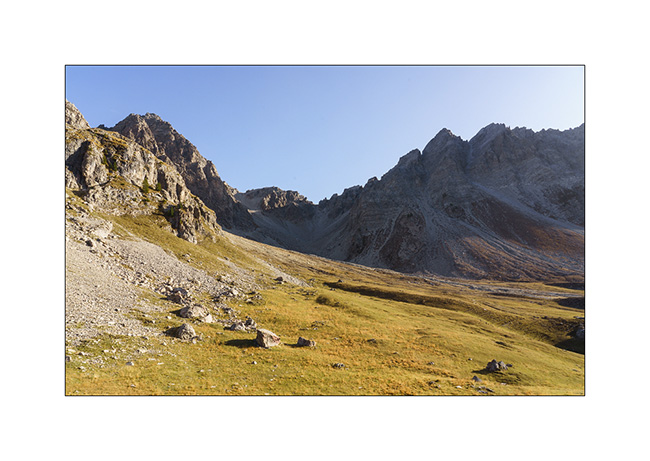
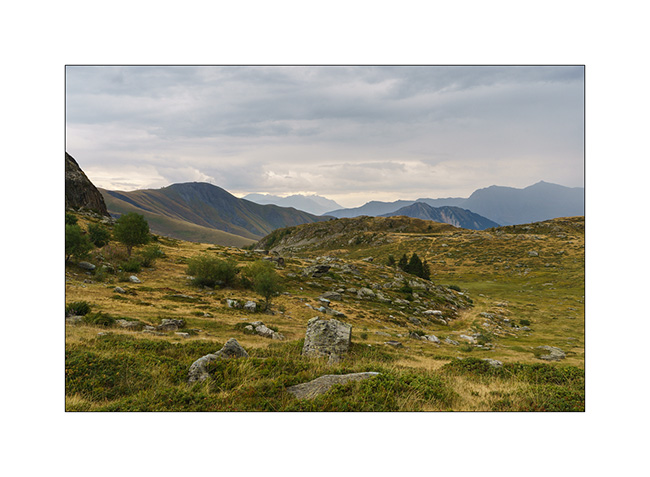
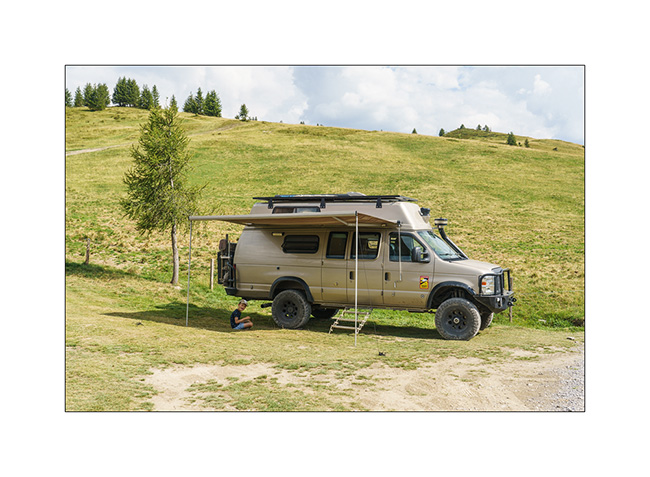
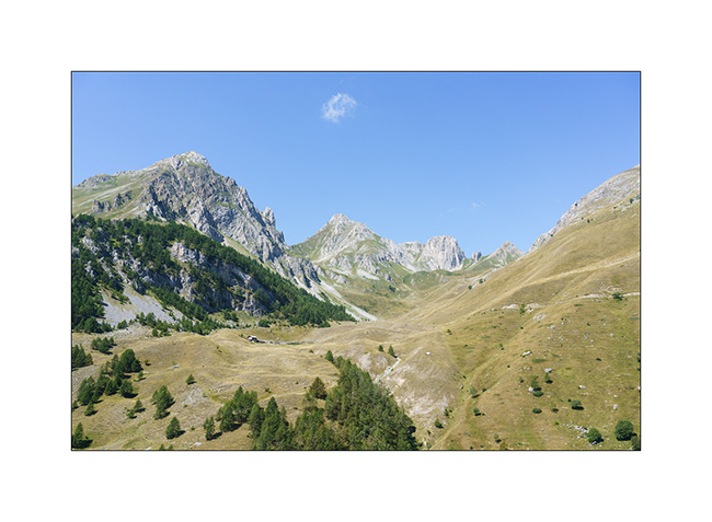
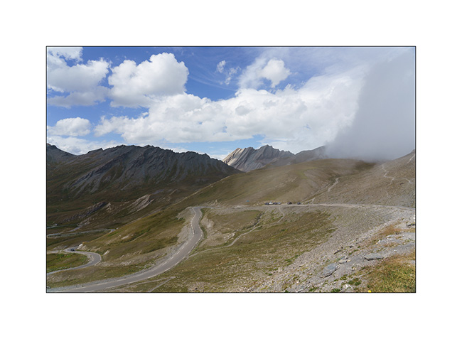
6. After reaching Andorra la Vella where we shop some groceries to fill the fridge, we decide to drive up to Pico Negro. The trail has become so busy that there is a guard of Guarda Civile who charges €25 at the start of the trail. As it’s already late afternoon, VLV climbs without stopping too much on a track in places very washed out by storms and reaches a first flat area at around 7,200 feet elevation. We don’t meet anyone there.
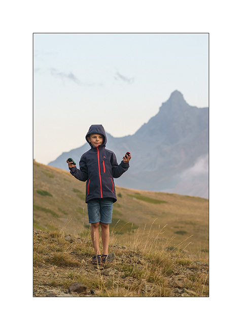
7. After approx. an hour’s drive, she arrives in sight of the summit, at about 8,900 feet above sea level.
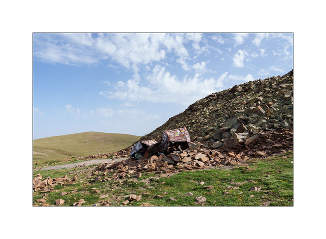
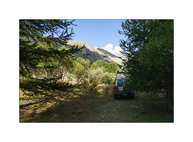
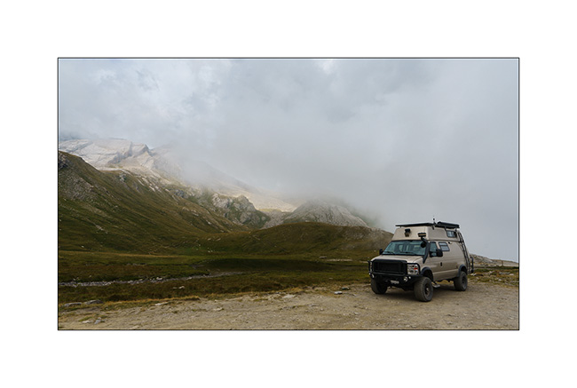
8. After the summit, we go further to the famous VW van carcass near which we spend the night.
9. VLV at the camp…
10. Climbing on the small summit overlooking it…
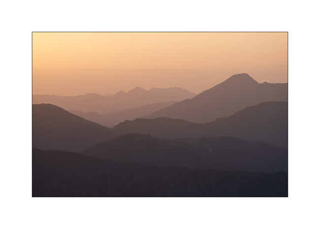
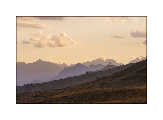
11. … to enjoy sunset.

12. Evening quietness…
13. See you tomorrow sunshine !

14. Dusk…

See you soon for more! 😀
Last outing of the year in the Doubs
While I was hoping to do another 2-3 weekends in VivaLaVida before storing her for the winter, a family celebration and an episode of gastroenteritis for Emile only let us make one last bivouac of the year on the last November weekend.
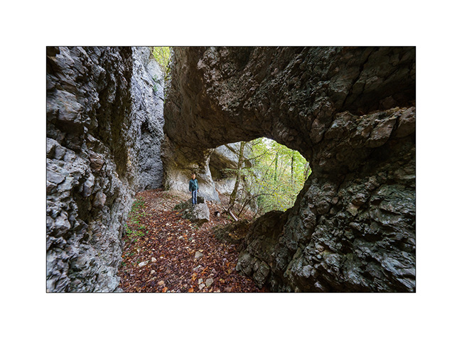
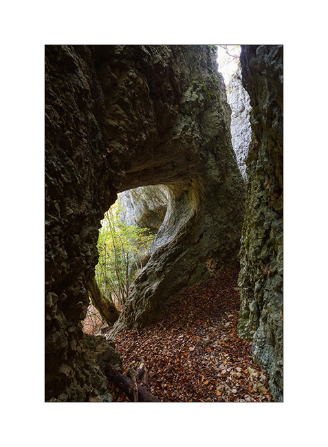
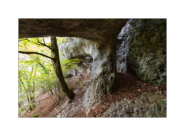
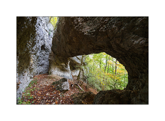
We went discovering two natural arches located in the Doubs department, south of Montbelliard in France.
1. Here we are not far from the first arch.
2. After a short climb, we walk along the cliff towards the arch…
3. … which soon appears through the fog.

4. Called Cave of Bisontin, the arch was created by the collapse probably several thousand years ago of the roof of a large cave created by infiltrations in the limestone rock.
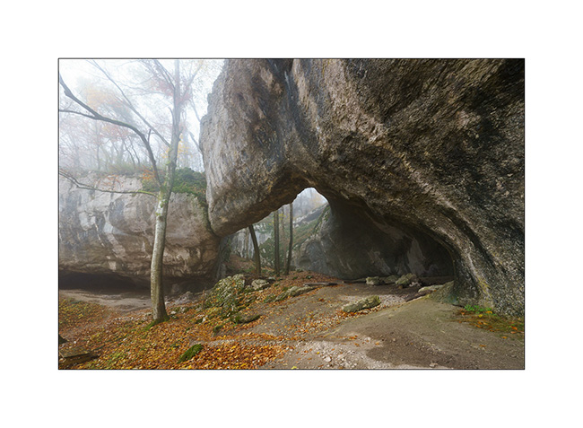
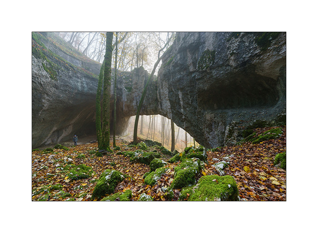
5. The arch is quite impressive with a span of about hundred feet. It is the largest I have seen in Europe so far.
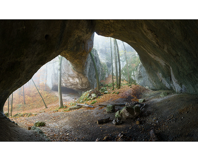
6. Emile gives the scale as the fog creates a particular atmosphere.
7. To reach the second arch, the path is steep as it follows a limestone ridge with cliffs on both sides. While the fog makes everything very slippery, I give up going there with Emile as a slip would certainly lead to a serious accident.
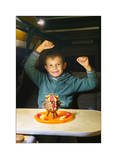
We go boondocking on a viewpoint above Maîche where we cook a good sauerkraut on our last campfire of 2022! It is also an opportunity to break a “Marmite de l’Escalade” (chocolate pot) a few days in advance, a Geneva tradition which commemorates the attempted invasion of 1602 by the Savoyards.
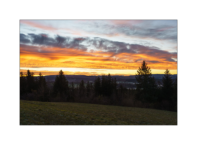
8. Chilly wake up…
9. … above the mist…

10. … with beautiful colors.
11. On the return trip, VivaLaVida crosses the symbolic bar of 300,000 km (186,000 miles). It’s not huge for a vehicle that drives in America – those with between 300 and 500,000 miles are quite common – but given the miles driven on trails – probably approx. 35,000 since I converted VLV to 4×4 – and the twisty roads of Europe, that’s already a respectable mileage. 🙂

After this outing, VivaLaVida went back to its winter shelter. I am already looking forward to the next adventures she has in store for us!
Thank you again to all of you who follow our modest peregrination on board. I already wish you Happy Christmas time. 😉
Last day before heading Home…
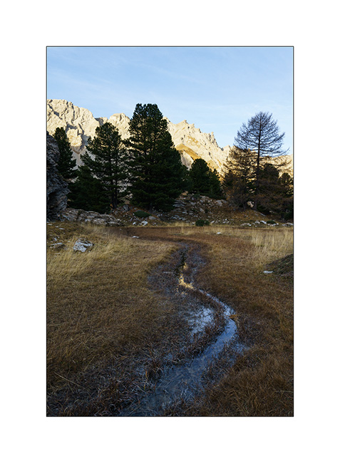
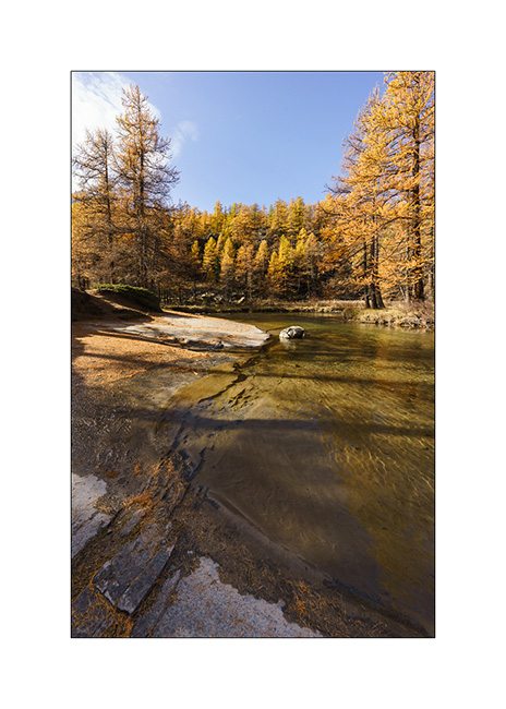
In the early morning, we go discover an altitude marsh spotted during our walk the day before..
1. A source there creates a stream that meanders on a flat.
2. At its end, a small pond formed.
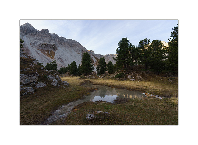
3. We don’t hang around too long because it’s chilly this morning.
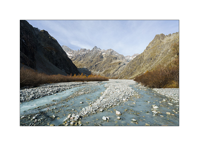
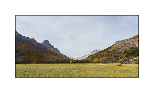
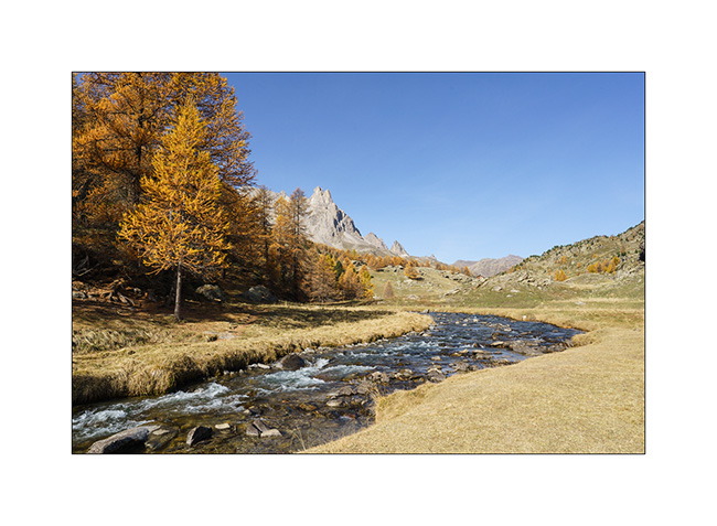
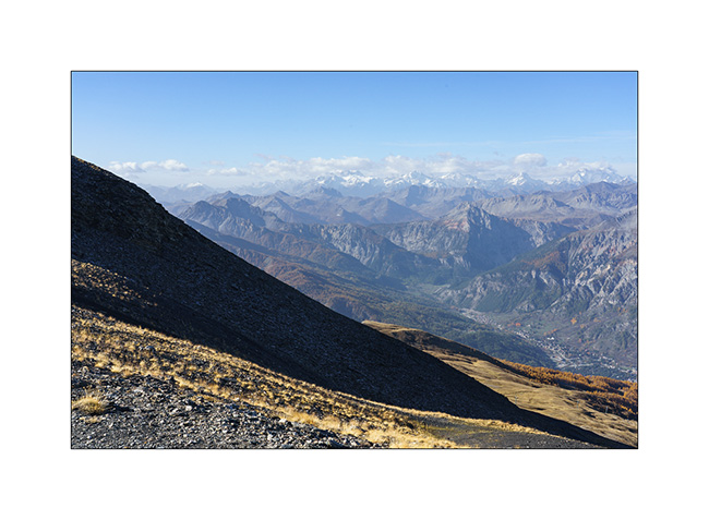
4. Change of place to discover the bottom of the valley of Vallouise Pelvoux, at a place called Le Pré de Madame Carle. We discover a sub-glacial zone where the floods of the river create a gravel bar like those visited in Alaska.
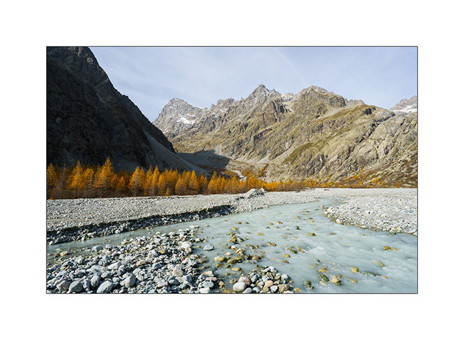
5. We are at the treeline altitude, which causes a certain alpine aridity at this place.
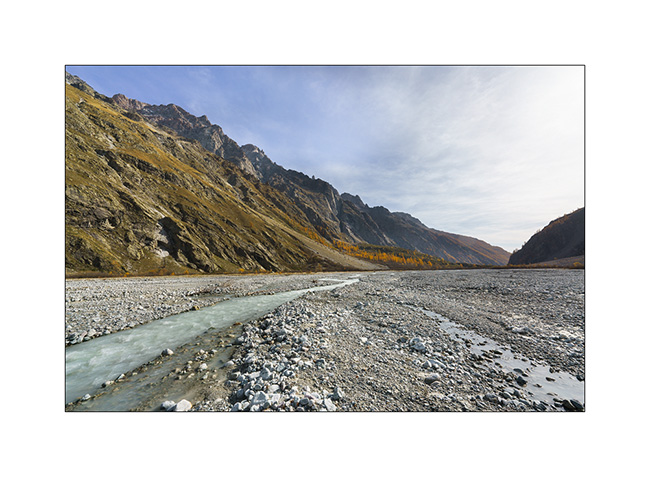
6. View from our lunch spot. They are worse, isn’t it?
7. On the way back, between Briançon and the Lautaret pass.
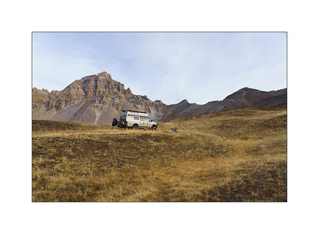
8. Thanks to the off-road capabilities of VivaLaVida, we find a nice promontory to boondock on the northern slope of the Galibier pass.

9. Out of sight of the road, our afternoon end is perfectly quiet there.
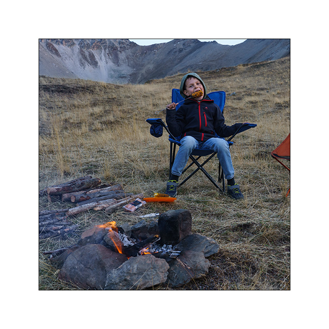
10. A last campfire for grilling some corns and meal.
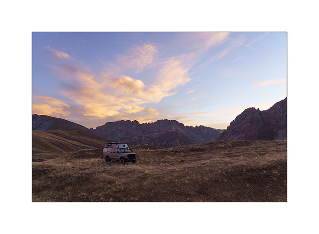
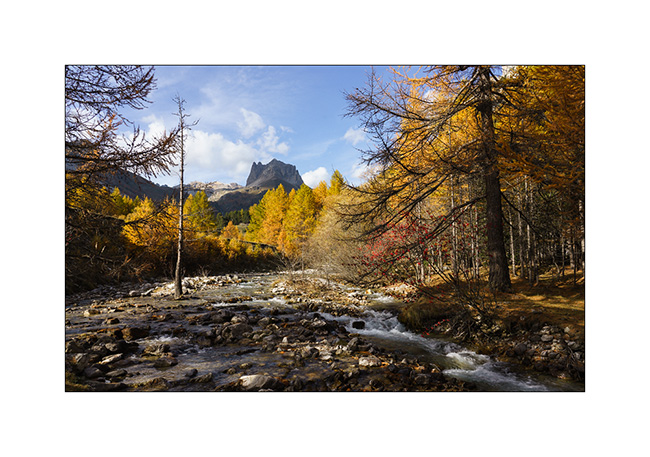
11. And a last image of this short week of travel with pretty colors at sunrise Sunday morning…
Back at home, we plan one or two more weekend outings before VivaLaVida returns to its wintering place. I’ll tell you about those in a while.
Thank you for your loyalty to follow this little blog! 😀
Back to Clarée Valley
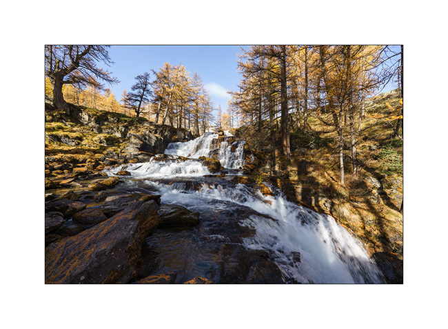
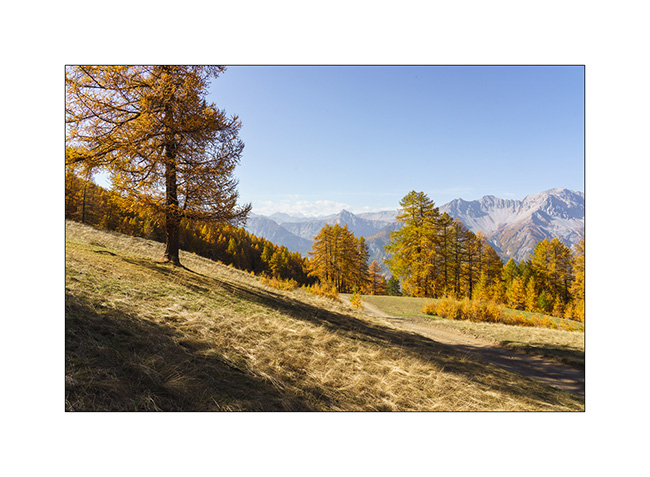
Still unable to walk much because of my sprained ankle, we decide to go back up to the beautiful Clarée Valley that we had discovered last year in the same season and discover the Fontcouverte waterfall, taking advantage of the golden larches to take some pictures.
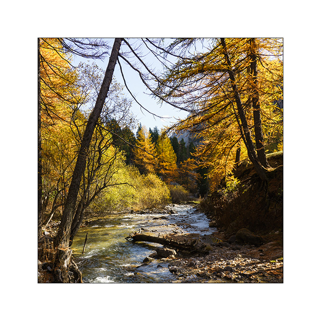
1. The Clarée River upstream from the waterfall.
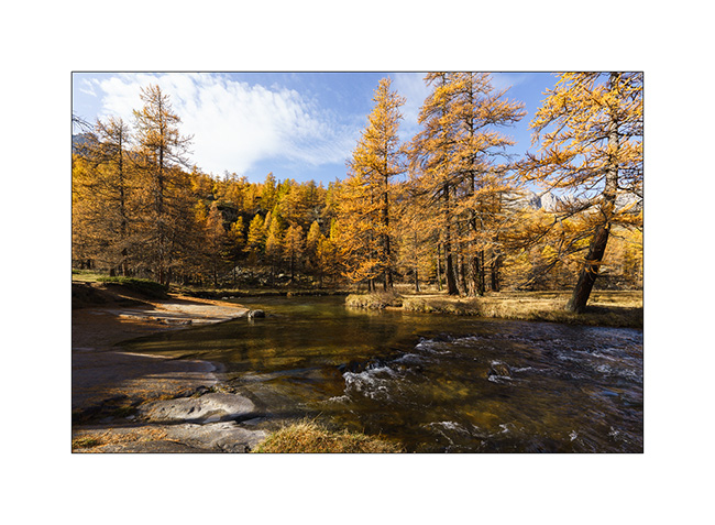
2. Fontcouverte waterfall.
3. I’m playing to look for some compositions.
4. Variation.
5. In the morning, we’re almost alone at this season while in summer, it is constantly crowded.
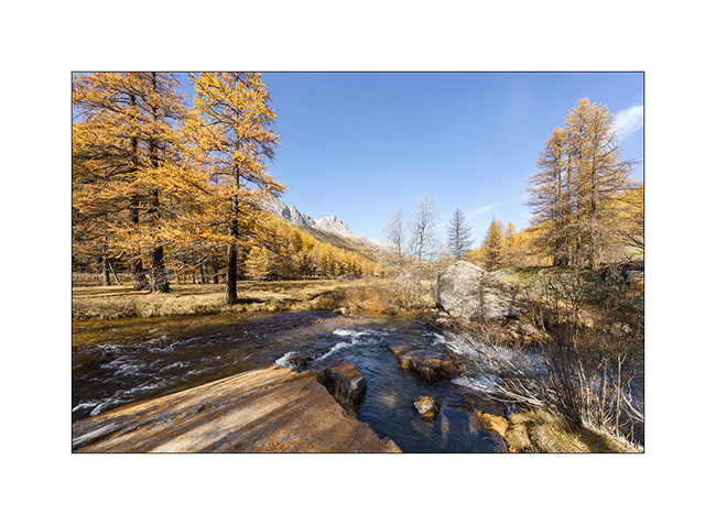
6. A little further up the valley.
7. We have our lunch under a mountain pasture.
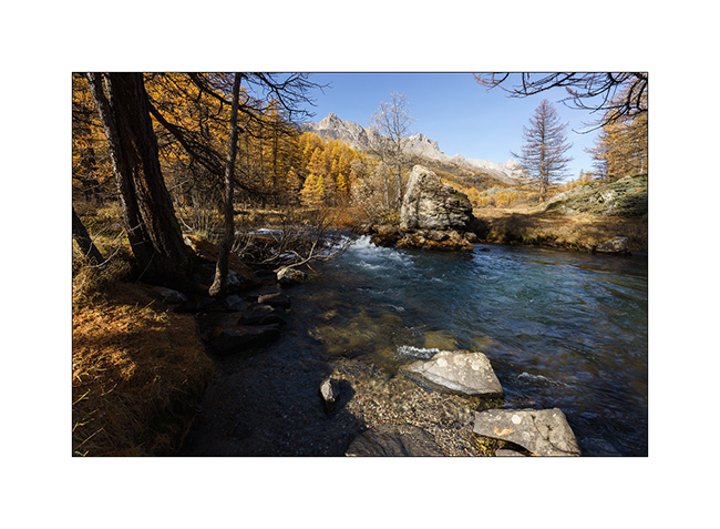
8. Last view of this beautiful valley before changing corners… Since last year, signs prohibiting wild camping have grown everywhere and the only campsite there is closed for the season.
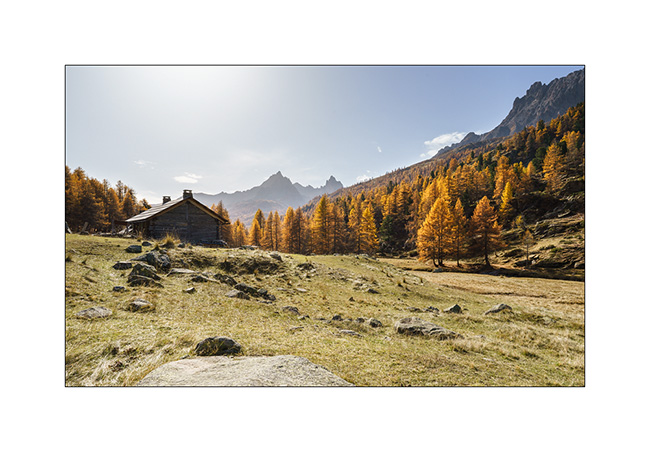
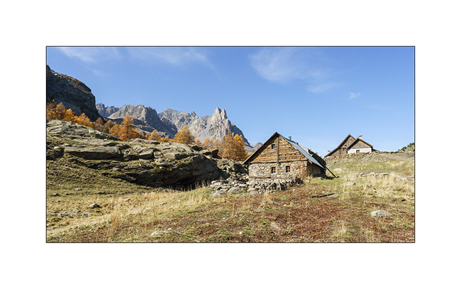
9. After a few tens of miles, we are at the very top of the Vallon de l’Orceyrette, above the Chalets de L’Alp. We are completely alone there for a quiet bivouac at about 7,900 feet elevation.
10. We discover the surroundings of the camp. This bottom of the valley is still wild.
11. View looking north.
12. We enjoy a nice campfire to cook our meal there.
Continuation and end of this few days trip shortly! 😉
Jafferau fortress, then Vallée étroite (Narrow valley)…
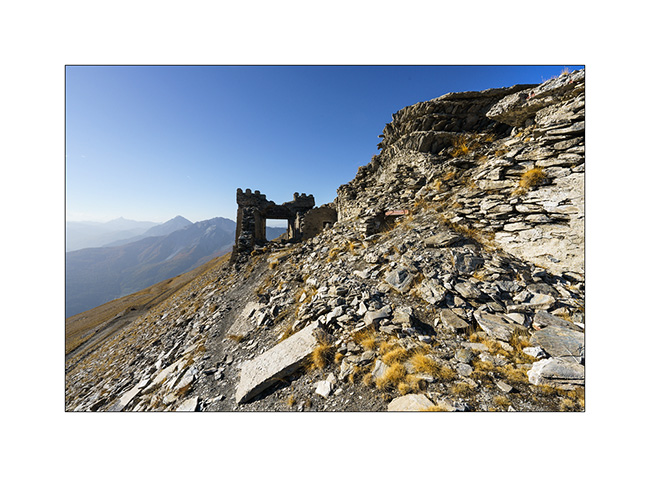
While setting up camp, I badly sprained my ankle. Despite the ointment applied quickly and a bandage to try to succeed in putting the foot on the ground, I will have to revise the plans. Damn! Here I am forced to give up a hike planned in two days. So, after having slept just under Fort Jafferau, we decide to take a look at this fortress in ruins.
1. South portal or what’s left of it…
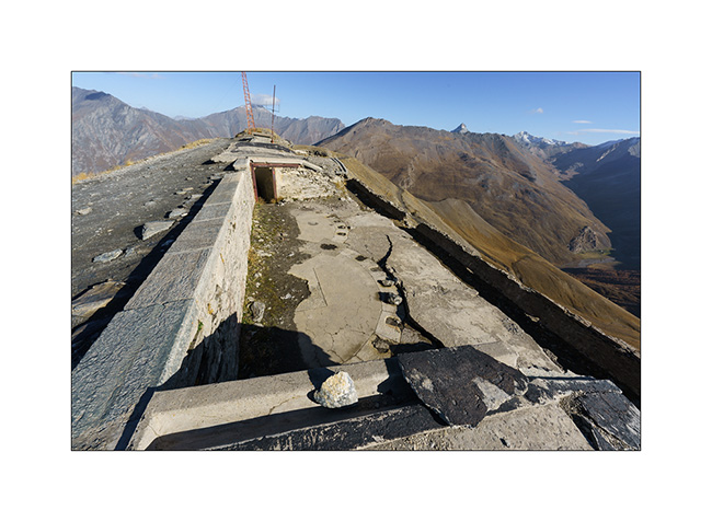
2. Here, canon battery bases with the arcs indicating the directions of fire.
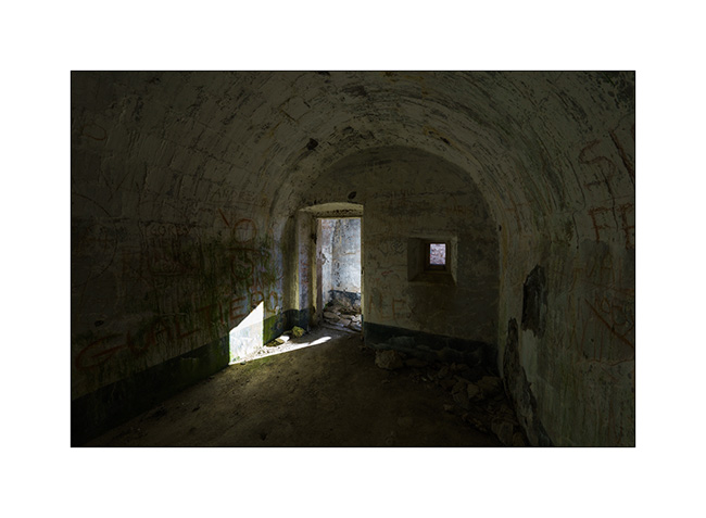
3. And one of the many vaulted chambers which likely served as cantonment.
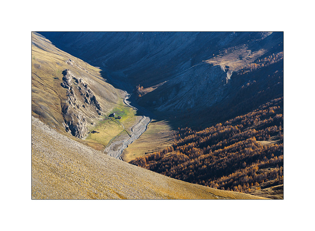
4. Bird’s eye view of an alpine pasture below.
5. Panoramic view of Ecrins mountains to the West.
6. Descent to Bardonecchia via the northwest side.
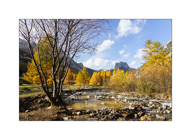
7. We take advantage of the afternoon to discover the Vallée Etroite (Narrow Valley) straddling the Franco-Italian border. The enfilade towards Mount Thabor is magnificent with the fall colors.

8. Opposite, by where we arrived.

9. The river that carved out this valley, called Narrow Valley Stream.
10. I take advantage of varying the compositions since I can hardly walk. Variation 1.
11. Variation 2.
12. And one last before leaving to do some grocery shopping in Bardonecchia and refuel VivaLaVida since the strikes in France make the refill difficult.

The rest with a return into the Clarée Valley in a few days. Thanks! 😀
Getaway in France
As fall holidays are approaching, we camped south of the Ain to discover a beautiful natural arch that had been on my bucket list for quite some time.
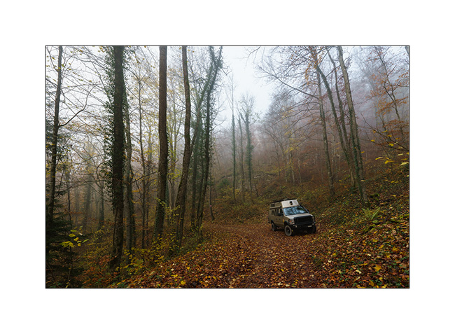
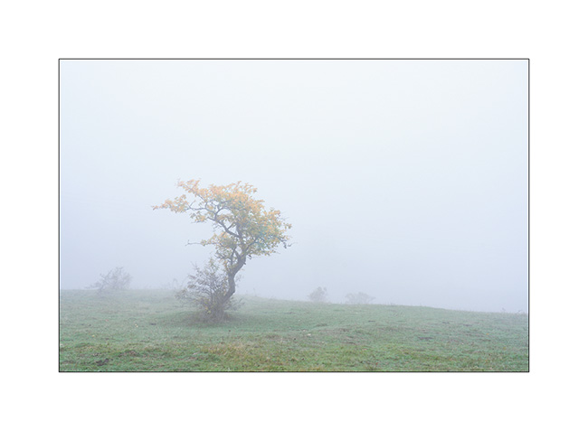
1. Through the fog…
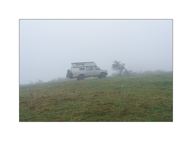
2. Spooky silhouette…
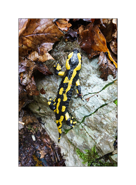
3. After finding our boondocking place, we follow the path that leads to the arch and we have a great encounter : a beautiful spotted salamander! Glad to be able to show it to Emile when it becomes more and more rare to meet them…
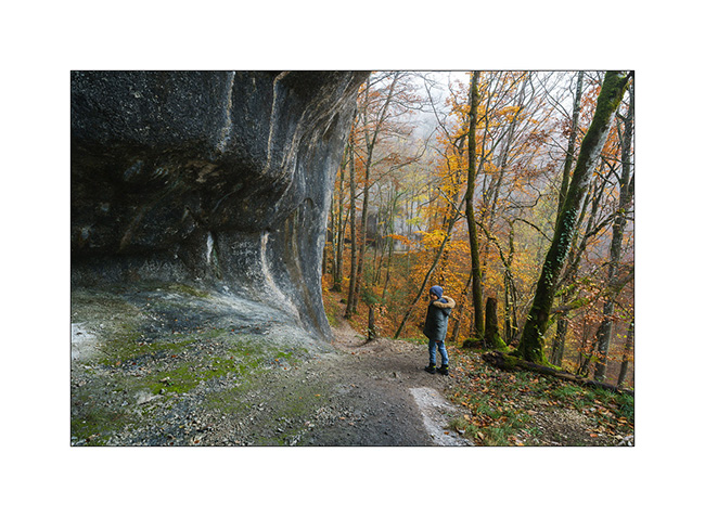
4. And here we are at this beautiful natural arch, created by a collapse following the digging of a trench in a limestone shoulder in order to pass a pipe through. Emile gives the scale ! 😉
5. In fact, it’s even a double arch; here the secondary arch of approx. 10 feet wide, smaller than the main one which should be around 25-28 feet wide.
6. The place reminds me of some of the arches discovered in America during VivaLaVida’s journey.
7. Last look before heading back to our camp.
8. On the way back, we somewhat searched for the path that fades into the vegetation, forcing us to cut through the woods to find our way back. We then enjoyed a lull that allows us to taste a succulent salmon & vegetables cooked on the campfire.
Return on Sunday by some logging roads under the showers. Now, I’ve to prepare VLV for the departure on vacation in a few days.
Thank you for your loyalty and see you soon here! 😀
Way back to home…
It’s time to head home, our three weeks coming to an end soon.
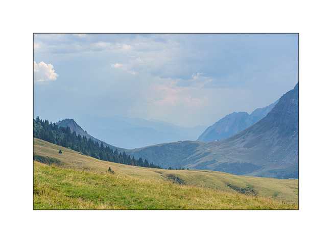
1. From Colle della Maddalena, we go down the Ubaye valley and we stop for a picnic on the banks of this beautiful river.
2. Window from the Girabeau Pass under the Parpaillon Pass, with the Serre-Ponçon Lake in the distance.
3. We make a detour via the Glandon and Croix-de-Fer passes. Obligatory passage by Lake Guichard while the Arves Needles disappear in the storm.
4. Along the trail…
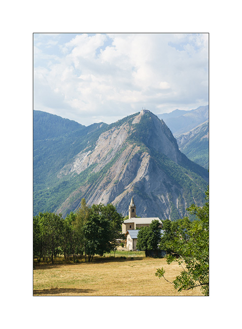
5. Chruch in l’Eglise, above Saint-Martin-de-la-Porte, as we descend after finding a closed barrier on the trail VivaLaVida wanted to drive.
6. We reach Aravis mountain range for a last night in VivaLaVida.
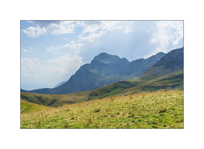
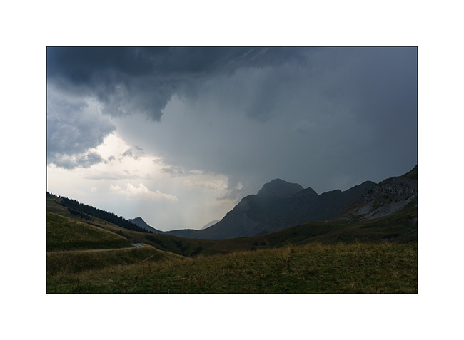
7. In the distance, the Arpettaz Pass as the storm prepares.
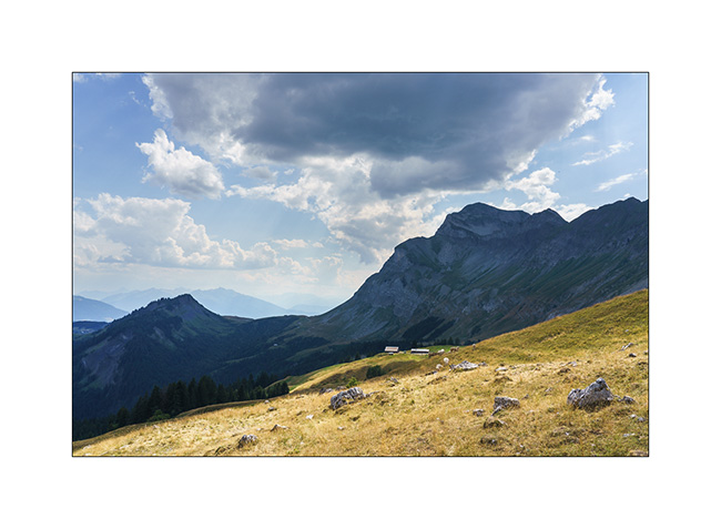
8. Our boondocking spot.
9. Stormy atmosphere…
10. On a walk to discover the surroundings.
11. To shelter before the thunderstorm.
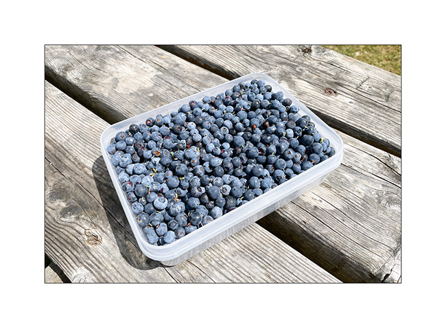
12. The next morning, we go to pick blueberries spotted the day before. Yum!!
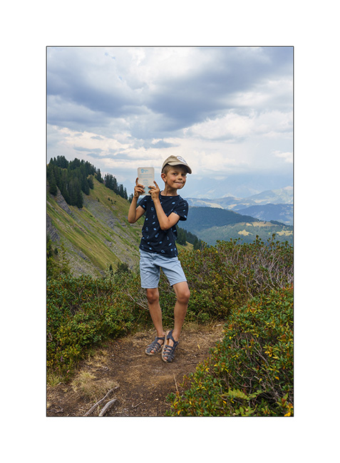
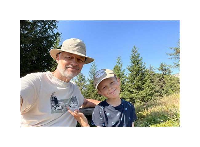
13. End of summer vacation selfie. 😉
That’s it for this little trip obviously too short. Thank you for following us through this little blog.
VivaLaVida will resume service for the next weekends and for the October holidays. I’ll feed this page with new articles during next fall.
See you soon and thanks again for your loyalty ! 🙂
Lakes in Ubaye
We leave this beautiful place to discover others…
1. Going down from Colle Fauniera.
2. We find a boondocking place on the edge of a pretty river, very close to the French border from where we will hike tomorrow.
3. …
4. And we build a dam on the river!
5. …
6. …
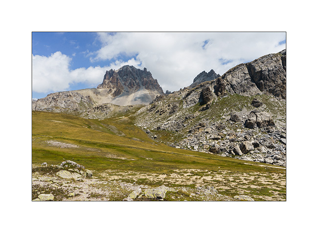
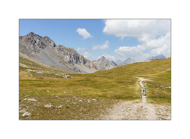
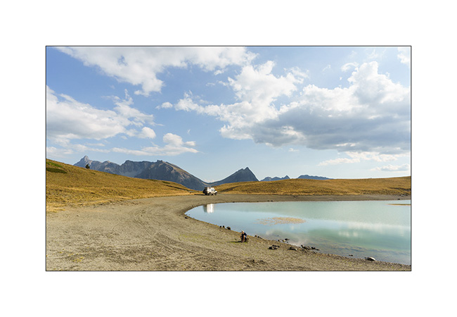
7. Leaving VivaLaVida early the next day for a nice mountain hike to discover several lakes.
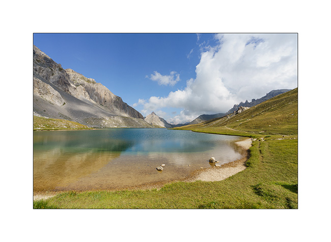
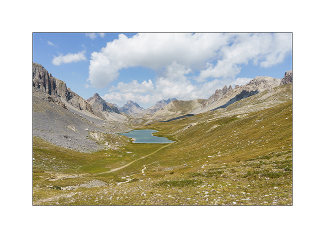
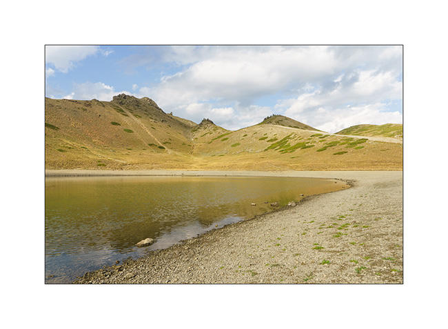
8. The goal of our day: the Lake of Roburent which I wanted to discover for a long time.
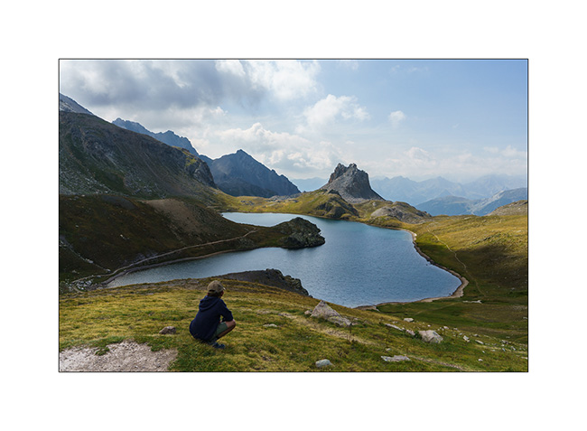
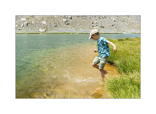
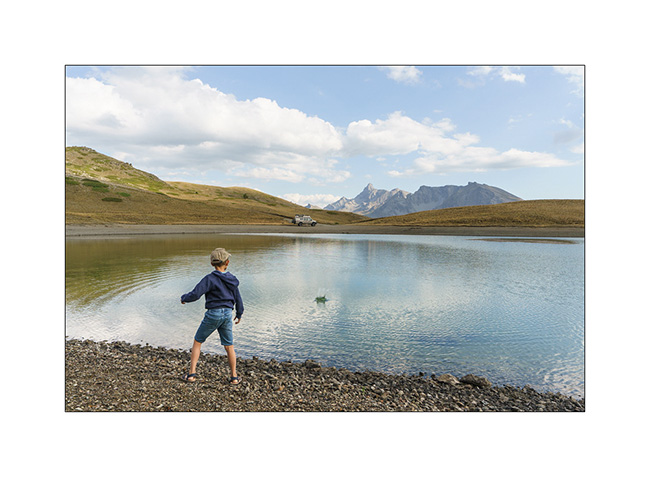
9. That’s where we picnic…
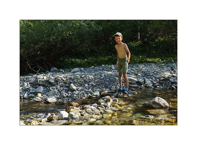
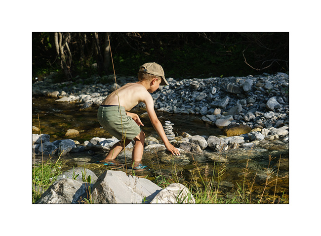
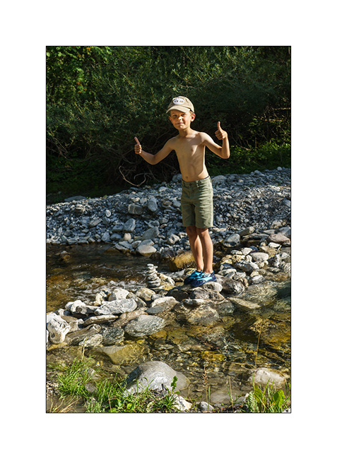
10. .. and Emile plays for a while.
11. We start the way back with a climb to the Col de Roburent.
12. Emile frolics like a goat!
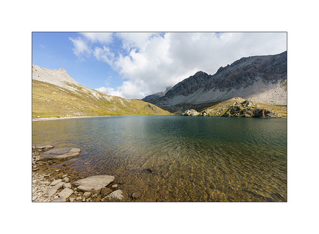
13. The valley we descend with the Lake of Orrenaye.
14. We stop there to refresh ourselves before returning to camp at the same place as yesterday…
Continuation and end of our three week trip shortly. 😉
Lacs et Queyras…
1. Dernière soirée dans le Val Argentera.
2. Le Lago Nero (Lac Noir), proche de la frontière franco-italienne, bondé ce jour-là alors que plusieurs colonies s’y sont données rendez-vous pour la journée. Nous décidons ainsi de poursuivre la piste vers un autre lac d’altitude.
3. Campement à 2’400 m. d’altitude.
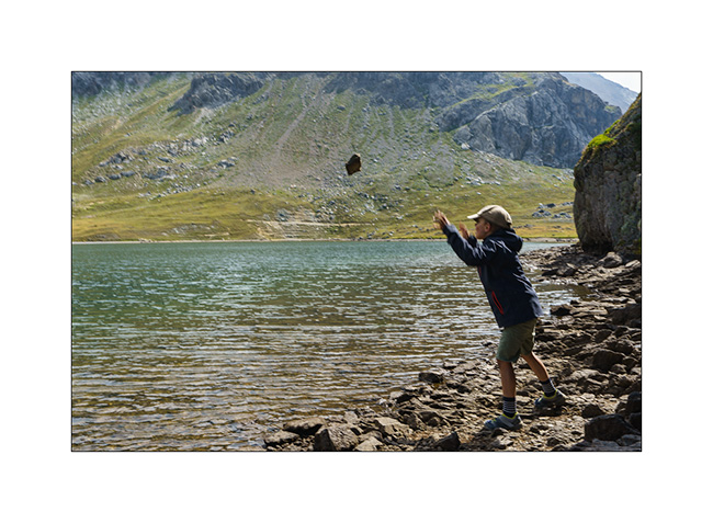
4. Emile s’entraîne à faire des ricochets.
5. Quiétude…
6. Préparation du souper.
7. Couchant
8. On se couvre un peu alors que la brise du soir rafraîchit l’atmosphère.
Ensuite, nous partons découvrir le Colle Agnello qui relie la haute vallée du Queyras à l’Italie. La vallée qui y mêne est magnifique, nous y reviendront à l’occasion.
9. Dernier lacets avant le col alors que la brume bouche le versant italien.
10. Nous trouvons un bivouac sur le versant italien, près d’un petit lac.
11. Et surprise, la brume se retire en début de soirée…
12. J’en profite pour tirer le portrait à ce joli petit lac.
13. Dernières lueurs sur les sommets.
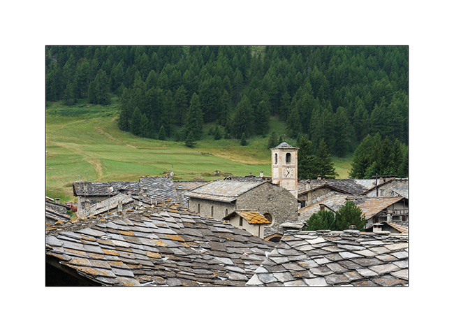
14. Village aux traditionnels toits de pierre sur la descente côté italien.
La suite dans le prochain post.
 D5 Creation