Vatnajökull @en
now browsing by tag
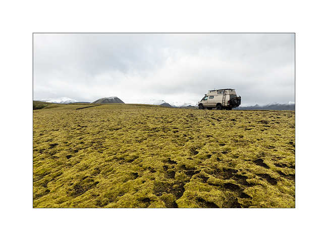
Highlands II, Askja, Viti – F910 / F88
1. The night was cool, 24°F to the thermometer of VivaLaVida.
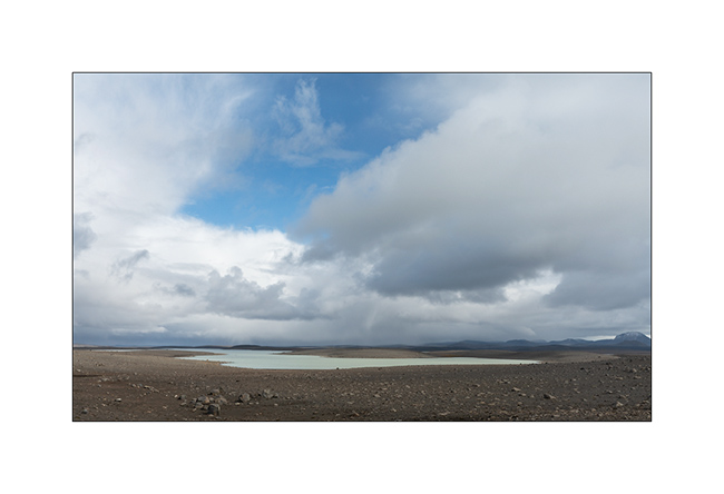
2. The Vatnajökull ice cap is really close.
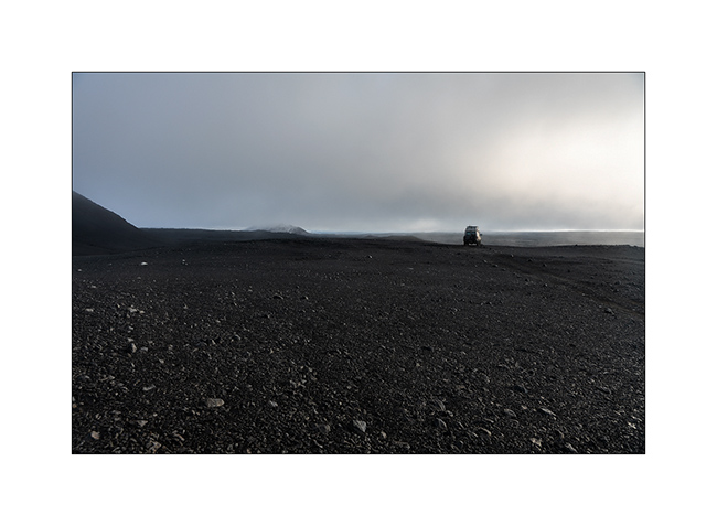
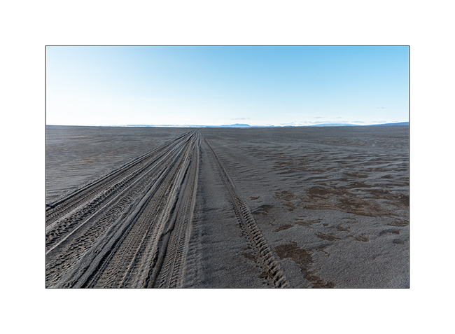
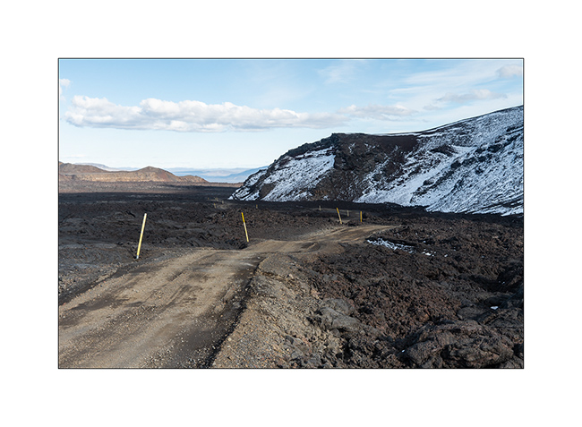
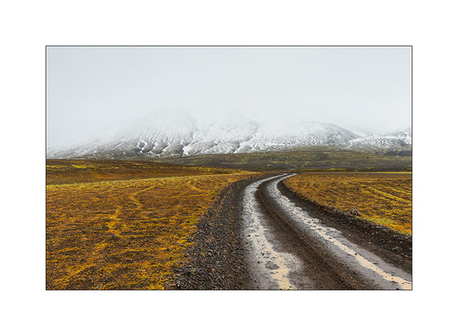
3. At the beginning of the day, as at the end of the previous one, the track was really chaotic through lava fields and screes. VLV did not drive faster than the average of 2 mph to take care of her occupants well shaken!
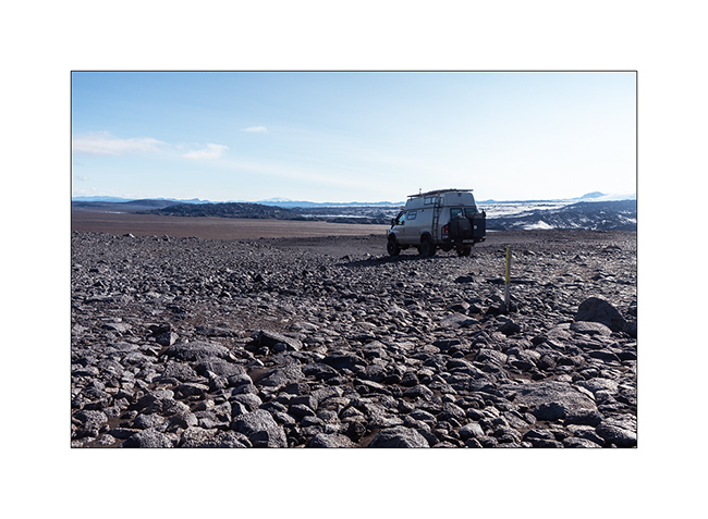
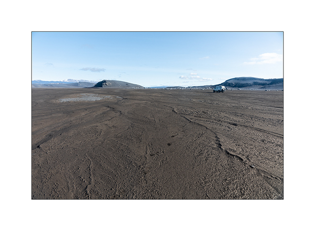
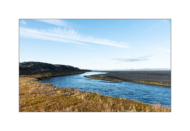
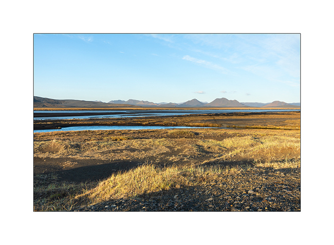
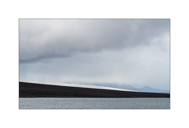
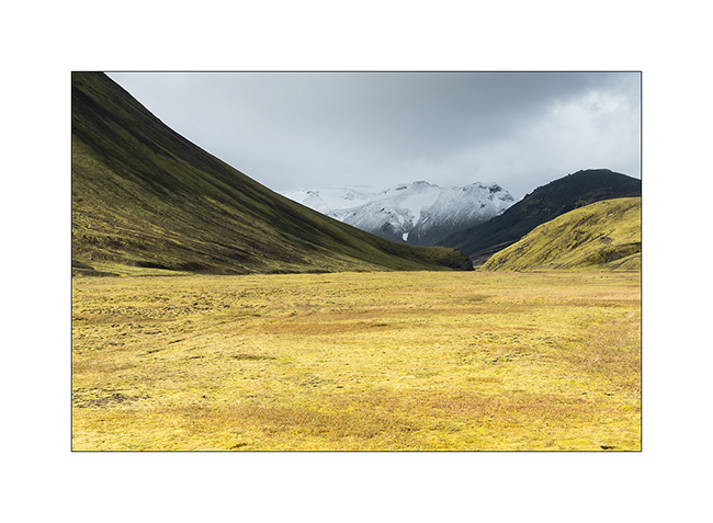
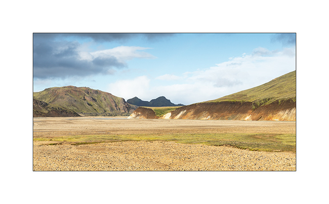
4. We are happy when she found vast alluvial plains…
5. Drawings…
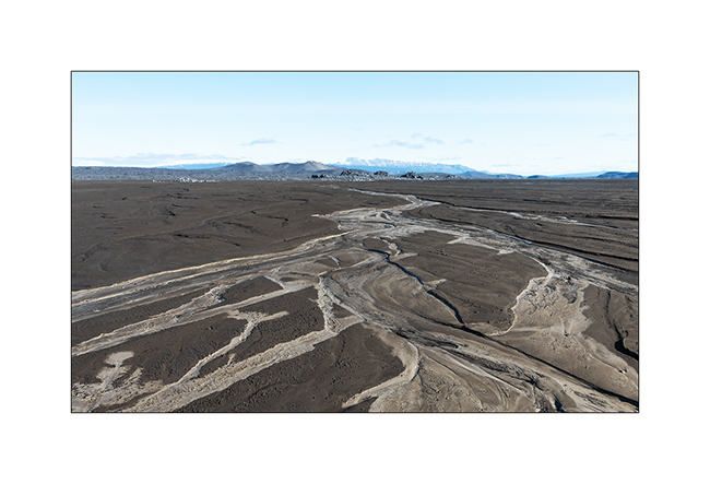
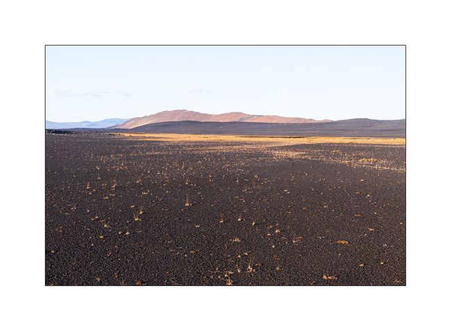
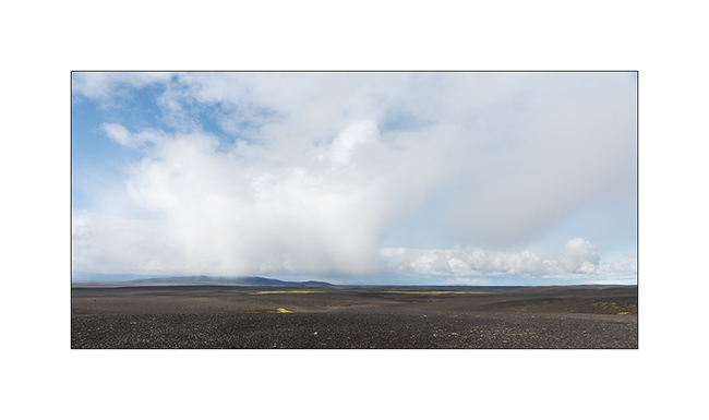
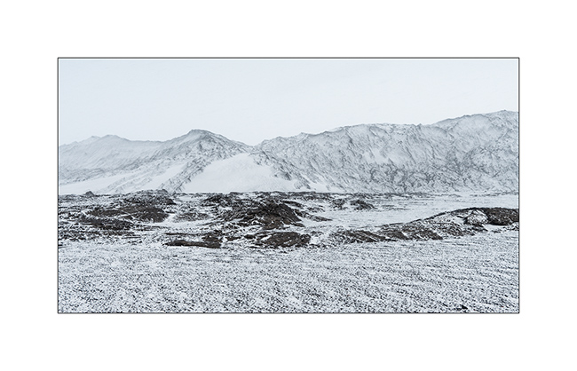
6. We then cross the Black Sand Desert.
7. Lunar…

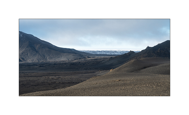
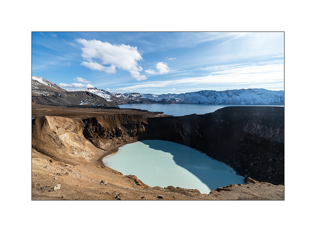
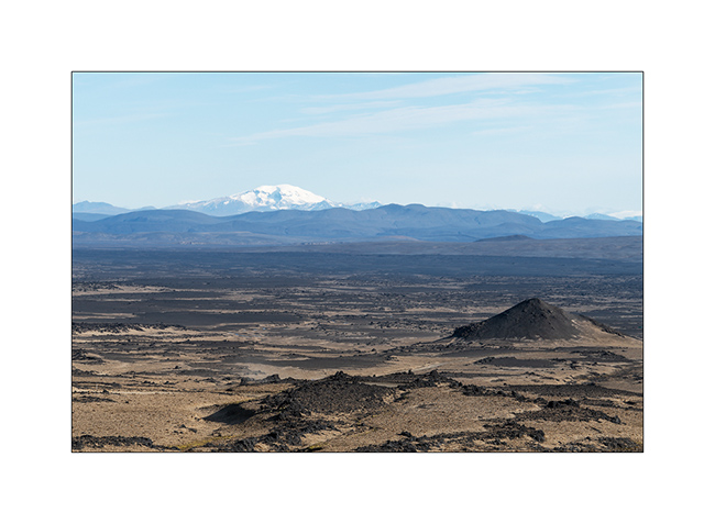
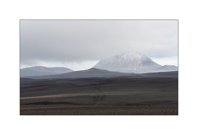
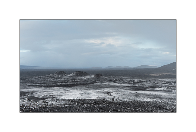
8. We reach the site of Askja, a large caldera of approx. 8 miles in diamete. Part of the crater contains lake Öskjuvatn.
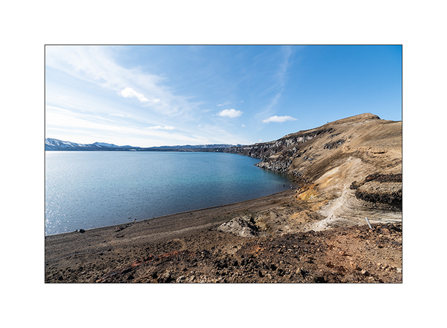
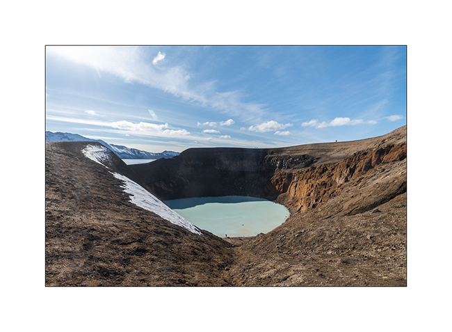
9. The opportunity to go discover the site of Lake Viti.

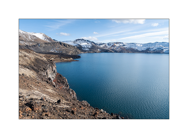
10. Lake Viti is nestled in a crater on the edge of the lake. Its temperature varies between 75° and 82°F, great for bathing.
11. Gorgeous!
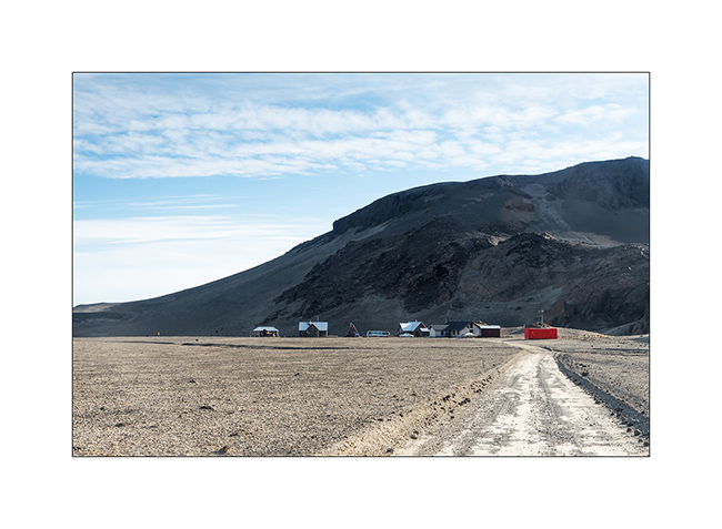
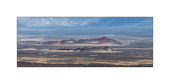
12. Lake Öskjuvatn with several lava flows of different periods.
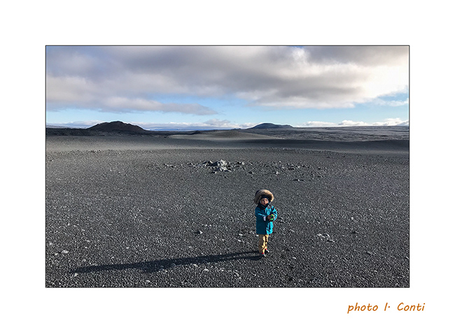
13. The trail leading to the start of the 2 miles hike crosses another lava fiels.
14. The Dreki refuge just outside of the caldera.
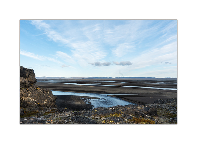
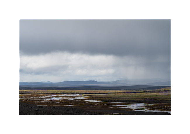
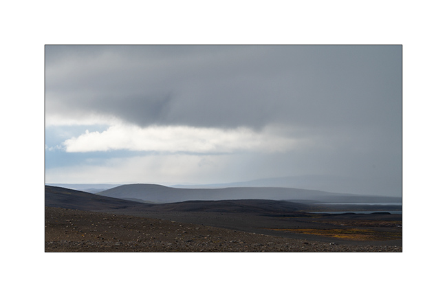
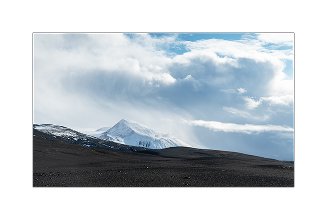
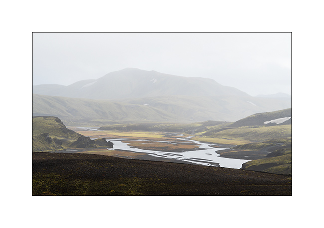
15. View on the plain toward East.
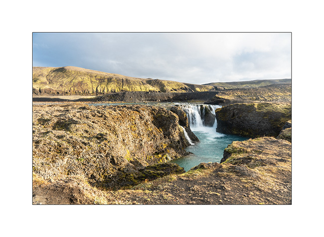
16. …
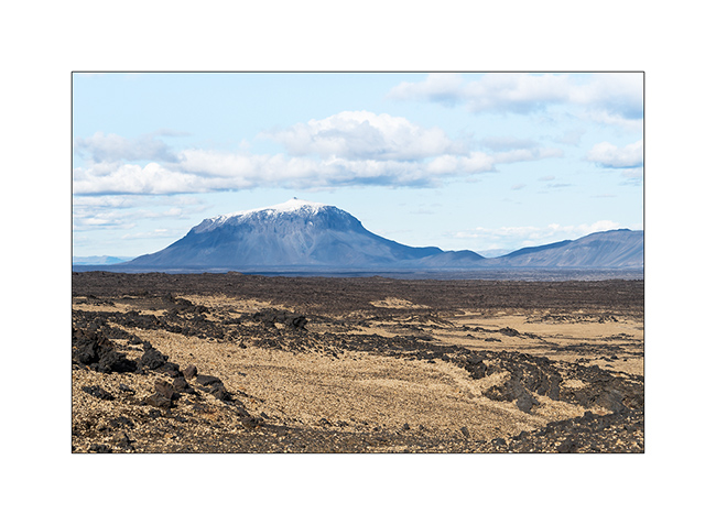
17. The famous mountain Herðubreið looking like a huge pastry.
18. We are now following the F88 track toward North and stop at Gljúfrasmiður canyon.
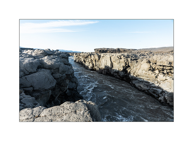
19. The Öskjuleið river rushes into it in pretty falls…
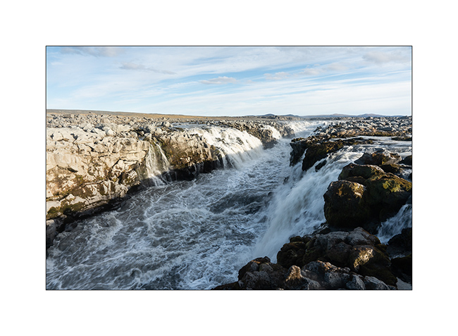
20. … before meandering along a lava flow.
21. …
22. Some iron colors…
23. End of the day light.
We had a nice wild camp in a crater before discovering the Mývatn region. To come soon…
Highlands I – F26 / F910
1. After refueling VivaLaVida (with about 10$ a gallon of diesel, it’s more than 400$.- to fill VLV!), we begin the crossing of the Highlands to the Northeast via the F26 road then the F910 which passes north of Vatnajökull.
2. We took two days to reach the site of Askja through beautiful and immense landscapes.
3. …
4. …
5. …
6. …
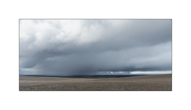
7. Giboulée…
8. Notre piste…
9. …
10. …
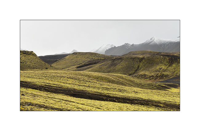
11. After about 150 miles exclusively mineral, we found some vegetal colors again…
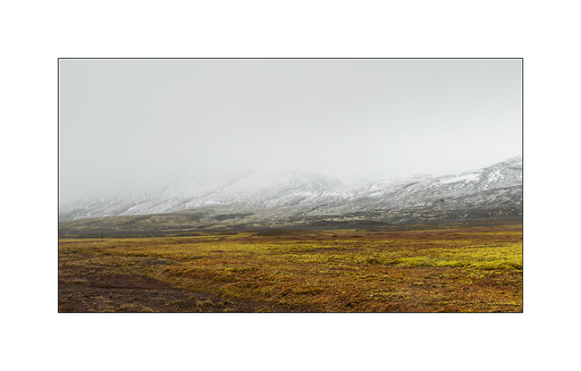
12. At 2400 feet elevation, snow is close.
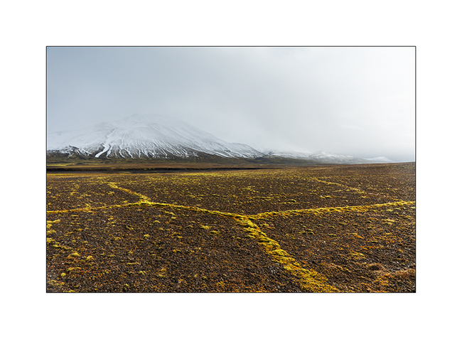
13. Moss grows along furrows carved by surface water, forming geometric shapes.
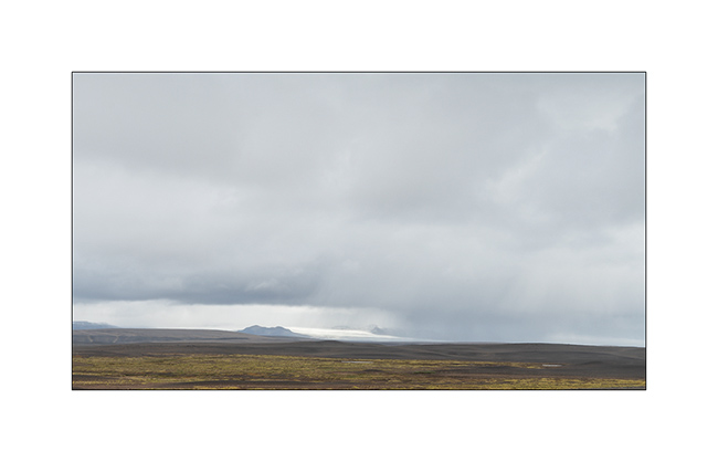
14. The sky ends up opening to the north.
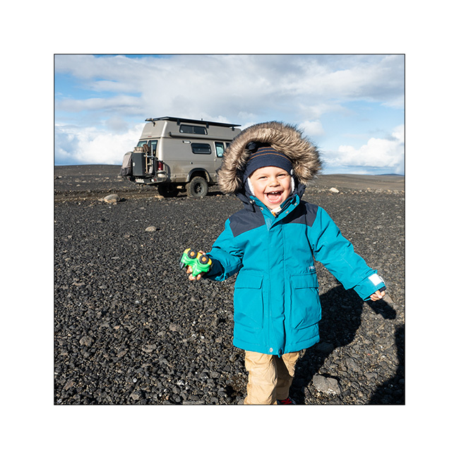
15. The opportunity for Emile to stretch his legs! 😉
16. …
17. …
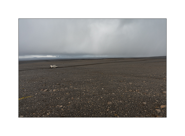
18. As we borrow the Southern variant of F910, as we gain altitude, the weather decays and the snow quickly covers the lava.
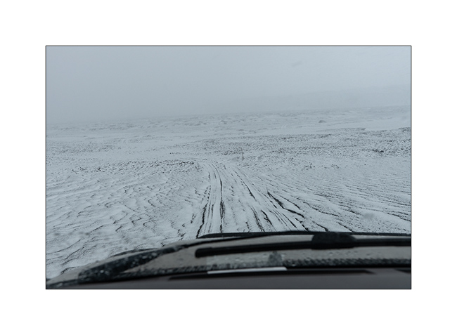
19. While snowing, VLV is the only color note of this landscape.
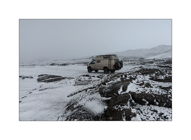
20. Naturally monochrome landscape.
21. …
We spend a cold night not far from the Kistufell refuge, near the Northern end of the VatnaJökull.
Continuation of VivaLaVida’s journey soon! Thank you for your loyalty.
Landmannalaugar and F208
After the gorgeous detour presented in the previous article, we reached the track F208 which leads to Landmannalaugar, a spectacular volcanic site but too touristy for me.
1. The small lake that hosted us for the night.
2. VLV on the trail.
3. It was cold that night and it snowed at about 2,700 feet.
4. Contrasts of shapes and textures…
5. The weather is still changing.
6. Following F208.
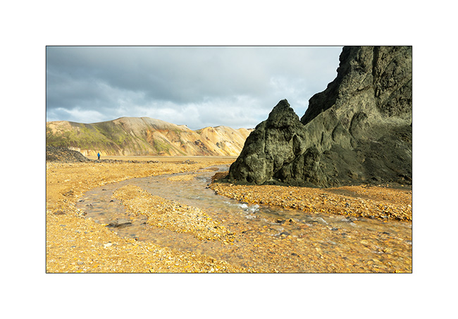
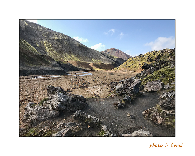
7. Arrival at Landmannalaugar.

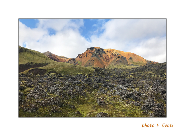
8. The colors are very different, definitely warmer.

9. Still contrasts…
10. …
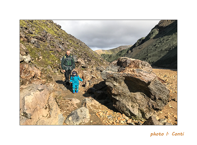
11. Despite our still small Emile, we went for a “hike” of 4 miles km and he did it very well apart from a loss of balance making him fall into a hole at the edge of the trail, which impressed his mom more than him.
12. The mix of colors and textures is amazing.
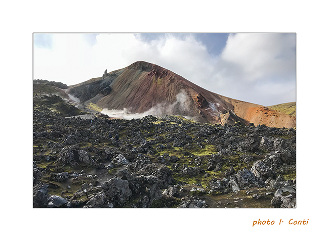
13. We go up the bed of a nice stream…
14. … up to sulfur fumaroles.
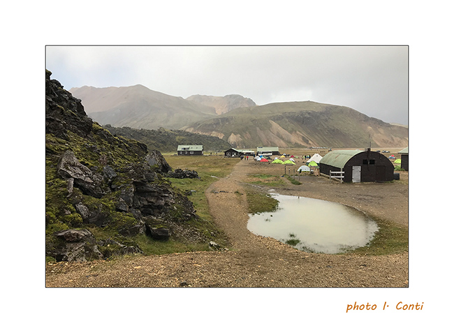
15. The upper part of the refuge / camping, which is a real small town where too much rooms, tents, buses and camper mingle…
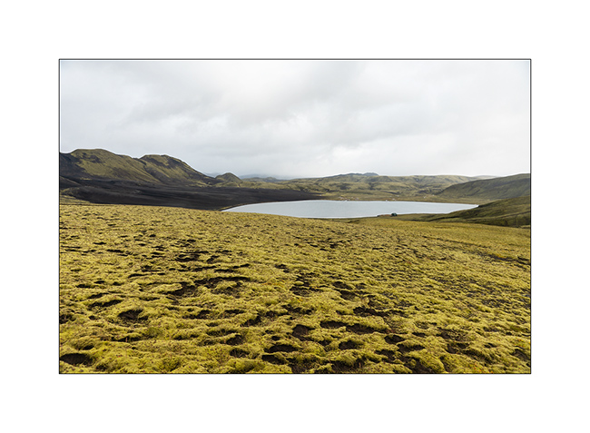
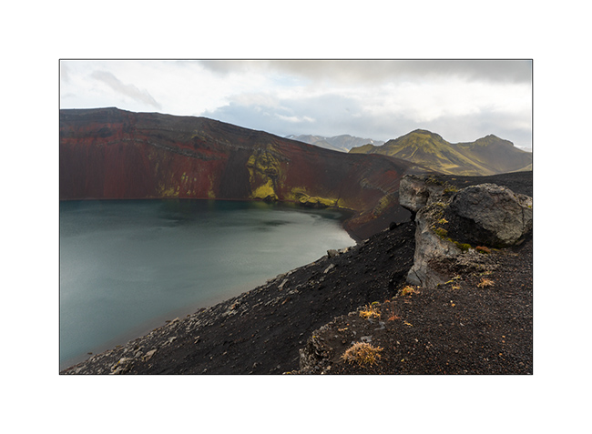
16. As it was difficult to make longer hikes with Emile, still too small for that, we took the trail toward North with a detour to discover the Lake Ljótipollur and its particular blue-green color.
17. …

18. Sigöldufoss, at the North end of road F208.
19. We spent the night at the coast of another lake, Fellsendavatn, along the road F228.

The continuation with the crossing of the Highlands all soon.
South coast…
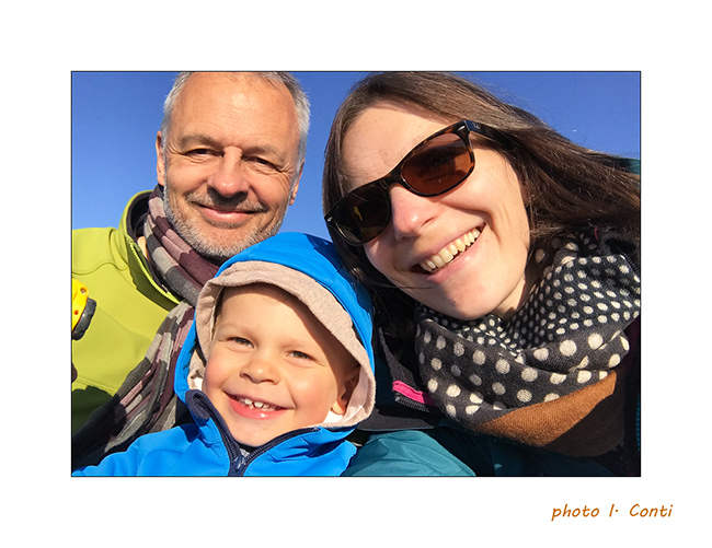
1. As Gaël requested it, here is the whole family. 😀
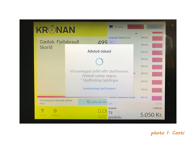
2. An example of the language at the checkout of a store, inapprehensible and unpronounceable for us.
And to show you what the rain can be there, here is a short video
of Isabelle made the day before where it rained like that almost all day long..!
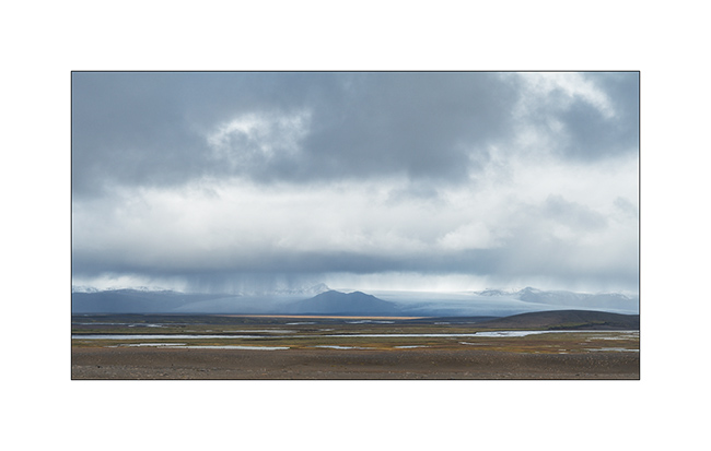
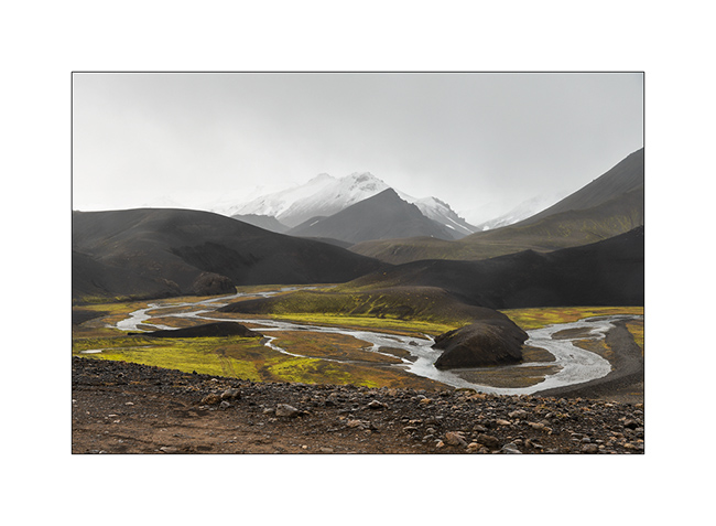
3. Continuation of the South Coast to the East. VivaLaVida crosses many Gravel Bars, large river beds that regular floods clear of all
vegetation.
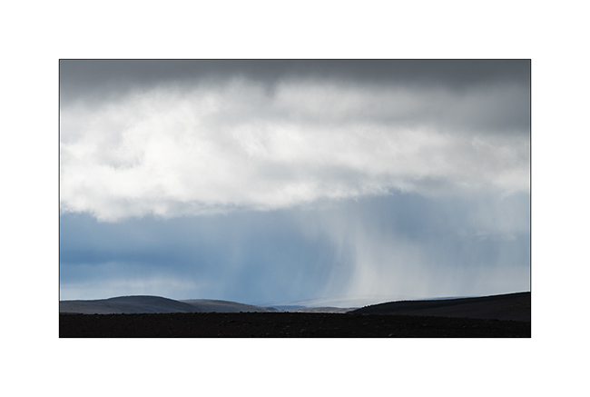
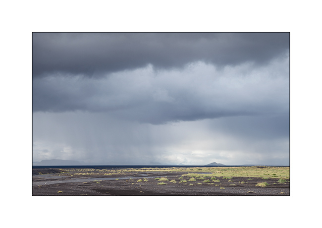
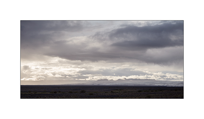
4. Showers that offer beautiful skies.
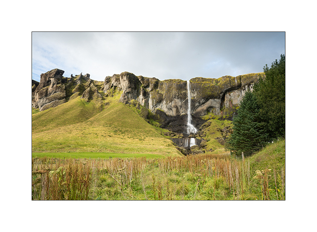
5. Waterfall Foss á Síðu along road Nb 1.
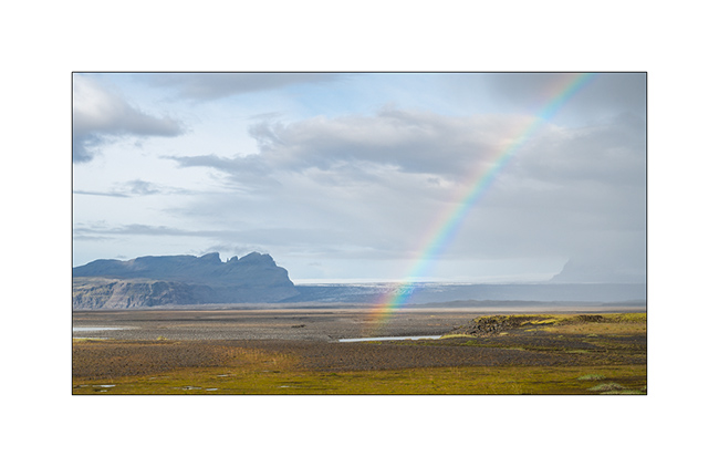
6. Rainbow in frontof the Vatnajökull ice cap in the distance.
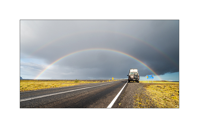
7. Another one to celebrate VivaLaVida.
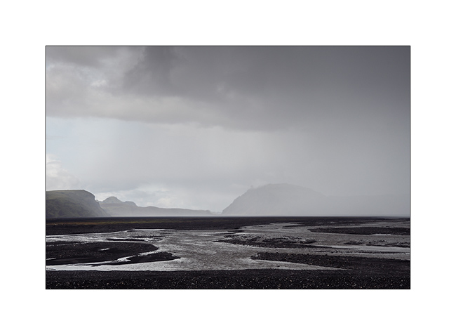
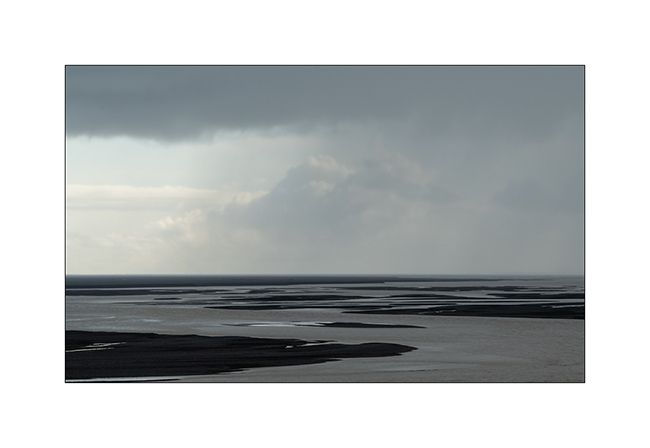
8. Gravel bar.
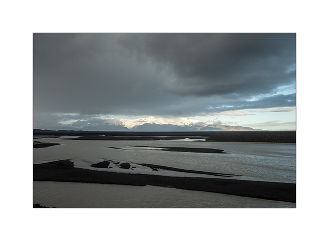
9. Shower on the coast.
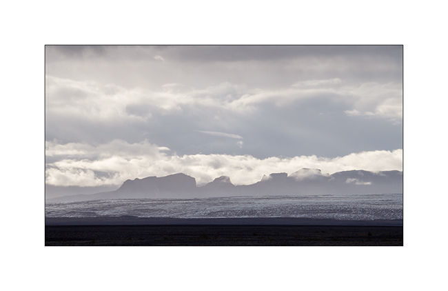
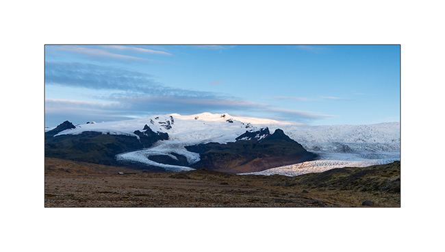
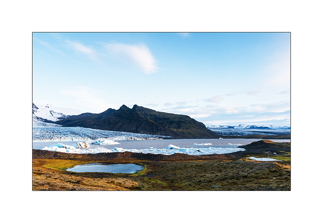
10. Vatnajökull ice cap, the largest in Iceland.
11. It is crossed by many volcanoes more or less active.
12. In the evening, VivaLaVida finds a nice boondocking place to camp near a glacial lake.
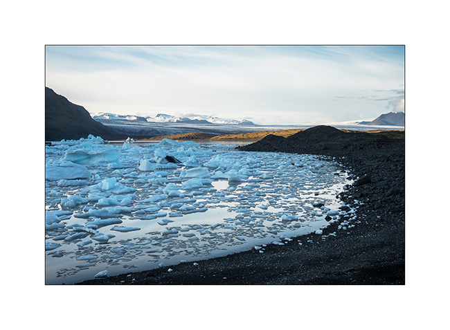
13. First colors at dawn.
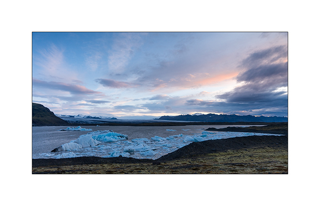
14. Camp of VivaLaVida, close to the glaciers.
15. Light beams…
16. … on raw elements.
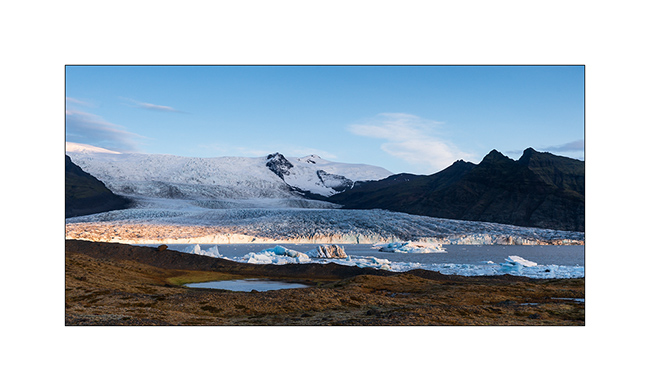
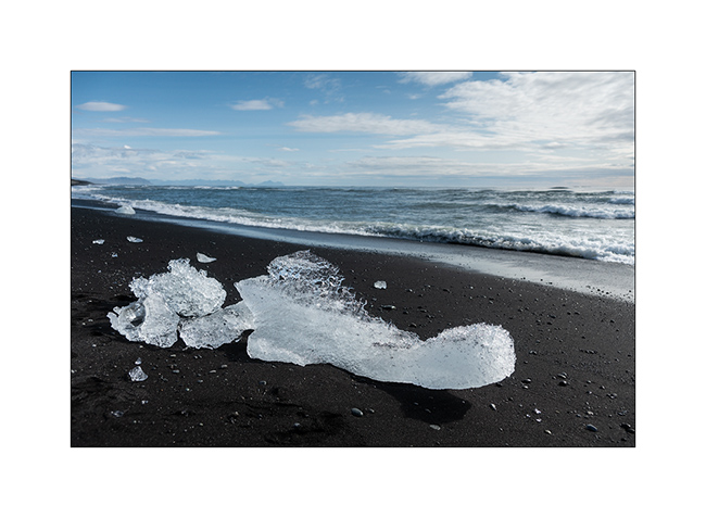
17. I couldn’t not show to Isabelle, a jewel fan, the “Diamond Beach”, famous for the icebergs that stand out from the Vatnajökull and flow
into the ocean by Lake Jökulsárlón before stranding on the black beach! 😉
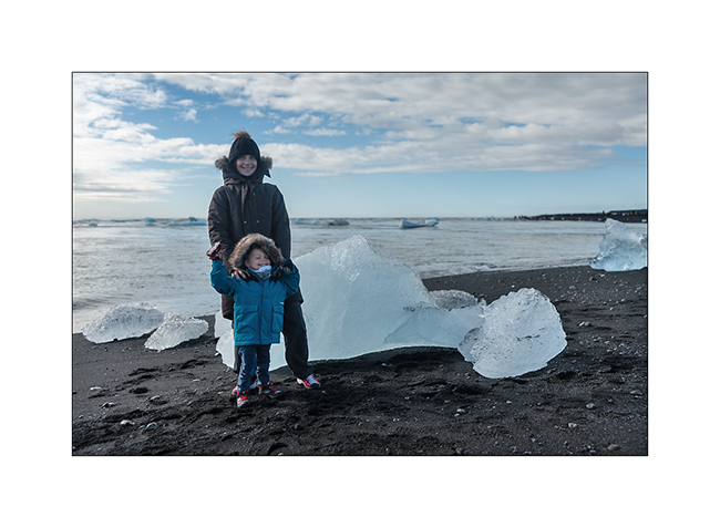
18. Photo souvenir…
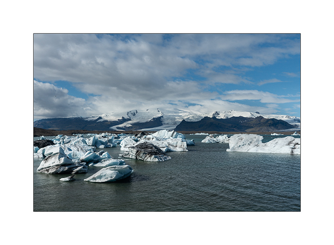
19. Jökulsárlón Lake.
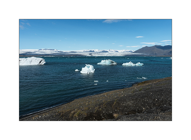
20. Larger icebergs must melt before crossing the channel leading to the ocean.
In the next update, we will leave the coast to discover the Lakagigar area where new small volcanoes appeared only some decades ago.
 D5 Creation