Utah @en
now browsing by tag
South San Rafael Swell
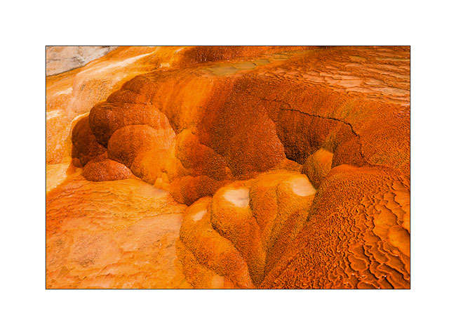
Out of my hike in the slot canyons, I saw a sign “Muddy Creek”. I thus followed the trail south and had the good surprise to find a quite large area of “bentonite”, this kind of clay that I also found at the Painted Hill in Oregon.
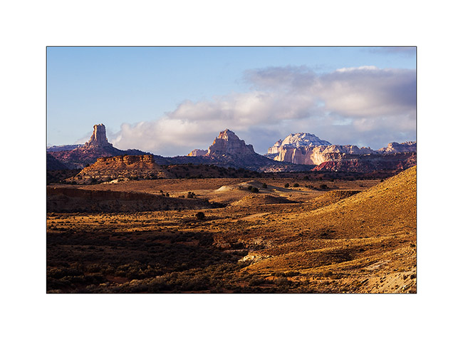
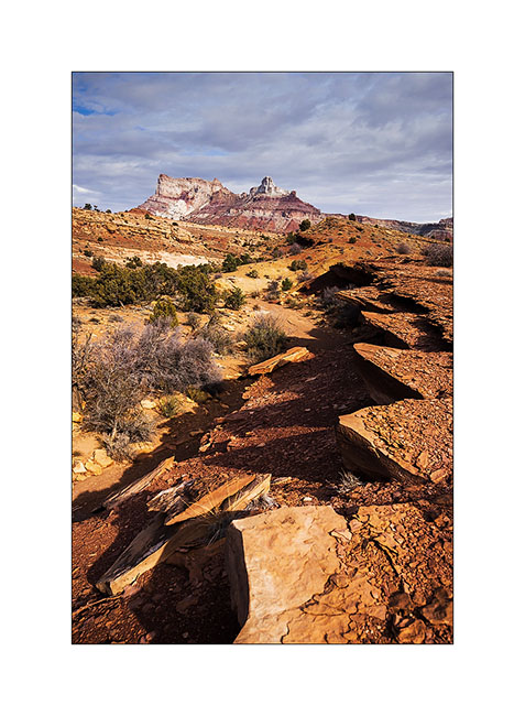
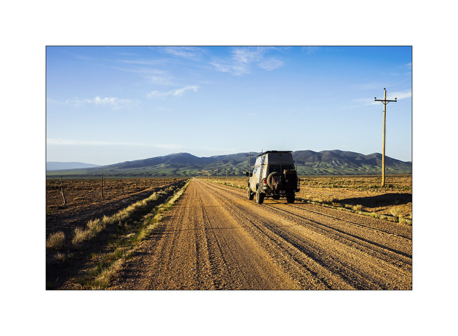
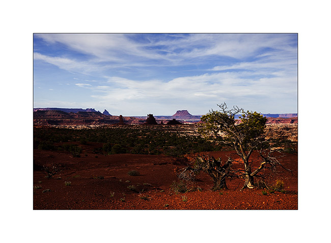
1. Bentonite Hills and Henry Mountains in the distance.
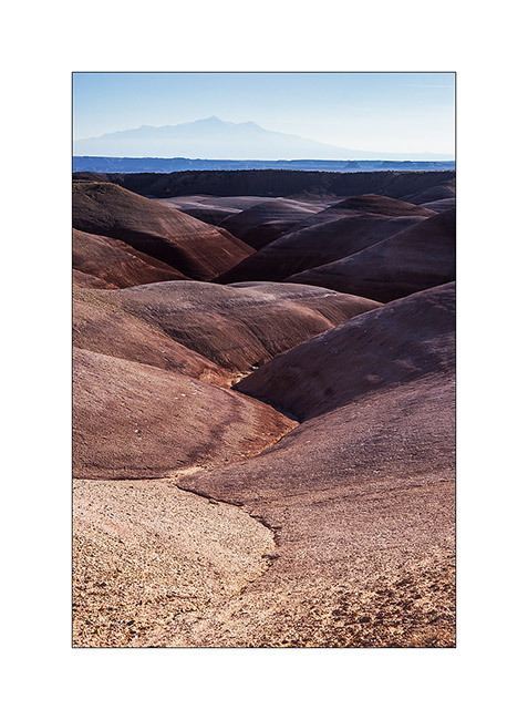
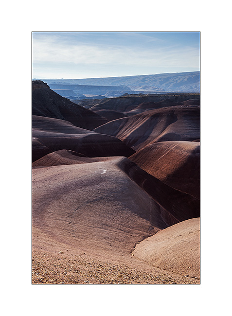
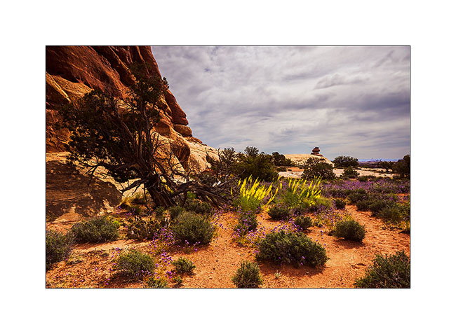
2. Nice colors in front of San Rafael Reef.

3. Valley…
4. Sweetness…
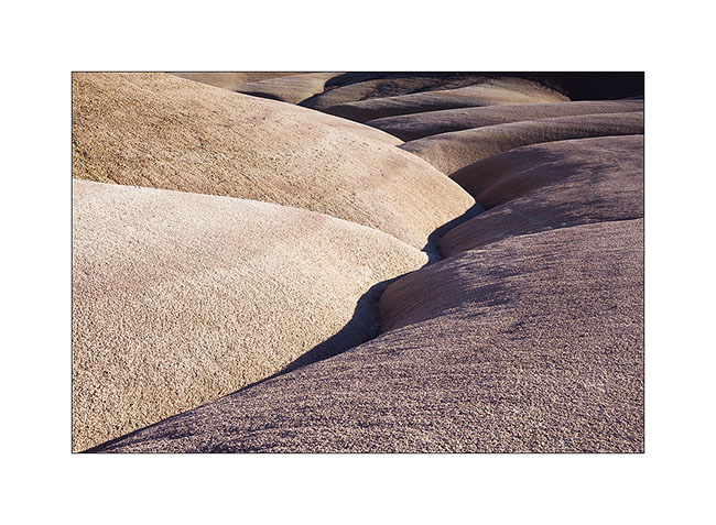
5. I vary the compositions in this sensual landscape…

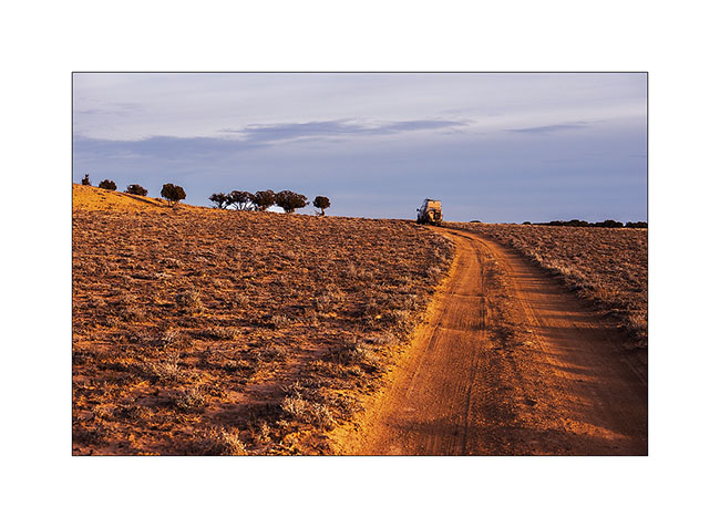
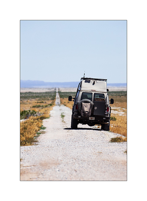
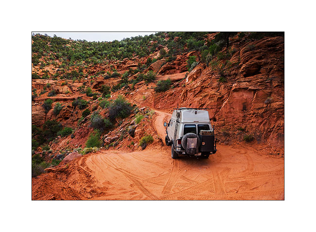
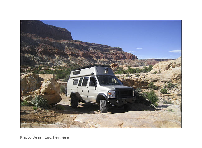
6. VivaLaVida having fun on that beautiful trail!
7. Muddy Creek, at the end of the trail.
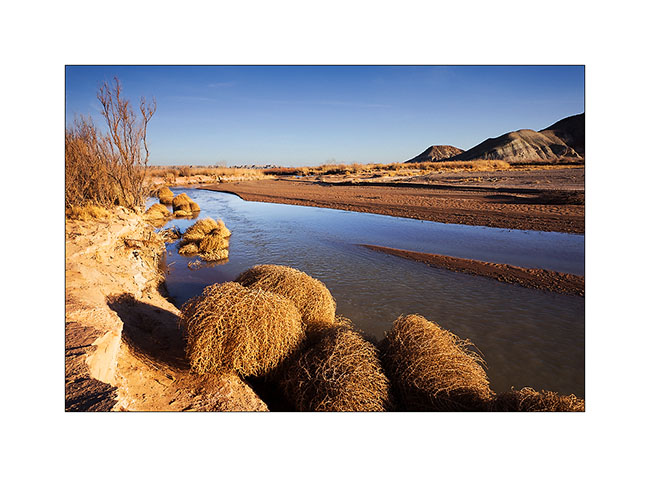
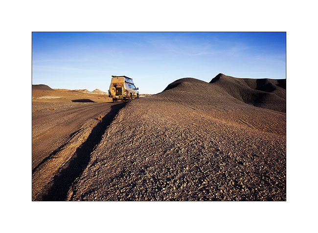
8. Ride over the Bentonite. 😉
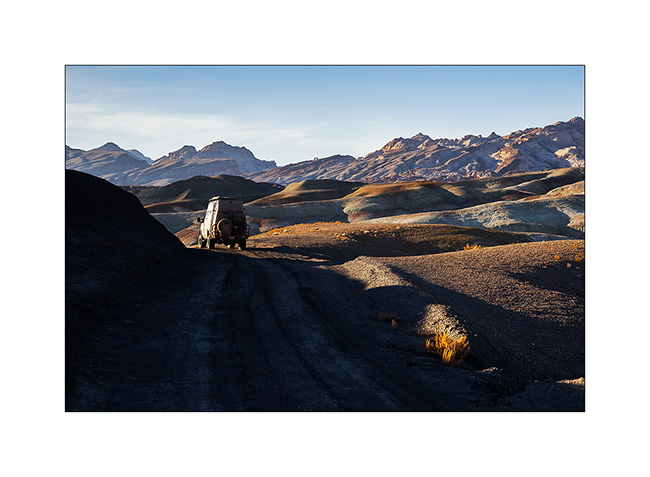
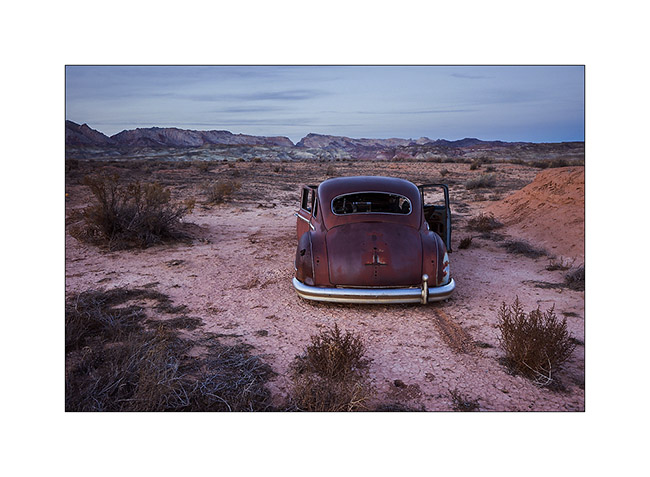
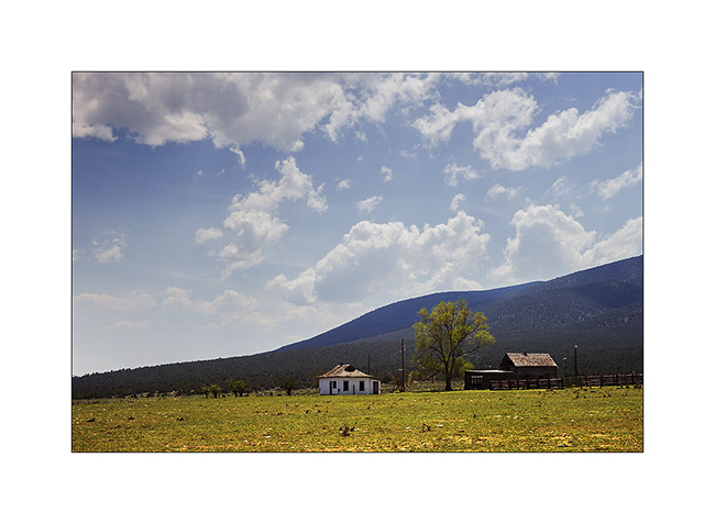
9. I slept near an abandoned ranch and discovered this carcass at nightfall.
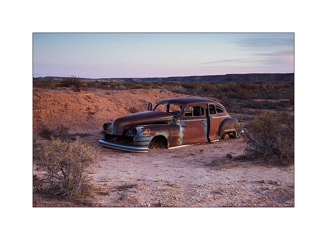
10. She too has beautiful sensual forms, isn’t it? 😀
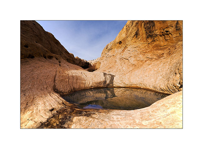
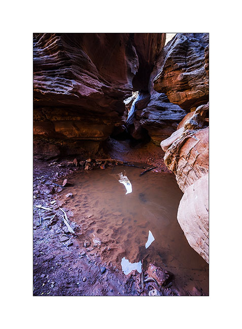
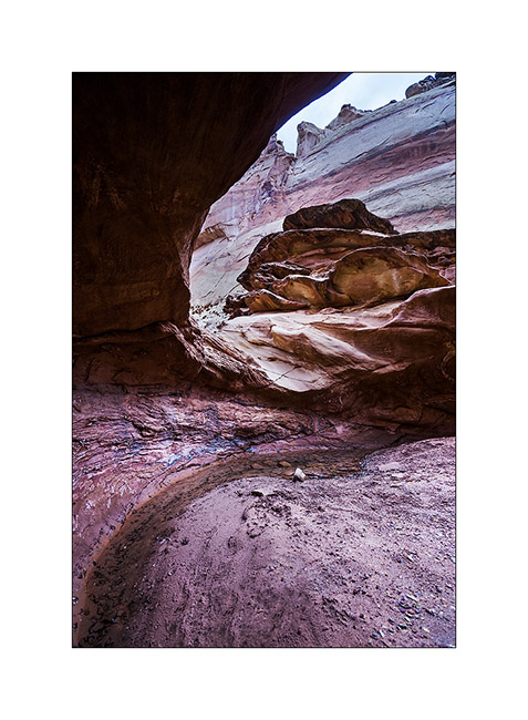
11. The next morning I went up towards a small arch and saw this pothole on my sundstone path.
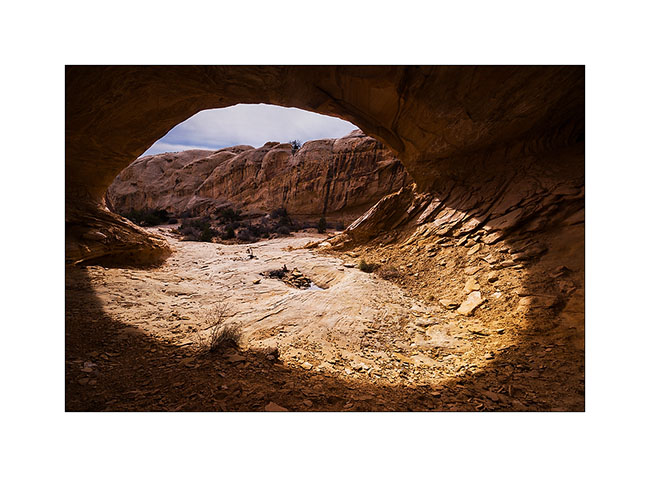
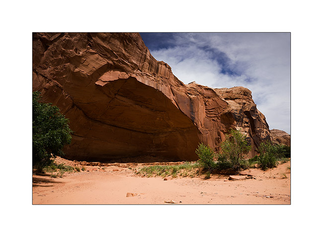
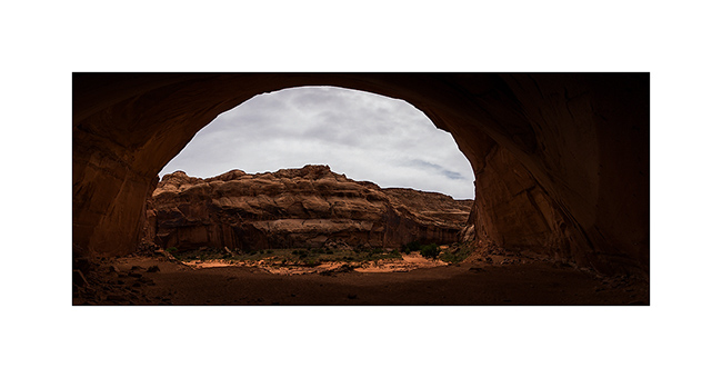
12. Here is Wild Horse Window.

13. The window is nice! 😀
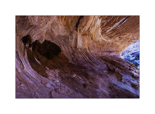
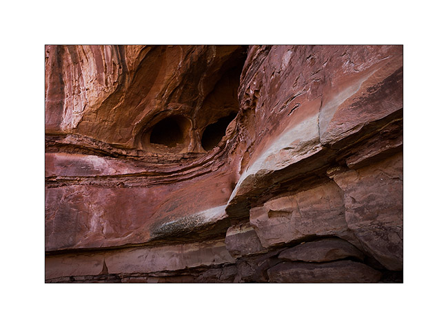
14. Guess who created this double cave? Yes, that’s it, that little spring that seeps from the bottom of the two caves, giving life to some ferns…
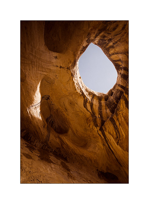
15. Almost a makeup eye…
16. By late afternoon, towards a high plateau at almost 7,000 feet elevationl to a camp near another slot canyon.
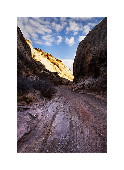
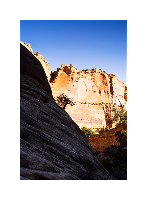
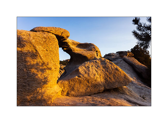
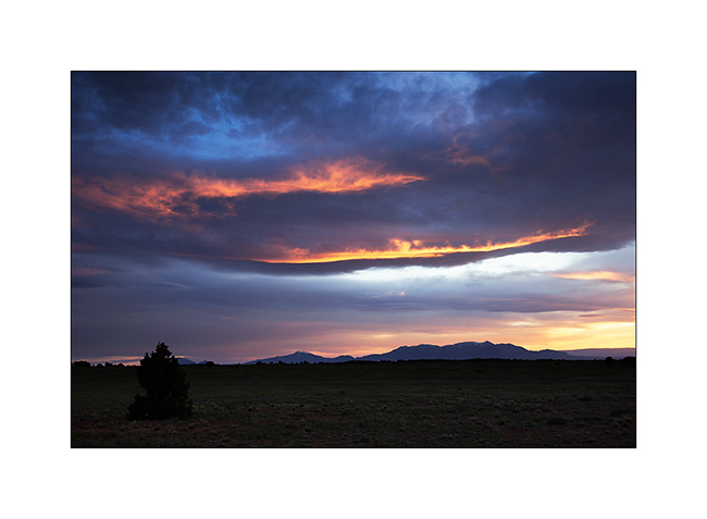
17. Upper Reds Canyon cliffs in Sunset light.
Another dive in a slot canyon to come soon! 😀
San Rafael Swell
Continuation of discovering this region less known and yet not far from Moab.
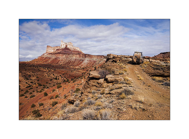
1. VivaLaVida on a little-used trail that circumvents Temple Mountain.
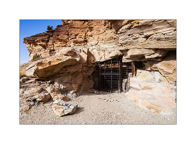
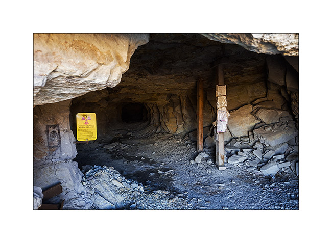
2. They are many old uranium mines in the area.
3. They are of course closed.
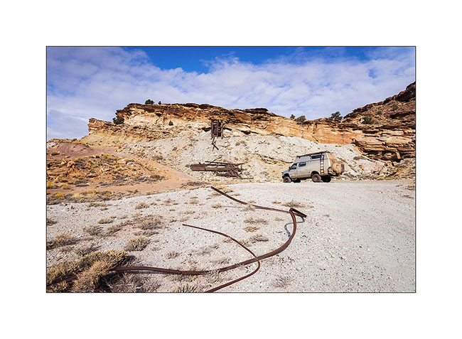
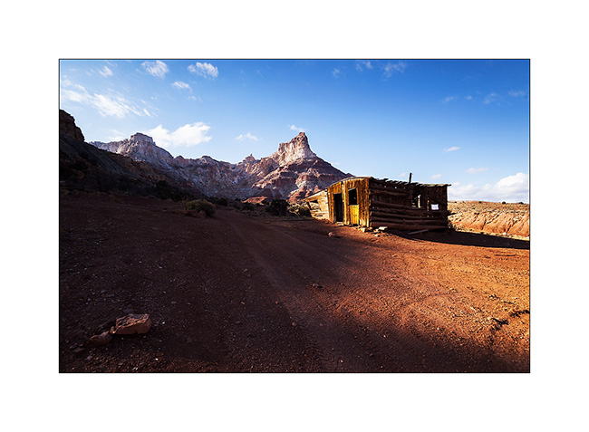
4. On the other side of Temple Mountain remains the “cabin” which housed miners.
5. Mining access corridor.
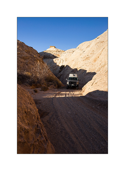
6. VivaLaVida going down the beautiful North Temple Wash…
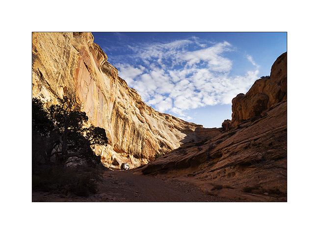
7. … driving in the course of the wash.
8. The output is a little narrow.
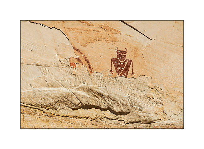
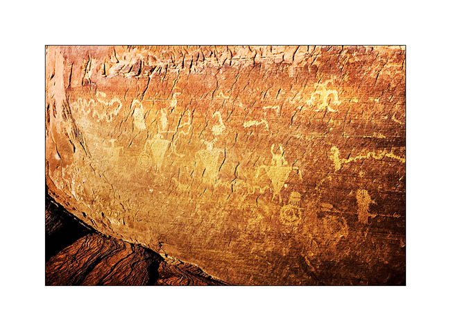
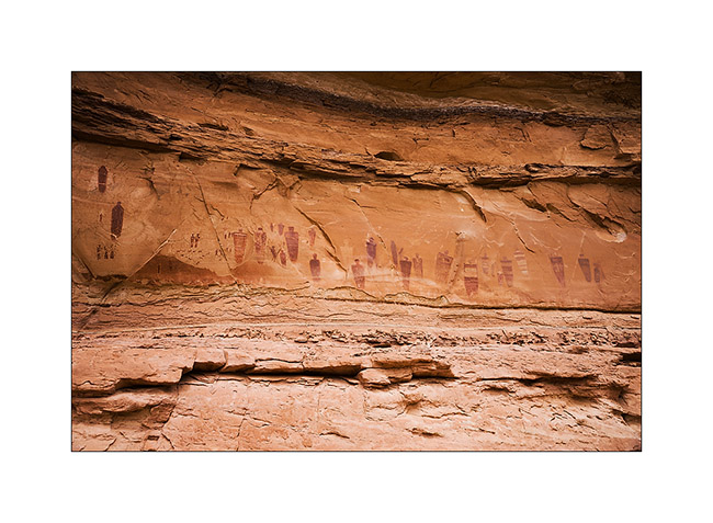
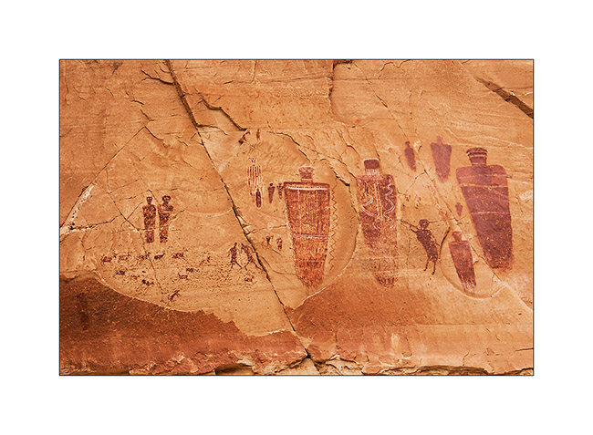
9. Splendid petrograph panel in the South Temple Wash.
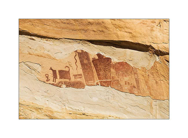
10. The white dots are not of the same time, just a idiot who shot this exceptional site… The weapons are all over the US, unfortunately.
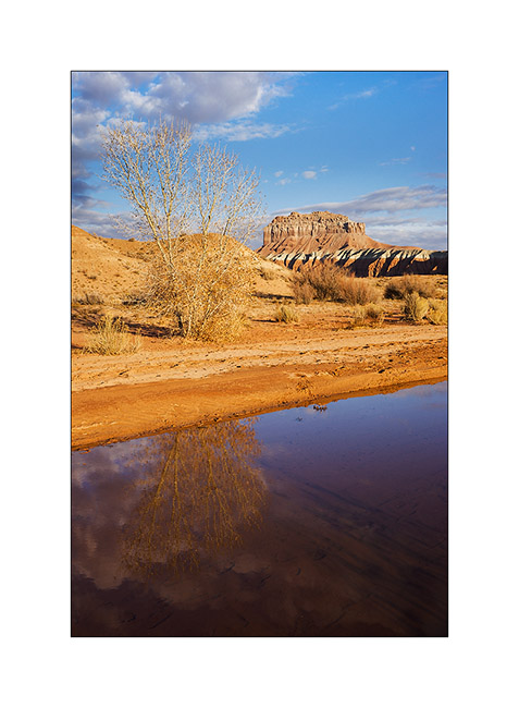
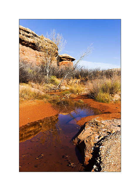
11. Going to the mouth of another canyon that I will explore the next day, I discovered a source…
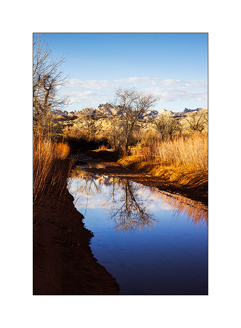
12. Late afternoon reflection…
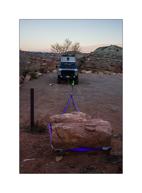
13. Having discovered that the bolts that connect the front axle with suspension springs were loose, I had to make some winching to realign the front axle before tightening… 😉
The next day I made a big hiking loop, up Little Wild Horse Canyon and back down through Bell Canyon.
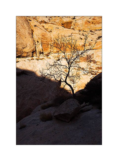
14. Silhouette…
15. Entering Little Wild Horse slot canyon.
16. End and deep trench in which we sometimes have to go sideways as it’s so narrow.
17. Some water remains in places.
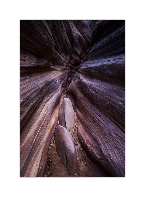
18. I imagine water flowing into these curves…
19. Labyrinth…
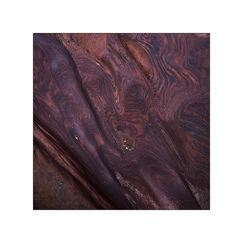
20. Some veining of sandstone are incredible.
21. Going down through Bell Canyon
22. Convergence…
23. Oui, it’s the right way! 😉

After this hike, I discovered by chance a nice area that I will present soon. 😀
Ruins and canyons
At a small meeting with Tom, aka Zeta on Sportsmobile forum, he advised me to visit the Hovenweep National Monument, a site where are grouped different Anasazi ruins. When I went there, it was raining but I still visited seven different sites.
1. The Twin Towers, on the main site in Utah.
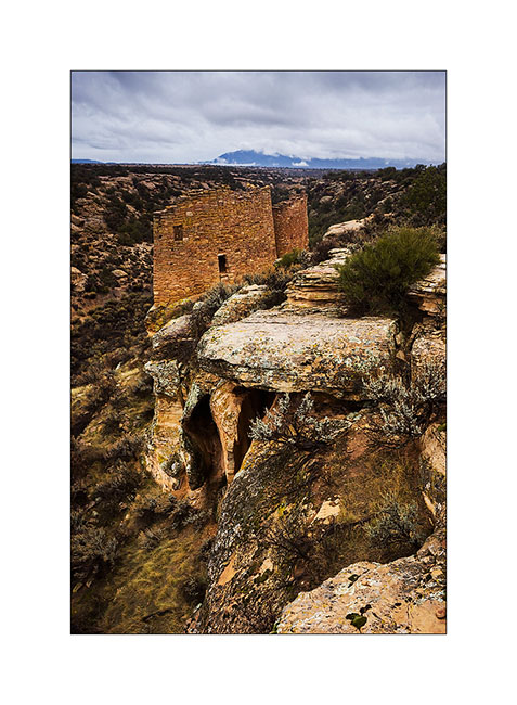
2. Hovenweep Castle and Square Tower. These sites were all built on springs and have likely been built to protect those They were all built between 1220 and 1280, were inhabited by three generations before being abandoned for unknown reason.
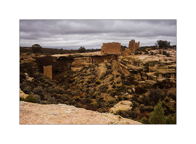
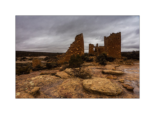
3. Hovenweep Castle, consists of two horseshoe towers and a large main house.
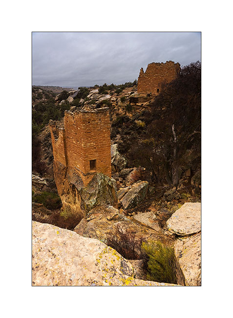
4. We go to Colorado, just ten miles away, at Holly site. Amazing how these builders were able to anchor foundations on vertical blocks of sandstone.
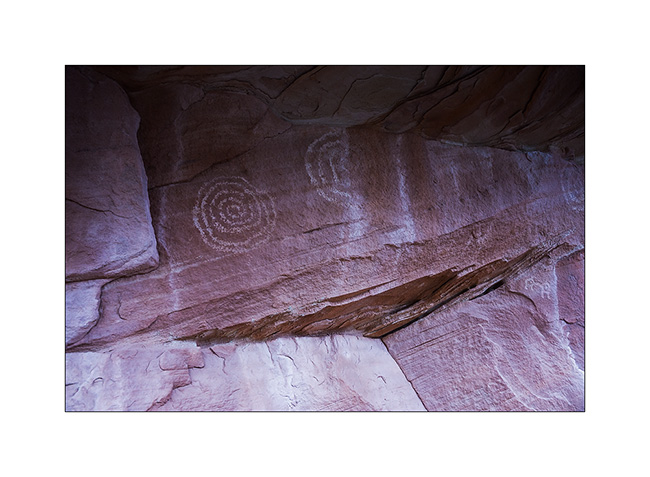
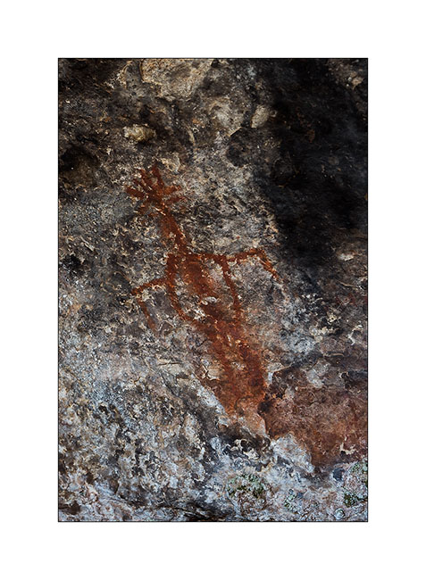
5. While walking through the canyon of Holly, I spotted this petrograph symbolizing the sun.
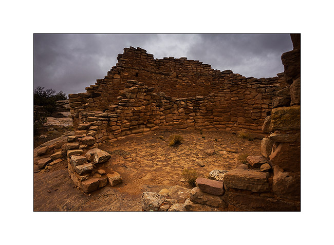
6. Here is the Horseshoe ruin, an house shaped like a horseshoe with double row walls.
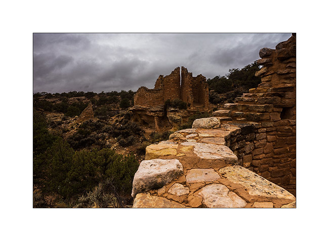
7. Farther, the Cutthroat Castle. Yet the Anasazi Indians were farmers, not warriors.
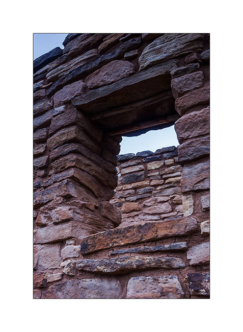
8. A well-preserved window. The covered – a large flat stone – is ensured with two poles of juniper.
9. At the foot of the sandstone block on which the castle sits, there are other structures, probably granaries.
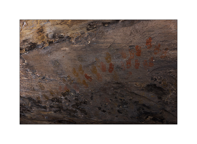
10. Not far away, a known petrograph: Painted Hands. It dates as the ruins of the 13th century.
11. On the site of Cajon, again in Utah, the spring still exists and was protected by two walls.
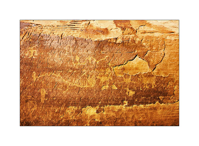
12. Some petroglyphs in Cajon Cayon.
A part ordered for VLV still not arrived, I went to spend a few days in South San Rafael Swell, beautiful region that contains many canyons.
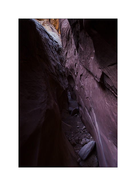
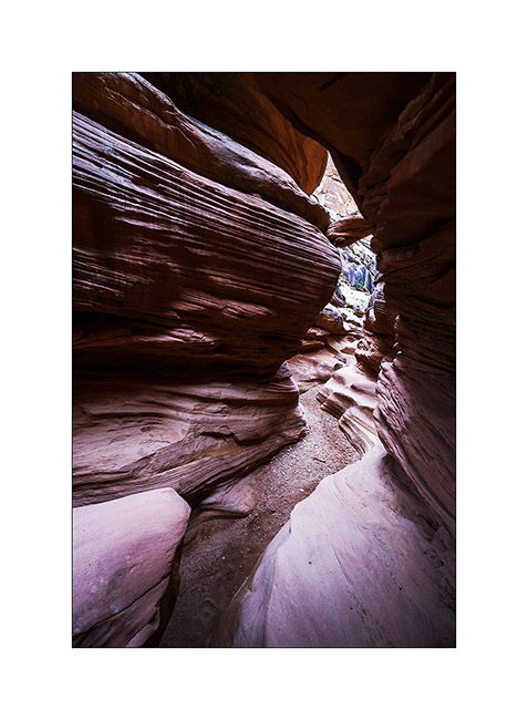
13. It is rather gray and very cold when I enter Crack Canyon.
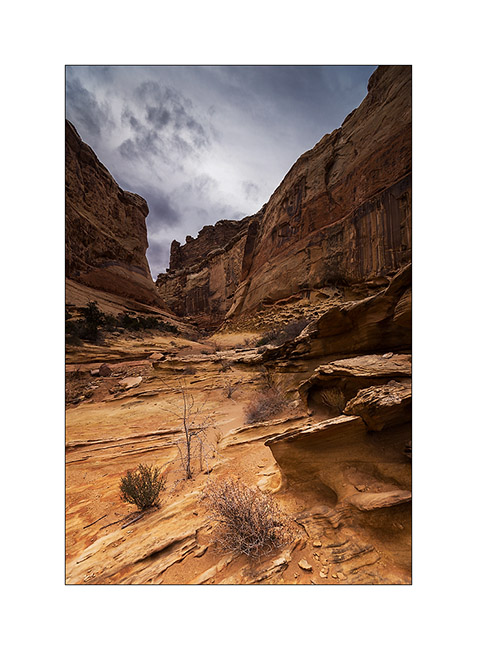
14. This is not really a slot canyon but some portions have beautiful overhangs dug by flash floods.

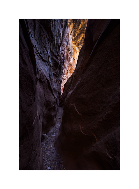
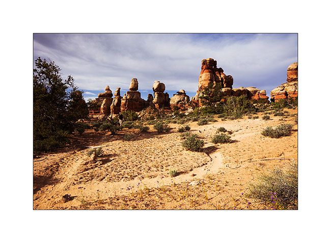
15. This is the narrowest part.
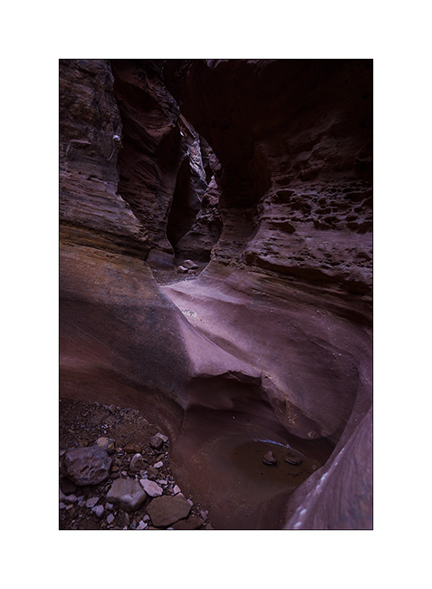
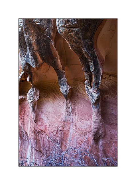
16. Columns carved by wind and water…
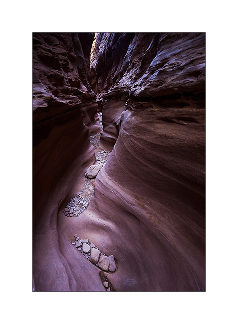
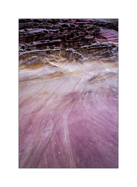
17. Sandstone colors…
18. Pot…
19. Late afternoon on Temple Mountain with finally some sunshine…
More to come in San Rafael Swell soon. 😀
Sandstone around Moab
Leaving the Beef Basin, I had the good surprise to find a message from Hans, a Swiss who lives here with his wife Madeleine for 35 years. I was greeted like a king by this adorable couple, not forgeting to specify that Madeleine is fine cooker. 😉
They explained me how to access a petroglyph site within walking distance of their beautiful home nestled on a sandstone hill.
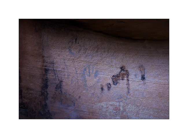
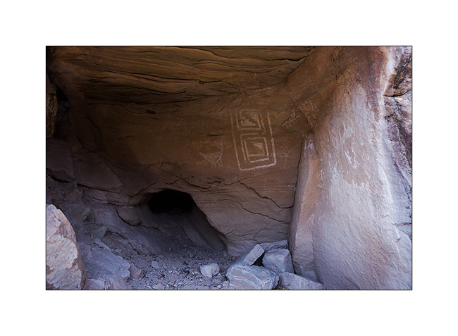
1. What a privilege to discover this private site where access is usually closed!
2. I have found some symbols already observed elsewhere.
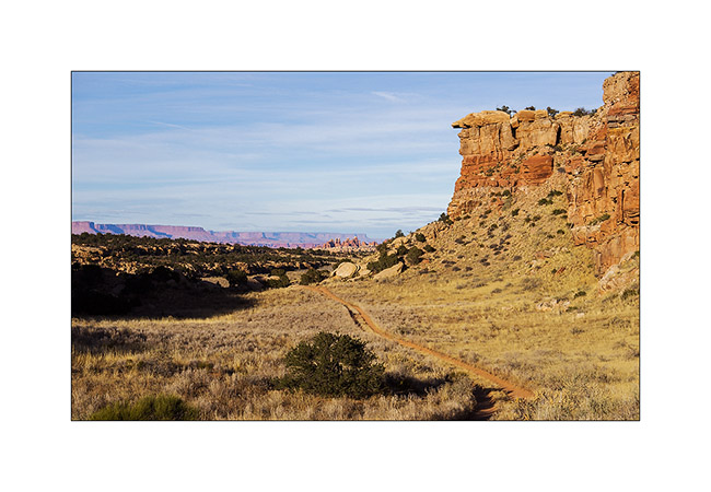
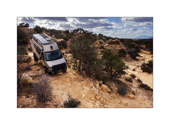
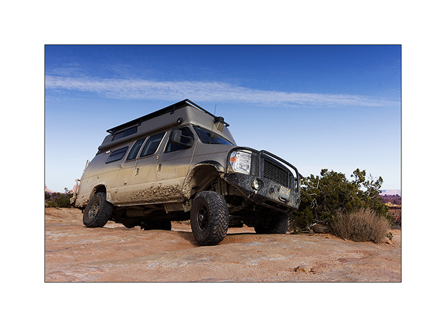
3. The next day and despite his 80 years, Hans brought me drive the Sevenmile Ridge Trail, a 4WD trail listed red (the most difficult) which passes near Uranium Arch.
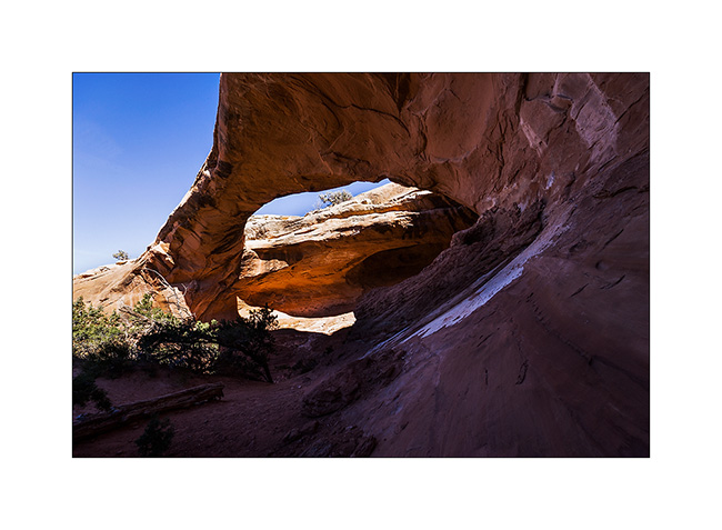
4. It’s a nice medium sized arch.
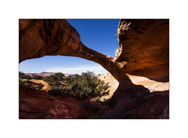
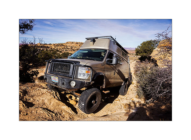
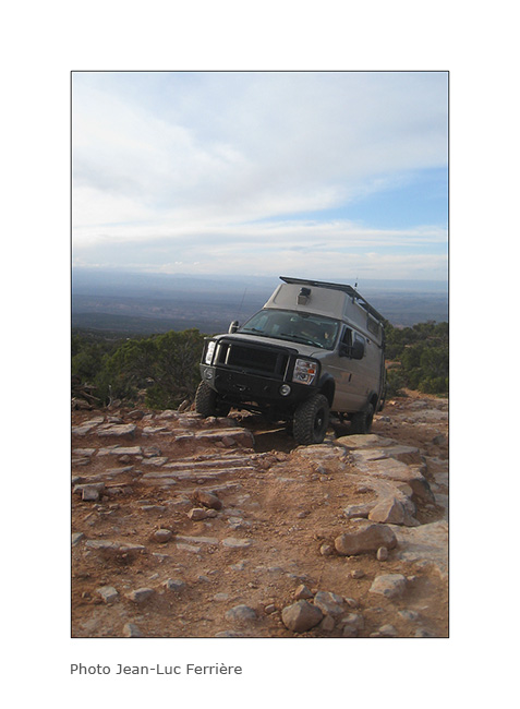
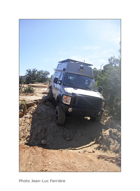
Near this arch, we met a couple from Colorado, Dave and Leanne, a little lost because their trail description was out of date. They followed us throughout the rest of the trail and took images of VLV in downright cool passages, especially a leaning spot that I really wasn’t sure how to deal with VLV high-pitched on her wheels. They sent me some pictures to discover here…
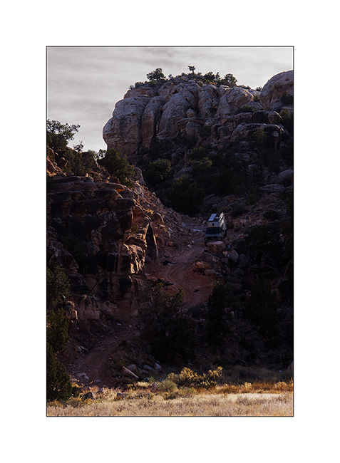
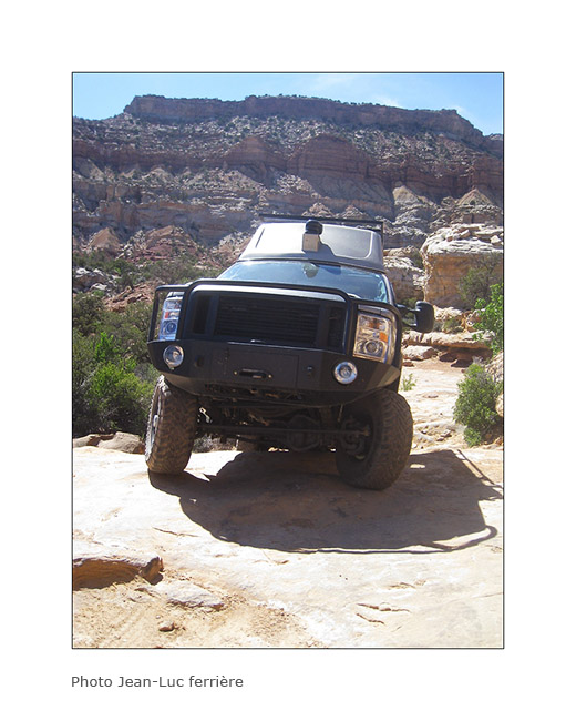
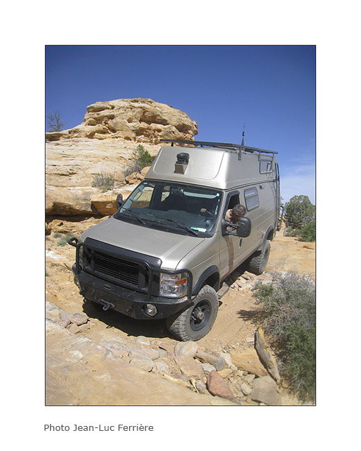
5. Steep hill leaving the arch.
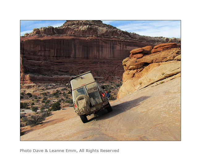
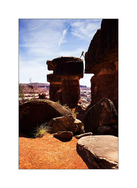
6. It’s like David and Goliath, isn’t it? 😉
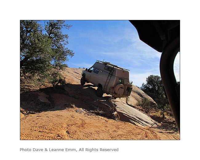
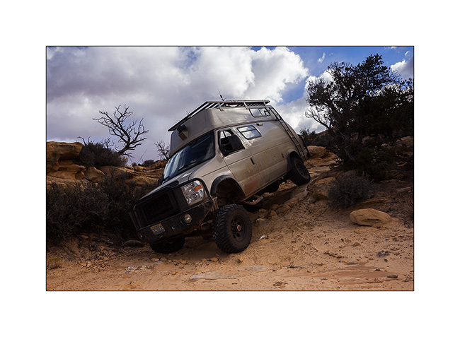
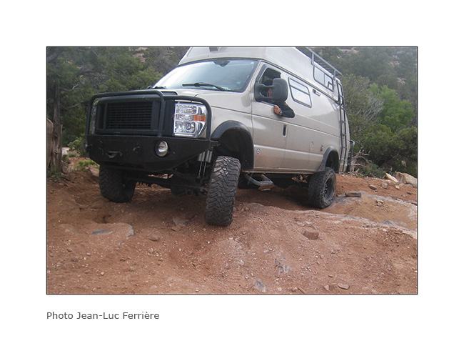
7. Here is Hans spotting me on the step to access to the leaning spot..
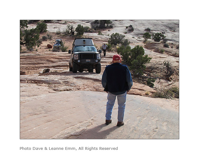
8. It doesn’t seem so but this entry is rather steep, with a good step!
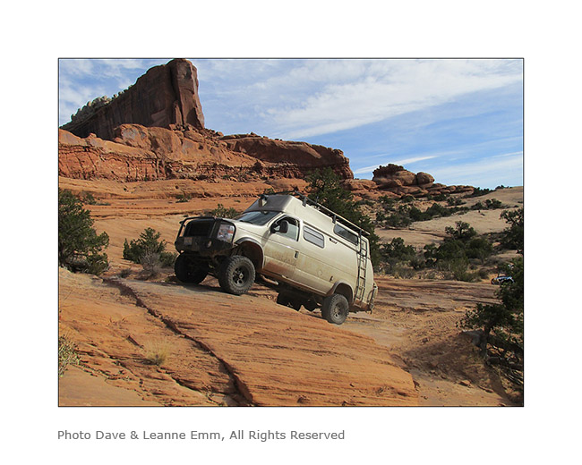
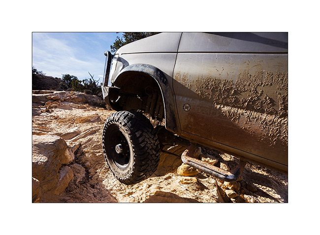
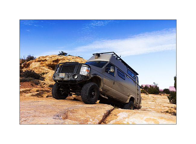
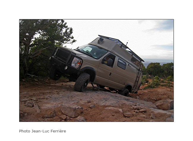
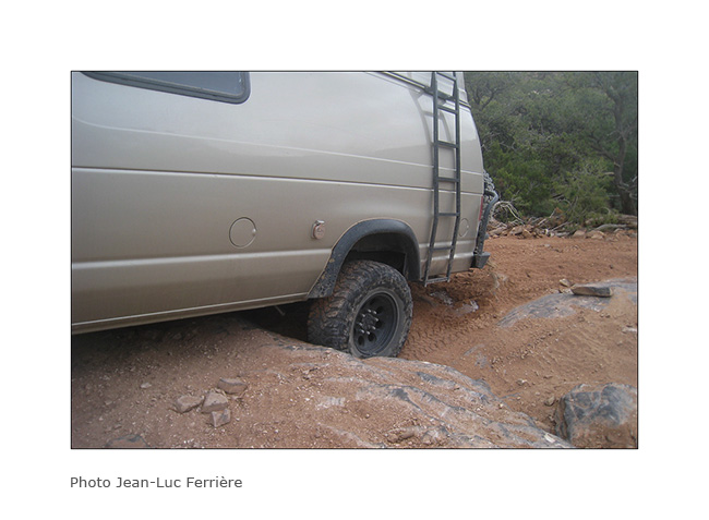
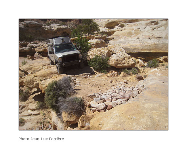
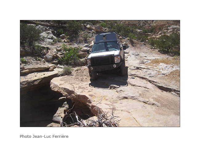
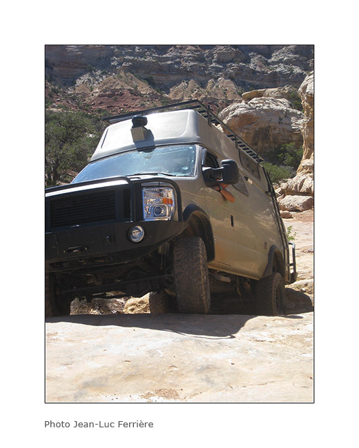
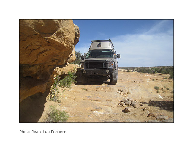
9. and here is the off camber spot. It leans quite a bit despite the left suspension fully inflated and the right one completely down..!
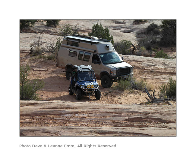
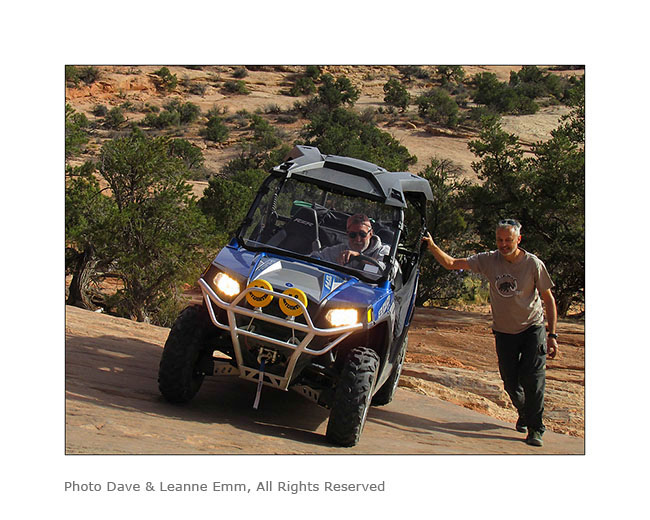
10. After VivaLaVida it’s Dave who goes through in his 50 inches wide only vehicle. I indicated him the line to follow. Well done Dave ! 😀
I want to say a huge thank you to Hans and Madeleine for their so warm welcome. I had such a great time with them. 😉
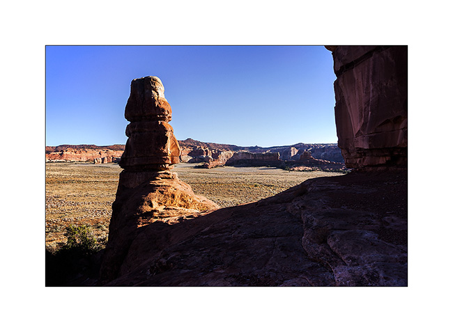
Hans recommended me a spot on the Dome Plateau where I had already spotted a natural arch. Leaving them, VivaLaVida took the path of this view that I discovered the next morning.
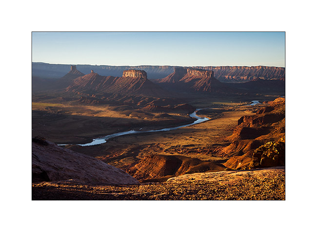
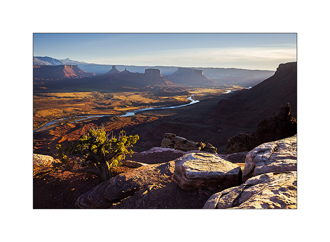
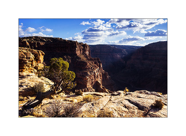
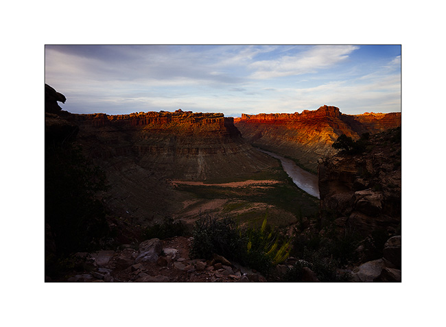
11. Colorado River and Castle Valley in early light…
12. Not far away, I went to discover La Boca Arch, a small pretty massive arch.

13. A bush managed to grow under the arch…
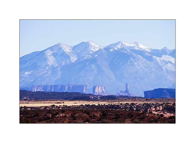
14. Castle Valley towers in front of La Sal Mountains.
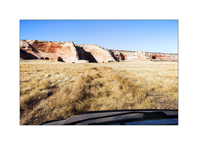
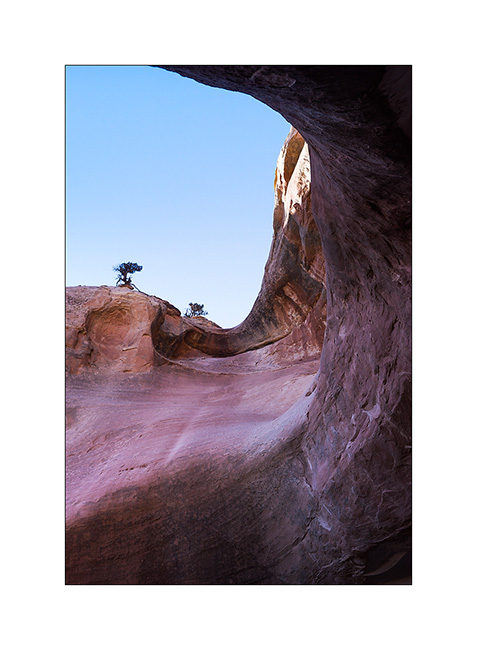
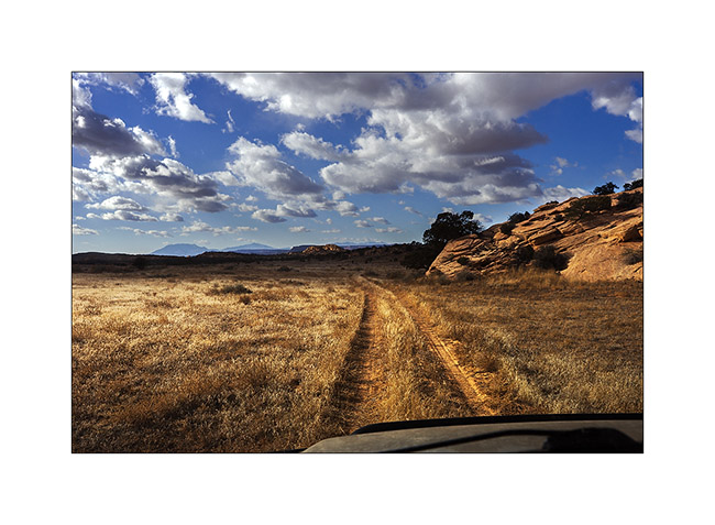
15. On my way to natural shelters, the famous herbs that are seen in Westerns rolled by the wind have almost eliminated the trail… 😉
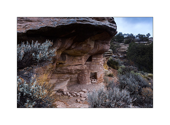
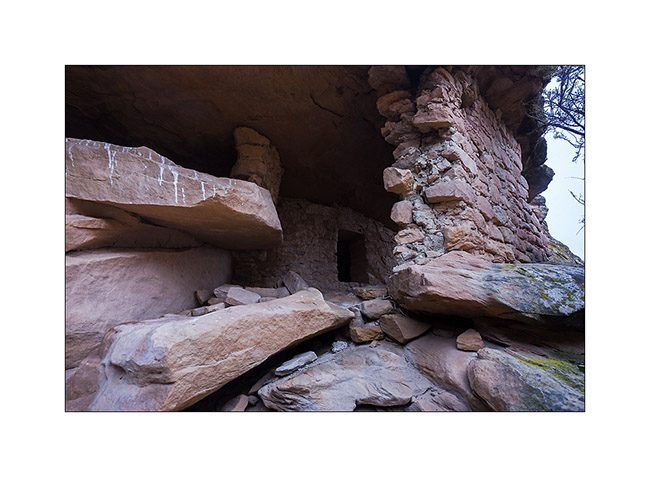
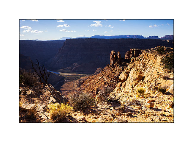
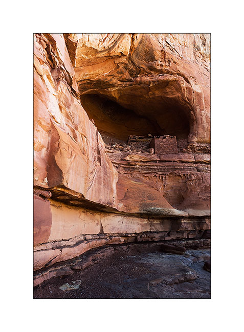
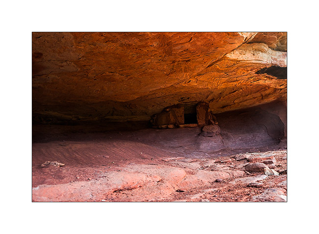
16. Here are sandstone cavities inhabited by Indians several hundreds years ago. One of them houses a source.
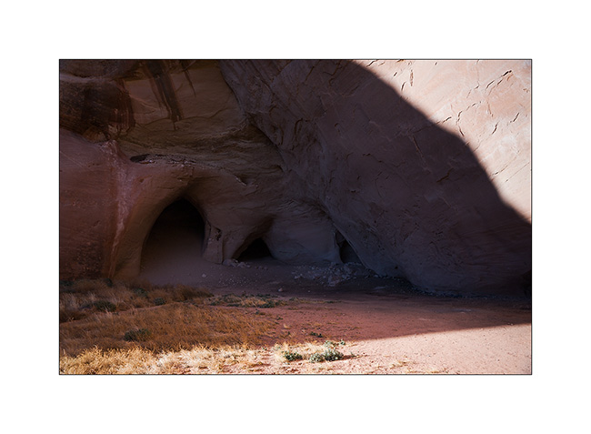
17. The bluff above is polished by the elements.
18. The lower cave is quite deep and some water oozes from the walls in places. The soot of inhabitant’s fires is still present (left of the entrance on this image).
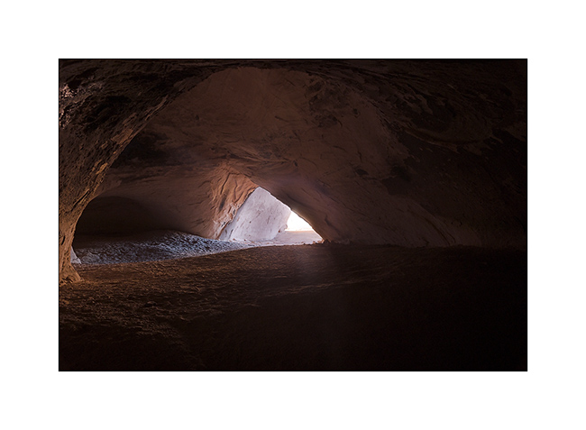
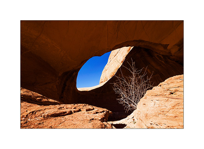
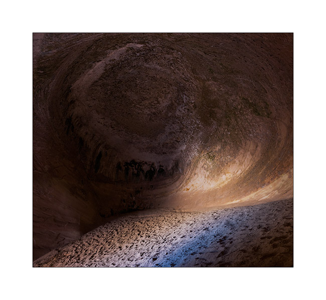
19. The top one’s ceiling is shaped in a quite photogenic circular vault.
20. Back to the overview in late afternoon.
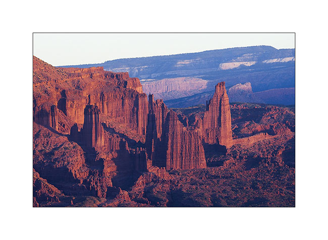
21. Very red material of Fisher Towers is colored by the sunset light.
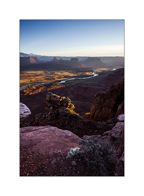
22. Last sunrays over Castle Valley.
More to come soon. Once again, thanks for your loyalty! 😀
Still in Beef Basin…
1. It begins with a blurry picture! 😉 Just to show that it was chilly that morning…
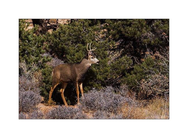
While I was getting ready to break camp, I noticed a young stag who seemed a little nervous. I decided to approach it to try to photograph it.
 
2. After 15 minutes of approach, I crouched beneath a juniper not far.
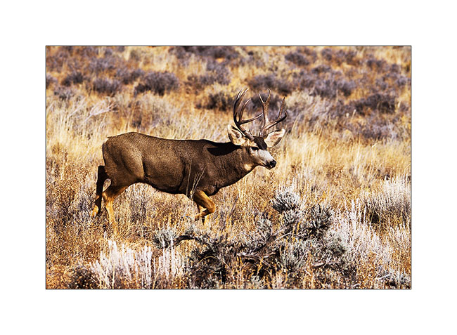
3. Forty minutes later, as I tell myself I’m gonna go back to VivaLaVida, I saw a large male tumbling.
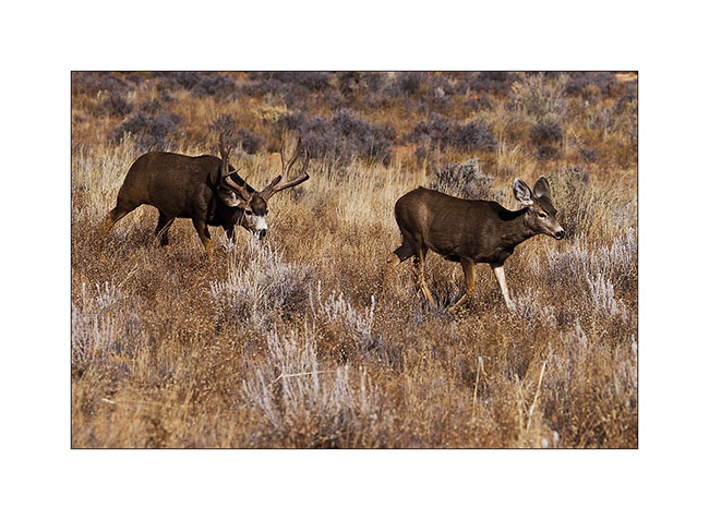
4. In fact, he was folloing a female as it’s the full rutting season. And the female had the good idea to walk fifteen feet in front of me without seeing me!
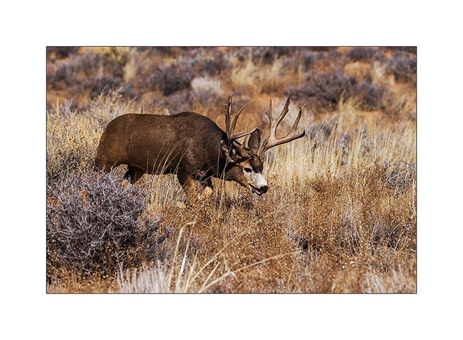
5. What an animal and what a meet… I’ll even get to see a mating the next day, about thirty feet away.
6. VLV have now to drive the trail back…
7. Nice wheel up… 😀
8. … And quite steep downhill.
9. That’s where we’re coming back.
10. On the other side of the Colorado River, Orange Cliffs and Sunset Pass where we slept with Jean-Luc last Spring.
11. Still in Beef Basin, while going down a side canyon to discover a permanent spring, I saw this Indian granary on a cliff.
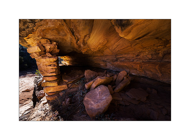
12. I manage to go up the cliff to show you the inside. Both ends have collapsed or have been opened.
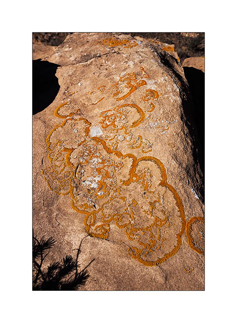
13. A pretty lichens and fungi that can be seen on certain blocks of sandstone.
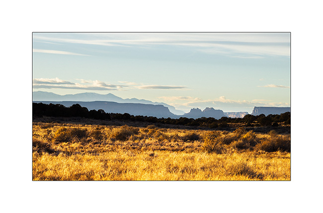
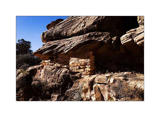
14. Having spotted a very red cliff I went to explore, I had the chance to discover on the way this beautiful Indian granary. It is not on any map and excepted archaeologists who studied the area, few people must have seen it as it is away from everything.
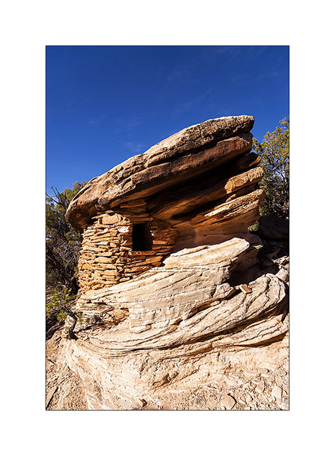
15. This is certainly one of the most aesthetic that I could see to date.

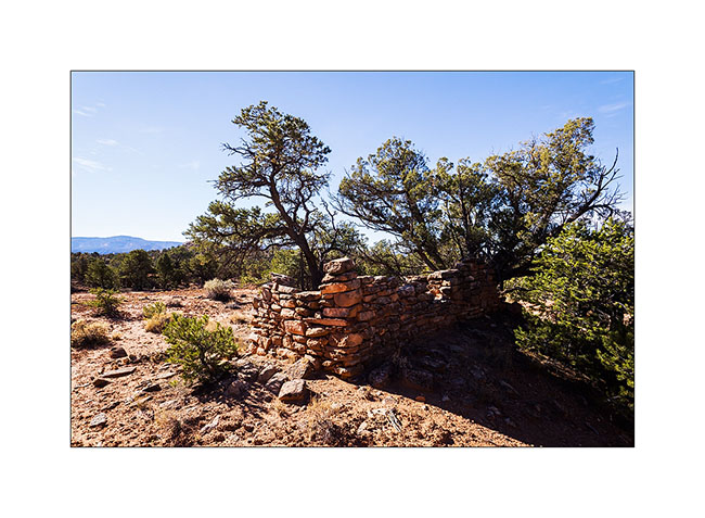
16. Nearby, there are several ruins of houses.
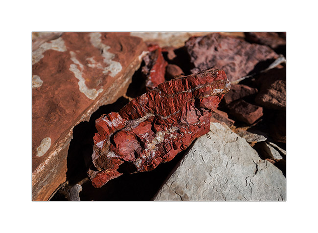
17. The cliff above have a very red layer of the same rock I saw in Fort Bottom called Chert, a kind of silex.
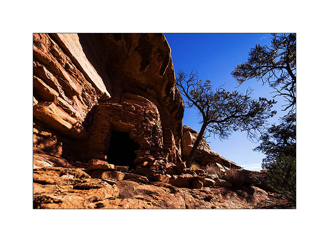
18. And I’m still discovering another granary also almost intact.
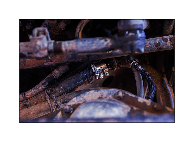
19. Time to leave Beef Basin but on the road, a strong antifreeze smell made me stop. A powerful jet escapes from one of the pipes of the VivaLaVida’s engine preheater!
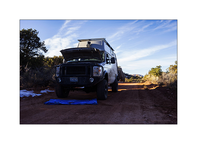
20. Temporary repairs with duck tape and hose clamps. We need to join Moab, a almos 100 miles away…
I will succeed the next morning and replace the pipe in question, which rubbed against a piece of metal because of a broken ziptie. I take this opportunity to do some other small works and replace the heim joints of the sway bar that had taken much of play.
That’s it for my exploration of the beautiful Beef Basin, a place that is worth the trip. See you soon. 😉
Ruins in Beef Basin.
Despite snow announced in the mountains, VivaLaVida headed south of Moab in the Beef Basin, an area which was the wintering place for Atabascan Indians between 2,000 and 700 years ago. It contains many relics like ruins and petroglyphs or petrographs.
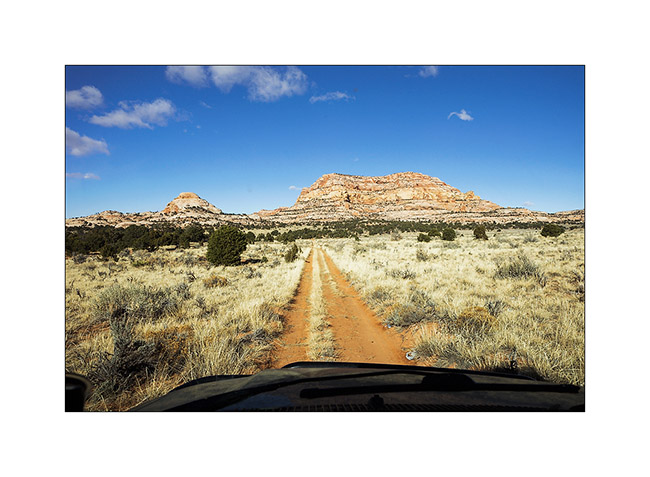
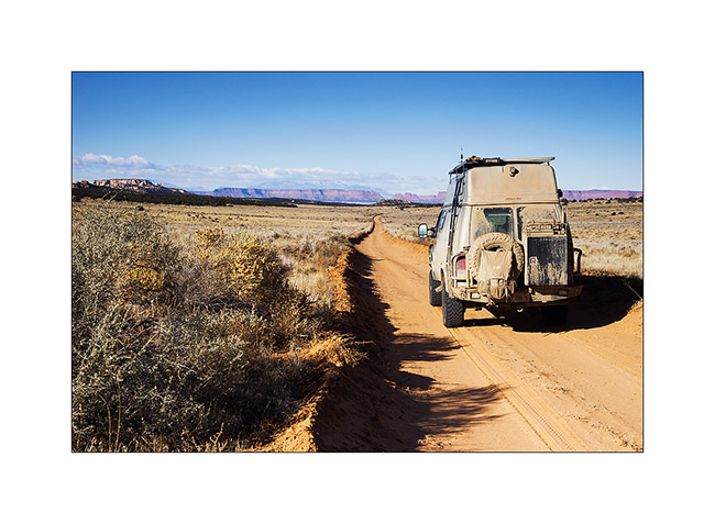
1. Some tracks that VLV borrows are not hardly frequented…
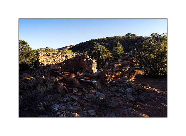
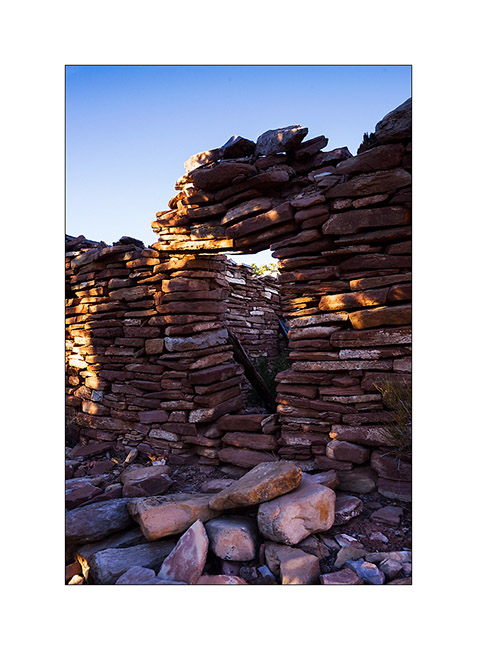
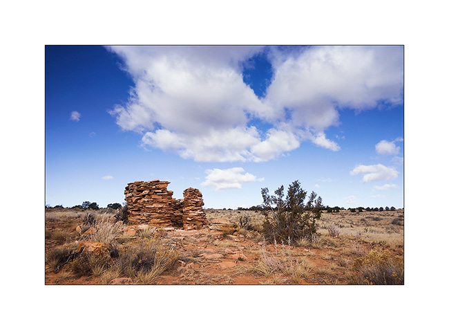
2. Here is a first ruin Southwest of Beef Basin. It dates from the end of the period, about 700 years ago; its rectangular shape attests.
3. Remains a doorway of which the covered stays by the force of the Holy Spirit..!
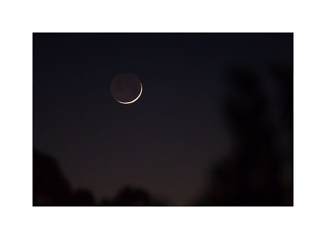
4. First day after the black moon…
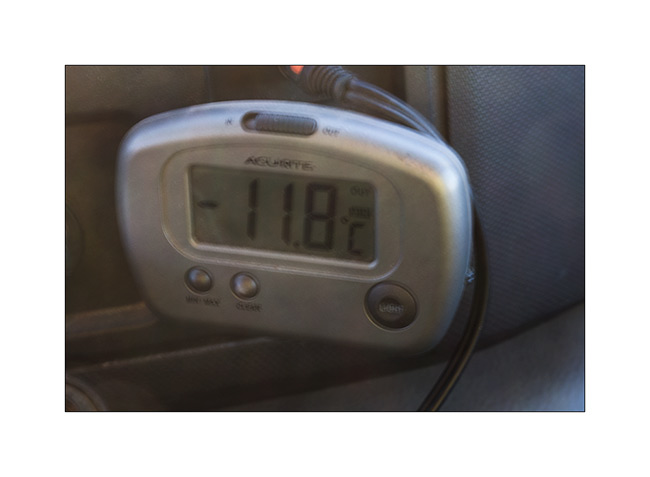
5. As it was already 24F around 7 PM, I cooked a good vegetables stew to warm me up!

6. Arrival in the grasslands of Beef Basin.You cannot see it but it was 20F when I took this picture.
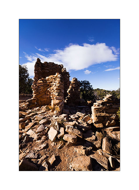
7. The most well known ruin as it’s close to the trail. An ancient tower which there remains a wall angle.
8. Further away, here’s a small round tower.
9. After a short walk, I arrive to one of the best preserved ruins of those I had spotted the coordinates. There are still two windows intact.
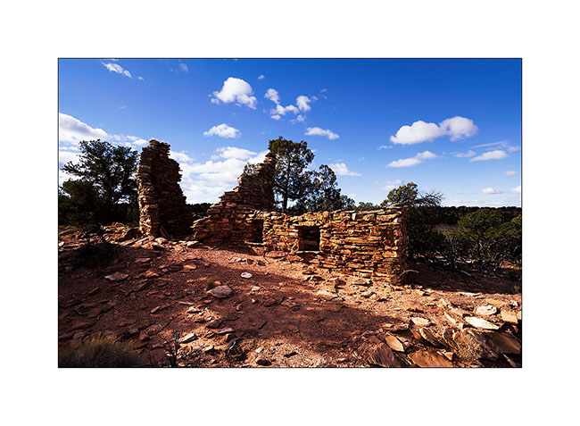
10. There is also still the mud to stanch the walls.

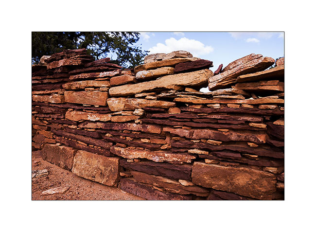
11. Wall details.
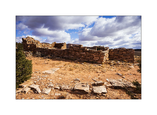
12. Here is a community farm, larger, with different rooms.
13. I decided to lead VivaLaVida to a promontory above Gypsum Cayon, with a rather chaotic trail.
14. Fortunately is wheel travel huge!
15. Approaching the end of the trail, the prairie stretches before us again.
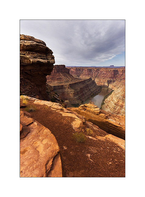
16. The mouth of Gypsum Canyon on the Colorado River.
17. Gypsum Canyon deep, inaccessible from here.
A nice meeting to tell you in the next update. 😉
Back in Utah
I met Nick and Kim in Moab. I met Nick in North Carolina. He also owns a Ford van, two-wheel drive and shorter than VivaLaVida but well equipped for two. He’s traveling for two and a half weeks with his friend Kim who discovers the West for the first time.
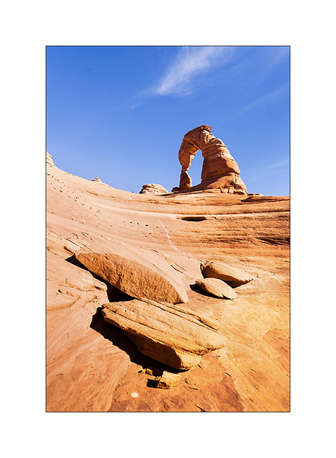
1. We spent the first day in Arches National Park, the opportunity to make an image a little different from Delicate Arch while every picture has been done on the site, one of the most photographed of Utah.
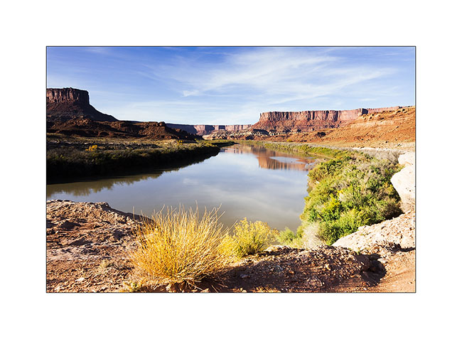
2. The next day, Nick rented a jeep to travel the White Rim Trail, a 100 miles trail that runs north of the Colorado first, then the Green River.
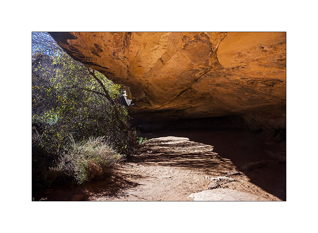
3. Having to wait four days to service VLV, I got back to the Needles, probably my favorite place in Canyonsland NP. I went to see Cave Spring inhabited by the Anasazi Indians from 7,600 years BC.
4. Petrograph in Cave Spring
5. The famous hands of Cave Spring.
6. On the way to Tour Ruins, another spot I discovered.
7. I first discovered granaries on the cliffs.
8. Here is the tower which gave its name to the ruins…
9. Here is the ruin, surprisingly well preserved. It was a dwelling place for the summer season.
10. I went to sleep above the Colorado and enjoyed the viewpoint the next morning.
11. The track to get back is quite interesting by place.
12. Axle crossing.
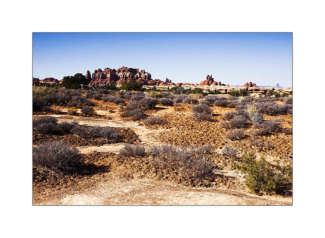
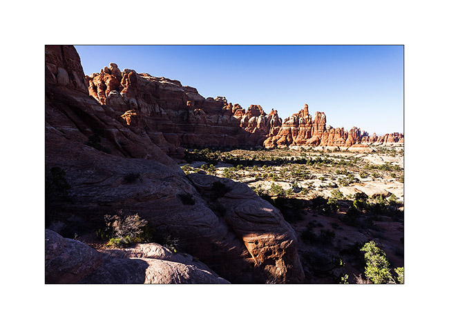
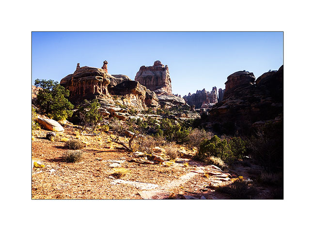
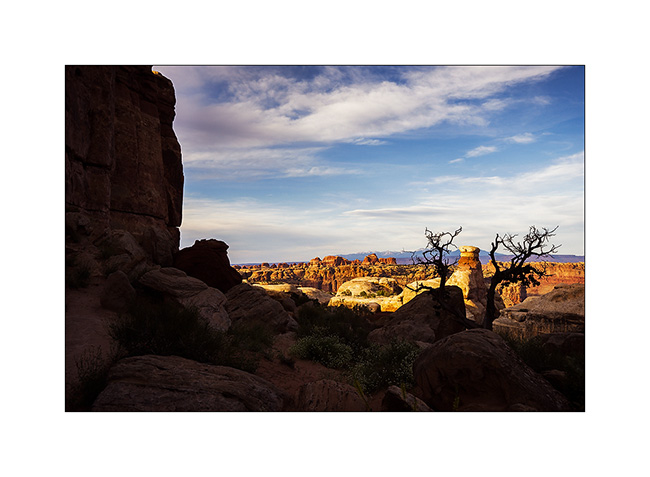
13. In the afternoon, I returned to Chesler Park, a beautiful place.
14. One of the canyons we cross to get there.
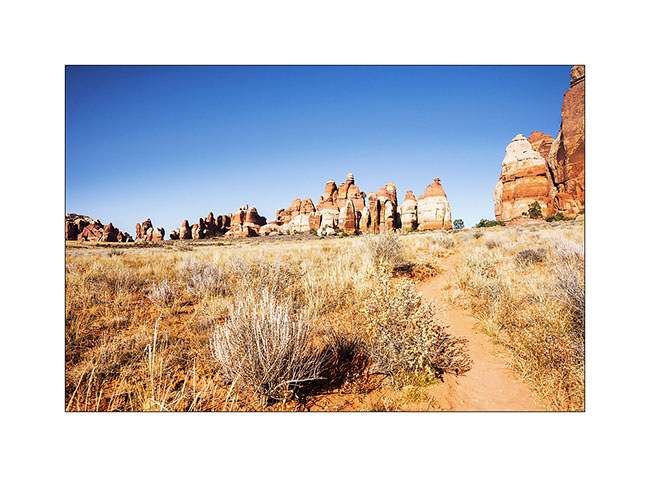
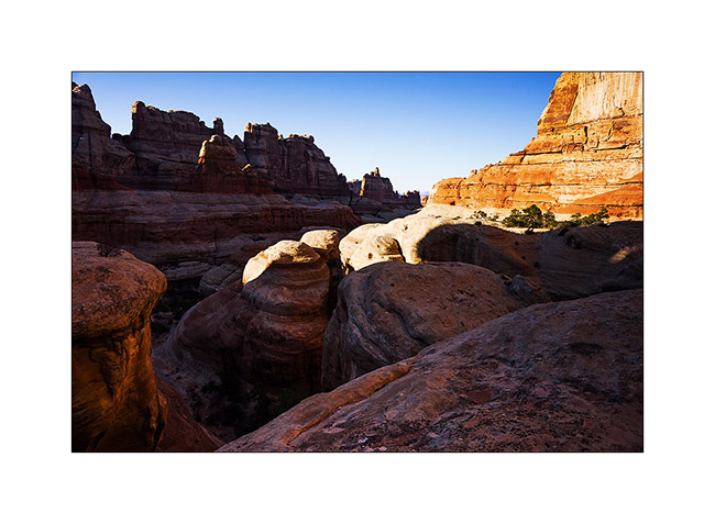
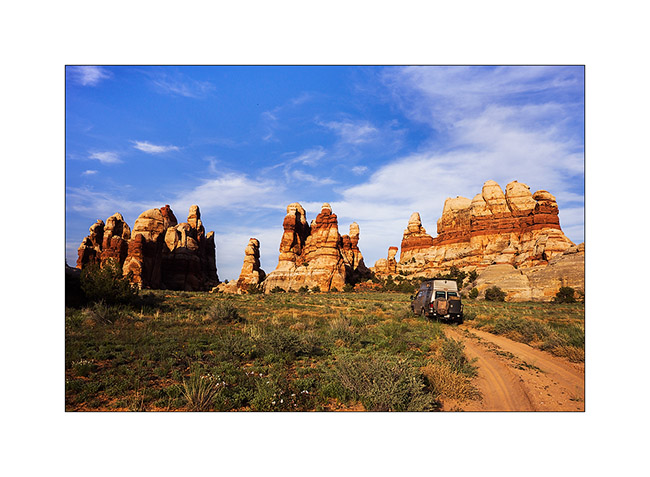
15. I approach the famous Needles.
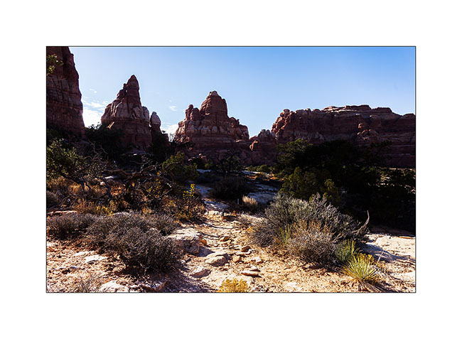
16. And here I am in Chesler Park.
17. The south side is a beautiful meadow that makes me want to camp there.
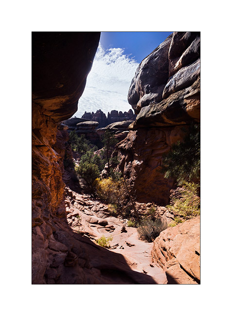
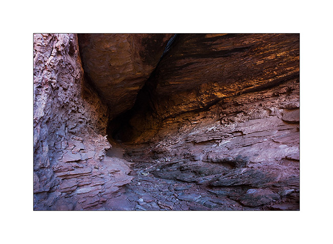
18. In a side canyon to Elephant Canyon, I discovered this fault created by erosion.
19. It’s late but I go up the Elephant Canyon to find a nice arch.
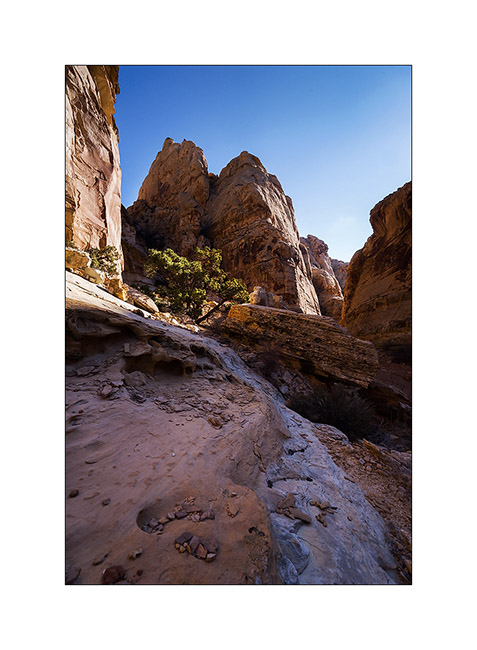
20. Small tree in the cliffs…
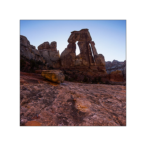
21. After almost running at full speed, here is Druid Arch, a rather unusual double arch.
22. I’m still at the top of Elephant Canyon and I must go down without delay to reach the Trailhead before nightfall, 6.5 miles away.
I reached VivaLaVida at nightfall, a little tired after more than 14 miles on quite uneven terrain.
Some other spots discovered in Utah to come soon…
Grand Lac Salé encore & Sud de l’Idaho
Après plus d’une semaine à Salt Lake City sans parvenir à vraiment résoudre les soucis de chauffe de VivaLaVida, j’ai repris la route en commençant par contourner le Grand Lac Salé par l’ouest…
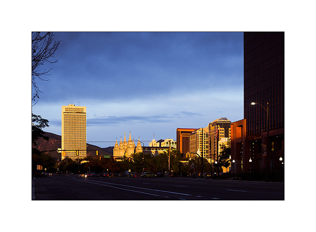
1. Derniers rayons sur le Temple Mormond de Salt Lake City.
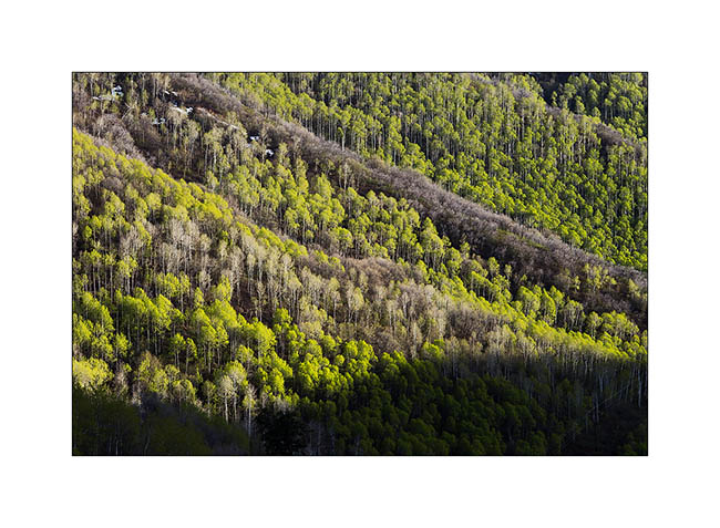
2. Les feuilles fraichement sorties des trembles sont d’un vert tendre magnifique…
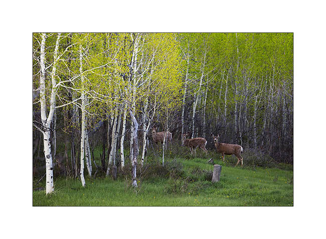
3. Cerfs attentifs à ma présence.
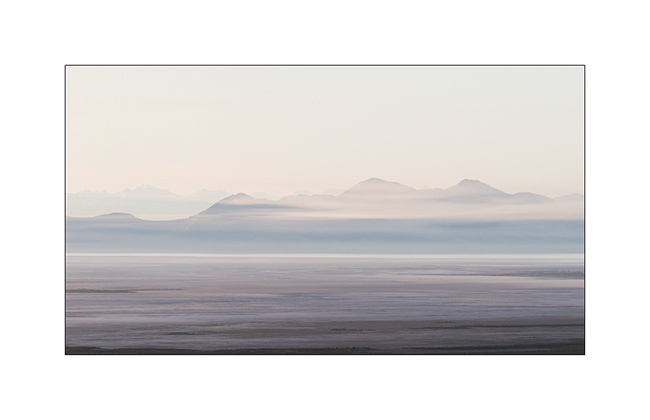
4. Petit matin.
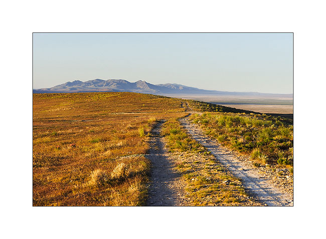
5. J’ai dormi à même la piste.
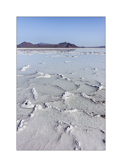
6. J’arrive à Bonneville Flat dont certaines parties sont encore sous l’eau.

7. Concrétions de sel…
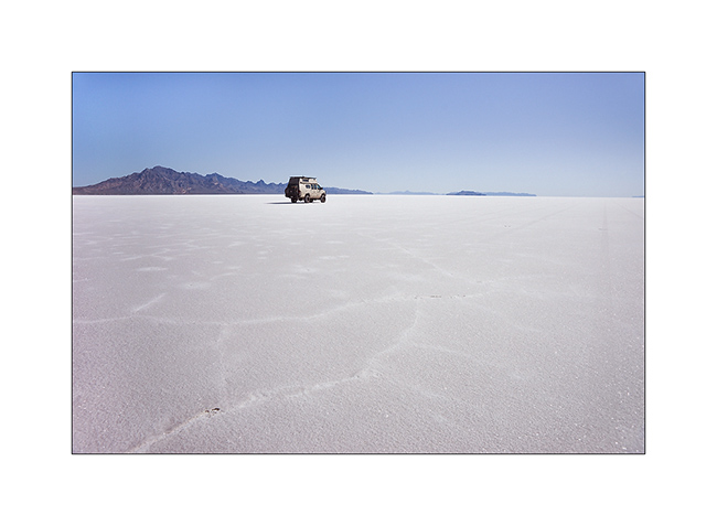
8. VivaLaVida sur la célèbre piste de vitesse où bon nombre de records de vitesse ont été établis ou battus.
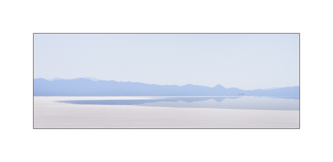
9. Estampe monochrome ou presque…
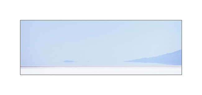
10. Minimalisme ultime…
11. VivaLaVida emprunte une voie de chemin de fer du 19ème siècle…
12. Une petite arche naturelle dite “des Chinois”.

Je suis ensuite passé en Idaho en allant visiter la City of Rocks, un lieu surprenant.
13. Première piste en Idaho.
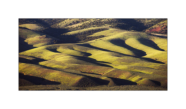
14. Lumière rasante sur des collines érodées.
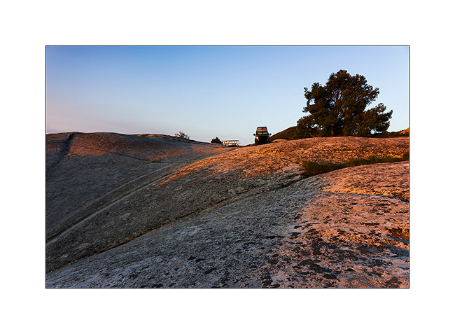
15. Campement à même le granite de City of Rocks.
16. Petite arche sans nom au levant.
17. Après deux bonnes heures sur la selle, la vue est immense…
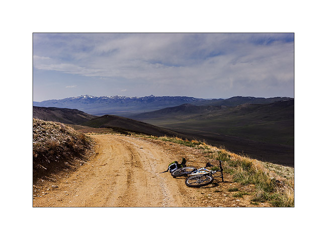
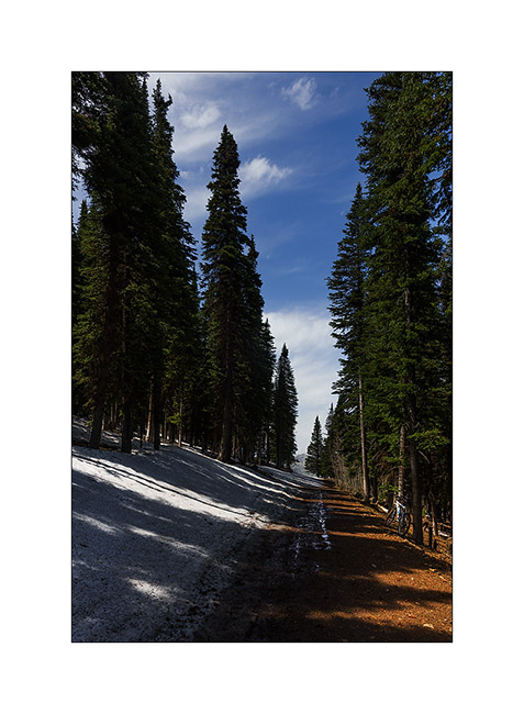
18. … mais je suis arrêté par la neige !
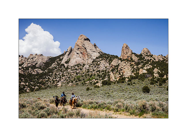
19. Le granite de City of Rocks est superbe ! C’est un haut lieu de grimpe, avec plus de 140 voies répertoriées.
20. Ferme traditionnelle.
Suite de mon périple en Idaho à venir bientôt… 😀
Maze Disctrict of Canyonsland NP & Moab area
The next day we decided to walk to the confluence of the Green River and Colorado River, north of Doll House.
1. Along the trail.
2. Some areas are full of flowers.
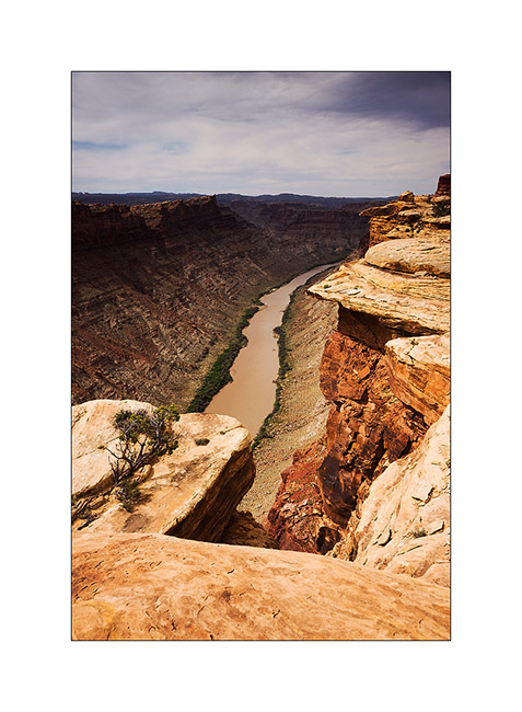
3. Colorado River 1000 feet below.
4. Jean-Luc saw him just before to walk on!
5. Using the Flint Trail to go up on the plateau, some switchbacks were really narrow, requiring maneuver. what an initiative to have drawn a road in such a steep slope!
6. We slept on the plateau…
7. … and saw a gorgious sunset.
8. We joined the Horseshoe Canyon to discover cave petrographs. Huge overhang! Can you see Jean-Luc ..? 😉
9. Panoramic picture from the bottom of it.
10. The “Great Gallery”.
11. Surprising painting…
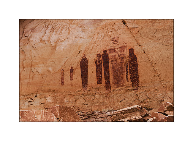
12. … so varied.
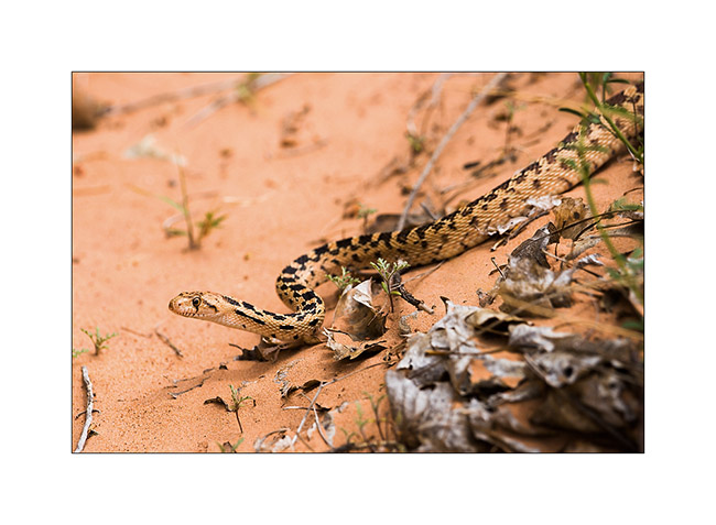
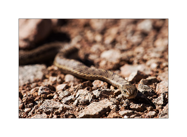
13. Going down the canyon, we saw this beautiful snake (about four feet long), an enemy of rattlesnakes he kills by constriction.
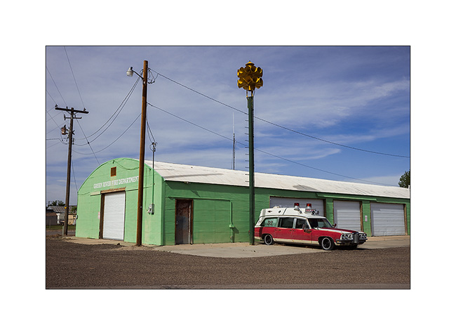
14. At Green River UT…
15. Further, a short stop to Crystal Geiser…
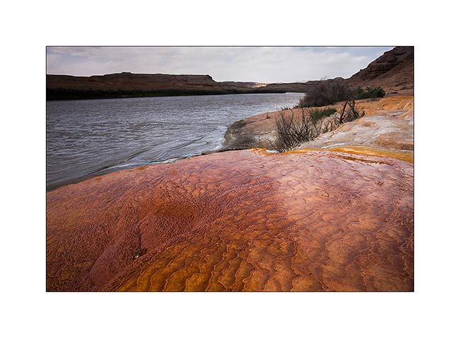
16. Saturated colors!
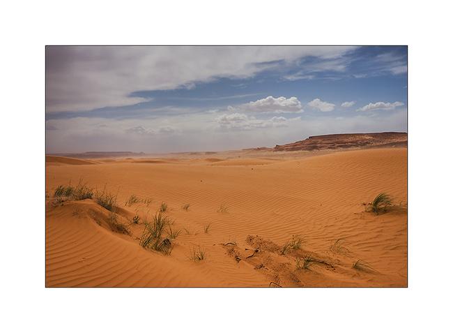
17. Detour through a smal erg of orange dunes.
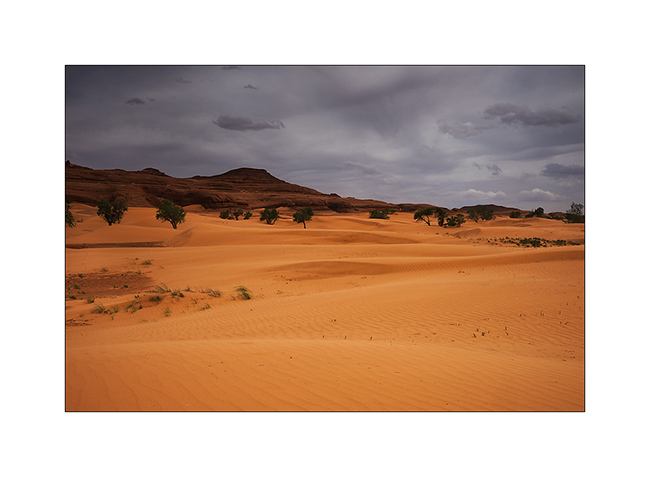
18. But the sand Wind will force us to go away.
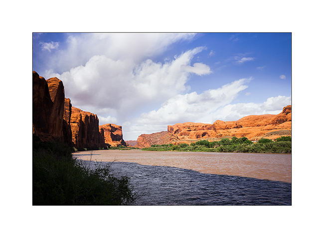
19. Colorado River near Moab.
The next day we joined a place called “Top of the World” by another quite rockcrawling track! Here are some images of Vivalavida in action since I had a photographer there. 😉
20. Steep hill…
21. Here, both lockers were necessary! 😀
22. big step.
23. Axle crossing.

24. Where is the best way to go..?

25. There! 😀
26. The Sunset was gorgious on this promontory!

27. Jean-Luc over tausend feet emptyness..!
28. A panoramic picture to finish this update…
The next update will bring you to the Great Salt Lake, the last place we wisited with Jean-Luc who then flew back. To come soon.
Henry Mountains & Maze District of Canyonsland NP
Since Jean-Luc decided to take a domestic flight from Salt Lake City to join his international flight to San Francisco, it left us more time to explore Utah. We visited western Canyonsland National Park we reached by crossing the Henry Mountains.
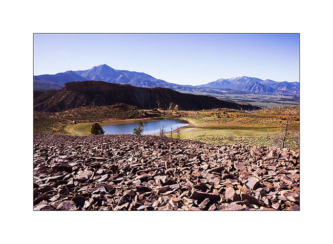
1. Stop for the night at Bastion Reservoir, at about 7,000 feet elevation.
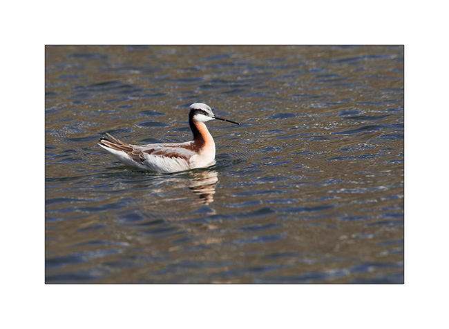
2. Jean-Luc spotted Wilson’s phalarope, an unexpected bird in this region.
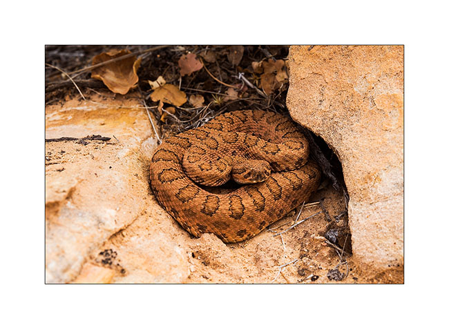
3. I saw this snake without being able to identify it.
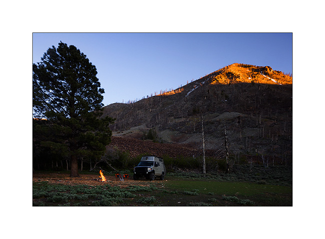
4. Campfire under the top that Jean-Luc climbed.
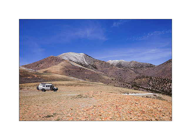
5. Down from Mount Helen, the culmination of Henry Mountains.
6. After going refueling in Hanksville, a really remote and depressed corner, we followed a long path to reach the Maze Overlook, first taking the Devil’s Canyon road.
7. Water crossing of the Devil’s River.
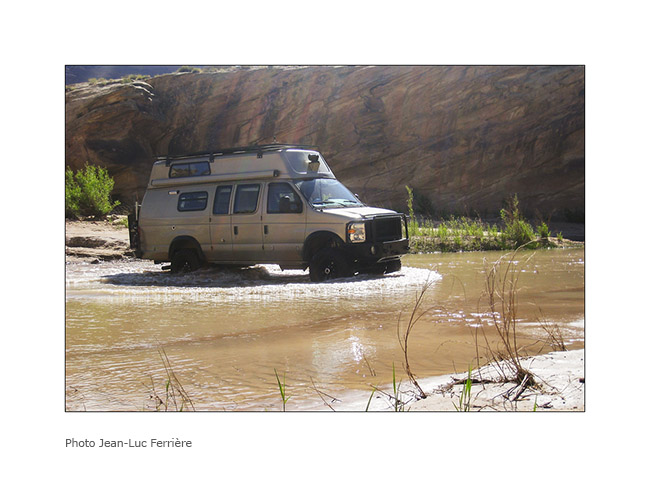
8. On the other side of the river.
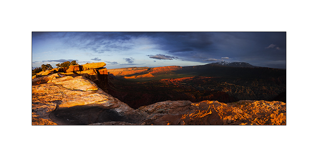
9. The track is rugher I imagined and we slept at the Sunset Pass…
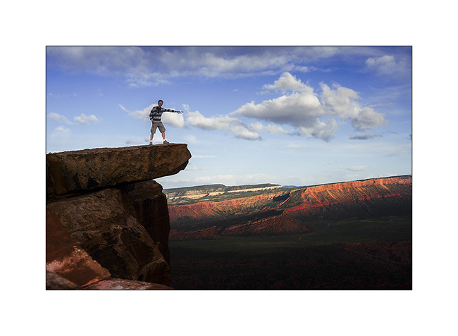
10. VivaLaVida over a huge overhang!
11. My acrobat brother at Maze Overlook. 😉
We then decided to join the Doll House and it took us no less than 6 hours to reach on a track probabliy the most difficult Vivalavida has traveled so far … Here are some pictures to illustrate this incredible journey.
12. Driving on the rock.
13. Sometimes overhanging.
14. It goes steep up…
15. … then down.
16. Big step.
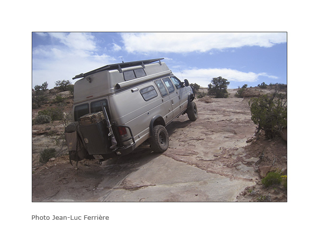
17. It leans sometimes too…
18. It’s sometimes narrow…
19. … or tight!
20. We will end up to arrive first at Standing Rock…
21. … then the beautiful Doll House that reminds me of the Needles, on the other side of Colorado.
22. We were Lucky to get a camp place just in the middle of Doolhouse ad this is the view we had at sunset;-)
23. Last rays on the Colorado River.
24. Indian granary well protected under an overhang of sndstone.
25. Trail at dusk in the mid of needles…
To be continued…
 D5 Creation