snow
now browsing by tag
Fall holidays (1)
As Emile is on vacation with me for a week, we decide to go enjoying the fall colors without traveling too far since we only have 5 days to travel. The destination will be the Hautes-Alpes, between France and Italy.
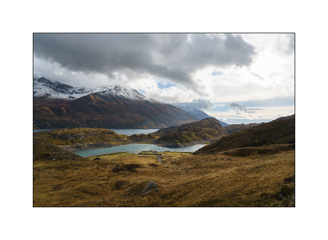
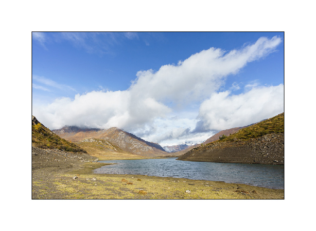
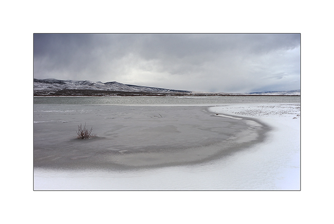
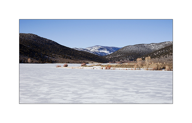
1. After half a day on the road, we arrive in the Mont-Cenis region and its lake at the end of the day.
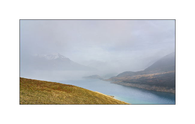
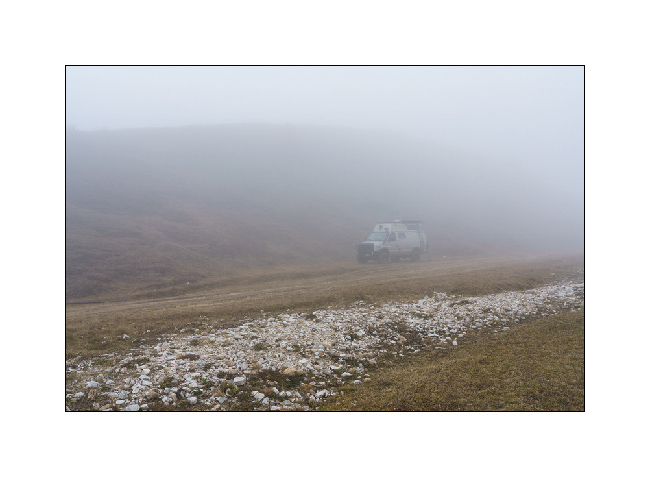
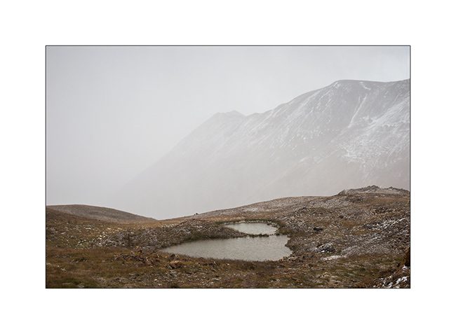
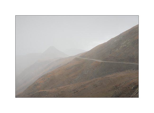
2. While the weather is fine all along the road, the east wind blows fog from Italy which gradually rises, enveloping VivaLaVida.
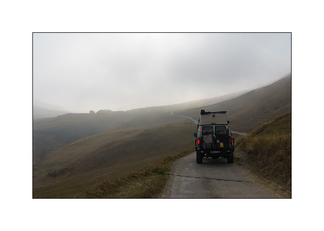
3. Climbing up to 2,200 m, we have time to make a shot hike outside the nimbuses.
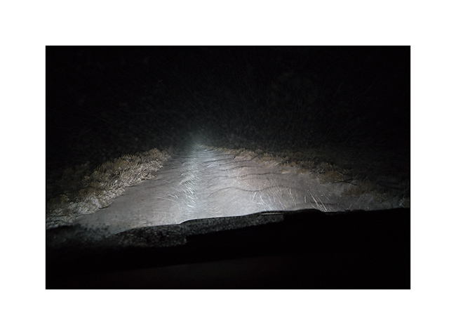
4. But half an hour later, the fog catches up with us.
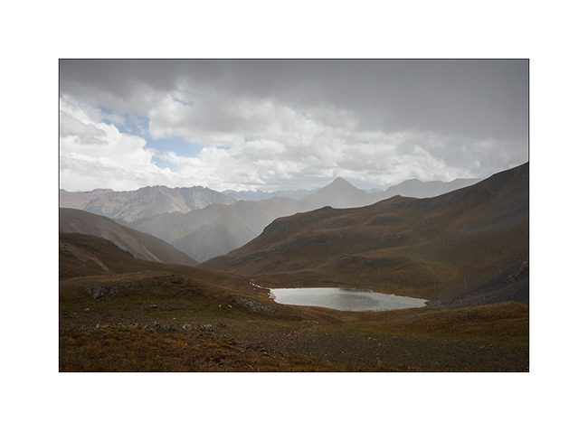
5. The time to find a boondocking site for the night and we are isolated by the clouds for a quiet but cool night.
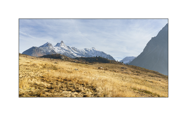
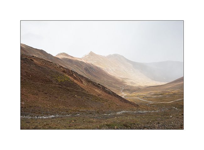
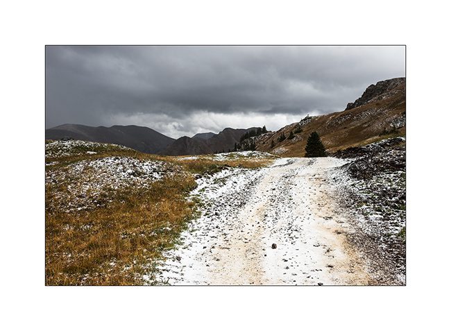
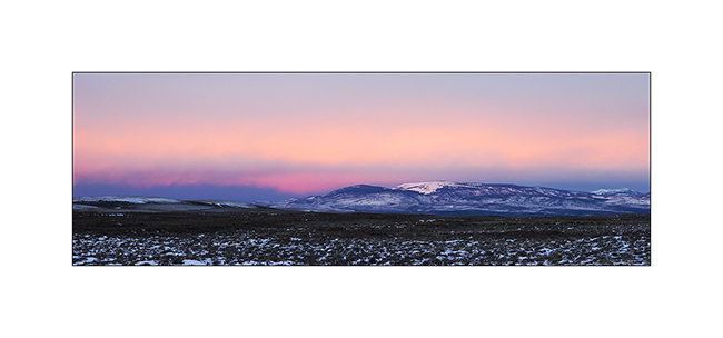
6. The disturbance of the night removed the fog and nicely sprinkled summits with fresh snow.
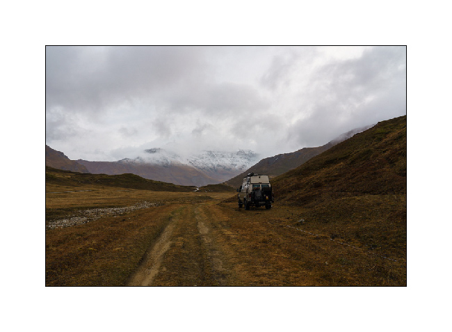
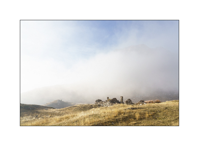
7. A few openings in the couds let in the light…
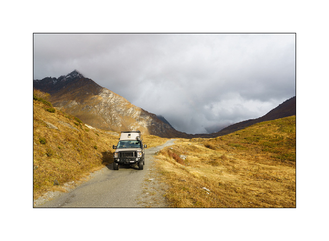
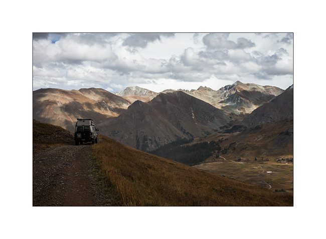
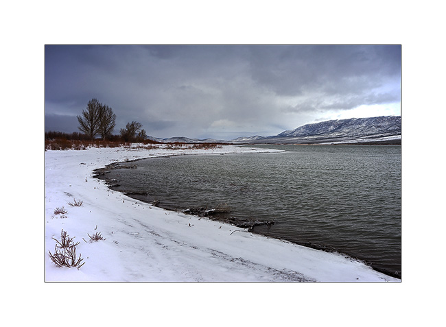
8. … and VLV takes the trail again to reach the lake.
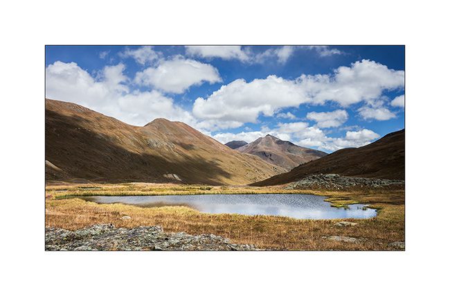
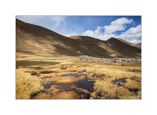
9. We take the trail that goes West of the lake…
10. … trail that we couldn’t drive in July, a barrier now blocking access from July 1st to September 15.
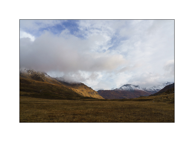
11. The showers follow one another and the wind is still blowing strong.
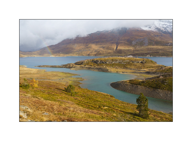
12. But we anyway go for a walk by the lake, just to play with Emile and, for me, to look for some picture composition.
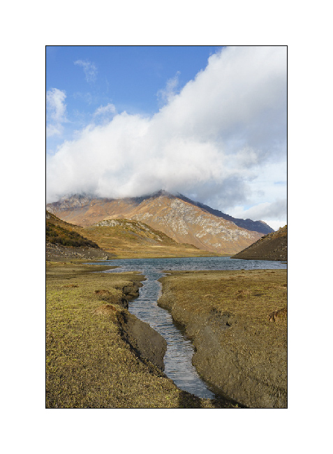
13. …
The continuation of the story in a few days…
Highlands I – F26 / F910
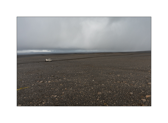
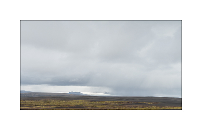
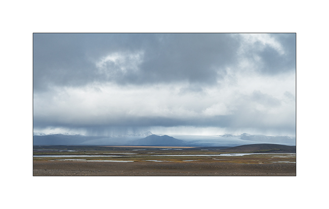
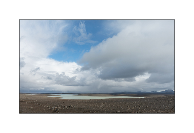
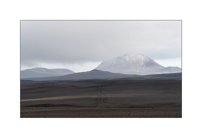
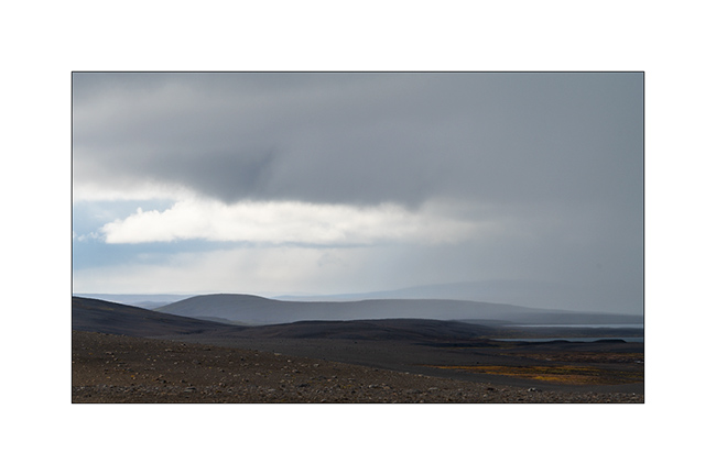
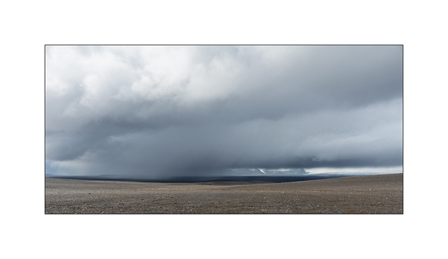
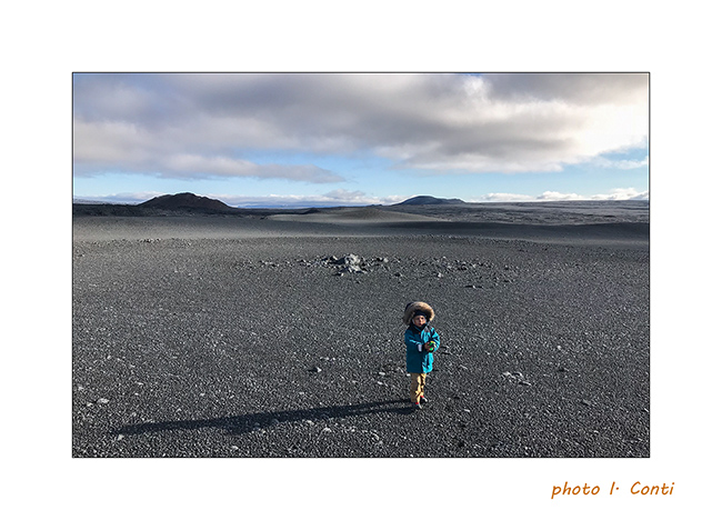
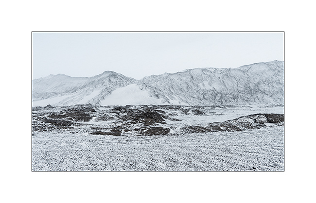
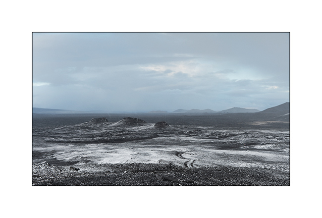
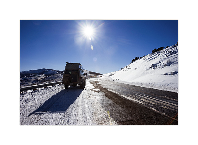
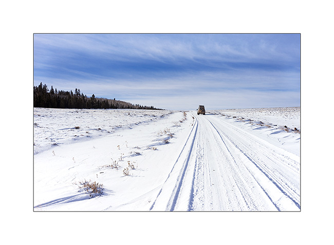
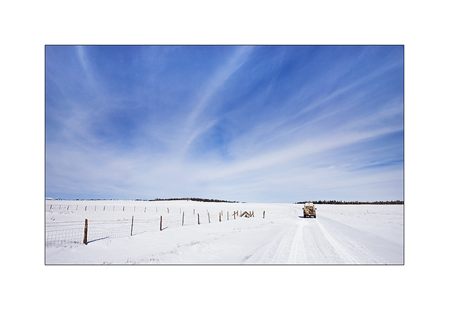
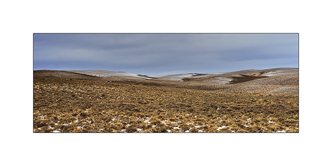
1. After refueling VivaLaVida (with about 10$ a gallon of diesel, it’s more than 400$.- to fill VLV!), we begin the crossing of the Highlands to the Northeast via the F26 road then the F910 which passes north of Vatnajökull.
2. We took two days to reach the site of Askja through beautiful and immense landscapes.
3. …
4. …
5. …
6. …
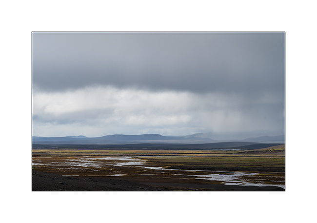
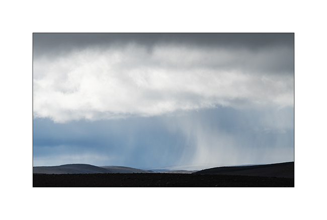
7. Giboulée…
8. Notre piste…
9. …
10. …
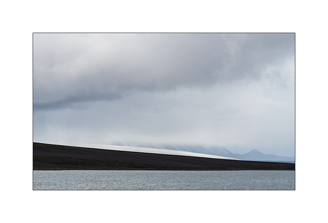
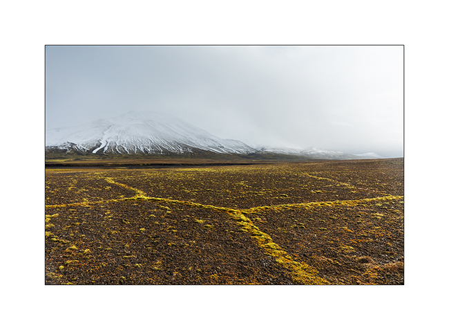
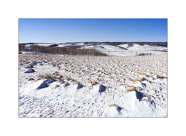
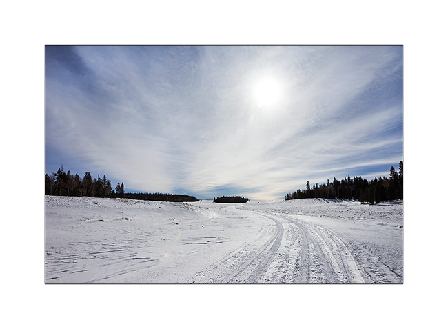
11. After about 150 miles exclusively mineral, we found some vegetal colors again…
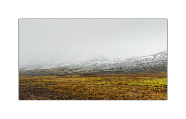
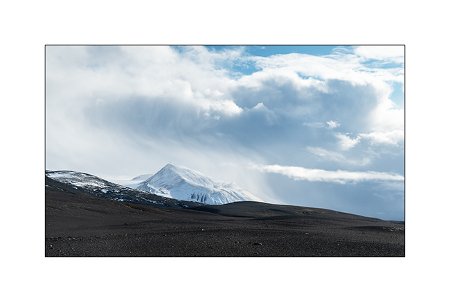
12. At 2400 feet elevation, snow is close.
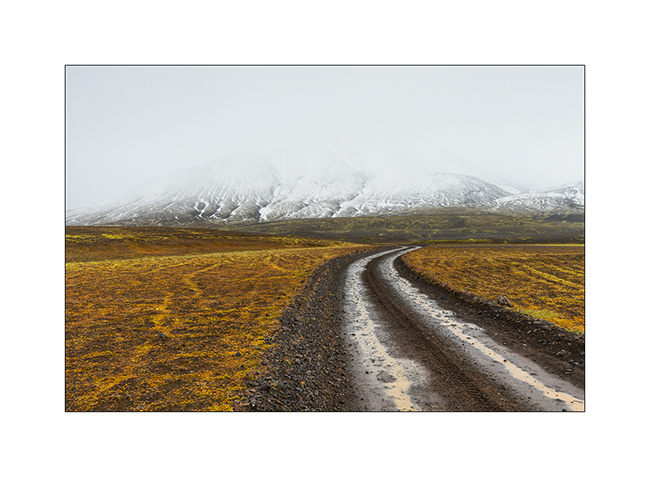
13. Moss grows along furrows carved by surface water, forming geometric shapes.
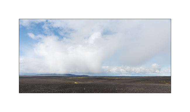
14. The sky ends up opening to the north.
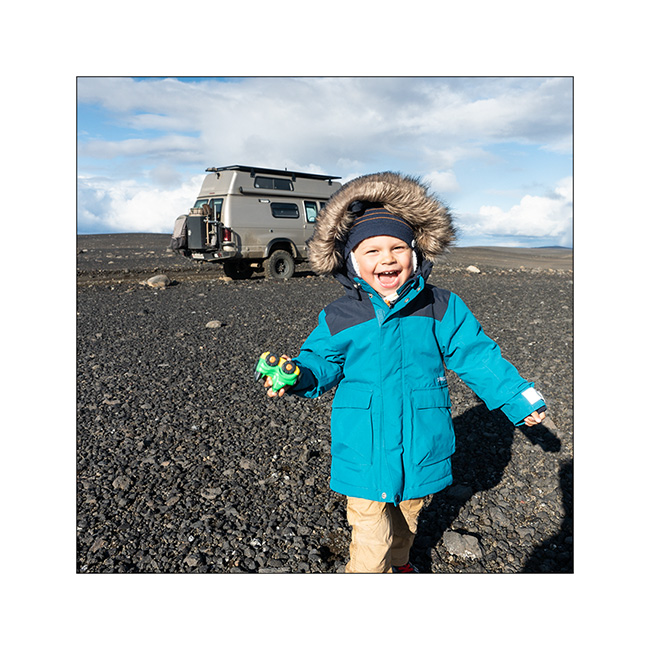
15. The opportunity for Emile to stretch his legs! 😉
16. …
17. …
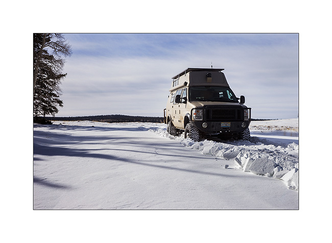
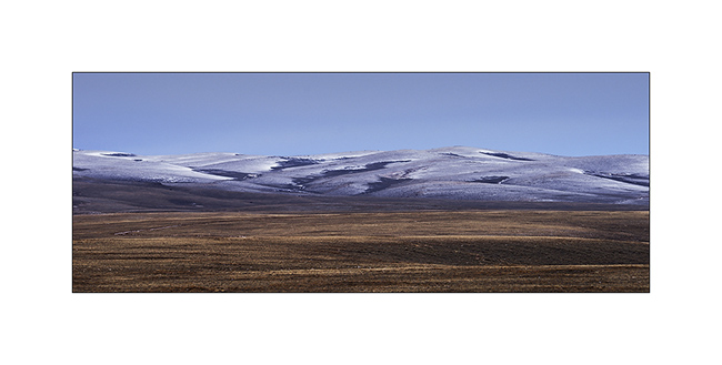
18. As we borrow the Southern variant of F910, as we gain altitude, the weather decays and the snow quickly covers the lava.
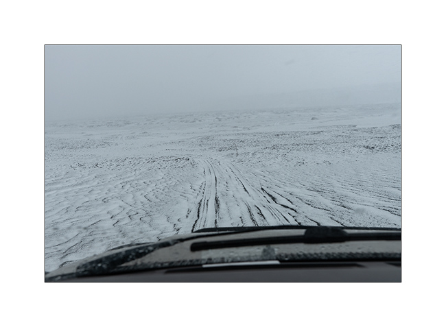
19. While snowing, VLV is the only color note of this landscape.
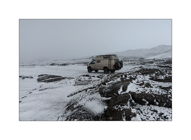
20. Naturally monochrome landscape.
21. …
We spend a cold night not far from the Kistufell refuge, near the Northern end of the VatnaJökull.
Continuation of VivaLaVida’s journey soon! Thank you for your loyalty.
Valaisan getaway and… Happy New Year 2018 !
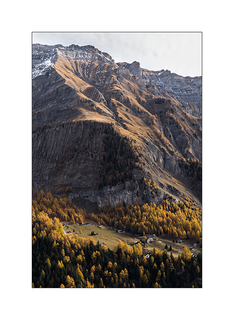
In early November, we went to make VivaLaVida discover some corners of the Valais, an Alpine canton of Switzerland.
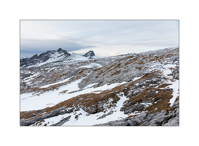
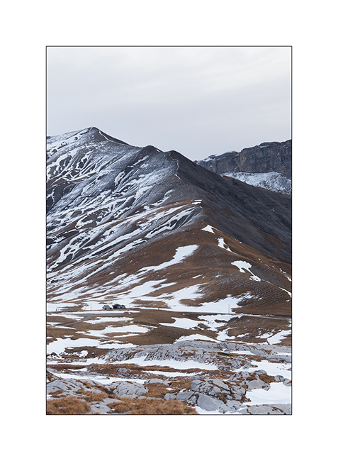
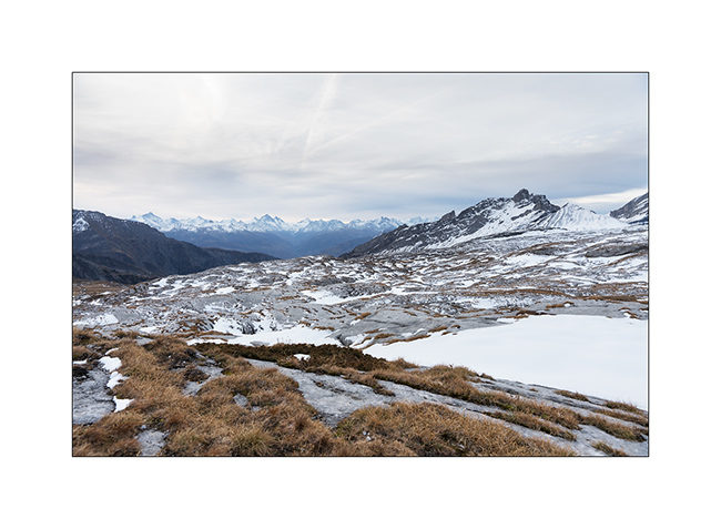
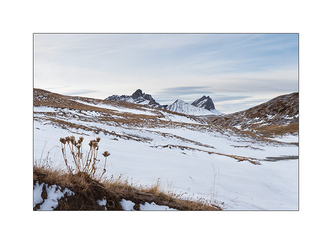
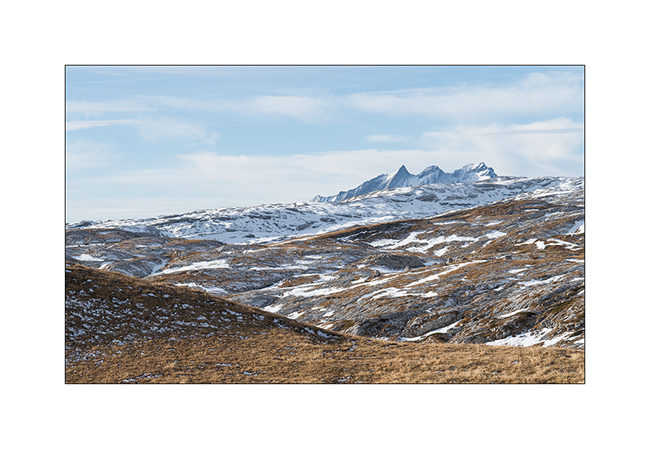
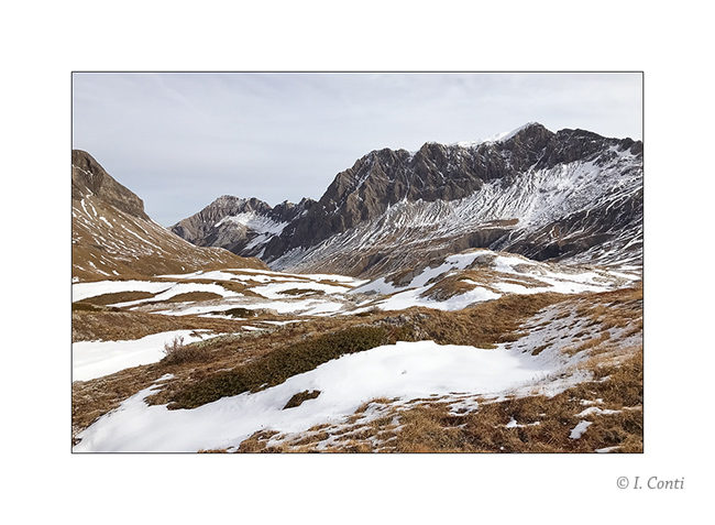
Departure for the Santesch Pass, at 7’200 feet elevation, and its splendid lapiaz. The recent snow stopped our way at the pass, beautiful snowdrifts cutting the road down to Lake Senin.
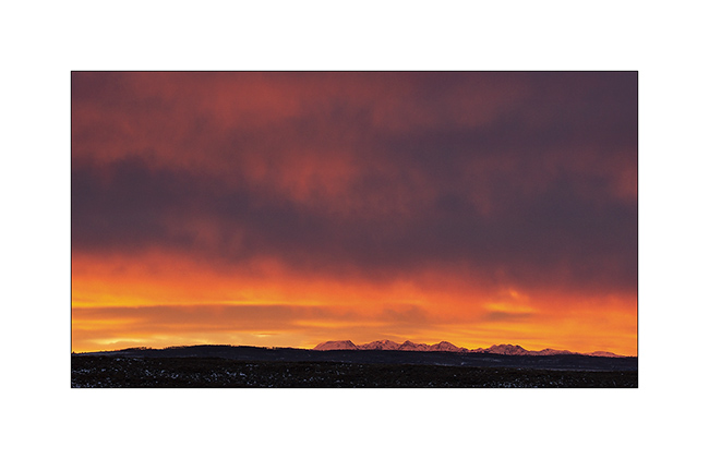
1. Sunrise without many colors…
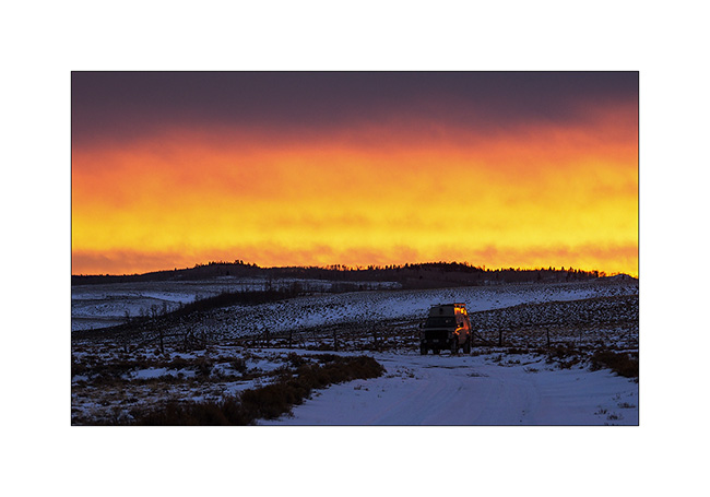
2. VivaLaVida at the pass, where we slept.
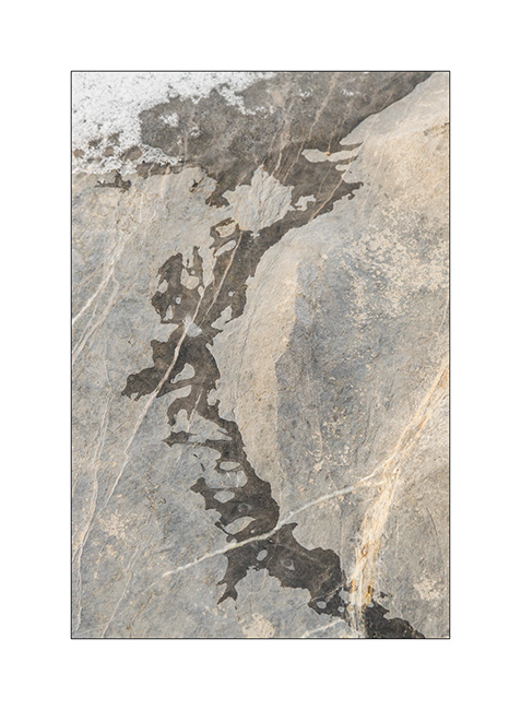
3. Eis on limestone.
4. View to the South over great alpine peaks: Dent Blanche (White Tooth), Matterhorn, Zinal Rothorn, Obergabelhorn, Dent d’Hérens (Herens Tooth)…
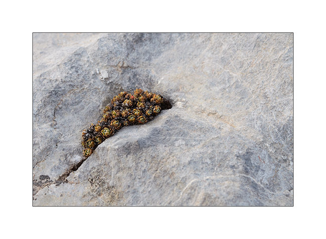
5. Life clings…
6. First snow left patchworks on the screes…
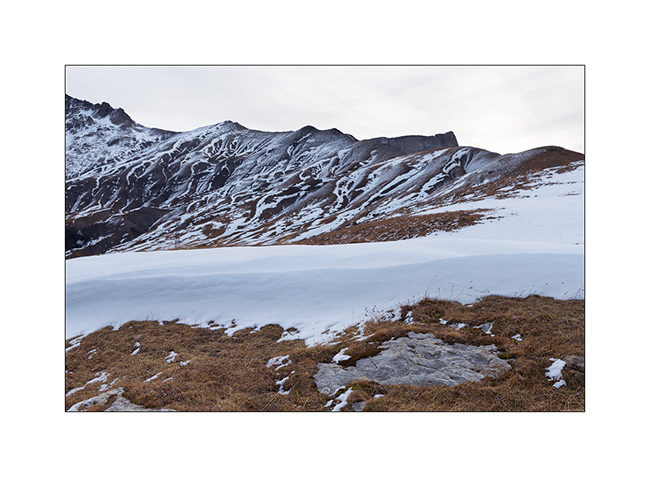
7. Snowfields…
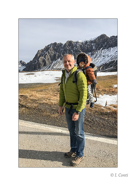
8. After breakfast, the sun came up and we went for a walk with family.
9. The big “lapiaz”, a geological curiosity created after the removal of the Tsanfleuron glacier, is gorgeous.
10. Mount Gond.

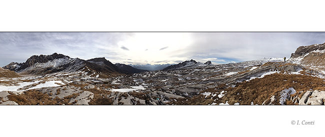
11. Breathtaking panorama!
12. Near Lake Senin.
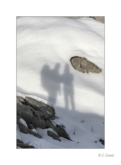
13. Family selfie 😉
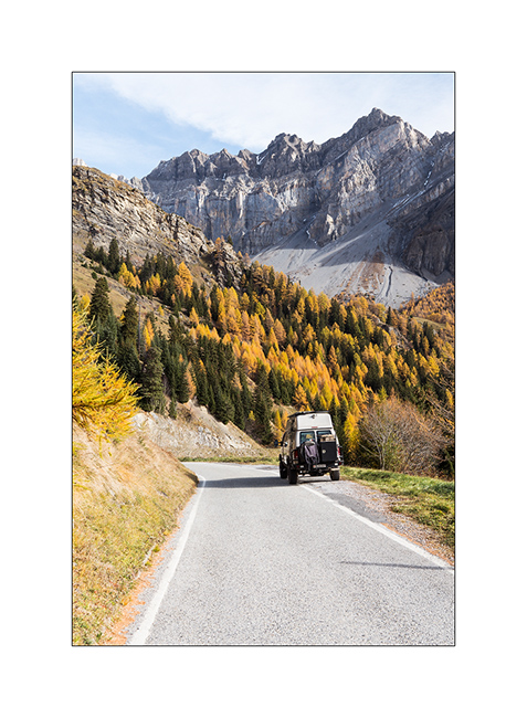
14. VivaLaVida on the little road…
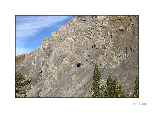
15. The tunnel to access the pass: 10 feet 7 inches, just enough for VLV!
16. When the mountain crushes the summer camp of Tsandra.
December the 31st, it’s time for us to send you our very best wishes for 2018! We wish you only the best: good health, stars in your eyes, beautiful trips here or elsewher, and lots of new enriching adventures.
See you next year for the continuation of VivaLaVida’s adventures! 😀
Alpine loop…
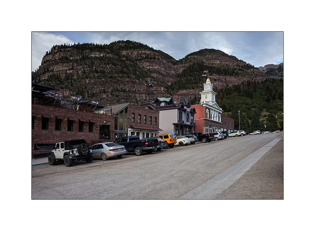
Imogene Pass is by far not the only track traced in these mountains. I went through Ouray buy some fresh food before traveling part of the Alpine Loop, a track that some Jeep enthusiasts love to discover.
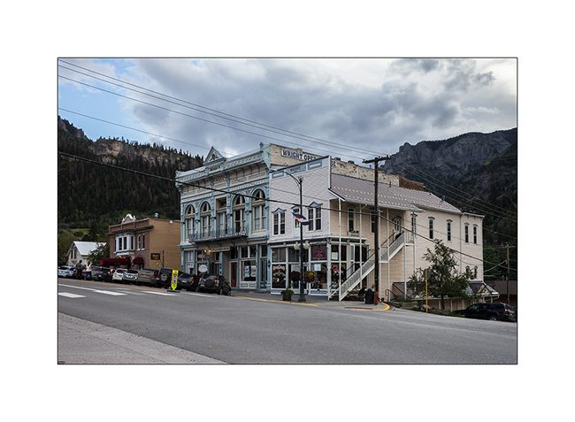
1. In Ouray even more than in Telluride, we believe to be a century ago!
2. The opera building.
3. Red Mountains which are aptly named, since my camp.
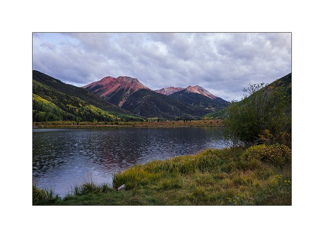
4. The next day, VivaLaVida begins by Gray Copper Gulch roa, amid the Red Mountains.
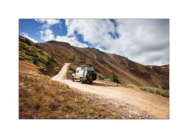
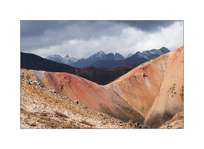
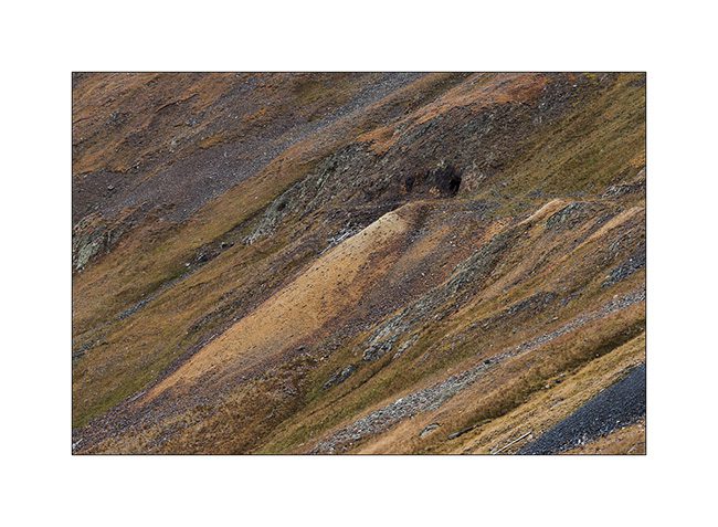
5. It’s color of the iron oxide which obviously gave their name to these mountains.
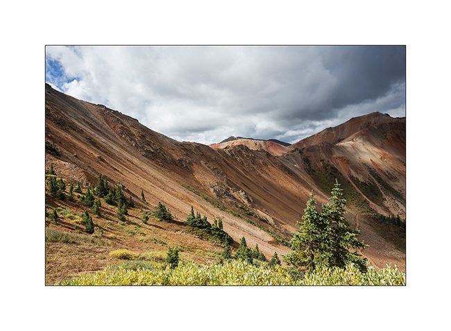
6. Colors are awesome!
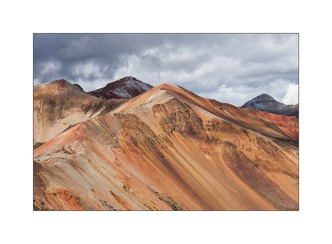
7. While on the nearby mountains, the iron ore concentration is not as important.
8. At the first pass (12,400 feet), a small lake…
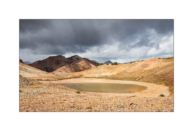
9. A little further, another cad and peaks powdered with snow of the night.
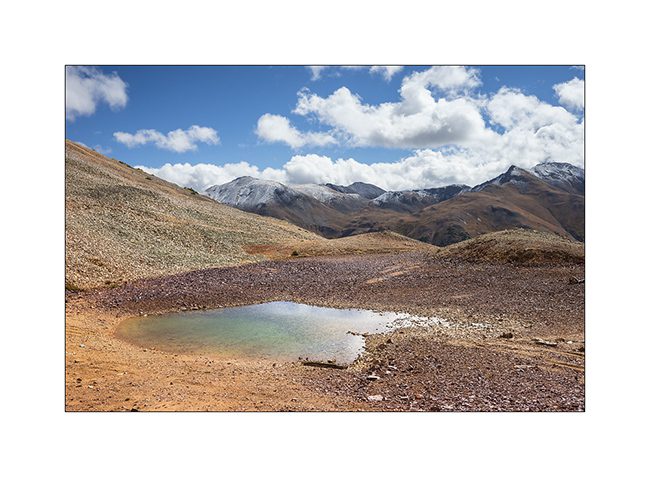
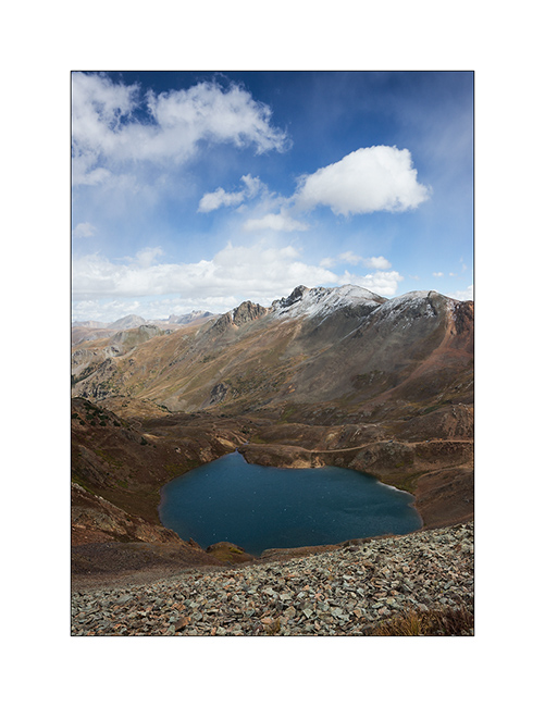
10. Lake Como, the larger of the area.
11. VLV cashes altitude unflinchingly.
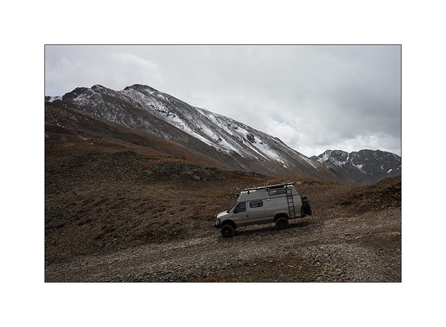
12. Snow shower at 12,700 feet, over California Pass.
13. Downhill on the other side while the shower goes away.
14. I left VLV a few hours to walk to a swampy area.
15. Altitude bogs…
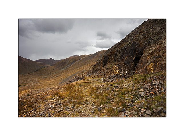
16. Everywhere, mining relics leave their trace. Here, a typical mine with tongue extracts waste.
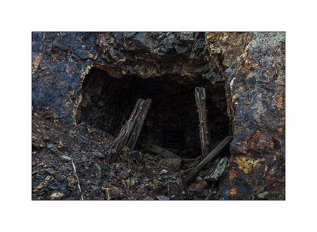
17. entrance of Silver Queen Mine…
18. All were closed to prevent accident.
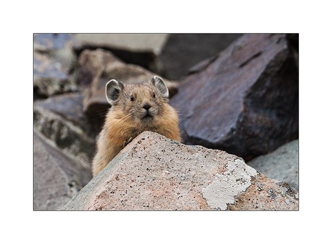
19. Nice surprise: I could finally capture the portrait of an adorable pika, so lively that it’s almost impossible to photograph.
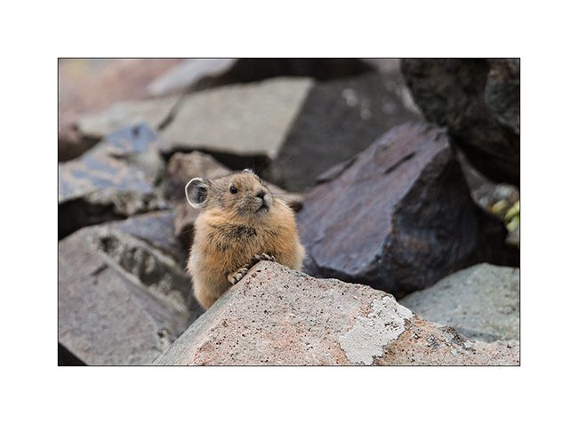
20. It lives in screes and it sneaks in full speed.
21. New snow shower.
22. Small alpine lake.
23. Downhill into the next valley. I only saw two Jeeps that day…
nbsp;
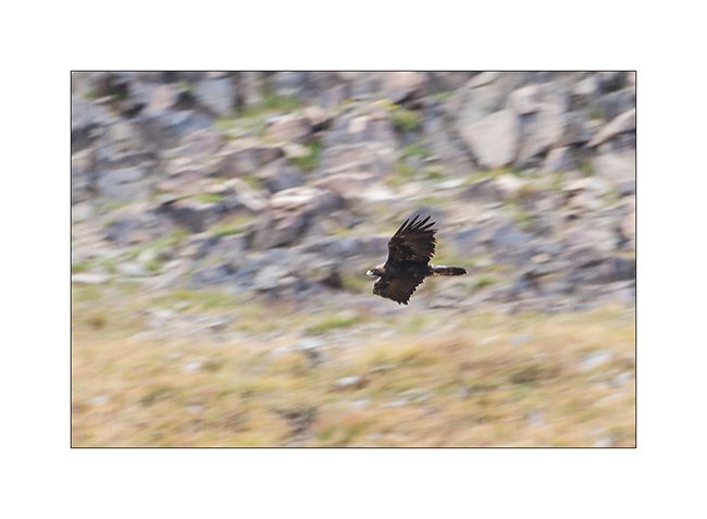
24. For my brother and just as testimony because the picture is very bad: a golden eagle.
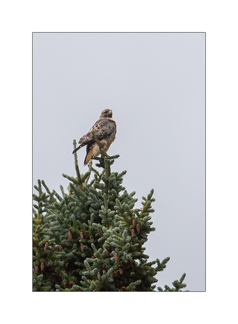
25. Another raptor that I have not positively identified.
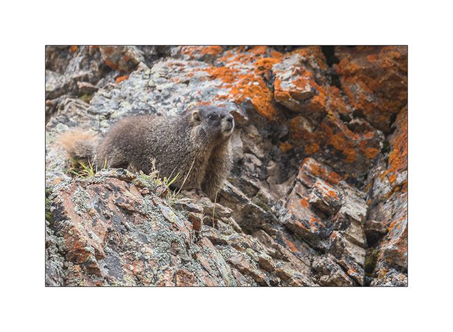
26. There is plenty of marmots..!
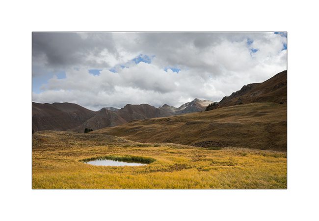
27. Alpine biotope.
28. Within minutes, the track is covered with hail…
Well, following the Alpine Loop in the next update, hoping not to bore you with all these alpine tundra images…
Back in North Carolina
After almost a year and a half, VivaLaVida found back the place where he had left.
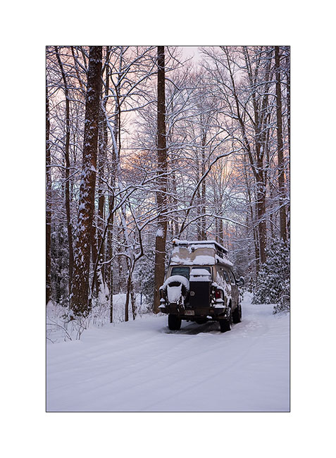
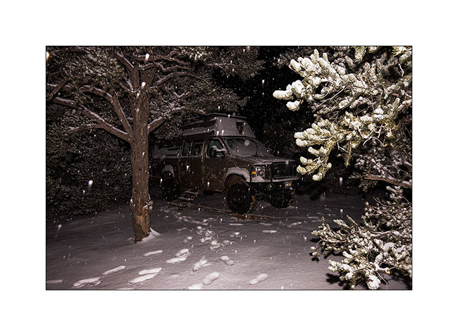
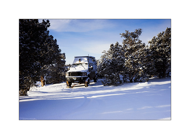
1. Last stretch of winter roads in Smoky Mountains.
2. Wake up in the snowy forest.
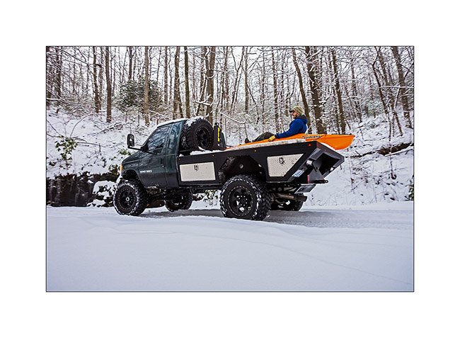
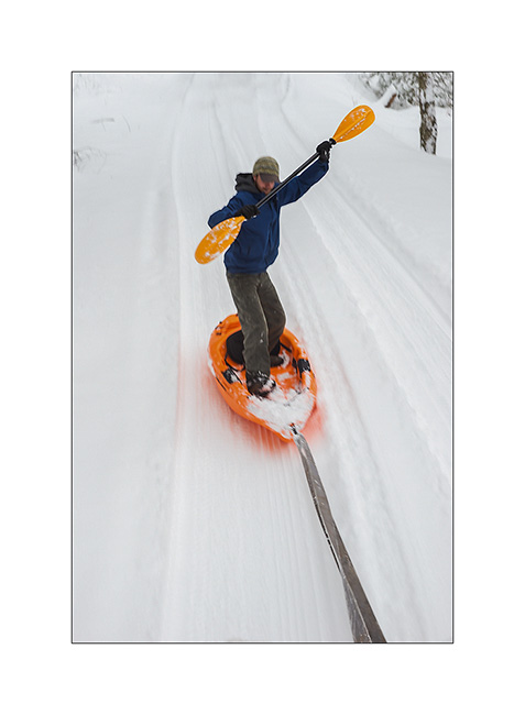
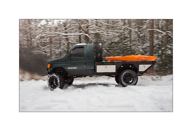
Before returning to Switzerland for a few days, I spent a relaxing day with the U-Joint Offroad crew in an unusual snowfall in the region.
3. Assault of forest roads!
4. Neil is warming up!
5. First paddle strokes.
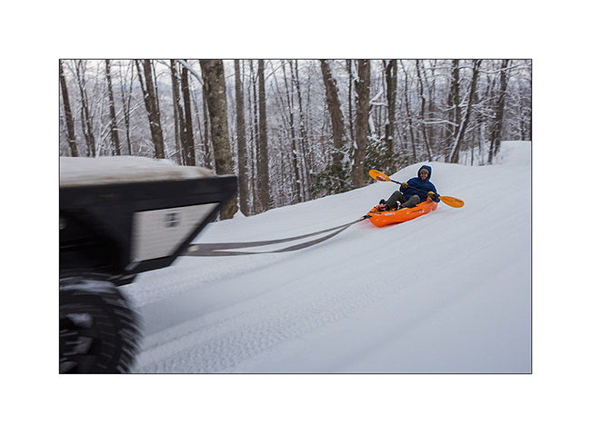
6. Surf.. 😉
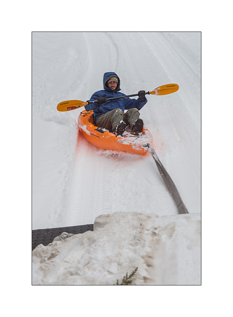
7. He tries to stand up…
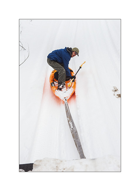
8. Done ! 😀
9. We must help each other, right?
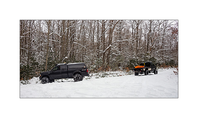
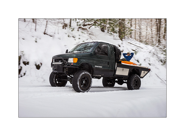
10. V4, Chros’s very special vehicle.
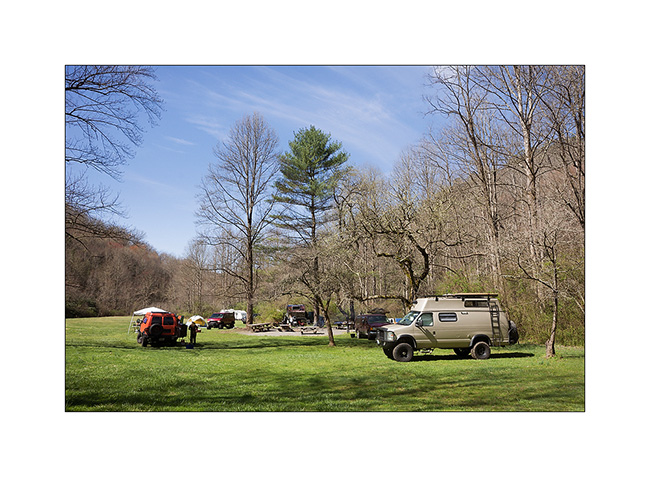
My stay in Switzerland went well despite the sustained pace of meals with family and friends. A period of a little more frugal meals is required now… 😉
I met some people to a group camping organized by U-Joint Offroad over the Easter weekend.
11. Camping with many vans in an almost spring atmosphere.
12. Mathys, Chris and Jennifer’s eldest daughter. Cute, isn’t she? 😉

13. And the twins: exactly one year old today!

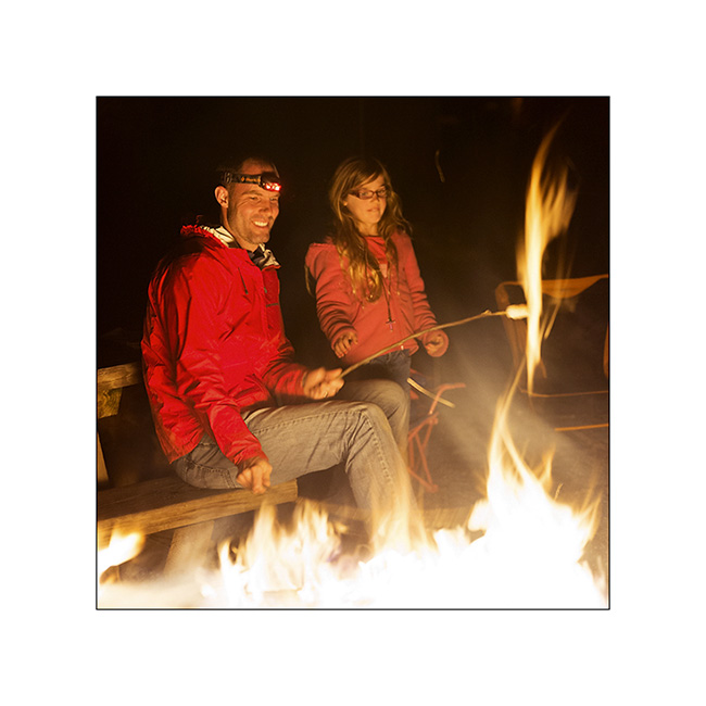
14. Nathan and his eldest enjoying the campfire to grill some marshmallow 😀
That’s it for this little update. However, the blog will still remain quiet some time since some parts take longer than expected to arrive, making me stay in the area to finish the work on VLV.
See you here soon… 😀
The crossing to the east continues…
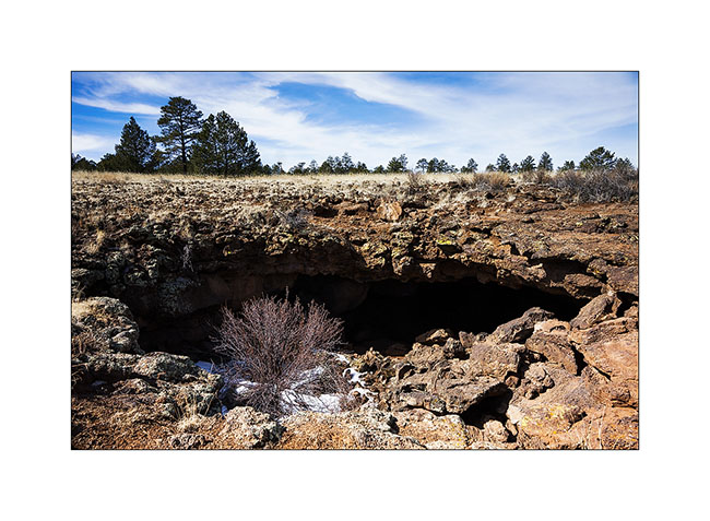
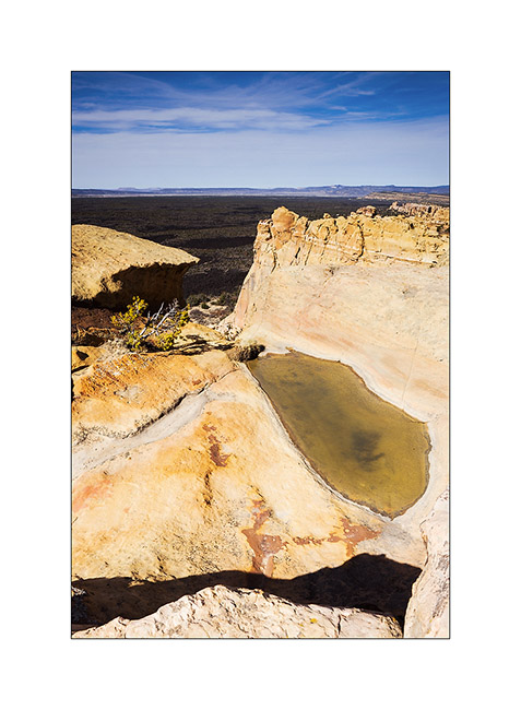
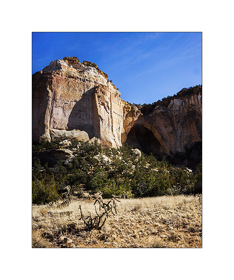
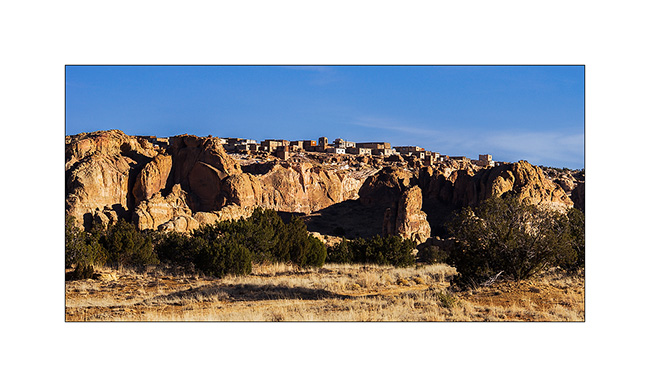
Still in New Mexico, I crossed the El Malpais area – “the bad country” – a volcanic site that spread a large lava flow approx. 3,000 years ago…
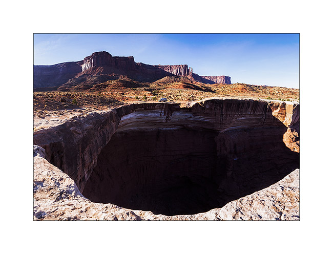
1. A lava tunnel revealed by the partial collapse of its vault. Its access was closed to protect bats that overwinter there.
2. View the gigantic lava flow from El Malpais, an Hawaiian type volcano. It covers nearly 35 miles.
3. La Ventana Arch, one of the largest natural arch in New Mexico.
4. The Pueblo Acoma on a hill of sandstone. I have not been allowed to visit it, the access being restricted, paying and … suspended for the winter!
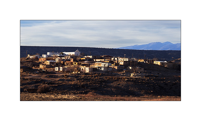
5. Further, the Pueblo Laguna Library and its Hispanic-style church.
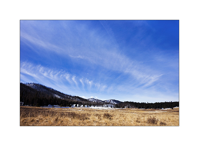
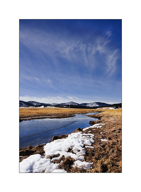
6. The next morning I woke up on the Valdez Caldera, remains of a giant volcano that collapsed on itself. This caldera is 14 miles in diameter!
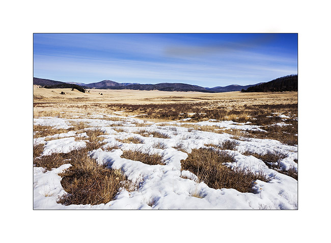
7. Beautiful sky while there is still a few snow at over 7,000 feet. Yet, for 5-6 years, the place doesn’t receive the usual 6-10 feet snow…
8. East Fork River.
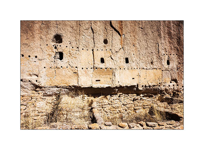
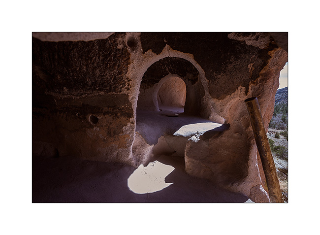
9. By collapsing, the volcano has poured an incredible amount of tuff nearly 55 miles around, sometimes more than 600 feet thick. It’s in a canyon carved in the tuff that are the Bandelier Dwellings. In addition to the cavities in the tuff, the Indian built houses at the foot of the walls. Note the horizontal rows of holes that allowed to fix the frames on the wall.
10. Natural cavities.
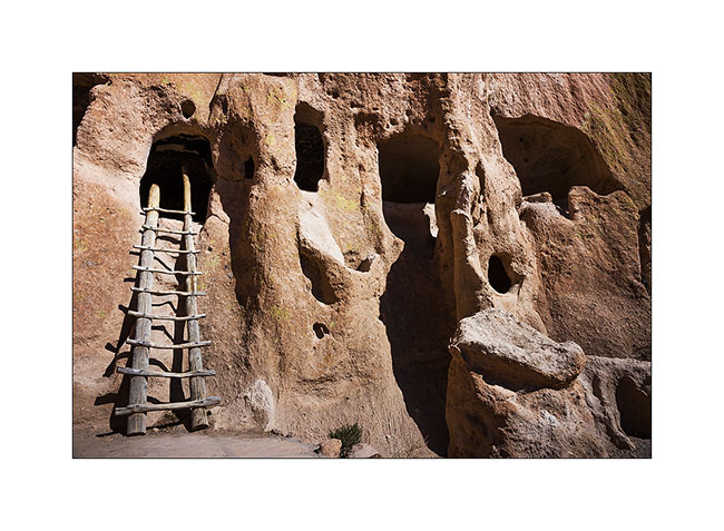
11. They were connected by passages duged into the tuff. Note soot that still covers the vaults.
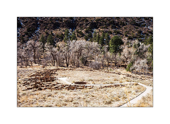
12. At the bottom of the canyon, the ruins of an impressive semi-circular pueblo.
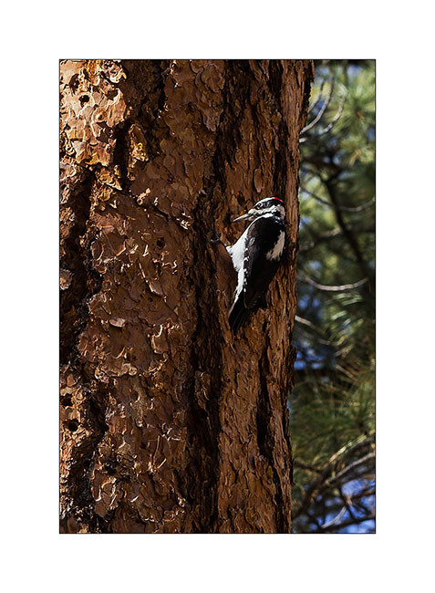
13. A local resident who allowed me to approach, which is rare for a woodpecker.
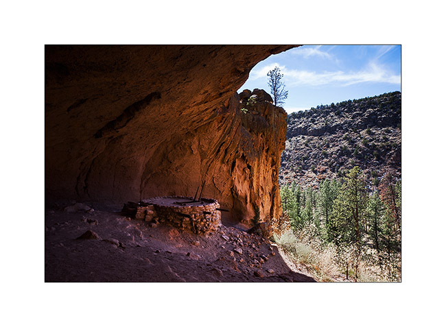
Further upstream, there is a kiva – a room for rituals and ceremonies – found almost intact under a large overhang; only the roof was rebuilt there sixty years ago. It is 140 feet above the canyon and you have to climb on long ladders to get there.
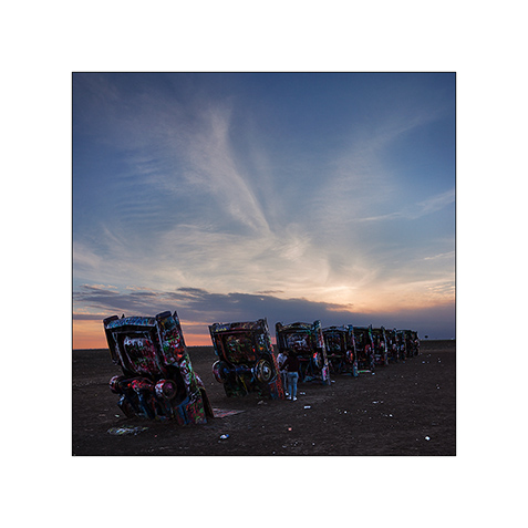
15. Detour in Oklahoma to discover the original work of an artistic collective: 10 old cars planted in the ground from the front…
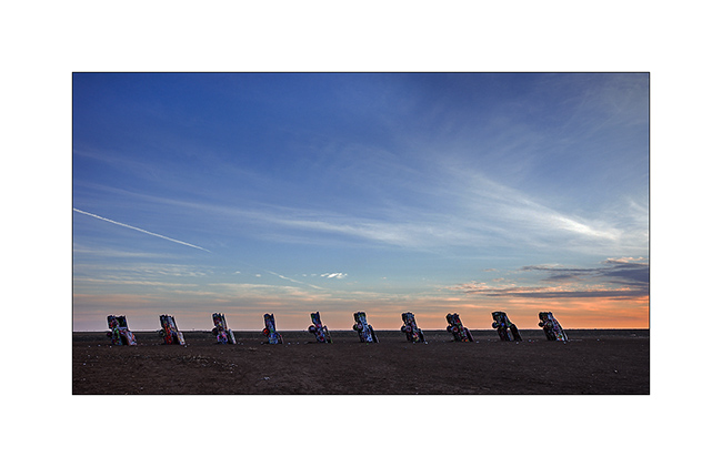
16. Quite original, it must be said. Too bad, I arrived a little late, the light wasn’t great…
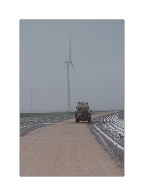
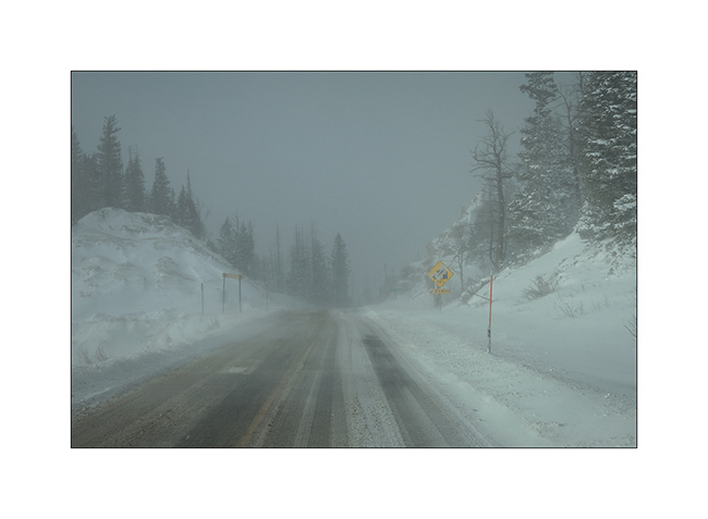
17. Winter wake up in the middle of a Wind mill field in which I spent the night. It was blowing a strong blizzard (announced between 50 and 60 mph!) and actual temperature was 15F…
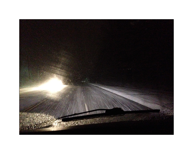
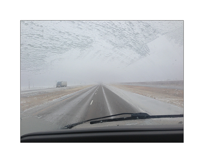
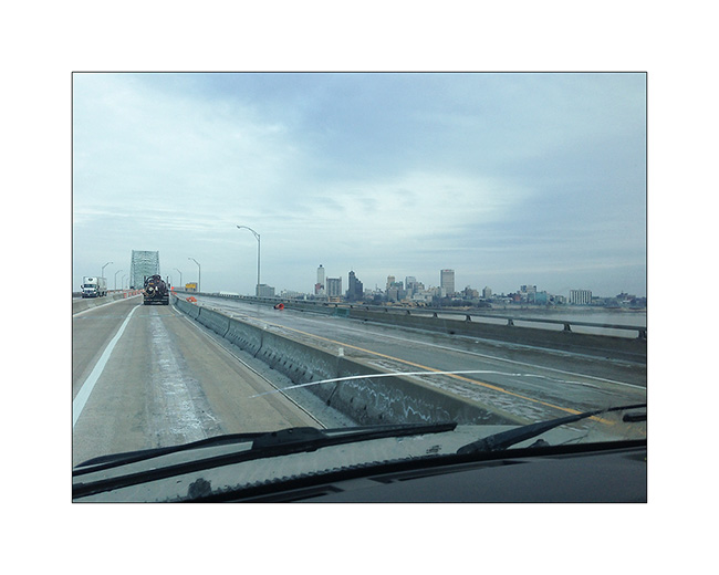
18. Hellish road conditions! Freeway was just a carpet of ice, the few inches of snow fell during the night was packed with trucks before freezing. VivaLaVida traveled almost 450 miles in these conditions, a little tiring for her driver…
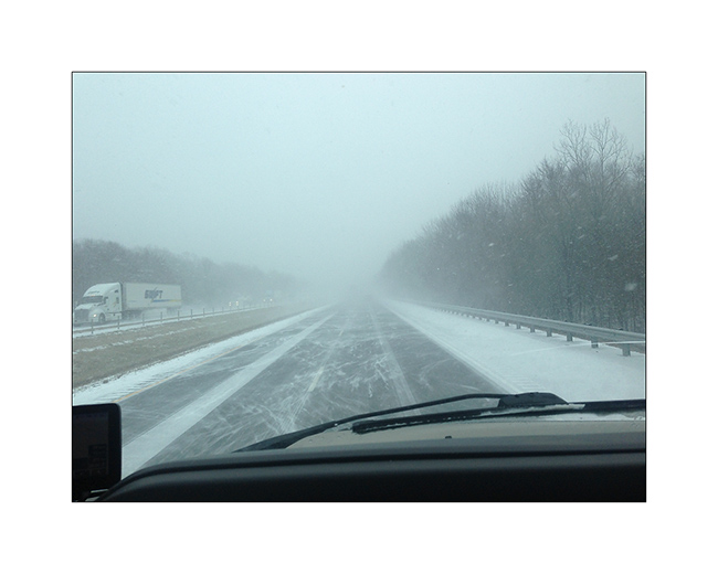
19. The next day in Arkansas, it was not much better: snowed all day to more than 400 miles. I stopped counting the vehicles out of the road at 50…
20. It improved a bit as I crossed the Mississippi River in Memphis TN.
Without showing it that much, this update relates to a three-day trip and more than 1,300 miles in very difficult conditions. After a stop at Maryville TN to eat with a couple of friends, I found the snow back on the road to cross the Appalachians but arrived in the region of Asheville safely.
I’ll be on the departure to Switzerland when you’ll discover these lines…
This blog will then be quiet for a few weeks … but will continue to relate VivaLaVida’s journey from early May no doubt!
Thank you for following this journey, I’m always very pleased to read your comments. 😉
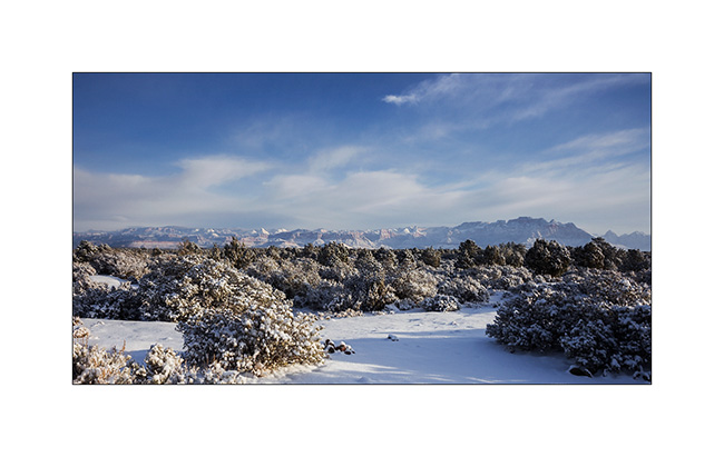
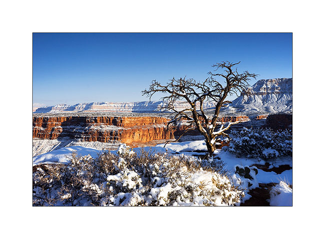
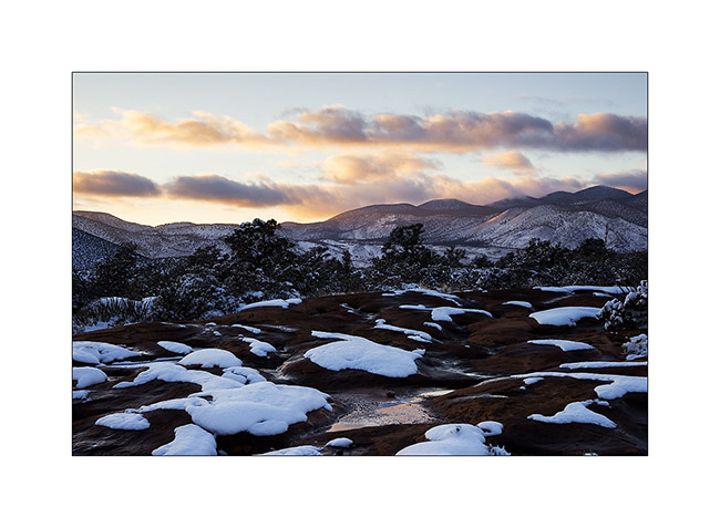
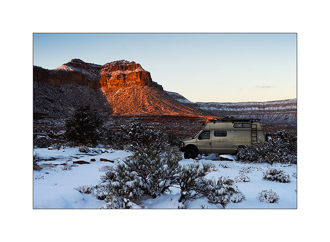
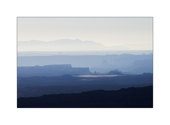
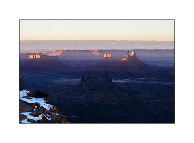
From Utah to Arizona…
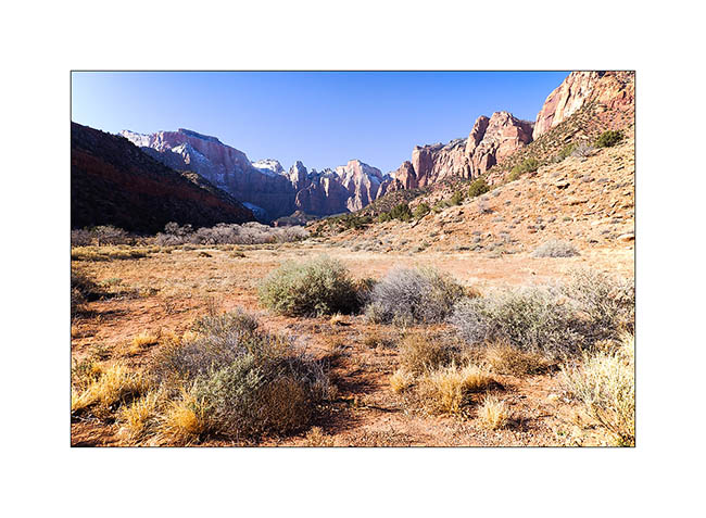
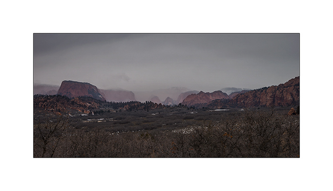
I spent the last days of 2014 between Zion and Gooseberry Mesa, not far away.
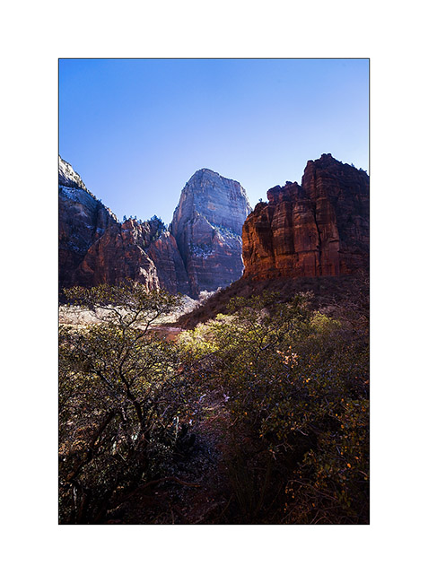
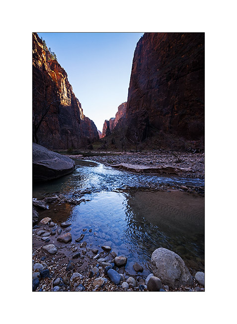
1. The bottom of the Zion Canyon is quite open, with magnificent cliffs.
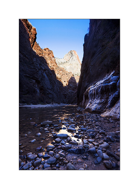
2. Gradually, when going upstream in it, he gently tightens.
3. Then suddenly, because of a change of rock, it turns into a narrow, a deep trench not wider than the river bed.
4. Some cliffs are almost vertical walls over 2,000 feet high, really impressive!
5. Along Kolob Terrace Road while it starts snowing… A few miles further, I will tow the Subaru of two French and two Belgian guys stucked in deep snow. Without VivaLaVida, they would have spent the night there, no one else was up there in this season. A little reckless in my opinion, without even a tow strap…
6. I spent my New Year Eve on Gooseberry Mesa, while it was snowing… 😀
7. In the morning, there was about 4 inches fresh snow.
8. The view over the Zion Mountains clears in early morning…
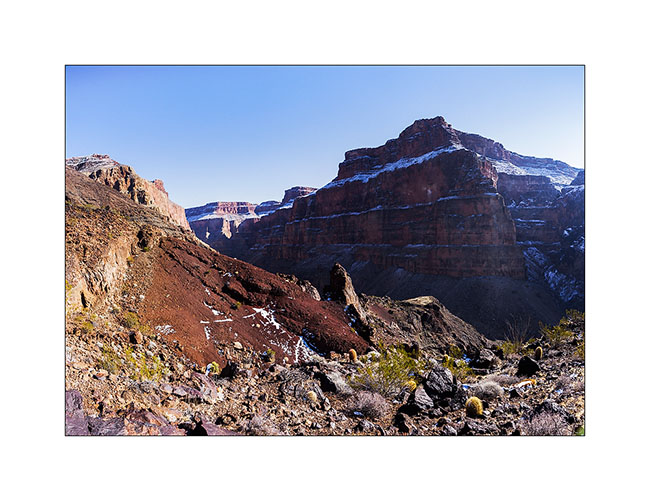
9. Despite the snow that fell the previous night, I tried to reach a viewpoint on the North Rim of the Grand Canyon. It’s a really unfrequented corner because of difficult access via a hundred miles trail, really muddy for the first part, then rocky and quite rough for the last 20 miles and closed in winter. However with VLV capabilities, I reached it in late afternoon when the moon rose.
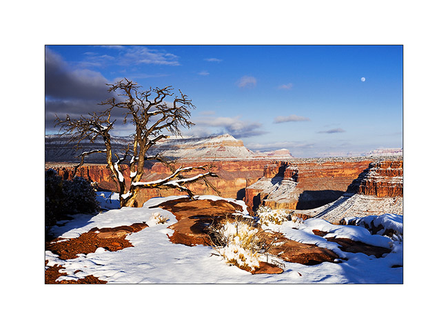
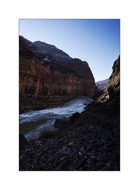
10. Enough air there! I’m on a 20 inches ledge overhanging a truly vertical wall… But it was the only way to show you the Colorado River, exactly 2,890 feet down! 😀
11. Warm last light rays in this winter atmosphere.
12. The snow fallen a few hours earlier makes patchwork design on the sandstone.
13. The camp will be really cold in the clear night…
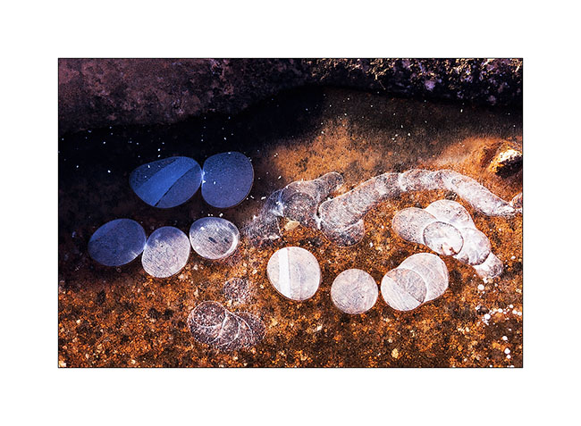
14. The potholes freeze on the sandstone, with beautiful textures. Here, ice pebbles…
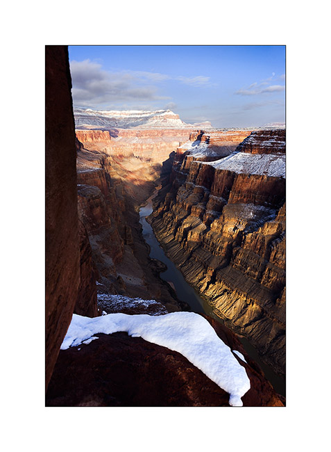
15. Down the next day in the canyon to see Lava Bed Rapids, the most difficult rapids of the entire Colorado River. The trail, sometimes non-existent, is very steep in a lava flow that makes walking dangerous, lava stones rolling like bearings under the feet. there is even some climbing in places, hopefully not too difficult because only I wouldn’t have be able to reach the bottom otherwise. A trek to not recommend to everyone anyway!
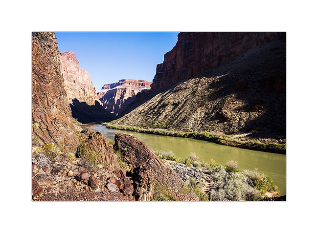
16. Here the rapids, without sun this season. Hard to show the scale as the canyon is so huge but it’s pretty impressive. What a power! I understand that there is a portage trail for canoes…
17. The depth of this canyon is just amazing, I fell really small down there!
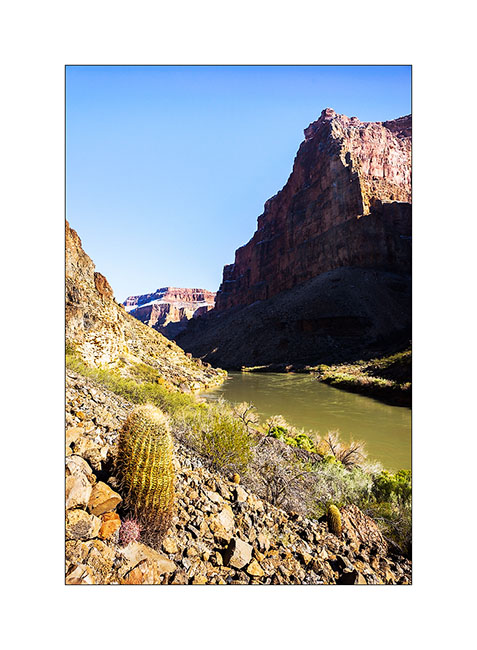
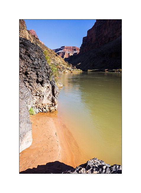
18. Small beach upstream the rapids.
19. I begin the long climb back. Top left is Toroweap Point where I go, 2,890 feet higher! 😀
Following of the discovery of this part of the Grand Canyon to come soon!
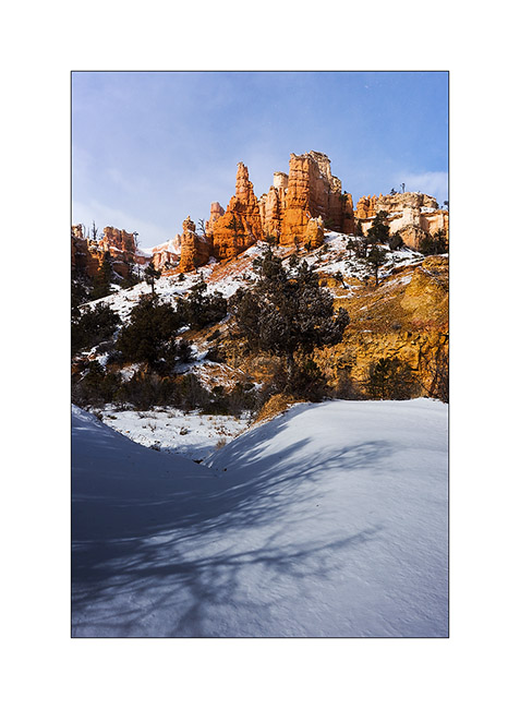
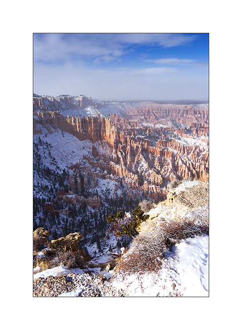
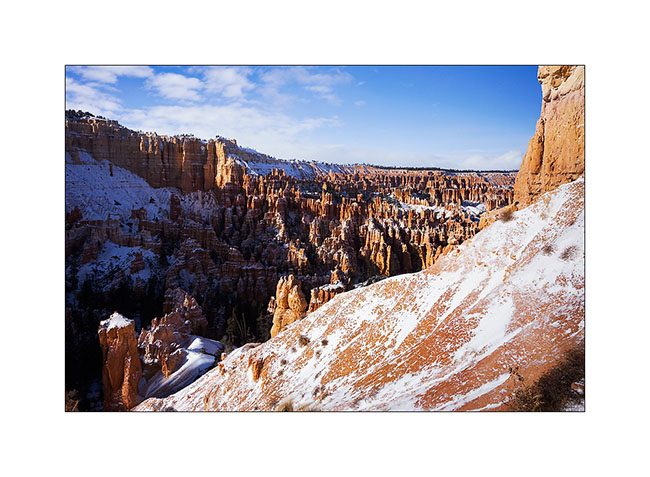
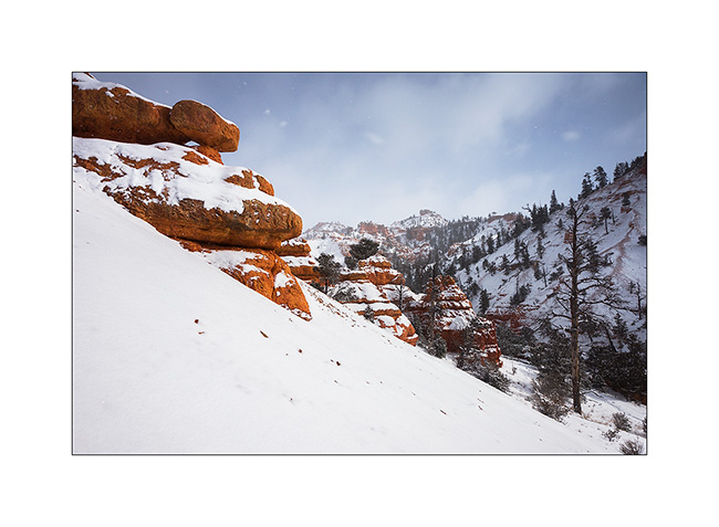
Bryce Canyon in winter…
Finally, not far from Bryce Canyon, snowfall inspired me to go discover it in his winter coat…
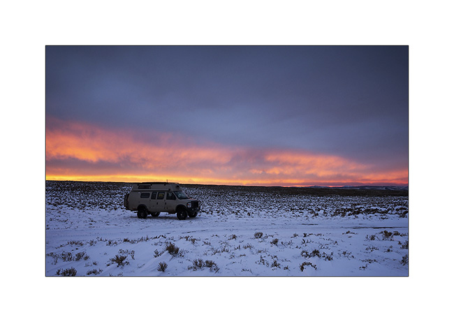
1. Start on Christmas Day. Warmer than the night before but snow and blizzard formed small snowdrifts while rocking me all night long… 😉
2. Small lake along a country road, between two flurries…
3. It is large enough to not be completely frozen yet. I saw two great eagles, probably on the lookout for some fish to eat.
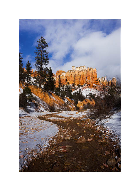
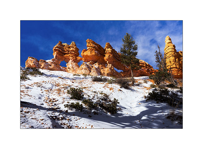
4. Arriving near Bryce, I first discovered a secondary cayon, less known but beautiful too.
5. It was partly dug by the water of an irrigation canal built upstream by Mormons a hundred years ago.
6. Triple arch on an edge.
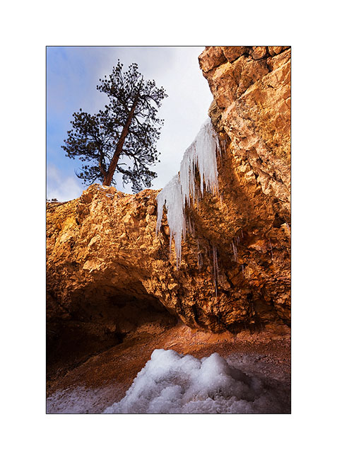
7. A small waterfall almost completely frozen…
8. I arrived on the heights of Bryce Canyon between scathing snow showers and blue sky. It was 15F and for once, there wasn’t many people there, only some Japaneses and Hindous.
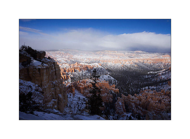
9. While I go down into it, snow showers give a wintry atmosphere…
10. Then shower fades…
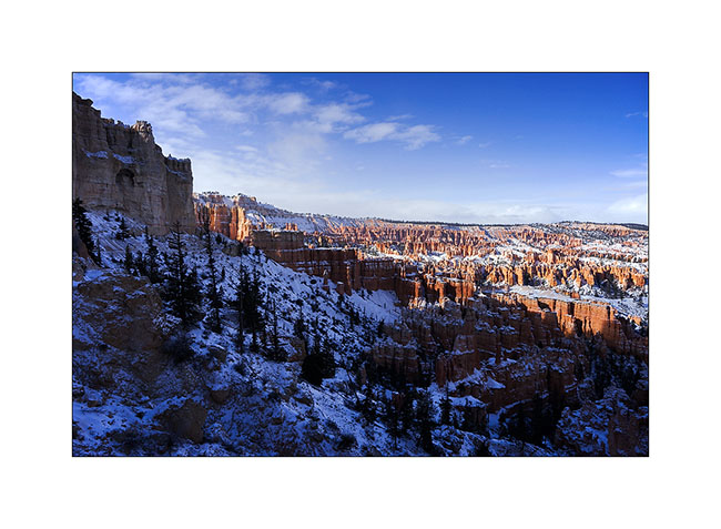
11. The white-red contrasts give a very different face of this exceptional place…
12. The next night was one of the colder than VivaLaVida has had to endure: -10F to her thermometer. Olive oil even froze in the closet… 😉

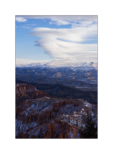
13. Wind creates clouds that cause snowing on the mountains while the rest of the sky his quite blue.
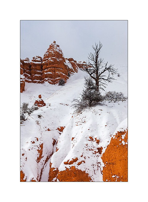
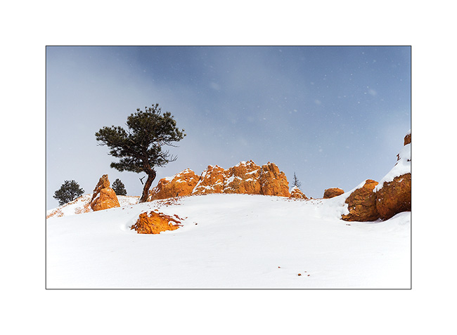
14. I went hiking in an annex canyon of Red Canyon, not far from Bryce and less known but also interesting to me.
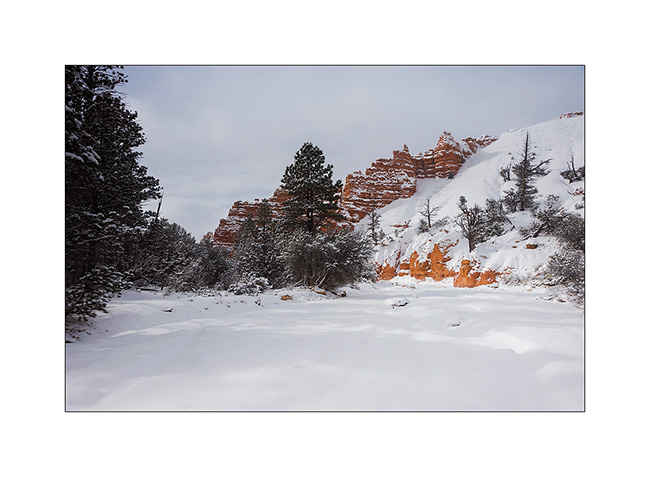
15. Hoodoos are everywhere.

16. I even find that unnamed arch.
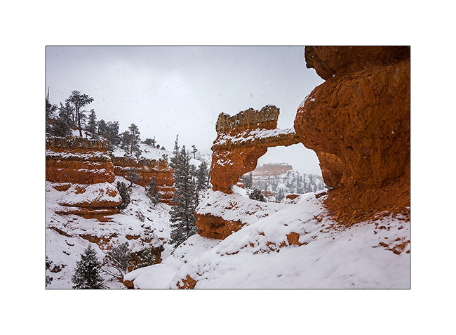
17. Almost ten inches powder snow fell in this wilderness.
18. And he still snosw under showers while the wind blows almost as a storm.
19. Going down to VLV in late afternoon.
20. That road conditions we had at almost 10,000 feet above sea level, near Cedar Break inaccessible due to snow.
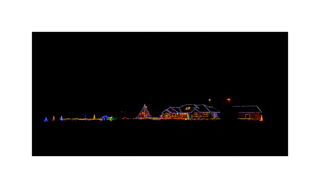
21. Down to warmer altitudes, an example of bright Christmas decoration that you Americans love. 😉
Change of scenery to come in the next update… 😉
Looking for a little warmer temp
As I wrote it in the previous update, VivaLaVida has turned south-west, temperatures from -13 to -22F being announced for the San Rafael Swell.
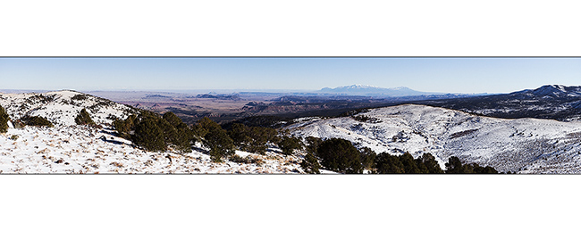
1. Tremendous panorama of Cathedral Valley and Henry Mountains in the distance.
2. At Hogan Pass at almost 8,000 feet above sea level, it is 8F at noon despite the sun.
3. And it blows a strong north wind that sculpts the snow.
Forsyth Reservoir is frozen, you could almost skate there.
5. VLV almost reached the Rock Lake but had to give up 9,350 feet, too much snow…
6. So I continued on foot, wrapped up warmly, while they didn’t seem to be cold! 😀
7. Went back down just before night, enjoying a beautiful sunset on highlands.
8. The next day, Christmas Eve, VivaLaVida tried to reach Escalante across the splendid Awapa Plateau, between 7,800 and 9,800 feet elevation.
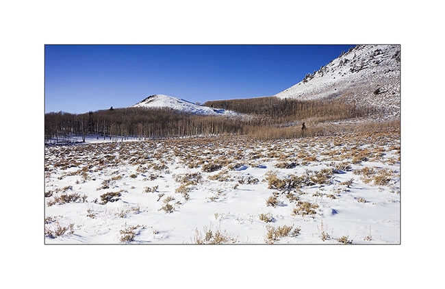
9. Vast stretches of grasslands. I like to imagine herds of bison grazing here 150 years ago before that men exterminated them from these areas…
10. As the altitude increases, the snow becomes more present.
11. It blows an icy wind that makes me think of a blizzard. 10F to the best of the day. But at least I enjoy a Christmas with snow! 😀
12. VLV had to give up, the amount of blown snow making progress difficult. He tried two other tracks but it ended the same.
13. Beautiful cirrus sky announcing some snowfall overnight…
14. These semi-snowy meadows remind me of the tundra of northern Alaska.
15. The wind has drawn waves, while the sky covers.
16. I so love this kind of moors landscapes, I decided to spend the night there. And Nature offered me a nice surprise for Christmas: an amazing sunset. It began with soft colors to the north.
17. Too much wind to light a campfire as I expected and it is already 3F…
18. Three minutes later, the sky blazes…
19. Without Christmas tree in her, VivaLaVida is aflamed by the Christmas setting sun! 😉
20. Last colors… all lasted only a few moments…
Unable to join Escalante by the way I had imagined because of the winter already installed in altitude, I found another path that led me to discover Bryce Canyon in its winter coat… To come here soon! 😉
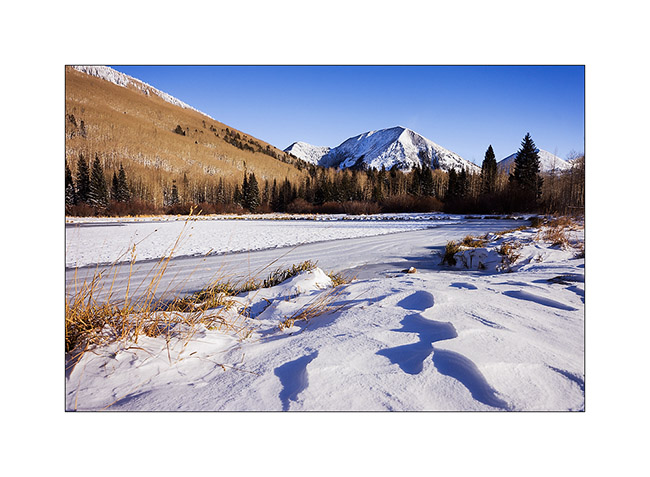
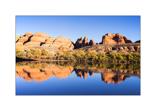
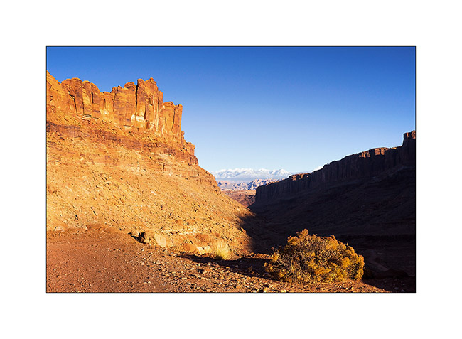
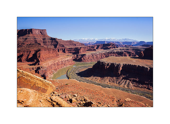
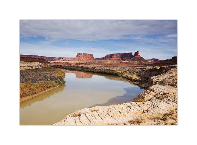
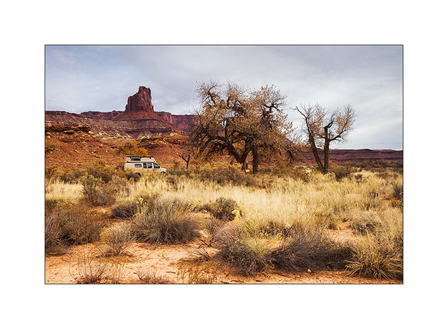
Still Canyonlands…
No way to risk to stay stucked in so much snow, I preferred not to cross the pass that would lead me to the other side of the La Sal Mountains and went to Warner Lake driving around the mountains. I already discovered this little mountain lake in a previous trip and wanted to see it in its winter coat.
1. Late afternoon light on the Warner Campground, obviously empty at this season.
2. Beautiful frozen Warner Lake.
3. As the weather forecast indicated 12 F in Moab, over 3,000 meters below, I went down for me to find a campsite less exposed to cold. The view over Canyonsland and Henry Mountains, over 0 miles away, was splendid.
4. I found a better sheltered spot above Sand Flat, near an overlook over Castle Valley, a picture of the Far West at sunset…
The next day, session welding because I discovered that the bracket supporting the engine preheater was broken. Again and again the vibrations of the dirt roads… So I went late to Long Canyon.
5. The Colorado River reflecting the Moab Rim.
6. Going up in Long Canyon, With La Sal Mountains in the back.
7. The famous spot in Long Canyon ; Souvenir photo stop required! 😉
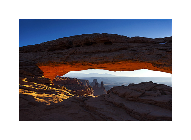
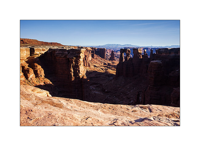
8. The next morning, I got up early to go to Mesa Arch at sunrise. A photo that I’m not the first to do but I like it…
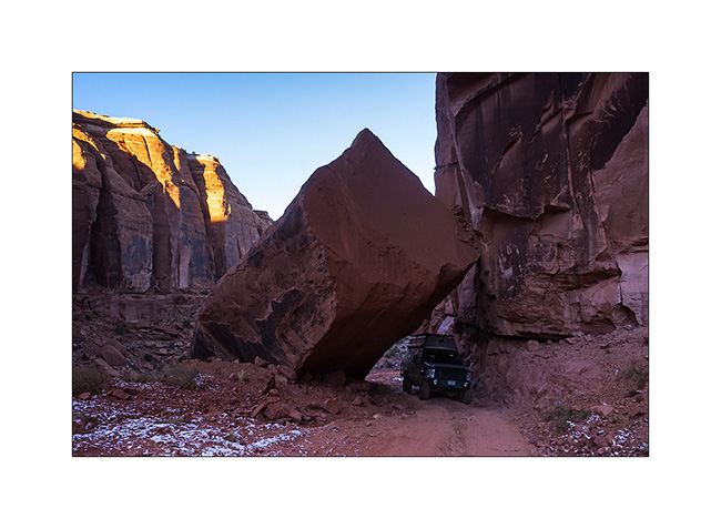
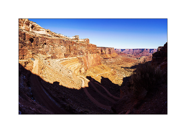
9. VivaLaVida then went down the Schafer Trail to get to the White Rim Trail. Beautiful downhill in the vertical walls! VLV is quite small up there…
10. One of the meanders of the Colorado from the White Rime Trail.
11. Self-portrait at Musselman Arch, quite aerial… 😉
12. The towers that appear Under Mesa Arch, but this time from the bottom.
13. One of the huge overhang that crosses the White Rim…
14. In Canyonlands, there are number of canyons and arches everywhere. The White Rim Trail takes its name from the clear limestone layer that it follows over 100 miles.
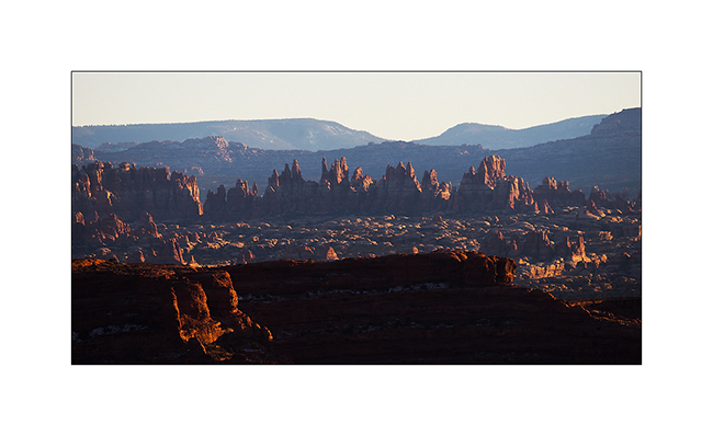
15. From Whitecrack Campground where I spent the night, Sunset over the 20 miles away Needles is gorgious.
16. Under windwos of VivaLaVida too !
17. Almost the same colors at sunrise…

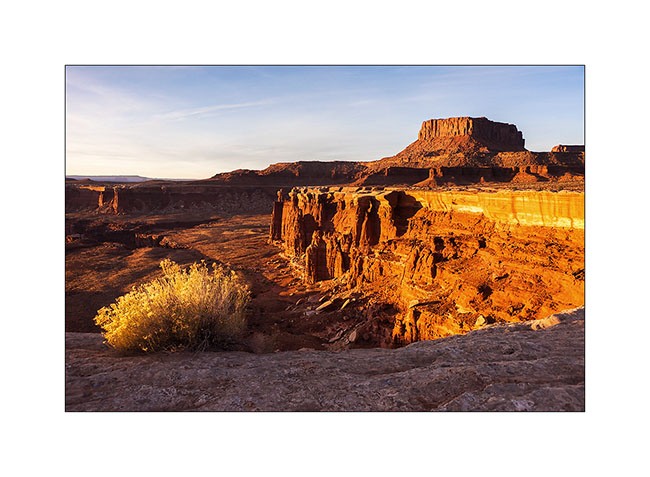
18. Another of theses giant overhansg with Candelstick Butte in the back.

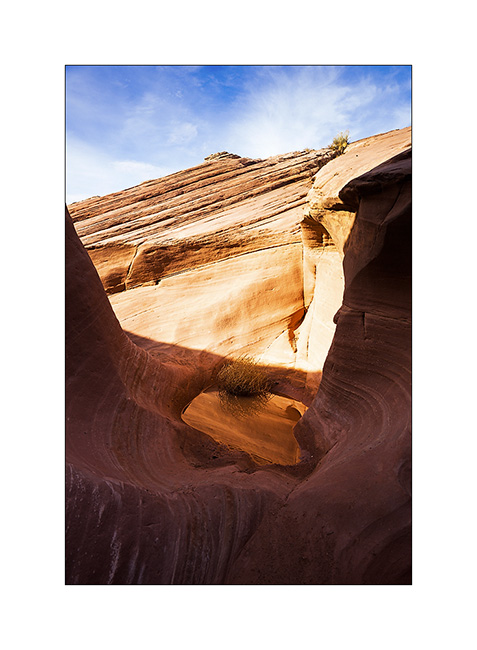
19. A small slot canyon I visited along the trail…
20. I rediscover the Green River…
21. Luch stop at Potato Bottom.
Continuation and end of the White Rim Trail in the next update.
 D5 Creation