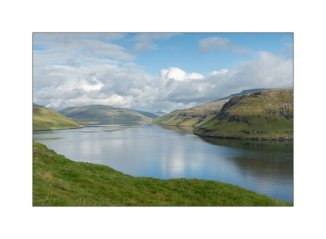
fjord @en
now browsing by tag
East fjords and end of the trip…
We are Tuesday, the ferry leaves tomorrow, so I have to end the route to the East.
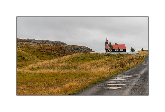
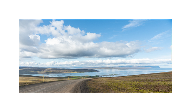
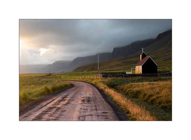
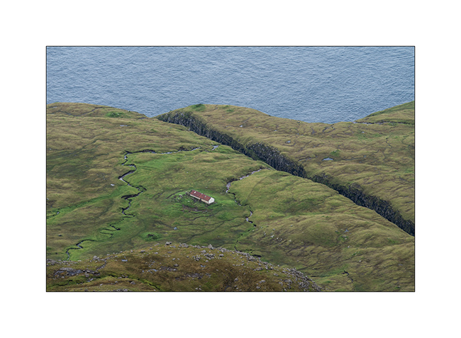
1. A farm and its small church in the plain.
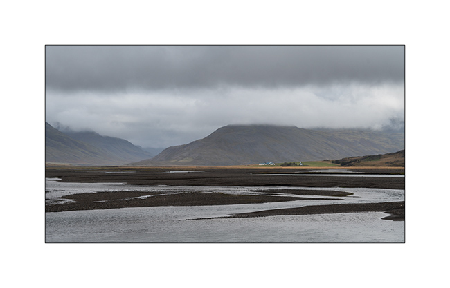
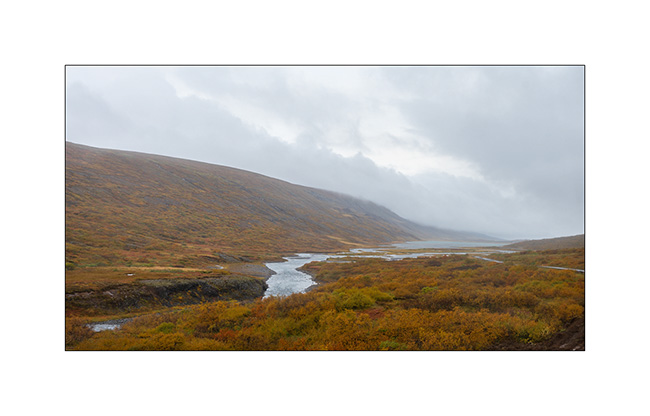
2. These plains are actually alluvial deltas (gravel bars) down the mountains that form the eastern fjords.
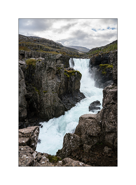
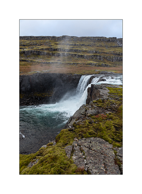
3. Short stop at the powerful Nykurhylsfoss waterfall, sometimes also called Sveinsstekksfoss.
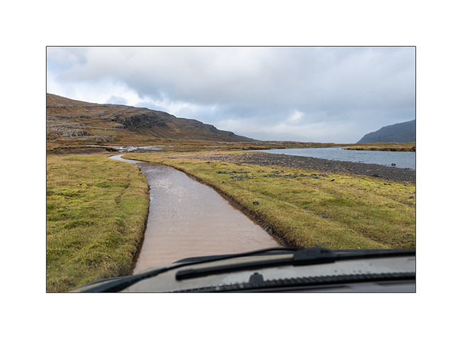
4. VivaLaVida makes a small detour through the valley from which she falls, on a track that looks more like a river in places 🙂
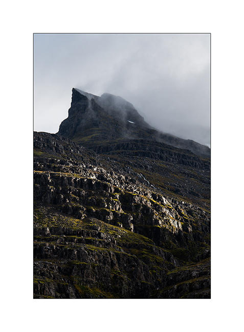
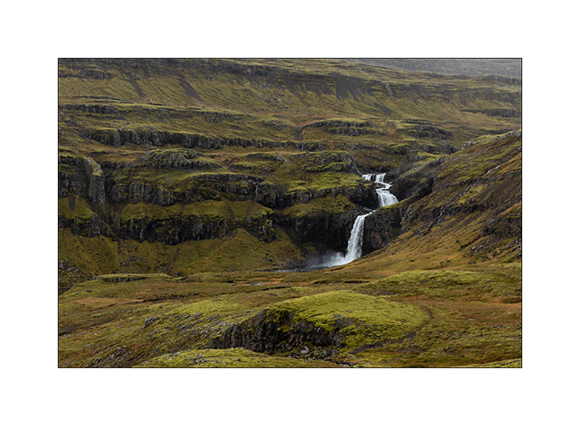
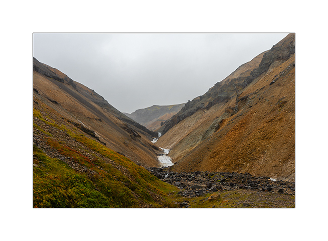
5. This valley is a magnificent basalt staircase, each step of which creates a waterfall. Gorgeous ! Too bad not to have time to explore it longer…
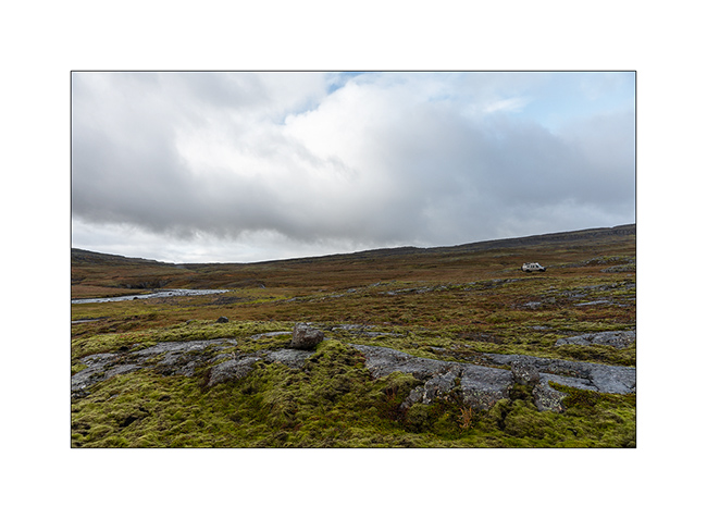
6. With autumn colors now very present, it’s beautiful.
7. A little further, on a small pass, the fall of Folaldafoss.
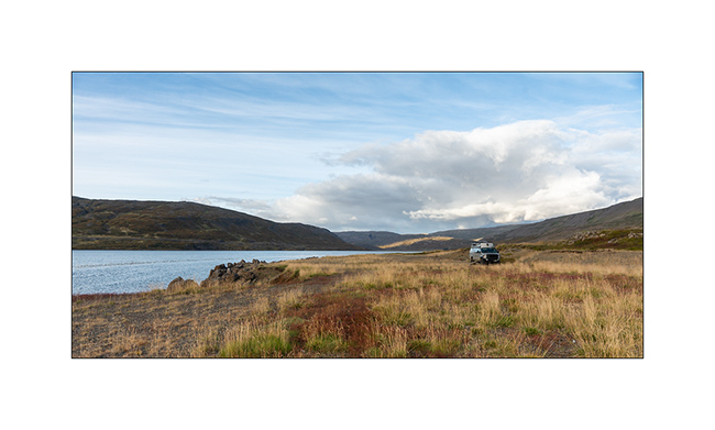
8. VLV will take a chaotic path to find a beautiful Icelandic camp near a small lake, 2100 feet above sea level.
9. The night will be particularly turbulent, with winds to almost 70 mph and heavy rain. In the morning, the rain gives me some respite while the wind maintained.
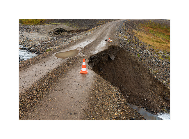
10. As I have a few hours left before boarding, I decided to take the F936 trail and was surprised to discover it perfectly leveled, without washboard or potholes. After ten miles, I understand why..! I do not take the risk to pass and turn around.
11. So, VLV goes up to do a small exploration towards North…
12. … discover the beautiful church of Kirkjubaejarkirkja.
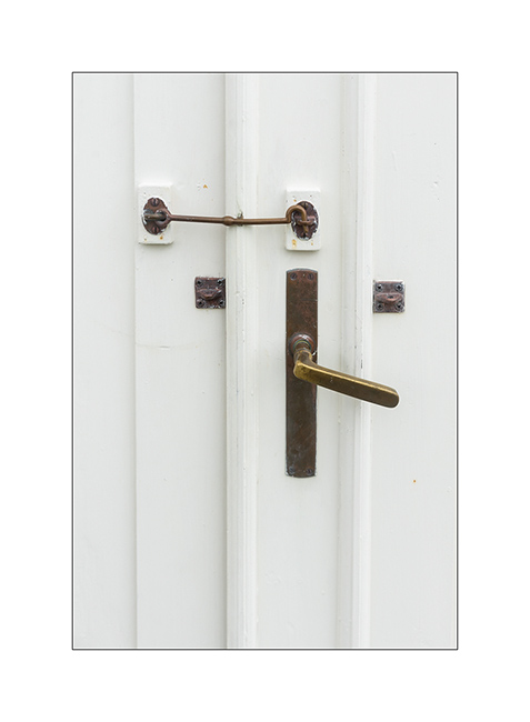
13. Details of door shutters.
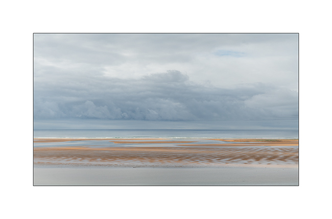
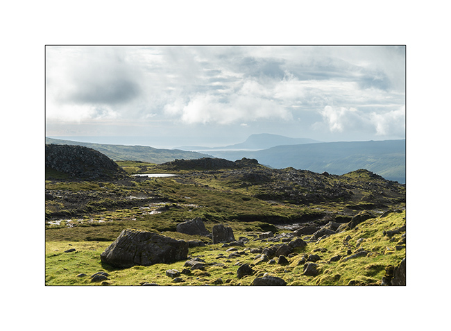
14. Climbing a small pass, a large beach exposed to the Arctic Ocean revealed.
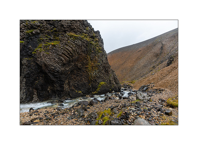
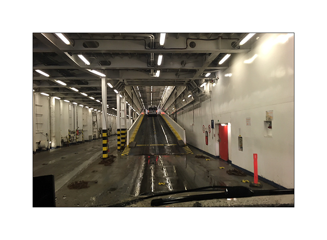
15. Small stop in a colorful side valley, obstructed by a wall of basalt.
16. Mineral colors.
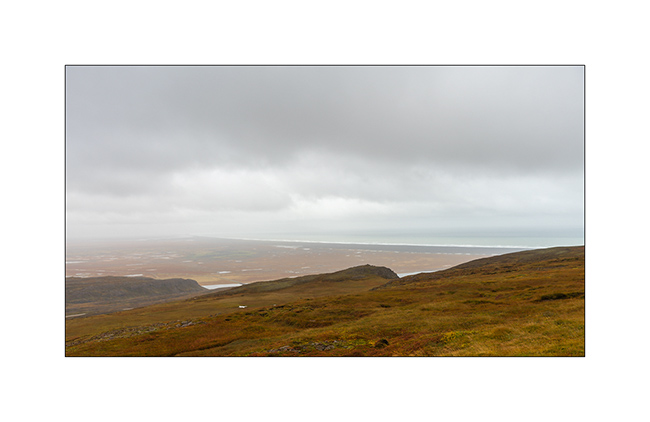
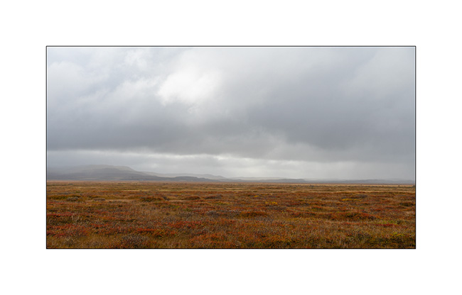
17. Last picture of a rainy heath…
18. VivaLaVida finds back the Nöronna ferry for the return crossing cruise.
In conclusion of these few weeks in Iceland, I have some mixed feeling. The island is home to a wealth of incredible natural treasures for whom, like me, love desolate and wild Nordic landscapes. Combined with the omnipresence of sustained and often extremely recent volcanic activity, the cocktail is often breathtaking. On the other hand, because of tour operators eager to make money, this destination has become so touristy that the consequences of this mass tourism become visible almost everywhere. More and more frequent access bans, legislation seeking to limit the impact on the fragile nature, sites with often developed unsightly infrastructure and invaded by dozens of buses, mini-commercial campers rented by hundreds and, probably corollary, Icelandic not very affable and often even unfriendly with foreigners… Not to mention a exorbitant life costs : filling VLV was more than 400.- USD..!
Apart from the few indoor tracks that VivaLaVida allowed us to access off the beaten path, the pressure of this tourism really bothered me. And we were there at the end of the season, with significantly fewer people than in July or early August. Of course, I understand everyone’s desire to discover this raw nature. Yet there are other places on the planet, equally spectacular but less exploited by tour operators who still know how to preserve their country and are in my eyes much more pleasant to visit.
No regrets, however, to have had the opportunity to make discover to Isabelle – Emile is probably still too small to remember of later – this large island and its beautiful and so changing landscapes!
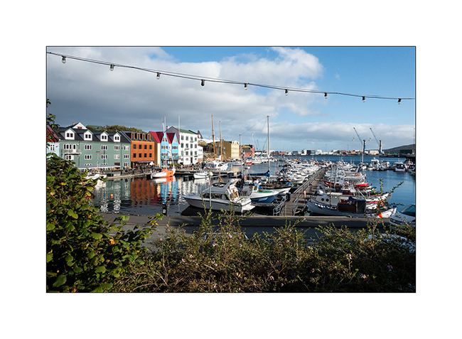
While the Nöronna ferry made a stopover in Torshávn on the way back, I was lucky enough to have some nice weather to offer you some new pictures of the capital of the Faroes.
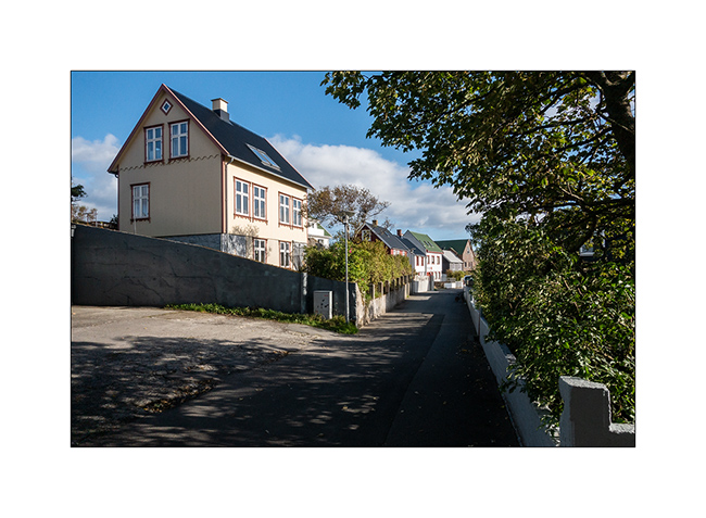
19. This small town offers dozens of narrow streets with pretty houses that denote with the American-style pavilions of Iceland.
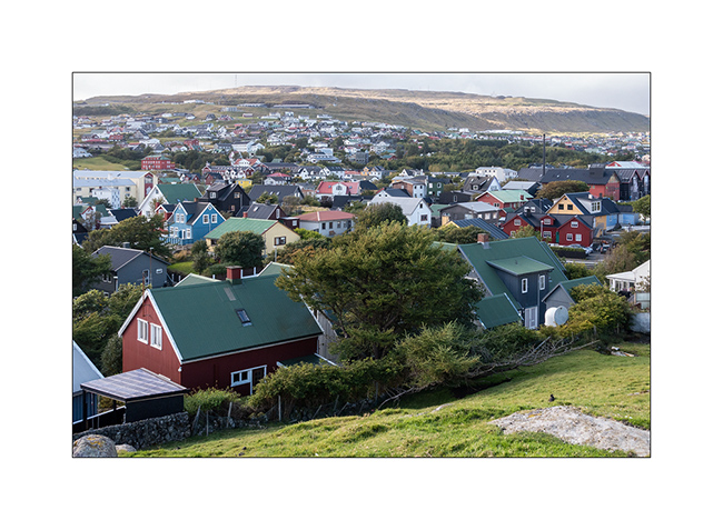
20. View on the city.
21. Marina.
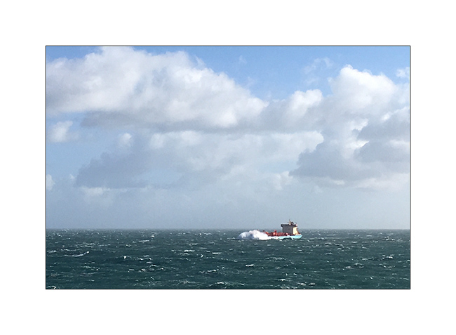
22. The crossing to Denmark will be somewhat turbulent, with strong winds up to 80 mph and 18-21 feet waves.
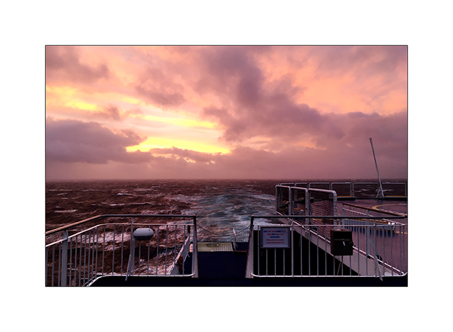
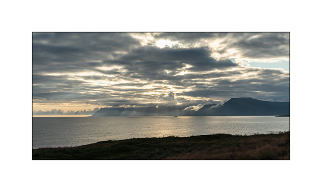
23. Venting sinset…
The return to Switzerland was normal except for a turbo hose that dislodged, forcing VLV to drag on the last 350 miles…
Thanks to you for having followed the story of this Icelandic journey of VivaLaVida which will now be rebuilding a small health (axle simmering to change, kneecaps to replace, and complete frame check after more than 6000 miles traveled, of which probably more than a thousand on the various tracks borrowed. You can also view the route on the map “Europe” of this blog… 😉
And see you soon for following VivaLaVida’s new adventures! 😀
Fjords of North West
1. Great weather in the morning!
2. Icebergs are still there.
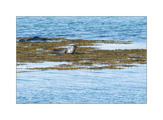
3. Stop on our way to observe seals.
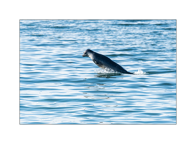
4. When some rest, others seem to play in the water.
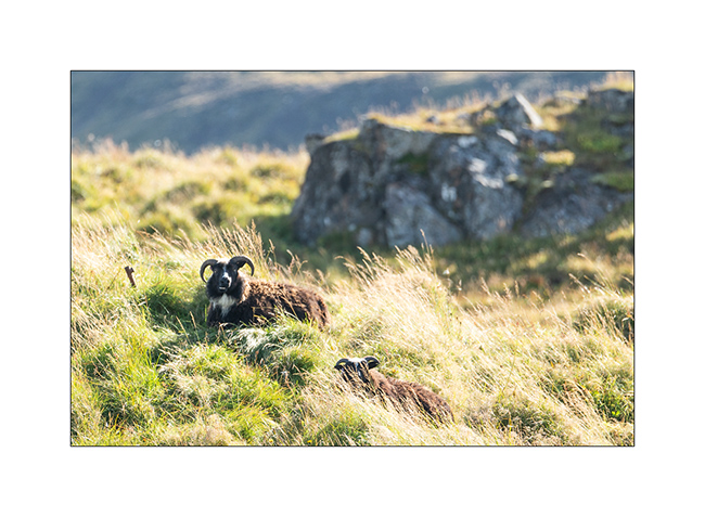
5. Under the eyes of ubiquitous and placid sheeps.
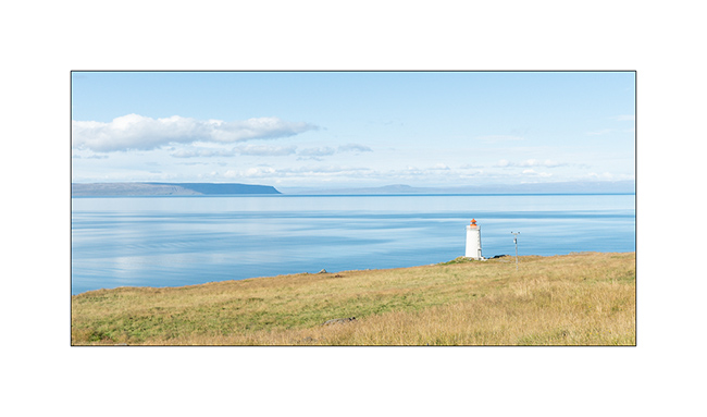
6. Small lighthouse on the coast.
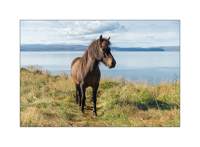
7. I draw the portrait to one of these famous Icelandic small horses with long manes.
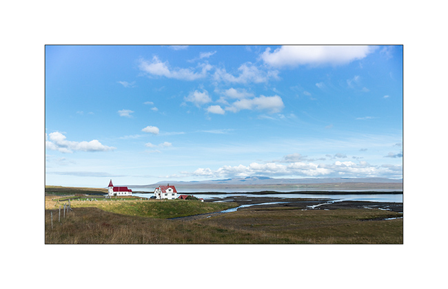
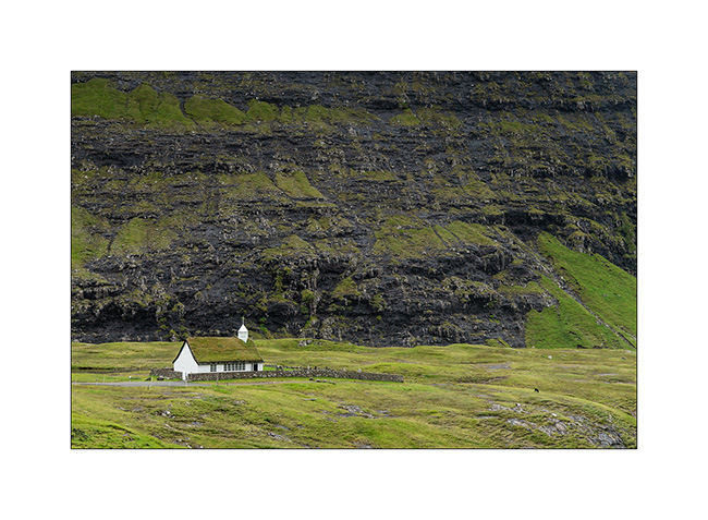
8. Small church along a fjord. There are many, always small and often with only one house around.
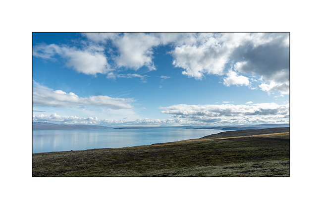
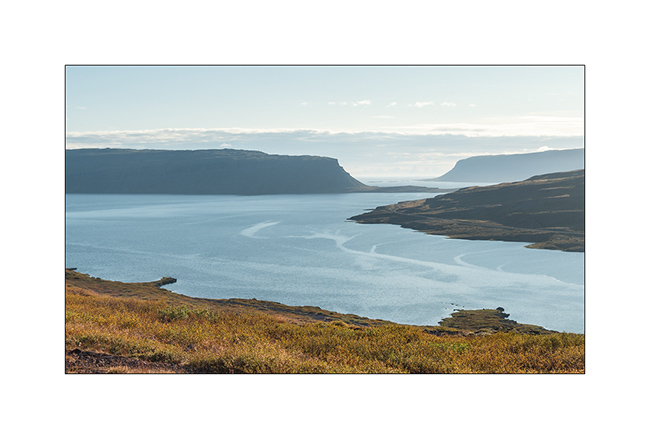
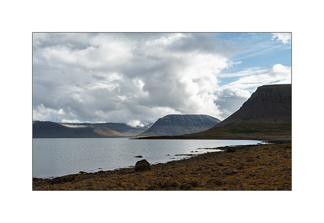
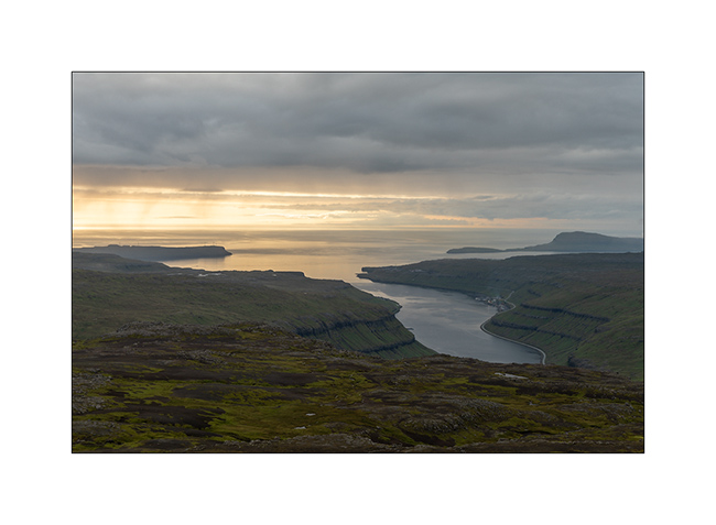
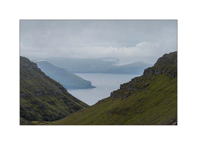
9. As VivaLaVida crosses a small pass between two fjords, the horizon deepens.
10. …
11. To reach a large beach far west of the fjords, the road is endless: while in a straight line, the GPS indicates 55 miles, it will take 125 miles of winding road to get there!
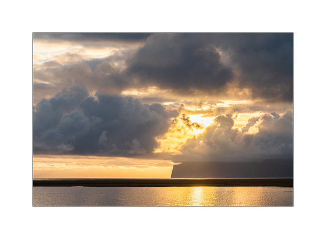
12. The end of day light is spectacular.
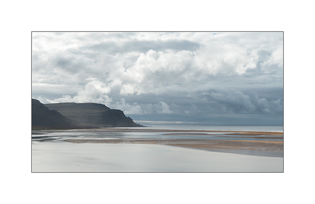
13. Rauðarsandur beach is behind this point…
14. VivaLaVida will finally reach it at sunset, enjoying last sun rays on its pretty black church.
15. Calm morning on the inlet.
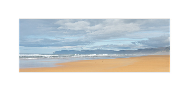
16. Rauðarsandur beach is Iceland’s largest and its color denotes with omnipresent black elsewhere. Wonder where does this colorful sand come from.
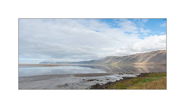
17. Refelction behind the beach.
18. Patchwork at rising tide.
19. Marine atmosphere…
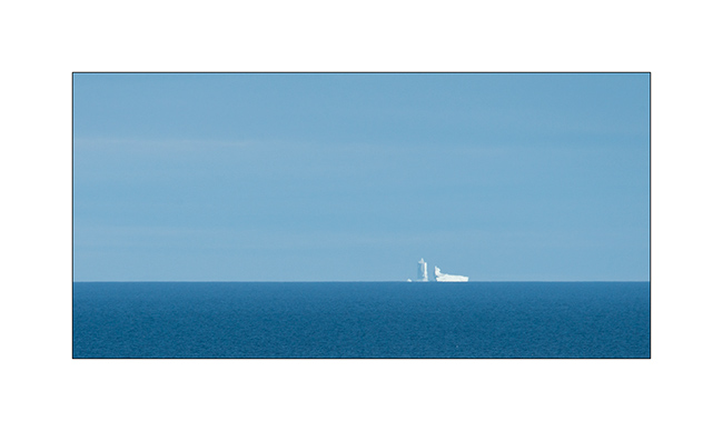
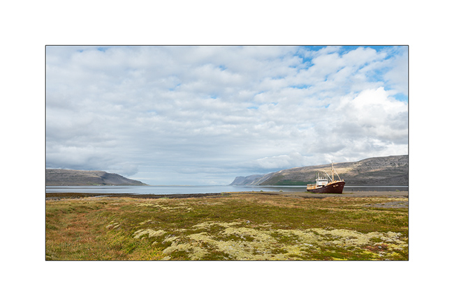
20. In a nearby bay, stop near a ship wreck.
21. These fjords are beautiful and constitute the least visited part of Iceland and let us enjoy more solitude.
22. We camp on the bank of a fjord sheltering hundreds of swans.
Discovery of Snæfellsness Peninsula coming soon. 😉
Faroes (I)
Having taken the boat from Hirtshals to Iceland, I decided to stop for three days to discover the Faroe Islands that attracted me for a long time. As I write this update from a small lost village, in the pouring rain, and don’t regret my choice. These islands are really beautiful, sheep heaths as far as the eye can see. In fact, there are only a few tens ofinches of humus on the substrate, sometimes basalt, sometimes black stone. The habitat is made of small villages of multicolored wooden houses scattered along the coast and located where there was an option of docking since it’s the Vikings who are the oldest colonizers of these islands. Here are some first pictures of VivaLaVida’s journey.
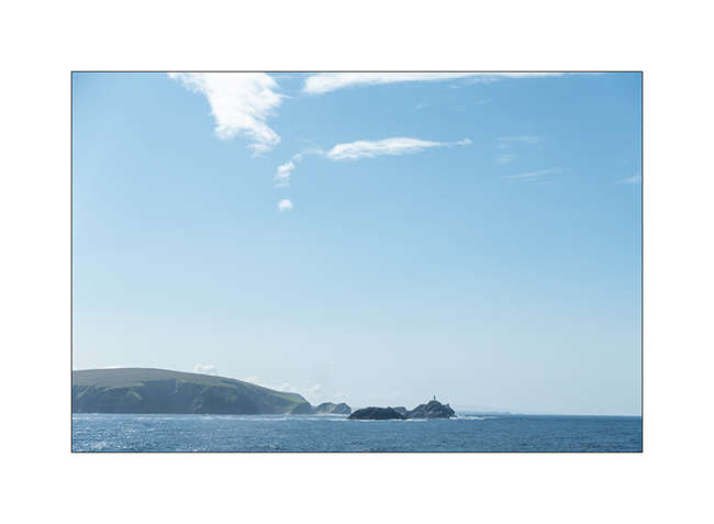
1. Before landing to the Faroe Islands, the ferry passed by the extreme Northern tip of the Shetland Islands.
2. While VivaLaVida landed at night, a small walk from my camping spot makes me discover an impressive panorama!
3. The day is announced dry and with some sun. Is it it coming from the South ?
4. Sheep stable…
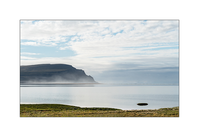
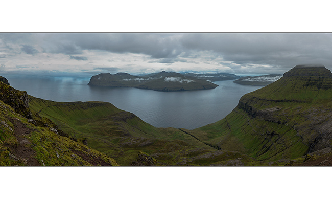
5. Each island is separated from its neighbor by one or more fjords.
6. Mix of rocks and mosses…
7. And here is the sun coming!
8. Going towards Saksund, VivaLaVida is driving along a fjord.
9. Saksund is a tiny hamlet, one of the first built on the main island, and still has several traditional very old houses.

10. Its old church.
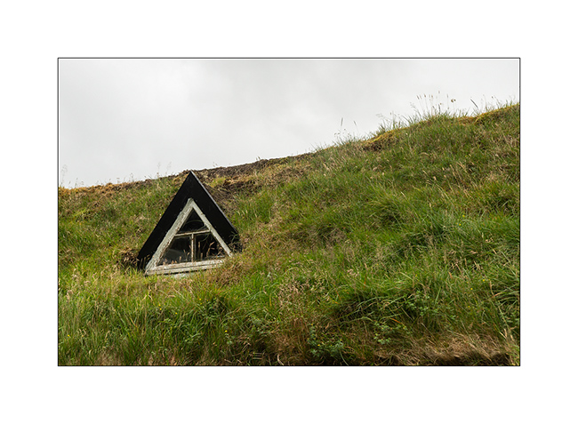
11. Specialty of these Northern countries, the roofs covered with moss and grass.
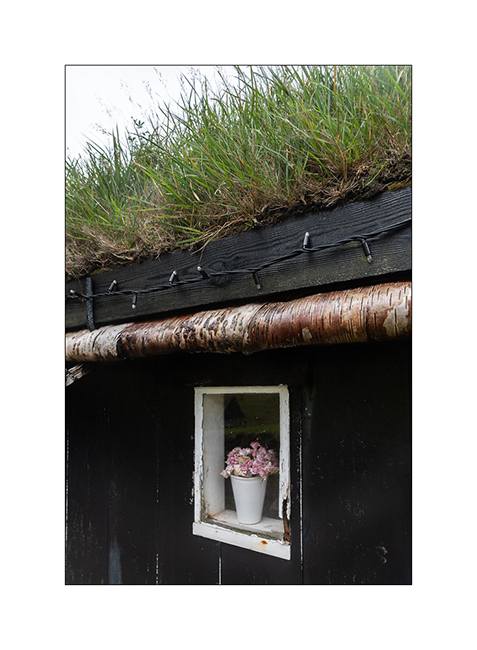
12. Window…
13. The village.
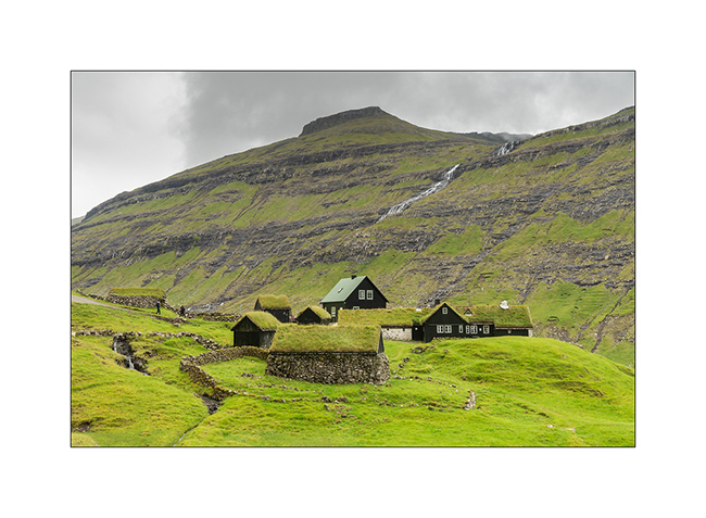
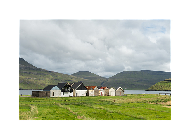
14. Boat garages a bit further along a fjord.
I will continue in a future update, just to avoid indigestion… 😉
Fjords, McKinley & Dalton Highway 1…
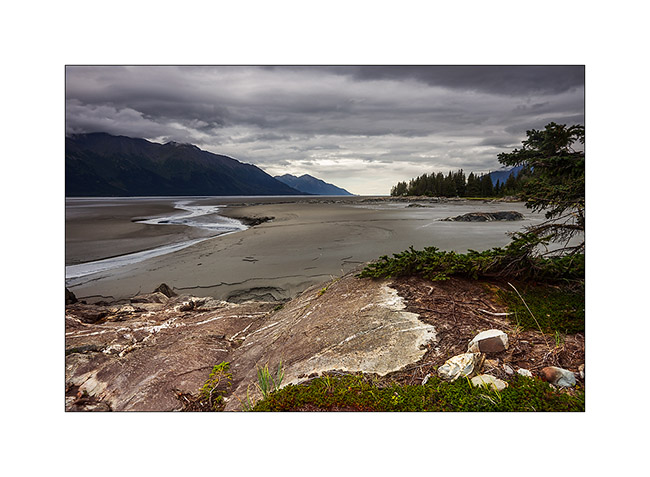
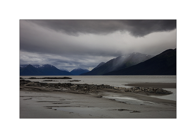
Pending favorable weather conditions to head to the far north, I took advantage of a brief lull to explore a fjord South of Anchorage. Large glacier valley, it was filled with sediment by the surrounding glaciers to the sea level or nearly. At low tide only remains a narrow channel of water in the middle. Each tide begins with a tidal wave. Not very spectacular the day I was there because the moon was in first quarter…
1. Turnagain fjord at almost low tide.
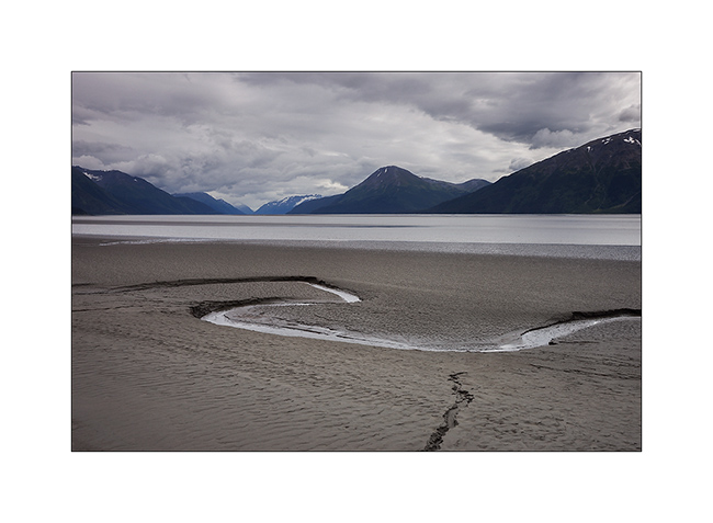
2. The channel that remains at low tide.
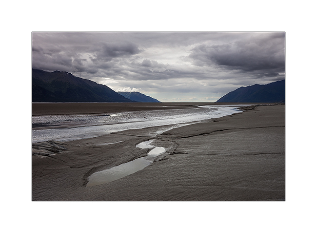
3. More than 150 miles away, the mountains of Kodiak.
4. After crossing swamps to seek a new composition… 😉
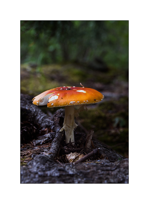
5. A non-edible touch of color in the undergrowth.
6. The lull was short-term…
And finally, after more than three weeks of waiting, thinnings were announced on the far north. Vivalavida hit the road for a 1,800 miles way before the arrival of my friend Mino.
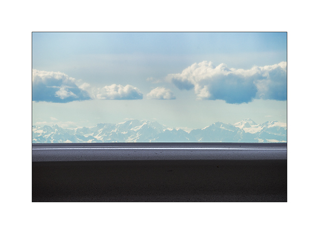
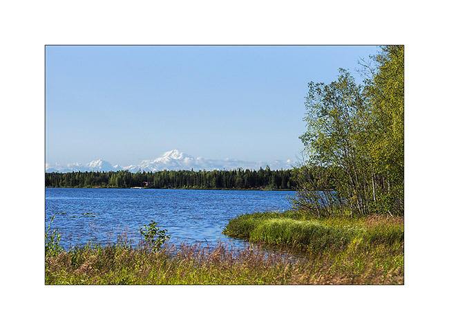
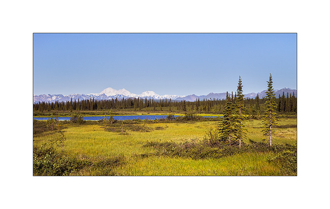
An unexpected opportunity: the beautiful weather allows me to see Mount McKinley, a rare opportunity as it is hidden in the clouds more than 80% of the year. It is the highest peak in North America, more than 20,000 feet elevation. A real giant!
7. I’m unable to transmit how big it is through my pictures but I was there still more than 120 miles away…
8. Here, still more than 50 miles away…
9. End of day on the surrounding mountains…
10. Camp next to a small lake.
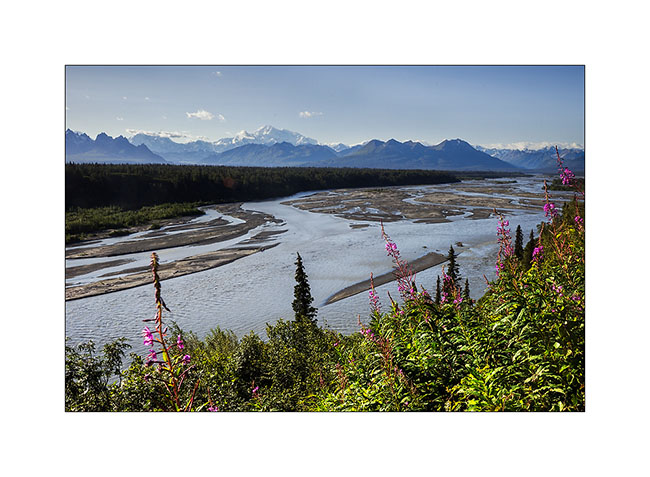
11. The next morning, the giant is still visible while I’m more than 70 miles North!
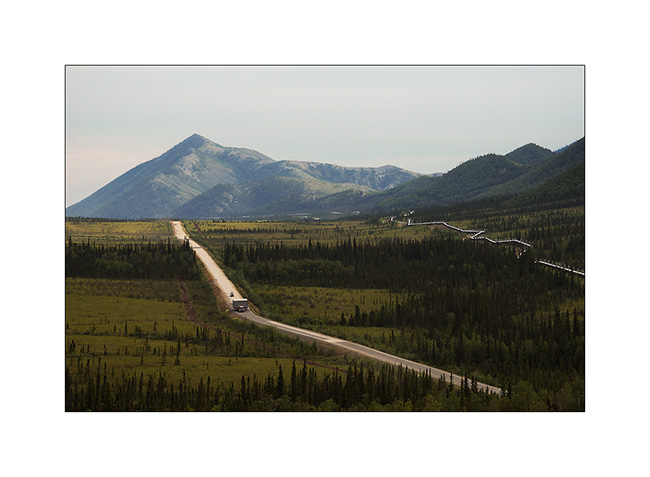
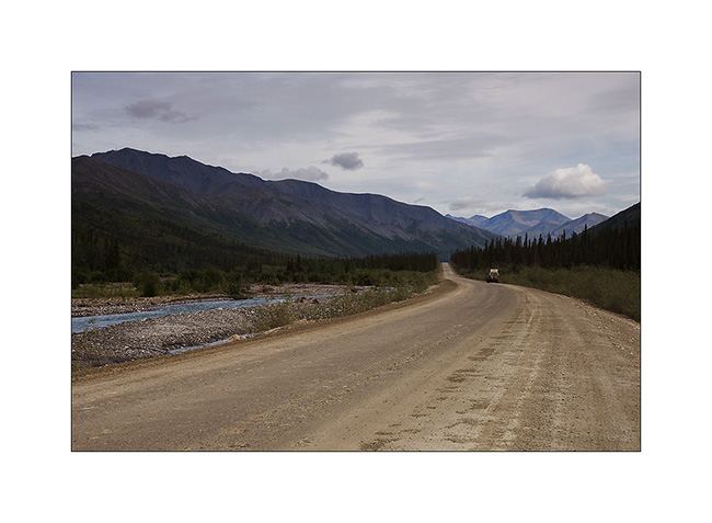
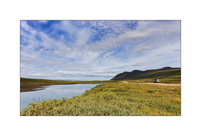
To go to the far north, there is only one path: the Dalton Highway, a 500 miles long road serving Prudhoe Bay and its oil fields. It was built along the Alaskan Pipeline and along almost its entire length. It took only five months and a half in 1976 to 15 teams working in parallel to build it, a performance driven by the short northern summer. It’s a road really committed, thin strip of dirt that goes up and down every hill in impressive percentages, then through the Brooke Range with a top at Antigun Pass, at about 3,400 feet. Only one service at mile 249, about midway. Traveled almost exclusively by large trucks that supply the oil workers, it turns into a quagmire when it rains; Vivalavida will find it out… It stays open all year round since the build of the bridge over the Yukon River.
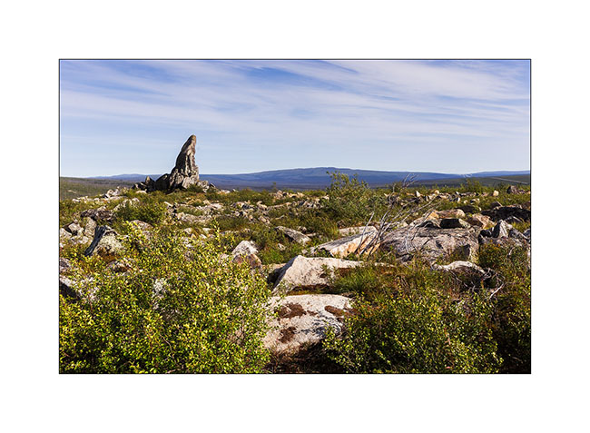
12. at mile 96, “Finger Mountain” points to the sky in the middle of the tundra.
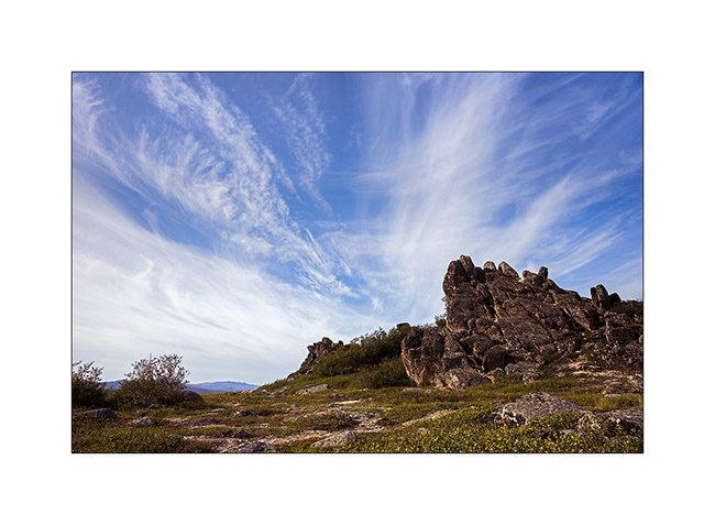
13. The sky is beautiful but cirrus clouds are already announcing the arrival of the next perturbation.
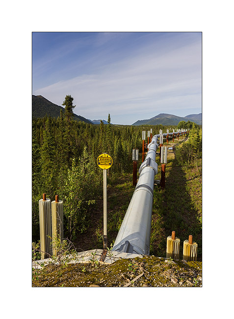
14. The Alaskan Pipeline, also completed in 1976. This is a strategic corridor for the exploitation of northern Alaska oil resources.
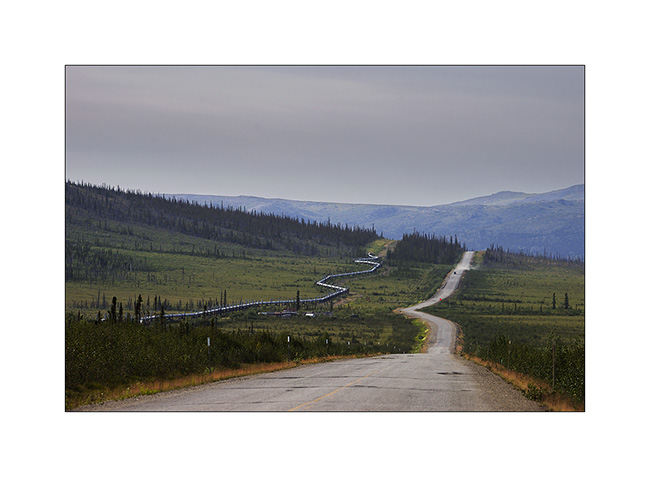
15. Its build shows great ingenuity. Each pillar is “free”, only laying on bidirectional Teflon pads. To overcome the expansion created by the magnitude of extreme temperature between winter (-60°F are common and every winter the temperature drops below that!) and summer, each tube is “sleeved free” to the next. Estimation of total theoretical expansion over the entire length would be more than 8 miles from Prudhoe Bay to Valdez terminal, 800 miles south..!
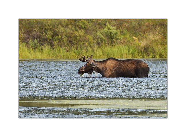
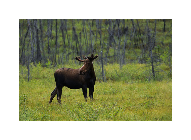
16. An moose grazing aquatic weeds that grow at the bottom of this small lake. They love it!
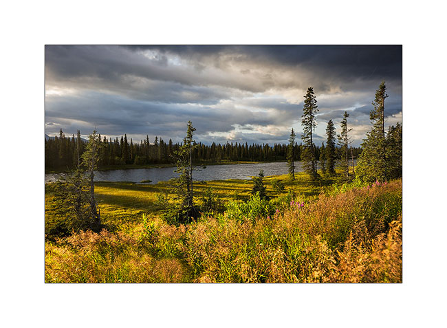
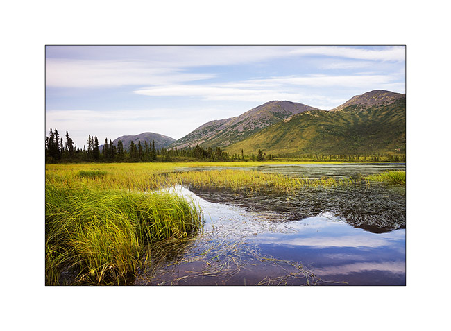
17. Small lake besides really aesthetic…
18. Everything passes through the Dalton; here, an about 25 feet wide house on this oversize convoy..!
19. Another moose seen from my camp in the morning.
20. Mirror…
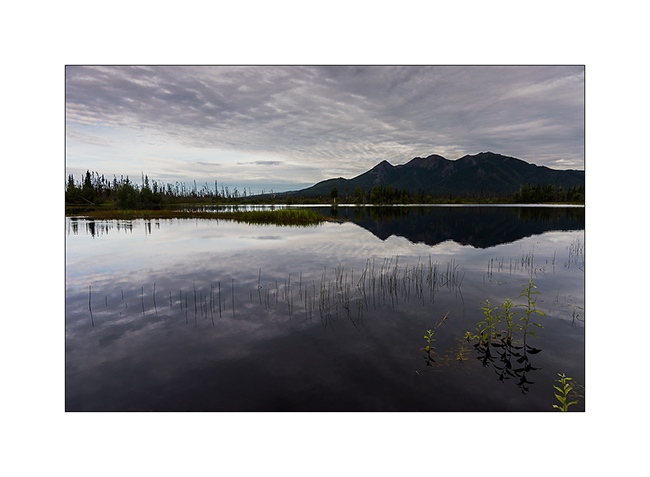
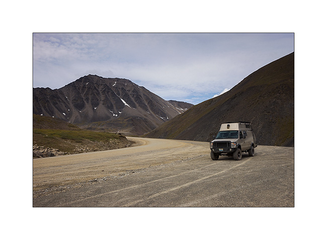
21. VivaLaVida on the northern foothills of the Brooke Range.
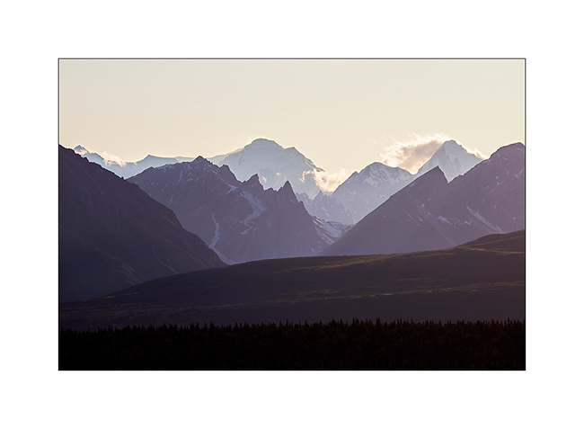
22. Antigun Pass.
23. The Brooke Range is superb, with beautiful streams that dig valleys.
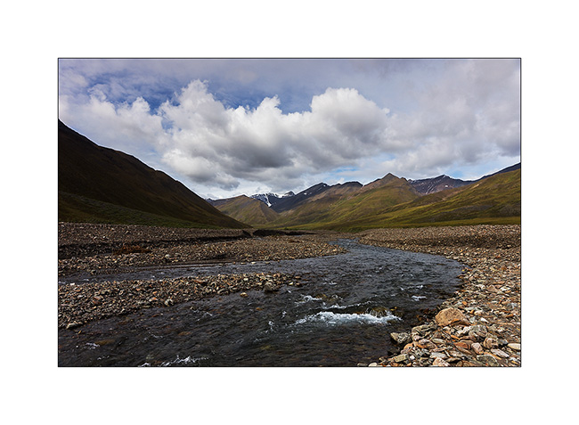
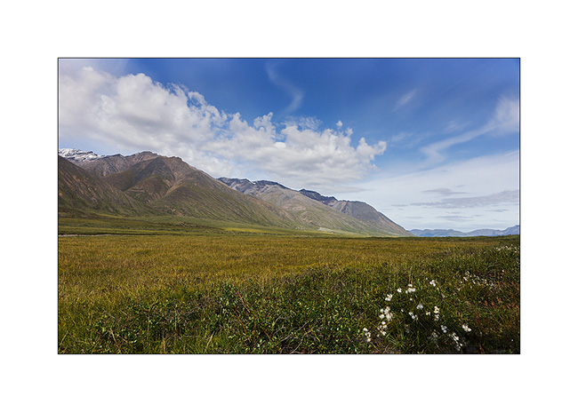
24. No more tree since mile 215. It’s to far North, the climate is too harsh. Only the tundra remains.
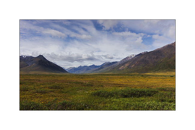
25. I take the opportunity of this thinning to “strafe” these moorland landscapes that are probably the ones that attract me the most…
26. VLV looks really small in these landscapes…
27. … dotted with small lakes.

Following of the thinning and return of bad weather in the next update… 😀
 D5 Creation