Colorado @en
now browsing by tag
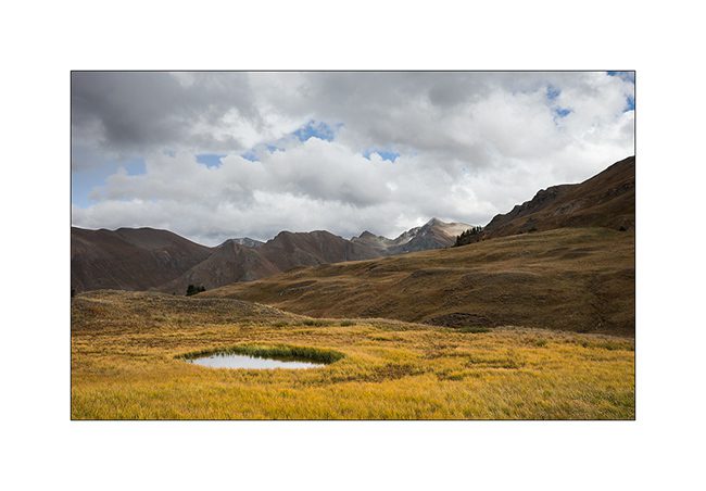
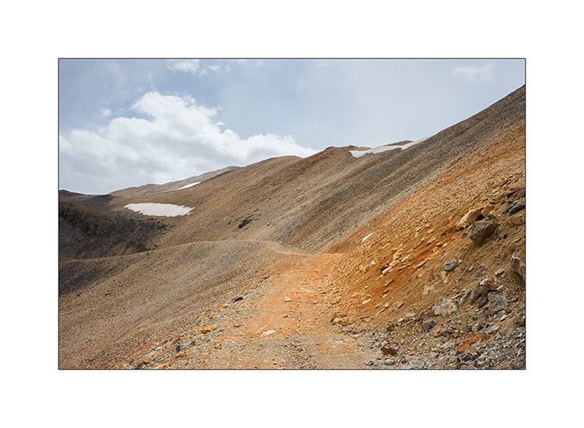
Last 14000…
I couldn’t leave Colorado without a detour to the Mecca of US motorsport… 😉
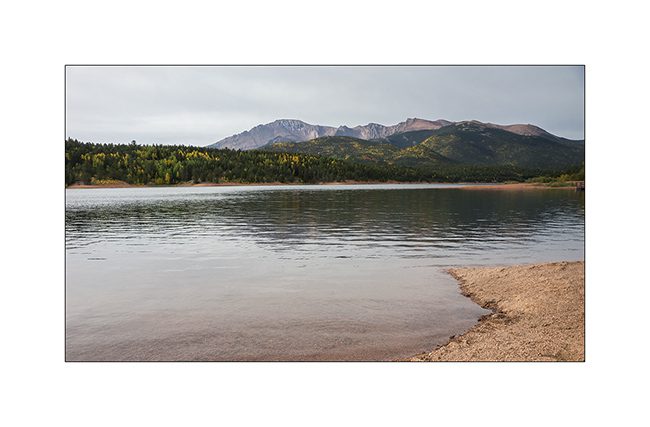
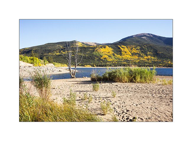
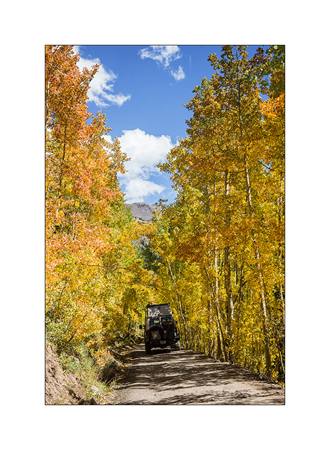
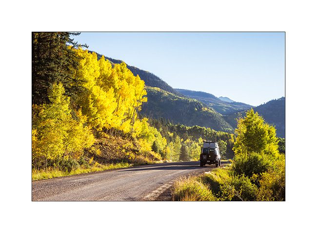
1. Fall colors in early morning…
2. So motorsport enthusiasts, you recognize the track? 😉
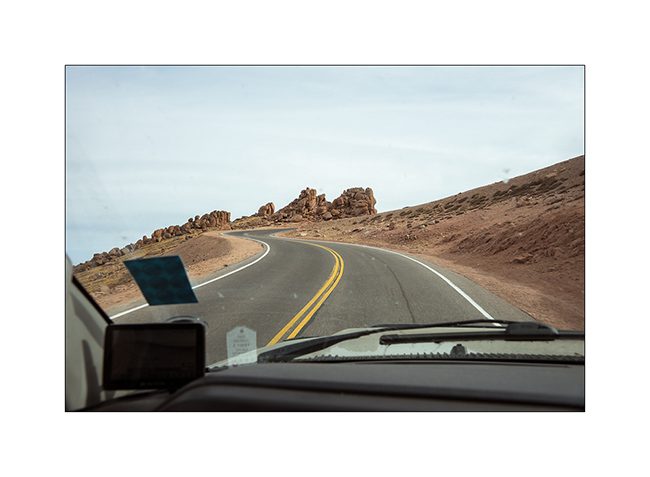
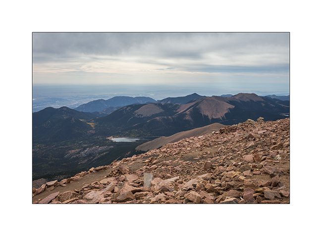
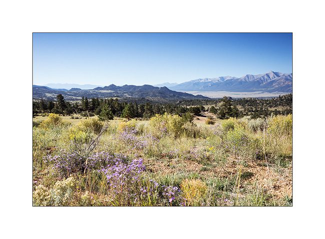
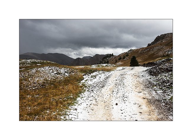
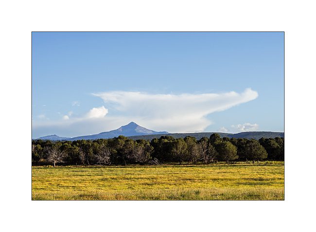
3. Yes, it’s the Pikes Peak road now paved till the summit culminating at 14,115 feet above sea level! On the first range of the Rockies, I can see the plains toward Eastextending over 1,500 miles…
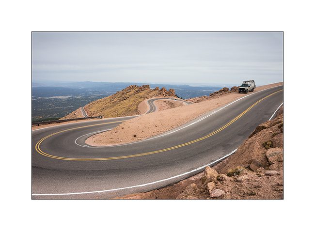
4. This road is just magnificent, the perfect hillclimb … Don’t worry, VLV didn’t brake Loeb’s record! 🙂
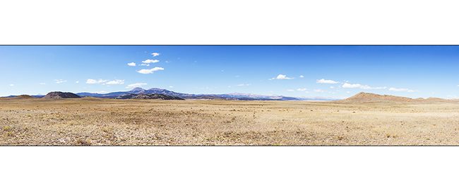
5. Then Eastward through shortest path…
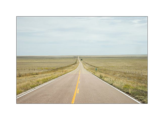
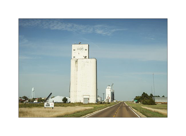
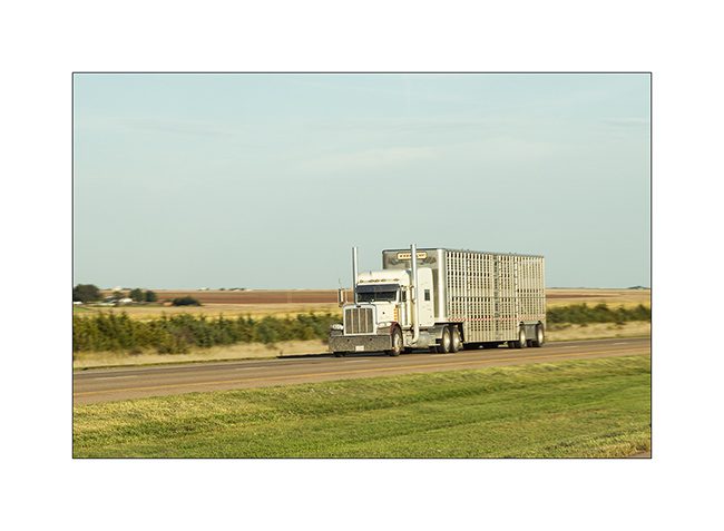
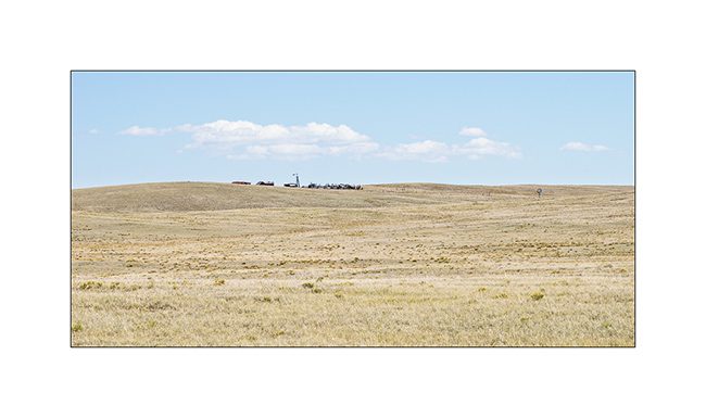
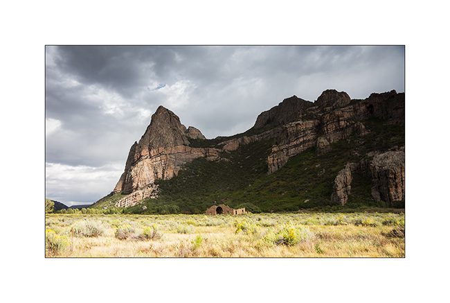
6. The first 300 miles, it’s kind of desert where only graze a few scattered groups of cows. Then, Kansas is mainly dedicated to cereal growth. Large silos appear sometimes in the endless plain.
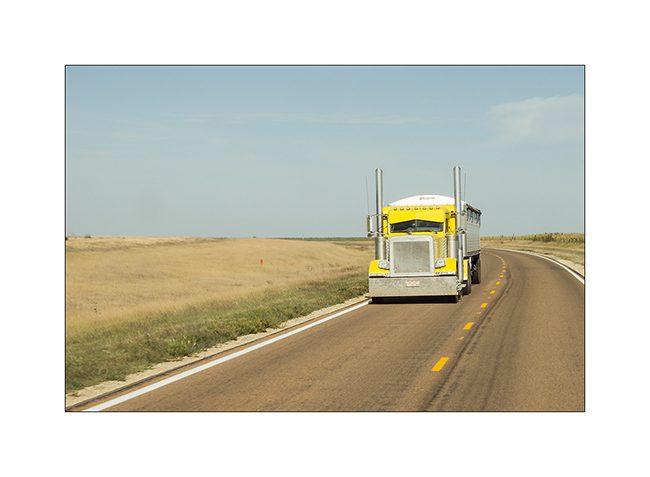
7. VivaLaVida only crosses trucks.
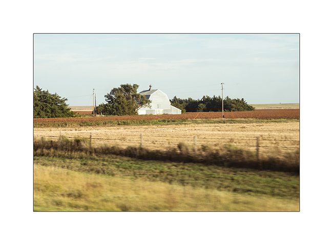
8. Small farm photographed on the fly, when drivingg…
9. I love these trucks!
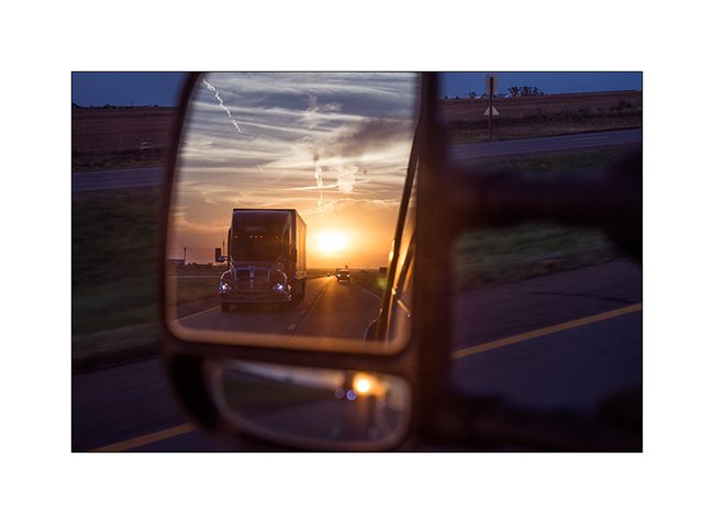
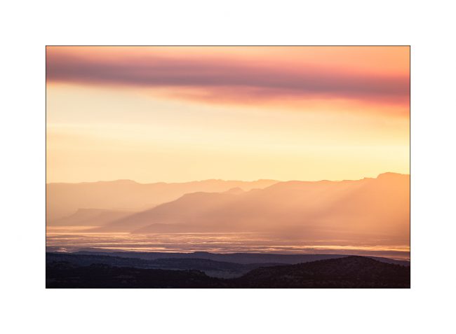
10. Sunset…
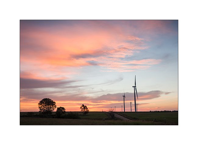
11. Early wake up in a wind farm where I spent the night.
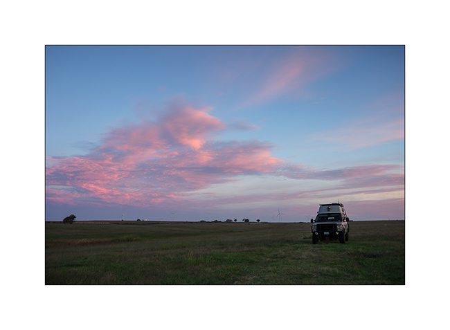
12. VLV doesn’t need much to stop…
13. Driving through Kansas City…

14. … then St-Louis, Missouri.

After two days driving accross the continent and some 1,700 miles further, VLV joined Georgia where I had dinner with my friend Colin before reaching North Carolina to begin work that should allow to register VLV in Switzerland.
I will tell you more in a few days… 😀
Arch and highlands…
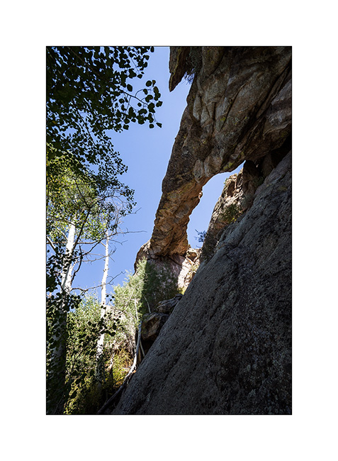
As written at the end of the previous article, I went to discover a natural arch, one of these natural formations that always attract me much. These, called Aspen Arch, is fairly isolated. To achieve it requires first finding your way through a maze of various tracks more or less maintained and then, about 20 miles further, to hike through virgin nature on a sometimes steep mountainside.
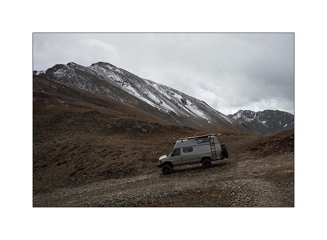
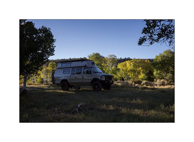
1. The place I left VivaLaVida for a few hours…
2. After 3 hours hijing and some pretty climbing, I discover Aspen Arch.
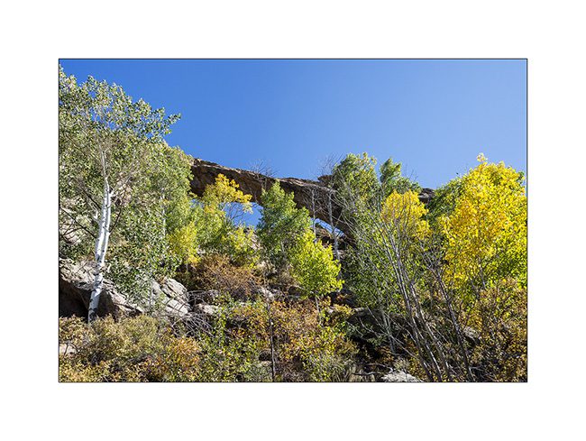
3. Its about 70 feet long impress!
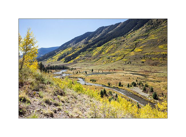
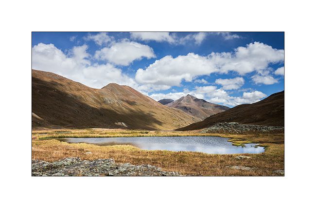
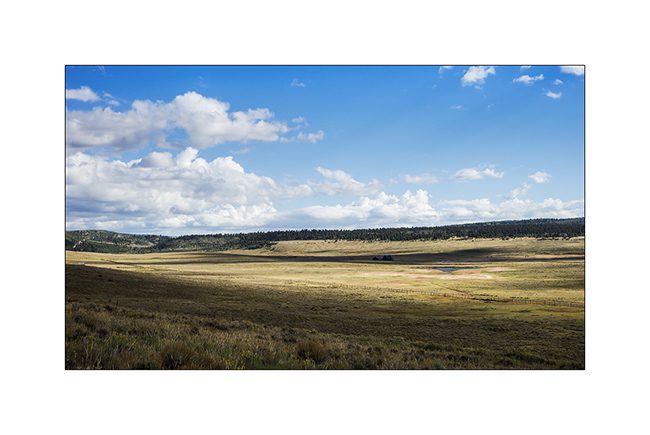
4. Continuing her way eastward, VLC crosses beautiful highlands.
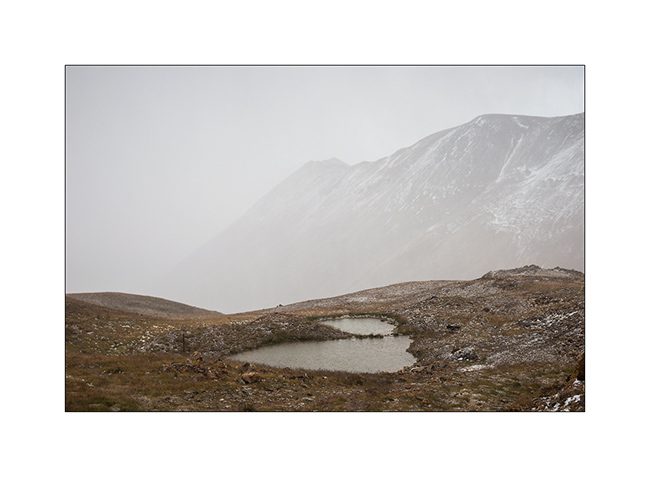
5. Lost ranch…
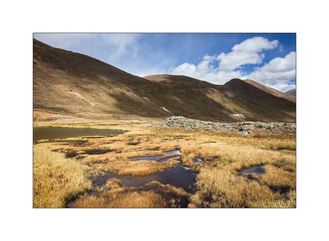
6. Looks like the Altiplano sometimes, here with a salty pond…

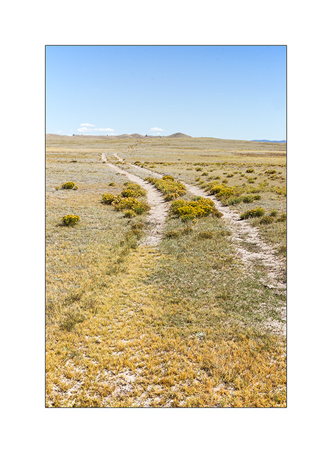
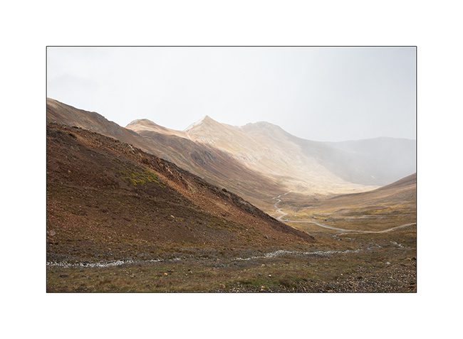
7. The track is not very marked in places…
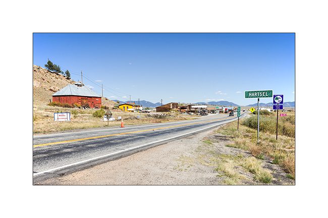
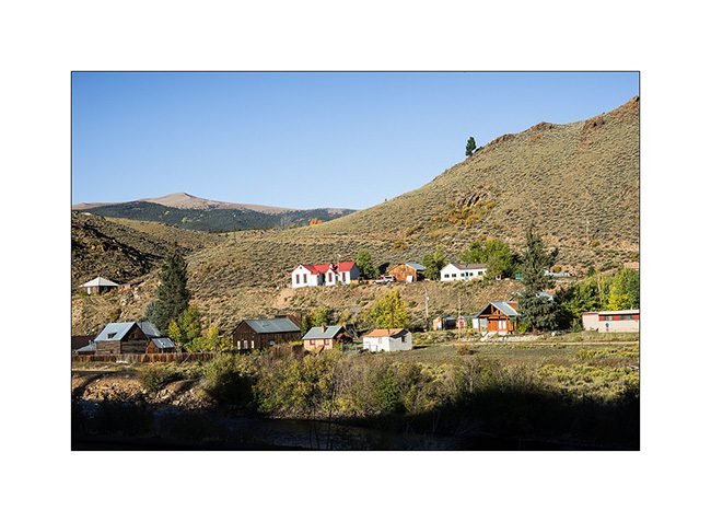
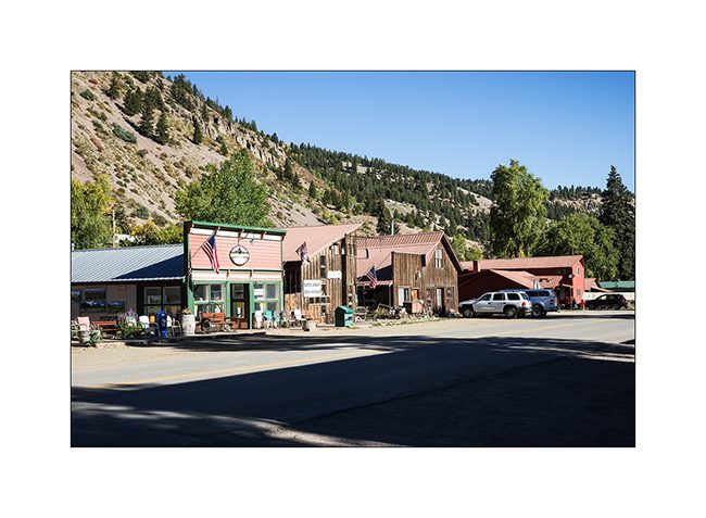
8. In Hartsel, small highland village…
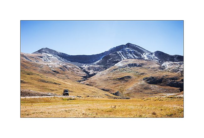
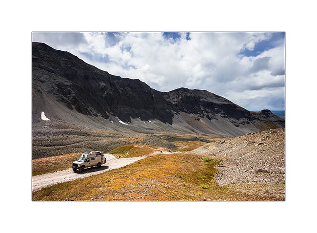
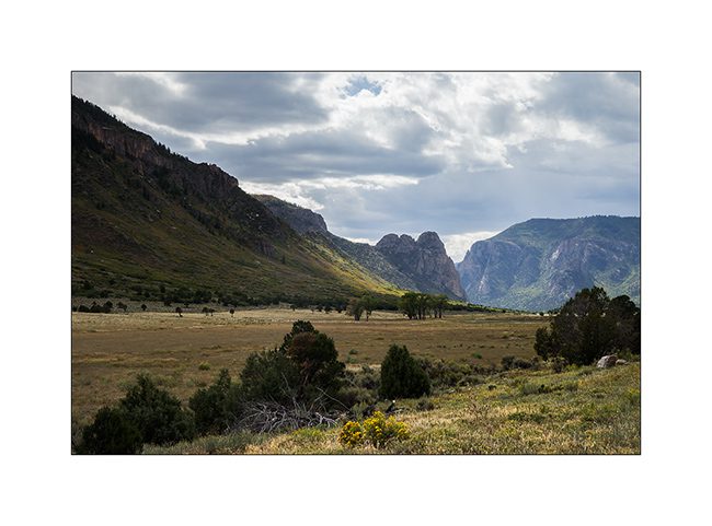
9. Another ranch, a bit further, as VLC approach the last mountain range before the great plains, laste Rocky Mountains range eastward.
10. Not far from the road, a small group Pronghorn antelope, the last species of wild antelope in North America.
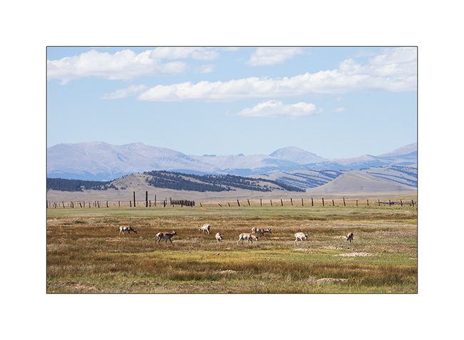
11. With some patience, I let them approach.
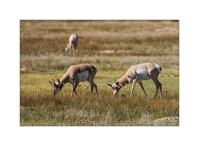
12. VLC sometimes serves me as a blind! 😉

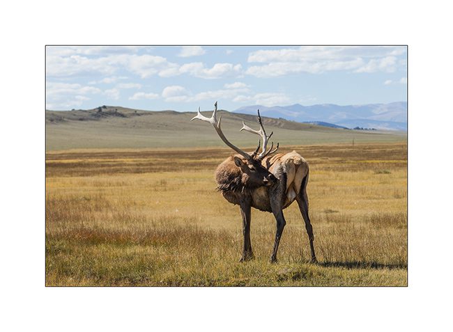
13. Only a few miles further, a new unexpected meet: a beautiful deer that VLV hardly scares.
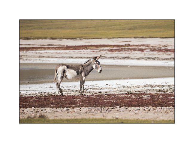
14. And a small band of burro, wild donkeys.
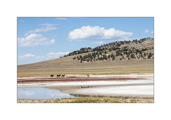
15. That day, they were more fearful than the deer, I couldn’t approach that much!
Continuation and end of my crossing of Colorado in a few days…
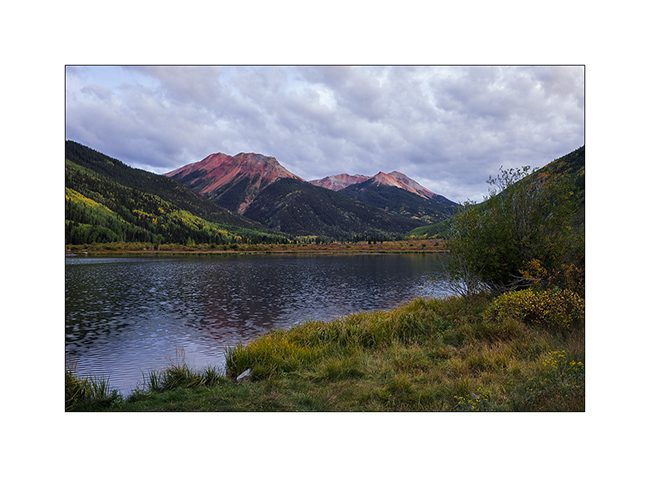
Still in Colorado
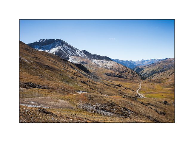
Transition stage still in Rocky Mountains.
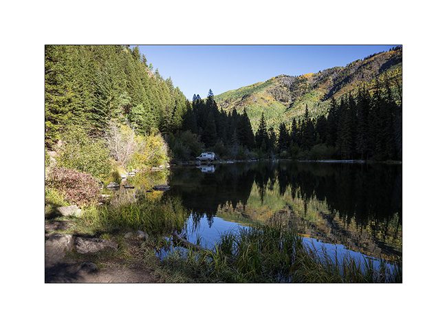
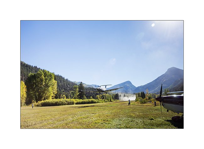
1. Being back from my walk to Crystal Mill at night, I slept at the edge of Lizard Lake, just above the village of Marble.
2. Surprise in the morning: the small Marble air strip host an aviation meeting. Something for you Marc-André! 😉
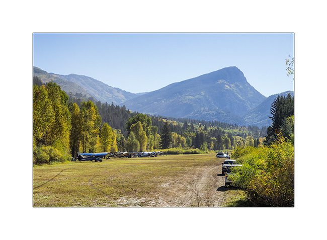
3. Everyone came for the night with tent and picnic and leaves the next morning.
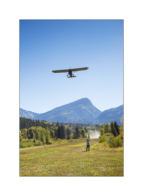
4. Radio is ensured by a simple walkie-talkie at the edge of the track to which everyone has free access.
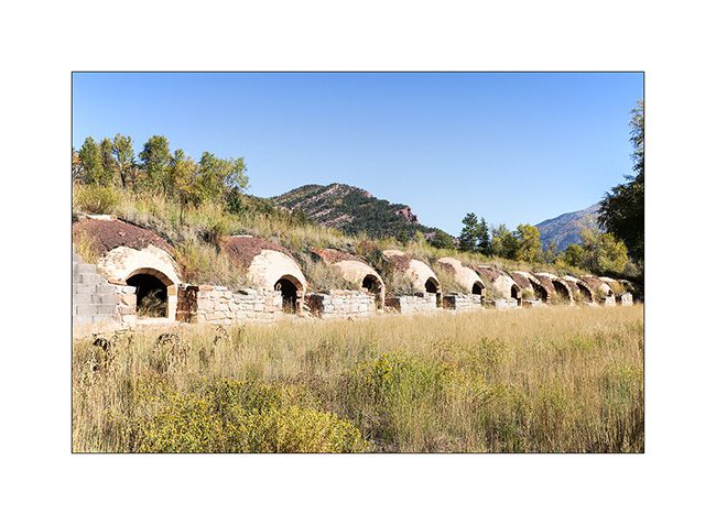
5. A little further, the site of Redstone and his row of charcoal kilns. Beautiful!
6. After a short stop in the posh resort of Aspen, VLC crossed the Independence Pass, at about 12,000 feet above sea level.

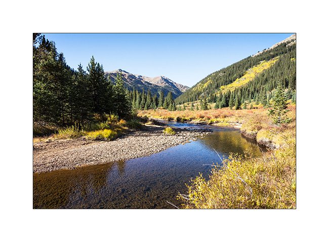
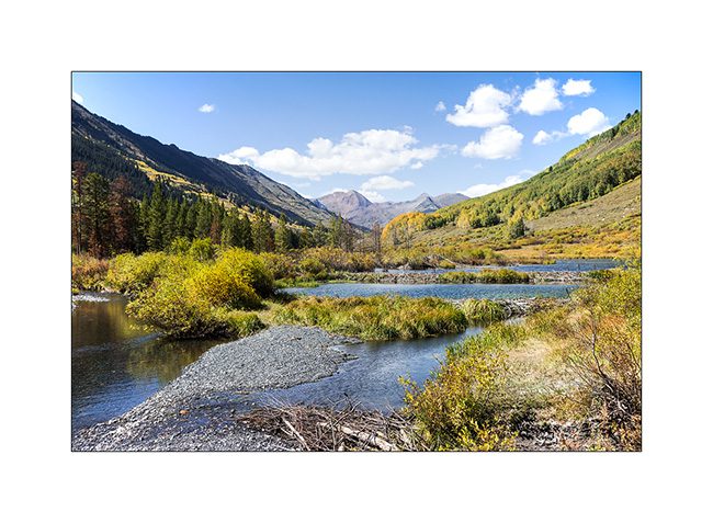
7. Mountain river.
8. The first of beautiful Twin Lakes.
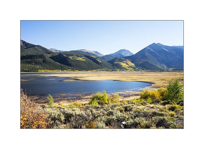
9. It’s good to walk there for a while…
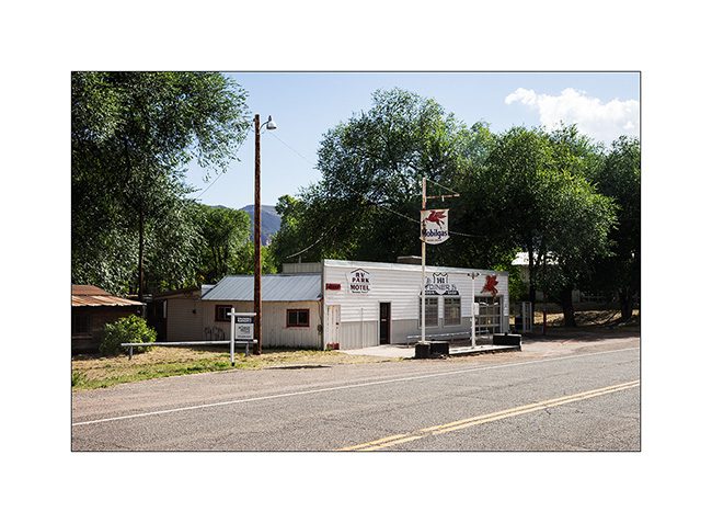
10. Small town along the road…
11. A track that should lead me to another natural arch…
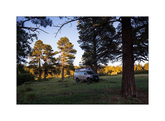
12. Another nice boondocking spot into the wild…
I will show you Aspen Arch in the next update! 😀
Further North but still in Colorado
After a few days at high altitude, I finally came down, well … a bit since I stayed between 7,000 and 11,000 feet.
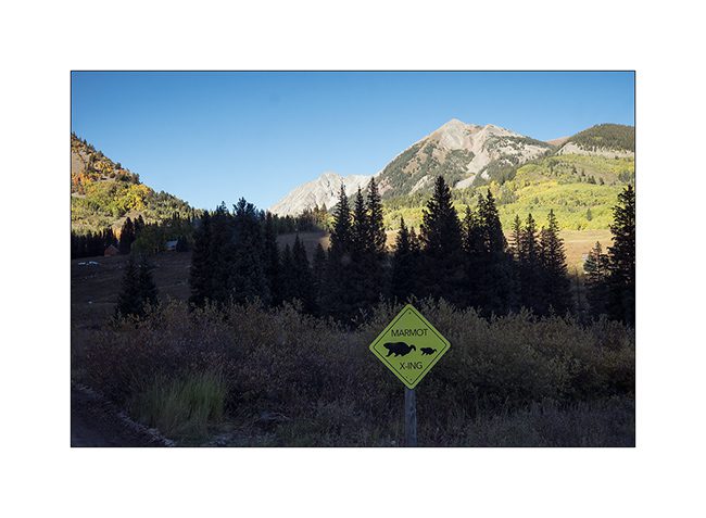
1. A sign I had never seen yet..! 😉
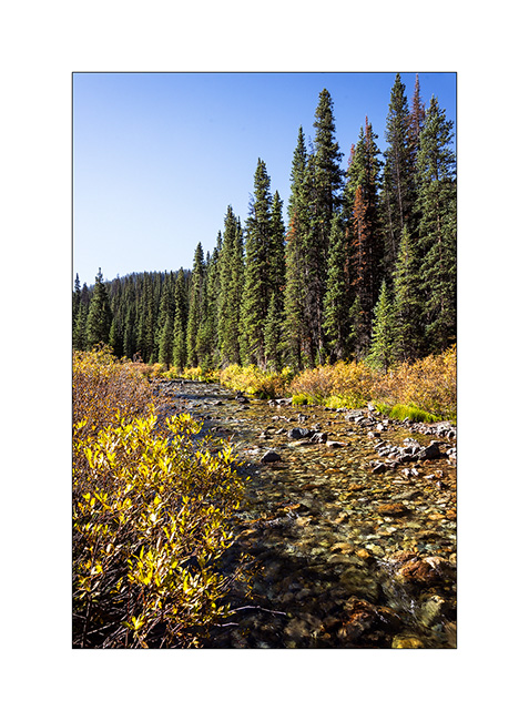
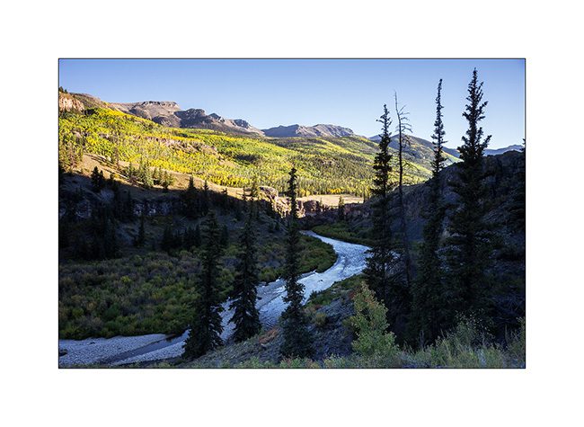
2. La Crystal River in early morning.
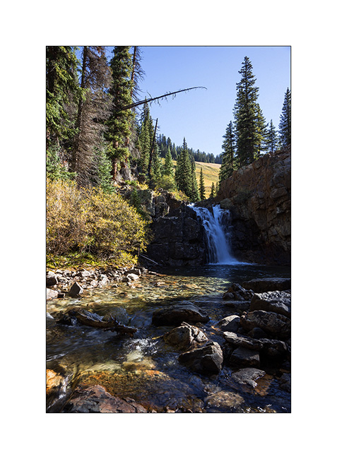
3. Small waterfall not far of my camp.
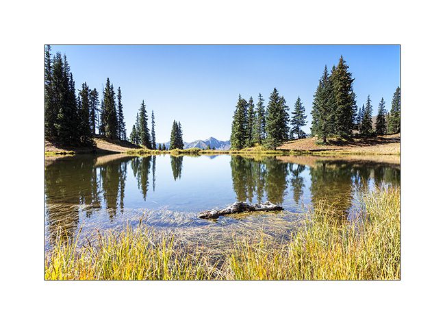
4. After passing Schofiled Pass, I reached Paradize Divide and its beautiful little lake.
5. going down in Paradize Valley gilding by aspens.
6. VivaLaVida likes it!
7. I tried passing the Gunsight Pass but the last track section was swept away by a landslide. So I stopped near a small mountain lake to snack before going back down…
8. Gilding aspens…
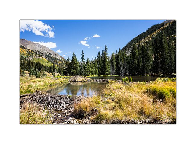
9. Another beautiful river inhabited by beavers…
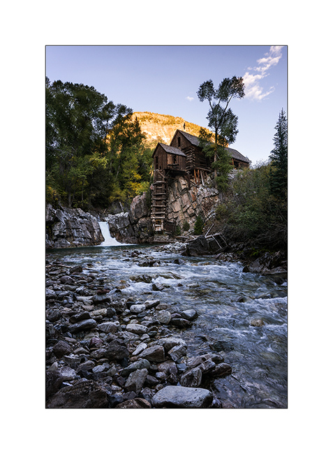
10. And finally, Crystal Mill, an old mill dating from the small mining Crystal Town, circa 1890. I unfortunately arrived after the sun set…
More to come soon…
Alpine Loop (2)
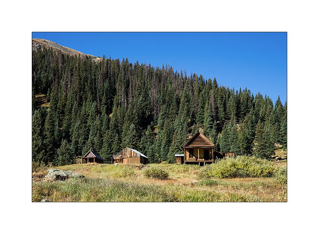
I slept in Animas Fork. This is an old mining town founded in 1880 and which was abandoned around 1920 when the fall of the metal rate during the great depression made their extraction unprofitable. The village hosted up to 450 people during the summer of 1887.
1. The village transformed into a Ghost Town but an association keeps the remains in a state close to the original.
2. The “mill” that served to separate ore by block sizes collapsed.

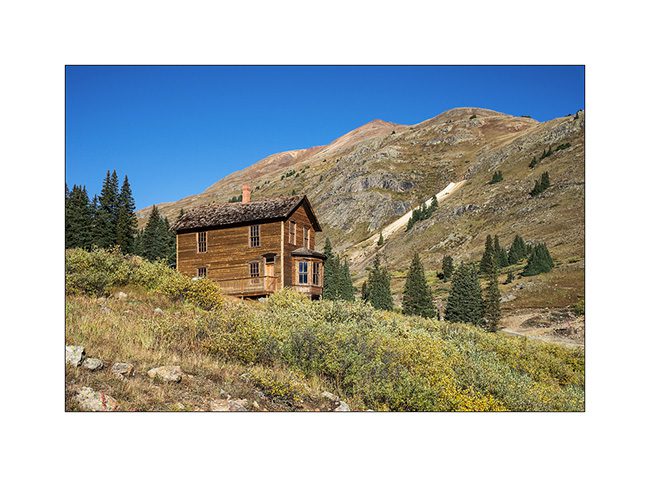
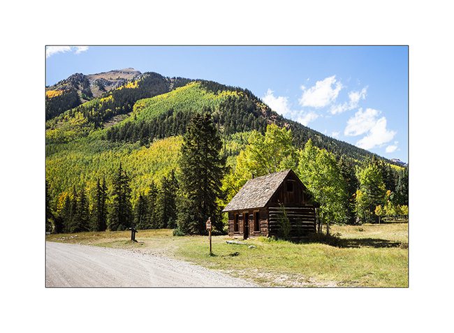
3. Well preserved house that housed two families (one per floor).
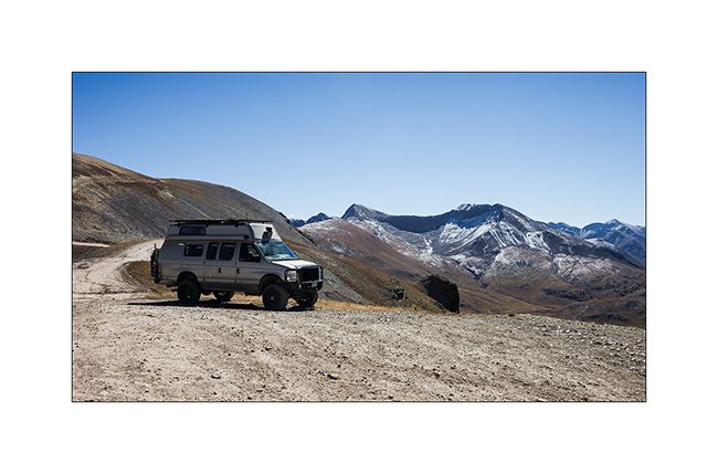
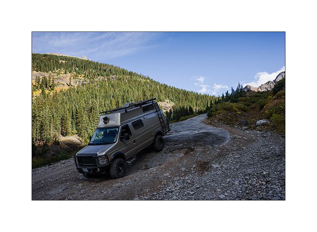
4. VivaLaVida heading to another pass over 13,000 feet : Engineer Pass.
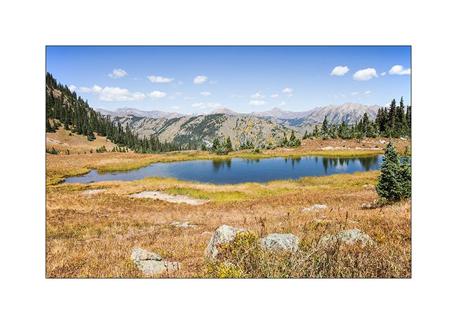
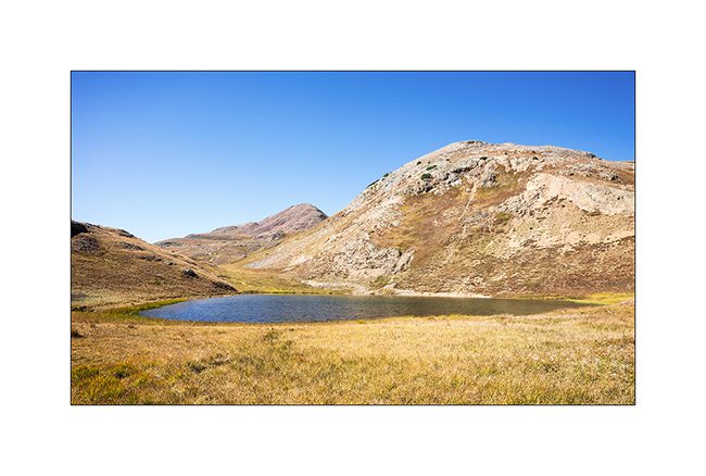
5. Small alpine lake…
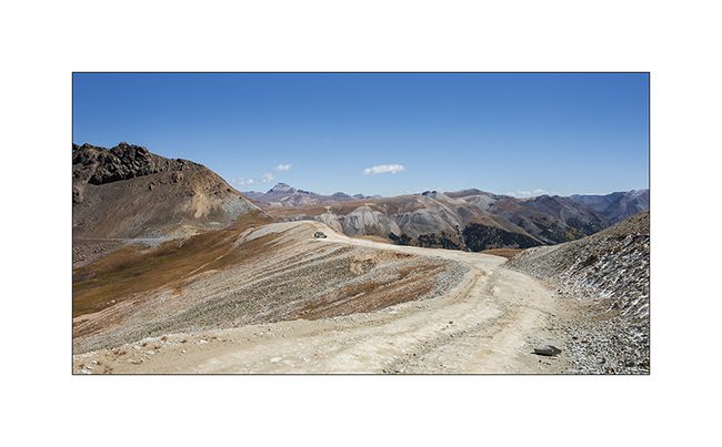
6. The track rises in the tundra. It doesn’t seem but some sections are quite steep.
7. Reaching the pass.
8. Grandiose panorama…

9. VivaLaVida looks small up there!
10. Tundra and Snowy rocks.
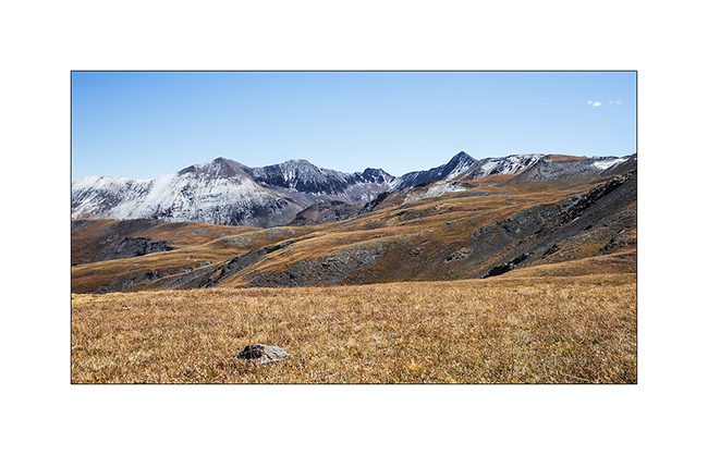
11. Touch of vegetal color…

12. Facing to the North…
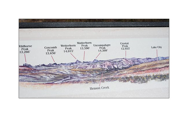
13. … there is a “Matterhorn Peak”! Funny Americans! 😉
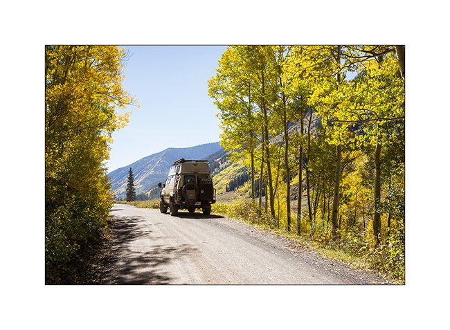
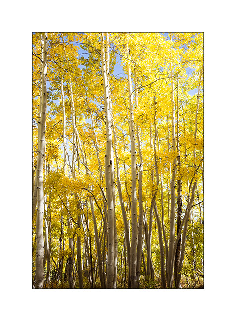
14. Descent into the aspens I so love and who, on this slope, began to take their fall colors, such intense orange yellow !
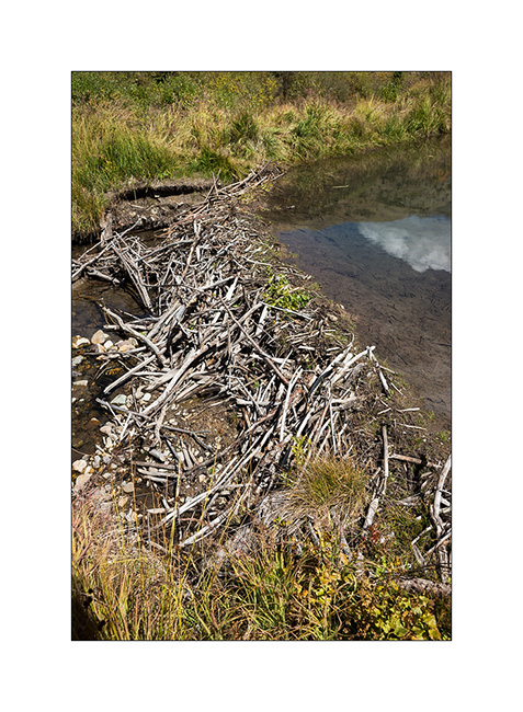
15. A small lake made by Mr. Beaver!
16. Dam builder.
17. Capitol City.
18. Indicator of past industrial activity, an arch dam built around 1890 or what is left…
19. Beautiful house in the picturesque small mining town of Lake City.
20. 2nd street…
21. Cinnamon Valley in late afternoon.
22. Aspens.
23. last sunrays on the road.

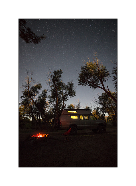
24. Cheers from my camp along the Lake Fork Gunnison River.
It continues with some other places of Colorado in a few days. Thank you for your loyalty to follow this blog! 😀
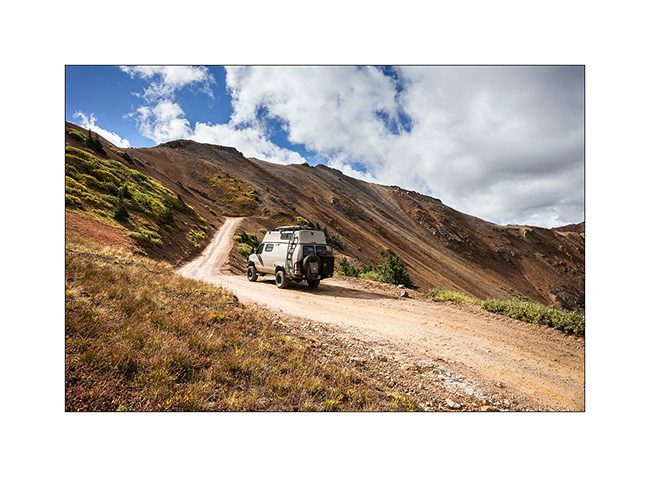
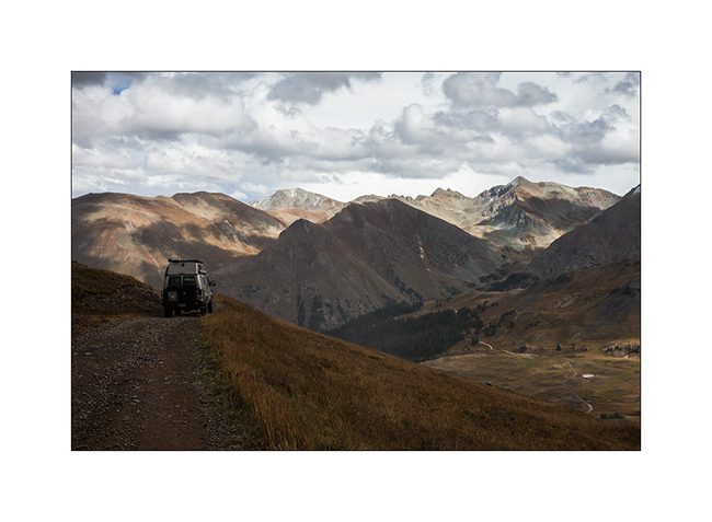
Alpine loop…
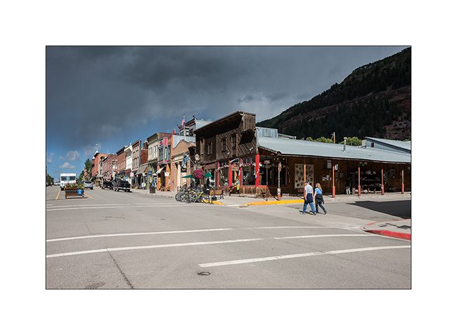
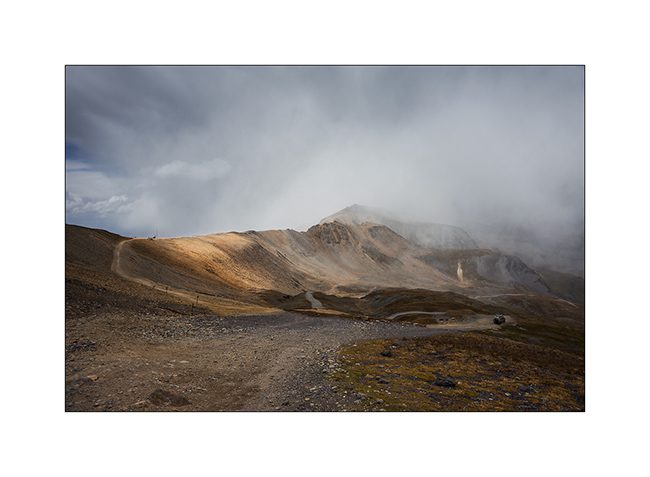
Imogene Pass is by far not the only track traced in these mountains. I went through Ouray buy some fresh food before traveling part of the Alpine Loop, a track that some Jeep enthusiasts love to discover.
1. In Ouray even more than in Telluride, we believe to be a century ago!
2. The opera building.
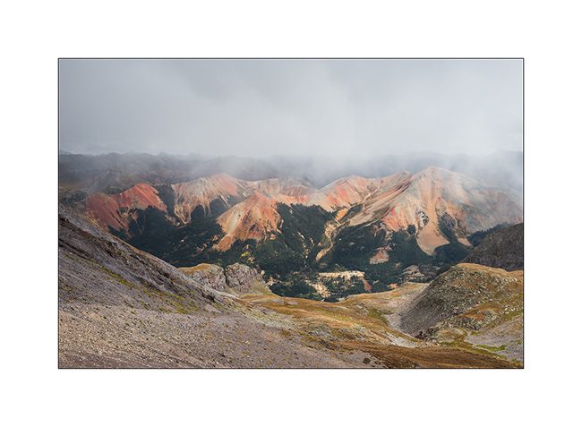
3. Red Mountains which are aptly named, since my camp.
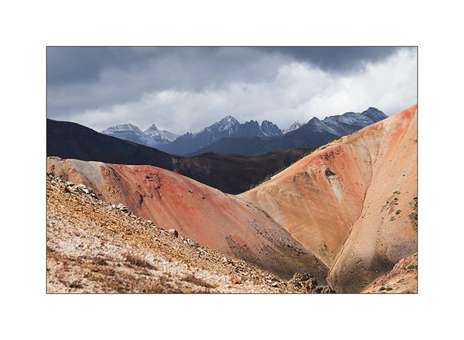
4. The next day, VivaLaVida begins by Gray Copper Gulch roa, amid the Red Mountains.
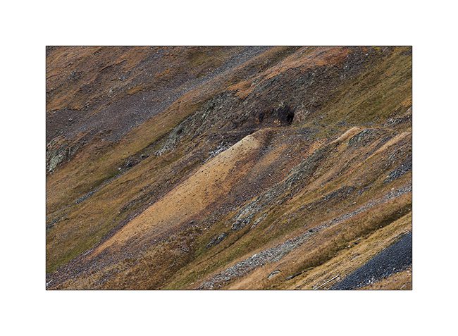
5. It’s color of the iron oxide which obviously gave their name to these mountains.
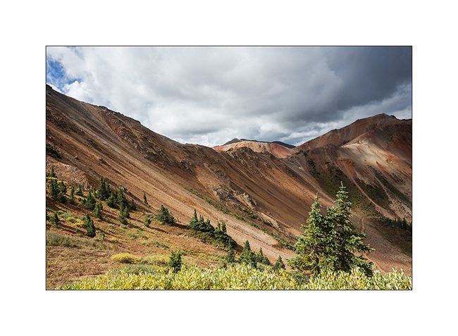
6. Colors are awesome!
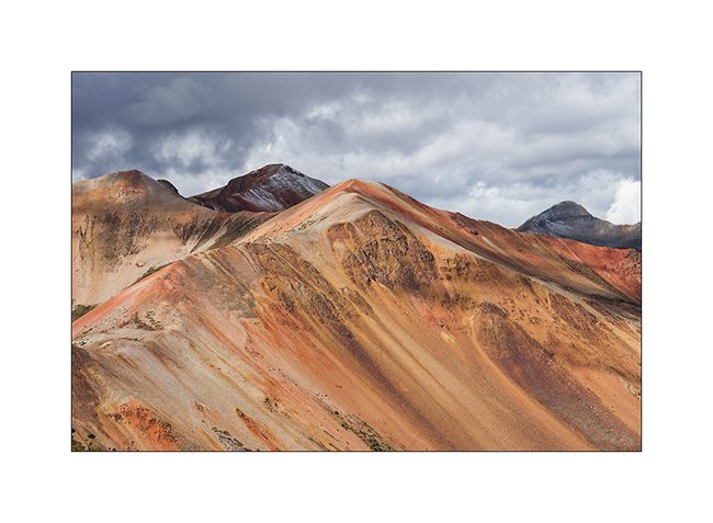
7. While on the nearby mountains, the iron ore concentration is not as important.
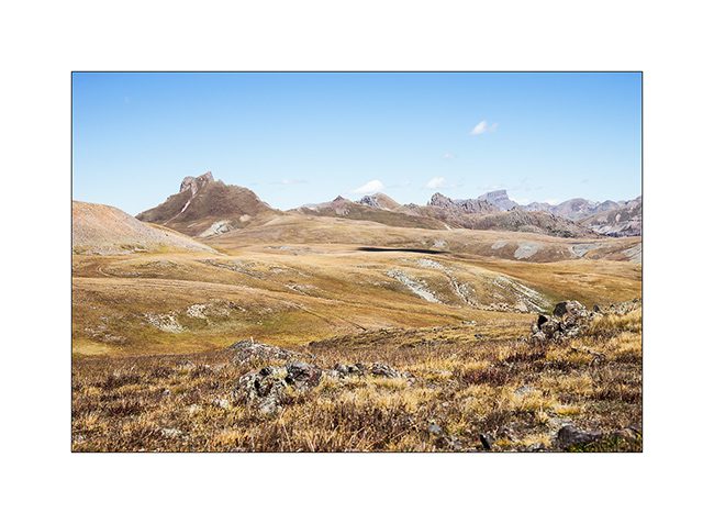
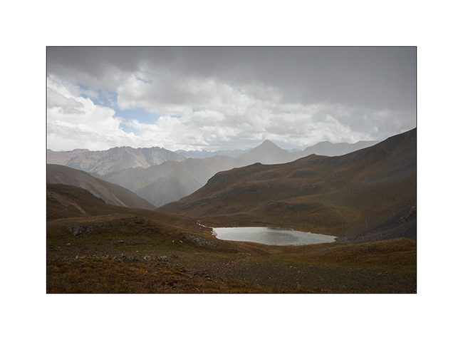
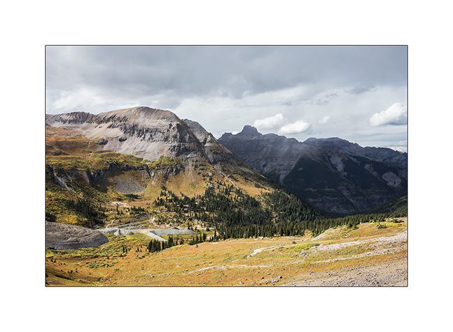
8. At the first pass (12,400 feet), a small lake…
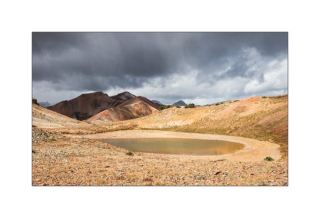
9. A little further, another cad and peaks powdered with snow of the night.
10. Lake Como, the larger of the area.
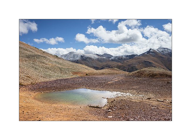
11. VLV cashes altitude unflinchingly.
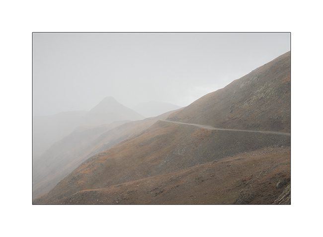
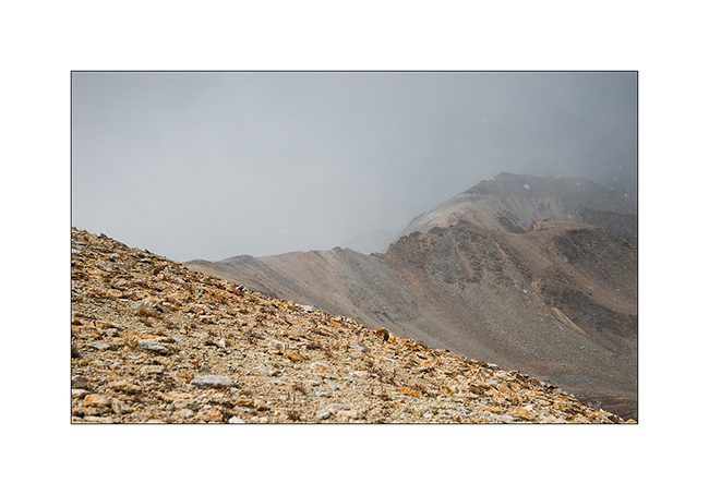
12. Snow shower at 12,700 feet, over California Pass.
13. Downhill on the other side while the shower goes away.
14. I left VLV a few hours to walk to a swampy area.
15. Altitude bogs…
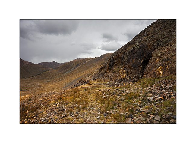
16. Everywhere, mining relics leave their trace. Here, a typical mine with tongue extracts waste.
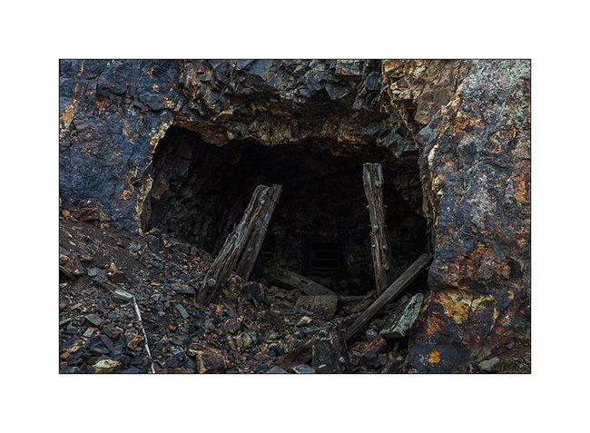
17. entrance of Silver Queen Mine…
18. All were closed to prevent accident.
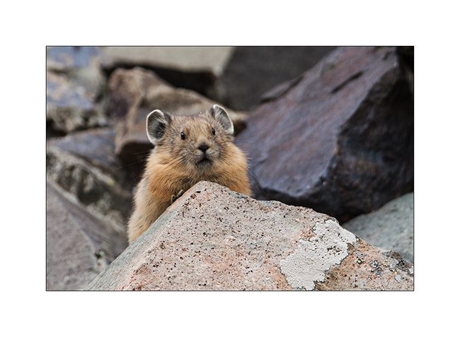
19. Nice surprise: I could finally capture the portrait of an adorable pika, so lively that it’s almost impossible to photograph.
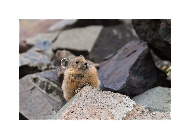
20. It lives in screes and it sneaks in full speed.
21. New snow shower.
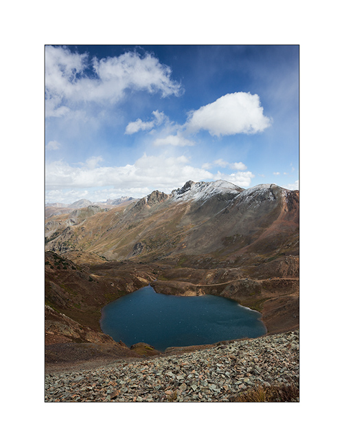
22. Small alpine lake.
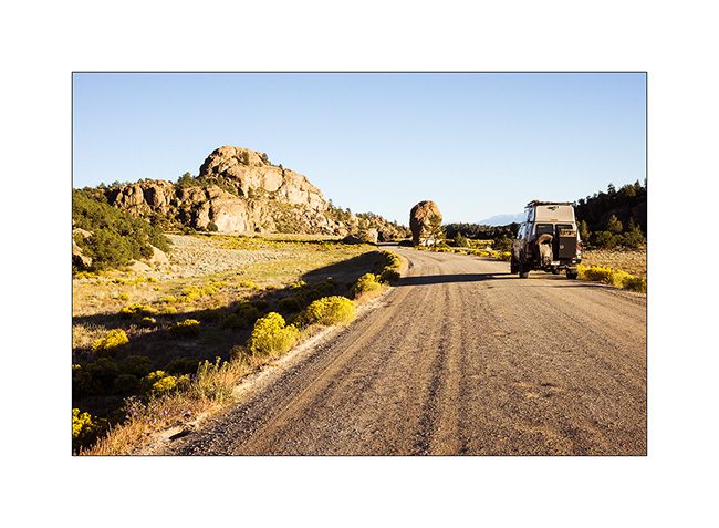
23. Downhill into the next valley. I only saw two Jeeps that day…
nbsp;
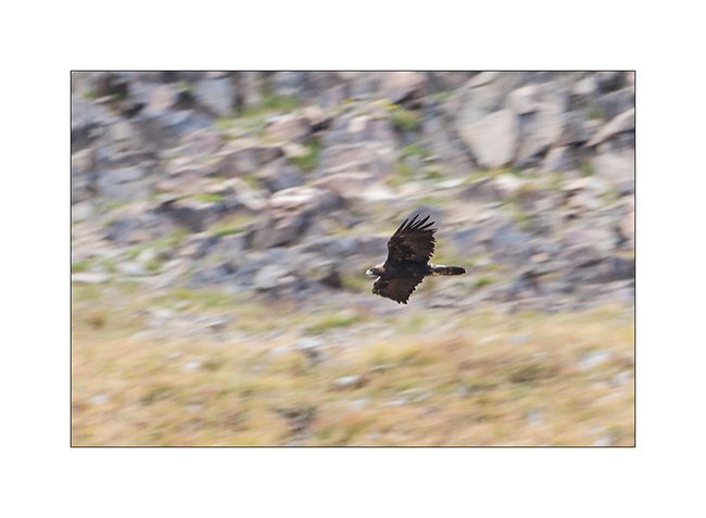
24. For my brother and just as testimony because the picture is very bad: a golden eagle.
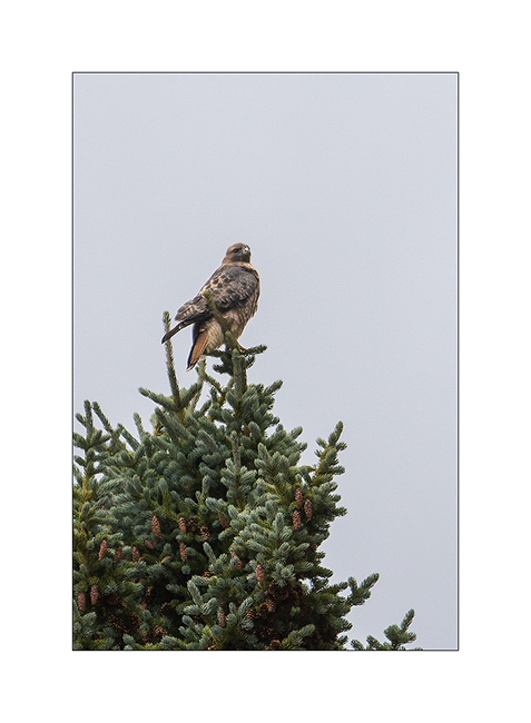
25. Another raptor that I have not positively identified.
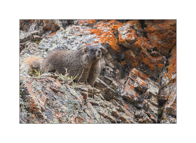
26. There is plenty of marmots..!
27. Alpine biotope.
28. Within minutes, the track is covered with hail…
Well, following the Alpine Loop in the next update, hoping not to bore you with all these alpine tundra images…
Telluride and its mountains
Less than 200 miles away from Moab, landscape is fully different.
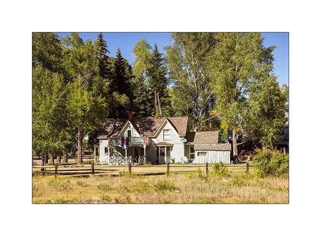
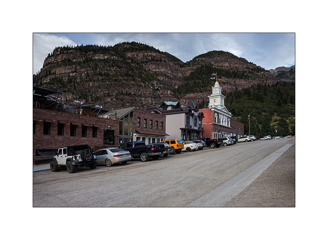
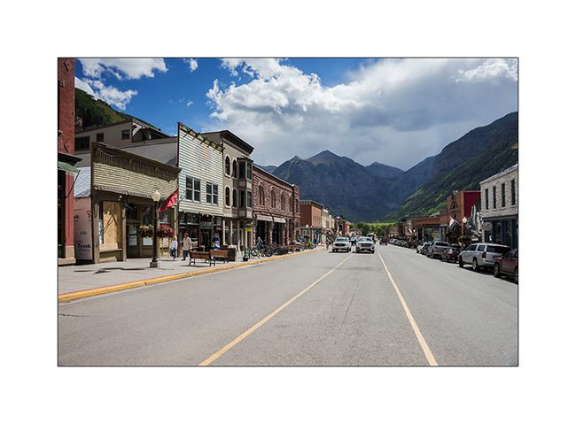
1. Telluride, small mining town founded around 1870.
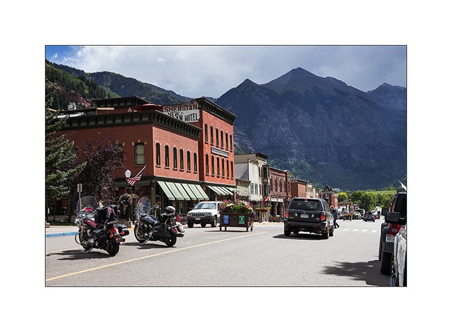
2. Most of the buildings are original and façades are maintained around what they looked like then.
3. Main street.
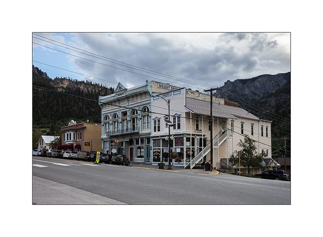
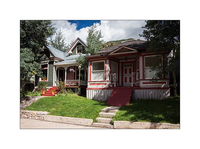
4. In the side streets, small miners houses have become prized.
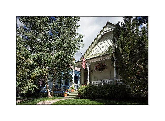
5. They are jealously kept in owning families.
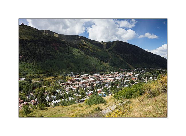
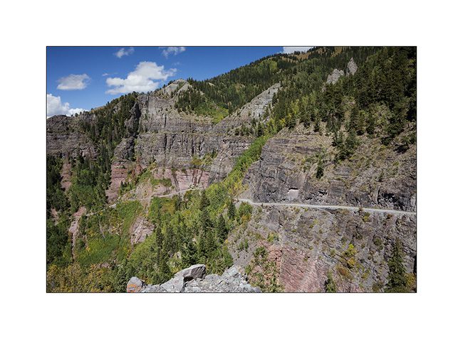
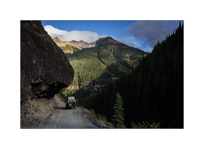
6. Overview of the city that became famous ski resort, while VLV starts the track that will lead her to Imogene Pass.
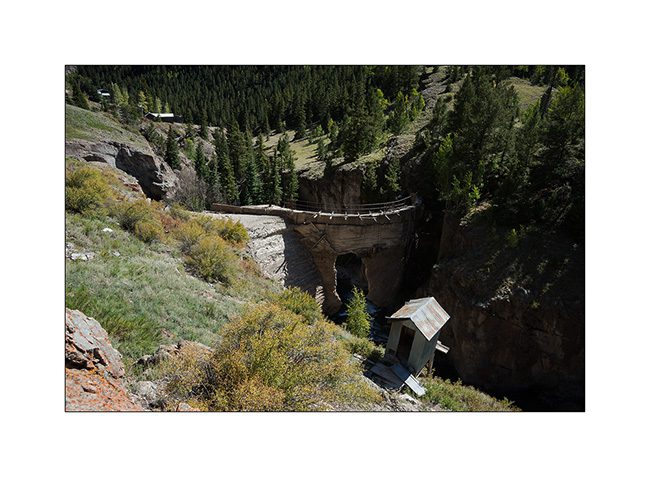
7. Another example ofwhat was created by the gold fever: a carved into the cliff road that crosses a pass at over 13’000 feet above sea level, not less!
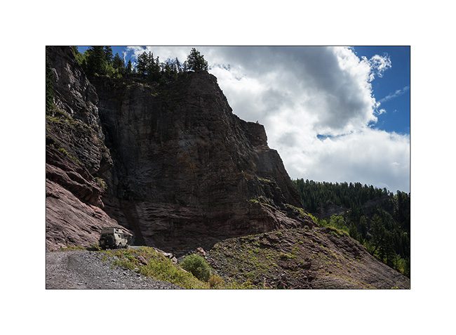
8. VivaLaVida sometimes seemed well wide on the narrow track. Would recommend as therapy for people suffering from vertigo..!
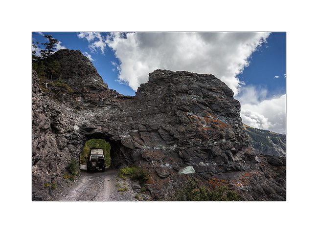
9. There is even a small tunnel to cross a rocky outcrop.
10. The road rises amid the still green aspens.
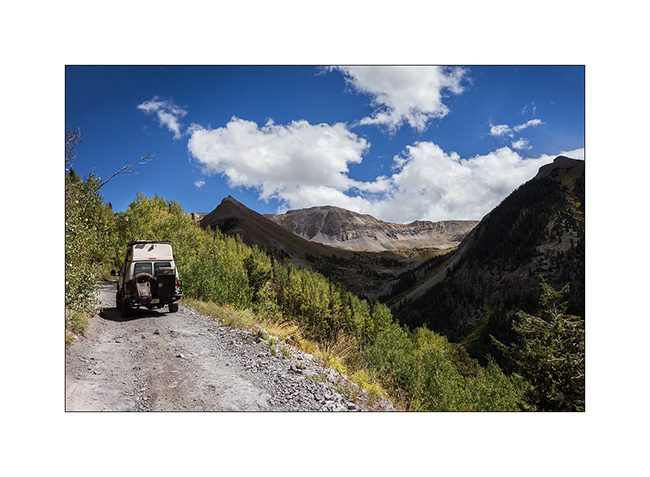
11. The tree limit stands between 9,500 and 10,800 feet elevation here.
12. The mountain is gorgeous with alpine tundra and large screes.
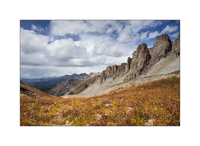
13. The rise is endless but VLV climb valiantly despite the altitude.
14. The last section is cutted in a 45° scree.
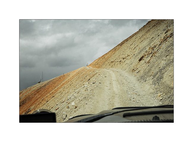
15. And here is the pass!
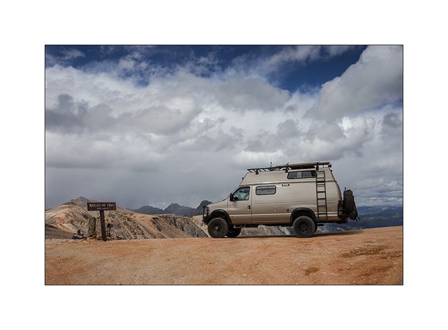
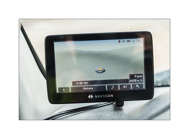
16. Altitude is on the GPS: 4029 meters or 13,218 feet! Impressive!
17. There are no more than loose stones up there.
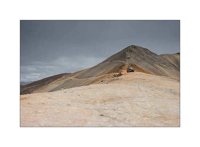
18. Clouds arrived…

19. Mineral oxides are ubiquitous, coloring the mountains…
20. The trail near the pass.
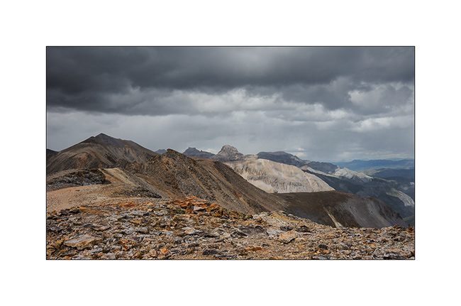
21. Red Mountains through which VLV will sneak tomorrow.
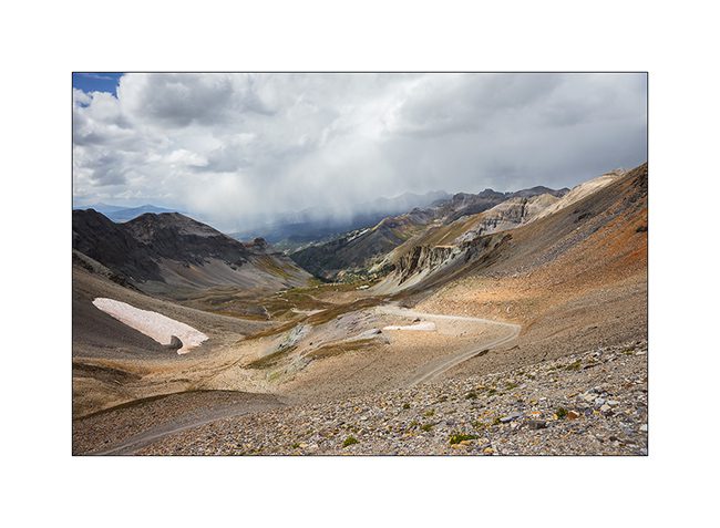
22. Snow showers changing landscape…
23. Constrasts…
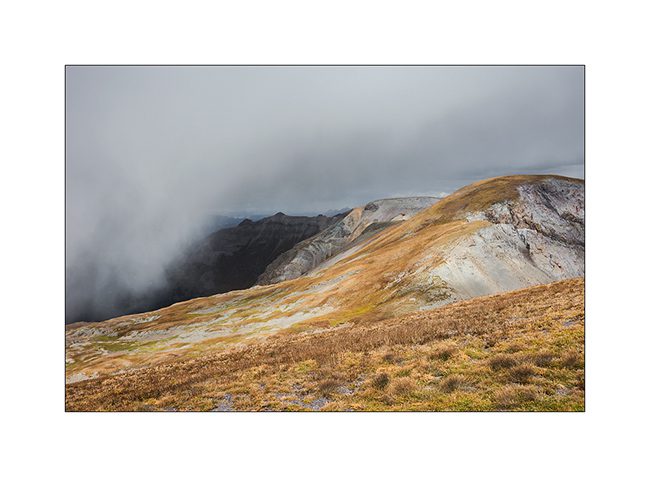
24. Mineral desert…
25. Down the other side.
26. The track is not of every rest but nothing to stop VLV!
27. Last section before the arrival in Ouray, another small mining town to discover in the next update.
Sorry for the long update, follow of the journey in a few days. 😉
Western Colorado
It’s been awhile that I wanted to explore Colorado mountains and as I have to cross the Rockies to go East, I took the opportunity to make a few detours.
1. Nice valley West of Uncompahgre Plateau.
2. The edge of the plateau is sometimes abrupt.
3. “Western” but actual building…
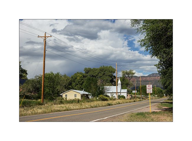
4. Small church in Gateway.
5. Beautiful mesa over Gateway.
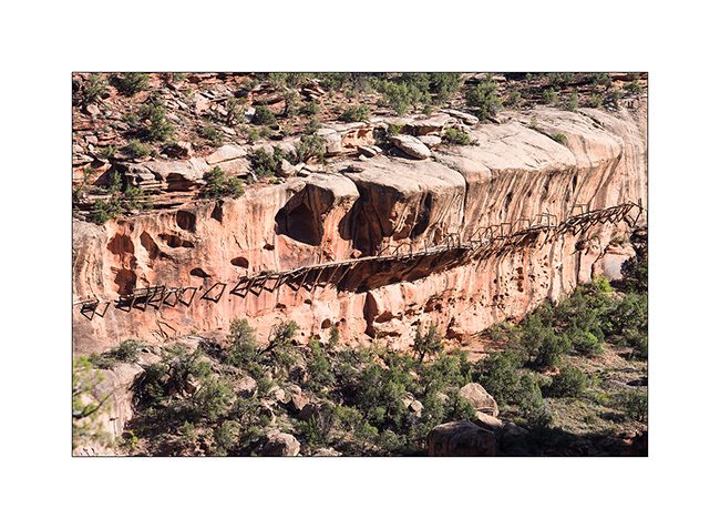
6. The Dolores River has a particularity. To bring water to gold mining, in 1883, a company created a 15 miles canal which was suspended in the cliffs for 5 miles. Some vestiges remain clearly visible…
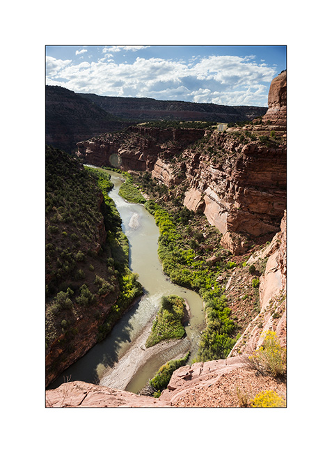
7. Here in closeup. It’s crazy what the search for gold and silver generated as work in the American West!
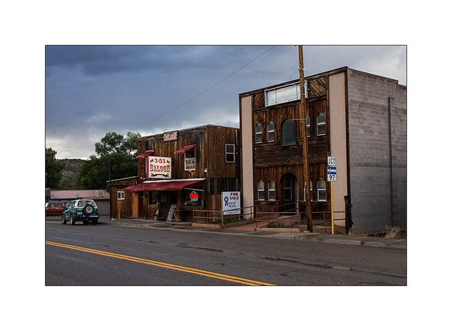
8. Typical saloon in a small hick town…
9. Wildlife is still abundant. Here a troop of deer not far from the road.

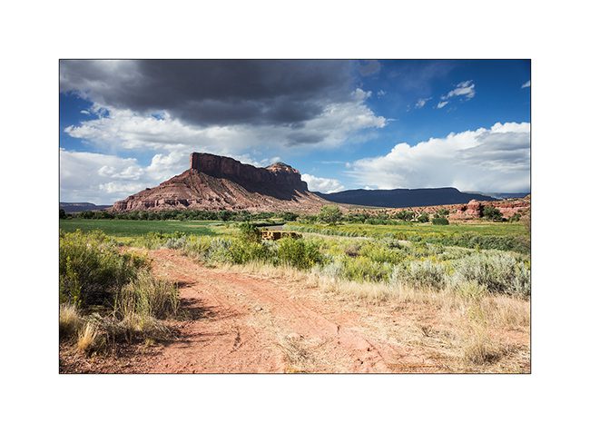
10. VivaLaVida approachs the mountains and leaves desert with altitude. Here the Lone Cone Mountain which looks like a volcano with this storm cloud.
11. Quiet camping in National Forest…
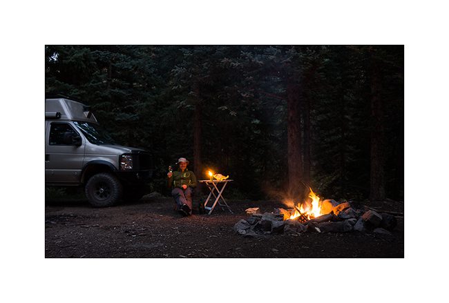
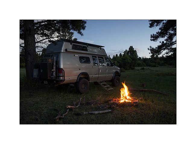
12. Of course with the campfire to cook the diner! 🙂
13. One of the symbols of the American West: artesian wells…
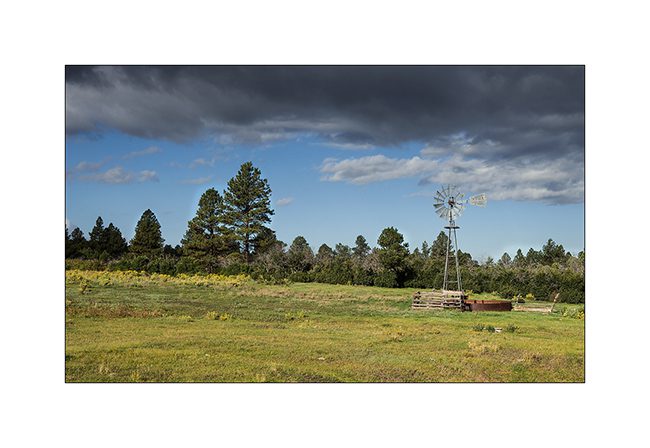
14. Pastures…

15. Highlands…
To be followed with a small glimpse of Telluride, a small town in the foothills of mountains.
Sandstone du Colorado…
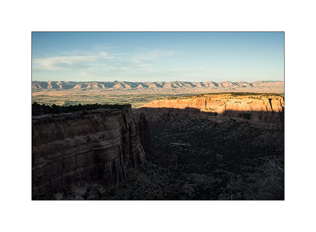
J’ai décidé de faire quelques détours sur la route de l’Est, en commençant par la découverte de quelques arches naturelles. J’ai traversé le “Colorado National Monument” qui n’a rien d’exceptionnel à mes yeux puis emprunter une piste assez rocailleuse sur une vingtaine de kilomètres.
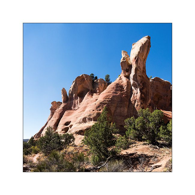
1. Colorado National Monument, de hautes falaises de sandstone.
2. N’ayant pas trouvé la piste alors qu’il faisait nuit, j’ai dormi sur Grand Mesa, à 2’680 mètres d’altitude.
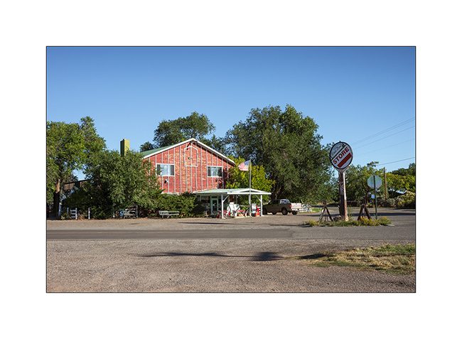
3. General Store perdu…
4. Ela Natural Bridge, non loin de là.
5. A défaut de puma que je n’ai toujours pas vu, j’ai aperçu une espèce extrêmement rare : un jeune éléphant d’Amérique ! 🙂
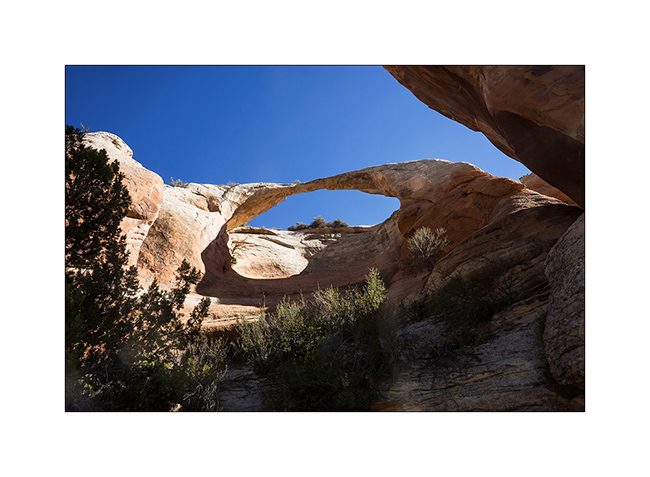
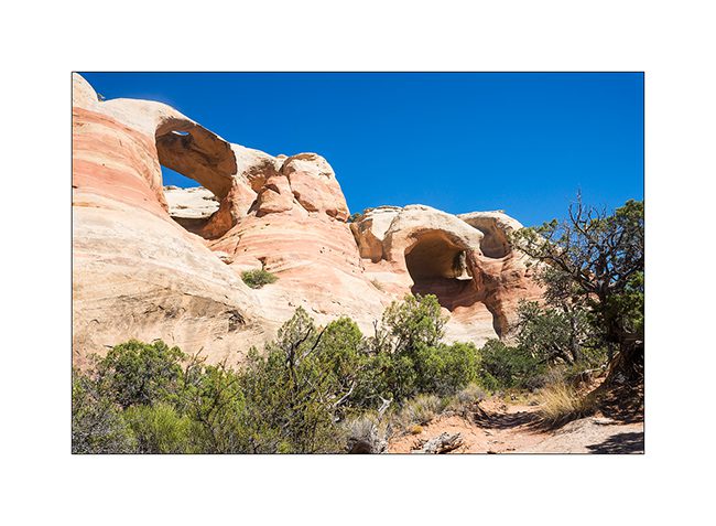
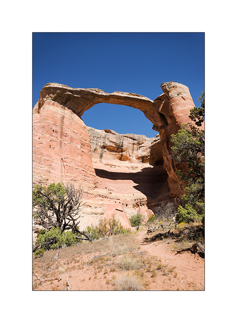
6. La rim que je découvre comporte cinq arches naturelles, ici celle de Hole in the Bridge Arch ainsi qu’une autre sans nom.
7. Sandstone…
8. Aérienne Centenial Arch.
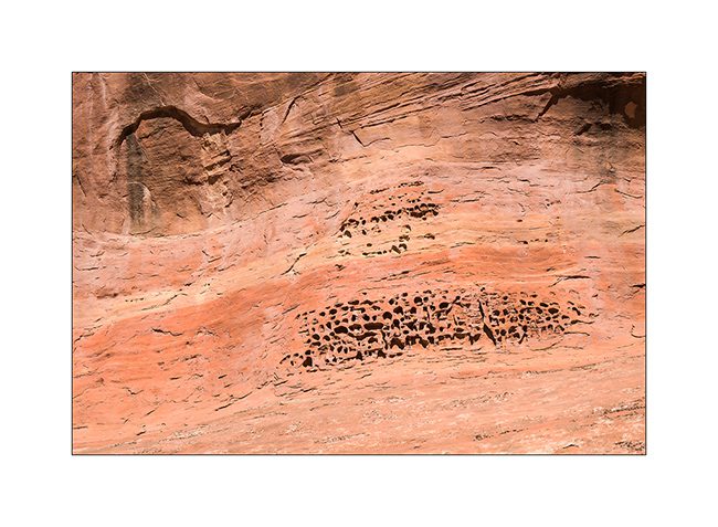
9. Le vente et la pluie ont sculpté la sandstone.
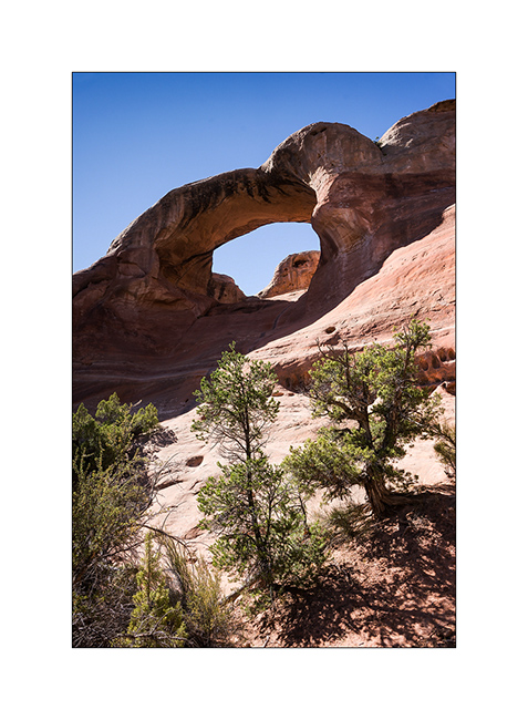
10. Et au bout du sentier, voici Rattlesnake Arch, l’arche du serpent à sonnette (que je n’ai pas vu là…).
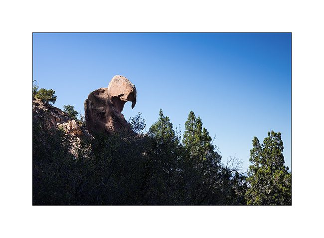
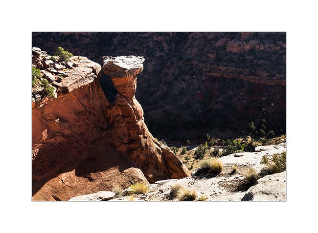
11. Un rocher en équilibre sur le flanc du canyon…
12. Ayant découvert une autre curiosité à découvrir (dont j’ignorait l’existence jusqu’à un panneau au trailhead), j’ai dormi sur place. La couchant m’a gratifié d’une lumière très inhabituelle, le grand feu de forêt sévissant actuellement au Wyoming envoyant sa fumée dans le ciel…
13. Couchant…

Voilà pour aujourd’hui. Découverte de l’une des plus grandes alcôves du continent nord américain dans la prochaine update… 😉
 D5 Creation